Tags
Historic Districts, NRHP, Salt Lake City, Salt Lake County, utah, Yalecrest, Yalecrest Historic District
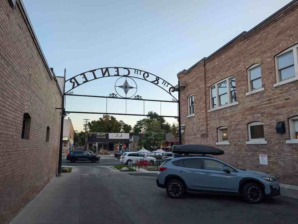
Yalecrest Historic District
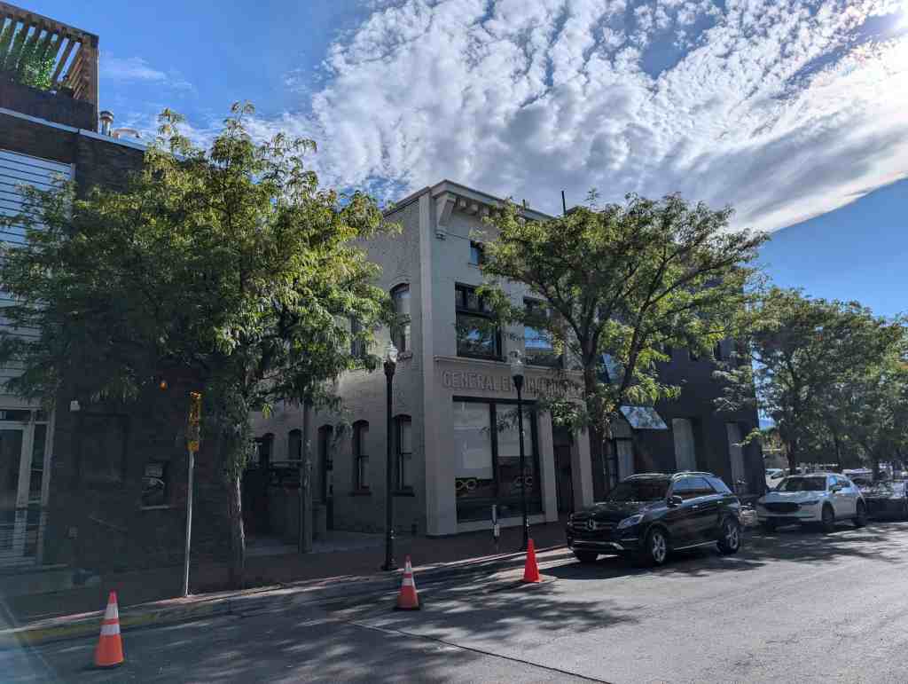
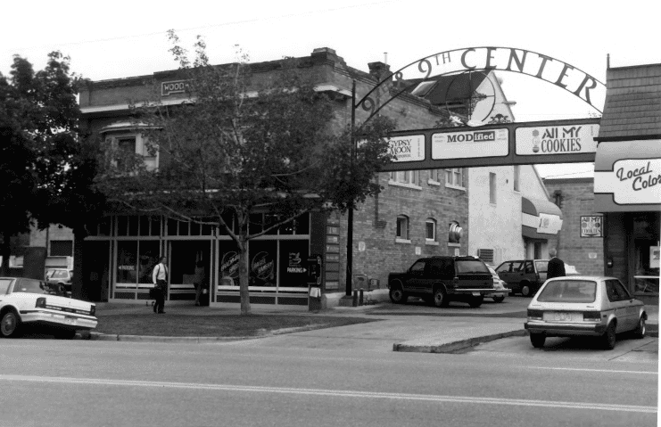
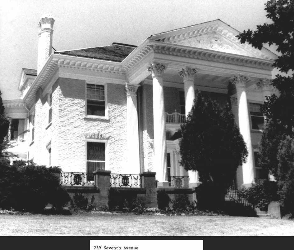
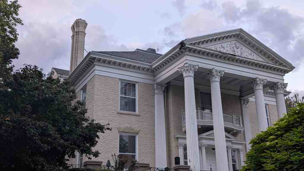
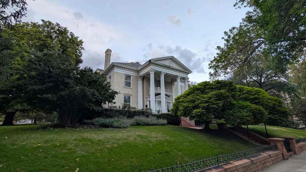
The Yalecrest Historic District is located on the east bench of Salt Lake City, southeast of the business and downtown section. It is locally significant both architecturally and historically, under Criterion A for its association with the residential development of the east bench of Salt Lake City by real estate developers and builders in the first half of the twentieth century. Its tract period revival cottages and subdivisions of larger houses for the more well-to-do represent the boom and optimism of the 1920s and 1930s in Salt Lake City. The district is also significant under Criterion C for its intact architectural homogeneity. It was built out quickly with 22 subdivisions platted from 1910 to 1938 containing houses that reflect the popular styles of the era, largely period revival cottages in English Tudor and English Cottage styles. The architectural variety and concentration of period cottages found is unrivalled in the state. Examples from Yalecrest are used to illustrate period revival styles in the only statewide architectural style manual. The subdivisions were platted and built by the prominent architects and developers responsible for early twentieth century east side Salt Lake City development. It is associated with local real estate developers who shaped the patterns of growth of the east bench of Salt Lake City in the twentieth century. Yalecrest was initially and continues to be the residential area of choice for prominent men and women of the city. The district is locally renowned as the “Harvard-Yale area” and its streets lined with mature trees and historic houses are referenced in advertising for twenty-first century subdivisions elsewhere in the Salt Lake Valley. It is a remarkably visually cohesive area with uniform setbacks, historic houses of the same era with comparable massing and landscaping, streets lined with mature shade trees, and a surprising level of contributing buildings that retain their historic integrity. It contains a concentration of architecturally significant period revival cottages and bungalows designed by renowned architects and builders of Utah. The historic resources of the Yalecrest Historic District contribute to the history of the residential east bench development of Salt Lake City.

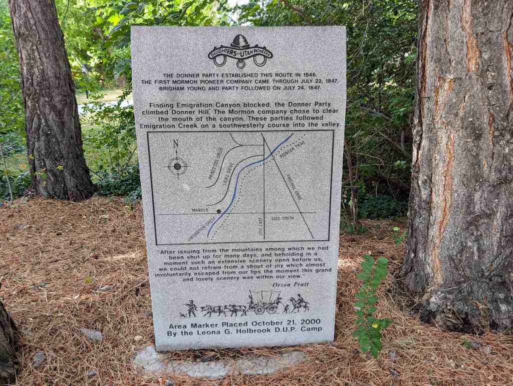
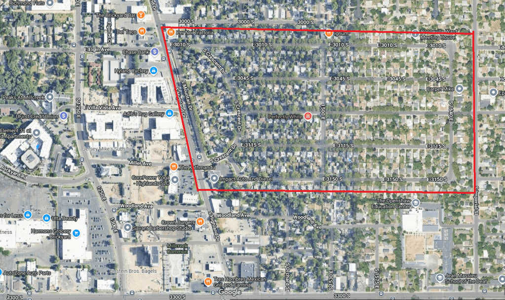
The Yalecrest Historic District has a boundary of Sunnyside Avenue (840 South) to 1300 South and 1300 East to 1800 East in Salt Lake City, Utah and was added to the National Register of Historic Places (#07001168) on November 8, 2007.
Related:
Historical Development of the Area (1849-1909)
Salt Lake City was a planned city, laid out in a grid according to the “Plat of the City of Zion,” a town plan proposed by Joseph Smith, founder of the Church of Jesus Christ of the Latter-day Saints (Mormon or LDS), and later used for many Mormon settlements throughout the Utah territory. Within a year of the arrival of the first group of settlers in 1847, Salt Lake City had grown to 5,000 inhabitants. Public buildings were in the center of the city, surrounded by residential lots and farmland to the south and west. The Big Field Survey in 1848 divided the land to the south of the Salt Lake City settlement (900 South today) into five and ten-acre plots to be used for farming for the “mechanics and artisans” of the city. The Yalecrest Historic District is located on the northeastern section of land that was initially set apart as Five-Acre Plat “C” of the Big Field Survey. The land was divided into 100-acre blocks, each of which was again divided into 20 lots of 5 acres each. The Yalecrest Historic District occupies Blocks 28, 29, and 30 which are bordered by the major northsouth streets of the survey area: 1300, 1500, 1700 and 1900 East and the east-west streets of 900 and 1300 South. The property was intended for agricultural use and was distributed by the LDS church authorities to the faithful by lot for use in raising crops and farming.
The earliest identified residents in the Yalecrest area begin to appear in the 1870s. Gutliffe Beck had a ten-acre plot and his early 1870s adobe farmstead was located near the intersection of Yalecrest Avenue and 1700 East. The property was later used as a dairy farm. Paul Schettler’s farm, situated near the intersection 1900 East and Herbert Avenue, had crops that included silk worms and mulberry orchards. David Lawrence had twenty acres of alfalfa located to the south of the Schettlers. On Sunnyside between 1800 and 1900 East Jim Carrigan built a house c. 1876 and farmed forty-five acres. A one-legged man named Wheeler lived at what is now 1372 Harvard and got his culinary water from Red Butte Creek. No remnants of the earlier settlement homes are known to remain.
Streetcars, Subdivision Development and Automobiles (1910-1939)
Rapid population growth of Salt Lake City and streetcar access to the downtown area made the Yalecrest area attractive to subdivision developers in the early years of the twentieth century. The population of Salt Lake City increased at the turn of the century, almost doubling from 1900 to 1910, bringing about a need for more 13 housing for the new inhabitants.19 Air pollution from coal-burning furnaces as well as growing industry in the valley created smoke-filled air in Salt Lake City. Properties on the east bench beyond the steep grade that flattens at 1300 East above the smoky air of the city became attractive for residential development. Land developers from Utah and out-of-state purchased land on the east bench and filed subdivision plats. Early subdivision advertising touted the clean air of the bench, above the smoke of the valley.
Pavement of some of the streets in Yalecrest occurred soon after construction of the first houses. The earliest street pavement project began with Yale Avenue from 1300 to 1500 East in 1913-1914. Developers usually provided the sidewalks, curbs and gutters as they began to lay out the subdivisions. The streets were paved by the city and funded through assessments of the adjacent properties. Most Yalecrest streets were paved in the 1920s with only a few following in the 1930s.
Streetcars made the Yalecrest area easily accessible to downtown Salt Lake City. The lines serving the Yalecrest area traveled from downtown to 1300 East in front of East High, south along 900 South to 1500 East, then south to Sugar House and the prison. By 1923 there were 217 streetcars and over 100,000 passengers a day in Salt Lake City. By that same time, Salt Lake County had 21,000 private cars registered and garages became a popular addition to urban house lots. Ridership on the streetcars began to decline in the later 1920s in spite of a total of 152 miles of streetcar tracks in 1926. A trial gasoline powered bus15 began a route along 1300 East in 1933. Buses soon predominated in public transportation in the latter part of this era.
Subdivisions
The majority of the Yalecrest area was platted in subdivisions; 22 were recorded from 1911 to 1938. The first was Colonial Heights in the southeast corner of Yalecrest in January of 1911, but little was built there until the 1930s. The largest was Douglas Park, laid out across the northern section of Yalecrest later in 1911 by the W.E. Hubbard Investment Company. Hubbard was a medical doctor from Chicago who came to Utah via Los Angeles and became involved in real estate sales, investments and mining. He was active in real estate and by 1919 had platted, developed, and sold 41 subdivisions.
Douglas Park Amended and Douglas Park 2nd Addition comprise a total of 1,158 building lots in an area that includes the ravine surrounding Red Butte Creek and another gully that runs between Michigan and 900 South between 1300 and 1500 East. Initial development consisted of rather large, geographically dispersed bungalows on the western section, overlooking the city. Some of the earliest houses in the area are these scattered bungalows on 900 South, 1400 East and 1500 East. Construction of houses in the Douglas Parks took place over a forty year period from the teens through the early 1950s.
The Leo and Hallie Brandenburger House is an Arts and Crafts bungalow built in 1913 on the north side of 900 South with its lot steeply sloping at the rear into a wooded ravine. It was one of the first houses in the Douglas Park subdivision to be completed and the Brandenburgers had a view of the city to the west from their front porch. Leo Brandenburger arrived in Utah in 1904, the same year that he received his electrical engineering degree at the University of Missouri. He worked at the Telluride Power Company and Utah Power and Light Company before opening his own engineering office in the Louis Sullivan-designed Dooley Building (demolished) in downtown Salt Lake City in 1914.
Don Carlos Kimball and Claude Richards formed Kimball & Richards Land Merchants in 1908 to develop and sell land. They were responsible for over 30 subdivisions between 1900 and 1925. They served as developers as well as builders in Yalecrest. Gilmer Park was a creation of Kimball and Richards in 1919, and consists of 295 building lots, most of which lie outside of Yalecrest in the Gilmer Park National Register Historic District to the west. Thornton Avenue and Gilmer Drive between 1300 and 1400 South constitute the Yalecrest section of Gilmer Park.
The 1920s were a period of tremendous growth in Yalecrest with eleven subdivisions platted by a variety of developers. Upper Yale Park has curvilinear streets with large irregularly-shaped lots, many extending back to the wooded area of the Red Butte ravine and Miller Park. Houses built on the curving streets in Yalecrest have larger lots and tend to be larger scale than those set in the rectilinear grid streets. It was platted by Ashton and Jenkins in 1924.
The Bowers Investment Company, a branch of the Bowers Building Company, filed the subdivision papers for Normandie Heights in 1926. Normandie Heights was the last large (140 lots) subdivision to be platted in Yalecrest and its houses were built primarily from 1926-35. It is distinctive like Upper Yale Park because of its picturesque rolling topography with landscaped serpentine streets, regular newspaper promotions, prominent homeowners, deep setbacks, and large irregularly shaped lots. Much of the sales of its lots and houses were done by the firms of Kimball & Richards, Ashton-Jenkins, Gaddis Investment Company, and Le Grande Richards Realty Company.
Uintah Heights Addition consists of Laird Circle, Uintah Circle and Laird between 1400 and 1500 East and was registered in 1928. Houses were constructed there primarily in the late 1920s and early 1930s, many by Herrick and the Gaddis Investment Company.
The other subdivisions from the 1920s: Yalecrest Park, Upper Yale Addition, Upper Harvard, Upper Yale 2nd Addition, Upper Princeton, Harvard Park, and Upper Yale 3d Addition have streets in a grid pattern. Four subdivisions were platted in the 1930s; Mayfair Park (1930) consists of two culs-de-sac and Hillside Park (1937) has the semi-circular Cornell Street. Upper Laird Park (1931) is both sides of one block of Laird Avenue. The last subdivision to be platted was Yalecrest Heights by Willard and Gwendolyn Ashton in 1938. After its plat was registered no significant vacant space was left in the Yalecrest area.
Architects
A number of prominent Utah architects designed houses and some also made their homes in the Yalecrest area: J.C. Craig designed the two-story Prairie house at 1327 S. Michigan c. 1915. Lorenzo S. Young who later designed the Bonneville LDS Ward Chapel and Stake Center in 1950 most likely designed his own house at 1608 E. Michigan c. 1935. Glen A. Finlayson built his unusual Art Deco house at 973 Diestal Road in 1936. He was a Utah native who worked as an architectural engineer for American Oil and Utah Oil for 33 years and lived in the house with his wife, Mina, until his death in 1969.
Slack Winburn designed the house at 979 South 1300 East in c. 1922. Winburn studied architecture at the Ecole des Beaux Arts et des Sciences Industrielles at Toulouse, France, following his service there in World War I. He moved to Salt Lake City in 1920 and was active designing many buildings in Utah and the Intermountain West including the Sigma Nu fraternity house and Bailif Hall at the University of Utah and a number of apartment buildings in Salt Lake City.
Fred J. Swaner drew the plans for and supervised the building of a fashionable clinker brick bungalow at 871 South 1400 East in 1915 for William R. Hainey who emigrated to Salt Lake City from Grafton, Nebraska, to work for the Hubbard Investment Company, owners of Douglas Park. Dan Weggeland was an architect employed by the Bowers Building Company and responsible for designing many of the houses and apartment buildings constructed by them, including those in Normandie Heights.
Raymond Ashton designed his own house at 1441 East Yale Avenue in addition to a number of other Yale Park houses as well as commercial and institutional buildings. The Jacobethan Irving School and Sprague Library in the Sugar House section of Salt Lake City show his facility with period revival styles. He also designed the Prairie Style bungalow at 1302 East Yale Avenue that was home to George Albert Smith, a President of the LDS Church. He was allied with the Ashton family businesses as well as the Ashton-Parry Company and Ashton and Evans, Architects.
The noted Utah architect, Walter Ware, designed a Tudor Revival house for Lee Charles and Minnie Viele Miller in 1929 at 1607 East Yalecrest Avenue. Walter Ware designed the First Presbyterian and the First Christian Science Churches among many other buildings in Salt Lake City during his long career from the 1890s to 1949.
The Frank Lloyd Wright-trained Utah architect, Taylor A. Woolley, most likely designed the Prairie style house at 1408 East Yale Avenue for William W. and Leda Rawlins Ray, the U.S. District Attorney for Utah as well as another Prairie School Style house at 1330 East Yale Avenue for his uncle, Albaroni H. Woolley, a manager for Zions Cooperative Mercantile Institution (ZCMI). Taylor Woolley was involved with both residential construction and one religious building in Yalecrest. The 1925 red brick Colonial Revival Yale LDS Ward Chapel at 1431 Gilmer Drive was designed by Taylor Woolley at Evans and Woolley and built by Gaskell Romney. Both Woolley and Romney were also residents of Yalecrest. Woolley was a major proponent of the Prairie School style of architecture in Utah.
Builders and Developers
Developers and builders played the primary role in the growth of Yalecrest. They laid out the potential lots, registered subdivisions with the county, arranged for sidewalks, curbs and gutters, arranged financing, involved real estate people, publicized the opening of the subdivisions in the newspapers, built speculative houses, frequently serving as contractors or builders for custom houses, and in many cases, lived in the subdivisions themselves. Most of the builders were active on numerous streets in the area.
There are seventy-three developers and builders associated with the Yalecrest Historic District. The AshtonJenkins Company, one of the largest real estate and mortgage banking companies in Utah, recorded three subdivisions in the survey area: Yale Park in 1913, Yale Park Plat A in 1915 and Upper Yale Park in 1924. The Yale Parks were heavily promoted in the newspapers and attracted prominent homeowners. Several generations of the Ashton family were major developers in Salt Lake City and involved in real estate, development, construction, architecture and allied occupations. Edward T. Ashton and his brother George S. were sons of Edward Ashton, a cut stone contractor who supplied stone for many church and public buildings in Utah, and were partners in the firm of Ashton Brothers, contractors and builders, and later the Ashton Improvement Company. They were responsible for the construction of thousands of houses in Salt Lake City. Edward T.’s sons continued the family involvement with construction: Raymond J. was an architect, Marvin O. was manager of the Rio Grande Lumber Company, and Edward M. was a contractor.
Edward M. Ashton went into real estate by himself in 1900 but soon founded the realty firm of Ashton & Jenkins in 1905 with Edward Elmer Jenkins, a businessman involved in real estate and banking. The Ashton-Jenkins Company was also involved in real estate sales for the Normandie Heights subdivision. Edward M. Ashton lived in one of the earliest houses in Yalecrest, designed by his brother the architect, Raymond Ashton, and built by the Ashton Improvement Company, at 1352 East Yale Avenue in 1913.
Several families of builders and real estate people, like the Ashtons, were involved in Yalecrest. George C., Louis J. and Frank B. Bowers were brothers. The Bowers Brothers constructed over 3,000 buildings in Utah, Wyoming and Nevada by 1946. The builder Gaskell Romney was involved in developing Normandie Heights as well as building houses on speculation. He was active in Utah, Idaho and California and worked in Mexico before coming to Utah in 1921. G. Maurice Romney, his son, also did speculative building in the area. Gaskell Romney and his wife, Amy, lived in Yalecrest at 1442 and later at 1469 East Princeton Avenue.
Fred A. Sorenson, most likely of the Sorenson Building Company, built his own house c. 1927 at 1049 Military Drive. He worked as a builder from 1908 to only a few years before his death in 1988. J.A. Shaffer built several houses on speculation on Laird in 1927. He was briefly involved in Salt Lake real estate before moving to Indiana. H. (Henning) Henderson was born in Denmark in 1887 and worked as a building contractor in Salt Lake City from 1913 until his retirement in 1950. Albert Toronto was the owner and operator of Toronto & Company, a Salt Lake real estate, insurance, and home building firm. He was a Salt Lake native, educated in the local schools and active in building in the 1920s and 1930s. He built speculative houses in the Colonial Heights subdivision.
N.L. Herrick was a partner in the Gaddis Investment Company as well as an individual builder, active in the Upper Harvard and Uintah Heights Addition. Herrick and Company provided design as well as construction services. The Gaddis Investment Company was founded in 1922 to deal in real estate, investments and insurance. Both of its partners lived in Yalecrest; N.L. Herrick at 1603 East Harvard Avenue and Thomas E. Gaddis at 1465 East Laird Avenue in a French Norman house built in 1929. Thomas Gaddis was involved in real estate and investments in Salt Lake City from 1909 to his death in 1967.
Individual developers occasionally built the entire street of speculative houses. The district of small cottages, from 1500 to 1600 East on Princeton and Laird Avenues, was for the most part constructed by Samuel Campbell; Princeton in 1924 and Laird in 1925. Samuel Campbell worked as a contractor/builder in Salt Lake City from 1913 to 1930 and built more than sixty houses in Yalecrest. He built primarily on speculation frequently with financing from the Ashton-Jenkins Company. Many of the houses served as rentals to middle class tenants before being sold. The cottage district was not platted as part of a subdivision. Louis J. Bowers is another example of a single builder constructing buildings along an entire street. He built all of the houses on Uintah Circle in the Mayfair Park subdivision (platted in 1930) on speculation in 1937 and 1938.
Sidney E. Mulcock both owned the property and built speculative houses in Upper Princeton. Mulcock built Duffin’s Grocery Store in 1925 at 1604 East Princeton Avenue, run by Clarence Duffin in conjunction with the William Wood & Sons meat market. Duffin’s was the only market within Yalecrest and was designed to have the same setback and blend in with the surrounding houses. It has since been modified for residential use and is now a noncontributing building.
Alice Felkner was one of the few women involved in real estate in Yalecrest. She was prominent in Utah mining and industrial pursuits as well as owning the land that was platted as Upper Yale Addition and Upper Yale 2nd Addition in 1926 & 1927. She was born in 1854 in Indiana and moved to Idaho with her brother, William H. Felkner, in 1886 to engage in stock, mercantile and mining businesses. The siblings moved to Salt Lake City in 1909. At the time of her death in 1937 she was a director of the Consolidated Music Company, a large stockholder of the Silver King Coalition Mines Company, and director of several large mining companies. The Upper Yale Additions extend along the north and south sides of Yale and Herbert Avenues from 1700 East to 1800 East. Houses were constructed in the late 1920s and 1930s, primarily by Philip Biesinger, another Yalecrest builder and developer.
With the help of mortgages from Ashton-Jenkins and the Romney Lumber Company Philip Biesinger built a model house at 1757 East Herbert Avenue in 1927-8. The Salt Lake Tribune advertisement noted that it is located in “the best residential section this city affords” and is built of “the finest of materials” and “presents a most imposing appearance.” The names of the workmen and suppliers are proudly listed in the model home announcement as are the “electric sink” and “automatic refrigeration.” The property did not immediately sell so Biesinger sold this property to the Romney Lumber Company who used it as a rental property until 1940. The Romney Lumber Company was involved in the construction and financing of a number of houses in the surrounding subdivision as well as a retail operation where they provided “roofing, cement, plaster, (and) wall board.” Philip Biesinger was building on the surrounding lots on Herbert as well as Harvard, Yale and Yalecrest Avenues.
Residents
The subdivisions of Yalecrest were actively marketed by the real estate firms through the newspapers to prominent people. Early inhabitants of the Yalecrest area range from leading citizens active in politics, business, sports and religion to well-to-do professionals, particularly law and medicine, as well as those in middle class occupations.
The Utah Governor Charles R. Mabey lived in an Ashton and Evans English Cottage-style house at 1390 East Yale. He also served on the Bountiful City Council, as Mayor of Bountiful, and as a state legislator. William C. Ray was a Democratic candidate for the U. S. House of Representatives in 1912 and later was the U.S. District Attorney. He lived in a Prairie School-style house at 1408 East Yale with his wife, Leda Rawlins Ray. Wallace F. Bennett owned a 1923 Prairie School-style house at 1412 East Yale Avenue that had been previously owned by David D. Crawford of the Crawford Furniture Company. Bennett served in the U. S. Senate from 1950 to 1974.
Two presidents of the Mormon Church lived in Yalecrest. All of the individual governors of the United States in 1947 visited the home of the then President of the Mormon Church, George Albert Smith, at 1302 East Yale Avenue. The Prairie School style bungalow was built for Isaac A. Hancock who was vice-president of a Utah fruit and vegetable company by Raymond Ashton in 1919. Ezra Taft Benson served under President Eisenhower as the Secretary of Agriculture before becoming the president of the LDS Church. He lived in the French Norman style house at 1389 East Harvard Avenue that was built for Richard Leo Bird, the founder of an outdoor advertising agency.
Many business owners were residents of Yalecrest. John and Bertha Barnes bought the Tudor style cottage at 1785 East Yalecrest Avenue in 1929 and lived there until 1940. John Barnes was the owner and operator of Crown Cleaning and Dyeing Company (NR listed 7/2003) from 1922 to 1962. He was also president of the National Association of Dry Cleaners and the Sugar House Chamber of Commerce. Bryant Crawford and his wife, Carrie Day, purchased 1757 East Herbert Avenue in 1940. He was the president of Crawford and Day Home Furnishings. Lee Charles Miller ran the Miller and Viele Loan Company, first with his father-in-law, then by himself. The firm was the largest farm mortgage company in the intermountain west. He specialized in farm loans and financed a number of irrigation systems and reservoirs in southern Utah. After his death in 1930 Mrs. Miller donated property in his memory along both sides of Red Butte Creek to the city where it became known as Miller Park. Mrs. Miller raised and bred prize-winning Hampshire sheep and Guernsey cattle on her ranch on the Snake River in Idaho. The Millers lived at 1607 East Yalecrest Avenue in a Tudor Revival style house.
The 1930 U.S. Census of Population provides a snapshot of other occupants of the Yalecrest Historic District. The typical residents were often business proprietors or with managerial or professional careers, native born, and owned their own homes. Marie Morrison was a grocery store owner and a widow raising two children by herself at 1437 East 1300 South. Her neighbors on the street were also home owners. Roland Standish owned an advertising agency and lived at 1457 East 1300 South with his wife, Bertha, and their four daughters. Jacob Madsen and his wife, Mary, were immigrants from Denmark and lived with their two grown children at 1463 East 1300 South. Jacob and Mary owned a farm out of state and Sarah and Ilta were a stenographer and grade school teacher, respectively. Other occupations on the street were safety engineer, pharmacist, musician, and newspaper compositor.
Several generations shared the Willey house at 1455 East Gilmer. David was an attorney, his son, David Jr. was a salesman for a paint company, and two daughters, Dorothy and Katherine, were a stenographer and a clerk. Three grandchildren, a daughter-in-law and mother complete the family resident in the house. Several neighbors had servants, not uncommon in the area. Occupations of residents on the street ranged from coal mine operator, food and drug inspector, automobile salesman, mining and electrical engineers, sales manager for a furniture company, hotel proprietor and a son who worked as a gas station attendant.
Two brothers lived next door to each other at 1403 and 1411 East Michigan Avenue. Joshua Summerhays was a hide and wool merchant who had four children with his wife, Mary. Their eldest daughter, Virginia, was a public school teacher as was her uncle, John, next door at 1411. John and LaPrella had four children ranging in age from 1 to 8 years old. The Summerhays’ neighbors had a variety of occupations which included two engineers, electrical and mining, two stock & bond salesmen, a coal mine inspector, a linotype operator, a manager of a storage company and a sales engineer of steel structures.
An optometrist, a medical doctor, a dentist and an apiarist (beekeeper) lived as neighbors on 900 South. Dr. Byron and Mabel Rees lived at 1382 East 900 South with their three children, Ralph, lone and Afton, and Ellen Bybrosky, their Danish servant. Hubert Shaw installed mining equipment for a living and lived with his wife, Edith, at their house at 1434 East 900 South. J.C. Wilson worked in religious education and lived with his wife, Melina, and their four children at 1466 East 900 South.
Leslie Pickering was a general building contractor and lived with his wife, Mina, and daughter, Beverly, at 1464 East Michigan Avenue. He is not known to have constructed any buildings in the Yalecrest area. Pinsk, Russia, was the birthplace of Simon Weiss who worked as a clothing salesman after coming to this country as a child in 1903. His wife, Claire, and daughter, Betty, were both born in Utah. The Weiss family owned their home at 1363 Thornton Avenue. Fred B. and Hazel Provol were early tenants at the model house on 1757 East Herbert Avenue. Fred Provol was secretary-treasurer of the Hudson Bay Fur Company (“furs, coats, dresses, lingerie and costume jewelry”) in the 1930s.
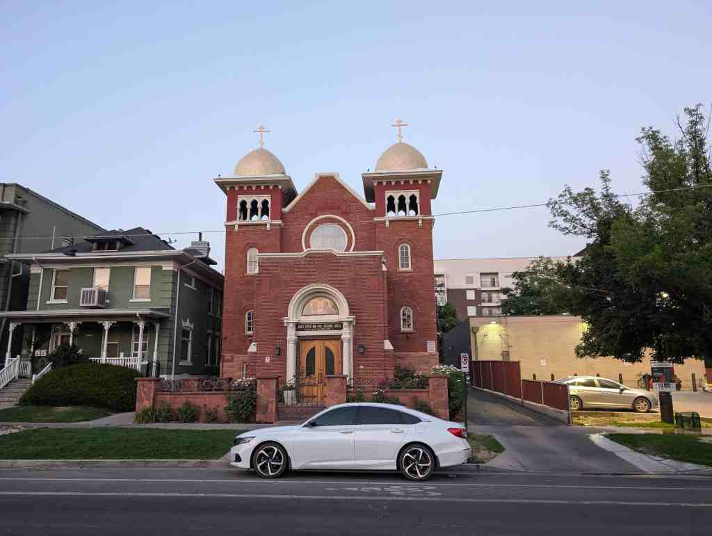
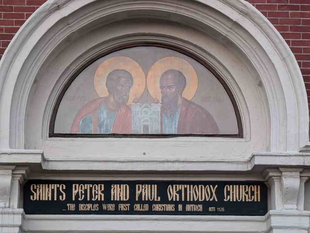
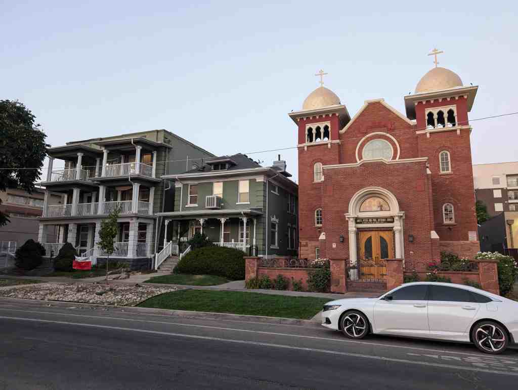
A school, two LDS churches, and a park were built to accommodate the population moving into the area. Uintah School was constructed in 1915 to support the growing elementary school age population of the East Bench. It was built encircled by vacant land but soon was filled to capacity with the rapid growth of the surrounding residential sections. The school was enlarged in 1927. Two LDS ward chapels were built in this era. Taylor Woolley’s firm designed the 1925 red brick Colonial Revival Yale LDS Ward Chapel at 1431 Gilmer Drive. The Art Deco Yalecrest Ward Chapel at 1035 South 1800 East was built in 1936 of exposed reinforced concrete. Miller Park (discussed above) follows the course of Red Butte Creek on both sides of its ravine and originally extended from 900 South to 1500 East.
World War Il and Postwar Growth (1940-1957)
The emergence of the defense industry in the Salt Lake valley in the early 1940s and the return of the Gs after the war caused a great need for housing. The population of Salt Lake City grew by 40,000. The FHA (Federal Housing Administration) estimated at the time that Salt Lake City needed 6,000 more housing units to meet the postwar demand. The district most likely reflects the building trends in Salt Lake in this era. New houses were built on the few vacant lots at Yalecrest and many homeowners took out building permits to finish basement or attic space for more room or to rent out as apartments. Donald and Ruth Ellison purchased their modern house at 1804 East Harvard Avenue soon after it was constructed in 1952. The following year they were living in the house while Donald Ellison was the claims manager for the Intern Hospital Service.
Mass-transit vehicles transitioned from streetcars to buses, but in general began to be supplanted by the widespread use of private cars. By 1940 the 1500 East streetcar was gone and city buses served Yalecrest traveling along 1300, 1500 and 1700 East as well as 900 and 1300 South. Houses began to be designed with attached garages, rather than a separate garage at the rear of the lot.
The growth of the LDS population after the war required the construction of a third facility. A land swap gave the southern section of what was Miller Park to the LDS Church in 1945 in exchange for property that became Laird Park, located on 1800 East between Laird and Princeton. Land that was previously the southern section of Miller Park was used for construction of the Bonneville LDS Ward Chapel and Stake Center. Its red brick Postwar Colonial Revival style building was designed by Lorenzo S. Young and constructed by the Jacobsen Construction Company in 1949. Bonneview Drive was constructed by the church a private road to provide access to the building but was later made a public street.
The few remaining vacant lots and streets on existing subdivisions were filled in during this era. For example, although the Hillside Park subdivision was registered in 1937 by the Anderson Lumber Company, an active builder in Yalecrest, initial construction didn’t begin until 1939 and continued into the 1940s.
1960s and Beyond (1958-2007)
This era was a time of stability for the neighborhood. The Yalecrest area avoided the blight common in many urban neighborhoods during this era and remained a desirable residential area. There was no population pressure in the early part of the period as the population of Salt Lake City actually decreased fourteen percent 22 between 1960 and 1980. No major roads were built through the neighborhood although traffic increased on the border streets of 1300 South, 1300 East and Sunnyside Avenue. A service station was built at 877 South 1300 East c. 1970 to aid the automobile traffic. The original 1915 Uintah Elementary School was demolished and replaced by a new structure in 1993.
The Monster House phenomena surfaced in the Yalecrest neighborhood and mobilized the inhabitants. They worked through their community council to create the Yalecrest Compatible Residential Infill Overlay Zoning Ordinance which was adopted by the City Council on July 12, 2005. Their residents took a leading role in presenting the concepts to the Salt Lake City Council and a city-wide ordinance followed in December of 2005, based on the efforts of the Yalecrest group.
Rising gasoline prices have made living near jobs in the city more attractive, reducing commuting time. As people desire to move from the suburbs back into the city, many want large suburban houses on small city lots. Even with the restrictions of the recent zoning ordinances, the district remains threatened by the trend to larger and larger residences, through demolition of the historic house and out-of-scale replacements or obtrusive additions to existing buildings.
Summary
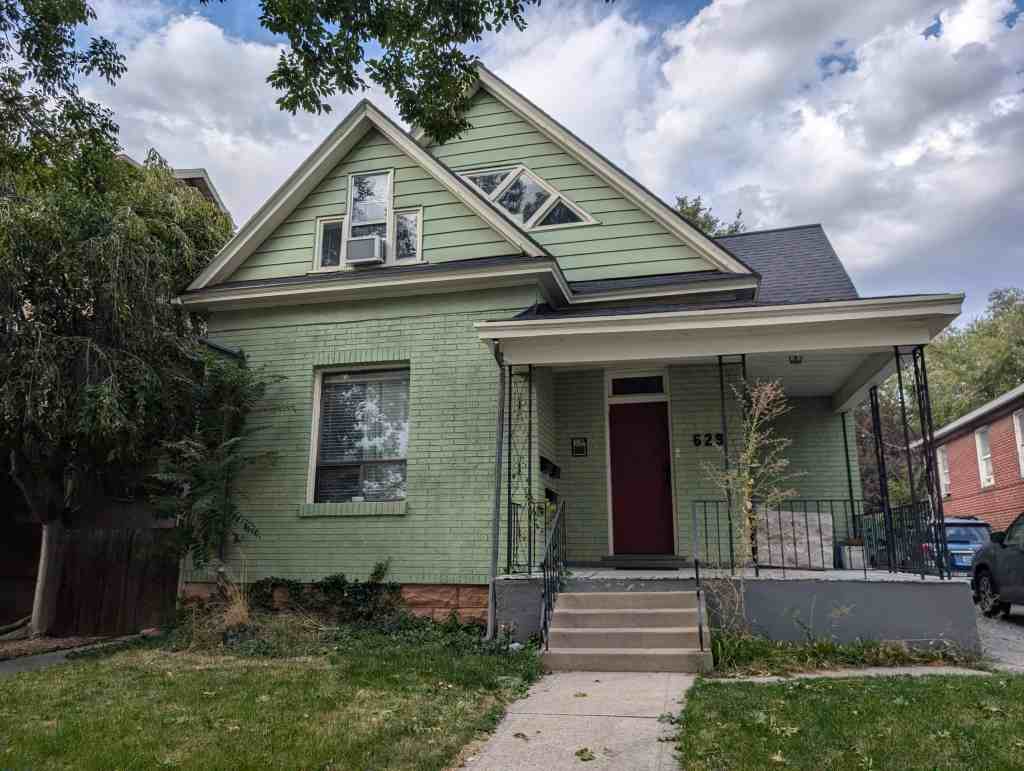
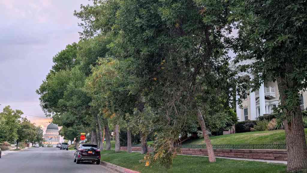
The Yalecrest neighborhood has mature street trees, well-maintained historic houses with landscaped yards and continues to be a desirable residential area, known throughout the valley as the Harvard-Yale area, and serves as an aspirational model for new subdivisions. The residential buildings within the Yalecrest Historic District represent the styles and types of housing popular in Utah between 1910 and 1957, with the majority built in the 1920s. Because it was developed within a short period of time by prominent developers and architects, the area has a remarkably high degree of architectural consistency and is highly cohesive visually. The collection of period revival styles both of the smaller period revival cottages in the gridiron streets as well as the larger houses on the more serpentine streets is a significant historic resource for Salt Lake City. The variety of period revival and bungalow styles found are literally textbook examples and, in fact, illustrate Spanish Colonial Revival, French Norman, and Prairie School styles in the state architectural history guide. The few noncontributing properties are scattered throughout the district and do not affect the ability of the district to convey a sense of significance. The area retains a remarkable degree of historic integrity.
Narrative Description
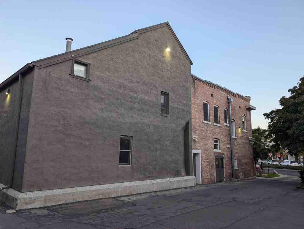
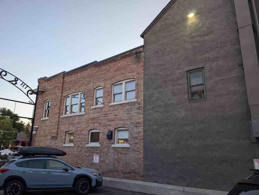
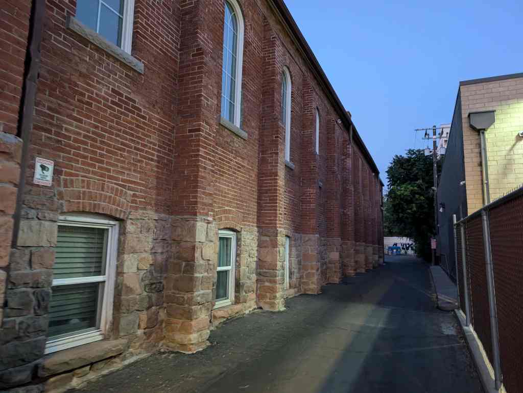
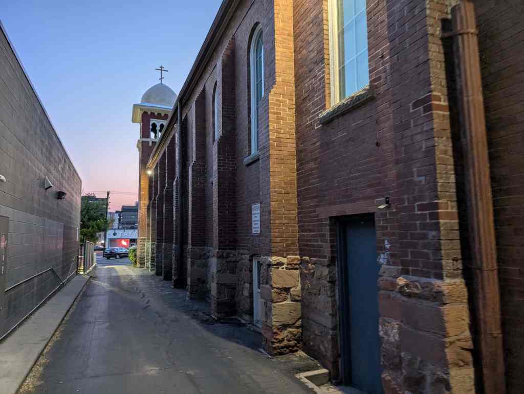
The Yalecrest Historic District is a residential neighborhood located on the East Bench of Salt Lake City, eight blocks to the south and thirteen blocks to the east of the downtown business area of the city. It is remarkably visually cohesive with the majority of the houses built in subdivisions of period revival-style cottages in the 1920s and 1930s. The Yalecrest Historic District consists primarily of residential buildings but also contains three contributing churches, three commercial buildings (two noncontributing, one contributing) and two contributing parks. Single family houses predominate but there are also fifty-one multiple dwellings, most of which are duplexes.
There are one thousand four hundred eighty seven (1,487) primary resources within the historic district. The district retains a high degree of historic integrity as the overwhelming majority (91%) of the resources, one thousand three hundred forty nine (1,349), contributes to the historic character of the district. There are nine hundred eighty nine (989) outbuildings which are primarily detached garages set to the rear of the lots, the majority from the historic period. All of the streets in the district are paved with curbs, gutters and sidewalks. Only one building, a Prairie School-style bungalow, the George Albert Smith House at 1302 Yale Avenue, has been listed on the National Register [listed 1993].
The historic district boundaries coincide with those of the Yalecrest Community Council district and are the surrounding major collector streets, Sunnyside Avenue, 1300 and 1900 East, and 1300 South. The district is visually distinctive from the neighboring areas by its cohesive historic-era architecture, unified tree plantings and landscape design that reacts with the natural topography of the creeks and gullies that cross the area. The architecture is remarkable for the concentration of fine period revival style houses; seventy four percent of the contributing resources (74%) were built from 1920-1939. These houses exhibit a variety of period revival styles with the largest portion being English Tudor (240 examples) and English Cottage (313 examples) styles.
Street patterns vary and represent several concepts of city planning: the rectilinear street grid of streetcar suburbs on the low relief sections, undulating patterns following the edges of streams and gullies, and the use of culs-de-sac and semi circles to limit traffic. There are a handful of alleys in the grid sections. Large uniform mature shade trees line the streets and the houses maintain similar setbacks and scale on the street faces. Street lighting is provided by two types of non-historic lamps; one with a cast concrete pole and a metal and glass top and the other, a metal pole on a concrete base. yards have established landscaping with lawns and gardens. Both buildings and yards are well-maintained. Because of its historic residences and the tree-lined streets, the neighborhood was initially and continues to be one of the most desirable residential areas of the east bench of Salt Lake City.
Architectural Styles, Types and Materials by Period
Streetcars, Subdivision Development and Automobiles (1910-1939)
The greatest number of resources (one thousand eighty-six or 81 percent) were constructed during this period, primarily via subdivision development. The principal building types found are bungalows (19 percent) and period cottages (53 percent), both immensely popular in Utah during this era. The bungalow was a ubiquitous housing type and style in the first quarter of the twentieth century in Utah and bungalows were the first houses to appear in Yalecrest. Bungalows have rectangular plans and are low to the ground with lowpitched roofs, either gabled or pitched. Stylistic elements of the Prairie School (110 examples) and the Arts and Crafts movement (26 examples) appear in bungalows and two story houses ranging from high-style architect-designed examples to simplified examples in the early subdivision and developer tracts. The Prairie School Style has a horizontal emphasis with broad overhanging eaves, low-pitched hip roofs, and casement windows. Many Yalecrest houses retain remarkable integrity, like the following Arts and Crafts bungalows: the stucco and cobblestone 1913 Brandenburger House at 1523 East 900 South and the W.R. Hainey House, a 1912 clinker brick example at 871 South 1400 East. The Prairie School vernacular style bungalow designed and built by Raymond Ashton, architect, as his own home was constructed of brick in 1913 at 1441 East Yale Avenue. The stucco and brick 1916 example at 1540 East Michigan Avenue is representative of a number of vernacular Prairie School bungalows in the area. It has the horizontal emphasis of the Prairie School as well as a more formal porte cochere. The Taylor A. Woolley-designed William and Leda Ray House at 1408 East Yale Avenue is a two-story brick Prairie School style box house with wide eaves built in 1915.
Two streets of small cottages between 1500 and 1600 East were constructed by a single developer, Samuel Campbell, in 1924 (between 1515 and 1589 Princeton Avenue) and 1925 (from 1515 to 1592 Laird Avenue). The clipped gable brick cottage on 1538 East Princeton Avenue was built in 1924 and is typical of the scale of the houses on the street. A small market at 1604 East Princeton Avenue was built by S. L. Newton in 1926 and later converted to single family use. The 1925 brick clipped-gable cottage at 1522 East Laird Avenue has columns and round-arched windows, characteristic of the distinguishing architectural detail Campbell and other builders supplied to the cottages. The sloping topography of the neighborhood makes garages underneath the house a practical solution to the space issues of a small lot. Samuel Campbell built the side-gabled brick clipped-gable cottage at 1207 South 1500 East with a garage underneath in 1925.
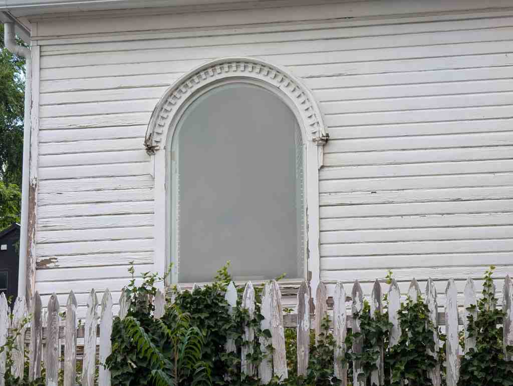
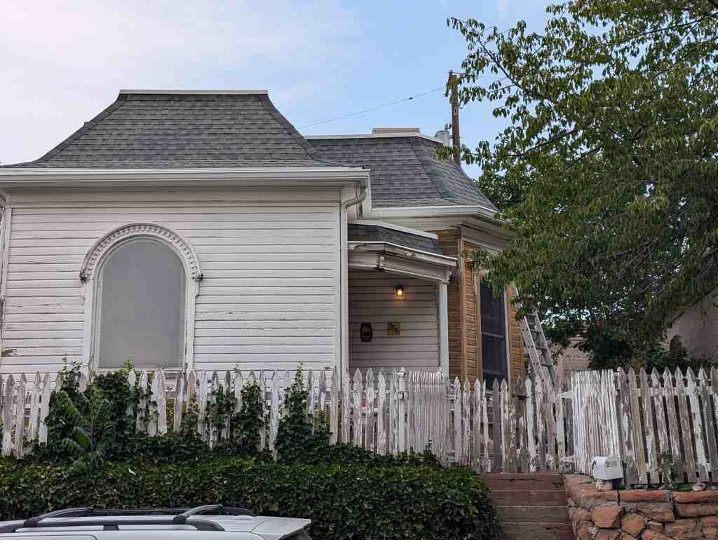
The period revival cottage is the largest category of building type in the neighborhood comprising 714 (53 percent) of the primary structures. Period revival styles were popular in Utah from 1890 to 1940. The most popular styles in Yalecrest are the English Cottage (310 or 19 percent) and the English Tudor styles (242 or 15 percent). Period revival styles are hypothesized to have been made popular in the United States by soldiers returning from World War I who had been exposed to the vernacular French and English historic architectural styles in Europe. The English cottage style refers to vernacular medieval English houses and differs from English Tudor in that the houses are of brick construction and do not typically feature false halftimbering. The English cottage period revival houses were frequently built between the world wars by speculative builders on small urban lots. They are mostly clad with brick and have irregular, picturesque massing, asymmetric facades, and steep front-facing cross gables. Both styles emphasize irregular massing, gabled roofs and the decorative use of various cladding materials. Single-story houses predominate although there are also a number of elegant two story examples.
Most of the prominent builders of the time constructed houses in Yalecrest in the English cottage and Tudor styles. The William Eldredge House at 1731 East Michigan Avenue is a brick and stucco English cottage style single-story period cottage built in 1927. A duplex period cottage-type house with rock façade on the twin steep front-facing gables was built in the English cottage style in 1932 at 940 South Fairview Avenue. A simpler English cottage style is a brick duplex at 1474 East Laird Avenue built in 1930. Half-timbering is the most easily recognizable style characteristic of the English Tudor. A number of larger one-and-a-half and two-story Tudors are found in the Military Way area. In 1929 Samuel Campbell built the two-story house at 972 East Military Drive with half-timbering and steep gables. A smaller single-story example with half-timbering in its gable ends was built by the Layton Construction Company in 1928 at 1780 East Michigan Avenue. D.A. Jenkins built a number of houses along 1500 East including the Tudor with a basket-weave brick pattern at 1035 South 1500 East in 1927. The 1926 Lawrence Naylor House at 1510 East Yale Avenue has a half-timbered second story wing. Layton Construction Company also built a one-and-a-half story Tudor with an oriel window for John and Bertha Barnes in 1926 at 1785 East Yalecrest Avenue Doxey-Layton built the single-story multicolored brick English Cottage on the corner at 1783 East Harvard Avenue in 1930.
Other period revival style houses in the Yalecrest Historic District range from the chateau-like French Norman (30 examples), gambrel-roofed Dutch Colonial (12), Jacobethan Revival (15), and Spanish Colonial Revival (6) to the eclectic, combining several styles. A number of imposing French Norman style houses are found in the Normandie Heights subdivision area, developed between 1926 and 1935 with large irregularly-shaped lots on serpentine streets and substantial houses. The Leo Bird house was owned by former Mormon Church president Ezra Taft Benson and has a unique sculptured wooden roof. It was built in 1929 at 1389 East Harvard Avenue. An expansive neighboring house, built and owned by the contractor Eugene Christensen in 1933 at 1407 East Harvard Avenue, also has the characteristic French Norman conical tower. The John Lang House is a stucco-covered Spanish Colonial with a red tile roof built in 1924 at 1100 South 1500 East. The eclectic brick one-and-a-half story house at 1757 East Herbert Avenue was built as a model home in 1928 by the prolific builder Philip Biesinger. has the rolled edge roofing imitative of thatch, one of the characteristics of period revival houses.
There are 149 (9 percent) Colonial Revival examples in Yalecrest that vary from large brick two-story houses to smaller Cape Cod cottages. A classic one-and-a-half story frame Cape Cod cottage was built in 1936 at 939 South Diestel Road by G. Maurice Romney for Adrian and Camille Pembroke, owners of a business supplies store. The two-story brick hip-roofed Colonial Revival with shutters at 1547 East Yale Avenue was built in 1924 of striated brick.
A handful of Art Moderne, Art Deco and International style houses provide a contrast to the surrounding steeply gabled period cottages and give variety to the Yalecrest neighborhood. The flat-roofed smooth-walled Art Moderne/International style Kenneth Henderson House at 1865 East Herbert Avenue was built in 1938. The Dal Siegal House at 1308 East Laird Avenue was constructed of striated brick in 1939. Its lack of ornamental details, rounded corners and smooth wall surfaces show the influence of the Art Moderne style in the late 1930s in Salt Lake City.
Towards the end of this era period cottages began to be supplanted by World War II cottages. The house at 1571 East Michigan Avenue is a transition from the steep-gabled period cottages to the boxier minimal traditional styling of the World War II cottage. It was built of brick in 1938 with an attached garage. The Salomon house at 1789 East Hubbard Avenue is also transitional, built in 1939 with less steep gables and the characteristic nested entry gables of a period cottage.
Two of the three Yalecrest LDS churches were built in this era. The 1925 red brick Colonial Revival Yale LDS Ward Chapel at 1431 Gilmer Drive was designed by Taylor A. Woolley at Evans and Woolley and built by Gaskell Romney. Both Woolley and Romney were residents of Yalecrest. The Art Deco LDS Yalecrest Ward Chapel at 1035 South 1800 East was built in 1936 of exposed reinforced concrete.
Miller Park was given to the city in 1935 by Viele Miller in memory of her husband, Charles Lee Miller. The park follows the course of Red Butte Creek and its ravine, extending from 900 South southwesterly to 1500 East, is heavily wooded and has walking trails on either side of the creek, several foot bridges across the creek, and a small stone masonry bench at the northern end. Two of its sandstone ashlar benches and pillars are visible on the corner of 1500 East and Bonneview Drive. A stone fireplace with a small area of lawn in the southern section of the park is used by neighborhood residents. The southern part of Miller Park is now known as Bonneville Glen and is part of the neighboring Bonneville LDS Ward Chapel and Stake Center property. Miller Park is a contributing resource in the Yalecrest Historic District.
World War II and Postwar Growth (1940-1957)
The World War II and post-war growth period provided twenty percent of the principal contributing structures in the survey area; fifteen percent from the 1940s and five percent from the 1950s. House types encountered range from late period revival cottages and World War II Era cottages to early ranch and ranch house types in a range of wall cladding. Colonial Revival styles still continue to appear as the two-story brick side-gabled house at 1340 East Harvard Avenue was built in 1940. The 1955 brick early ranch at 1762 East Sunnyside Avenue is a transition between earlier period cottages and later ranches. An unusual contemporary or “modern” example is the stylish “butterfly” roof of the Donald B. & Ruth Ellison House built in 1953 at 1804 East Harvard Avenue.
Postwar population growth of 40,000 in Salt Lake City spurred infill development in Yalecrest although there was no vacant land remaining for any additional subdivisions. The LDS Church acquired the southern half of Miller Park from the city and constructed the red brick postwar Colonial Revival style Bonneville Ward Chapel and Stake House in 1949. The building was designed by Lorenzo S. Young and built by the Jacobsen Construction Company. In exchange the LDS Church gave the land that became Laird Park to the city. Now Laird Park provides a small green open area of lawn and playground bounded by Laird and Princeton Avenues and 1800 East. Its open space serves as a soccer field as well as a practice ball field. It is a contributing resource to the area.
A small commercial area developed in the postwar period at the intersection of 1700 East and 1300 South. In an example of adaptive reuse, a service station built in 1951 now serves as a restaurant at 1675 East 1300 South. It is a contributing resource. Across the street is an out-of-period 1961 service station, still serving its original purpose at 1709 East 1300 South. The two other commercial structures across 1300 South to the south are outside of the historic district.
1960s and Beyond (1958-2007)
The late-twentieth century buildings in Yalecrest are infill or replacement structures and constitute only two percent of the total buildings of the district. The Uintah Elementary School at 1571 East 1300 South was designed by VCBO Architects of Salt Lake City and constructed by Layton ICS in 1993, replacing the previous 1915 structure. It is not out-of-scale with the nearby houses with its two floors and its brick masonry walls reflect the most common wall cladding from the surrounding neighborhood.
Modern housing styles predominated in the early part of the era. A ranch/rambler with a projecting double car garage was built of brick in 1976 at 1836 East Sunnyside Avenue. A later frame shed-roofed c. 1990 house is set back from the road at 1384 East Yale Avenue.
The construction of the house on 1788 East Hubbard Avenue in 2000 spurred neighborhood controversy by its out-of-scale massing and three car garage doors on the façade. It led to neighborhood activism through the community council and the eventual development of a new zoning ordinance to prevent the construction of more out-of-scale houses in the neighborhood. Another two-story twenty-first century replacement house can be seen in contrast to its single-story neighbors at 1174 East Laird Avenue.
More recent replacement houses reflect a modern reworking of the predominant styling of the area with NeoTudor styling details such as the asymmetry, brick and stone cladding and steeply gabled roofs but with significantly larger massing than the surrounding houses. Examples can be seen at 1774 East Michigan Avenue under construction in 2007 and the 2004 example at 904 South Diestel Road. A substantial addition to a 1927 Dutch Colonial style house is under construction in a style similar to that of the original house at 1009 Military Way.
Yalecrest remains a desirable residential area with mature street trees and well-maintained historic houses and yards. It has a significant concentration of historic houses, fifty-nine percent of which are period revival cottages, built by prominent architects and developers in subdivisions from the 1910s through the 1940s with some infill and development in the 1950s. Its historic houses retain their historic integrity to a remarkable degree, ninety-one percent (91%), and contribute to the historic association and feeling of the area.