Tags
Historic Schools, NRHP, Schools, Stockton, Tooele County, utah

The text on this page is from the nomination form (#100003269) for the National Historic Register, the school was added to the register on December 31, 2018 and is located at 18 North Johnson Street in Stockton, Utah.
Stockton School, constructed in 1929 in Stockton, Tooele County, is significant under Criterion A in the area of Education. The building is locally significant because of its historic association with the ongoing development of education and improvement in educational facilities in Stockton during the early twentieth century. Stockton was, and still is an isolated town that served the education needs of a few small mining communities located in the nearby mountains to the east. This particular building replaced the previous smaller brick school building that was outgrown as population increased in the region. Stockton School’s historical development is represented in the growth, decline, and vacancy followed by an adaptive reuse of the building in the 1980s. The school was designed by Scott & Welch Architects, which was a prominent regional architecture firm during the early twentieth century. Scott & Welch designed several schools in Utah and surrounding states during this era. However, only few are extant. The period of significance of the Stockton School begins in 1929—when it was constructed—and ends in 1968, the end of the historic period. The school was in continuous use as an education facility until 1984, when Stockton Town adapted it for reuse as the town hall. It now serves multiple functions as town hall, police station and library. The building’s appearance has temporarily changed with the covering of the four main windows with plywood. However, the changes are easily reversible as the historic windows are still in place behind the covering. In spite of this the building still retains sufficient historical integrity to be considered a significant historic resource in the town of Stockton.

Criterion A Significance: Education
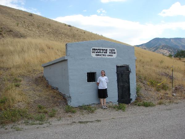
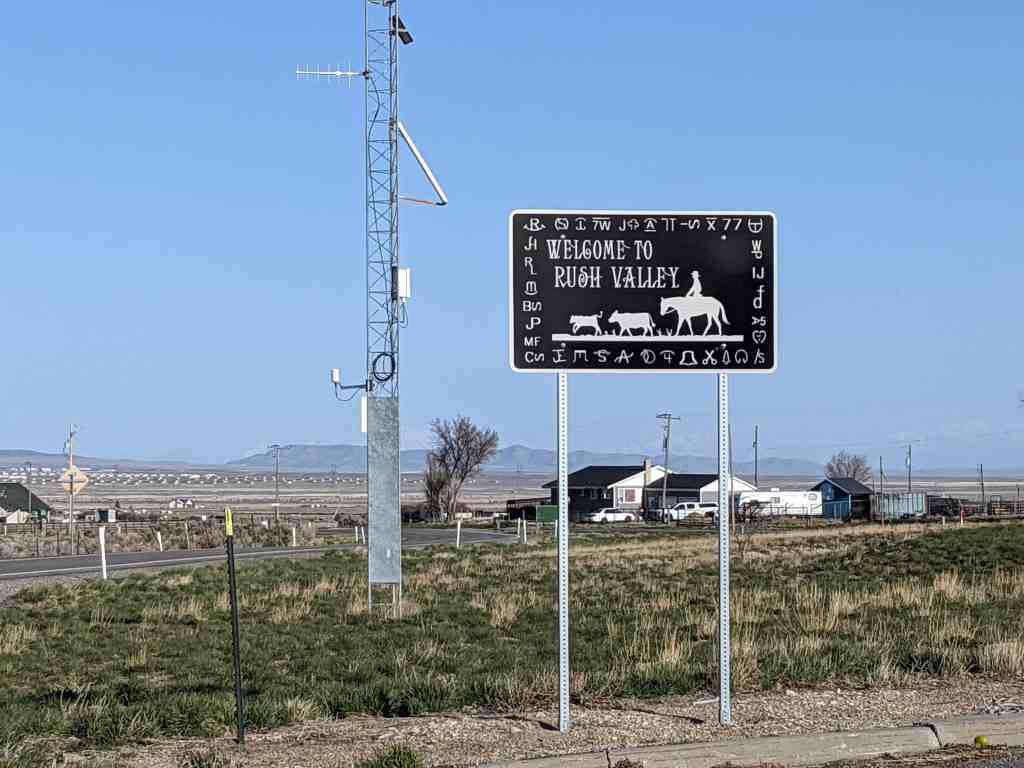
Stockton is located in a primarily rural area of Tooele County. In its founding days in the early 1860s, Stockton was known as a gentile (non-Mormon) mining town. As mines were excavated in the surrounding Oquirrh Mountains, Stockton became a base camp for the increasing population. Around the turn of the twentieth century, Mary Jane Hickman and James Brown organized the first school in Stockton, located in the Brown Store building on Main Street. A second school was later established further east on the corner of Grant Avenue and Silver Street. This was used until 1912, when a more permanent red brick schoolhouse was constructed on Silver Avenue and this building was repurposed as the Stockton Opera House. The new building had two classrooms. Four grades were taught in the large west room and four upper grades were taught in the east room. But as the town’s population continued to grow, this two-room building served as the primary center for education only until 1929, when “a new and larger” school building was constructed. The new school was built directly across the street east overlooking the older school. And, once the new building was put into use the 1912 school was reused as an LDS meeting house for a number of years and was later adapted for residential use. It still stands and looks very much as it did when it was a school.
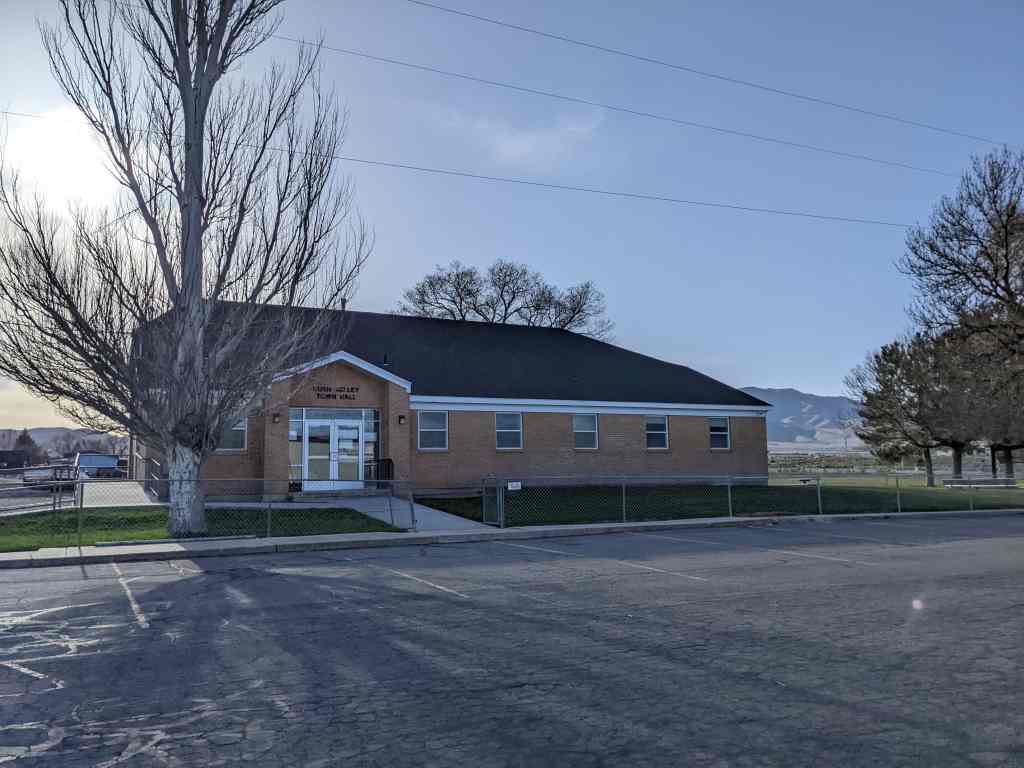
The Stockton School of 1929 had four large classrooms—double that of the previous school–an office and a large basement area that occasionally was used as a classroom and also contained the restrooms. Not only did the building serve Stockton’s children, but it also became the regional school for the surrounding rural areas including Ophir Creek, and later, the Deseret Chemical housing area. However, as in most mining areas, the mines played out and populations move on. But, because of Stockton’s isolation and decreasing enrollment rates, the Stockton School continued in use well beyond the life of school buildings of similar age in more populated areas of the state. Finally, however, continued population decline forced the closure of the school after more than a half-century of use. In 1984 classes at the school were discontinued and the students from the area began to be bussed several miles north to the county seat of Tooele. The schoolhouse went unused for a short while, but since the 1990s the building has been used as Stockton’s Town Hall. Some interior adaptations were made to make spaces for city offices, the police station and the library. Most of these interior alteration is in the form of partition walls in the basement to make office space for the various city entities. The most apparent change on the main floor was the covering of the large multi-paned windows on the west and east elevations with plywood. Although this has caused a slight loss of historic integrity, it is not a permanent change, as the original windows remain in place and could easily be restored with the removal of the wood sheeting. Because of this the building retains sufficient historical integrity to be considered eligible for National Register nomination.
Additional Historical Context: Education in Utah
Members of the Church of Jesus Christ of Latter-day Saints began settling the Great Salt Lake Valley in July 1847. During this time, settlement and survival took priority over education. This resulted in small and often seasonal ward (ecclesiastical unit) schools. Private, informal schools were hastily organized and held in homes and meetinghouses.
This early educational system was heavily influence by local economic and environmental conditions. The curriculum was limited to very basic reading, mathematics and Mormon religious teachings. In 1851 the Provisional State of Deseret structured regions into school districts. Under this organization each community was empowered to create as many schools as needed. The Territorial School Law of 1852 organized school districts. These districts maintained existing school buildings (private homes and meeting houses) through taxation. Unfortunately, taxes under this legislation were rarely levied and funds remained inconsistent between districts. The relative effectiveness of districts varied dramatically, according to the abilities of teachers and the financial means of local residents and trustees. Other religious organizations in Utah saw this as an opportunity to proselytize Mormon children.
Beginning in the late 1860s and early 1870s,these churches offered free schools with professionally trained teachers. During the development of the district schools, mission boards from the Congregational, Presbyterian, and Methodist churches established approximately one hundred private elementary and secondary schools. Initially these schools were popular with families of all religions, but Mormon leaders became alarmed by the influence of the secular teachings of these schools and Mormon parents gradually withdrew their children. Eventually, the territorial legislators (all who belonged to the LDS Church) decided to create a public school system that would not expose their young to non-Mormon teachings. The result was a system of Mormon schools, or academies, established in each stake (similar to a diocese) of the LDS Church.
The Free Public School Act of 1890 quickened the collection of taxes in earnest, consolidated districts according to counties, established a state curriculum, and made attendance compulsory (prior to this legislation only 27 percent of children between 8 and 16 years of age attended). The creation of a tax supported school system had a direct impact on the educational architecture that followed. After 1890 small, individually designed multi-purpose buildings were replaced by large, permanent and uniformly designed, single-purpose schools. Architects hired by the state or local school districts engineered standardized designs.
While education in the nineteenth century was primarily shaped by conflict and necessity, education in the twentieth began to follow national educational patterns and issues. There began to be demands for consolidation and centralization of schools. In the late 1930s, national trends moved towards increased state funding of education.
Setting
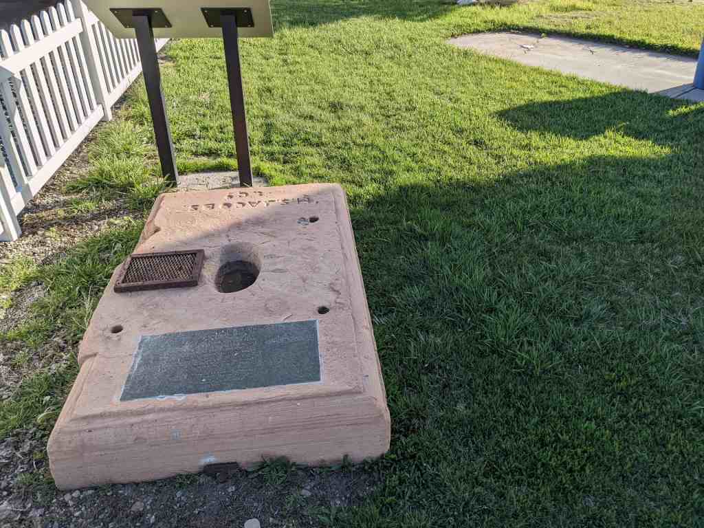
The school is located toward the front of an open corner lot with a lawn/dirt surrounding it on the south, west and east sides A short concrete retaining wall faces the west side of the lot along the front sidewalk. Plants include three large juniper trees growing next to the building on the right half of the west façade, a large spruce tree at the northwest corner a small deciduous tree on the south end and two other deciduous trees—one at the northeast and one at the southeast corner. There is also a large concrete flag pole base with the 2002 Winter Olympics logo embossed in it. Behind (to the east of) the school is a large blacktopped parking area and a larger concrete pad that was used as a basketball court. To the east of this is a small lawn-covered field ascends up a slight rise to the street behind the school. The north, east and most of the south borders or the property are enclosed by chain-link fencing. Other than a small temporary metal shed, there are no permanent outbuildings on the property.
While there have been some alterations to the Stockton School over time—primarily the covering of the large main windows and rearranging of spaces in the basement–overall the main building structure is still intact and retains the majority of its character defining features. It retains sufficient historical integrity to be considered a contributing historic resource in the town of Stockton.
Narrative Description
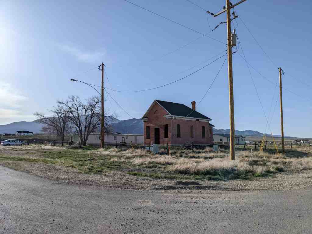
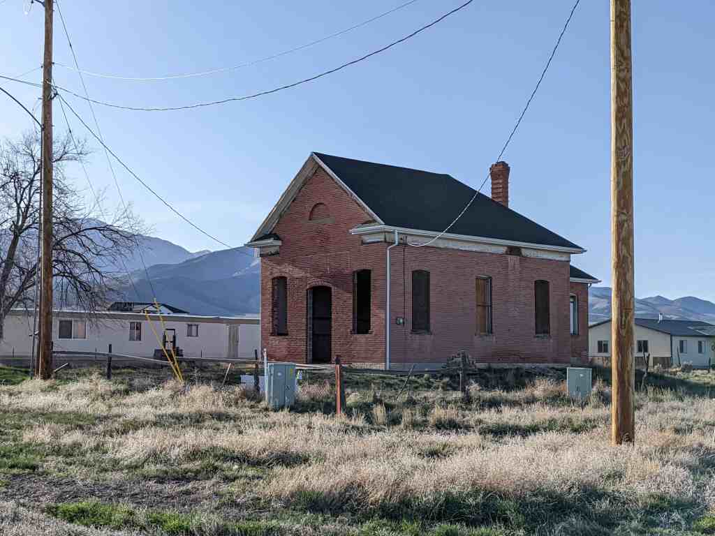
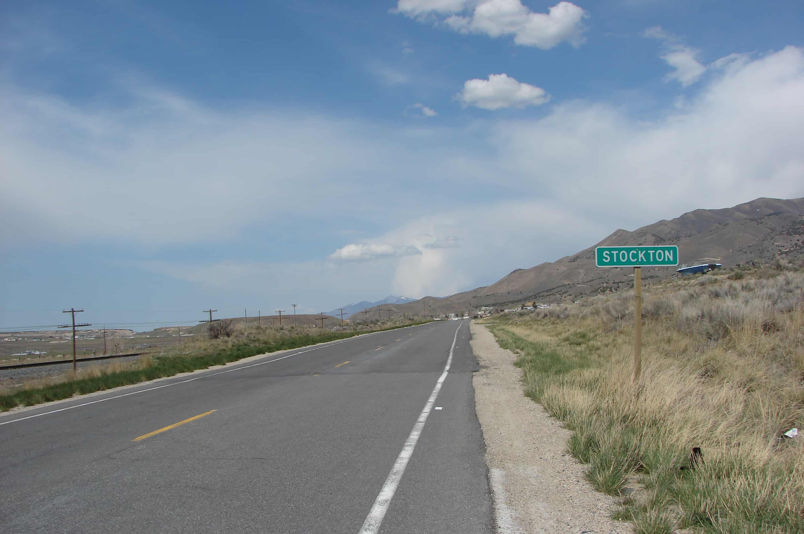
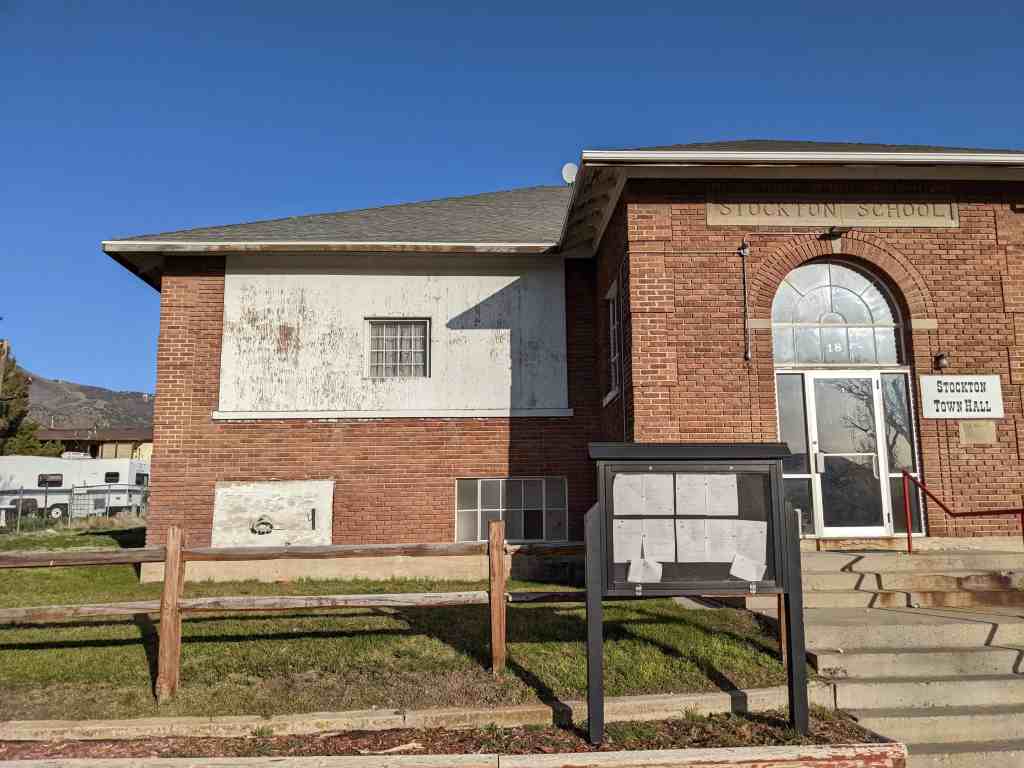
The Stockton School, constructed in 1929, faces west on a .22 acre lot located at 18 N. Johnson Street in Stockton, Tooele County, Utah. Stockton is a rural area located about 40 miles southwest of Salt Lake City. The all-brick building is set back on the lot with concrete stairs leading from N. Johnson Street to the front (west) of the building. Behind the building (east) is a paved parking lot and there are no other structures on the property. This building is a classically inspired 1½ story, Colonial Revival style school with a hipped roof, and projecting central bays on the main and rear elevation. The building is of masonry construction with a rusticated brick veneer over a poured concrete foundation. The tall hipped roof is covered with asphalt shingles. While there have been some alterations to the school, they have had a minimal impact on the historic character defining features.
The Stockton School, built in 1929, is located on the northeast corner of North Johnson Street and East Silver Avenue in Stockton, Tooele County, Utah. The 1½ story foursquare building faces west over a raised concrete basement. The eclectic Colonial Revival influence found in the Stockton School’s design is typical of early twentieth century school construction in Utah. This style emphasizes symmetry, the use of hipped roofs and large banks of multi-paned windows that rest on continuous sills. The building is clad with American or common bond rusticated brick over wood frame. Brick quoins are applied at the major corners of the building and on the corners of the west central bay. The building has a medium pitched hipped roof with the ridgeline extending north to south with two additional hipped roofs over the central projecting cross bays on the west and east elevations. The roof is covered with asphalt shingles. It overhangs the building approximately two feet on all elevations and features exposed rafters.
The main (west) elevation is symmetrical with two horizontal bands of windows. The upper band is a continuous set of large window openings separated only by the central projecting entrance bay. These windows were boarded over with plywood at an unknown date (but most likely when it was converted to the town hall in the mid-1980s) except for a single sash in the middle. The original multi-paned steel window sash and most of the glazing are intact behind the plywood boards and are visible from the interior. The windows on the lower raised basement level are significantly smaller and have been evenly subdivided in pairs across the façade. The left-and right-most windows at this level have also been covered with plywood, while the inner two windows are still visible. All have the original steel sash. The central bay connects a Roman-arched main entrance with the hipped roof. Two 6/3 windows are located in the north and side walls of the projecting bay. The arch is a combination of soldier and sailor bricks concrete block inscribed “Stockton School” is centrally located over the arched entrance. The window in the archway appears to be the original metal sash. However, the door and sidelights are more-recent aluminum and glass replacements.
The north elevation has no openings in the brick façade. The south elevation has a steel sash, multi-pane window located near the southeast corner at the basement level and an enclosed staircase access to the basement, constructed of CMU block with a shed roof. The shed enclosure is more recent, non-historic addition.
The rear (east) elevation has the same upper horizontal band of boarded-over window openings as the front elevation. The original multi-pane steel sash windows are also intact behind the plywood and are visible from the interior rooms. The central projecting bay has a 6/3 sash window centrally located and a bricked-over coal chute at basement level. The building has an interior chimney that is located slightly off-center of the central bay. The chimney projects approximately eight feet above the roof and has a concrete chimney cap and decorative concrete and brick corbelling at the top. The rear projecting bay has an entrance located in the south side. The door itself is a more-recent aluminum and glass replacement. A non-historic concrete ramp is located laterally across the southeast side of the elevation that leads to the entrance.
On the interior, the main floor has a central hallway with four large rectangular classrooms-one at each corner of the building. A wide hallway bisects the building from front to rear. The hallway features shallow built-in alcoves that were probably originally used for coat racks. The main entrance in the front projecting bay is a half-story below the main floor and a wide stairway ascends to this floor. Flanking narrower stairways descend to the basement level. Small windows on the north and south sides of the projecting bay illuminate the stairway area. The east end of the hall way at the rear of the school has had a restroom constructed at an unknown time (though not during the historic era). This is located adjacent to the rear exit.
The original interior walls are constructed with wood lathe and plaster. Original classrooms components include blackboards, chalk tray, bulletin boards, and closets. All rooms have tall ceilings and have been painted uniformly with a tan color (including painting over the glass panes of the boarded-over windows).
The basement has been altered and subdivided over the years and has a number of smaller rooms. Currently the space is used for storage, Stockton’s Police Department, and the town library.
Scott & Welch Architects
Carl W. Scott and George W. Welch were partners in a prominent Utah architectural firm that successfully survived the Great Depression of late 1920s and 1930s. One of their notable achievements in the 1920s was the planning and design of an entire new community for Utah Copper Company (Copperton Historic District, NRIS #86002642). The firm’s popularity grew once the Works Progress Administration (WPA—later the Work Projects Administration) was initiated as a part of the President Franklin Roosevelt’s New Deal program. In fact, Scott and Welch designed more school buildings in the 1930s than any other architecture firm in Utah, with the list including Hawthorne Elementary School, Bryant Junior High, Tooele High School, and Blanding High School. Many of these schools were WPA funded projects. The firm’s school designs ranged from more-traditional Colonial Revival/eclectic styles, such as the Stockton School, to modern boxy designs with Art Deco embellishment. The Stockton School, like other buildings of their work, has survived and has been adapted for other functions, while others have been demolished or replaced throughout the years. The Stockton School remains an intact example of the dwindling stock of Scott & Welch’s surviving buildings.