• About JacobBarlow.com
  • Cemeteries in Utah
  • D.U.P. Markers
  • Doors
  • Exploring Utah Email List
  • Geocaching
  • Historic Marker Map
  • Links
  • Movie/TV Show Filming Locations
  • Oldest in Utah
  • Other Travels
  • Photos Then and Now
  • S.U.P. Markers
  • U.P.T.L.A. Markers
  • Utah Cities and Places.
  • Utah Homes for Sale
  • Utah Treasure Hunt

JacobBarlow.com

~ Exploring with Jacob Barlow

JacobBarlow.com

Tag Archives: Wyoming

Sand Springs – A Stop on the Oregon Trail

29 Monday Sep 2014

Posted by Jacob Barlow in Uncategorized

≈ 1 Comment

Tags

historic, Oregon Trail, Sublette County, Wyoming

2018-01-05 14.07.29

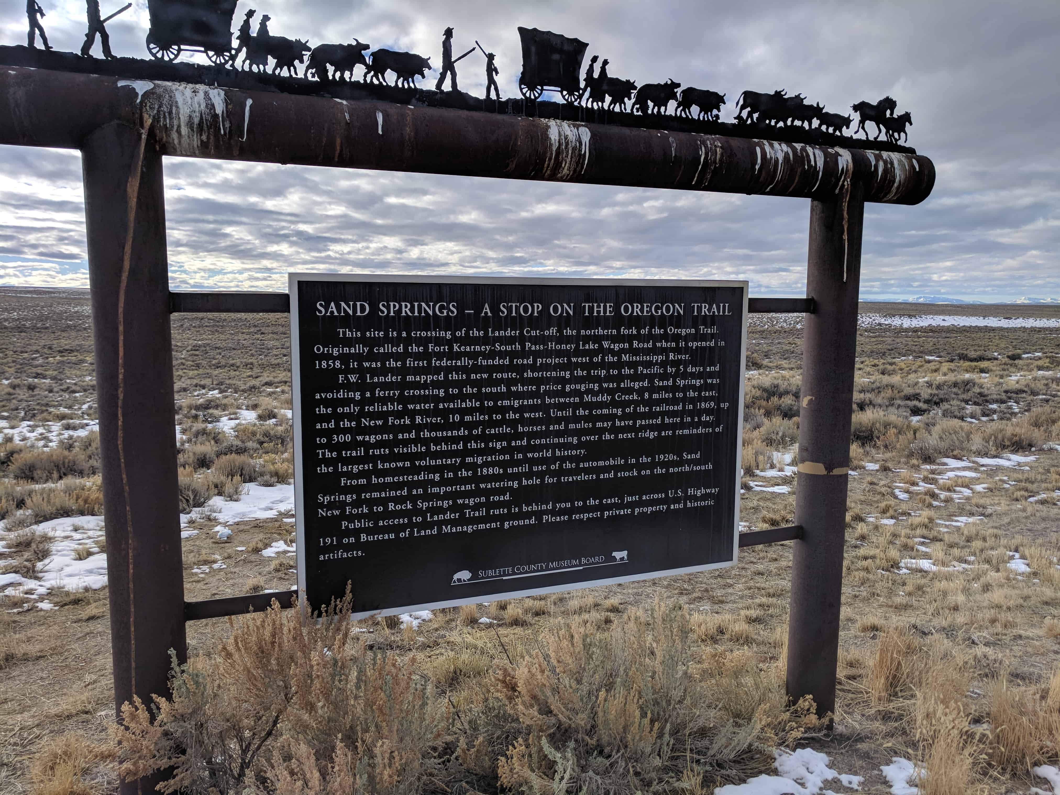
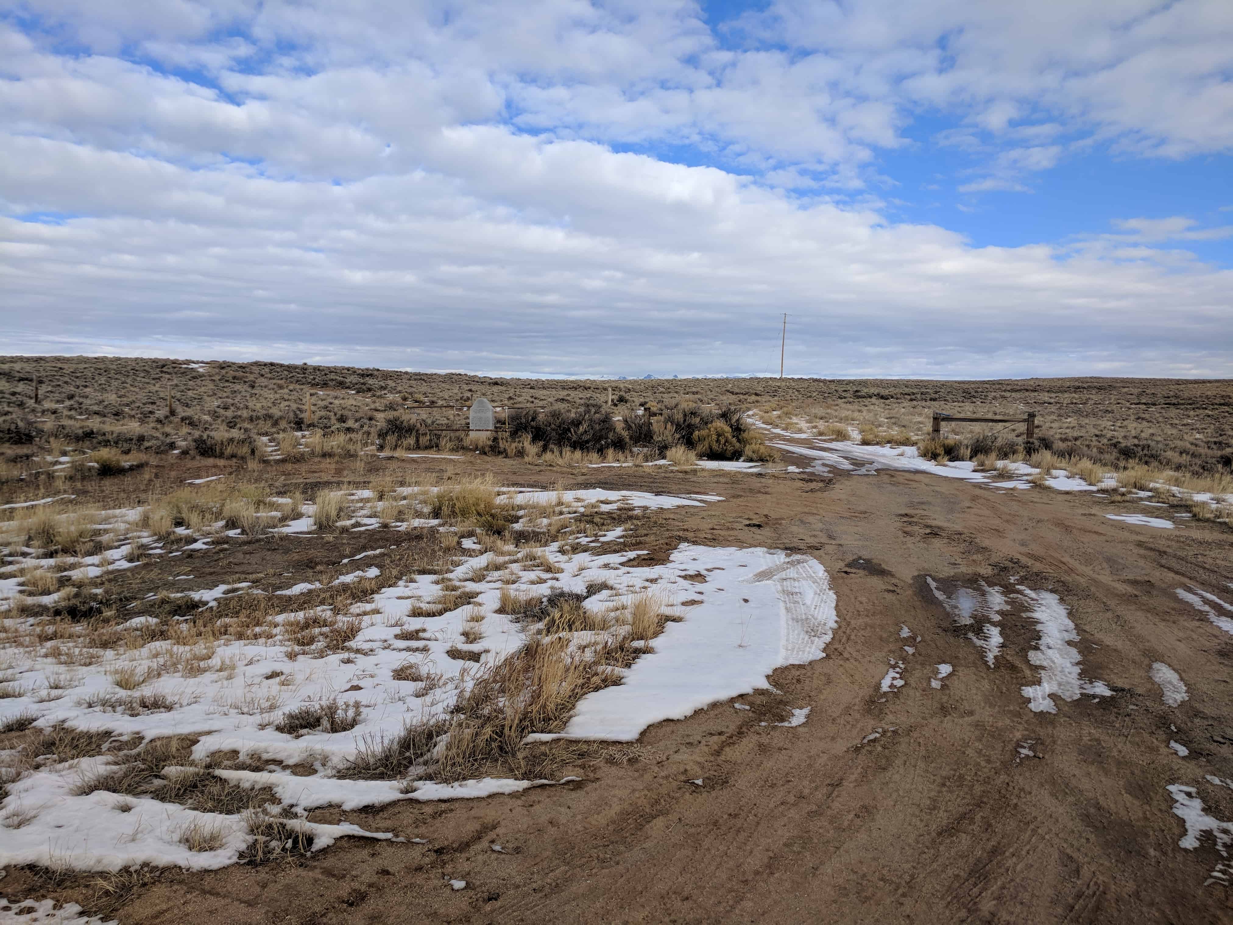
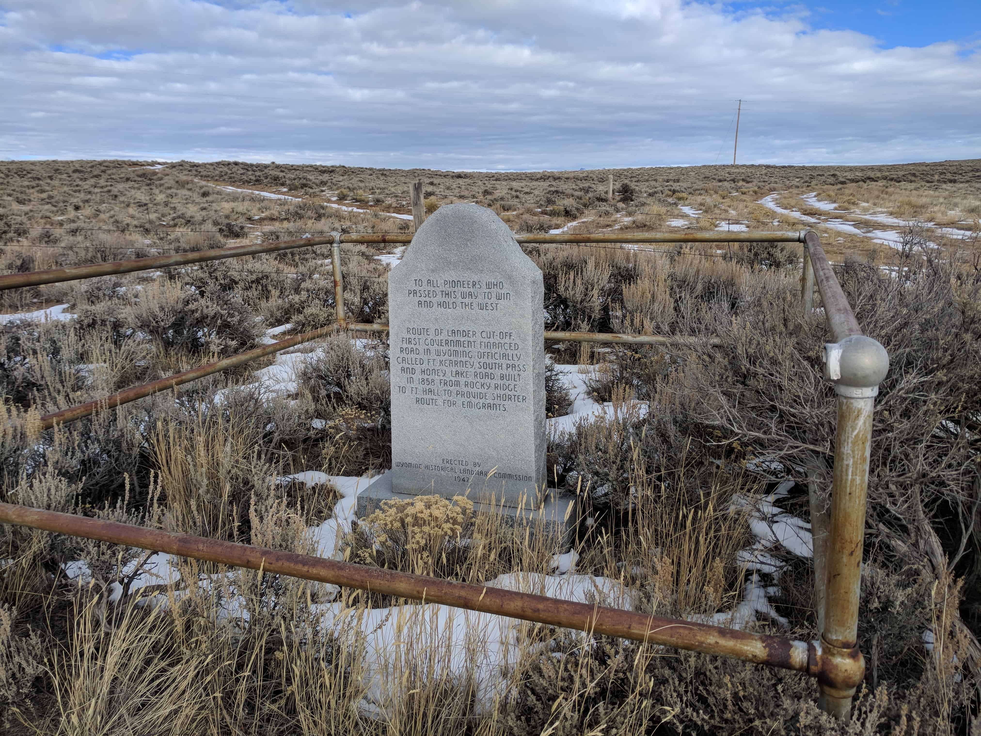
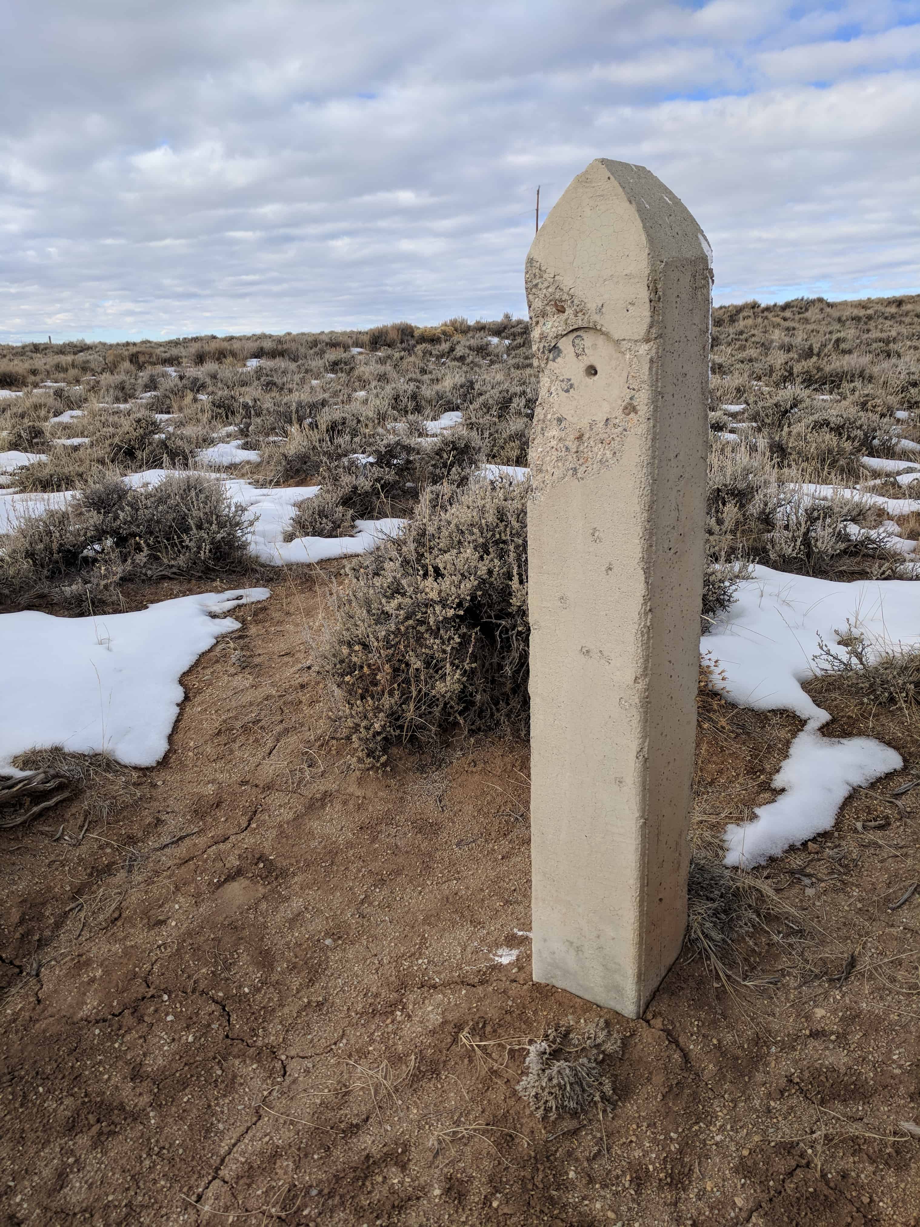
This Site is a crossing of the Lander Cut-off – the northern fork of the Oregon Trail, following a route of the fur traders. It was suggested as an emigrant road by Mountain Man John Hockaday in order to avoid alkali plains of the desert, shorten the trip to the Pacific by five days and provide more water, grass and wood. In 1857 it was improved as a wagon road by the Government under the supervision of F.W. Lander and termed the Fort Kearney-South Pass-Honey Lake Road. As many as three hundred wagons and thousands of cattle, horses and mules passed here each day. An expanding nation moved with hope and high courage. The trail, cut deep into the dirt of the plains and the mountains, remains as a reminder of a great epoch.”

2018-01-05 14.07.24

2018-01-05 14.07.36

2018-01-05 14.07.42

2018-01-05 14.08.28

2018-01-05 14.08.33

2018-01-05 14.08.37

2018-01-05 14.08.41

2018-01-05 14.09.09

2018-01-05 14.09.25

2018-01-05 14.09.29

2018-01-05 14.10.15

5f529d5a-36be-4882-8581-72a4a1210440 e62bd4ec-f64a-4f9d-a5a3-e31ebde50b0f

Prairie of the Mass

27 Friday Jun 2014

Posted by Jacob Barlow in Uncategorized

≈ 1 Comment

Tags

historic, Wyoming

picture14jul08-036

“Rev. Pierre De Smet (1801-1873) was born in Belgium but came to America in 1821, joined the Jesuit Society and begun his work with the Indians. In his work he established 16 treaties, crossed the ocean 19 times and travelled 180,000 miles on his errends of charity for the Indians who knew him as ‘The Sincerest Friend.’ “On July 5, 1840, in the presence of 2000 Indians, trappers, and traders he offered the first Holly Mass in what is now Wyoming on an alter of native stone decorated with wild flowers. In Father De Smet’s own words, ‘It was a spectacle truly moving to the heart of a missionary that this immense family, composed of so many tribes should prostrate themselves in equal humility before the Divine Host.’ “The monument at the site was erected in 1925 and a commemorative mass is offered there annually in July. On July 4, 1940, the 100th anniversary of the first mass, a Pontifical High Mass was offered by the Most Rev. Bishop McGovern assisted by more than 30 priest and attended by about 2000 people.”

2c16fda2-6664-44a7-b6e5-a263d0cc2dac
76cf9273-5d24-477a-a33a-9827c152d821

Of Cattle and Men

27 Friday Jun 2014

Posted by Jacob Barlow in Uncategorized

≈ 1 Comment

Tags

Big Piney, historic, Sublette County, Wyoming

picture14jul08-041A marker west of highway 189 between Daniel and Big Piney, near the Big Piney Cut-off reads:

“Thousands of people, cattle and horses passed this way to the Northwest when the Sublette Cut-off of the Oregon Trail was opened in 1857. None settled in this county. At the close of the Indian Wars in 1877, cattle herds from Oregon came this way to meet the railroad and to stock Wyoming ranges. The first Sublette County herds were started with other western cattle. In 1878-79, Ed Swan’s, Otto Leifer’s (Circle), D. B. Budd’s, Hugh McKay’s (67) and A. W. Smith’s (Muleshoe) outfits settled on nearby Piney Creek. Their cattle were not longhorns. The county’s first barbed wire was unrolled in 1881 on the Circle outfit.”

The marker was erected in June 1960 at the expense of the Sublette County Historical Society. The text was written by Jim Harrower.

cattleandmen1
cattleandmen2
cattleandmen3
cattleandmen4

Green River Rendezvous

27 Friday Jun 2014

Posted by Jacob Barlow in Uncategorized

≈ Leave a comment

Tags

Daniel, historic, Sublette County, Wyoming

picture14jul08-034

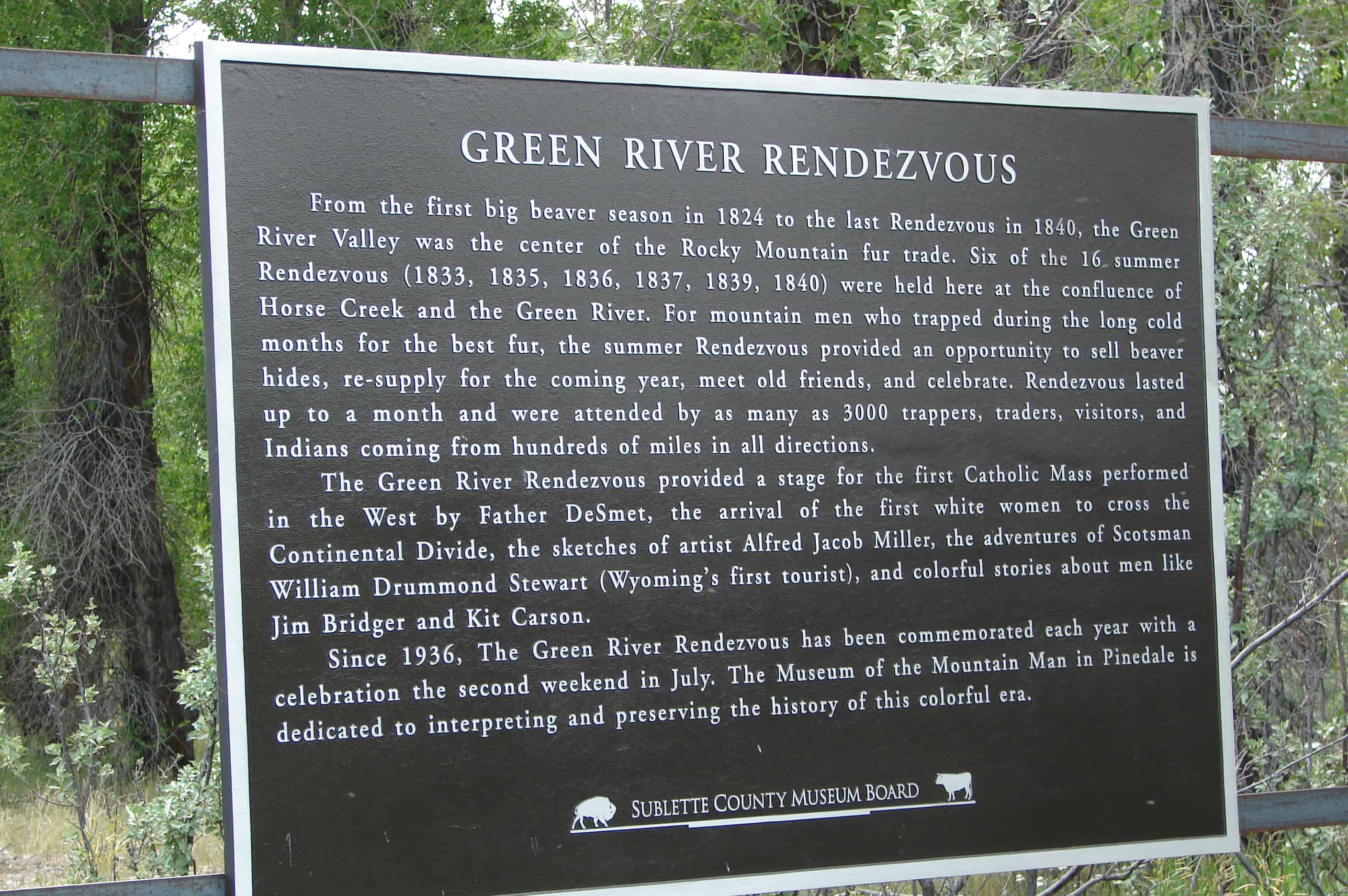
The Rendezvous had a broad meaning with the early trappers; not only was it a place to which they carried their furs and exchanged them for all sorts of commodities, such as clothing, saddles, bridles, tabacco, whiskey, bright dyes for coloring the trappings of their horses – but it was a place to meet traders who might wish to engage their services for the coming year. It was indeed a place noted for business, pleasure, mirth, gambling and brawls, and the motley collection was not without interest even to the early missionaries. Along about 1835, religious teachers became a regular feature at the Rendezvous. Rev. Samuel Parker made a number of religious talks to white men and Indians at the Green River in 1835. Father De Smet made a number of his winning and pleasant talks in 1840 at this same place. The Green River Rendezvous are commemorated the second Sunday in July each year at the Museum of The Mountain Man in Pinedale. A large interpretive historical site marker was erected by the Sublette County Historical Society in July 1955 on the Rendezvous grounds near Daniel. It was designed by Jim Harrower and Myra Cooley prepared the lettering. Mrs. Jean Roth cut the stencils and arranged the lettering. The legend on the sign reads: “A market place of the fur trade, from the Mississippi to the Pacific, from Canada to Mexico, where trappers, traders and Indians came to barter for the first great resource of the West. Six Rendezvous were held here, gathering not only furs but information of geographical importance to weld the final link in exploration of the new world. It is a tribute to the brave men, both red and white, who blazed the trails for culture and progress, and to the lowly beaver who gave it impetus”

ImageImage

picture14jul08-035

A Pause On A Journey

20 Friday Jun 2014

Posted by Jacob Barlow in Uncategorized

≈ 2 Comments

Tags

historic, Pinedale, Sublette County, Wyoming

A marker located west of the Pine Creek Bridge in Pinedale, on the North side of the highway reads:

“On Oct. 16, 1812, the Astorians Robert Stuart, Ramsay Crooks, Robert McClellan, Joseph Miller, Benjamin Jones, Francis LeClair and Andy Vallee, traveling from Astoria to St. Louis, all their horses having been stolen by Indians, passed this way on foot and forded Pine Creek near here, the first white men known to have seen it.

From Stuart’s Journal: ‘We forded another stream whose banks were adorned with many pines – near which we found an Indian encampment – deserted about a month ago, with immense numbers of buffalo bones strewed everywhere – in the center of camp a great lodge of pines and willows – at the west end three persons lay interred with feet to east and at head of each a large buffalo skull painted black – from lodge were suspended numerous ornaments and moccasins.’

Six days later, on Oct. 22, 1812, they made the memorable discovery of the South Pass.”

The marker was erected in August of 1962 at the expense of the Sublette County Historical Board. The script is by Jim Harrower.

ImageImageImageImage

Pinedale, Wyoming

20 Friday Jun 2014

Posted by Jacob Barlow in Uncategorized

≈ 4 Comments

Tags

Pinedale, Sublette County, Wyoming

Image

Pinedale Posts:

  • A Pause On A Journey
  • Pinedale’s Boulders

In 1904, John F. Patterson proposed establishing a town in the Green River Valley along Pine Creek in western Wyoming, in what then was still part of Fremont County. Patterson offered to build and stock a general store if local ranchers Charles A. Petersen and Robert O. Graham each donated five acres for the town site. The three men agreed, and hired a surveyor. Pinedale, Wyo., named after the post office on Petersen’s ranch, became a town on paper owned by the trio.


The boundary line set by the ranchers became Pine Street. Patterson earned recognition as the founder of Pinedale. On Sept. 26, 1904, the first town plat was drawn on a piece of yellow cloth showing blocks, lots and streets. That date was designated as Founder’s Day.

Image

The tiny town served the area’s small, yet thriving, industries. This included supplying provisions for tie hacks living in mountain camps. Tie hacks, who cut trees and shaped railroad ties from them, came from around the world for this work. As Union Pacific Railroad expanded its tracks through Wyoming in the early years of the 20th century, it needed ties to support the new rails.

Image

Even before the town of Pinedale was founded, guests, often known as “dudes,” paid guides to assist them during their visits to the nearby Wind River Mountains. During the late 1800s, tourists came to enjoy horse pack trips, fishing and hunting in the beautiful nearby mountains.

picture09march08-013
picture09march08-015

Great herds of Hereford and Black Angus cattle roamed on area ranches in the Green River Valley, some of which were established before the town itself. Ranchers and cowboys, along with their families, were among the early settlers of the region.(…more here)

2018-01-05 13.26.11

2018-01-05 13.26.16

2018-01-05 13.26.50
2018-01-05 13.26.54
2018-01-05 13.26.59

2018-01-05 13.27.02

2018-01-05 13.30.16
2018-01-05 13.30.02
2018-01-05 13.27.39


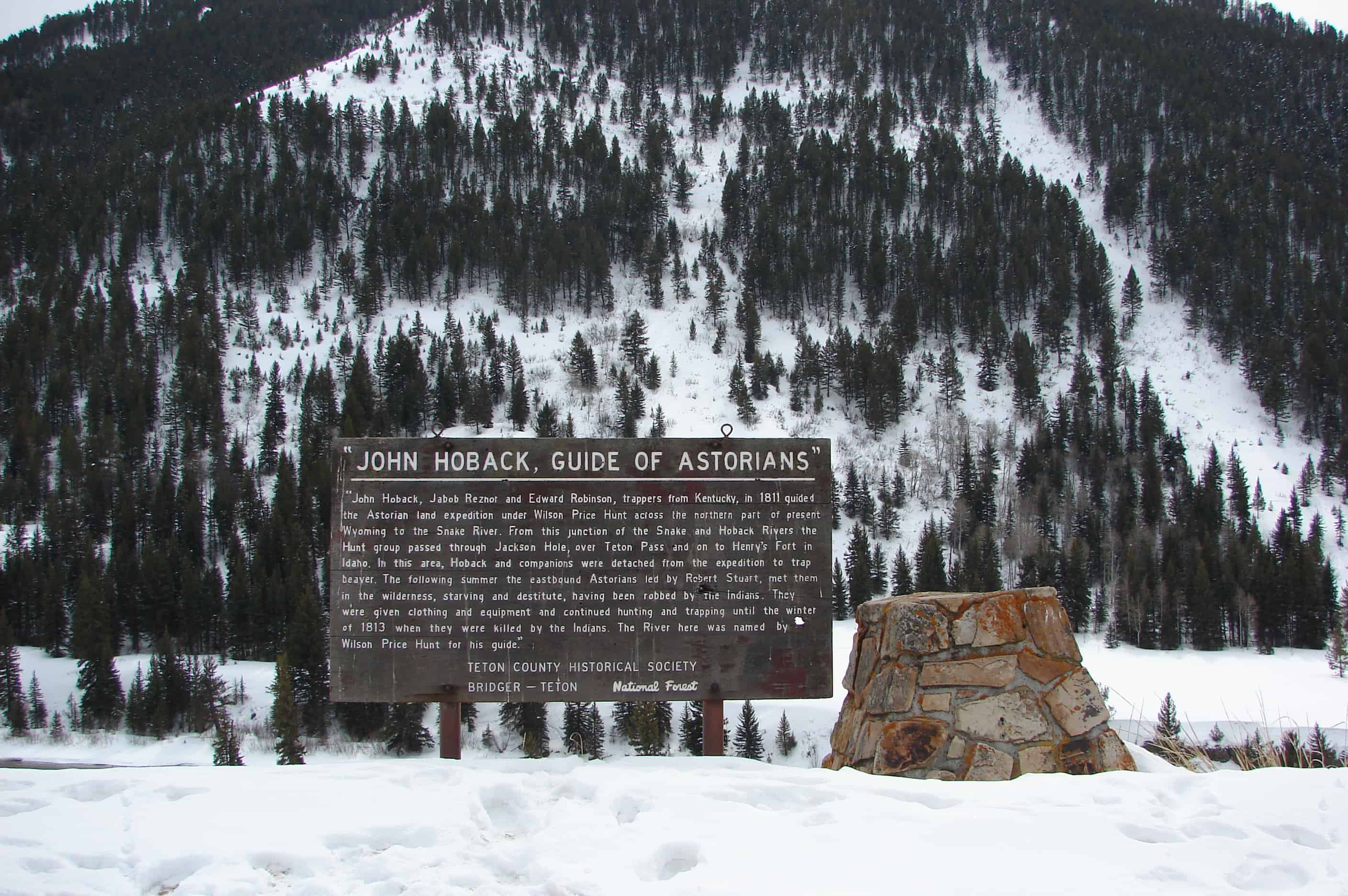
John Hoback, Guide of Astorians

20 Friday Jun 2014

Posted by Jacob Barlow in Uncategorized

≈ 1 Comment

Tags

Hoback Junction, Jackson, Teton County, Wyoming

picture09march08-018

John Hoback, Jacob Reznor and Edward Robinson, trappers from Kentucky, in 1811 guided the Astorian land expedition under Wilson Price Hunt across the northern part of present Wyoming to the Snake River. From this junction of the Snake and Hoback Rivers the Hunt group passed through Jackson Hole, over Teton Pass and on to Henry’s Fort in Idaho. In this area, Hoback and his companions were detached from the expedition to trap beaver. The following summer the eastbound Astorians led by Robert Stuart, met them in the wilderness, starving and destitute, having been robbed by the Indians. They were given clothing and equipment and continued hunting and trapping until the winter of 1813 when they were killed by the Indians. The River here was named by Wilson Price Hunt for his guide.

picture09march08-020
picture09march08-019

Diamondville Mining History

20 Friday Jun 2014

Posted by Jacob Barlow in Uncategorized

≈ 2 Comments

Tags

Diamondville, Lincoln County, Mining, Wyoming

Diamondville got its name from the quality of the superior-grade coal from the local mines that seemed to resemble black diamonds.

In 1868, a man by the name of Harrison church discovered coal near the Hams Fork River. He built a cabin on the hill where part of modern Diamondville now stands. Realizing the area’s potential, he sought financial backing from a group in Minneapolis, who eventually formed the Hams Fork River Coal Company, incorporated in 1884. Later S.F. Fields, a promoter from Salt Lake City, Utah, took over management of the company and with the financial backing of the Anaconda Mining Company, renamed it the Diamond Coal & Coke Company.

Over the course of time the development of a western coal mine evolved from digging out and hauling coal by hand from an outcrop or tunnel to today’s mechanical monsters of the plains.

Draglines and truck and shovel operations now remove up to several hundred feet of overburden in order to expose the coal. Conveyor belts and haul trucks transport hundreds of tons each minute to sophisticated automated silos that evenly distribute carefully measured loads onto unit trains. A man used to be paid by the number of tons he dug; today what took days of back breaking labor to dig can be moved in a matter of seconds by a single shovel operator.

The uses for coal have also changed, chunks of coal used to be burned in old stokers and forges for heating purposes. Today coal is crushed, pulverized and sprayed into furnaces to generate steam which is then used to generate electricity. Synthetic fuels or “synfuels” are also generated from Wyoming coal. Currently only a very small percentage of Wyoming’s coal is used as form coke in steel manufacturing.

In the 1860’s steam engines were starting to use coal instead of wood. The recognition of the western coal resource potential had only begun. Also, coal’s high Btu ( British Thermal Units ) made it more favorable to burn than wood. The benefits of using coal were that it increased horsepower, increased the distance that steam engines of the time could travel and was readily available. Wyoming’s abundance of coal and general topography in conjunction with the ongoing Civil War served as deciding factors on the choice of the northern route across southern Wyoming for the Transcontinental railroad.

There are four main steps to mining coal

Step One

Coal must be broken away from the face of the coal seam.

In the early mines picks were used to break the coal away from the face, then holes were drilled in the face and dynamite was into the hole and detonated (1900 – 1950).

Step Two

Coal must be gathered up and loaded into a conveyance to hual it out of the mine.

In the first mines, coal was gathered up and loaded by hand with a coal shovel into the car.

Step Three

Coal has to be transprted out of the mine.

The first coal cars were pushed out of the mine by hand, then mules were used to pull the cars.

Step Four

The coal is prepared and delivered to the consumer.

In the early mines the coal was brought out of the mine in big chunks and loaded onto a horse-drawn wagon.

ImageImageImageImageImage

Muddy Creek Camp and Crossing

10 Tuesday Jun 2014

Posted by Jacob Barlow in Uncategorized

≈ 1 Comment

Tags

DUP, historic, Piedmont, Uinta County, Wyoming

picture24mayr08-016

Muddy Creek Camp and Crossing

The Muddy Creek Camp, which was northwest of this marker and on the west side of the Muddy Creek was used by Brigham Young’s first group of Mormon pioneers who arrived here on July 9, 1847. Thomas Bullock reported that the brethren sang hymns for President Brigham Young, and they had a delightful evening. This camp had good water and plenty of grass, and the animals were well-fed by the tall bunch-grass growing along the creek. Erastus Snow described the campground as “very pretty.”

It was one of the most heavily used camps on the Overland-Mormon-California-Pony Express Trails. Approximately 70,000 Mormon pioneers crossed, passed through, or camped at Muddy Creek Campground. The U.S. Army camped here with 2,000 men in June of 1858. Both the Martin and the Willie handcart companies crossed here in November of 1856 while traveling with rescue wagons. The Muddy Overland Stage Stop and Pony Express Station were located at this site, and foundation stones may still be seen along the west bank of Muddy Creek. The road by this marker was the original Transcontinental Railroad bed of 1869. The Transcontinental Telegraph, automobile road, and stageline either go through the campground or are very nearby, making Muddy Creek Camp an important park of this area’s history.

picture24mayr08-015
picture24mayr08-014
picture24mayr08-017

Check out all of the historic markers placed by the Daughters of Utah Pioneers at JacobBarlow.com/dup

Osmond

05 Thursday Jun 2014

Posted by Jacob Barlow in Uncategorized

≈ 2 Comments

Tags

DUP, historic, Lincoln County, Star Valley, Wyoming

picture7sep07-247

Dry Creek, later called Mount Pleasant was settled 1886, the first public building erected in this area, 1891, was a log schoolhouse also used as a church. Students furnished their own desks and stools. George Hardman, Teacher. Osmond Ward, organized September 8, 1901, Andrew M. Neilson, Bishop. Named (sic) honored George Osmond, First President of Starr Valley Stake, Church of Jesus Christ of Latter-Day Saints.

picture7sep07-246

Check out all of the historic markers placed by the Daughters of Utah Pioneers at JacobBarlow. com/dup

← Older posts
Newer posts →

Follow Jacob

Follow Jacob

Come wander with me on Youtube.

Blog Stats

  • 2,174,164 hits

Social and Other Links

BarlowLinks.com

Recent Posts

  • Charles H. and Lenore Taylor Home
  • Cherry Creek Camp
  • Gas Company – The Stand Filming Location
  • Stevens Cannery
  • Ole Peterson House

Archives

Loading Comments...