Tags

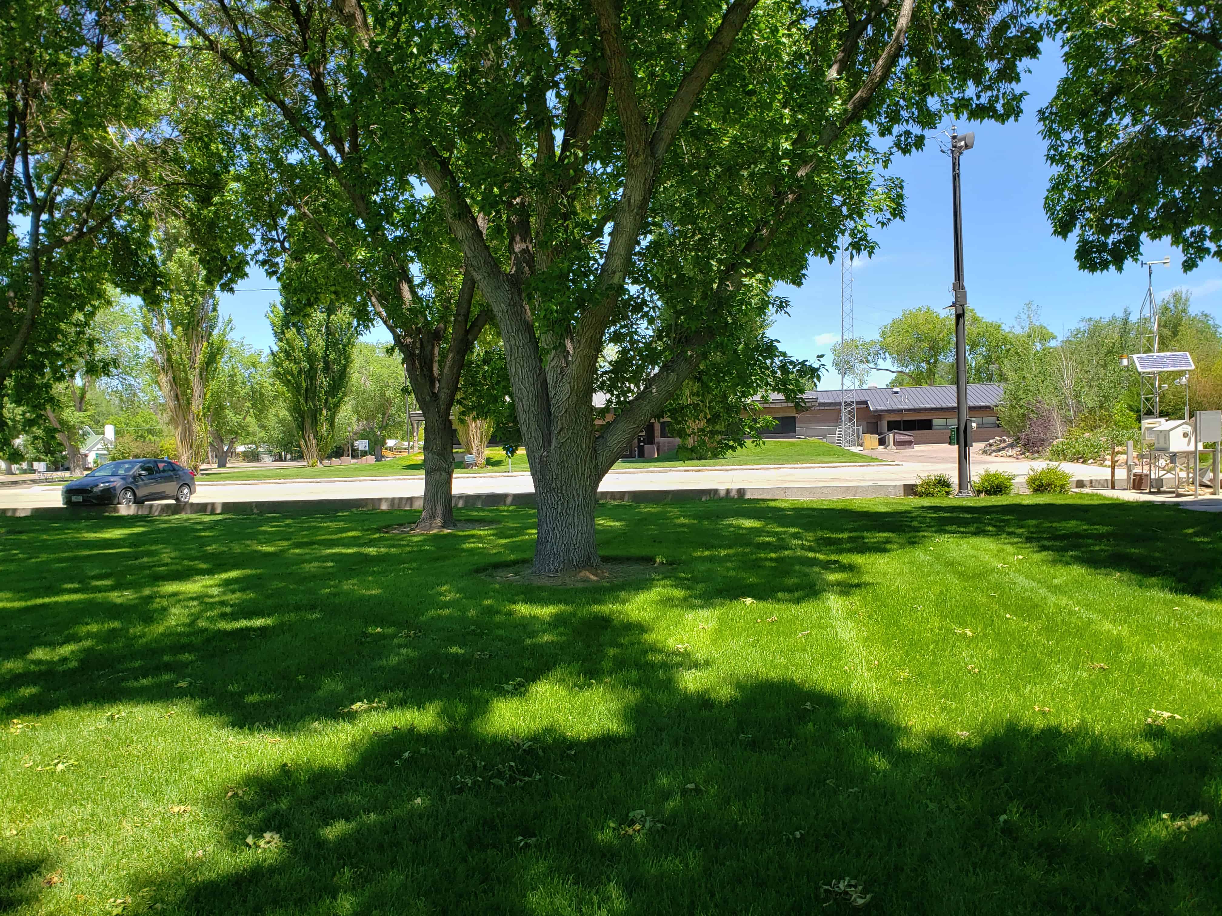
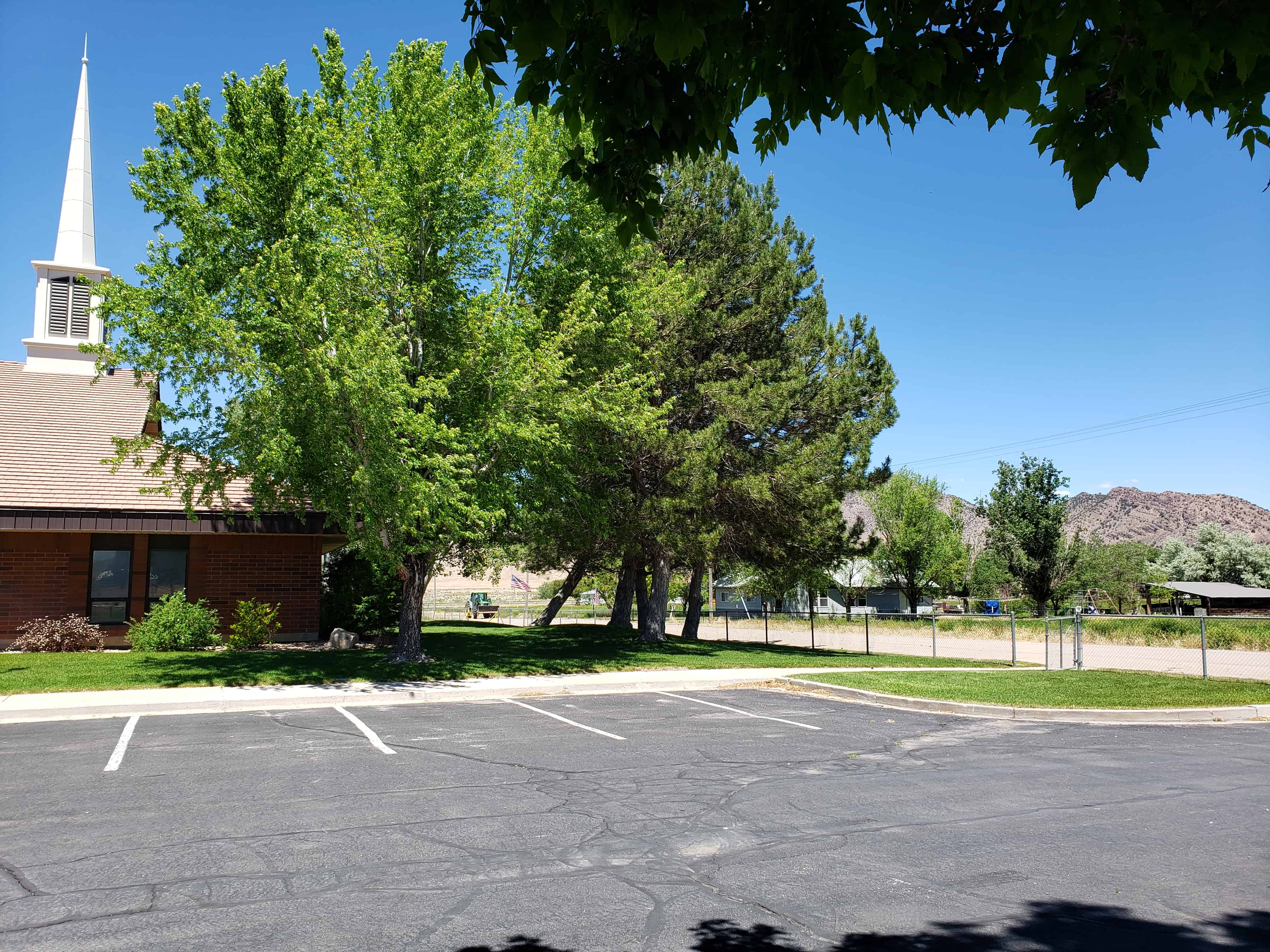
Delta City Park in Delta, Utah.
Related Posts:
- Escalante Trail (Historic marker in the park)
- Pioneer Cabin (Historic marker and cabin in the park)
- Topaz 1942-1946 (Historic marker in the park)


30 Tuesday Jun 2020
Posted in Uncategorized
Tags
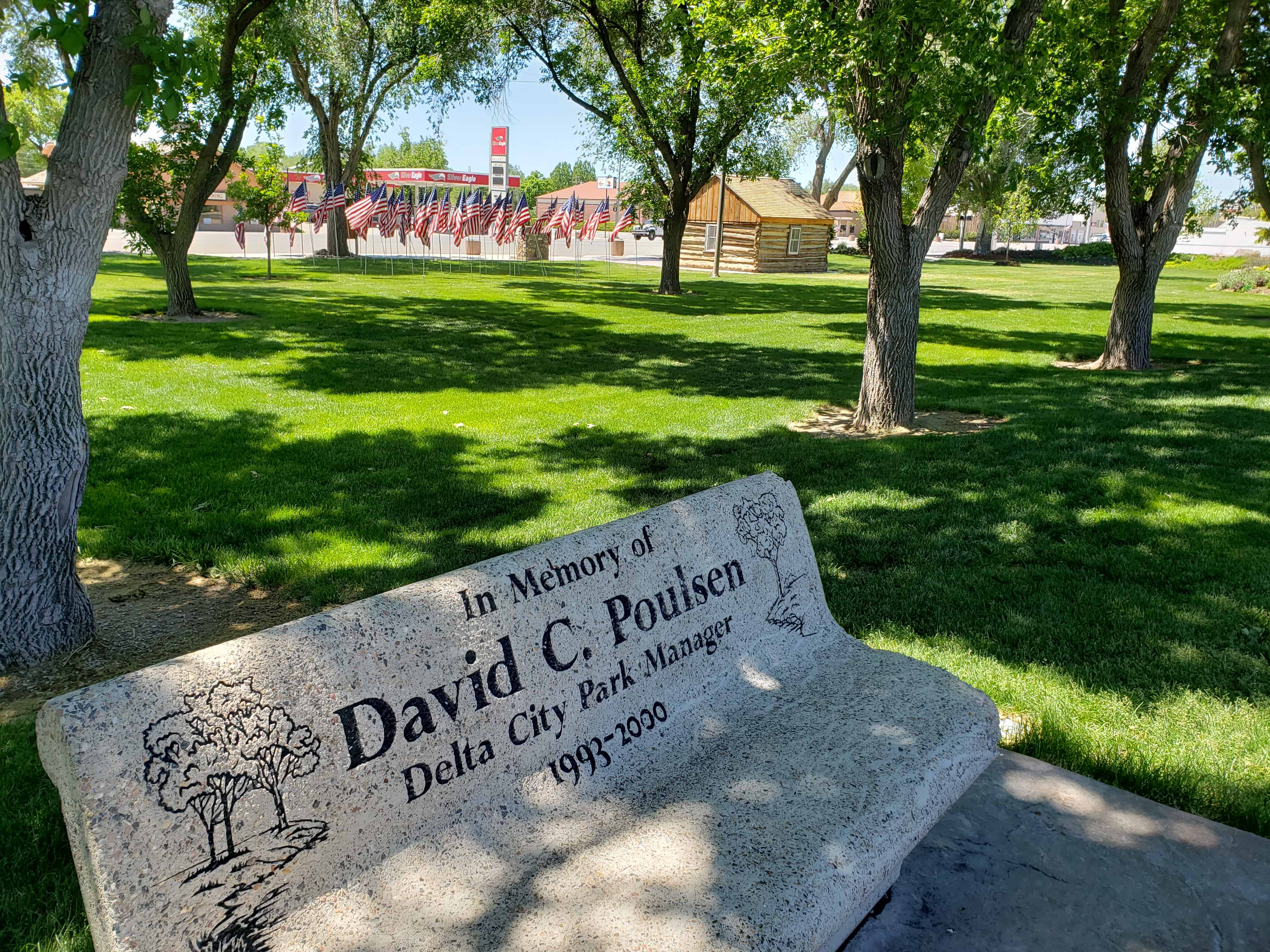
Delta City Park in Delta, Utah.
Related Posts:
30 Tuesday Jun 2020
Posted in Uncategorized
Tags
Concentration Camps, Delta, Historic Markers, Millard County, National Historic Landmarks, NRHP, utah, World War II

Topaz 1942 – 1946
Central Utah WRA Relocation Center
Fifteen miles west at Abraham is the location of the bleak desert site of a concentration camp, one of ten in Western America, in which 110,000 persons of Japanese ancestry were interned against their will during World War II. They were the victims of wartime hysteria, racial animosity, and economic opportunism on the West Coast.
Confined behind barbed wire fence and guarded by armed sentries ad held for no justifiable reason, the internees, two-thirds of whom were American citizens, and the majority of whom were women and children, not only endured the bitter physical discomforts of the desert heat and cold, but sustained a shocking affront to their sense of justice and fair play and human dignity. May this grim episode of basic American principles gone astray remind us to work for understanding and goodwill and justice in an enlightened America today.
The former residents of Topaz remember with grateful appreciation the friendliness and understanding with which the people of Delta received us during the period of our trial and despair.
This historic marker is located at the city park in Delta, Utah


16 Friday Dec 2016
Posted in Uncategorized
Tags
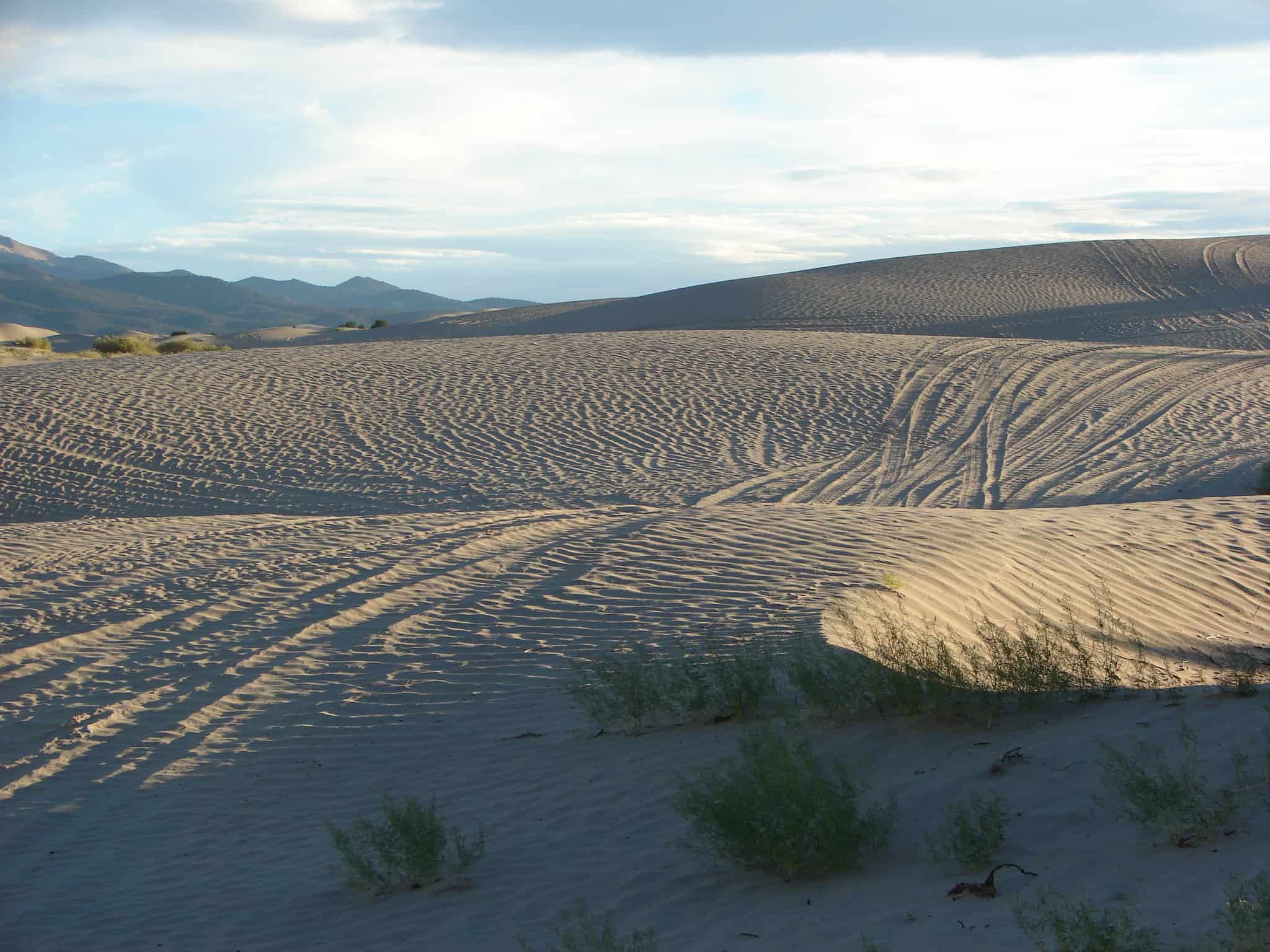
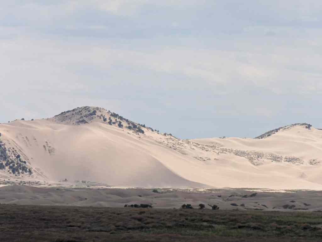
The Little Sahara Recreation Area in Utah is a large area of sand dunes, hills and sagebrush flats located in the west central part of the state approximately 30 miles north of Delta, Utah. It is managed by the U.S. Department of the Interior Bureau of Land Management. A 9,000-acre portion of the northwest corner of the facility has been designated as The Rockwell Natural Area and is off limits to vehicles to preserve and shelter desert plants and animals.

29 Saturday Oct 2016
Posted in Uncategorized
Tags

Some random sand dunes south of Delta we stopped to play on along side the highway.


23 Monday Nov 2015
Posted in Uncategorized
Tags

The town of Leamington on the northern border of Millard County is situated in a small but fertile valley of the winding Sevier River. It is surrounded on the north, east, and south by the Wasatch range.
In 1871, a number of people from Oak City visited the present site of Leamington. Unlike other Utah settlements, these people were not sent to Leamington by Church authorities. However, Bishop Platt Lyman of Oak City did send John Lovell to Leamington to act as the presiding elder. The first permanent settlers in Leamington built their home in 1873.
Leamington was named after a town in England by Frank Young, a nephew of Brigham Young who was one of the early settlers in Leamington.(*)
Related Posts:


28 Wednesday Jan 2015
Posted in Uncategorized
Tags
16 Friday Jan 2015
Posted in Uncategorized
Tags

Settlement of Delta began in 1906 on townlots that had been laid out in 1906. The town was originally called Akin and then Burtner, after that is was Melville and finally Delta.
Delta Posts:
Delta is rather unusual among the primarily agricultural towns in the state, since it was founded in the twentieth century and owed virtually nothing regarding its establishment to direction from the general hierarchy of the Church of Jesus Christ of Latter-day Saints.*
The previously settled West Millard farming area was already becoming prosperous from alfalfa seed production when Frederick R. Lyman and others of his Oak City family began investigating the possibility of diverting Sevier River water upstream from the relatively new Gunnison Bend Reservoir, which was used for cultivating lands at Oasis, Deseret, Hinckley, and Abraham. After farmers from those communities claimed winter runoff water and commenced building a larger Sevier Bridge Reservoir in southeastern Juab County, Lyman persuaded his fellow members of the Millard LDS Stake presidency, Orvil Thompson and Alonzo A. Hinckley, to call attorney James A. Melville to determine the feasibility of forming a new irrigation company in connection with this reservoir project. The Mellville Irrigation Company was organized for that purpose on 24 March 1906. Twenty-nine of the thirty-four original incorporators were residents of Millard County.


30 Friday May 2014
Posted in Uncategorized

No. 218
Erected 1955
Escalante Trail
Father Escalante camped here October 2, 1776. His exploring party of ten men headed by Father Francisco Dominguez and map-maker Pacheco preached to the Indians and charted a northern route between Santa Fe, New Mexico and Monterey, California. They named this valley “Valley Salado” (Valle of Salt). They traveled west near Clear Lake then east to a hillock, (Pahvant Butte). Here they found marshes and much pasturage, but salt water.
Related Posts:
This historic marker is #218 of the Daughters of Utah Pioneers historic markers and is located at the city park in Delta, Utah


27 Tuesday May 2014
Posted in Uncategorized
Tags
Delta, DUP, historic, Historic Markers, Millard County, utah

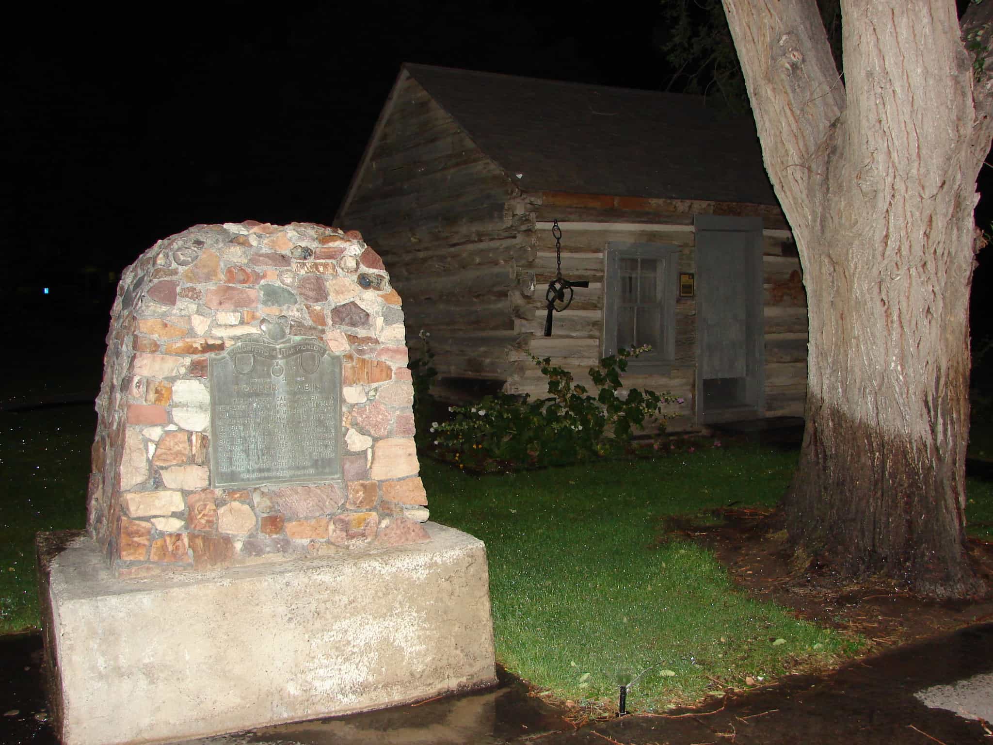
This pioneer cabin was built in December 1907 by Henry J. McCullough and was the second house in the town of Melville. One month later January 18, 1908, the first Post Office was established and the name changed to Burtner. Adjoining this cabin, on March 5, 1908, the first store was opened for business. The first Sunday School of the vicinity was organized in this building on September 8, 1908.
This historic marker is #119 of the Daughters of Utah Pioneers markers and is located at the city park in Delta, Utah
Related:


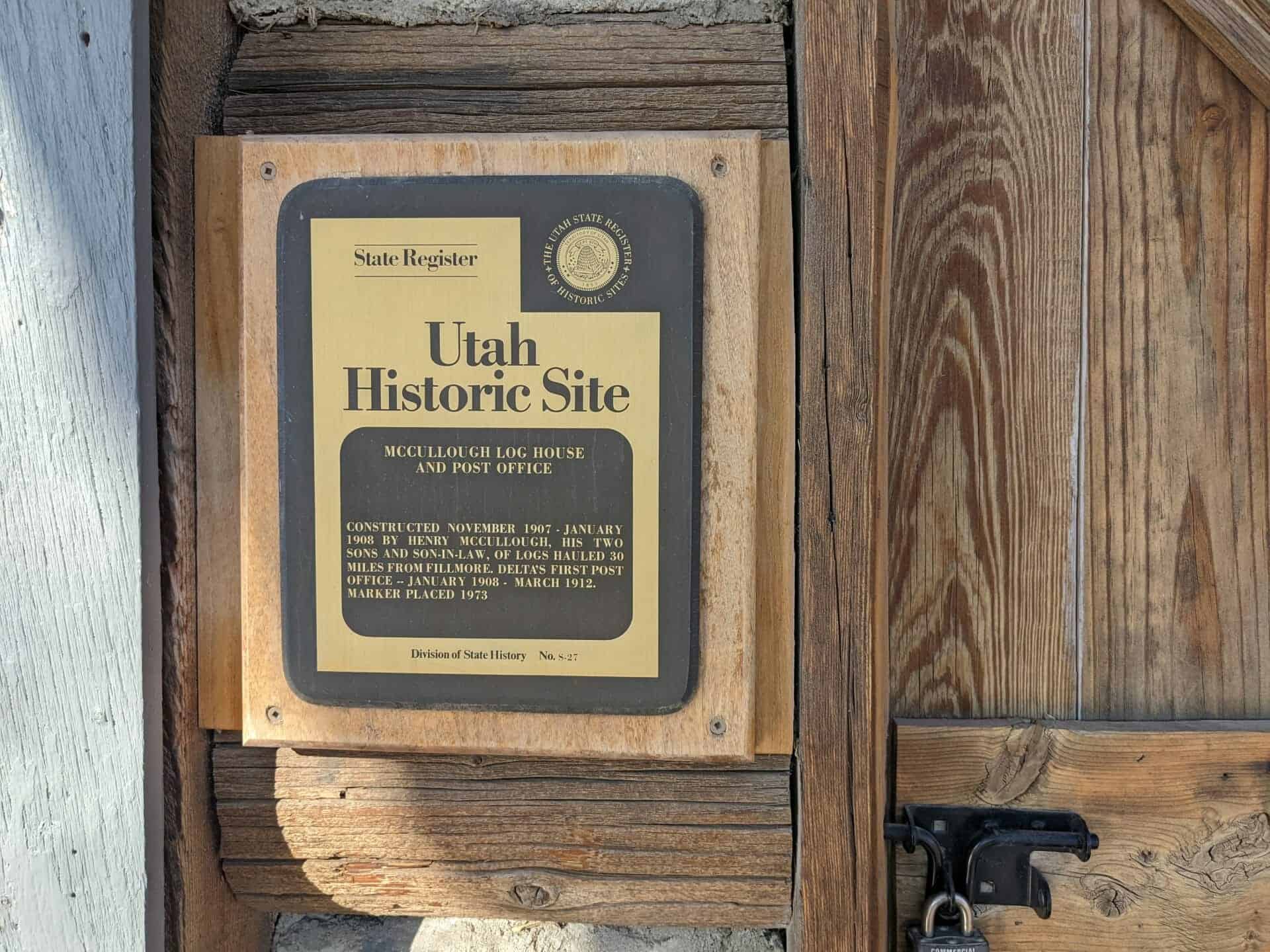
McCullough Log House and Post Office
Constructed November 1907 – January 1908 by Henry McCullough, his two sons and son-in-law, of logs hauled 30 miles from Fillmore. Delta’s first Post Office – January 1908 – March 1912.


21 Wednesday May 2014
Posted in Uncategorized
Tags
Delta, Deseret, DUP, Forts, historic, Millard County, NRHP, State Parks, utah
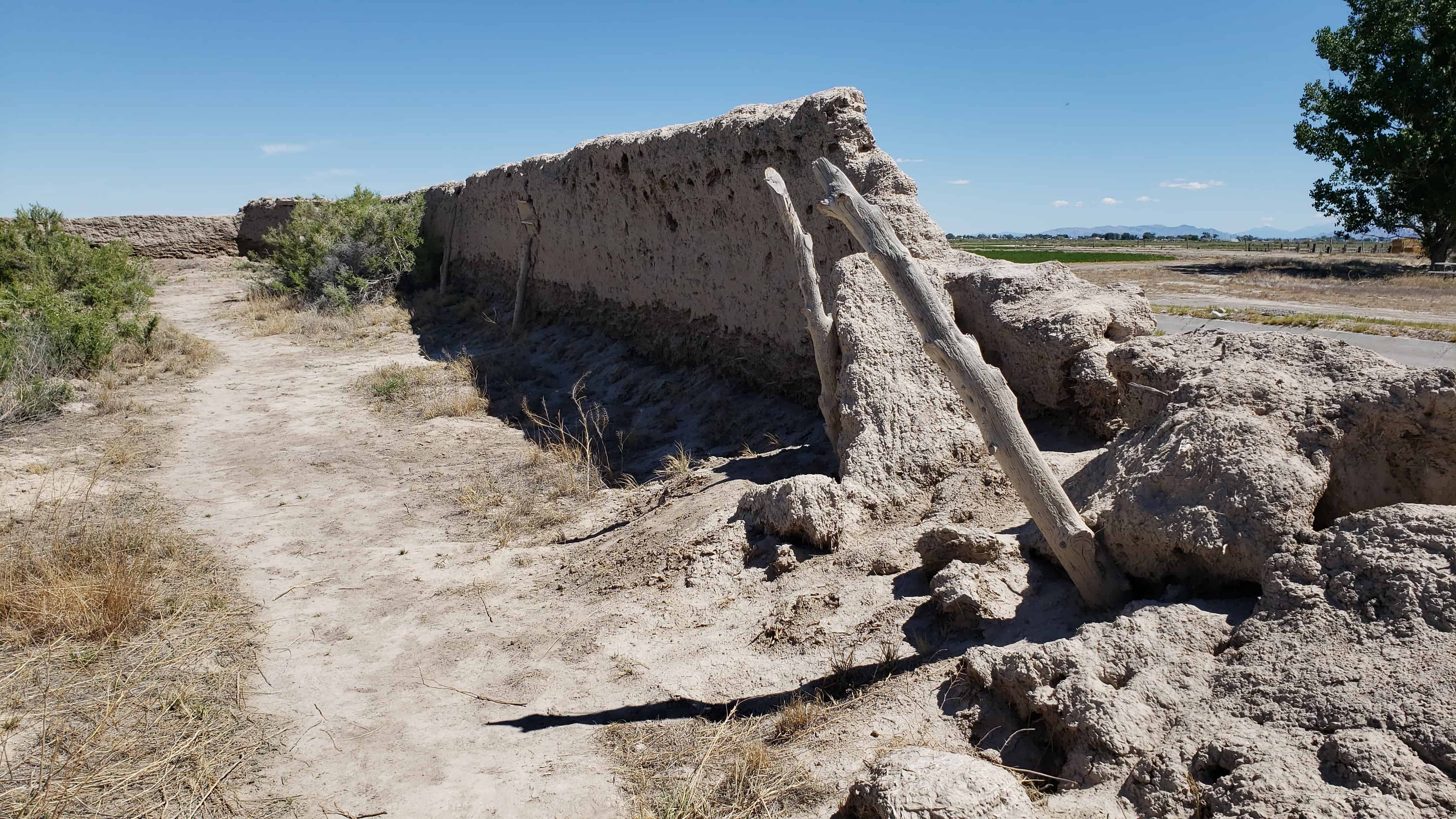
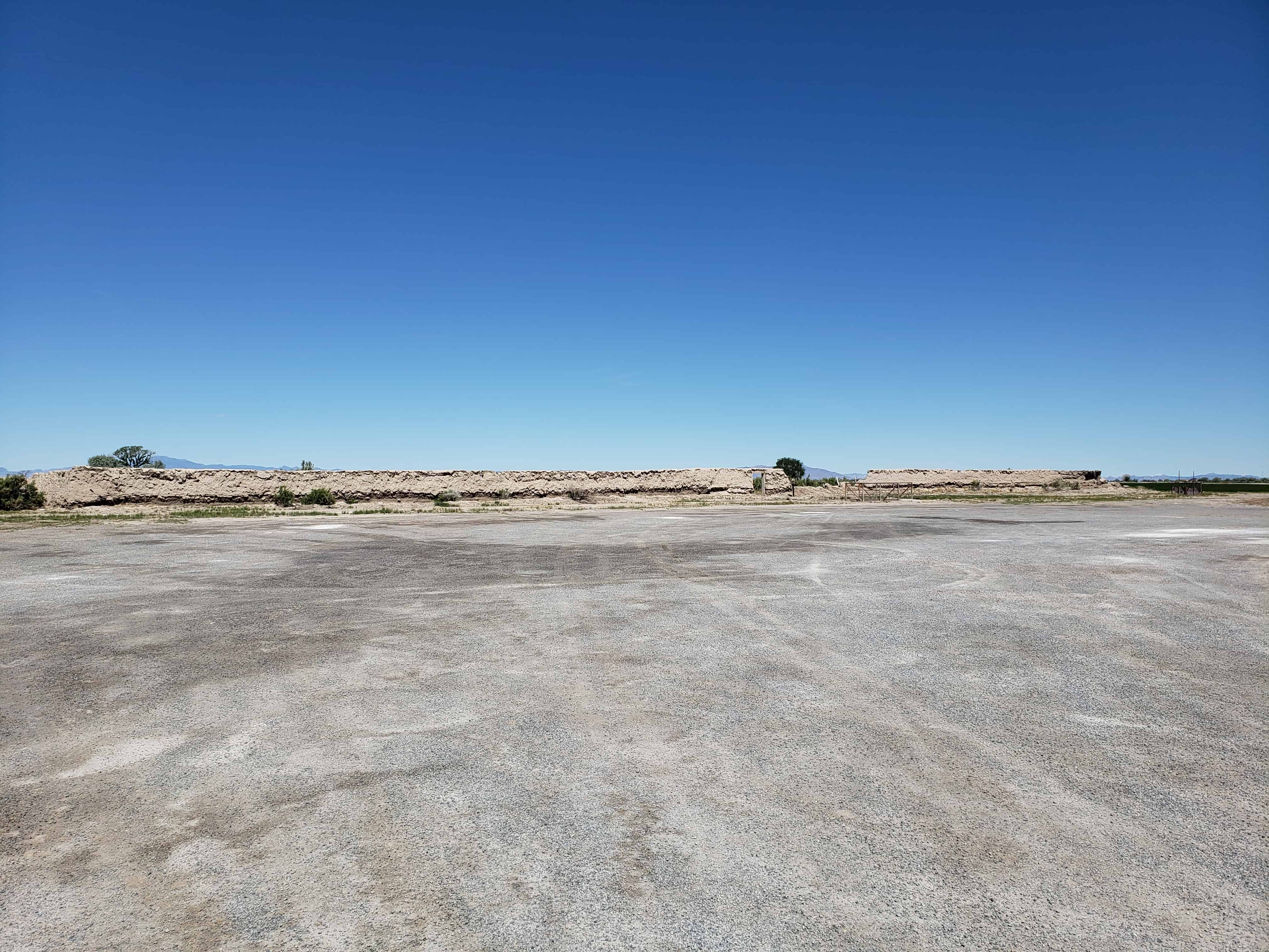
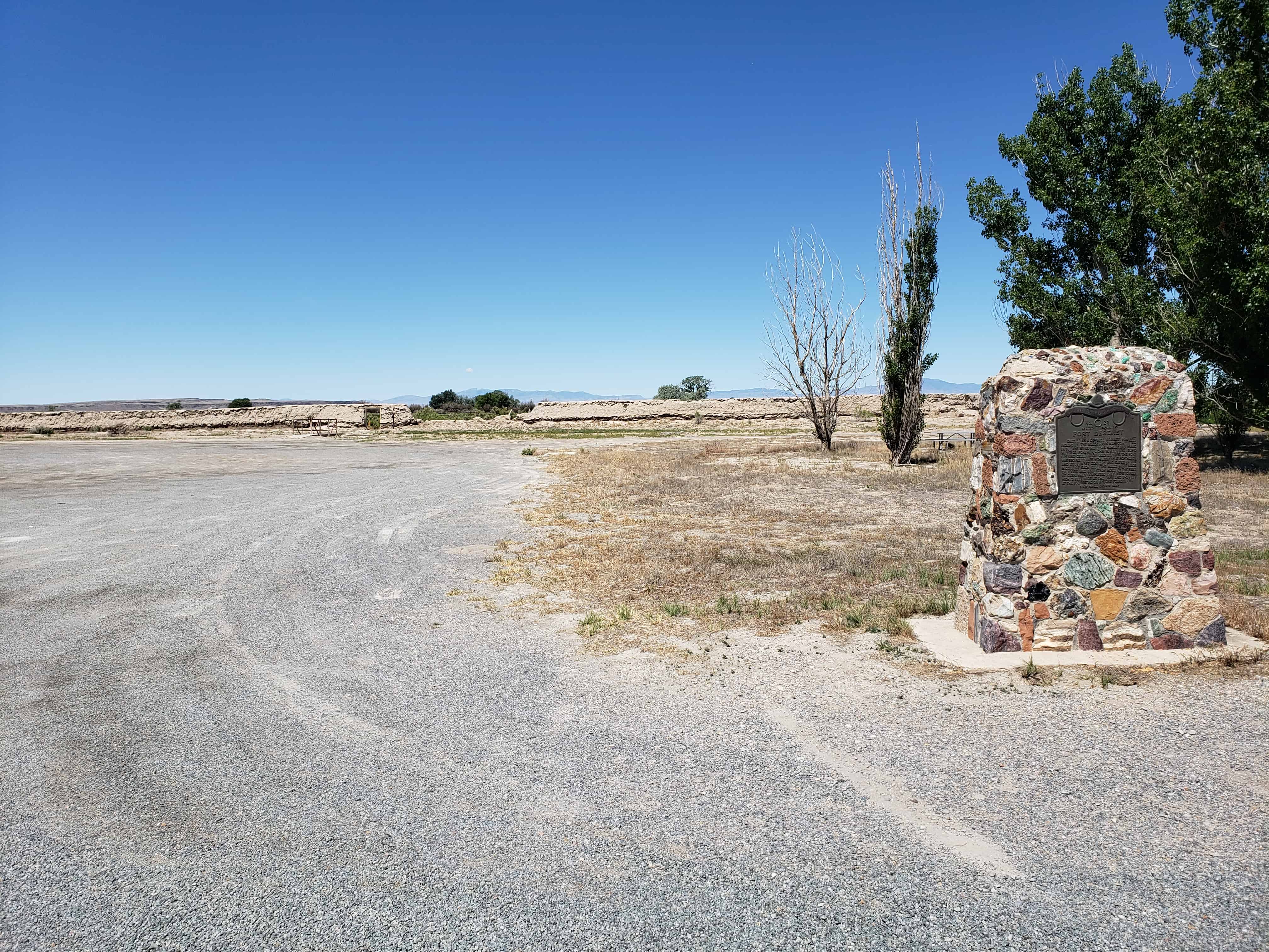
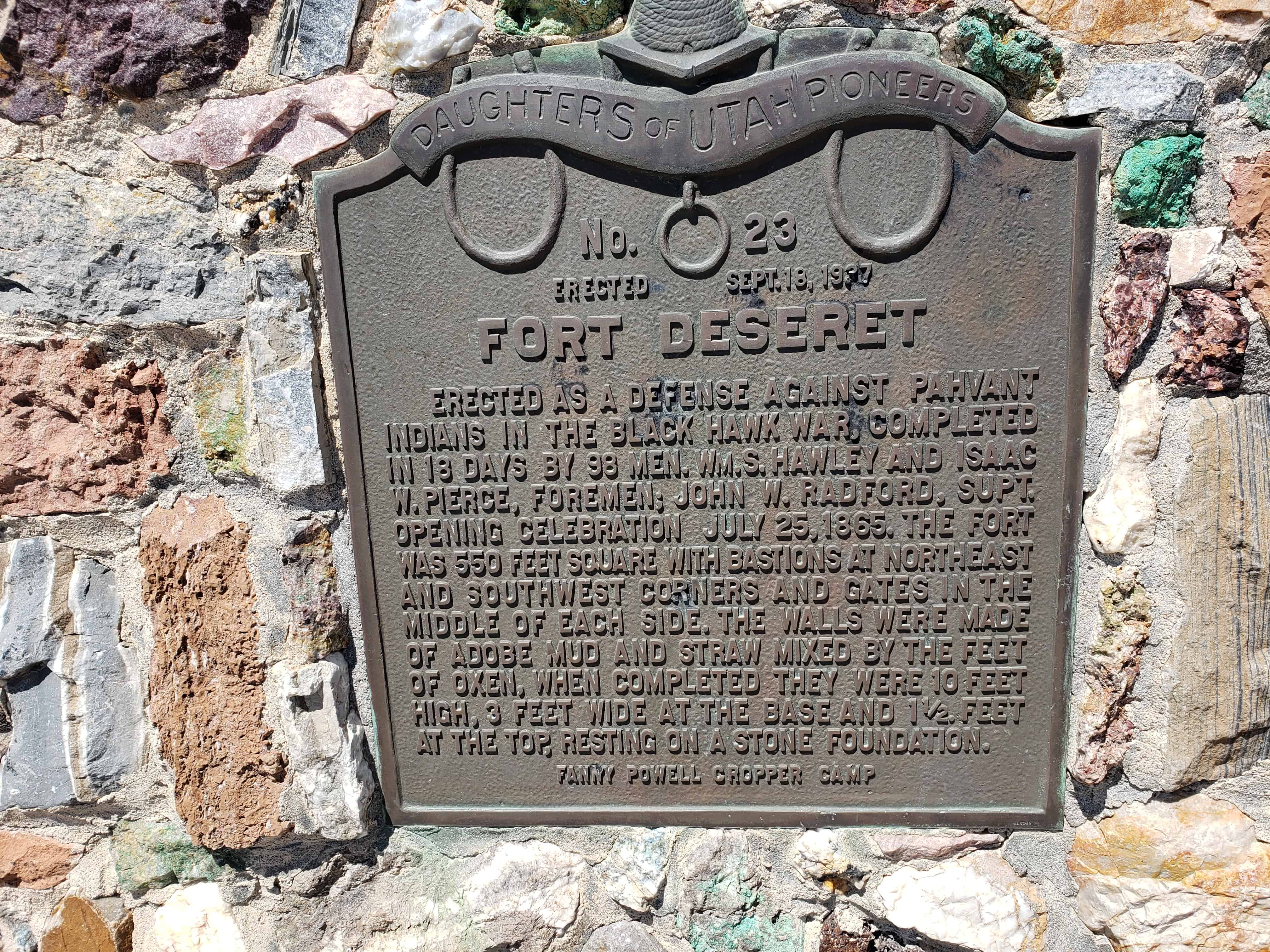
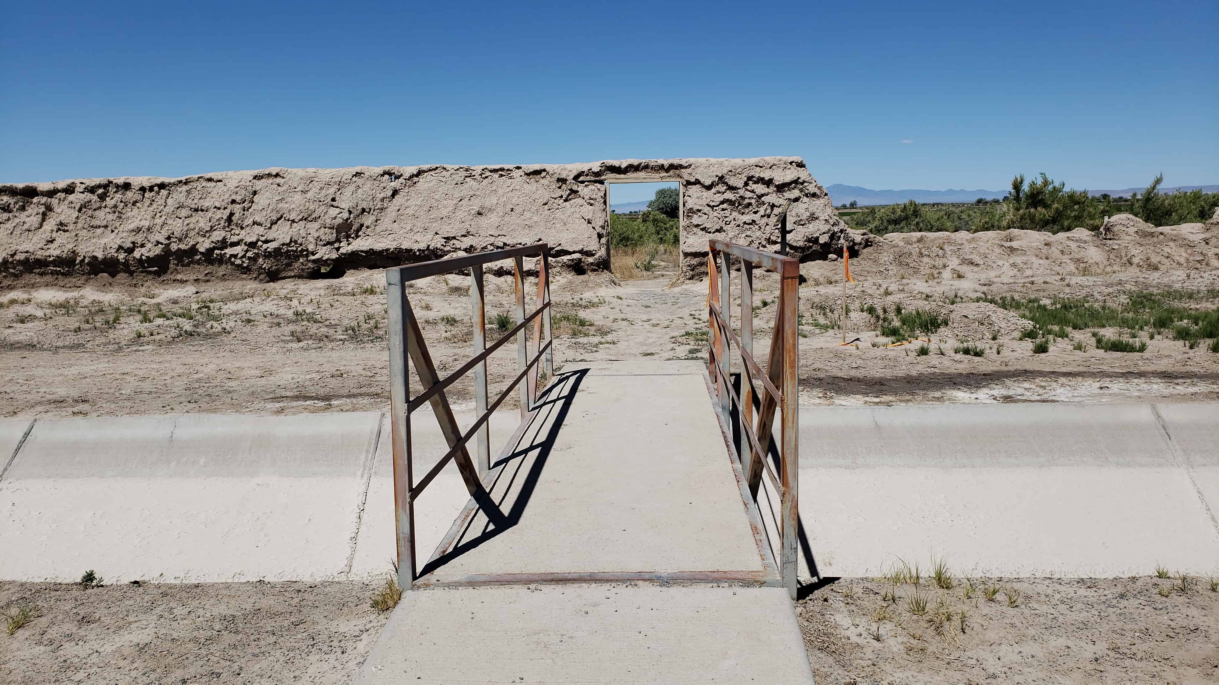
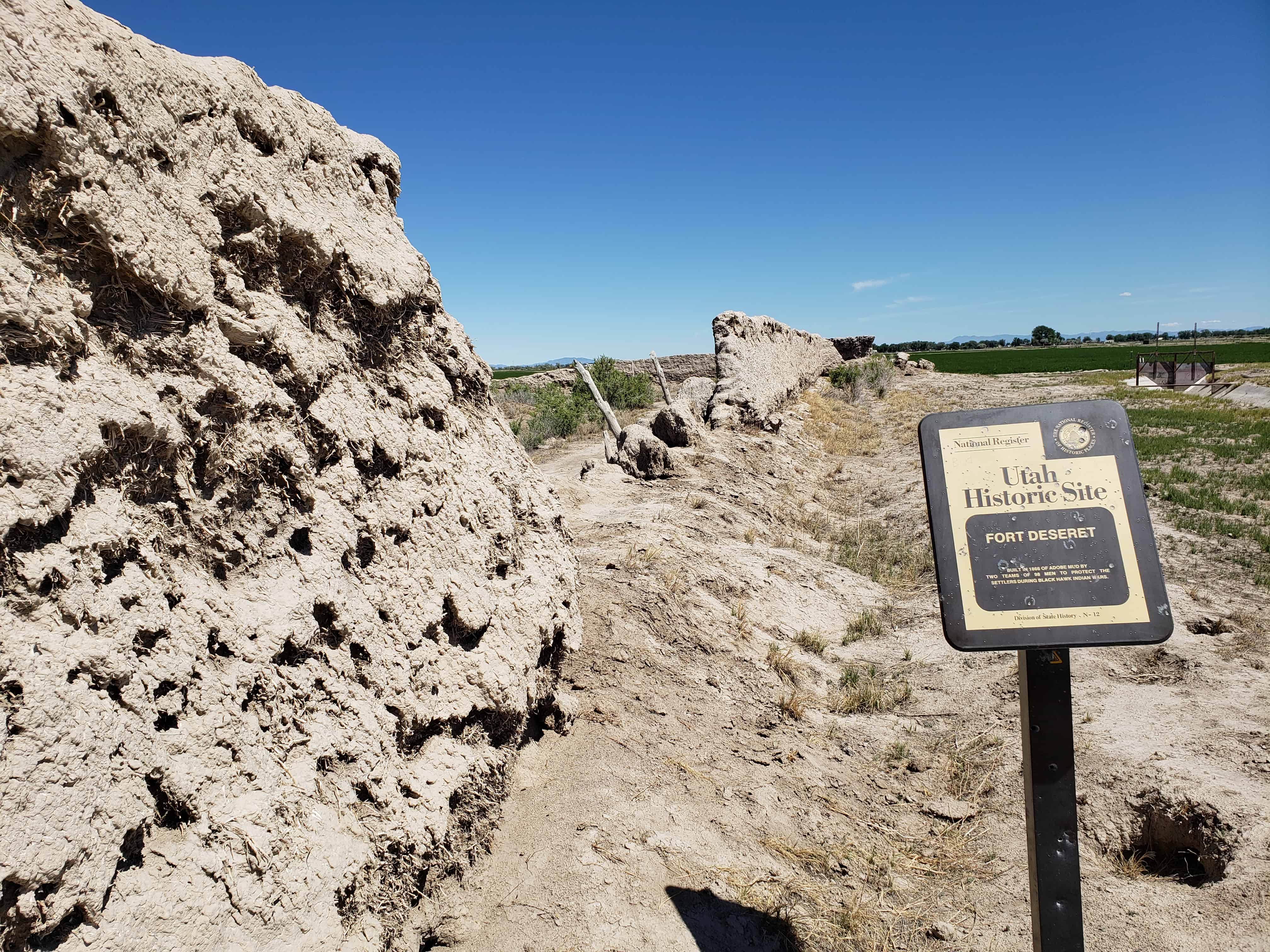
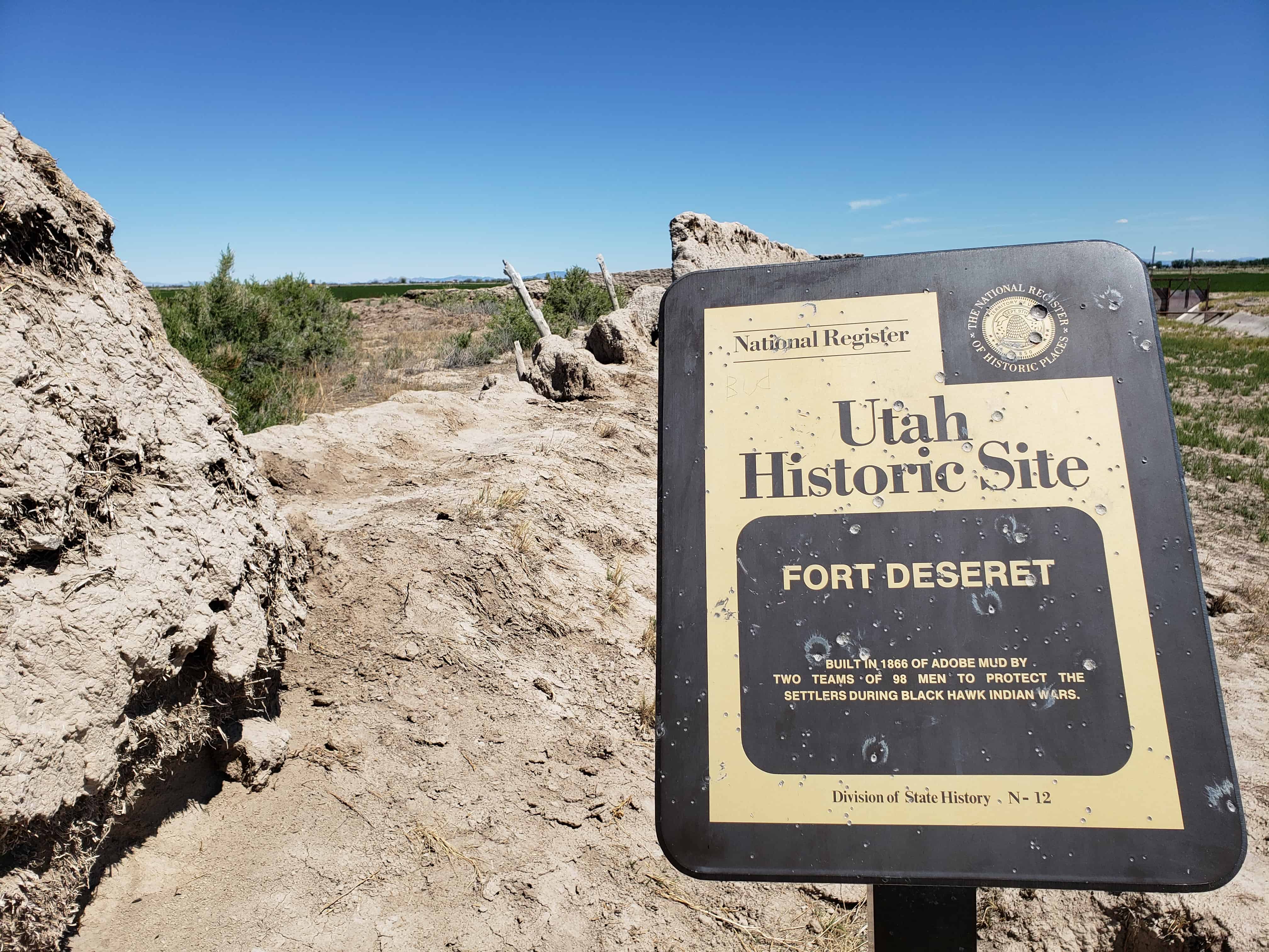
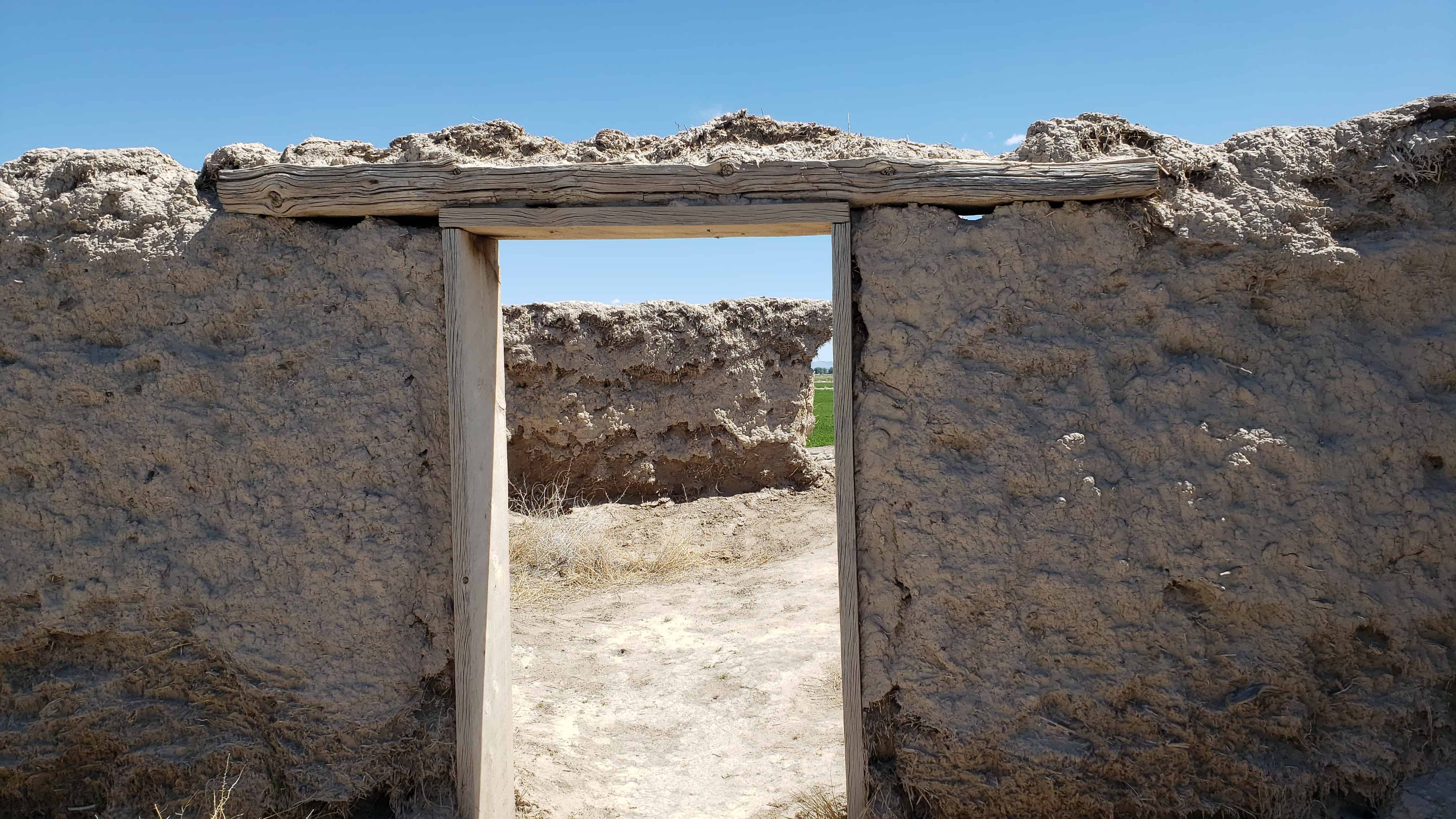
Fort Deseret
Erected as a defense against Pahvant Indians in the Black Hawk War, completed in 18 days by 98 men. Wm. S. Hawley and Isaac W. Pierce, foremen; John W. Radford, Supt. Opening celebration July 25, 1865. The fort was 550 feet square, bastions at Northeast and Southwest corners and gates in the middle of each wall. Made of adobe mud and straw mixed by the feet of oxen, when completed were 10 feet high, 3 feet wide at base and 1 1/2 feet at top, resting only on a stone foundation.
(the above text is from Daughters of Utah Pioneers historic marker #23)


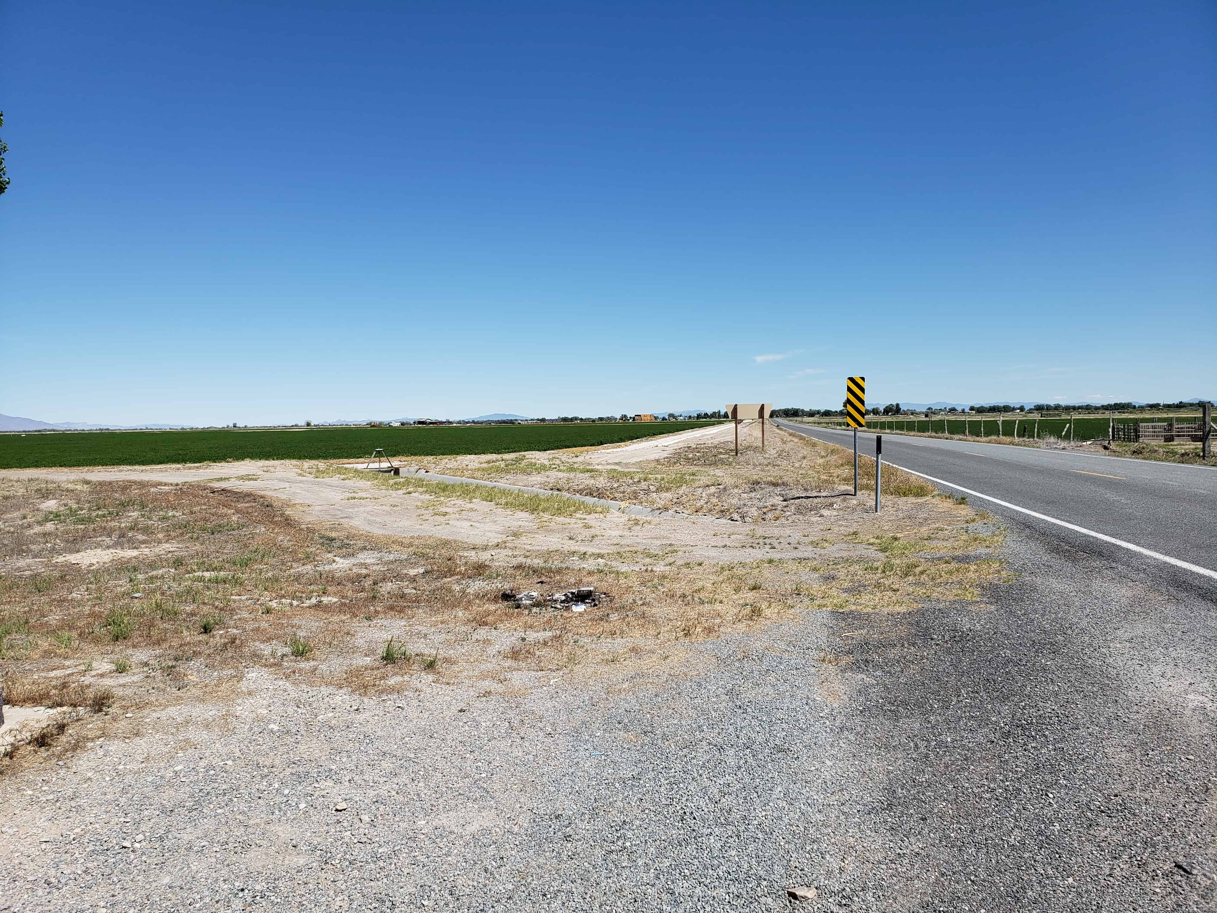
Located just south of Deseret, Utah.


The below text is from the nomination form from when the fort was added to the National Historic Register (#70000624) on October 9, 1970.
The first white settlers reached the lower drainages of the Sevier River, Pahvant Valley, in 1860, and established the community of Deseret, By 1865 they were fairly well established. With the Indian unrest of the Blackhawk war, Brigham Young advised all outlying Mormon settlements to “fort up.” His mandate was reinforced by the early summer visit of Bishop Thomas Callister and Apostle Amasa M. Lyman, Immediately the community set about building a fort, with John W. Radford in charge.
Men with teams were organized to haul lava rock from across the valley to the west and lay the four-foot wide footings. To build the walls themselves, the men divided into two groups, led by William S. Hawley and Isaac W. Pierce, Each team was to build half the wall, with the winning team to be given a party by the losers.
The walls were constructed of adobe mud made by running water into trenches into which dirt and straw were thrown and then mixed by having oxen tromp it. The mud mixture was then stacked up in ten-foot walls three feet wide at the base, tapering to one-and-one-half feet at its top. The center of the walls were high to cause the rain water to drain outward.
The race to construct the fort took the 98 men 18-1/2 days –9- 1/2 days for Pierce’s group and 9 days for Hawley’s; however, as a portion of Hawley’s wall fell, a tie was declared, A big celebration was held July 24, 1866, to commemorate the fort’s completion. It had cost about $3,706 in materials and labor.
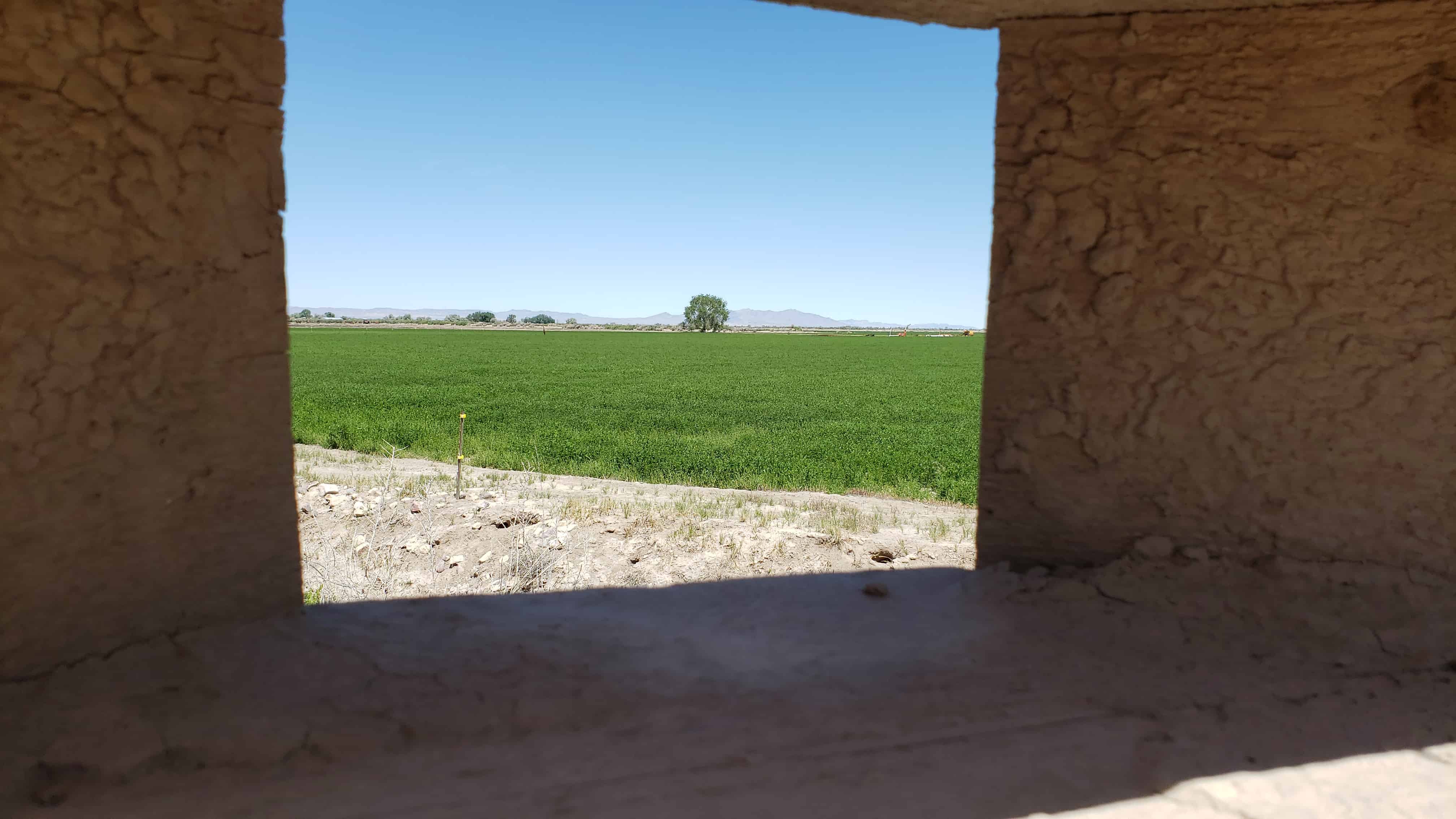
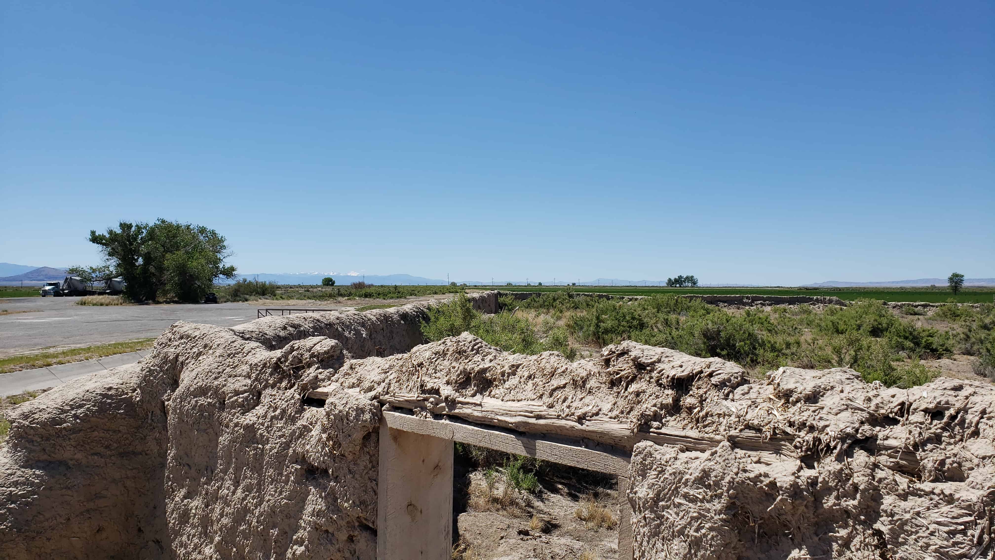
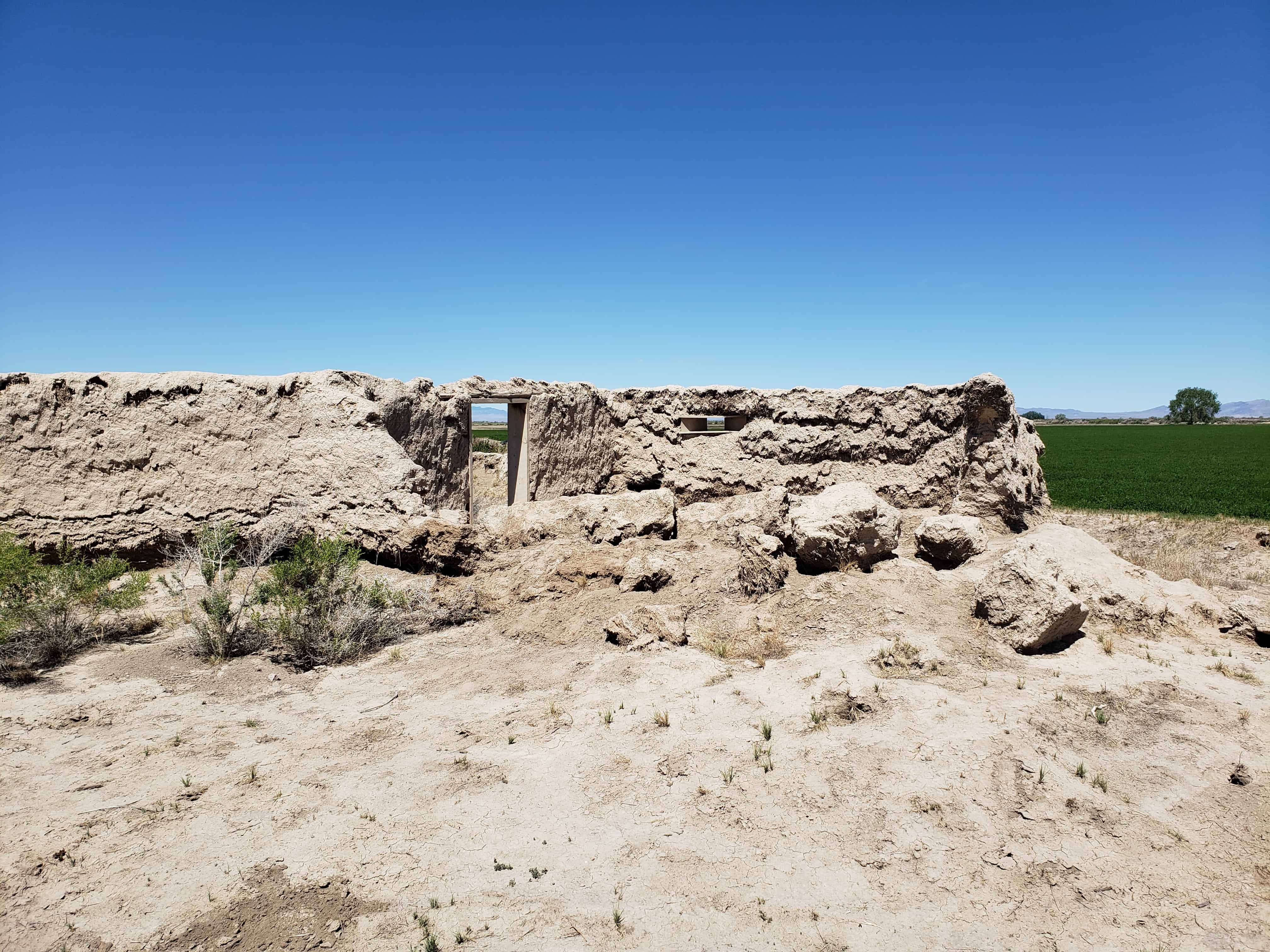
Actually the fort was never used to defend against the Indians, although it did offer security to the small isolated colony during a crucial period of Indian unrest; and cattle from the settlement were frequently corralled in the fort to avoid their being stolen by the Indians. In fact in later years the Indians themselves often used the abandoned fort. The community of Deseret was abandoned in 1868 because of water difficulties and was not reoccupied until 1874. The old mud fort remained a landmark but has slowly eroded during its more than one-hundred-year existence. Today less than half its walls remain standing.
Not only does Fort Deseret remain as a landmark in Mormon pioneering history, but it is the only remaining example of an “adobe mud” fort in Utah. Further, it was built entirely as a community project of materials at hand, thus typifying the cooperative nature of Mormon settlement. Its preservation needs are acute.
Description:
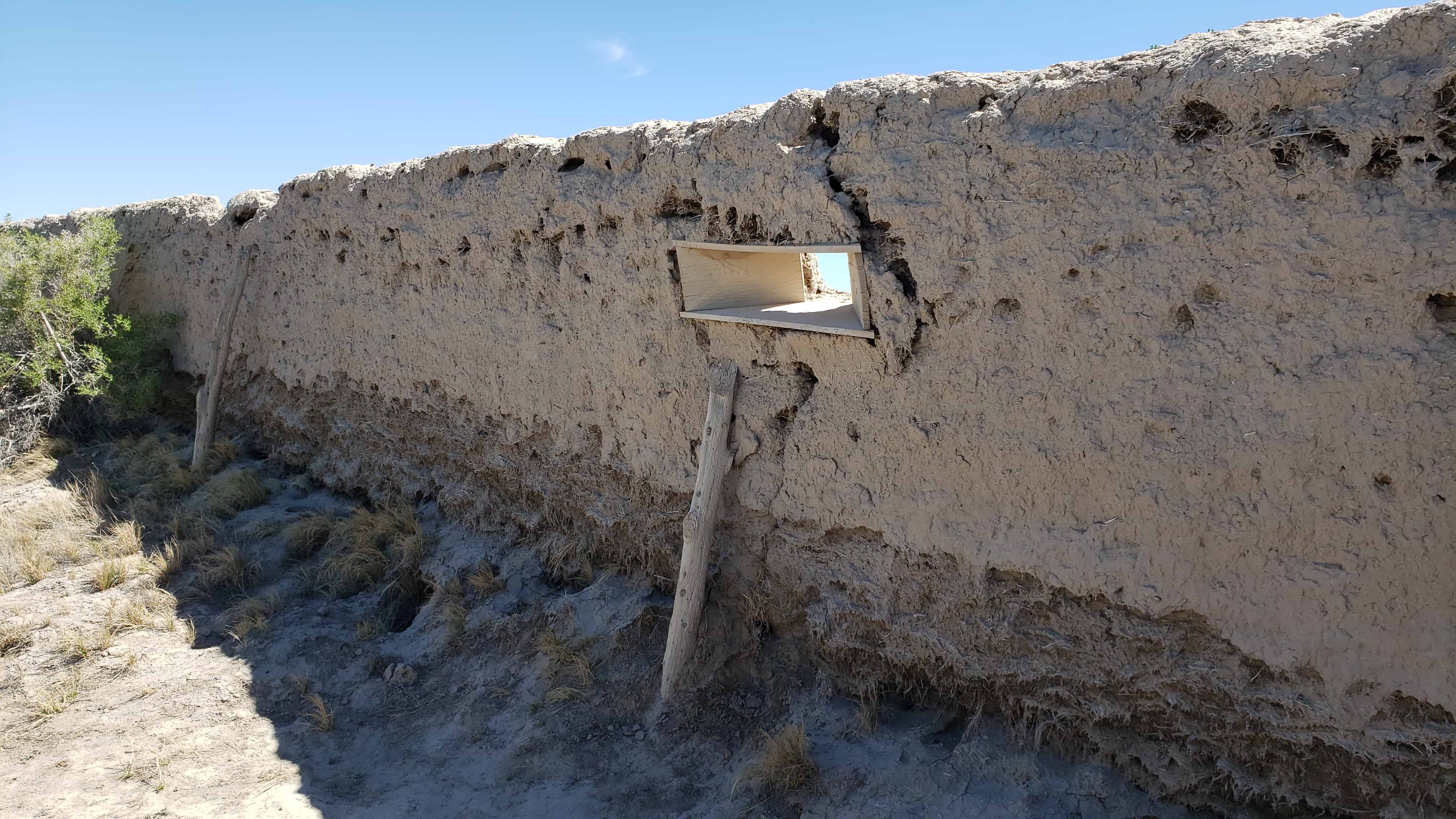
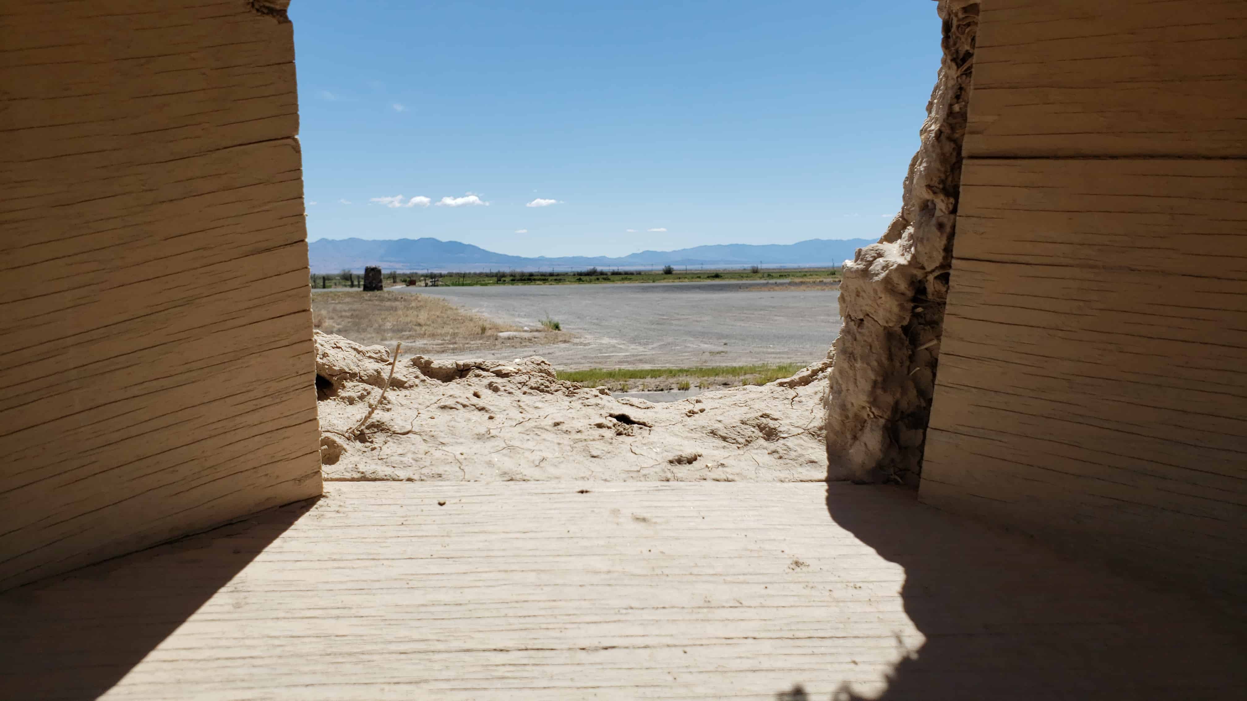
Fort Deseret was laid out in a square 550* x_55.p l . The foundations for the walls were made with 3-foot wide lava rock footings. Adobe mud for the walls was made by turning water into a big trench, then adding clay and straw which was mixed by foot of both humans and oxen. The mud was stacked on the footings to form walls 10′ high, 3′ wide at the base, and 1-1/2′ wide at the top. The center of the wall was the highest, to allow drainage outward.
Taller bastions were constructed in the northeast and southwest corners extending beyond the walls. Rough hewn lumber was used to make the portals through which guns could be fired with a minimum of exposure to the defenders. Three portals were placed in each bastion, several on each side. The main gates were in the north and south walls, with small gates in the east and west walls.
Rain and wind erosion has reduced the walls severely. Only portions remain, mainly on the east wall, the bastions and corners. One can see in the fallen portions of the wall the kind of adobe construction a layer of mud, a layer of straw. The remaining walls are from 6 to 7 feet high and badly eroded.
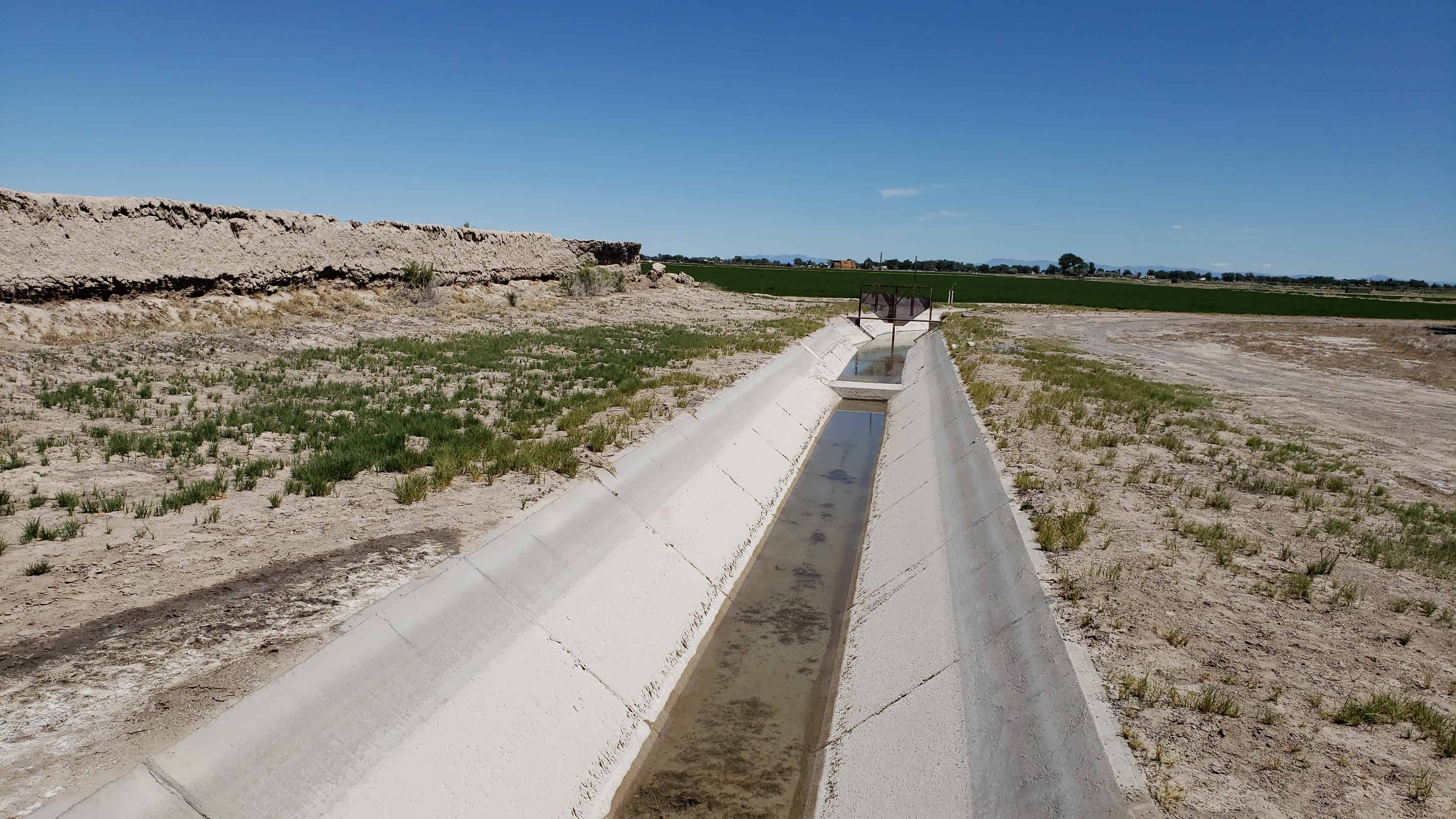
Greasewood and other brush have grown up around the walls. A ditch runs near the north wall and a large lateral in front of the east wall.
The site is near the old Sevier River channel, long since changed by man’s needs. Now owned by Utah State Parks and Recreation, both its preservation and development are being planned.


