Tags
Deseret Cemetery
30 Tuesday Jun 2020
Posted in Uncategorized

30 Tuesday Jun 2020
Posted in Uncategorized
Tags
30 Tuesday Jun 2020
Posted in Uncategorized

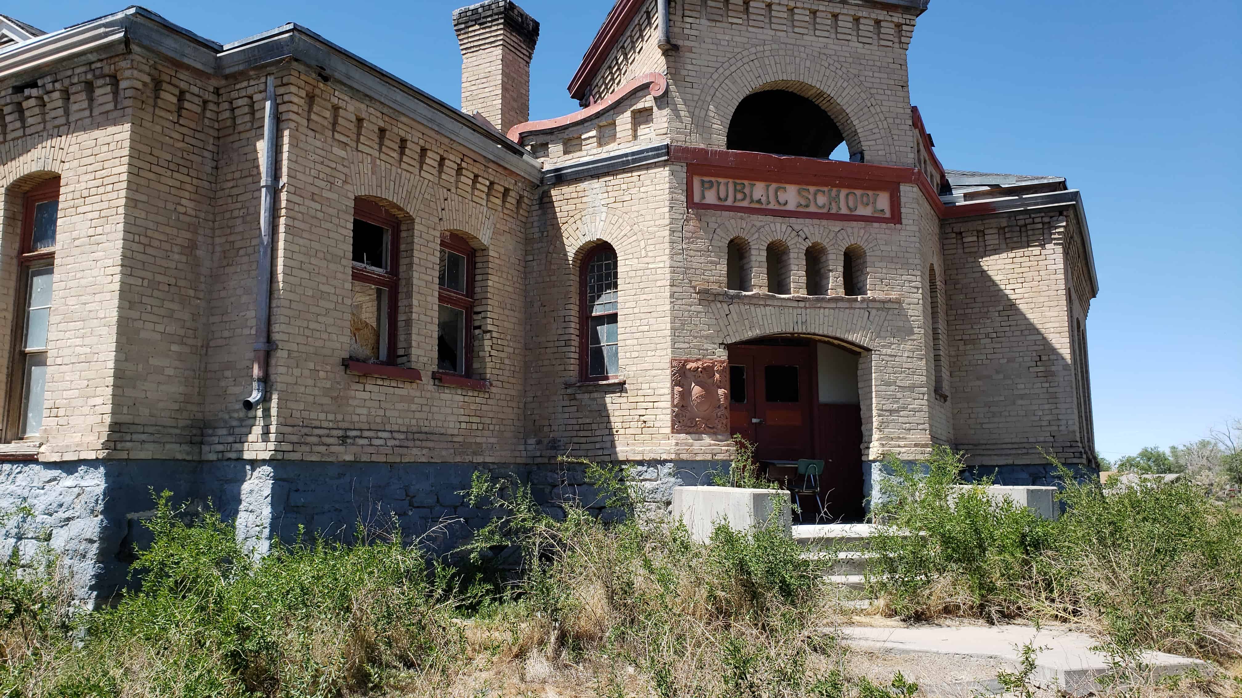
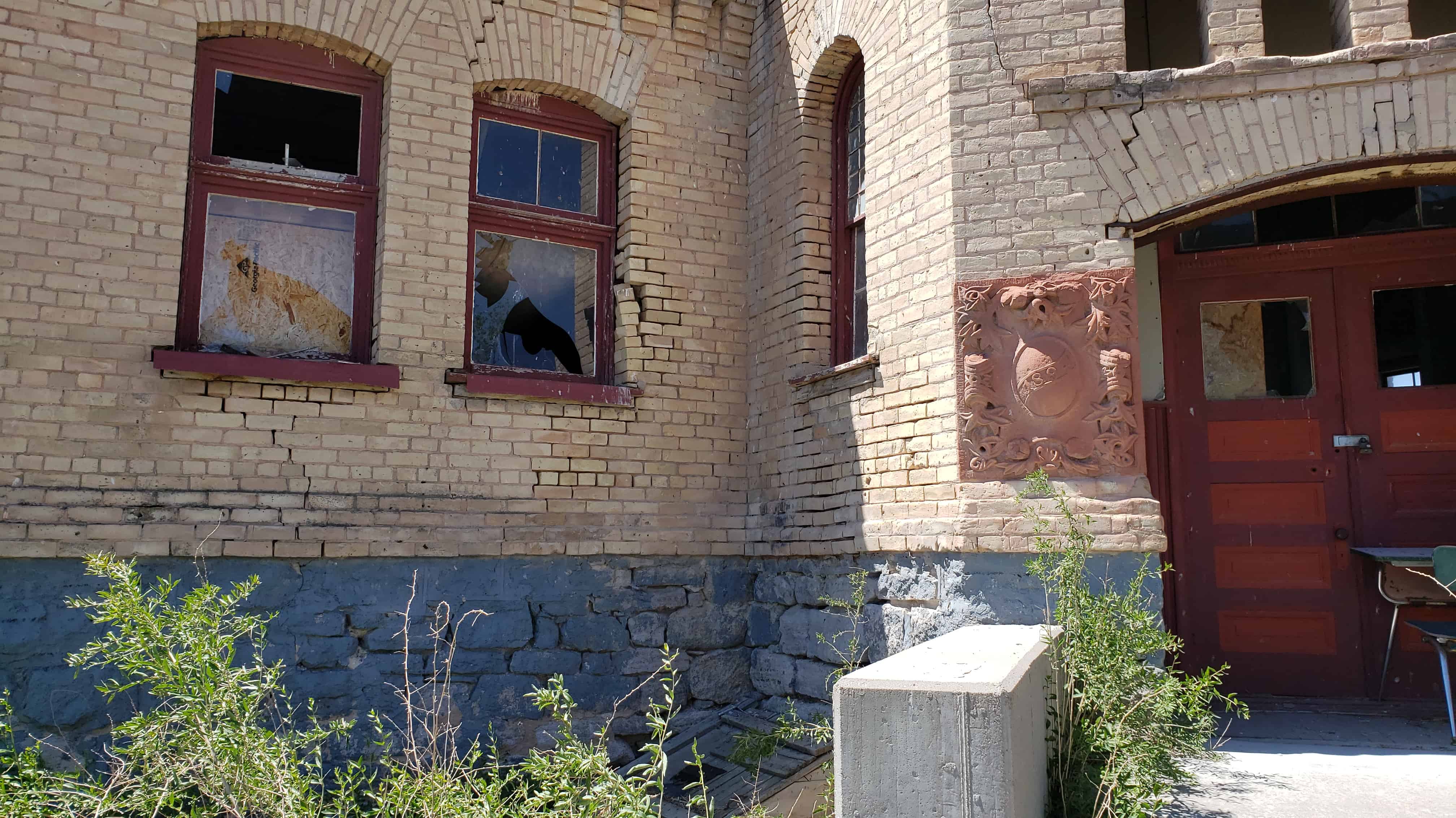
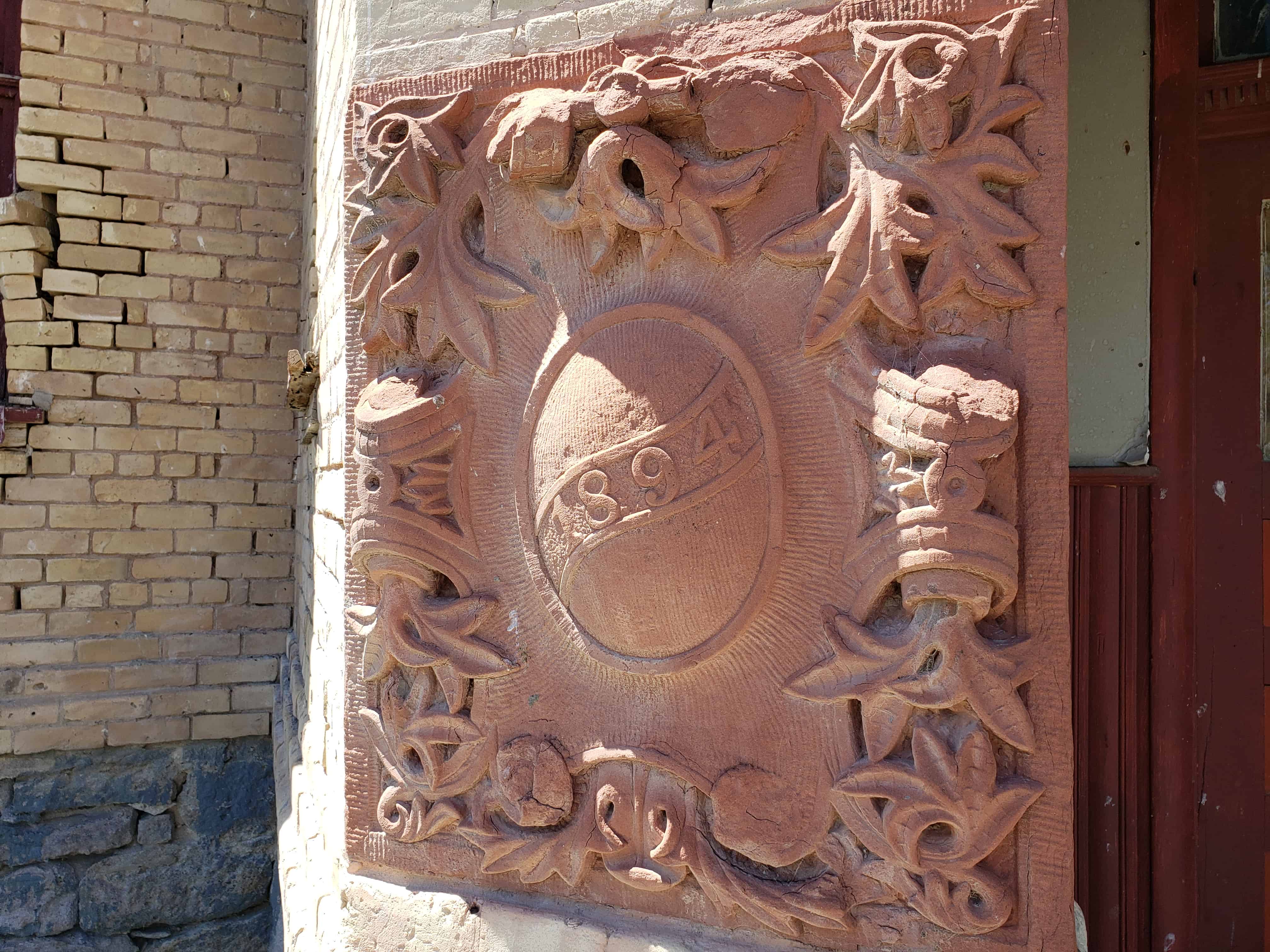
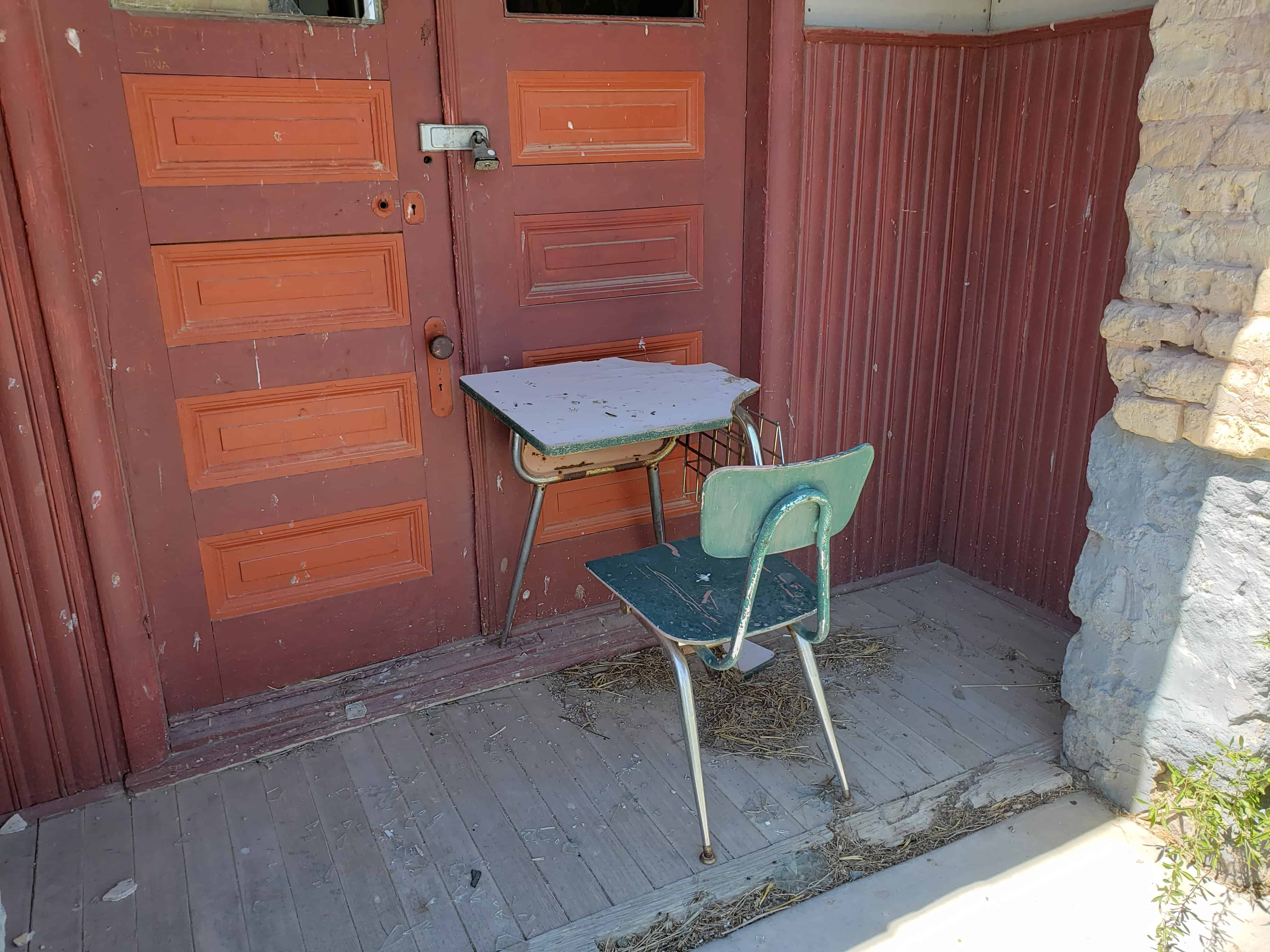
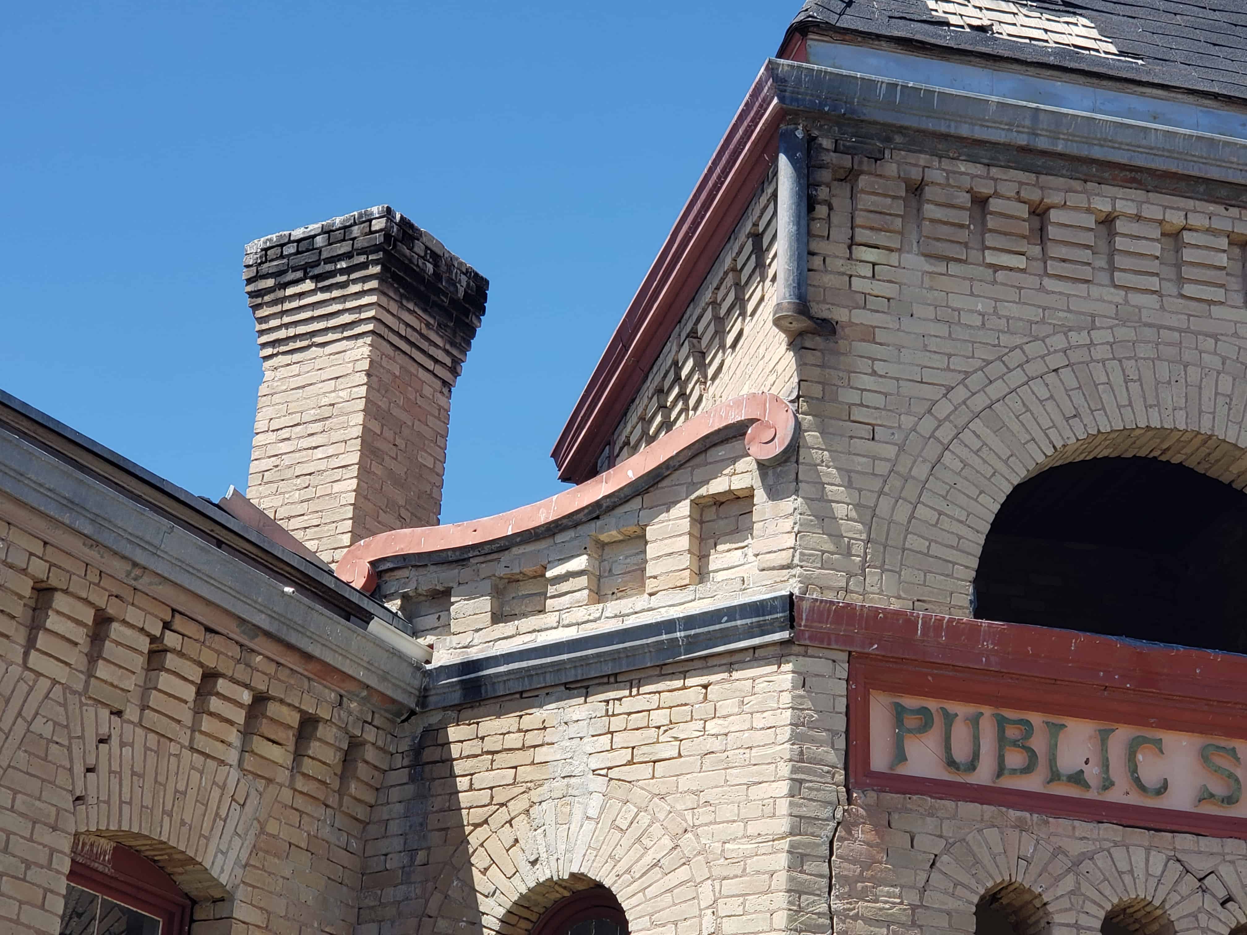
Deseret Utah’s public school, built in 1894.
The following was posted to my facebook group by Doug Cahoon:
This school was built in 1895, replacing an early school on the same site. It only served as a school until 1914 when a larger school was built. It was sold at auction in 1919 when Louis Schoenberger purchased the school. He remodeled it into a home and boarding house for school teachers. He lived there until his death in 1972. Locally the old school is known as the “Schoenberger Place.”
My grandfather went to this school and lived next door. He remembered, ““I started school at six years old. I attended elementary school in Deseret, Utah. The schoolhouse had three big rooms with a big pot-bellied stove in each room. They let bids out for the wood; they hauled cedar wood from the hills. And the older boys in the class would feed the stoves with this wood, and we seemed to be very comfortable. There was one teacher in each room in the school. Two years had passed after I had entered school, and my brother Clayton started to school. And my mother had made him a book sack, and he was in the same room with me. And he would keep putting the book sack over his head. The teacher told him to stop, and the children in the room were laughing at him. And so, the teacher finally had to take him up to the head of the class and put him on a stool and put the book sack over his head. That made me very mad and disturbed, and I went up to the head of the class and took him by the hand and took him home. We had no more landed home than the schoolteacher was there, and my mother and the school teacher talked it over. We lived just over the fence from the school.”


01 Monday Jun 2020
Posted in Uncategorized
Tags
Deseret, DUP, Historic Buildings, Historic Markers, Millard County, Relief Society, Schools, utah

The Relief Society in Deseret was first organized in September of 1877. This group of women met in each other’s homes until 1878, when they had a large, one-room adobe hall built. In 1894 the members of the Relief Society decided they should construct a new Relief Society Hall. They began raising money for this building by donating and saving what they could. The Church of Jesus Christ of Latter-day Saint’s General Relief Society Board called for contributions to the building of the new General Relief Society Hall located in Salt Lake City, Utah. The Deseret Relief Society sent all of their funds, thus delaying their own building project.

The Deseret Relief Society ladies began again to plan for a hall. They sold their adobe building, land was donated, fund raised, and labor was volunteered by the men of the LDS Ward.
Construction costs for the building were $743.65 and $21.00 for the outhouse. Relief Society meetings, socials, dances, and plays were held in the hall from 1906 until 1934, when the new chapel was completed.

The Hall is the oldest remaining LDS Church building in the community. It has served many functions over the years. After the chapel burned in 1929, this hall was again used for church services. Public school classes were also held when the A.C. Nelson School burned. Boy Scouts used the hall for their meetings for several years. The Deseret Irrigation Company bought this building and used it for meetings and storage. They deeded the building to the Daughters of Utah Pioneers, Fanny Powell Cropper Camp, on February 7, 1995. It is now used for DUP meetings and for the display of pioneer memorabilia.


28 Wednesday Jan 2015
Posted in Uncategorized
Tags
30 Tuesday Dec 2014
Posted in Uncategorized


Just wanted to share some information I was reading online:
The word “Deseret” appears twice on the Utah stone at the Washington Monument (1978; replica of the cornerstone of the Salt Lake Temple, 1853). The interior of the monument contains 190 stones representing individuals, cities, states, and nations. “Deseret” was a name often used in the territory colonized by the Mormon pioneers. Photographer: Robert L. Palmer.
by Jeffrey Ogden Johnson
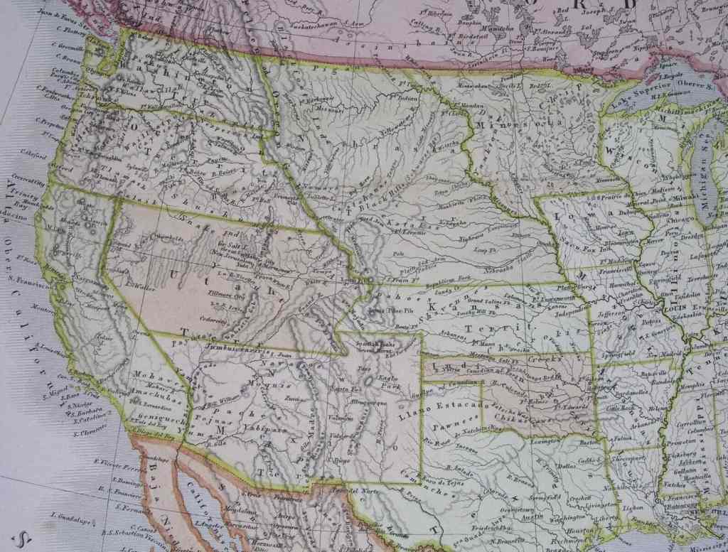
On February 2, 1848, by the Treaty of Guadalupe Hidalgo, Mexico ceded to the United States an extensive area that included the Great Basin, where Mormon pioneers had begun settlement six months earlier. Even before the treaty was signed, Church leaders began discussing petitioning the U.S. government for recognition as a state or asking for territorial privileges. In July 1849 a committee wrote a Constitution. It used as models the U.S. Constitution and the Iowa Constitution of 1846, from which the committee took fifty-seven of the sixty-seven sections of the new Constitution. The committee requested that the state be named Deseret and that the boundaries be Oregon on the north, the Green River on the east, Mexico on the south, and the Sierra Nevada on the west, including a portion of the Southern California seacoast. “Deseret,” a word from the Book of Mormon, means “honeybee” (Ether 2:3) and is symbolic of work and industry. A slate of officers was approved, with Brigham Young as governor. Almon W. Babbitt, appointed representative to Congress, was instructed to carry the plea for statehood to Washington, D.C.
This effort by Latter-day Saint settlers to organize themselves into a provisional government was much like the attempt made in the 1780s by settlers in Tennessee, who organized the state of Franklin when they felt neglected by North Carolina, and the settlers of Oregon, who established a local government that functioned without recognition from the U.S. government until they were given territorial status in 1848.
The State of Deseret General Assembly met in regular session from December 1849 to March 1850. After special sessions during the summer, the members assembled for their second regular session in December 1850. Earlier, on September 9, U.S. President Millard Fillmore had signed an act to create a much smaller Utah Territory and appointed Brigham Young the first territorial governor. After word of the creation of the territory reached Utah, the tentative state of Deseret was dissolved on March 28, 1851. The provisional government had lasted only about a year and a half.
The territorial status did not provide the self-government Latter-day Saints desired, and even though Brigham Young was appointed first governor, Church leaders and the territorial legislature continued efforts to obtain statehood. In 1856, delegates met to again write a Constitution and propose the state of Deseret, an effort rejected by Congress. As a part of a third effort in 1862, Brigham Young called the State of Deseret General Assembly into session for the first time since 1851. Thereafter it met each year until 1870, each session lasting only a few days and focusing on winning statehood on the basis of the proposed Constitution of 1849 with only minor changes.
In the meantime, Brigham Young had been replaced as territorial governor by a series of outside appointees, who became progressively more hostile to the meetings of the General Assembly and complained about this “ghost government,” as they called it. In 1872 a constitutional convention drew up a new Constitution and dropped the name Deseret from the petition. This petition also failed, and hope for the state of Deseret came to an end.
[See also History of the Church, 1844-1877; Utah Statehood; Daily Living home page; Church History home page]
http://www.lightplanet.com/mormons/daily/history/1844_1877/deseret_state_eom.htm
http://www.omniglot.com/writing/deseret.htm
21 Wednesday May 2014
Posted in Uncategorized
Tags
Delta, Deseret, DUP, Forts, historic, Millard County, NRHP, State Parks, utah
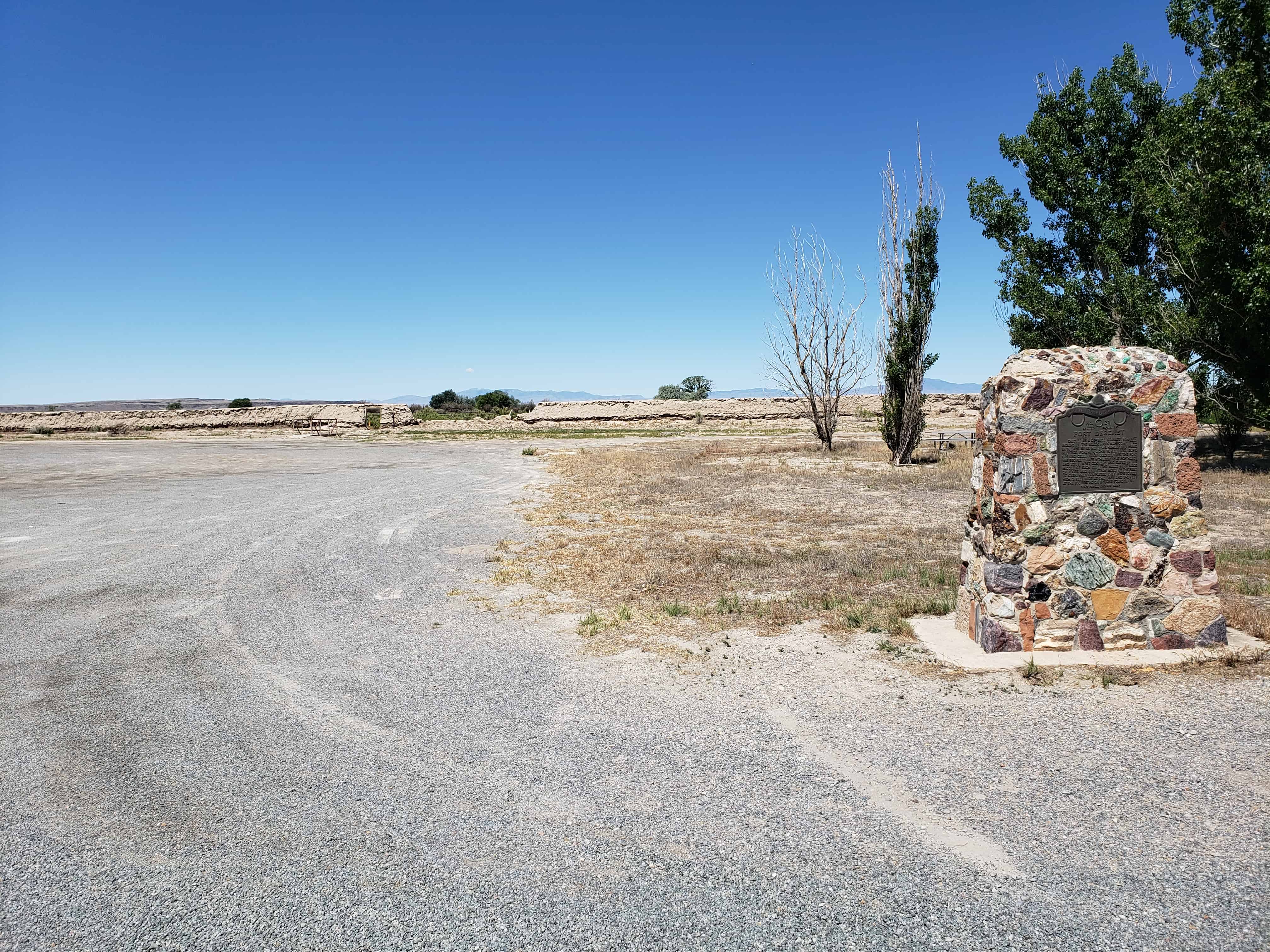
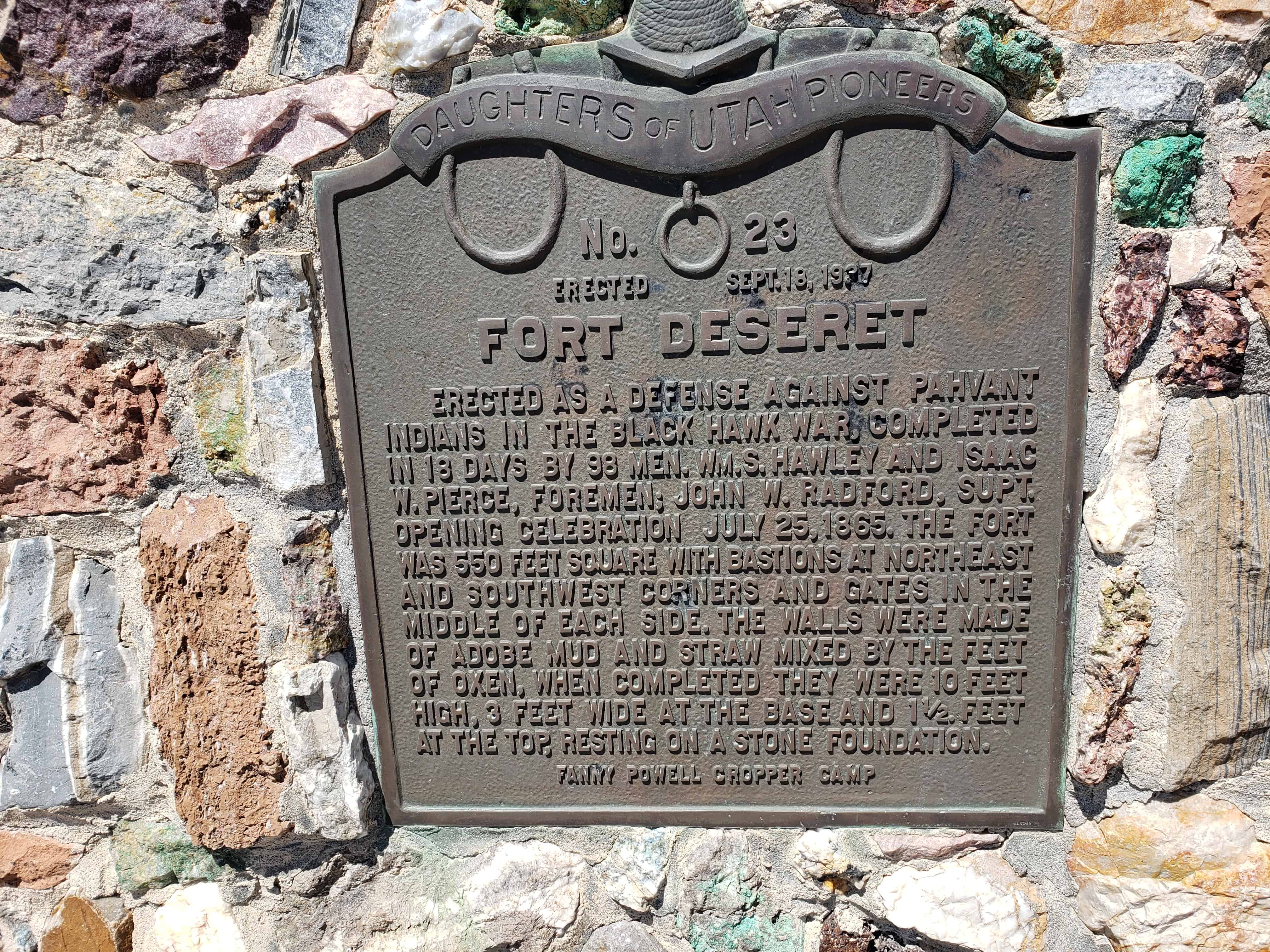
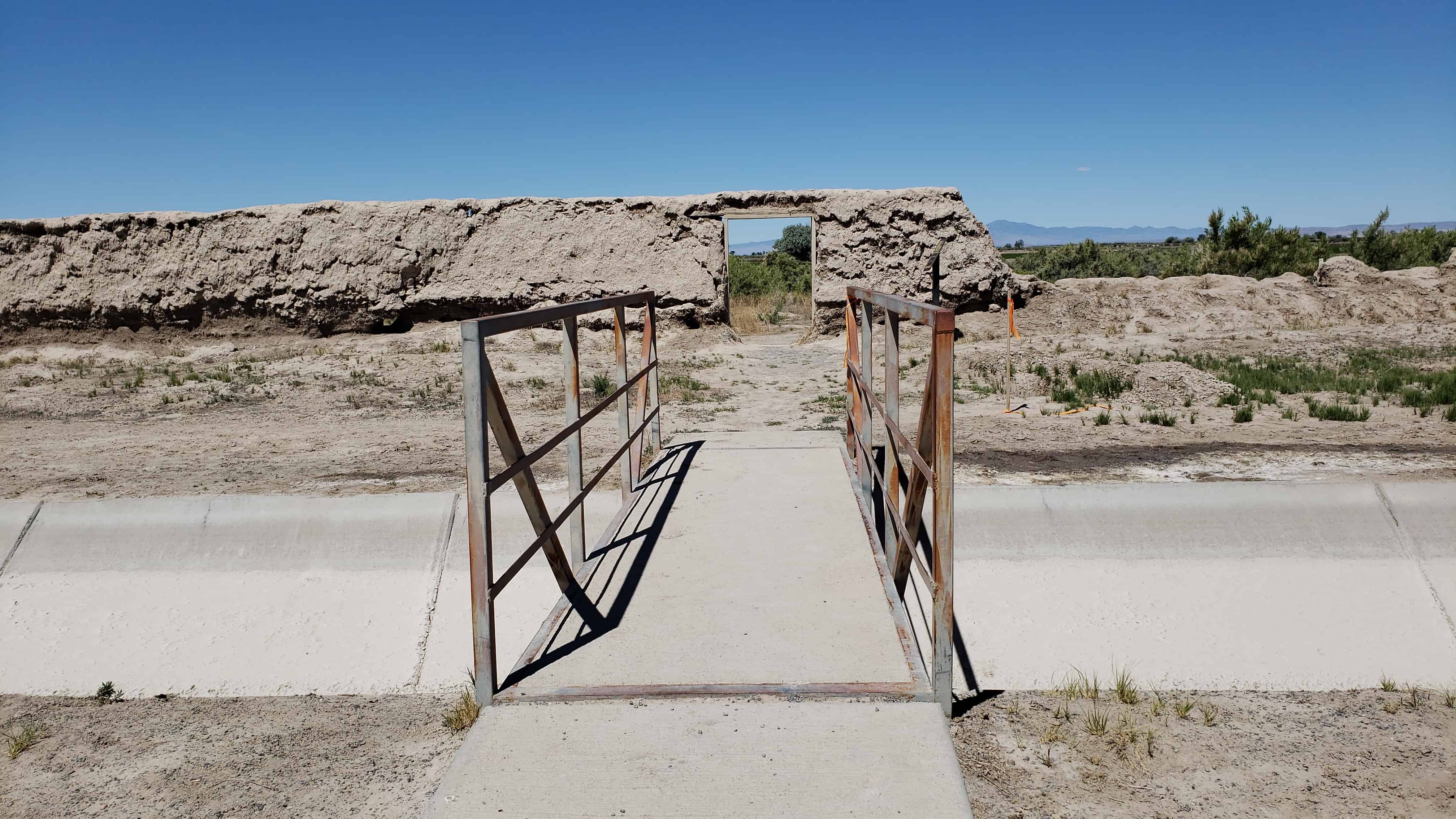
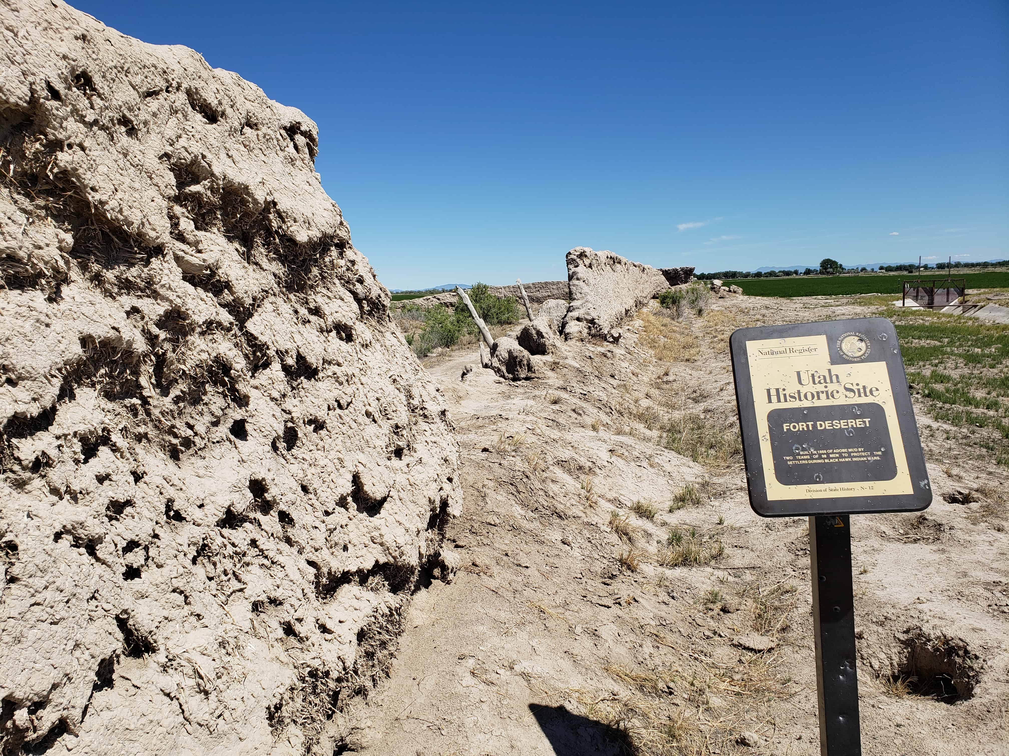
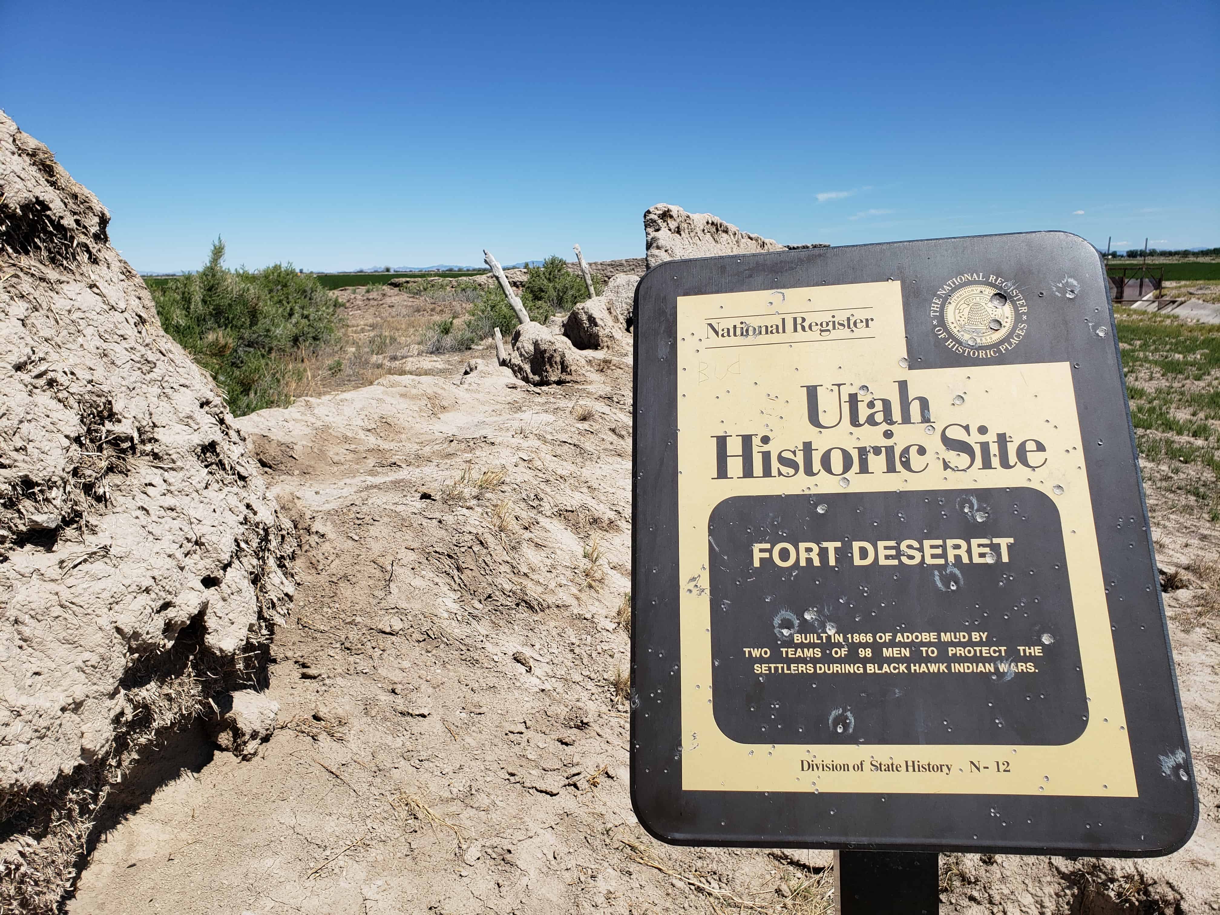
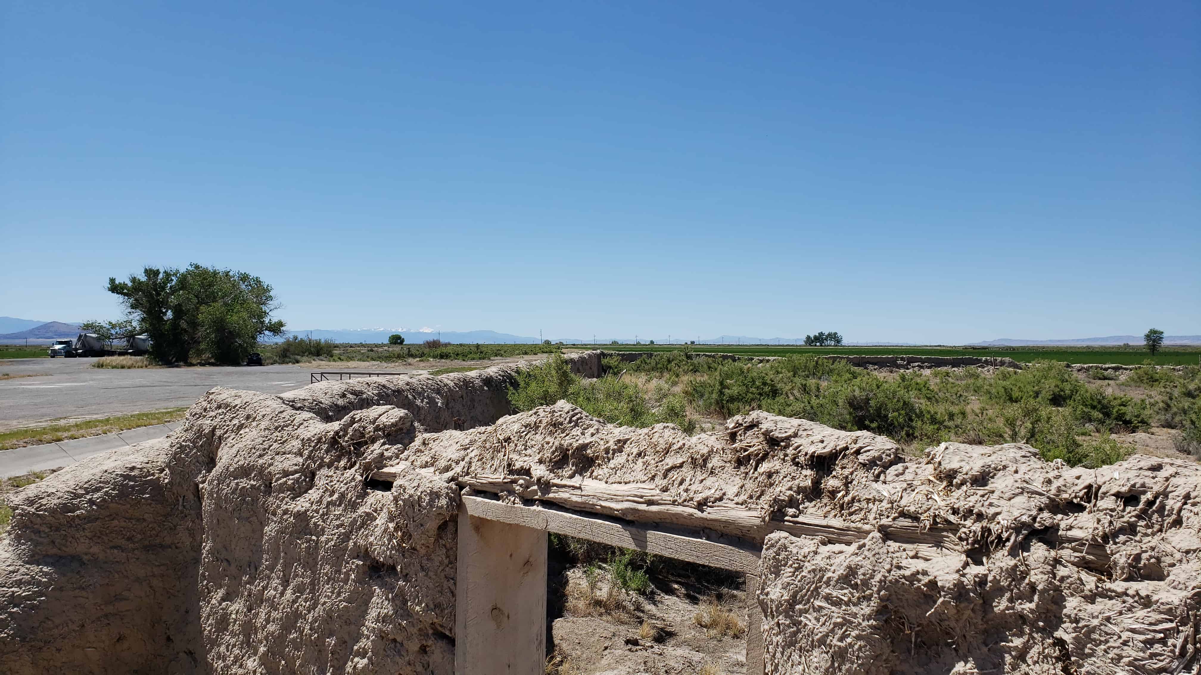
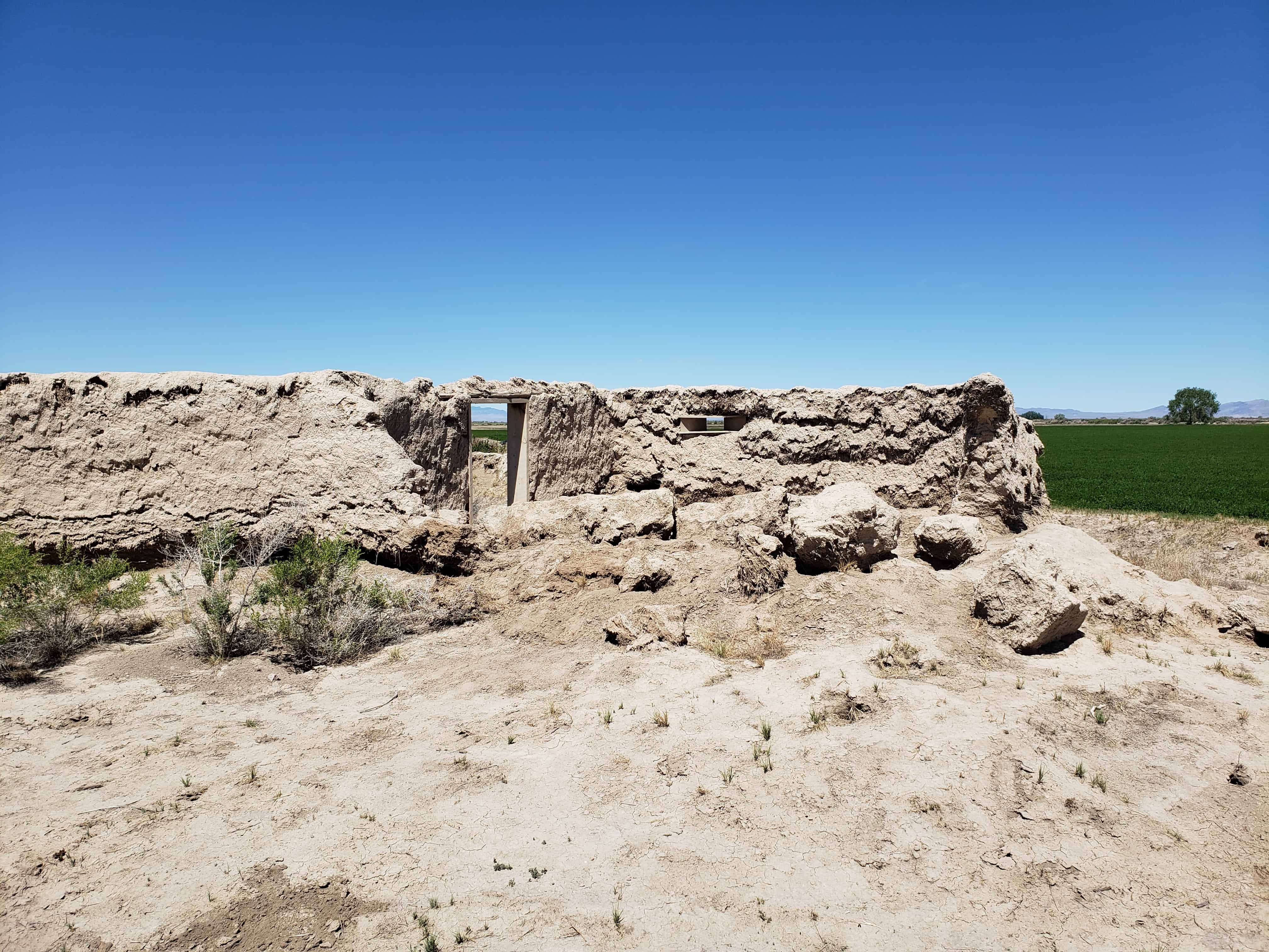
Fort Deseret
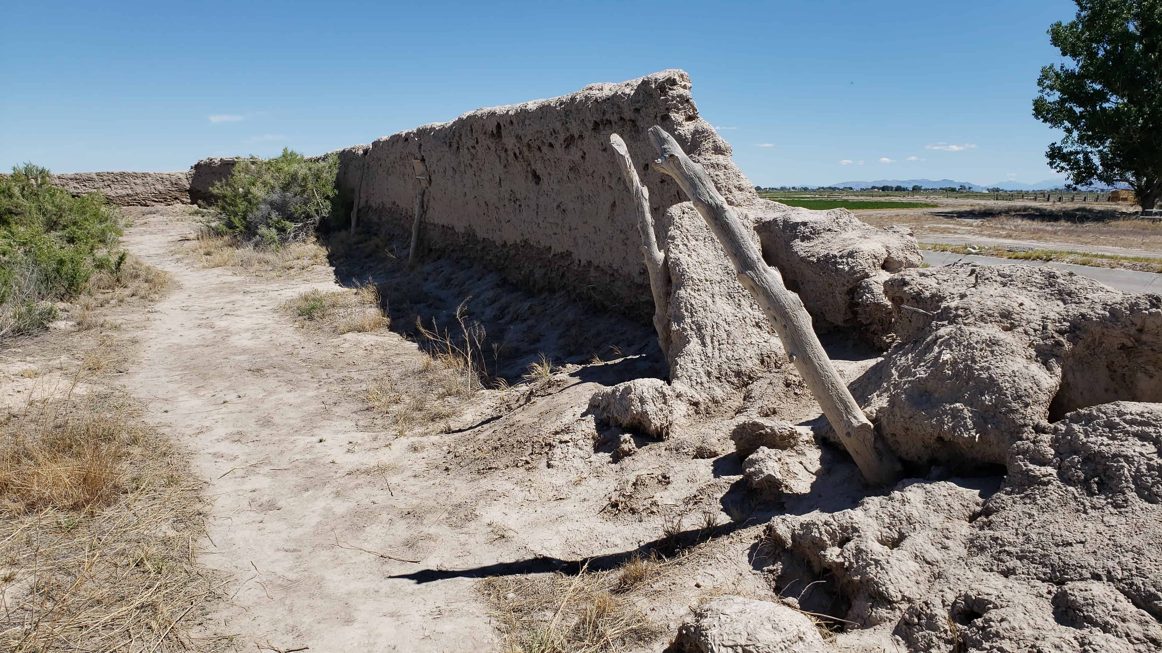
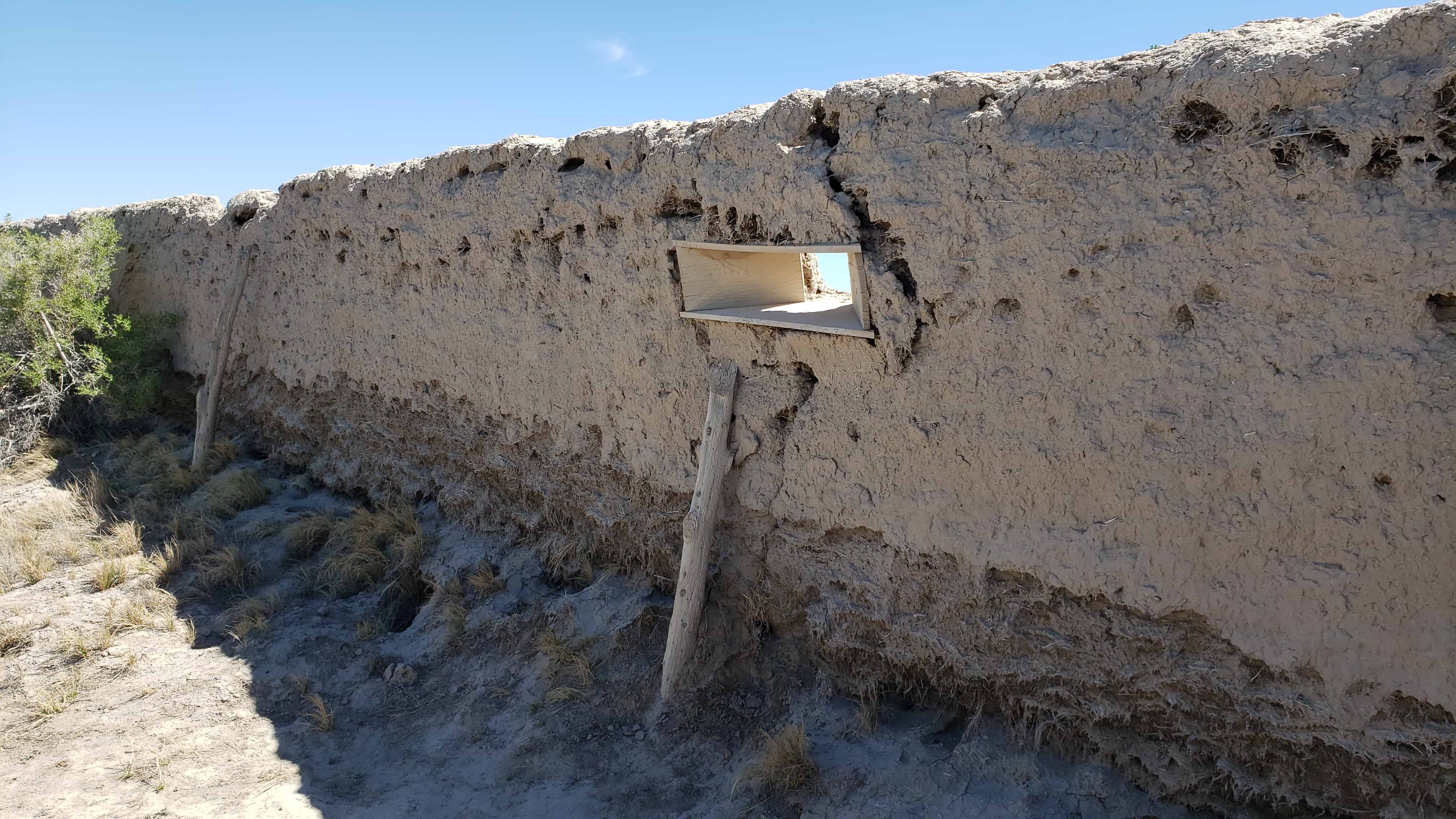
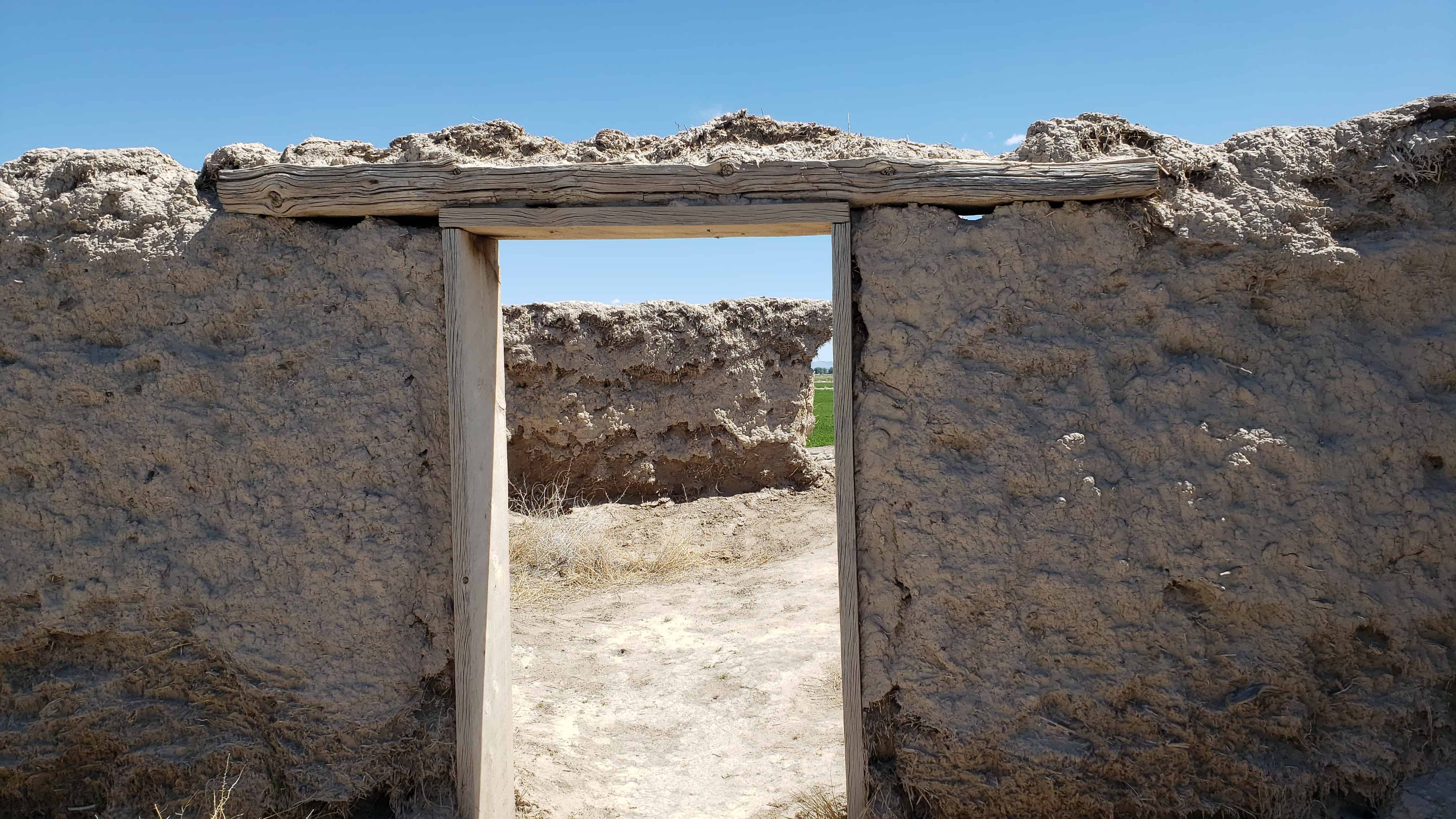
Erected as a defense against Pahvant Indians in the Black Hawk War, completed in 18 days by 98 men. Wm. S. Hawley and Isaac W. Pierce, foremen; John W. Radford, Supt. Opening celebration July 25, 1865. The fort was 550 feet square, bastions at Northeast and Southwest corners and gates in the middle of each wall. Made of adobe mud and straw mixed by the feet of oxen, when completed were 10 feet high, 3 feet wide at base and 1 1/2 feet at top, resting only on a stone foundation.
(the above text is from Daughters of Utah Pioneers historic marker #23)


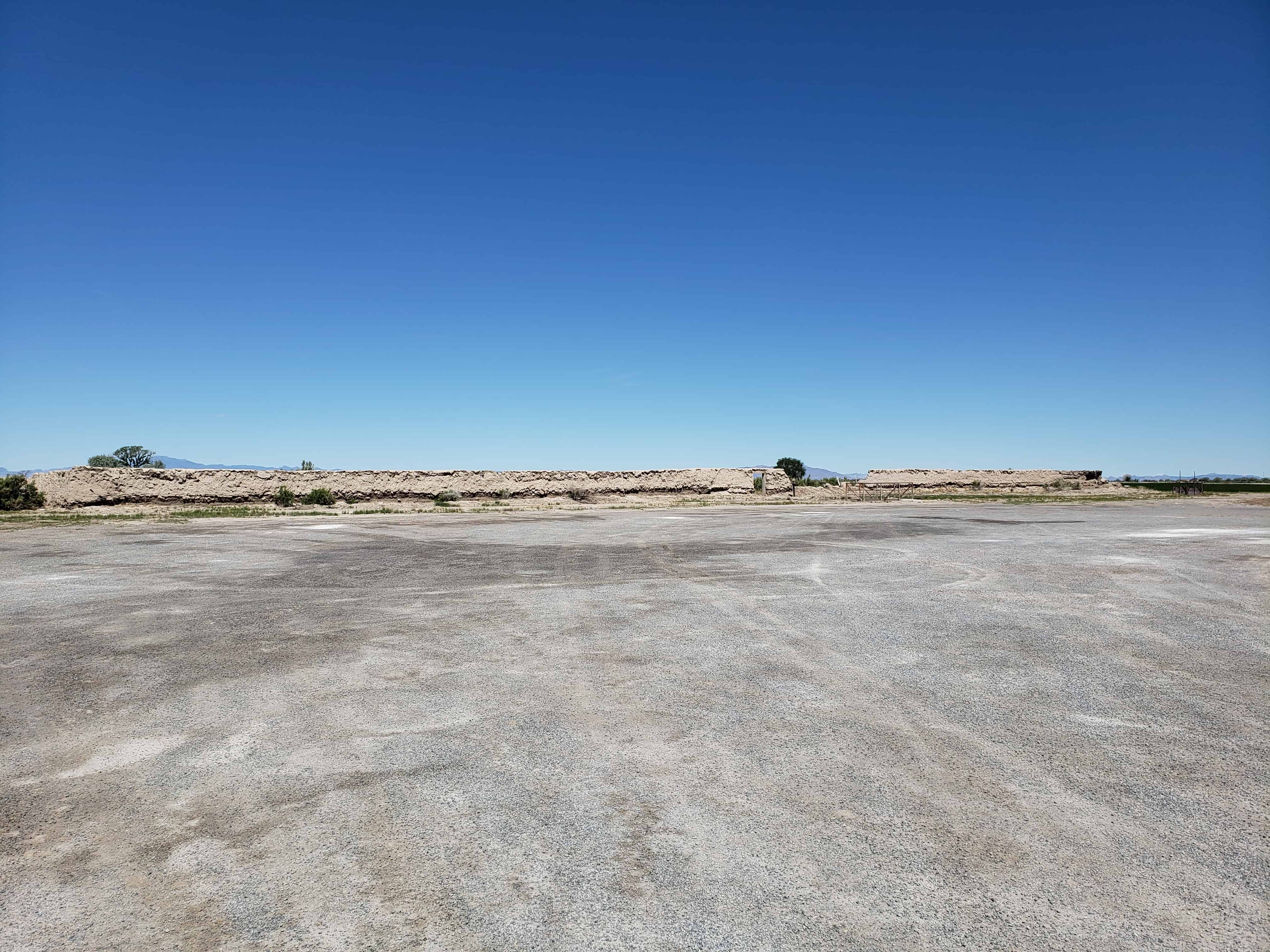
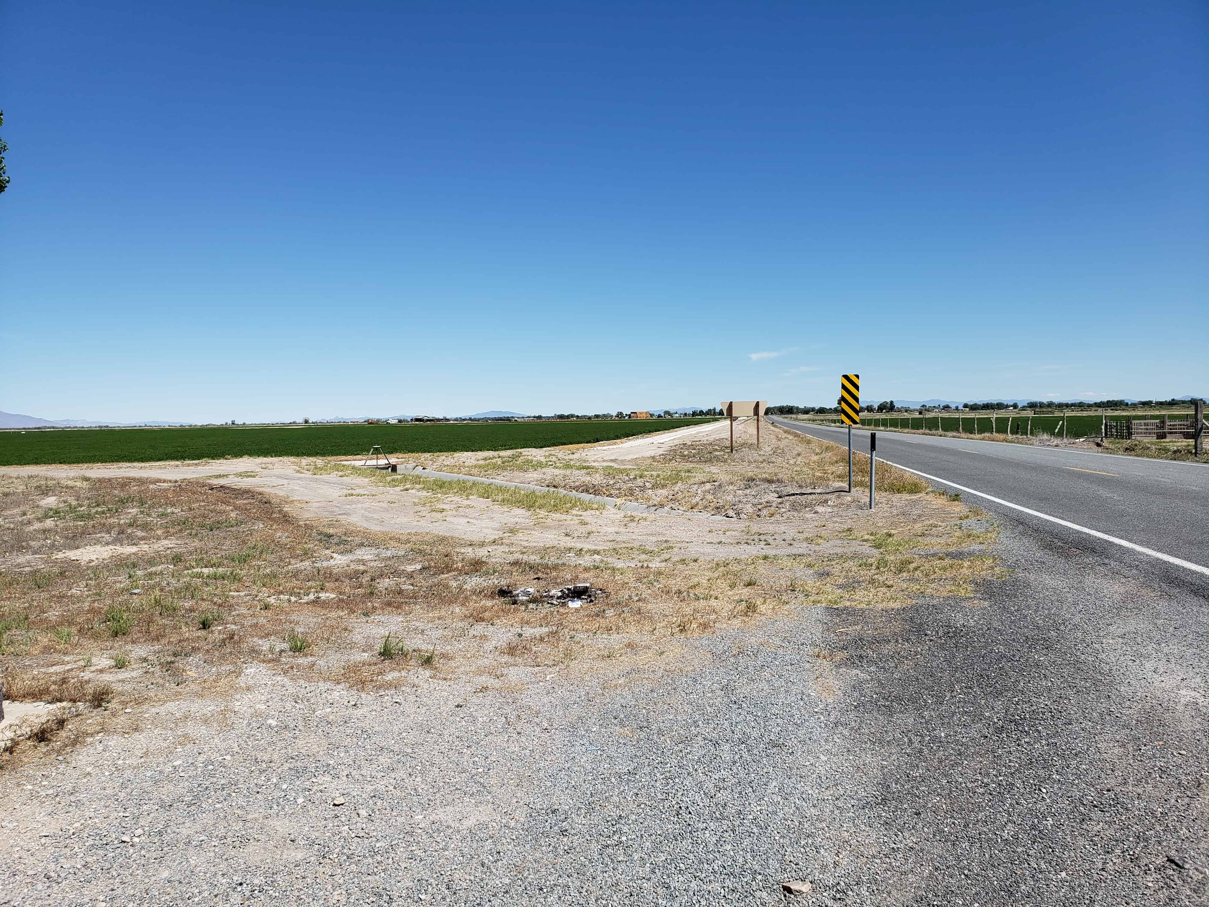
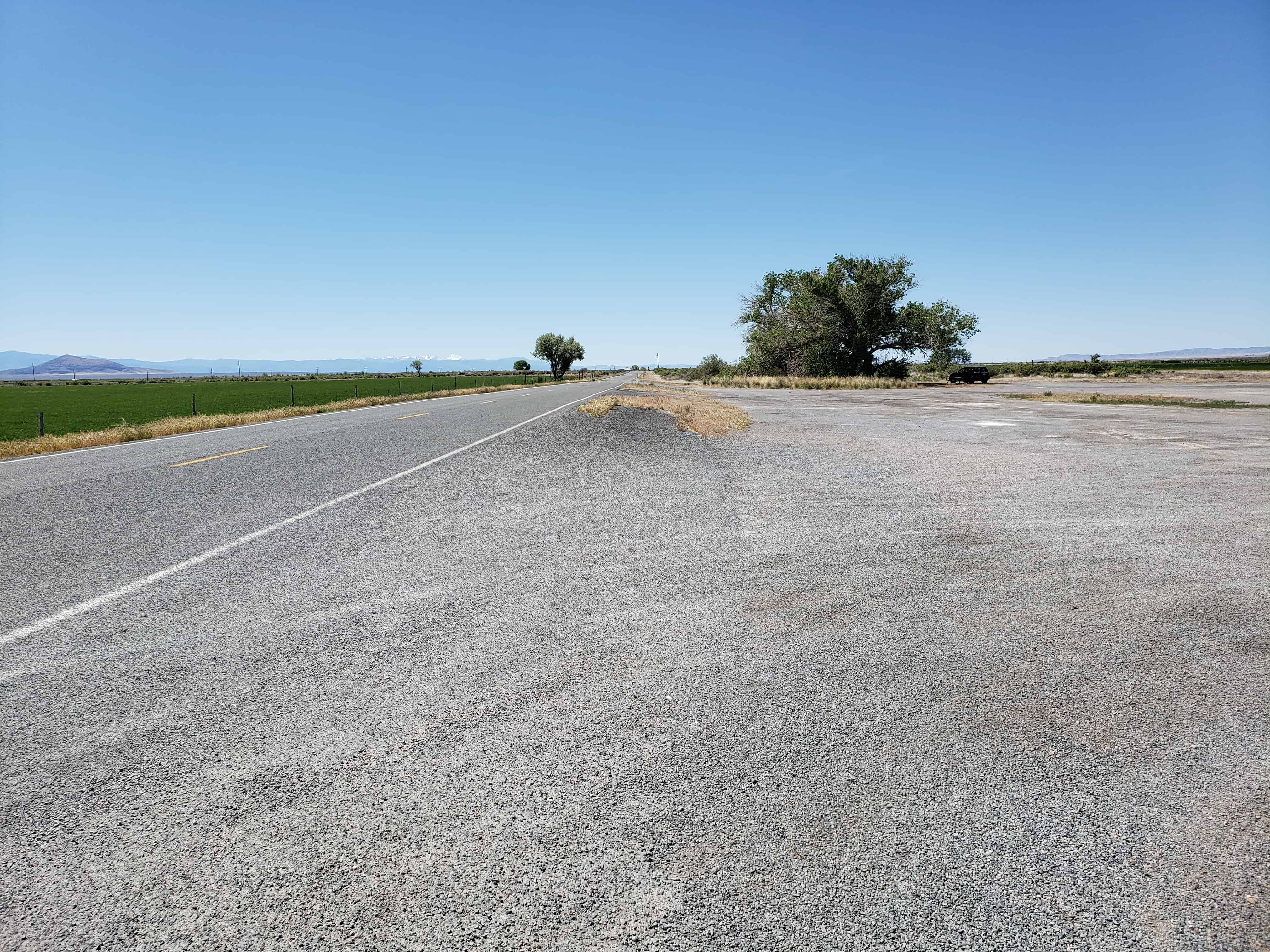
Located just south of Deseret, Utah.


The below text is from the nomination form from when the fort was added to the National Historic Register (#70000624) on October 9, 1970.
The first white settlers reached the lower drainages of the Sevier River, Pahvant Valley, in 1860, and established the community of Deseret, By 1865 they were fairly well established. With the Indian unrest of the Blackhawk war, Brigham Young advised all outlying Mormon settlements to “fort up.” His mandate was reinforced by the early summer visit of Bishop Thomas Callister and Apostle Amasa M. Lyman, Immediately the community set about building a fort, with John W. Radford in charge.
Men with teams were organized to haul lava rock from across the valley to the west and lay the four-foot wide footings. To build the walls themselves, the men divided into two groups, led by William S. Hawley and Isaac W. Pierce, Each team was to build half the wall, with the winning team to be given a party by the losers.
The walls were constructed of adobe mud made by running water into trenches into which dirt and straw were thrown and then mixed by having oxen tromp it. The mud mixture was then stacked up in ten-foot walls three feet wide at the base, tapering to one-and-one-half feet at its top. The center of the walls were high to cause the rain water to drain outward.
The race to construct the fort took the 98 men 18-1/2 days –9- 1/2 days for Pierce’s group and 9 days for Hawley’s; however, as a portion of Hawley’s wall fell, a tie was declared, A big celebration was held July 24, 1866, to commemorate the fort’s completion. It had cost about $3,706 in materials and labor.
Actually the fort was never used to defend against the Indians, although it did offer security to the small isolated colony during a crucial period of Indian unrest; and cattle from the settlement were frequently corralled in the fort to avoid their being stolen by the Indians. In fact in later years the Indians themselves often used the abandoned fort. The community of Deseret was abandoned in 1868 because of water difficulties and was not reoccupied until 1874. The old mud fort remained a landmark but has slowly eroded during its more than one-hundred-year existence. Today less than half its walls remain standing.
Not only does Fort Deseret remain as a landmark in Mormon pioneering history, but it is the only remaining example of an “adobe mud” fort in Utah. Further, it was built entirely as a community project of materials at hand, thus typifying the cooperative nature of Mormon settlement. Its preservation needs are acute.
Description:
Fort Deseret was laid out in a square 550* x_55.p l . The foundations for the walls were made with 3-foot wide lava rock footings. Adobe mud for the walls was made by turning water into a big trench, then adding clay and straw which was mixed by foot of both humans and oxen. The mud was stacked on the footings to form walls 10′ high, 3′ wide at the base, and 1-1/2′ wide at the top. The center of the wall was the highest, to allow drainage outward.
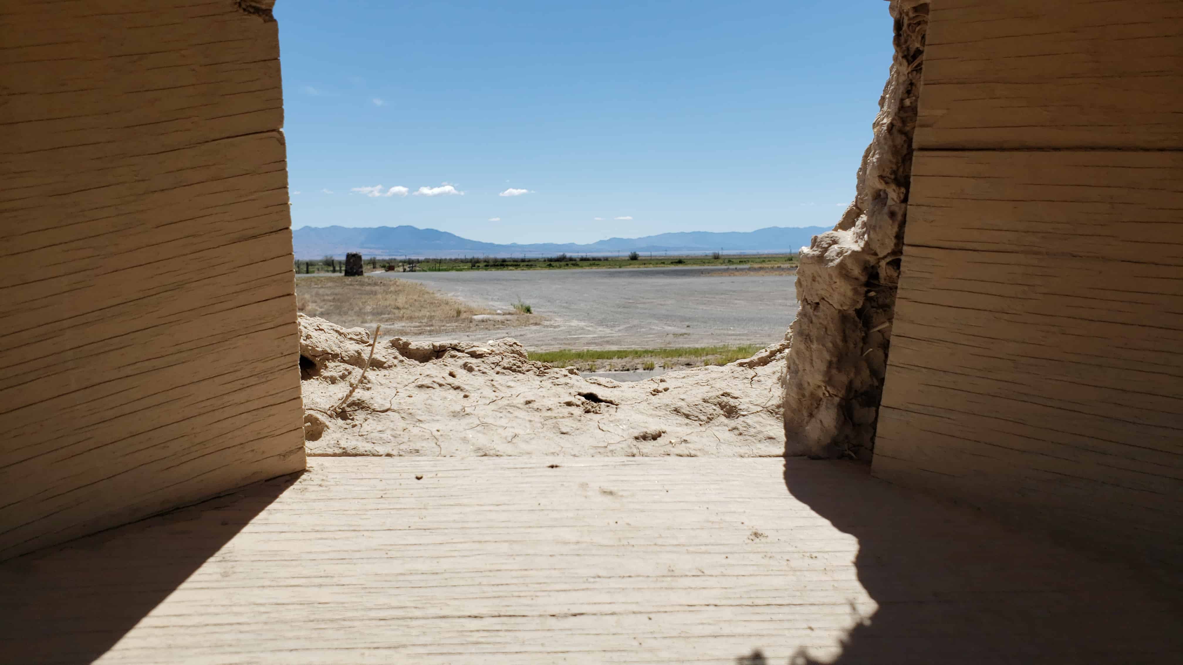
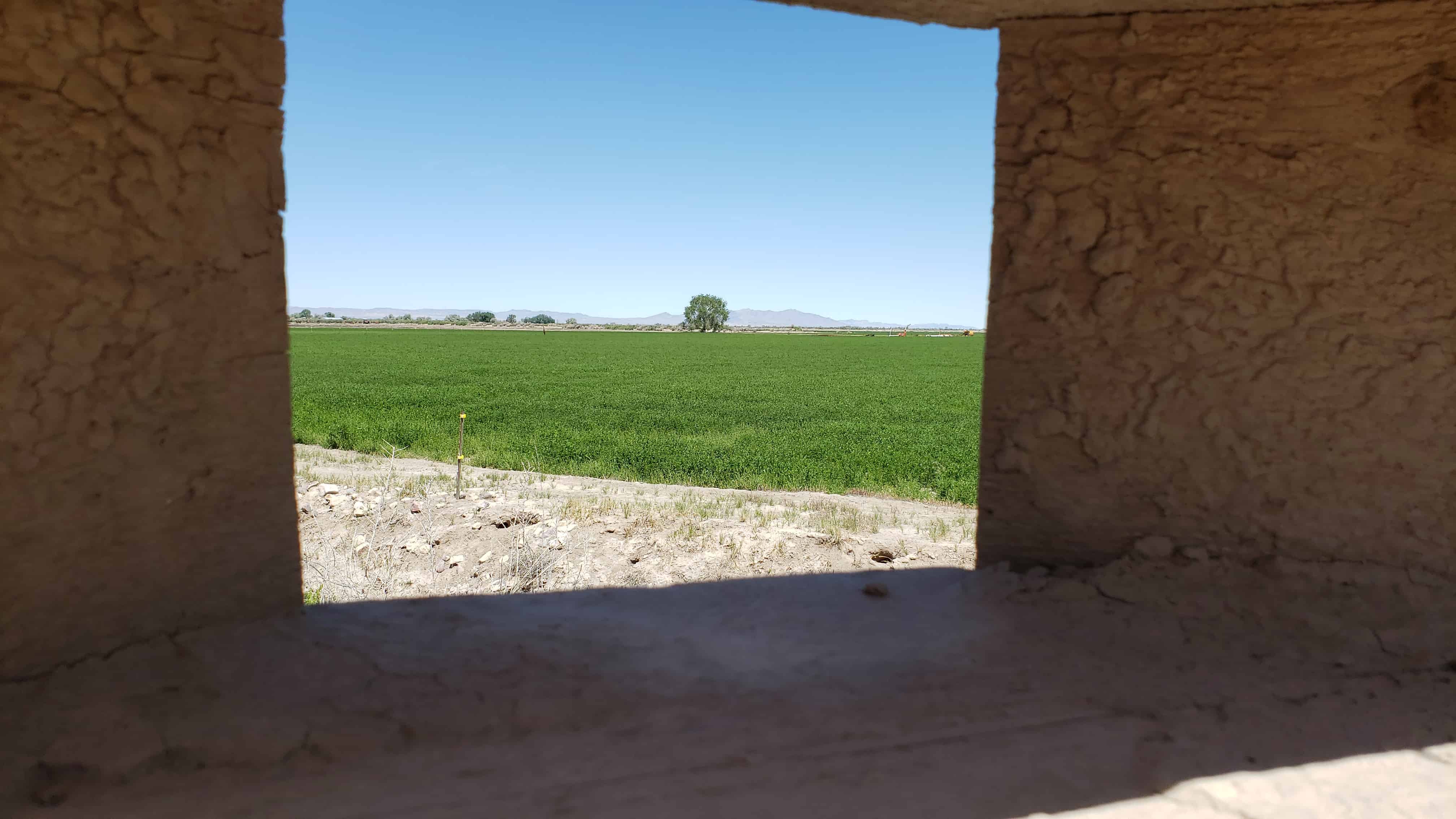
Taller bastions were constructed in the northeast and southwest corners extending beyond the walls. Rough hewn lumber was used to make the portals through which guns could be fired with a minimum of exposure to the defenders. Three portals were placed in each bastion, several on each side. The main gates were in the north and south walls, with small gates in the east and west walls.
Rain and wind erosion has reduced the walls severely. Only portions remain, mainly on the east wall, the bastions and corners. One can see in the fallen portions of the wall the kind of adobe construction a layer of mud, a layer of straw. The remaining walls are from 6 to 7 feet high and badly eroded.
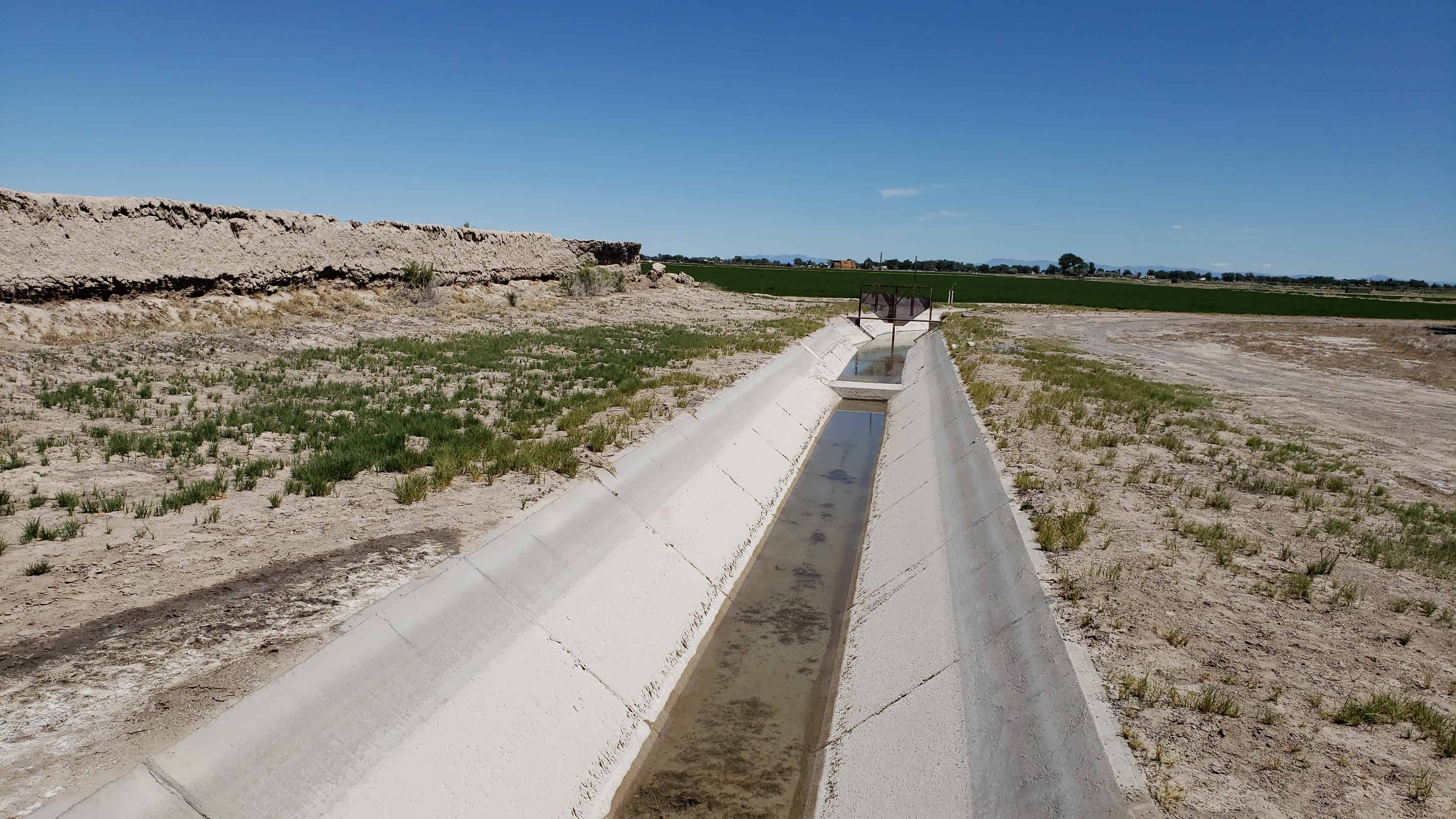
Greasewood and other brush have grown up around the walls. A ditch runs near the north wall and a large lateral in front of the east wall.
The site is near the old Sevier River channel, long since changed by man’s needs. Now owned by Utah State Parks and Recreation, both its preservation and development are being planned.


