The Escalante Historic District is roughly bounded by 300 North, 300 East, 300 South and 300/400 West in Escalante, Utah.
Related:
Escalante’s architectural history reflects the evolution of a community that grew up around a single industry (livestock) and declined when that industry diminished. In its early years (1876-1920), Escalante boomed with the expansion of the local livestock industry. This boom precipitated a surge in construction activity. Over 40 percent of all structures and nearly two thirds of the contributing structures in the historic district were constructed during Escalante’s first 45 years.
As the livestock industry declined, however, Escalante’s population decreased and so, too, did construction activity. Less than 60 percent of all the buildings and less than 40 percent of the historic structures in the district were constructed in the 90-year period between 1920 and 20 I 0. New buildings that were constructed after 1920 primarily replaced existing
structures rather than occupying vacant lots, diminishing the historic housing stock. In short, construction after 1920 did not significantly increase the building stock in the historic district and, in particular, the stock of contributing buildings.
The district comprises 289 resources, of which 124 (43 percent) contribute to its historic character: Non-historic resources in the district are divided between 71 non-contributing and 94 out-of-period resources (25 and 33 percent of all resources, respectively). The vast majority of contributing structures (over 75 percent) are residential, with agricultural, religious, and commercial resources being the other uses of greater than one percent. The most common exterior cladding for all structures in the district is aluminum siding (indicative of a gradual progression toward less expensive materials), followed by brick and wood siding. For contributing structures specifically, brick is by far the most prevalent material, followed by wood siding and aluminum siding.
Development Patterns
Although it was originally settled by Mormons, Escalante was not established as a Mormon colony as assigned by Brigham Young. Rather, it was settled because of the increased opportunities for livestock grazing and farming that its relatively mild climate offered.
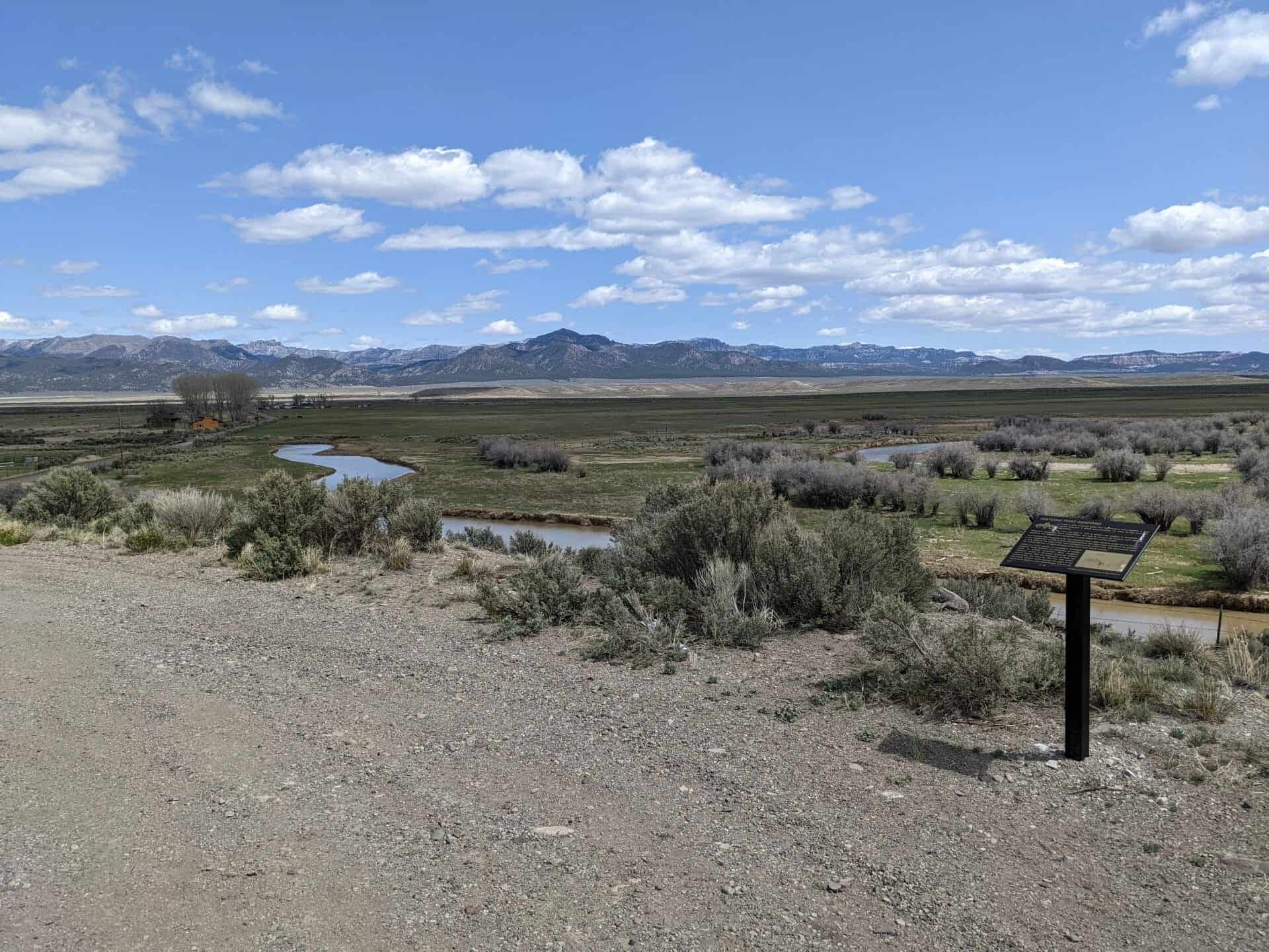
Nevertheless, Escalante was platted and developed along the lines of other Mormon villages. This development pattern, based on the Plat for the City of Zion, called for wide streets with five-acre blocks divided into four individual lots of 1.25 acres each. The large lots provided space for domestic agriculture, including produce and livestock. Most homesites would therefore have included not only the house but outbuildings and other structures, such as backhouses, granaries, barns, and corrals. The original townsite comprised 18 of these five-acre blocks along the banks of Escalante
Creek.
As with most Mormon villages, development was concentrated within the urban boundaries. Very few houses were built outside of the original townsite (on farms, for example, as might be found in rural communities in other parts of the country). Rather, farmers and ranchers lived in town and “commuted” to their farms and ranches outside of town. As the town expanded, it maintained the basic five-acre block configuration, although some larger parcels were distributed around the edge of the urban boundary.
Summary of Architectural Styles by Period
Building types in Escalante represent a typical “sampling” for rural Utah communities. As mentioned above, the vast majority of contributing structures are residential, and most of these were constructed prior to 1920. Not surprisingly, the primary building types are house types common to periods prior to 1920: bungalow, cross wing, hall parlor, and foursquare. Later house types (ranch/rambler and World War II-era cottage) are less numerous but still fairly common in the district. Contributing buildings also include a handful of civic, religious, and commercial buildings, as well as barns and other outbuildings (“backhouses”). (However, backhouses and other outbuildings are not being counted as primary buildings.) Of the non-residential buildings, the most common uses are churches, barns, and commercial/civic buildings.
Buildings in the historic district do not reflect a distinctive architectural style-i.e. a style (or styles) unique to the region or to Escalante itself. Rather, they reflect prevailing styles and types of the period in which they were built. In Escalante’s early years, those styles were a little “behind the times,” reflecting Escalante’s remoteness. For example, classical styles, which had cycled out of fashion in most of the rest of the country by the mid 1800s, remained popular in Escalante until the end of the 19th century and even into the early 20th century. While this pattern was typical for Utah and the broader region, it was more pronounced in Escalante because of the community’s isolation.
Because most of the contributing buildings in the district were constructed prior to 1920, the most common architectural styles in the district are those associated with the early 20th century and latter half of the 19th century: Prairie School, Arts and Crafts, Classical, and Victorian. As with building types, more modern styles (Ranch/Rambler and Minimal Traditional) are less common but still present in the district. (Note: These observations reflect the fact that more than one style may be attributed to some buildings.)
Settlement 1875 -1889
Escalante was settled in phases. Although the first Anglo settlers arrived in 1875 to prepare for settlement, no permanent residents lived in Escalante until 1876. So Escalante’s first “houses” were primitive, meant to provide only rudimentary, temporary shelter. These earliest residences were dugouts-literally, holes in the ground-usually about 100 to 150 square feet by six feet high, with roofs made of cottonwood poles and rushes covered with dirt. As more permanent structures were built, many of these dugouts were simply built over and served as root cellars or basements for houses or outbuildings later constructed on the same sites.
By 1876, lumber was being produced by local saw mills, and wood houses became the norm, which was not typical of other settlements in Utah, where stone and adobe brick were more common. Rapid population growth was prompted by the burgeoning livestock industry, so that by 1877 “the townsite was dotted by a number of one and two-room log houses.” Made from whole logs or thick planks, these modest single- or double-cell structures had shingle, shake, or board-and-batten roofs, simple windows with one or two panes, and dirt or flagstone floors.
The prime examples of single-cell cabins from this period are the Rufus Liston cabin (1885) that has been reconstructed and relocated to the city park at 50 East Main Street and a log house (1890) located at 250 South Center Street. As Escalante matured and developed, these single-cell log houses were often moved and replaced with new houses, used as “cores” for new houses constructed around them, or simply covered with siding.
While most of Escalante’s earliest houses were simple, functional structures, some examples remain of larger, more elaborate houses, reflecting architectural types and styles imported from other places. One of the earliest houses extant in Escalante is the Don Carlos Schurtz house at 90 West 200 North (c. 1880 or earlier). This is very nice example of a central-passage type, which was fairly common for wealthier settlers in early Utah. Interestingly, there are no extant double-cell houses from this early era. This lack of double-cell houses in Escalante is atypical, as the type was one of the most common in early Utah. However, in Escalante’s early years, the hall parlor was the more common type of larger house, with its larger “hall” and smaller “parlor.” The asymmetry of the interior was masked by a symmetrical façade. Because of this external symmetry, hall-parlor houses were most often designed in classical styles, with geometric composition, centrally spaced doors, and evenly-spaced windows.
This ubiquitous blend of hall parlor type with classical style is found in the house at 90 South 100 East (c. 1890) and the Edmund Allen house at 80 East 200 North (1890). The latter house displays elements that also indicate a transition in Escalante from classical styling to Victorian influences. Classical designs are also displayed in Escalante’s earliest civic and religious buildings. The tithing office at 20 South Center Street (1884) displays elements of Greek revival style with its pedimented gables and window heads. The tithing office also demonstrates the use by early residents of a range of locally available materials beyond wood-in this case, sandstone.
Other materials, primarily adobe, were used during this period, although the use of adobe was brief, as brick soon became the material of choice. The walls of adobe houses were usually at least 12 inches thick and often covered with stucco. The remaining example of adobe construction from this period is the Don Carlos Schurz house mentioned above. As with the Edmund Allen house, the Schurz house reflects a transition in Escalante from classical to Victorian styles, displaying the symmetry of the former and the ornamentation of the latter.
Finally, local materials included concrete, as exemplified by the historic jail house at 50 West Main Street ( c.1890). This structure is somewhat unique in Utah in that it is made entirely of formed concrete, a material that was not common in Utah until after the tum of the 20th century.
Economic Prosperity 1890 -1919
The thirty years from 1890 to 1920 represent Escalante’s “golden” period. With livestock counts at their peak, Escalante was “one of the richest communities in southern Utah.” This prosperity was accompanied by rapid growth that fostered a construction boom. Not surprisingly, over 60 percent of the contributing resources in the historic district were built during this 30-year period.
From its modest beginnings, Escalante was maturing. “By 1900, Escalante was looking more like a settlement. Log or lumber houses had replaced the dugouts, and adobe or brick houses were now beginning to dot the landscape.” Nevertheless, “older” architectural types, styles, and materials still lingered into the 20th century as evidenced by an abandoned wood-sided double-cell house in classical style at 245 South 300 East (1910). This is the only known remaining double-cell house in the city.
Although houses continued to be constructed based on earlier types (e.g. hall parlor and double cell), the prevalent stylistic elements began to reflect a transition to a more contemporary Victorian aesthetic. The earliest known example of a hall-parlor house in the Victorian style is the Ed Twitchell house at 185 West 300 South (1895). As in other parts of the country, Victorian houses in Escalante were characterized by asymmetrical facades, roofs with steep pitches, and detailed decorative woodwork. By and large, Victorian houses in Escalante don’t fall into a particular style but are classified as Victorian eclectic, and earlier examples tend to be less ornate.
As Victorian styles became more common in Escalante, so did the building type most commonly associated with Victorian architecture: the cross-wing. Constructed with two wings set at right angles, the cross-wing displayed the
asymmetry essential to Victorian styles and emerged as a common house type in Escalante at the tum of the 20th century. The earliest example of a cross-wing house is at 90 North Center Street (1900).
These earlier examples of Victorian architecture are relatively simple in their detailing, but later Victorian houses in Escalante incorporated more elaborate ornamentation. The William Henry Gates house at 120 South Center Street (1910) displays the more intricate woodwork associated with the Eastlake style. While the cross-wing house was the predominant type between 1900 and 1910, Victorian houses were built in other types, including central passage and central block with projecting bays. An example of the former type is found at 185 West Main Street (1895), and an example of the latter type is found at 95 West 200 North (1905).
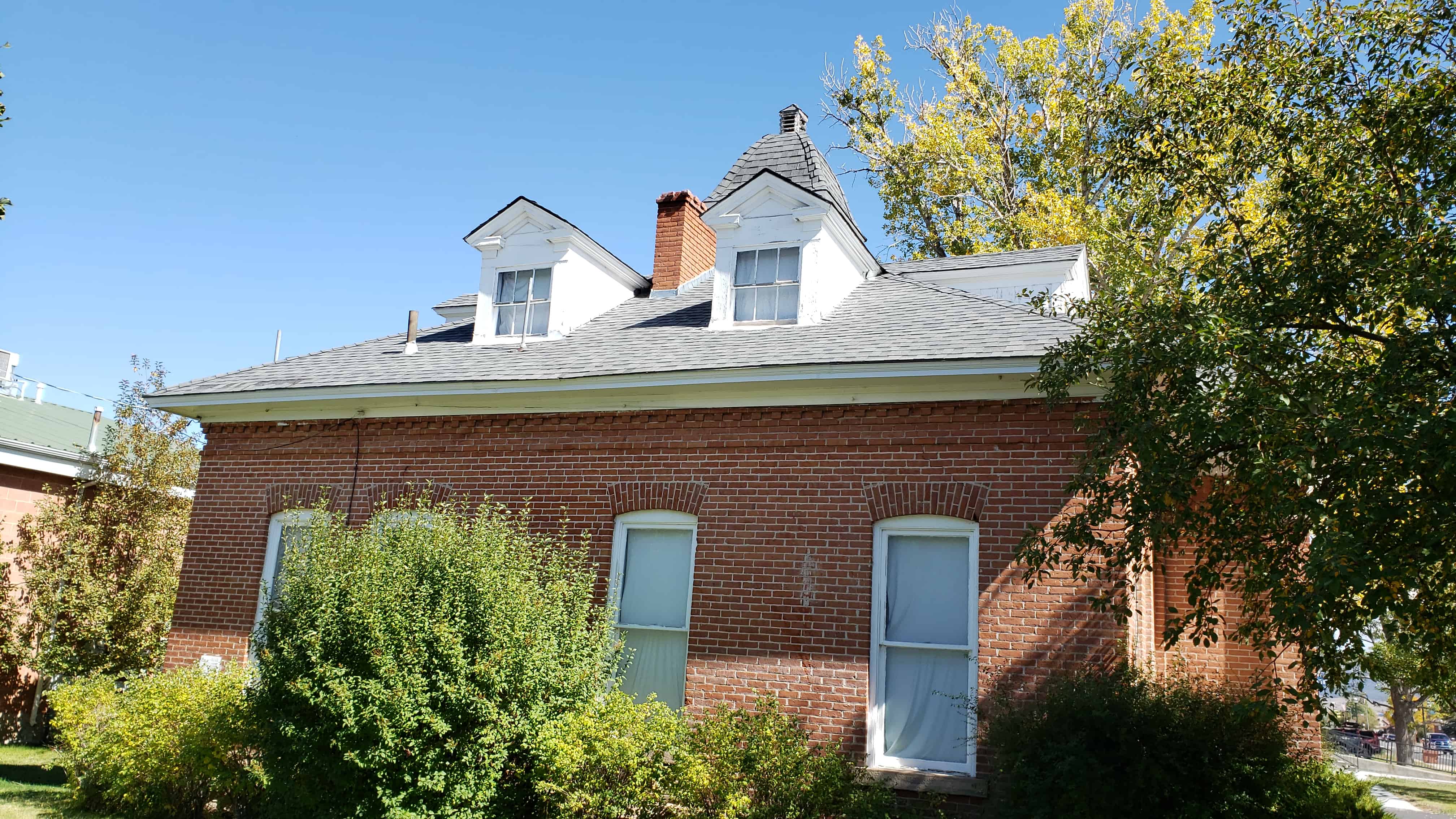
These new influences and more permanent materials marked a transition to a more established, more settled community. Escalante’s incorporation in 1903 expressed a permanence reflected in new buildings. As local kilns started production, brick replaced wood and adobe as a more permanent material, and new houses in Escalante increasingly incorporated building types and design influences from the rest of the country. The primary building types from this period represent the more general transition across the country from 19th to 20th century architecture: bungalow, cross wing, foursquare, and central block with projecting bays.
By 1910, the more “modem” bungalow house type began to appear in Escalante. The most common house type in the historic district, the bungalow was constructed with a low-pitched roof, broad eaves, and a wide porch or veranda. Bungalows in Escalante were constructed primarily in a vernacular Arts and Crafts style, with a prime example located at 89 North 200 East (1923). While local brick was, by far, the most common material, other materials included stucco and wood.
Aside from the bungalow and cross wing, the other primary house type from this period is the foursquare. In Escalante, these houses did not conform to the typical foursquare, but tended to be simple, small, and unadorned, and usually had porch notched into the plan. So, in the regard, they are only a foursquare in that they have a square plan. None of them
fall into a particular stylistic category. The prime example of this type is located at 90 West Main Street (1916).
Residential Outbuildings
Homesites in Escalante contain a prevalence of what are known locally as “backhouses”-small (usually one-room), stand-alone structures that provided additional living space. Historian Edward Geary has observed that “[t]he backhouses of Escalante are not unique, but I know of no other Utah town where so many of them remain, or where even houses constructed in relatively recent times often have them.”
Because the backhouse often served to expand indoor living space (for sleeping, cooking, etc.), its existence reduced the need for more living space in the house itself. Even as advances in architectural style and building technology made larger houses possible, Escalante residents continued to build and use backhouses as additional living space into the middle of the 20th century. Many of these structures are still in use, whether they still stand separate or have been structurally connected to the house.
Backhouses therefore represent an important architectural and historical element in Escalante’s historic district. A prime example of a backhouse is the brick example located behind the ornate central-passage house at 290 West 200 North (c. 1890). Although this particular example is constructed of brick, backhouses were also constructed of wood siding and sometimes stone. As mentioned above, backhouses were often constructed over dugouts, and in some cases, as at 90 North 300 East (c. 1910), backhouses were also sometimes integrated into the house. As utilitarian buildings, backhouses were simple, generally constructed as single-cell structures in a simple style most accurately classified as a vernacular representation of the classical style. (It should be noted that only primary buildings are counted in the resource count. Outbuildings are not included in the count of buildings but are being discussed here because of their unique history in Escalante.)
Barns
As was typical of Mormon villages, self-sufficiency was an integral concept in the planning and design of Escalante. While ranching and farming took place on properties outside of town, each lot in town included space not only for residences but also for barns, granaries, and other structures (e.g. corrals) to allow residents to raise their own meat and produce. Barns therefore played a significant role in Escalante’s residential development. Barns were a common feature of the typical Escalante homesite, although many original barns have collapsed or been demolished in the past decade or so. The primary purpose for domestic barns was the storage of alfalfa or hay.
Barns were constructed primarily in one of two types: the English (“three-bay”) barn (distinguished by a large entrance at the center of the broad side) or the Intermountain barn (distinguished by an entrance at the gable end). An example of the former type is found at 290 East 200 South (1910). An example of the latter type is found at 120 South 100 East (1920). While backhouses, granaries, and other outbuildings incorporated a variety of
construction materials, barns in Escalante were built exclusively of wood.
Other
The period of prosperity from 1890 to 1920 also saw the construction of Escalante’s first commercial buildings, including the Zion’s Cooperative Mercantile Institution (no longer standing), the Peoples Exchange at 105 North Center Street (1900), and Griffin Grocery/Hardware at 9 West Main Street (1920).
The People’s Exchange is Escalante’s only significant (contributing) remaining commercial building. A two-part block building, it displays elements of Victorian commercial style with a recessed entry flanked by large display windows and the styling and ornamentation found on houses built in the Victorian style. This structure as a whole is an interesting example of a commercial building being added to an earlier residential building. Griffin Grocery/Hardware is a simple one-part block building with no defining style.
One religious building remains from this period: The Church of Jesus Christ of Latter Day Saints meetinghouse at 55 North 100 West (1920). Built of brick, it is a rare example of period revival style in Escalante, displaying colonial revival detailing with its symmetrical facade, fanlights, and classical ornamentation.
Economic Transition 1920 -1963
The early years of this period saw a continued decline in the livestock industry. As the period progressed, an infusion of people and money through Civilian Conservation Corps projects temporarily added to Escalante’s population, which reached its peak in 1940 at 1,161 residents. But a slow steady decline in population starting in 1940 resulted in a
contraction in building activity. In 1950, Lowry Nelson noted in that, although 90 new houses had been built between his first survey in 1923 and his follow-up in 1950, most replaced existing houses rather than adding to Escalante’s housing stock. By Nelson’s count, only 49 net new houses were added during this 27-year period.
Early in this period, the bungalow continued to be the primary building type in Escalante, the prime example being a house at 185 North 300 West (1923). Smaller, simpler “box” bungalows, typically with only a small porch or no porch at all, also remain from this period. The most recent example is located at 131 East 100 North ( 1938). These houses are notable primarily because they indicate a shift to smaller, less ornate houses (e.g. they are constructed with various types of siding rather than with brick}–probably a result of the Great Depression but perhaps more directly a result of the declining livestock economy in Escalante.
These box bungalows were the precursors of the World War II era cottage that, by the 1930s, had replaced the bungalow as the primary house type and that seemed particularly well suited to Escalante given the community’s propensity for smaller, simpler houses. Based on a small, square floorplan, the World War II era cottage displayed little ornamentation, emphasizing function (in particular, ease of construction) over form. As a result, houses of this type in Escalante reflect the minimal traditional style, with straight lines, large (picture) windows in the front fa9ade, and little if any ornamentation.
The prime example ofthe World War II era cottage in Escalante is located at 215 West 200 North (c.1935). Most of these cottages were constructed of brick, although by this time brick was imported from elsewhere (i.e., no
longer produced in Escalante). Perhaps because of this change in availability (and expense), brick became less common as a building material in Escalante, and houses increasingly incorporated siding or veneers.
Towards the end of this period, houses once again grew larger, although their styling remained relatively simple and unadorned. Generally, these houses are categorized in the ranch/rambler type (and style), with earlier versions representing essentially an elongated World War II era cottage and later versions even more extended to create greater separation between living areas and bedrooms. Stylistically, early ranch/rambler houses maintain the characteristics of the minimal traditional style-little ornamentation, gabled roofs, and straight, clean lines such as the example at 120 W. 200 South (1948). In addition, the front entry in ranch/rambler houses is understated, with no ornamentation or accentuation. As the 1950s progressed, the ranch house became more extended in size, taking up more
of the width of the lot. Escalante has few full-size ranch-type houses. One of the better examples is located at 130 South 200 West (c.1960).
The emphasis in this period on simpler house types has led naturally from the World War II era cottage to ranch style houses to the mobile home. Particularly in the rural areas of Utah, the mobile became popular as married children stayed with their parents to help with the farm. The mobile home-and later, the manufactured/modular home-made it possible for them to place their residence next to their parents. An example of an early mobile home from this period is located at 195 West 200 North ( c.1963). As with ranch/rambler houses, mobile homes are not necessarily
associated with a particular style, although the above example displays design characteristics typical of mobile homes: a long, narrow profile, a relative lack of windows, and metal siding.
Few contributing non-residential buildings remain from this period in Escalante. The prime example is the LDS Meetinghouse at 70 South Center Street (1945), which reflects details associated with the PW A Moderne
style, with its flat roof, straight lines, and subtle art deco motifs.
Tourism and Public Employment: 1964 -2012
Although the most recent period in Escalante’s architectural evolution is outside of the period of significance, some context is included in Section 8. However, as the buildings would be considered out of period, no examples are provided here.
Intrusions
While the historic district contains a large number of eligible resources, considering the boundaries contain the majority of the city limits, there are also many intrusions that do not either the age or integrity standards. Nearly 60 percent of the structures that were evaluated are non-contributing or out-of-period. In most cases, these structures reflect the
progression of architectural types and styles in Escalante but have been modified to the extent that their original historic character is no longer intact. Some early example include the houses at 110 West 200 North (c.l895) and 0 West 100 North (c.1895). Both show significant alteration, including major additions, modem siding, and metal or vinyl sliding windows– the kinds of modifications typical to homes that owners have attempted to “modernize.”
Out-of-period structures show a progression toward inexpensive houses that are relatively easy to construct such as manufacture/modular homes like this example located at 340 North 300 West (c.2005). Nearly 50 percent of the out-of-period structures are either mobile homes or manufactured homes, although the later ranch/rambler type represents nearly 20 percent of out-of-period structures. Some other examples include a more-recent ranch house at 240 East 100 South (c. 2000) and a more contemporary house at 170 North Center (c.1990).