Tags
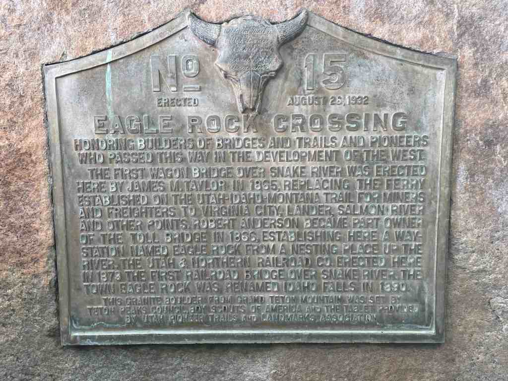
Eagle Rock Crossing
Honoring builders of bridges and trails and pioneers who passed this way in the development of the West.
The first wagon bridge over Snake River was erected here by James M. Taylor in 1865 replacing the ferry established on the Utah-Idaho-Montana trail for miners and freighters to Virginia City, Lander, Salmon River and other points. Robert Anderson became part owner of the toll bridge in 1866, establishing here a way station named Eagle Rock from a nesting place up the river. The Utah & Northern Railroad Co. erected here in 1879 the first railroad bridge over Snake River. The town Eagle Rock was renamed Idaho Falls in 1890.
This granite boulder from Grand Teton mountain was set by Teton Peaks Council, Boy Scouts of America and the tablet provided by Utah Pioneer Trails and Landmarks Association
The above text is from Utah Pioneer Trails and Landmarks Association marker #15 erected August 26, 1932 in Idaho Falls, Idaho.
- U.P.T.L.A. Markers (these markers were later adopted by the SUP, S.U.P. Markers )
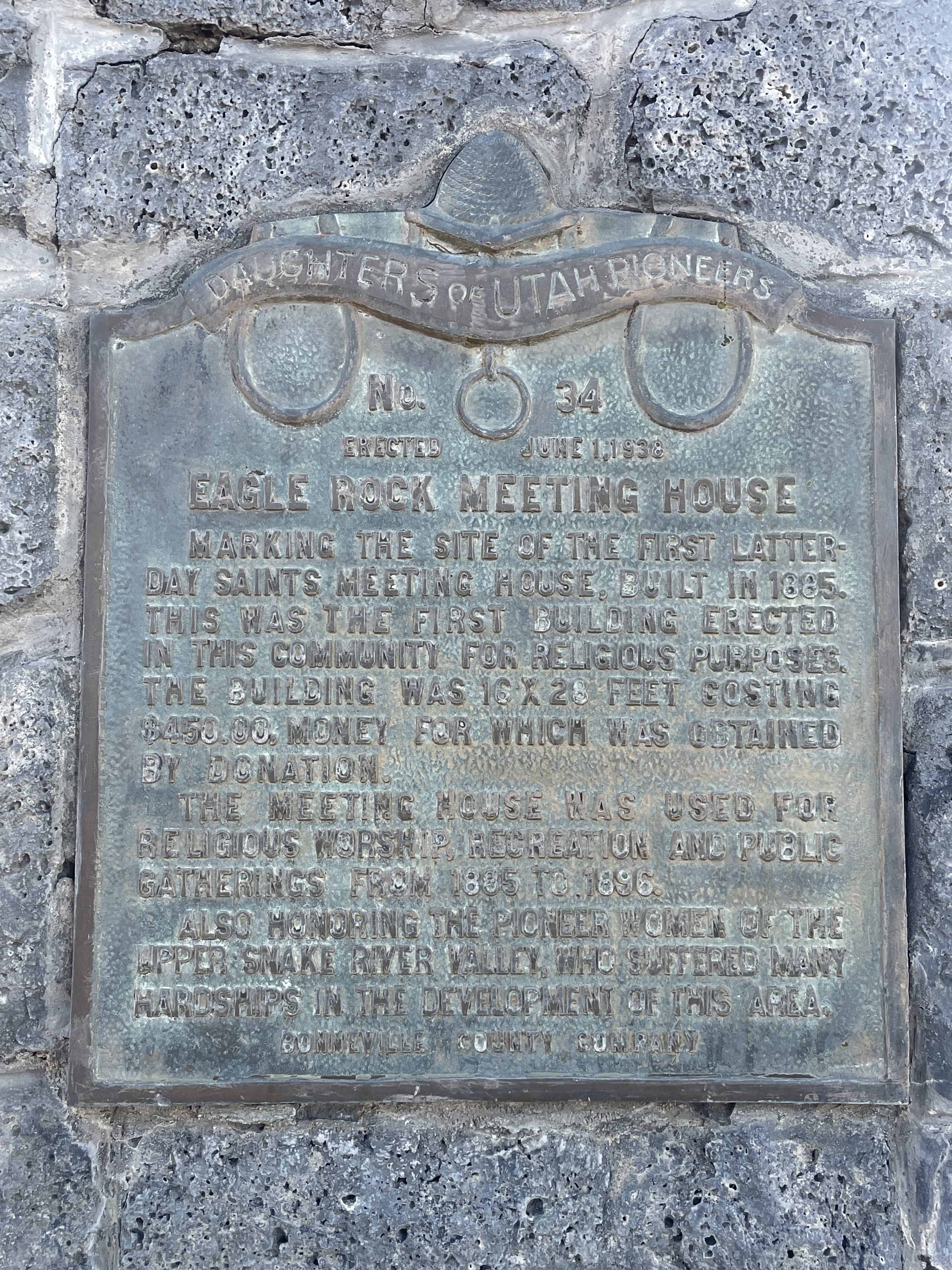
These photos were submitted by Marshall Hurst: