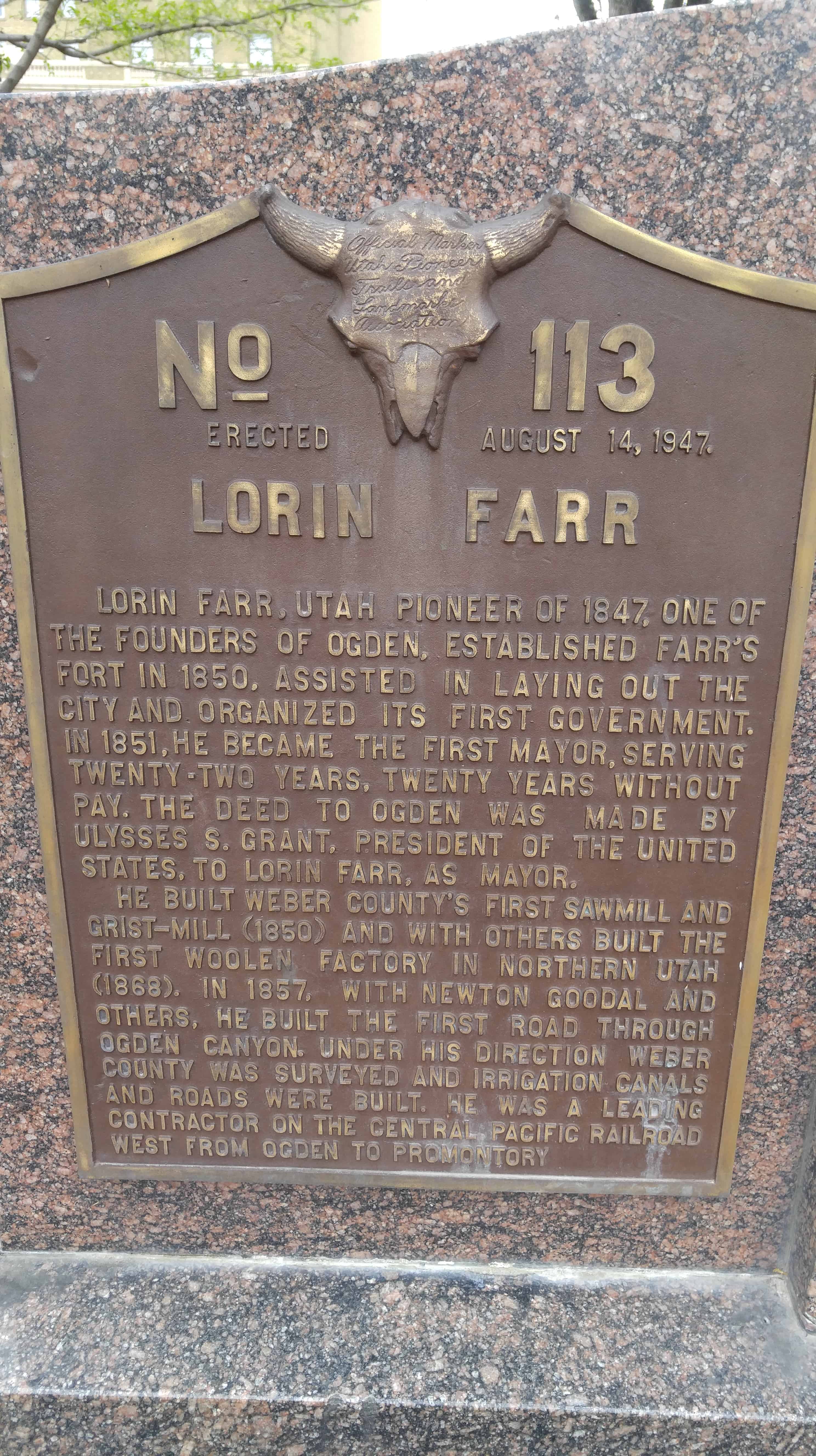
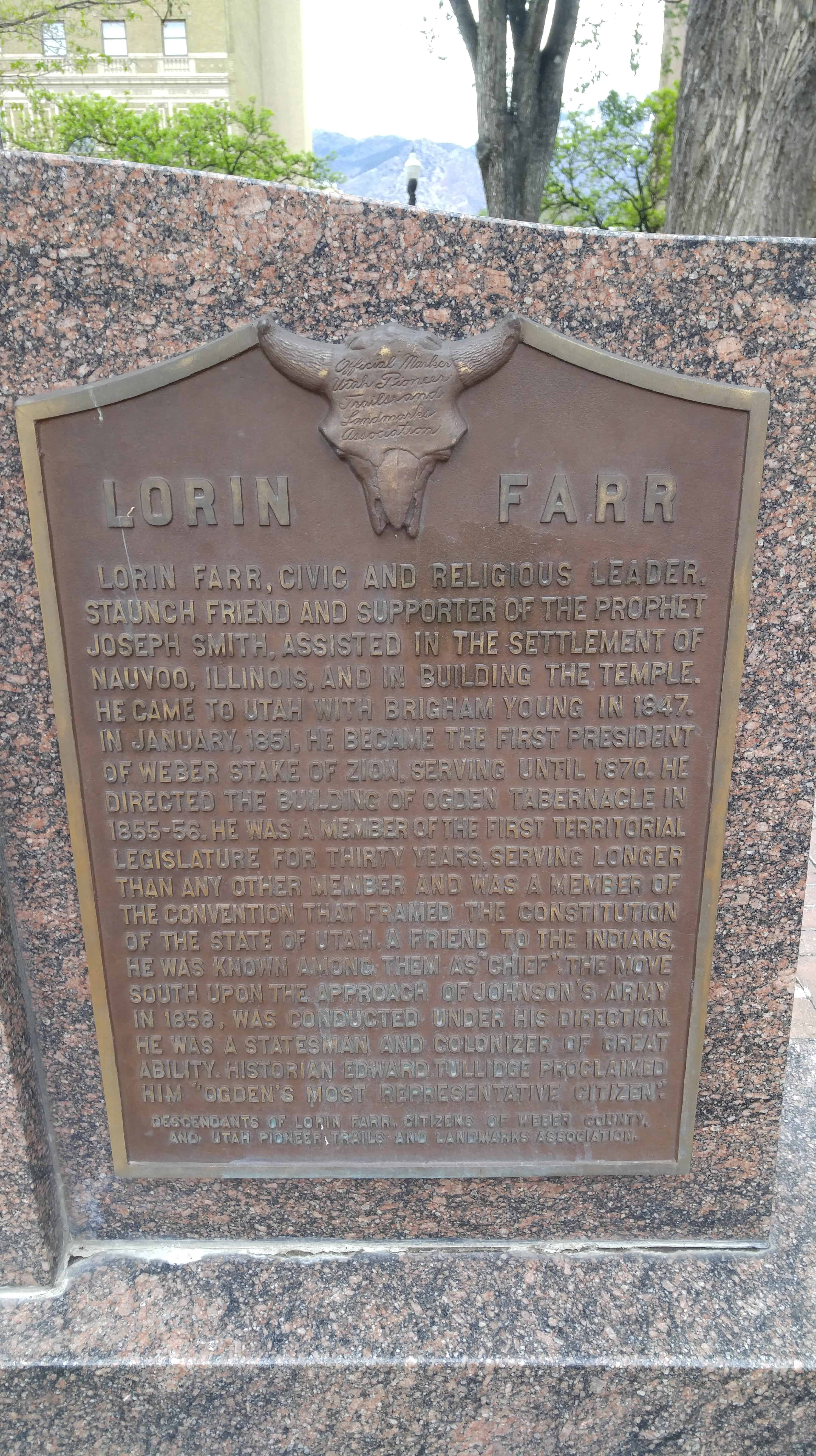
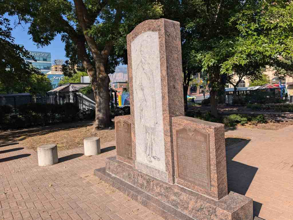
Lorin Farr, Utah pioneer of 1847, one of the founders of Ogden. Established Farr’s Fort in 1850. Assisted in laying out the city and organized its first Government. In 1851, he became the first Mayor, serving twenty-two years. Twenty years without pay. The deed to Ogden was made by Ulysses S. Grant, President of the United State, to Lorin Farr, as Mayor.
He built Weber County’s first sawmill and grist-mill (1850) and with others built the first woolen factory in Northern Utah (1868). In 1857, with Newton Goodall and others, he built the first road through Ogden Canyon. Under his direction Weber County was surveyed and irrigation canals and roads were built. He as a leading contractor on the Central Pacific Railroad west from Ogden to Promontory.
Lorin Farr, Civic and religious leader, staunch friend and supporter of the Prophet Joseph Smith, assisted in the settlement of Nauvoo, Illinois and in building the temple. He came to Utah wit Brigham Young in 1847 in January 1851 he became the first President of Weber Stake by Zion, serving until 1860. He directed the building of Ogden Tabernacle in 1855-56. He was a member of the first Territorial Legislature for thirty years serving longer than any other member and was a member of the convention that framed the Constitution of the State of Utah.”
Devil’s Slide is an unusual geological formation located in Weber Canyon, Morgan County, Utah.
The sides of the slide are hard, weather-resistant limestone layers about 40 feet high, 25 feet apart, and several hundred feet in length. In between these two hard layers is a softer limestone that is slightly different in composition from the outer limestone layers. This middle layer is softer, which makes it more susceptible to weathering and erosion, thus forming the chute of the slide. Looking like a large playground slide fit only for the Devil, this site is a tilted remnant of sediments deposited in a sea that occupied Utah’s distant geologic past. Approximately 170 to 180 million years ago, a shallow sea originating from the north spread south and east over areas of what are now Montana, Wyoming, and Utah. This sea extended as far east as the present-day Colorado River and south into northern Arizona. Over millions of years, massive amounts of sediment accumulated and eventually formed layers of limestone and sandstone. In northern Utah, these rocks are known as the Twin Creek Formation and are approximately 2700 feet thick. About 75 million years ago, folding and faulting during a mountain- building episode tilted the Twin Creek rock layers to a near-vertical position. Subsequent erosion has exposed the near-vertical rock layers and created Devils Slide.*
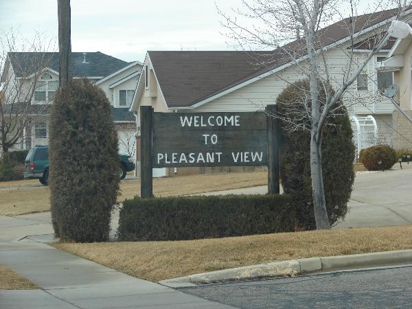
Considered part of North Ogden for its first 30 years, Pleasant View was known during its early days by several names, including West District, Hot Springs District, Stringtown, or simply Out West. The city was officially named Pleasant View in 1882 by Wilford Cragun, one of the first white children born in the area. Mary Lake, daughter of William Bailey Lake and Sarah Jane Marler was born in North Ogden, 15 December 1851. Other early settlers were Thomas Dunn, John Mower, and Simeon Cragun families.
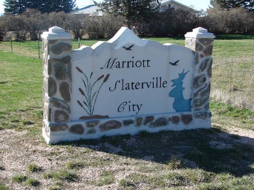
Marriott-Slaterville City was originally settled by several Mormon pioneer families, in 1852, including the Richard Slater family, and the Perry, Smout, Marriott and Field families. Many living descendants of these families, including relatives of J. Willard Marriott, pioneer hotelier of the 20th century and founder of Marriott International, still reside within Marriott-Slaterville.
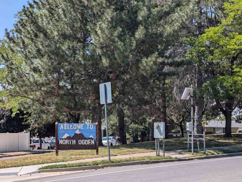
North Ogden located 3 miles north of Ogden is an outgrowth of of that city. It is on U-235, south of Brigham City. The Campbells and Riddles, Cattle ranching families from Ogden, attempted to settle the area in 1850. However, after wintering their cattle only a few months, problems with the Shoshone Indians forced them to return to Ogden. After the problem with the Indians had been partially resolved the following year, John Campbell and several other families returned to permanently settle there.
The Paramount Pictures logo, known as Majestic Mountain, was modeled after North Ogden’s own Mount Ben Lomond. William W. Hodkinson (known as the man to have invented Hollywood), a native of the Ogden area, initially drew the image on a napkin during a meeting in 1914.
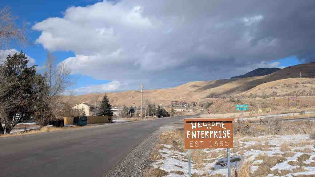
The first settlers in Enterprise were Henry and Stephen Hales, who arrived in 1861. They found fertile land on the bench, but little water for irrigation. They dug a 2-mile ditch from the Weber River to water their farmland. A canal company was organized in 1863 to irrigate the whole area, but Enterprise was short on water for many years as thieves diverted water upstream. The first schoolhouse was built in 1863. A townsite with official blocks was surveyed and laid out in 1865. A sawmill operated in Roswell Canyon in the 1870s. Although it was not an official census precinct, the 1880 census enumerated 81 residents in Enterprise.
(Not to be confused with Enterprise, Utah in Washington County)
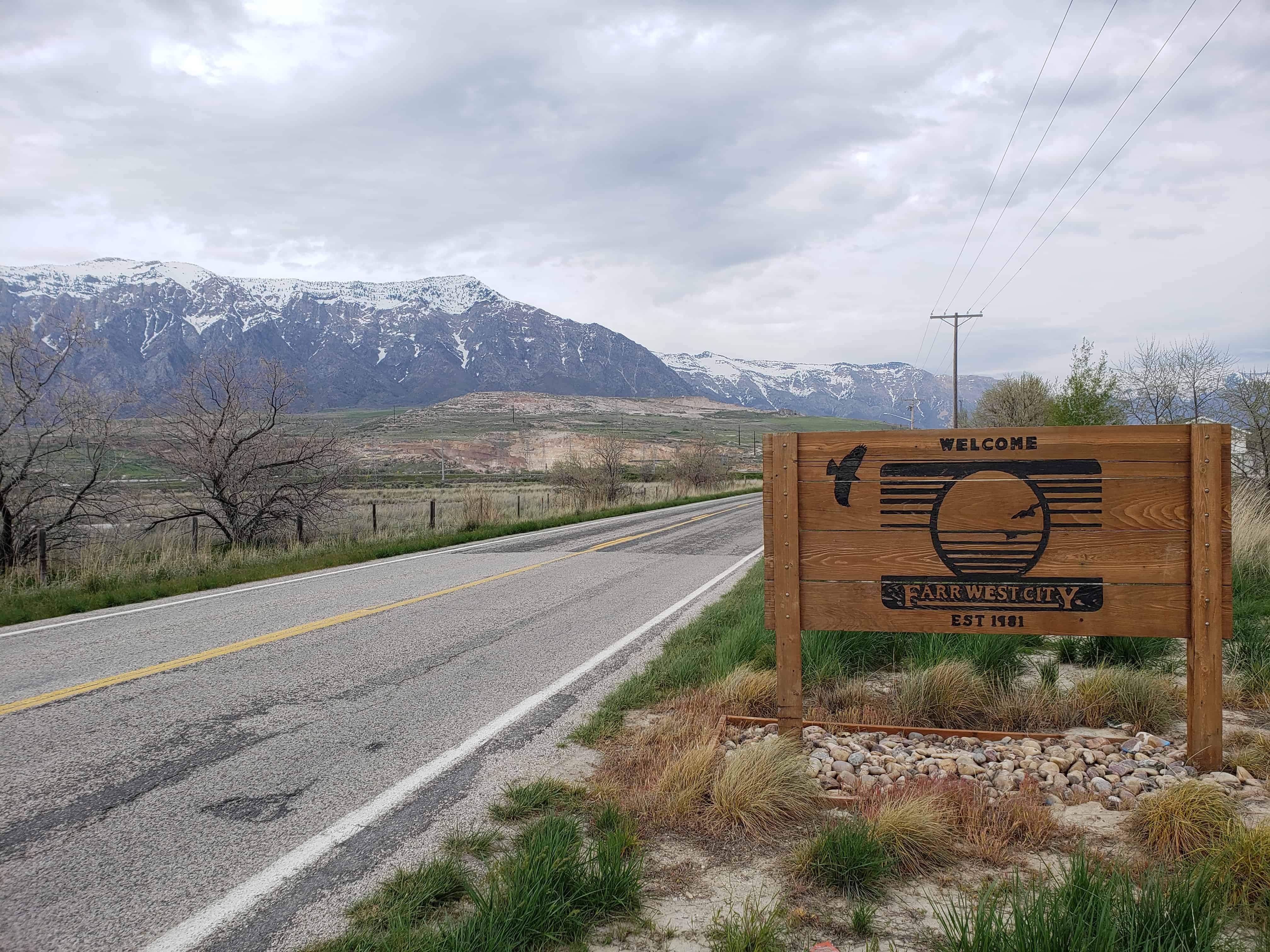
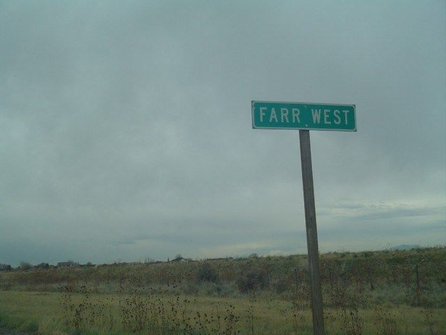
Farr West is a city in Weber County, Utah. The population was 3,094 at the 2000 census.
Farr West City is located on the north end of Weber County. It is bordered on the east by Pleasant View and by Harrisville, on the south by Slaterville, and on the west by Plain City, and was first settled by Mormon pioneers. In 1858 Joseph Taylor settled in the area that later became Farr West. In 1868 the area was included as a part of Harrisville when a precinct was organized. On 30 November 1890 western Harrisville was organized into a separate LDS ward and given the name Farr West in honor of Lorin Farr, former president of the Weber LDS stake, and Chauncey W. West, who had served as presiding bishop of Weber County, and who was the son-in-law of Abraham Hoagland. The name echoes “Far West”, an important early Mormon settlement in frontier Missouri.
The earliest settlers engaged in agriculture for their livelihood, and it received a great boost when the sugar beet industry was introduced in 1898. In 1923 further benefits were available to farmers when the Utah Packing Corporation installed a pea viner to help process field-grown peas.
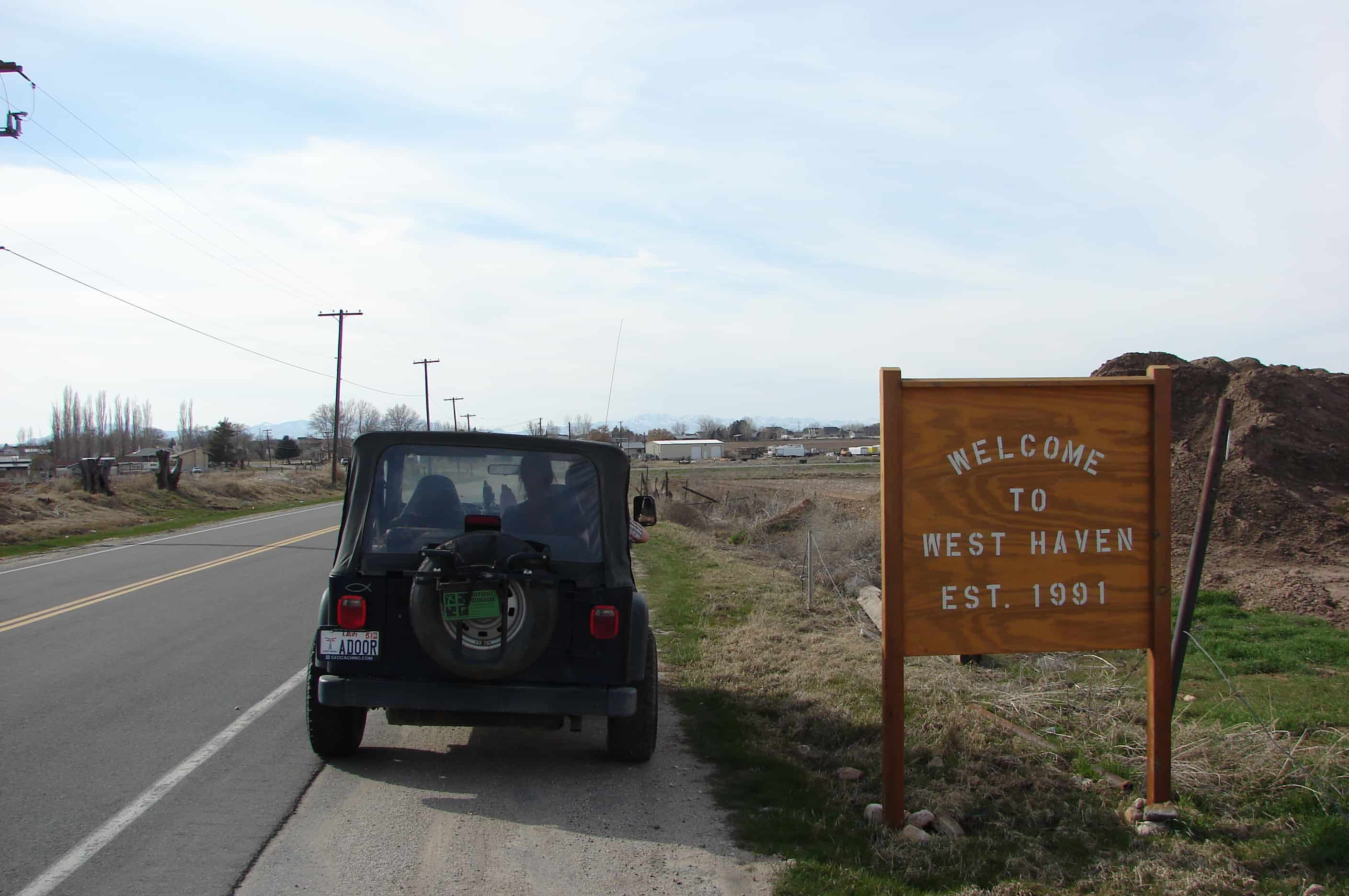
West Haven City (Weber) is located approximately thirty-five miles north of Salt Lake City, west of the Wasatch Mountains in Northern Utah. The confluence of the Weber and Ogden rivers is located inside the north-eastern corner of the city. The city is bordered on the east by Ogden, on the south by Roy and on the west by Hooper and on the north by Marriot – Slaterville.
On July 4th, 2003 the city marked the 10th annual West Haven Days celebration. The yearly event, held in the West Haven City Park and hosted by the mayor, city council and members of the city parks committee, begins at 7:00AM with a flag ceremony followed by a breakfast and an auction. Other activities throughout the day include: a variety of booths, food vendors, games, entertainment, a car show, a rodeo and fireworks.
West Haven boasts a City Park which includes an Historical Monument. Future plans provide for a River Parkway Trail that would include a fishing bridge, a pedestrian tunnel under 21st Street, picnic tables, places to rest and points of historical interest. Plans have this trail connect with the Weber County Centennial Trail.
805 feet north of this site was located the toll gate, established November 15, 1860, by Lorin Farr and Isaac Goodale, builders of the first road through Ogden Canyon. From 1865 to 1882 it was operated by the Ogden Canyon Road Company, with the original builders and John Taylor as principle stockholders. James Dinsdale was gate keeper for 14 years. It became a public road February 10, 1882.
See other historic markers in the series on this page for UPTLA/SUP Markers.