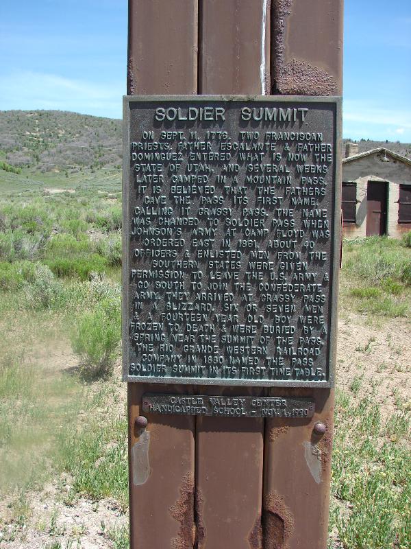
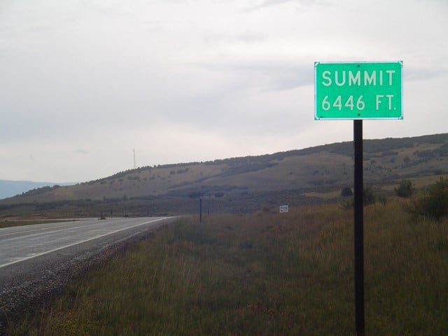
On September 11, 1776. Two Franciscan Priests, Father Escalante & Father Dominguez entered what is now the State of Utah, and several weeks later camped in a mountain pass. It is believed that the fathers gave the pass its first name, calling it Grassy Pass. The name was changed to Soldier Pass when Johnson’s Army at Camp Floyd was ordered east in 1861, about 40 officers & enlisted men from the Southern States were given permission to leave the U.S. Army & go south to join the Confederate Army. They arrived at Grassy Pass in a blizzard, six or seven men & a fourteen year old boy were frozen to death & were buried by a spring near the summit of the pass. The Rio Grande Western Railroad Company in 1880 named the pass Soldier Summit in its first time table.
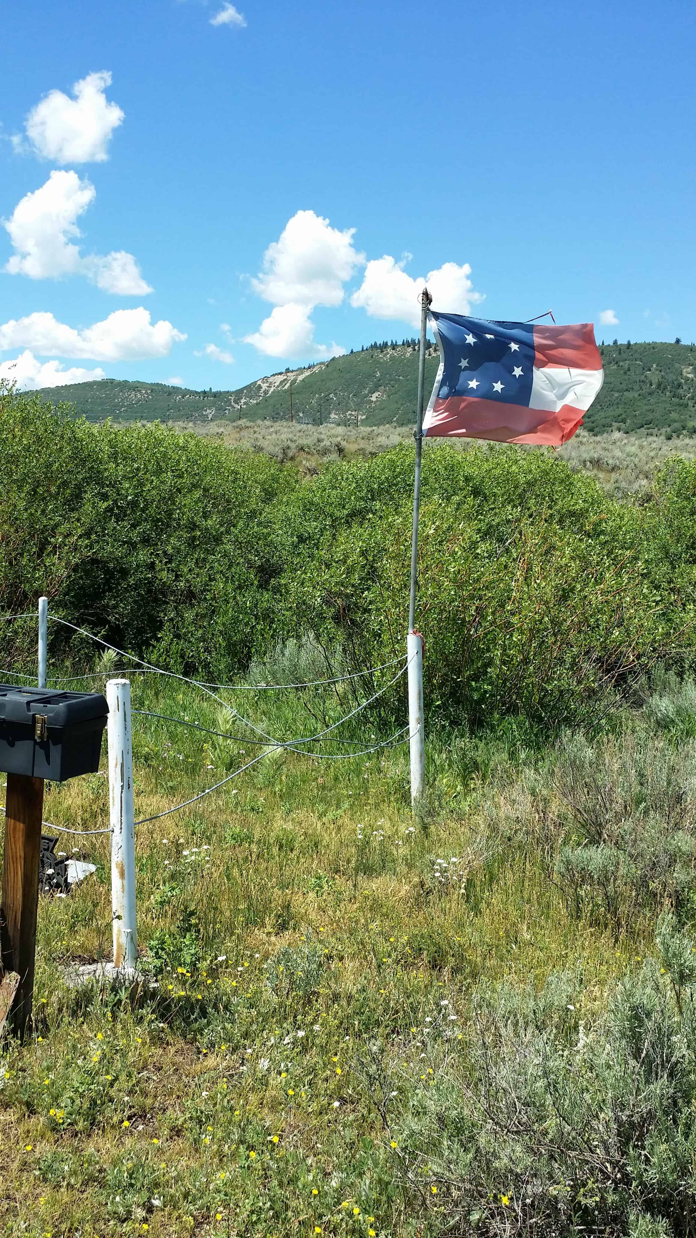
When the Civil War broke out in 1861, soldiers from the South who were stationed at Camp Floyd were released from the US Army. General Albert Sidney Johnson marched eastwards in April. In July, a second group of 40 men, led by General Phillip Cooke marched east to join the Confederate Army. When they reached this spot, they were caught in a freak snowstorm, and six men and a 14-year-old boy froze to death. They are buried in this cemetery. The flag is the first style flown by the Confederacy in 1861.
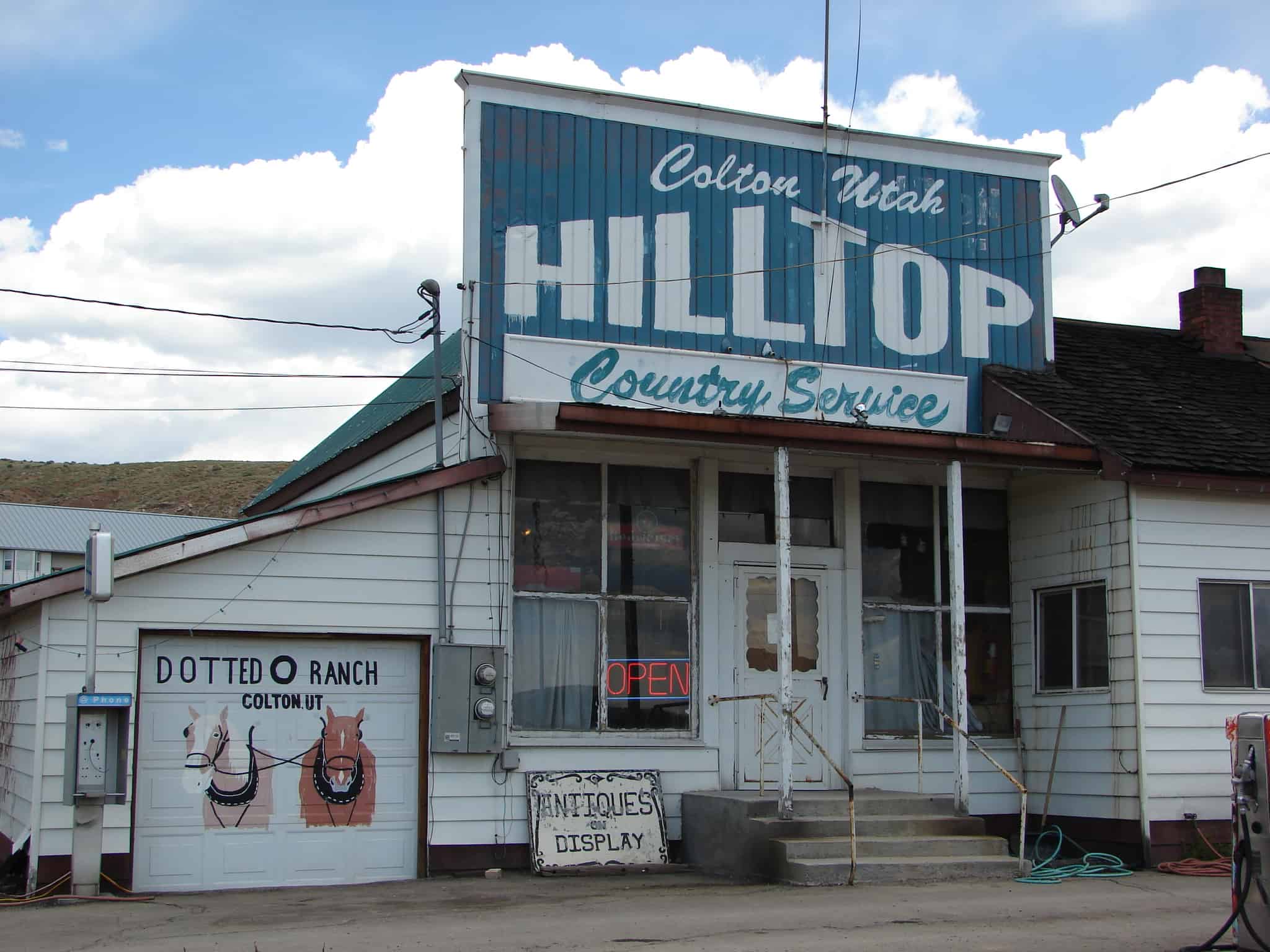
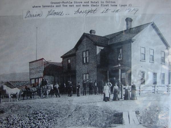
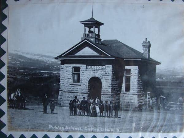
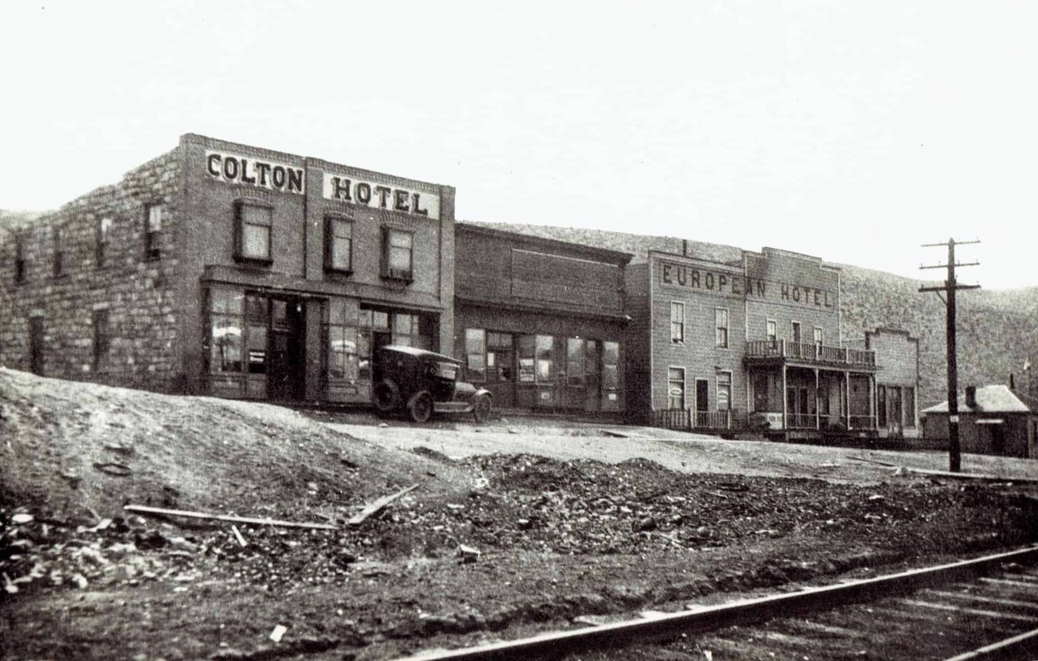
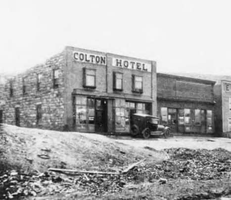
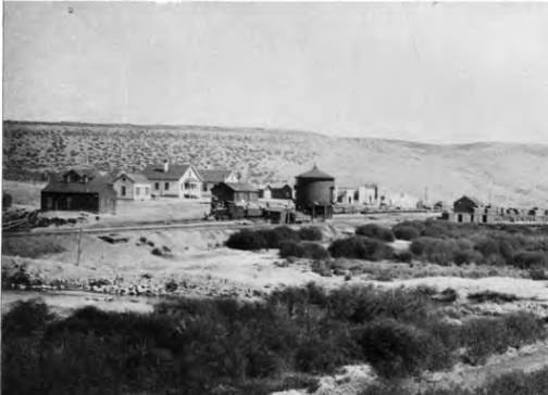
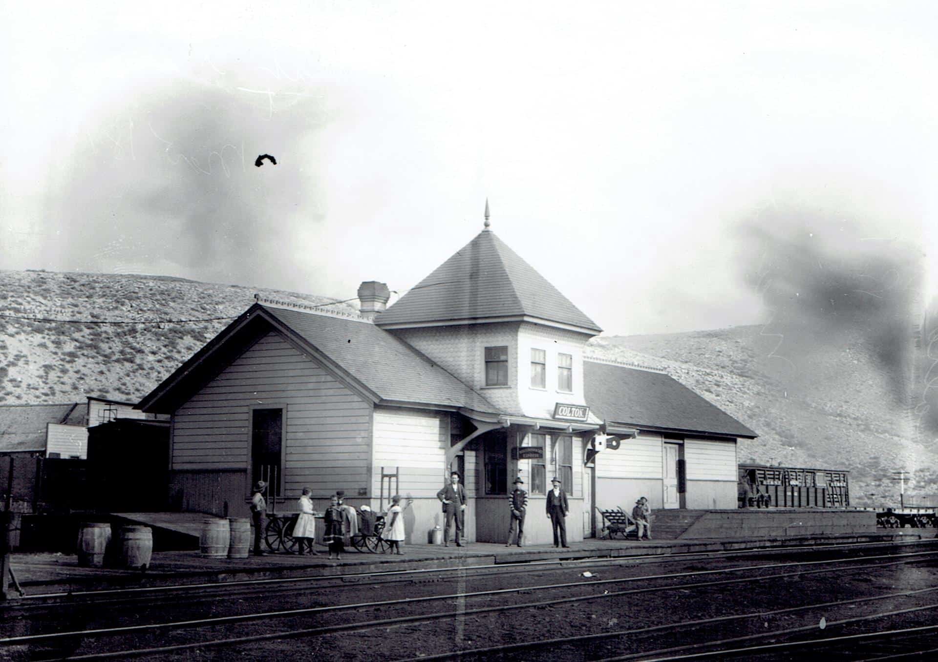
I stopped by the Hilltop store at the old site of Colton, Utah a few years back, I got some cool pictures and some pictures of old pictures. The guy who runs it talked about growing up there and told cool stories, like Butch Cassidy coming in to see his grandpa, , he had a picture of them together.
It’s pretty cool and worth a stop if you are driving through Spanish Fork Canyon.
The photos below are taken by me if in color, and the black and white photos are pictures the man in the store had that I took pictures of with my camera.
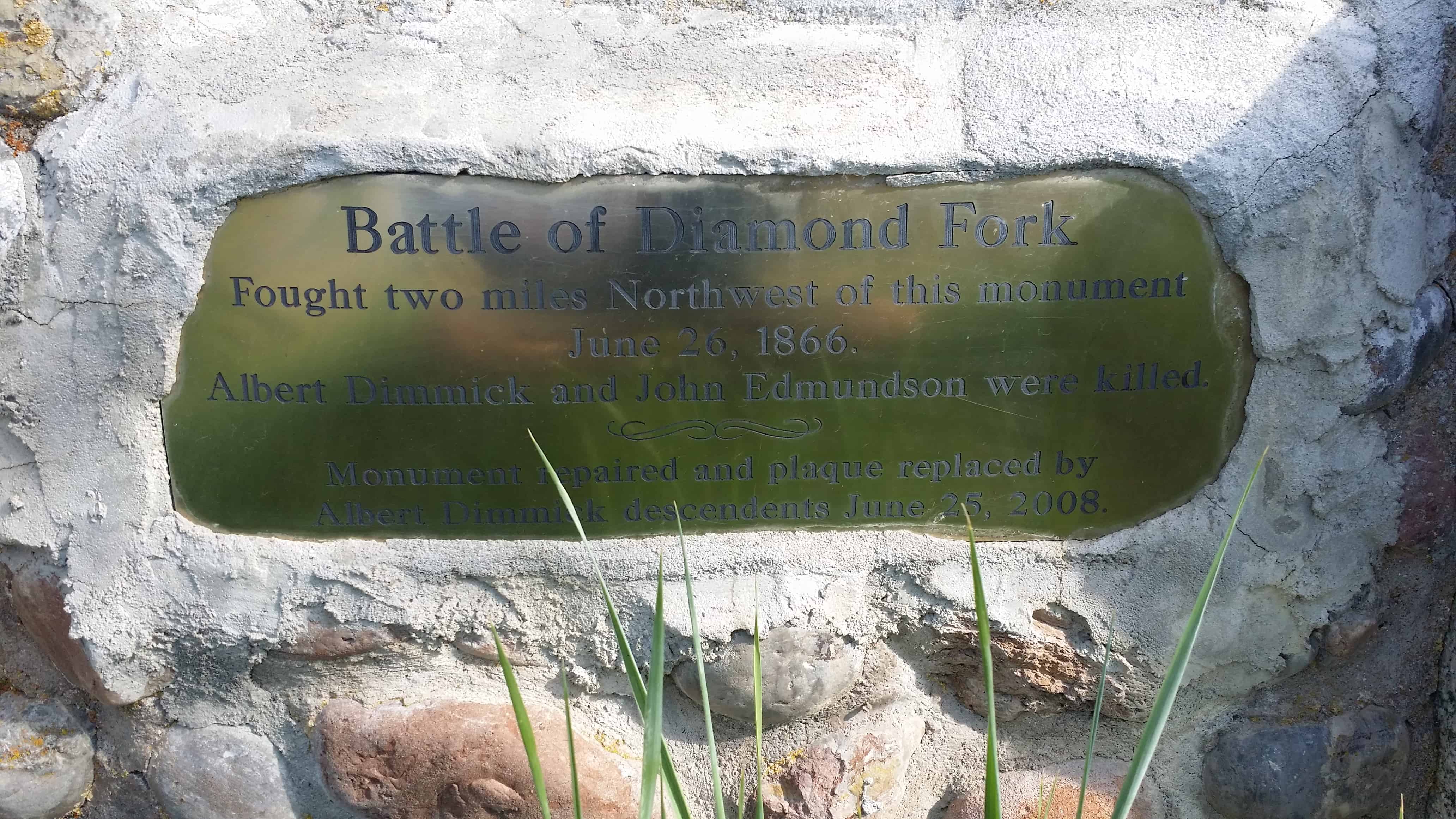
Today I decided to go back up Diamond Fork Canyon to the Diamind Battle stone marker and look around, the story is that back in 1866 during the Black Hawk War there was a battle here. I’ll post my photos and then some stories and links I’ve found useful.
See other historic markers in the series on this page for SUP Markers.
June 1866 brought the Uintah Utes into the conflict. Up until that time a few hot-headed young fighters joined Black Hawk but Chief Tabby and others had kept the Utes in the Uintah Valley reservation out of the war. The call for an additional 350 men from Salt Lake and Davis Counties to strengthen Mormon settlements angered Tabby and his fighters. But Black Hawk’s brother, Mountain, Isaac Potter and Richard led separate war parties toward Utah Valley. They found a Nauvoo Legion detachment at what is now Indianola and attacked. The pinned the militia down for most of the day, but a second detachment under John L. Ivie arrived late and kept the first detachment from being overwhelmed. The soldiers were convinced that Chief Tabby had led the attack. When and additional 130 men under Warren Snow arrived, it was agreed to chase the Utes up Spanish Fork Canyon. Fearing another Salina Canyon disaster, the troops moved cautiously but on arriving at Soldier Summit Pass found that the Utes had split up and gone in different directions. He turned his men around and marched them back to Sanpete Valley.
Mountain had led his men to Spanish Fork to exact vengeance on William Berry who years before had beaten Black Hawk with an old bucket for a supposed theft. They killed Berry and drove off about forty cattle and horses and fled into the Wasatch Mountains through Maple Canyon. The militia, who were already on alert, gave chase. They intercepted the Utes at Diamond Fork River but were outnumbered and pinned down by desultory rifle shots and arrows. A second force of eight men rushed the Utes and three were shot dead. The others put the Utes in a crossfire. The Utes quietly withdrew leaving the livestock and camp to be plundered by the militia. Among the gear they found US issued items, which showed the Utes had been accepting food and supplies at the Uintah Reservation. Leaders of the militia swore affidavits that white men had been seen directing the Utes. It was feared that the US Indian officials were aiding and abetting the Utes in their war against the Mormons.
These incidents were a turning point in the war. Mormons had begun to be vigilant as Brigham Young had repeatedly encouraged them to do. Fort building and evacuations of small settlements, combining livestock herds under guard, and the hundreds of additional soldiers patrolling commonly used canyon trails stymied the ability of Utes to drive off the numbers of cattle and horses of the first two years in the war. Tabby used his influence after the defeat of the reservation Utes to keep most of his people out of the conflict. It would not be until 1872 in the final days of the war that reservation Utes caused any more trouble. The ‘defeat’ of the reservation Utes encouraged Mormons to continue to prevent attacks whenever possible.(*)
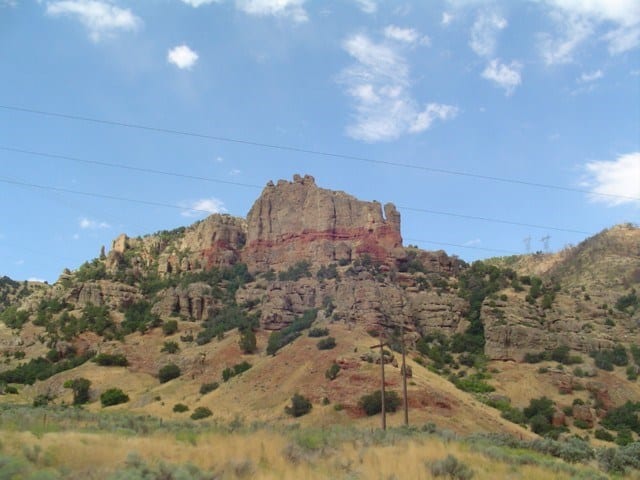
Up Diamond Fork Canyon there is a place to stop called Red Ledges, there are picnic tables, a restroom, an arch, a cool sun and moon carving in the cliff and a lot of fun hiking on red rock.
It’s fun to have a red rock playground like St George or Moab but so close to Utah Valley, we take the kids there and play.
There are often people rappelling down the cliffs too.
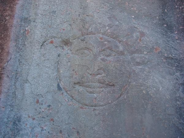
Up Diamond Fork Canyon (Off of Spanish Fork Canyon) you can go to Red Ledges and hike up into the red rock and see a sun and moon carved in the cliff. I’ve read books that claim the sun carving is a clue from the Spaniards to their old gold mines, I have heard that the moon appears to be more recent and not authentic.
My friend Russ Eager told me that he’s seen a sun carving across the canyon from this one, I’d love to go see it.
Either way it’s a pretty cool thing to see and red ledges is a fun place to play.
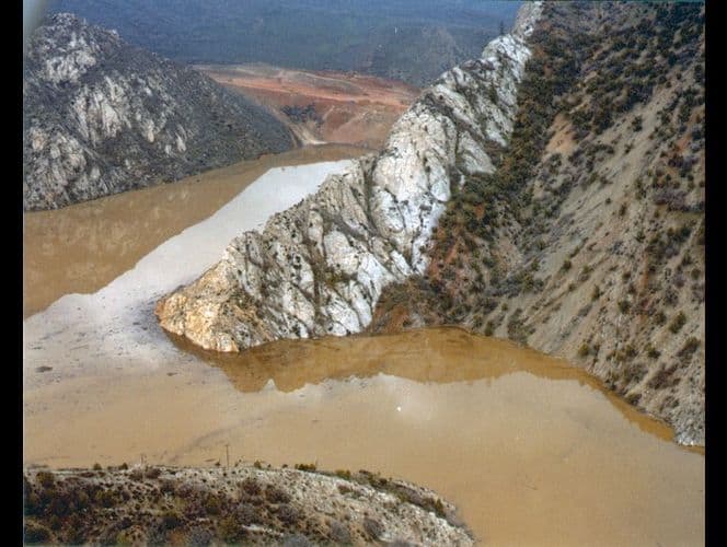
In April, 1983 a massive landslide dammed the Spanish Fork River. Residents evacuated as the valley filled with water backed up, flooding the town and destroying the town. It was the first presidentially declared disaster area in Utah.
There are a few structures remaining, you can see a few in this video.
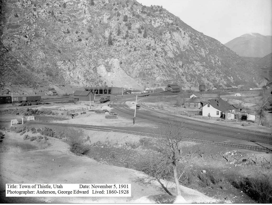
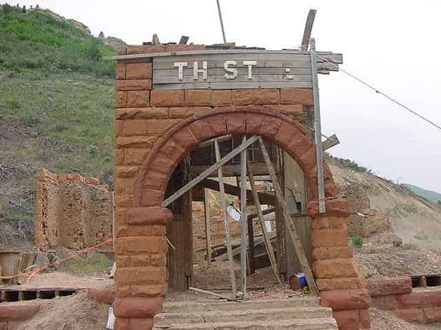
In 1983 the town of Thistle, Utah, known to many highway travelers as the small community where both the Spanish Fork River and nearby U.S. highways branch, was eliminated by the most costly landslide on record in the United States.
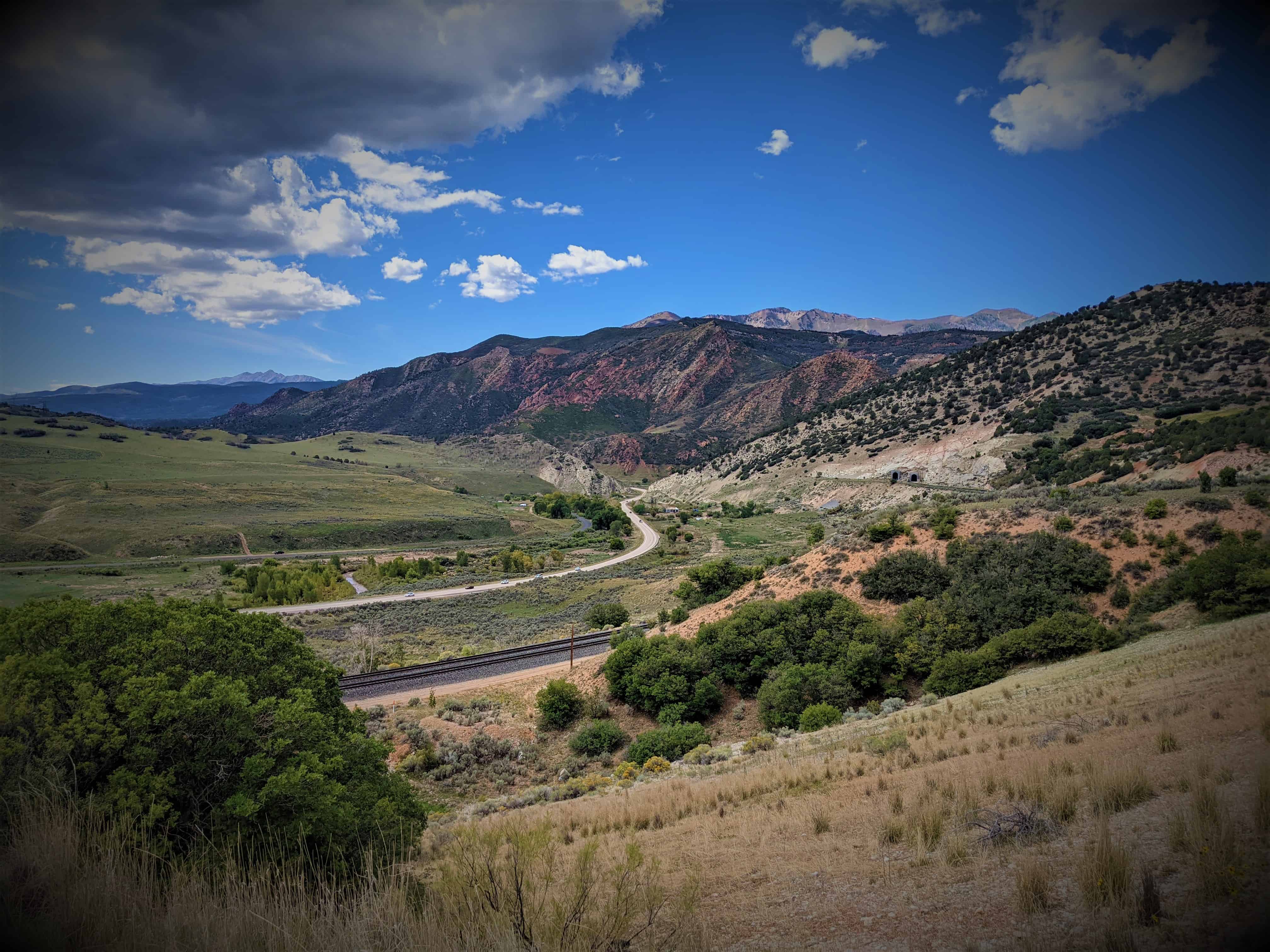
Thistle was located at the triple junction of transportation systems leading south to Sanpete County, east to the coal counties of Carbon and Emery and points beyond, and northwest to the Wasatch Front and Salt Lake City. Two major highways converged at Thistle (U.S. Highways 89 and 6). Until the landslide, two rail lines also converged at Thistle–the main line of the Denver and Rio Grande Western Railroad (D&RGW) joining Denver and Salt Lake City, and a branch line to Marysvale.
Ironically, the main line of the D&RGW railway from Denver to Salt Lake City follows the Soldier Creek and Spanish Fork drainages because of, rather than in spite of, landslides. Few corridors through the Rocky Mountains accommodate the gentle gradients required by railroads. Less stable landforms susceptible to landslides have eroded and formed the gentler terrain that allows modern rail passage. The advantages of this route had long been known. Undoubtedly the local Native Americans who guided the Spanish explorers traveled this route. Later trappers and pioneers used this natural corridor for their trade and transportation needs. The name “Spanish Fork” refers to the early exploration of the area by the Spanish, specifically Dominguez and Escalante in 1776 as they sought a trading route from Mexico to California. Soldier Creek is named for the route taken by federal troops as they moved through the area in the mid-1800s.
Thistle became an important junction on the railroad with the 1890 completion of a branch line south through Sanpete Valley. When the Utah Railway Company began to construct its own line in 1912, a second set of tracks up Spanish Fork Canyon to Helper, the D&RGW contracted to maintain the tracks for joint use and to maintain the Marysvale line. Ninety years later, because the Thistle landslide buried the exact junction and joint tracks, the two companies fought out legal responsibilities and insurance claims in the courts.
The town of Thistle expanded and contracted with the fortunes of the railroad. The town saw its heyday in the early 1900s. Six hundred residents lived in Thistle in 1917. Changing economics and technologies reduced the need for an active rail town with its large depot, water and coal supplies, roundhouse, and supporting stores, post office, schoolhouses, and saloon. The depot was torn down in 1972. Shops closed, and even the post office closed in 1974. A few families stayed; others moved in. In March 1983, fifty residents in a dozen houses claimed the town of Thistle as their home.
For a century, the D&RGW competed with the Union Pacific for traffic from Denver to Salt Lake City. Mineral, energy fuels, and manufacturing products dominated the railroad’s freight and revenues. Eastern Utah mines generated almost half of the freight tonnages. During the 1950s the railroad branch from the Sanpete-Sevier region carried manufactured wallboard, as well as mine and agricultural products. However, by 1983 trains to Marysvale were infrequent and the Thistle landslide provided the coup de grace for the D&RGW to obtain permission to close the unprofitable line. The landslide prematurely shut down the D&RGW Zephyr passenger service and delayed the start of Amtrack’s “California Zephyr” service on the D&RGW main line.
Storms heralding the 1982 to 1986 wet cycle kicked off the wettest month ever recorded at the Salt Lake City International Airport in September 1982, and saturated the ground before the winter snows. The winter was neither exceptionally wet nor cold. However, snows and cold nights continued late into April and May 1983, and resulted in an unusually late and sudden snowmelt when temperatures did warm up. May snowpacks of northern Utah averaged two to three times their normal. Utah’s landslide problems correlate with precipitation and snowmelt. Two large landslides in the early spring alerted geologic experts to the situation. The National Weather Service briefed local and national officials about the unusual conditions. Yet even with the geologic and climatic indicators, the events of April, May, and June caught the state by surprise.
Starting in January, the D&RGW watched the Thistle area as well as several other landslide-prone areas near Soldier Summit. Their geotechnical experts visited the area on April 12. Days later, when the Thistle landslide began to move visibly, no one recognized it as a major hazard. The railroad tracks went out of alignment on Wednesday, 13 April. The highway became bumpy, fractured, and became impassible on Friday, 15 April. The streambed and deposits on the canyon floor rose approximately one foot an hour as a huge tongue of earth piled up against the bedrock buttress of Billies Mountain, filled the canyon, and dammed the river. The waters of the Spanish Fork River rapidly created Thistle Lake upstream of the landslide dam.
The railroad company and the Utah Department of Transportation (UDOT) initially tried to keep the railroad tracks, highway, and river open. Sunday, 17 April the landslide defeated efforts to cut down through the rising toe of the landslide and allow passage of the river water. Efforts to siphon waters rising behind the landslide dam also failed. Rising lake waters drowned the community of Thistle. That very day, the president of the D&RGW announced at Thistle that the railroad would tunnel a new railroad course through Billies Mountain. To be successful, the tunnel had to be above Thistle Lake’s eventual highest water line. Railroad experts in consultation with the state decided to form the landslide into a dam and to construct an overflow spillway tunnel to control the uppermost rise of the lake. Having calculated how fast an overflow tunnel could be constructed, and how fast the lake would rise, they began drilling. The state took charge of public safety priorities. Armies of workers and heavy equipment shaped the landslide dam while it moved by transferring 500,000 cubic yards of earth from the middle area of the landslide onto its toe. This also provided a platform from which to construct the tunnels. The state constructed a third tunnel to drain the impounded water. UDOT decided to relocate the highway over Billies Mountain. The Army Corps of Engineers constructed a pumping system to keep Thistle Lake from rising to dangerously high levels.
The impounded water rose at approximately the rate predicted and the D&RGW contractors completed the overflow tunnel system with two days to spare. Trains passed through the new tunnel on 4 July, eighty-one days after the initiation of the project and eleven days before the contracted completion date. The new tunnel provided a permanent bypass for the Spanish Fork River around the landslide. The relocated highway encountered difficult geotechnical problems. The highway opened at the end of the year but was often closed due to major rockfalls and slope stability problems.
The town of Thistle was destroyed. The Marysvale branch line of the railroad was never reopened, leaving a large area of central Utah without rail service. Thistle resulted in Utah’s first presidential disaster declaration and became the most costly landslide the United States had experienced. The Utah Business and Economic and Research Bureau reported the following dramatic impacts of the landslide. The D&RGW and Utah Railway embargoed all shipment that normally went through Thistle. The rerouting surcharge of $10 per ton virtually stopped coal shipments. Two trucking companies laid off workers, cancelled contracts, and even suspended operations. Most of the area’s coal mines laid off miners, cancelled contracts, and experienced shut downs. Some miners’ commutes suddenly exceeded 100 miles. Some coal haulage commutes trebled. Due to market conditions and the Thistle landslide, coal production dropped nearly 30 percent in 1983. Uranium producers paid substantially more for supplies in an already soft market. At least one oil company became non-competitive due to increased travel costs. Tourism in the area, particularly in-state tourism, sagged in response to negative publicity and difficult access. To the south, the blockage of route 89 and the Marysvale line hurt coal companies, turkey and feed operations, and gypsum, cement, and clay shipments.
The Thistle landslide caused total estimated capital losses of $48 million and revenue losses of $87 million, plus associated losses in tax revenues. Direct costs of Thistle tally over $200 million, including relocating the railroad at a cost of $45 million, relocating the highway at a cost of $75 million, and lost revenue to the railroad of $1 million per day (which totaled $80 million, including $19 million in charges that the D&RGW paid the Union Pacific to use their rail lines).
This is what it looked like in 2001 when I first explored it: