The first yearlong abode of white men in what is now Utah, was Antoine Robidoux’s Indian and fur trading post (Fort Wintey or Uintah), which was built 8 miles north of here in 1832. It was on the trail from Taos, New Mexico to the Pacific Northwest, and from Utah Lake to the Platte River region. Many Trappers traded and wintered here. Several distinguished travelers sojourned here, including Kit Carson, Joseph Williams, Rufus B. Sage, Marcus Whitman, A. L. Lovejoy and John C. Fremont, all prior to the burning of the post by Indians in 1844.
August 20, 1886, two companies of colored infantry commanded by Major F. W. Benteen and four companies of infantry under Captain Duncan arrived at this site to control the activities of the Indians. There were three bands of Utes – Uncompahgres, Whiterivers and Uintahs. The troops hauled logs from nearby canyons, built living quarters, commissary, storehouses and hospital, thereby establishing Fort Duchesne. Abandoned in 1912, now headquarters for the Uintah Reservation.
Daughters of Utah Pioneers historic marker #315 (see others on this page) located in Fort Duchesne, Utah.
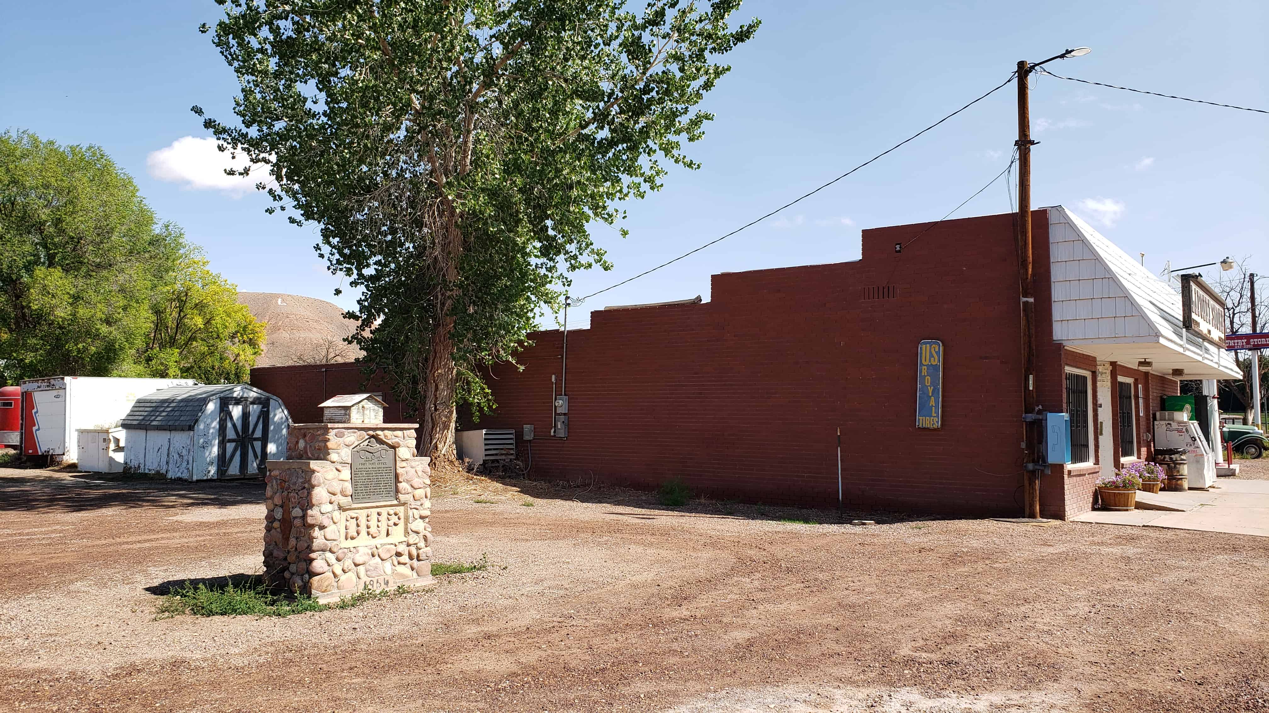
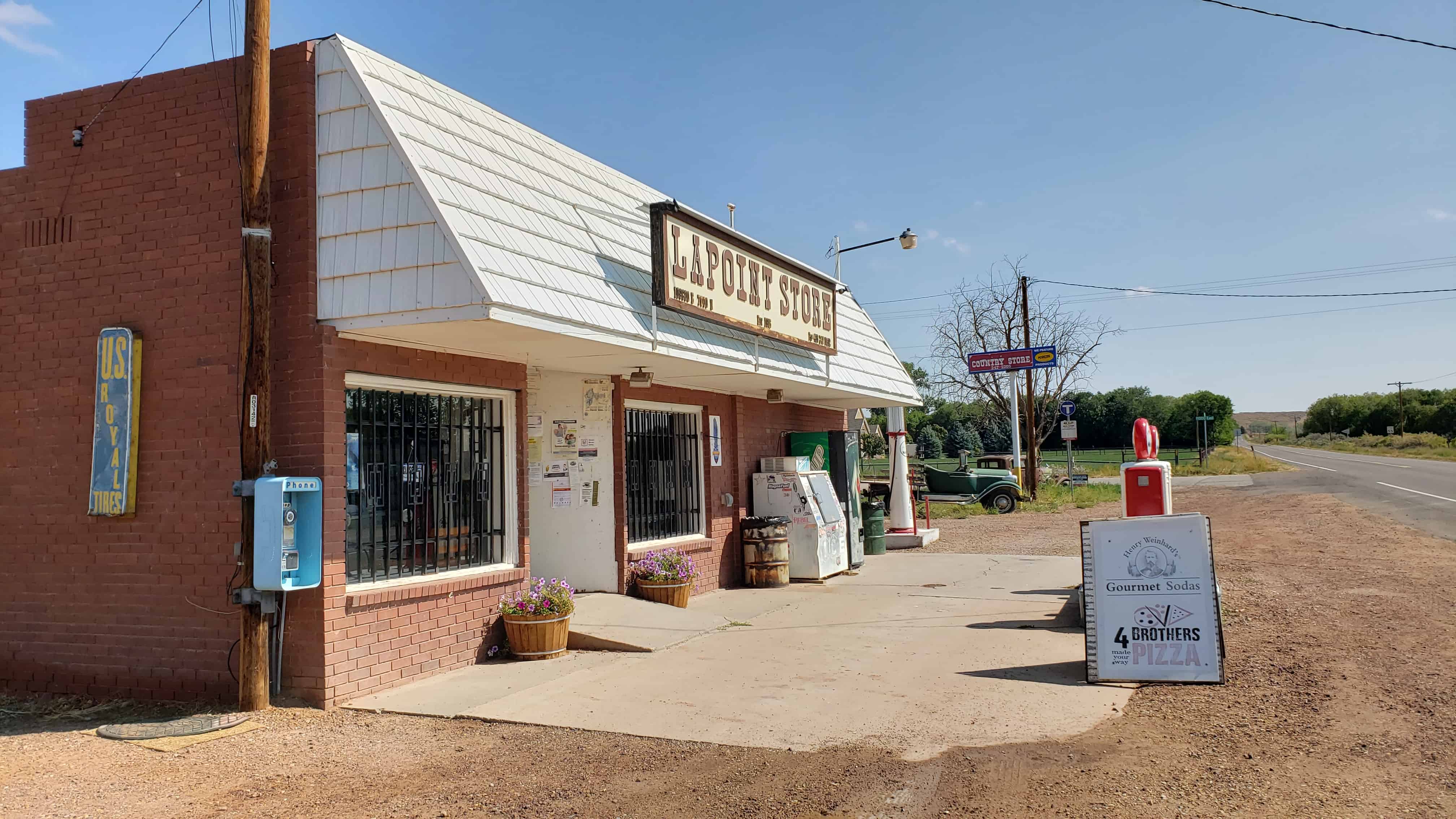
In August 1905 the Uintah Indian Reservation was opened to white settlers who came and built homes. They organized Whiterocks Irrigation Company, built a canal and raised crops. In 1908 a post office and store was built at Taft, one mile south of here by Maylus E. Sprouse who was the first postmaster. Roy Warburton carried the mail from Vernal on horseback, making three trips each week and Warren Ross carried mail to and from Fort Duchesne. In 1915 the settlement of Taft was moved and renamed Lapoint.
This historic marker is #300 by the D.U.P., located at the Lapoint Store at 109800 East 7000 North (Highway 121) in Lapoint, Utah.
The Reservation was thrown open for homesteading in August 1905
First Settlers
James Harrison built a log cabin on the bank of Deep Creek and moved his family there on the 13th of Mar 1906. Harmon Mullins and William Sprouse also built one room log and lumber cabins on their homesteads and moved their families in on the 18th of April 1906. Grandma Daniels (six miles away) was their closest and only neighbor Archie Lee Searle (Headstone below) was the first grave to be placed in the Lapoint Cemetery
Completed Sept 10th 1965 Dedicated Nov 7th 1965 Built and dedicated by J. M. Rasmussen
The Dry Fork Valley Petroglyphs are probably among the most photographed, well- publicized and best known examples of aboriginal rock art in the state of Utah and in the Western United States. The site was thoroughly photographed by Albert Reagan in 1931, who published his material in numerous journals (Reagan 1931, 1932, 1933). Frank Beckwith’s work also helped make the site famous, calling it the “best in the state” (Beckwith 1935:40). The site is considered to be the type site for the Vernal Style, attributed to the Fremont Culture, but it may be pre-Fremont. Wormington has the following comments on the petroglyphs in the Vernal area: “In Dry Fork Canyon, 8 miles from Vernal, Frank Beckwith found numerous pictographs (Beckwith, 1955). Two panels are shown in Fig. 59 (p. 145). The shape of the bodies, the elaborate necklaces and belts, the horned headdresses, and the lines below the eyes all suggest Fremont work. It is interesting to note the presence of two crownlike headdresses. The magnificent headdresses of flicker feathers found in Mantle’s Cave and a similar specimen reported from the Fremont area would probably be depicted in such a manner. The head carried by the individual in the lower panel is also of interest. It could be a mask, but masks are not likely to have necks. Perhaps, as Reagan and Beckwith have suggested, it represents a trophy head. The head in the upper panel is more mask-like.” (1955:145).
The evidence, however, does not clearly point to a specific Fremont cultural affiliation for this art style. The headdresses found in cave deposits noted above are probably associated with earlier Basketmaker components at the sites. In addition, the shield figures are found in a much wider area than that assigned to the Fremont Culture, as far north as Pictograph Cave in Montana. Many of the figures do closely resemble those found along the Fremont River, which are also generally ascribed to The Fremont Culture. Again, it should be noted that cave deposits adjacent to the panels in both Dry Fork and the Fremont River contain much cultural material that could be ascribed to an earlier Basketmaker II or III level of technology.
Thus, there is still considerable question regarding the exact dating, cultural affiliation, and meaning of this distinctive rock art. Nevertheless, there can be no question regarding its significance, aesthetic value, and importance for understanding the cultural affiliation of various prehistoric populations.
Located at 6228 McConkie Road in Vernal, Utah and added to the National Historic Register (#75001828) on September 25, 1975.
The site is located in Dry Fork Valley, a major tributary of Ashley Creek, a narrow valley with permanent water, approximately 8 miles northwest of Vernal. The site consists of numerous separate panels along the base of the yellow Navajo sandstone cliffs which form the north and east side of the Dry Fork Valley. The panels are scattered along the cliff for about 2 miles, with the greatest concentration behind the McConkie ranch house. There is a long talus slope below the cliff which is about 100 to 150 ft. high. The site overlooks the whole lower portion of the Dry Fork Valley.
This site, one of the most well-known in the Western United States, is considered to be the type site of the Vernal Style. It is characterized by elaborate anthropomorphs, generally with trapezoidal bodies, headdresses, necklaces, earrings, kilts and other decorations. They commonly hold shields and masks, the latter have been interpreted by many as severed heads (Wormington 1955:145). By far, the main focus of the panels is on the elaborate anthropomorphs Every panel has several, and in many panels this is the only figure present. Animals are also present but they are insignificant, as are the occasional geometric designs. At least two of the panels show what are apparently bears, either “fighting” or “dancing” with the anthropomorphs. In general, the ornaments (necklaces, earrings, kilts, and headdresses) are more deeply carved than the anthropomorphs themselves. In several cases weathering has almost completely obliterated the figures except for these ornaments. Often, other anthropomorphs have been superimposed on these older figures. Red pigment is present on a few of the panels, but is badly faded. In some cases it was used to accentuate the carvings, on others if apparently represents all that remains of earlier pictographs.’ The panels resemble those in Nine Mile Canyon, to the south, in being small and scattered along the valley walls for a great distance.
During the I930’s, many of the panels were numbered by Albert Reagan and chalked in by Reagan or Frank Beckwith for identification and photographic purposes. Most of the chalking and numbers still remain. None of the panels appear to be marked by vandalism, and the site is very well protected by the McConkies who charge admission to the site and conduct tours. The site is presently visited by many hundreds of visitors each year and maps are available in Vernal giving directions to the site for tourists.
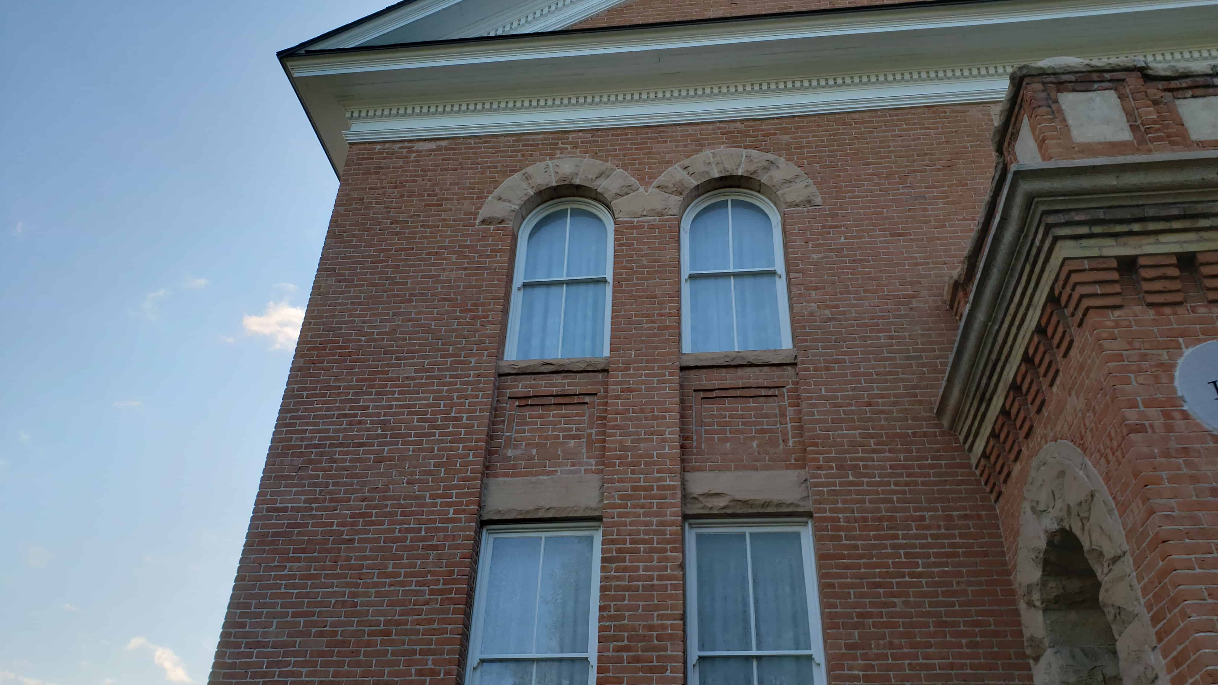
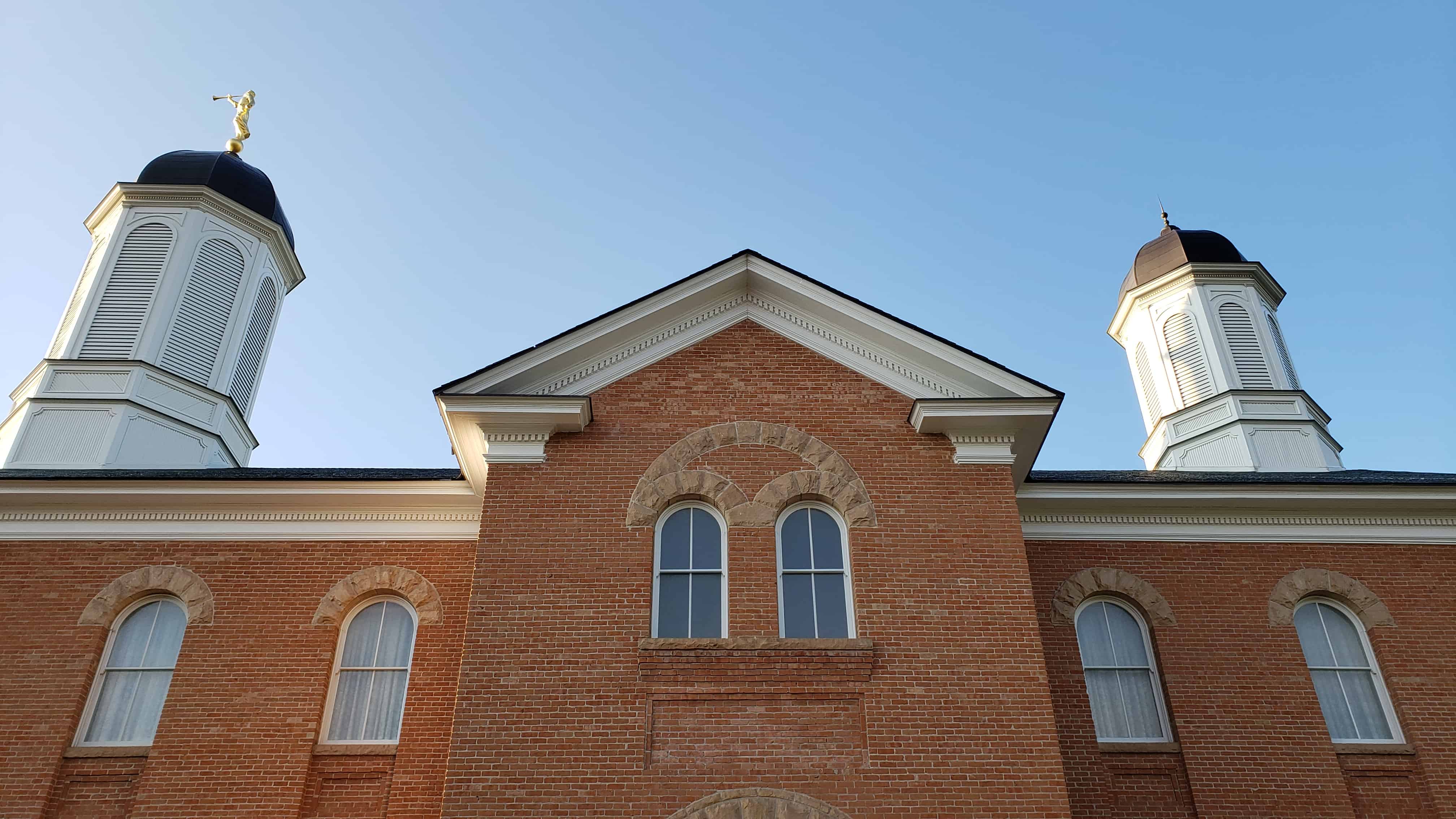
The Vernal Utah Temple of The Church of Jesus Christ of Latter-day Saints, formerly the Uintah Stake Tabernacle.
On February 13, 1994 it was annouced that the vacant tabernacle would be converted into a temple for the LDS Church.
The Uintah Stake Tabernacle is devoid of Gothic detail common in church architecture and is a more simplified and almost civic variant of the Georgian New England Church form. Of over forty tabernacles built in Utah, it is the only one existing in the eastern part of the state. Built during the years between 1900-1907, it is the most significant symbol of the Mormon culture in the Uintah Basin, one of Utah’s last frontiers to be settled by members of the Church of Jesus Christ of Latter-day Saints. The Uintah Stake Tabernacle is also on the Utah Register of Historic Places.
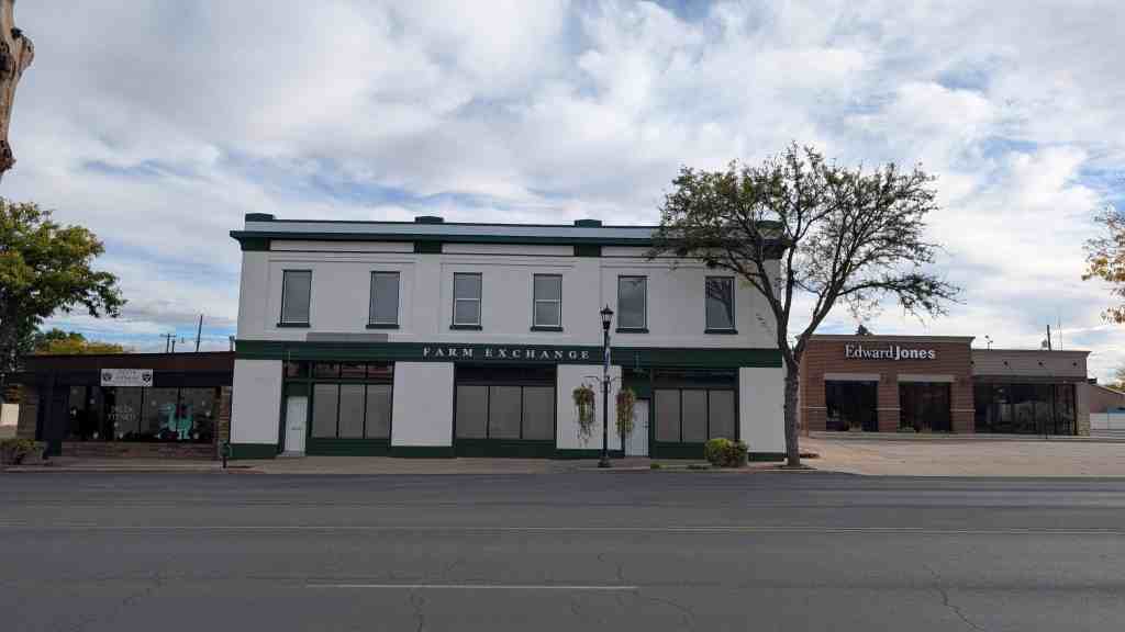
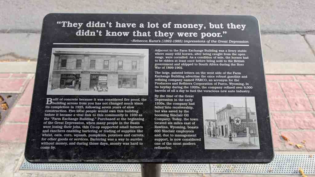
“They didn’t have a lot of money, but they didn’t know that they were poor.“ –Rebecca Kunz’s (1892-1985) impressions of the Great Depression
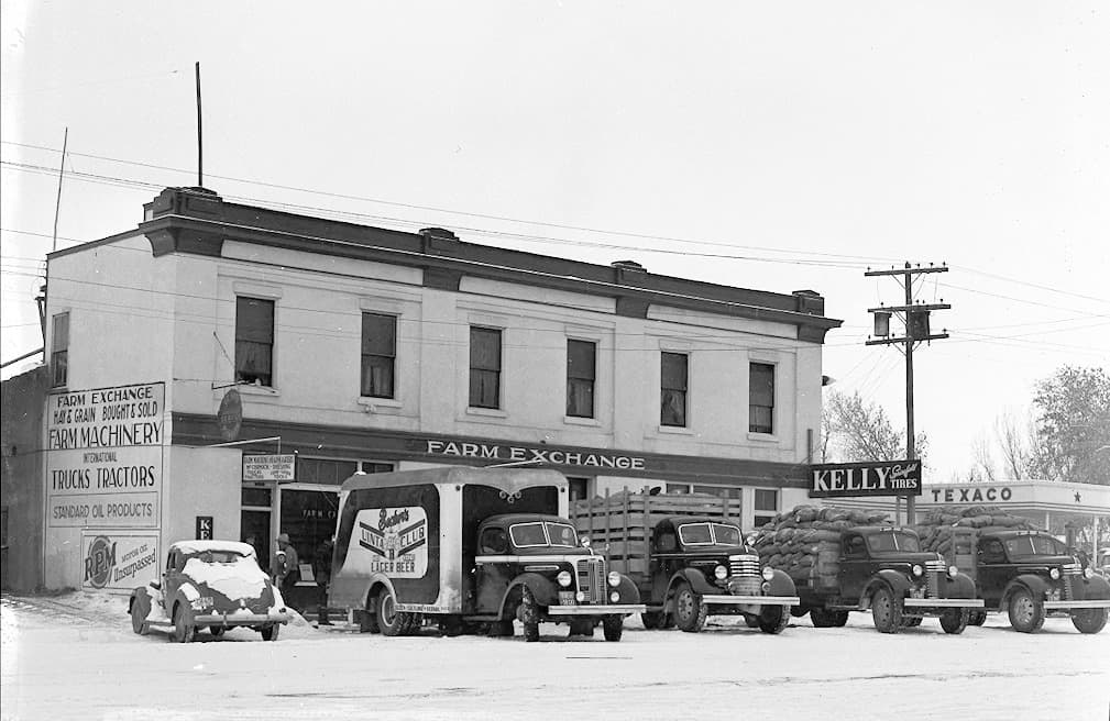
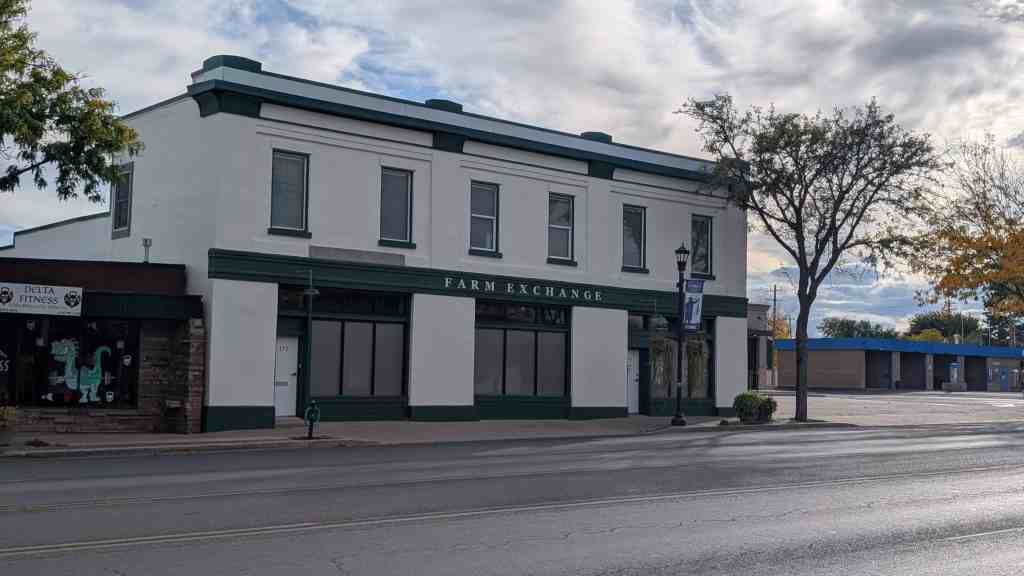
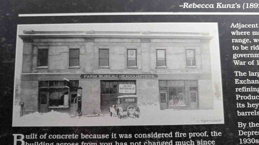
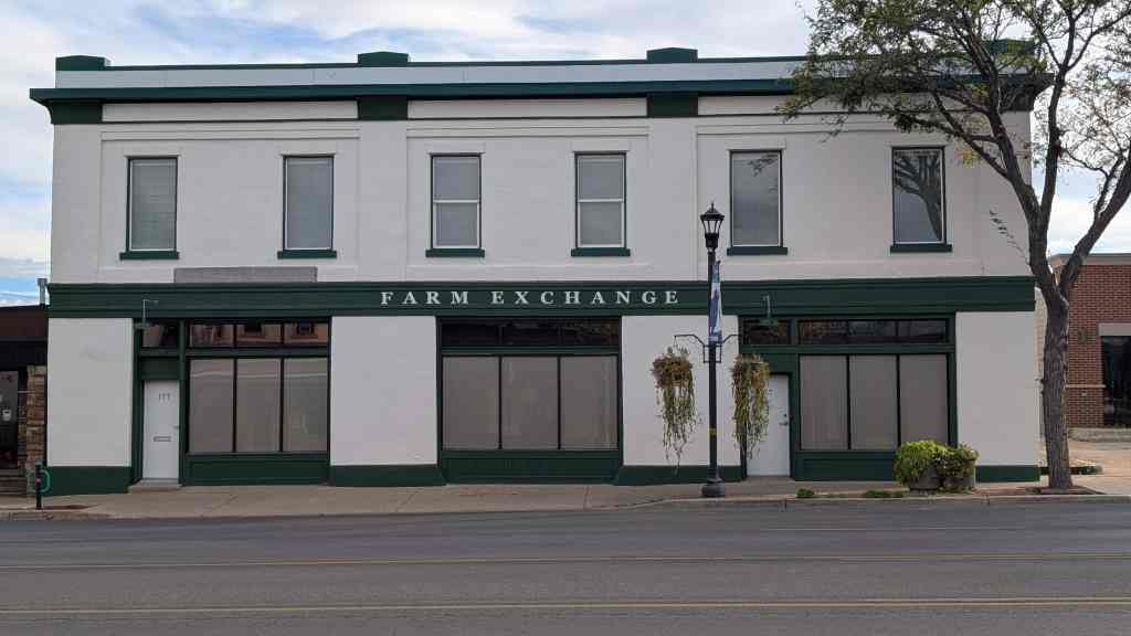
Built of concrete because it was considered fire proof, the building across from you has not changed much since its completion in 1925, following seven years of slow construction. Five local people would own this building before it became a vital link to this community in 1930 as the “Farm Exchange Building.” Purchased at the beginning of the Great Depression, when many people in the Basin were losing their jobs, this Co-op supported small farmers and ranchers enabling bartering or trading of supplies like wheat, oats, corn, squash, pumpkins, potatoes and carrots, for other goods or services. Bartering was a way to survive without money, and during those days, money was hard to come by.
Adjacent to the Farm Exchange Building was a livery stable where many wild horses, after being caught from the open range, were corralled. As a condition of sale, the horses had to be ridden at least once before being sold to the British government and shipped to South Africa during the Boer War of 1899-1902.
The large, painted letters on the west side of the Farm Exchange Building advertise the once robust gasoline and refining company named PARCO, an acronym for the Producers and Refiners Corporation of Parco, Wyoming. In its heyday during the 1920s, the company refined over 8,000 barrels of oil a day to fuel the voracious new auto industry.
By the time of the Great Depression in the early 1930s, the company had fallen into receivership, but was saved by the booming Sinclair Oil Company. Today, the town located six miles east of Rawlins, Wyoming, boasts 600 Sinclair employees and, due to management support, is now considered one of the most modern refineries.
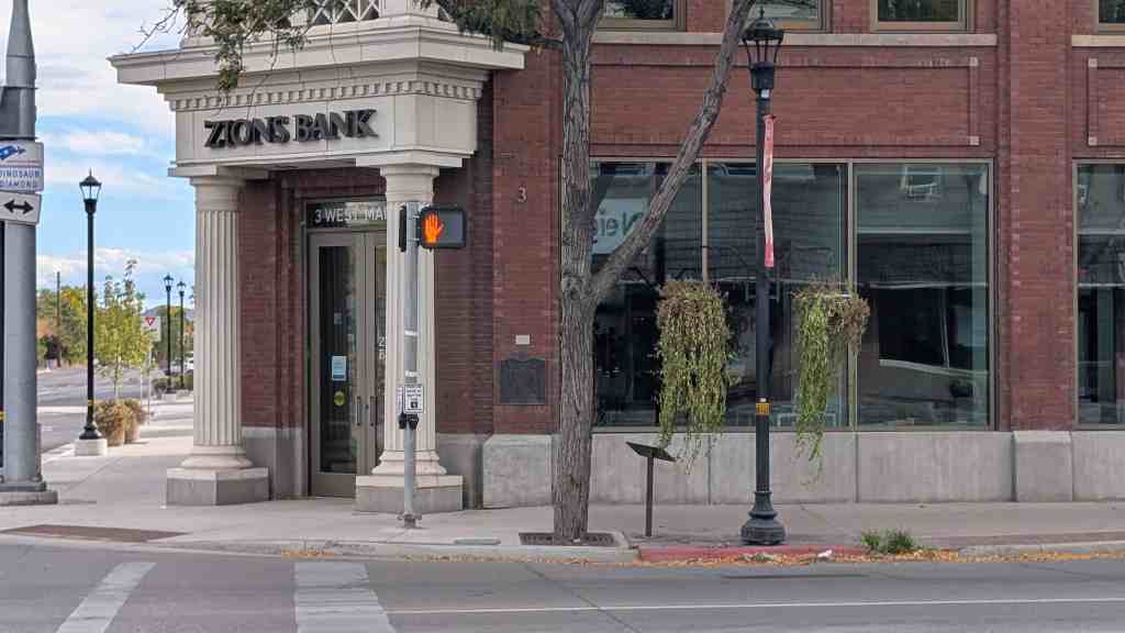
September 1886 Samuel R. Bennion was sent here to establish a banking institution called the ‘Ashley Co-op.’ In 1903 the first pioneer bank was opened for business. In 1916 W.H. Coltharp erected this building with Salt Lake City brick. A full car load of brick was used, each wrapped separately and sent Parcel Post U.S. Mail to Watson, Utah by train. From there they were hauled to Vernal by freight wagon and teams. It is known as the ‘Parcel Post Bank of the World,’ with N.J. Meagher, Sr. cashier, this bank has been a great factor in the development of Uintah Basin.
Daughters of Utah Pioneers historic marker #247, located at 3 W Main in Vernal, Utah.
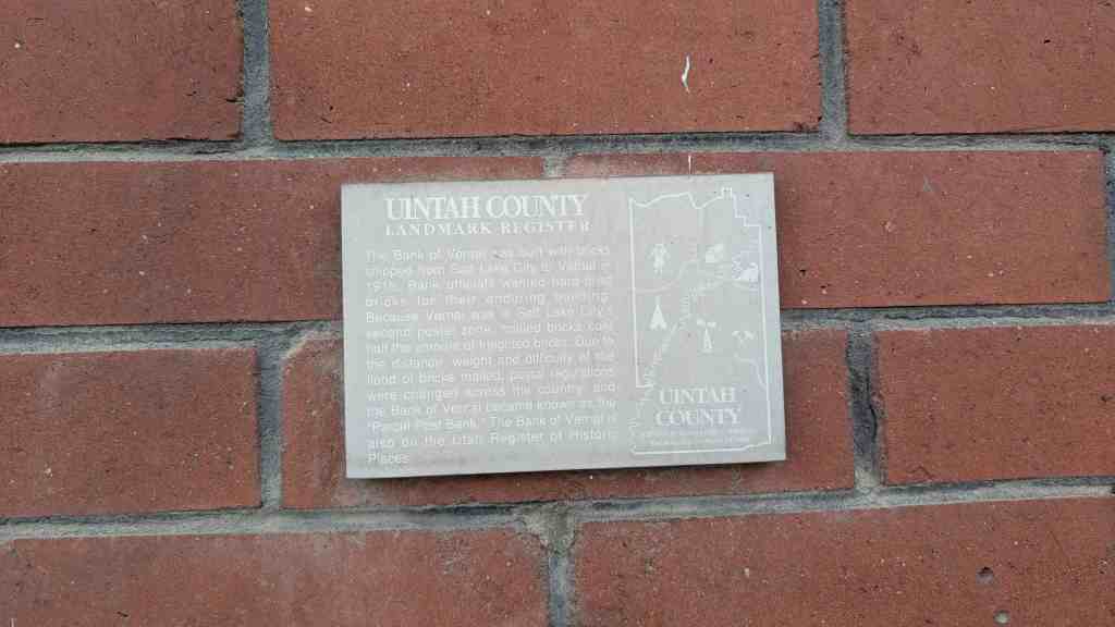
The Uintah County Landmark Register plaque on the building says:
The Bank of Vernal was built with bricks shipped from Salt Lake City to Vernal in 1916. Bank officials wanted hard-fired bricks for their enduring building.
Because Vernal was in Salt Lake City’s second postal zone, mailed bricks cost half the amount of freighted bricks. Due to the distance, weight and difficulty of the flood of bricks mailed, postal regulations were changed across the country, and the Bank of Vernal became known as the “Parcel Post Bank.”
The Bank of Vernal is also on the Utah Register of Historic Places.