• About JacobBarlow.com
  • Cemeteries in Utah
  • D.U.P. Markers
  • Doors
  • Exploring Utah Email List
  • Geocaching
  • Historic Marker Map
  • Links
  • Movie/TV Show Filming Locations
  • Oldest in Utah
  • Other Travels
  • Photos Then and Now
  • S.U.P. Markers
  • U.P.T.L.A. Markers
  • Utah Cities and Places.
  • Utah Homes for Sale
  • Utah Treasure Hunt

JacobBarlow.com

~ Exploring with Jacob Barlow

JacobBarlow.com

Tag Archives: Walker War

Mt Pleasant Relic Home

16 Monday Dec 2019

Posted by Jacob Barlow in Uncategorized

≈ 1 Comment

Tags

Historic Homes, Mt. Pleasant, Peace Treaties, Sanpete County, utah, Walker War

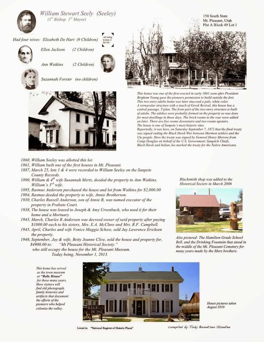
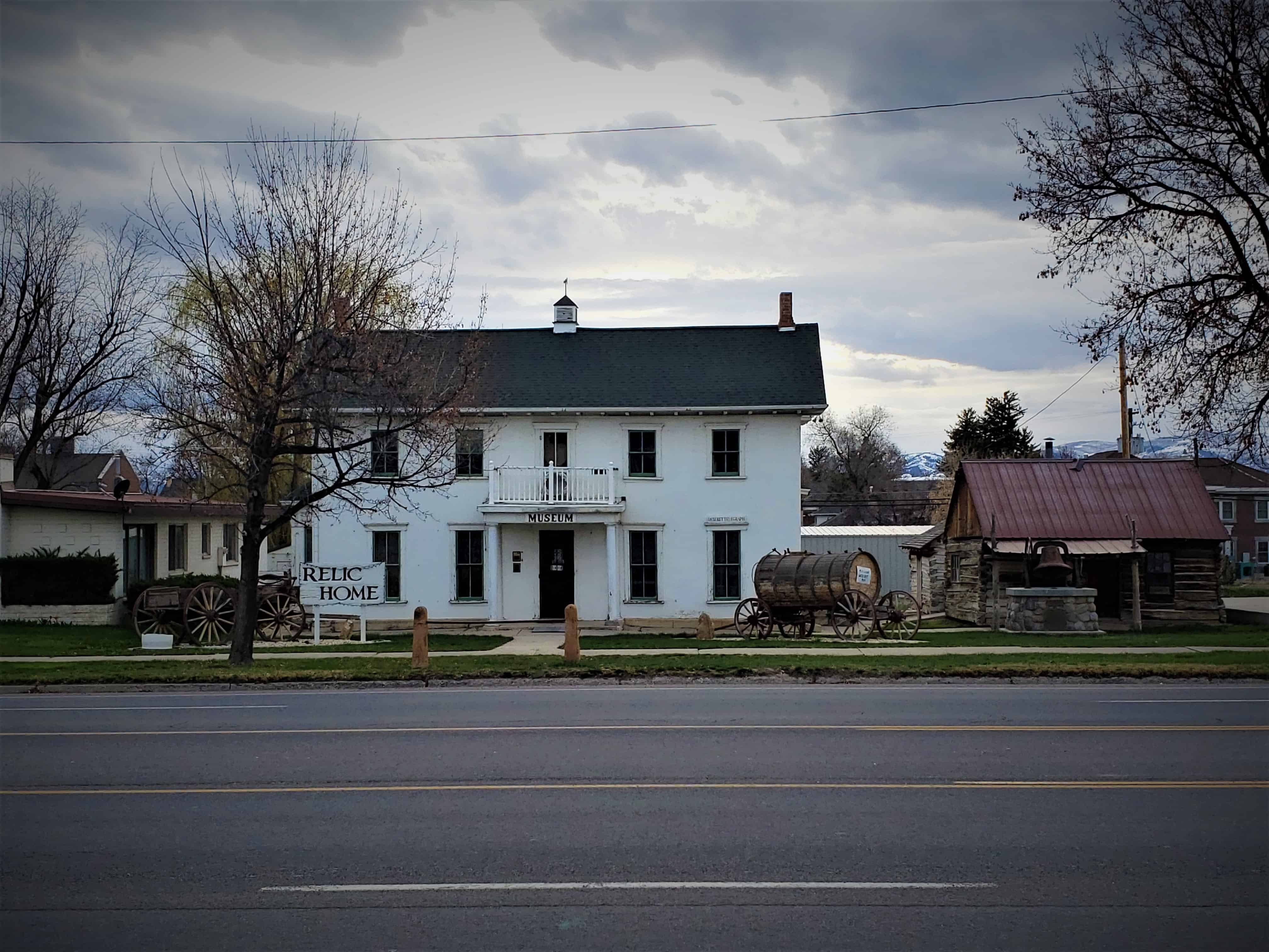
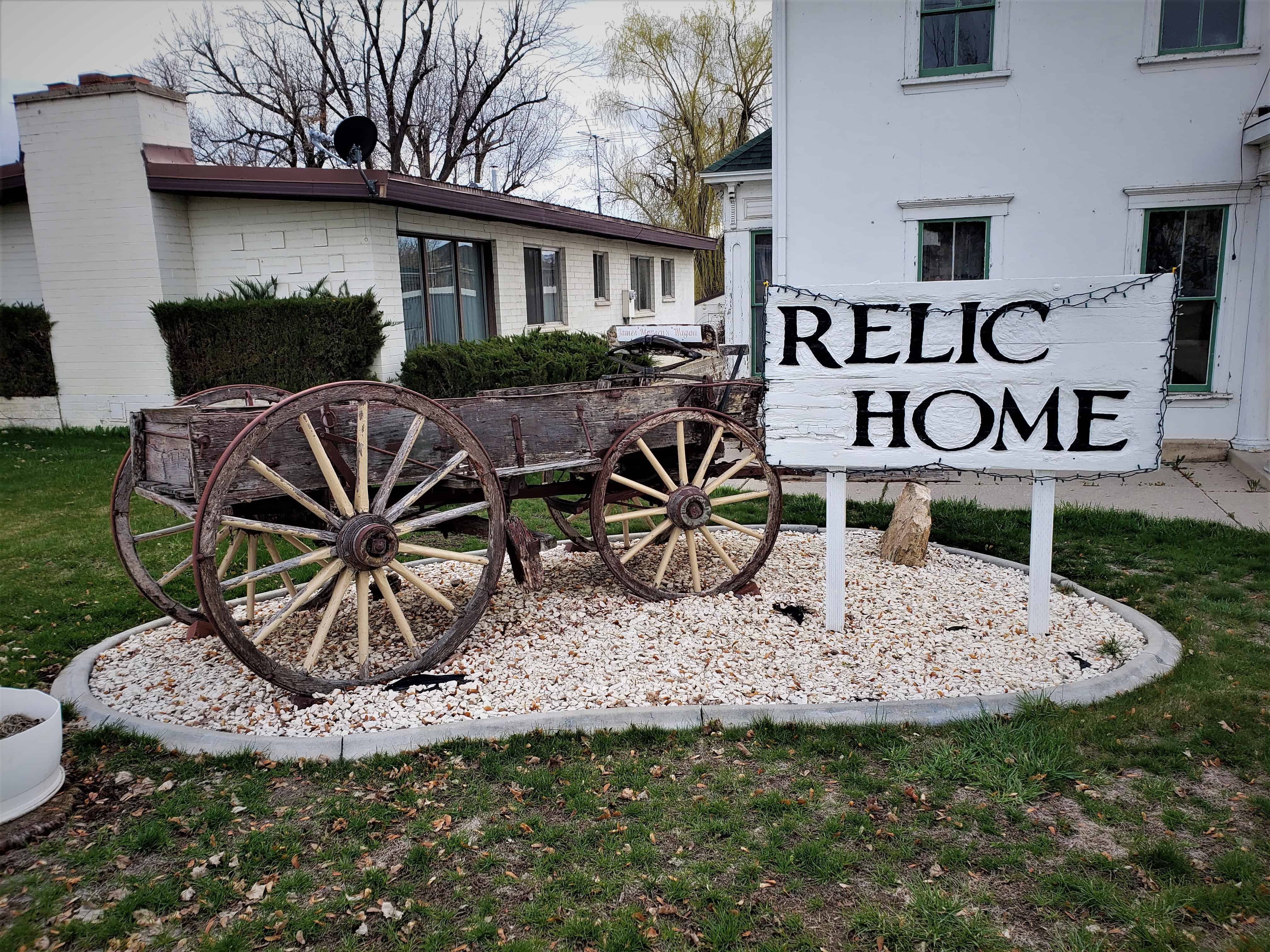
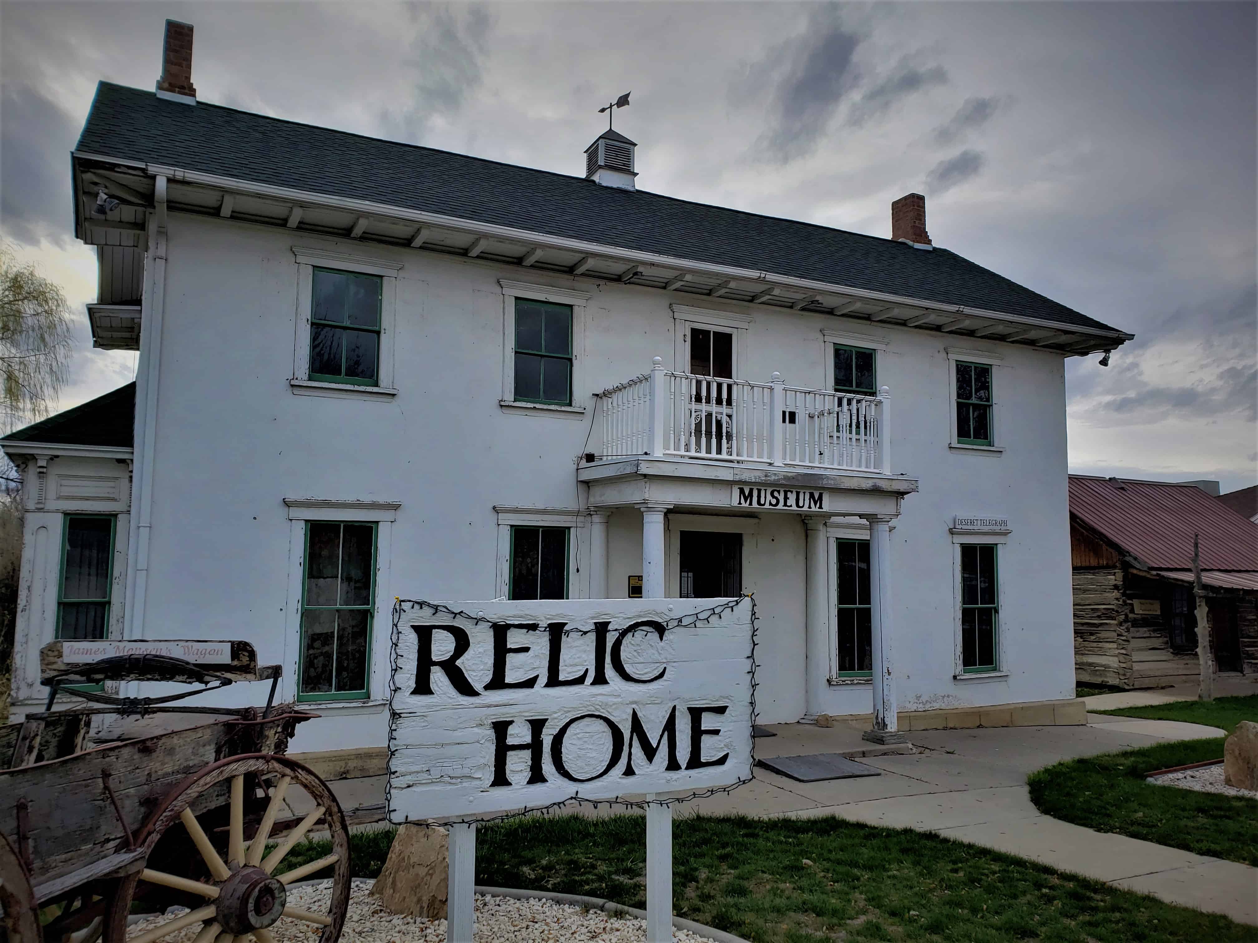
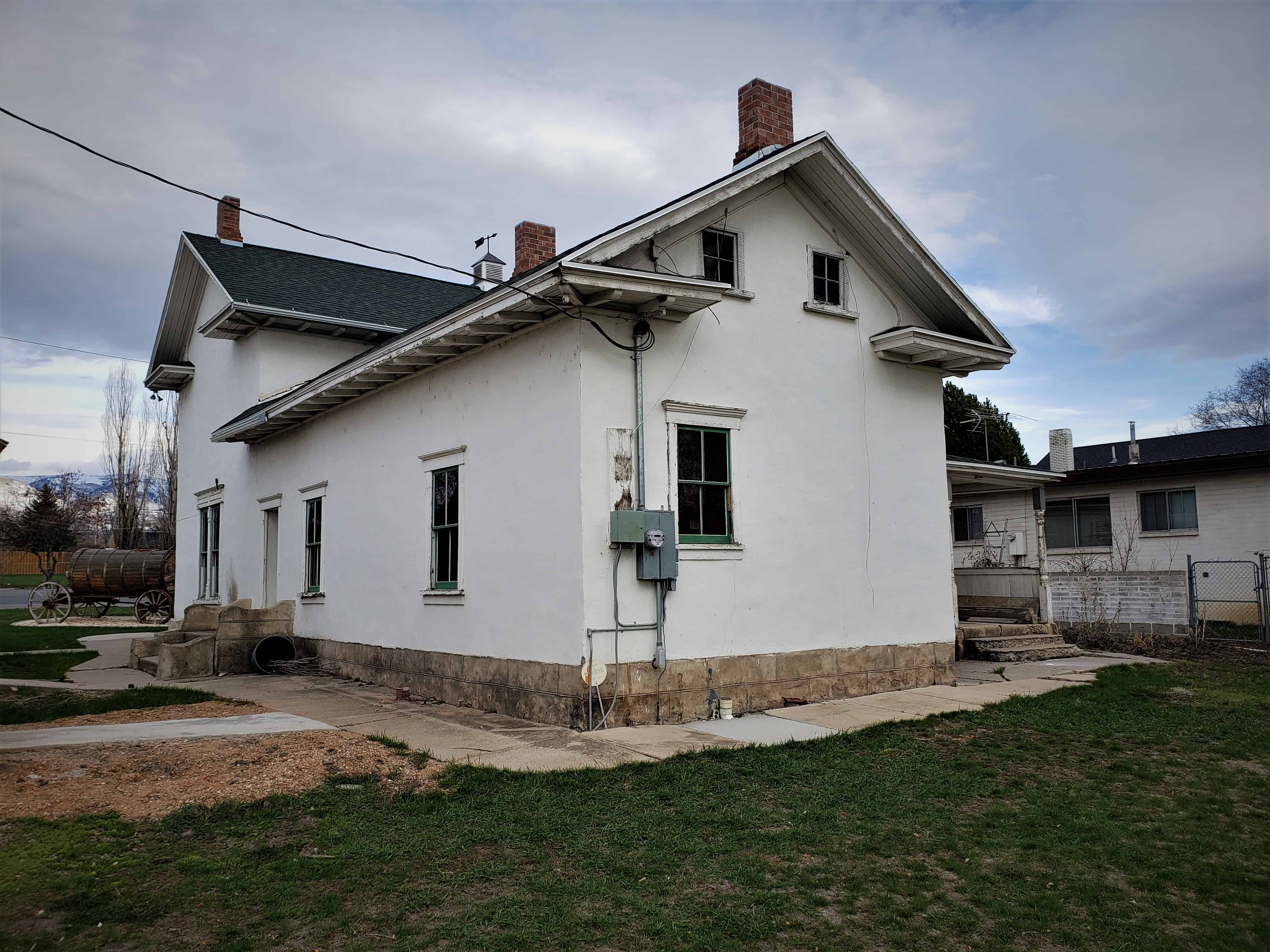
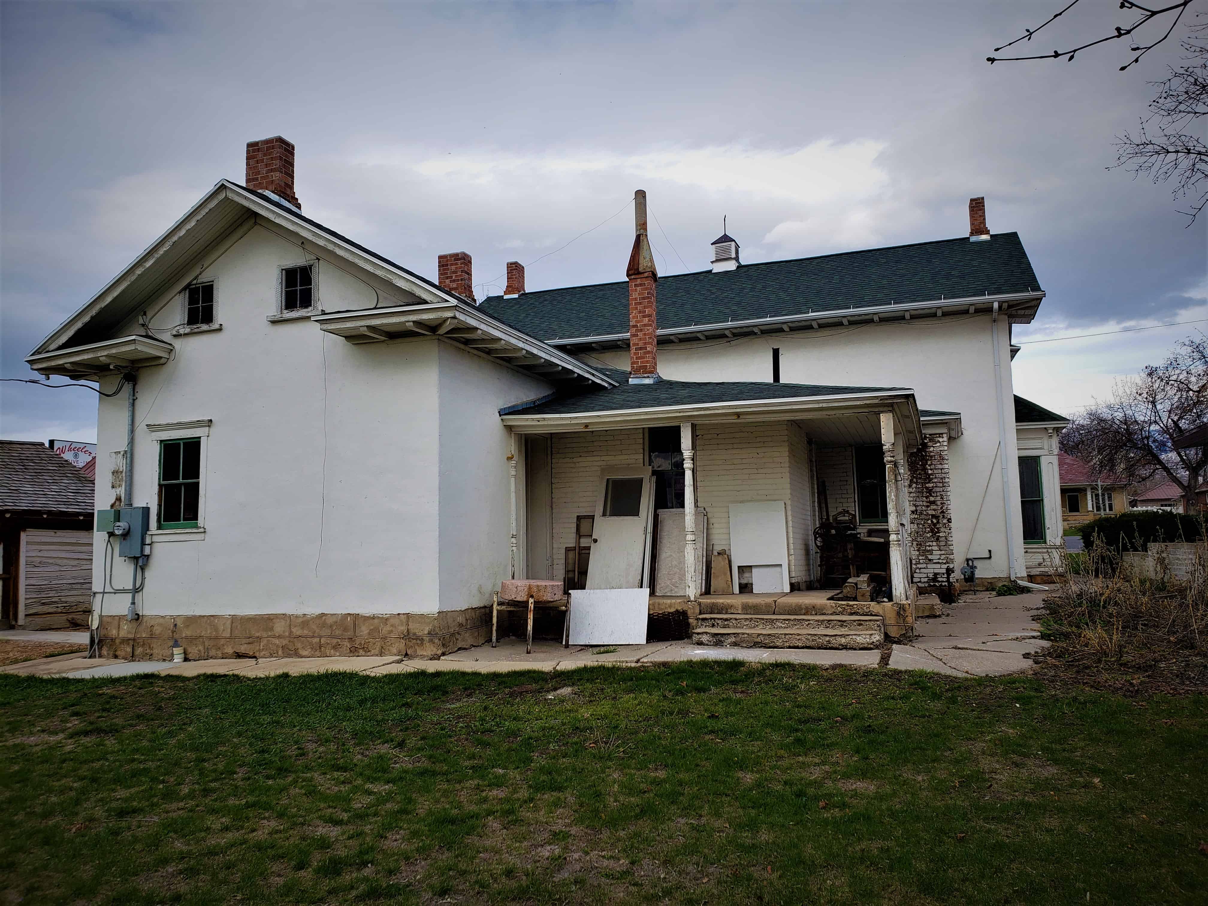
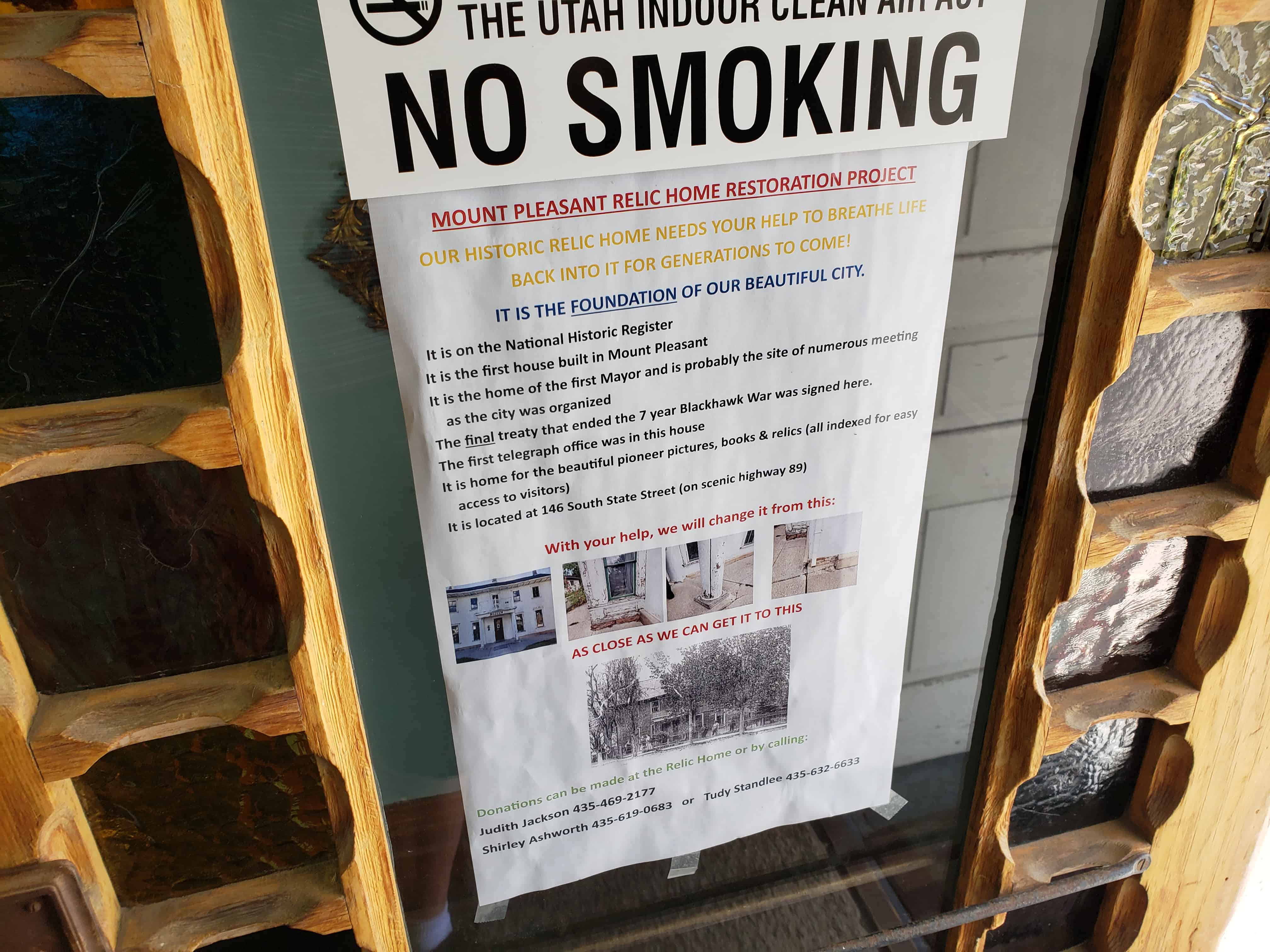
William Stuart Seeley House / Relic Home Museum

Mount Pleasant Utah’s First House

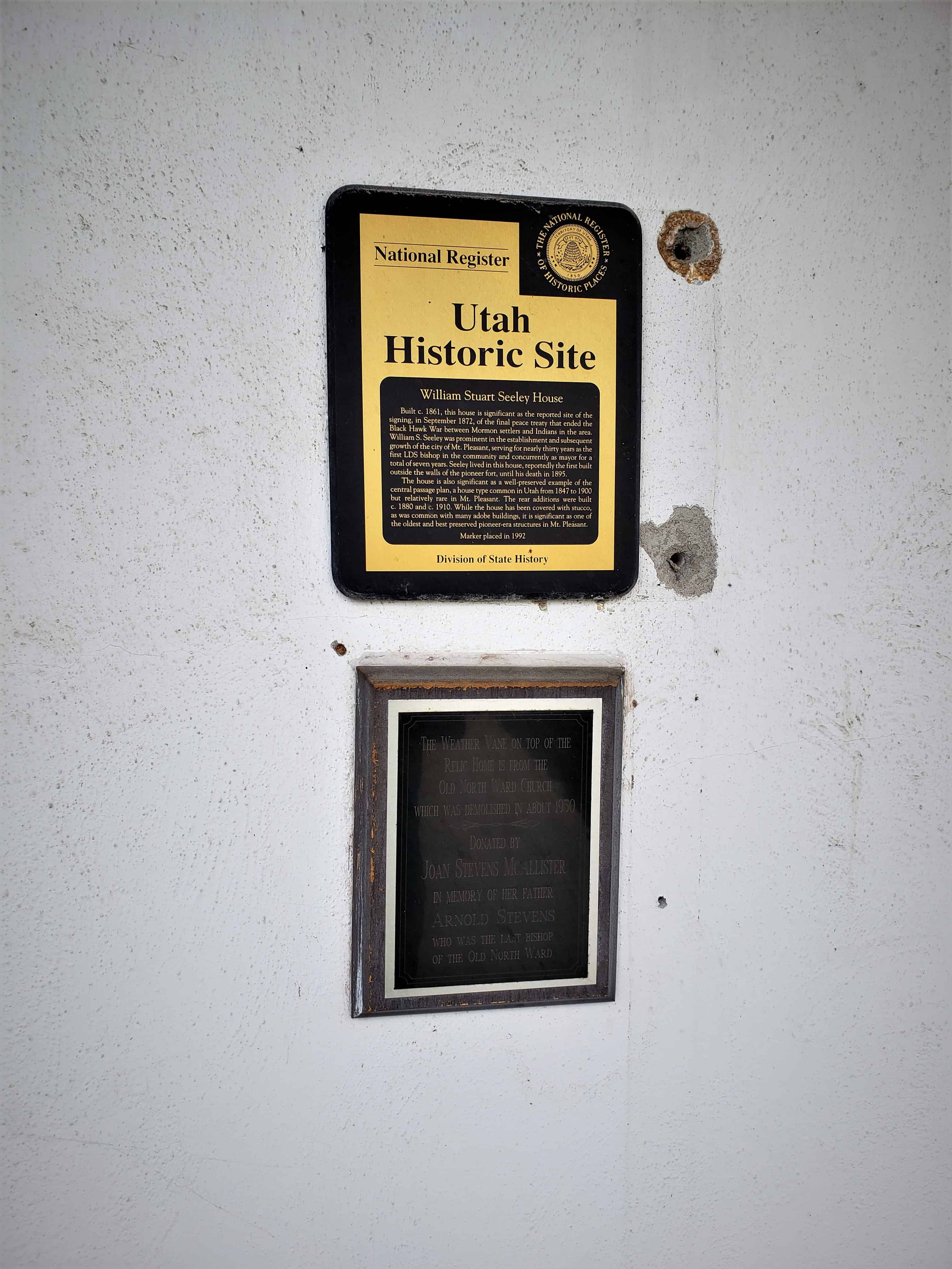
Built c. 1861, this house is significant as the reported site of the signing, in September 1872, of the final peace treaty that ended the Black Hawk War between Mormon settlers and Indians in the area. William S. Seeley was prominent in the establishment and subsequent growth of the City of Mt. Pleasant, serving for nearly thirty years as the LDS Bishop in the community and concurrently as mayor for a total of seven years. Seeley lived in this house, reportedly the first built outside the walls of the pioneer fort, until his death in 1895.

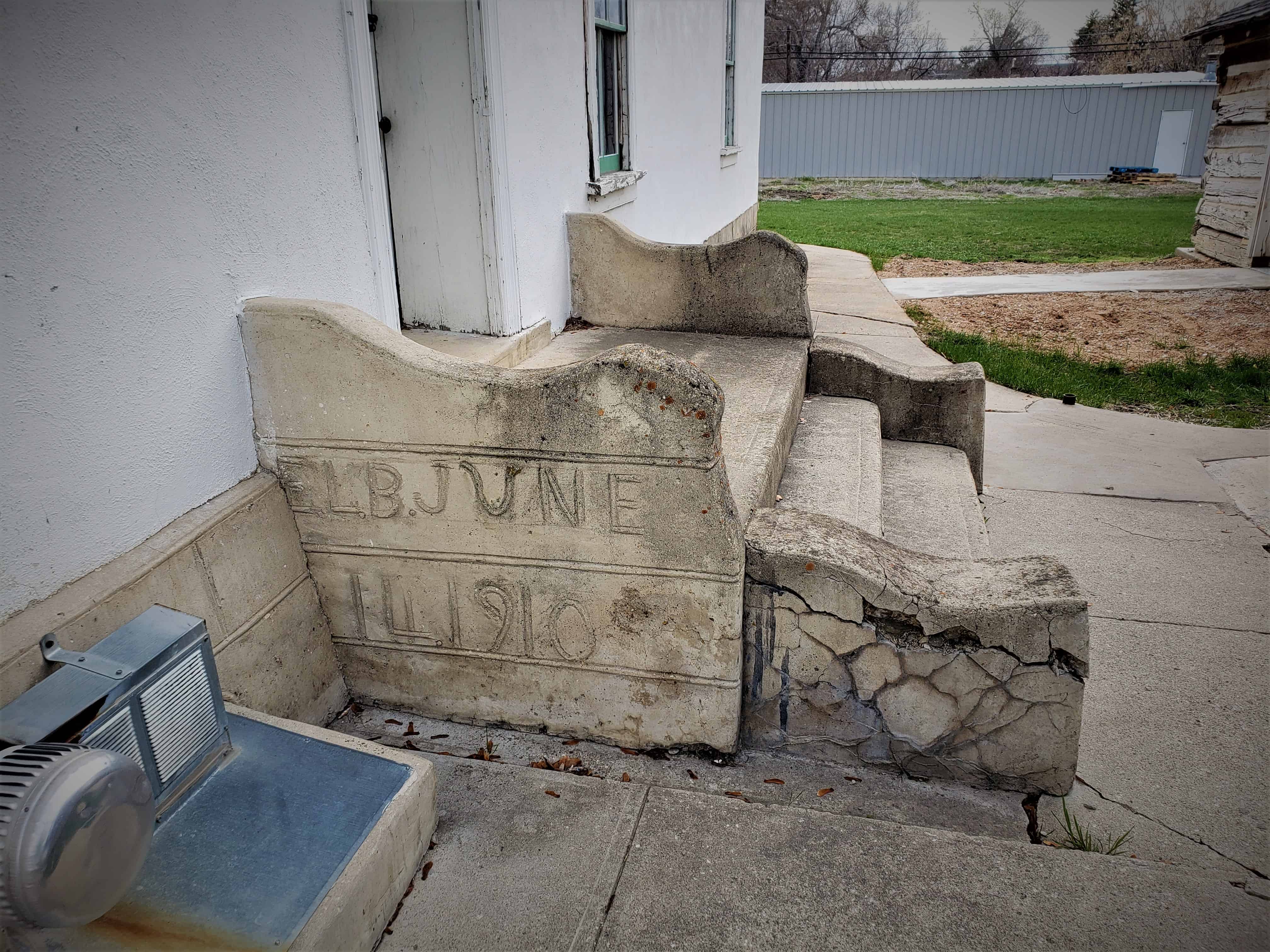
The house is also significant as a well-preserved example of the central passage plan, a house type common in Utah from 1847 to 1900 but relatively rare in Mt. Pleasant. The rear additions were built c, 1880 and c, 1910. While the house has been covered with stucco, as was common with many adobe buildings, it is significant as one of the oldest and best preserved pioneer era structures in Mt. Pleasant.

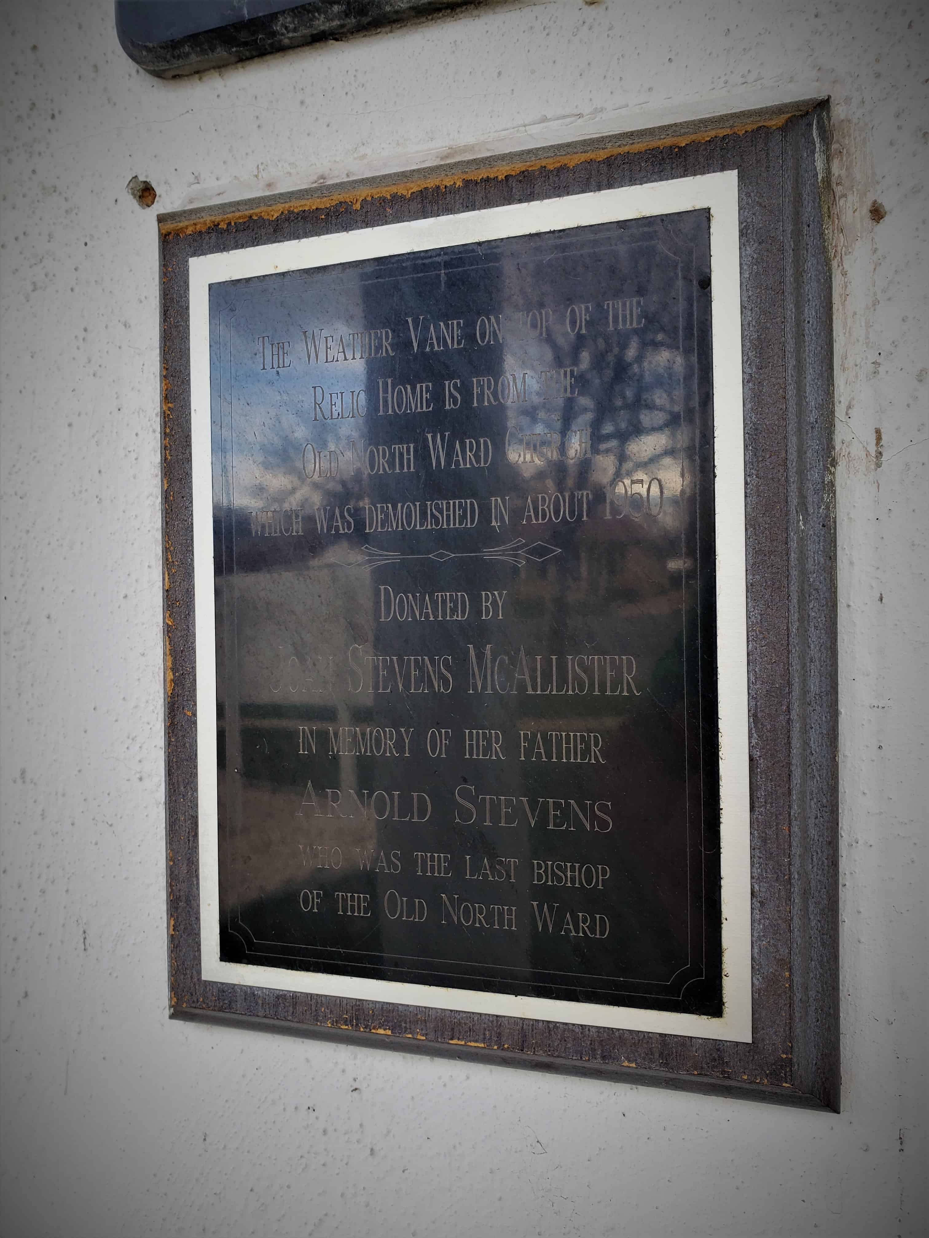
The weather vane on top of the Relic Home is from the Old North Ward Church which was demolished in about 1950, donated by Joan Stevens McAllister in memory of her father, Arnold Stevens.

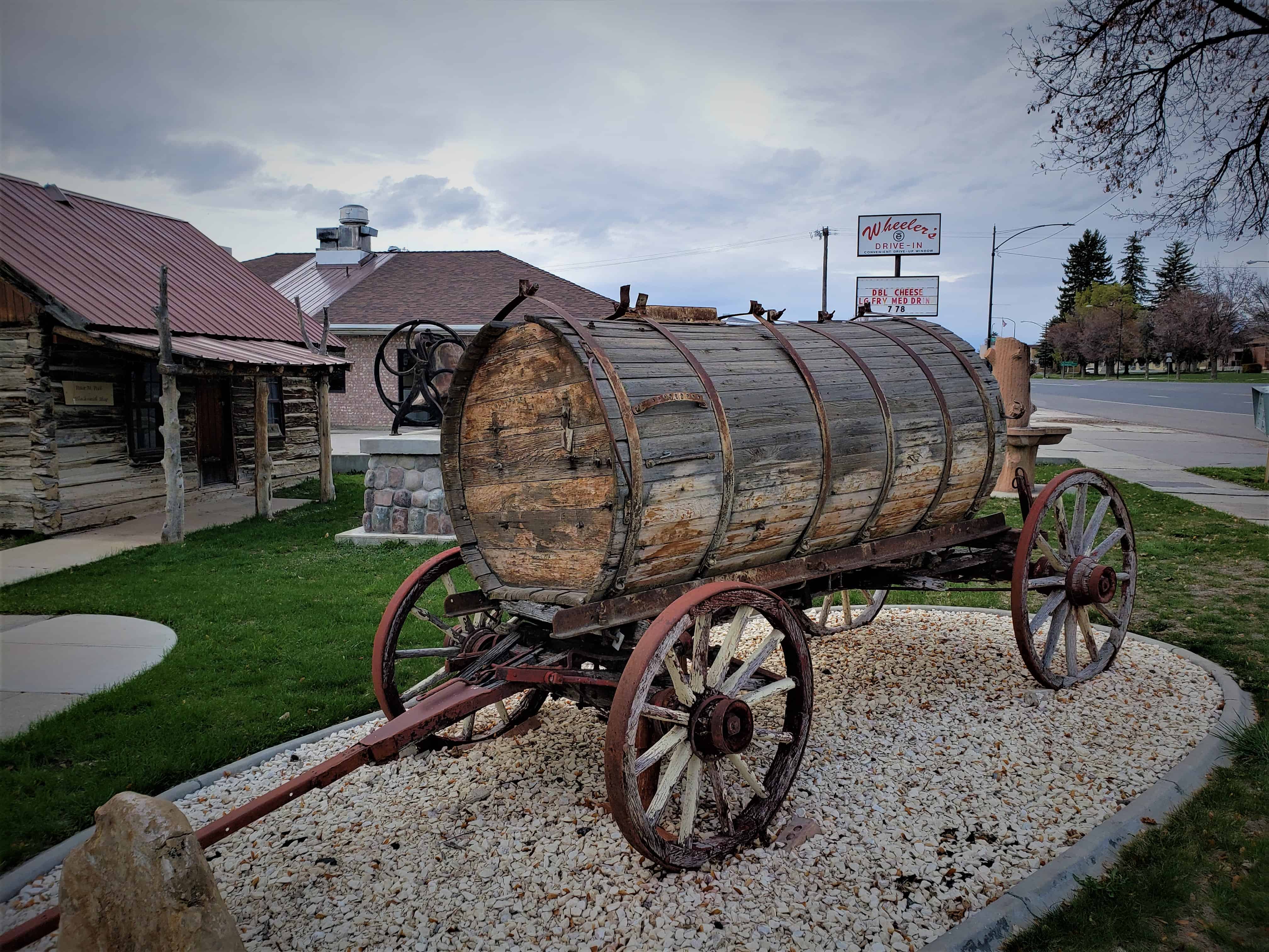
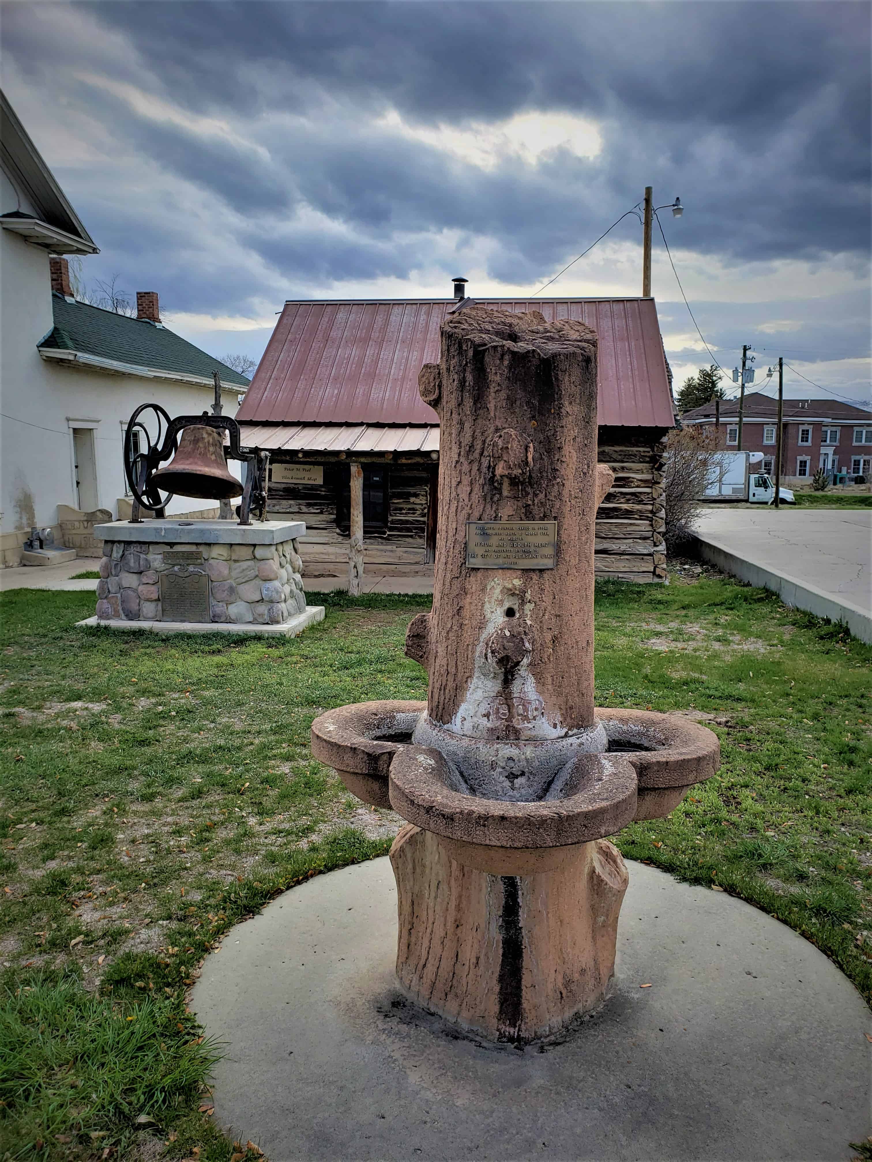
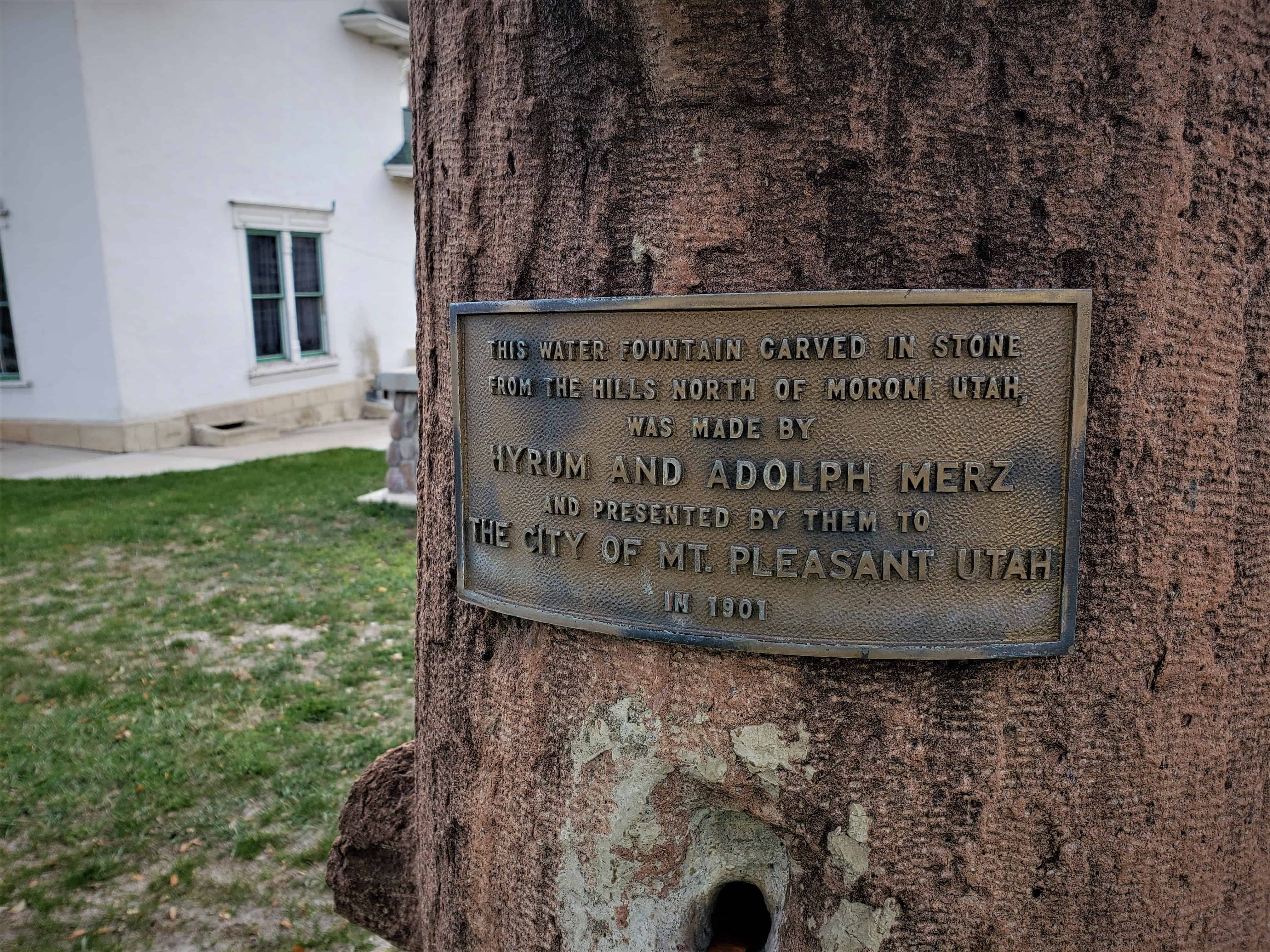
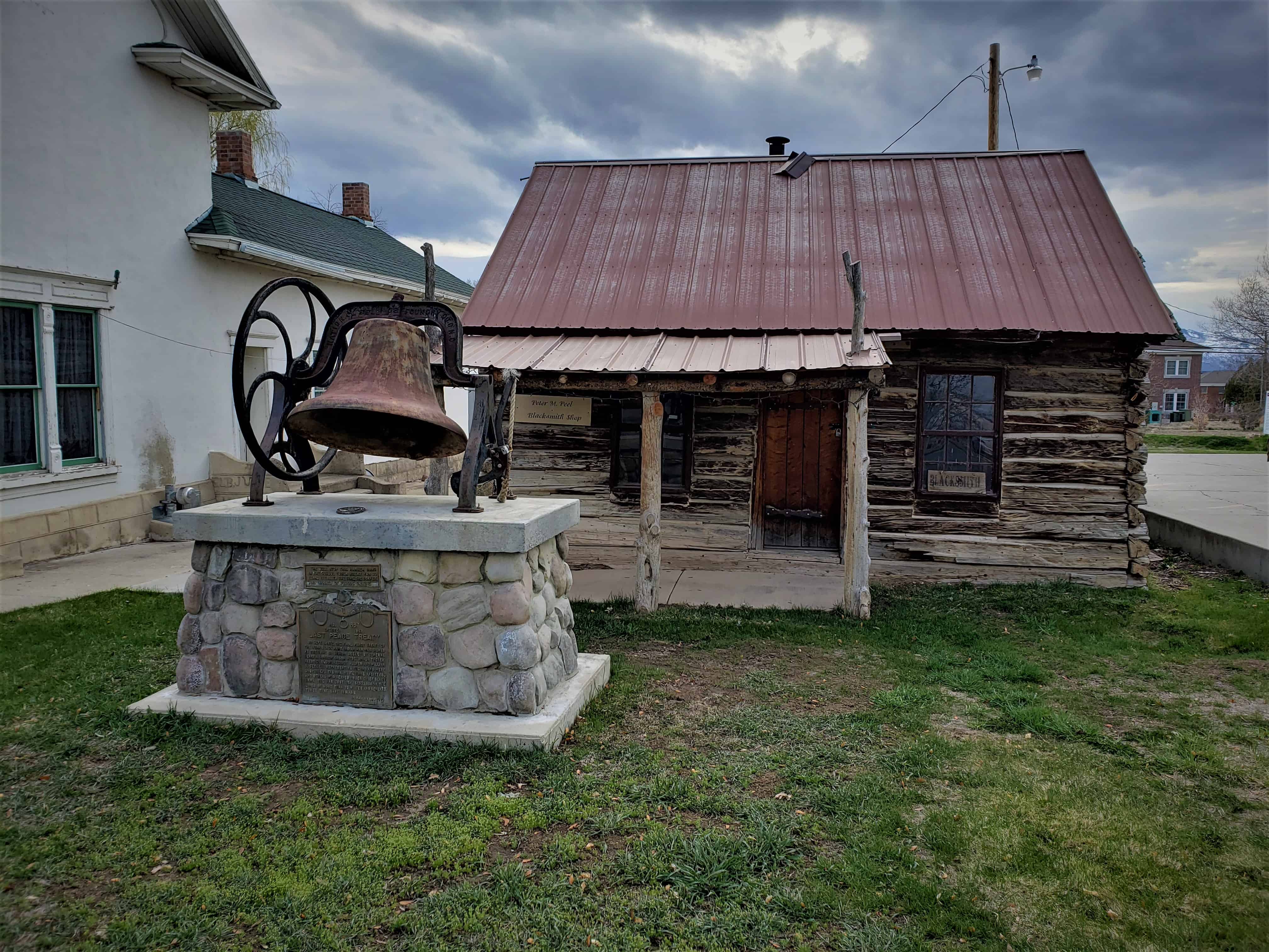
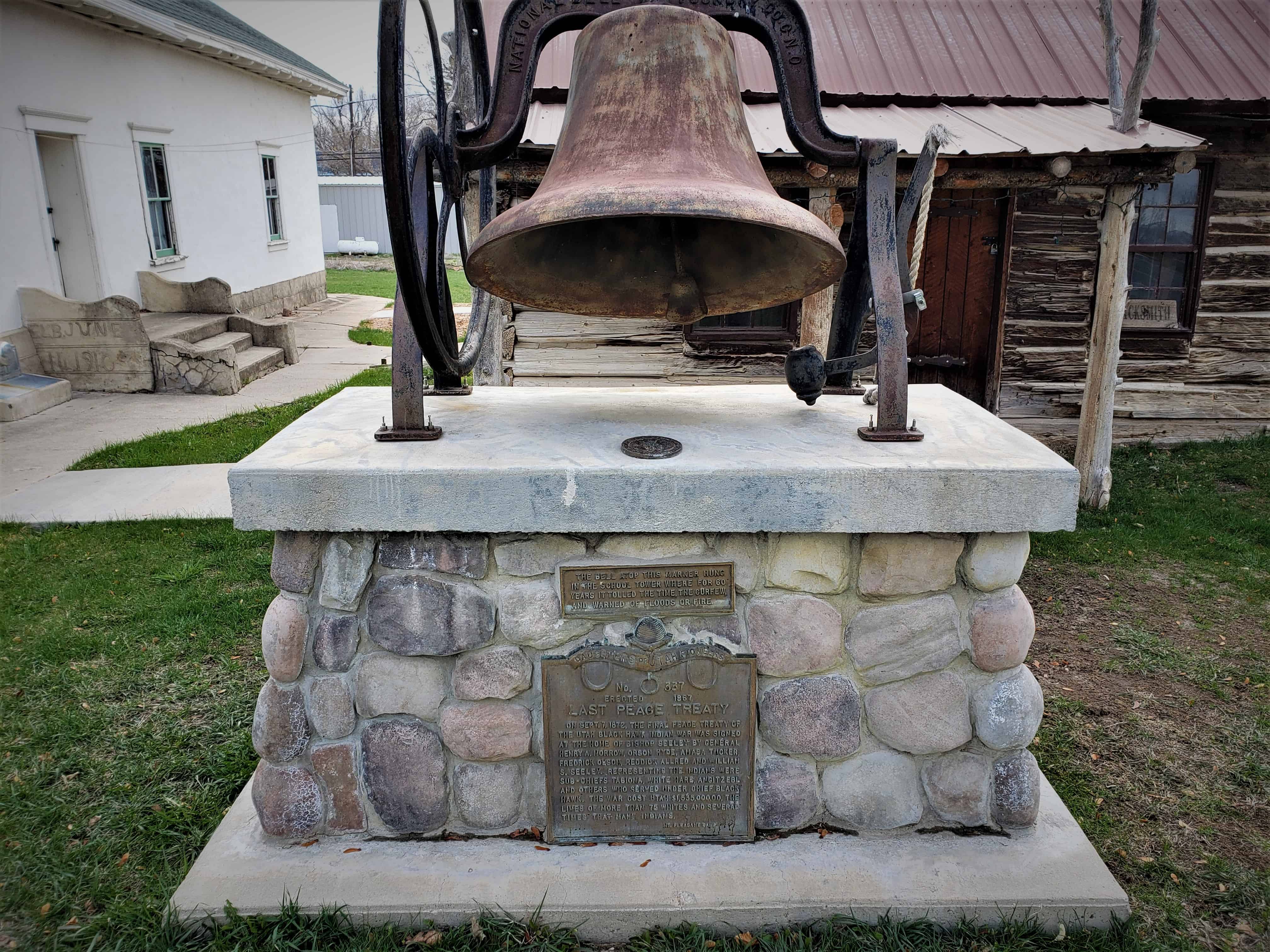
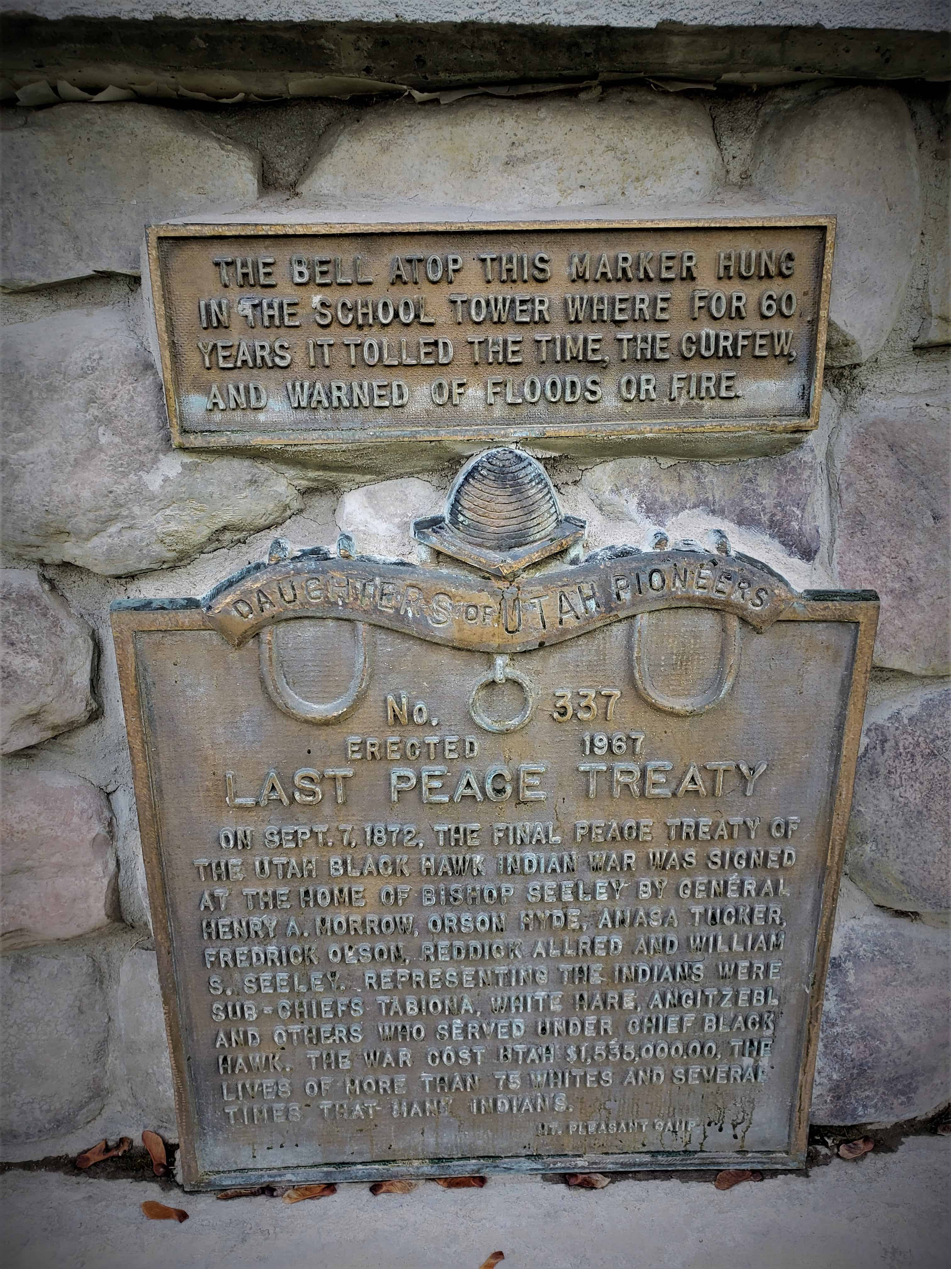
D.U.P. Marker # 337, Last Peace Treaty is located here, as well as the Merz Fountain.

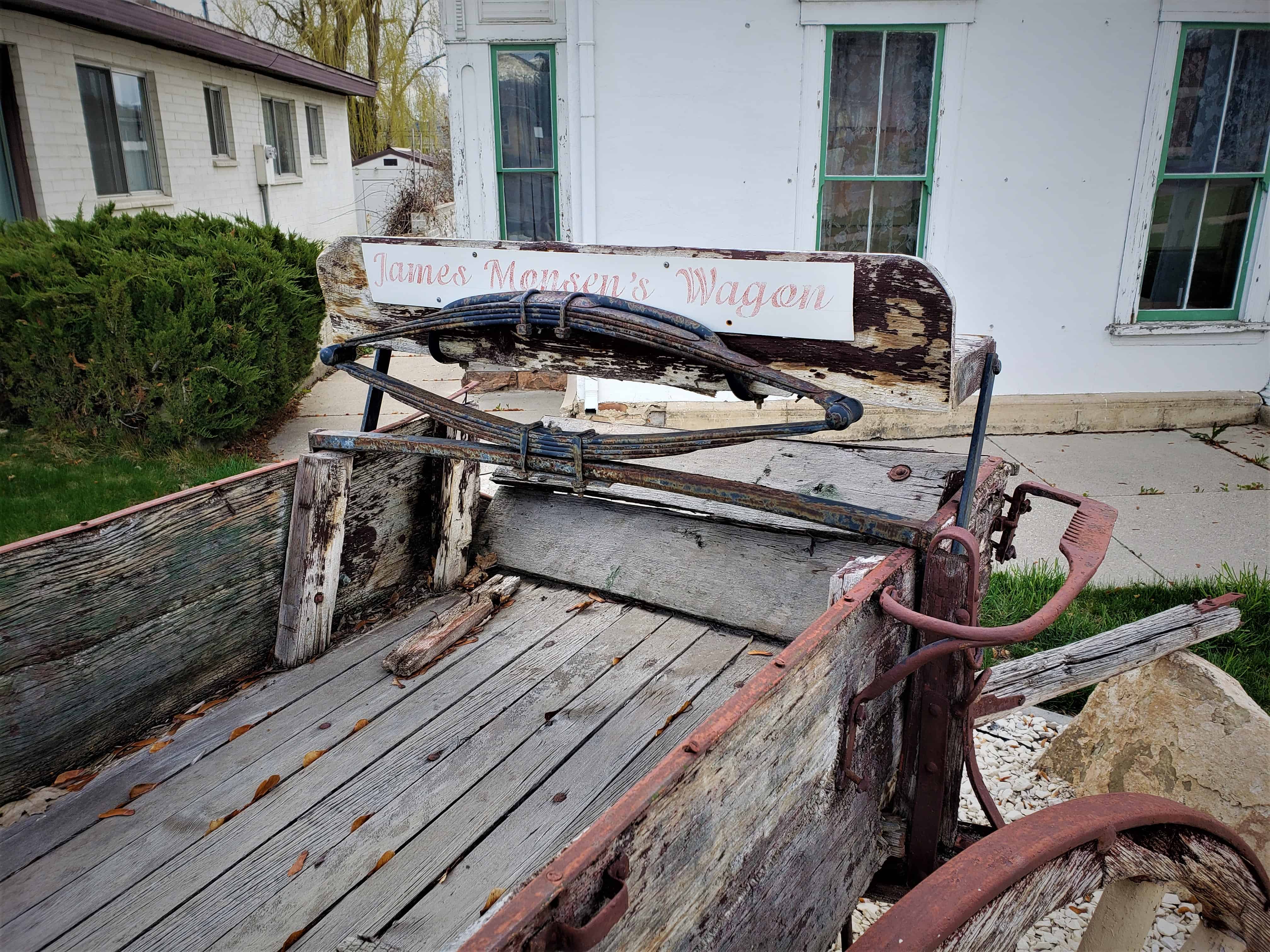
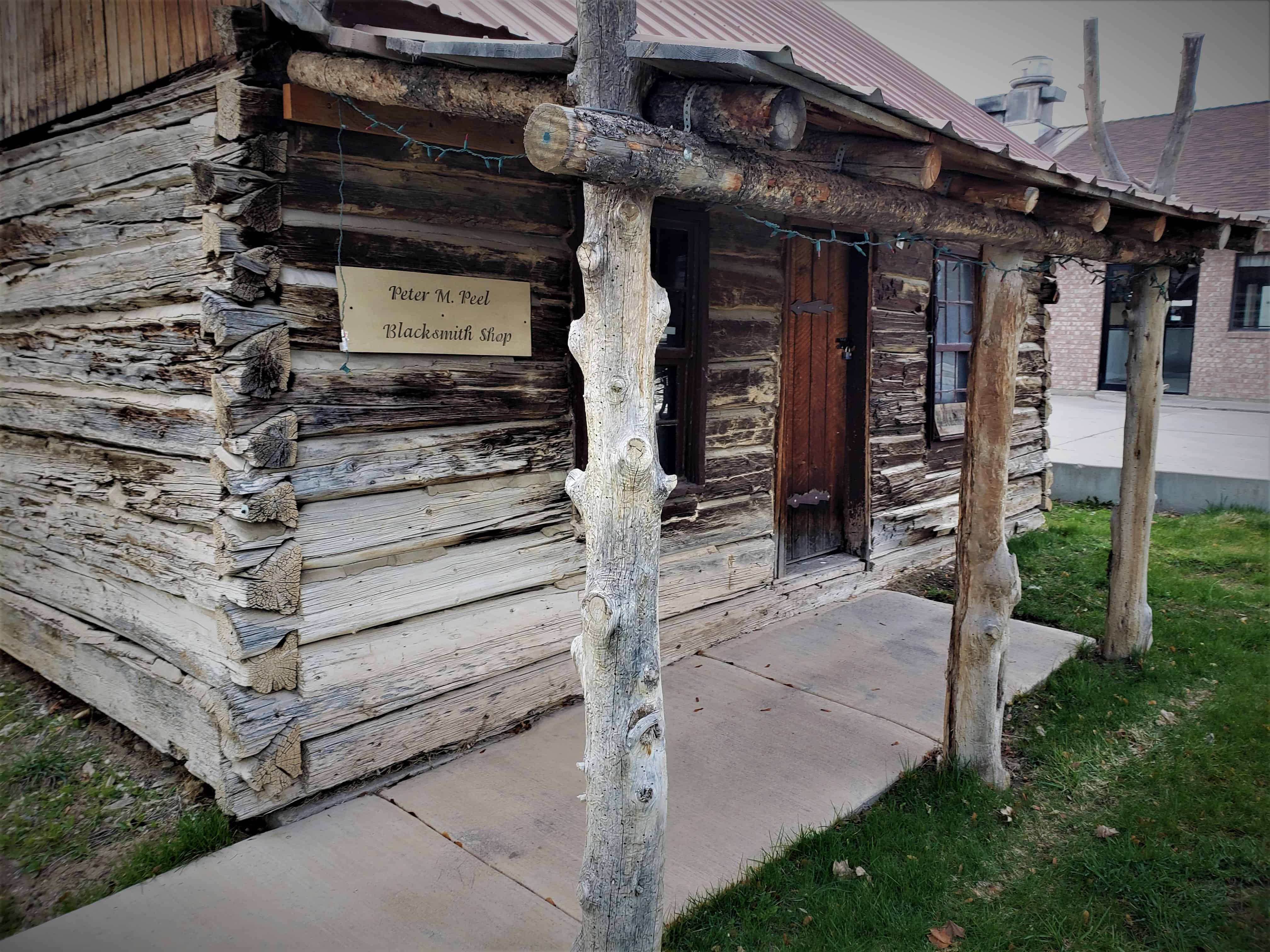
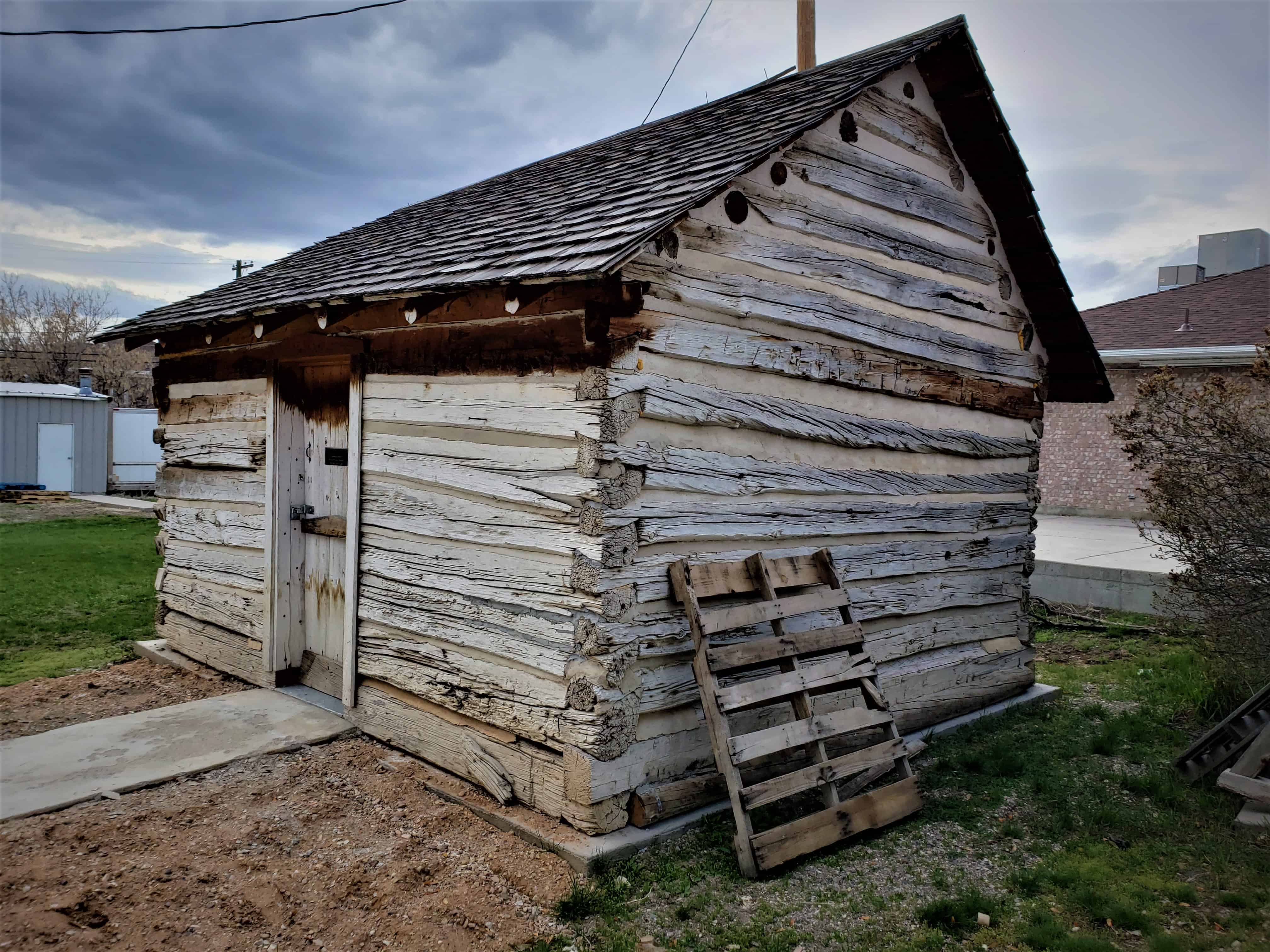
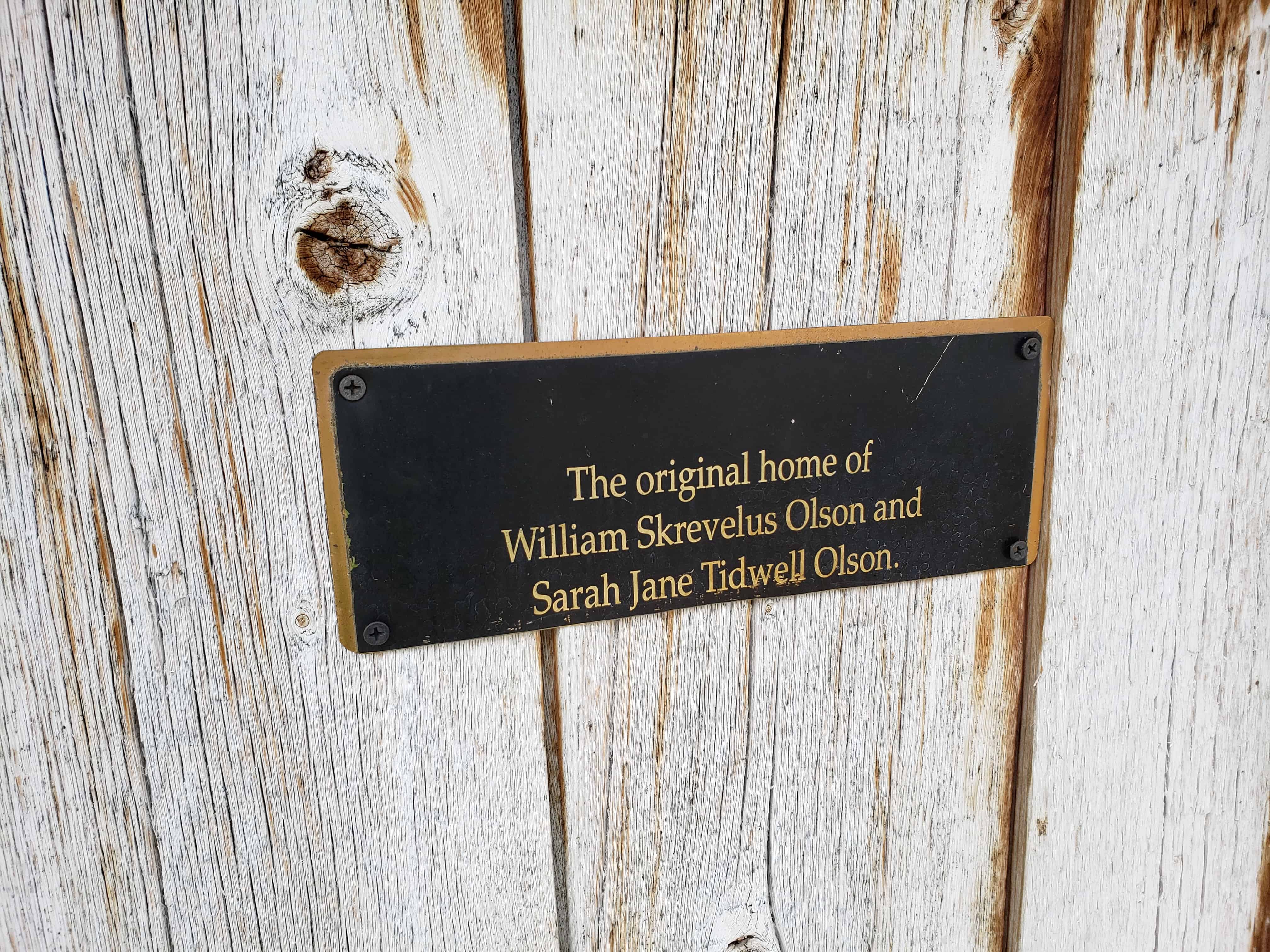
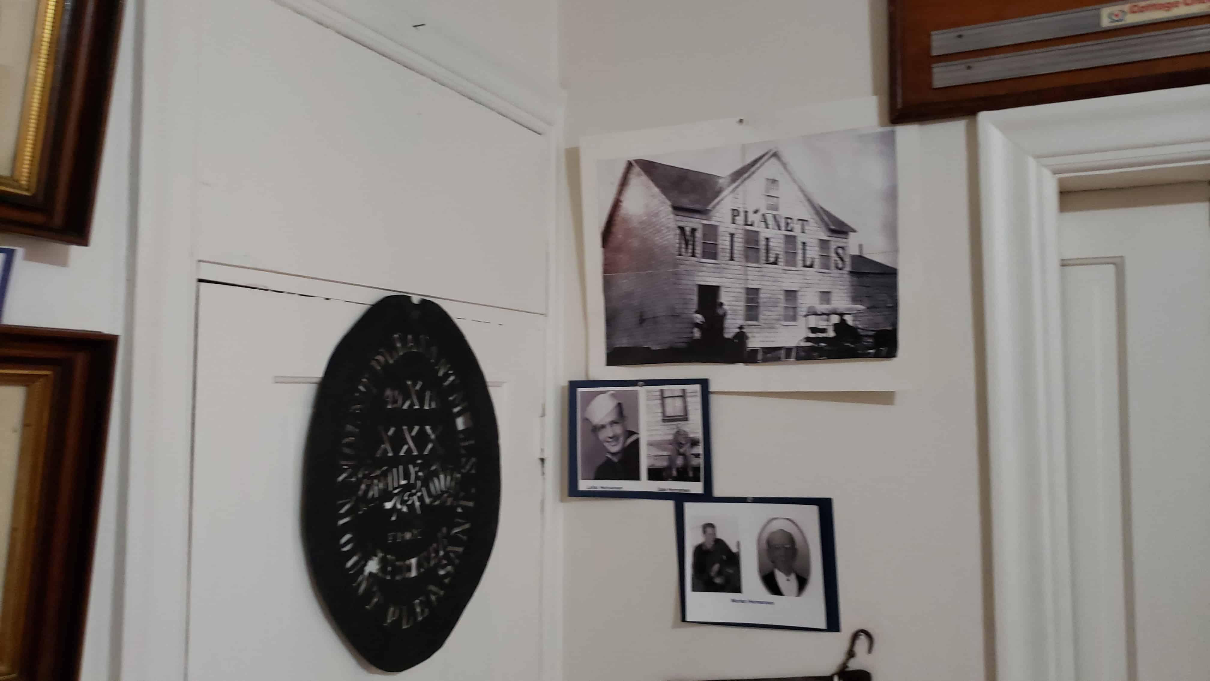
The cabin outside the relic home was previously located at the William Skrevelius Olson Home.

Related Posts:

  • Mt Pleasant, Utah

The below image was borrowed from this webpage:

Payson Fort Wall

15 Saturday Nov 2014

Posted by Jacob Barlow in Uncategorized

≈ 1 Comment

Tags

Forts, historic, Payson, utah, utah county, Walker War

Several of the towns in Utah started out as forts as protection for the people, many of those have the location of the fort marked, some of those have the location of the corners of the forts marked.  Here are the markers placed to mark where the corners of the Payson Fort was.

The Main Gate:     N 40° 02.629 W 111° 43.774


picture16dec07-033
picture16dec07-034

This road has remained open since 1853.  Just inside was a stagecoach inn & Pony Express station which operated until the telegraph came in 1861.  Alexander Keele, while on voluntary guard duty, was killed on 18 July 1853 by Indians as they left the Fort.

The Southeast Corner: N 40° 02.621 W 111° 43.775


picture16dec07-031
picture16dec07-032

The Fort was 60 rods square with corners built of logs forming a buttress.  Adobe, rock and mud walls stood 8 feet tall.  4 feet wide at the bottom and 2 feet wide at the top on a rock foundation with a deep 4 foot trench around the outside.   It was built during the Walker Indian War 1853-54.

The Southwest Corner: N 40° 02.622 W 111° 44.105


picture16dec07-028
picture16dec07-029
picture16dec07-030

The Northwest Corner: N 40° 02.875 W 111° 44.105


picture16dec07-037
picture16dec07-038

The Northeast Corner: N 40° 02.868 W 111° 43.775


picture16dec07-035
picture16dec07-036

Last Peace Treaty

05 Thursday Jun 2014

Posted by Jacob Barlow in Uncategorized

≈ 1 Comment

Tags

DUP, historic, Historic Markers, Mt. Pleasant, Sanpete County, utah, Walker War

  • Image

On Sept. 7, 1872, the final peace treaty of the Utah Black Hawk Indian War was signed at the home of Bishop Seeley by General Henry A. Morrow, Orson Hyde, Amasa Tucker, Fredrick Olson, Reddick Allred and William S. Seeley. Representing the Indians were sub-chiefs Tabiona, White Hare, Angitzebl and others who served under Chief Black Hawk. The war cost Utah $1,535,000.00, the lives of more than 75 whites and several times that many Indians.

The bell atop the monument is the bell that used to be atop the Hamilton School.

This is located outside the Relic Home in Mt Pleasant, Utah

  • Image

Follow Jacob

Follow Jacob

Come wander with me on Youtube.

Blog Stats

  • 2,099,340 hits

Social and Other Links

BarlowLinks.com

Recent Posts

  • Scout Monument
  • Provo High School Seminary Building
  • 821 E 100 S
  • 820 E 100 S
  • 817-819 E 100 S

Archives

Loading Comments...