• About JacobBarlow.com
  • Cemeteries in Utah
  • D.U.P. Markers
  • Doors
  • Exploring Utah Email List
  • Geocaching
  • Historic Marker Map
  • Links
  • Movie/TV Show Filming Locations
  • Oldest in Utah
  • Other Travels
  • Photos Then and Now
  • S.U.P. Markers
  • U.P.T.L.A. Markers
  • Utah Cities and Places.
  • Utah Homes for Sale
  • Utah Treasure Hunt

JacobBarlow.com

~ Exploring with Jacob Barlow

JacobBarlow.com

Tag Archives: Washington County

Erastus Snow’s Big House

29 Friday Jun 2018

Posted by Jacob Barlow in Uncategorized

≈ 1 Comment

Tags

historic, Historic Markers, St. George, SUP, utah, Washington County

2018-02-19 17.00.12

Erastus Snow’s Big House

On this site in 1867, Erastus Snow began construction on a four-story, adobe home which later became known as the “Big House.” Snow, an LDS apostle, was the presiding Mormon leader during the colonization of St. George. The “Big House” was an uncommonly large dwelling which served as lodging for many of the guests that visited St. George. The structure had three stories and a basement, the southern exposure of which was level with the ground. A balcony supported by pillars was attached to the west of the home and a low, rock wall overlaid with red sandstone bordered the sidewalk in from (where you are now standing). Though not extravagant or ornate, it was a comfortable, livable home that typified the style of many early St. George residences.

Shortly after it was completed, Snow’s wife Elizabeth (Libby) managed the “Big House” as a guest home for weary travelers. Nearly 80 visitors sat down to dinner here to celebrate Erastus’ 50th birthday in 1868. Beginning in 1888, Snow’s son Mahonri managed the “Big House” as a first class hotel for 25 years. In 1913, it was sold to Samuel Judd who continued the service but changed the name to the Dixie Hotel.

St. George owes much of its establishment, growth and progress to Erastus Snow, whom people looked to for counsel and advice during his 27 years here. His “Big House” was known as the executive mansion of the Southern Utah Mission. It stood as a fine example of the craftsmanship and dedication of the early southern Utah Pioneers.”

2018-02-19 17.00.18

This is S.U.P. Marker #72.06, for other markers in the series visit this page.  Other markers in the series located here in the St George Memorial Plaza are:

  • 72 – St. George Memorial Plaza
  • 72.01 – And the Desert Shall Blossom
  • 72.02 – Gardeners’ Club Hall
  • 72.03 – St. George Social Hall “Opera House”
  • 72.04 – Brigham Young Home
  • 72.05 – Pioneer Courthouse
  • 72.06 – Erastus Snow’s Big House
  • 72.07 – Dixie Academy
  • 72.08 – St. George Temple
  • 72.09 – St. George Tabernacle
  • 72.10 – Woodward School

St. George Social Hall “Opera House”

29 Friday Jun 2018

Posted by Jacob Barlow in Uncategorized

≈ 1 Comment

Tags

historic, Historic Markers, St. George, SUP, utah, Washington County

2018-02-19 16.58.37

St. George Social Hall “Opera House”

At a time when colonizers of the Dixie Cotton Mission were struggling to survive, their leaders placed a high priority on culture. The Mormon prophet Joseph Smith taught that “Man is that he might have joy.” His successor Brigham Young interpreted this “joy” to be participation in and enjoyment of the cultural arts. The first locally produced drama was presented in a bowery made of tumble weed just nine months after the city’s birth. The historical Social Hall, or Opera House, was built in 1875 at the corner of Main and Diagonal Streets (one block north of here). It began as a wine cellar built by the Gardener’s Club where sacramental wine was stored. A 23×56 foot room was built above the cellar which became the stage and wings section, and a 35×50 foot addition to the west became the audience seating area. For nearly 50 years this was the center of social and cultural life in Dixie.

The building featured a mechanized floor which could be lowered several inches at the east end, allowing everyone an unobstructed view of the stage. With a seating capacity of 400, this was a delightful venue for local dramatic clubs as well as outside players. Opera and other musical entertainments were held there, as well as dances on the movable floor.

During the early part of this century, the stage of the St. George Stake Academy, as well as movie theaters began to replace the activities of the Opera House. The building was eventually sold to U&I Sugar Company and used as offices and storage for sugar beet seed.

Presently, the building is being restored as the central feature of the Pioneer Center for the Arts.

Related Posts:

  • Utah Social Halls, Opera Houses, and Amusement Halls
2018-02-19 16.58.41

This is S.U.P. Marker #72.03, for other markers in the series visit this page.  Other markers in the series located here in the St George Memorial Plaza are:

  • 72 – St. George Memorial Plaza
  • 72.01 – And the Desert Shall Blossom
  • 72.02 – Gardeners’ Club Hall
  • 72.03 – St. George Social Hall “Opera House”
  • 72.04 – Brigham Young Home
  • 72.05 – Pioneer Courthouse
  • 72.06 – Erastus Snow’s Big House
  • 72.07 – Dixie Academy
  • 72.08 – St. George Temple
  • 72.09 – St. George Tabernacle
  • 72.10 – Woodward School

Gardeners’ Club Hall

29 Friday Jun 2018

Posted by Jacob Barlow in Uncategorized

≈ Leave a comment

Tags

historic, Historic Markers, St. George, SUP, utah, Washington County

2018-02-19 16.58.21

Gardeners’ Club Hall

Built just five years after St. George was settled, the Gardeners’ Club Hall is considered to be the oldest public building still standing in the city. This small unassuming adobe building pre-dates the courthouse, the Tabernacle and the Temple by several years. Located across the street north and a half-block west of here, the one-room structure was built in 1867 as the meeting place for the Gardeners’ Club, an organization formed to promote the growing of fruit trees, shrubs and flowers.

The Gardeners’ Club was organized in 1865. Joseph F. Johnson, the club’s first president, was a powerful force in the development of horticulture and floriculture in Dixie. In his newspaper the Pomologist, he passed on to the public his extensive knowledge of horticulture. He also demonstrated that knowledge on his own St. George property, which included much of the block upon which the Gardeners’ Club Hall and the Brigham Young Home stand. There he created a veritable Eden in the desert, cultivating trees, vines and flowers, and operating his nursery business. Through the Gardeners’ Club, Johnson, along with other horticultural experts, such as Walter E. Dodge and Luther S. Hemenway, spearheaded a movement which went forward until the Dixie area abounded in lovely orchards, vineyards, and gardens. In addition to being a meeting house and social gathering place, the Gardeners’ Club Hall was the site of early horticultural exhibits displaying the many varieties of fruits, vegetables and plants that could be grown in Dixie.

2018-02-19 16.58.26

This is S.U.P. Marker #72.02, for other markers in the series visit this page.  Other markers in the series located here in the St George Memorial Plaza are:

  • 72 – St. George Memorial Plaza
  • 72.01 – And the Desert Shall Blossom
  • 72.02 – Gardeners’ Club Hall
  • 72.03 – St. George Social Hall “Opera House”
  • 72.04 – Brigham Young Home
  • 72.05 – Pioneer Courthouse
  • 72.06 – Erastus Snow’s Big House
  • 72.07 – Dixie Academy
  • 72.08 – St. George Temple
  • 72.09 – St. George Tabernacle
  • 72.10 – Woodward School

And the Desert Shall Blossom

29 Friday Jun 2018

Posted by Jacob Barlow in Uncategorized

≈ 2 Comments

Tags

historic, Historic Markers, St. George, SUP, utah, Washington County

2018-02-19 16.57.47

And the Desert Shall Blossom

Water – the lack of it and too much of it – was the greatest challenge to Dixie’s early Mormon settlers. When the original company of families entered the St. George Valley late in 1861, they had little more than two small springs to rely upon for drinking water, and the capricious currents of the Virgin and Santa Clara Rivers for irrigation. From the day those indomitable pioneers set foot in this valley until the day they died, their lives were spent in search of, diverting, ditching, and wisely using water.

William Carter, who built his home on the southeast corner of this block, holds the distinction of plowing the first ditch in the valley. The water he channeled emerged from the spring which still flows from the east edge of the red sandstone ledge north of the city. Soon a ditch and wooden flume system was built throughout the town, conducting water from East and West Springs to the town’s many lots. The water from the springs did not taste good, but was nonetheless life sustaining, and much better than the rank water dipped from the Virgin River. In those days a “Drinking Hour” was established in the town. During a specified hour each morning, all irrigation diversions were taken out of the main ditch so that water flowed completely through the system. Members of each household dipped enough water from the ditch for the day’s needs and stored in barrels.

Though contention over water turns was unavoidable, completion of the Tabernacle with its punctual town clock in the tower helped synchronize the citizens and reduce disagreements.

To irrigate farms south of town, the pioneers began immediately to put dams and diversions in the Rio Virgin and build ditches to the fields. Project after project failed as the river’s unpredictable currents and periodic floods literally washed their dreams to sea. It was decades before the Virgin’s flow was effectively harnessed, yet even today the river still finds the means to have its way.

Historian Andrew Karl Larson aptly described the dilemma: “During the late 1860s, 70s, and 80s, floods roared down the Virgin and its tributaries with increasing frequency and volume. Its turbid waters, swelling in angry crescendo as the years passed, tore out dams as fast as the tired settlers on its uneasy banks could put them in. Worse still, much of the finest bottom land was carried to the Pacific by the wrathful Virgin who struck out blindly and even viciously at those who had so thoughtlessly violated her watersheds. Like an angry goddess, she turned upon her tormentors to destroy what they had built.”

2018-02-19 16.58.01

This is S.U.P. Marker #72.01, for other markers in the series visit this page.  Other markers in the series located here in the St George Memorial Plaza are:

  • 72 – St. George Memorial Plaza
  • 72.01 – And the Desert Shall Blossom
  • 72.02 – Gardeners’ Club Hall
  • 72.03 – St. George Social Hall “Opera House”
  • 72.04 – Brigham Young Home
  • 72.05 – Pioneer Courthouse
  • 72.06 – Erastus Snow’s Big House
  • 72.07 – Dixie Academy
  • 72.08 – St. George Temple
  • 72.09 – St. George Tabernacle
  • 72.10 – Woodward School

Dixie Academy

29 Friday Jun 2018

Posted by Jacob Barlow in Uncategorized

≈ Leave a comment

Tags

historic, Historic Markers, St. George, SUP, utah, Washington County

2018-02-19 16.57.36

Dixie Academy

Across the street west, and two blocks south of here stands the building originally known as the St. George Stake Academy. After the turn of the century, southern Utah citizens realized a great need for higher education in this isolated corner of the state. The LDS Church determined to establish an academy in St. George. Leaders at Church headquarters in Salt Lake City agreed to contribute $20,000 in cash if people of the St. George Stake would pay the remaining $35,000 in money, materials and labor. In keeping with long established tradition, the response of citizens was enthusiastic, and people emptied their precious savings accounts and offered materials and services.

The foundation of the structure was made of black volcanic stone. Because it was felt that the academy should be built of something that would add variety to the look of the public square, it was decided to use the delicate pink Chinle sandstone from a quarry east of Washington , rather that (sic) darker sandstone used for the Tabernacle and Woodward School. The heavy slabs were brought to St. George over rutted roads on the running gears of wagons. The rocks were cut into shape by the same master stone masons who worked on the Tabernacle. The stone work, especially the entry arch and entablature above it, is among the finest anywhere. Citizens watched with deep satisfaction as their house of learning rose to completion and opened for classes in September of 1911.

People persisted in calling the new school the Dixie Academy. It became the forerunner of both Dixie High School and Dixie College, and continues as a key community center today.

2018-02-19 16.57.41

This is S.U.P. Marker #72.07, for other markers in the series visit this page.  Other markers in the series located here in the St George Memorial Plaza are:

  • 72 – St. George Memorial Plaza
  • 72.01 – And the Desert Shall Blossom
  • 72.02 – Gardeners’ Club Hall
  • 72.03 – St. George Social Hall “Opera House”
  • 72.04 – Brigham Young Home
  • 72.05 – Pioneer Courthouse
  • 72.06 – Erastus Snow’s Big House
  • 72.07 – Dixie Academy
  • 72.08 – St. George Temple
  • 72.09 – St. George Tabernacle
  • 72.10 – Woodward School

St. George Temple

29 Friday Jun 2018

Posted by Jacob Barlow in Uncategorized

≈ Leave a comment

Tags

historic, Historic Markers, St. George, SUP, utah, Washington County

2018-02-19 16.57.22

St. George Temple

When the Mormon pioneers arrived in Utah, they left behind two holy temples – one in Kirtland, Ohio, and one in Nauvoo, Illinois. Work began on a temple in Salt Lake City in 1853, but was delayed for various reasons. Desirous of having a temple built in the new Mormon territory before his death, Brigham Young chose St. George as the site where the goal could best be accomplished. Work on this unique structure, located three blocks east and five blocks south of here, began in November 1871. The majestic white landmark was dedicated in April 1877.

The project was a cooperative effort of all the communities of southern Utah. Similar to a public works project, it served as employment for people when money and provisions were scarce. Workers (as many as 250 at one time) obtained food for their families in return for their labor. Those living farther away furnished food stuffs and other commodities as their contribution to the project.

Difficulties were encountered throughout the six years of construction. In spite of water and sink holes in the gypsum soil, Brigham Young could not be persuaded to change his mind about the site. A major drainage system was built, and volcanic rock from black ridge to the west was hauled in and tamped deep into the earth with a 1,000-pound cannon dropped from a hoist. The building’s walls are of the same red sandstone found in the Tabernacle one block south of here.

When it was built, the temple stood alone, a good distance south of the town. It is said that Brigham Young declared the temple would one day stand in the center of the city. That day has long since come.

2018-02-19 16.57.27

Here’s another page about this temple.

  • The Temple Quarry

This is S.U.P. Marker #72.08, for other markers in the series visit this page.  Other markers in the series located here in the St George Memorial Plaza are:

  • 72 – St. George Memorial Plaza
  • 72.01 – And the Desert Shall Blossom
  • 72.02 – Gardeners’ Club Hall
  • 72.03 – St. George Social Hall “Opera House”
  • 72.04 – Brigham Young Home
  • 72.05 – Pioneer Courthouse
  • 72.06 – Erastus Snow’s Big House
  • 72.07 – Dixie Academy
  • 72.08 – St. George Temple
  • 72.09 – St. George Tabernacle
  • 72.10 – Woodward School

Bloomington

24 Sunday Jun 2018

Posted by Jacob Barlow in Uncategorized

≈ 1 Comment

Tags

Bloomington, DUP, historic, Historic Markers, utah, Washington County

2018-02-19 16.39.58

Bloomington – D.U.P. Marker #505

Numerous petroglyphs are the only record of the original settlers of this area, the Anasazi and Paiute Indians. In January 1858 a small Mormon pioneer group was sent south from Salt Lake City to raise cotton. The pioneers settled the east side of the Virgin River calling it Heberville; it was later changed to Price City.

New settlers coming in 1861 built homes on the west side of the river. This settlement was called Bloomington because of the wealth of wild flowers. It became the larger community (centered in the lower Manzanita Street area). There was a school building used also for socials and church, a post office, library, and the Union and Village Echo newspaper building. There were productive farms of vegetables, grains, and broom corn. Orchards consisted of nut and fruit trees. Peaches were shipped as far as Chicago. Silkworms were raised, barrels for processed molasses were made, and the best brooms throughout the area were produced in a broom factory. Bloomington was always a favorite spot for parties, picnics, and moonlight rides.

The undrinkable Virgin River water was a problem; therefore water had to be hauled from St. George. The river had to be crossed on horseback for school and church. It flooded often, ruining farms, dams, and ditches which were built and rebuilt with great effort.

By the late 1930s, the area was almost deserted with only a few farms remaining. Modern Bloomington began to be developed in 1966, largely as a residential community. The river is still a problem with flooding occurring in 1979 and 1988. This monument was erected as a reminder to future generations to keep their heritage alive and appreciate the efforts of those who settled and tamed what was once a hostile environment.

2018-02-19 16.40.06

2018-02-19 16.41.06

Nisson Park

07 Thursday Dec 2017

Posted by Jacob Barlow in Uncategorized

≈ 3 Comments

Tags

Historic Markers, Parks, utah, Washington, Washington County

picture01march08-010

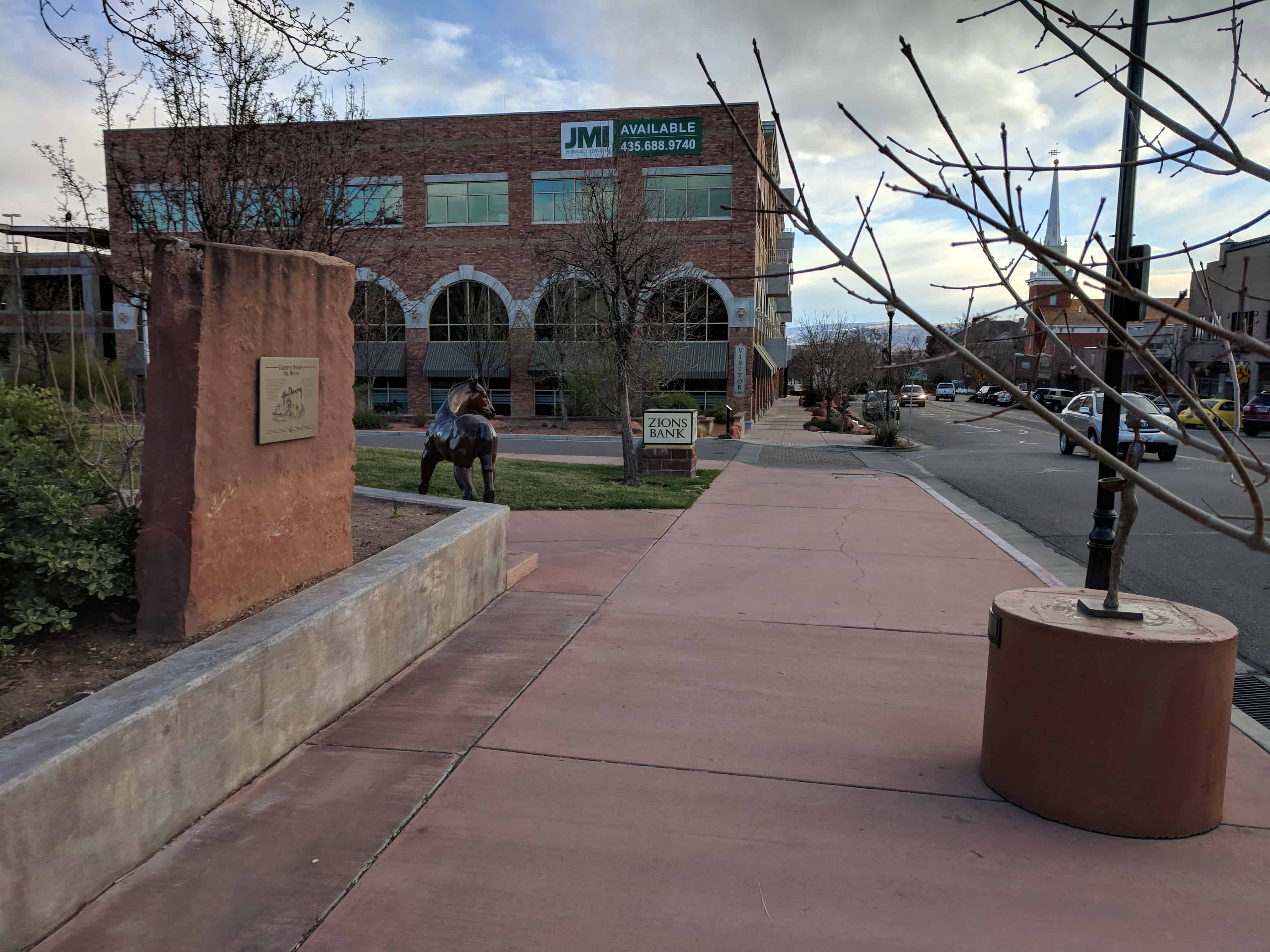
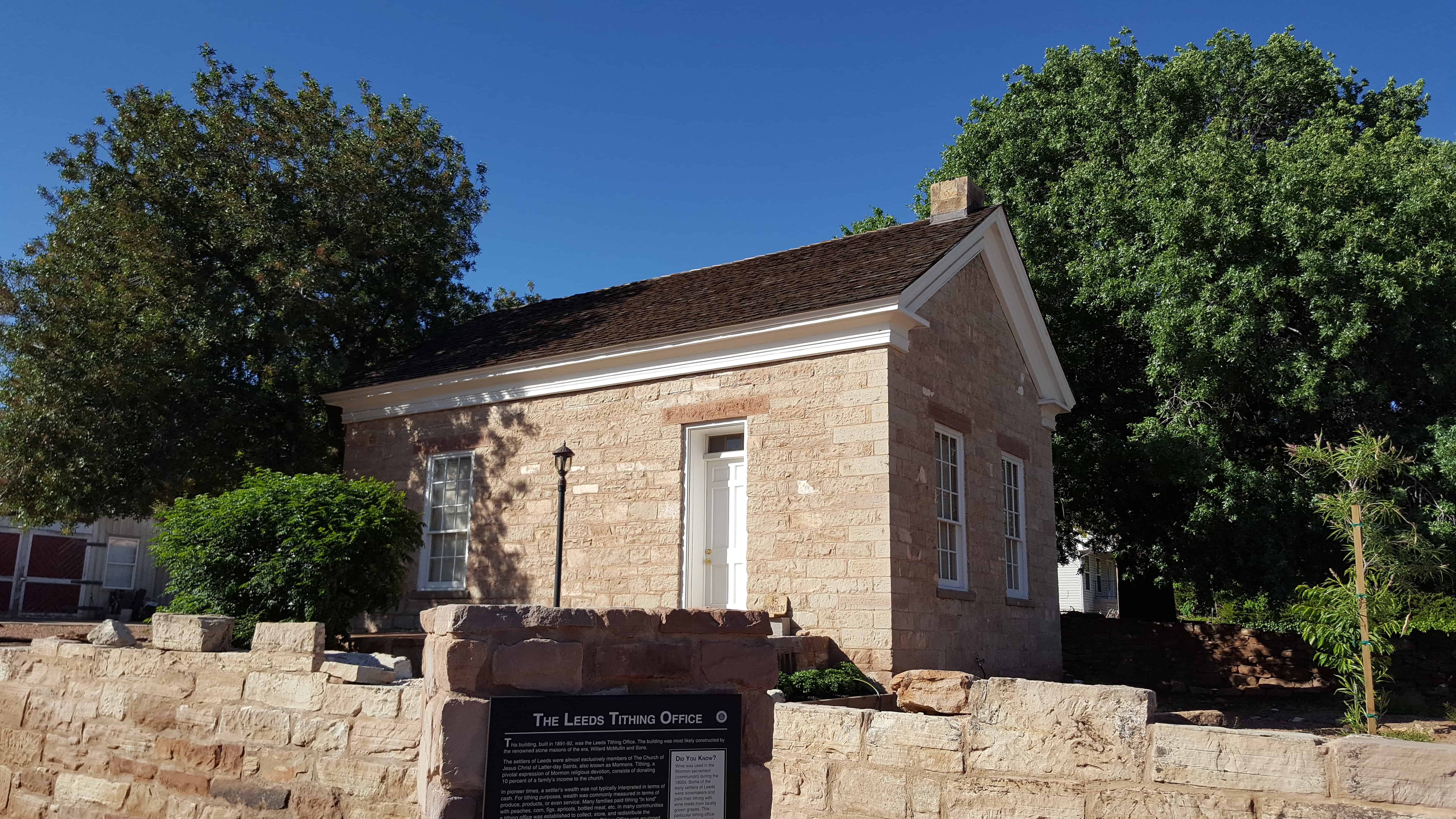
Nisson Park in Washington, Utah.

Willard O. Nisson Park opened in May of 1999. Serving as a gateway to the city with the magnificent water wheel feature, Nisson Park also has a covered pavilion, a playground area, basketball hoops, a shaded walking path with picnic tables, restrooms and a large playing field.

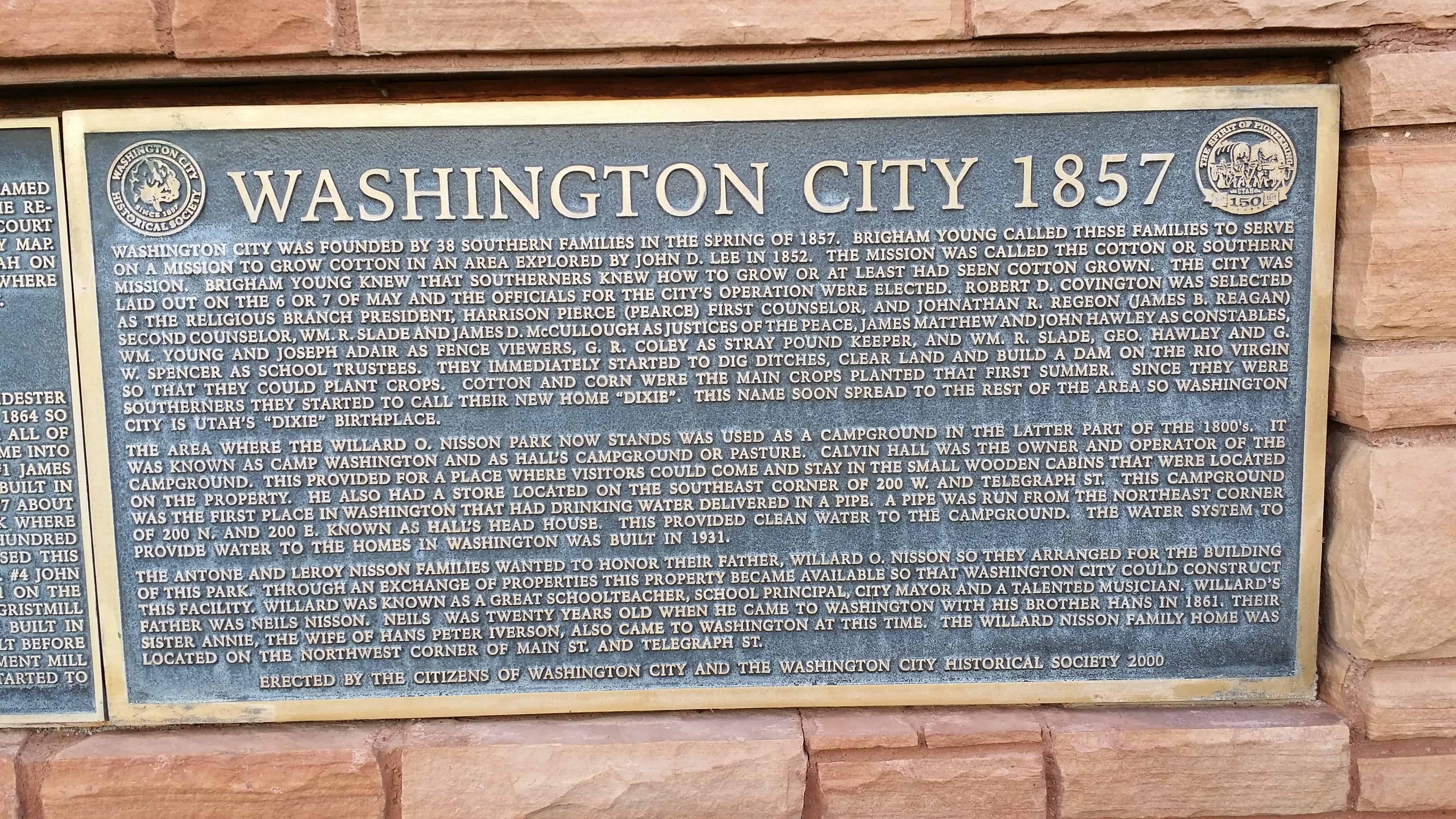
There are some historic plaques on the main sign with the water wheel with the following information:

Washington City 1857

Washington City was founded by 38 southern families in the spring of 1857. Brigham Young called these families to serve on a mission to grow cotton in an area explored by John D. Lee in 1852. The mission was called the Cotton or Southern Mission. Brigham Young knew that southerners knew how to grow or at least had seen cotton grown. The city laid out on the 6 or 7 of May and the officials for the city’s operation were elected. Robert D. Covington was selected as the religious branch president, Harrison Pierce (Pearce) first counselor, and Jonathan R. Regeon (James B. Reagan) second counselor, Wm. R. Slade and James D. McCullough as Justices of the Peace, James Matthew and John Hawley as constables, Wm. Young and Joseph Adair as fence viewers, G.R.Coley was stray pound keeper, and Wm. R. Slade, Geo. Hawley and G.W. Spencer as school trustees. They immediately started to dig ditches, clear land and build a dam on the Rio Virgin so that they could plat crops. Cotton and corn were the main crops planted that first summer. Since they were Southerners they started to call thei new home “Dixie.” This name soon spread to the rest of the area so Washington City is Utah’s Dixie birthplace.

The area where the Willard O. Nisson park now stands was used as a campground in the latter part of the 1800’s. It was known as camp Washington and as Hall’s campground or pasture. Calvin Hall was the owner and operator of the campground. This provided for a place where visitors could come and stay in the small wooden cabins that were located on the property He also had a store located on the southeast corner of 200 W. and Telegraph St. This campground was the first place on Washington that had drinking water delivered in a pipe. A pipe was run from the northeast corner of 200 N. and 200 E. known as Hal’s Head House. This provided clean water to the campground. The water system to provide water to the homes in Washington was built in 1931.

The Antone and Leroy Nisson Families wanted to honor their father, Willard O. Nisson so they arranged for the building of this park. Through an exchange of properties, this property became available to that Washington City could construct this facility. Willard was known as a great schoolteacher, school principal, city mayor, and a talented musician. Willard’s sister Annie, the wife of Hans Peter Iverson, also came to Washington at this time. The Willard Nisson family home was located on the northwest corner of Main St. and Telegraph St.

2014-03-01 10.27.59

2014-03-01 10.28.03

2014-03-01 10.28.09
2014-03-01 10.28.15
2014-03-01 10.30.48

Telegraph Street

When Washington was laid out in May, 1857, there was not a street named or located where Telegraph Street is today. It was not until the resurvey of January, 1873, ordered by Wm. Snow, Judge of the Probate Court dated December, 1872, that Telegraph Street was shown on a city map. The Telegraph was completed between St. George and Logan, Utah on January 10, 1867, and the wire for the telegraph was located about where Telegraph Street is today; therefore the name Telegraph Street.

2014-03-01 10.27.49

Millcreek Mills

Machine Creek was the original name of Millcreek. John M. Chidester sold the water rights from Machine Creek to Brigham Young in 1864 so that the cotton factory could be built. It must have been after all of the mills were built along the creek that the name Millcreek came into existence. There were at least 8 mills built along the creek: #1 James Richey’s cotton gin was built in May, 1858. The first cotton gin built in the area. #2 Thomas W. Smith’s corn cracker mill was built in 1857 about halfway between Telegraph Street and the mouth of Millcreek where it enters the Rio Virgin. #3 Theodore Turley had a gristmill a few hundred yards below where the cotton factory is. John D. Lee purchased this mill and later sold it to Henry Barney of Grafton before 1860. #4 John D. Lee’s grist and lumber mill was finished Telegraph Street / Millcreek Mills Markers image. Click for full size. By Bill Kirchner, August 30, 2012 2. Telegraph Street / Millcreek Mills Markers in the fall of 1861 on the east side of the reek near the Turley’s mill site. #5 Snow’s gristmill on the west side of the creek opposite Jon D. Lee’s mill was built in 1866. #6 Hawley’s cane mill near the mouth of Millcreek was built before 1859. This mill was obtained by John D. Lee and his new replacement mill #7 was finished in September 1859. #8 The Cotton Factory was started to be built in 1865 and completely finished in 1870.

2014-03-01 10.30.46

There is also a “Pioneer Cotton Mills” historic marker with the following text:

As early as 1851 cotton was raised in northern Utah. In 1855 it was cultivated on a small scale at Santa Clara, nine miles west of here. In 1864 the nearby communities had 140 acres under cultivation, and the product was said “to be equal in every way to that grown in Tennessee.” The first extensive manufacture of cotton cloth was begun in 1865 when a cooperative cotton factory, organized by Brigham Young, was established immediately south of this marker. Machinery was freighted from the Missouri River, more than 1300 miles away. Shortly after the opening of the factory, equipment to manufacture woolen cloth was also installed, the wool being provided from large flocks of sheep, also operated on a church cooperative basis. The cotton industry flourished surprisingly for a time, partly due to Civil War interference with planters in the south. Part of the raw product went to California and some was freighted to New York where it sold as high as $1.90 a pound. After the cotton industry revived in the south, following the close of the war, the industry in Utah was abandoned.

2014-03-01 10.28.21

From Native American Trail to Interstate Exit

22 Thursday Jun 2017

Posted by Jacob Barlow in Uncategorized

≈ 1 Comment

Tags

historic, Historic Markers, Leeds, utah, Washington County

2017-05-13 17.48.38

From Native American Trail to Interstate Exit

A local history of passage

The earliest desert routes in the West followed water. Having drinking water for person or pack animal was critical in negotiating the extreme heat and rugged terrain. Springs of water are located near where you stand and elsewhere in the vicinity of Leeds. Until the 1900s, these springs were significant features in defining early travel routes for travelers in this part of the West.

Native Americans, the Paiutes or Pah-utes, lived in the Leeds area along Leeds Creek. Pah is the native word for water. The Paiutes were somewhat nomadic, traveling along routes where life-giving water was available. The earliest pathways in the Leeds area were those of the Paiutes and their ancestors.

Fur traders, trappers, and explorers used the trails as well. In the 1860s, as the Mormons began settling southern Utah, the area that would eventually become Leeds was known as Road Valley. The springs were the site of a wagon rest stop. After Leeds was settled in
the 1860s, its main street became part of the route connecting Salt Lake to St. George and other Mormon settlements in southern Utah.

When silver was discovered in the early 1870s at nearby Silver Reef, a symbiotic  relationship between the new little farming community and the mining town was born.
Farmers sold their produce to the residents of Silver Reef. Residences, a church, dance
hall, mercantile, boarding house, and other businesses sprang up along the main road in Leeds. For several decades, the economy of southwestern Utah thrived as a result of this
interdependence of farming and mining.

With the advent of the automobile in the early 1900s, long-distance travel became more common. In the early days of the automobile, the road through Leeds became part of a route known as the Arrowhead Trail. In 1926 the federal system of numbered highways was initiated, and the Arrowhead Trail became known as U.S. Highway 91. In 1931 the final stretch of Highway 91 from Harrisburg through Leeds to Toquerville Junction was paved. The highway became the major route between Los Angeles and Salt Lake City. Well into the 1950s, travelers continued to pass through Leeds. The small Main Street businesses were utilized by residents and travelers alike.

In 1956, with a good paved highway and faster automobile travel, the residents of Leeds started sending their children to St. George to school. Many Leeds residents worked and shopped in St. George as well. In 1964 the section of Interstate Highway 15 was completed parallel to Leeds, officially retiring Highway 91 as the major route. Leeds was reduced to just another interstate exit. The change brought more residential tranquility to the center of town but produced an economic coma for the local businesses. Over the
next several years, Main Street became almost exclusively a residential street with only a few businesses.

2017-05-13 17.49.15

2017-05-13 17.48.48

The Leeds Tithing Office

22 Thursday Jun 2017

Posted by Jacob Barlow in Uncategorized

≈ 1 Comment

Tags

historic, Historic Buildings, Historic Markers, LDS Church, Leeds, utah, Washington County

2017-05-13 17.47.35

This building, built in 1891-92, was the Leeds Tithing Office. The building was most likely constructed by the renowned stone masons of the era, Willard McMullin and Sons.

The settlers of Leeds were almost exclusively members of The Church of Jesus Christ of Latter-day Saints, also known as Mormons. Tithing, a pivotal expression of Mormon religious devotion, consists of donating 10 percent of a family’s income to the church.

In pioneer times, a settler’s wealth was not typically interpreted in terms of cash. For tithing purposes, wealth was commonly measured in terms of produce, products, or even service. Many families paid tithing “in kind” with peaches, corn, figs, apricots, bottled meat, etc. In many communities a tithing office was established to collect, store, and redistribute the donated goods to those in need. The Leeds Tithing Office was equipped
with bins and barrels for storage and a set of scales for weighing produce.

Of the several early tithing offices built in the region, the Leeds building is the only remaining example of a stone tithing office that still stands with its original stone walls.

The in-kind tithing system was retired in the early 1900s.

2017-05-13 17.47.46

2017-05-13 17.47.43

2017-05-13 17.48.13

2017-05-13 17.47.51

← Older posts
Newer posts →

Follow Jacob

Follow Jacob

Blog Stats

  • 2,062,566 hits

Social and Other Links

BarlowLinks.com

Recent Posts

  • The Old Settler’s “Swallow’s Nest”
  • Arthur Miles Home
  • Navajo Shadehouse Museum
  • Impossible Canyons
  • The Old Hurricane Bell

Archives

Loading Comments...