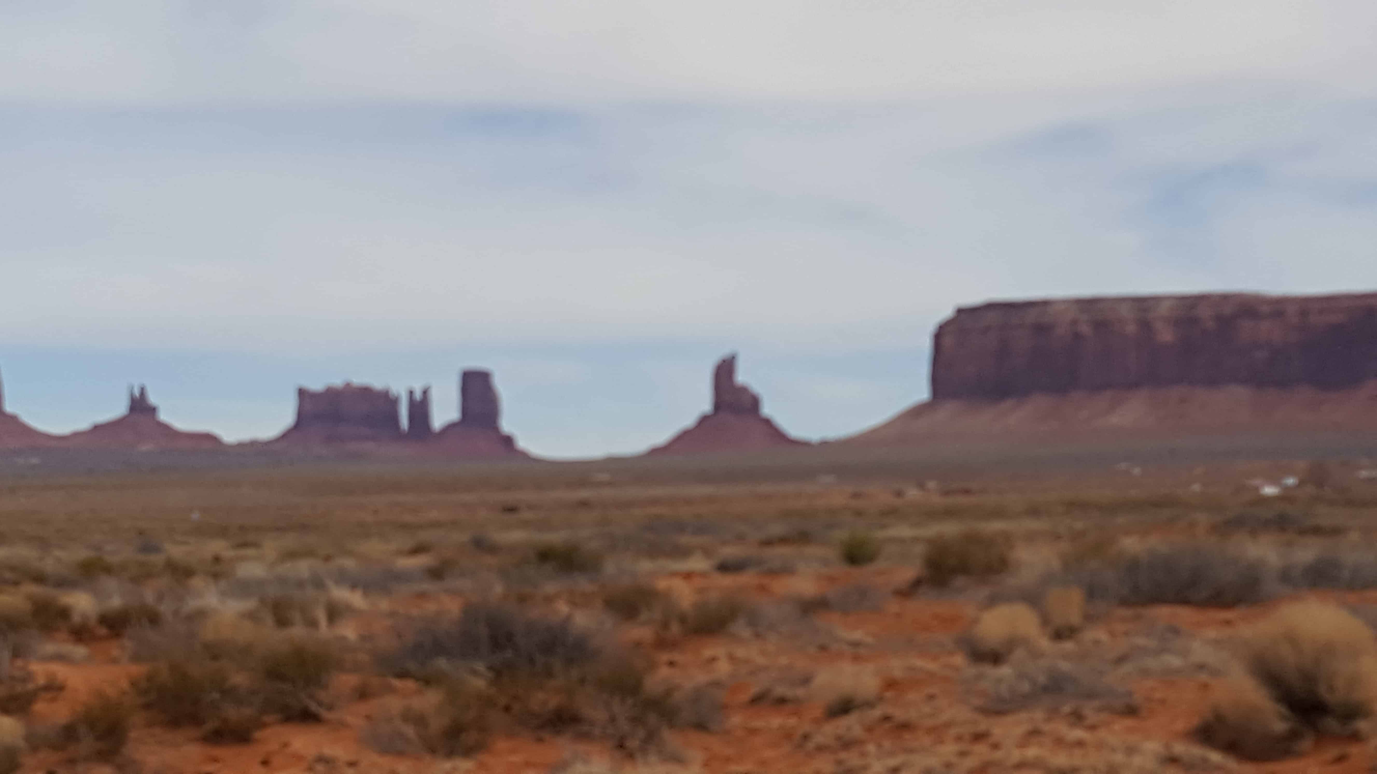
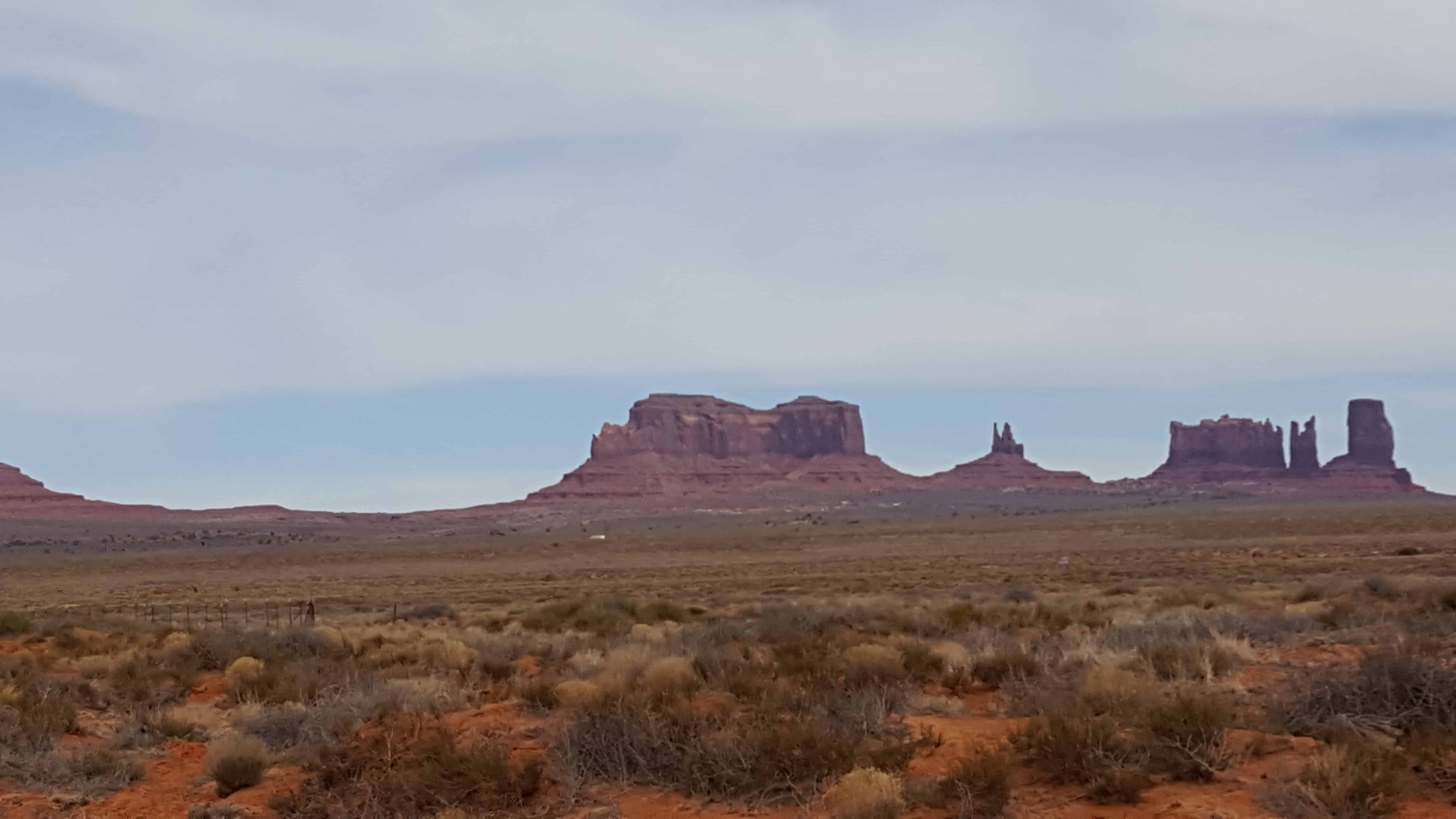
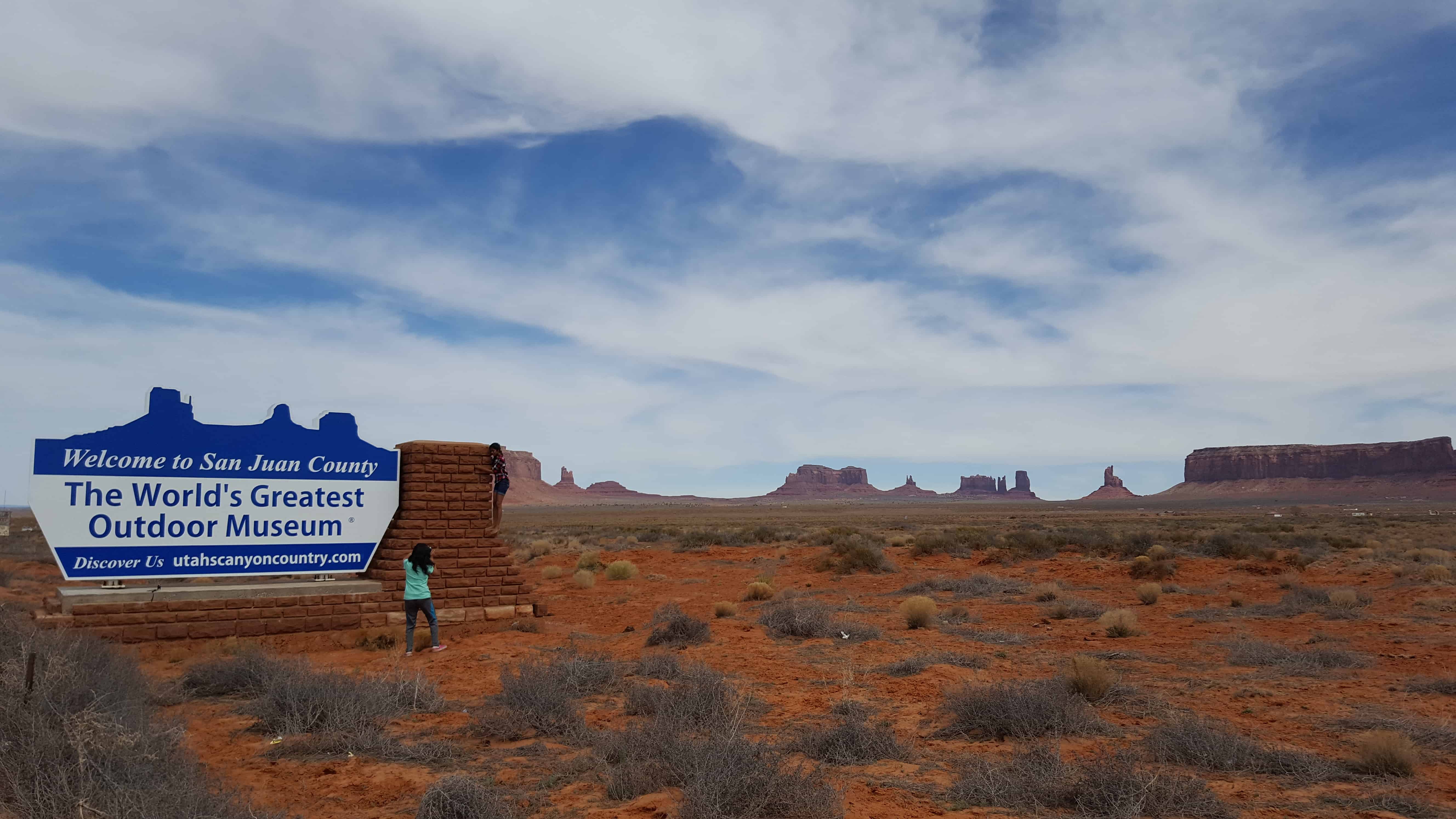
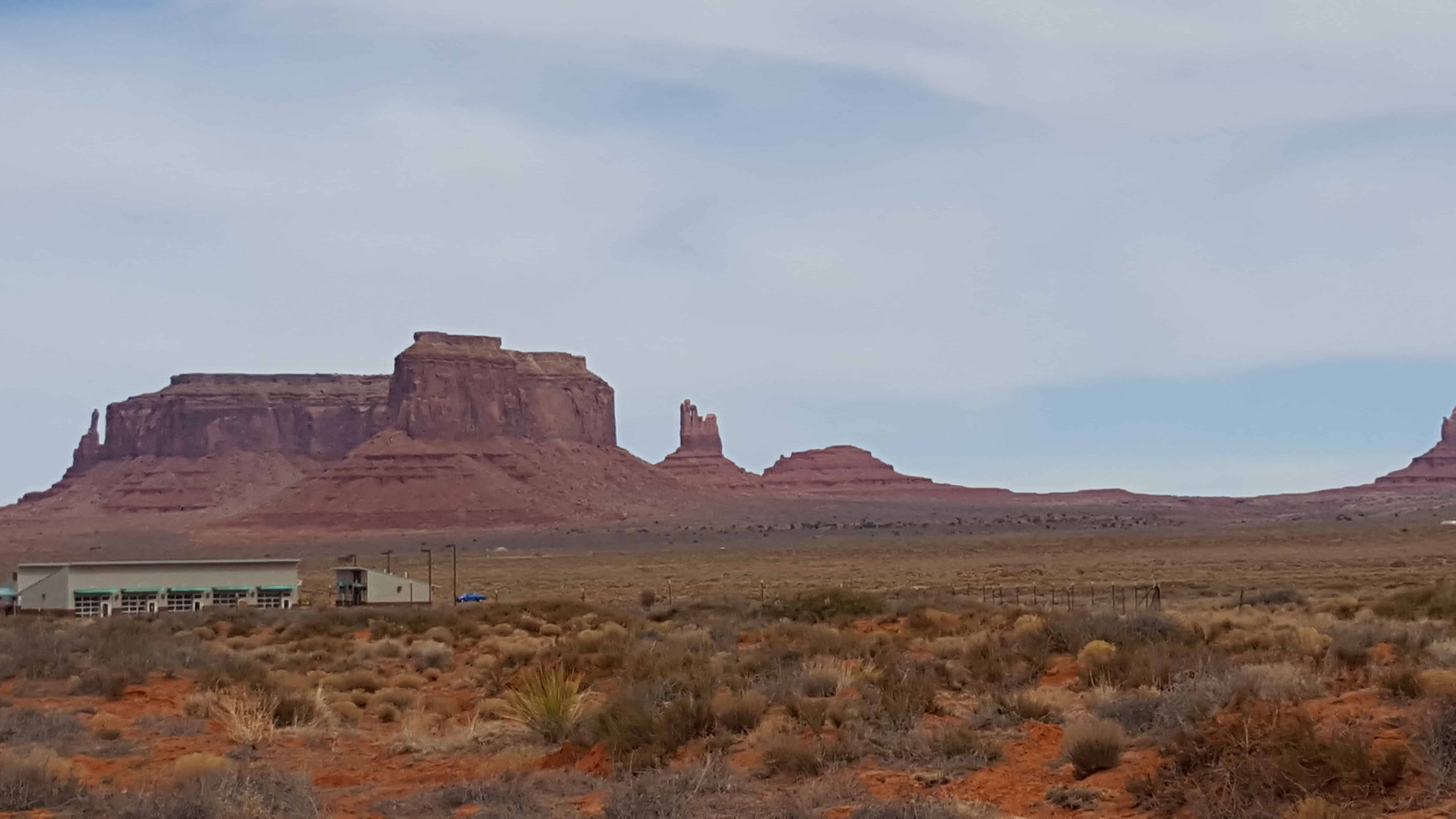
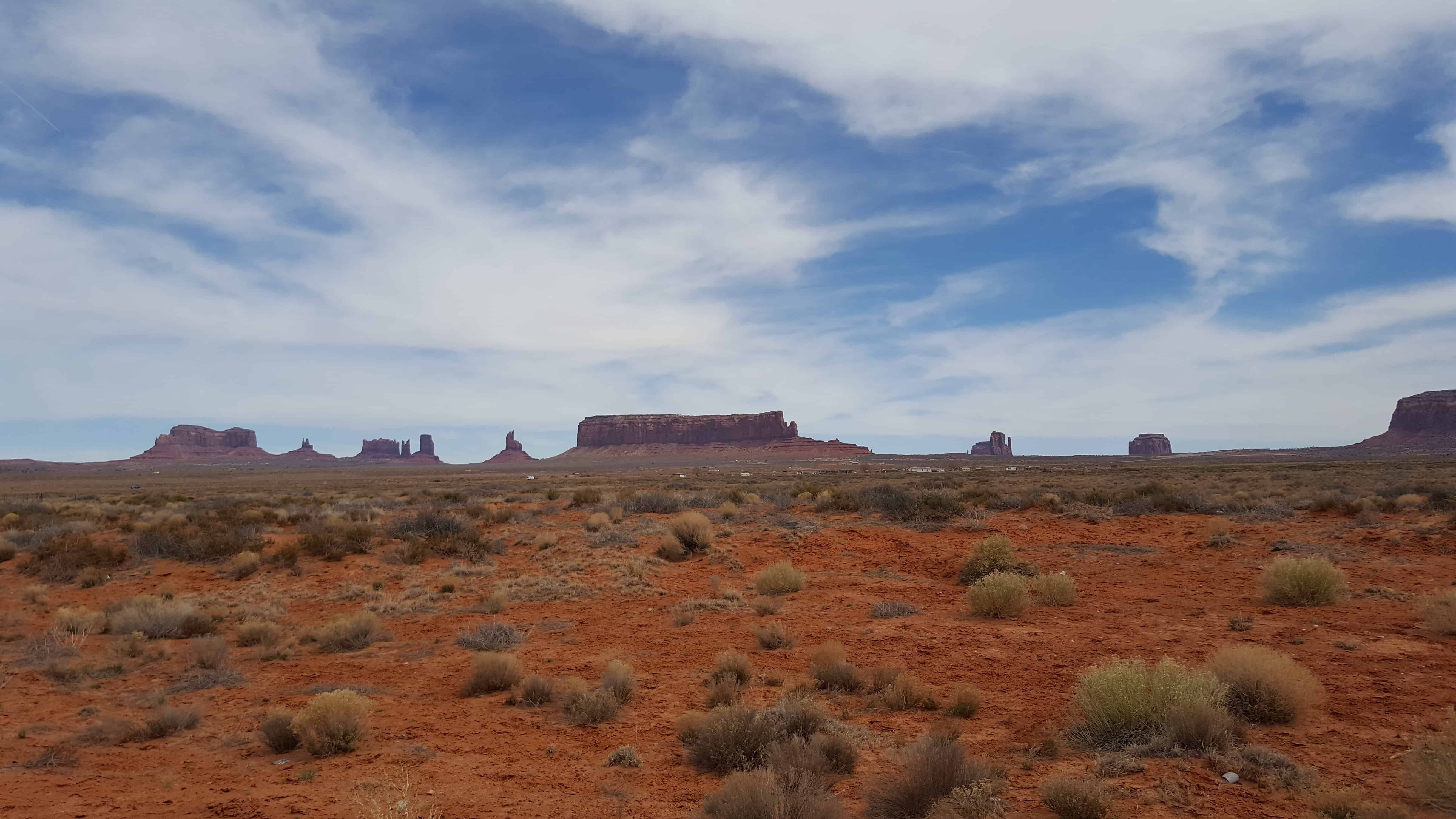
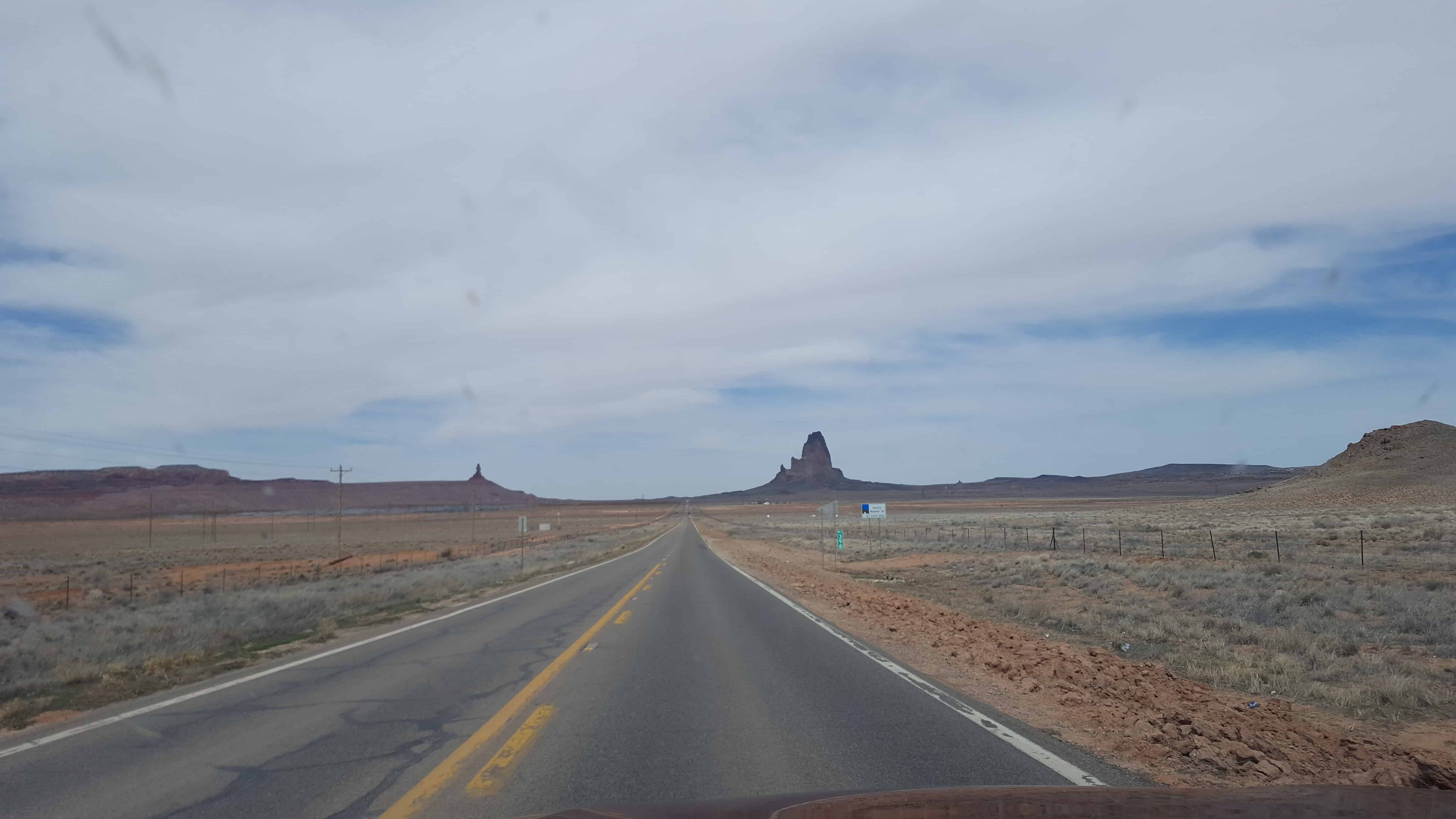
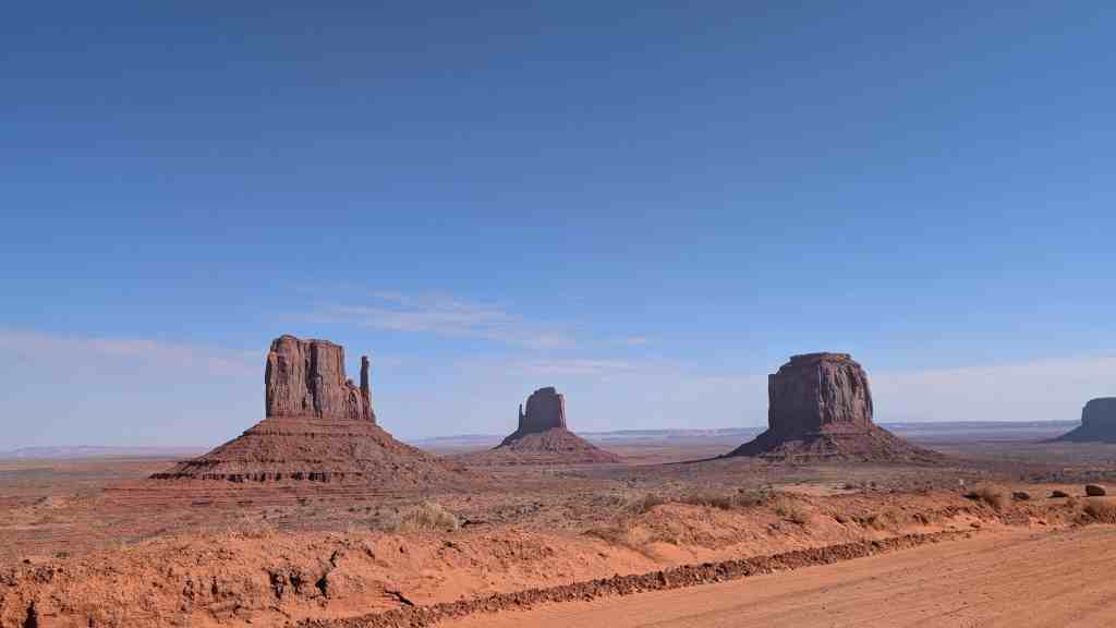
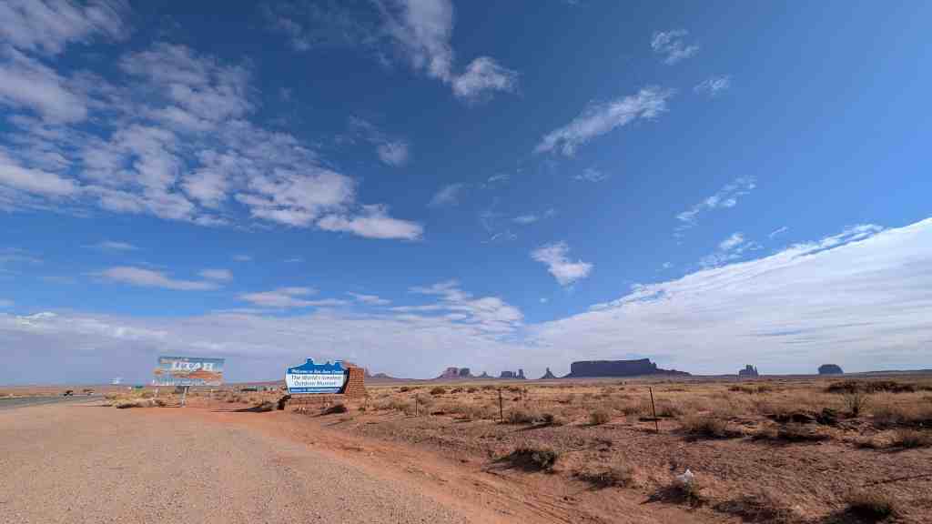
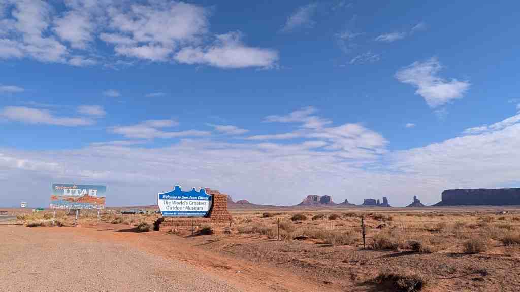
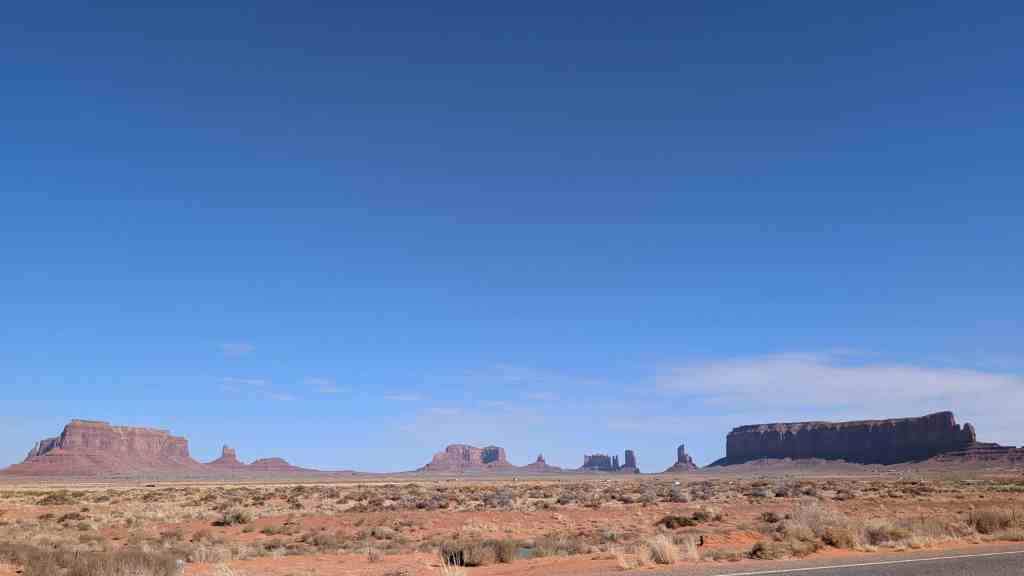
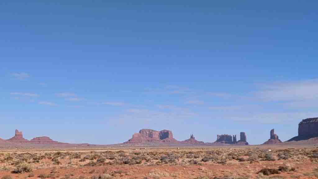
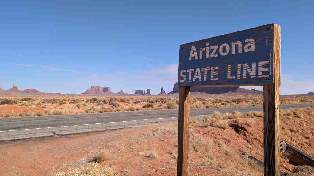
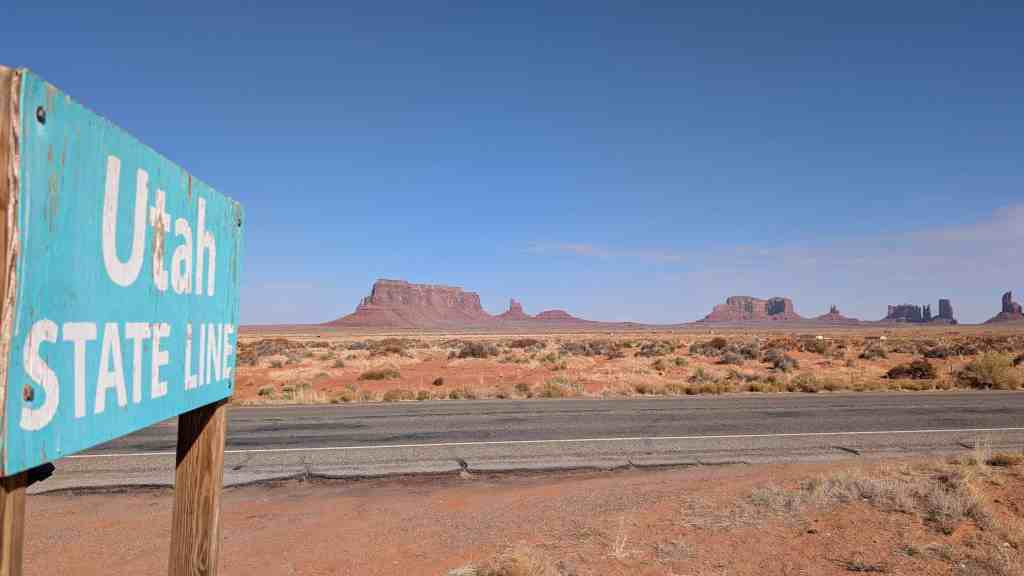
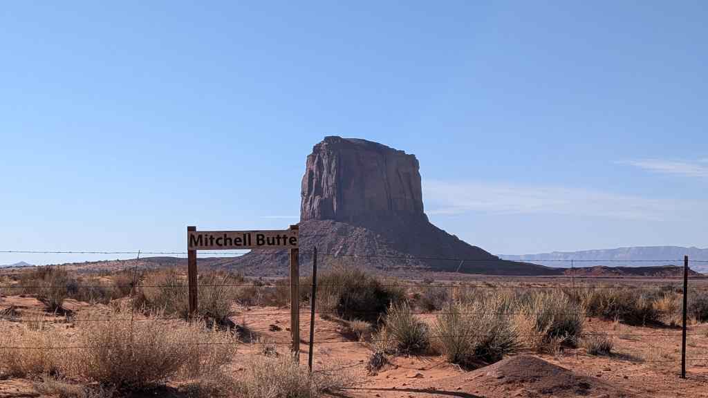
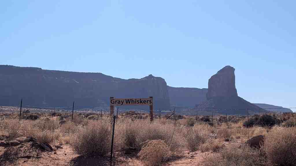
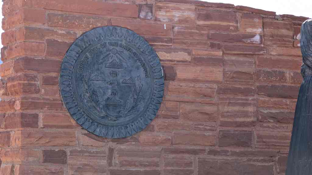
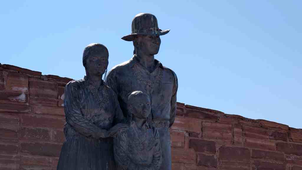
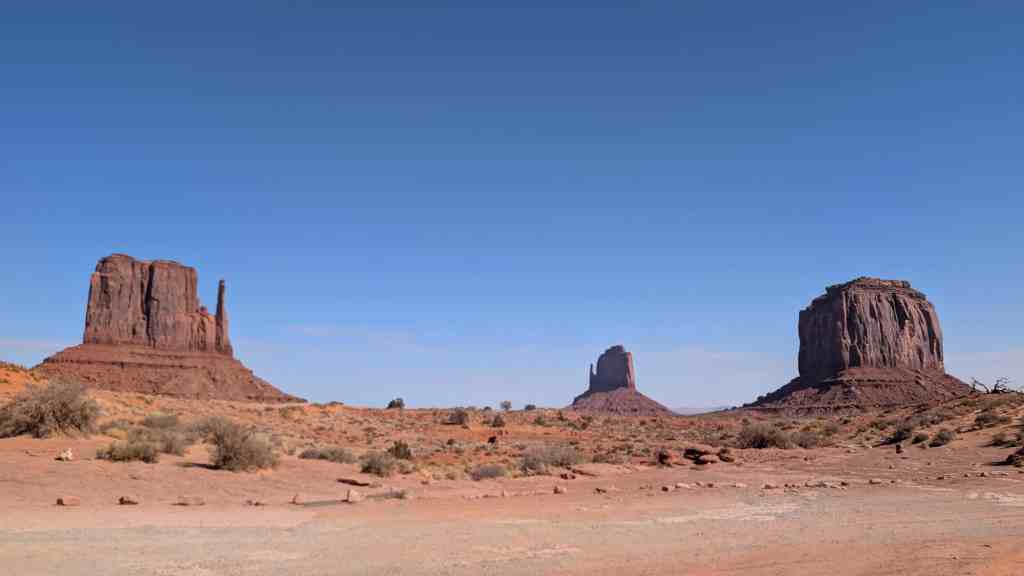
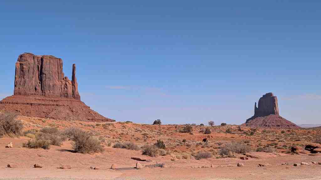
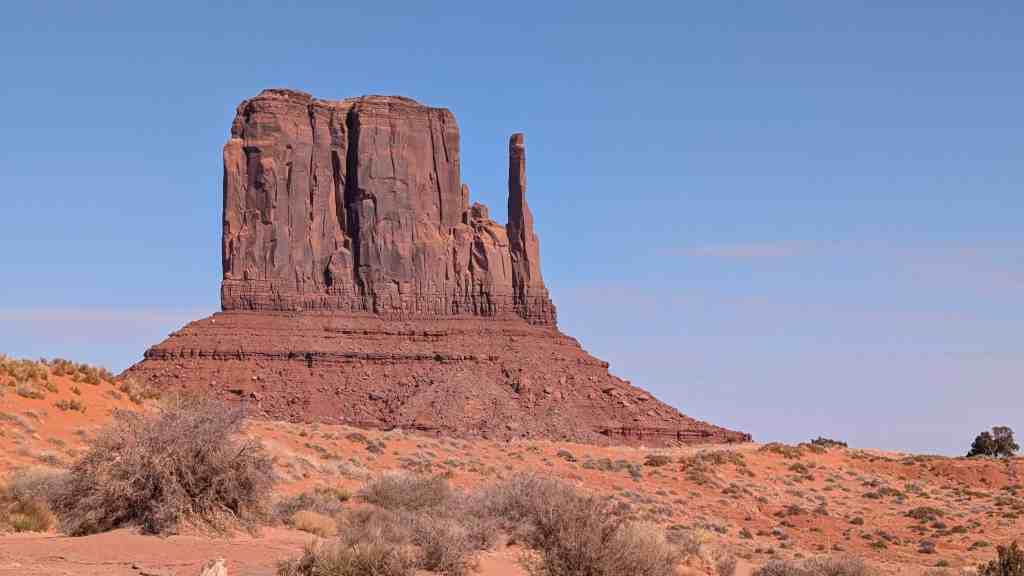
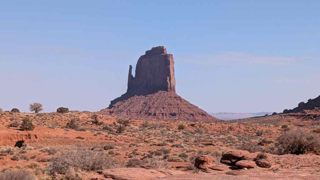
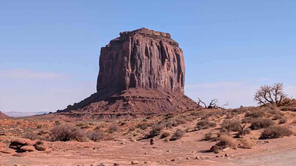
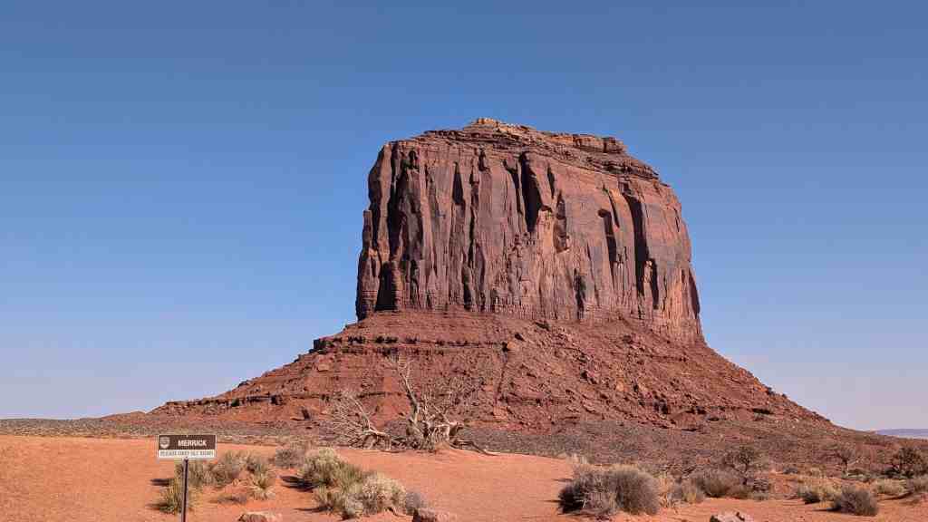
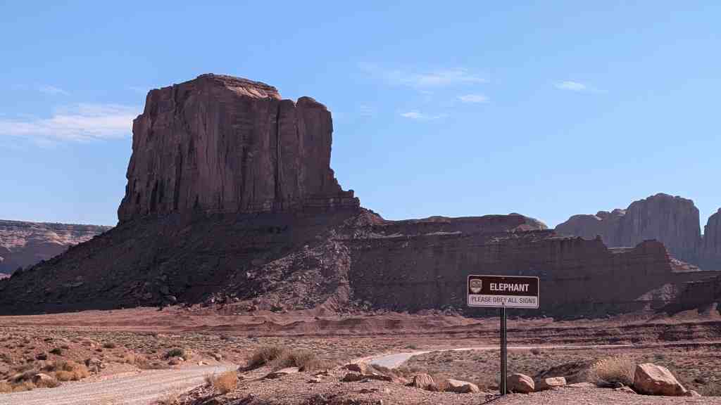
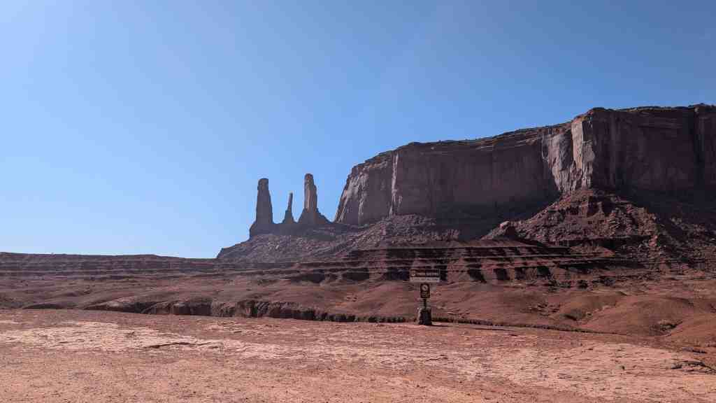
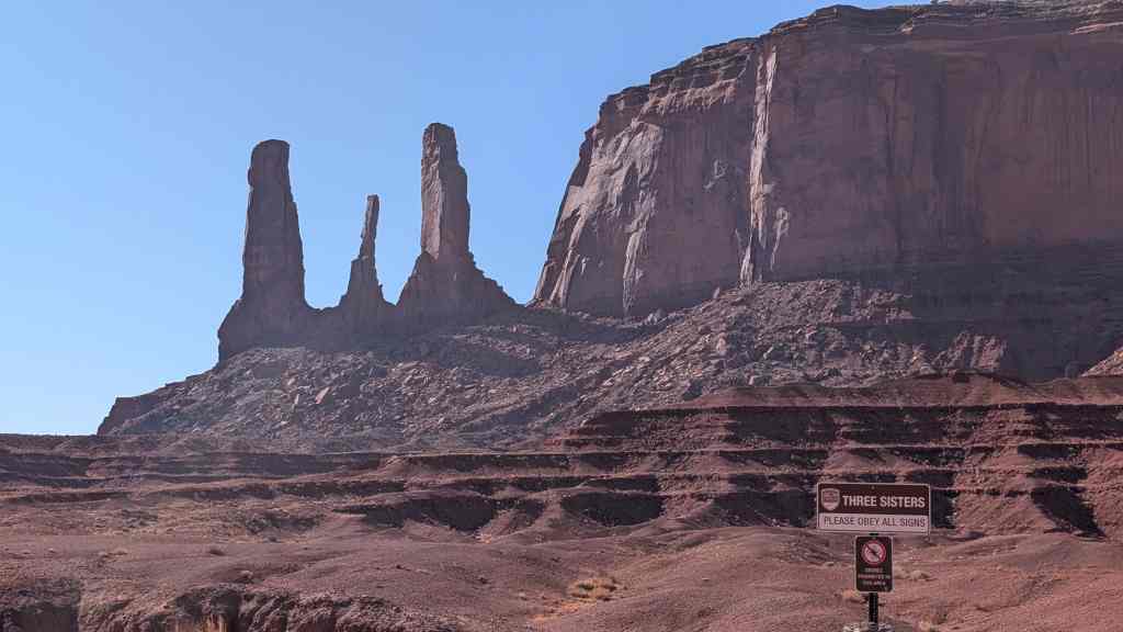
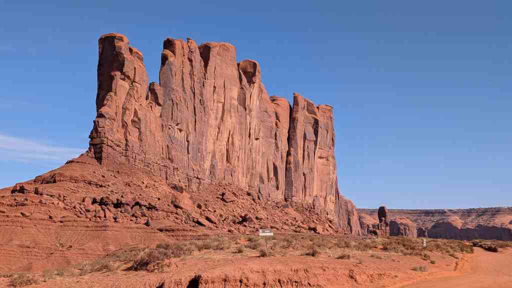
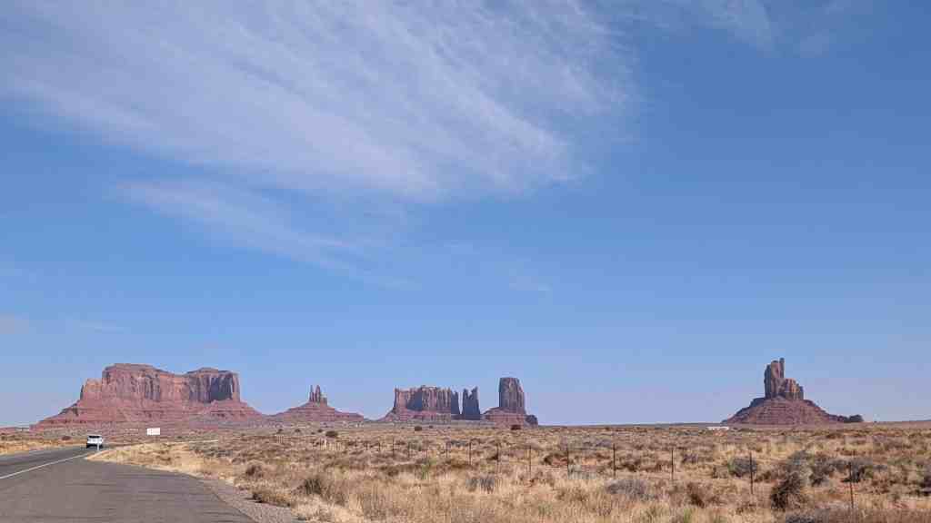
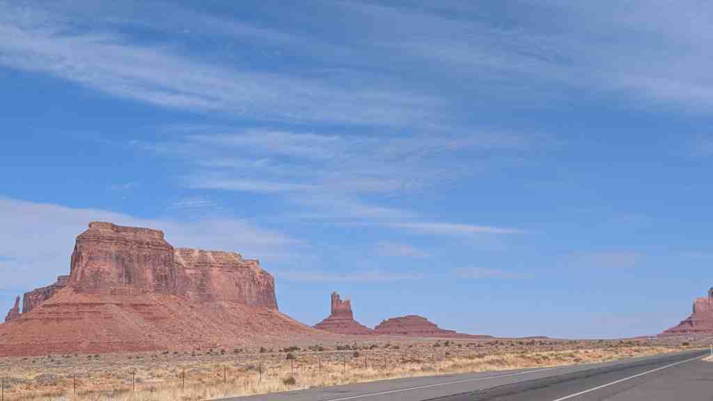
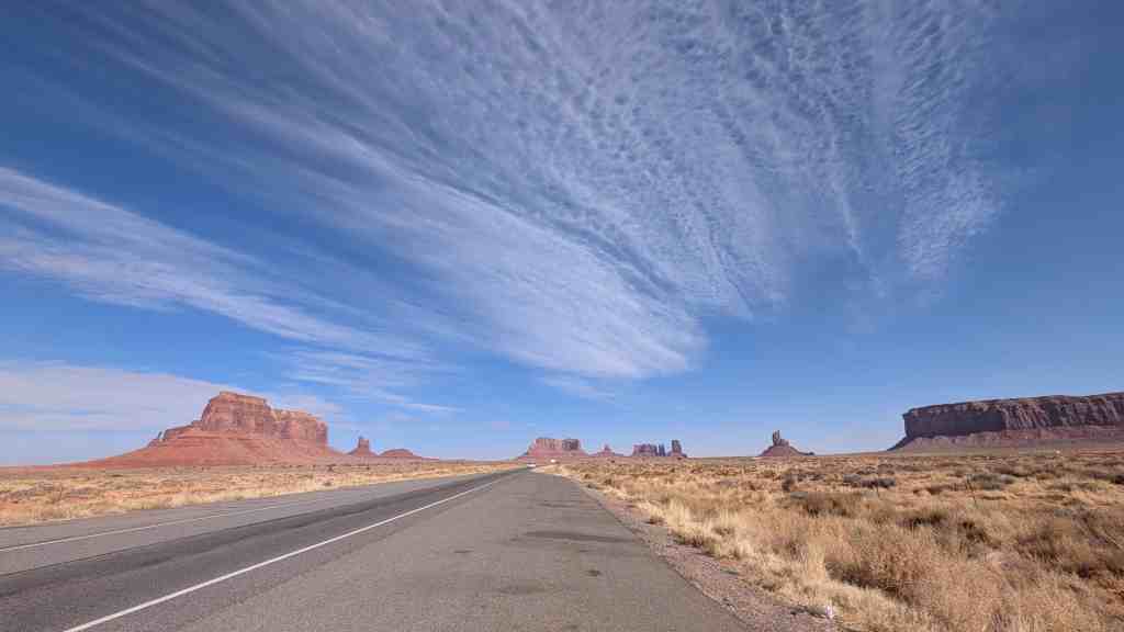
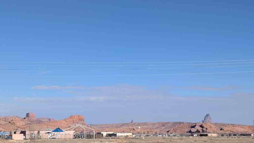
Monument Valley (Navajo: Tsé Biiʼ Ndzisgaii, meaning valley of the rocks) is a region of the Colorado Plateau characterized by a cluster of vast sandstone buttes, the largest reaching 1,000 ft above the valley floor. It is located on the Arizona–Utah border, near the Four Corners area. The valley lies within the range of the Navajo Nation Reservation and is accessible from U.S. Highway 163.
Monument Valley has been featured in many forms of media since the 1930s. Director John Ford used the location for a number of his best-known films and thus, in the words of critic Keith Phipps, “its five square miles have defined what decades of moviegoers think of when they imagine the American West.”
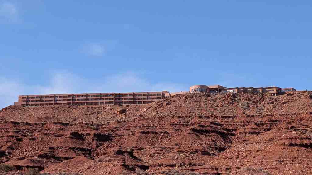
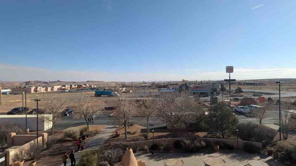
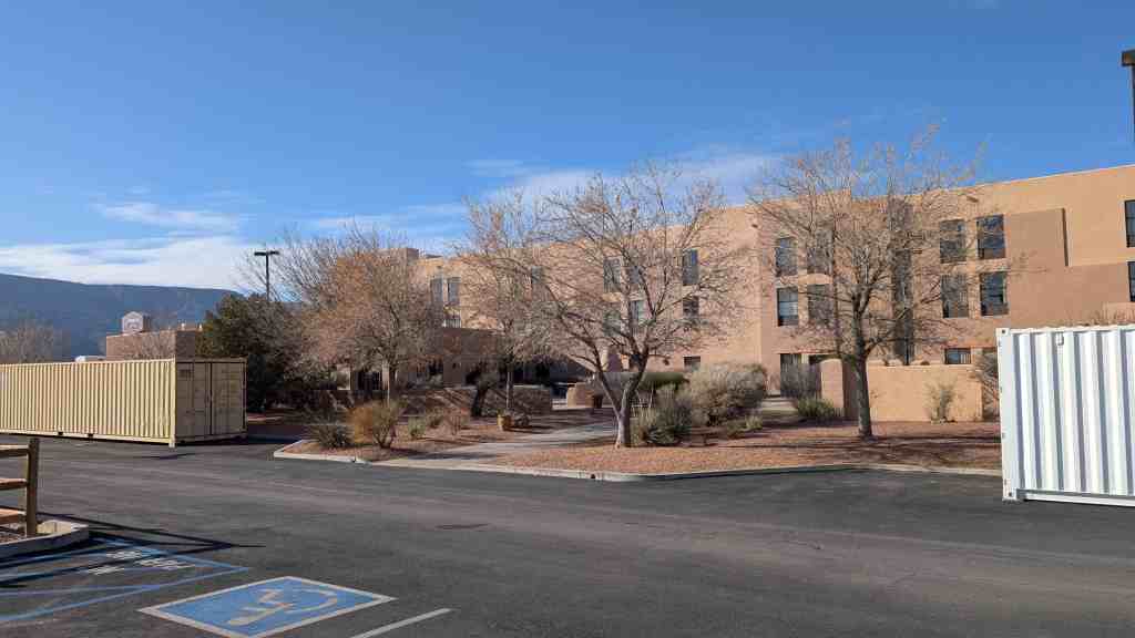
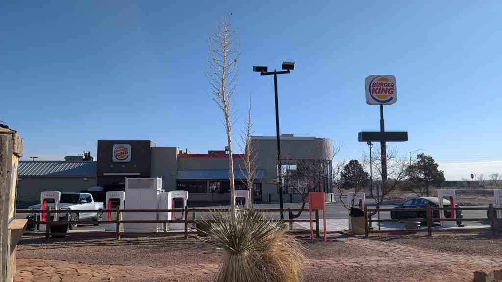
Kayenta is a U.S. census-designated place which is part of the Navajo Nation and is in Navajo County, Arizona. The population was 5,189 at the 2010 census. Kayenta is located 25 miles south of Monument Valley and contains a number of hotels and motels which service visitors to Monument Valley. Like other places on the Navajo Nation, it is illegal to serve alcohol. Arizona does not observe Daylight Time; however, the Navajo reservation does.*
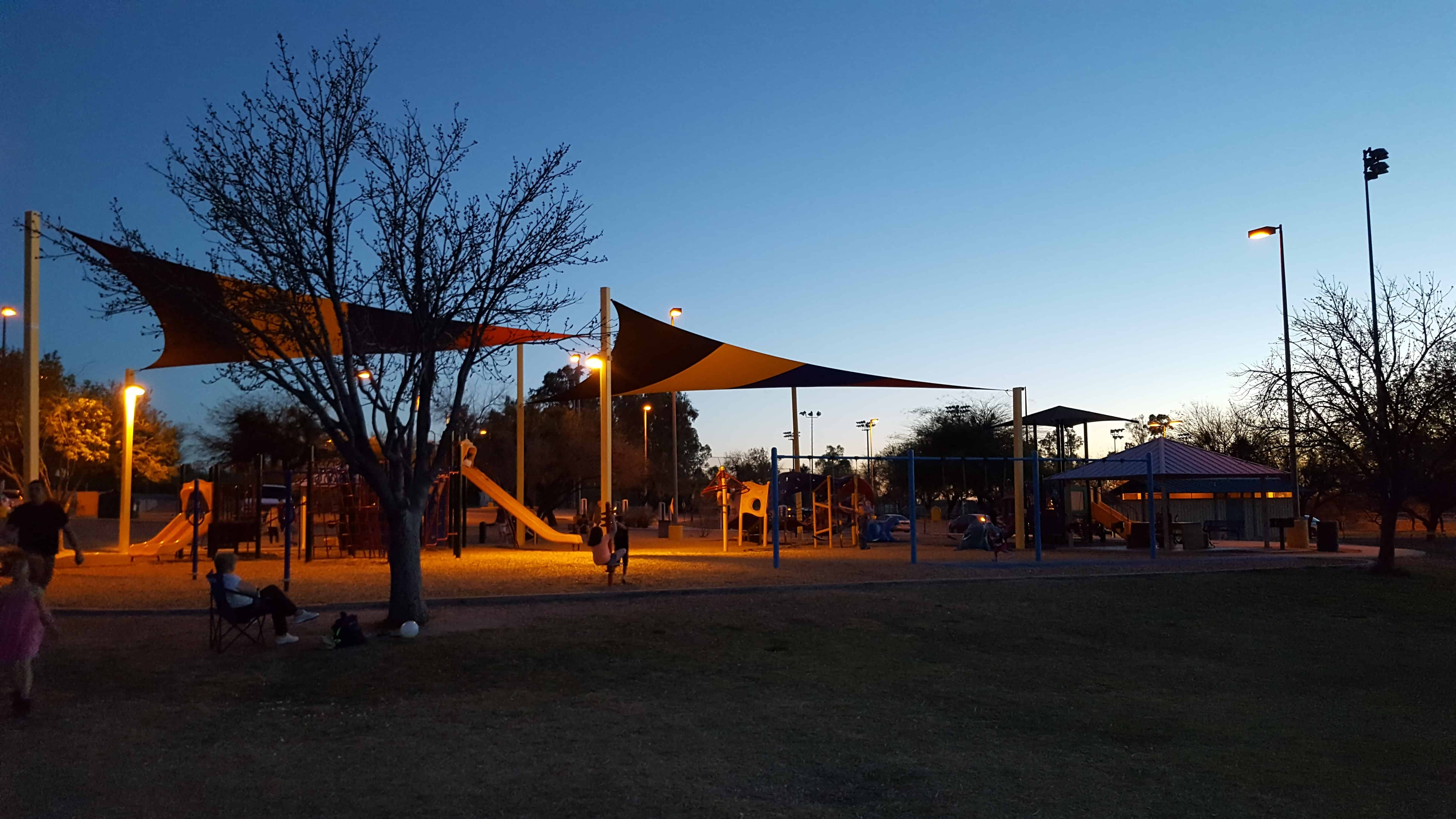
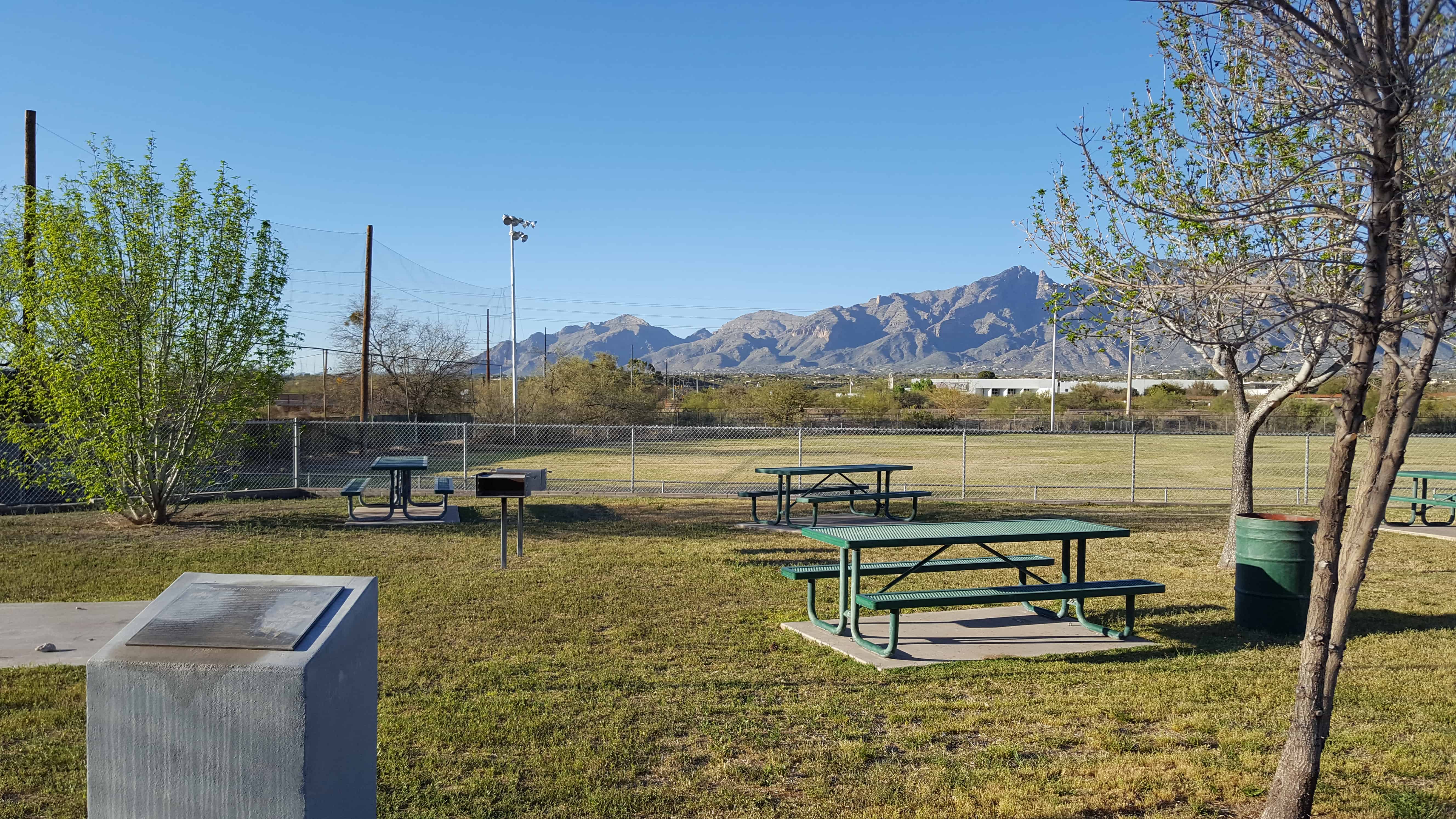
McDonald Park in Tucson is a very cool place for kids and families to play. There are large grassy areas, great views, a huge interesting playground and more.
The first members of The Church of Jesus Christ of Latter-day Saints to enter what is now Arizona were remnants of the Mormon Battalion. They arrived in the Valley of the Tucson Basin December 17, 1847, prepared for battle. However, the Mexican Garrison refused to surrender and departed with most of the population. The Stars and Stripes were raised over the ancient Indian village. This march accomplished the task of pioneering a route through southern Arizona and inspired many, like Pvt. Erastas Bingham, to return with his wife and sons. They homesteaded, cleared land of mesquite, creosote, cats claw, rattlers, Gila monsters, lizards and tarantulas. Teams, plows, picks, and shovels were used to build reservoirs and irrigation systems. They called their community Binghampton, The children walked or rode on horseback or in buggies to school at Nephi Bingham’s home. School was later held in a one-room building south of the Rillito River at Fort Lowell & Maple Boulevard. In 1905 Alexander Davidson donated land for the Davidson School. Charles Bayless furnished materials, and members of The Church of Jesus Christ of Latter-day Saints donated labor. The school was used for cultural and church events. Settler families, Bingham, Farr, Young, Webb, Williams, and Hurst, were soon followed by Mormon Colonists fleeing Mexico. Colonists Langford, Bluth, Done, Ray, Johnson, Hardy, Nelson, Stock, Evans, Terrel, Jesperson, James, Price, Cordon, Butler, Huish, Naegle, Heder, Chlarson, and others added to the bustling Mormon farm village. The Binghampton Branch of The Church of Jesus Christ of Latter-day Saints was organized May 22, 1910. Binghampton was gradually absorbed by Tucson’s growth. All that remains is the pioneer cemetery, a few adobe homes, and the chapel built in 1927, still used by ward members from the Tucson Arizona Stake.
This is DUP Marker #548, for other DUP Markers click here.
Here the first Government Indian School was established for Pimas and Maricopas in 1871, with Rev. Charles H. Cook as teacher. It was the location of Pima villages, friendly resting place for travelers during the Mexican War and the Gold Rush. It was also the birth place of Ira Hayes, a Pima, one of the U.S. Marines in the famed Flag-Raising at Iwo Jima.
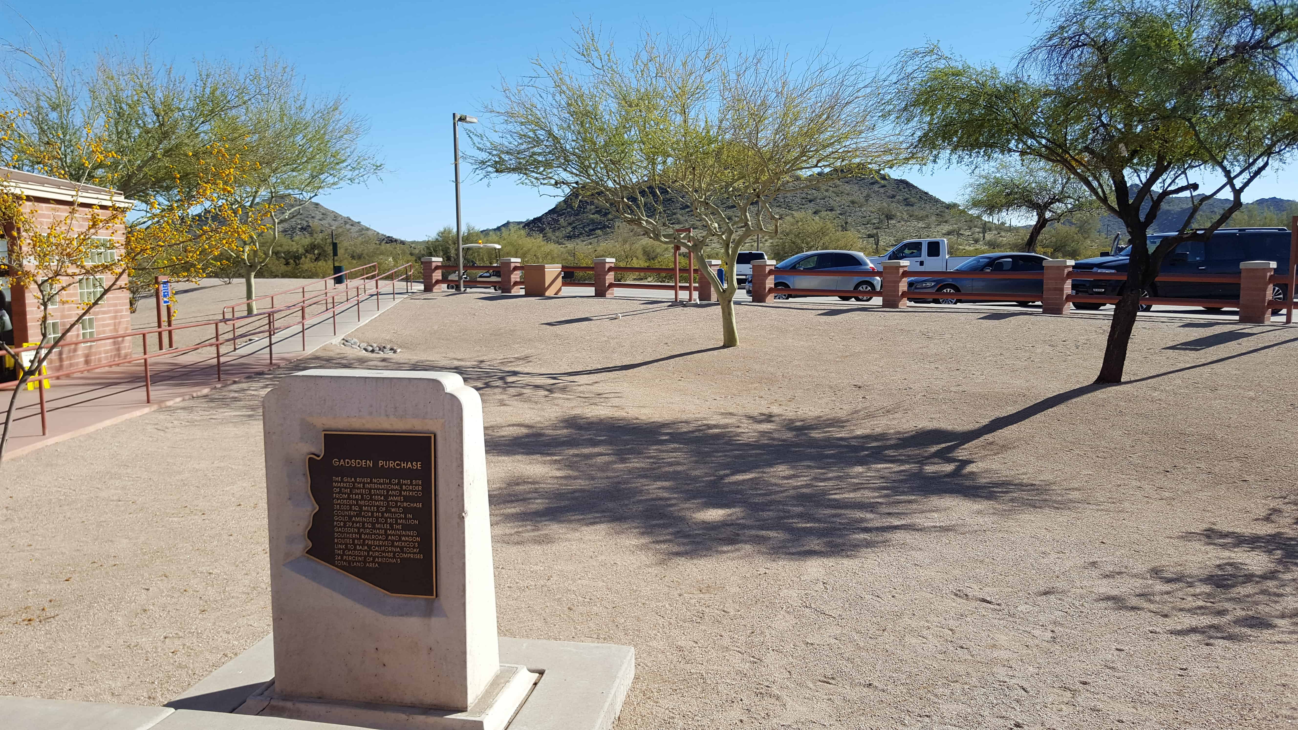
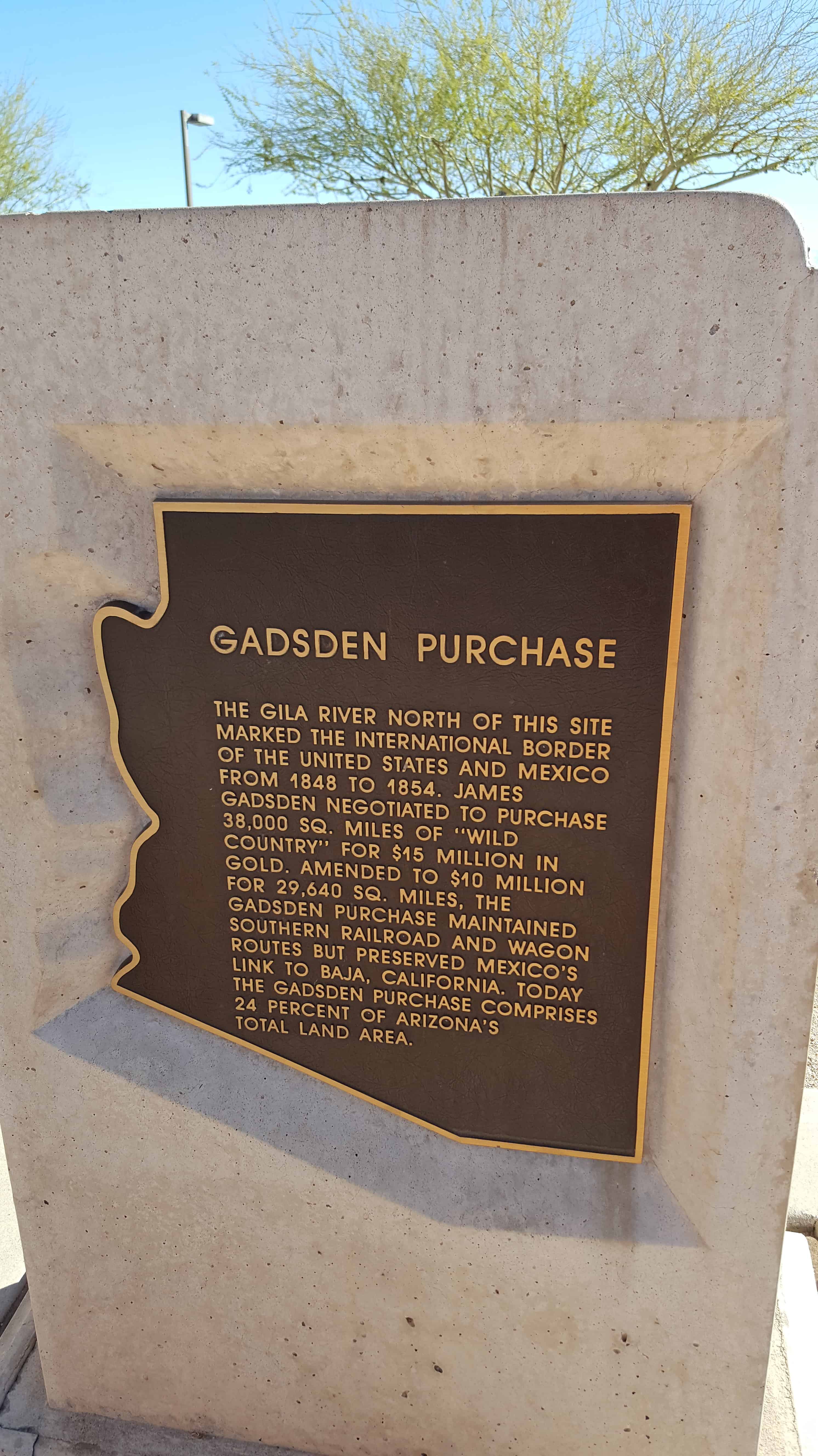
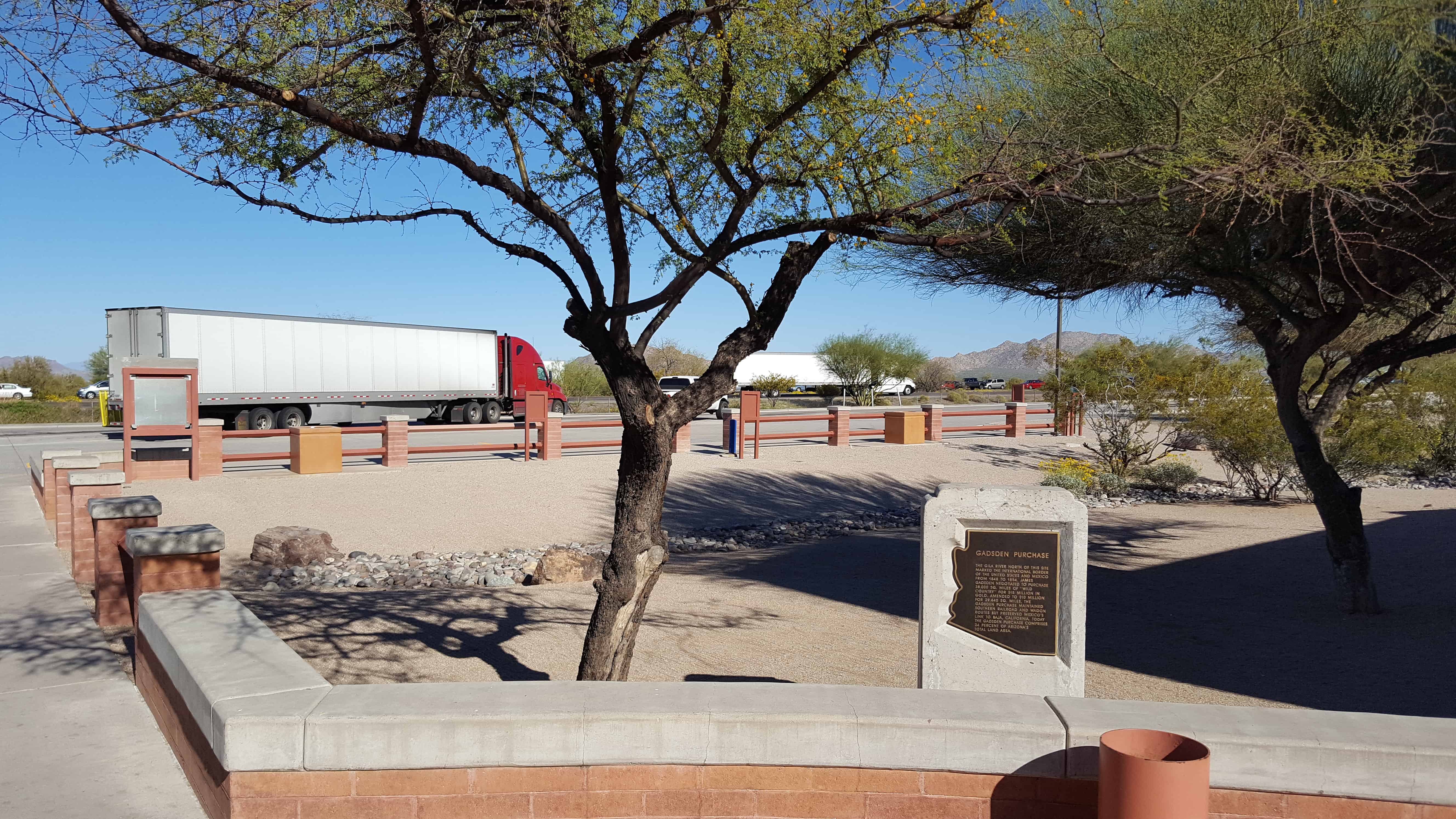
The Gila River north of this site marked the international border of the United States and Mexico from 1848 to 1854. James Gadsden negotiated to purchase 38,000 SQ. Miles of ‘wild country’ for $15 million in gold. Amended to $10 million for 29,640 SQ. miles, the Gadsden Purchase maintained southern railroad and wagon routes but preserved Mexico’s link to Baja, California. Today the Gadsden Purchase comprises 24 percent of Arizona’s total land area.
The first meetinghouse in Phoenix for The Church of Jesus Christ of Latter-day Saints (Mormons) was built on this site by the three-hundred-member congregation of the Phoenix Ward. At the time, J. Robert Price was bishop.
Since their beginning in 1912 with nine members, the Latter-day Saints in Phoenix had met in four different locations – – the Knights of Pythias Hall at 23 East Washington Street, a laundry at 534 West Washington Street, an old Spanish-style building at 121 South First Avenue, and a room over a bicycle shop at 237 North Fifth Street. They purchased this area on the eastern edge of Phoenix’s original city plat and built their first chapel 1918-1919.
The handsome meetinghouse – – designed by Pop and Burton, Architects, of Salt Lake City – – was an early example of the influence Frank Lloyd Wright’s architecture had in the Southwest. The Latter-day Saints worshipped here for nearly thirty years. Phoenix used it as a community center, and weekly businessmen’s luncheons and youth dances were held in the building.
By 1923, a thriving congregation (ward) of 730 made it necessary to expand the building; after further expansion in 1926, the meetinghouse filled this plaza area. Other wards were organized and more chapels were built, but the Phoenix First Ward continued to meet here until 1948, and Brill was completed. The building on this site was sold to another church and eventually demolished in 1969.
Bishop J. Robert Price, 1918-1926 Bishop George F. Price, 1926-1928 Bishop John H Udall, 1928-1938 Bishop Arch B. Campbell, 1938-1950
Placed 1981 Sons of Utah Pioneers, Salt River Chapter and Historic Arts and Sites Committee of The Church of Jesus Christ of Latter-day Saints


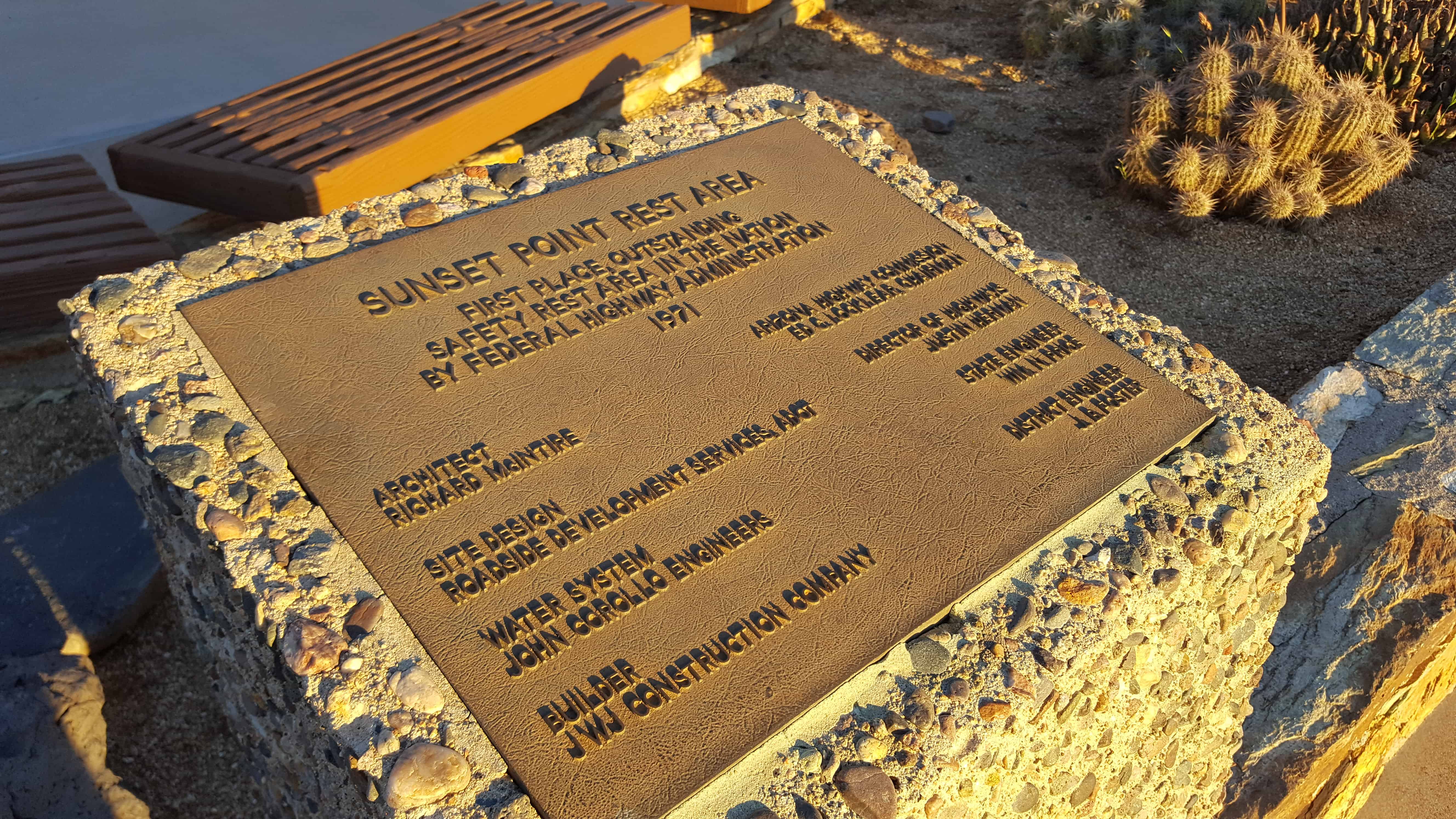
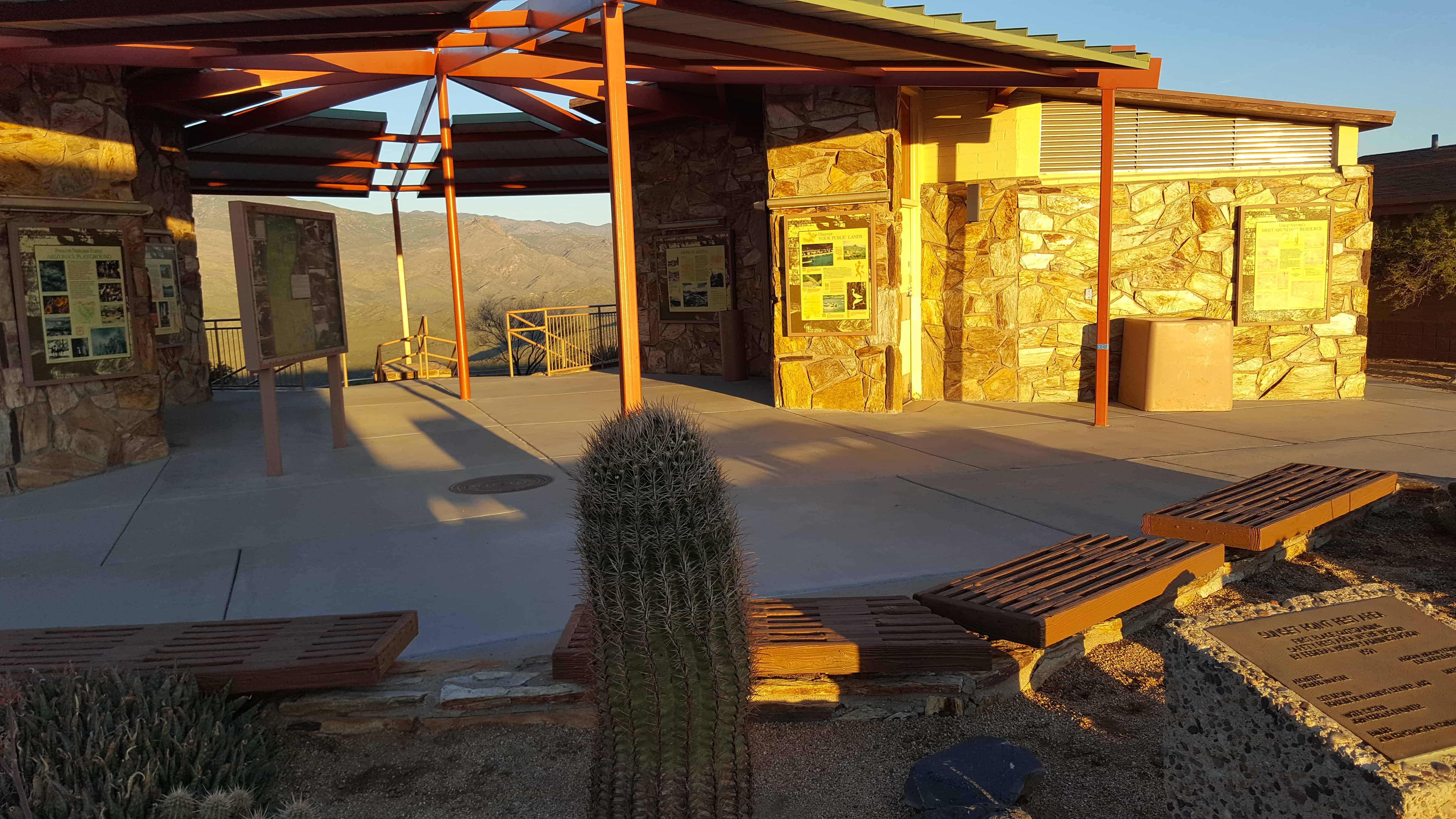
 The Sunset Point Rest Area on I-17 has some great views and is a good place to take a rest.