Hoover Dam

The Hoover Dam was added to the National Register of Historic Places (#81000382) on April 8, 1981. The text below is from the nomination form for the historic register.
Hoover Dam is among the largest and earliest of the Bureau of Reclamation’s massive multiple-purpose dams. By providing electric power, flood control, and irrigation waters, the dam made increased levels of population and agricultural production in large areas of the Southwest feasible, affecting not only lands near the river, but also urban centers such as Los Angeles. Hoover Dam was not the first major arch-gravity dam to be constructed. The Cheesman Dam in Denver, for example, predates it. Nor is the dam the first of the Bureau of Reclamation’s multi-purpose dams in the United States; that distinction belongs to the Theodore Roosevelt Dam, already a National Historic Landmark. Hoover Dam is, however, distinguished by its size, the size of its hydroelectric plant, and the far-reaching consequences of its construction in the agricultural, industrial, and urban development of the Southwestern United States.
In the field of hydraulic engineering, the dam is an accomplishment comparable to the Panama Canal. Hoover Dam was the highest dam in the world – 726.4 feet from bedrock to the crest – when it was constructed. Today it is still the western hemisphere’s highest concrete dam. Because of this height, it created a reservoir that could store the normal flow of the river, including all average floods, for 2 years. When filled to the maximum, it will impound more than 31 million acre-feet of water. The dam is also large enough to trap and hold the millions of tons of sediment carried by the river every year, without seriously impairing its efficiency as a reservoir or interfering with the generation of electrical power.
One of the major engineering techniques developed in was the cooling of the concrete. If the dam had been it would have taken more than a century to do so, and cracked as it cooled. Engineers solved this problem pier-like blocks and cooling the concrete by running more than 582 miles of pipe embedded in the blocks. of the chemical heat generated by the “setting up” of cooling was completed in March, 1935.
Hoover Dam’s role in the history of hydroelectric power is indicated by the fact that from 1939 until 1949, the dam’s powerplant was the largest hydroelectric powerplant in the world. It provides electrical energy for transmission to southern California, southern Nevada, and parts of Arizona, contributing to industrial and population growth in those areas. Directly or through interconnections, the Hoover powerplant has facilitated mining and minerals exploitation projects in California, Nevada, and Arizona.
Four intake towers provide for release of stored water under normal conditions and control the flow to the canyon-wall and tunnel-plug outlet works and to the power-plant turbines. Each of the intake towers is constructed on a rock bench or shelf excavated in the canyon wall and consists of an inner barrel 29 feet 8 inches in diameter surrounded by 12 radial buttresses, which accommodate the trashrack sections (gratings for retaining objects from water entering a penstock) and support the barrel. The outer diameter of each tower tapers from 82 feet at the base to 63 feet 8-7/8 inches at the top, a parapet 342 feet above the base. The towers have upper and lower gate openings, with 12 openings each. These cylinder gates, 32 feet in diameter and 11 feet high, are raised and lowered over the openings by electrically-operated stem hoists.
TUNNELS AND OUTLET WORKS

The two downstream intake towers are each connected by a header tunnel to the canyon-wall outlet works. Each of the tunnels is 41 feet in diameter and lined with 24 inches of concrete. Each is connected by four 21-foot-diameter tunnels to the powerplant turbines. Downstream from the 21-foot tunnels, the header tunnels are each connected to the canyon-wall outlet works by six 11-foot horseshoe tunnels filled with concrete.
The two upstream intake towers are connected with the inner diversion tunnels by 41-foot-diameter inclined tunnels lined with 24 inches of concrete. These inclined tunnels are each connected to the powerplant turbines by four 21-foot penstock tunnels.
The tunnels carry a system of steel plate pipes constructed by the Babcock and Wilcox Company of Barberton, Ohio. These are composed of four 30-foot-diameter headers, four branch penstocks 13 feet in diameter leading from each header to the turbines, and a 25-foot header leading beyond the penstock pipes to six smaller branch pipes connecting to the outlet valves on each side. These pipes rest on reinforced concrete piers and are anchored at both ends, at bends and manifolds, and in several intermediate areas.
The outlet works downstream from the dam regulated the reservoir and supply water for flood control and downstream use before the generator capacity was sufficient. They have a designed capacity of about 100,000 second-feet of water. At the present time the flow is 45,000 second-feet. The outlet works consist of the canyon wall outlet system and the tunnel-plug system. The canyon wall system incorporates 84-inch needle valves on each side of the canyon approximately 175 feet above the river and pointed 60° downstream. The valves are housed in reinforced concrete structures of similar design. The Arizona house is 206 feet long, 36 feet wide, and 64.5 feet in height. The Nevada house is 190 feet long, 37 feet wide, and 64.5 feet in height. The valves are protected by 96-inch Paradox emergency gates connected to the steel outlet conduits entering through the back wall of the houses.
The tunnel plug outlet works are in the inner diversion tunnels, several hundred feet from their outlet portals. They are fed by 25-foot steel outlet pipes each leading to three 13-foot branch pipes, each of which in turn leads to two 86-inch pipes which feed a total of six 72-inch needle valves protected by 86-inch emergency gates in each diversion tunnel.
POWER PLANT
The dam’s first generator began operating fully in 1936 and its last in 1961. The powerplant consists of 17 turbines with a rated capacity of 1,850,000 horsepower with an additional 7,000 horsepower provided by the two service station units. The main turbines are each equipped with a butterfly type hydraulic-rotor-operated shut-off valve at the inlet, and a 10- to 14-footdiameter turbine casing. They are of the vertical-shaft, single-runner Francis type with cast-steel spiral casings and single-piece cast-steel runners. The initial installation was composed of four 115,000-horsepower units and one 55,000-horsepower unit. These generators became operational in 1936 and 1937. The generators are of two sizes: 82,500 KV-ampere, 180 r.p.m., 60-cycle, 16,500-volt generators; 40,000 KV-ampere, 257 r.p.m., 60-cycle, 13,800-volt generators of the conventional two-guide-bearing type with thrust bearings on the top of the frame and a 50,000 KV-ampere and 90,000 KV. Inert-gas-filled outdoor-type transformers with shielded windings provide either 55,000 kilovolt-amperes at 287,500 volts or 13,333 kilovolt amperes at 138,000 volts as well as 230,000 KV and 69,000 KV. The larger transformers are water-cooled. The powerplant is immediately downstream from the dam and is a U-shaped structure 1,650 feet long, with 2 wings, each 650 feet long. The two wings are on opposite sides of the river, with offices, shops, and operating and storage rooms built across the downstream face of the dam.
CONTRACTION JOINTS AND COOLING PIPES
Radial and circumferential contraction joints divide the face of the dam into blocks ranging in size from 25 feet by 30 feet to 50 feet by 60 feet.
These extend through the slot from its upstream face to loops of 1-inch steel cooling pipes buried in the concrete of the dam at intervals of 5 feet vertically and 5 feet and 9 inches horizontally. These 1-inch pipes are arranged in coils running from the slot circumferentially to the canyon walls and returning to the slot. More than 582 miles of these cooling pipes are embedded in the concrete of the dam.
GALLERIES, VISITOR FACILITIES, AND ARCHITECTURAL ORNAMENT
The dam is pierced with galleries at 50-foot horizontal intervals from the 575-foot altitude to the 957-foot altitude, to provide for drainage and inspection. There are approximately 2 miles of galleries in the dam. Two elevator shafts drop from the dam crest to tile-lined galleries 528 feet below, which lead downstream through the dam to the central portion of the powerhouse. In addition to the elevator shaft houses at the summit of the dam, there are two similar houses containing public restrooms. All four of these structures are decorated in Art Deco style, which is also used in the parapets of the intake towers. Sculped bas-reliefs on the upstream faces of the elevator and restroom houses depict symbolic representations of power, water storage, and other themes.
A small 1,630-square-foot exhibit building was constructed in 1940 on the Nevada side of Hoover Dam. This building provided a small lobby and an 85-seat auditorium in which visitors could view a model of the Colorado River and listen to a 10-minute taped lecture. From January, 1942, to September, 1945, the exhibit building and the dam were closed to the public and were used by the U. S. Army as a military command post.
To commemorate the engineering achievement of building Hoover Dam, a memorial was placed by the dam, with its principal part on the Nevada side of the dam, close to the abutment. Rising from a black polished base is a flagstaff, 142 feet high, flanked by two winged figures that are believed to be the largest monumental bronzes ever cast in the United States, resting on a black diorite base.
In terms of acreage, agricultural use is the most significant of the kinds of development fostered by Hoover Dam. The area irrigated with water stored in or controlled by Hoover Dam is 2,279,818 acres out of a total of 16,214,239 acres supplied with water provided by the Water and Power Resources Service projects in seventeen western states. The Boulder Canyon Project, which includes Hoover Dam, represents 14 percent of those irrigated lands, yet produces 22 percent of the vegetables and 37 percent of the fruits produced on all the lands developed as a result of the Water and Power Resources Service. This production is even more significant than these average figures suggest, because it includes winter vegetables that could not be cultivated in other areas. Also, much of the finest long- staple Pima variety cotton produced in this country is grown here. The value of the crops produced in the area served by the Boulder Canyon Project was $517,127,461 in 1977-1979.
The construction of Hoover Dam also provided storage for water for the Los Angeles metropolitan area. The development of that area and of the entire coastal southern California area was accelerated by the water supply that Hoover Dam made available.
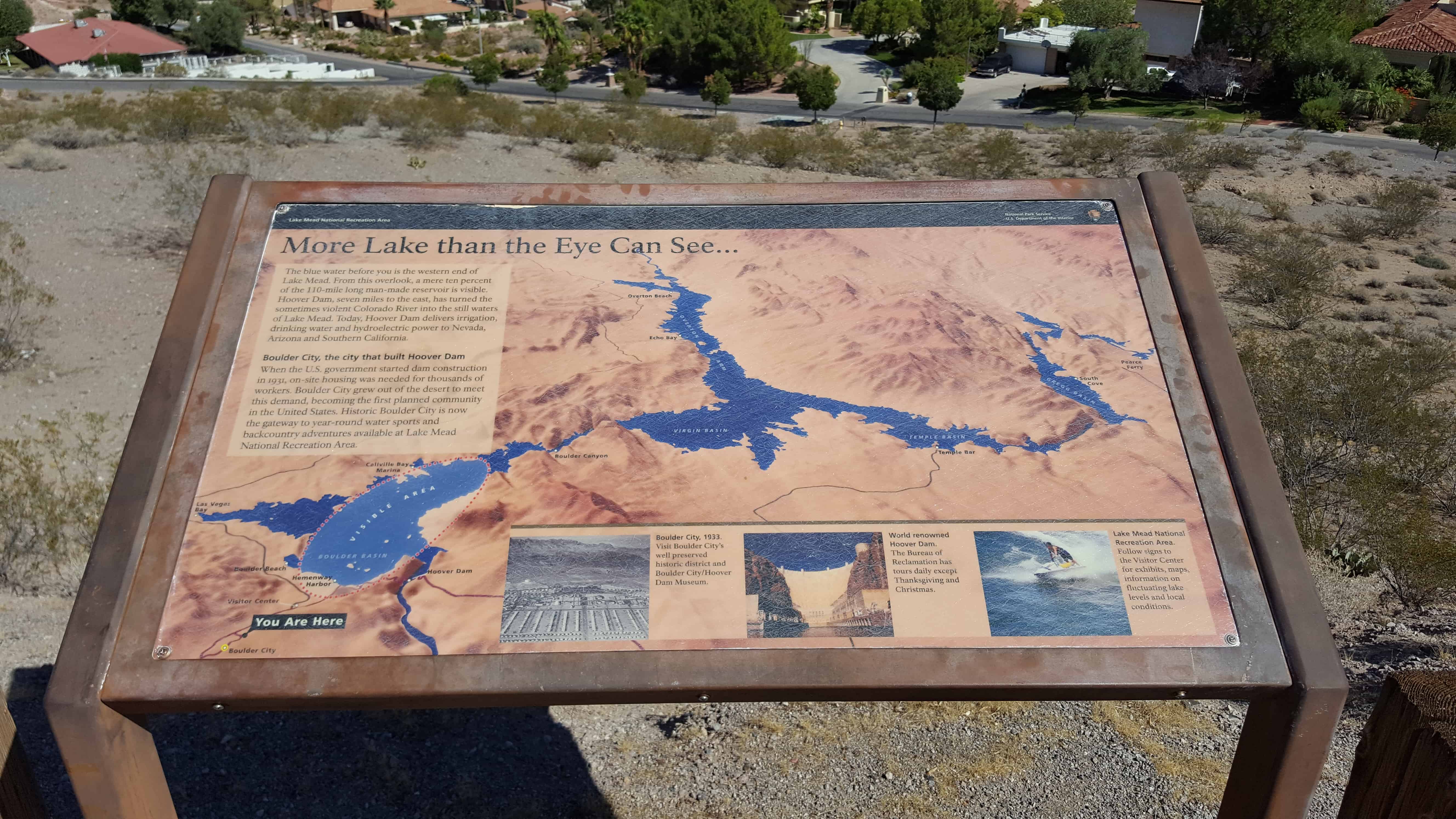
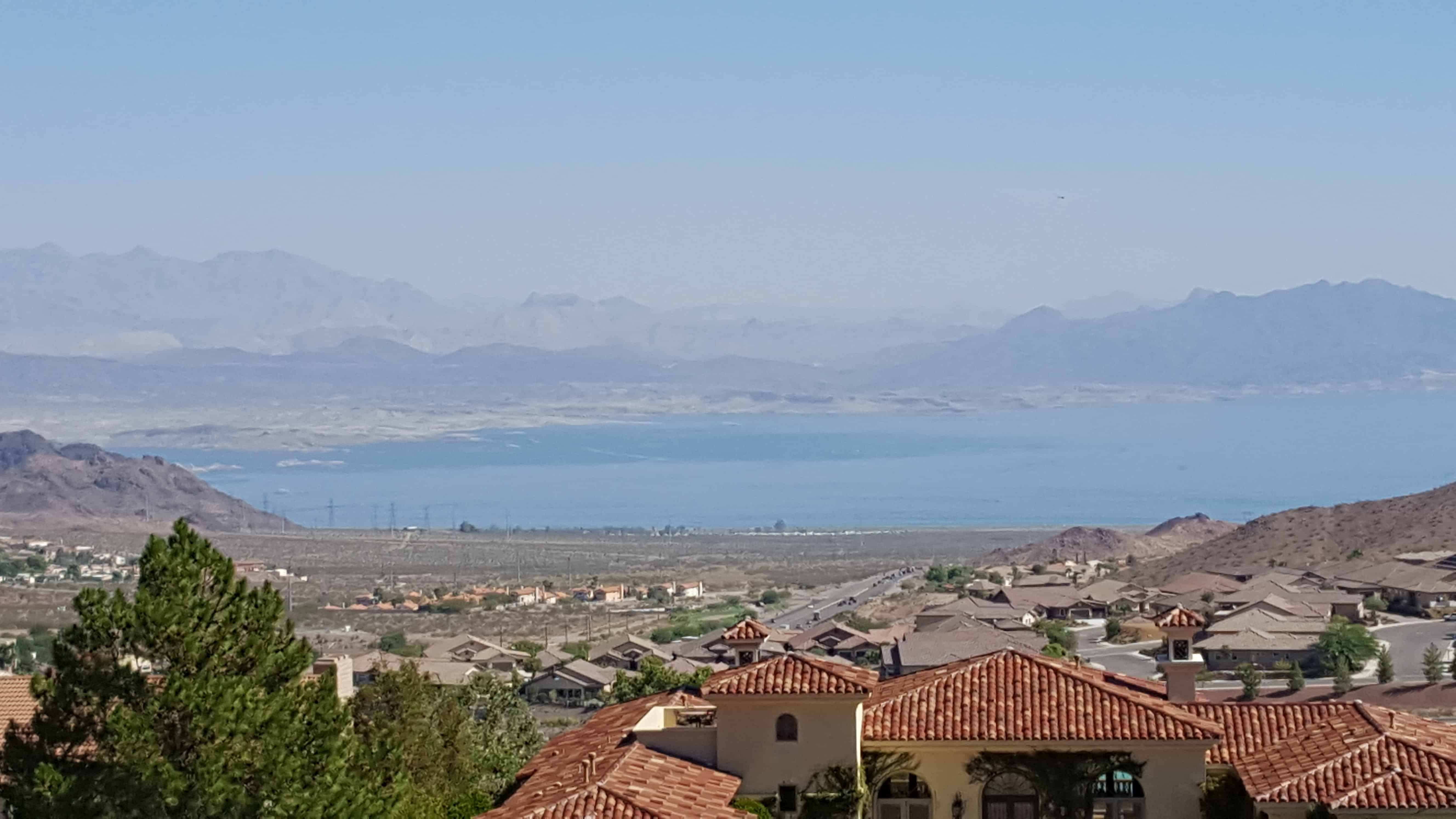
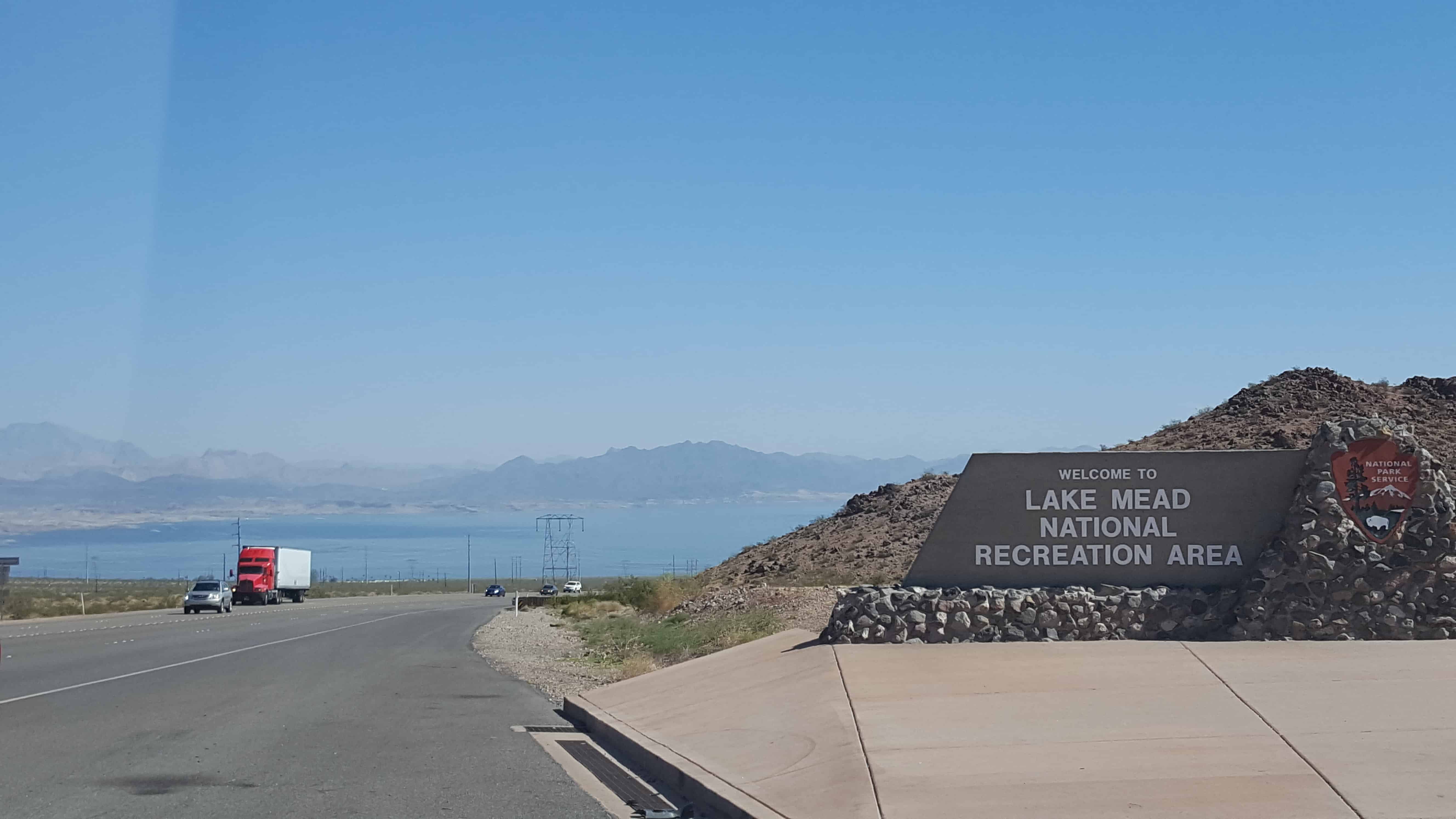
Recreational and retirement developments have grown up in the areas protected by the dam. In 1936, the impoundment behind Hoover Dam became the first National Recreation Area established by Congress. This recreation area, known as Lake Mead National Recreation Area, has been one of the most visited areas of the National Park Service for a decade or more.
Regulation of the Colorado’s waters has protected some 8,000 acres of land from annual flooding, in the low-lying valleys of Arizona and Southern California. The building of the dam has also controlled the sediment deposits carried by the river. Prior to construction of the dam, the river had an annual discharge of more than 100,000 acre-feet of silt at Yuma. The build-up of silt deposits contributed to the destructive forces of floods, such as the one in 1905. If no other dams had been built on the river, Hoover Dam would retain all of the silt released by the river into the reservoir for a period of 300 years, and for more than 100 years before its storage capacity and usefulness would be seriously impaired. As other dams were constructed on the river, they also began to catch and retain silt, thereby extending the usefulness of the dam.
Prior to the building of the dam, low-lying areas in Arizona and southern California were particularly vulnerable to the high water flows of the Colorado River. The lower Colorado, like other western desert rivers, usually has high water flows in late spring and early summer. During those seasons, floods resulting from rapidly melting snows occurred frequently and caused great damage in the lower Colorado River basin each year. The river in times of flood carried immense quantities of sediment which, deposited in irrigation canals and headworks, created serious problems of water delivery and maintenance and constituted a major irrigation problem along the lower Colorado River. Following these high-water periods, the flows often dropped to only 3,000 to 4,000 cubic feet per second. These periods of low flow, infrequently interrupted by large flash floods from such tributaries as the San Juan, Little Colorado, Bill Williams, and Gila Rivers, limited the area that could be irrigated.
Levees had to be built and continuously repaired to protect the lowlands from flooding. In 1905, the river broke through a temporary cut into the Imperial Canal, found a new course, and poured into the Salton Sink. The Salton Sea was formed as a result, and the river caused flooding in the Imperial Valley for about 16 months. Railroad tracks and highways were washed away, and agricultural lands destroyed. Damage amounted to millions of dollars. In 1909, the Colorado River again took a new course, causing Congress to authorize a milliondollar levee project. From 1906 to 1924 a total of $10 1/4 million was spent on levee work along the lower Colorado River.
Soon after the Reclamation Act became law in 1902, reclamation engineers began a series of studies of the Colorado River. A 1922 report to Congress on the condition and potential for irrigation of California’s Imperial Valley and a 1924 study both recommended construction of a dam at or near Boulder Canyon on the Colorado. In 1928, the Boulder Canyon Project Act became law, authorizing construction of a dam at Black or Boulder Canyon for purposes of flood control, improved navigation, storage and delivery of the Colorado’s waters, and electrical energy generation. The bill also authorized construction of an Ail-American Canal System connecting the Imperial and Coachella Valleys with the Colorado.
The proposed dam was of such magnitude that there was serious opposition and concern about the economic feasibility of the project and the engineering expertise needed. Some raised the possibility of the dam’s collapse. Contributing to construction problems were the remoteness of the dam site, the ruggedness of the surrounding terrain, and the extreme climatic conditions (summer temperatures of 125° in the canyon, cloudbursts, high winds, and sudden floods).
Planning for the dam went forward, however. In 1931, the labor contract for building the dam was awarded to Six Companies, Inc., of San Francisco. The crest height of the dam was reached in March, 1935, and placement of concrete was complete by May of that year.
GENERAL DESCRIPTION:
Hoover Dam is a concrete arch-gravity storage dam. The water load in this type of dam is carried both by gravity action and by horizontal action. The dam is in the Black Canyon on the Colorado River. The west wall of this canyon is in Clark County, Nevada, and the east wall is in Mohave County, Arizona. The dam is about 28 miles southeast of Las Vegas, Nevada, and approximately 7 miles east of Boulder City, Nevada.
The drainage area above Hoover Dam comprises 167,800 square miles including parts of the states of Wyoming, Utah, Colorado, Nevada, Arizona, and New Mexico. The Colorado River above Hoover Dam rises in the Rocky Mountains of Wyoming and Colorado and flows southwestward to Lake Mead for a distance of about 900 miles. Along this stretch of the river, principal tributaries are the Green, Yampa, White, Uinta, Duchesne, Price, San Rafael, Muddy, Fremont, Escalante, Gunnison, Dolores, San Juan, Little Colorado, and Virgin Rivers.
The first concrete in Hoover Dam was placed on June 6, 1933, and the last on May 29, 1935. The dam was dedicated September 30, 1935, and was completed two years ahead of schedule.
Hoover Dam is 1,244 feet long at the crest, where U. S. Highway 93 surmounts it. Its maximum height is 726.4 feet, measured from the lowest point of the foundation rock to the crest. The dam is 660 feet thick at the base and tapers to 45 feet thick at the top. 3.25 million cubic yards of concrete were used in the dam itself.
Four diversion tunnels were built on each side of the river to drain the dam site for construction. Each is a circular tunnel 50 feet in diameter and lined with three feet of concrete. The combined length of the tunnels is 15,946 feet. Since completion of the dam, these tunnels have been plugged, sealing off the upper portions while leaving the lower portions open. These serve as spillways in the case of the two outer tunnels and as penstocks in the case of the two inner tunnels. The spillways were designed to carry 400,000 second-feet of water and include a concrete-lined 600-foot inclined tunnel leading to the diversion tunnels on each side. Gravity dams of overflow profile were constructed to serve as spillway weirs; these are 85 feet high on the Arizona side and 75 feet high on the Nevada side. Piers at quarter points on the crests of these overflow sections divide them into 100-foot sections for structural steel drum gates to control spillover. The spillway channels are 125 feet wide at the weir crest and 165 feet wide at the tunnel end. They include more than 127,000 cubic yards of concrete.