La Grande was the first town permanently settled in Northeastern Oregon. Daniel Chaplin laid out the original “Old Town” in spring of 1862 and Ben Brown built the first house, a log cabin, alongside the Oregon Trail at the corner of B Avenue and Cedar Street.
As the prime lands of western Oregon were settled, and then gold was discovered in eastern Oregon, a reverse migration used the Oregon Trail from west to east. The “Old Town” area grew quickly. James S. McClung noted in his diary on September 22, 1862, “we came to Legrande Citty 5 houses 1 store and a Black smith shop… some of the people were living in their tent & waggon beds until they could build houses.” Just two weeks later Henry Herr wrote, “Oct. 9th Grande Rounde Valley City… This place is composed of 75 log cabins and emegrants with us are taking up claims and commencing to build houses. There are three stores.“
The post office was established in May 1863 under the name of “La Grande.” In 1884, the shape of La Grande changed dramatically when Chaplin donated 105 areas to the new railroad and the commercial center moved from “Old Town” to the tracks.
This historic marker is located on Adams Avenue in La Grande, Oregon.
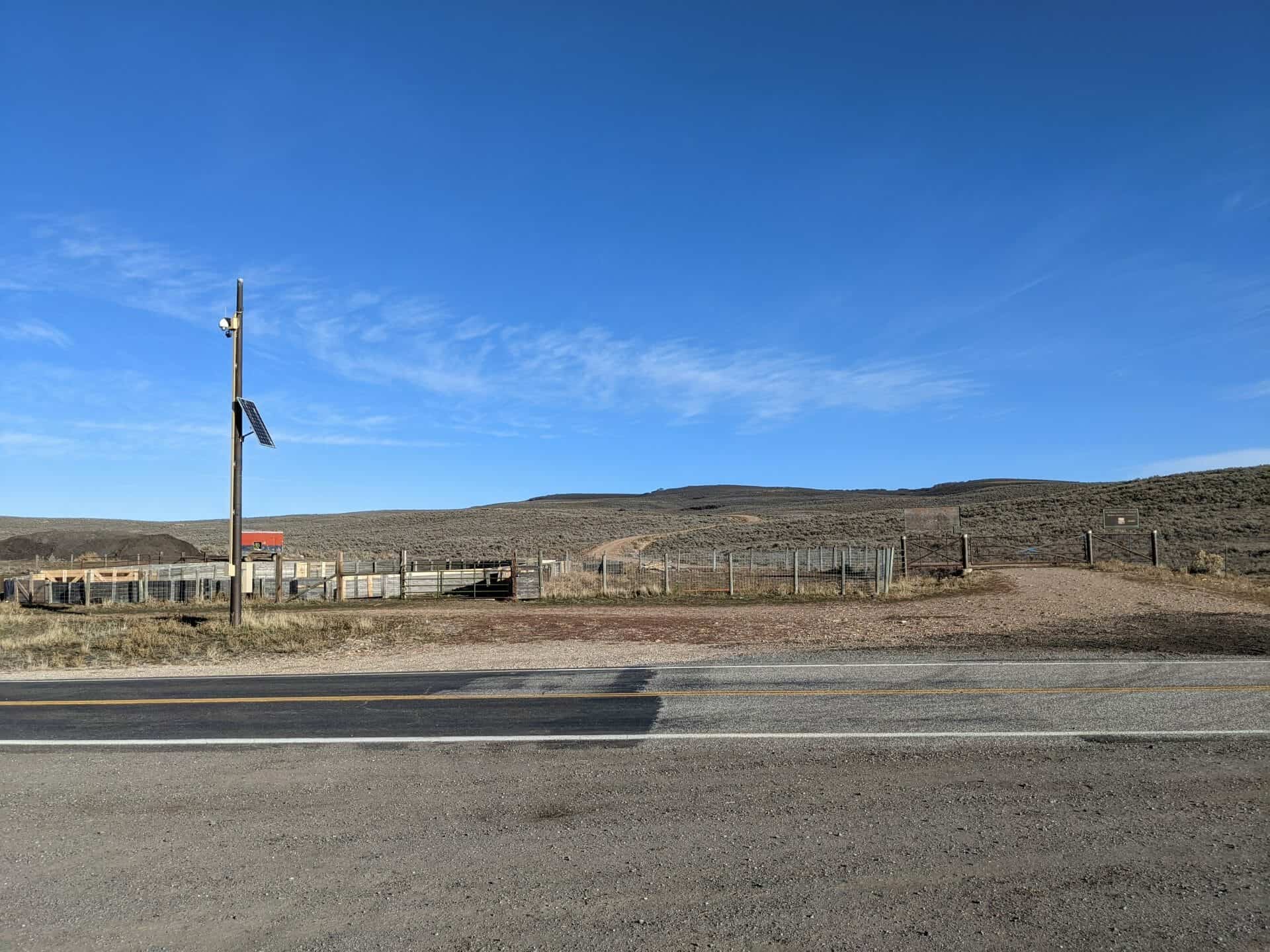
y the late 1840s emigration had seriously depleted trail-side game, grazing, water, and firewood. Many Indians tribes began demanding tribute from emigrants for passage through their lands and for the use of natural resources — violence was but one regrettable consequence. Agents of the Bureau of Indian Affairs attempted to entice the tribes away from the emigrant routes through treaties, annuities and the establishment of reservations. In 1851 the Bureau established the Umatilla Indian Agency a few miles east of this site at Echo. The agency’s building became a landmark for travelers, and many stopped here to purchase supplies.
… traveled three miles, to the crossing of the Umatilla River, at the Indian agency. Here we saw the first frame house since leaving the Missouri River. This house is about eighteen or twenty feet square, and one story high. The sight of this house, although standing alone out here in this wilderness, proved to be a great stimulus to the poor emigrants, worn out by there (sic) long trip across the continent, who received new encouragement, believing their long and tiresome journey was nearing its end, and trudged along. — E. W. Conyers; September 4, 1852
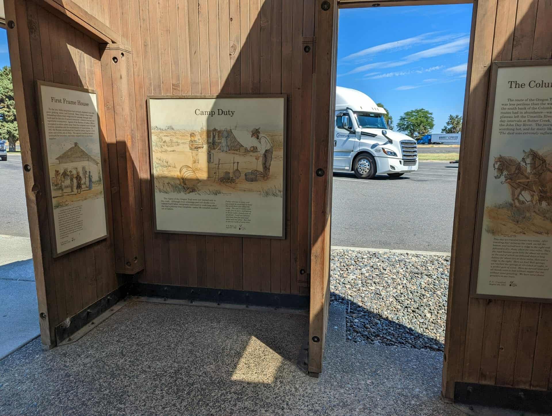
Camp Duty
The rigors of the Oregon Trail were not limited only to the road. Although river crossings and hill climbs were indeed hard labor, emigrants continued to work long after the day’s journey was complete — camp life entailed another set of labors.
Father attends to camp, and you would be surprised to know the work there was about the camp. The tent to stake, water to get, fire to start, and baking to do for such a family was no small job. I will not mention any more here for time and space will not allow. But that is not one tenth of camp duty. — S. B. Eakin, Jr.; August 9, 1866
Ignoramuses!
The majority of Oregon Trail emigrants relied upon published guidebooks for route and travel information. There was no substitute for firsthand information; however, emigrants were always eager to query anyone they met from the Willamette Valley — sometimes answers to their questions were more than enlightening.
We met some men this afternoon who were from The Dalles. … Nearly every person they met had a lot of questions to ask in regard to Oregon. Of course we were no exception, and when we met them many questions were asked. Finally someone in our party asked about the size of Oregon City, and how far it was to that place. This question about Oregon City seemed to ruffle his feelings somewhat, and he answered. “You emigrants seem to think that Oregon City is the only town in Oregon. Why there is Portland, that is about twelve miles below, which is twice the size of Oregon City and does ten times the business. You fellers must be a set of damned ignoramuses to think that Oregon City is the only town that is in Oregon.” We readily came to the conclusion that we were somewhat ignorant concerning the geography of the great Northwest, and asked no more questions. –E. W. Conyers, September 4, 1852
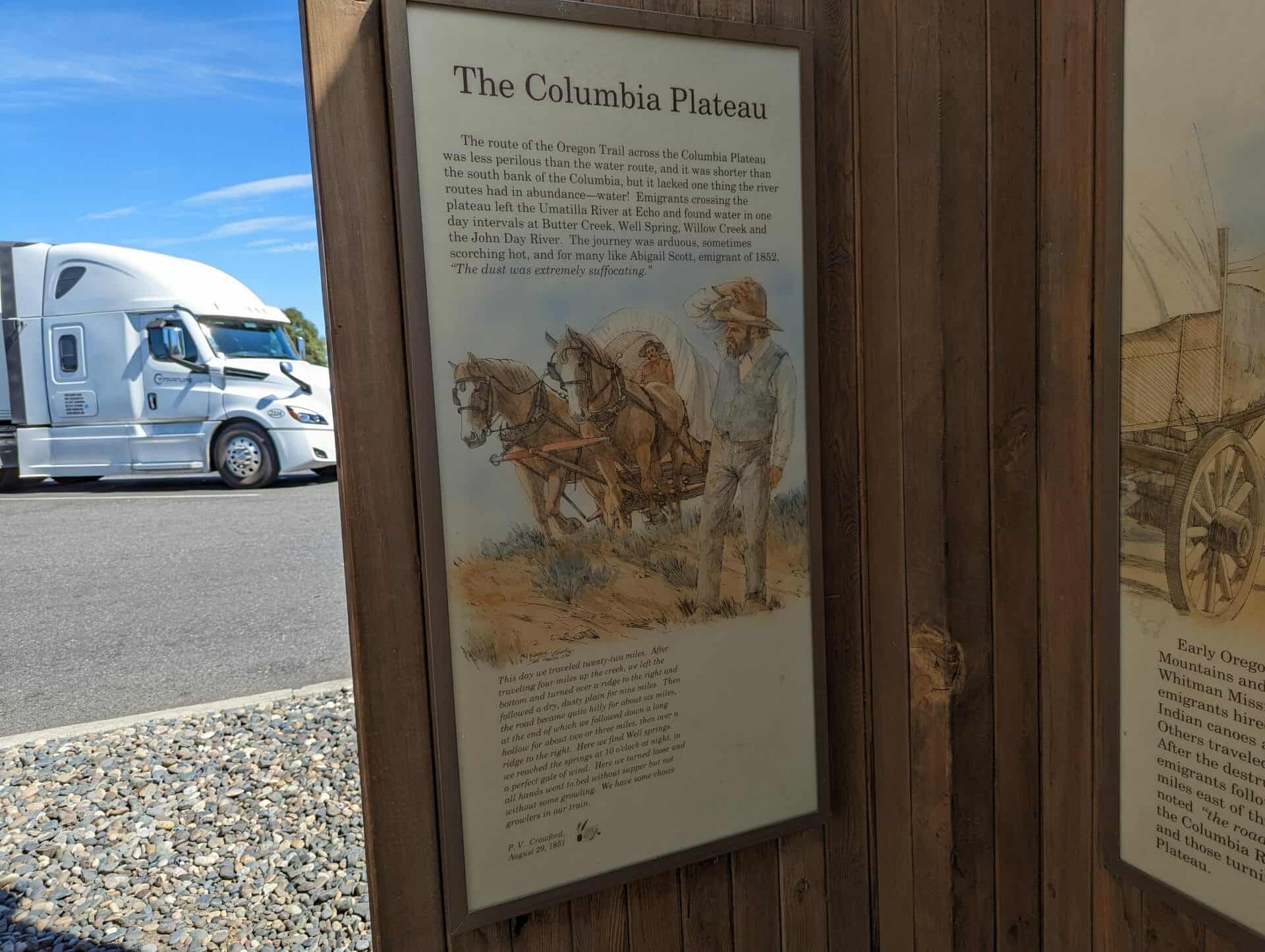
The Columbia Plateau
The route of the Oregon Trail across the Columbia Plateau was less perilous than the water route, and it was shorter than the south bank of the Columbia, but it lacked one thing the river routes had in abundance–water! Emigrants crossing the plateau left the Umatilla River at Echo and found water in one day intervals at Butter Creek, Well Spring, Willow Creek and the John Day River. The journey was arduous, sometimes scorching hot, and for many like Abigail Scott, emigrant of 1852, “The dust was extremely suffocating.”
This day we traveled twenty-two miles. After traveling four miles up the creek, we left the bottom and turned over a ridge to the right and followed a dry, dusty plain for nine miles. Then the road became quite hilly for about six miles, at the end of which we followed down a long hollow for about two or three miles, then over a ridge to the right. Here we find Well springs. we reached the springs at 10 0’clock at night, in a perfect gale of wind. Here we turned loose and all hands went to bed without supper but not without some growling. We have some choice growlers in our train. — P. V. Crawford, August 29, 1851
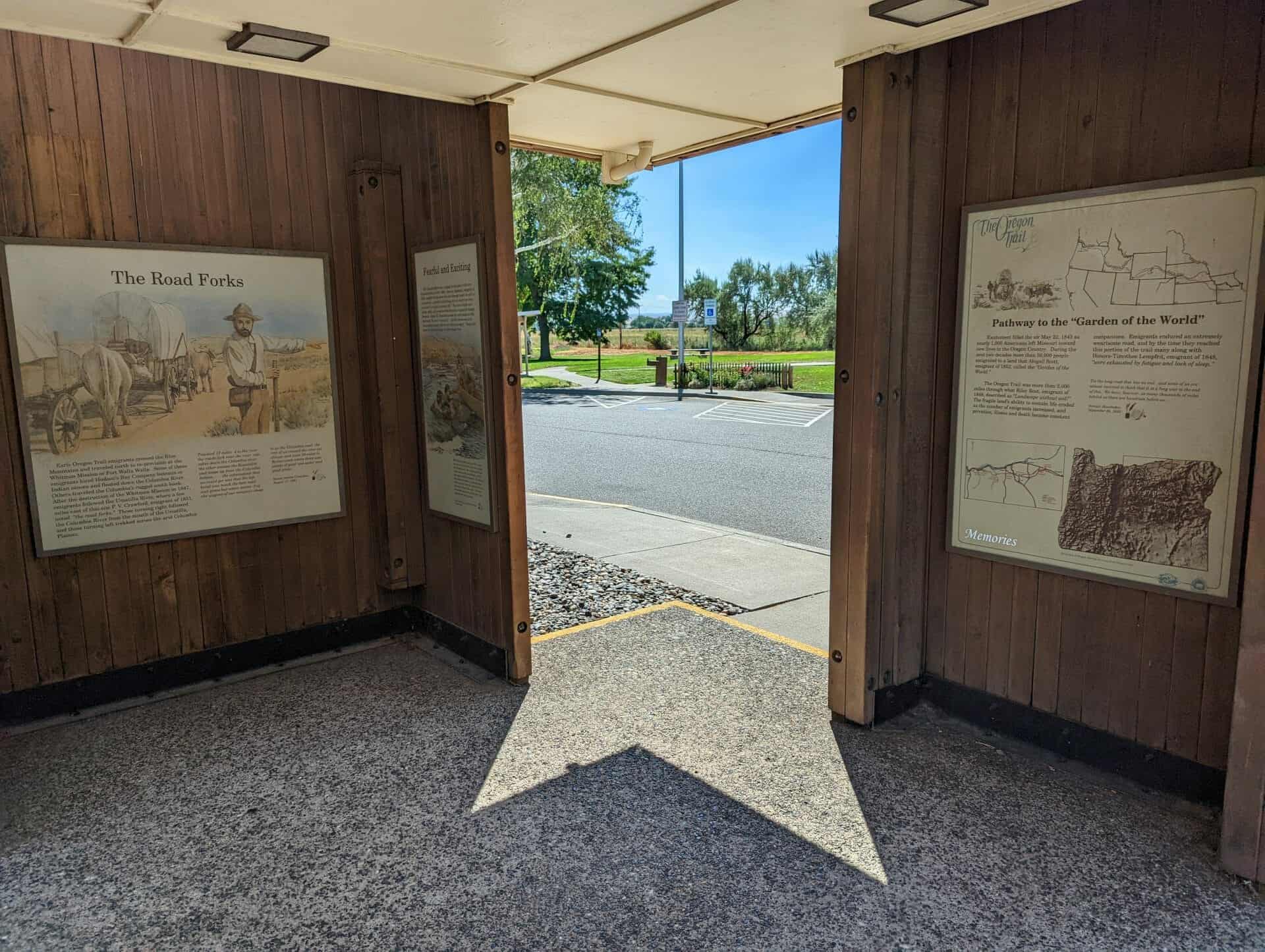
The Road Forks
Early Oregon Trail emigrants crossed the Blue Mountains and traveled north to re-provision at the Whitman Mission or Fort Walla Walla. Some of these emigrants hired Hudson’s Bay Company bateaux or Indian canoes and floated down the Columbia River. Others traveled the Columbia’s rugged south bank. After the destruction of the Whitman Mission in 1847, emigrants followed the Umatilla River, where a few miles east of this site P. V. Crawford, emigrant of 1851 noted “the road forks.” Those turning right followed the Columbia River from the mouth of the Umatilla, and those turning left trekked across the arid Columbia Plateau.
Traveled 17 miles 4 to the river the roads fork near the river one takes down the Columbia river the other crosses the Eumatilla (sic) and keeps up from the Columbia bottom … the information that we could get was that the left hand was much the best road and grass but water scarce 2 of the wagons of our company chose to go the Columbia road the rest of us crossed the river eat dinner and went 10 miles to Butter creek where there was plenty of good cool water and good grass.– Susan Amelia Cranston, August 17, 1851
Fearful and Exciting
The Columbia River was a raging torrent prior to the construction of dams in the 1930s. Jesse A. Appleggate, emigrant of 1843, recalled his trip down the river through rapids “so wild, so commotional, so fearful and exciting, had not death been there , were worth a month of ordinary life.” The river’s banks were sandy, rocky, and presented little firewood, or grass for hungry livestock. James W. Nesmith traveled the south bank in 1843 and noted “the river is beautiful … but the barrenness of the surrounding country affords but a dreary prospect.” Despite the mode of travel, hardship was the common fare.
On the first day after leaving the Fort, one of our canoes, in which there were three persons, one of whom was a lady, in passing through a narrow shoot in the Grand Rapids, struck a rock, upset, and filled instantly. The lady and her husband succeeded in gaining the rock; which was about three feet across the top, and just under the surface of the water. Our pilot succeeded in taking them off in safety, and regained most of the property. — Overton Johnson and William Winter, October 1843
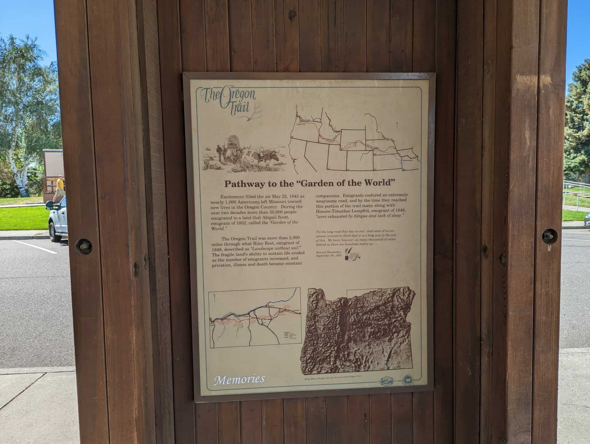
Pathway to the “Garden of the World”
Excitement filled the air May 22, 1843 as nearly one thousand Americans left Missouri toward new lives in the Oregon Country. During the next two decades, more than 50,000 people emigrated to a land of abundance. a land that Abigail Scott, emigrant of 1852, called the “Garden of the World.”
The Oregon Trail was more than 2,000 miles through what Riley Root, emigrant of 1848, called “Landscape without soil! The fragile landscape’s ability to sustain life eroded as numbers of emigrants increased, and privation, illness and death became constant companions. Emigrants endured an extremely wearisome road, and by the time they reached this portion of the trail many along with Honore-Timothee Lempfrit, emigrant of 1848, “were exhausted by fatigue and lack of sleep.“
Tis the long road that has no end. and some of us are almost inclined to think that it is a long way to the end of this. We have, however, as many thousands of miles behind as there are hundreds before us… – Samuel Handsaker, September 20, 1853
Diagonally across the street from you was the Ashley Cooperative Mercantile. It began in 1881 as a small, one-story log and rock building. By 1900, a new two-story general merchandise store with groceries, meat, dry goods, hardware, shoes, and a men’s department was constructed. Area residents also used the store to deposit and exchange money, to obtain loans, and to make investments. The volume of money became more than the Co-op could handle, resulting in the establishment of the first Bank of Vernal. The bank opened inside the Co-op in 1903. To discourage local outlaws, a large walk-in vault and a bulletproof screen surrounding a steel-lined counter became added security features to the new bank.
In the early 1880’s, two gun-toting horsemen robbed the Co-op. At closing time, the robbers caught the store clerk up on a ladder, where he was showing off a new, brimmed hat to two customers. In response to the clerk’s reply, they fired a shot, grazing the store clerk’s hatband before making off with the money.
Butch Cassidy (Robert Leroy Parker) was also a Co-op customer. In 1896, he purchased a Colt .45 single-action revolver which may have been used by the outlaw on his exploits with the notorious Wild Bunch.
This is #5 of the 21 stop history walking tour in downtown Vernal, Utah. See the other stops on this page:
Where Can You Get an Iron Port, Phosphate, or Suicide?
Today it would be difficult, but in 1946 you could have ordered one of these soft drinks at a soda fountain. Vernal’s most popular soda fountain was part of Vernal Drug which was located in the building across the street. At the marble counter, soda jerks mixed a variety of soft drinks and ice cream delights. A popular treat was cherry phosphate (cherry syrup, soda water, and citric acid); you could also order a cherry or vanilla Coke. Vernal was one of the few places you could find “Iron Port,” an old fashioned ice cream soda. If you wanted chocolate ice cream, you would ask for a “dip of mud;” a chocolate cone was called a “black stick;” a “houseboat” was the common term for a banana split. In the 1950s the soda fountain was a focal point where young people gathered after school or with a date.
The soda fountain hosted its first customer in 1900 when Vernal Drug opened its doors. The drugstore relocated several times, but in 1917 it found a permanent home. In 1960 the drugstore expanded into the Vogue Theater building. In 1991 Vernal Drug closed after 91 years in service, giving way to discount store pharmacies and the changing tastes of youth. So today you can’t get a “suicide” (a squirt of everything in the soda fountain) in Vernal.
This is #6 of the 21 stop history walking tour in downtown Vernal, Utah. See the other stops on this page:
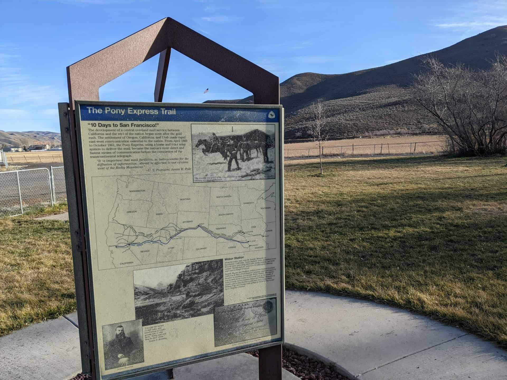
Pony Express – 1860-61 St. Joseph, Missouri – Sacramento, California Also Overland Stage & Freight Route 1858-1868
This monument was constructed by enrollees, U. S. Grazing Division, C. C. C. Camp 116, Company 2529 on August 23, 1940 and sponsored by the Utah Pioneer Trails and Landmarks Association (#91 of their monuments) it was later adopted by the Sons of Utah Pioneers (#237 of their monuments) and rededicated in 2017.
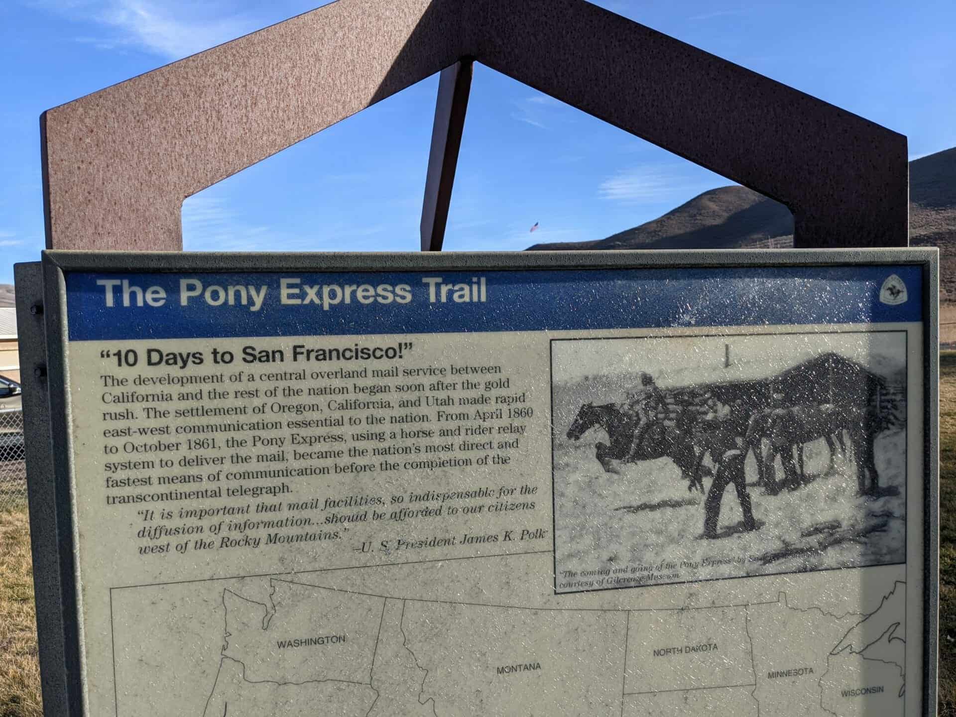
The development of a central overland mail service between California and the rest of the nation began soon after the gold rush. The settlement of Oregon, California, and Utah made rapid east-west communication essential to the nation. From April 1860 to October 1861, the Pony Express, using a horse and rider relay system to deliver the mail, became the nation’s most direct and fastest means of communication before the completion of the transcontinental telegraph.
“It is important that mail facilities, so indispensable for the diffusion of information… should be afforded to our citizens west of the Rock Mountains.” – U. S. President James K. Polk
Along the entire trail, from St. Joseph, Missouri to Sacramento, California, “horse stations” were established every 40 to 80 miles, providing riders with meals, lodging, and fresh mounts. “Swing stations” were 8 to 12 miles apart, offering water and a change of horses.
Russell, Majors, and Waddell, owners of the Central Overland California & Pike’s Peak Express Company, employed James E. Bromley to establish and operate Weber Station. The station was located about 5 miles to the southeast, at the mouth of Echo Canyon. Local residents James and William Hennefer or Charles and Louisa Richins would have seen young riders William Page and George Little gallop by on the way to and from “Bromley’s Station.”
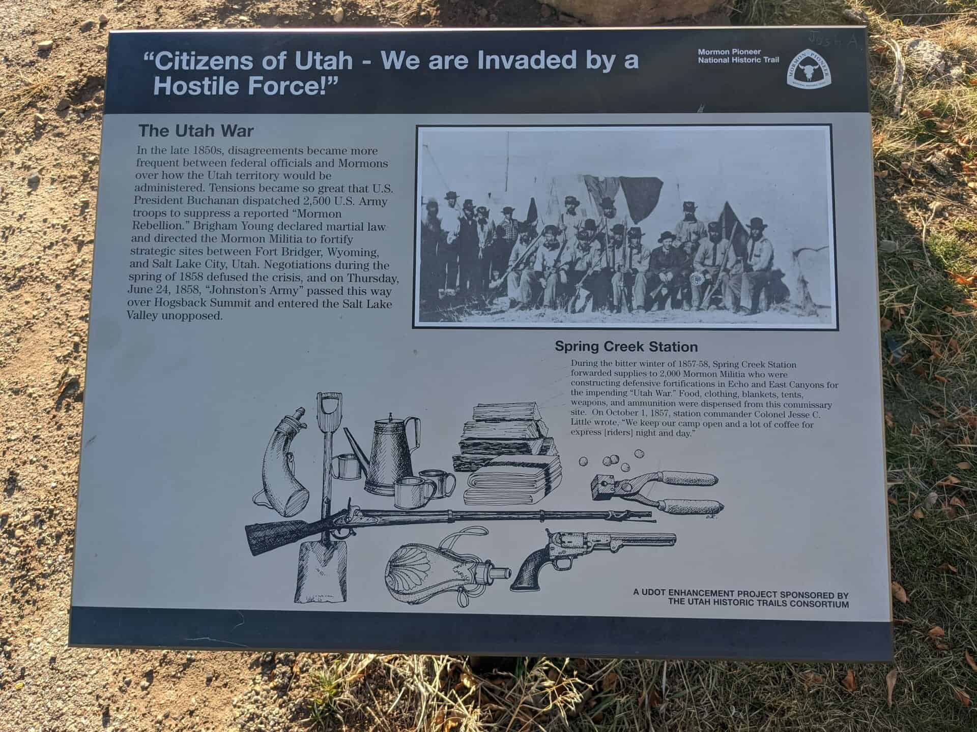
“Citizens of Utah – We are Invaded by a Hostile Force!”
The Utah War
In the late 1850s, disagreements became more frequent between federal officials and Mormons over how the Utah territory would be administered. Tensions became so great that U. S. President Buchanan dispatched 2,500 U. S. Army troops to suppress a reported “Mormon Rebellion.” Brigham Young declared martial law and directed the Mormon Militia to fortify strategic sites between Fort Bridger, Wyoming, and Salt Lake City, Utah. Negotiations during the spring of 1858 defused the crisis, and on Thursday, June 24, 1858, “Johnston’s Army” passed this way over Hogsback Summit and entered the Salt Lake Valley unopposed.
Spring Creek Station
During the bitter winter of 1857-58, Spring Creek Station forwarded supplies to 2,000 Mormon Militia who were constructing defensive fortifications in Echo and East Canyons for the impending “Utah War.” Food, clothing, blankets, tents, weapons, and ammunition were dispensed from this commissary site. On October 1, 1857, station commander Colonel Jesse C. Little wrote, “We keep our camp open and a lot of coffee for express [riders] night and day.”
“We resumed our journey up a small stream on Reid’s route [James Reed of the Donner-Reed Party], sending in advance of the wagons a small company to make the road passable. … We traveled about 6 miles, and crossing the ridge [The Hogsback], began to descend another ravine.” – Orson Pratt, July 16, 1847
Utah Crossroads Chapter – OCTA
HU-3.2
This is part of the series of California Trail markers I’ve been documenting on these pages:
“The country west looks rough and mountainous,” wrote William Clayton, describing this panorama of the Wasatch Mountains. Modern historians have dubbed this summit “Heartbreak Ridge” to describe the feelings of many early Mormon Pioneers who crested this ridge. After months on the trail, traveling over 1,200 weary miles, it was heart-wrenching to discover that the most difficult part of the journey still lay ahead. Some people must have broken down and wept. Others gritted their teeth with determination and moved southwest down off Hogsback Summit to challenge the mountains and canyon that lay ahead.
“…arrived [July 19] on the summit of the dividing ridge and put a guide board up, “80 miles to Fort Bridger” … The descent is not very steep but exceedingly dangerous to wagons being mostly on the side hill over large cobble stones, causing the wagons to slide very badly. – William Clayton
“After we had encamped Mr. Newman and myself walked down the ravine to examine the road. We found that Mr. Reid’s [Donner-Reed] company last season had spent several hours’ labour in spading, &c., but finding it almost impracticable for the wagons, they had turned up a ravine [Broad Hollow], at the mouth of which we had encamped and taken a little more circuitous route over the hills.” – Orson Pratt, July 16, 1847
Utah Crossroads Chapter – OCTA
HU-3A
This is part of the series of California Trail markers I’ve been documenting on these pages:
Unable to fight through brush and willows down Dixie Hollow, the Donner Party turned right up Broad Hollow at this spot, climbed to Broad Bench above, dropped down into East Canyon just above present dam.
Mormon pioneers follow, as did many others until road was cut through hollow years later.
In memory of the sick detachment of the U.S. Mormon Battalion which traveled north from Pueblo, Colorado to Ft. Laramie, Wyoming and then followed the Pioneer Trail into the Salt Lake Valley, July 1847.
Erected by Scout Troop 152, Syracuse, Utah / June 22, 1985 under the direction of U.S. Mormon Battalion, Inc.