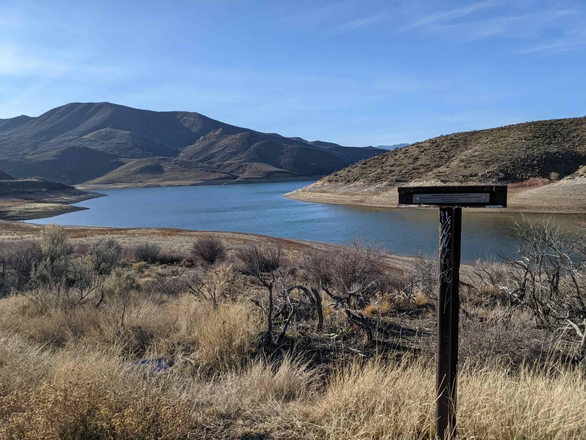
“On the banks of East Canyon Creek are numerous remains of small Indian lodges, hastily constructed of willow boughs.” – Horace K. Whitney, July 22, 1847
Utah Crossroads Chapter – OCTA
HU-3B
This is part of the series of California Trail markers I’ve been documenting on these pages:
“In the rear of this [battery] is a deep narrow gulch leading west towards the big Mountain, it is a good retreat for horsemen, but rather a long race for infantry.” – Colonel Pace [Mormon Militia] November 27, 1857
Utah Crossroads Chapter – OCTA
HU-3C
This is part of the series of California Trail markers I’ve been documenting on these pages:
Ashley Valley, settled in 1873, had its first postoffice in this structure. Built in 1879 by Wilbur C. Britt, the first postmaster. Logs hauled from nearby forests were put together with wooden pegs and square nails to erect one large room. A partition separated the postoffice from a store. Once a week carriers, riding horseback or wearing snowshoes, delivered the mail to and from Greenriver, Wyo. Mail service here was discontinued in 1899. This building now belongs to the Daughters of Utah Pioneers.
This is Daughters of Utah Pioneers historic marker #313, located at 1333 West 2000 North in Vernal, Utah
The Ashley Post Office was established in the center of Ashley Town on December 27,1878. At that time there were about 300 settlers in Ashley Valley. Wilbur Carlton Britt and Finley Britt used logs from nearby mountains, wooden pegs, and square nails in constructing this building. It had a dirt roof and wide board floors. The cracks between the logs which were filled with mud. A log partition separated the post office from a grocery store. Wilbur Britt was appointed first postmaster on April 16, 1879. The Ashley Post Office is also on the Utah Register of Historic Places.
Interior of Old Post Office In the southwest corner of the post office was a pot-bellied stove with places all around to sit and visit. These visits were mostly of a social nature, but from these visits the pioneers also acquired knowledge and news from the outside world. At about the time the post office was built there were around 300 settlers in the valley.
When gold was discovered in Jordan Creek in 1863, people from all over the world came to seek their fortune. Many came from the East along the Mormon Trail, branching off to follow the stage and freight trail from Kelton, Utah, to Idaho, then remaining on the “Dry Trail” south of the Snake River. Nestled in the War Eagle and Florida Mountains, the mining camp of Ruby City grew to become a roaring settlement and the Owyhee County seat. It was named for the red color of the silver ore compounds found there.
Only half a mile away, Silver City became a booming mining town. It was located on the high slopes of War Eagle, at the head of Jordan Creek, and almost atop the fortune the mountain held. Within one year, the county seat was moved to Silver City, as well as many of the buildings and homes. This settlement grew to have six general stores, two hotels, a school, four restaurants, and numerous other businesses. Everything had to be hauled in by wagon teams over the rugged mountainous terrain. Settlers began to make their homes on many of the creeks. Indians roamed freely in the area, and fought fiercely to protect this great land against the white settlers.
Desiring to farm and ranch, settlers came in the spring of 1869 to Bruneau, named for a Canadian fur trapper, Pierre Bruneau, who came to Idaho in 1815. Many places in the area bear his name. Salmon came up the Bruneau River by the thousands, and herds of antelope and deer roamed freely in the vast countryside. To cattleman and sheepman alike, this areas became known as the Valley of the Tall Grass. In 1884, the first public building in Bruneau was erected by the Hughes Brothers, Frank and Jim, and served as a saloon, store, and post office.
Grand View was so named because of its big beautiful green valley with the Snake River winding through the middle. On either side lay lush desert as flat as a table top with sage as tall as a man. At one time there were 100,000 cattle in the valley. Sheepmen soon followed with vast herds, which fed in the belly-deep grasses. Hundreds of tons of hay and many kinds of fruit and nuts were harvested and sold in the area. The Dorsey Ranch was about two miles to the east. Although the ranch changed hands many times, its name remained the same. The ranch became a favorite ferry route and stopping place for early settlers going back and forth to Boise for supplies. Grand View had a large hotel and store (destroyed by fire) as well as many other businesses and homes. Some still stand today. The first post office was opened in 1888.
Farther to the west is Oreana, a settlement named by Harry Olsen when he opened a hotel in 1884. Oreana, meaning an unbranded yearling, was known nationwide for its many tons of hay and large productive orchards. The settlement had a general store, post office, blacksmith shop, school, and church.
In 1899, Murphy, a settlement near the majestic Owyhee Mountains, became the terminal when the railroad finished its plans to run the track to Silver City. Later, with the slowing of the mining operations at Silver City, and Ruby City and for easier accessibility, the Owyhee County seat was moved to Murphy where it remains today.
This is Daughters of Utah Pioneers historic marker #530, located in Centennial Park in Grand View, Idaho.
The boat was built in 1866 to provide easy river travel for a part of the route from the Columbia to Boise and Silver City.
It was intended to ply 105 miles between here and Old’s Ferry. Once it even explored the river for 60 miles above here, astonishing the jackrabbits with its ambitious whistle. But business was poor and firewood for the boilers was scarce, and service stopped after a few trips. Finally in a hair-raising ride, the 136-foot, 300-ton boat was run down through Hell’s Canyon and to the Columbia.
This is Idaho Historic Marker #194 located near Melba, Idaho
The first L.D.S. church in Canyon County was purchased in 1910 from St. Paul’s Congregation for $1000, and dragged with great difficulty through the mud from 1st St. and 14th Ave. S. to this site. It was remodeled, painted, and made ready for use as a chapel and recreation hall for the Nampa Branch of the N.W. States mission and served the Saints of Canyon County until 1938. L.C. Pond was the presiding elder, Eugene Kimball, W.A. Wilcox and others made the benches and pulpit.
This is Daughters of Utah Pioneers historic marker #139 located at 504 11th Ave N in Nampa, Idaho
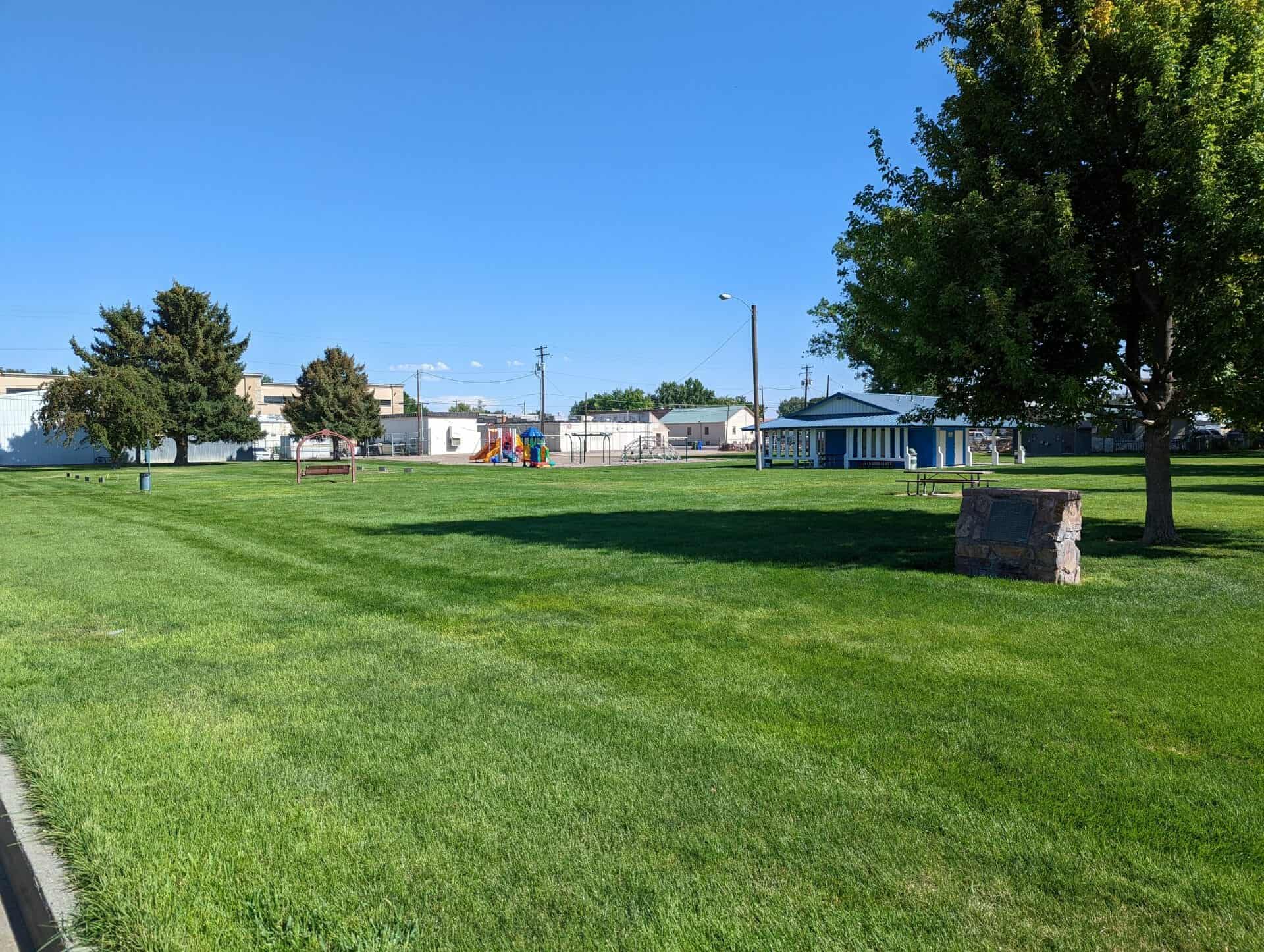
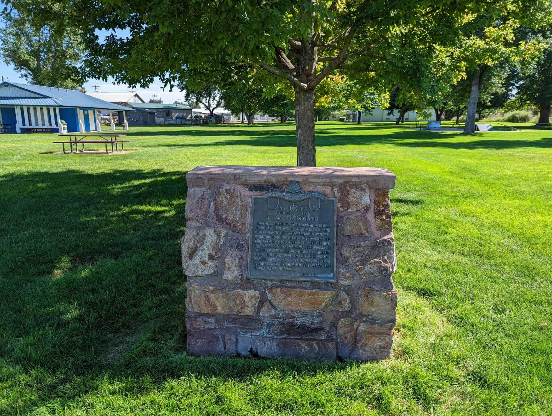
In 1810-18 Francois Payette, Donald McKenzie, John Day, Jack Weiser, a Mr. Whitman and others, named this valley and river “Payette.” In 1862 David Bivens’ stage station was erected and Nathan Falk’s store was opened in 1876. William E. Smythe, of the National Irrigation Congress, sent a group to late a townsite with a view to opening an irrigation project. In April 1895 New Plymouth was chosen. A postoffice was established 1896, Veasey and Jennie Stovel in charge.
This is Daughters of Utah Pioneers historic marker #352 located at Kiwanis Park at 150 W Ash Street in New Plymouth, Idaho
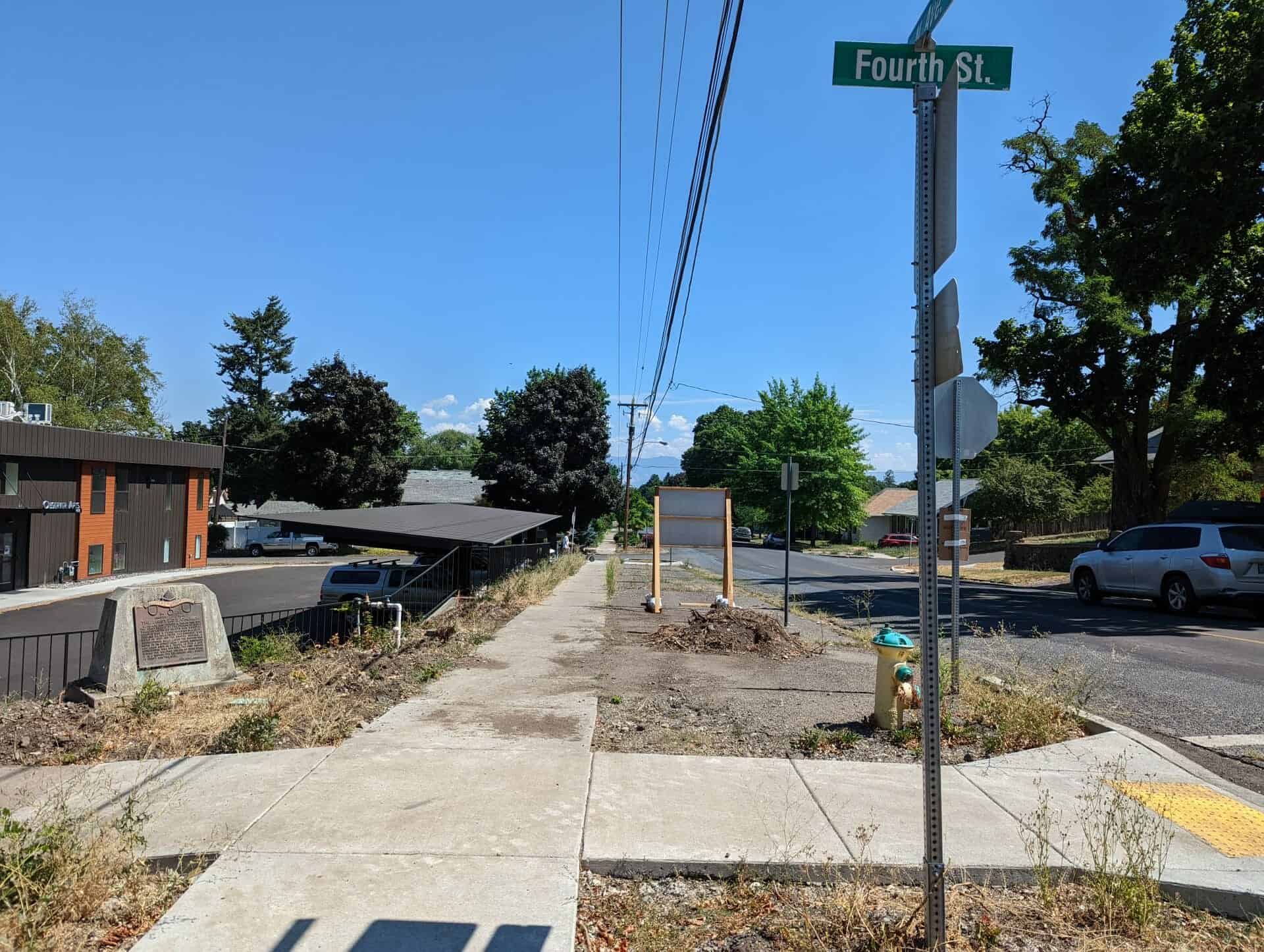
La Grande was founded in 1861. On this site the first chapel of The Church of Jesus Christ of Latter-day Saints was erected. (1901) it was a frame building 34 x 60 ft. costing $2,100. A brick tabernacle was built in 1907 and the chapel became a recreational hall. Later the church was moved to Fir Street near Y Avenue, renovated and again used as a chapel. In 1929 a new recreational hall was built. The first church became the welfare center of Union Stake. It is a refuge for the hungry and a symbol of thrift for the wise.
This is Daughters of Utah Pioneers historic marker #252, located at the southeast corner of N Avenue and Fourth Street in La Grande, Oregon.
Local legend attributes the discovery to the locator picking up a rock to throw at a jackrabbit and finding himself holding high-grade silver. The Jackrabbit District, named for the mine, was located in 1876 by Isaac Newton Garrison. Early mine production of the camp, at one time named Royal City, was about ten tons per day, carrying native silver in flakes, yielding about $40 per ton – sometimes as high as $2,000 per ton. Mineral production declined during the 1880s, but when a fifteen-mile narrow gauge railroad was opened in 1891 between the Jackrabbit Mine and Pioche, mining soon increased. After 1893 the mines fell silent except for several short periods of activity in 1906-1907 and 1912-1914.
This is Nevada State Historical Marker #204, see others on this page:
In 1869 Heleman Pratt, Wm. D. Kartchner and other L.D.S. church members came to Overton; built adobe homes; planted vineyards and crops. In 1871 double taxation forced an exodus from Muddy Valley. Local investors acquired the land, resold to returning pioneers 1880. John Munson, Overton Presiding Elder. Martha Cox taught school under trees until schoolhouse was finished. Jessie W. Crosby, Postmaster 1883. Isaiah Cox Sr., Ward Bishop 1884. This building first Moapa Stake House.