• About JacobBarlow.com
  • Cemeteries in Utah
  • D.U.P. Markers
  • Doors
  • Exploring Utah Email List
  • Geocaching
  • Historic Marker Map
  • Links
  • Movie/TV Show Filming Locations
  • Oldest in Utah
  • Other Travels
  • Photos Then and Now
  • S.U.P. Markers
  • U.P.T.L.A. Markers
  • Utah Cities and Places.
  • Utah Homes for Sale
  • Utah Treasure Hunt

JacobBarlow.com

~ Exploring with Jacob Barlow

JacobBarlow.com

Tag Archives: Hurricane

Hurricane Canal

12 Monday Feb 2024

Posted by Jacob Barlow in Uncategorized

≈ Leave a comment

Tags

Canals, Hurricane, NRHP, utah, Washington County

Hurricane Canal

The following History and Statement of Significance for the Hurricane Canal was prepared by Allan Comp, Project Historian for the Historic American Engineering Record work in Utah in 1971-1972.

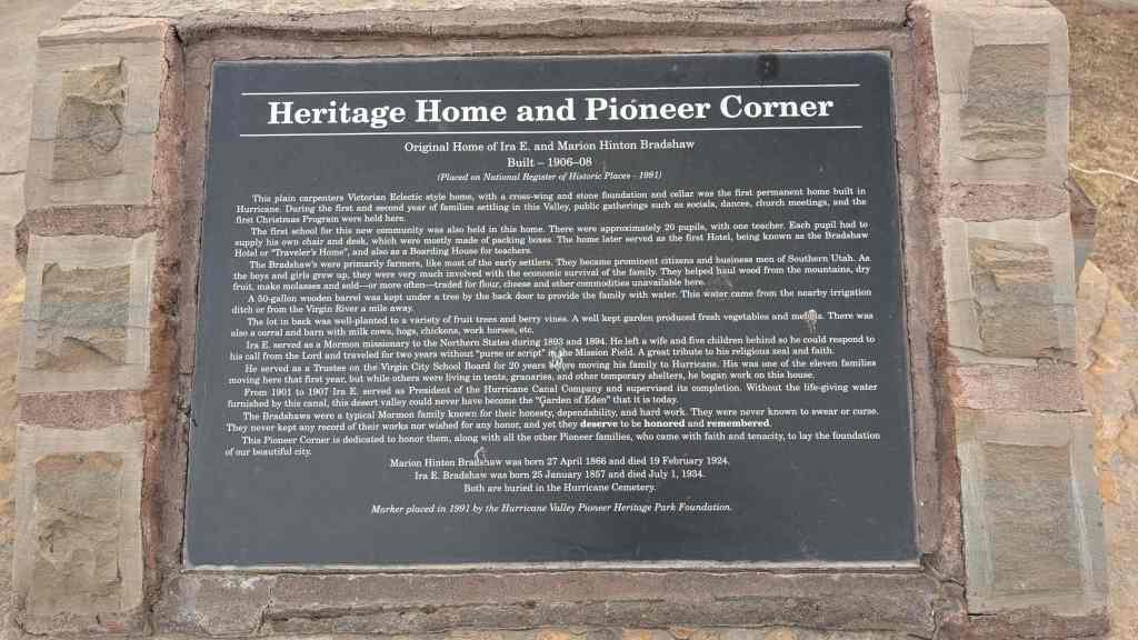
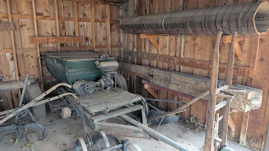
The construction of the Hurricane Canal is one of early Utah’s proudest stories of pioneer determination. Built completely by hand, the 7.5 mile canal clings to the sheer walls of the Virgin River Canyon before leaving to follow the Hurricane Fault and then encircle the flat farmlands of the Hurricane Bench. The canal took eleven years and $60,000 to build, most of the capital being represented by the labor of men who paid for their shares in the canal company by working on the canal during the winter months. The completed canal brought water to 2000 acres of parched bench land and created the now successful village of Hurricane, Utah.

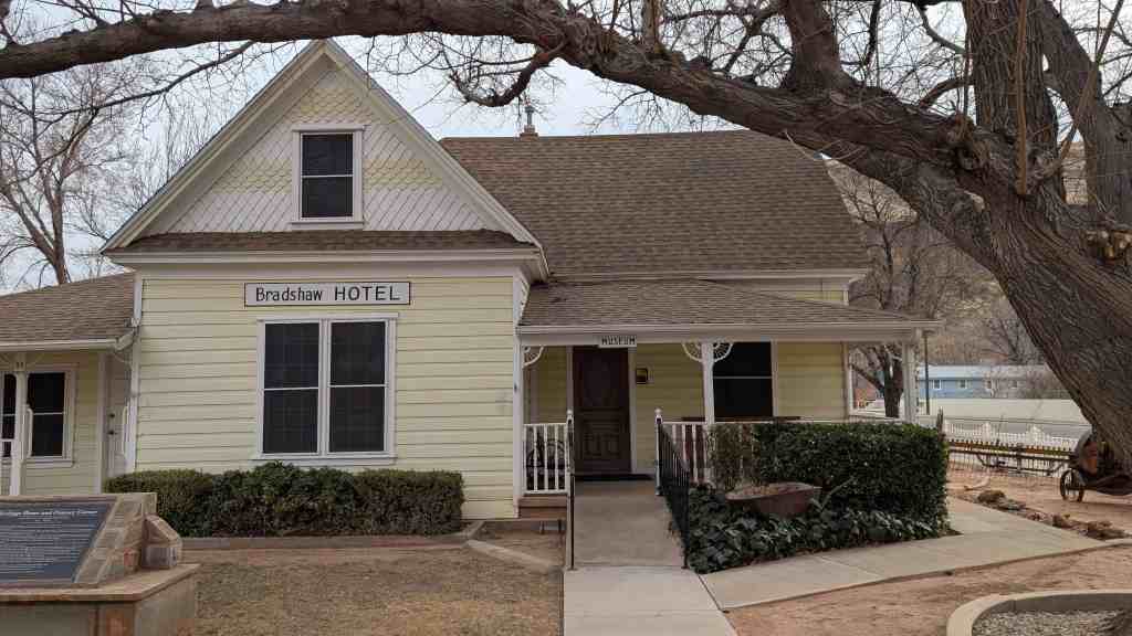
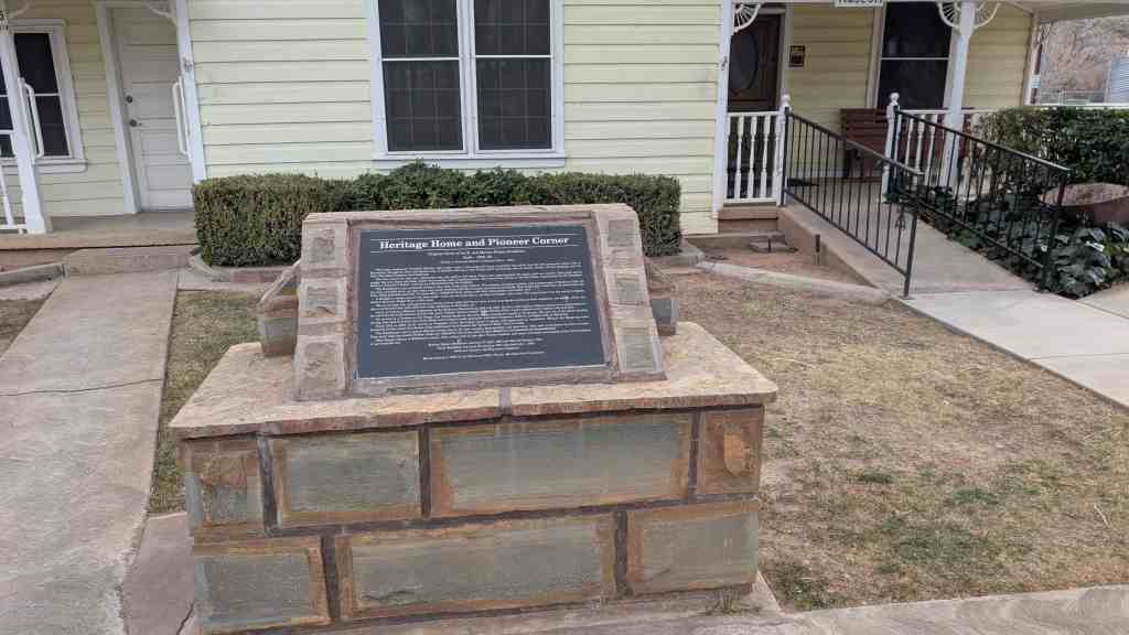
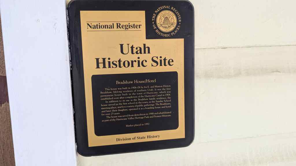
The Hurricane Canal in Hurricane, Utah was added to the National Register of Historic Places (#77001324) on August 29, 1977. The text on this page other than this paragraph and the list of post links below is from the nomination form for the historic register.

Related Posts:

  • Hurricane Canal (historic marker)
  • Hurricane Canal (historic marker)
  • The Historic Hurricane Canal (historic marker)
  • The Hurricane Canal (historic marker)
  • Hurricane Historic District

ORGANIZATION

Early residents of the area settled on the small bottom lands of the upper Virgin River Valley and elsewhere, but the erratic floods of the river diminished the available land while expanding families increased the need for more farmland. As some families began to move out of the area in search of new lands, others turned their eyes to the Hurricane Bench. If farms could be established here families could remain together and lands would be freed from the threat of flood. But water was essential to this expansion, and few thought a canal was possible. In the 1860’s, Erastus Snow and pioneer surveyor John M. MacFarlane explored the area and decided a canal was not a feasible undertaking. Brigham Young’s son John came to the valley in 1874 with the idea of a canal to take water out on the bench, but after a quick survey decided it was impracticable and went home. The little towns of Virgin, Mountain Dell, Duncan’s Retreat, Rockville, Grafton, Springdale, and Toquerville, prodded by their need for new land, continued to wish for some way of getting water to the bench despite the seeming impossibility of the task.

Finally, two men from the area, James Jepson and John Steele, decided in 1893 that a dam and canal could be built and began to interest others in the project. By the end of June a committee of six had been formed and, after investigating the canyon, returned a favorable report. The Hurricane Canal Company was soon created and the first meeting held in Toquerville Hall on July 11, 1893. August 25 brought another stockholders meeting, this time to hear the preliminary report of County Surveyor Isaac MacFarlane. He reported that the canal could be constructed, that it would have to be about 7.5 miles in length, would require a dam fifteen feet high, and would irrigate about 2000 acres. Although MacFarlane did not estimate costs, his report was accepted. The meeting then moved that the company incorporate the begin construction. J. T. Willis was appointed superintendent of construction on November 15, 1891.

CONSTRUCTION

Every reporter and historian who has visited the canyon of the Virgin River and the canal site comments on the impossibility of appreciating the difficulty of the undertaking. The steep canyon walls are chiefly lime rock and conglomerate which would often slide down the sides of the canyon after excavation was begun, burying the canal route under additional tons of cover. In other places fills had to be made with loose rock or a flume on trestle-work built across the opening or gap. There was no road into the canyon during the first year so all materials for canal and dam construction, as well as tools, bedding and food had to be carried in by hand.

Most of the work was done between November and May when farm chores were less demanding. Workers camped at the construction site and transients were often put to work for their board. Construction tools were quite simple. Except for a short distance near the dam, it was not possible to use horse teams with plows and scrapers so most of the work had to be done by hand. Wheelbarrows, picks, shovels, crowbars, and hand-driven drills were the basic tools used in the construction of the 12-foot grade or bed for the canal which was 8 feet wide and 4 feet deep.

Canal company shareholders built the canal by the contract or piecework method. The working survey marked off the route in 4-rod lengths, then carefully estimated the cost of construction for each length. These lengths or stations were taken up by stockholders working out their stock payments at $2.00 per day. The survey estimates allowed 15 cents per cubic yard for earth excavation, 75 cents per loose rock and gravel, and $1.25 for solid rock. When workers could demonstrate that the estimates were incorrect, adjustments were made.

Building the dam turned out to be much more difficult than originally anticipated. Specifications called for a structure seventy-five feet in thickness up and down the river, and five feet higher than the bottom of the canal. The river is about forty feet wide at the place called the Narrows where the dam was built. The sides and bottom of the river are solid rock, the north side was a solid limestone cliff over 100 feet high and on the south was a rock that rose nine feet to a shelf above the river. The site was ideal for a dam, but inexperience with construction and the raging floods of the Virgin led to several disappointments.

The plan was to use the shelf on the south side for a spillway and during the winter of 1893-1894 huge rocks were blasted from the sides of the canyon and dropped into place as an anchor. Smaller rocks were then used to fill in and complete the dam. The finished structure looked sturdy enough and the canal company paid the Isom Company $1150.00 for its work. About a year later flood water came surging out of the Narrows, picked up the dam and left the huge boulders strung along the river below the dam site.

For its second attempt the company secured a big pine log from the Kolob Mountains north of Virgin and laid it across the river by setting one end into a hole in the limestone cliff and the other into a slot cut into the south shelf. Juniper posts were then laid with their butts on the log and their tops upstream in the river and the whole mass weighted down with rocks. This dam held for about a year until another flood lifted the log and its load of juniper posts and rock out of its mountings and carried the timber downstream. The third time proved the charm. The pine log was recovered and put back in its slots and junipers again placed with their tops upstream. This time two layers of rocks were placed on the juniper logs and then the whole mass was woven together with heavy galvanized wire. The dam held. It had taken about six years and three attempts, but there was now water available for the canal to carry.

anal to carry. If the dam was difficult, the canal was only more so. Carving a twelve foot bed out of solid limestone or loose conglomerate was hard and dangerous work. Time dragged on and work progressed slowly. Landslides wiped out months and even years of work, tunnels had to be blasted through solid rock, flumes on trestlework were built to span open spaces like Chinatown Wash. Winter after winter passed and still the canal remained uncompleted. Discouragement began to overtake the workers until by 1901 only seven or eight men were still working on the canal. As progress came to a standstill, the canal board realized it must find the cash necessary to supply construction needs or work would stop altogether.

Stockholders had considered asking the L.D.S. Church for help as early as 1898, but four more years of effort passed before the canal company decided the assistance was essential. Finally, in 1902 James Jepson, one of the originators of the canal, went to Salt Lake City for an audience with Church President Joseph F. Smith. After a brief but determined exchange between Jepson and Smith, Jepson returned home with the $5,000 cash the canal company needed.

The stimulus of Mormon Church support and the $5,000 cash were sufficient to renew the spirit and the treasury of the company and work again went ahead. On August 6, 1904, eleven years after the canal was begun, water flowed over the dam spillway, through the canal and onto the Hurricane Bench.

SETTLEMENT

When the company formed in 1893 each share of stock entitled the owner to one acre of farm land with primary water right and an equity in a town lot. Both fields and town lots were distributed by drawing, a sort of pioneer land lottery. Individuals were restricted to a twenty acre maximum because the company wanted to keep the size of stockholdings down to a size men could afford to carry (numerous assessments were levied on the stock to help defray canal construction expenses) and also to make it possible for all men, young and old, to get farms and homes rather than just a few wealthier men owning all. The only exception to the twenty acre maximum was made for men with grown sons who were each allowed twenty acres.

With water on the bench, the 11-year-old company stock could finally deliver what it had long promised and farming on the new lands began almost immediately. Some grain was raised in 1905 (some fields producing fifty bushels of wheat per acre) and in 1906 Mr. and Mrs. Thomas P. Hinton moved into a wooden granary to become the first residents of Hurricane. Other stockholders farmed their lands by camping during the week and then returning home for the weekend. Ten families established homes in Hurricane in 1906 and although there was still trouble with the new ditch breaking, a rather common event until the structure settled, the new lands of the Hurricane Bench proved themselves well worth the struggle to bring in irrigation water.

CONCLUSION

If the Hurricane Canal is considered within the secular framework of technological history, a somewhat analytical perspective becomes possible. As an engineering accomplishment, the Hurricane Canal can hardly be compared favorably with earlier canals, be they Egyptian, Roman, Medieval, or even early American. The Hurricane Canal is perhaps best seen as the recognition of necessity. New lands and the water to irrigate them were essential if families were to stay intact. To bring water to those lands a canal had to be constructed, Once that necessity was recognized, the rest followed as a matter of course. While one may marvel at men willing to accomplish their goals by using rather primitive hand tools in the midst of a rapidly industrializing society, it is their determination and not their engineering prowess which should be most admired.

DESCRIPTION

The Hurricane Canal begins at a diversion dam constructed on the Virgin River at a place known as the Narrows. The dam is a combination of existing river boulders and infill boulders that were placed without mortar. The dam was washed out twice before successfully withstanding floods and high waters. Later concrete was poured to help stabilize the dam.

The canal follows along the south side of the Virgin River in a westerly direction running along the face of the Virgin River Canyon walls for a distance of approximately three and one-half miles. It then leaves the canyon and turns south along the west slope of the Hurricane cliffs for a distance of approximately three miles where it leaves the cliffs turning west to provide water for the fields located on the Hurricane Bench.

The pioneers blasted a total of twelve tunnels and constructed six wooden flumes, most of which have been replaced by metal flumes. The canal is laid out on a twelve foot wide shelf of conglomerate and lime rock, and in one place gypsum. The inside dimensions of the canal are eight feet wide and four feet deep. Frequent floods and landslides have washed out portions of the canal, but it is kept in good repair. A rider makes regular trips along the canal to inspect for breaks and carry out maintenance work.

As the canal flowed past the town along the Hurricane cliffs it provided water for part of the community as ten cisterns were located along the canal to collect and hold water. With the completion of a more modern water system, the ten cisterns were abandoned.

The canal still follows the same course as when first completed in 1904. Located high above the Virgin River the canal can be followed on foot only with difficulty and the exercise of extreme caution. The narrow trail and sheer drops to the canyon bottom limits access to the canal.

Bradshaw House-Hotel

23 Saturday Dec 2023

Posted by Jacob Barlow in Uncategorized

≈ Leave a comment

Tags

Historic Homes, Hotels, Hurricane, NRHP, utah, Washington County

Bradshaw House-Hotel

Built in 1906-08, the Bradshaw House/Hotel is significant for its role in the settlement and early community life of Hurricane, Utah. It was the first permanent house built in the town, which was established soon after the Hurricane Canal (National Register) was completed to bring water to this previously dry benchland. In addition to its use as the Bradshaw family residence, the house served as the first school in the town, as a place for Sunday school, and for a variety of other public gatherings. The Bradshaws also operated it as a boarding house and hotel, the first in the community. It was one of the few hotels in the town and one of the longest-lived, operating for over 25 years.

The Bradshaw House-Hotel is located at 85 South Main Street in Hurricane, Utah and was added to the National Historic Register (#91001443) on September 26, 1991. The text on this page is from the nomination form from when it was added to the register.

Ira E. and Marion Hinton Bradshaw started construction of this house in early 1906 and had it sufficiently completed by the end of the summer for the family to move in. According to family and local histories, it was the first permanent house built in the new community of Hurricane. As such it served a variety of community purposes since it was the largest building in town. The northwest room, though at first unfinished, served as the town’s first school, as a Sunday school room, and for other public gatherings. These activities were eventually shifted to other buildings as the town developed. These included a social hall (1908), a church (1907-08), and a school (1917).

Completion of the Hurricane Canal in 1904 opened up the Hurricane Bench for agriculture and instigated the formation of the town. Residents of neighboring communities first began constructing the canal in 1893. They continued under adverse conditions for nine years. By then only a few of the original canal stockholders still had faith to remain with the project. One of them was Ira Bradshaw, who served as president of the Hurricane Canal Company from 1901 to 1907. The group contacted the First Presidency of the Church of Jesus Christ of Latter-day Saints (Mormon Church) in Salt Lake City requesting assistance with their project. The church had directed the establishment of over 300 communities in Utah from 1847 to the late 1880s, so assisting with settlement efforts was not new. At this time, however, the church was no longer actively colonizing in Utah. The effort to build the canal and establish the town of Hurricane was a private venture. The church’s decision to invest $5,000 in the project demonstrates the leaders’ willingness to assist with community-building, though in a more business-like fashion than it had in the nineteenth century. Without the infusion of cash generated by the church’s purchase of stock, the company may not have completed the canal.

Settlement of the town of Hurricane began soon after the canal was completed. Stockholders drew lots to determine their parcels in the new townsite. The town was laid out in five-acre blocks divided into four lots. Twenty-acre farm sites south of town were divided in the same manner. Many of the early settlers built cellars or granaries that could serve temporarily as homes and later be used as auxiliary structures. Only one of those granaries is extant: the George H. and Annie C. Isom granary located at 274 W. 100 North, where it was moved in 1945.

Ira Bradshaw’s house is credited as the first permanent home in the town. Others were apparently built at approximately the same time. A Washington County News article from January 1908 noted that, “Lewis Campbell is finishing off the Ira Bradshaw house. It will soon be ready for the painter. Jesse Lemmon expects to have his house painted soon. Jesse Demill’s house is almost completed.” Though Bradshaw’s house was not completed until 1908, it was, according to numerous local sources, being used in an unfinished condition as early as the fall of 1906. Of the three houses mentioned in the article only the Bradshaw house remains standing.

Both Ira and Marion Bradshaw were lifelong residents of southern Utah. They were married in 1883 and had five children. They made their home in Virgin until moving to Hurricane after the canal was completed. Ira held a variety of jobs, including farmer, canal worker, and hotel operator. He served six years as president of the Hurricane Canal Company and twenty years as a member of the school board.

In addition to its community uses, the house also functioned as a hotel. Marion Bradshaw was an industrious homemaker and managed to accommodate traveling salesmen, known as “drummers,” and other travelers in the house. She also boarded teachers. From 1910 to 1923 the house became known as the Bradshaw Hotel. A c.1912 photograph shows the house, complete with a balustraded front porch and a “Bradshaw Hotel” sign over the front window. Thus it was the first hotel in the town of Hurricane. In 1917, The Hotel Monthly magazine gave a description of the clean rooms and sumptuous meals at the “little Bradshaw Hotel.” After Marion Bradshaw’s death in 1924, a daughter and son-in-law, “Mack” and Juanita Bradshaw Naegle, helped run the hotel and take care of the family still at home. Ira Bradshaw transferred title to the property to Juanita in 1929. Mack and Juanita decided to construct a new hotel just to the north. They operated that hotel only from 1930 until 1932. The economic decline brought on by the Depression forced them to close it down. They resumed taking boarders in the old home as before. Soon after Ira Bradshaw 1 s death in 1934, the loan company that held title to the property sold it, forcing the family to close down the hotel and move.

Other owners since 1942 were: the J. H. Ridings, the Golden Taylors, the Kenneth Gublers and Leah C. Adams and Miriam L. Cochran. The last two (who were joint owners) sold the property to Washington County in 1976. In June of 1989, Washington County leased the property to the City of Hurricane, who then leased it to the Hurricane Heritage Park Foundation in July of 1989. It is leased for a 25 year period, for a $100 per year lease with an option to renew. The foundation is in the process of the rehabilitating the hotel.

Hurricane Historic District

13 Tuesday Apr 2021

Posted by Jacob Barlow in Uncategorized

≈ Leave a comment

Tags

Hurricane, NRHP, utah, Washington County

The Hurricane Historic District is locally significant, both architecturally and historically, because it represents the social, economic, and architectural history of Hurricane, Utah. The district is significant under Criterion C for its concentration of intact examples of residential and commercial buildings that were built during each major construction period of the community’s early history, from the town’s founding in 1906 through 1940. The district accurately represents the full range of architectural styles, types, and construction materials found in Hurricane. The district is also significant under Criterion A for its representation of early agricultural family settlement patterns and local community growth. Hurricane experienced steady expansion as an agrarian community after the Hurricane Canal provided crop irrigation for new residents in 1904. The town continued to develop as an agricultural settlement until the beginning of World War II.

The Hurricane Historic District in Hurricane, Utah was added to the National Register of Historic Places (#95000980) August 4, 1995. The text on this page is taken from the nomination form from when the district was submitted to be on the register. – Jacob Barlow

Roughly bounded by 300 South, 200 West, State St. and the Hurricane Canal.

Site

Hurricane is located in the southwest corner of Utah, 18 miles northeast of St. George, the county seat and largest city in the region. The town contains a population of approximately 4,500 people, and is built upon a grid of five acre blocks separated by wide streets. The Hurricane Historic District is located in the center of town and contains a variety of buildings from three primary building phases: 1906- 1920, 1920-1940, and 1945-present. The district covers an area of approximately twelve square blocks, with 121 primary buildings and 24 outbuildings. Of these, 66 of the buildings and 15 of the outbuildings contribute to the historic character of the district. Although out-of-period structures are found throughout the area, the district retains its overall historic feeling and association.

Commercial buildings dominate the core of the district along Main Street, with houses radiating into the surrounding blocks. Though each block is divided into four lots, most blocks contain 12-15 houses, with moderate front yards and varying set-backs. Residential blocks are characterized by open interiors, where a number of outbuildings are located. The oldest houses are located on corner lots. An abundance of mature trees, especially oak, fruit, and nut varieties, line the residential streets. Sandstone gutters are found on the east side of Main Street between 200 South and 300 South; elsewhere the gutters are concrete or nonexistent. Sidewalks are found only in front of the commercial buildings on Main Street, where the buildings are joined to each other and built flush with the sidewalk

The surrounding landscape of Hurricane is characterized by dramatic red and black rock outcroppings and scrubbrush. The natural landscape along the eastern boundary of the district consists of a rugged cliff that rises sharply for a distance of approximately 300 feet. The Hurricane Canal runs along the side of this ridge, which provides a distinctive visual boundary for the district. Two historic rock and concrete water cisterns (c. 1909) are located next to the canal at the north edge of the district boundaries.

Residential Buildings

Domestic structures within the Hurricane Historic District are primarily Victorian eclectic cross-wing houses, single-story Foursquare cottages, Bungalows, and Period Revival cottages that were built between 19068 and 1940. Later infill construction consists of post-WWII cottages and modern ranch houses. The houses are relatively small one or one-and-a-half story single family residences that contain little exterior embellishment. Detailing, where present, is usually subtle and of Greek Revival or Victorian eclectic style. The Victorian houses are characterized by asymmetrical facades, arched brick lintels over double-hung windows, and patterned wood shingles on gable roof ends. The Bungalows and Foursquare cottages are distinguished by low, hipped rooflines and simple, rectangular footprints. The Bungalows have large porches and wide overhanging eaves. Period Revival Cottages are characterized by picturesque irregular massing and decorative exterior materials. The post-WWII cottages are identified by simple, square plans and narrow eaves over hipped roofs. The long, rectangular ranch houses follow horizontal plans with elongated facades.

Red brick is the most common building material among all housing types, though several houses are constructed of frame. Approximately ten percent of the houses (both brick and frame) have been covered with stucco. Foundations of the earliest structures are sandstone, while the later buildings contain concrete foundations. The most common roofing material is asphalt shingle, a non-original material. Almost all of the houses contain frame or brick porches, most of which maintain their original appearance. Large picture windows are present in many of the houses, especially among the Bungalows, Foursquare cottages, and ranch houses

Among all houses in the district, the Victorian houses and Bungalows along Main Street retain the highest level of integrity. Newer buildings which are found throughout the district are compatible in scale and materials with the historic structures and do not overwhelm the character of the district.

Commercial & Public Buildings

Historic commercial buildings in the Hurricane Historic District are one-part or two-part block buildings, constructed from local brick between 1911 and 1922. Like the houses, these buildings exhibit minor stylistic characteristics which are predominantly Victorian eclectic. Modestly decorative brick patterns form a common detail element on the upper story of these early structures. Many of them have been covered in stucco. Large display windows and recessed entries are also recurrent. A later commercial building is the Spanish Colonial Revival style Dixie Hotel (c. 1925) which is located at 73 South Main.

Out-of-period commercial buildings within the district are similar in scale to the historic structures but exhibit modern signage and detailing. Brick veneer and aluminum and vinyl siding are the dominant exterior materials of these post-WWII buildings.

The Hurricane Historic District includes a concentration of public institutional buildings in two blocks along 100 West, between State Street and 100 South. Most of these are red brick PWA Moderne structures that were built in the 1930’s. The 1938 Hurricane City Hall/Library (35 West State) is surrounded by a town square and outdoor pioneer park museum. Three public schools (two contributing), an out-of-period gymnasium, and playgrounds are located within this complex.

Outbuildings

A number of outbuildings, including barns, granaries, and sheds are found throughout the district. The block between 200-300 South, Main Street-100 East contains four contributing barns and two granaries, all of which probably date from the earliest years of the town’s history. Like the houses, most of the single-cell granaries are constructed of red brick, with gabled roofs. These granaries generally contain less than 200 square feet. The large frame barns are somewhat deteriorated but retain their historic integrity. Most barns contain two levels, with spaces for livestock on the main level and agricultural storage above.

Canal Building, 1893-1908

Early pioneers had occupied the region for many years before Hurricane was established. The nearby Virgin River valley, settled by Mormons in 1862, had become heavily overstocked and overgrazed by the late 19th century. Because most natural vegetation had been destroyed, spring rains and thaws created severe agricultural erosion problems for residents of the valley. Intense population growth in the 1870’s and 1880’s placed additional strain on available lands. By 1890, residents of the valley were desperate for additional agricultural property. They wanted to remain close to their families in Virgin, and looked to the Hurricane bench as a possibility for expansion. They believed the soil was highly fertile and would support crops if the land could be irrigated.

After several years of feasibility studies by various investors, an elaborate canal was built at the turn of the century. Over the first nine years of the project, few original stockholders remained. Financial difficulties troubled the enterprise, and it was near total failure in 1902. James Jepson, president of the Hurricane Canal Company, successfully lobbied officials at the Church of Jesus Christ of Latter Day Saints (Mormon Church) headquarters in Salt Lake City for intervention. They invested $5,000 into the project, which provided the needed capital to complete the canal. With irrigation underway, Hurricane quickly became known by locals as “Utah’s Fruit Basket,” renowned for its abundant vineyards, fruits, and nut orchards.

When more than 100 people gathered for a rally in August of 1904 to watch water flow into their new homeland, a story was told of an 1865 incident involving Mormon church leader Erastus Snow. Snow was travelling through the area when a sudden gust of wind blew the top off of his buggy. He exclaimed, “My, that was a hurricane! We’ll call this Hurricane hill.” The people at the rally cheered and decided to name their new town “Hurricane” (pronounced “Hurricun” by locals). Ironically, the area boasts of a mild climate throughout the year.

The town was surveyed in 1896, but the first permanent structures were not built until 1906. Earlier town residents lived in tents, dugouts, or granaries while they built permanent homes; few of these early structures remain.

Early Residential Growth. 1906-1930

Although Hurricane was founded several years later than most Utah communities,6 the town follows a tradition of early Mormon settlements, utilizing the characteristic layout of carefully planned, gridded streets. Agrarian families (mostly Mormon), settled on 1.25 acre plots that were assigned to them in return for investment in the Hurricane Canal Project. The Hurricane Canal Company assigned lots and approved building activity for the town, but retained title to all property until the mid-1910’s. The earliest permanent homes were located on corners, with the central portion of the blocks reserved for gardens, outbuildings, and small livestock. A number of these early agricultural structures remain. In addition to the residential lots, each investor received 20 acres of farmland outside the town.

Early families built houses of frame or brick, in Victorian or Bungalow styles. Few buildings were fashioned with ornate embellishment. The early residents of Hurricane adopted scaled-down versions of the contemporary architectural styles in Utah. A typical Hurricane adaptation to the Victorian house appears as a simple cross-wing plan, with modest wood porch and minor trim.

Local builders were responsible for most of the initial construction in Hurricane. F.T. Ashton, Christian Christensen, Alonzo Dalton, Jesse Lemmon, and John Stout were contractors in the 1910s. Early masons included Edward Cripps, J.H. Petty, and George Worthen. Amos Workman was the town surveyor for several years during Hurricane’s original development period.

Early Commercial Growth, 1908-1920

In response to flourishing agricultural growth, rapid commercial and economic expansion swept the area in the years soon after completion of the Hurricane Canal. Visitors to the area commented in 1909, “Hurricane, that thrifty new settlement, surely has made great progress during the year in building new homes, school house, hall and planting out thousands of fruit trees and vines.” The first local brick was produced in 1908. By 1913, Hurricane was furnished with four mercantile stores, an ice supply operation, a new planing mill, and long distance telephone service. Hurricane residents could buy food, fabric, hardware, building materials, and even caskets from Petty, DeMille, and Company, who boasted of having a “fine new building…the largest mercantile in the county.” In 1914, William Petty brought a movie theater to Hurricane, which was powered by natural gas. Three hotels were in existence by 1915, all of which were operated from private homes. That same year, Bert Woodbury opened an ice cream parlor, and Petty, DeMille, and Company installed the first automobile gasoline tank in front of their store on the corner of State and Main Streets. By 1916, Hurricane had a population of 750, with “substantial stores, a public school, flour mill, and several long distance telephone connections.” The first automobile garage and service station opened in 1920, and a bank was completed in 1922. Almost all of these early businesses operated within the boundaries of the proposed Hurricane Historic District; many of these buildings still stand.

Hurricane residents received confirmation of their newfound permanent status in 1913, when Dr. H.H. Wilkinson and his wife moved to town. Prior to this, all medical services were rendered by Myra H. Lemmon, a nurse and midwife. The H.H. Wilkinson House is located at the south end of the district, at 20 East 400 South.

Public Improvement Projects

Public improvement projects accompanied residential and commercial growth in Hurricane, especially after its incorporation in 1914. In 1907, Hurricane hired two teachers. The first local post office was established (c. 1907) by J.L. and Mary Workman, and a social hall (demolished) was built in 1908. The Hurricane Canal Company announced plans for an electric generating plant in October of 1915, hoping to have the town “lit up for Christmas.” Gravel street improvements also occurred in 1915. Hurricane residents installed a drinking water system in 1918, the same year a new school building (demolished) was completed for $32,000, enthusiastically financed through a town bond issue. Public sewers were first introduced in 1930. New Deal projects of the 1930’s brought about a second wave of public building activity. A new twelve-room schoolhouse was completed in 1935, and a city hall/library was built in 1938.

Characterized by a single road leading into and out of town, Hurricane was known as the “dead end street town” by residents of surrounding communities for many years. Hurricane residents, however, saw the potential economic value they could generate through tourism if a strategic highway was built that placed Hurricane on the major thoroughfare between the city of St. George, Zion National Park, and the Grand Canyon. For many years, town residents fervently petitioned the Utah State Legislature to build such a road. This request was finally honored as a Utah Works Progress Administration project in 1937, when a road was completed that linked Hurricane to the surrounding area. Since the completion of this road, consistent growth has occurred in the area surrounding the Hurricane Historic District. Today, Hurricane is experiencing intense growth pressure due to its proximity to St. George, one of the fastest growing communities in Utah. The area attracts retirees and others who are drawn to the mild climate and affordable cost of living. Current residents who are employed generally work in nearby St. George.

The Hurricane Historic District is an important historical resource because it represents the settlement and development of Hurricane, Utah. The district is locally significant because the buildings reflect the architectural and historical development of the town. The residences, commercial buildings, institutional structures, and outbuildings within the district provide a complete representation of a wide range of architectural styles and plans popular in the local region between 1900-1940.

Hurricane Library/City Hall

05 Friday Mar 2021

Posted by Jacob Barlow in Uncategorized

≈ 1 Comment

Tags

City Hall Buildings, Historic Buildings, Hurricane, Libraries, New Deal Funded, NRHP, utah, Washington County, WPA

Hurricane Library/City Hall

This building was constructed in 1938-40 as a Works Progress Administration (WPA) project. The WPA was one of several New Deal programs designed to stimulate economic recovery during the Great Depression while providing needed public services and facilities. Over 230 public works buildings were constructed in Utah; approximately half of them retain their architectural integrity.

This building housed the city offices, library, police, and Hurricane Canal Company until the mid-1980s. The city then made it available to the Hurricane Valley Pioneer Heritage Foundation to develop as a museum.

The structure is built chiefly of hand-hewn sandstone that was quarried by construction workers from the banks of Berry Springs, about six miles west of Hurricane. The original estimated cost of construction was $22,300, but as the material cost was greatly reduced, the city was obligated to pay only $7,000.

Related Posts:

  • Hurricane, Utah
  • Hurricane Valley Pioneer Heritage Park

Hurricane City

16 Tuesday Feb 2021

Posted by Jacob Barlow in Uncategorized

≈ Leave a comment

Tags

Historic Markers, Hurricane, SUP, utah, Washington County

Hurricane City

Hurricane had its humble beginning in the year 1906 with the coming of eleven families to establish their homes. These first settlers were the families of T. Maurice Hinton, Ira E. Bradshaw, Anthony Jepson, Thomas Isom, Bernard Hinton, Erastus Lee, Jacob Workman, Amos Workman, Nephi Workman, and Frank Ashton. However, the story of our city cannot be told without looking back to Palmyra, New York, where a new church was organized on April 6, 1830. These people (our forebearers) became known as Mormons. Because of “peculiar” beliefs and a new book of scripture brought forth and translated by the Prophet Joseph Smith, they were severely persecuted and mobbed. Being driven from state to state they finally ended up in Nauvoo, Illinois, their last stronghold in the United States at that time.

On June 27, 1844, a mob with blackened faces killed the Prophet. Hatred and malice steadily increased and by February, 1846, it was evident our people must flee again. Brigham Young, an apostle, now became the leader and gave orders for a mass exodus to begin. On solid ice the first wagons rolled across the Mississippi River toward an unknown land in the Rocky Mountains. Without shelter and being exposed to the bitter weather, many people died while others suffered greatly.

Brigham Young, with the first company of exiles, entered the Great Salt Lake Valley on July 24, 1847. The next twenty years saw numerous covered wagon trains and hand-cart companies crossing the plains of mid-America. Many converts came from Europe to join the exodus. From 1846 to 1866 nearly 80,000 made the trek to Utah, and over 6,000 others were buried along the 1,300 mile trail.

Being so far from civilization the new Mormon empire must now become self-sufficient. Exploration parties were sent far and wide to find suitable places to colonize. This area became known as Utah’s Dixie because of its semi-tropical climate. During the Civil War cotton was desperately needed so the church leaders called families to come south to settle and raise cotton and other crops which could best be grown in this warm climate. With the coming of the railroad and establishment of peace with the U.S. Government, the need for the cotton industry gradually subsided.

The Virgin River Basin was now left with many little towns struggling for survival. Malaria fever, isolation and a turbulent, unconquerable river contributed to the extreme hardships. Large families and lack of land prompted the faint hearted to move elsewhere.

Our town was the last pioneer settlement of this area. Up to this time, the arid land, without water for irrigation, had little value. The conception and building of the Hurricane Canal is the real story of Hurricane. Bringing water from the deep Virgin River Gorge to the Hurricane Bench, through a canal, was dreamed about for many years. Most thought it impossible. There were some, however, with the necessary faith and tenacity to believe it could be done, who set out to fulfill their dreams. With handtools and dynamite our pioneers labored for twelve long years carving the 12-mile channel that would give life-blood to the valley. The canal, stretching hundreds of feet above the canyon floor, passing through ten tunnels of solid rock and over five trestled flumes, looms on the south side of the Virgin River Gorge. It is literally etched into a mountainside of pervious material. Only God and man’s constant vigil has sustained it there.

Our town was incorprated in 1912. Thanks be to God for these stalwart, dedicated, hard-working and religious people – the pioneers of Hurricane.

This is S.U.P. Marker #23-C, see other S.U.P. Markers here.

This historic marker is located in Hurricane Valley Pioneer Heritage Park in Hurricane, Utah.

Homeward Bound

13 Friday Mar 2020

Posted by Jacob Barlow in Uncategorized

≈ Leave a comment

Tags

Escalante y Dominguez, Historic Markers, Hurricane, Spanish Explorers, utah, Washington County

Homeward Bound

On July 29, 1776, Fathers Francisco Atansio Dominguez and Silvestre Velez de Escalante led an exploration party of ten horsemen from Santa Fe, New Mexico to establish an overland route to Monterey, California while spreading the Catholic faith to the native peoples they hoped to meet along the way.

On October 14, the expedition camped at San Hugelino in present day Toquerville. The previous day, the two Indian guides, suspicious and afraid of the Spaniards, led them into the hills west of Ash Creek Canyon and disappeared, leaving the padres to find their way out the best they could. The Spaniards found their way back to Rio del Pilar 9Kanarra Creek) with great difficulty and camped there at San Daniel.

Two days later, as the party traveled south near present day Hurricane they came upon three small corn fields, watered by irrigation ditches Since they had nothing left but two slabs of chocolate, this meant provision could be secured on the return trip to Santa Fe. The community orientation of these Indians also meant that the chances for success in teaching Christianity to them were good.

Although the expedition never reached California, they covered some 2,000 miles of challenging terrain, adding greatly to the knowledge of the geography and the native inhabitants of the Spanish domain now called the American Southwest.

This marker is located just outside the Hurricane Pioneer Museum in Hurricane, Utah

Isom’s Corner

12 Thursday Mar 2020

Posted by Jacob Barlow in Uncategorized

≈ Leave a comment

Tags

Historic Markers, Hurricane, SUP, utah, Washington County

Isom’s Corner

The Thomas & Annie Isom Family

The Thomas and Annie Isom family came to Hurricane following the completion of the Hurricane Canal, which allowed the Hurricane Valley to become a reality. The northwest corner of State and Main (across the Street) is historically known as Isom’s Corner. The first home was built on this lot. It was a two-room house with a rock-lined cellar. (Annie and daughter, Regina pictured, ca 1910). It was built for Thomas and Annie Isom in the spring of 1906 by Annie’s brother, Thomas Maurice Hinton. Because of Thomas Isom’s ill health, T. M. Hinton and his family occupied the house until December 6, 1906, when Thomas and Annie (pictured) moved in with six of their eventual ten children. The Thomas Isom Family became one of the original ten families to settle Hurricane.

They lived in the first house until 1911 when their brick home, “The Isom House”, was completed on the same corner. It eventually became the Isom Hotel (pictured). The hotel served the community and southern Utah for over forty years until it was demolished in Many church and civic leaders and other travelers into the area stayed at the hotel.

The Isom family owned the south one half of the block where vegetable and flower gardens, grape vineyards, fruit orchard, a bam and granary existed. The fruits and vegetables were used to sustain the large Isom family and also served the many travelers who stayed at the hotel. The travelers ate family-style with the family. Their horses and other animals were also boarded on the property during their stay for a small daily fee. Tom and Annie helped establish the town’s schools, church, city government and utility systems. The Isom House was the first home in Hurricane to be plumbed and wired for water and electricity. Thomas became the first city marshal upon incorporation in 1912. Through their vision, hard work and sacrifice they were able to facilitate the desert to “blossom as the rose”.

S.U.P. Historic Marker #179.

Related Posts:

  • Hurricane, Utah
  • Hurricane Valley Pioneer Heritage Park
  • S.U.P. Markers

Left picture caption: “The First House Built in Hurricane Built in 1906 by T. M. Hinton for
Thomas and Annie Isom”

Center picture caption: “Thomas and Annie Isom”

Right picture caption: “The Isom Hotel”

Hurricane’s H

10 Tuesday Mar 2020

Posted by Jacob Barlow in Uncategorized

≈ Leave a comment

Tags

Hillside Letters, Hurricane, utah, Washington County

The H above Hurricane, Utah – another in my collection of hillside letters.

Pioneer Gratitude

28 Friday Feb 2020

Posted by Jacob Barlow in Uncategorized

≈ 1 Comment

Tags

Historic Markers, Hurricane, Sculptures, utah, Washington County

Pioneer Gratitude – Claron Bradshaw Family, Sponsor

When Claron Bradshaw was asked by the Heritage Park Foundation Committee if he would sponsor the expense of casting the “Pioneer Gratitude” statue in bronze and placing it on the monument in the park, he responded —

“I appreciate my Dixie Pioneer
Heritage! I will do it!”

Claron is the grandson of Ira Elsey Bradshaw and Marian Hinton Bradshaw who built the first permanent home in Hurricane. When Hurricane City was colonized in 1906, they moved down from Virgin City and lived in this home. The Bradshaws let the community use their front room for school, social and religious services until other facilities were built. The home was also used as a hotel for many years.

Claron’s father, Sherwin, was born December 29, 1905 in Virgin City and came with his folks to Hurricane in 1906. His mother, Maree Wood Bradshaw was born in Cedar City, Utah which her progenitors hepled colonize.

The historic Bradshaw home still stands on the southwest corner of the block across the street east from the Heritage.

Related Posts:

  • Pioneer Gratitude (George O. Cornish, Sculptor)
  • Hurricane, Utah
  • Hurricane Valley Pioneer Heritage Park

Pioneer Trails

27 Thursday Feb 2020

Posted by Jacob Barlow in Uncategorized

≈ Leave a comment

Tags

Historic Markers, Hurricane, utah, Washington County

Pioneer Trails

Two Important Pioneer Trails Lie to the South of Here

Historic Temple Trail
The Temple Trail, which has two parts, was used during the years 1874-1876 to bring lumber by ox-team from two sawmills at Nixon Springs on the south face of Mount Trumbull to St. George, eighty miles away, for constructing the L.D.S. Temple. Forty-five volunteers from local communities constructed the roadways during April and May of 1874. Over a million board feet of lumber were produced by the sawmills which operated during the warmer months only. Much of the production went along the main trail that drops down over the Hurricane Cliffs about twenty miles south of here and on to St. George, the trip taking seven days. Part of it was taken to Antelope Springs via the alternate trail and then hauled on to St. George when winter snows stopped sawmill work. The latter route descends the Hurricane Cliffs twelve miles to the south of us through a declivity that was later used by the Honeymoon Trail.

Historic Honeymoon Trail
The Honeymoon Trail had a number of points of origin, but mainly one destination: the St. George Temple. For some, it started at the Mormon settlements in Arizona such as Snowflake and St. Johns. It crossed the Colorado River at Lee’s Ferry, went through Pipe Springs and followed the winter leg of the Temple Trail on down the Fort Pierce Wash and into St. George. Utah residents, such as those living in Orderville or Glendale picked it up as it passed south of Kanab. Following dedication of the St. George Temple in 1877, groups of young couples, with chaperones in tow, would make the trek to St. George by wagon or by buggy to exchange wedding vows in the Temple. Spring and Fall were the favored times; the weather was mild and they could be better spared from farm work. The trip might take six weeks or more. It was arduous, but for those who were young and in love, it was a great honeymoon.

“We commemorate this plaque to the great pioneers,
Who made Hurricane home in those early years.
The Temple and Honeymoon Trails together,
In historic memory will live here forever.
“

The Wilkinson family, featured here, only typifies the staunch characteristics of most other Dixie Pioneers and their progeny.

This plaque was sponsored by the Joseph T. Wilkinson, Jr. extended family
to honor their parents and great-grandparents.

Joseph T. and Annie Webb Wilkinson
“They were steadfast and immovable in keeping the
commandments of God
.” (Alma 1:25)

Steadfastness was demonstrated when two days after their marriage, they went on a three and one-half year “honeymoon” serving as missionaries to the Tahitian Islands. While there they participated in the development of the written Tahitian language. Under church direction they published a monthly newsletter and translated the L.D.S. hymnbook into Tahitian.

Upon returning, they settled in Hurricane for six years. Joseph was principal of the Hurricane school during the 1911-1912 and 1915-1916 school years. They took a homestead at Cane Beds where they taught school, ran the Post Office, and operated a small cattle ranch.

Joseph and Annie were dedicated to family, church and music. Their six children who lived to maturity, along with most of their progeny, have responded to gospel teachings, married in the Temple, and fulfilled their church callings and civic responsibilities. By 1995, sixty-seven had served as L.D.S. missionaries throughout the world.

This historic marker is located in Hurricane Valley Pioneer Heritage Park in Hurricane, Utah.

← Older posts

Follow Jacob

Follow Jacob

Blog Stats

  • 1,949,070 hits

Social and Other Links

BarlowLinks.com

Recent Posts

  • Jack Slade
  • Lewis A. Ramsey House
  • 69 W Andrew Ave
  • 604 Kensington Ave
  • Hyland Hotel

Archives


Loading Comments...