• About JacobBarlow.com
  • Cemeteries in Utah
  • D.U.P. Markers
  • Doors
  • Exploring Utah Email List
  • Geocaching
  • Historic Marker Map
  • Links
  • Movie/TV Show Filming Locations
  • Oldest in Utah
  • Other Travels
  • Photos Then and Now
  • S.U.P. Markers
  • U.P.T.L.A. Markers
  • Utah Cities and Places.
  • Utah Homes for Sale
  • Utah Treasure Hunt

JacobBarlow.com

~ Exploring with Jacob Barlow

JacobBarlow.com

Tag Archives: NRHP

Julius Hornbein Home

12 Sunday May 2024

Posted by Jacob Barlow in Uncategorized

≈ Leave a comment

Tags

Gilmer Park Historic District, NRHP

1261 E. Yale Avenue

Built in 1916 for Julius Hornbein, an inspector for the U.S. General Land Office, this Spanish Mission Revival style bungalow features curvilinear gabled parapet walls, a recessed full-width arcaded front porch, exposed purlins, and arched windows. Ernest Broberg, a successful banker, and his wife, Elizabeth, then owned the home during 1918-29. Henry B. Emrick, an accountant, and his wife, Ethel, were the next owners who resided here until 1945 when it was purchased by Leonard and Carol Robbins. The Robbins family occupied this house for more than 30 years.

1261 East Yale Avenue in the Gilmer Park Historic District in Salt Lake City, Utah

(from county records)

Copperton Historic District

22 Monday Apr 2024

Posted by Jacob Barlow in Uncategorized

≈ Leave a comment

Tags

Copperton, Copperton Historic District, Historic Districts, NRHP

Copperton Historic District

The Copperton Historic District was added to the National Historic Register (#86002642) on August 14, 1986. It is roughly bounded by 5th East, Hillcrest Street, 2nd West and State Highway.

The Copperton Historic District encompasses most of the town of Copperton, a planned residential community constructed for employees of Utah Copper Company primarily between 1926 and 1941. The district is exceptionally significant in Utah as a unique combination of company town, planned community and promotional showpiece. Copperton is one of several company towns in Utah, but it transcends the standard company town image with its carefully planned layout, fully developed amenities and substantial brick and stucco houses. The attractiveness of this “model community” reflected well on Utah Copper Company, and the extensive use of copper on the houses was an overt attempt by the company to advertise the use of its product for building construction purposes. Not only is Copperton the elite of company towns in Utah, it is also the only known historic community in Utah that was architect designed. The design quality and scope of the project render it a significant work of Salt Lake City-based architects Scott & Welch, one of the leading architectural firms in Utah at that time. Though Copperton continued to be developed up through the mid-1950s, 85 percent of the community, including all of the single-family houses, was built by 1941, and it was not until 1949 that construction in the town resumed. Of the 207 principal buildings in the Copperton Historic District, 77 were built after 1936 and therefore are not yet 50 years old. Despite their age, those 77 houses are included as contributing buildings in the district because their scale, materials and styling are virtually identical with the earlier houses, and they share the same company town historical associations. Most of those houses are also located in the heart of the community, comprising an integral part of this exceptionally significant district.

Related:

  • Copperton, Utah
  • Utah’s Historic Districts

In 1926 Utah Copper Company began developing Copperton, the company’s worker housing project located at the mouth of Bingham Canyon near the Bingham Copper Mine. The new community was built as a residential annex to the town of Bingham, which, located within the narrow canyon, was ill-suited to handle the population growth brought on by the expansion of the mine operation during the early 1900s. Eighteen houses were built in Copperton in 1926, 30 in 1927, and so on until by 1941 a total of 204 houses had been built. The fourteen houses built in 1941 were the last “full size” houses constructed in Copperton. Thereafter the company built only duplexes, and it was not until 1949 that construction of those began. By that time the nation had gone through World War II and Utah Copper Company had been taken over by Kennecott Copper Corporation. Kennecott, an international corporation, was somewhat less thorough than Utah Copper Company had been in maintaining the houses and the town, and in 1956 it decided to get out of the housing business altogether. That year all the houses in Copperton and other Kennecott towns were sold to private individuals. Kennecott continued its mining operations, however, expanding the huge open pit mine until Bingham and other small towns in the area were swallowed up. Copperton is the only remaining community located near and closely associated with the Bingham Copper Mine, a National Historic Landmark.

Utah Copper Company was the first large copper company in Utah and the most significant in terms of its impact in the industry. It was formed in 1903 as an amalgamation of a number of smaller mining operations in the Bingham area. The Bingham Copper Mine, which became the focus of the company’s mining operation, has been one of the world’s largest producers of copper, molybdenite and gold during the twentieth century, and it ranks first in terms of the aggregate quantity of metal produced by a single mine. The open-cut method of mining was introduced and perfected at the Bingham Mine, and the mine is currently one of the largest open pit mines in the world. The past 75 years have been the primary period of the mine’s production, although significant mining activity was underway in the immediate area as early as the 1860s.

Utah Copper Company chose the Copperton site for its planned housing community for several reasons: the property was already owned by the company; the parcel of land was relatively flat and large enough to accommodate the size of community needed; and the site was close to the mine, which would help minimize worker tardiness and absenteeism, especially in bad weather. Problems with the site were fairly minor, the most serious of which was probably that portions of the town were built on top of mine tailings, requiring that concrete piles, some up to 30 feet deep, be used to provide a solid footing for the houses. As many as 18 pilings were used to support some of the houses built in the northeast section of the town.

Architects Carl W. Scott and George W. Welch were hired by Utah Copper Company to design the overall layout of the town and the individual houses that were to be built there. Their plan for the subdivision community included amenities such as a fully landscaped park, concrete curb, gutters, and sidewalks, shade trees, graded and graveled streets, and a ballpark that was developed at the site in 1923. Scott & Welch worked up most, if not all, of the 85-plus design variations for the houses. This variety was apparently intended to avoid the repetitive and uniform streetscapes that typified most company towns. It is unclear how long Scott & Welch continued to supervise construction activities in the town, since Utah Copper Company apparently took over much of that responsibility after the initial years. The builder for many of the early homes was E. J. Teague and Company, and F. B. Bowers is credited with constructing some of the later homes.

Scott & Welch, the architect of the community, was one of the most prominent and prolific architectural firms in Utah during the 1920s-’40s. Partners Carl W. Scott and George W. Welch designed a great number of schools and other public buildings throughout the state during that period, many of which were federal public works projects. They also designed a significant number of commercial and institutional buildings in the Salt Lake City area. Their works include the Elk’s Club Building, Masonic Hall, South High School, Bryant Junior High School, Nelson-Ricks Creamery Building, and Firestone Tire Company Building in Salt Lake City, and in other parts of the state Blanding High School, Tooele High School, Cedar City Elementary School, Morgan Elementary School, Richmond Community Building, and elementary and high school buildings in Park City. Copperton was the only project of its type undertaken by Scott & Welch, and it is a significant example of the firm’s work.

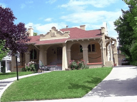
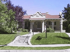
The Copperton houses were well-built, attractive, and modernly furnished. They had concrete foundations, brick or stucco exteriors, copper roofing and raingutters, central heating, indoor plumbing, garages and landscaped yards. Although the same floor plans were used repeatedly throughout the town, variations in appearance were achieved by using different exterior features and by inverting the plans. The standard house types were a four-room model, which cost $5,065 to build, and a five-room model, which cost $5,804. The most expensive house in town, the superintendent’s house, cost $18,983 to construct. The four- and five-room houses were rented to company employees for $22.50 and $27.50 per month, respectively.

Because of the reasonable rent and the quality of the accommodations the Copperton houses were very much in demand. Since there were many more employees than there were houses, priorities were established for allotting them. First choice was given to the head company officials; the superintendent automatically had his own house. The first eighteen houses built in 1926 were all initially occupied by mid- or upper level management personnel. Only married workers could qualify to live in the town, and those were rated according to their seniority, department, date of application, and record of taking care of company property, if they had previously lived in company housing. The mine superintendent took those factors into consideration and made the final decision on who would live in the houses. His personal feelings toward an employee would often determine whether or not that person was given a house.8 If a worker retired or quit the company he was no longer eligible for a home in the town and had to move out. Widows, too, were not allowed to remain in their Copperton homes after the deaths of their mine-worker husbands.

Utah Copper Company was devoted to maintaining high standards in the appearance of the community. The houses were kept in good condition by regular cleaning, painting and repairs. Maintenance of each yard was the responsibility of the occupant, but the superintendent personally inspected the properties to insure that the proper standards were kept. Louis Buchman, the superintendent from 1930 to 1946, was notorious for his habit of driving slowly through the town each morning to inspect the homes and yards. Any irregularities that he spotted were sure to be brought to the attention of the occupant, and in at least one instance he was known to have dispatched a company employee to mow regularly overgrown lawns and to charge the occupants the cost of the mowing.

The eight-acre park in the center of town was also kept up very nicely by the company. It was developed in 1927 and was landscaped with grass, trees, flowers and winding paths. The park also had a bandstand, rest rooms, tennis courts, and a children’s playground. A greenhouse was constructed nearby in 1937 to provide flowers for the park, and there was a full-time gardner who was responsible for the park maintenance.

The showpiece quality of Copperton was intended for more than just satisfying the workers; it was a definite attempt to advertise the company and its product copper. Building specifications for the houses called for the installation of copper shingles, copper downspouts, bronze screens, brass plumbing fittings, bronze plated hardware, and a variety of other copper products. Utah Copper Company kept careful records of the construction costs of the Copperton houses, and concluded that the initial 5-6 percent increase in costs due to the use of superior copper materials would be offset by savings in maintenance over a short period of years. Most of the more visible copper elements, the shingles and rain gutters, have been replaced over the years, usually not with the same materials.

A more ambitious attempt by Utah Copper Company to promote the use of copper in the building construction industry was the erection of four prefabricated “experimental houses.” The first of these model homes, located at 201 West Park Street, was built in 1936 amid a wave of publicity. During the week-long open house over 2500 people toured the home, which was touted as Utah’s first prefabricated house. The local newspaper gave the following description of the house:

Visitors were particularly impressed with the economy of the arrangement of rooms in the house and characterized it as “the biggest little house” ever planned. Another feature that will help to sell copper houses is that a house like the one on display at Copperton is everlasting. Roof, gutters, downspouts, window frames and screens, radiators and piping are all of copper and the framework of steel make the house termite proof.

Copper Houses, Inc., a subsidiary of Utah Copper Company, was formed to promote and distribute the houses. Offices were established in Salt Lake City and in Washington, D.C., and by January 1937 groups of copper houses were reportedly being erected in several Eastern cities. Three more experimental houses, each slightly different, were built in Copperton in 1937-38. The success of this venture was apparently limited since there is little mention or physical evidence of such houses having been built elsewhere in the state.

Copperton received very favorable coverage in the local newspapers and in mining journals as a model company town. The hospitable environment of the community was viewed as a benefit to both worker and employer. It was noted that “Copperton will be a town of families there will be no room for the floater, the pool-room habitue, or the bootlegger….Truly, one can foresee for Copperton a colony of real homes and children fitted in body and mind far better than the child living under the conditions that prevail in the ordinary mining camp.”

As Copperton grew and developed, schools and churches were established in the community and a number of stores were built as well. Copperton Elementary School (now demolished) was constructed along the south edge of town in 1929, and Bingham High School was built at the north side of town in 1931. The LDS church building, completed for use by 1942, was the first church constructed in the town. The Methodist Church was moved into Copperton in 1948 from its original location at Kearns Army Camp, several miles northeast of town. The third and final church erected in Copperton was the Catholic Church, constructed in 1949. Since none of the churches were built during the historic period (pre-1941) they were not included in the historic district. Commercial buildings, too, have been excluded from the district because they have either been demolished or extensively altered. There were relatively few commercial buildings in the town anyway, because the principal business district in the area was in the town of Bingham, three miles away.

The establishment of schools in Copperton and the requirement that teachers live within the boundaries of the district in which they taught resulted in the construction of three buildings for teacher housing in the community. The first, a ten-unit two-story apartment building, was constructed on the property to the immediate west of the high school in 1931. Two sets of duplexes were built to the west of those apartments in 1939. The apartments were occupied by single teachers, but the duplexes were for the exclusive use of married teachers. The teachers’ apartments and duplexes were constructed by the Jordan School District with the permission of Utah Copper Company which owned the land.

Recreational activities were an important part of life in Copperton. A company ball park was built at the site in the early 1920s even before the town was built. It continued in use until the completion of the high school ball fields and stadium in 1938. The old ball park, located in the center of town, was then replaced with the three blocks of houses between First East and First West streets, from State Highway to Hi 11 crest Street. The high school stadium, a WPA project, is still intact and is used by the Bingham Middle School which currently occupies the old high school building.

Though neither the first nor the largest company-built mining community in Utah, Copperton did own the distinction of having the most substantial and well furnished houses of any company town in the state. It was considered the showpiece of Utah Copper Company towns with its modernly equipped, copper accoutered masonry houses. The largest of UCC’s towns was Garfield, located twelve miles to the north. It eventually consisted of almost 400 houses, as well as school buildings, churches, and numerous commercial enterprises. Garfield was established in 1906 near the mine’s smelter, but in 1957, in order to make way for expansion of the smelter operations, the houses were either demolished or moved from the site. There were also several company towns erected by coal companies in central Utah during the early 1900s. Included among them are Clear Creek, Columbia, Sunnyside, Kenilworth, and Hiawatha. The houses built in those towns were generally neither as large nor as well furnished as the Copperton houses, and were frame instead of masonry buildings. Hiawatha, however, is probably a more complete company town than Copperton. It has a wider variety of resources, including public, commercial, religious and mining company buildings as well as segregated residential areas for workers and management. Copperton, on the other hand, was primarily just a residential community.

Company towns and planned communities were an important development in American housing during the late nineteenth and early twentieth centuries. Planned industrial towns, such as Lowell, Massachusetts, had been in existence since the 1820s, but it was not until the turn-of-the-century that sociological and management concerns were combined with the ideas of the nascent urban planning profession to create the company town that is most familiar and pervasive in the U.S. The standard appearance of company towns is that of evenly spaced, virtually identical houses clustered in a subdivision arrangement. Uniform facades were used not only to cut construction costs, but also to convey the sense of order and efficiency valued by the large industrial employers who had the towns built. While providing employees with improved living conditions, company towns also served the employers by giving them greater control over the workers. As owner of the town, the company could dictate who could live in the houses, how the houses should be maintained, what kinds of businesses would be allowed in the town (no saloons), and, by having the workers live near the industrial site, the company could better regulate worker tardiness and absenteeism.

Though Copperton still retains its original appearance, it ceased serving as a company town in 1956. That year Kennecott Copper Corporation decided to divest itself of all its residential real estate and to focus its efforts entirely on mining. A plan was worked out whereby the occupants were given first opportunity to buy their own houses for very reasonable costs. The transactions took place with very few problems.

The transition from company town to privately owned community necessitated the formation of local administrative bodies to oversee community functions such as water and sewer services, street maintenance, and upkeep of the community park. Though Copperton has never been incorporated as a town, it has functioned successfully as a community for over 30 years, despite it isolated location.

Today Copperton appears much as it did during its first few decades. None of the houses have been torn down and only a relatively few have been significantly altered. There have been no substantial additions to the size of the town since its company town days of the mid-1950s. This well preserved, compact community conveys a distinct sense of time and place and represents important segments of Utah’s architectural and social histories.

Description:

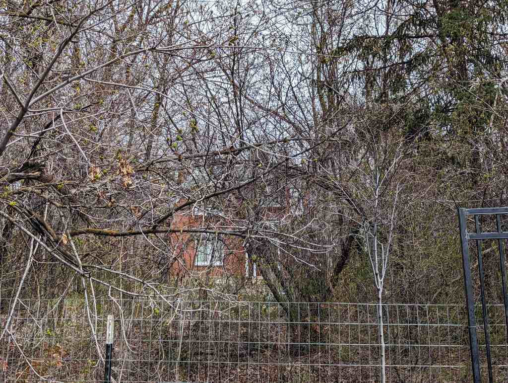
The Copperton Historic District contains most of the town of Copperton, a compact, isolated community located at the mouth of Bingham Canyon approximately 25 miles southwest of Salt Lake City. The town was built between 1926 and about 1955 as a planned residential community for employees of Utah Copper Company. Resources in the district include the high school building and stadium, one small apartment building, two duplexes, an 8.5-acre park, and 204 similary styled houses with 63 accompanying garages. The subdivision layout of the town consists primarily of straight streets and rectangular blocks divided into roughly equal size lots. The individual resources in the district as well as the town’s overall layout are, for the most part, very well preserved and effectively convey the original character and significance of the town.

Boundaries of the District

Boundaries for the Copperton Historic District were chosen to include the parts of town that were developed before 1941, the cutoff date for the district. (See the Significance Section for details on the cutoff date.) Of the 247 principal buildings in the community, 207 are included within the boundaries of the historic district. The newest sections of town, those built after 1941, are located on the fringes and are therefore easily excluded from the district. The district is bounded on the south by Hillcrest Street, on the east by 5th East Street, and on the west by 2nd West Street (with the exception of three houses). The northern boundary is the most irregular with State Highway serving as the boundary at both the east and west ends of town, but in the center the boundary extends across the highway to take in all the structures between 115 East State Highway and 106-108 West State Highway, inclusive (see map). The boundaries may be expanded at a later date to include all of the buildings constructed in Copperton during its years as a company town, up to 1956.

pany town, up to 1956. Excluded from the district at this time were the duplexes on West State Highway, 5th East Street and in Copper Circle, all three churches, the extensively altered credit union at 117 East State Highway, the gas stations and miscellaneous commercial buildings at the east end of town, and the Lions Club building/firestation south of the park. All of these buildings are on the fringes of the community.

Contributing Resources in the District

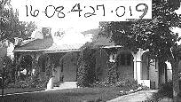
Contributing resources in the district include 199 (of 207) principal buildings, 34 (of 63) frame garages, the community park and the structures included with the high school stadium. Of the 199 contributing principal buildings, 195 are single-family houses which are very similar to each other in terms of their scale and design. The important original features that have been retained on those contributing houses include their roof lines, exterior wall surfaces, and window and door openings, especially on the primary façade. Minor changes have been made to most of the houses, however. These include new porch railings, new windows and doors, small additions on the side or rear elevations, the replacement of original copper shingles and rain gutters with non-historic materials, and the installation of aluminum siding on relatively small areas, such as gable ends and soffits. Interior alterations have also been made on most of the houses to accommodate growing families and changing tastes, but they were not taken into consideration in the evaluation of the houses. One of the most common interior alterations has been the excavation of a full basement, since the houses originally came with only a partially excavated basement.

The 34 contributing garages in the district are those that were built within the historic period which have undergone only minor alterations (photo 3). Most of the garages are rectangular stuccoed buildings with either two or four separate bays under a simple gable roof. The two-bay garages are accessible by a single driveway and are set to the rear between the two adjacent houses they serve. Most of the four-bay garages are, in essence, two two-bay garages set back to back in the middle of the block. They serve a pair of houses on each side of the block. There are also a few multi-bay garages in the center of some blocks that are lineally arranged as opposed to back-to-back. The nineteen garages that are attached to houses were not counted as separate buildings. Common garage alterations that were considered minor included the replacement of the original hinged double doors with overhead doors and small additions on the sides or rear.

Non-contributing Resources in the District

The non-contributing buildings in the district include 9 (of 207) principal buildings, 29 (of 63) garages, 11 out-of-period garages, 3 buildings at the community park, and 2 buildings at the high school stadium. There are no out-of-period principal buildings in the district. The 9 non-contributing buildings are all houses built within the historic period but which have been significantly altered over the years. The most common major alteration is the addition of aluminum siding to the exterior of houses. Unlike some of the contributing houses which had only minor exterior wall surfaces covered with aluminum siding, these non-contributing houses are either completely covered or are covered with the exception of only a few rows of exposed brick at the base of the walls or surrounding doorways. Other major alterations on non-contributing houses include the enclosure and drastic alteration of the front porch and the enlargement of window openings on the façade.

The 29 garages that were evaluated as non-contributing are those that have been significantly altered by large additions and/or new exterior siding. Since most of the garages contain either two or four separate bays, each individually owned, the chance for alterations was greatly increased. If one of the bays was significantly altered the entire structure was determined to be non-contributing because of the major impact of those changes on the relatively small, simple building.

House Designs and Floorplans

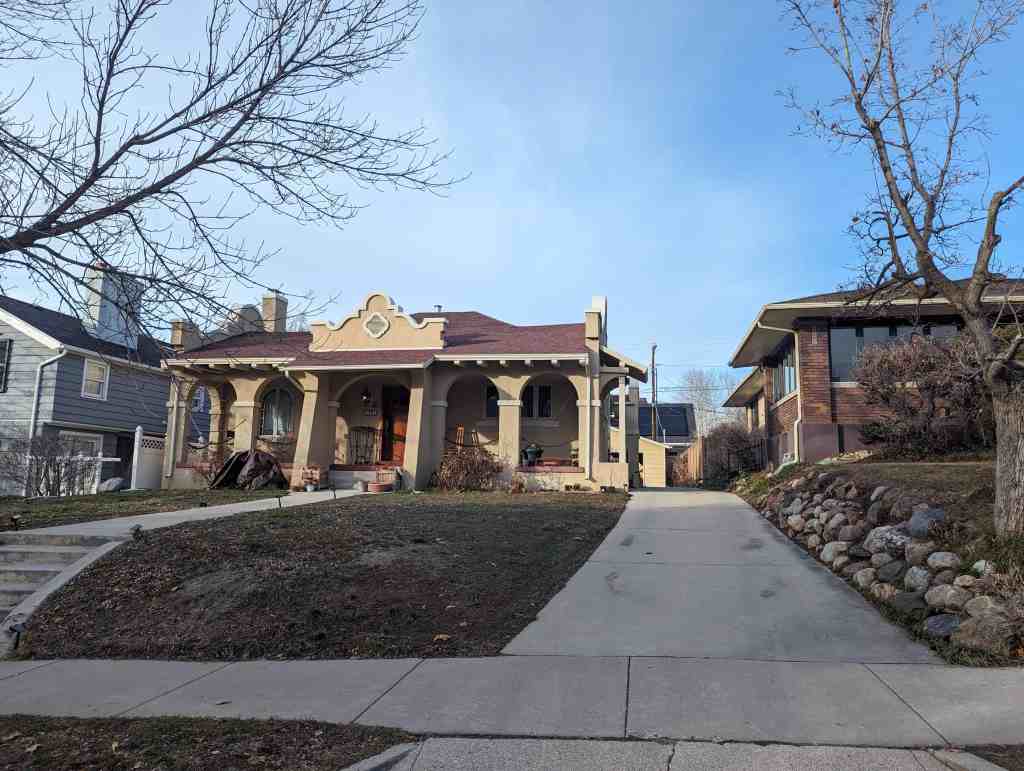
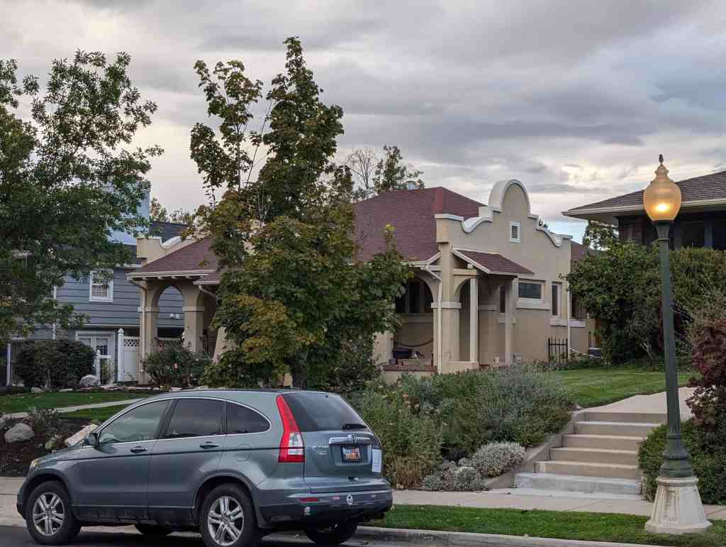
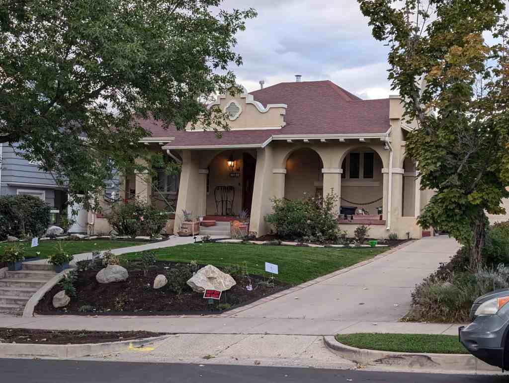
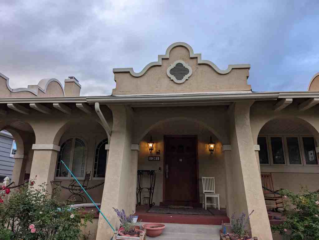
The houses in the Copperton Historic District convey a distinct sense of cohesiveness through their age, scale, materials, and design. They were built between 1926 and 1941 and are all one-story houses with brick or stucco exteriors. Stylistically, all of the houses in the district are bungalows, period cottages or a combination of both. The bungalows are characterized by their broad front porches and exposed rafters, and they tend to more plain than the period cottages. The period cottages generally have modest designs in the English Tudor or Spanish Colonial Revival styles. The period cottage house type, popular in Utah between the two world wars, was so named because its stylistic embellishments were derived from designs of earlier historic periods. English Tudor was the most common style used on period cottages in Copperton and throughout Utah. In addition to the bungalows and period cottages there are four prefabricated copper-clad houses built between 1936 and 1938. Though slightly different in their architectural styling, those copper houses blend in well with the other houses in town.

The designs for virtually all of the Copperton houses were drawn up by Scott & Welch, a Salt Lake City-based architectural firm that is also credited with designing the layout of the town. An extensive, though not complete, collection of their original drawings for Copperton provides an invaluable insight into the design process for both the houses individually and the community as a whole.” There is also an overall layout of the town, apparently begun by Scott & Welch, which shows each building in the community and gives the plan type for each house.

Although there are over 85 stylistic variations for the Copperton houses, a single floorplan concept served as the basis for virtually all the designs. That basic floor plan is a rectangular form with its narrow end facing the street. It is divided lengthwise by a central wall with “public” rooms living room, dining room, kitchen on one side and “private” rooms bedrooms and bathroom on the other. The majority of those 85-plus variations are four- and five-room plans, which together account for over 95 percent of the houses in the town.

The four-room floor plans are the most common, probably since they were the most simple and inexpensive to build. There are 55 variations of four-room houses, and they constitute 75-80 percent of the houses in the community. They all share a standard floor plan that has a living room and kitchen on one side and a bedroom-bathroom-bedroom arrangement on the other. (The bathroom was not counted as a room.) There is a short hallway adjacent and parallel to the center dividing wall connecting the two bedrooms. The front door enters into the living room, and the rear entrance and the stairway to the basement are located at the rear of the kitchen. Built-in breakfast nooks are a prominent feature in the kitchens. The “semibasements,” which had one unexcavated room in order to avoid paying higher taxes for a full basement, included a laundry room, a furnace room, a storage/fruit room and a coal room.

The numerous variations of this basic four-room plan are all the result of exterior changes, minor interior alterations, or inverted plans. Those changes do not alter the basic room arrangement, however. In some versions the living room projects slightly to the front, while in others it is flush. Most of the four-room plans have the living room and the front bedroom facing the street, but there are a few variations that rotate the plan 90 degrees to have the living room/kitchen side of the house facing the front with the porch projecting off that elevation. Exterior variations are numerous, consisting of changes in roof lines, porch treatments, windows, wall surfaces and design elements. A few of the four-room houses have attached garages, though the vast majority share a detached garage with the neighboring house.

Five-room plans differ from four-room plans primarily in that they have a dining room inserted between the living room and the kitchen. The living room is often projected slightly out the front or side in order to help accommodate that additional room. In one version the kitchen extends behind the back bedroom, and in another a third bedroom is added across the back of the house. Twenty-four of the 39 five-room houses are located on corner lots, which were traditionally favored locations. There are at least 23 five-room plans, and they account for about 20 percent of the houses in the town.

Although four- and five-room plans make up the vast majority of the Copperton houses, there are a number of miscellaneous floorplans with six, seven, or eight rooms. These were used on a very limited number of houses in the town, and some of the designs may not have been used at all, since there are no houses that have been clearly identified with them. The largest house in town is the eight-room superintendent’s house at 104 East State Highway (National Register 1985).

The four copper-clad prefabricated houses in Copperton were built as “experimental houses,” and as such they are noticeably distinct. Although these houses have the same number and types of rooms found in the earlier houses, the floor plan and the exterior designs are different. The exteriors are symmetrical and simpler than those of the standard houses, and the modest stylistic features that they have are Classical instead of Period Revival or Bungalow. The horizontal copper siding on three of the four houses is very similar in appearance to aluminum siding, but early photos prove that it was original. The broadside-to-the-street orientation of these houses is reflected in their floor plans. The front and rear bedrooms are adjacent and set to one side of the house and the living room and kitchen to the other. The bathroom is set between the kitchen and the rear bedroom and the stairway to the basement is located between the living room and the kitchen. Despite their distinctiveness, these house have the same setback and scale as the other houses in town and therefore blend in very well.

Other Resources in the District

In addition to single-family houses in the Copperton Historic District there are also the old Bingham High School and stadium, the teachers’ apartment building, the two duplexes for teachers, and the community park. The high school is an Art Moderne building designed by Scott & Welch and built in 1931. The teachers’ apartment building was also built in 1931, and the duplexes were built in 1939. The stadium was constructed as a WPA project in 1937-38. The three-acre park is planted with grass and trees and has tennis courts and a playground at the south end. There are three buildings in the park, two of which – the “roundhouse” pavilion and the restrooms – are out-of-period. The maintenance shed appears to be an original building that has been extensively altered. The concrete and wrought iron entrance at the northwest corner gives the name of the park and its date of completion: Utah Copper Company Community Park, 1927.

COPPERTON HISTORIC DISTRICT
List of Buildings and Owners
April 1986
Property Address (evaluation; date of construction; house type)
Current Owner and Address

  • 100 First East Street (contributing; 1941; type 5-2-39)
  • 101 First East Street (contributing; 1926; type 5-1-R)
  • 102 First East Street (contributing; 1941; type 4-A-41)
  • 103 First East Street (contributing; 1926; type 4-B)
  • 200 First East Street (contributing; 1940; type 5-B-40)
  • 202 First East Street (contributing; 1940; type 4-B-26-R)
  • 204 First East Street (contributing; 1940; type 4-A-40)
  • 206 First East Street (contributing; 1940; type 6-A-40)
  • 300 First East Street (contributing; 1940; type 6-B-40)
  • 302 First East Street (contributing; 1940; type 4-D-26)
  • 304 First East Street (contributing; 1940; type 4-D-40)
  • 306 First East Street (contributing; 1940; type 5-A-40)
  • 101 Second East Street (non-contributing; 1926; type 4-C-R)
  • 102 Second East Street (non-contributing; 1926; type 4-B)
  • 103 Second East Street (contributing; 1926; type 4-B)
  • 104 Second East Street (contributing; 1926; type 5-2-R)
  • 101 Third East Street (contributing; 1928; type 4-Y-1-10)
  • 102 Third East Street (contributing; 1927; type 4-F)
  • 103 Third East Street (contributing; 1928; type 4-B-3)
  • 104 Third East Street (contributing; 1927; type 4-B)
  • 105 Third East Street (contributing; 1928; type 4-E-5)
  • 201 Third East Street (contributing; 1927; type 5-4-R)
  • 203 Third East Street (contributing; 1927; type 4-A)
  • 205 Third East Street (contributing; 1927: type 4-B)
  • 207 Third East Street (non-contributing; 1927; type 4-F)
  • 209 Third East Street (contributing; 1927; type 5-3-R)
  • 211 Third East Street (contributing; 1927; type 4-G)
  • 213 Third East Street (contributing; 1927; type 4-C)
  • 215 Third East Street (contributing; 1927; type 4-D)
  • 217 Third East Street (contributing; 1927; type 4-B)
  • 219 Third East Street (contributing; 1927; type 5-2-R)
  • 221 Third East Street (contributing; 1927; type 4-E-R)
  • 223 Third East Street (contributing; 1927; type 4-G-R)
  • 101 Fourth East Street (contributing; 1928; type 4-Y-1-10)
  • 102 Fourth East Street (contributing; 1928; type 4-B-3)
  • 103 Fourth East Street (contributing; 1928; type 4-D-2)
  • 104 Fourth East Street (contributing; 1928; type 4-C-4)
  • 105 Fourth East Street (contributing; 1928; type 4-E-5)
  • 106 Fourth East Street (contributing; 1928; type 4-F-6)
  • 107 Fourth East Street (contributing; 1928; type 4-G-7)
  • 200 Fourth East Street (contributing; 1927; type 4-B-R)
  • 201 Fourth East Street (contributing; 1929; type 5-1-12)
  • 202 Fourth East Street (contributing; 1927; type 4-C)
  • 203 Fourth East Street (contributing; 1929; type 4-E-5)
  • 204 Fourth East Street (contributing; 1927; type 4-F)
  • 205 Fourth East Street (contributing; 1929; type 4-A-3)
  • 206 Fourth East Street (contributing; 1927; type 4-B)
  • 207 Fourth East Street (contributing; 1929; type 4-B-26)
  • 208 Fourth East Street (contributing; 1927; type 4-E)
  • 209 Fourth East Street (contributing; 1929; type 4-Y-l-ll)
  • 210 Fourth East Street (contributing; 1927; type 4-C)
  • 211 Fourth East Street (contributing; 1929; type 4-D-27)
  • 212 Fourth East Street (contributing; 1927; type 4-D)
  • 213 Fourth East Street (contributing; 1929; type 4-D-26)
  • 214 Fourth East Street (contributing; 1927; type 4-B)
  • 215 Fourth East Street (contributing; 1929; type 4-F-6)
  • 216 Fourth East Street (contributing; 1927; type 4-G)
  • 217 Fourth East Street (contributing; 1929; type 4-B-27)
  • 218 Fourth East Street (contributing; 1927; tye 5-4-R)
  • 219 Fourth East Street (contributing; 1929; type 4-X-1-8)
  • 220 Fourth East Street (contributing; 1927; type 4-A)
  • 221 Fourth East Street (contributing; 1929; type 4-C-4)
  • 222 Fourth East Street (contributing; 1927; type 4-C-R)
  • 223 Fourth East Street (contributing; 1929; type 5-3-27)
  • 102 Fifth East Street (contributing; 1928; type 4-G-7)
  • 104 Fifth East Street (contributing; 1928; type 4-A-3)
  • 106 Fifth East Street (contributing; 1928; type 4-F-6)
  • 108 Fifth East Street (contributing; 1928; type 4-Y-1-10)
  • 200 Fifth East Street (contributing; 1929; type 4-C-4)
  • 202 Fifth East Street (contributing; 1929; type 4-Y-1-11-R)
  • 204 Fifth East Street (contributing; 1930; type 4-F-6)
  • 206 Fifth East Street (contributing; 1930; type 4-B-27)
  • 208 Fifth East Street (contributing; 1930; type 4-D-27)
  • 210 Fifth East Street (contributing; 1930; type 4-D-26)
  • 212 Fifth East Street (contributing; 1930; type 4-D-2)
  • 214 Fifth East Street (contributing; 1930; type 4-Y-1-10)
  • 216 Fifth East Street (contributing; 1930; type 4-E-5)
  • 218 Fifth East Street (contributing; 1930; type 4-A-3)
  • 220 Fifth East Street (contributing; 1930; type 4-B-26)
  • 222 Fifth East Street (contributing; 1930; type 5-1-27-R)
  • 101 First West Street (contributing; 1941; type 4-A-40-B)
  • 102 First West Street (contributing; 1929; type 4-X-1-8-A)
  • 102 Second West Street (contributing; 1937; type 7-A-37)
  • 92 Cyprus Street (contributing; 1940; type 4-D-40)
  • 93 Cyprus Street (non-contributing; 1940; type 4-E-5-40)
  • 94 Cyprus Street (non-contributing; 1940; type 4-D-26)
  • 95 Cyprus Street (contributing; 1940; type 4-A-40)
  • 96 Cyprus Street (contributing; 1940; type 4-Y-1-10-R)
  • 97 Cyprus Street (contributing; 1940; type 4-B-26-R)
  • 98 Cyprus Street (contributing; 1940; type 4-D-39)
  • 99 Cyprus Street (contributing; 1940; type 4-F-40)
  • 100 Cyprus Street (contributing; 1937; type 4-A-3)
  • 101 Cyprus Street (contributing; 1937; type 5-1-27)
  • 102 Cyprus Street (contributing; 1937; type 4-C-4)
  • 103 Cyprus Street (contributing; 1937; type 4-D-2)
  • 104 Cyprus Street (contributing; 1937; type E-3-5-RM)
  • 105 Cyprus Street (contributing; 1937; type 4-B-27)
  • 106 Cyprus Street (contributing; 1937; type 4-D-26)
  • 107 Cyprus Street (contributing; 1937; type 4-D-27)
  • 108 Cyprus Street (contributing; 1937; type 4-F-6)
  • 109 Cyprus Street (contributing; 1937; type 4-Y-1-10)
  • 110 Cyprus Street (contributing; 1937; type 4-B-26-R)
  • 111 Cyprus Street (contributing; 1937; type 4-D-2)
  • 112 Cyprus Street (contributing; 1937; type 4-Y-1-10)
  • 113 Cyprus Street (contributing; 1937; type 4-D-26)
  • 114 Cyprus Street (non-contributing; 1937; type 4-B-27)
  • 115 Cyprus Street (contributing; 1937; type 4-B-26)
  • 116 Cyprus Street (contributing; 1937; type 4-D-2)
  • 117 Cyprus Street (contributing; 1937; type 4-Y-1-10-B)
  • 118 Cyprus Street (non-contributing; 1937; type 4-B-3-R)
  • 119 Cyprus Street (contributing; 1937; type 4-E-5)
  • 120 Cyprus Street (contributing; 1937; type 5-2-5-RM)
  • 121 Cyprus Street (contributing; 1937; type 4-A-37)
  • 92 Hillcrest Street (contributing; 1940; type 4-Y-1-10-B)
  • 94 Hillcrest Street (contributing; 1940; type 4-D-39)
  • 96 Hill crest Street (contributing; 1940; type 4-A-40)
  • 98 Hillcrest Street (contributing; 1940; type 4-D-26)
  • 100 Hillcrest Street (contributing; 1939; type 5-2-39)
  • 102 Hillcrest Street (contributing; 1939; type 4-5-1-10-BR)
  • 104 Hillcrest Street (contributing; 1939; type 4-D-26-R)
  • 106 Hillcrest Street (contributing; 1939; type 4-C-4)
  • 108 Hillcrest Street (contributing; 1939; type 4-B-26)
  • 110 Hillcrest Street (contributing; 1939; type 4-E-5)
  • 112 Hillcrest Street (contributing; 1939; type 4-D-27)
  • 114 Hillcrest Street (contributing; 1939; type 4-Y-1-10)
  • 116 Hillcrest Street (contributing; 1939; type 4-F-6)
  • 118 Hillcrest Street (contributing; 1939; type 4-D-39)
  • 101 East Park Street (contributing; 1926; type 5-2)
  • 103 East Park Street (contributing; 1926; type 4-C)
  • 105 East Park Street (contributing; 1926; type 4-D)
  • 107 East Park Street (contributing; 1926; type 5-3-R)
  • 201 East Park Street (contributing; 1926; type 5-1)
  • 203 East Park Street (non-contributing; 1927; type 4-D)
  • 205 East Park Street (contributing; 1927; type 4-C)
  • 207 East Park Street contributing; 1927; type 5-1-R)
  • 301 East Park Street (contributing; 1928; type 4-X-1-8)
  • 303 East Park Street (contributing; 1928; type 4-X-2-9)
  • 88 West Park Street (contributing; 1941; type 4-E-5-40)
  • 90 West Park Street (contributing; 1941; type 4-D-26)
  • 92 West Park Street (contributing; 1941; type 4-D-40-R)
  • 93 West Park Street (contributing; 1940; type 4-Y-1-10-R)
  • 94 West Park Street (contributing; 1941; type 4-B-26-R)
  • 95 West Park Street (contributing; 1940; type 4-A-40)
  • 96 West Park Street (contributing; 1941; type 4-F-40-R)
  • 97 West Park Street (contributing; 1940; type 4-E-5-40)
  • 98 West Park Street (contributing; 1941; type 5-A-40)
  • 99 West Park Street (contributing; 1940; type 4-B-40-R)
  • 100 West Park Street (contributing; 1929; type 4-Y-l-ll)
  • 101 West Park Street (contributing; 1937; type 4-D-26)
  • 102 West Park Street (contributing; 1929; type 4-X-29)
  • 103 West Park Street (contributing; 1937; type 4-E-5)
  • 104 West Park Street (contributing; 1929; type 5-1-27)
  • 105 West Park Street (contributing; 1937; type 5-1-5-RM)
  • 106 West Park Street (contributing; 1929; type 4-B-3)
  • 107 West Park Street (contributing; 1930; type 4-Y-1-10)
  • 108 West Park Street (contributing; 1929; type 4-D-2)
  • 109 West Park Street (contributing; 1930; type 4-B-27)
  • 110 West Park Street (contributing; 1929; type 4-D-26)
  • 111 West Park Street (contributing; 1930; type 4-A-3)
  • 112 West Park Street (contributing; 1929; type 4-X-1-8)
  • 113 West Park Street (contributing; 1930; type 4-B-26)
  • 115 West Park Street (contributing; 1930, type 4-F-6)
  • 117 West Park Street (contributing; 1930; type 4-Y-1-10)
  • 119 West Park Street (contributing; 1930; type 4-D-27)
  • 121 West Park Street (contributing; 1930; type 4-Y-1-11-RA)
  • 201 West Park Street (contributing; 1936; “model home,” no type given)
  • 100 East State Highway (contributing; 1926; type 7-R)
  • 102 East State Highway (contributing; 1926; type 4-D)
  • 104 East State Highway (contributing; 1926; supt. residence)
  • 105 East State Highway (contributing; 1930; type 8-A-30)
  • 107 East State Highway (contributing; 1930; type 4-E-5-A)
  • 109 East State Highway (contributing; 1930; type 4-C-4-A)
  • 111 East State Highway (contributing; 1930; type 4-X-1-8-A)
  • 113 East State Highway (contributing; 1930; type 4-Y-1-10-A)
  • 115 East State Highway (contributing; 1930; type 4-X-29-RA)
  • 200 East State Highway (contributing; 1926; type 5-3-R)
  • 202 East State Highway (contributing; 1926; type 4-A-R)
  • 204 East State Highway (contributing; 1926; type 5-4-R)
  • 206 East State Highway (contributing; 1926; type 5-3)
  • 300 East State Highway (contributing; 1928; type 5-2-13)
  • 302 East State Highway (contributing; 1928; type 4-E-5)
  • 304 East State Highway (contributing; 1928; type 4-D-2)
  • 306 East State Highway (contributing; 1928; type 4-Y-1-11)
  • 308 East State Highway (contributing; 1928; type 4-F-6)
  • 310 East State Highway (contributing; 1928; type 5-1-12)
  • 400 East State Highway (contributing; 1928; type 5-2-13)
  • 402 East State Highway (contributing; 1928; type 4-C-4)
  • 404 East State Highway (contributing; 1928; type 4-B-3)
  • 406 East State Highway (non-contributing; 1928; type 5-1-12)
  • 91 West State Highway (contributing; 1941; type 4-D-40)
  • 93 West State Highway (contributing; 1941; type 4-A-40)
  • 95 West State Highway (contributing; 1941; type 4-F-40)
  • 96 West State Highway (contributing; 1931; high school building)
  • 97 West State Highway (contributing; 1941; type 4-E-5-40)
  • 99 West State Highway (contributing; 1941; type 5-1-27)
  • 100 West State Highway (contributing; 1930-31; teachers’ apartments)
  • 101 West State Highway (contributing; 1927; type 6-R)
  • 102-104 West State Highway (contributing; 1939; duplex)
  • 103 West State Highway (contributing; 1929; type 4-C-4)
  • 105 West State Highway (contributing; 1929; type 5-3-27)
  • 106-108 West State Highway (contributing; 1939; duplex)
  • 107 West State Highway (contributing; 1929; type 4-B-26)
  • 109 West State Highway (contributing; 1929; type 4-F-6)
  • 111 West State Highway (contributing; 1929; type 4-X-1-8-A)
  • 113 West State Highway (contributing; 1929; type 4-X-29-A)
  • 115 West State Highway (contributing; 1929; type 5-2-13)
  • 203 West State Highway (contributing; 1940; type 4-B-4-40)

Horseshoe Canyon Archeological District

13 Saturday Apr 2024

Posted by Jacob Barlow in Uncategorized

≈ Leave a comment

Tags

NRHP, Pictographs, Wayne County

Horseshoe Canyon Archeological District

Horseshoe Canyon Archeological District was originally listed on the National Historic Register as Horseshoe (Barrier) Canyon Pictograph Panels (#72000099) on February 23, 1972. It is located in Canyonlands National Park.

Zion Lodge Historic District

13 Saturday Apr 2024

Posted by Jacob Barlow in Uncategorized

≈ Leave a comment

Tags

NRHP, utah, Washington County, Zion National Park

Zion Lodge Historic District

The Zion Lodge Historic District is significant for its historic association with the development of the “Rustic Style” architecture in the National Park Service during the 1920’s. The complex was designed by one of the leaders of “Rustic Style” architecture, Gilbert Stanley Underwood. In 1919, the Mukuntuweap National Monument was enlarged and the name changed to Zion National Park. Previous to gaining park status, accommodations for tourists were provided by Wylie Camping Company. The Wylie Camps, popular in other western national parks, gave the tourists a “camping experience” complete with tent-style living. The Union Pacific Railroad secured the concessions contract for Zion National Park and formed the Utah Parks Company to plan, build, and maintain the concession developments. The Union Pacific Company retained Gilbert Stanley Underwood to design the Zion Lodge Complex. Underwood is credited with the design of Timberline Lodge on Mount Hood, the Ahwahnee Hotel in Yosemite, the Grand Teton Lodge, Wyoming, the Bryce Canyon Lodge, and the Williamsburg Lodge in Williamsburg, Virginia.

Between 1900 – 1940, the use of “Rustic Style” architecture was popular in the western national parks. The style was characterized by the use of native materials to blend with the rugged landscapes, and the careful use of scale and design to make the building compatible with the natural environment. The “Rustic Style” of architecture of Gilbert Stanley Underwood is one of the most important and lasting contributions of the Utah Parks Company to Zion National Park. The “Rustic Style” of Underwood served as a model for the later construction in the park, particularly during the New Deal of the 1930’s. The Male Dormitory in the Zion Lodge Complex is an example of Underwood’s style being followed.

The original Zion Lodge Complex consisted of the Zion Lodge, the Bathhouse and Swimming Pool, the Female Dormitory, Comfort Station, Linen Cabins, Deluxe Cabins, and the Standard Cabins. The original Zion Lodge burned in 1966 and was replaced in 1966 by a prefabricated building placed on the original lodge’s foundation. The Bathhouse and Swimming Pool were removed in 1976. The Standard Cabins were the first attempt by the Utah Parks Company for accommodations in the lodge complex and were augmented by the Deluxe Cabins over the following four years. The Standard Cabins were designed for a 20 year structural life.

In 1937, the Male Dormitory was built following the design set by Gilbert Stanley Underwood in the previous decade. The “Rustic Style” architecture of Gilbert Stanley Underwood as exemplified by the Zion Lodge complex can also be seen at Bryce Canyon National Park.

The Zion Lodge Historic District is located in Zion National Park in Washington County, Utah and were added to the National Historic Register (#82001718) on August 24, 1982.

Melvin Harley Randall House

04 Thursday Apr 2024

Posted by Jacob Barlow in Uncategorized

≈ Leave a comment

Tags

Centerville, Davis County, Historic Homes, NRHP, utah

Melvin Harley Randall House

The Melvin Harley Randall House is a representative example of early stone building in the vernacular tradition which was strong in the Centerville area and which may be detected even today. Unlike other parallel stone dwellings of the period which are extant, however, the Randall home retains its original exterior and interior character. The house also served as the residence of Melvin Harley and Frankie Bennett Randall until 1940. Melvin Randall served as the first Centerville Town Board President, and remained active in local church and civic affairs.

Located at 390 East Porter Lane (400 South) in Centerville, Utah and added to the National Historic Register (#80003896) on June 20, 1980.

Melvin Harley Randall was born August 1, 1852 in Salt Lake City, Utah, the son of Alfred Jason and Margaret Hawley Randall. In 1875 he married Frankie Bennett. Randall’s family had settled in the fertile land in Centerville, Utah shortly after its initial settlement in 1848. Centerville, originally called Cherry Cheek, became an important agricultural area, located some twelve miles north of Salt Lake City. As other early Mormon communities, Centerville contained a strong church organization headed by a bishop and counselors who presided over all church affairs. Civil matters also became of concern on the local level.

By 1880 Melvin Randall was listed in local directories as a farmer, with his stone home having been built around 1875. Randall was active in church, political, and educational affairs of Centerville, gaining recognition in various sources as among the prominent pioneers of the town. In 1888 Randall became a First Counselor to Centerville Ward Bishop Aaron B. Porter, and in 1899 he was ordained Bishop, serving in that capacity until 1911.

In 1915 Centerville organized into a town in order to issue bonds to install a needed waterwork. The Davis County commissioners granted the petition by Centerville residents seeking town stature, and resolved that,” the following named persons are hereby appointed as the Board of Trustees of said Centerville Town: M.H. Randall, President of the Board, and as additional members Don Major, William Barber, Joseph E. Williams and F.W. Walton.” Thus, Randall became the first Centerville Town Board President, heading the town from May 15, 1915 to December 31, 1915, and helped to install the Centerville water system. He continued active in civil affairs by serving as a Davis County Commissioner and school trustee.

Melvin Harley Randall died at his home on April 21, 1930, followed by his wife Frankie, who died in November, 1940. The home is cited in the Smoot and Sheriff history of Centerville as one of the historic homes in Centerville, recognizing it as locally significant.

The Randall House is a two-story stone hall and parlor house, two rooms wide with symmetrical door-window-door façade piercing on the first floor with matching six-over-six windows but no center opening on the second floor. A one-story frame addition has been added to the rear, which made the house into a simple “H” plan. The cornice is undecorated, as are the lintels. The door surround is done with very plain pilasters. The wall beneath the cross gable connecting the one and two story sections of the house is set back below the roof, creating a narrow porch.

A later addition containing a utility room and bathroom was built on the west façade of the original house. The interior of the house retains most of the original door, window and baseboard moulding.

A very early twentieth century photograph of the house shows ornamental pediments over the windows of the frame section. The pediments were probably removed when aluminum siding was added.

Beckstead-Butterfield House

04 Thursday Apr 2024

Posted by Jacob Barlow in Uncategorized

≈ Leave a comment

Tags

Historic Homes, NRHP, Riverton, Salt Lake County, utah

Beckstead-Butterfield House

The Beckstead-Butterfield House, constructed in 1897, is a 1½-story brick Victorian Eclectic residence on Redwood Road in Riverton, Utah. The house is locally significant under Criterion C in the area of Architecture as the most ornate and largest surviving example of a Victorian Eclectic-style central-blockwith-projecting-bays type house in Riverton. Although not a fully realized Queen Anne-style house, the Beckstead-Butterfield House has many Queen Anne details such as octagonal bays, an asymmetrical façade, irregular floor plan and colored glass sashes in the upper windows. The house was associated with three members of the Beckstead family, who were sheep ranchers in Riverton. The longest owner/occupants were members of the Butterfield family, who operated one of the largest farms in Riverton on the property between 1906 and 1950. The historic name has been chosen to reflect the ownership by both the Beckstead and Butterfield families. Both names are still associated with the house as a landmark in the local community. The farmhouse property has been reduced to 0.52 acres by late-twentieth-century development in the area. In the area of Architecture, the period of significance spans the original construction in 1897 to 1900 when the matching rear addition was believed to have been constructed. The construction of both the original house and the addition is attributed to the local builder, Carl Madsen. The exterior of the house has good historic integrity with some minor alterations that were reversed during the recent rehabilitation using state and federal tax credits.

Located at 13032 South Redwood Road in Riverton, Utah and added to the National Historic Register (#100006389) on April 12, 2021.

The Beckstead-Butterfield House is locally significant under Criterion C in the area of Architecture as the most ornate and largest surviving example of a Victorian Eclectic-style central-block-with-projecting-bays type house in Riverton. Riverton is located approximately 30 miles south of Salt Lake City and remained a sparsely settled farm community until the 1990s when a population boom and suburban sprawl reached the town. Only about a dozen central-block type houses are estimated to have been built in the community. In 2004, a survey prepared for the Utah State Historic Preservation Office’s database found only five extant farmhouses identified with the Queen Anne style. Four of the five houses in the database were on or near Redwood Road, the main north-south corridor through Riverton and the prime location for commercial development. Two of the houses were recently demolished when the street was widened. Another house was remodeled into a commercial space with new windows, doors, and a façade ADA ramp. The fifth house is still eligible but does not appear to have had any Queen Anne details. A sixth house was not identified as Queen Anne style in the 2004 but was identified as Queen Anne in a 2016 survey of Redwood Road in Riverton. None of the six had towers or turrets, and of the five, only the Beckstead-Butterfield House has any other salient characteristics of the Queen Anne style.

The Beckstead-Butterfield House, built in 1897, is the last surviving Victorian-era central-block-withprojecting-bays type house in Riverton with Queen Anne-style details. The Beckstead-Butterfield House is more elaborate than most Victorian Eclectic-style houses in Riverton. The Victorian period marked two important changes in domestic architecture in Utah. The first was an end to Utah’s relative isolated as the coming of the railroad brought new materials to Utah. The second was the introduction of architectural style books that popularized the complexity and irregularity of the Victorian Eclectic domestic architecture. While the cross wing introduced asymmetry into Utah’s domestic architecture, the central-block house with its projecting bays produced the desired external irregularity while making the principal rooms larger and brighter (i.e. more window area). The floor plan of the original Beckstead-Butterfield House is an unusual variation by a local builder that had projecting bays on all four elevations, but no window openings in the south elevation bay.

The Victorian Eclectic was popular in Utah between 1880 and 1910. The Queen Anne style, as a variation of the Victorian Eclectic was popular between 1885 and 1905. Domestic examples are characterized by asymmetrical façades, tower/turrets, irregular floor plans, octagonal bays, dormers, and ornate woodwork. The Beckstead-Butterfield House is not a true Queen Anne because it lacks a tower. The house originally has a variety of materials, textures, and even colors, as seen in a 1906 photograph. The most distinctive characteristic of the Queen Anne style found on the Beckstead-Butterfield House are the multilight sashes. Surviving Queen Anne sashes are rare, particularly in rural communities like Riverton. The Beckstead-Butterfield House features three varieties of Queen Anne sashes: 1) multi-light upper sash, 2) perimeter square lights in a traditional window, and 3) a unique example of perimeter lights in a semicircular window.

As noted in the Riverton Multiple Property Submission (MPS), within the Enterprise and Rural Development Period, 1882-1899, Riverton dairy farmers and wool growers became the most prosperous families in the community and were able to build more substantial and elaborate homes than most area famers. Most were located along Redwood Road. Local builder, Carl Madsen, built two large brick houses at 13217 S. Redwood Road (1893) and 13030 S. Redwood Road (1897) for the Charles Nokes (a dairyman) and George Beckstead (a sheep herder), respectively. Carl Madsen also built a massive brick barn for George Beckstead that was more ornate than the house.

The exterior of the Beckstead-Butterfield House has good historic integrity in the qualities of design, materials, and workmanship. Minor alterations such as the front porch enclosure and missing south porch were reversed during the 2019-2020 rehabilitation. Although the interior was substantially modeled over the years, the recent rehabilitation preserved as many extant historic features as possible. During the rehabilitation, the missing Victorian fireplace, staircase, and pocket doors were replaced with historically appropriate features. The property has good location, feel and association integrity, but the original farm setting has been somewhat compromised by recent development in the neighborhood. For this reason, the property is being nominated for Architectural, but not Agricultural significance.

Additional Historic Context: History of the Beckstead-Butterfield House

Riverton was settled in the 1850s by members of the Church of Jesus Christ of Latter-day Saints (LDS or Mormon Church). The first residents lived in dugouts or crude log cabins near the Jordan River. A communal water project, the South Jordan Canal (begun in 1870 and completed in 1876), opened up the bench lands for agriculture. At the time the settlement was named Riverton in 1879, there were about one hundred residents living in scattered farmsteads on a bluff west of the Jordan River. After the completion of the larger Utah and Salt Lake Canal in 1881, as more settlers arrived, the community coalesced and expanded along Redwood Road. Redwood Road was the community’s main thoroughfare, in addition to being one of only two north-south transportation routes linking the north and south ends of the Salt Lake Valley at the turn of the twentieth century (the oldest route is the former Territorial Road, today’s State Street). It was named for the redwood stakes used to survey the road. In the late 1890s and early 1900s, a small commercial district developed at Redwood Road and 12400 South in Riverton.

The first owner of the land where the Beckstead-Butterfield House is located was James C. Hamilton, who received the first patent in 1883. A 30-acre portion of the homestead was acquired by Christian and Minnie Peterson, who sold it to W. W. and Mary Jane Beckstead in 1896. William Warren Beckstead was born in Riverton, on March 26, 1870. His parents were early settlers of Riverton, George Wesley and Eleanor Davis Beckstead. George W. Beckstead was a prosperous sheep rancher, whose assets were divided between his children at his death in 1890. In December 1891, W.W. Beckstead married Mary Jane Berg, who was born in Provo, Utah, on March 2, 1871. The Becksteads constructed a large brick eight-room home on Redwood Road in 1897. On November 22, 1897, Riverton’s local correspondent for the Deseret News reported on the progress of the new house:

W.W. Beckstead of Riverton has moved into his new residence. It is hardly yet completed—just enough to accommodate his family for the present. When finished it will no doubt be one of the finest in the vicinity. We want to see a few more such residences erected by our better able townsmen in the near future, as it adds greatly to the appearance of our settlement and displays the faith of its inhabitants in its future prosperity.

W.W. Beckstead farmed on his property in Riverton and managed sheep ranches in Idaho and Wyoming with his eldest brother, George F. Beckstead, and their sister, Mamie’s, husband Ed Harding. Two children were born to Mary Jane and W. W. before they built the brick house and two were built while they lived in the house. After just three years in the house, they decided to move to Rexburg, Idaho, to be closer to the ranches. The property in Riverton reverted to Christian and Minnie Peterson, who sold 10 acres to W.W.’s brother, George F. Beckstead. W.W. and Mary Jane Beckstead moved to Logan, Utah, in 1923. William Warren Beckstead died on February 2, 1954. Mary Jane Berg Beckstead died in California on July 18, 1968. They are buried in Logan.

Within the community of Riverton, the Beckstead house is more often associated with its second owners, George F. and Charlotte Beckstead. This is due to the fact that George F. Beckstead had a large brick barn built on the property soon after they acquired the house in 1900. The two-story barn sat slightly south and west of the house. It was built of brick with an ashlar granite foundation. The elaborate architecture of the barn included round towers at the front corners, a wide arched entrance, a stained-glass rose window, castellated parapet, and hard wood floors. The initials “G.F.B.” were installed above the entrance [Figure 3]. The castle-like, brick barn was a landmark in the community until its demolition in 1968. The George F. Beckstead barn was built by Carl Madsen, the most prolific Riverton builder of the period. Madsen is also believed to be the builder of the Beckstead house a few years earlier, and probably built the 1900 addition to the house for George and Charlotte.

Carl Madsen was born in Denmark in 1857. As a young man, he was apprenticed to a carriage maker. In 1881, Carl immigrated to Utah. Carl began working for a home builder in South Jordan in 1884. Carl and his wife, Anne Crane, moved to Riverton in 1889. His career as a builder lasted almost sixty years. Carl made was one of the building supervisors of the Riverton LDS Ward meetinghouse, designed by Richard Kletting, the architect of the Utah State Capitol. The building was nicknamed the Riverton domed church. It was built in 1899 and demolished 1940. Carl Madsen died in Riverton in 1947.

George Francis Beckstead was born on March 25, 1860 in Provo, Utah. He married Charlotte Emeline Hamilton in 1881. Charlotte was the sister of James C. Hamilton. George and Charlotte were the parents of nine children. Soon the death of George W. Beckstead in 1890, George and Charlotte moved into his father’s house in Riverton. In 1900, they moved one mile south on Redwood Road to W.W. and Mary Jane’s house. George F. had acquired a number of sheep herds by then. In her biography, Charlotte describes her husband as “the biggest sheep man in the state.” George F. also raised horses and the elaborate barn was built as a showcase for his horses. Charlotte brought George’s mother back from Salt Lake City to live with them in Riverton because they had “plenty of room.” Eleanor Davis Beckstead lived with them until her death in 1902. In 1906, the Beckstead family decided to move to Provo to help further the education of their almost grown youngest children. George Francis Beckstead died on January 5, 1916. Charlotte Emmeline Hamilton Beckstead died on June 7, 1953. They are buried in the Provo Cemetery.

Although the Becksteads did not move to Provo until 1906, on December 2, 1902, George and Charlotte deeded 80 acres of property, including the house, to Edward T. Harding, George’s sheep business partner and the husband of his sister, Mary Elizabeth Beckstead Harding. Edward Thomas Harding was born in Provo in 1860. Mary Beckstead was also born in Provo in 1866. They were married in 1886. It appears the Harding family remained in Provo and never lived in the Riverton house. On September 8, 1906, they sold the Riverton property to Almon T. Butterfield, a Riverton farmer. Edward T. Harding died in 1922. Mary Beckstead Harding died in Salt Lake City in 1944.

Though the early occupants of the house were members of the Beckstead family, the family of Almon T. Butterfield owned the property between 1906 and 1950, making them the longest owners. Most Riverton residents old enough to remember the landmark brick barn, also remember Almon replacing the initials “G.F.B.” with his own “A.T.B.” over the barn’s entrance. Almon Thomas Butterfield was born in Herriman, Utah, on July 5, 1868.

As a boy, Almon Butterfield herded sheep and later went into the sheep business. Almon married Sarah Jane Crump in 1896. Sarah Jane Crump was born in Herriman on September 2, 1873. They had four children in Herriman before moving to Riverton where four more children were born. While Almon was serving a mission for the LDS Church between 1908 and 1911, Alvin Miller helped run the farm for Sarah Jane. In addition to the 80 acres of property around the house and barn, Almon T. Butterfield had 500 acres of irrigated land, making him one of the largest farm holders in Salt Lake County. Almon T. Butterfield was among the founding members of a number of corporations in Riverton: Riverton Pipe Company, Riverton Canning Company, Riverton Drug Company, and the Riverton Livestock Company. He was the president of the Jordan Valley Bank for 26 years. Almon T. Butterfield served a term in the Utah state legislature.

Almon T. Butterfield died on September 18, 1940. Around this time, the frame cottage was built to the north of the brick house. Sarah Jane may have lived there until 1950 when the property was sold to Decker Farms. Sarah Jane Crump Butterfield died on March 14, 1963 in Riverton. Almon and Sarah Butterfield are buried in Herriman, Utah. Between 1950 and 1953, the property was owned by Decker Farms. In the 1960s, the agricultural land was divided for subdivision development and changed hands several times. In 1979, the house was sold to R. L. and Beth Webster. The Websters had a large extended family and ran a home school in the house. The current owner, Barbara Catron, acquired the vacant house and property in 2017. Between 2019 and 2020, a full rehabilitation was completed as a mixed commercial-residential use.

Mahleres & Siampenos Building

28 Thursday Mar 2024

Posted by Jacob Barlow in Uncategorized

≈ Leave a comment

Tags

Carbon County, NRHP, Price, utah

Parker & Weeter Block / Mahleres & Siampenos Building
87 West Main Street in Price, Utah

The Mahleres-Siampenos Building built in 1913 is locally significant as one of the oldest commercial buildings in Price still to retain most of its outstanding architectural features and traditional uses. It exemplifies much of the enduring commercial development that made Price the leading business center of eastern Utah, and remains an outstanding local example of twentieth century commercial architecture which combines elements of the Classical Revival style with the massing and decorative elements of the Prairie Style.

Listed on the National Register of Historic Places (#82004115), the text on this page is from the nomination form from when it was added.

The present Mahleres-Siampenos building was originally known as the Parker and Weeter Block when it was built in 1913. It was constructed on the site of the original Weeter Lumber Company yard, the first enterprise of its kind in Price. John C. Weeter owned both the land and the building, which he constructed in partnership with Frank L. Parker and James W. Loofbourow. Weeter Lumber Co. was also responsible for building many of Price’s other pre-World War I structures; the owners insured that their edifice would be among the finest in that city.

The building has passed through very few owners in its long existence, testifying to its viability as a commercial structure. During the first few years it was managed by Loofbourow, secretary of the J. C. Weeter Lumber Company and later mayor of Price (1924-25). Later, Frank L. Parker obtained sole ownership from his two partners. Parker’s widow, Mary, deeded the building to Harry Mahleres in 1938, who granted one-half interest to Sam Sampenos a year later. (Please note that Siampenos and Sampinos are variations on the same name; the spellings differ on the building and the deed.) Harry Mahleres had actually had an interest in the building before his purchase, investing $59.50 for improvements in 1921. After purchase by Mahleres and Sampinos, the name of the building was changed to that of its present owners, the heirs of the purchasers.

Harry Mahleres and Sam Sampinos were brothers-in-law, since Harry was married to Sam’s sister Ourania. They came from nearby villages in the mountains of central Greece, where sheepherding was a way of life. Upon arrival in America in the early 1900’s both men first worked at odd jobs and later went into the sheep business. Their success at breeding sheep enabled them to buy this building, as well as several other properties which they held in common(including their family home and a ranch out in Nine Mile Canyon where the sheep were sometimes pastured.) No doubt some of the Greek architectural features of this building, especially the ornamental façade, appealed to these Greek men who always retained a love of their native land.

From its construction, the Mahleres-Siampenos Building housed a variety of commercial interests, just as it does today. On the ground floor, the left-hand side has always been a bar. The initial manager was John Causer, who ran the Bank Club 66 bar at that location. Around 1920 the name was changed to Gilners, and the Miners Club formed part of the enterprise. In 1971 the Savoy Club began operation on the premises, where it remains. (This last bar was originally in the grand old Savoy Hotel, across the street to the west, one of Price’s finest landmarks. The hotel was torn down in the late sixties to create a parking lot, but its name is preserved in the business housed in the Mahleres-Siampenos Building.)

The right-hand side of the ground floor has usually been a restaurant. The earliest proprietors were Nick Rinette and Mr. Capitolo, who ran an Italian and French restaurant on the premises for many years. During the 1940’s the Bureau of Land Management office utilized this space, and beginning in the early 1950’s the Hi Spot Restaurant opened in this part of the building. The Hi Spot was first a confectionary, along the lines of the traditional Greek coffee-house, run by immigrant Greeks but catering to people of all nationalities. The first proprietor, Tom Anest, sold out in 1958 to John Sampinos, the nephew of Sam Sampinos and Harry Mahleres. He and his family made the Hi Spot into a restaurant and something of a Price institution. When John retired on May 30, 1980, the community expressed regret at his departure, which was prominently featured in the local newspaper, the Price Sun Advocate. The restaurant currently rests in the capable hands Andy and Reva Douros who maintain the tradition of an eating and meeting place in this building.

The upper floor of the structure was originally a rooming house, or hotel. The first managers are unknown, but the second were Mr. & Mrs. Ernest Sumner, who rented the entire upstairs as well as running a furniture store further east on Price’s Main Street. Around 1920 it became known as the Central Hotel, a name it bore until it closed c. 1960.

The basement of this structure also saw a variety of uses. At first it was utilized for meetings of various clubs: Rotarians, Kiwanas, the American Legion. On several occasions Rinette and Capitolo catered banquets for the clubs on these premises. At other times, dances were held there. During the sixties these functions ceased, and the basement remained unoccupied until 1977, when it housed Infinity Music record shop for a few months. The basement is once again vacant, although it had been remodeled to accommodate this last business.

In the future, the Mahleres-Siampenos Building will undoubtedly continue to house the type of business that it has consistently maintained since construction. The Savoy Club will remain; the Hi Spot is due for some interior remodeling to facilitate the operation of the restaurant. The owners have begun to give some thought to remodeling the upstairs hotel, which could then be reopened for use. There is no doubt that the building will be preserved and will continue to act an an amalgam of Price’s varied, enduring commercial enterprises.

The Mahleres-Siampenos building is a two story brick building, three bays wide and six bays deep with a flat roof. It has elements of the Prairie Style. Classical elements include the paired brackets and dentils at the cornice line. The Prairie Style influence is evident in the horizontality of the building emphasized by the bands of fenestration and accented cornice line. The central projection on the parapet, the geometric quality of the blocky massing of the building, and the geometric ornament are all characteristics common to Prairie Style design in commercial buildings.

The first floor of the façade was originally divided into two commercial spaces each with a recessed entry, which was separated by a recessed central door that offers access to the second floor. The same arrangement still exists except that there is no longer a recessed entrance to the shop on the south half of the building. The panel of windows that spanned the width of the building over the first floor establishments have since been filled in.

The windows on the second story are the double hung sash type. Across the façade they are grouped so that four windows are centered between two pairs of windows. Down the north side of the building there are two windows per bay. The windows are set into a darker brick and the bays are outlined and divided by bands of a light color brick. Within the panel above the windows and separating the bays, defined by the light color brick, are geometric decorative elements reminiscent of Prairie Style design. Above the second story windows is a projecting cornice supported by paired brackets and a line of dentils. The cornice is topped by a parapet which is outlined by a band of light colored brick and ornamented at the corners and at projecting points along the wall with a simple geometric ornament, also reminiscent of Prairie Style design.

The building has received few alterations. No changes are evident above the first floor, and on the first floor only the south half of the façade and the band of windows above the shops appear to have been changed. A hood over the basement steps has been removed. These changes, however, have not affected the original integrity of the building.

Joseph Adams House

24 Sunday Mar 2024

Posted by Jacob Barlow in Uncategorized

≈ 2 Comments

Tags

Davis County, Historic Homes, Layton, NRHP, utah

Joseph Adams House

The Joseph Adams House is significant as one of the best remaining examples of the turn-of-the-century farm house in Utah’s Davis County. Located between the two large metropolitan areas of Salt Lake City and Ogden, Davis County became the garden spot of the Wasatch front as a considerable number of prosperous family farms were operated in the county; however, in the last few decades much of the farmland has been appropriated for housing subdivisions, schools, shopping centers, highways, and other urban structures. The Joseph Adams House and out buildings, located in a grove of trees and surrounded by pasture land, provides a glimpse of the by-gone rural-agricultural era of Davis County.

Located at 400 North Adamswood Road in Layton, Utah and added to the National Historic Register (#78002655) on February 17, 1978 (text on this page is mostly from that nomination form).

Related:

  • Joseph Adams Grave

Joseph Samuel Adams was born at Quincy, Adams County, Illinois, September 19, 1841. Earlier his parents Elias and Malinda Railey Adams had joined the Church of Jesus Christ of Latter-day Saints and moved to Illinois to be with the main body of Mormons. Following the exodus from Illinois the Adams family moved to Mount Pisgah in May 1846 and remained there until 1850. In the spring of 1850 Elias Adams was released from his assignment at the Mount Pisgah way station and allowed to complete the journey to the Great Salt Lake Valley.

After their arrival in Salt Lake City, September 7, 1850, the Adams family immediately traveled north to the Kaysville settlement where Elias Adams claimed a parcel of land .approximately one by two miles.

Joseph Adams remained with his family in Kaysville until 1873 when he was called to serve as a colonizing missionary to northern Arizona. The mission proved a failure, and the group returned to Utah. However Joseph Adams left his mark in Arizona at House Rock Springs where his assessment of the mission, carved in stone, can still be read, “Joseph Adams from Kaysville to Arizona and busted June 4, A.D. 1873.”

Joseph returned to Kaysville and in February 1876 married Isabella “Belle” Smith. He purchased 80 acres of land from his father for 450 bushels of grain. In the spring of 1876 a large log house was constructed and several out buildings including the granary, cellar and wash house. The farm proved profitable and in 1889 Adams began construction of the present brick house. Brick for the house was made by Joseph Adams who had learned brick making from his father.

Joseph Adams died October 13, 1901. His wife “Belle” remained in the house until her death in 1944. Prior to that time his son Charles moved into the house and the property passed to him. Charles Adams died in 1966, and his wife, Minnie N. Adams, is the current owner. She has deeded the house and property to her son, Charles P. Adams, who has shown a strong commitment to the preservation of the house and property.

Of the original eighty-acre farm only six acres are included as the National Register property. The six acres include the following buildings: the house, constructed in 1889-1890; the wash house, constructed in 1876; the milk house, constructed c. 1900; the granary, buggy shed, and milking shed, constructed in 1876; and a garage, constructed c. 1920. Also on the property but not included in the nomination is a thresher shed constructed in 1959.

The Adams house is a good example of a basic “T” form, 2-story brick house (with a one-story shed addition), which uses Queen Anne style decorative elements without the variation in plan or massing characteristic of more elaborate Queen Anne buildings. The fine decorative detail, although limited to the front façade, makes for great visual interest. The first floor double two-over-two windows in the gable end framed by a brick arch, with a tracery pattern in the wood infill below the arch. The second floor windows above and the dormer window are set in raised brick corbelling. Both second story windows, one in the gable end and the dormer over the porch, are framed by raised corbelled brick.

The porch projects past the front of the house and is supported by six turned posts with bell and spindle fret work just below the porch roof line. The roof of the porch is broken by a projecting gable over the steps with a turned finial on the gable peak.

The wash house is approximately 10 feet by 14 feet. The log structure was constructed in 1876 for bathing and washing clothes.

The granary, located to the rear, southeast of the house, was constructed in 1876 and is built of wood on a stone foundation which comprises a cellar and is reached by an entry on the west side of the granary. The granary is reached by doors on the north.

Attached to the granary on the east is a buggy shed with three stalls which open to the north. Attached to the buggy shed to the east is the milking shed. It opens to the south. The milk house, a 4 foot by 6 foot wooden shed used to cool the milk is located approximately forty feet west of the granary.

The garage is located east of the house, approximately 120 feet and north of the granary approximately 60 feet. It is a wood frame structure.

The house and out buildings are surrounded by approximately four and a half acres of pasture land.

Cottonwood Canyon Cliff Dwelling

22 Friday Mar 2024

Posted by Jacob Barlow in Uncategorized

≈ Leave a comment

Tags

Cliff Dwellings, Kane County, NRHP, utah

Cottonwood Canyon Cliff Dwelling (42Ka1504) was first recorded by Neil M. Judd in 1919 (see Judd 1926}. Judd did not excavate any of the site, although he did note some deterioration due to weather and cattle but the impact was- apparently small. Judd labelled this cliff dwelling “Cave 6,” one of more than twenty which he noted in Cottonwood, Indian and Farm Canyons. In October 1973, Michael Bunker of the Bureau of Land Management-Kanab recorded the site for the Kanab District Archeological site inventory, There have been no subsequent archeological activities at this site. However, during July 1966 Utah State University contracted with the BLM to stabilize portions of the site. Presently additional stabilization is being considered.

The BLM survey analyzed the cliff dwellings as being affiliated with the Virgin branch of the Anasazi culture area. The site is a Pueblo II-type and has been dated to A.D. 1100-1200. It is unknown at this time whether earlier components exist at the site, but excavations at another cliff dwelling in Cottonwood Canyon (42Ka1170; Judd 1926) did indicate Basketmaker occupation.

Ten to twelve structures were identified as probable living and storage structures by the BLM survey. (Judd had recorded nearly twenty structures.) This makes Cottonwood Canyon Cliff Dwelling the largest site in the drainage, and one of the largest in the Kanab vicinity. Cultural material observed by the BLM include: gray and corrugated ceramics; ashes, fire-cracked rocks and smoke-stained ceilings indicating hearths; and structure walls standing to a height of five feet. Other sites in Cottonwood Canyon have yielded cedar bark, corn stalks, a mountain goat-hair bag, stone slabs, sandals, digging sticks, basketry fragments, rabbit skin, corn kernals, beans and black-on-white ceramics. (Judd 1926)

The cliff dwelling, is located under a semicircular overhang, 53 m long and 12 m deep, in the low enclosed sandstone cliff at the head of an unnamed eastern tributary of Cottonwood Canyon. The midden area which spills down the slope in front of the rock shelter is 530 m square. A spring flowed at the north end of the overhang at one point. Vegetation outside, the shelter currently consists of oak, cedar and pinion pine.

Intrusions at the site consist of pot holes adjacent to several structures. However, it is the opinion of the BLM survey that the majority of the site is undisturbed.

Although smaller cliff dwellings and other sites exist in the Cottonwood Canyons, the large size of 42Ka1504 makes it unique and significant in its own right. A “district” nomination of the entire Cottonwood drainage does not seem warranted at this time as no systematic survey of the area has been made. That should not detract from the integrity and importance of this site, alone. Unfortunately, although the Cottonwood Canyon Cliff Dwelling did not function in isolation and should not be considered so, insufficient data exists to nominate the canyon as a whole.

Taken by D.McFadden, June 1978

The following are elements of the site’s significance:

Integrity – Where twenty or more rock shelters were noted by Judd in 1919, only 9 are officially recorded today. Some of these are not duplicates. Cottonwood Canyon Cliff Dwelling (42Ka1504) is one of the few listed in “good” condition. A comparison of photo- graphs from 1919 and 1978 indicates that little deterioration has occurred. The site’s condition, its proximity to Kanab and its accessibility would provide an excellent opportunity for public education. However, these same factors make it a prime candidate for looting.

Site – Most all other archeological structures in the Kanab vicinity are small storage units or rock art panels. This site combines both dwelling and storage units. According to present knowledge, there are. only two other sites similar to this one in the area. One is in a tributary to Johnson Canyon, which is approximately ten miles east of Kanab. The other is located on private ground a few miles farther up Cottonwood Canyon. This site, 42Kall40, completely excavated in 1919, contained only a few structures. Clearly, 42Ka1504 is unusually large. Even Judd (1926:114), a man well-acquainted with many Southwestern archeological sites, called it the “largest Cliff-dweller settlement visited by the writer during his archeological observations north of the Rio Colorado.”

Research Potential – Research questions would revolve around this problem of size. Because of its unique size, we would expect that Cottonwood Canyon Cliff Dwelling should exhibit unique intrasite spatial patterning indicative of a special political and social development. Additionally, there is the question of the specific culture history of the site itself. Should earlier component exist at this cliff dwelling as existed at other Cottonwood Canyon sites, then information concerning culture change could be recovered.

Cottonwood Canyon Cliff Dwelling would be a focal point in regional studies as it must have been a focal point in prehistoric regional activity. Its large size indicates that the site may have been an economic or political center for the Cottonwood canyons. What was the settlement pattern within the drainage? What was the relationship between this unusual site and other, more typical sites in the canyons? Answers to these questions could answer questions on settlement and organizational patterns in the Virgin Anasazi subarea as a whole.

Franklin D. Richards House

16 Saturday Mar 2024

Posted by Jacob Barlow in Uncategorized

≈ Leave a comment

Tags

Davis County, Farmington, Historic Homes, NRHP, utah

Franklin D. Richards House

The Richards House was constructed in the early 1860 T s by Franklin D. Richards for his plural wife Rhoda H. Foss Richards. Franklin D. Richards married Rhoda after the death of Willard Richards, her first husband and Franklin D. Richard’s uncle.

Located at 386 North 100 East in Farmington, Utah and added to the National Historic Register (#77001303) on December 23, 1977.

Rhoda Foss Richards was born April 19, 1830, in Maine. She was baptized a member of the Church of Jesus Christ of Latter-day Saints in 1844 and in 1850 came to Utah with her mother, brother and sisters. The next year, November 30, 1851. she married Willard Richards, second counselor to President Brigham Young. One son, Calvin W. Richards, was born to Rhoda before Willard Richards died six weeks before his 50th birthday on March 11, 1854. One of several plural wives left by Willard Richards, Rhoda and other wives lived in Salt Lake City while several other wives lived in Farmington.

With no one directly responsible for the welfare of the Willard Richards family and the family facing acute financial problems, several wives wrote to Brigham Young seeking his advice. Following Young’s counsel, four of the wives, including Rhoda, married Franklin D. Richards on March 7, 1857. The marriage might have taken place earlier but Franklin D. Richards left for a proselyting mission to England two weeks after Willard’s death in March 1854 and did not return to Utah until October 1856.

Following the unsettled period caused by President James Buchanan’s sending a Federal Army to put down an alleged rebellion among the Mormons, Franklin D. Richards moved Rhoda to Farmington in 1858 where she occupied a log cabin until the three-room rock house was completed some time after the birth of twin boys, Ira and Exra, on July 27, 1860. Earlier another son, Hyrum, was born to Franklin and Rhoda on December 14, 1857. Later a daughter, Sarah Elizabeth, was born on October 31, 1862.

Rhoda lived in the Farmington home until her death in 1881. Although the official residence of Franklin D. Richards was Ogden, his journal notes frequent visits to Farmington to care for Rhoda and three other wives who lived in the community. An attractive lady of twenty-seven at the time of her marriage to Franklin, Rhoda seems to have been an understanding wife for whom Franklin had a great concern. A few days before her death, Franklin, upon her advice, reluctantly left to accompany other church authorities on a visit to the Southern part of Utah. In a biographical sketch of Rhoda Foss Richards, Mathias F. Cowley writes, “She was kind and lovable, yet firm for the right in everything whether of small or great importance. She and her family were very poor in this world’s goods, but rich in faith and the hopes of a glorious future. She was well educated but yet willing not only to be a school teacher but to milk a cow, feed chickens and attend to every essential work whether in the house or out of doors. She raised her family in the main with little help from her husband for his duties as a faithful apostle of the Lord called him away from home most of the time, and having a large family they had to struggle but it made them self reliant. . ..”

Franklin D. Richards was one of the most important intellectual leaders of the LDS church and Utah during the Nineteenth Century. Born April 2, 1821, in Richmond, Berkshire County, Massachusetts, he joined the Mormon Church in June 1838 and moved West first to Missouri and then Illinois. During the period from 1840 to 1845 he served several proselyting missions in the United States and in July 1846 he left for a two-year mission to England.

Arriving in Salt Lake City in October 1848 he was called as one of the Church’s twelve Apostles on February 12, 1849. In October 1849 he returned to England as President of the British Mission from January 1, 1851, until he left England for Utah in May 1852. Under his administration the Prepetual Emigration Fund, a system whereby emigrants could borrow from a fund to pay for their travel to Utah then return the money to the fund for the use of others, was established in England. A successful administrator and missionary, Franklin D. Richards served as President of the entire European Mission, which included the British, French, Scandinavian, Swiss, German, and Italian mission fields, from 1854 to 1856 and 1866 to 1868.

Following his return from the last mission he was asked to move to Ogden to be the presiding ecclesiastical authority in Weber County. In this capacity he represented Brigham Young at the ceremonies marking the completion of the Transcontinental Railroad on May 10, 1869.

During the polygamy crusade of the 1880 ! s he was described as the “visible head of the church.” While Church President John Taylor was forced into hiding because of the polygamy issue, Franklin D. Richards and his wives, “. . . conformed their mode of life to the requirements of the law.” Without harassment by Federal authorities, Franklin Richards, while in communication with his colleagues who were in hiding, was able to act in an official capacity for the church including presiding over the church general conferences from October 1884 to October 1887.

In 1884 Franklin D. Richards was assigned to assist the Church Historian, Wilford Woodruff, and in 1889, when Wilford Woodruff became President of the church, Franklin D. Richards was appointed Church Historian. As a:_ historian, Richards was devoted to objectivity and authenticity. “His administration was marked by an intense desire to secure the strictest accuracy possible, and to have all history subject to the most careful scrutiny that may be available.”

He assisted Hubert Howe Bancroft in his preparation of his History of Utah which was completed in 1885 but not published until 1889. He participated in the founding of the Utah Genealogical Society in November 1894 and served as its first president. Recognizing that Utah’s History extended beyond the bounds of “Mormon History,” he also participated in the founding of the Utah Historical Society in 1897 and served as its president until his death on December 9, 1899. His Presidential address of 1898, given less than three weeks after his appointment as president, sought to define areas of possible research into Utah’s varied past. He noted the areas of agriculture, irrigation, manufacturing, mining, architecture, transportation, communication, colonization, education, Mormon and non-Mormon religious institutions, literature, fine arts, invention, social customs, manners and morals, politics, and woman’s suffrage. Regarding architecture he noted, “The evolution of architecture, as exhibited in the advancement from primitive log cabin to the stately mansion, and from the plain adobe structure with its small openings and little sashes, to the imposing edifices, public and private, erected and beautified with sandstone, granite, marble, onyx and other costly materials, obtained within our borders, must not be forgotten.”

He concluded the address with an optimistic outlook for the newborn organization’s future, “I regard the organization of this society as the foundation for a superstructure which will be continuously added upon, as the years pass by, until an edifice will appear which will command the admiration of successive generations, which will be invaluable to our mountain State, which will rank among the foremost institutions of the kind in our beloved country, and which will aid materially in the education of our people and advance the welfare of mankind.”

Following the death of Rhoda Foss Richards in 1881 the house remained in her family’s possession, and in 1890 Ezra Richards brought his new bride, Amanda Reeder, to the Farmington home. A farmer by occupation, Ezra also served a mission to New Zealand from 1885 to 1888 where he directed the translation of the Book of Mormon into the Maori language. Later from 1896 to 1898 he served as President of the New Zealand Mission. He added a fourth room to the three-room house in 1904.

Ezra Richards died February 1, 1930. However, his wife Amanda lived in the house until her death on March 4,1962. The house is currently owned by Clara Richards, a daughter of Ezra and Amanda Richards and granddaughters of Franklin D. Richards.

The Richards house is significant as one of the early rock houses constructed in Farmington. Since the Franklin D. Richards residence in Ogden has been destroyed, the Farmington House is perhaps the best tangible reminder of the life of this early church leader and historian. The relationship which developed between Rhoda Richards and her first husband’s nephew is an example of the workings of polygamy among Nineteenth Century Mormons.

The original portion of the Franklin D. Richards House is a one-story, three room stone structure with a T-shaped plan. The stone used in the building is a hard, igneous stone gathered from nearby fields and riverbeds. The walls of multicolored stone are laid up in random rubble fashion. Basically vernacular in character, the Richards’ House is trimmed with a plain cornice and frieze and flat lintels and sills, all of plain, unmoulded wood. The window and door bays are square. The windows are 6/6 double-hung sash with simple beveled muntins.

The front porch, a hipped roof canopy which extends across the full length of the western side of the trunk of the T appears on early photographs with round wooden columns and brackets. It is likely that this porch, along with a one-story, frame, hipped wing along the eastern and southern sides of the trunk of the T, were added after 1890. The posts and brackets remain on the later porch, but the frame siding has been covered with newer sheathing. Fortunately, these exterior alterations are on the backside of the house and are not visible from the front view.

Inside, the original rooms retain their original dimensions, trim and spacial arrangements. One fireplace of c. 1890 vintage is also extant. The house has been carefully maintained so that the original design and fabric contribute to our knowledge of pioneer vernacular craftsmanship.

← Older posts
Newer posts →

Follow Jacob

Follow Jacob

Come wander with me on Youtube.

Blog Stats

  • 2,106,592 hits

Social and Other Links

BarlowLinks.com

Recent Posts

  • Scout Monument
  • Provo High School Seminary Building
  • 821 E 100 S
  • 820 E 100 S
  • 817-819 E 100 S

Archives

Loading Comments...