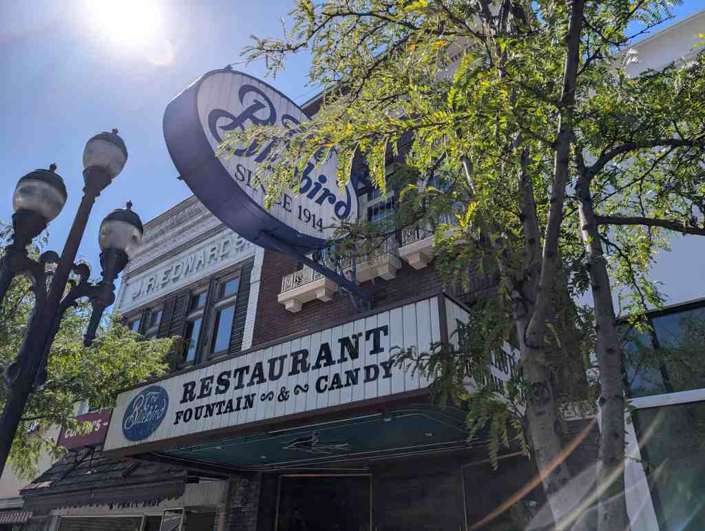
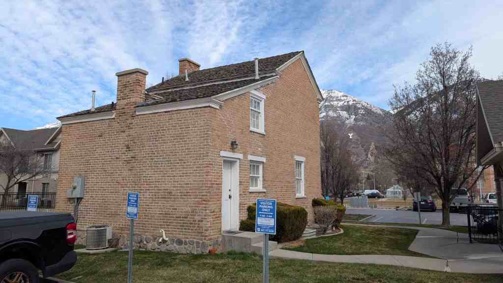
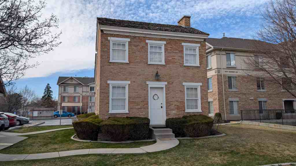
El Cortez Hotel and Casino
Fremont Street was the center of Las Vegas’ tourism industry and the heart of the city’s entertainment district from its incorporation in 1905 until the early 1950s, when it was supplanted by the booming resorts along the Las Vegas Strip. When the El Cortez opened in 1941, it became the largest and most fashionable hotel/casino in the City, representing downtown’s prosperous future and becoming a key element in the entertainment and commercial development of Fremont Street.
Located at 600 East Fremont Street in Las Vegas, Nevada and added to the National Register of Historic Places (#13000010) on February 22, 2013.
The city block upon which the El Cortez Hotel would be built consists of two subdivisions, Buck’s and Hawkin’s Addition. The fonner was subdivided in 1905, the latter in 1921. Clark’s Las Vegas Townsite, the historic center of the city’s original downtown, began west of Fifth Street (which would be renamed Las Vegas Boulevard). On May 16, 1940 the majority of lots facing Fremont Street between Sixth and Seventh streets owned by the Colorado River Exploration Company, Ltd. were sold to Marion B. Hicks and his business partner John C. Grayson. 13 Marion B. Hicks was a Los Angeles based developer who, with business partner John C. Grayson, was responsible for conceiving the El Cortez Hotel in the early 1940s. Hicks and Grayson hired local contractor C.W. Jorgensen to erect the El Cortez Hotel and Casino, which opened on November 6, 1941. The building’s original architect is unknown.
The history of the El Cortez would be documented over the decades by the Las Vegas Review-Journal with an initial article announcing its grand opening:
[The El Cortez Hotel] … represents an investment of approximately $325,000 … 71 bedrooms and baths … 8 luxury suites .. .large dining room to seat 125 … casino, an elaborate cocktail room where there will be dancing, a bar, a beauty parlor, a large lobby, outside porch and patio …. A western motif has been carried out in modified manner in the selection of furnishings and decorations for the entire building so that the visitor will be subtly conscious of the ‘last frontier’ atmosphere of the community, yet provided with luxurious and comfortable surroundings.
America entered the Second World War one month after the El Cortez Hotel was completed, the beginning of a five year period that did not seem to negatively affect the business success of the hotel/casino. In September 1943, Hick’s partner John Grayson sold his shares to Tom Hull, former owner of the Hotel El Rancho on Highway 91 (that would become known as the Las Vegas Strip or simply the Strip). 15 Hicks and Hull immediately announced an “extensive redecoration and addition of new furniture as soon as materials are available. ” It is not clear that the 1943 redecoration occurred because Tom Hull was associated with the El Cortez for only three months when Hicks purchased Hull’s interest in the property.
The Advent of Gambling in Las Vegas
In 1928 the U.S. Congress passed the Boulder Canyon Progress Act allowing for the construction of Boulder Dam, now called Hoover Dam. Construction of the dam, which began in 1931, had a significant impact on the economic and physical development of Las Vegas. Because ofthe national depression, thousands of laborers arrived in Las Vegas to work on the dam. These men and their families, in need of goods, services, and housing, spent their hard-earned wages in Las Vegas. The dam was also a boon to the city’s tourist trade. The same year that construction on the dam started, the Nevada legislature repealed gambling prohibition and liberalized its divorce laws by shortening residency requirements from three months to only six weeks, further spurring the local economy. Between 1920 and 1930, the population of Las Vegas doubled, increasing from 2,304 to 5,165. In 1940, just prior to the construction of the El Cortez Hotel, the population has nearly doubled again, rising to 8,422 (Mooney 2002).
World War II was the next big event to stimulate growth and development in Las Vegas. The government, fearing an attack on the West Coast, feverishly built military bases and war industry plants throughout the western United States. In Las Vegas, the Army Air Gunnery Range began construction in 1941, followed in 1942 by Basic Magnesium, Inc. in what was to become Henderson, Nevada. The construction and operation of these military and industrial facilities, with the influx of servicemen, military contractors and workers, had a significant effect on the development of Las Vegas.
By 1950, the population of Las Vegas had expanded to 24,624. The city continued to focus on growth, looking for additional ways to increase jobs and attract tourists. The increase in automobile tourism following World War II also affected Las Vegas’ growth and development, as businesses and building types geared to that market, such as automotive repair shops, gas stations, motels, and diners, expanded.
As relates to downtown Las Vegas, all of the action had been along Fremont Street in the city prior to the Second World War. But during the war, as the newly opened Hotel El Rancho Vegas, Hotel Last Frontier and several small night clubs were constructed along Highway 91, attention was shifted to the newly christened Las Vegas Strip situated south of Las Vegas’ city limits along Highway 91 in Clark County. The post war additions to Highway 91 of the Flamingo Hotel, soon followed by the Sahara, Desert Inn, Sands and others contributed to this shift.
Fremont Street: Pre-1945
The railroad governed Las Vegas’ design, shifting it twenty-seven degrees off north to accommodate the straightest run for track through the valley. Las Vegas was a prototypical railroad town: a gridiron of blocks paralleling the tracks. In theory, a grid can be stretched in all directions infinitely and equally. It is the perfect form, in the eyes of civic boosters, for a town with no limit to its potential. The railroad station weighted this grid at one point. Within the vast space of the desert, the railroad decided to stop the train at one place, Main and Fremont streets, which became the town’s gateway. At this portal, at the head of Fremont Street, people stepped off the train. The most valuable lots sold at the 1905 real estate auction were therefore nearest the station. All other districts fanned out from this point in decreasing value.
By 1906 Las Vegas had a railroad station, the grandest building in Las Vegas at the time. This Mission Revival structure was a modest version of sumptuous haciendas, pueblos, and missions that the Fred Harvey Company built and managed as railroad hotels and restaurants along the western train lines. The location established the dominance and wealth of the east side of town for most of the century. By 1908 the comer of First and Fremont already had a Greek temple bank. Signs in 1908 were thin, wooden, and horizontal, and announced services: baths, shoe shop, groceries, drugstore. Liquor sales were limited to Block 16, the red light district located on the east side of north of First Street between Ogden and Stewart avenues.
Clark County was established in 1909, a critical development for the future Strip. By 1925, Fremont Street was paved all the way to Fifth Street, and Fifth was paved all the way south to the town line. South of there Fifth became the Los Angeles Highway. The highway was the latest version of the wagon roads and railroad lines that brought people west in the first place.
In much of the West, a new tourist architecture began to be built in the 1920s. Most of the first western tourists were rugged adventurers who camped out. Wealthier tourists appreciated the comforts of hotels such as La Fonda in Santa Fe, New Mexico, a puebloid hotel from 1920. Soon, the Spanish Colonial and Mediterranean Revival styles would surge in popularity as applied to single- and multi-family residences, especially in Los Angeles. Hotels, too, were influenced by these styles including the enormous Ambassador Hotel erected in 1921 on Wilshire Boulevard in Los Angeles. It would be the Spanish Colonial Revival style, combined with a rustic Western flavor that would be utilized in the design and naming of the El Cortez Hotel in 1941.
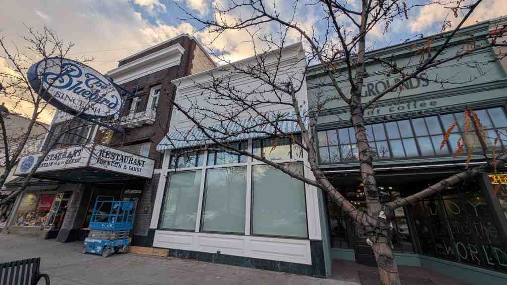
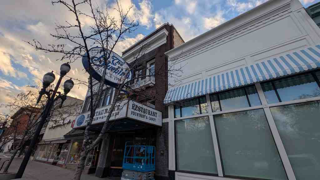
Following the 1931 legalization of gambling in Nevada, the first legal gambling clubs in Las Vegas were simply business as usual, with back room gambling relocated to the front room facing Fremont Street. Locals were the main market, although other clubs, located outside of town along the highways, catered to travelers. The first gambling license in Clark County went to Mayme Stocker of the Northern Club, a Fremont Street bar and restaurant which opened in 1912. Five other licenses granted in 1931 in Las Vegas went to clubs on Fremont Street between First and Third (later extended to Fifth), near the old red light district. TheEl Cortez would be located even further east on Fremont at Sixth Street. Besides the new Hotel Apache and the Boulder Club next door, little changed on Fremont Street in the 1930s with gambling remaining a sidelight for Las Vegas, a steady but minor industry consisting of clubs along Fremont Street.
Featuring bars, poker tables, and slot machines, the Fremont Street clubs were largely a domain of serious male card players. Things began to change when tourism inspired by the Boulder Dam brought a different sort of clientele to downtown. As a result, some Las Vegas leaders envisioned their region as a tourist attraction and their town as its center. With visions of Nevada Palm Springs in their heads, they began to promote their characteristic western identity embodied by the desert scenery and “old west” lore.
Outsiders from Los Angeles would discover and exploit the potential at their newly built Meadows Club. A brief description makes the Meadows seem prescient: a combination casino, hotel, dinner club, and nightclub located outside the city limits on a main highway. Owned by Los Angeles underworld figures, Tony Cornero and his brothers, the Meadows Club opened in 1931. But this was ten years before the appearance of the El Rancho Vegas and the Last Frontier resorts, and fifteen years before Benjamin Siegel and his partners became involved with the Flamingo. The Meadows Club would last until 1936, the same year the dam project was completed.
In spite of Las Vegas’ slow start, the foundations of the incipient neon city were laid on Fremont Street in the 1930s. Between 1930 and 1932, many of the one-story wood shacks were replaced by prosperous two-story brick structures. The two-story reinforced concrete Nevada Hotel (later the Sal Sagev, since 1955 the Golden Gate) across from the train station added a third floor in 1931. It still exists; however, it has suffered from exterior remodeling that has erased much of its original physical integrity. Drugstores, banks, bakeries, and other businesses stood beside the relative handful of casinos. Small storefronts dominated the street. State Cafe, Ethel’s Liquor Store, shoe shops, and other establishments had standard signs of the period. While the storefronts had typical display windows, the casinos had frontages lined with wood and swinging doors to make entrance easy. These were replaced in the late 1930s with sliding glass panels, which opened the clubs to the sidewalk. Off Fremont, laundries, icehouses, and other service buildings tapered off into the scrubland.
Fremont Street’s architectural design was eclectic. The basic buildings were a mix of one- and two-story commercial fronts’ several were variations of stucco Mission and brick Victorian styles with a bit of appropriate Classicism used in bank buildings. Despite a few overtly western touches (the Las Vegas Club had a neon Indian head sign), Fremont Street was not self-consciously western in style. Indeed, the typical Fremont Street sawdust joint of the 1930s was a high ceilinged storefront crammed with gaming tables and a bar. A bingo lounge stood at the rear.
The gem of the new downtown was the three-story Hotel Apache that opened in 1932. It was as sophisticated as the town could imagine. An elevator rose to a supper club on the top floor. Canvas awnings sheltered the store windows of a cafe, drugstore, and lobby on the hotel’s ground floor. Inside, zigzag corners decorated the interior arches, a motif borrowed from Native American designs and used to convey a western tone. In the mid-1930s the ground floor Apache Bar was the plushest casino in town, with its own neon sign and terra-cotta facing.
Neon, the medium that was to make Las Vegas famous, was already a presence on Fremont Street, but its application was hardly exceptional. Only at the end of the 1930s did the wattage pick up. The Hotel Apache began with a single horizontal sign extending from the third floor. The Frontier Club, Boulder Club, Las Vegas Club, and Sal Sagev Hotel all had large vertical signs with modified zigzag modern crests reaching no more than ten feet above the roofline. Only the number of signs, and the fact that they advertised roulette and keno, distinguished Fremont Street’s neon from the signs in urban entertainment districts elsewhere.
Casinos along Fremont Street began to flourish in the 1930s and early ’40s as illegal gambling operators were driven out of other cities and took refuge in Las Vegas. While the first casinos on what would become known as the Strip opened for business in the early ’40s, Fremont Street remained the valley’s main attraction, its collage of colorful neon signs prompting the nickname “Glitter Gulch.”
As Las Vegas became savvier about the potential of a tourist economy, it began to exploit its western heritage more consciously. TheEl Rancho Vegas, which opened in April 1941 just south of the Las Vegas city limits on the Los Angeles Highway, was self-consciously western in its theme. However, the conventional wisdom in the early 1940s was that a lavish and sprawling resort such as the El Rancho was too remote to succeed. Downtown remained the center of the city’s growth.
As noted, an important indicator of Fremont Street’s prosperity was the construction of the Spanish Colonial Revival style, 59-room El Cortez Hotel and Casino in 1941, built by Los Angeles contractor Marion Hicks with business partner John Grayson. Located several blocks east of the old center of town, the all-new building was bigger than the Fremont Street clubs although its hotel portion was smaller than the Apache’s., The El Cortez would be located along Fremont Street, the historical center of Las Vegas, as opposed to far out of town on the Boulder Highway like the ill-fated Meadows Club. With the Meadows gone, the El Cortez became with its opening in 1941 another illustration of downtown’s prosperous future erected at a time when Fremont Street was the heart of the city.
The war boom pumped money into the downtown casinos, which allowed them to grow by absorbing neighboring bakeries, Western Union offices, and other casinos. Fifty years later this consolidation would result in single casinos stretching across entire blocks and encroaching on blocks on either side of Fremont Street. Ill prepared to cope with the car, downtown faced a major parking problem during the wartime boom. Parallel parking was replaced with diagonal parking until parking was banned entirely from the casino district.
Neon signs continued to grow in size and complexity through the war years with the Pioneer Club setting the pace with its prominent vertical and canopy signs. Over the decade, postcards reveal a growing incrustation of neon tube lighting; neon seemed to be driving the architectural development of Fremont at this point. Casino owners and sign companies slowly escalated and accelerated the competition. Permanent sidewalk canopies, known in Las Vegas since 1905, became wider and served as frames for neon under, over, and along the marquees. Signs were scaled to compete with neighboring buildings and to draw in passersby on the sidewalk.
Even before Pearl Harbor, the Apache, Northern, Boulder, and Las Vegas Clubs on Fremont Street expanded into neighboring storefronts and bars to make bigger and more spacious casinos. Architect Wayne McAllister remodeled and opened up the interior of the El Cortez in 1946 for Moe Sedway’s syndicate.
Fremont Street became a showplace for neon signs. Intramural sign competition would lead to excesses and innovations that would make Las Vegas a city of signs and light.
Though the boom of the early 1940s spurred Fremont Street more than it did the new highway hotels, the crowding and parking problems downtown underscored the advantages of the roadside site.
Historian Geoff Schumacher summarized the 1905- 1945 period of downtown and Fremont Street in this way:
Fremont and Main is where it all started, where Las Vegas transformed from frontier rest stop to full-fledged town. And for 40 years that intersection was the axis around which Las Vegas rotated. It was the heart of ‘downtown,’ the place where Las Vegans shopped, ate in restaurants, watched movies, bought insurance, attended school and did their banking. It was also where people went if they wanted to gamble, drink and perhaps pay for companionship.
Fremont Street: 1946 – 1960
The future of Las Vegas arrived with the opening of the Hotel Flamingo on Highway 91 in 1946. Unlike the western themed El Rancho Vegas, Last Frontier, and most of the clubs downtown, the Flamingo was sophisticated, upscale, and modem, evoking the look and feel of a sleek Hollywood nightclub of the day. Despite a bumpy start – and the murder of the property’s flashy proprietor- the Flamingo was successful enough to quickly spawn a host of imitators along Highway 91. Marion Hicks, the original co-owner of the El Cortez Hotel, had sold his interest in the property in 1945. Three years later, in 1948, Hicks opened the Ranch Modem style Thunderbird Hotel on the Las Vegas Strip. Wilbur Clark’s Desert Inn, a sleeker version of the Thunderbird, followed in 1950. The Sahara Hotel appeared in 1952, as did the ultra-modem Sands Hotel that same year. The Flamingo was completely remodeled in 1953 and its sparkling champagne tower became a famous beacon along the Strip for the remainder of the decade. The Riviera, Royal Nevada, and Dunes hotels all opened in 1955.
Meanwhile, Fremont Street still gloried in its Old West style. In 1946, the Chamber of Commerce named three blocks of Fremont Street “Glitter Gulch,” thereby fusing the modem sheen and the Old West theme. Fremont felt little pressure to respond to the new resorts on the Las Vegas Strip in the late 1940s; the Strip had largely created its own market and brought in new customers. Additionally, many Strip and downtown establishments shared the same owners. The Golden Nugget, opened in 1945, set a standard for Fremont Street as the Flamingo would the Strip later in the year. The Golden Nugget’s investors created a dazzling new casino out of a nondescript two-story commercial block at the comer of Second and Fremont. They chose the western vernacular of urban Gold Rush San Francisco, the Barbary Coast style. In 1950, a large sign was added, lifted clear of the roof on a steel framework one hundred feet in the air. It was designed by the Young Electric Sign Company (YESCO), the same firm that would design the El Cortez’ enormous roof sign, marquee and “Gambling” signs in 1952. The Golden Nugget sign was a radiant phantasm of neon and incandescent light that set off another round of bigger and brighter signs on Fremont Street.
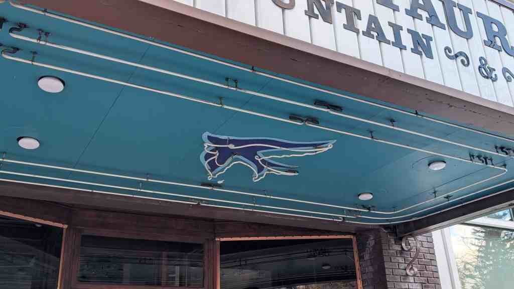
In the 2 pt century, the most enduring of the monumental neon signs of the early 1950s, other than the neon signage of the El Cortez, has been the 60-foot cowboy known as “Vegas Vic” that was erected on the comer of the Pioneer Club in 1951 and survives today hemmed in by the curved canopy of the Fremont Street Experience.
In the 1930s the three blocks of Fremont Street had been a mix of Main Street shops and a few casinos. By 1955, Glitter Gulch contained only one drugstore, one telegraph office, and one bank as the casinos expanded. That year the tallest building in Nevada was erected on the comer of Second and Fremont streets. Strictly modem in style, the 13-story Fremont Hotel brought Strip amenities and style to Fremont for the first time. Another modem wonder of sign design in the 1950s was The Mint erected in 1957. The sign, though fabricated by YESCO, was designed as an integral part of the building by the architectural firm of Zick and Sharp, who had been responsible for modernizing portions of the El Cortez in 1952.
As the neon signage along the Strip became more elaborate, enveloping buildings the way the Stardust sign did its new hotel/casino in 1957, so also did the signage on Fremont Street. For example, the Golden Nugget expanded its neon across the entire fa~ade and enlarged its comer sign in 1957, beginning a new era of Glitter Gulch signage so powerful that it would imprint the neon image of Second and Fremont streets in the global imagination. Following the Golden Nugget’s example was Binion’s Horseshoe (now simply Binion’s since Harrah’s bought the Horseshoe name in 2004). It had been purchased in 1951 by Benny Binion and fronted by Joe W. Brown for five years while Binion dealt with legal difficulties in his home state of Texas. The Horseshoe’s remarkable aqua blue neon facade that extends the entire block facing Fremont Street up to the top of the original Apache Hotel was completed in 1960 (and extended west to the comer when it swallowed The Mint in 1988). It should be noted that, while the original fac;ade of the 1932 Apache Hotel apparently remains beneath Binion’s blue neon skin. In contrast to the modifications, the exterior elevations of the El Cortez Hotel remain visible, essentially as they have since 1952.
Fremont Street: 1961 – Today
In witnessing the growth of the Strip starting after World War II, the City of Las Vegas made several unsuccessful attempts at annexation. To this day the Strip remains an unincorporated township of Clark County, Nevada with the tax revenue from its ever-expanding hotel/casinos bypassing Fremont Street and downtown. Several other events diminished the growth and success of downtown Las Vegas in the postwar years. The construction of McCarran Airport south of downtown meant that visitors by air encountered the Strip hotels first upon their arrival. Additionally the opening of the convention center one block east of the Strip encouraged conventioneers to stay in nearby hotels and not downtown. “As a result, the area’s surging convention business helped boost the expansion of Strip hotel facilities compared to those along the less strategically located streets downtown. “
The Las Vegas Strip dominated the City’s tourism with its sprawling resorts drawing visitors who not only gambled but also enjoyed lounge acts, swanky restaurants, and relaxing swimming pools that the smaller downtown casinos generally did not offer.
Despite increasing competition from the Strip, downtown casino operators did not throw in the towel. Instead, they upgraded their facilities, added hotel rooms and catering to serious gamblers and value-conscious visitors. In the ’50s, Binion’s Horseshoe Club, operated by Texas maverick Benny Binion, became a favorite of high-limit bettors and poker players.
The Fremont Hotel added a 14-story tower in 1963, The Mint built its 26-story hotel tower in 1965, the nine-story Sundowner was erected in 1965 and added a 33-story tower in 1983, and the Four Queens built its 18-story tower. The 22-story Union Plaza Hotel (by architects Zick and Sharp, with the El Cortez’ Jackie Gaughan one of the co-owners) went up in 1971. Under the ownership of Steve Wynn, the Golden Nugget erected its first hotel wing in 1977. In 1984, the El Cortez itself greatly expanded its hotel capacity by erecting a 15-story tower with a two-story connection to its original building.
Consolidations and rebranding from the 1980s to the present day led to the massive expansion of the Golden Nugget that removed its iconic neon signage in 1986. The purchase of the Mint by Binion’s Horseshoe led to the disappearance of the Mint’s pink and white neon facade and the extension of the blue and white of the Horseshoe’s neon skin around the block. Binion’s Horseshoe was bought and sold by Harrah’s Corporation (although Harrah’s kept the “Horseshoe” name upon its sale). Sam Boyd purchased the Fremont Hotel; the Union Plaza was substantially renovated and recently reopened.
In 1995 the most monumental change to downtown Las Vegas arrived with the Fremont Street Experience, four blocks of an overhead light show from Main Street to Fourth Street that closed the area to traffic and made the former thoroughfare a pedestrian mall. The curved canopy screen required to display the moving images of the Experience blocked out the sky (and the upper portions of the buildings), creating a shopping mall-like enclosed space quite different from the street’s historical urban feeling and appearance. Further east, the three-story Neonopolis dining, shopping and theatre complex was built on the block between Fourth Street and Las Vegas Boulevard. Between Fifth and Sixth streets, a mix of small nightclubs, restaurants, and retail stores remained.
Following the real estate and economic crisis of 2008 that was particularly damaging to Las Vegas, Fremont Street suffered the loss of numerous commercial tenants in the blocks east of Fourth Street. Only recently (2012) have new businesses begun to reoccupy vacant storefronts in this part of town. As for the Fremont Street casinos, Binion’s closed the hotel portion of its property; however, the Golden Nugget continued to expand and the Union Plaza hotel/casino reopened after being closed for a number of years. Most recently, Fitzgerald’s hotel/casino has undergone a substantial refurbishment as part of its conversion into The D Las Vegas. Yet, east of Sixth Street, the El Cortez Hotel and Casino continues to operate much as it has since 1941.
Conclusion
The El Cortez Hotel and Casino is associated with the economic and entertainment development of Las Vegas in general and on Fremont Street in particular from the early 1940s through the early 1950s. Fremont Street was the center of Las Vegas’ tourism industry and the heart of the city’s entertainment district from its incorporation in 1905 until the early 1950s, when it was supplanted by the booming resorts along the Las Vegas Strip. When the El Cortez opened in 1941, it became the largest and most fashionable hotel/casino on Fremont Street and would remain so for the next decade. With its 1941 opening, the El Cortez represented downtown’s prosperous future at a time when Fremont Street was the heart of the city. As such, the El Cortez Hotel and Casino assisted in the city’s economic development until the new resorts along the Las Vegas Strip outshined downtown Las Vegas. Therefore, because the original portions of the El Cortez Hotel and Casino represent a tangible, visible, and significant link to Fremont Street’s economic development, the property meets National Register Criterion A for important historic associations. The property’s period of significance is 1941- 1952, corresponding with the period when the hotel/casino was most instrumental in the economic development of Fremont Street and the period when the exterior of the original El Cortez Hotel attained its current appearance.