Tags
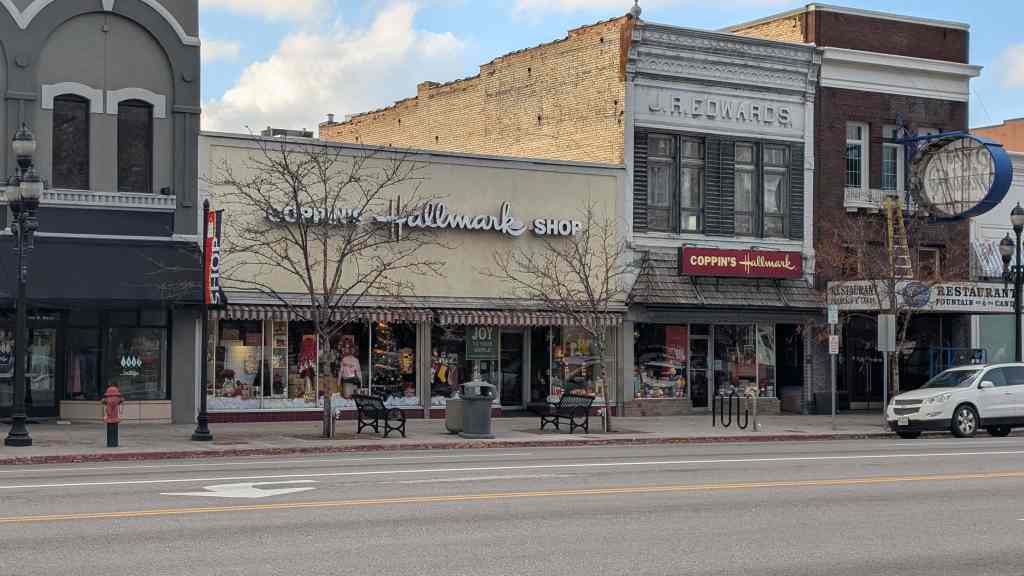
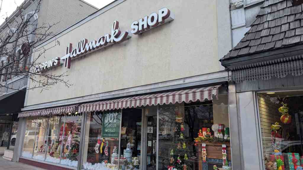
15 North Main Street on Historic Logan Main Street and part of the Logan Center Street Historic District in Logan, Utah

30 Thursday Apr 2026
Posted in Uncategorized
Tags
15 North Main Street on Historic Logan Main Street and part of the Logan Center Street Historic District in Logan, Utah
30 Thursday Apr 2026
Posted in Uncategorized
San Xavier del Bac Mission
Mission San Xavier del Bac has served the Papago Indians since it was founded in 1700 by the Jesuit Eusebio Francisco Kino. Bac was then “beyond the rim of Christendom” and formed the extreme northern thrust of Nueva Espana. The present church is the third, perhaps the fourth, on the site; begun in 1783, it was completed in 1797. Since that time it has continued to serve the Papagos under the flags of imperial Spain, revolutionary Mexico, and the young and expanding United States. It has survived heat, storm, earthquake, the neglect of church and state, and the attack of hostile Indians. It continues to stand serene and untroubled against the timeless backdrop of the desert, a strange visitor from another world, completely at home in its alien environment, the most spectacularly lovely gift of colonial Spain to the United States.
San Xavier del Bac Mission is located at 1950 West San Xavier Road in Tucson, Arizona and was added a National Historic Landmark (#66000191) on October 9, 1960.
The Jesuit missionary, explorer, and cartographer Eusebio Francisco Kino (c. 1645- 1711) was born at Segno, Italy, in the Tyrolean Alps. He entered the Jesuit order at Freiburg in 1665 and received his education in Upper Germany, showing great talent for mathematics. Determined to become a missionary, he hoped to join other members of his order in China, but chance assigned him to Mexico, where he landed in 1681. The rest of his long and useful life was spent in pushing back the frontiers of New Spain. After a futile attempt to colonize Baja California, he was assigned to Pimeria Alta, the upper Piman lands of northern Sonora and southern Arizona. Making his headquarters at Mission Dolores in Sonora, Father Kino spent a quarter of a century exploring and founding missions. During his many expeditions, he stood on the shores of the South Sea (the Pacific) in 1695; he proved that California was not an island but a peninsula; he opened a cattle trail around the Gulf of California to supply the Baja California missions; and he discovered and named the ruins at Casa Grande. In the thousands of miles he traveled, he reached as far north as the junction of the Gila and Colorado Rivers.
The whole of the design and decoration, with the exception of some minor interior painting, is European in intent, but the execution shows the distance in time and space between Bac and metropolitan Spain–or even Mexico City.
Directly to the east of the main doors of the church is a smaller pair of wooden doors, classically framed, which lead to the convento. Inside the doors, to the right is a small room used as the church office. To the left are two small rooms, the first a sales room, the second a small museum. Straight ahead is another pair of wooden doors leading to the cloister and garden. The convento, a U-shaped structure built on the east wall of the church, was formerly the school and convent, but now houses the parish priests in small rooms sheltered by a porch with arched openings which faces on the small garden, a tiny green spot with shrubs and trees and a new fountain, the base of which is a copy of the quatrefoil windows in the main dome drum.
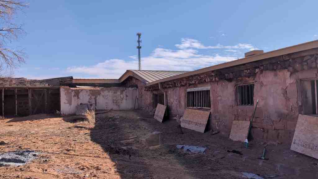
Behind the church to the north are a dormitory, and, across a yard, an L-shaped garage and utility shed. These structures do not contribute to the significance of the landmark.
Immediately to the west of the church lies a small plain mortuary chapel also of white plastered adobe. Small niches, framed by carved surrounds which end in scrolls matching those on the church, flank the entry. A classical cornice with corner finials and a three bell campanile centered over the door cap this elegant little building, once used for the laying out of the dead prior to the funerals in the church. The chapel and grounds, formerly the cemetery, now a cactus garden, are walled separately.
Three hundred feet east of the church is Grotto Hill, a small hillock which takes its name from the replica of the Grotto of Lourdes which Bishop Granjon had built on the north side. The road in front of the church goes up to Grotto Hill, turns left through gate posts surmounted by lions, passes by the Lourdes Grotto, and continues around the hill. A white cross crowns the hill.
Across the road from the church to the south is an open space, at present used for parking. This is the site of the original Papago village.
Kino had an unusual understanding of Indian psychology. Of the heroic padres who dedicated their lives to the expansion of Christianity on the northern frontier of New Spain, he was perhaps the most beloved by the Indians. The Papagos even today make an annual pilgrimage to the Mission Dolores at Magdalena, Sonora, where Father Kino lies buried, to celebrate the feast of Kino’s patron– and theirs–St. Francis Xavier.
Kino first visited the Papago village of Bac–the place where the water emerges– in 1692. This rancheria, which he named San Xavier, then had about 800 inhabitants. These Papago people, a Piman speaking group, were semi-sedentary farmers and gatherers, living along the Santa Cruz River while they tended their irrigated crops of corn, beans, and squash. To these traditional crops the Spanish added wheat and more varieties of beans. During the hottest summer months they migrated to the mountain camps where they gathered mesquite beans and hunted wild game. In 1697 Kino revolutionized the Papago economy by introducing cattle and horses at Bac. By this time some of the children of Bac had been baptized, and the people had built a house for the permanent priest who had been promised them. Finally in April 1700, Kino returned to Bac and began the foundations for the first church of San Xavier del Bac. He wished himself to be the resident priest at Bac, and he eventually obtained his superiors’ permission, but he could find no priest to relieve him at Dolores, so he was never able to take up his new post. He died in 1711 and was buried at Mission Dolores.
The cattle and horses at Bac attracted the attention of the Apaches, the traditional plunderers of the farmer Indians of the southwest, and Bac was subject to regular raids, but the Spanish provided no protection for the converts. They could not even provide regular pastors for the church. In 1701 Father Francisco Gonzalvo became the first in a long line of resident priests at Bac. His career there was typical–he stayed only one year, and the mission was more often than not without a resident.
By 1737 the vestments and ornaments given to the mission by the King of Spain, and housed either in the Kino church or another, were in bad shape. Things went from bad to worse. During the Pima Rebellion of 1751, the resident priest, Father Franz Bauer, had to flee south for his life, returning only in 1754 after the Pima had been surpressed. It is probable that what remained of Kino’s church was destroyed in the revolt, for Father Alonso Espinosa who arrived at the mission in 1756 constructed a new church, probably the second there. It was described in 1772 as being “of medium capacity, adorned with two side chapels with paintings in gilded frames.” This church was just west of the present church; its foundations were discovered in 1958 by Bernard L. Fontana and William Robinson of the University of Arizona. Father Espinosa also ordered “a head and hands of San Xavier with a body frame resembling the statue in Vera Cruz” from Mexico City in 1763, probably the same statue that stands in cassock and surplice above the main altar in the present church. The village had around 220 inhabitants then.
Shortly thereafter Charles III expelled the Jesuits from the Spanish empire (1767), and the Franciscan order took over the operation of the Spanish frontier missions. At Bac the first Franciscan was Father Francisco Hermenegildo Garces, who arrived June 29, 1768. Garces was more interested in exploration than in residency. During this period Apache depredations were especially severe, and Garces had to rebuild some of his buildings at the mission.
It was during the residency of Father Juan Bautista Velderrain that construction began on the present church, probably in 1783. He borrowed 7,000 pesos from Don Antonio Herreros, secured by the future crops of the mission, and began work. Who designed the building is unknown. The structure is avowedly European and, unlike some of the New Mexico churches, untouched by Indian design except possibly in some of the interior decorations. One noted architectural historian sees in it the hand of a master workman, or even an architect, but no names can be established with certainty. Local folk wisdom credits the Gaona brothers of Caborca, Mexico, with the design, but this is uncertain, since it is based on the resemblence between the San Xavier church and the Mission Nuestra Senora de la Purissima Concepcion del Caborca, which they are supposed to have designed and built at the same time. The evidence for the Gaona brothers having built either church is not convincing, and the Caborca church was not contemporary with San Xavier.
The materials used in the building are the traditional adobe bricks of the southwest, and Indian labor must have been used in construction, but the laying up of the vaults was almost certainly beyond the scope of the local Indian craftsmen and must have been done by imported laborers. Most of the interior decoration and the design and carving of the reredos was also beyond the local Indians. Father Velderrain died before the construction was completed. The church was completed in 1797 under the direction of Father Juan Bautista Llorenz.
After the completion of the church, the Spanish mission system – and the empire itself – declined rapidly. The Mexican revolution began in 1810, and in 1821 Mexico declared herself a republic. The new republic demanded that the Spanish priests swear allegiance to the new country. Most of the padres refused because of the anticlericalism of the new regime. Since Pimeria Alta was so far away from Mexico City, it was 1828 before the last Spanish priest, Father Rafael Diaz, was removed from Bac.
After Diaz’s departure, Bac was left for a long period without a resident priest, and in 1841, with the secularization of the missions, it became a part of Magdalena parish. The buildings began to decay, and the Indians at the village took the moveable furnishings into their homes to protect them.
Various Americans passing that way after 1846 visited Bac. Philip St. George Cooke and the Mormon Battalion built a wagon road of sorts through to California, and after the discovery of gold in California in 1848, hordes of gold seekers took that way and passed by the old mission. Among them was H. M. T. Powell, who has left us a pencil sketch of the church and village done in October 1848.
After the Mexican War (1846-1848) Bac was south of the Gila River boundary marked out for the Mexican cession by the Treaty of Guadaloupe Hidalgo and so it remained in Mexico. All this was changed in 1853 by the Gadsden Purchase. In 1859 the Catholic Church placed the Gadsden purchase area in the Santa Fe diocese under Bishop Lamy, and the church roof was repaired, protecting it from the certain destruction common to exposed adobe brick.
Not until 1864 did the Bishop manage to provide a pastor for the flock at Bac, Father Carolus Evasius Messea, a Jesuit. By this time the U. S. Bureau of Indian Affairs had taken notice of the Papago people at Bac. On and off again there was an agent resident there, the first being M. 0. Davidson in 1864. Father Messea stayed at Bac only from January to August of 1864, but in that time he founded the first public school in Arizona and saw it close after a few months because of a lack of funds and because the Indians would not attend.
During the Civil War the Apaches were particularly active and again there was no permanent resident at Bac, but the Tuscon clergy visited San Xavier regularly.
In 1873 a school was established at Bac by the Sisters of St. Joseph of Carondolet; they used the convento extending east from the church, which had been repaired by the U. S. government. The following year Bac was established as a reservation for the Papagos, but the headquarters was soon moved to the Gila reservation. The school at Bac closed the same day.
In 1887 a severe earthquake shook the area and damaged the church facade and the cemetery wall. In 1890 the San Xavier Reservation got a Government Farmer resident, and the school was reopened under the Sisters of St. Joseph. In 1895 the government spent $1,000 to repair the church, and some rooms were added to the convento around the turn of the century for the use of the school.
In 1906 D.H. Holmes inspected the church for the Traders’ National Protective Association of Tucson and recommended that the main dome, which was found to be cracking, be sheathed in copper. At this point Bishop Henry Granjon began a renovation and building project at the mission. He had the church and the mortuary chapel repaired, built a wall along the front of the convento, and placed a small arch at its east end. A similar arch, Bishop Granjon’s Gate, he placed at the north end of the courtyard. He had the church plastered and painted and generally saved the structure from destruction. He also placed a replica of the Grotto of Lourdes on the north side of the hill just east of the convento (subsequently called Grotto Hill).
It was not until 1913, however, that he succeeded in staffing the church permanently. That year the Franciscan Province of Santa Barbara of Oakland, California, sent a native Tusconian, Father Ferdinand Oritz to Bac.
The mission has thrived under the California Franciscans. In 1947 a new school for the Papago children was constructed west of the church and in 1949 Father Celestine Chinn and architect Eleazar D. Herreras began a repair and restoration project that resulted in new floors in the church, repaired roof and walls, and repairs to outside walls and to the convento. The priests now live in the convento.
The mission of San Xavier del Bac is the most spectacular remnant of the Spanish mission system in United States territory. It is almost miraculous that this church has survived the vicissitudes of time. So many others, built of the same desert materials, have melted before the onslsughts of time, weather, and vandalism. What saved it was the dedication of the Papago people and the interest of others captured by its improbable beauty. The mission is a functioning parish church, but it is open to visitors during daylight hours.
The landmark boundary for San Xavier del Bac includes the church and convento complex (of which the dormitory and garage do not contribute to the significance of the landmark), the mortuary chapel and garden, Grotto Hill, and the plaza in front of the church which is the site of the original village.
Starting at a point 275 feet south of the south edge of the county road running east and west in front of the church and 225 feet west of the west edge of the continuation of the above road which runs north and south (A), proceed due east approximately 1000 feet to the west edge of the dirt road which goes around the north side of Grotto Hill (B); follow the west edge of said road north approximately 500 feet to the point where the road curves west (C); follow the (now) south edge of the road generally west for approximately 1000 feet to a point (D); proceed from that point directly south for approximately 500 feet to point of origin.
30 Thursday Apr 2026
Posted in Uncategorized

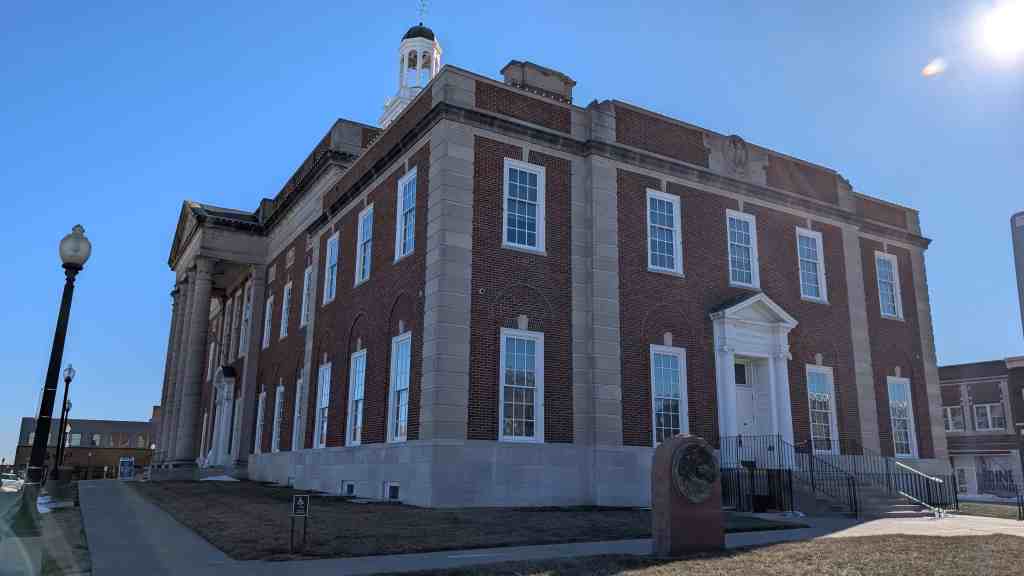
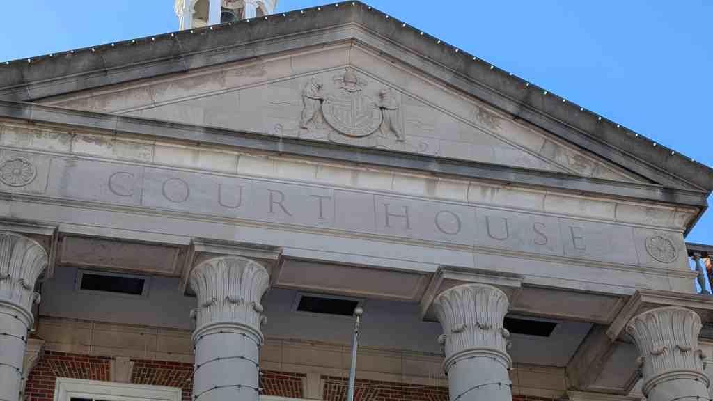
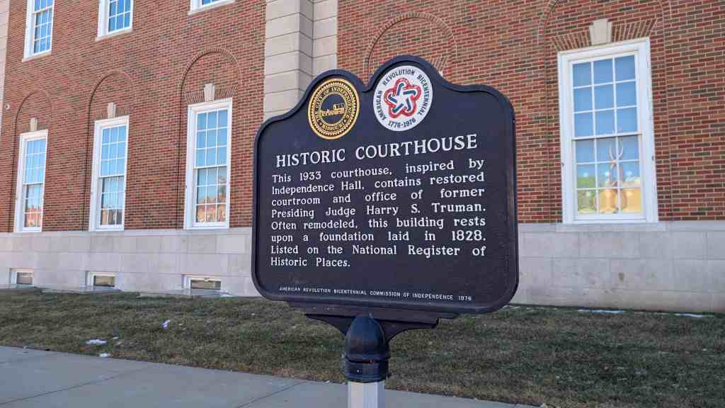
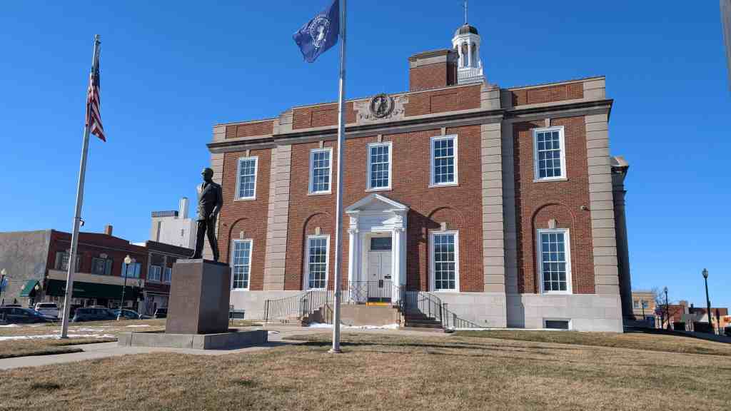
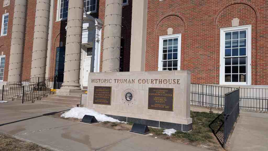
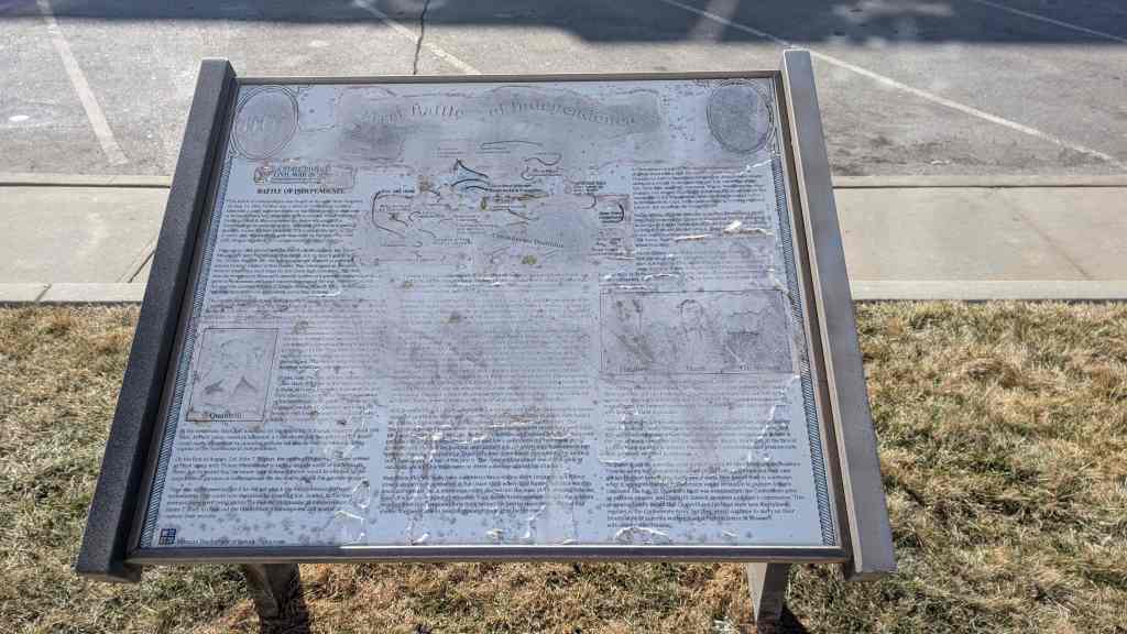
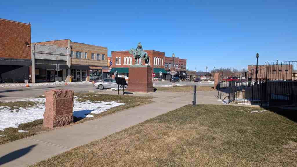
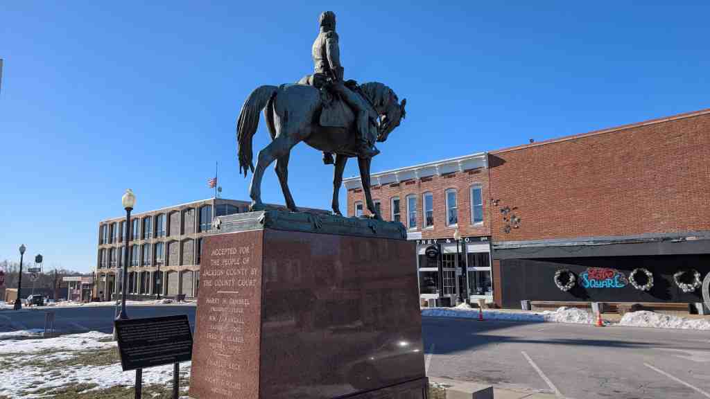
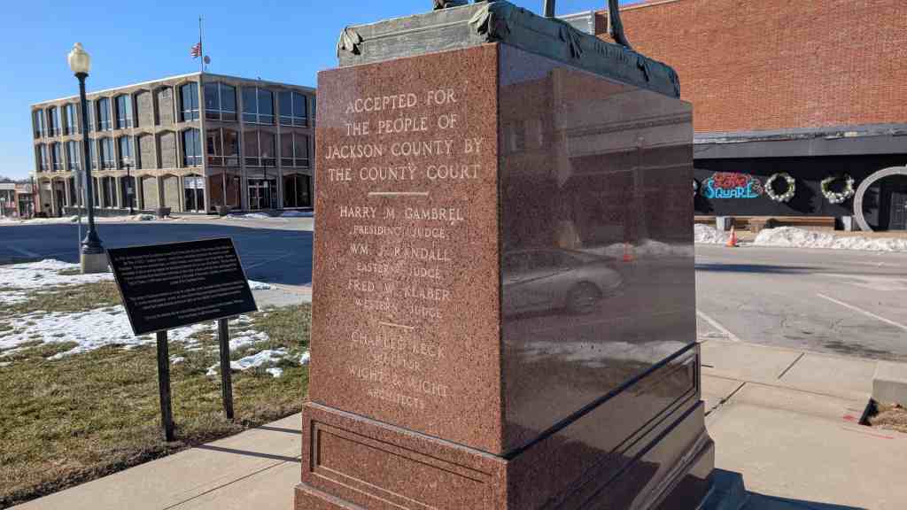
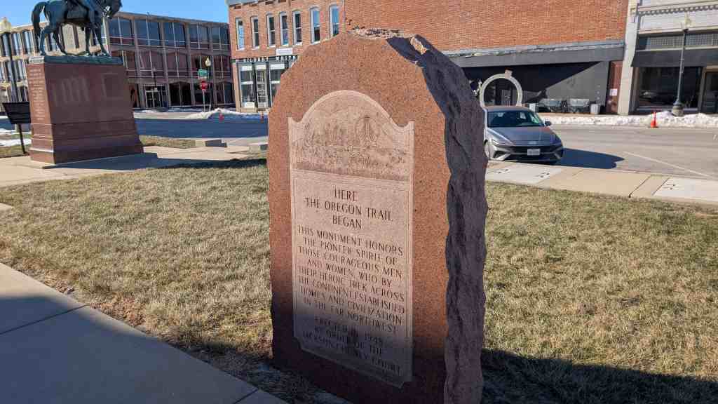
Historic Truman Courthouse
This 1933 courthouse, inspired by Independence Hall, contains restored courtroom and office of former Presiding Judge Harry S. Truman. Often remodeled, this building rests upon a foundation laid in 1828.
Located at 112 West Lexington Avenue in The Square in Independence, Missouri and added to the National Register of Historic Places (#72000713) on October 18, 1972.


30 Thursday Apr 2026
Posted in Uncategorized
29 Wednesday Apr 2026
Posted in Uncategorized
Tags
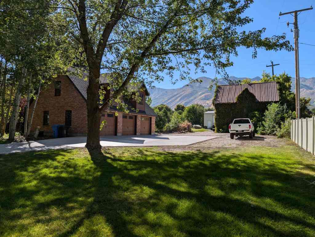
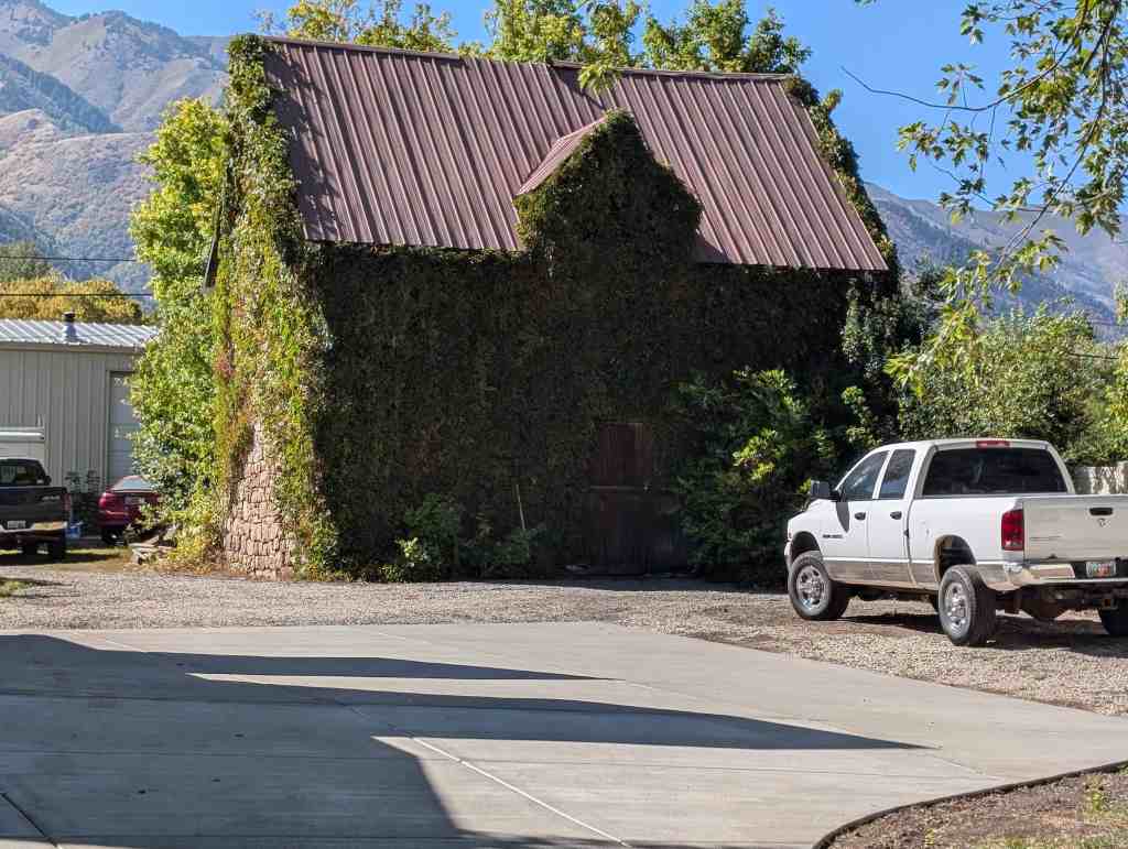
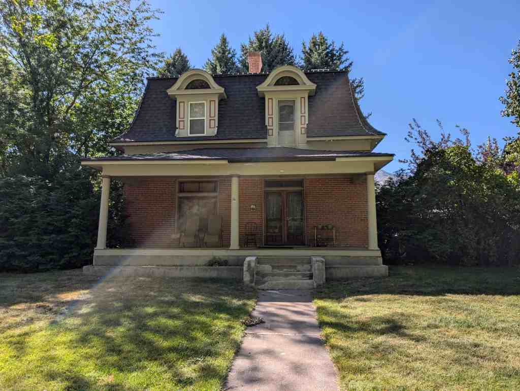
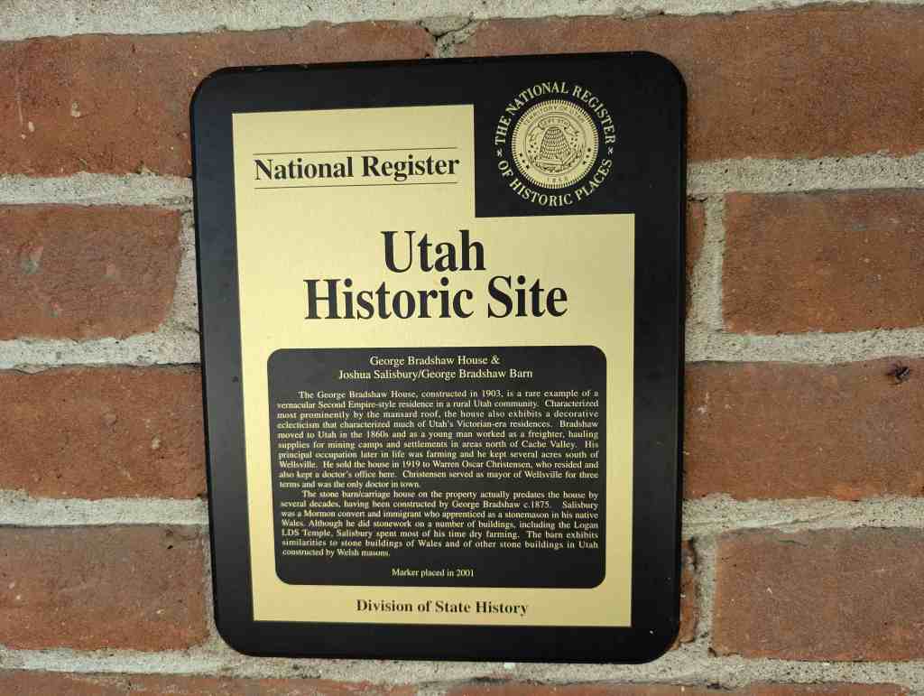
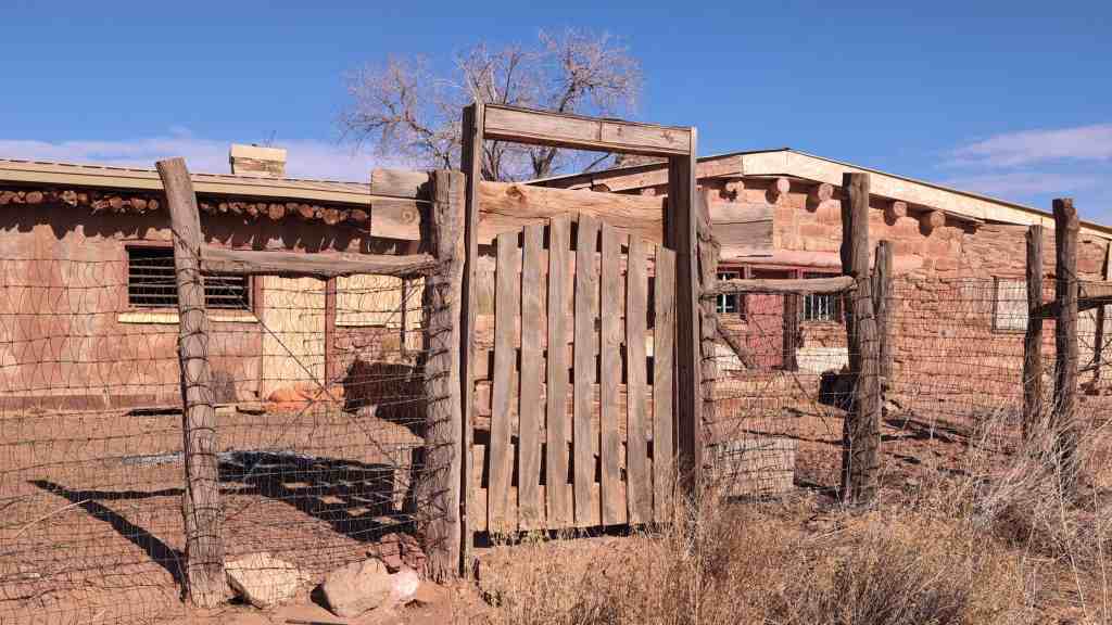
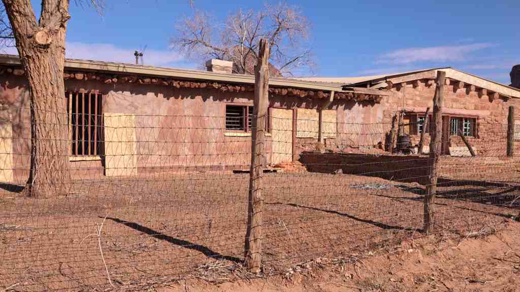
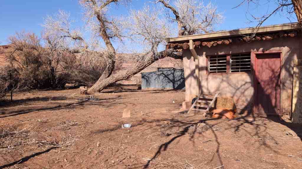
George Bradshaw House & Joshua Salisbury/George Bradshaw Barn
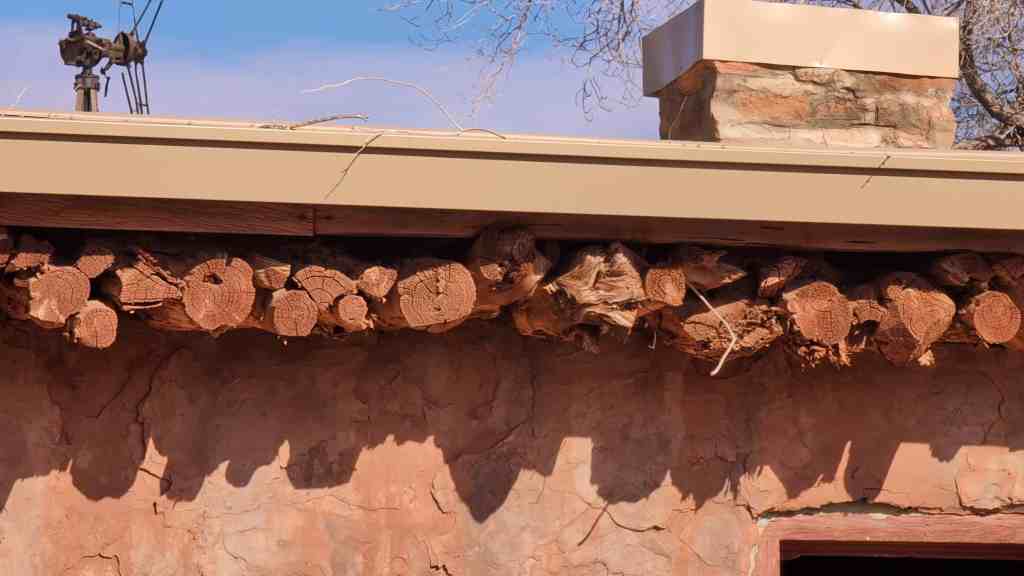
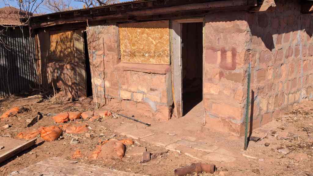
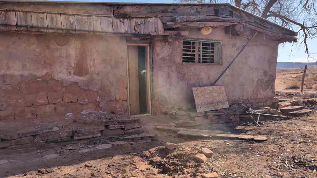
The George Bradshaw House, constructed in 1903, is a rare example of a vernacular Second Empire-style residence in a rural Utah community. Characterized most prominently by the mansard roof, the house also exhibits a decorative eclecticism that characterized much of Utah’s Victorian-era residences. Bradshaw moved to Utah in the 1860s and as a young man worked as a freighter, hauling supplies for mining camps and settlements in areas north of Cache Valley. His principal occupation later in life was farming and he kept several acres south of Wellsville. He sold the house in 1919 to Warren Oscar Christensen, who resided and also kept a doctor’s office here. Christensen served as mayor of Wellsville for three terms and was the only doctor in town.
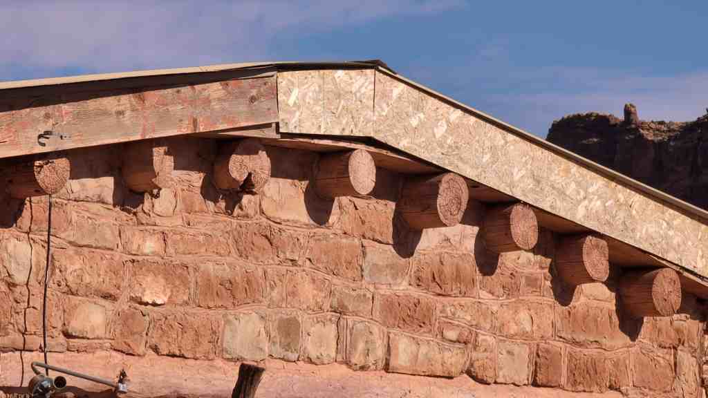
The stone barn/carriage house on the property actually predates the house by several decades, having been constructed by George Bradshaw c.1875. Salisbury was a Mormon convert and immigrant who apprenticed as a stonemason in his native Wales. Although he did stonework on a number of buildings, including the Logan LDS Temple, Salisbury spent most of his time dry farming. The barn exhibits similarities to stone buildings of Wales and of other stone buildings in Utah constructed by Welsh masons.
73 South Center Street in Wellsville, Utah
12 Sunday Apr 2026
Posted in Uncategorized
Tags

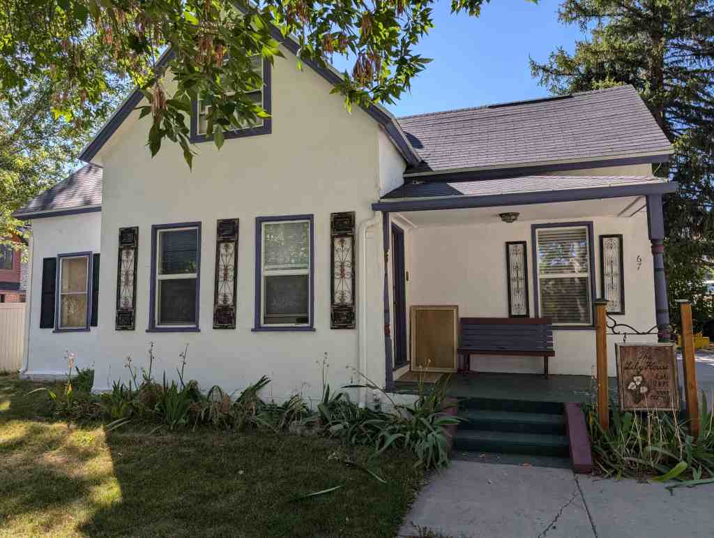
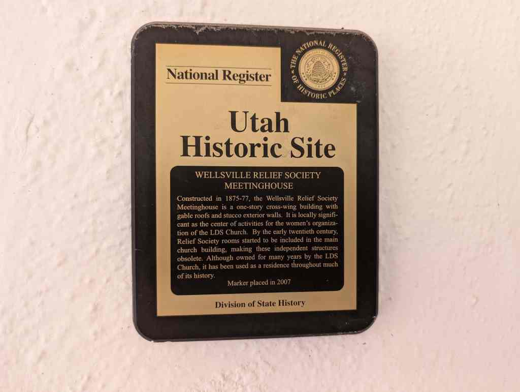
Wellsville Relief Society Meetinghouse
Constructed in 1875-77, the Wellsville Relief Society Meetinghouse is a one-story cross-wing building with gable roofs and stucco exterior walls. It is locally significant as the center of activities for the women’s organization of the LDS Church. By the early twentieth century, Relief Society rooms started to be included in the main church building, making these independent structures obsolete. Although owned for many years by the LDS Church, it has been used as a residence throughout much of its history.
67 South Center Street in Wellsville, Utah

08 Wednesday Apr 2026
Posted in Uncategorized
Tags

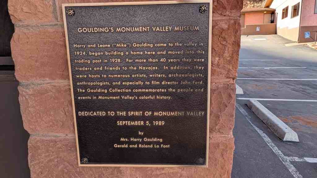
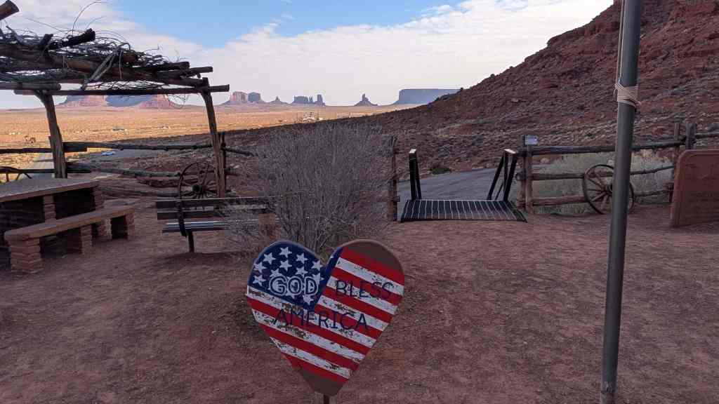
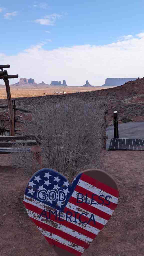
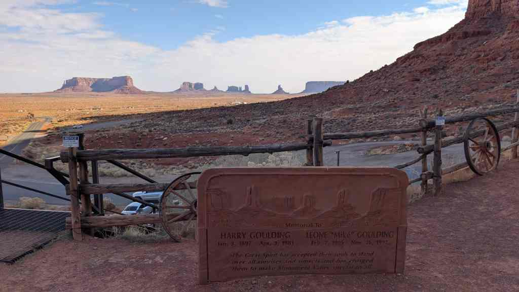
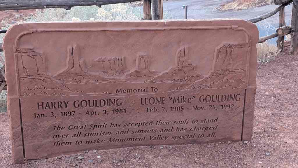
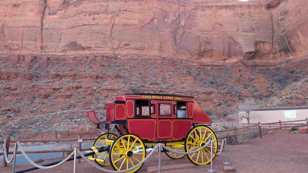
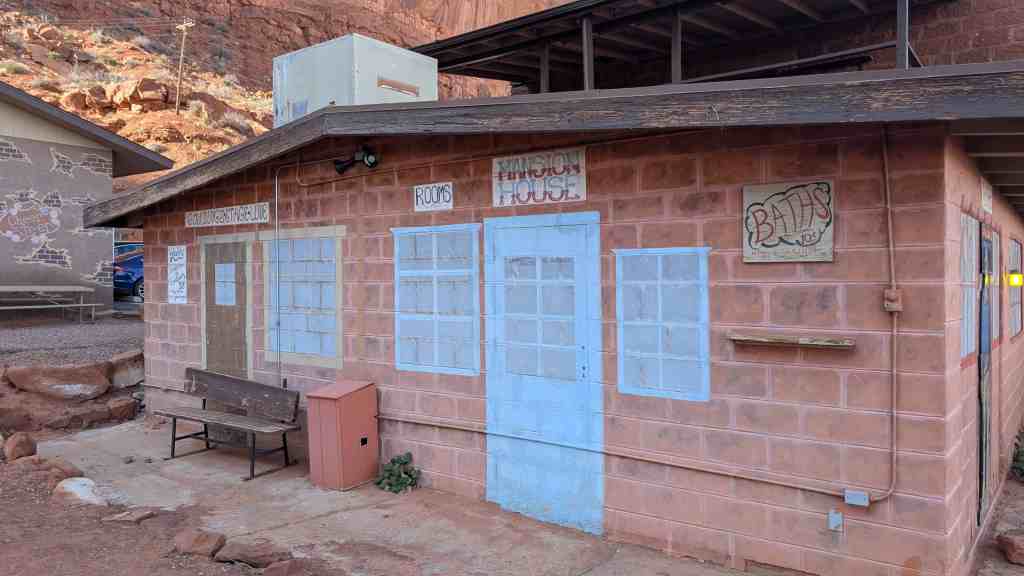
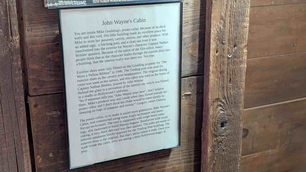
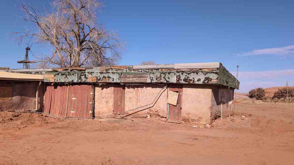
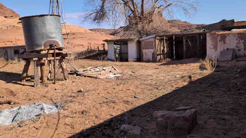
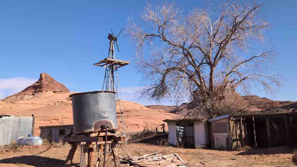
Goulding’s Trading Post is significant as a unique trading. It was founded by Harry Goulding and his institution in Navajo wife, “Mike”, in 1923 and remained under their ownership for forty years, when the title was transferred to Knox College, Galesburg, Illinois to provide a for Navajo youth. In their continuing interest in perpetual scholarship fund the welfare of the Navajo people and their concrete steps to improve the Indians’ well-being, the Gouldings have maintained the tradition of the “old trader” who was much more than a salesman and concerned with the interests of the Indians. In addition, Goulding’s Trading Post exemplifies the transition that has taken place on the Navajo reservation, from isolated colony to integrated component of American society, in a manner unrivaled by other Utah trading posts.
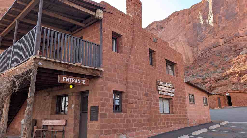
Goulding’s Trading Post was added to the National Register of Historic Places (#80003941) on October 20, 1980.
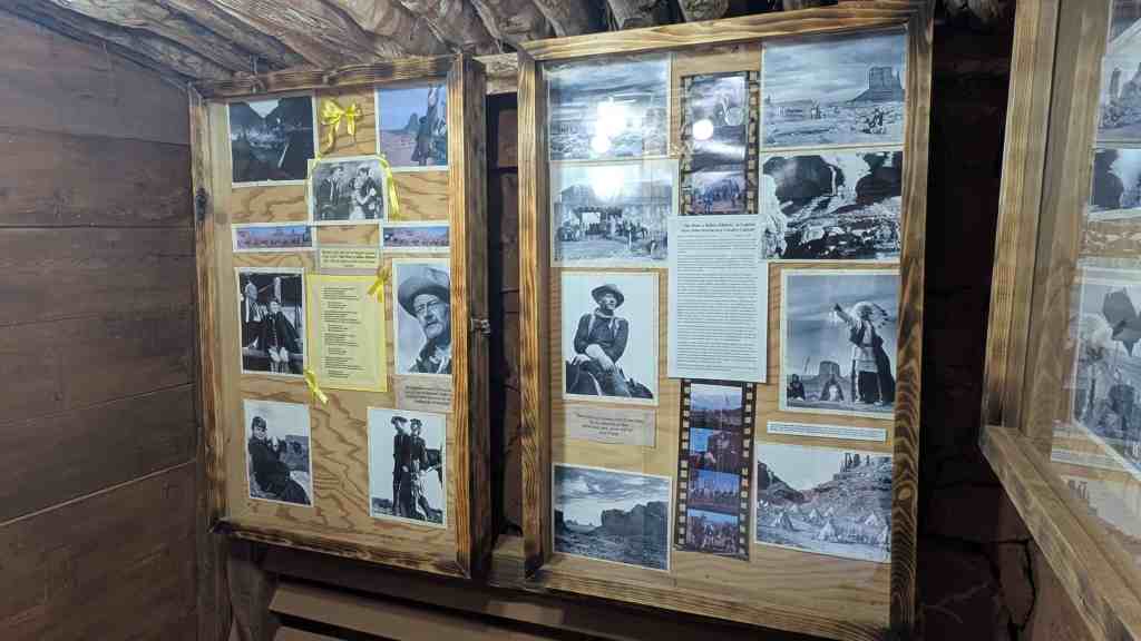
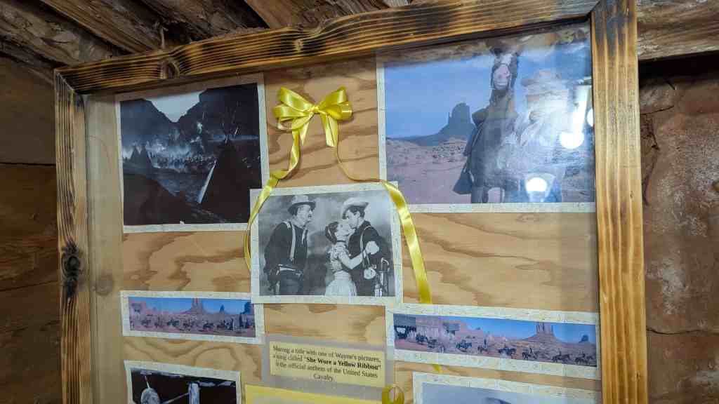
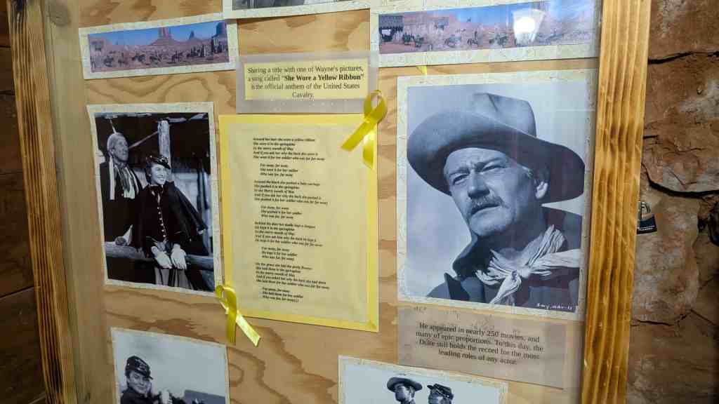
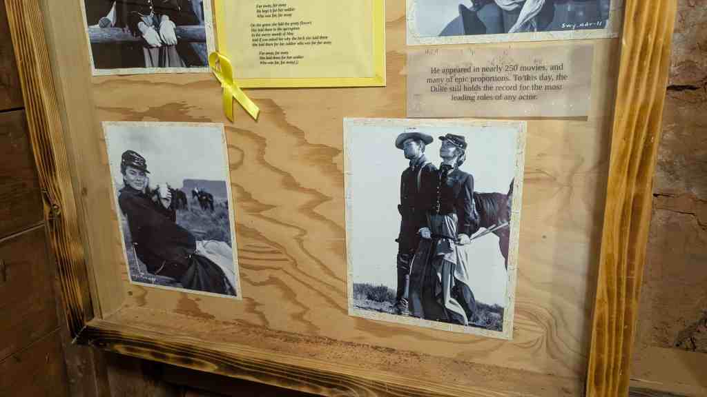
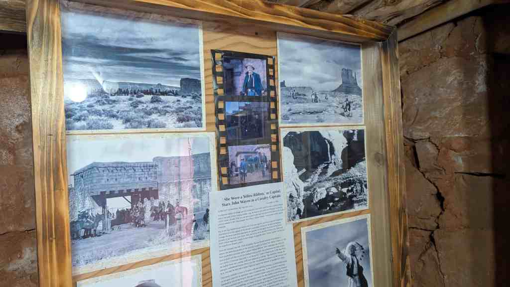
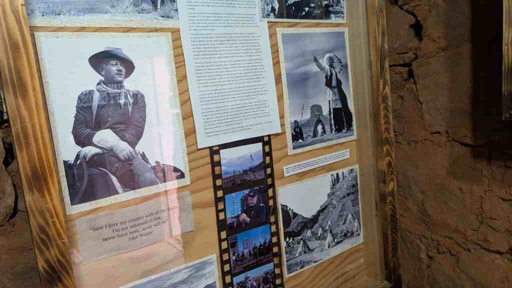
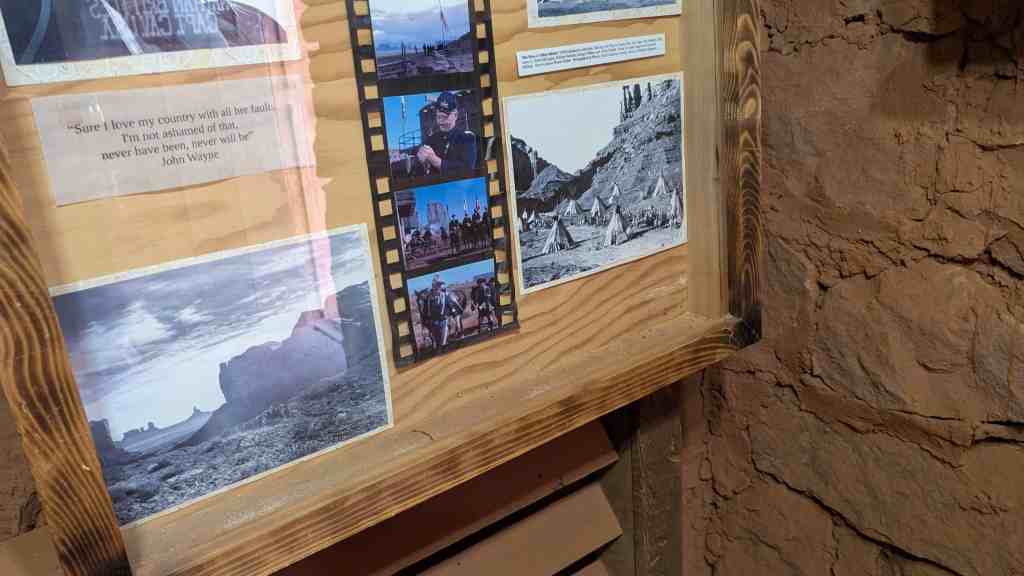
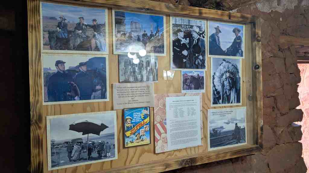
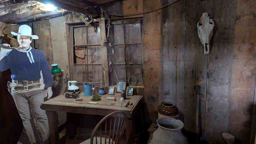
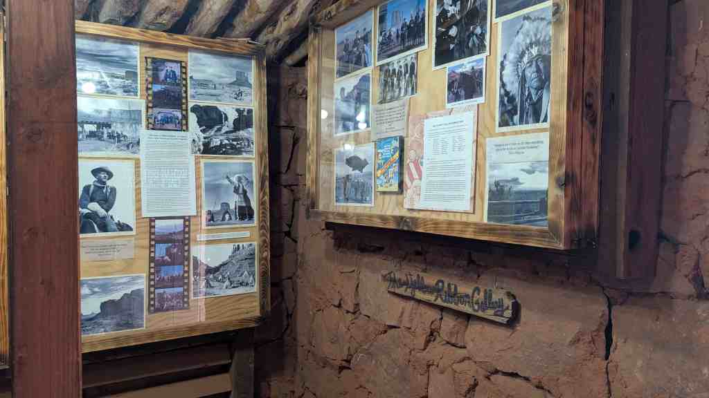
Goulding’s Trading Post began when Harry and Mike Goulding arrived in 1923 and built a few basic structures to live in. They homesteaded 640 acres on the Utah side of Monument Valley, whose stark beauty had first attracted them. They started trading with the Navajo and also acted as inn-keepers, a common enough function among white traders in this part of the world but one that was to grow in importance. “During his [Harry’s] first year, there were only four visitors to the area and he put them up at his place”. Slowly, visitors to the scenic area increased in number, bringing their tourist dollars to augment local income (for both the Gouldings and the Navajos, whose wares are sold at the trading post). The Great Depression decreased the flow, however. “Then in 1938 things were pretty tough for the Indians and Mr. Goulding heard rumors that the moving picture people were looking for a place to film a movie with Indians. He gathered up pictures of the area and made a trip to the West Coast which resulted in John Ford going to Monument Valley for [the] filming of “Stagecoach”. “My Darling Clementine” and “War Party” were also filmed at Monument Valley; recently there have been other films. Goulding’s provided accomodations for the entire company and the local Indians earned additional income through their participation in the movies. Partly through Harry Goulding’s encouragement the Navajo have gradually taken advantage of growing opportunities brought by modernization.
The Gouldings also aided the Navajo indirectly. They deeded thirty acres of their original homestead to the Seventh-Day Adventist Church for the building of a hospital and school. The clinic, in particular, is heavily patronized because it is the only facility of its kind for miles. (The next nearest medical facility is at Blanding, over 70 miles distant.)
In spite of the Goulding’s involvement with the modern world, they resisted the trend of the “new trader . . .[who] is in it for a short while . . .[and] comes in to make money and get out.” They have instead embodied in their post and in their actions the functions of the old-time trader, who “took pride in the higher standard of living and greater material comfort his activities brought to the Indians . . . summed up J.B. Moore [an old-time trader], . “manifestly, my only hope for success lies in aiding and bettering the conditions in my settlement by every means possible and to the utmost of my ability.”


06 Monday Apr 2026
Posted in Uncategorized
Tags

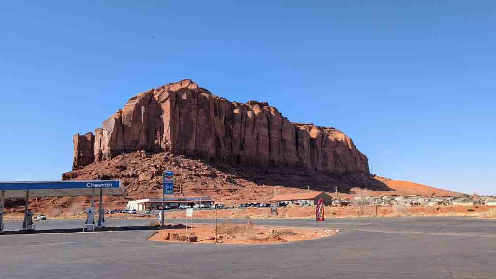
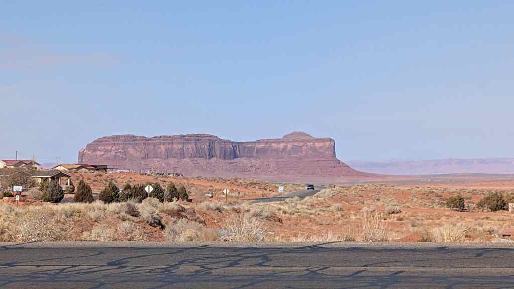
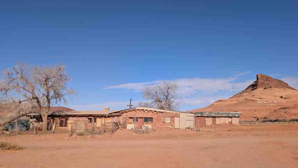
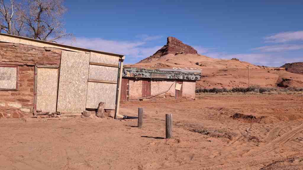
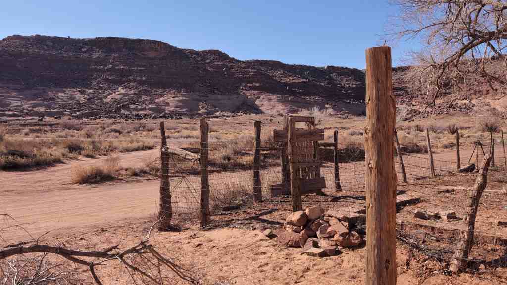
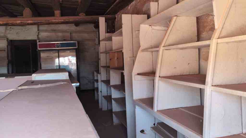
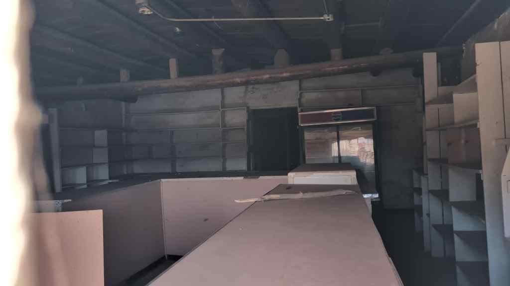
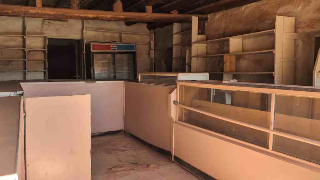
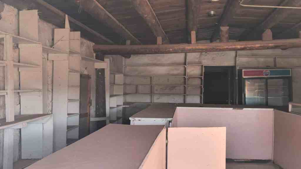
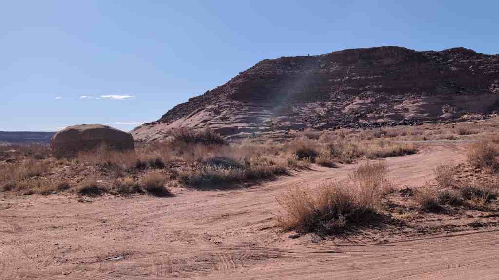
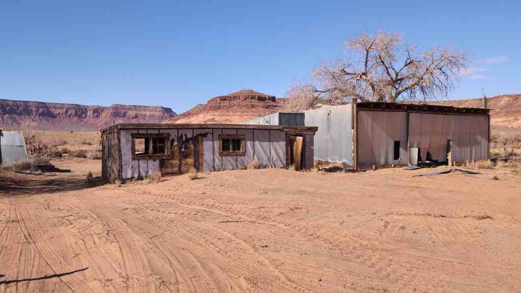
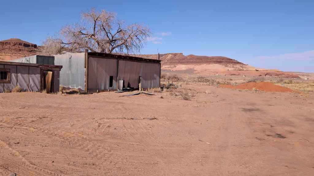
The Oljato Trading Post built in 1921 is significant as a building closely tied to the history of Indian trading throughout the Four Corners region of Utah, Colorado, New Mexico and Arizona, and is one of the few remaining examples of this type of enterprise still flourishing in Utah. It is located approximately one mile west of the ruins of the Wetherill Trading Post (1906-1910), the first one established in the northwestern part of Navajo land. The present Oljato Trading Post continues the traditions of trading in this remote section of the reservation. It also houses an eclectic collection of Navajo artifacts which the owners wish to preserve intact with the building. The post still functions as a communications center with the only telephone for miles. It is primarily a trading post, differing slightly in appearance form those of the last century. And it retains the spirit of the “old trader” in the desire of the owners to preserve the post’s appearance, function and collection of artifacts reflecting the heritage of both the traders, and the Navajos they serve.
Located in Oljato, Utah, the trading post was added to the National Register of Historic Places (#80003939) on June 20, 1980.

The history of trading on the reservation has been one of growth. After the Navajo return from the “captivity” of 1864-1868 at Fort Sumner, trading posts were quickly established. “In 1887 there were six licensed traders on the [Navajo] reservation. By 1890 there were nine on the reservation and thirty more surrounding it on all sides”. However, the Oljato area was undeveloped for two more decades. The movement grew until “by 1943, probably the peak of the trade, there were 146 trading posts on or near the reservation, of which ninety-five were licensed by the government”.
As trade increased the type of people involved in trading gradually changed. The founders of most of the posts, known as “old traders”, were an independent group of people, deeply involved in the lives of the Indians and, of necessity, concerned about their welfare. As well as salesmen, they were inn-keepers, interpreters, guides and friends to the Navajos in times of trouble. However, as the reservation modernized and contact increased with the outside world, the traders lost their old, paternalistic functions and were replaced with people more interested in commercial possibilities and less in the well-being of the Navajos. In most areas of the reservation, the “old trader” was gone by the end of World War II; in Oljato the original pattern still persists to a limited extent.
The isolation of Oljato has been a major factor in its resistance to the transformation of trading posts into supermarkets with absentee owners. Because of its remoteness, trading here began late in history. Not until 1906 did the Wetherill family open a post in the area, which they ran only four years before moving on to Kayenta. An eleven-year hiatus followed, during which the local Indians had to trek long distances to sell their wares and obtain supplies.
The Oljato site remained attractive, however, largely because of the availability of water. Since 1921 a series of traders have operated there. Joseph Heffernan, the first to re-establish the post, was typical of many of the “old traders”. He had moved to Colorado from New York State in 1876 and around 1908 had purchased Noland’s Four Corners Store in northwestern Colorado which he ran for several years. In the early 1920’s he came to Oljato and began his business in a tent. He later built an adobe structure which forms the basis of the present establishment. He retained ownership when the Navajo reservation was expanded in 1933 to include the land on which he had built the post.
The subsequent history of Oljato has been molded by a long list of inter-related or well-acquainted Indian traders. Heffernan kept the Oljato post until 1936 when he sold it to John Taylor who kept it for two years more and then moved on to the trading post at Red Lake, Arizona (also known as Tonalea). George Pearson owned the Oljato post from 1936 to 1938, after which he sold it to Reuben Heflin, brother-in-law to the present owner, Mrs. Virginia Smith. Heflin had already been trading for a number of years, including a stint at the Shonto Trading Post in northeastern Arizona. In 1944 he was succeeded by Fred Carson who was joined by his cousin, O.J. Carson, in 1948. The Carson family had been actively involved in Indian trading since the late 19th Century and were responsible for starting Carson’s Trading Post and the Huerfano Trading Post, both in northwestern New mexico. O.J. Carson had started his own trading post in 1914 at Star Lake, south of Farmington, New Mexico, then moved to Carson’s Trading Post further south and then to Oljato.
In 1949 O.J.’s daughter, Virginia, and her husband, Edward D. Smith, came to Oljato and began work. The following year Mr. Smith obtained a license from the Navajo Nation as Oljato’s resident manager; on December 1, 1958 the Smiths received a 25-year lease under which they still operate.
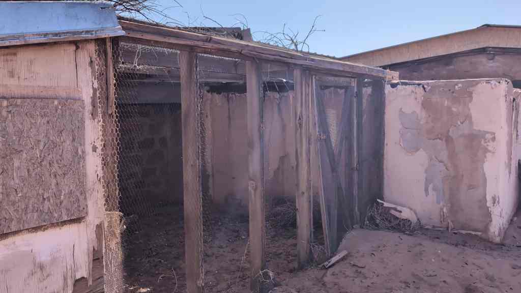
Over the years there have been subtle changes at Oljato. During the last twenty year Mrs. Smith has amassed a fine collection of Navajo artwork, including baskets, rugs and silver. These will be kept intact at the post, which will hopefully be passed on to the Smith’s daughter, currently the resident trader at Inscription House Trading Post. Additionally, the Qljato Trading Post has always had a traditional hogan in front, facing east, which was previously used by Navajos who travelled long distances to trade and needed a place to spend the night. Water was provided for them and they could stay as long as they wanted, but the advent of the pick-up truck shortened travel time to Oljato. Accommodations became unnecessary; the hogan was first cemented over and is now closed up. Corrals were dismantled as livestock, previously a medium of exchange, was replaced by cash as stipulated by the Navajo tribe.
The role of the traders has changed as well. “The old trader did everything for the Navajo. He was the banker, the doctor, the lawyer. Now there’s so many of them [Navajos] that are educated that the trader doesn’t play the role he used to in the old days. “We’ve written a lot of letters for them and read their mail and so forth, but we have never had to, for instance, bury them or doctor them or anything because the hospital has been here [at Goulding’s] since we’ve been here.” However, Oljato still provides a unique link to the old ways. It is still a communications center.


31 Tuesday Mar 2026
Posted in Uncategorized
Tags
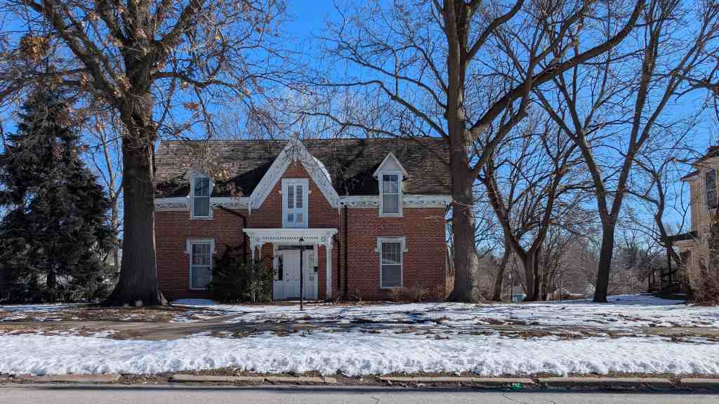
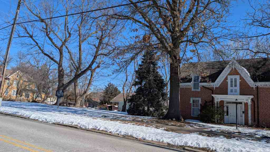
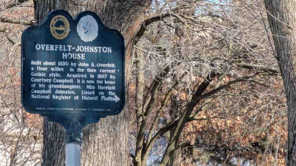
Overfelt – Johnston House
Built about 1850 by John A. Overfelt, a flour miller, in the then current Gothic style. Acquired in 1867 by Courtney Campbell, it is now the home of his granddaughter, Miss Harriett Campbell Johnston.
Listed on the National Register of Historic Places and located at 305 South Pleasant Street in Independence, Missouri.
31 Tuesday Mar 2026
Posted in Uncategorized
Salt Creek Archeological District
The Salt Creek Archeological District is in the The Needles district in Canyonlands National Park in San Juan County, Utah. Salt Creek Canyon holds the park’s highest concentration of archeological sites, particularly many structures constructed by the ancestral Puebloan and Fremont people.* The Archeological District was added to the National Register of Historic Places (#75000164) on March 31, 1975.