Gilmer Park Historic District
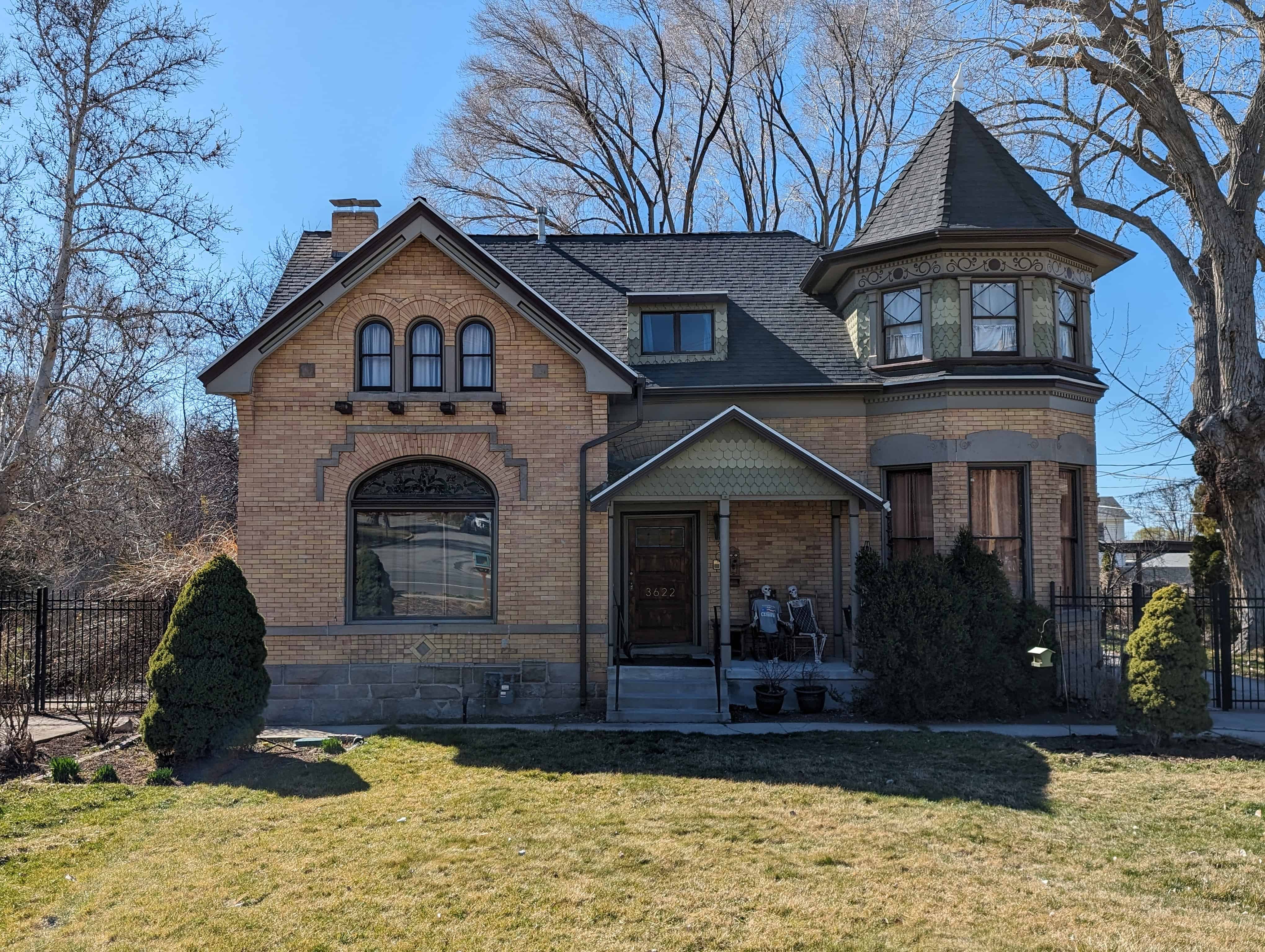
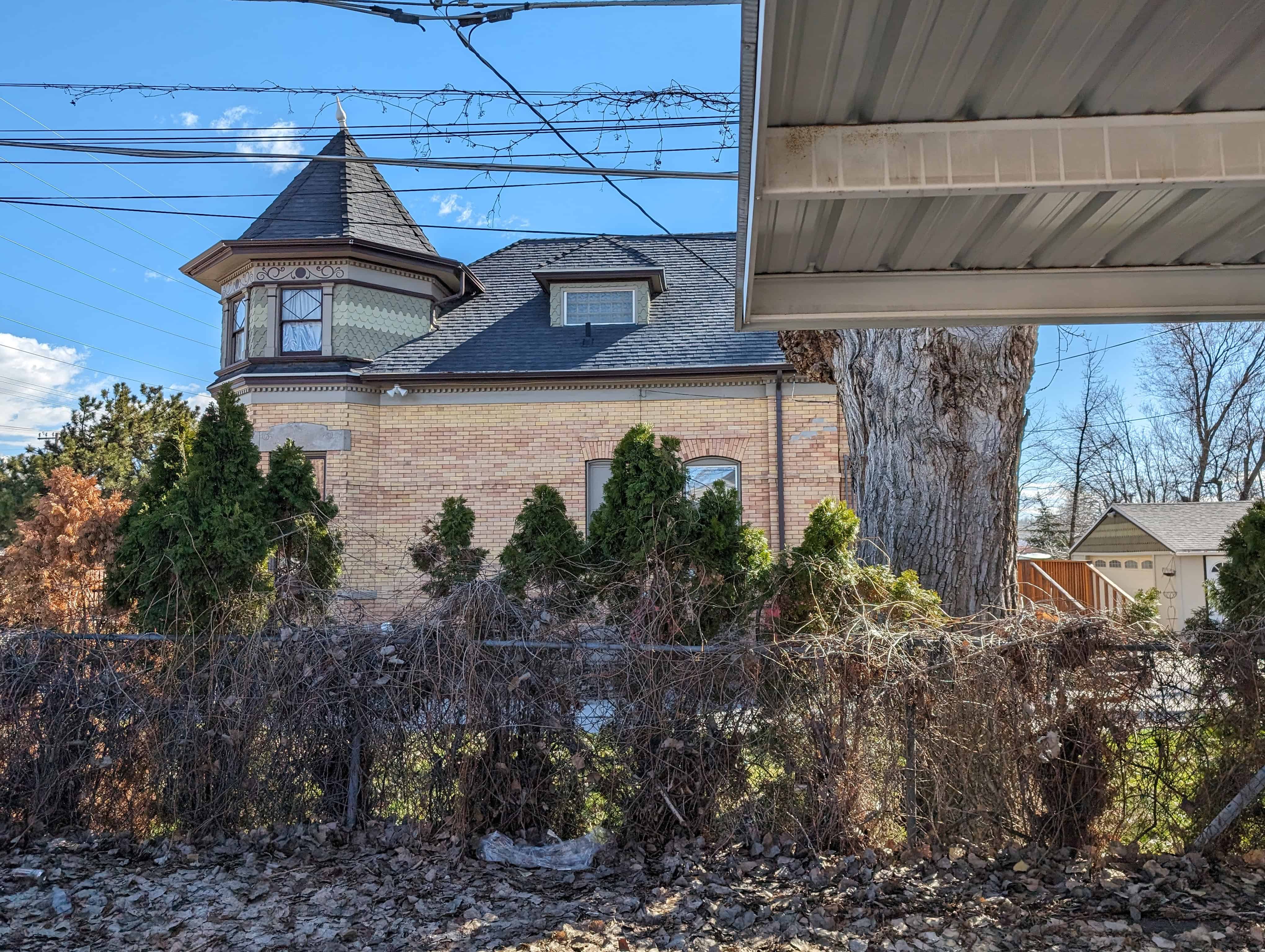
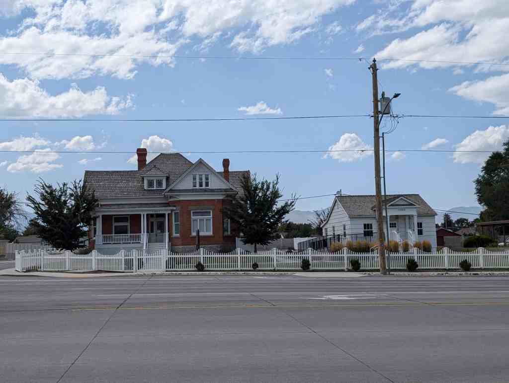
The Gilmer Park Historic District, developed primarily between about 1909 and 1943, is a significant residential neighborhood in Salt Lake City. It is a well-preserved, cohesive neighborhood of 244 buildings, all but two of which are houses and eighty-eight percent of which are contributing structures. The district’s significance is based on three key factors. First, it represents the most intensive period of housing construction in the city’s history, during which virtually all of the farmland on the south edge of the city, where Gilmer Park is located, was transformed into residential subdivisions. Between 1910 and 1930, Salt Lake City’s population increased fifty-one percent with more than 47,000 new residents, and suburban developments accommodated most of that growth. Gilmer Park is one of the most distinct of those subdivisions. Second, a substantial number of Gilmer Park residents were important individuals in the community and state. These included influential businessmen, politicians (including a governor), artists, architects, doctors, attorneys, educators, and religious leaders (including a president of the LDS Church). Third, many of the houses in the district are excellent local examples of important architectural styles and types. The neighborhood was developed between 1909-43, with the majority of building (sixty-two percent) occurring between 1921-8. This period of development, just after World War I, is reflected in the postwar construction boom and the predominant use of Period Revival style architecture in the area. The neighborhood itself, with its curvilinear layout, represents a unique variation in subdivision design in the city. It is one of the first subdivisions in the city to deviate from the rectangular grid and follow the national trend toward more organic layouts.
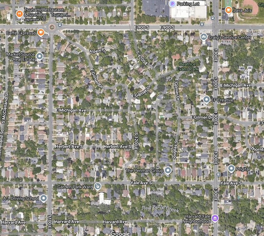
The Gilmer Park Historic District covers the area east roughly between 1100 East and 1300 East from 900 South to Harvard Avenue and is in the East Central Neighborhood of Salt Lake City, Utah and it was added to the National Register of Historic Places (#96000314) on March 28, 1996. The text on this page is mostly from the nomination form from the national register.
Related:
Places in the district:
HISTORY OF GILMER PARK HISTORIC DISTRICT
Early History
Water, a primary factor in the development of land, and transportation services were in place prior to the development of Gilmer Park Historic District. Water mains were installed on 1100 East in 1892. The area was three miles from downtown Salt Lake City and in response to the need for public transportation because, in 1889 the streetcar system extended to 900 South, and in 1898, the lines were extended to 2100 South on 1100 East. A bus line was in place along 1300 East by 1926.
Roughly bounded by 900 South and Harvard Avenue (1100 South) between 1100 and 1300 East, the district comprises two large properties known historically as the Gilmer estate, from 900 South to Yale Avenue, and the LeGrande Young estate, between Yale and Harvard Avenues. Once this area was primed for development, four sections formed from these estates: Gilmer Park, Gilmer Square, the Young-Howard Estate, and approximately one-fourth of Park View subdivision. Subdivision plats were filed in 1909 for Gilmer Park and 1910 for Gilmer Square. Park View Subdivision was platted in 1889. The Young-Howard Estate was never platted. Construction of the first homes in Gilmer Park Historic District began in 1909 but the majority of the homes were constructed between 1921-8.
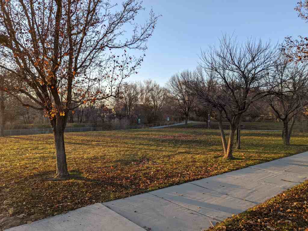
Though Gilmer Park Historic District has a cohesive appearance, it was actually created by a number of different owners and developers. The fact that several owners and developers were able to create this visual cohesiveness through the use of curvilinear tree-lined streets, irregular lots, similar house styles, similar scale of houses, and deep set-backs with lawns and landscaping, is evidence of the trend for landscaped subdivisions that began to occur in Utah and across the country. They quickly realized the area’s assets of cleaner air and a unique park-like setting and sloping topography, characteristics that were attractive to home buyers. Capitalizing on the natural features of the district, development was directed at defining a unique, internally-structured, and cohesive neighborhood. Careful and judicious planning extended to the quality of the homes being built.
GILMER ESTATE
The land on which most of the Gilmer Park Historic District was developed originally belonged to the Gilmer family. It was first developed as the Gilmer estate, property that was located between 900 South and Yale Avenue (1080 South) between 1100 East and 1400 East. It was purchased in 1888 by Mary E. and John T. Gilmer from a farmer in the area, Alvin F. Guirvits. John T. Gilmer (1841-92) was a successful mining operator, government mail contractor, and a partner in the Gilmer and Salisbury Overland Stage Company. Mary E. Gilmer (1844-1924) was active in women’s clubs and civic affairs, helping found the Ladies Literary Club and the Sarah Daft Home for the Aged. She was also a local leader in the women’s suffrage movement. In 1889, the Gilmers built a house on the property near the corner of 900 South and 1100 East at the end of a curved driveway which is now part of Gilmer Drive. In 1899, the house and property were leased to the Salt Lake Country Club, Salt Lake’s first and newly organized golf club. The house (originally at 945 South 1100 East) was used as the clubhouse and the surrounding land as the golf course. The Salt Lake Country Club moved to the Forest Dale location in 1907. The Gilmer house was apparently replaced by newer houses built in the 1920s.
Gilmer Realty Company
In 1909, Mary Gilmer and her son, Jay T. Gilmer, organized the Gilmer Realty Company and filed subdivision plats for a portion of Gilmer Park. Gilmer Realty Company was responsible for the initial platting and promotion of Gilmer Park and Gilmer Square, land they owned together with other investors. Their involvement in the development of the Gilmer Park Historic District is significant in initiating the building of a unique neighborhood. Advertisements in Goodwill’s Weekly Magazine show that Gilmer Realty and J.T. Gilmer were involved in developing this area through at least 1914. For whatever reasons, the Gilmers’ role in developing the property diminished and by about 1920 they no longer appear to have been active in the venture. Gilmer Realty Company may have actually built only about thirty homes in the area.
Kimball & Richards Company
It appears that much of the development in Gilmer Park was done by Kimball and Richards Company. Weekly newspaper ads that appear in the 1919 Salt Lake Tribune support their involvement in this area. These ads extolled the virtues of living in Gilmer Park for its location, natural beauty, improvements such as sidewalks, trees, city water and sewer, its regulations that protected it from undesirable surroundings, the individuality of each homesite made possible with the services of an expert landscape architect, and the reasonable price of the lots. Kimball & Richards developed numerous lots throughout the district with the exception of the Gilmer Square.
The company was first listed in the Polk Directory as an insurance and rental company in 1908. By 1910, they had expanded into real estate and development, calling themselves “land merchants.” The firm of Kimball & Richards consisted of three corporations: Kimball & Richards “land merchants,” which marketed subdivisions; Kimball & Richards Building Company, which custom built many of the homes for buyers on lots promoted by the “land merchants”; and Kimball & Richards Securities Company, which provided financing. Taylor Woolley and Clifford Evans, architects that lived in Gilmer Park, designed homes for Kimball & Richards. Kimball & Richards Company was known for its innovative promotion methods and was aware of national trends. In 1910, D. C. Kimball visited Los Angeles and Southern California to study the California market and the promotional methods used there. Both Don Carlos Kimball and Claude Richards were Utah natives and members of the LDS Church. It was one of the most active companies in the early decades of the twentieth century. They developed individual houses and large subdivisions such as Chesterfield, Homefield Acres, and Highland Park. They left their mark indelibly in the growing subdivisions of Salt Lake City. Unfortunately the firm was forced out of business by the mid-1920s because of internal and external economic problems.
Ashton-Jenkins Company
It appears that Ashton-Jenkins Company also had a great deal of influence in the Gilmer Park Historic District. As early as 1909 they owned property in the area between 900-1000 South and 1100-1300 East and in 1913 they were buying land throughout Gilmer Park Historic District.
The Ashton-Jenkins Company was responsible for hundreds of buildings in the Salt Lake Valley between 1890-1945. Edward T. Ashton was a successful builder and architect as well as a talented businessman and developer. He purchased, planned, and developed the Franklin Subdivision, drew plans for and constructed the State Normal School at Cedar City, and erected electrical plants for Telluride Power. In 1881, Edward T. Ashton began a general contracting business and was later joined by his brother Charles S. to form the Ashton Brothers Company. Edward E. Jenkins joined them to form the Ashton-Jenkins Company which became one of the largest real estate companies in Salt Lake City.
Ed D. Smith & Sons
Ed D. Smith & Sons were involved in the Gilmer Park Historic District in about 1916 having purchased property from Clifford P. Evans. Their influence was apparently throughout the district. Newspaper articles show they were developing lots between 900 South and Yale and 1100 East and 1400 East, with several hundred homes planned for construction. In 1916, plans were formalizing for street improvement work with plans to grade part of Gilmer Drive. This company also brought influences from outside Utah. For example, in 1916 a news article about Gilmer Park and Ed D. Smith & Sons reported that a “prominent California landscape gardener was brought here from California to plan the park, and it promises to be a delightful spot, with the broad, curved driveways, parkways, tennis courts, shrubbery and groves.” Gilmer Park was also described as a place that could be easily accessed by motorists, offered great views, and was apart from the grime of the city.
Other Developers
Vincent-Peterson Construction, owned by J. G. Vincent, who lived in the area (1220 Yale Ave.), was involved in building five homes on Gilmer Drive in addition to many others in the area. Waddoups Company (1922-5) and Morrison-Merrill Company (1925-7) were also developers in the area.
GILMER PARK SUBDIVISION (1914-43)
The subdivision known as Gilmer Park extended south to Yale Avenue and east to 1400 East, excluding Michigan and Herbert Avenues (the Gilmer Square Subdivision). The owners of the subdivision included Gilmer Realty Company, Taylor and Dorrit Evans Woolley, Evelyn J. Burton, J. G. and Winnie B. Vincent, and George E. and Lillian C. Merrill.
What was originally the Gilmer Park Subdivision is the largest portion of the Gilmer Park Historic District. Its primary period of development was between 1914-43, with the majority (approximately eighty-five percent) of the building occurring between 1921-30, although a few homes were built prior to 1920. Restrictions placed on the buildings were made to “insure beauty and permanence that should enhance the value of the property.” The minimum construction cost was set at $3,000 with the majority of the homes starting at $3,500 to $4,000. The landscape plan for a portion of Gilmer Park, primarily around Alpine Place, was designed by Taylor Woolley.
GILMER SQUARE SUBDIVISION (1910-26)
The Gilmer Square Subdivision, platted on April 4, 1910, was owned by Gilmer Realty and LeGrande Young. It included the lots along Herbert Avenue, the south side of Michigan Avenue, and the north side of Yale Avenue between 1100 East and 1200 East. The majority of the building in this subdivision occurred between 1914-26. In a Salt Lake Tribune advertisement, Gilmer Realty stated that some of the features of the subdivision were: a $4,000 minimum building cost restriction; extensive public improvements including sidewalks, city water, graded streets, perfect drainage, and a street car line; and it was considered “the last close-in residence division of the better class.
One of the earliest houses in the subdivision was built in 1910 for Jay T. Gilmer (1038 South 1200 East) at a cost of $6,000. It was designed by two prominent Utah architects, Frederick A. Hale and Charles S. McDonald. Drawings of Jay T. Gilmer’s home were used to promote the Gilmer Square development in newspapers and magazines. The majority of development in the subdivision began in 1915.
LEGRAND YOUNG ESTATE
The LeGrande Young estate, between Yale and Harvard Avenues, was obtained in 1887 by LeGrande Young (nephew of Brigham Young) from his uncle, Lorenzo Young. LeGrande built a home c.1890 on the site now occupied by the Garden Park Ward and began planting a wide variety of trees including oak, plum, apple, pear, cherry, Boston elm, silver leaf poplar, and horse chestnut. His efforts resulted in beautiful groves and gardens for which the area became well known and which later attracted people to this area. The gazebo, pond, brick wall, and carriage house which are still located on the property were part of this estate.
YOUNG-HOWARD ESTATE (1918-39)
In 1914, Young sold the entire estate to John C. Howard, a prominent Salt Lake businessman and community leader who served, among other positions, as president of Utah Oil Refining and president and director of the American Mining Congress. Howard sold some of the parcels of land, but retained the two-and-one-half acres that now constitute the Garden Park grounds. The area immediately surrounding the Howard estate was developed primarily during the early 1920s, without being officially platted as a subdivision.
Howard and his wife, Gertrude Musser, lived in the home built by LeGrande Young with their four daughters until their deaths in 1929 and 1919, respectively. After Mr. Howard’s death, three of his daughters lived in the house until 1938. Apparently they had planned to add on to the house before it was deeded to the LDS Church. In that same year, a chapel designed by architects Taylor Woolley and Clifford Evans, both ward members, was built on the foundation of LeGrande Young’s home and the foundation of what was to have been a new house for the Howards. At first the building was called the Gilmer Park Ward, but was later changed to Garden Park Ward.
PARK VIEW SUBDIVISION (1909-27)
The portion of the Park View Subdivision in the Gilmer Park Historic District is the south side of Harvard Avenue between 1100 East and Douglas Street. LeGrande Young was the owner and developer of the subdivision, which is located directly south of the Young-Howard Estate. LeGrande Young purchased the property from William G. Timmons on March 3, 1889, for a reported $12,000, and a plat for the Park View Subdivision was filed on October 23, 1889. This portion of the subdivision was apparently undeveloped until about 1909.
In 1914, LeGrande Young moved from his estate located between Yale and Harvard Avenues to his newly built home across the street from Park View at 1121 Harvard Avenue. His children also built homes in the subdivision primarily on the south side of Harvard Avenue: Grace Young and Kenneth Kerr (1172 Harvard Avenue, 1909); Lucille Young and William Reid (1150 Harvard Avenue, 1905); and LeGrande Young, Jr. (1218 Harvard Avenue, 1910).
The only portion of Park View included in the Gilmer Park Historic District are the lots on the south side of Harvard Avenue west of Douglas Street. Houses were built on lots along this part of Harvard by 1920. The lots on the east side were developed a few years later. This section of the Park View Subdivision is included within the boundaries of the Gilmer Park Historic District because of the connections with LeGrande Young’s family throughout this district and because of the visual cohesiveness and similar scale of houses.
CONTEMPORARY SUBURBAN DEVELOPMENT
The earliest suburbs were thought of in a different light than they have been perceived in the 1950s through today. Early suburbs were sub-urban, or not fully urban. By the late 1890s, suburbs were occupied mostly by upper class families because they could afford a retreat from the city heat and filth. The residential developments outside the urban setting were considered a retreat from the grime and grit of the city and afforded the middle and upper classes a chance to have the American dream of a single family home that accommodated private space inside and outside. By 1910 things changed and the middle- and working-class citizens were moving out to the suburbs by the thousands, facilitated by public transportation. People moving in from the farm and out from the city combined to create an altered architectural pattern. With this came the creation of a significant architectural type — the suburban house form. 33 It wasn’t until the advent of the post-WWII housing development that the pastoral qualities of the suburb of the late 19th and early 20th century began to vanish.
The urban space, divided into plain rectangular strips without concern for topography or aesthetics and whose gridiron plan produced straight streets intersecting at right angles, appealed to the city residents’ preference for rational solutions and scientific methods. It was a practical approach for ordering space and simplified surveying and facilitated speculation. Early suburbs followed this plan because the rectangular layout of the streets extended beyond the city to make easier the sale and resale of lots possible in advance of settlement; it also stimulated promotion of undeveloped areas. “The price that the grid exacted in ugliness appeared small in a strange world where monotony also suggested familiarity.”
Just after the turn of the century the suburban form began to change. The increased cost of real estate in the city led land speculators and real estate developers to survey fields and meadows, imprinting streets and creating a landscape, neither rural nor urban, where people could enjoy both city and country lives. Profits were abundant for developers of the early twentieth century. Some learned that greater profits could be realized from “new arrangements of streets and structures, from new building materials, and from integrated beauty.” People in search of rural settings and something “unique would force private developers to reach new levels of residential design and new levels of profit.”
Large-scale suburbs on curvilinear street systems, like Vandergrift, Pennsylvania, were planned as early as 1895 by Frederick Law Olmsted, Jr. Olmsted (landscape architect of the nineteenth century) had outlined the requirements of city planning. His plan stated that first, main thoroughfares “should be direct, ample, and convenient no matter how they cut the land.” Second, other roads must be “quiet, attractive” residential streets, not “fantastically rooked,” but laid out “so as to discourage their use as thoroughfares.” Third, was the necessity of park land and public open spaces. Although Olmsted was successful in influencing planning patterns throughout the country, his work, along with that of Grosvenor Atterbury, an architect of equal reputation, and the Sage Foundation in their c.1911 development of “Forest Hills Gardens produced almost no progeny.” This lack of influence is believed to have been caused primarily by the village or company town appearance which overshadowed the efforts of backers and designers. Other planned subdivisions such as Shaker Heights, developed beginning in 1911 by the Van Sweringen brothers outside of Cleveland, did influence many residential developments. These developers controlled the building in this area by reviewing the plans of a number of different architects and landscape architects. “Forest Hills Gardens and Shaker Heights reflect something of the range of the early twentieth-century planned residential development.” Some suburban developments were not successful while others continue to be known.
Some subdivisions were developed to follow the natural topography. Roads followed the trails established when lands were first settled; bridges were built where ferries had terminated; old hedgerows and trees were surprisingly often preserved as “salable features.” Post-Victorian suburbs were individualistic, egalitarian, and comfortable. The idea was to live in a location far enough from the city to have rural qualities that included an open field nearby, a garden behind, and a front lawn, while living close enough to commute to the city to earn a living. This was a new era for housing development. The suburbs were practical because land was less expensive and afforded an individual home on a lot. They provided psychological advantages because they were “images of sturdy independence in their apartness from their neighbors.” And, they were traditional as an American idea and historical experience in contrast to European. The American house-designer conceived of houses as individual units set in landscapes rather than one among many similar buildings.
By the mid-1920s Salt Lake City mirrored the national trends of contemporary planning. Growth in the city during this period was occurring primarily to the east and south of the city center and between 1906-30, 439 new residential subdivisions were recorded with the county recorder’s office. Land subdivision was relatively stable during this period and was marked by the desire to make the city a good place to live.
Unlike many other developments in Salt Lake City during the early twentieth century, Gilmer Park Historic District “distinguishes itself through unusual skill and sensitivity applied to the layout and design of both the area as a whole and the individual structures.” Gilmer Park Historic District is believed to be the one of the first subdivisions in Salt Lake City developed using curvilinear streets, a layout that was considered a more progressive design. According to architectural historian, Gwendolyn Wright, the “increasing reliance on the car had many effects on residential planning to make driving more pleasurable, some developers abandoned the familiar rectilinear grid street and laid out wide, curving streets and cul-de-sacs.”
Federal Heights, roughly bounded by Virginia Street, University Street, First South, the University of Utah, and the foothills of the Wasatch mountains, is the only other known similarly planned subdivision that occurred as early as Gilmer Park Historic District. Telluride Real Estate Company began developing the area in 1909 and named it Federal Heights in reference to the government’s previous ownership of the property and its neighbor, Fort Douglas. The street patterns were designed to take advantage of the sloping topography and to create greenspaces within the neighborhood. Federal Heights, like Gilmer Park, has maintained its historic integrity and widespread identity. Slight differences occur in the scale of the homes from those in Gilmer Park as the number of large-scale residences in Federal Heights are greater. Also a number of the roads in Federal Heights are wider. Overall, however, the similarities between these two neighborhoods are strong and both reflect the a particularly successful pattern of subdivision development during the early 1900s in Salt Lake City.
Other suburban developments in Salt Lake City of about the same time did not follow the planned landscaped community as completely as did Gilmer Park. Westmoreland Place, with entrance gates at 1500 East and 1300 South, was platted in 1913 just a few years later than Gilmer Park and developed by Earl and Clark Dunshee. Amenities similar to those found in Gilmer Park included the landscaped green spaces and the idea of using parks, but it maintained the rectilinear street grid.
Highland Park was developed by the firm Kimball & Richards Company. Boundaries for this subdivision are roughly between Elizabeth Street (1140 East) and 1500 East, from Parkway Avenue (2400 South) to 2700 South. Highland Park was built primarily during the period between c. 1910-25 in a rectilinear plan. Kimball & Richards generally followed the typical pattern of subdivision layout, promotion, and development that had been established during the 1890s. They did include the planting of shade trees and terraced yards.
Many areas were developed not as a single subdivision but by speculative developers purchasing a few lots within an area. For example, the University Neighborhood Historic District, roughly bounded by South Temple and 500 South between University and 1100 East, was not a ‘subdivision’ and in addition to its single-family residences there are numerous apartments, and commercial buildings.
Gilmer Park’s planning and development by the individuals who owned and developed the area was intended to define an internally-structured and cohesive neighborhood. The visual quality of the district is created by a combination of several factors: the sloping terrain, curving streets, sloped or terraced yards, uniform setbacks and spacing, landscaping, and the architectural quality of many of the homes. While all subdivisions in Salt Lake City were named when they were developed, few remain easily identifiable today. Gilmer Park has withstood the test of time and most people recognize the name with the area that is being designated for nomination.
Gilmer Park influenced the development of other subdivisions in the area. Later subdivisions to the east of Park View were the site of many middle- and upper-middle-class residences located on tree-lined, lamp-lit, serpentine streets. This area is known as the Harvard/Yale area having been given ivy league street names as a result of the city engineer’s attempt to provide a standardized system of naming streets in the various residential developments. Harvard/Yale, like Gilmer Park, is one of the few most recognized residential neighborhoods in Salt Lake City.
Gilmer Park Historic District is also important because it contains numerous buildings that are both significant and modest examples of the work of prominent Utah architects. Since several architects participated in the subdivision’s development, their awareness of current trends in suburban planning no doubt influenced its plan. Layout of much of the Gilmer Park area is attributed to Taylor Woolley, a prominent Utah architect. He apprenticed with Frank Lloyd Wright in the early 1900s and apparently brought that influence to his work in his layout and landscaping of lots along Gilmer Drive. His plan for a section of the district shows several homes located on spacious lots on Alpine Place. Although those particular houses were never built, the layout has remained intact with curvilinear streets and deep setbacks, including a private alley that leads to a group of garages. It is unknown whether Woolley designed other curved streets in the subdivision, but his influence is obvious. The architectural firm he formed in 1917, Miller, Woolley, and Evans, was one of the first to include a landscape architecture department. They did not limit their designs to buildings but included the planning of the State Capitol grounds and Memory Grove. Woolley’s firm also influenced the architecture in the area. He and his brother-in-law, Clifford Evans, designed the Garden Park Ward Chapel located at 1150 Yale Avenue. Other houses in the district that may have been designed by Woolley include 1016 Douglas Street and 910 South 1200 East. He also designed several notable Prairie School style homes just east of 1300 East on Yale Avenue.
Other architects who influenced the area included Frederick A. Hale and Charles S. McDonald, who are known to have designed J.T. Gillmer’s residence (1038 S. 1200 E., 1910). Hale designed more than one hundred buildings in Salt Lake City including the Alta Club, the First Methodist Church, the Keith-Brown mansion, and numerous residences. Charles S. McDonald, of the firm McDonald and Cooper, worked with Hale on the addition to the Alta Club, designed the Keith O’Brien building, and worked with Eames and Young on the Walker Bank building.
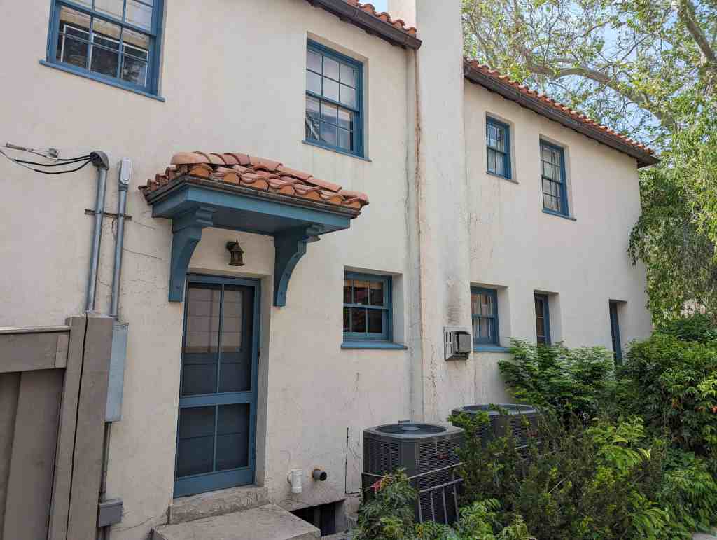
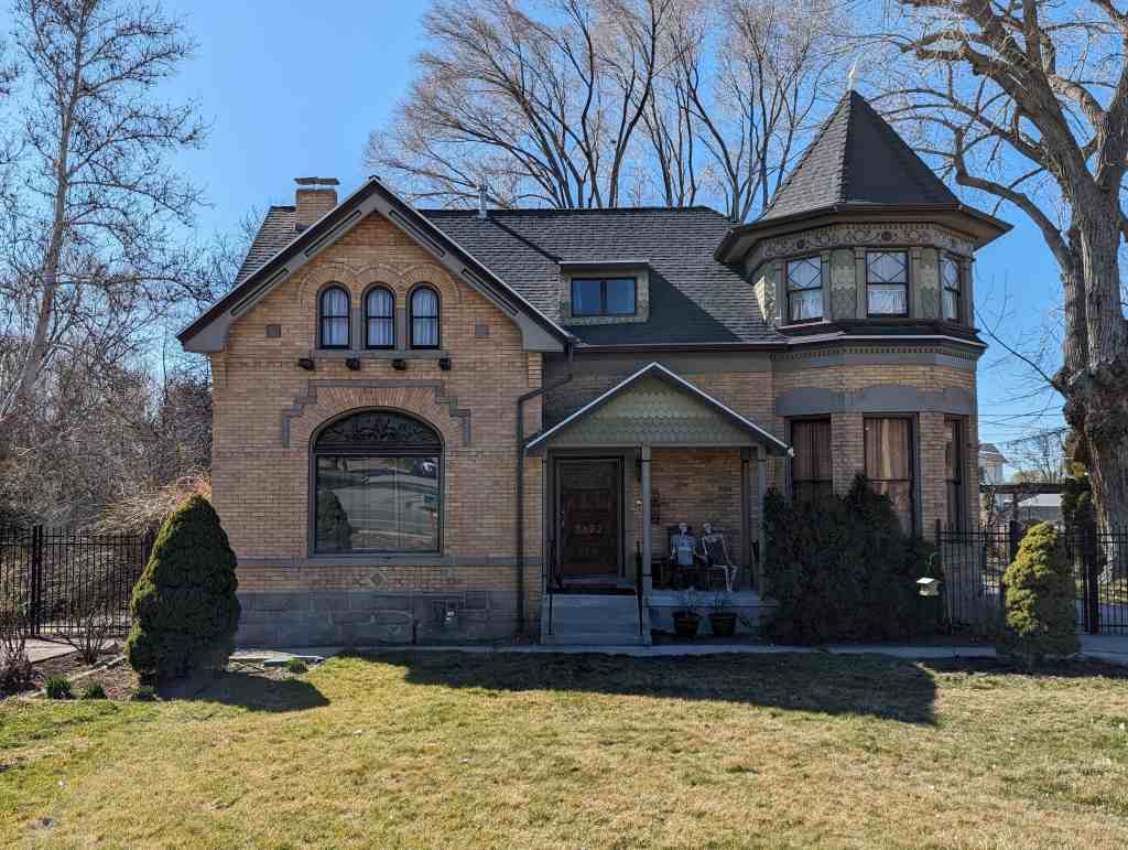
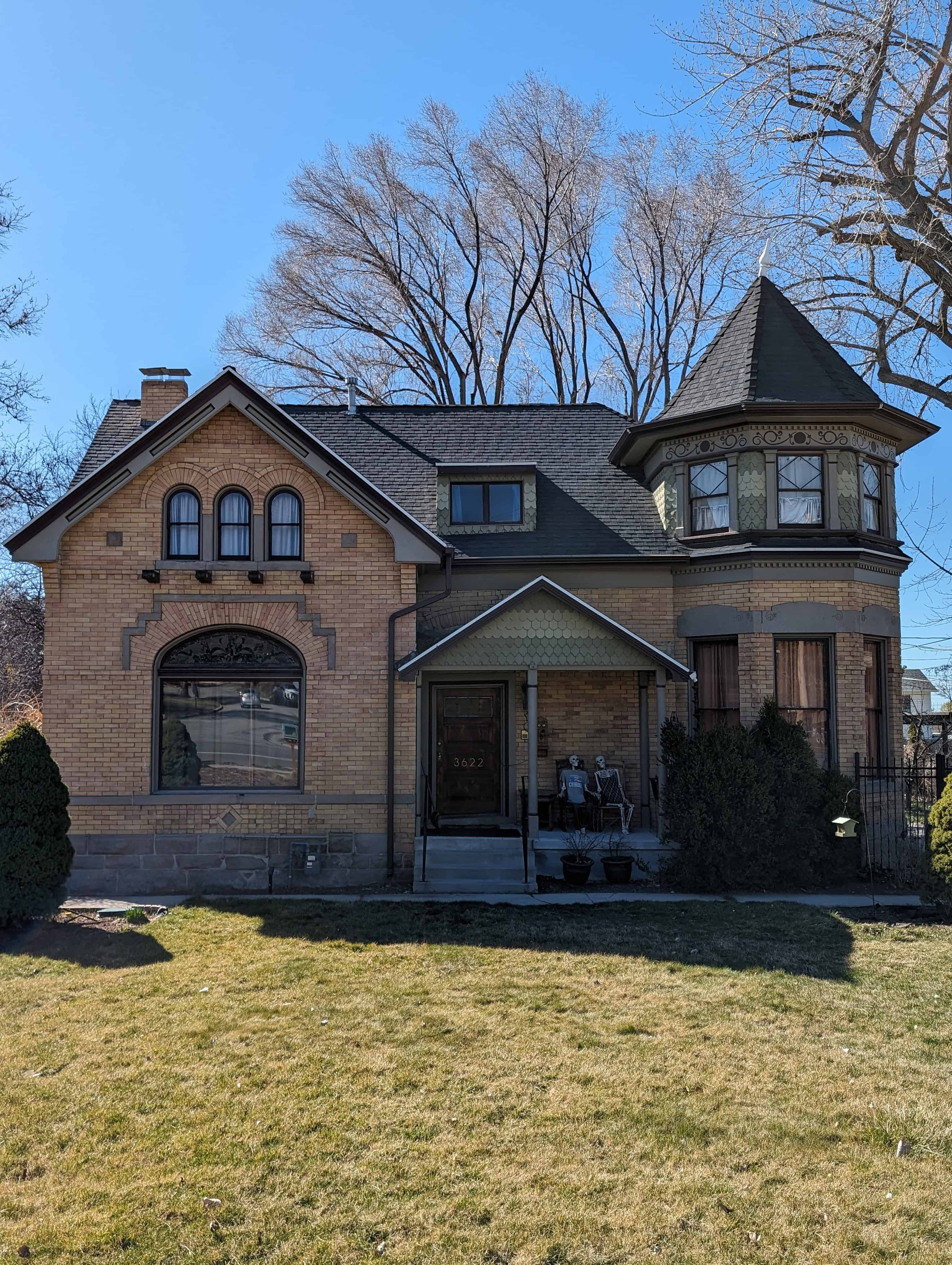
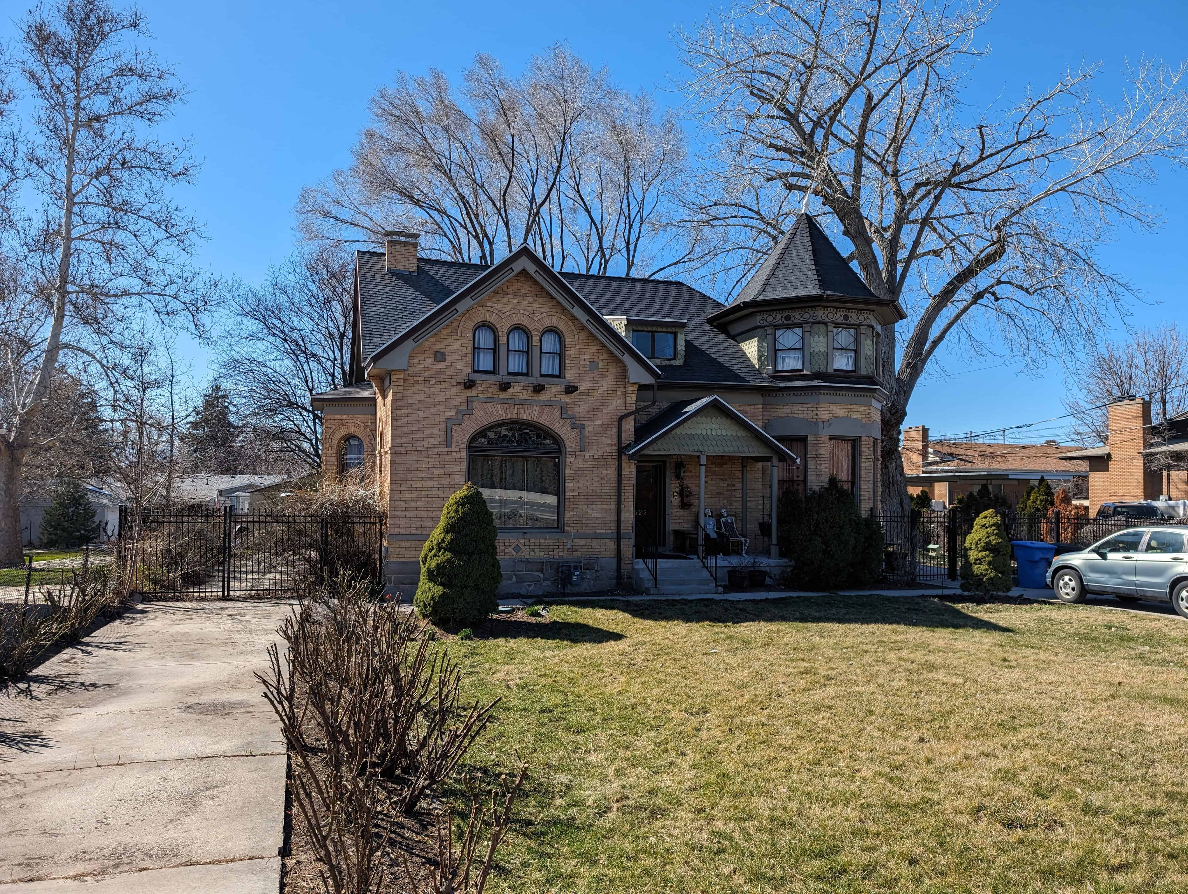
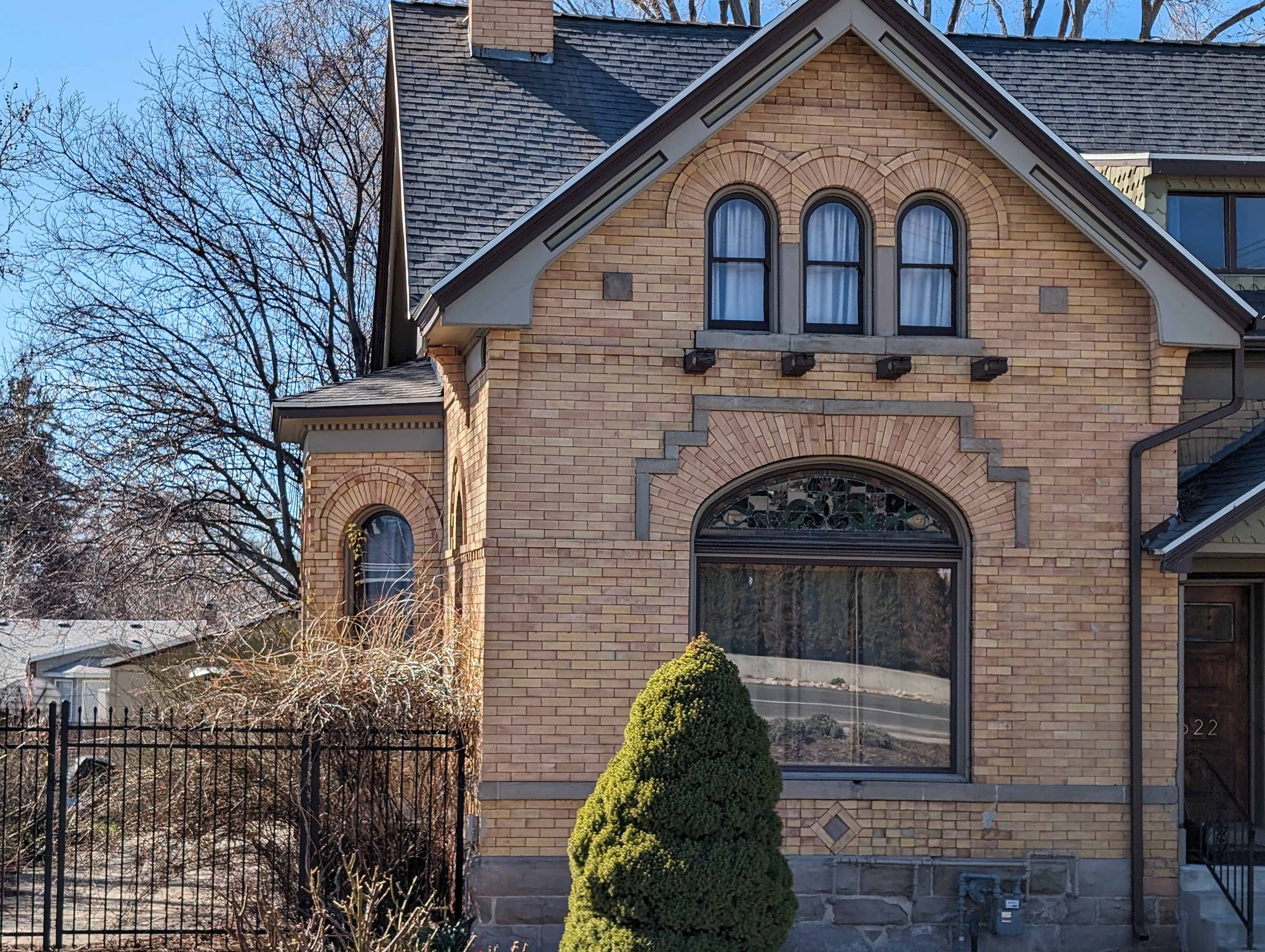
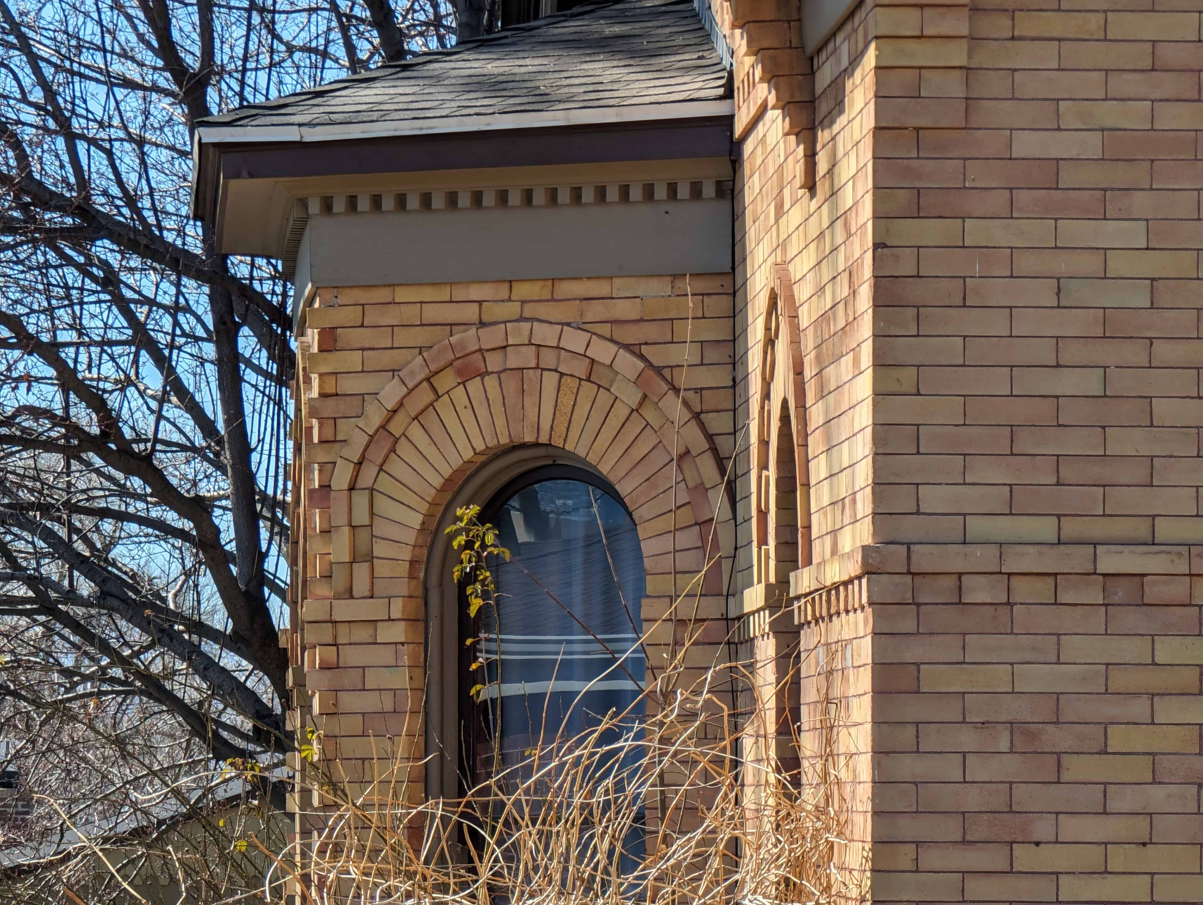
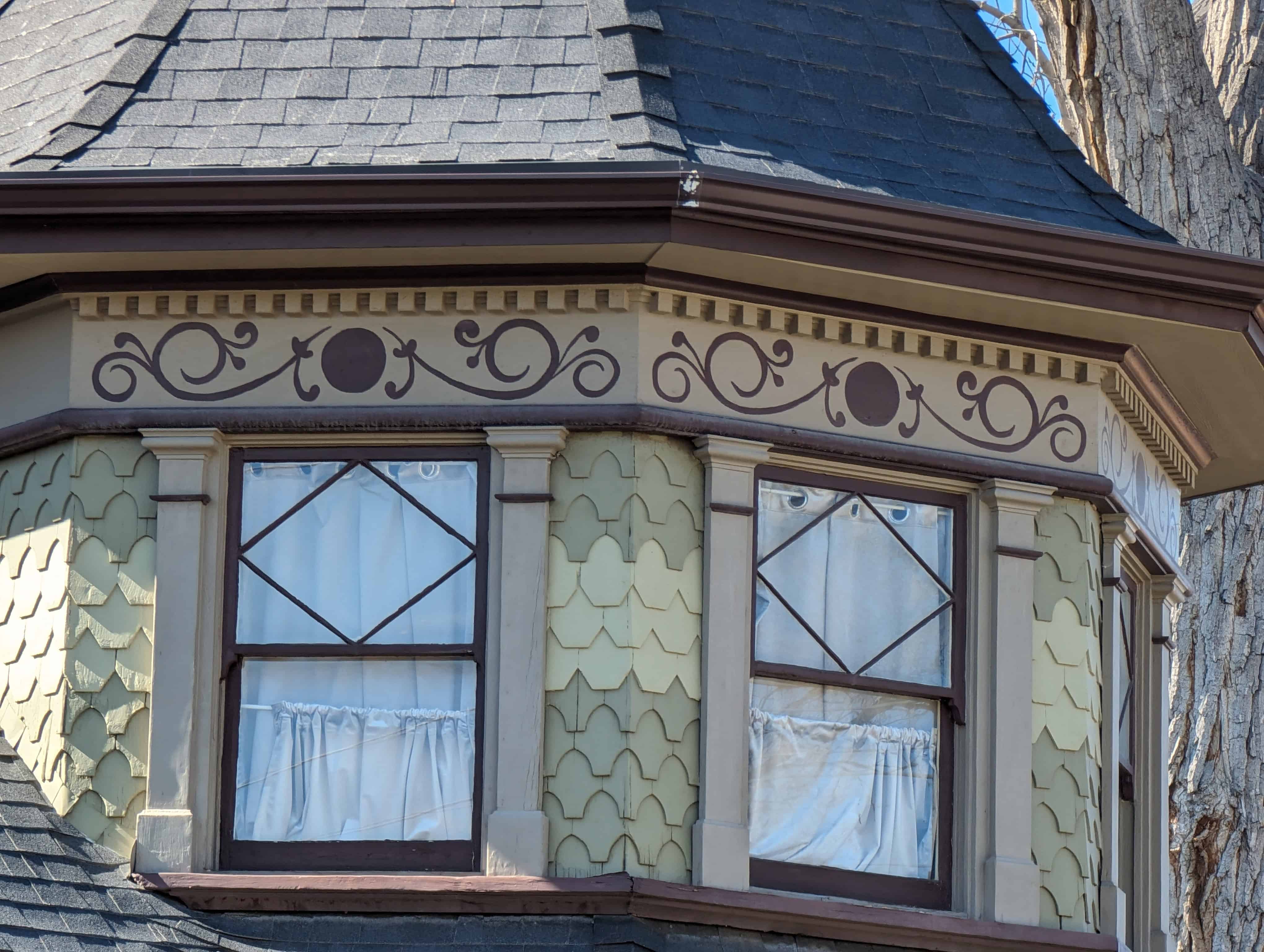
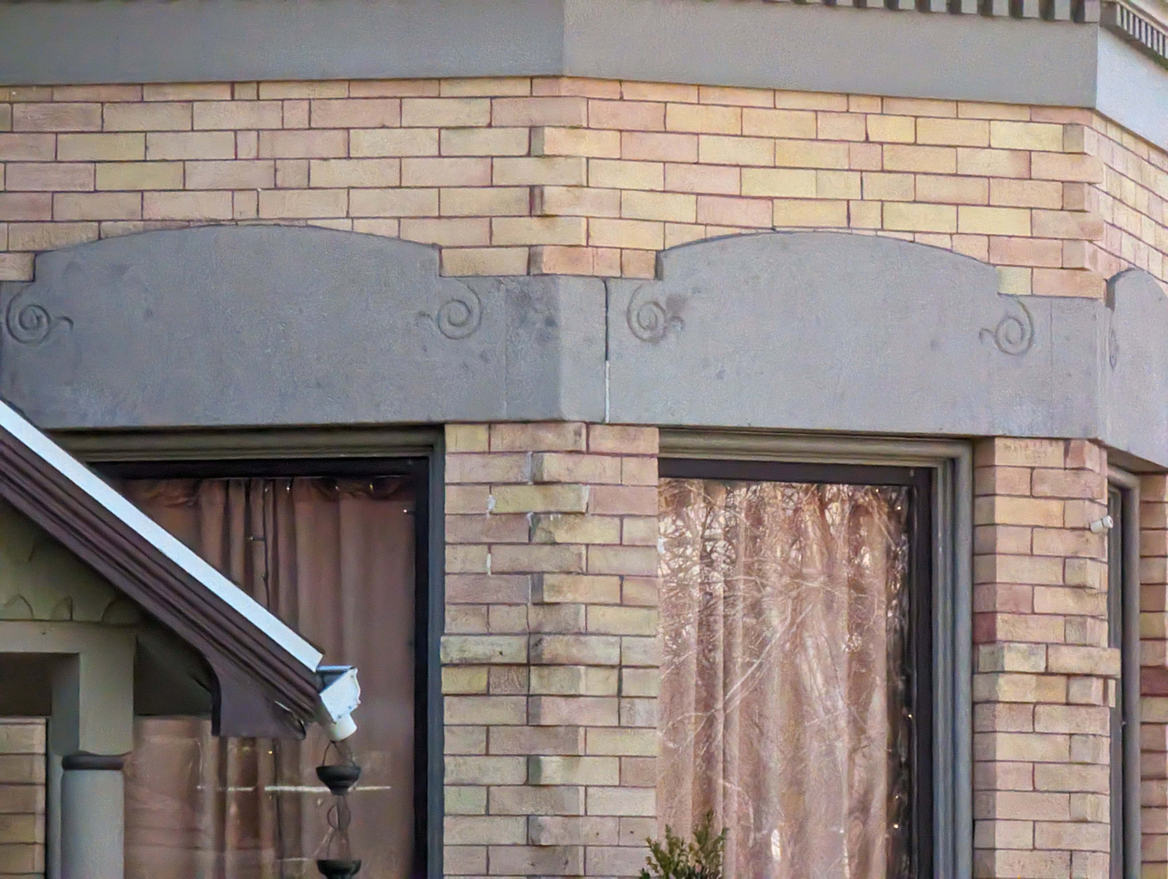
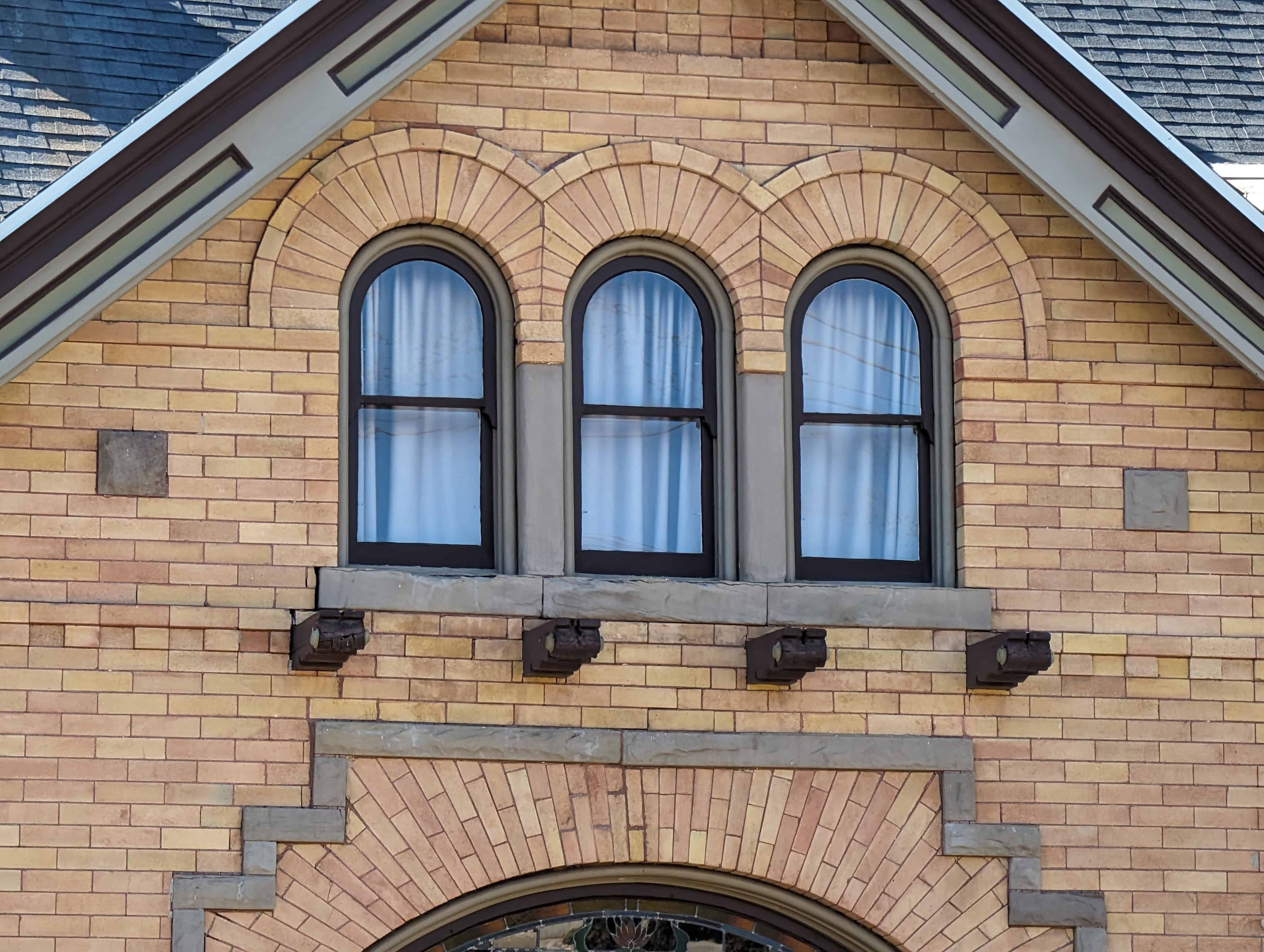
Gilmer Park Historic District contains large number of excellent examples of the styles popular in Salt Lake City and Utah during the period of significance, 1909-43. The houses display the craftsmanship of design and construction materials associated with the era of the significant period. Attention was paid to the quality of design and cohesiveness in the neighborhood. The residential building styles are predominantly Period Revival Cottages and Bungalows and portray the sequence of its development and its association with the growth of the city during a progressive era.
The majority of buildings constructed in the district were bungalows and period revival cottages. Nearly twenty-nine percent of the homes are bungalows, either Arts and Crafts or Prairie School. These styles were popular in Utah from 1905-25 and incorporated many similar stylistic features such as low, hipped roofs and wide, overhanging eaves. The wide porches help to create an impression of informal living and unite the houses to their sites. The bungalow plan is open, informal, and economical and became the basic middle-class house, replacing the late-nineteenth century Victorian cottage. Like the Victorian style, the bungalow’s popularity can be attributed to the widespread use of architectural pattern books and a corresponding period of economic prosperity when many families were purchasing their first homes.
Approximately sixty-four percent of the homes in the district are Period Revival English Cottages, English Tudor, and Colonial Revival homes. Period Revival styles were popular in Salt Lake City and throughout Utah primarily between 1920-40. Most of the Period Revival homes in Gilmer Park Historic District were constructed in the 1920s. A possible reason for the rise in popularity of the Period Revival style may have resulted from national pride following World War I which led to its increased use. English Tudor, Spanish Revival, and French Norman styles were most likely imported by soldiers returning from the war in Europe. These designs were based primarily on external decorative features rather than the historical building and planning traditions and “were simplistically massed, suggesting the informality that various architectural writers of the period stated was appropriate to the American way of life.”
PROMINENT RESIDENTS OF GILMER PARK HISTORIC DISTRICT
Gilmer Park Historic District is also significant because of its association with prominent residents who contributed to the growth and progress of Salt Lake City and the state. The influx of professionals were an indication of the progress the city was experiencing and greatly influenced the growth and social fabric of the neighborhood and ensured its viability. The neighborhood has been home to many of Salt Lake City’s prominent residents who were influential in business, politics, art, architecture, medicine, law, education, and religion.
A look at the lives of many of the residents in the district reveals that the district was home to many prominent citizens involved in business, politics, architecture, art, law, medicine, education, and LDS Church activities. Those who chose to make Gilmer Park their home came from all walks of life, although residents were generally upper-middle class.
Many Gilmer Park Historic District residents were politically influential. Wilson McCarthy, state senator, governmental appointee, and president of Denver and Rio Grande Railroad, lived at 974 South 1300 East between 1924-32. Elise F. Musser, state senator and governmental appointee, and her husband Burton W. Musser, state senator and attorney, resided at 1133 Harvard Avenue. Elise lived there until her death in 1967 and Burton lived there through the 1980s. Elizabeth P. Hayward, also politically active as a state legislator and with the Democratic National Committee, lived at 1140 Herbert Avenue between 1917-28. Finally, Herbert B. Maw, a former governor of Utah, lived at 1212 Yale Avenue between 1939-80s.
A number of residents were prominent in business. Earl F. Free (1205 Gilmer Drive) was the founder and manager of Carbo-Chemical Group and also Hygeia Ice Company. Harold H. Bennett lived at 1187 Harvard Avenue between 1930 and the 1980s and was the president of Zion Cooperative Mercantile Institution (ZCMI). Samuel H. Sharman (1159 Gilmer Drive, 1925-38) was vice-president and general manager of Sharman Automobile Company and was also a nationally famous trap-shooter. Between 1922-36, Simon Rosenblatt, vice-president of Eimco and founder of Grand Central Stores, lived at 1277 Yale Avenue.
A University of Utah economics professor and governmental appointee, Mark H. Green, lived at 1127 East Alpine Place between 1933-49. Other professionals who lived in the area included Walter M. Stookey (1270 Yale Avenue, 1923-35) and Rush B. Stevens (1236 Yale Avenue, 1924- 37) who were physicians, and Murray P. Rock (1120 Yale Avenue, 1922-27) who was a dentist.
Many residents were also known for their accomplishments in art and architecture. Gilbert P. Riswold (1252 Gilmer Drive, 1924-31) was a sculptor. Three prominent Salt Lake City architects lived on 900 South between 1200 and 1300 East on what has been called “architects row.” Taylor Woolley lived at 1222 East 900 South from 1918 until his death in 1965. His brother-in-law and partner, Clifford P. Evans resided at 1266 East 900 South. Harold W. Burton, of the firm Pope and Burton lived at 1226 East 900 South.
LDS Church leaders also made their home in Gilmer Park Historic District. Richard L. Evans lived at 1032 Douglas Street between 1936-71 and was best known as the radio announcer for the nationally broadcast radio program, “Music and the Spoken Word.” Sterling W. Sill who resided at 1264 Yale Avenue from 1935 through the 1980s was bishop of the Garden Park Ward and a member of the Quorum of the Seventy. Adam S. Bennion was a member of the Council of the Twelve and a United States Senate candidate who lived at 1183 Herbert Avenue between 1918-58. Joseph Fielding Smith (998 Douglas Street, 1926-53) was the tenth LDS Church president.
SUMMARY:
Gilmer Parks’ distinctiveness lies in its break with the street grid pattern that dominated the development of Utah cities. Rich in history and architectural significance, the Gilmer Park Historic District is one of the best-preserved and well-designed twentieth-century suburban neighborhoods in Salt Lake City. The influence of the people who lived in this area is evident through their political and professional affiliations and leadership. The unique qualities of the neighborhood combined with the people who continue to value these qualities remains strong. The original owners resided in their homes in Gilmer Park Historic District for relatively long periods of time. Residents in the neighborhood continue to take great pride in their homes and streets by maintaining their houses and yards. A strong neighborhood association was formed about ten years ago and continues to be very active today.
RESIDENTS OF GILMER PARK
- Bennett, Harold H. – 1187 Harvard Avenue (1930- ); President Z.C.M.I.
- Broberg, Ernest J. – 1261 Yale Avenue (1918-28); Banker
- Gilmer, Jay T. – 1028 S. 1200 E. (1910-16); President of Gilmer Realty Co.
- Hayward, Henry J. – 1140 Herbert Avenue (1918-27); President/Manager of Salt Lake Mill & Construction Co.
- Kelly, Lincoln G. – 1171 Herbert Avenue (1924-68); President of Kelly & Co., accountants
- Nelson, Marion C. – 974 S. 1300 E. (1932-56); Owner/President of Gillham Advertising Agency
- Pembroke, Adrian B. – 1062 Douglas St. (1925-46); President and General Manager of Pembroke Co.
- Robins, Thomas R. – 1246 Gilmer Dr. (1927-42); President of Fabian Brokerage Co., Vice-President of Robins Canning Company
- Rockwood, Julius A. – 950 S. 1300 E. (1940-48); President of A.J. Rockwood Furniture
- Rosenblatt, Simon – 1277 Yale Avenue. (1922-36); Eimco Vice-President
- Russell, John H. – 1120 Yale Avenue (1927-43); Manager of Metropolitan Life Insurance Co.
- Sharman, Samuel H. – 1159 Gilmer Dr. (1925-38); President of Sharman Automobile Company, 1924 Olympic team member
- Vincent, Joseph G. – 1220 Yale Avenue (1927-36); Restaurant entrepreneur, President of Vincent-Peterson Co., developers
- Warshaw, Maurice – 1270 Yale Avenue (1935-55; Founder of Grand Central Stores
- Woolley, Albaroni H. – 1244 E. 900 S. (1924-55); Z.C.M.I. department manager and board of directors member
POLITICS:
- Hayward, Elizabeth P. – 1140 Herbert Avenue (1918-27); State Legislator, Democratic National Committee member
- Maw, Herbert B. – 1212 Yale Avenue (1939-46); Governor of Utah
- McCarthy, Wilson – 974 S. 1300 E. (1924-32); State Senator, Governmental Appointee, President of D.&R.G.W. Railroad
- Musser, Burton W. – 1133 Harvard Avenue (1924- ); State Senator, Attorney
- Musser, Elise F – 1133 Harvard Avenue (1924-67); State Senator; Governmental Appointee
ARCHITECTS, ARTISTS, DOCTORS, EDUCATORS
- Burton, Harold W. – 1226 E. 900 S. (1918-20); Architect
- Evans, Clifford P. – 1266 E. 900 S. (1921-73); Architect, University of Utah instructor
- Greene, Mark H. – 1127 Alpine Place (1933-49); University of Utah economics professor, Governmental Appointee
- Riswold, Gilbert P. – 1252 Gilmer Dr. (1924-31); Sculptor
- Rock, Murray P. – 1120 Yale Avenue (1922-27); Dentist
- Stevens, Rush B. – 1236 Yale Avenue (1924-37); Physician
- Stookey, Walter M. – 1270 Yale Avenue (1923-35); Physician, Utah historian
- Woolley, Taylor – 1222 E. 900 S. (1918-65); Architect
LD.S. CHURCH OFFICIALS
- Bennion, Adam S. – 1183 Herbert Avenue (1918-58); Member of the Council of the Twelve of the LD.S. Church, U.S. Senate Candidate
- Evans, Richard L. – 1032 Douglas St. (1936-71); Member of Council of the Twelve of the L.D.S. Church, Radio announcer
- Sill, Sterling W. – 1264 Yale Avenue (1935- ); Garden Park Ward Bishop, Member of the Quorum of Seventy of the L.D.S. Church
- Smith, Joseph Fielding – 998 Douglas St. (1926-53); Tenth L.D.S. Church President
HISTORY OF SALT LAKE CITY
The Gilmer Park area was part of a tremendous building boom in Salt Lake City. At the turn of the century, Salt Lake City experienced a major shift in demographic patterns. The population of Salt Lake City increased from 20,000 in the 1880s to well over 92,000 in 1910, and the physical structure of the city rapidly expanded upon higher land to the east and south of the original town grid. The accumulation of a smoke haze over the city had also been a problem in the late 1800s, with coal-fired furnaces and smoke-producing industries exacerbating the problem. During the winter the entire valley was frequently engulfed in a black curtain of smoke particles that marred buildings and clothing. Salt Lake City was so plagued with smoke during the early 1920s that it was nicknamed “the Pittsburgh of the West.” As the population grew, people moved away from the center of town. There was a need and a desire for residents of Salt Lake City to move to higher ground for cleaner air and water. After the problems of acquiring a suitable water supply and sewer system for the bench lands were alleviated, suburban development began to increase. From 1906-30, there were 439 new residential subdivisions platted in Salt Lake City. By 1911 the city consisted of compact residential areas and well-established transportation lines, and in 1922 zoning was established in response to the problems of indiscriminate commercial, industrial, and residential development in all parts of the city.
Nationally the Progressive Era was effecting social changes through governmental reform and the related City Beautiful movement encouraged the design of public spaces that would improve urban life. The movements that defined the early twentieth century, the Progressive Era and the City Beautiful Movement, were also aimed at improving urban life and bringing rational order and efficiency to the forces of progress that had begun in the past century. Private citizens and Salt Lake City’s government moved to join the City Beautiful movement. In 1900, they planted trees in local parks and around the City and County Building, and improved walks and drives in Liberty Park, then considered a showplace of Salt Lake City open spaces. In 1908, due greatly to pressures by the Civic Improvement League, the city established a park board to make Salt Lake into a “City Beautiful”. In 1909 a Parks and Playground Association, with members largely from upper-middle class was formed to provide playgrounds for children. Civic improvements throughout the city included the planting of trees and building of sidewalks.
During the Progressive Era, the first two decades of the twentieth century, Salt Lake City underwent industrialization and urbanization like other cities across the nation. It experienced a shift from an agricultural to a commercial and industrial economy. The city was no longer isolated but was politically and economically integrated into the mainstream of the country. In general, Utah experienced the commercialization of agriculture, the emergence of a substantial business sector, and the development of corporate mining and manufacturing. The combination of agriculture, mining, manufacturing, commerce, and transportation produced prosperity for Salt Lake City.
In the early 1920s Salt Lake City and Utah experienced a postwar World War I economic slump. Although construction, retail trade, transportation, and communication contributed to overall growth, the city experienced an economic plateau in the mid 1920s and did not participate in the national prosperity of that decade. Building, however, was very strong during this period, even with the higher building material prices and interest rates. The demand for new construction was great due to the need for private homes, the building of which had been curtailed during the war. Gilmer Park Historic District provides evidence of this period of building.