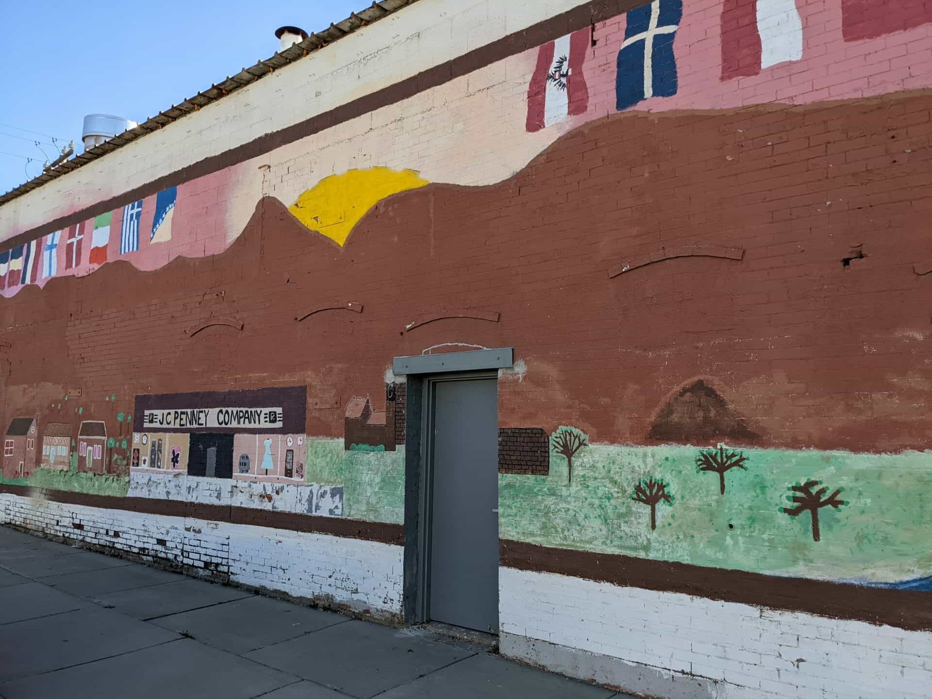
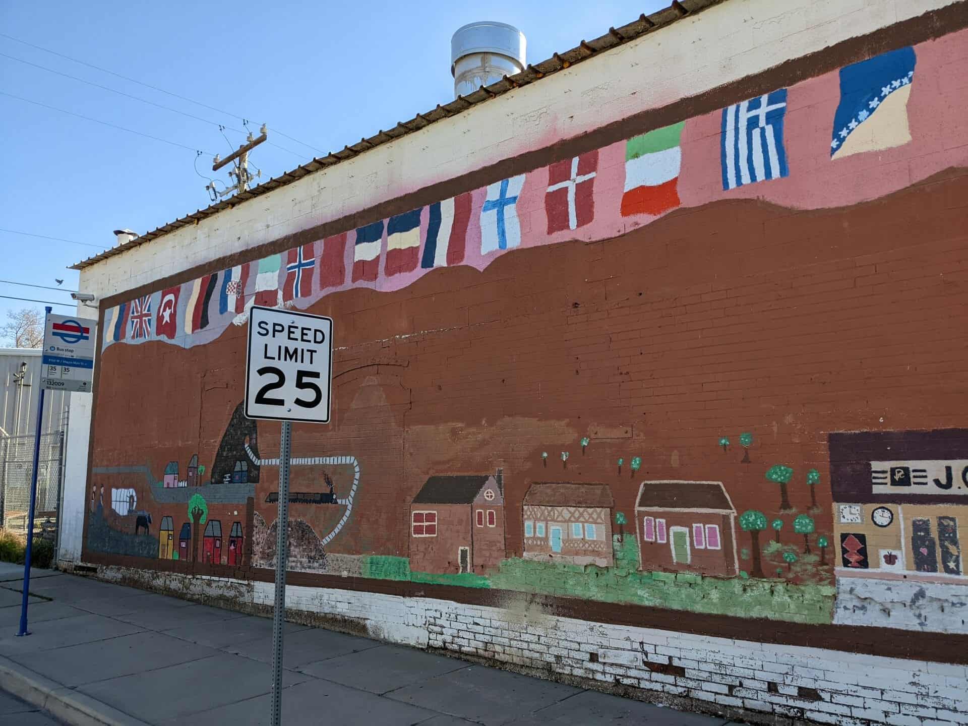
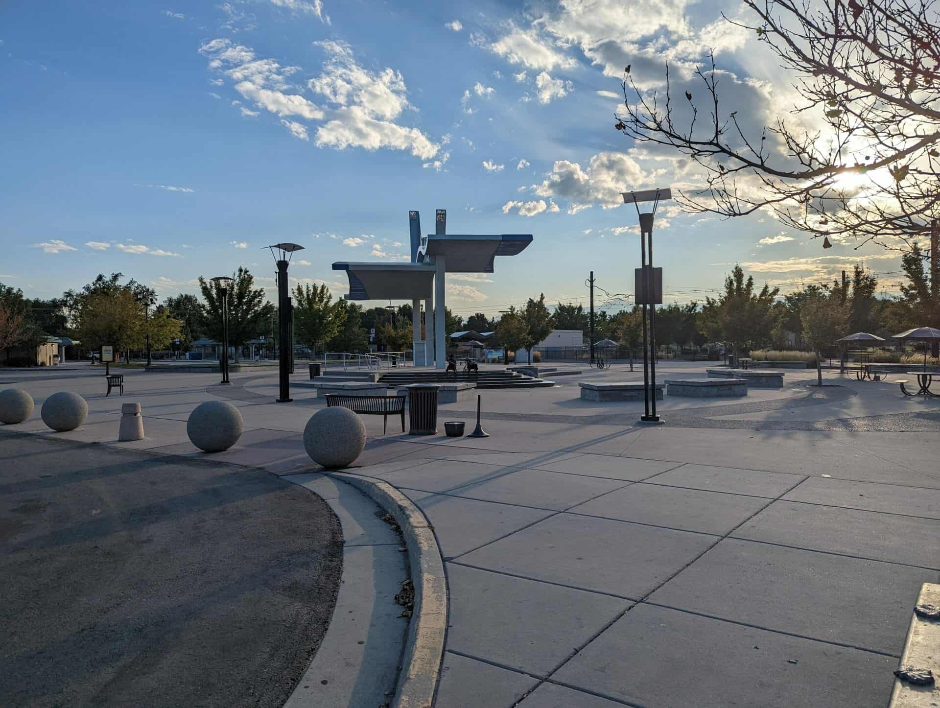
Alzheimers Park
265 South 1200 West in the Poplar Grove neighborhood in Salt Lake City, Utah
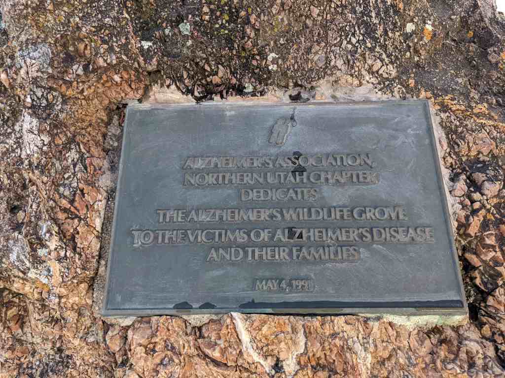
Alzheimer’s Association
Northern Utah Chapter
Dedicates
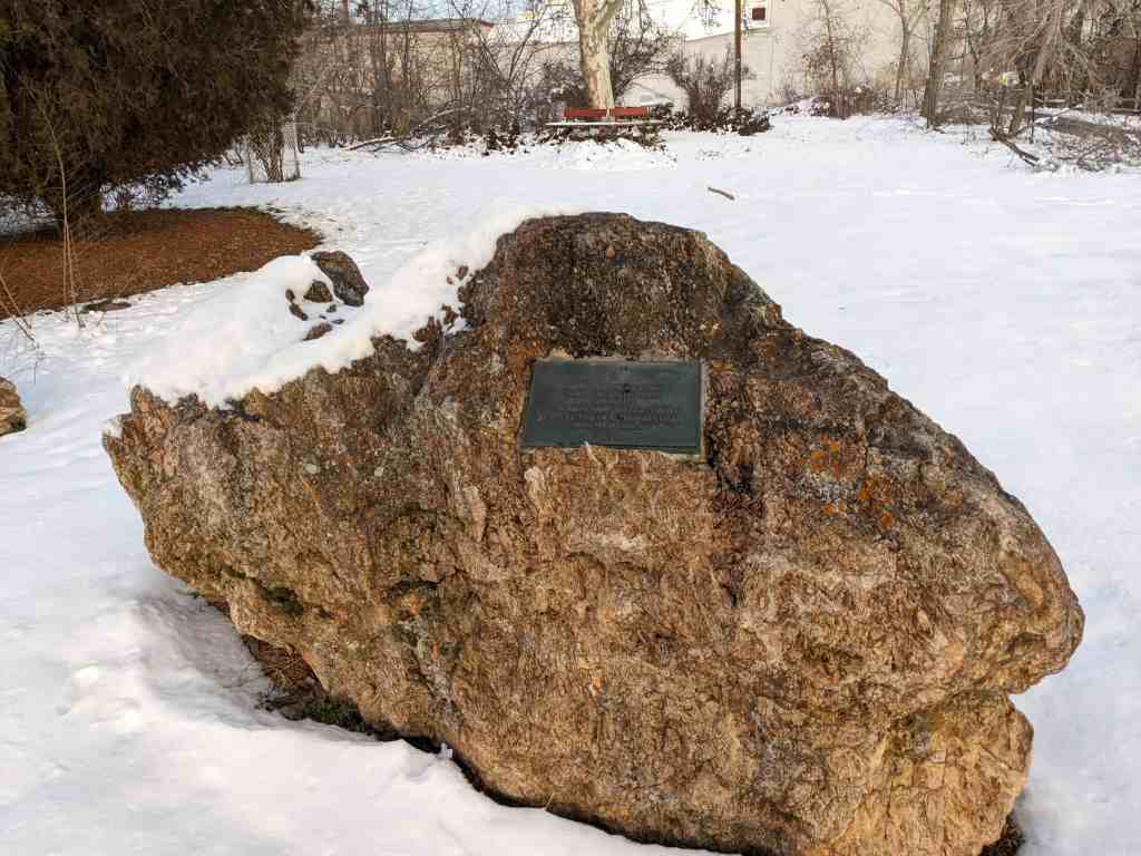
The Alzheimer’s Wildlife Grove
To the victims of Alzheimer’s disease
and their families
May 4, 1991

07 Thursday Mar 2024
Posted in Uncategorized
Alzheimers Park
265 South 1200 West in the Poplar Grove neighborhood in Salt Lake City, Utah
Alzheimer’s Association
Northern Utah Chapter
Dedicates
The Alzheimer’s Wildlife Grove
To the victims of Alzheimer’s disease
and their families
May 4, 1991
26 Monday Feb 2024
Posted in Uncategorized
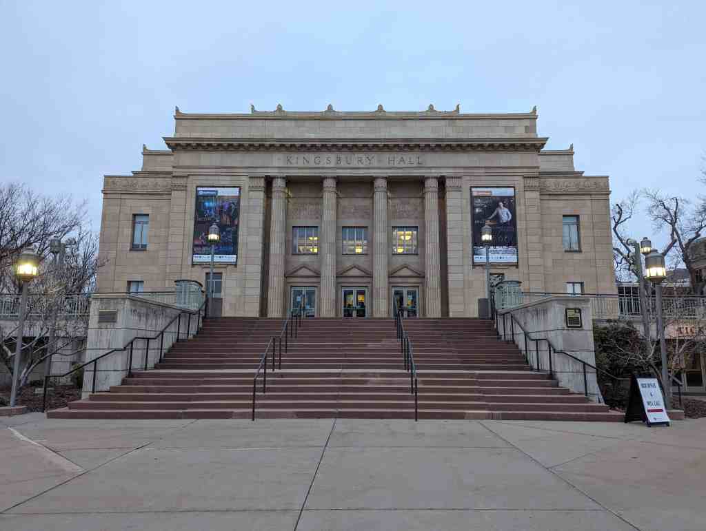
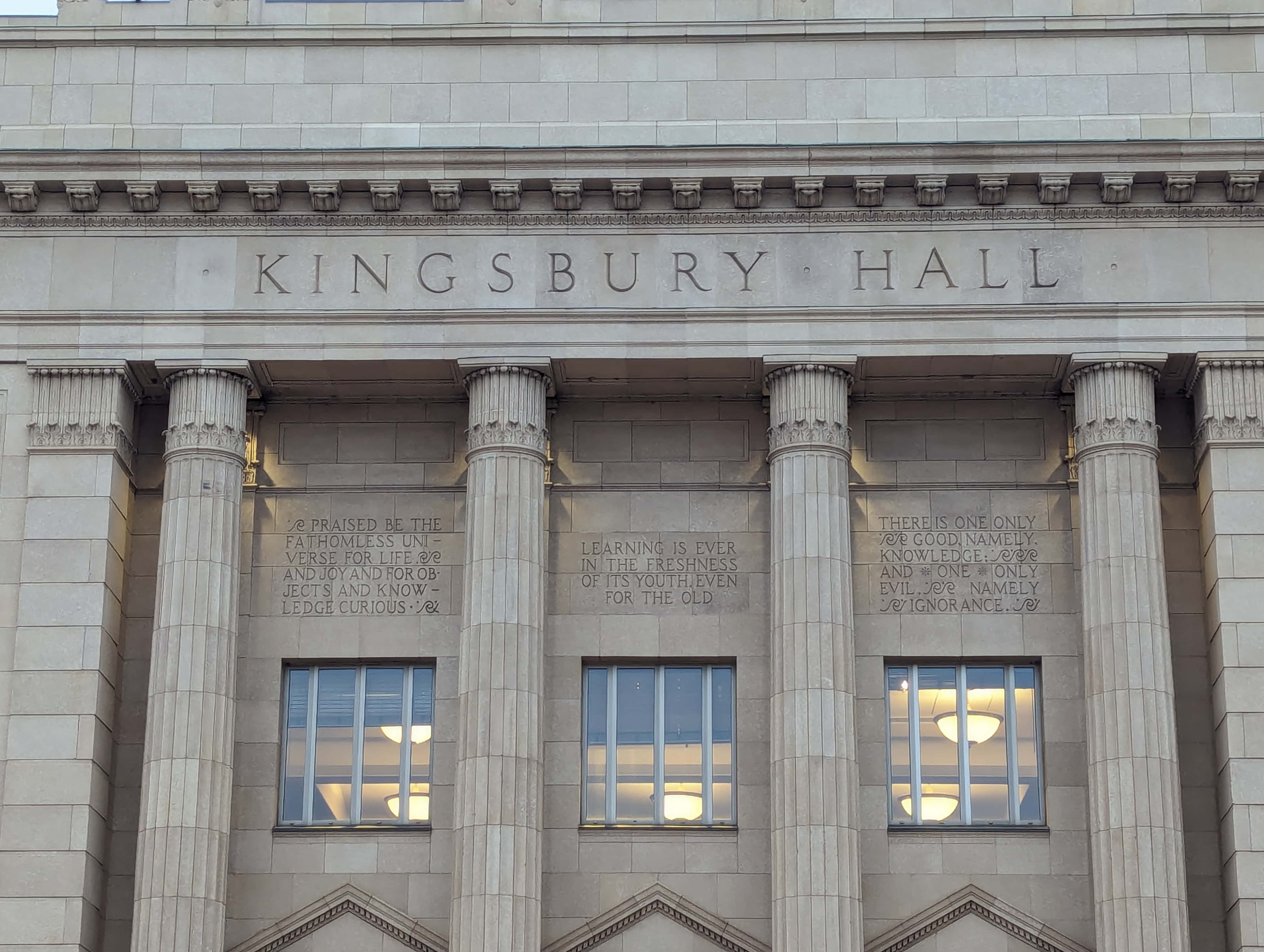
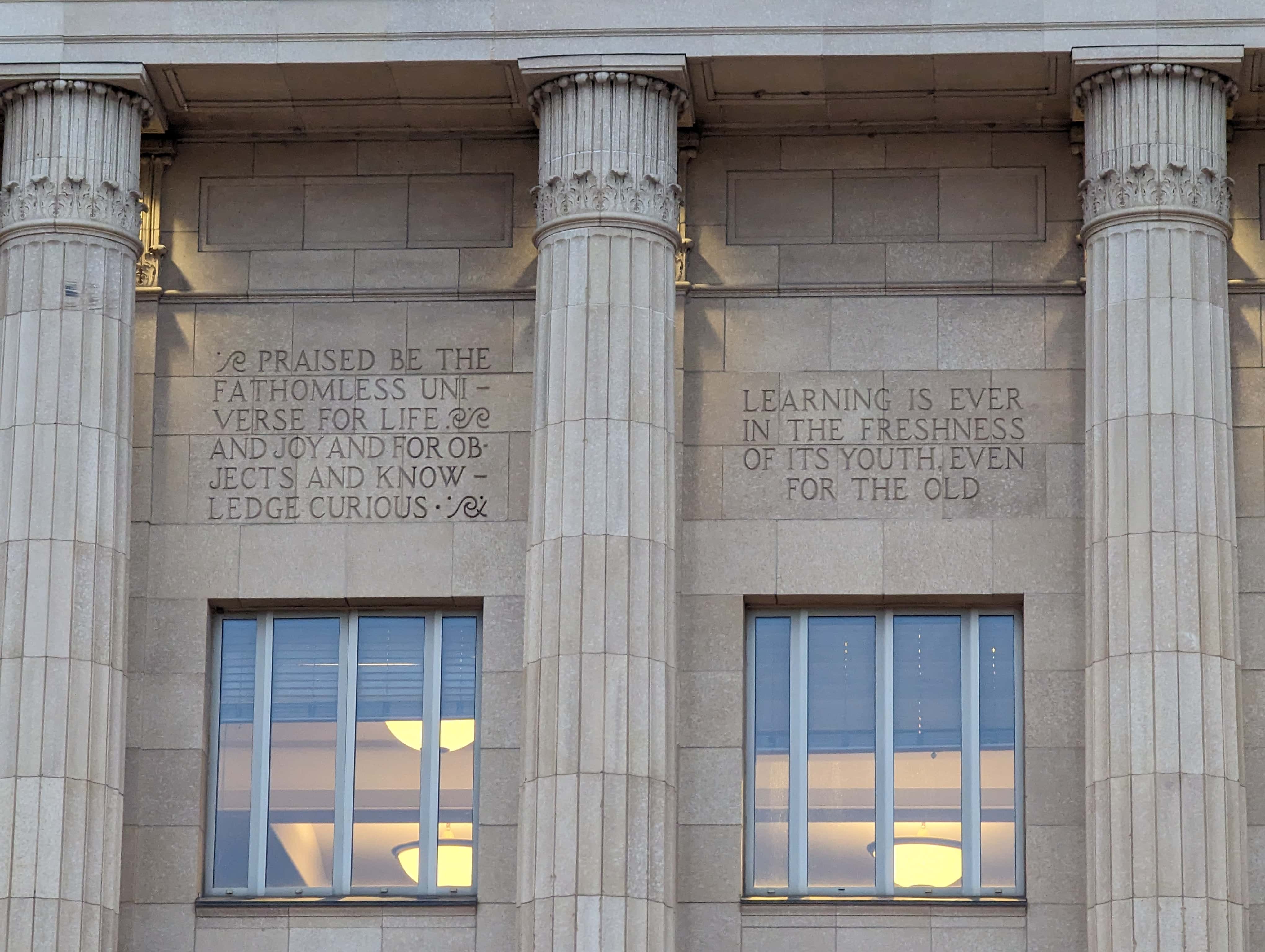
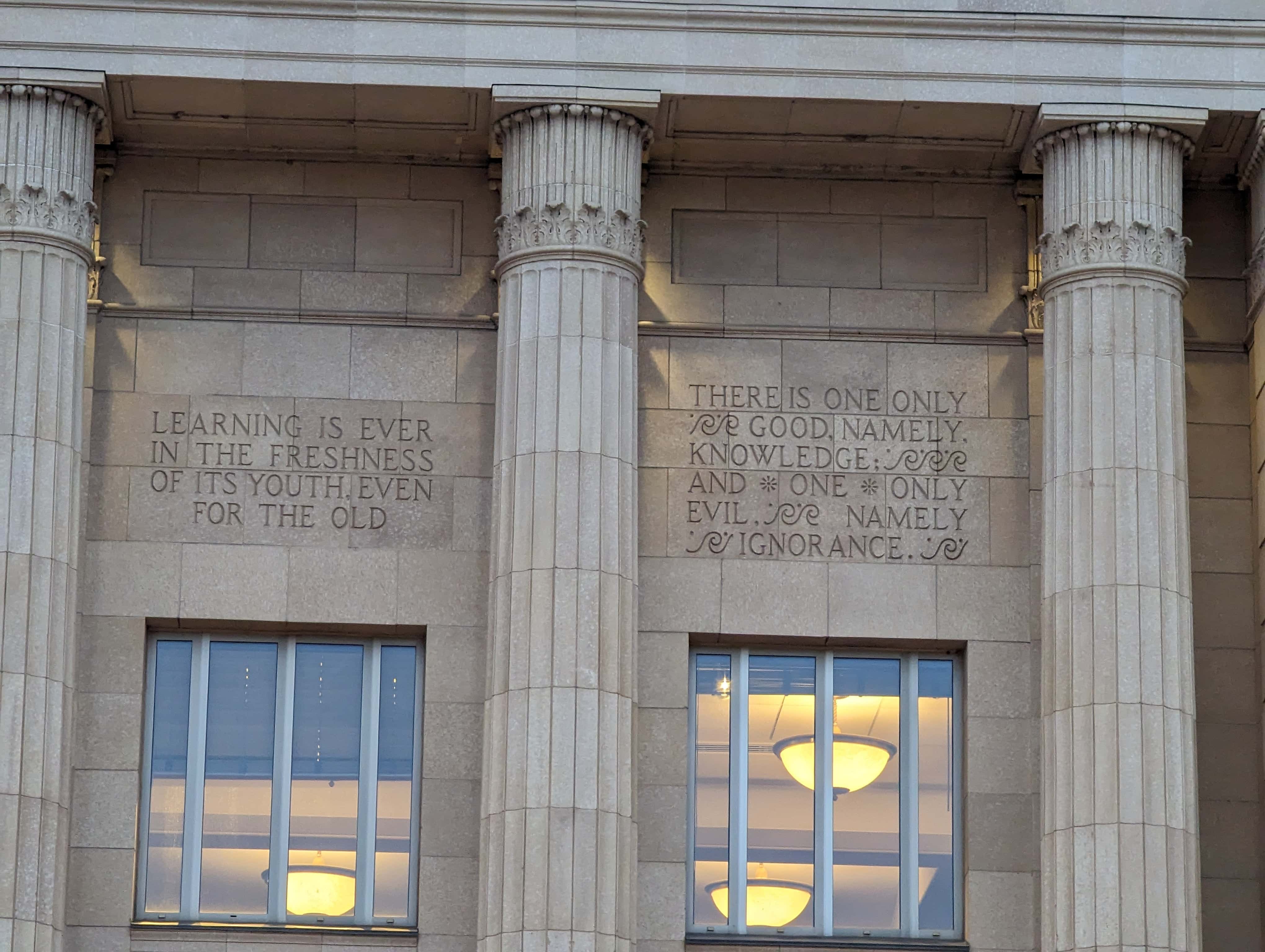
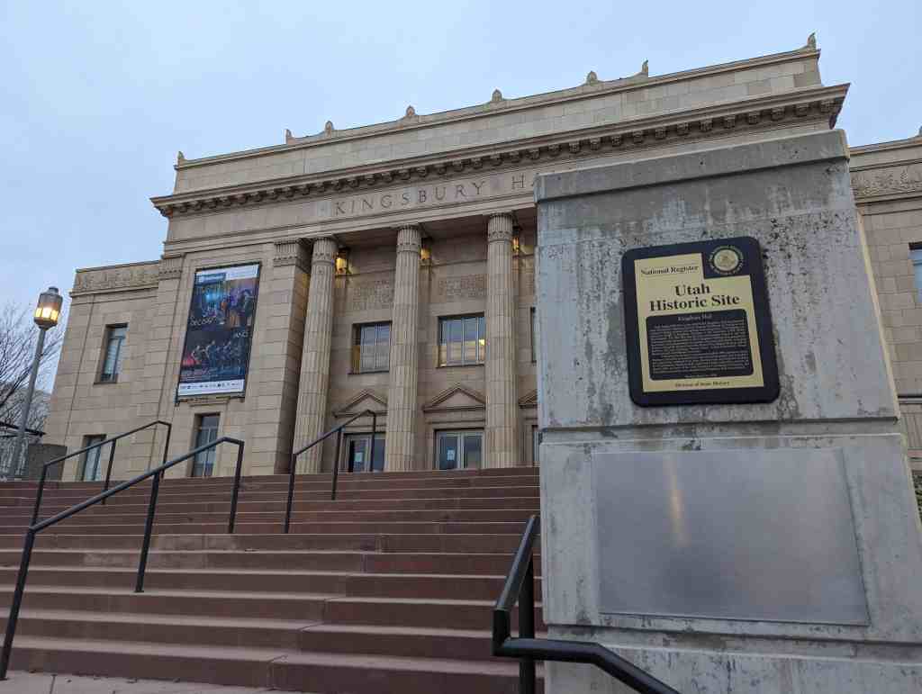
Kingsbury Hall
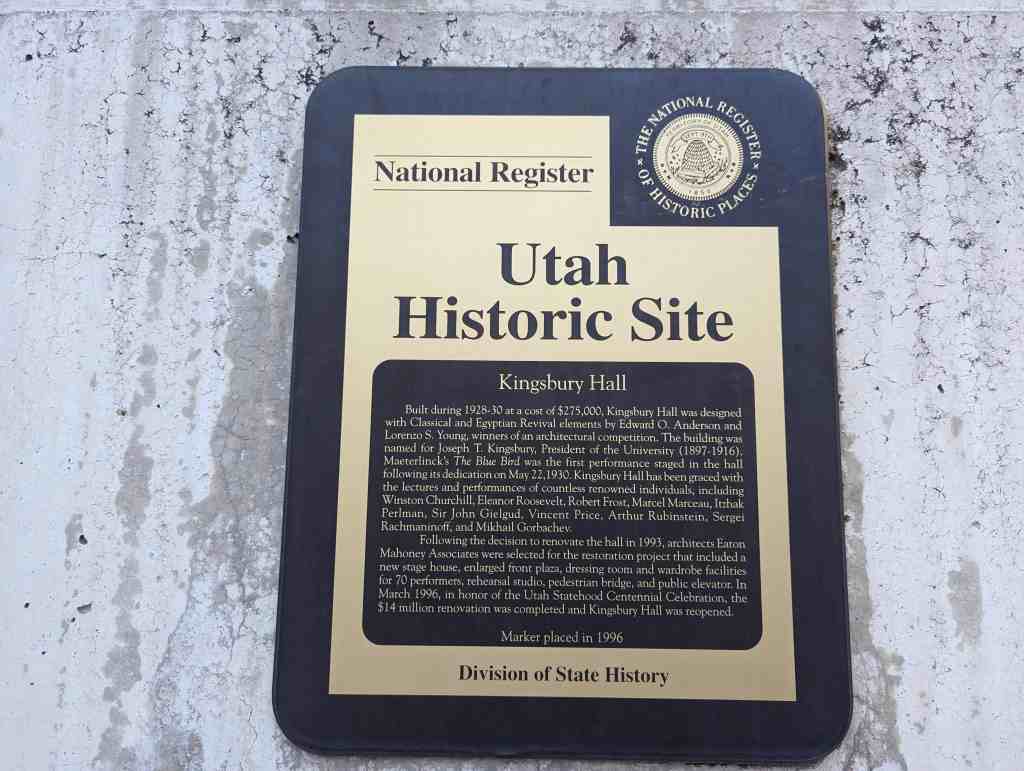
Built during 1928-30 at a cost of $275,000, Kingsbury Hall was designed with Classical and Egyptian Revival elements by Edward O. Anderson and Lorenzo S. Young, winners of an architectural competition. The building was named for Joseph T. Kingsbury, President of the University (1897-1916). Maeterlinck’s The Blue Bird was the first performance staged in the hall following its dedication on May 22,1930. Kingsbury Hall has been graced with the lectures and performances of countless renowned individuals, including Winston Churchill, Eleanor Roosevelt, Robert Frost, Marcel Marceau, Itzhak Perlman, Sir John Gielgud, Vincent Price, Arthur Rubinstein, Sergei Rachmaninoff, and Mikhail Gorbachev.
Following the decision to renovate the hall in 1993, architects Eaton Mahoney Associates were selected for the restoration project that included a new stage house, enlarged front plaza, dressing room and wardrobe facilities for 70 performers, rehearsal studio, pedestrian bridge, and public elevator. In March 1996, in honor of the Utah Statehood Centennial Celebration, the $14 million renovation was completed and Kingsbury Hall was reopened.
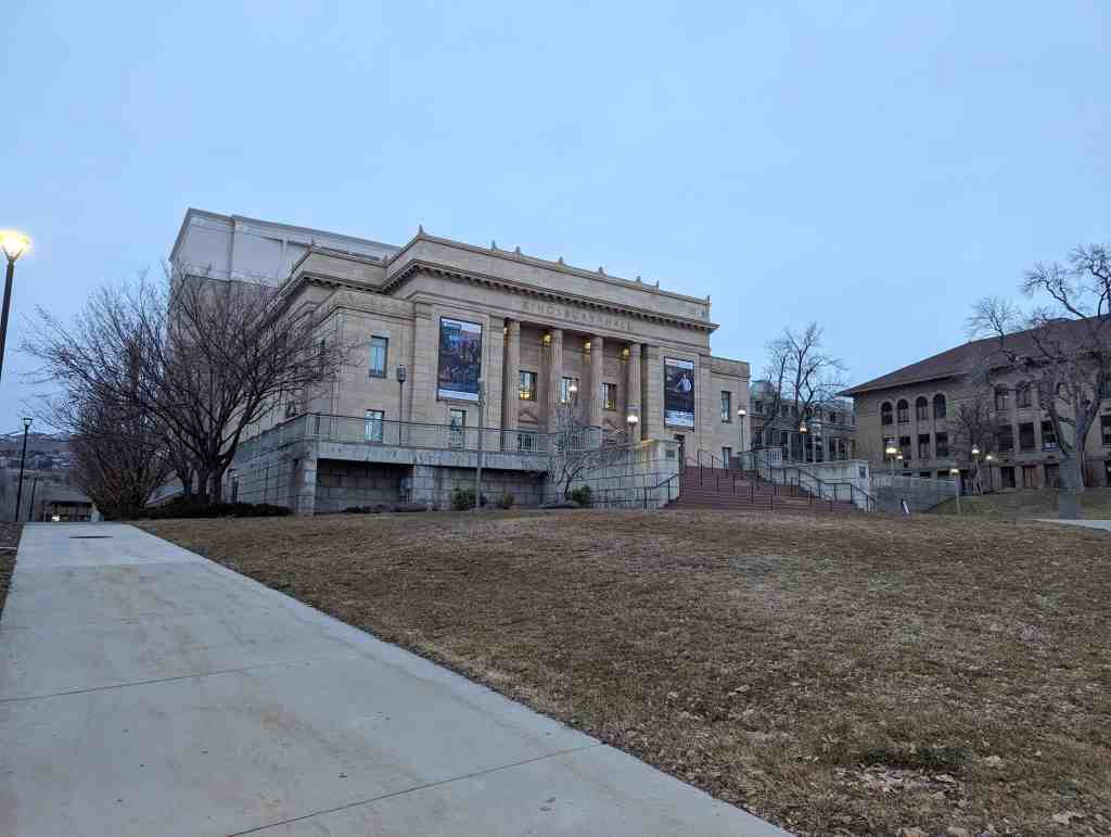
Located at 1395 Presidents’ Circle in the U of U Circle Historic District in Salt Lake City, Utah
13 Tuesday Feb 2024
Posted in Uncategorized
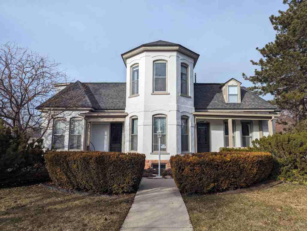
The John M. Whitaker House is significant for its association with its original owner, occupant and namesake, John Mills Whitaker, a man important for his contributions to his church, business, educational and political community. His voluminous journal and papers are a valuable local history resource.
Built in 1889 and located at 975 East Garfield Avenue in Salt Lake City, Utah and added to the National Register of Historic Places (#78002684) on March 30, 1978. The text on this page is from the nomination form when it was added.
Related:
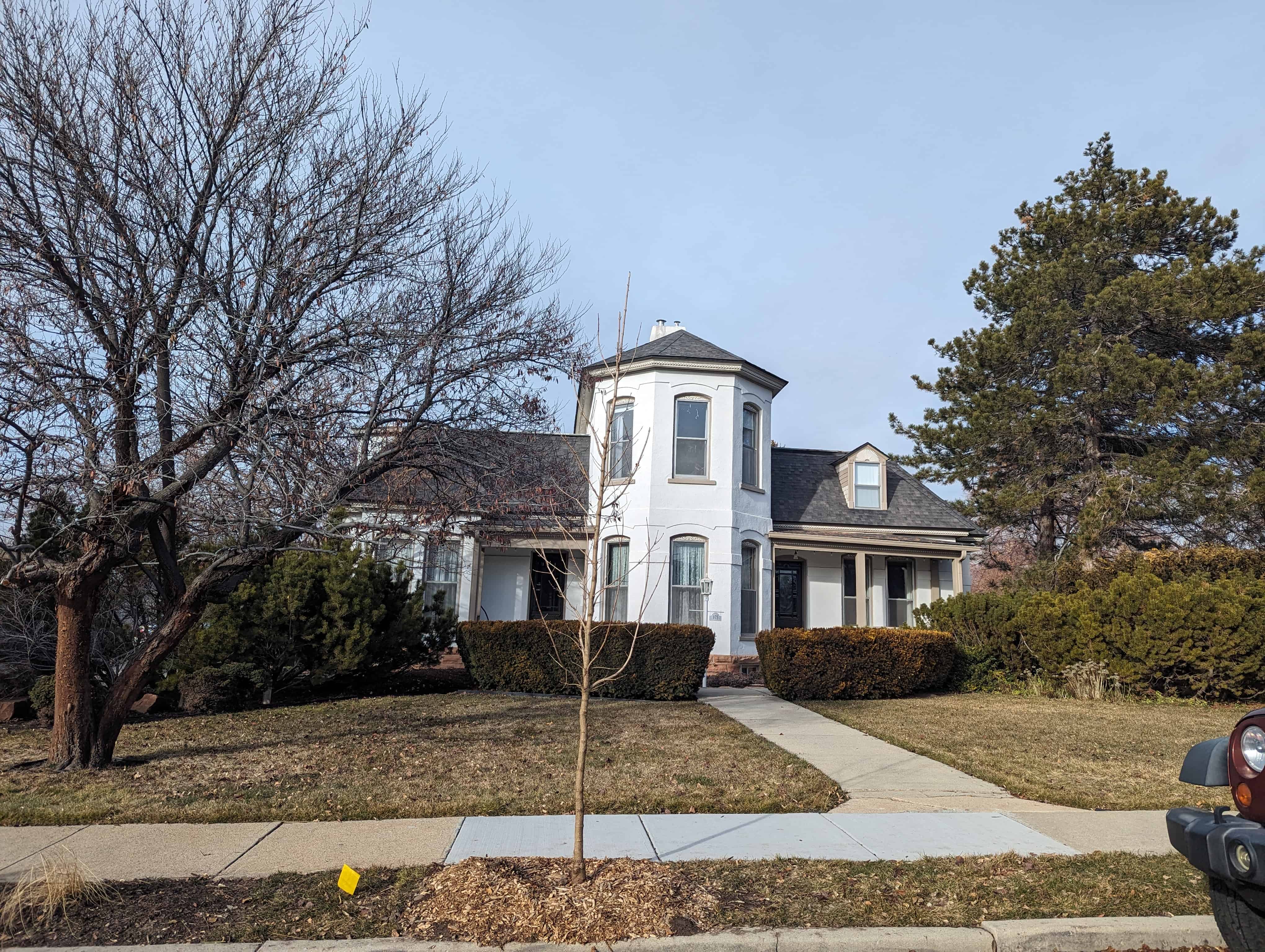
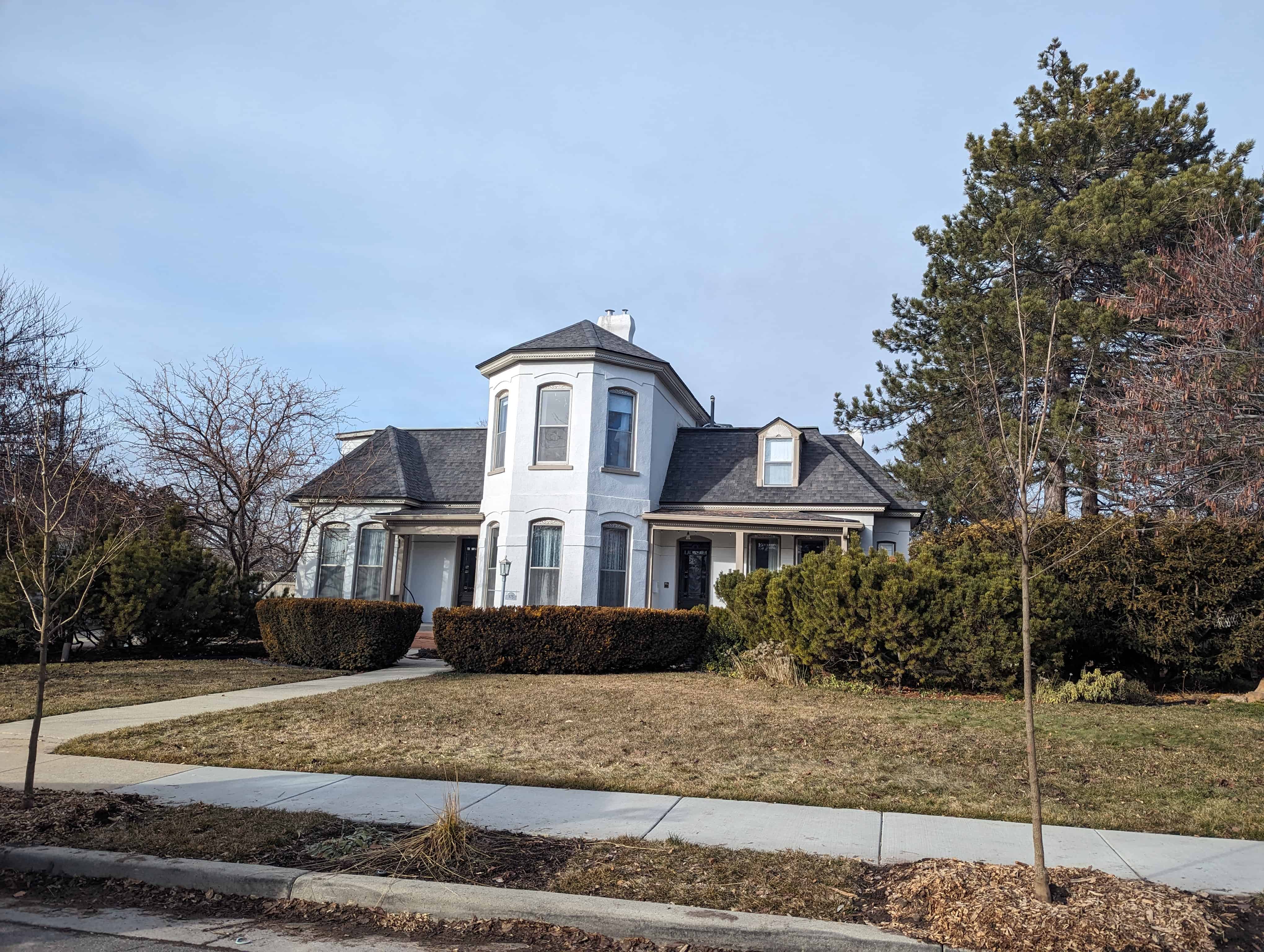
The John M. Whitaker House is a two-story building constructed of brick with stone trim in 1889. The residence follows the High Victorian Italianate style and is well preserved, excepting the stucco sheathing over the exterior brick–an alteration which conceals the original color and texture of much of the exterior. Inside, however, the house is very much intact.
Typical of Victorian era floorplans, the plan of the Whitaker House is irregular, yet it is almost symmetrical with both the east and west wings of the building being identical as to types and layouts of rooms. Each wing has separate front entries. The plan has all of the aspects of a two-family residence or perhaps a “polygamy house.” The central wing of the house has pent corners and is fully two stories tall, while the side wings are one-and-one-half stories in height.
The building has a hip roof and boxed and moulded cornice. The window bays are tall, segmentally arched and contain one-over-one operable sash windows. The wings have shallow, square bay windows. The foundation wall is sandstone. All major entries to the home are recessed and covered by wooden porches which feature carved wooden trim. The original landscaping is intact, the trees and shrubbery now being fully matured and very large. A photograph of the building taken shortly after construction shows the original appearance of the home and its yard.
Of its architectural features, the interior of the Whitaker House is most impressive Several fireplaces with ornamental wood mantels and front pieces, tile hearths, and stamped metal hoods are extant. A variety of Eastlake doors, as well as window and base trim are intact. The heavy Eastlake stair rails and balusters, high ceilings, wood floor and original hardware also remain in most areas of the building.
The original contract with T. O. and T. J. Angell, October 17, 1889, is extant and specified the “best of materials, Oregon pine studs, and maple, walnut or mahogany banister.” The contract also mentions a spring, a well, and plumbing and indicated “the house will be built at a cost of $4,575.”
John M. Whitaker was an active and prominent member of the Church of Jesus Christ of Latter-day Saints during its early years in the Salt Lake Valley. During his lifetime he saw the church emerge from the trying pre-manifesto days to its present condition. As a young man Whitaker knew intimately men whose lives reached back far beyond Civil War days. He was acquainted with Mormon Church President John Taylor and married his daughter Ida in 1886. He worked with John Young, son of Brigham Young, on some of the great railroad projects of Utah. Whitaker witnessed the dedication of the Salt Lake Temple and saw Utah enter into statehood. As one of the early residents of the Sugarhouse area, Whitaker developed what came to be known as the Verona Water System, the earliest supply of water in that location.
The papers of John M. Whitaker contain the many facets of his long life: missionary, bishop, patriarch, teacher and speaker in the L.D.S. Church as well as horticulturist, builder, educator, politician, businessman and diarist.
His business life included employment as the secretary of John W. Young and the building of the Salt Lake and Eastern Railway, manager of the Taylor Brothers Real Estate Company, assistant secretary and ticket and passenger agent of the Utah Light and Railway Company. He later became head of the office of the Utah Light and Railway Company (Utah Power and Light) , manager of the Deseret Employment Bureau, and Civic Employment Bureau and paymaster for the Civic Works Administration.
Whitaker was best known for his role in church activities and administration. He faithfully recorded what he saw and heard, and carefully preserved written information of all kinds. For fifty years he recorded for the press all the General Conferences of the Church of Jesus Christ of Latter-day Saints. He also initiated the tremendous growth of the seminary movement in the Mormon Church. His seminary teaching, the establishment of a Free Public Library which later became the Salt Lake Stake Library and his activities during the depression with unemployment in church and state marked the beginning of the ward, stake, and general welfare program of the Mormon Church.
During the polygamy persecutions when several church officials went into hiding Whitaker absorbed some of their responsibilities in their absence. This resulted in his work in the L.D.S. Church Historian’s Office and his long involvement recording and editing church history.
After the passage of the Edmunds-Tucker Law in 1887 the L.D.S. Church was disincorporated and Whitaker was out of work. He began employment with the Salt Lake Herald, the Cannon Brothers Real Estate Company, and gave private shorthand lessons, being an expert in that field.
In 1889 Whitaker was appointed to several prestigious offices in his church. It was also at this time that he became interested in politics. He worked for Senator Reed Smoot and made great efforts with lectures and press articles to defend B. H. Roberts in his fight to gain a seat in the United States Congress. He also defended and proselyted for Mormonism and became active in the prohibition movement, helping to organize the Utah Federation of Prohibition and Betterment League, later becoming its president in 1914. In addition, Whitaker was the first deputy treasurer of Salt Lake County. Whitaker’s last few years were concerned with seminary teaching, the initiation of the Church Welfare Plan and gardening. On April 2, 1960, John Mills Whitaker died at the age of 96.
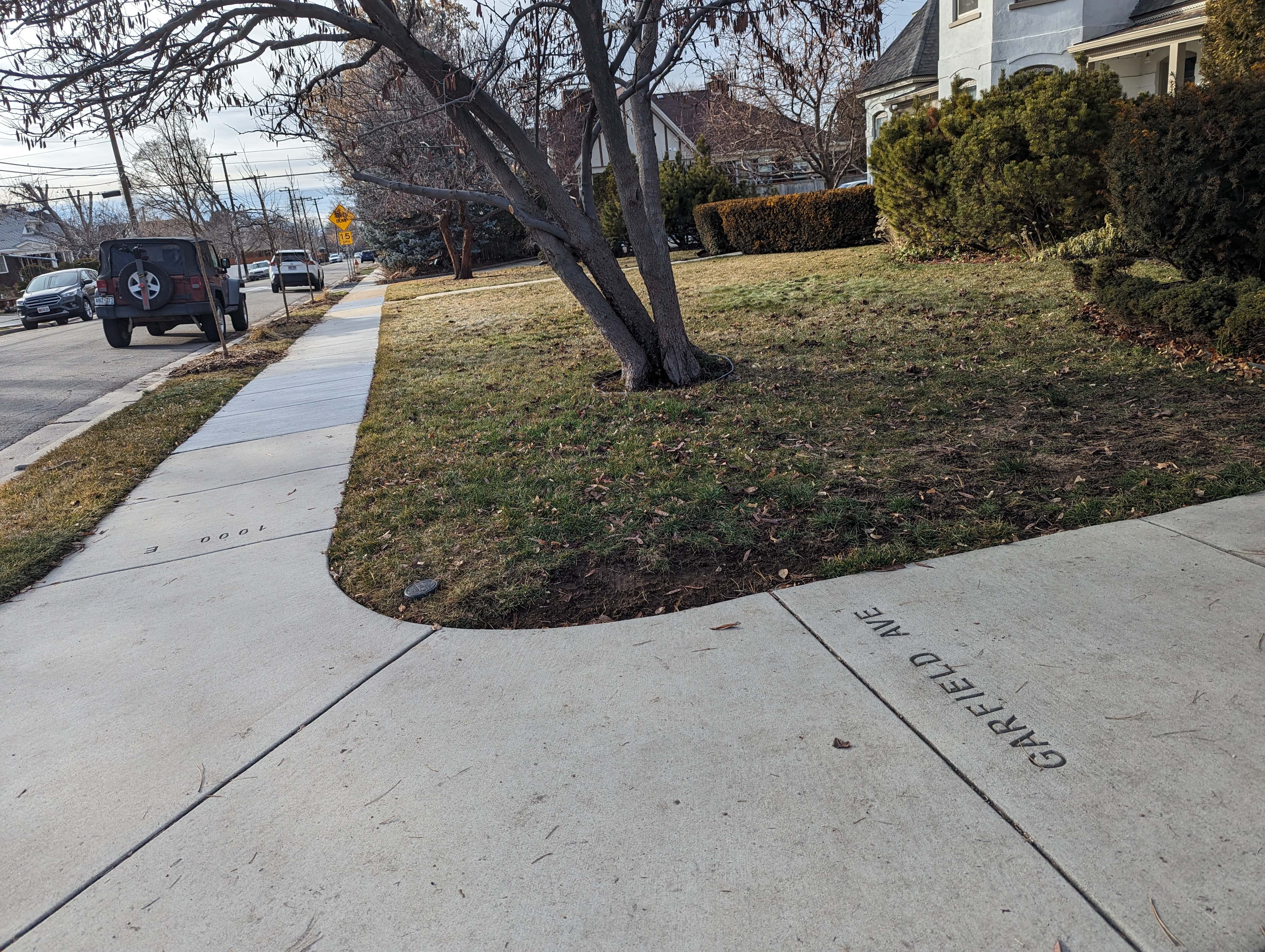


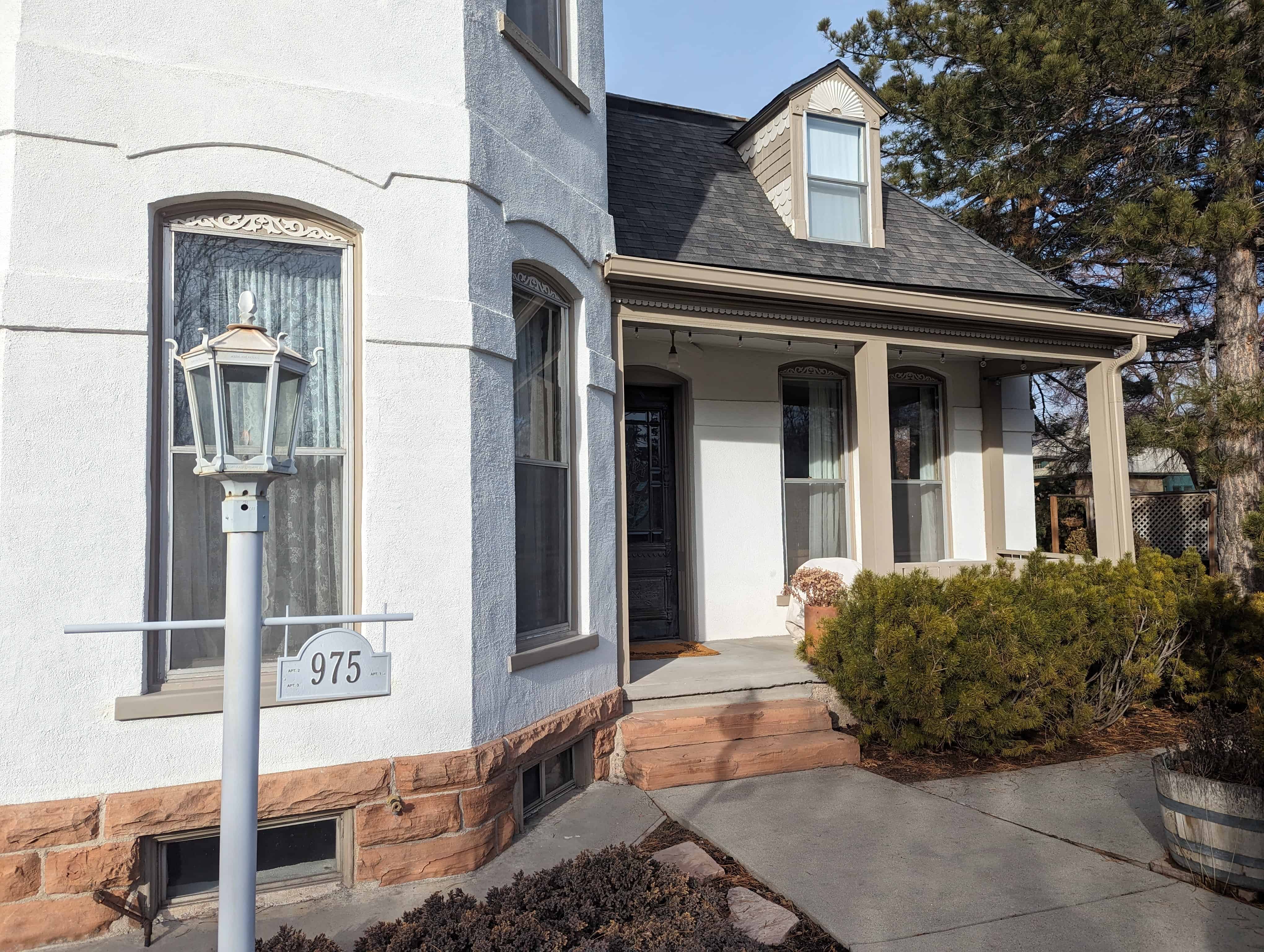

The following chronology outlines the life and accomplishments of John M. Whitaker:
October 16, 1863. He was born at Centerville, Utah, the son of Thomas William Whitaker and Elizabeth (Oakden) Mills Whitaker. His youth was spent in Centerville and Ogden working with his father farming and in carpentry and building. At this time he began his study of Pittman shorthand. His first lessons were from his father.
December 17, 1879. He received a Territorial prize at the Deseret Agricultural and Manufacturing Society Fair for his wood carving of the Lord’s prayer. He was very proficient in carving and scroll work.
1883. He worked in a bank in Ogden for H. S. Young.
August, 1883. He went to Salt Lake City with his father to work in the building trades. He joined the Delta Phi Debating Society at the University of Deseret. He was made secretary. During the evenings he gave shorthand lessons to students. Also he started recording speeches, sermons and the conferences in the Tabernacle, which activities he continued throughout most of his life.
November 7, 1882. He met Ida Taylor, daughter of John Taylor, president of the L.D.S. Church, and Mary Oakley Taylor.
January, 1884. He registered at the University of Deseret as a Normal student. He earned money by giving shorthand lessons, recording sermons and speeches. He was also employed on a part time basis as instructor in phonography (phonetics, shorthand, typewriting and commercial letter writing). He also helped his father. He attended the 14th Ward where he met many Church leaders, contacts which were of benefit to him later.
July 7, 1884. Franklin D. Richards, L.D.S. Church Historian, offered him a part time job which he accepted. During the time of the polygamous persecutions when Richards had to be away, Whitaker was responsible for all the office business.
April 28, 1886. His father, Thomas W. Whitaker, died suddenly of a heart attack in Salt Lake City.
June, 1886. He received his two-year Normal degree.
September 22, 1886. He married Ida Taylor. They lived at the Gardo House for a time-while President Taylor was in hiding during the time of polygamy period.
February 23, 1887. He began efforts to establish a Free Library and Reading Room in the Salt Lake Stake.
July 23, 1887. John and Ida’s first child was born. She was named Ida Taylor Whitaker.
July 25, 1887. President John Taylor died while still in hiding over polygamy.
The Church offices closed because of federal pressures. The L.D.S. Church was disincorporated as a result of the Edmunds-Tucker Law passed March 1887. Whitaker was out of work. He was offered part time employment for the Salt Lake Herald, which position he accepted. He also worked for the Cannon Brothers Real Estate Company and other establishments. He continued to give private shorthand classes. At this time he became actively interested in politics. Through his efforts the Salt Lake Stake Library was established.
February 29, 1888. He was asked by John W. Young, owner and manager of the Salt Lake and Fort Douglas Railway to work for him. He became his private secretary and was managing secretary for the railroad. August 30, 1888. He became the purchasing agent for the Salt Lake and Eastern Railway also. This necessitated giving up the University and other work except some reporting for F. D. Richards. September 3, 1888 he was put in charge of the new offices, and on September 22 was made director. October 3 he was in charge of all affairs of John W. Young while Young was in the East.
September 22, 1888. His daughter Mary Taylor was born. She died November 28, 1888.
January 24, 1889. He was called to New York by Young to assist him there.
June 11, 1889. He purchased an acre of ground in Sugarhouse area.
June 24, 1889. He assisted Young in the organization of the Utah-Western Railway Company. He became one of the directors and stockholders.
July 11, 1889. He became secretary and general treasurer of the First Council of Seventy of the Church of Jesus Christ of Latter-day Saints. He was also a member and the secretary of the Sunday School Union Board and secretary to the General Superintendency of the Sunday Schools.
1889. He continued private shorthand classes and wrote out blessings of missionaries for the extra income. During August he taught a class at the University of Utah. He taught the first Commercial course given at the University of Utah.
1889. He was assistant secretary of the Bullion Dust Mining Company.
September, 1889. He turned over to others the work of the Free Library.
October 17, 1889. He let the contract for the building of his home at 975 Garfield Ave.
January 5, 1890. His daughter Elizabeth Taylor was born.
September, 1890. The family moved to their new home in Sugerhouse Ward.
1890. He became very active in promoting learning among the young people. He was soon elected a trustee of the Twenty-ninth School District.
August 18, 1891. His daughter Marguerite Taylor was born.
1891. He was still actively interested in politics. He also recorded many speeches of visiting celebrities.
June 3, 1893. He received his teaching certificate from the University of Utah.
November 6, 1892. His son John Taylor was born.
1895. He was one of the reporters for the Constitutional Convention. He voted “Yes” for Utah to become a state.
February 23, 1896. His son Leon Taylor was born. Died, April 13 of whooping cough.
November, 1896. He cast his first vote for the President of the United States.
May 5, 1897. His daughter Janette Taylor was born.
August 18, 1897. He was called on a mission to the Eastern States Mission. He left December 3, 1897.
1898. He was in charge of the elders of New Jersey. He lectured, wrote press articles and his first pamphlet, “The Plan of Salvation.” May 1898. He was appointed president of the New England Conference. He organized the first L.D.S. Sunday School in Providence, Rhode Island.
May, 1899. William H. Smart, president of the Eastern States Mission, called John Whitaker to Boston to act as his assistant. His assignment was to systematize the Mission records, write histories of the conferences and also a general history of the Mission. During all this time he made great efforts with lectures and press articles to defend B. H. Roberts in his fight to gain his seat in Congress. He also did the same in defending and proselyting for Mormonism.
January 20, 1900. He was released from his mission after 25 months in the field.
November 24, 1900. His son Eugene Taylor was born.
February 1900. He was appointed second counselor to the bishop of Sugarhouse Ward. January 1902. He was appointed first counselor.
February 7, 1901. His son John T. Died of diphtheria.
1902. He became the first deputy treasurer of Salt Lake County.
1903. He was a worker for Reed Smoot, Senator. He was one of the committee to go to Washington to plead the case.
July 26, 1904. His son Edison was born.
January 1905. He was made bishop of Sugarhouse Ward.
March, 1905. He became assistant secretary and ticket and passenger agent of the new Consolidated Light and Railway Company. Later he became head of the office of the Utah Light and Railway (Utah Power and Light Company).
February 9, 1907. He resigned this position to become manager of the Taylor Brothers Real Estate Company. In 1908, Taylor brothers Real Estate was agent in this area for the King Hill Irrigation Project, King Hill, Idaho. Whitaker was actively involved in its preliminary promotion. He and members of the family bought into it.
May 1911. He first expressed his interest in prohibition. He became active in the movement and helped organize the Utah Federation of Prohibition and Betterment League. In 1914 he became its first president.
March 1914. He was released as bishop of the Sugarhouse Ward when it was divided and reorganized. He was selected to be a patriarch.
1915. He was appointed by Frank Y. Taylor as the instructor for the L.D.S. Granite School Seminary. He reorganized the whole curriculum and procedure. With Adam S. Bennion, superintendent of Church Education, George H. Brimhall, president of B.Y.U., and others, he helped develop the church seminary system and curriculum.
April 1917. He proposed having the Seminary students speak in the wards, which activity has continued.
June 10, 1919. He received his Bachelor of Science in Education and his High School Life Diploma from the University of Utah. He continued taking courses in evolution, psychology, science and modern thought under visiting professors.
July 1920. As chairman he conducted the Lecture Program for Seminary Teachers at the B.Y.U. Aspen Grove Summer School. He delivered many of the lectures himself.
June 1921. He was again responsible for the lecture program on “Doctrine of the Church” at B.Y.U. Summer School.
January 15, 1925. He was made chairman of the new Editing Committee on Church History and Doctrines with Sidney B. Sperry, David A. Broadbent, and Enoch Jorgensen.
July-August, 1927. He taught the course “Science and Religion” at B.Y.U. Aspen Grove Summer School.
June 1929. At age 65 he retired from seminary teaching.
November 1927. The family moved from the old home at 975 Gargield where they had lived for 27 years to the newly completed home at 1536 South 13th East.
December 13, 1929. He became the manager of the Deseret Employment Bureau. He immediately put into it the same enthusiasm, systematizing efforts, innovations and hard work as in all his endeavors.
Fall of 1930. He also managed the newly created Civic Employment Bureau. It closed in the spring of 1931, reopened in the fall of 1931, and closed again the next spring of 1932.
August 1932. The Deseret Employment Bureau was placed under the Presiding Bishop’s Office. He was designated as “contact officer.” He also received the tithing in produce under David F. Smith, manager of Growers’ Exchange. Continued through 1936.
1933. He was paymaster for Civic Works Administration. He also taught some seminary classes. 1936. The Welfare Plan of the Church of Jesus Christ of Latter-day Saints was initiated. Whitaker was invited to meet and help in its organization and development. Much of his past work became a basis for its development.
1937. His mother, Elizabeth Mills Whitaker, died in Centerville, at the age of 98 years
1939. The Federal reform program was becoming a program of recovery. This brought about the end of the work with the Presiding Bishop’s Office.
June 1942. He and Ida became members of the University of Utah Emeritus Club. June 7, 1943. He was made its president.
May 22, 1946. On this date occurred the death of his wife, Ida Oakley Whitaker, at their home. She was 86 years old, the last surviving daughter of President John Taylor. He lived alone until 1954. He worked in his garden, with his sons, attended church, did ward teaching, gave blessings, had fireside meetings in his home. He began to organize and write his transcript journal from his many notes, letters, and diaries.
1951. He made a trip to the H. E. Huntington Library at San Marino, California, to see Leslie E. Bliss who was interested in the Whitaker journal. He made arrangements for them to make photostatic copies.
1954. His daughter Bessie and husband Nelson G. Hunt moved in with him. Mr. Hunt died soon after.
1958. He made arrangements with Mr. L. H. Kirkpatrick to send his library and collection of papers, letters, diaries, etc., to the University of Utah Library. Some were turned over to them in 1959 and some were to be given later. The last were received by the Library in 1969.
July 29, 1959. He made his last journal entry.
April 2, 1960. He gave his last blessing. Three hours later he died at his home on 13th East, age 96 years 6 months.
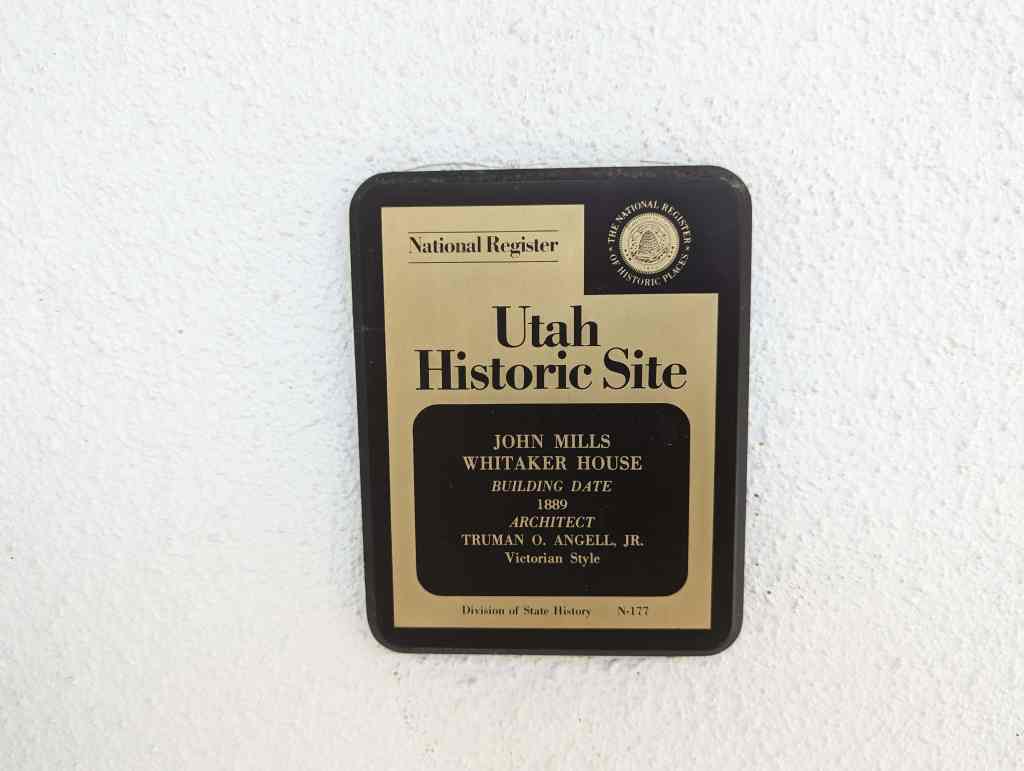
Whitaker’s house was designed by Truman O. Angell, Jr. and built by the Angell Brothers. Angell is best known as architect of the Logan Temple and Temple ton Building The Whitaker House, built in 1889, is High Victorian Italianate in style.
29 Friday Dec 2023
Posted in Uncategorized
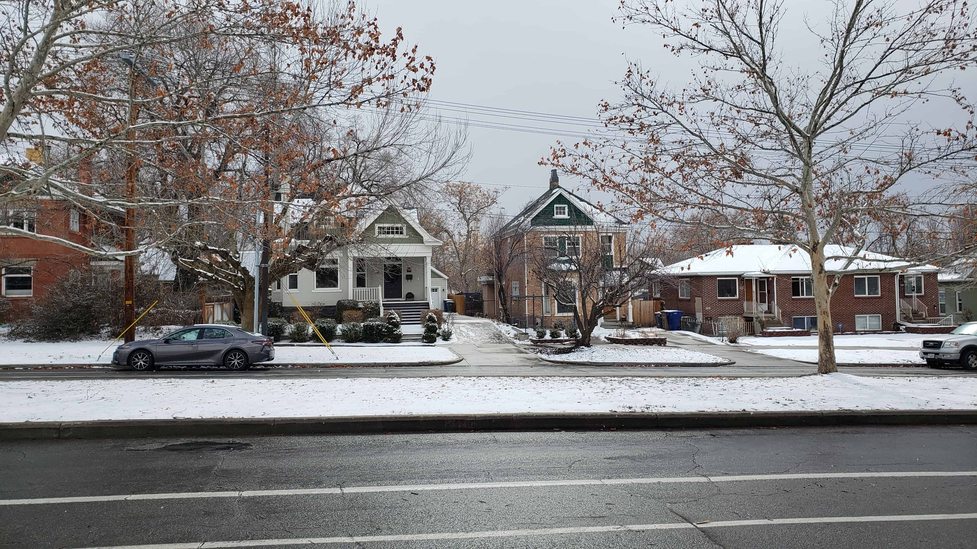
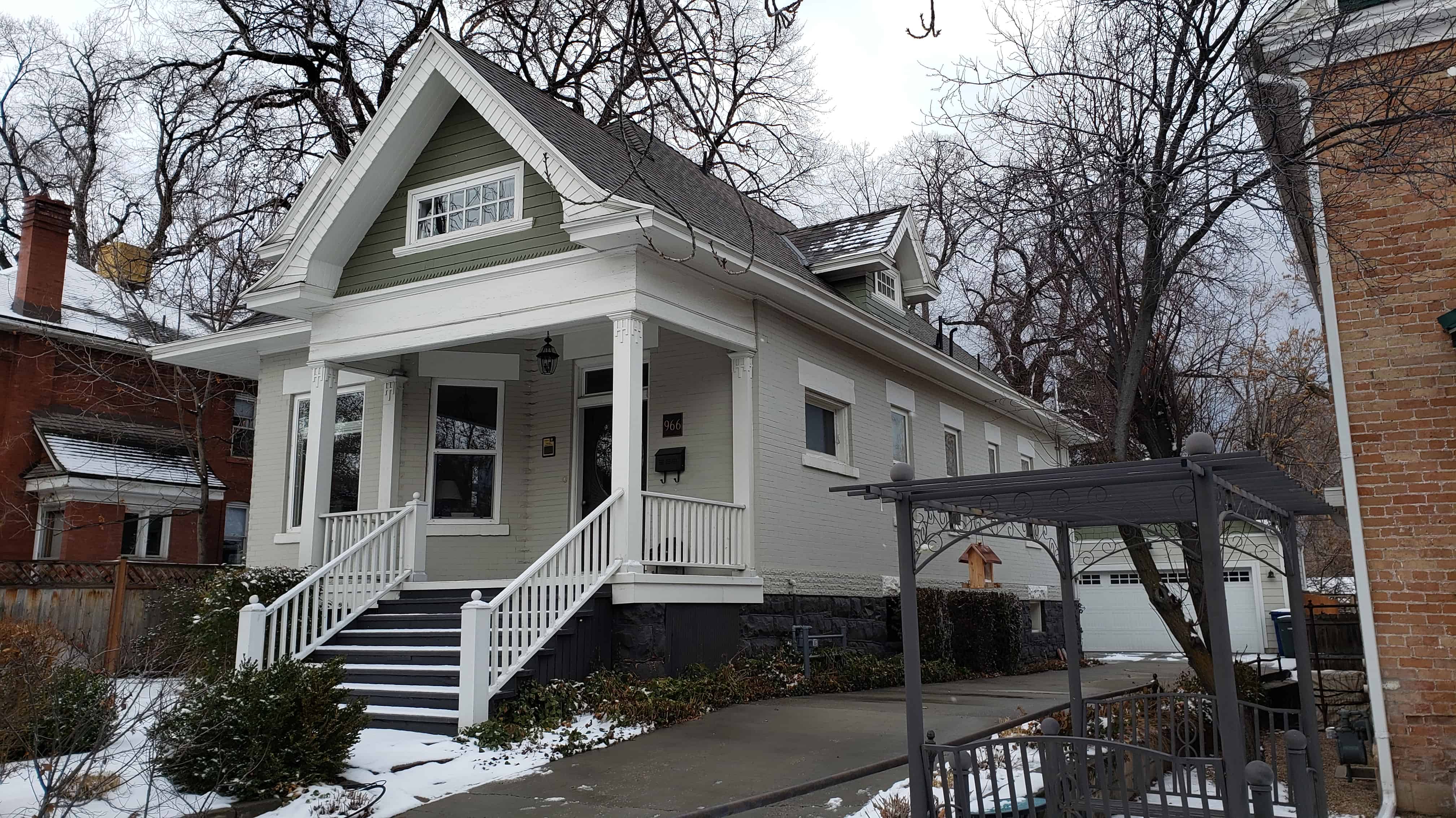
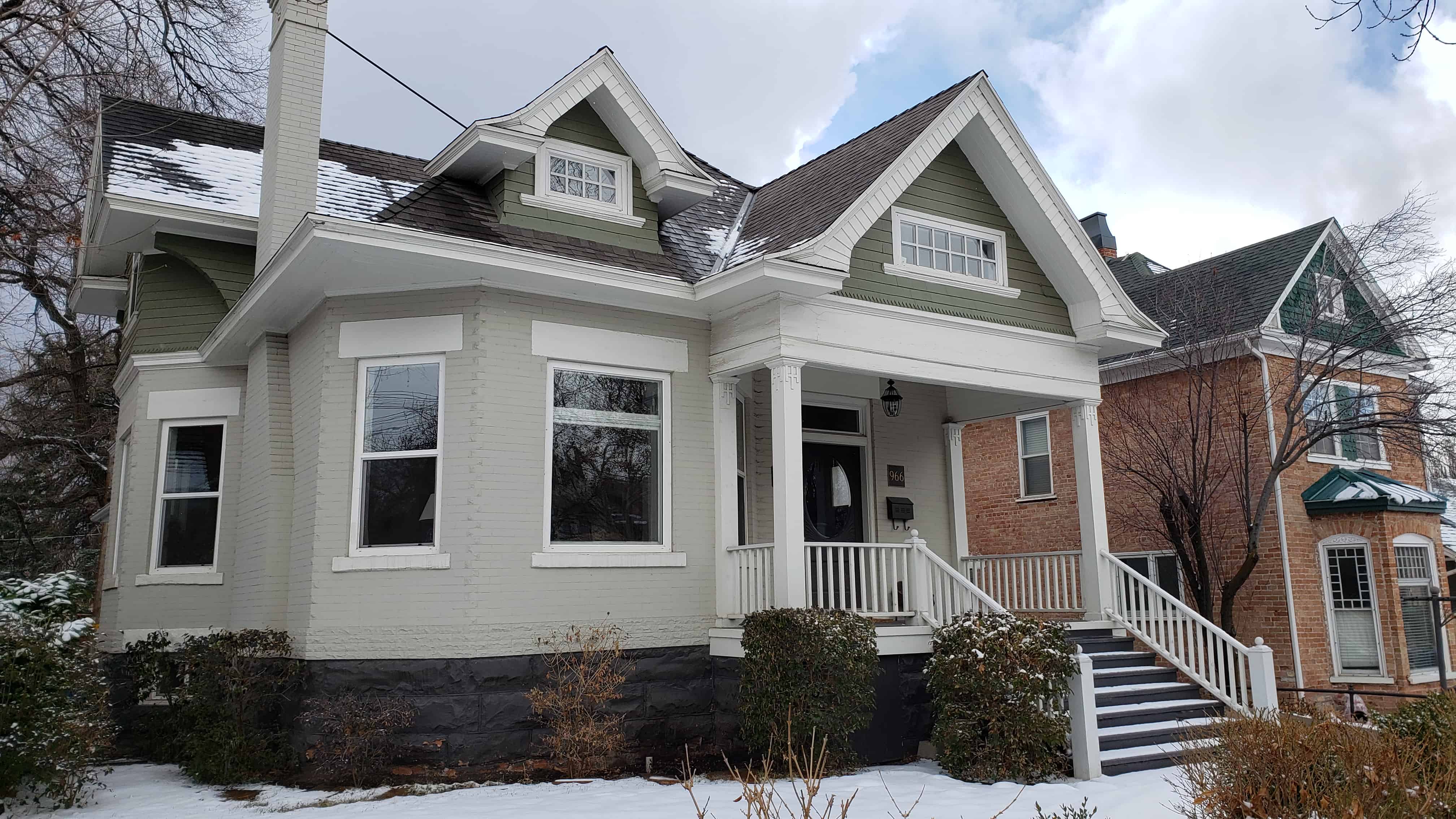
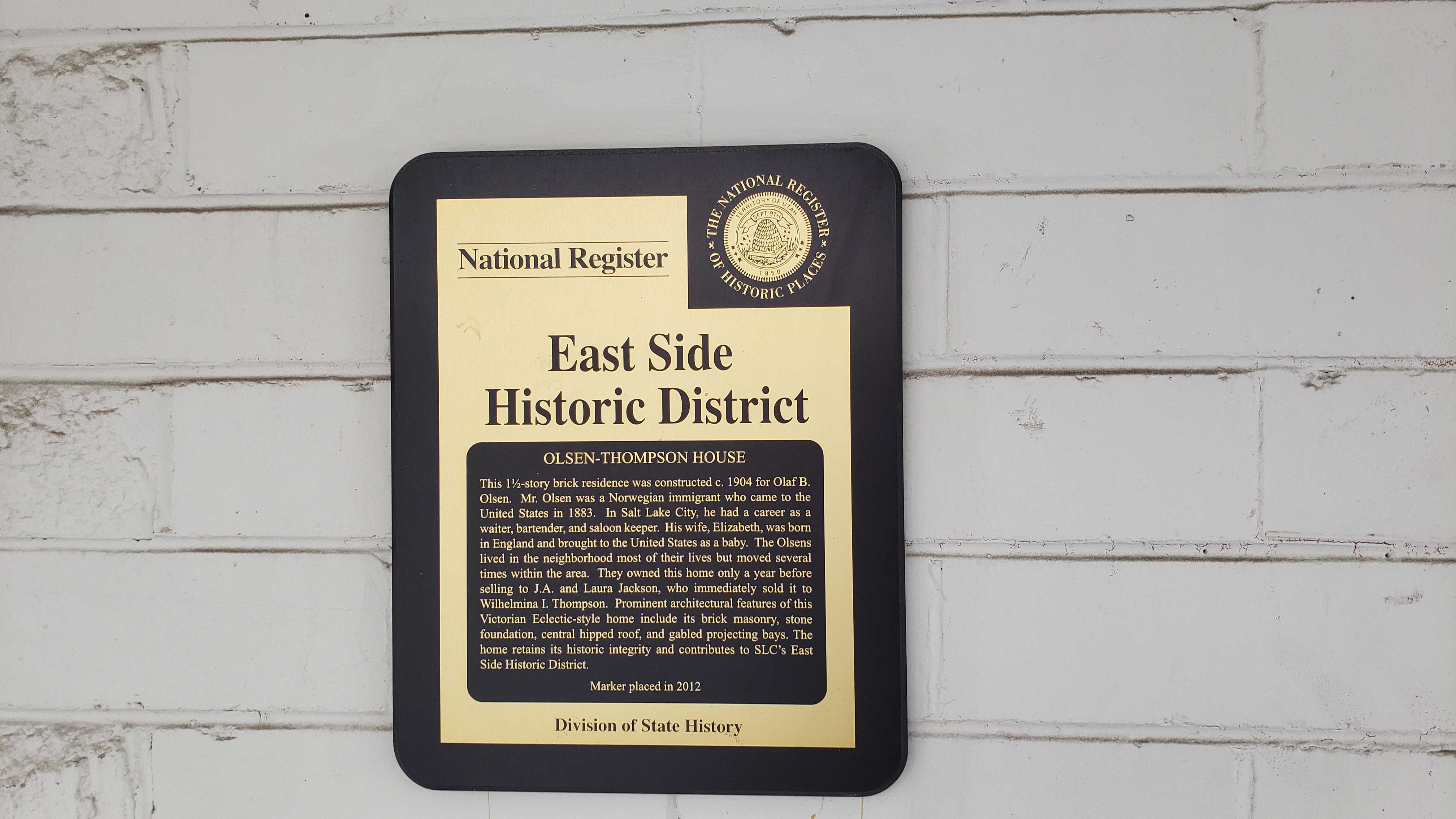
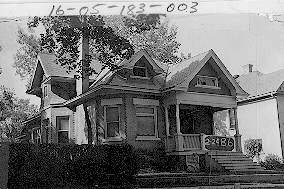
Olsen-Thompson House
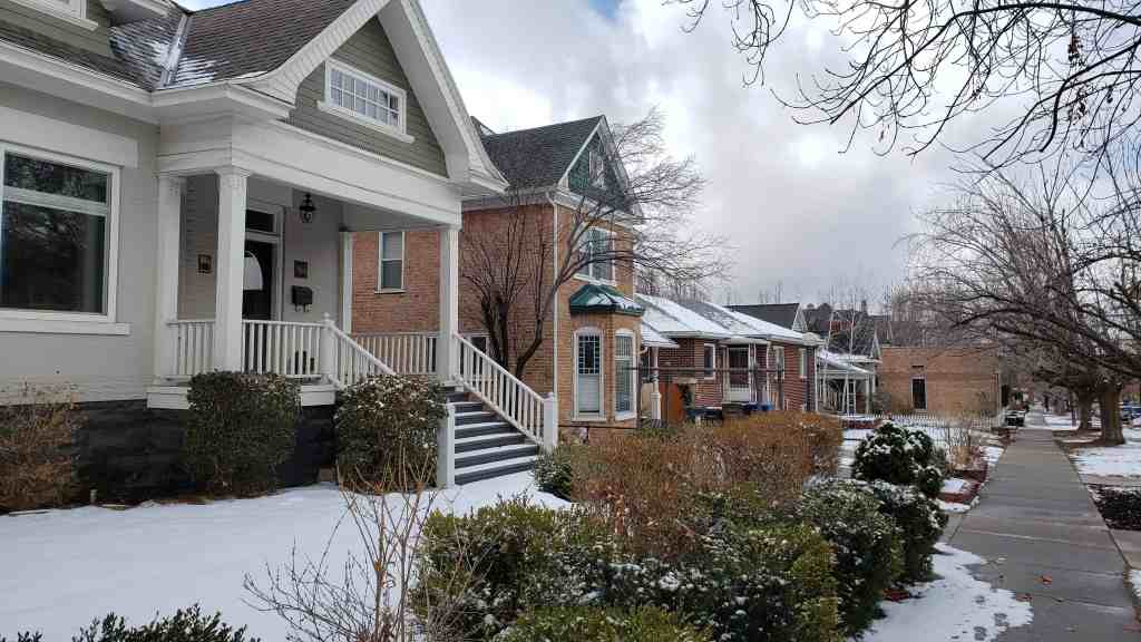
This 1 1/2-story brick residence was constructed c. 1904 for Olaf B. Olsen. Mr. Olsen was a Norwegian immigrant who came to the United States in 1883. In Salt Lake City, he had a career as a waiter, bartender, and saloon keeper. His wife, Elizabeth, was born in England and brought to the United States as a baby. The Olsens lived in the neighborhood most of their lives but moved several times within the area. They owned this home only a year before selling to J.A. and Laura Jackson, who immediately sold it to Wilhelmina I. Thompson. Prominent architectural features of this Victorian Eclectic-style home include its brick masonry, stone foundation, central hipped roof, and gabled projecting bays. The home retains its historic integrity and contributes to SLC’s East Side Historic District.
966 East 200 South in Salt Lake City, Utah
20 Wednesday Dec 2023
Posted in Uncategorized
Tags
Irving Junior High School
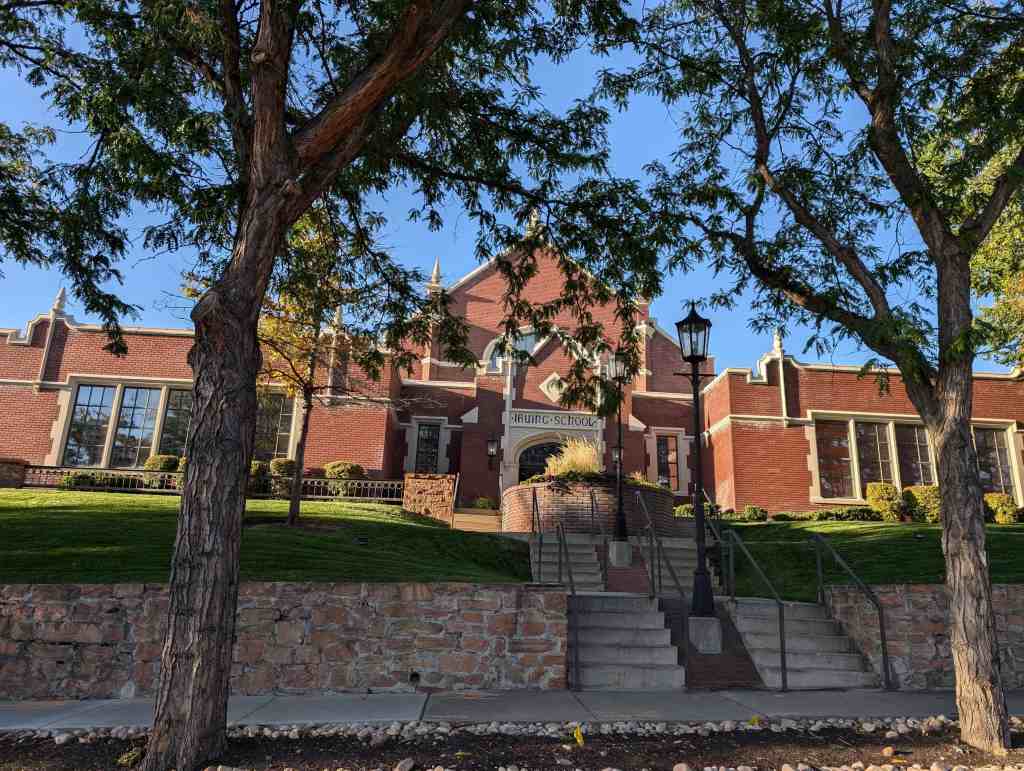
The community of Sugarhouse in Salt Lake City, Utah, was settled in the spring of 1848 and is considered among the first ten of Mormon settlements in the Great Basin. Located about six miles southeast of the center of Salt Lake City, the colony was organized for the purpose of building a sugar factory to process locally grown beets into refined sugar. Excellent molasses was produced but numerous attempts to manufacture table sugar at this location failed. Nevertheless, the settlement established a firm agricultural and commercial economy and survived after the sugar factory failed. Physical evidence of the early colony such as the Sugar House and the Mormon meetinghouse and school have been replaced by newer structures in recent decades. One of the oldest surviving public building of note in Sugarhouse is the Irving School.
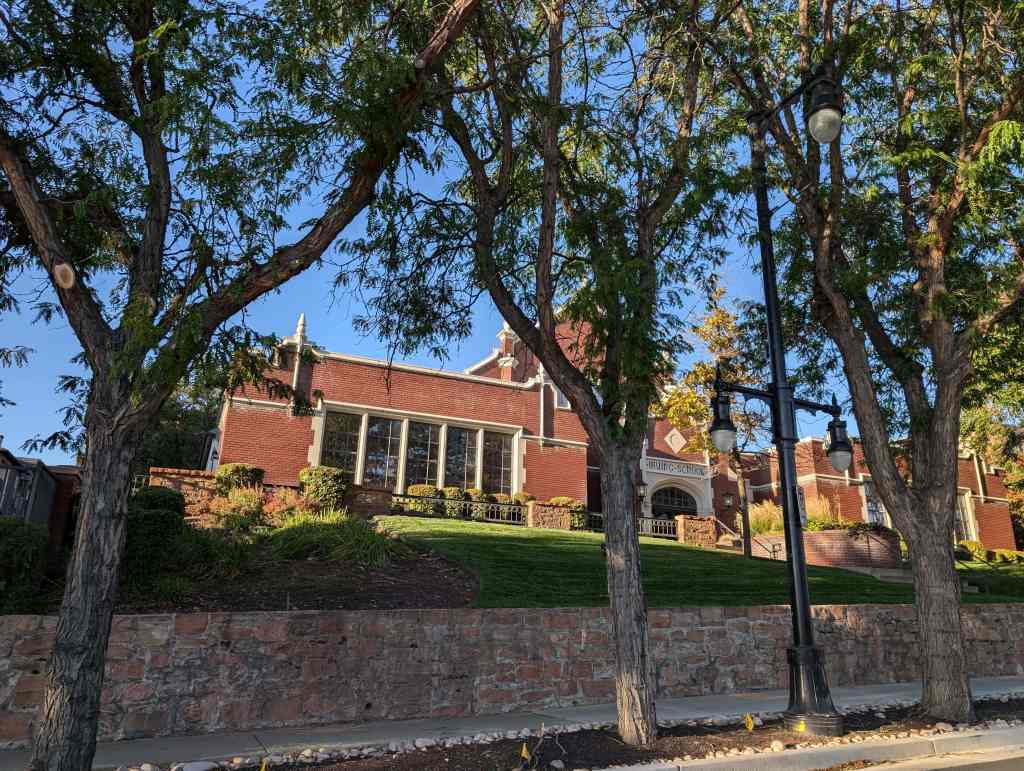
Located on an elevated site along the north side of 21st South Street (the main east-west axis of the community), Irving School overlooks the area’s commercial and residential districts. The school’s terraced site, with sandstone retaining walls, is a major historical focal point in Sugarhouse. Since its opening in 1916, Irving School has serviced the educational needs of the neighborhood’s middle-school or junior high school children.
Irving School is one of the best and earliest examples of the Jacobethan Revival Style in Utah. Utah’s earliest significant example of the style is Converse Hall (National Register) built in 1906 as the main administrative building for Westminster College. Irving School, built in three idealistically styled sections in 1916, 1926, and 1930 is characteristic of the Jacobethan Revival in many of its design elements. Particularly significant features include the steeply pitched gables, Elizabethan windows of various types with cast stone frames and mullions, and decorative cast stone copings, pinnacles, string courses, quoins, labeled arches, and inscription plaques. The cast stone ornamentation is itself significant for being among the earliest examples of that type of material in that region.
The interior of Irving School, while conventional in plan, features interesting exposed trusses, a proscenium stage, molded wooden trim, Tudor-arched bays, and light fixtures which carry the Jacobethan theme throughout the building.
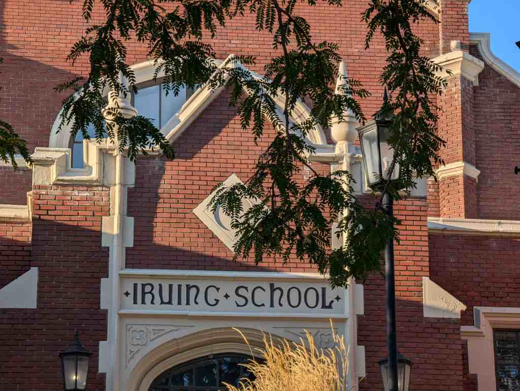
Located at 1179 East 2100 South in the Sugar House Neighborhood of Salt Lake City, Utah and added to the National Historic Register (#78002674) December 22, 1978. The text on this page is from the nomination form for the national register.
The primary architects of the Irving School were Charles S. McDonald and Raymond J. Ashton. McDonald’s practice, which spanned the period from 1909 through 1918 was cut short by his untimely death at age 39. During his career, McDonald was associated with architect Frederick A. Hale and later became a partner in the firm of McDonald and Cooper with Walter J. Cooper. Although he designed homes, theaters, and commercial buildings, McDonald’s major commissions were school buildings for the Salt Lake City, Board of Education. Besides Irving School, McDonald designed two other 26-room schools in Salt Lake City in 1916.
Following McDonald’s death, architectural work on Irving School was done by Raymond J. Ashton. Early in his career Ashton was associated with a prominent local building contracting firm known as the Ashton Brothers. R. J. Ashton became a draftsman for the firm which led to his becoming an architect, a profession which he engaged in for over 40 years. Primarily known for designing many of the area’s older church buildings, Ashton was quite sensitive to historical architecture. He chose to carry on McDonald’s Jacobethan Revival theme as he made additions to the pre-existing school. The final result, despite having been built in several stages, displays a cohesive, well-integrated design.
Irving School is a load-bearing brick wall structure which varies from one to three stories in height. Set back on a terraced prominence overlooking the Sugarhouse area of Salt Lake City, Utah, the school is impressively situated amongst mature Evergreen shrubbery. With wood floors and trusses and a Jacobethan Revival façade and interior, the building is somewhat anachronistic considering some of the more contemporary architectural and engineering trends which were developing in 1916, the year the first section of the school was constructed. The reaction against academic formalism as well as the austere, geometric rigidity of styles such as the Prairie Style was considered legitimate at the time, however, and resulted in Irving School’s fanciful dark red brick and light east stone appearance. Basically H-shaped in plan, the building was built in several stages over a twelve-year period. Typically, the school contains classrooms flanking central halls, an auditorium, gymnasium, shop and music rooms and other special-use spaces, kitchen and cafeteria, offices and other rooms related to the building’s original school functions. Much of the school’s interior appointments are intact including wood trim and doors, columns, exposed trusses, decorative plaster trim, stairways, theater seats, radiators, and fountains.
On the exterior, Irving School displays dark red brick in the field of its walls, with decorative cast stone trim in a light color as contrast. Door and window bays are of various shapes and sizes and include Tudor-arched bays and various rectangular, flat-arched bays. All bays, as well as the cornice copings on the gables and parapets, are of cast stone. Cast stone is also used in a plastic way to give form to pinnacles, splayed entry casings, label arches, string courses, quoins, stepped buttress caps and various panels and plaques. This ornamental trim, together with the variety of massing and form inherent in the building, give it a quality of considerable visual interest.
19 Tuesday Dec 2023
Posted in Uncategorized
Liberty Wells Historic District was listed on the National Historic Register (#10000210) in 2010 with the boundaries being State Street to 700 East and 1300 South to 2100 South, in 2011 a section was added (#11001069) that covered State Street to 500 East from 900 South to 1300 South.
The text below is from the national register nomination forms:
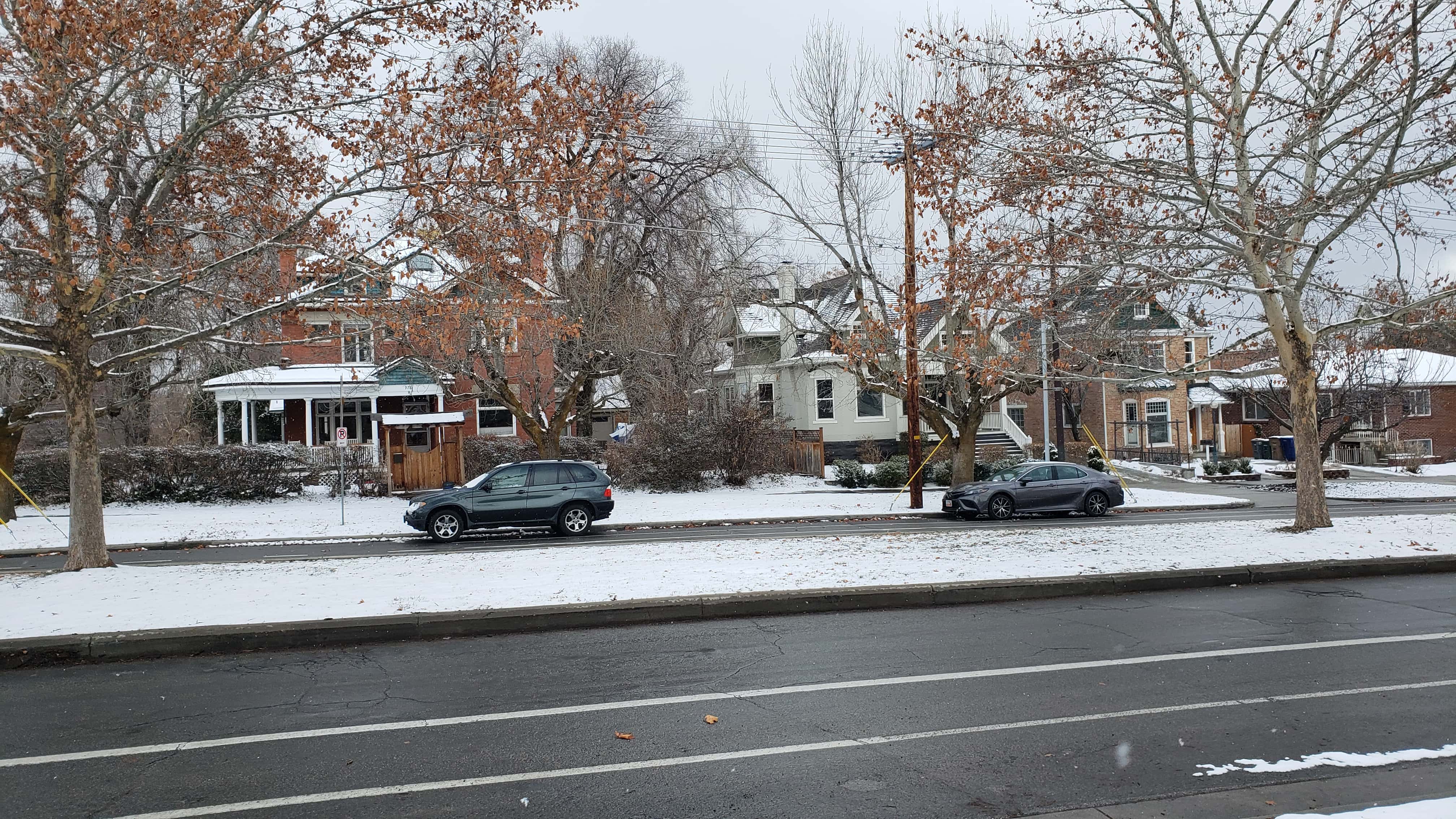
The Wells Historic District is a residential neighborhood, composed primarily of single-family homes, located immediately south of Liberty Park and south of downtown Salt Lake City, Salt Lake County, Utah. It is bordered on all sides by substantial transportation corridors: 700 East (on the east), 2100 South (on the south), State Street (on the west), and 1300 South (on the north). Although these boundary roadways have seen extensive modern development, the vast majority of the area between them retains its historic suburban quality due to its tree-lined streets, uniform setbacks, well-preserved architecture, and the similarity of scale in the housing stock. By far, most buildings were constructed during the first three decades of the twentieth century; thus the district is notable for its collection of Bungalow variations and Eclectic Victorian and Period Revival residences. Bungalows are the architectural strength of the neighborhood, comprising the single largest category of building forms and styles in the district. The most common alterations to buildings in the district are the application of stucco or aluminum, vinyl, or asbestos (also pressboard) siding and the replacement of original windows. Many of the contributing homes from the period have additions, frequently built during the historic period but also representing modern alterations.
The Wells Historic District encompasses approximately 61 acres spread over roughly 100 blocks containing individual lots of various sizes. This area is comprised of many small-scale subdivisions intermingled with individually built homes. Residential construction in the area began on a limited basis in the late 1880s, grew substantially between 1900 and the stock market crash of 1929, and by the late 1930s much of the area had been developed. Development increased slightly during World War II, and after the war construction occurred in only small pockets due to a lack of vacant land. Minimal construction continues into the present and consists of additions to existing structures as well as tear-down projects in which older structures are demolished to accommodate new construction. Many of the newer structures being constructed serve city and community purposes as well as provide low to moderate income multiple housing units.
The distribution of housing types and styles within the district echoes the broad time span over which construction occurred within the district but also clearly illustrates the periods of boom and bust in construction. All but approximately 1 percent of the properties in the district are residential properties, and among these, nearly 94 percent are single-family residential structures. The remaining 6 percent of the historic residences are multi-family properties, including an excellent array of double houses and duplexes representing a variety of time periods and architectural styles. A total of 23 historic commercial properties and 5 historic churches are also present, as are one historic school building and a commemorative park.
The Wells Historic District contains 2,829 documented primary buildings, of which the majority (2,639 or 93 percent) were constructed during the historical period (e.g., built during or before 1957). Of the 2,829 total buildings, 68 percent (1,924) contribute to the historical character of the district. Of the 905 buildings that do not contribute to the district, 715 are historical structures that have been substantively altered, and 190 are out-of-period structures, primarily built during the 1960s and 1970s. Three properties, all associated with the Wilford Woodruff Family, are individually listed on the National Register of Historic Places. These are the Wilford Woodruff Farm House at 1604 South 500 East (listed July 14, 1982; NRIS No. 82004152); Woodruff Villa at 1622 South 500 East (listed July 14, 1982; NRIS No. 82004150); and the Asahel Hart Woodruff House at 1636 South 500 East (listed July 14, 1982; NRIS No. 82004151).
Twenty-four percent (475) of the contributing properties have not only primary structures but also outbuildings present on the property, for a total of 481 contributing outbuildings in the district. Most of the outbuildings are small, detached single-car garages, though small sheds and workshops are also present. Most retain their physical integrity, and they contribute to the visual unity of the district in a general way.
All of the streets within the district are paved with asphalt and most are lined with concrete curbs, gutters, and sidewalks. Mid-block alleys are present within most of the blocks to provide access to the rear of the residential properties where the detached garages and outbuildings are most commonly located. The street layout within the district is mostly rectilinear (with some blocks running lengthwise north-south and some running east-west). This layout is different from the dominant square grid-like nature of downtown Salt Lake City that was established upon the first settlement of the valley. The Wells area was originally platted during the mid 1800s as part of the Big Field, a mainly agricultural area, with plats ranging from 5 to 80-acre parcels. In the 1880s sections of the Big Field began to be divided into smaller, residential-sized blocks that were soon platted as subdivisions by developers from outside of Utah, who brought alternative concepts of community development and design to the area. Thus, the lot and block layout of Wells and similarly platted areas is clearly distinct from areas platted earlier under the Plat of the City of Zion construct of the Latter Day Saints (Mormons) who founded Salt Lake City.
With a few exceptions around the boundaries of the district, the Wells area is visually cohesive, with various styles of Late Victorian and Early 20th Century American style residences tying together the different areas of the neighborhood and providing aesthetic continuity within the district. This visual cohesion easily distinguishes the Wells Historic District from the surrounding neighborhoods to the south and west and to a certain degree from those to the north and east. Individual subdivisions within the district exhibit the different architectural focus of developers at the time each subdivision was developed, with some subdivisions dominated by Bungalows, others by Victorian Cross-wings, others by Period Cottages and Clipped Gable Cottages, and still others by World War II Era Cottages. Other subdivisions exhibit a more eclectic collection of architectural types and styles, reflecting the greater period of time over which the subdivision was developed. Despite the individuality of the various subdivisions, the housing stock within them represents a limited number of architectural types and styles that are present throughout the entire district and tie the entire area together.
Historic infill construction of single-family homes from the 1940s and 1950s is evident throughout the district but contributes, rather than detracts from the district, because the massing of the structures are consistent throughout the area, and these later structures represent a key period in the subdivision’s history, when most of the lots had been developed and only a few remained available for new construction. More recent (1960s+) infill projects, on the other hand, have introduced large, multi-family apartments, commercial buildings, and other structures, the scale of which is not in keeping with the rest of the district. This is particularly evident along the boundary streets of the district and is less common in the interior. Residential landscape is present throughout most of the district and is characterized by mature trees, which line the parking strips of most streets in the neighborhood. Planned or designed public landscaping is generally absent in the area except for First Encampment Park, a small park commemorating the approximate location of the first campsite of Mormon pioneers upon entering the Salt Lake Valley.
Historic, and modern, commercial development is largely centered on the major through-streets within the district: State Street, 1300 South, 700 East, 1700 South, and 2100 South. Away from these corridors, commercial development consisted of individual specialty shops, such as small groceries, scattered among residential structures. Many of these small shops arose as additions to residential structures, with the store front abutting the sidewalk and the residential structure set back from it.
Survey Methods and Eligibility Requirements
Buildings were classified as either contributing or non-contributing to the district based upon the results of a reconnaissance level survey of the Wells area in 2007.’ Each building was evaluated for its contributory status using a set of integrity criteria (i.e., a rating system) established by the Utah State Historic Preservation Office. This rating system is as follows:
Evaluations of individual buildings were based primarily on the known or estimated age of the structure and its architectural integrity (e.g., evaluations were based on physical characteristics of the buildings observable from public property, where access to the private property was not granted by the landowner). The tax assessment records for the properties were also consulted to identify/confirm probable construction dates.
The assessment of historical integrity for individual buildings was carried out within the context of the collective architectural nature of the entire district. That is, over the course of the survey, it became apparent what array of material types, window types, in-period additions, and other historical characteristics were common to buildings of particular types and time periods. Buildings that deviated from these norms in terms of their modifications were given greater scrutiny relative to their historical integrity.
When considering integrity and eligibility for individual architectural properties within the study area under the above rating system, several factors were taken into account, including frequency of occurrence of specific property types. For those building types and time periods that are well represented in the architectural record of the community in which the study corridor is located, stricter standards for defining historical integrity are appropriate. Conversely, for those building types and time periods that are not as well-represented, more lenient standards for defining historical integrity are appropriate.
Under stricter standards for defining integrity, fewer modifications of the primary historical building on a property are considered acceptable. Alterations such as enclosing or partially enclosing a porch, enclosing a carport, or converting an attached garage to additional living space, are considered unacceptable if the alteration causes the individual building to be visually distinctive from other buildings of its same type and style within the study area. Out-of-period additions are generally considered to be an adverse impact on the historical building’s integrity.
Under the stricter criteria, modification of the fenestration (enclosing or changing the size and shape of door and window openings) is considered a significant impact to the structure’s integrity. Finally, the use of aluminum or vinyl siding is considered an acceptable alteration only if the siding is of sufficient width to replicate historical clapboard, horizontal plank, or drop siding, and the application of the siding does not eliminate or reduce the aesthetic impact of architectural detailing around windows, doors, eaves, and other elements of the building. The application of other non-historical siding or exterior wall treatments is considered a significant impact unless the materials sufficiently replicate historical treatments in the overall appearance of buildings of the particular type and style to which they are applied.
Under more lenient standards of integrity, more substantial modifications are considered acceptable before integrity is lost. In order to be considered eligible under the more lenient standards, the primary historical building must retain sufficient integrity to represent the era in which it was constructed. The building’s overall form and massing must be discernable despite additions and other modifications of the structure. Out-of-period additions may be considered acceptable if the original form of the building is still decipherable. Under the more lenient standards, window and door openings may be enclosed, but their original form and size must remain discernable. Modification of exterior wall treatments, such as the application of modern aluminum or vinyl siding, is considered acceptable if the new treatment replicates historically appropriate treatments for the given building type and style represented by the property.
Architectural Styles, Types, and Materials by Period
Farms and Fields (1847 to 1870)
Prior to the platting of the Wells area beginning in the 1880s, the area, which was part of the Big Field, was only sparsely settled and primarily contained agricultural fields and communal livestock grazing areas. Extant buildings from this period in the district’s history are exceptionally rare. Only one known permanent residence from this time period, built between 1859 and 1860, remains standing in the Wells area today. This building is known as the Woodruff Farm House (1604 South 500 East) and belonged to Wilford Woodruff, who later became president of the LDS Church. The farmhouse, which exhibits simple Classical styling, was constructed of logs and is of the double-pen plan with a rear extension that results in an overall saltbox profile.
The building was later clad in stucco siding. Very few buildings were constructed in the Wells area during this time period, and all but the Woodruff Farm House were demolished to make room for later construction projects or have been so heavily modified over time that they are no longer recognizable as representatives of this period.
With rare exceptions, buildings constructed during this period were single cell or hall and parlor structures built from logs, adobe brick, and/or stone. During the earliest part of the period, semi-subterranean dugouts were common along foothills and terraces but less so in the flat lands of the Salt Lake Valley bottoms.
The Wells Historic District includes one contributing site, First Encampment Park. The park, developed in 1997, is located on the corner of 1700 South and 500 East and commemorates the approximate location of the first campsite used by Mormon pioneers when they first arrived in the Salt Lake Valley in July 1847 and determined to settle the area.
Initial Settlement (1871 to 1899)
The development of the streetcar system in the Salt Lake Valley in the early 1870s and the platting of the Big Field ca. 1890 spurred speculation by land developers. These developers purchased large tracts of land, platted subdivisions, and began promoting the establishment of the first real suburbs in Salt Lake City. At least 31 subdivisions, the majority of subdivisions in the Wells District, were platted during the late 1880s and 1890s. Actual development of the subdivisions was slow at first, but as the streetcar system expanded and reliable service was established in the area, more residents eschewed urban living for the still semi-rural atmosphere of the Wells area. Housing and commercial development in Wells during this period was most intense along the northern periphery of the area, the nearest area to the services of downtown Salt Lake City, during the early part of the period and closest to new streetcar lines along the margins of the neighborhood during the latter part of the period.
During this time, simple Classical styling in architecture slowly gave way to more elaborate Victorian styles across the state. Cross-wing structures in variants of “T-” and “L-cottages” and double cross-wings along with other typically Victorian forms such as rectangular blocks and central-blocks-with-projecting-bays became popular throughout Utah during these last decades of the nineteenth century and continued in their popularity through the early twentieth century. While some of the early versions of these structures saw little in the way of exterior adornment, others were endowed with the comparatively fancy dressings of the Queen Anne, Eastlake, Romanesque Revival, Victorian Eclectic, or other late Victorian styles.
Sixty-three (63) contributing properties are associated with this time period in the history of the Wells Historic District. Examples of Classical architecture are understandably rare, as little development occurred in the area during the early part of the period when Classical styles were popular. Only three contributing buildings from this period exhibit elements of Classical style, and these are, at best, muted examples such as the cornice return and denticulated cornice molding of the central block with projecting bays residence at 1781 South 500 East, which was constructed at the very end of the period in 1899.
Victorian architecture dominates the housing stock from this period. Of the 63 contributing properties from this period, approximately 42 (67 percent) are buildings representing Victorian forms and styles. Side-passage/side-entry residences and central-blocks-with-projecting-bays are equally common among the contributing properties of the period, with foursquare residences, various forms of cross-wings, and one Victorian double house/duplex also present. Most of these buildings reflect what can best be described as Eclectic Victorian style or vernacular expressions of Victorian styles. Shotgun residences were also constructed within Wells during this period, reflecting flexibility in the building “codes” and use of a variety of different designers and contractor/builders, though no contributing examples of such properties are present in the area today.
Three major examples of the Late Victorian architecture from this period are the Woodruff Villa (built ca. 1897), the Septimus W. Sears House (built ca. 1892), and the Dawes House (built ca. 1897). The Woodruff Villa, located at 1622 South 500 East, is a 2-1⁄2 story central-block-with-projecting-bays residence exhibiting Eclectic Victorian elements with an emphasis on the Eastlake and Queen Anne styles. The Sears House, located at 1902 South 400 East, is also a 2-1⁄2 story central-block-with- projecting-bays residence exhibiting Eclectic Victorian style, as is the Dawes House, located at 1590 South 500 East.
The Woodruff, Sears, and Dawes houses were exceptionally large and ostentatious for the Big Field area and are atypical examples of the average homes of the period, which were largely comprised of simpler structures. More common housing stock is represented by the 1898 brick and shingle central-block-with-projecting-bays residence at 1463 South Edison Street; the 1893 brick and shingle side-passage residence at 1455 South Edison Street; the 1892 cross-wing residence at 131 East Downington Avenue; and the 1898 brick foursquare residence at 350 East Wilson Avenue. While many duplexes are present in the district, only one contributing example of a Victorian duplex was identified. This single-story brick building, built in 1887, is located at 1618 South Park Street.
Regular brick and shingle siding were the predominant construction materials for houses built during this time period. Occasional wood frame examples are also present, and many buildings from this period have been clad in stucco during the modern era. Sandstone and concrete foundations are typical among the housing stock; with concrete foundations becoming far more common toward the end of the period.
Streetcar Suburbs (1900 to 1929)
The streetcar system continued to be a key factor in shaping the pattern of development of Wells during the early decades of the 1900s and can rightfully be seen as the single greatest impetus for a boom in construction during this period. Beginning in the early 1900s, a series of developments in electrical power generation and a realization among competing transit operators that their companies would fare better if they joined forces rather than each carving out a small piece of the market, caused several operators to merge their transit system, which created more powerful companies that had the ability to expand streetcar routes throughout Salt Lake City.
By 1919, streetcar lines extended along the east and west boundaries of the Wells area as well as into the heart of the neighborhood along 400 East. The presence of the lines through the area was a major selling point for land developers who painted a bucolic image of suburban living outside the polluted area downtown Salt Lake City and championed the convenience afforded by the streetcar in advertisements for their subdivisions. The promotions worked, and thousands of individuals and families flocked to the area, most with a particular desire to purchase houses along or near the streetcar lines. This meant that the greatest amount of development, both commercial and residential, occurred along the major streetcar corridors of State Street, 400 East, and 700 East, particularly in the early part of the period; later in the period, construction was well distributed throughout the district. Public facility development, including county infirmary (since demolished), also took advantage of the streetcar lines along State Street.
More than three-quarters (approximately 1,479) of all contributing buildings in the Wells Historic District were constructed during this period, primarily within subdivisions constructed adjacent to streetcar lines. All but four of these properties are residential structures. Four main architectural forms, adorned with a variety of different styles, dominate the built environment of the area. These include bungalows (the most common), foursquares, period cottages, and late versions of central-block-with-projecting-bays residences. Examples of this latter form as well as many foursquare residences took on decidedly more pronounced bungalow characteristics than the Victorian styles associated with them during the previous period in the district’s history.
Truly early architectural forms, such as rectangular block and shotgun residences became less common in the area while forms such as the foursquare, which persisted in popularity in Utah until the 1910s, became more common. Toward the middle part of the period, the new, home-grown American architectural form, the bungalow, rose in popularity in Utah. These bungalows were ubiquitous in the streetcar suburbs of Salt Lake City, with the period from approximately 1915 to 1925 representing the height of their popularity in such locations. In general, the Wells bungalows from this period conformed to the generic, mass production version of the form, which exhibited very little in the way of exterior adornment and maintained only the basic characteristics of the prototypical bungalow.
Of the 1,479 contributing properties in the district from this period, nearly 32 percent (614) are bungalow variations. Myriad styles were applied to the bungalow form, though most commonly they were unadorned and simply exhibited the basic bungalow characteristics of a low-slung roof, heavy porch, and deep eaves as represented by the 1918 and 1924 residences at 628 East Wilson Avenue and 156 East 1700 South. Others received greater stylistic treatment with details from the Arts and Crafts style, as seen in the 1916 residence at 305 East 1700 South and the Prairie School style, as seen in the 1923 residence at 1883 South 300 East.
Many bungalows built during the latter part of the period and overlapping into the early part of the next period incorporated Colonial Revival elements and clipped gables, resulting in a distinct form referred to locally as the Clipped Gable Cottage. The 1924 residence at 1948 South 300 East and the ca. 1925 residence at 535 East Browning Avenue are good examples of such architecture.
Toward the latter part of this period, a small number of period cottages were constructed within Wells (105 contributing properties). The vast majority were constructed after 1923. Such cottages were another very popular architectural form constructed by developers within the streetcar suburbs. Nearly all of the cottages were constructed of brick, mostly striated brick, and many exhibited designs that were conducive to “mass production” within subdivisions. These designs frequently incorporated only the very basic period revival elements such as multiple steeply pitched gables. Others incorporated elements of English Tudor and English Cottage design. Examples of such buildings include the 1928 residence at 562 East Browning Avenue and the 1929 residence at 428 East Cleveland Avenue.
Variations on the period cottage plan also appeared in large numbers in Wells during this period, though more were constructed during the subsequent period. This variation blended the rectangular plan and heavy porches of bungalows with moderately steep gables and Period Revival decoration. The 1923 residence at 563 East Cleveland Avenue is typical of such structures. Buildings of this nature are most prevalent in the west-central portion of the district.
In addition to the many single-family dwellings that are associated with this period district’s history are several double houses (duplexes). These double houses are somewhat unique within streetcar suburbs such as Wells, as they represent higher density housing that was typically found in more urban settings. However, several streetcar suburbs around downtown Salt Lake City are known to have included a surprising number of such multi-family residences, including Wells and nearby Forest Dale. Roughly two dozen contributing double houses representing this period are present in the district. Most, such as the ca. 1912 property at 661 East Downington Avenue and the 1928 property at 604 East Kensington Avenue, exhibit elements of Period Revival style. Others, such as the 1924 residences at 665 East Downington Avenue, incorporated the highly popular Bungalow style.
Construction of the most notable public building in the district, the former South High School building, began at the very end of the period, in 1929. The Period Revival-inspired building was constructed on the northeast corner of 1700 South and State Street between 1929 and 1931 and remains in use today as the main Salt Lake Community College campus.
Commercial development continued to be focused along the major roadways of State Street, 1300 South, 1700 South, 2100 South, and 700 East. Typical 1-Part Block commercial buildings, such as the 1926 O.P. Skaggs grocery building at 1435 South State Street were most common along these thoroughfares; however, small, neighborhood groceries and specialty stores were also built during this period, most frequently as commercial additions to residential structures. The ca. 1917 property at 405-407 East 1700 South is a good example of this phenomenon.
Brick was by far the most common building material used in structures from this period. Regular, fired brick continued in high frequencies, but striated brick clearly began to rise in popularity as a preferred material given its relatively extensive use on houses within the district as well as in other contemporary residential developments.
The Era of Infilling (1930 to 1945)
Housing construction decreased dramatically during the Great Depression. Throughout the Salt Lake Valley, new house starts dwindled to record low numbers as financing became increasingly difficult to obtain. Fewer than 200 (10 percent) of the contributing buildings remaining in the Wells area today were constructed between 1930 and 1945. Construction during this period was distributed throughout the district and mostly consisted of small-scale subdivisions and individual buildings on the few remaining open lots in the area. The relative number of multi-family housing units to single-family houses increased during this period, as renting versus buying became the norm for cash-strapped residents. Of the nearly 200 contributing properties from this period, 12 (approximately 6 percent) are multi-family units. This is in comparison to a proportion of multi-family unit to single family units of just over 3 percent of all contributing buildings during the previous period in the district’s history.
While Period Cottages continued in popularity during the early years of the period, they soon gave way to more modern forms, including World War II Era Cottages. The transition between the two forms is evident in residences such as the 1936 home at 339 East Sherman Avenue, which possess a roof pitch between the steep pitch of a Period Cottage and the moderate to shallow pitch of a World War II Era Cottage and muted elements of Period Revival ornamentation on a World War II Era Cottage plan.
The World War II Era Cottage forms present in Wells are primarily small, simple residences with a basic rectangular plan oriented with the long axis parallel to the street. Most are only minimally adorned and have narrow to absent eaves. The 1945 residence at 471 East Wilson Avenue is a good example of the typical unadorned World War II Era Cottage in the district. Others have slight eaves and incorporate elements of Colonial Revival design; this combination of elements is often referred to as Minimal Traditional style. The ca. 1940 residence at 1413 South 400 East is typical of such buildings.
Other cottages of the period were constructed with square or square with projecting bays plans and low-slung hipped roofs more common to bungalows of earlier periods, though the deep Bungalow style eaves are absent. The 1942 residence at 162 East Wilson Avenue is representative of such buildings in Wells.
As noted, multi-family housing was more common as a ratio of all new housing construction in this period than in previous periods. Examples of such housing in Wells can be seen in the 1936 and 1945 double houses at 508 East Cleveland Avenue (1445 South 500 East) and 1331-1333 South 600 East. As can be seen from these two examples, multi-family housing constructed early in the period exhibited the more common Period Revival style while such properties constructed later in the period took on the elements of more modern styles, such as Minimal Traditional and Early Ranch – the latter of which did not appear in earnest in Wells until after World War II.
Public and commercial construction was relatively limited during this period. The Art Deco South High School campus, construction of which began in 1929, was completed early in this period, and a new form of commercial property, the motor lodge, appeared late in the period. The Zion’s Motel was opened in 1939 at 1829 South State Street and was one of the earliest motels in the area to cater to the growing popularity of the automobile in American culture and the emergence of the “road trip” as a specific type of leisure activity. The motel exhibits Period Revival style.
Brick continued as a popular construction material, but frame construction and aluminum siding began to overtake it during the latter part of the period. Other cladding materials such as asbestos shingles also grew in use.
The Post War Era (1946 to 1957)
The Wells area continued to grow and change following the close of World War II; however, the entire area, for all intents and purposes, had been developed on some level prior to the 1960s. Redevelopment occurred on a limited basis during the 1960s and 1970s. Older single family homes were demolished and replaced with multi-family dwellings or small commercial ventures such as convenience stores or small walk-up stores. In some cases, former residential buildings were converted into commercial enterprises. The larger and more trafficked streets, such as State Street, 2100 South, and portions of 1300 South and 1700 South have seen the most redevelopment within the Wells area.
One hundred and forty-seven (147, or 8 percent) contributing buildings affiliated with this time period are present within the district. Most are single-family residential structures in variations of World War II Era Cottage and Ranch/Rambler forms. By the early 1950s, the small, World War II Era Cottage plan was extended, making it longer, and cross-gables and cross-gable bays were added to create early versions of the Ranch house form. As time progressed, the plan was extended even further and took on the trappings of the more typical tract house version of the Ranch/Rambler form established in California by Clifford May. A good example of post-war World War II Era Cottages in Wells can be seen in the 1950 residence at 519 East Emerson Avenue, while a good example of the tract house version of the Ranch/Rambler form can be seen in the 1955 house at 1636 South 200 East. Similar characteristics are seen in duplexes of the period, such as the 1948 property at 223-225 East Westminster Avenue.
Despite the redevelopment, the Wells community continues to retain a residential atmosphere and zoning ordinances allow very limited commercial development in the heart of the community. Historical buildings, such as the ca. 1930 South High School building, which now serves as the Salt Lake Community College campus, are being used rather than replaced. However, this has not always been the case; the apartment buildings at 1488 South 400 East and adjacent lots are typical examples of modern (non-historical) multi-family housing that has been constructed in small numbers within the district. With few exceptions, such buildings are scattered individually amongst single-family homes rather than in complexes or clusters. Not only is the massing of these properties out of proportion with the predominantly single-family housing of the rest of the neighborhood, but the focus on accommodating the modern automobile culture results in property configurations that are inconsistent with those of the majority of residential properties; that is, automobile parking is situated in front of or directly adjacent to the buildings whereas the majority of historic properties have garages at the rear of the parcels, accessed by mid-block alley ways. Additionally, because of the narrow but deep nature of the platted lots in Wells, construction of these large apartment complexes required that they be oriented with their long axis perpendicular to the frontage road, creating a situation in which the primary public façade is the side of the building, devoid of doorways, porches, and windows that typify the single-family homes in the rest of the neighborhood.
New commercial construction during this period is designed to accommodate the automobile culture rather than pedestrian traffic. Historical commercial properties such as the 1947 Alta Motel Lodge at 1899 South State Street and more recent businesses incorporate parking lots for drive-up traffic where little such need existed prior to World War II. Other, more modern development that has encroached upon the historic character of the district, though only in limited fashion, includes the Catholic elder care facility – St. Joseph Villa at 451 East Bishop Federal Lane. Portions of this facility were constructed between 1957 and 1959, and it underwent substantial renovation in the mid 1980s.
Construction materials varied more widely during this period than in previous periods. New material technologies developed during World War II gave way to inexpensive aluminum and other metal siding and a variety of veneers in synthetic materials, including imitation stone veneers developed in the eastern U.S. prior to 1940 but only really becoming popular in Salt Lake City during and after the war. Oversized brick and concrete block are also common in historical buildings from this period. Stucco and stacked stone veneers became popular during the 1990s and have been used to renovate older buildings and clad new ones.
Architects and Builders
By and large, houses within the streetcar suburbs were constructed by a variety of different contractors using readily available commercial designs or simply constructed buildings based on past experience and accepted practice. Construction contractors were not the only ones contributing to the architectural development of Wells; land merchants, carpenters, and architects also played a large role. Several prominent local land merchants were responsible for the promotion and development of subdivisions between 1900 and 1929. These merchants include J.A. Fritsch, developer of the East Capitol and Kensington Subdivisions; Philip A. Finegan, developer of the Grand Haven Subdivision; F.A. Virtue, developer of the Avondale Park Subdivision; Edward Hackett, developer of the Hackett’s Addition Subdivisions and; William Hubbard, developer of the Thorndyke, North Waterloo, and Waterloo Subdivisions. Archelaus (Archie) Fillingan, a builder/contractor, was also active in the Wells area during the late 1910s and early 1920s, primarily in the construction of Bungalows and Clipped Gable Cottages in the eastern part of the district.
Hyrum J. Jensen, a prominent local construction contractor was responsible for several Bungalow subdivisions. The Kenwood Subdivisions located along between Milton Avenue and 1700 South, along 300 to 400 East; the Thorndyke Subdivisions located between Westminster Avenue and 2100 South, along 300 to 400 East (which Jensen helped to co-develop); and the collection located along the north side of Redondo Avenue, between 300 and 400 East. Thomas Campbell was a local carpenter who was responsible for many residences in the Wells area. Examples of Campbell’s work are present along 1700 South at 408 East and 412 East and along Blaine Avenue at 425 East. Philip A. Finegan, a land broker, developed the Grand Haven Subdivision, which encompasses the area from Browning Avenue to Emerson Avenue, between 600 and 700 East.
One prominent local architect, John A. Haedlund, an immigrant from Sweden, designed may local, private and public residences in the Salt Lake Valley, including the Immanuel Baptist Church building (401 East 200 South). Haedlund also contributed to the architectural history of the Wells area. Haedlund designed the ca. 1904 foursquare residence at 1538 South 400 East with a gambrel roof and Colonial Revival stylistic elements. Educated in Sweden and the U.S. (Chicago), Haedlund ventured west to Kansas City and then to Colorado Springs in the late 1800s, ultimately settling in Salt Lake City around 1889. The George M. Cannon House at 720 East Ashton Avenue in the Forest Dale Historic District southeast of Wells was among the first, if not the very first, house designed by Headlund upon his arrival in Salt Lake City. During his time in Salt Lake City, Headlund designed more than 500 buildings in Utah, Idaho, Nebraska, and Wyoming. So exceptional was Headlund’s work, that three of his buildings in the Salt Lake Valley are individually listed on the National Register for their architectural merit. These buildings include the 1911 Immanuel Baptist Church at 401 East 200 South (NRIS No. 78002668), the 1906 Woodruff-Riter-Stewart House at 225 North State Street (NRIS No. 79002507), and the 1890 George M. Cannon House (NRIS No. 83004419).
Summary
The Wells Historic District comprises one of the best and most comprehensive collections of Early 20th Century American residential architecture in Salt Lake City. The array of architectural types and styles present in the district reflects both the protracted period over which the buildings in the district were constructed and the periods of boom and bust in new housing starts; however, it is the extensive collection of bungalows that are the district’s strength and which lend the area the unique feeling of a streetcar suburb. The continuous development of the subdivision throughout the historic period lends a visual cohesiveness to the neighborhood, as the transition from earlier to later architectural designs is visible in the district’s housing stock, the majority of which is considered contributing to the district. Both historic and modern infill projects are present in the district. The historic examples represent the final phase of full build-out of the Wells area and contribute to the district’s overall character. The modern infill projects, on the other hand, are not in keeping with the scale and stylistic continuity of the rest of the district. These structures are relatively rare and do not substantially detract from the integrity of the district. Finally, a variety of architects and builders are represented by the structures of the district and range from local carpenters like Hyrum J. Jensen and Thomas Campbell to nationally known and internationally trained architects such as John Headlund, whose influence and training is visible in the design of other prominent buildings in the Salt Lake Valley.
Narrative Statement of Significance
The Wells Historic District is locally significant under Criteria A and C for two primary reasons: 1) its key association with streetcar development in Salt Lake City; and 2) its well-preserved collection of Early 20th Century American housing stock.
Under Criterion A, the district is significant for its association with suburban (streetcar) development in Salt Lake City. The Wells area itself is a major contributing resource in the overall history of streetcar subdivisions in the city. The incorporation of the interurban street car system as a necessary and integral component of the subdivision paved the way for future development of streetcar suburbs in the surrounding area (e.g., the many subdivisions of the West Sugar House area: Sixth East, Wilmington, Country Club Place, Adamson, Fairmont Springs Addition, Forest Dale, etc.), thereby establishing a distinctive pattern of community expansion for the southeastern portion of Salt Lake City.
The Wells Historic District contains an impressive collection of Early 20th Century American residences that render the district significant under Criterion C. Further, the building stock represents the work of numerous architects and designers, including both locally trained draftsmen and nationally practiced architects, such as John Haedlund. The residences of the neighborhood, the vast majority of which are considered contributing resources within the district, are among the most well-preserved collection of early 20th century residential architecture in the Salt Lake Valley, lending visual cohesiveness to the district and distinguishing it from the surrounding neighborhoods. The patterning of architectural types and styles on the landscape within the district clearly demonstrates how the Wells area was developed over time. A few residences in the district are individually listed on the National Register of Historic Places for their architecture as well as their associations with the Woodruff Family, who played an important role in local history.
As representative of the Early 20th Century American movement in architecture, the Wells Historic District contains an impressive collection of well preserved bungalow, period cottage, and clipped gable cottage residences. Collectively, buildings of these types represent approximately 1,065 (56 percent) of the 1,916 contributing properties in the district. The housing stock in Wells exhibits several different variations of these architectural forms and the application of myriad styles to them, illustrating how they were adapted to evolving residential needs and concepts of acceptable space, functional utility, and aesthetic appeal.
The period of significance for the Wells Historic District extends from 1871 to 1957. This time frame, and its relevance to the district, is best understood when divided into contextual eras based upon significant events and trends within the area’s history. Four specific periods of significance apply to the Wells Historic District, and they begin in 1871; however, the period prior to that, 1847 to 1870, is also discussed in this nomination in order to provide a context for the initial development of the area. Thus, for the purpose of this statement of significance, the following eras are discussed: Farms and Fields (1847 to 1870); Initial Settlement (1871 to 1899); Streetcar Suburbs (1900 to 1929); The Era of Infilling (1930 to 1945); and the Post War Period (1946 to 1957).
The four primary contextual eras-Initial Settlement, Streetcar Suburbs, The Era of Infilling, and the Post War Period are marked by key milestones in the history of the district. The platting of the Big Field area encompassing Wells began in the 1880s during the Initial Settlement era but was initiated by the establishment of the streetcar system in Salt Lake City in the early 1870s. The Streetcar Suburbs era encompasses the expansion of multiple streetcar lines into the Wells area, while the Era of Infilling is highlighted by the Great Depression, the associated steep decline in development, and the wartime recovery. The Era of Infilling, the third period of significance, represents the first focus on developing previously undeveloped lots in subdivisions that had been platted during the earlier periods. The fourth period, the Post War Period, marks the final phase of historical development in the Wells area, when most of the platted lots had been developed and only occasional individual parcels or small sections of contiguous parcels were available for construction of the distinctive housing stock of the period.
History of the Wells Area
Farms and Fields (1847 to 1870)
Members of the Church of Jesus Christ of Latter-day Saints (LDS; or “Mormons”) settled the Salt Lake Valley in July 1847, when the first contingent of settlers arrived under the guidance of church president Brigham Young. Within a few days of the pioneers’ arrival in the valley, the basic layout of Salt Lake City was in place. The city was laid out in plats; the platting of the city took three years, and one plat was laid out in each of the first three years the settlers were in the valley. The first three plats were designed in a grid of 10-acre blocks, each block containing eight lots, with dirt roads 132 feet wide and 20-foot wide sidewalks. The layout of the city was based upon the “Plat of the City of Zion”, a city plan with a configuration of lots and blocks and intended land uses put forth by Joseph Smith, founder of the LDS Church. The configuration of the City of Zion plat encouraged family-level subsistence, efficient land use, and social cohesion by avoiding individual, isolated residences outside of the city’s core area.
The original three plats for the city included the present downtown area and extending as far south as 900 South. The area to the south, platted in much larger lots of between 5 and 80 acres, was commonly referred to as the Big Field. The Big Field, which encompasses the Wells Historic District, was designated as an area within which primarily agricultural activities would take place in support of the residents living in the developing heart of the Salt Lake City. The smallest lots in the area, those of 5 acres, were to be located in the northern portion of the area closest to the platted portion of the city (between 900 South and 2100 South) and were to be used by “mechanics and artisans”. The larger lots, which were platted in 10-, 20, 40-, and 80-acre parcels, were to be allocated to farmers, most of whom lived within the platted city but farmed outside the city limits.13 The future Wells area was part of the Five-Acre Survey. Large portions of the Five-Acre Survey in which Wells is located were allocated to Brigham Young, then-president of the LDS Church; Wilford Woodruff, then-future president of the LDS Church; and Daniel Wells, future Bishop of the LDS Wells Ward. Smaller sections of the area were allocated to other individuals.
Of great concern agriculturally during this period was the appropriation of a valuable and limited resource, water. The Mormon Church is the first known entity to legally regulate water for agricultural purposes. Each farmer was granted land and water rights by the Church, which, in the absence of federal homestead laws, had laid claim to all land within the Utah Territory. In less than two decades, this system of land granting experienced serious disruptions when the area’s first federal land office opened following the passage of the Homestead Act of 1862. It was in 1870, after the passage of the Homestead Act and the establishment of a federal land office in Salt Lake City that the lands encompassing the Wells area were formally patented to Young, Woodruff, and the others.
The mere granting of water rights to individuals by the Mormon Church did not solve the problem of accessing that water. To their credit, the Mormon pioneers were ingenious in their creation of irrigation systems to address the issue. The settlers in the Salt Lake Valley, within days of their arrival, set about digging irrigation ditches from the numerous streams flowing out of the Wasatch Mountains. By the 1870s, an extensive network of canals designed to control the flow and amount of water carried to the numerous the homesteads extended throughout the valley. Farmers received water rights by digging sections of canals on their lands. The canal system was geographically widespread and stretched across many pioneer communities. Some of the irrigation ditches extended off of Parley’s Creek into the Big Field/ Wells area to serve the farmlands platted there.
Initial Settlement (1871 to 1899)
The expansion of the railroad into the West was one of the foremost events of the nineteenth century. In 1869, railroading entered the area with the completion of the first transcontinental line running through Promontory and Corinne, north of Salt Lake City. Recognizing the economic importance of being connected with the main national east-west transportation corridor, Brigham Young immediately initiated the construction of the Utah Central Railroad to link Salt Lake City with the northerly route.
In addition to the northern line from Salt Lake City to Ogden and points beyond, rail lines were constructed to the south as well, extending the reach of the national markets and social influence. Within a matter of years, Mormon-owned lines covered three-fourths of the Utah Territory. The railroads, in addition to servicing passengers and freight into and out of the Salt Lake Valley, began running lines directly to the mining communities located around the perimeter of the valley. By 1898, the Utah Central Railroad extended south into the Salt Lake Valley, passing to the east of the Wells area.
Mining also significantly contributed to the growth of Salt Lake City, and “suburbs” of the city, such as Sandy, Bingham Canyon, and Alta prospered from the mines. Sandy became a hub with its proximity to Alta’s silver mine and its service from the Utah Southern Railroad. Most of the mining operations were owned and operated by non-Mormons. The LDS Church did not support the mining industry because of what it considered to be inevitable social problems that accompanied it, problems such as prostitution, gambling, and alcohol consumption. However, over time the economic benefits of the mines began to wear away at this opposition. The Jordan Silver Mining Company was one of the few Mormon ventures into the industry. Mining was so prevalent along the Wasatch Front that one visitor to Salt Lake City in 1880 described the area along Main Street as, “one large mining camp”.
By 1880, the core of the Salt Lake City business district extended south along Main Street and one block on either side to about 200 South. By 1890 it stretched to 300 South, and by the early 20th century to 400 South. Yet, while downtown Salt Lake City was booming and construction was occurring at a rapid pace, the Wells area remained primarily agricultural in nature; expansion of the developed portion of Salt Lake City was occurring to the east and west but far less so to the south (e.g., north of 900 South), at least until the end of the period.
The California gold rush of the late 1800s and the arrival of the Transcontinental Railroad in 1869 led to the transformation of Salt Lake City from an isolated, agrarian religious utopia to a crossroads for travelers heading west and a major center for the movement of goods and people throughout the region. The development of the western rail system spread from the major north-south and east-west freight lines of the large railroad companies to smaller, interurban railways focused on transporting passengers and small amounts of cargo within and between Utah’s rapidly growing Wasatch Front communities. In 1872, the first interurban (street/trolley car) company, the Salt Lake City Railroad (SLCRR) was organized by two of Brigham Young’s sons and several other businessmen from the area. Standard gauge rail was laid over a few miles of the earthen streets in Salt Lake City, and mule- and horse-drawn cars transported passengers through the downtown area. Within a few years, several other short branches of the streetcar system had been constructed in the city. In 1889, SLCRR crews began erecting an overhead electrical catenary for what was to become the first electric trolley system in Salt Lake City. The trolley was an immediate success. The cars provided not only a faster means of getting about town, but also provided some relief from the dusty, often garbage clogged city streets that became veritable mud bogs during the spring and winter months. Soon, the trolley cars became crowded, and astute businessmen in the city recognized the opportunity to cash in on the new transportation craze.
In the late 1880s, largely as a result of the success of the transit system, but also to accommodate the rapidly growing population of Salt Lake City, which doubled between 1880 and 1890, portions of the Big Field area south of 900 South began to be divided into smaller, residential-sized blocks. Unlike the blocks within the original city plat area, which were configured as squares, the ten-acre blocks in the Big Field area took the form of rectangles, marking a striking divergence away from the Plat of the City of Zion concept championed by the Mormon Church, which called for this portion of the Salt Lake City settlement to be allocated to agricultural purposes. Within these new blocks, the residential lots were smaller than those downtown and streets were much narrower. This “new” configuration may have been at least partially the result of the many out-of-state, non-Mormon developers and investors who were involved in subdivision development in the area; this pattern was perhaps the most common subdivision grid in the nation at the time, largely because of its “simple layout, its efficient use of the land by eliminating ‘wasted’ property in the interior of blocks, and because it provided street frontage to every lot on the block. The departure from the Plat of the City of Zion in the streetcar suburbs “brought about a dilution of the city’s distinctive Mormon village appearance, setting it more in line with national patterns of development.”
Land merchants and speculators quickly identified the development potential of the open lands of the Big Field, and at the close of the 1880s, they began purchasing available tracts as quickly as possible. Dozens of individual subdivisions began to be platted within the newly surveyed portion of the Big Field. Between 1888 and the depression of 1893, approximately 300 residential subdivisions were recorded in Salt Lake County, representing 75 percent of the 400 subdivisions that would be platted in the area by 1900. The frenetic pace at which land speculation occurred is evidenced by the fact that between 1887 and 1888 the number of real estate firms in Salt Lake City grew from 6 or 7 to 75. Many, perhaps the majority, of these firms were run by non-Mormon developers from states such as Colorado and lowa, men who stayed in Utah only for a few years, until the housing boom ended. At least 31 subdivisions, the majority of subdivisions in the area, were platted within the Wells study area during the late 1880s and 1890s. The table below lists the relevant subdivisions from this period.
Subdivision Name and year Platted
Park Boulevard Addition 1889
Park Place Addition 1889
Rice and Gelder’s 1st Addition 1889
Rosedale Addition 1889
Alta Place 1890
Avondale Park 1890
Capitol Ave. Addition 1890
Chelsea Addition 1890
Chicago Addition 1890
Kensington 1890
Midvale 1890
Watkins Addition 1890
Webb and Palmer Addition 1890
Villa Park 1890
Acadia 1891
Broadway Addition 1891
Dankowske Park 1891
East Side Addition 1891
Fisher & Snowden’s Addition 1891
Nye’s Addition 1891
Waterloo Addition 1891
East Waterloo 1892
Hackett’s Addition 1892
North Waterloo 1892
Thorndyke 1892
Wellington Addition 1892
Kenwood Addition 1893
Sommerville 1894
Blythe’s 1895
Marlon Park Addition 1890s
Ouray Place 1890s
Many developers commissioned the construction of numerous single-family homes as speculative ventures, having them built before a buyer was identified and renting them out until the property was sold to a permanent owner. However, generally speaking, construction of housing within most of the subdivisions platted during this period was quite limited due to five major factors. First, while the population of Salt Lake City was expanding rapidly, the spate of subdivision recordings far outpaced the number of people looking to purchase new homes. Second, city infrastructure, including transportation options, well-maintained roads, effective sanitation systems, etc., had not been extended to the area south of 900 South by this time. Third, the nature of land speculation is one of minimal capital investment and frequent reselling of land for profit, which does not encourage the construction of large numbers of houses on the hope a buyer will appear soon. Fourth, Mormons, who comprised the majority of the population in the Salt Lake Valley at this time, were apparently reluctant to purchase homes in outlying subdivisions, with at least one out-of-state real estate broker commenting that “Mormons are sellers, not purchasers… in eighteen months our firm has been in business here, we have not made a single sale to a Mormon.” Finally, the financial panic of 1893, and the economic slowdown leading up to it, put a damper on the real estate market and led to the failure of many real estate deals. In the broader context, it wasn’t until roughly 1910 that subdivision development in Salt Lake City began to gather momentum again.
In 1891, the Salt Lake Rapid Transit Street Car Company extended service south of the downtown area along 700 East. This line passed along the eastern boundary of the Wells Historic District. During roughly the same time period, the Salt Lake Rapid Transit Company constructed trolley lines along State Street and 400 East, both of which passed through the Wells area. The presence of these lines created opportunities for residential and commercial development in Wells and the surrounding area that had not existed before. Despite the increased availability of transit in the Wells area, settlement in the Wells areas was generally limited to the periphery of the neighborhood, either along major east-west routes such as 1300 South, 1700 South, and 2100 South, or along the streetcar lines at State Street, 400 East, and 700 East. Large numbers of new subdivisions were platted along the transit lines and in the surrounding area during this period, including those listed in the table above. These subdivisions varied in size from a few lots to several hundred and most, as mentioned earlier, were developed by non-Mormon speculators from out-of-state and largely housed Salt Lake City’s growing non-Mormon citizenry.
These subdivisions would not have been nearly so popular with inventors and home buyers had the electric streetcar system not been established in Salt Lake City. “Without the fast and convenient service of the electric streetcar, there would have been little demand for building lots in the southeastern suburbs, and the land there would likely have remained farmland much longer. The popularity of such subdivisions stemmed from the fact that they offered “the fresh air and uncrowded conditions of country living, yet, with their streetcar access, they were only a short ride from the city center.” As evidenced by settlement patterns within the Wells Historic District, development was heavily focused in the portions of the subdivision nearest the streetcar lines. The residences that were constructed in the Wells area during this period, 63 contributing examples of which remain standing at present, are dominated by late-Victorian types and styles. The examples comprise an impressive collection of such structures compared to other Salt Lake City streetcar subdivisions and represent the broad array of Victorian forms being constructed in the valley during this period, including central-block-with-projecting-bays, cross-wing, side-passage/side-entry, foursquare, shotgun, and rectangular block forms.
Another major development marking the early-1890s in Salt Lake City and influencing the development of the Wells area was the establishment of electrical service, albeit unreliable at first, in March of 1891. Utility poles lined, and in some cases extended down the middle of, many downtown streets. Electrical service was immediately extended through the Big Field/ Wells area, though primarily for use in public facilities such as the Calder Park amusement center located to the south of Wells.
Although not located in the Wells study area, Liberty Park has played an important role in the development of the community. Situated on the northwest corner of 1300 South and 700 East, the park began as informal, privately owned open space held first by Isaac Chase, a prominent local businessman, and later by Brigham Young. In 1881, the Salt Lake City Municipal corporation purchased the 5-acre parcel from the then-deceased Young’s estate. Approximately a year later, the City formally established Liberty Park on the site.
During the last decades of the 1800s, simple Classical styling in architecture slowly gave way to more elaborate Victorian styles across the state.34 Within the Wells study area, examples of Classical and Victorian architecture from this period are present but rare, as little development occurred in the area during this time. Major examples of these architectural styles/forms are the Wilford Woodruff Villa (ca. 1891), the Septimus W. Sears House (ca. 1892), and the Dawes House (ca. 1897)
Streetcar Suburbs (1900 to 1929)
Beginning in the early-1900s, a series of developments in electrical power generation and an apparent recognition of the drawbacks of the head-to-head streetcar competition lead the SLCRR and the SLRT to merge into the Consolidated Railway & Power Company (Consolidated). In 1904, Consolidated merged with Utah Power & Light to form Utah Light & Railway. Fourteen years later, in 1918, Utah Light & Railway merged with a rival company, Salt Lake Light & Traction to form Utah Light & Traction (Carr and Edwards 1989). By 1919, streetcar routes extended throughout the city, offering service to Holladay, Midvale, Sandy, the University of Utah, Fort Douglas, and other points in the valley. As mentioned previously, these lines extended along the east and west boundaries of the Wells neighborhood as well as into the heart of the neighborhood along 400 East. The lines offered stops for would-be residents who worked in downtown Salt Lake City but wanted to live outside its heavily urbanized core area.
The popularity of the suburb concept and the lure of easy transit was almost unprecedented, as many hundreds of new residents purchased lots and erected homes in Wells during this period. Nearly 77 percent of the contributing resources within the district were constructed between 1900 and 1929. This is the largest number of buildings in the history of the district. The overwhelming majority of construction was residential in nature, with single-family homes being far more common than multi-family structures. Sanborn Fire Insurance Company maps from 1911 show the beginnings of the existing street and parcel system in the Wells area, though many of the blocks remained undivided, and many of today’s streets had yet to be constructed.
In Wells, several prominent local land merchants were responsible for the promotion and development of the subdivisions during this time. Many of these individuals commissioned the construction of numerous single-family homes as speculative ventures, having them built before a buyer was identified and renting them out until such time as the property was sold to a permanent owner. For example, the Grand Haven Subdivision, developed by Philip A. Finegan, encompassed the area from Browning Avenue to Emerson Avenue, between 600 and 700 East. The development was platted in 1909 and, like many subdivisions during that time, heavily promoted in the Salt Lake Tribune from 1909 through the 1910s as a streetcar subdivision with valuable investment potential. The plat for the subdivision included 53, long, narrow, rectangular building lots, most of which now host single- family bungalow homes.
The many subdivisions that were platted during the previous period had largely remained undeveloped until after 1905 and did not reach their full development until the 1920s. Around this time, a new LDS ward was established in the area and was named Waterloo Ward. The future Wells area thus became known as the Waterloo Area for a time. The influx of residents to the area was generally slow at first, but as evidenced by the known construction dates of buildings within the Wells neighborhood, by the mid 1910s, residential development was in full swing. This development appears to have continued unabated until the start of the Great Depression following the stock market crash of late 1929. Commercial development accompanied the residential development, though only on a limited basis. State Street, 1300 South, and 2100 South saw the greatest commercial development in the area, with most of the “inner” Wells area remaining residential or seeing only the occasional commercial establishment.
As residential development occurred, public facilities also had to be built to provide services to the growing population. By 1911, at least three public schools had been constructed in the area. These include the Uintah Public School, located on the northwest corner of 700 East and 1700 South, then referred to as Tempest Avenue, the Whittier Public School, located on 300 East between Kensington Avenue and 1700 South, and the Waterloo Public School, located immediately northeast of the Whittier school. Also by this time, the County Infirmary and Hospital building had been constructed on the northeast corner of 2100 South and State Street.
Wells’ housing stock from this period illustrates the growing assimilation of national trends into Salt Lake City’s architectural resources. The bungalow form usurped late-Victorian forms as the overwhelmingly most common residential type in the district. This change represents a pervasive trend sweeping through the city’s suburban development at the time, when the bungalow form became the most popular residential form for streetcar suburbs largely because of its simple design and conduciveness to “mass-production” by designer-builders rather than fully trained architects. The juxtaposition of these simple, low-slung, rectangular bungalows with the complex and typically vertically-oriented Victorian structures of the earlier periods visually evokes an understanding of how the older architectural forms of past generations were giving way to the “modern” forms of the new century. Period Cottages also appeared in Wells during this time, though not with the same frequency that they were constructed in other streetcar subdivisions in the area.
Similar suburban growth was occurring elsewhere in Salt Lake City during this period, particularly within its southeastern quadrant, where the platting of subdivisions continued at a rapid pace. Among the contemporary subdivisions in the general vicinity of the Wells neighborhood were the Homesite Addition (1913), the Sixth East subdivision (1914), the Stratford subdivision (1918), the Free subdivision (1922), the Wilmington subdivision (1924), the Adamson subdivision (1925), and the Bradford subdivision (1927). Further to the east, the expansive Highland Park subdivision with its 3,124 lots, the Yalecrest subdivisions (1911-1938), and the Gilmer Park subdivision (1919) (all National Register-listed historic districts), represented a new trend toward complexity and sophistication in subdivision design, incorporating curving streets, blocks of varying sizes and shapes, and neighborhood-wide landscaping. The subdivisions of Wells, on the other hand, are representative of a standard gridded layout.
Suburban development continued strongly into the early 1920s in Wells and the surrounding neighborhoods. On the whole, the state of Utah experienced an economic slowdown following the end of World War I, when demand for mining and agricultural products and rail transportation of materials for the war effort decreased. Salt Lake City was, however, somewhat insulated from the slowdown, as the city had transitioned away from a frontier town fully dependent on extractive industries and resource exploitation to a regional center more dependent on a service economy.
The increase in popularity of auto and bus travel in the late 1920s resulted in a massive scaling-back of the streetcar system. Beginning in 1926, trolley tracks throughout the valley were removed, although in some cases, it was easier and less expensive to simply pave over the tracks rather than remove them. The greater reliance on automobiles slowly began to change the architectural landscape of Wells, as larger garages had to be built to accommodate cars and trucks, and situating garages for access from the frontage road rather than a mid-block alley became socially desirable. By mid 1944, all trolley service in the valley was eliminated.
The Era of Infilling (1930 to 1945)
The Great Depression hit the entire state of Utah hard; in 1932 the state had the fourth highest unemployment rate in the country, at 36 percent.40 Statistics indicate that in 1935 one out of five, or 20 percent, of Salt Lake County families were receiving financial relief in one form or another.” Many more were living below the poverty line. Relatively speaking, very limited residential and commercial development occurred in the Wells neighborhood, or elsewhere in the state or nation, during the throes of the Great Depression. Few residents had the available funds to purchase homes, banks were unable to lend monies at acceptable interest rates, and the relative costs of building materials had skyrocketed. In fact, only 12 percent of the contributing resources within the Wells Historic District were constructed during this period, the second lowest number of properties since the Big Field was platted into residential blocks. Of these properties, all but a handful were constructed during the late 1930s and early 1940s, as the pre-war and war time economy precipitated an economic recovery.
Construction largely took the form of either infill projects on the very few remaining undeveloped lots within Wells or of teardown-and-rebuild projects where older homes were demolished and replaced with new, more modern homes. Other existing homes in the area were expanded through the construction of additions, mostly to the rear of the buildings because of the narrowness of the building lots. Greater dependence on personal automobiles, larger now than their predecessors, instigated construction of new, larger garages as well as garage/carport additions in some instances.
The new buildings constructed in Wells during this period represent national trends in housing development. Early versions of World War II Era Cottages-moderately sized, rectangular or boxy withy minimal ornamentation structures-replaced bungalows and Period Cottages and modern concepts of necessary space and domestic technology (e.g., indoor refrigerators instead of ice chests, central air conditioning, and separate “utility rooms” to house washers, dryers, and the home’s mechanical equipment such as furnaces, circuit breakers, etc.). Many extant homes in Wells illustrate the transition between Period Cottages and World War II Era Cottages and take the form of simple, rectangular structures with the long axis oriented parallel to the street and steeply pitched, gable roofs. After the transition to the World War II Era Cottage form was complete, roof forms changed to moderately steep to low-pitched gable roofs and low-slung hipped roofs.
The Post War Era (1946 to 1957)
The Wells area continued to grow and change following the close of World War II, however, the entire area, for all intents and purposes, had been developed on some level prior to 1960s. Based on known construction dates for buildings in the area, redevelopment appears to have occurred on a limited basis during the 1960s and 1970s. Older single family homes were demolished and replaced with multi-family dwellings or small commercial ventures such as convenience stores or small walk-up stores. In some cases, former residential buildings were converted into commercial enterprises. State Street, 2100 South, and portions of 1300 South and 1700 South have seen the most redevelopment within the Wells area.
The historic building stock of the early part of the period is dominated by World War II Era Cottages (until the mid-1950s), Ranch Houses, and drive-up commercial structures. The California-based Ranch House form offered larger residences, separation of domestic activity areas, and incorporation of even more modern technology. It also lent itself well to mass- or pre-fabricated construction in the rapidly growing suburbs and represented a return of country (ranch style) living to urbanized communities. The Ranch House examples in Wells are typical of those in Salt Lake City’s suburbs, but their presence reflects the culmination of historical architectural development in the subdivision and maintains the continuity of architectural trends within the district.
Commercial structures of the post-war period were adapted to the automobile culture that arose after the war. Instead of pedestrian-friendly buildings abutting sidewalks, commercial buildings were built to the rear of lots, leaving space for parking. Motor lodges, such as the Alta Motel Lodge on State Street, accommodated a new breed of tourist, the road tripper, and drive-up restaurants offered in-car dining.
As the final build-out of Salt Lake City’s downtown and suburb areas occurred during the post-war period, the city’s infrastructure, particularly its roads, had to be upgraded to accommodate the popularity of modern technology. Specifically, the community’s road system had been designed for wagons and streetcars, not the post-war boom of personal automobiles, semi-trucks, and public buses. In 1957, the 700 East roadway was widened by the Utah Department of Transportation. The majority of the widening through the Wells area took place along the west side of the road, and nearly all of the houses along that side were demolished to make way for the expansion. Additionally, State Street and 2100 South were subject to the beginnings of a substantial redevelopment program, primarily for commercial purposes. This redevelopment continued well into the modern era and took hold with particular energy in the 1970s and 1980s.
The replacement of historic houses with modern commercial structures along these roadways and the demolition of homes along 700 East to accommodate road widening largely erased the evidence of the earliest homes and businesses built along the former routes of the streetcar lines. Fortunately, though, the historic core area of Wells beyond these compromised roadways remains intact with only small pockets of incompatible development.
The building stock in Wells during this period reflects the westward migration of the Ranch House form and Ranch style from California to the rest of the country. The early forms of the Ranch residences present in the Wells Historic District are low-slung buildings with moderate to deep eaves, gabled or hipped roofs, and a rectangular plan with the long axis parallel to the street. Most of these buildings are only slightly longer than similarly shaped World War II Era Cottages from the previous period. This is primarily due to the narrow lot sizes in the Wells area. In other sections of the Salt Lake Valley, where wider residential lots did not pose such constraints, Ranch residences from the same period are often slightly longer. The buildings of this period, particularly the residential structures, are vernacular representations of the high-style Ranch House design. That is, they are simplified versions that lack the exterior ornamentation and detailing of the true Ranch style. Most are constructed of striated brick, though a few mix brick with other cladding materials.
Commercial structures built during this period exhibit a variety of modern styles; however, their unifying characteristic is that they reflect the growing reliance of Utahns on automobiles. During the post war period, Americans in general adopted automobile culture like they had not before. New advancements in mass production technology during the war years and the development of the National Defense Highway System led to more affordable vehicles and a greater level of connectivity between communities, states, and regions of the country. As more people came to depend on automobiles for both short and long distance travel, the commercial environment changed to accommodate them. This was reflected in the incorporation of parking lots and drive-through lanes in association with new commercial structures and in the establishment of drive- up motor lodges (motels) instead of walk-up hotels. Properties such as the historic Alta Motel Lodge and the Zion Motel, both motor lodges on State Street, represent this trend in the Wells Historic District.
Summary
The Wells Historic District has a long history that is reflected in its well-preserved architecture. The majority of contributing resources within the district are tied directly to the key periods of significance within the neighborhood and illustrate the district’s early platting and its development as a streetcar suburb and then as a post-war community. Because the bulk of the development occurred over a relatively short period of time, the architectural resources demonstrate a remarkable level of visual cohesiveness in both style and patterning on the landscape. The exceptional collection of early 20th century bungalows and clipped-gable-cottages is among the most intact examples in the area. The post-war historical building stock contributes to the overall continuity of Wells through time and adds to the spectrum of architectural history of the neighborhood. The Wells Historic District contributes significantly to the historic resources of Salt Lake City and stands as an excellent example of how this community developed over time and what factors played a role in that development.
2011 Boundary Expansion:
The Liberty Wells Historic District has been created through a boundary increase to the existing Wells Historic District, listed on the National Register in 2010 (NRIS II #10000210). This nomination describes a contiguous historic neighborhood to the north of the Wells Historic District. To avoid confusion, this area will be referred to as the Liberty Area. The Liberty Area is located west of Liberty Park and south of downtown Salt Lake City. It is bounded by State Street, 900 South, 500 East, and 1300 South. The southern boundary along 1300 South is also the northern boundary of the existing Wells Historic District. The Liberty Area contains 1,053 documented primary buildings, of which the majority (987 or 94 percent) was constructed during the historical period (i.e., built during or prior to 1961). Of the 1,053 total buildings, 75 percent (791) contribute to the historical character of the area. Of the 262 buildings that do not contribute to the area, 196 are historical structures that have been substantively altered and 66 are out-of-period structures built after 1961. None of the properties in the Liberty Area are individually listed on the National Register at present. This nomination form recommends extending the boundaries of the existing district to include the Liberty Area and proposes to rename the expanded district as the Liberty Wells Historic District. The period of significance for the Liberty Wells Historic District is 1871-1961, encompassing four historic eras: Initial Settlement (1871-1899), Streetcar Suburbs (1900-1929), the Era of Infilling (1930-1945), and the Post-War Era (1946-1961). The Liberty Wells Historic District is significant in the areas of community planning and development, transportation, and architecture.
The Liberty Area as a whole retains sufficient integrity to contribute to the Liberty Wells Historic District and justify expansion of the district boundaries. The building stock and patterns of development in the Liberty and Wells areas reflect the common history of the broader Liberty Wells neighborhood. The array of architectural types and styles present in the neighborhood reflects both the protracted period over which the buildings in the area were constructed and the periods of boom and bust in new housing starts. The extensive collection of bungalows in both areas is the defining characteristic of the neighborhood and lends the area the unique feeling of a streetcar suburb. The continuous development of the subdivision throughout the historical period lends a visual cohesiveness to the neighborhood, as the transition from earlier to later architectural designs is visible in the area’s housing stock. Both historical and modern infill projects are present. The historical examples represent the final phase of full build-out of the area and contribute to the neighborhood’s overall character. The modern infill projects, on the other hand, are not in keeping with the scale and stylistic continuity of the rest of the district. These structures are relatively rare, are concentrated along boundary streets, and do not substantially detract from the integrity of the district. Together, the Liberty and Wells areas comprise one of the best and most comprehensive collections of Early 20th Century American residential architecture in Salt Lake City.
Narrative Description
The Liberty Wells Historic District has been created through a boundary increase to the existing Wells Historic District, listed on the National Register in 2010 (NRIS II #10000210). This nomination describes a contiguous historic neighborhood to the north of the Wells Historic District. To avoid confusion, this area will be referred to as the Liberty Area and the area included in the existing Wells Historic District will be referred to as the Wells Area. The broader neighborhood that encompasses both areas will be referred to as the Liberty Wells area or neighborhood.
This nomination will amend the period of significance of the Liberty Wells Historic District to 1871-1961. The period of significance for the existing district is 1871-1957. Because the inventory of the Wells Area was conducted in 2007, a cutoff date of 1957 was used to determine whether buildings were historic. However, the inventory of the Liberty Area was conducted in 2011 and a cut-off date of 1961 was used accordingly. Buildings in the Liberty Area constructed during and prior to 1961 contribute to the historic significance of the district and this nomination will amend the period of significance of the Liberty Wells Historic District to 1871-1961. It is also important to note that the earliest extant buildings in the Liberty Area date to 1890. However, buildings constructed prior to 1890 are extant in the Wells Area and this nomination will retain the start date of 1871 for the period of significance. The historic eras used to describe the existing Wells Historic District also describe the amended period of significance for the Liberty Wells Historic District. These eras are: Initial Settlement (1871-1899), Streetcar Suburbs (1900-1929), the Era of Infilling (1930-1945), and the Post-War Era (1946-1961). The end date of the Post-War Era has been extended from 1957 to1961 to account for development up to and including 1961.
This nomination will retain the areas of significance of the existing Wells Historic District. These areas are community planning and development, transportation, and architecture. These areas of significance reflect the defining characteristics held in common by both the Liberty and Wells areas. Both are associated with the historical development of streetcar suburbs in Salt Lake City, reflecting the significance of community planning and development, as well as transportation. Both the Liberty and Wells areas are also characterized by well-preserved collections of Early 20th Century American architecture, and are historically significant for their architecture.
The Liberty Area is a residential neighborhood located immediately west of Liberty Park and south of downtown Salt Lake City. This area takes its name from Liberty Park, established in 1881; the Church of Jesus Christ of Latter-day Saints (LDS) Liberty Ward, established by 1887; and the LDS Liberty Stake, founded ca. 1904. The area is bordered on three sides by substantial transportation corridors: State Street (on the west), 900 South (on the north), and 1300 South (on the south). Five-hundred (500) East borders the boundary increase area on the east; 500 East is less heavily traveled than the other three boundary streets, but separates the residential neighborhood from Liberty Park. The Liberty Area and the existing Wells Historic District share a boundary street: the southern boundary of the Liberty Area is the north side of 1300 South, while the northern boundary of the existing Wells Historic District consists of the south side of 1300 South. Although 1300 South is heavily traveled, it is primarily residential, with less modern large-scale development than State Street or 900 South.
The Liberty Area encompasses approximately 217 acres spread out over 34 blocks containing individual lots of various sizes. The area is comprised of many small-scale subdivisions intermingled with individually built homes. The street layout is mostly rectilinear (with some blocks running lengthwise north-south and some running east-west). This layout is different from the dominant square grid-like nature of downtown Salt Lake City that was established upon the first settlement of the valley. The Liberty Area was originally platted during the mid 1800s as part of the Big Field, a mainly agricultural area, with parcels ranging from 5 to 80 acres in size. In the 1880s, sections of the Big Field began to be divided into smaller, residential-sized blocks that were soon platted as subdivisions by developers from outside of Utah, who brought alternative concepts of community development and design to the area. Thus, the lot and block layout of the Liberty Area and similarly platted areas (including the existing Wells Historic District) is clearly distinct from areas platted earlier under the Plat of the City of Zion construct of the Latter-day Saints (Mormons) who founded Salt Lake City. All of the streets in the Liberty Area are paved with asphalt and most are lined with concrete curbs, gutters, and sidewalks. Mid-block alleys are present within many of the blocks to provide access to the rear of the residential properties where detached garages and outbuildings are commonly located. Residential landscape is present throughout most of the Liberty Area and is characterized by mature trees, which line the parking strips of most streets in the neighborhood. Planned or designed public landscaping is generally absent in the Liberty Area.
The patterns of development and building stock in the Liberty and Wells areas reflect the common history of the broader Liberty Wells neighborhood. The catalyst for development in both areas was the convergence of a rapidly growing population in Salt Lake City, the need for additional residential areas outside the city center, and the expansion of the streetcar system in the area south of 900 South. These factors drove the rapid residential development that shaped the Liberty and Wells areas during the early twentieth century. By far, most buildings in both areas were constructed during the first three decades of the twentieth century. The Liberty Area is notable for its collection of Bungalow variations, Period Revival residences, and to a lesser extent, Eclectic Victorian residences. Bungalows are the architectural strength of the neighborhood, comprising the single largest category of building forms and styles in the Liberty Area. Together, the Liberty and Wells areas comprise one of the best and most comprehensive collections of Early 20th Century American residential architecture in Salt Lake City.
Residential construction in the Liberty Area began on a limited basis in the early 1890s, grew substantially between 1900 and the stock market crash in 1929, and by the late 1930s, much of the area had been developed. Development increased again during World War II, and after the war, construction occurred primarily as infill development due to the lack of vacant land. Minimal construction continues into the present and consists of additions to existing structures as well as tear-down projects in which older structures are demolished to accommodate new construction. The distribution of housing types and styles within the boundary increase area echoes the broad time span over which construction occurred within the Liberty Area but also clearly illustrates the periods of boom and bust in construction.
The Liberty Area contains 1,053 documented primary buildings, of which the majority (987 or 94 percent) was constructed during the historical period (i.e., built during or prior to 1961). Of the 1,053 total buildings, 75 percent (791) contribute to the historical character of the area. Of the 262 buildings that do not contribute to the area, 196 are historical structures that have been substantively altered and 66 are out-of-period structures built after 1961. None of the properties in the Liberty Area are individually listed on the National Register at present.
The vast majority (96 percent) of the contributing properties in the area is residential properties, and among these, 92 percent are single-family residential structures. The remaining 8 percent of contributing residences are multi-family properties, consisting primarily of double houses and duplexes, but also including larger multi-family dwellings. The double houses and duplexes represent a variety of time periods and architectural styles. A total of 16 contributing commercial properties and 3 churches are also present.
Sixty-three percent (660) of the documented properties have not only primary structures but also outbuildings present on the properties. A total of 227 outbuildings in the Liberty Area were constructed during the historical period and retain moderate to high degrees of physical integrity. Most of the outbuildings are small, detached, single-car garages, though small storage sheds and workshops are also present. These outbuildings contribute to the visual unity of the area in a general way. However, as with the Wells Historic District, they are not included in the total count of contributing resources for the Liberty Area.
With a few exceptions around the boundaries of the district, the Liberty Area is visually cohesive, with various architectural styles of early 20th-century residences tying together the different portions of the neighborhood and providing aesthetic continuity within the area. This visual cohesion extends to the existing Wells Historic District. This cohesion easily distinguishes the Liberty and Wells areas from surrounding neighborhoods to the north and west and to a certain degree from those to the east. Individual subdivisions within the district exhibit the different architectural focus of developers at the time each subdivision was developed, with some subdivisions dominated by Bungalows, others by Victorian forms, others by Period Cottages and Clipped Gable Cottages, and still others by World War II Era Cottages. Other subdivisions exhibit a more eclectic collection of architectural types and styles, reflecting the greater period of time over which the subdivision was developed. Despite the individuality of the various subdivisions, the housing stock within them represents a limited number of architectural types and styles that are present throughout the entire Liberty Area and create cohesion both within the area and with the existing Wells Historic District.
Historical infill construction of single-family homes from the 1940s and 1950s is evident throughout the Liberty Area, but contributes, rather than detracts from the area because the massing of the structures is consistent throughout the area. These later structures represent a key period in the neighborhood’s history, when most of the lots had been developed and only a few remained available for new construction. More recent (1960s+) infill projects, on the other hand, have introduced large, multi-family apartments, commercial buildings, and other structures, the scale of which is not in keeping with the rest of the district. This is particularly evident along 900 South and State Street and is less common in the interior of the Liberty Area. Commercial development – both historical and modern – is largely centered on the major through-streets that bound the area: State Street, 900 South, and to a much lesser degree, 1300 South. Commercial development is also present along Edison Street, which is only a block removed from State Street. Away from these corridors, commercial development consists primarily of individual specialty shops, such as small markets, scattered among residential structures.
The Liberty and Wells areas are generally characterized by similar patterns of development and building stock. However, slight differences in development and building stock are present. These differences appear primarily during the Initial Settlement period and the Era of Infilling. A greater proportion of buildings dating to the Initial Settlement period (1871- 1899) was observed in the Wells Area (3.3 percent of contributing buildings) than in the Liberty Area (1.5 percent). Additionally, no extant buildings in the Liberty Area pre-date 1890, while the Wells Area includes several buildings constructed during the early part of the period. During the Streetcar Suburbs period (1900-1929), the Liberty and Wells areas experienced very similar patterns of development and the extant building stock in the two areas reflects this common history. The only difference observed during this period is that duplexes are more common in the Liberty Area. The two areas differ again during the Era of Infilling (1930-1945). During this period, development is slightly more common in the Liberty Area than the Wells Area; 14 percent of contributing buildings in the Liberty Area date to this period, compared with only 10 percent in the Wells Area. Multi-family dwellings were more common in the Liberty Area during this period as well. During the Post-War Era (1946-1961), there are few differences in the development of the two areas. Because the vast majority of buildings in both areas was constructed during the Streetcar Suburbs period, when differences between the two areas were minimal, the Liberty and Wells areas are generally characterized by very similar building stock. The building stock in both areas reflects the rapid growth of suburban residential development during the early twentieth century in the broader Liberty Wells neighborhood.
The Liberty Area as a whole retains sufficient integrity to contribute to the Liberty Wells Historic District and justify expansion of the district boundaries. Although the boundary streets of 900 South and State Street have seen extensive modern development, the vast majority of the area retains its historical suburban quality due to its tree-lined streets, uniform setbacks, well-preserved architecture, and the similarity of scale in the housing stock. The most common alterations to buildings in the area are the application of stucco or aluminum, vinyl, or asbestos (also masonite) siding and the replacement of original windows. Many of the contributing homes from the period have additions, frequently built during the historical period, but also representing modern alterations. However, alterations to individual buildings do not significantly detract from the overall visual cohesion or historic significance of the neighborhood. With three-quarters of the buildings in the Liberty Area contributing to its historic character, the Liberty Area retains a high degree of integrity and reflects historic patterns of development and building trends in the broader Liberty Wells neighborhood.
Architectural Styles, Types, and Materials by Period
Farms and Fields (1847 to 1870)
Prior to the platting of the Liberty Area beginning in the late 1880s, the area was only sparsely settled and primarily contained agricultural fields and communal livestock grazing areas. With rare exceptions, buildings constructed during this period were single cell or hall and parlor structures built from logs, adobe brick, and/or stone. During the earliest part of the period, semi-subterranean dugouts were common along foothills and terraces but less so in the flat lands of the Salt Lake Valley bottoms.
No known buildings from this period are extant in the Liberty Area. Buildings from the period were likely demolished to make room for later construction projects or have been so heavily modified over time that they are no longer recognizable as representatives of this period. This era is not included in the period of significance.
Initial Settlement (1871 to 1899)
The development of the streetcar system in the Salt Lake Valley in the early 1870s and the platting of the Big Field ca. 1890 spurred speculation by land developers. These developers purchased large tracts of land, platted subdivisions, and began promoting the establishment of the first real suburbs in Salt Lake City. Four subdivisions were platted in the Liberty Area during the late 1880s and early 1890s. However, development within them was limited until near the turn of the century and did not reach fruition until the era of streetcar subdivisions (1900–1929). Maps published by the Sanborn Fire Insurance Company (Sanborn maps) dating to 1898 do not include the Liberty Area, which may indicate that the area did not contain concentrations of buildings that were at risk for fire. This may suggest that little development had occurred within the subdivisions prior to 1898. Buildings constructed in the Liberty Area during this period occurred primarily along the arterial streets – State Street, 900 South, and 1300 South, and 300, 400, and 500 East. A number of houses were also built along Harvard and Hampton Avenues in the late nineteenth century. Harvard and Hampton Avenues are not listed in city directories for 1895 or 1900 and they were likely referred to by other names at the time. These houses are not located within any of the early subdivisions and represent the construction of individual residences on subdivided Big Field lots.
During the last decades of the 1800s, simple Classical styling in architecture slowly gave way to more elaborate Victorian styles across the state. Cross-wing structures in variants of “T-” and “L-cottages” and double cross-wings along with other typically Victorian forms such as rectangular blocks and central-blocks-with-projecting-bays became popular throughout Utah during these last decades of the nineteenth century and continued in their popularity through the early twentieth century. While some of the early versions of these structures saw little in the way of exterior adornment, others were endowed with the comparatively fancy dressings of the Queen Anne, Eastlake, Romanesque Revival, Victorian Eclectic, or other late Victorian styles.
Within the Liberty Area, no known buildings constructed prior to 1890 remain extant in the area. However, several buildings in the Wells Area pre-date 1890 and the period of significance for the Liberty Wells Historic District thus includes the entire Initial Settlement period. In the Liberty Area, houses from the later portion (1890 to 1899) of the Initial Settlement period are present but rare, as little development occurred in the area during this time. Twelve (12) contributing properties in the Liberty Area are associated with this time period. Buildings from the period include Victorian forms such as cross-wing, central-block-with-projecting-bays, and rectangular block types. However, simpler forms such as foursquare and shotgun types are slightly more common in the area. These houses exhibit primarily Victorian and Classical architecture. One example from this period is the c. 1897 residence located at 1246 South 500 East, a two-story foursquare residence exhibiting Victorian Eclectic and Neoclassical styles. More typical for the area, however, are the c. 1890 foursquare located at 1166 South 500 East and the shotgun house at 352 Harvard Avenue. These residences are smaller and have a simpler form. All three reflect the Victorian Eclectic style, with an array of elements drawn from various styles of the period.
Regular brick and shingle siding were the predominant construction materials for houses built during this time period. Occasional wood frame examples are also present, and many buildings from this period have been clad in stucco during the modern era. Sandstone and concrete foundations are typical among the housing stock, with concrete foundations becoming far more common toward the end of the period.
Streetcar Suburbs (1900 to 1929)
The streetcar system continued to be a key factor in shaping the pattern of development of the Liberty Area during the early decades of the 1900s and can rightfully be seen as the single greatest impetus for a boom in construction during this period. Beginning in the early 1900s, a series of developments in electrical power generation and a realization among competing transit operators that their companies would fare better if they joined forces rather than each carving out a small piece of the market, caused several operators to merge their transit system, which created more powerful companies that had the ability to expand streetcar routes throughout Salt Lake City.
By 1919, streetcar lines extended along State Street and 700 East, as well as into the heart of the neighborhood along 400 East. The presence of the lines through the area was a major selling point for land developers who painted a bucolic image of suburban living outside the polluted area in downtown Salt Lake City and championed the convenience afforded by the streetcar in advertisements for their subdivisions. The promotions worked, and thousands of individuals and families flocked to the area, most with a particular desire to purchase houses along or near the streetcar lines. This meant that the greatest amount of development, both commercial and residential, occurred near the major streetcar corridors of State Street and 400 East, particularly in the early part of the period; later in the period, construction was well distributed throughout the Liberty Area.
Approximately 76 percent (604) of all contributing buildings in the Liberty Area were constructed during this period, primarily within subdivisions constructed adjacent to streetcar lines. The vast majority of these properties are residential structures. Four main architectural forms, adorned with a variety of different styles, dominate the built environment of the area. These include bungalows (the most common), period cottages, duplexes, and late versions of central-block-withprojecting- bays residences. Examples of this latter form as well as rectangular block residences took on decidedly more pronounced bungalow characteristics than the Victorian styles associated with them during the previous period in the area’s history.
Early architectural forms, such as rectangular block and shotgun residences became less common in the area. Toward the middle part of the period, the new, home-grown American architectural form, the bungalow, rose in popularity in Utah.
These bungalows were ubiquitous in the streetcar suburbs of Salt Lake City, with the period from approximately 1915 to 1925 representing the height of their popularity in such locations. In general, the bungalows from this period in the Liberty Area conformed to the generic, mass production version of the form, which exhibited very little in the way of exterior adornment and maintained only the basic characteristics of the prototypical bungalow.
Of the 791 contributing properties in the area, nearly 60 percent (470) are bungalow variations. Myriad styles were applied to the bungalow form, though most commonly they were unadorned and simply exhibited the basic bungalow characteristics of a low-slung roof, heavy porch, and deep eaves as represented by the c. 1920 residence at 318 E. Hampton Avenue. Others received greater stylistic treatment with details from the Arts and Crafts style, as seen in the c. 1920 residence at 147 E. Harvard Avenue, and the Prairie School style, as seen in the c. 1920 residence at 457 E. Edith Avenue.
Toward the latter part of this period, a number of period cottages were constructed within the Liberty Area (56 contributing properties). The vast majority were constructed after 1925. Such cottages were another very popular architectural form constructed by developers within the streetcar suburbs. Nearly all of the cottages were constructed of brick, mostly striated brick, and many exhibited designs that were conducive to “mass production” within subdivisions. These designs frequently incorporated only the very basic period revival elements such as multiple steeply pitched gables. Others incorporated elements of English Tudor and English Cottage design. An example of such a building is the 1929 residence at 265 E. Herbert Avenue.
Also during the latter part of the period, an architectural form emerged that combined elements of the Bungalow and Period Cottage forms. This form is referred to locally as the Clipped Gable Cottage. These buildings often incorporate Colonial Revival elements and clipped gables, as well as deep porches and wide eaves. The c. 1925 residence at 252 E. Belmont Avenue is a good example of such architecture.
In addition to the many single-family dwellings that are associated with this period are several double houses (duplexes). These double houses are somewhat unique within streetcar suburbs such as the Liberty Area, as they represent higher density housing that was typically found in more urban settings. However, several streetcar suburbs around downtown Salt Lake City are known to have included a surprising number of such multi-family residences, including the existing Wells Historic District and the historic Forest Dale neighborhood. Roughly 26 contributing double houses representing this period are present in the district. Most double houses from the period, such as the c. 1925 property at 122-124 E. Williams Avenue, exhibit elements of Period Revival style. Others, such as the c. 1925 residence at 359-361 E. Williams Avenue, incorporated the highly popular Bungalow style or the Clipped Gable Cottage style, such as the c. 1925 residence at 964 S. Denver Street.
Commercial development continued to be focused along the major roadways of State Street and 900 South. Typical 1- Part Block commercial buildings, such as the c. 1915 building at 274-282 E. 900 South were most common along these thoroughfares; however, small, neighborhood groceries and specialty stores were also built during this period, most frequently as commercial additions to residential structures.
Brick was by far the most common building material used in structures from this period. Regular, fired brick continued in high frequencies, but striated brick clearly began to rise in popularity as a preferred material given its relatively extensive use on houses within the Liberty Area as well as in other contemporary residential developments.
The Era of Infilling (1930 to 1945)
Housing construction decreased dramatically during the Great Depression. Throughout the Salt Lake Valley, new house starts dwindled to record low numbers as financing became increasingly difficult to obtain. Fewer than 113 (14 percent) of the contributing buildings remaining in the Liberty Area today were constructed between 1930 and 1945. Construction during this period was distributed throughout the area and consisted of individual buildings on the few remaining open lots in the area. The relative number of multi-family housing units to single-family houses increased during this period, as renting versus buying became the norm for cash-strapped residents. Of the nearly 113 contributing properties from this period, 14 (approximately 12 percent) are multi-family units. This is in comparison to a proportion of multi-family units to single family units of just over 4 percent of all contributing buildings during the previous period in the district’s history.
While Period Cottages continued in popularity during the early years of the period, they soon gave way to more modern forms, including World War II Era Cottages. The transition between the two forms is evident in residences such as the c. 1940 home at 1123 S. 400 East, which possess a roof pitch between the steep pitch of a Period Cottage and the moderate to shallow pitch of a World War II Era Cottage and muted elements of Period Revival ornamentation on a World War II Era Cottage plan.
The World War II Era Cottage forms present in the Liberty Area are primarily small, simple residences with a square plan or a rectangular plan oriented with the long axis parallel to the street. Most are only minimally adorned and have narrow to absent eaves. The 1939 residence at 241 E. Herbert Avenue is a good example of the typical unadorned World War II Era Cottage in the area. Others have slight eaves and incorporate elements of Colonial Revival design; this combination of elements is often referred to as Minimal Traditional style. The 1942 residence at 443 E. 1300 South is typical of such buildings.
As noted, multi-family housing was more common as a ratio of all new housing construction in this period than in previous periods. Examples of such housing in the Liberty Area can be seen in the c. 1931 and c. 1945 double houses at 1242 S. 300 East and 424-428 E. Williams Avenue. As can be seen from these examples, multi-family housing constructed early in the period exhibited the more common Period Revival style while such properties constructed later in the period took on the elements of more modern styles, such as Minimal Traditional and Early Ranch – the latter of which did not appear in earnest in the Liberty Area until after World War II.
Public and commercial construction increased slightly during this period. The Art Deco Morrison Bros. building at 905 S. State Street was completed early in this period, and a new form of commercial property, the motor lodge, appeared late in the period. The Uptown Motel was opened in 1941 at 1185 S. State Street and was one of the earliest motels in the area to cater to the growing popularity of the automobile in American culture and the emergence of the “road trip” as a specific type of leisure activity. The motel exhibits Minimal Traditional style.
Brick continued as a popular construction material, but frame construction and aluminum siding began to overtake it during the latter part of the period. Other cladding materials such as asbestos shingles also grew in use.
The Post-War Era (1946 to 1961)
The Liberty Area continued to grow and change following the close of World War II; however, the entire area, for all intents and purposes, had been developed on some level prior to the 1960s. Redevelopment occurred on a limited basis during the 1960s and 1970s. Older single family homes were demolished and replaced with multi-family dwellings or small commercial ventures. In some cases, former residential buildings were converted into commercial enterprises. The larger and more trafficked streets, such as State Street and 900 South have seen the most redevelopment within the Liberty Area.
Sixty (8 percent) contributing buildings affiliated with this time period are present within the area. Most are single-family residential structures in variations of World War II Era Cottage and Ranch/Rambler forms. By the early 1950s, the small, World War II Era Cottage plan was extended, making it longer, and cross-gables and cross-gable bays were added to create early versions of the Ranch house form. As time progressed, the plan was extended even further and took on the trappings of the more typical tract house version of the Ranch/Rambler form established in California by Clifford May. A good example of post-war World War II Era Cottages in the Liberty Area can be seen in the c. 1950 residence at 332 E. Williams Avenue, while a good example of the Ranch/Rambler form can be seen in the c. 1955 house at 1150 S. Denver Street.
Despite the redevelopment, the Liberty Area continues to retain a residential atmosphere and zoning ordinances allow very limited commercial development in the heart of the community. Historical buildings are being adaptively reused rather than replaced. However, this has not always been the case; the apartment buildings at 1140 and 1146 S. 500 East are typical examples of modern (non-historical) multi-family housing that has been constructed in small numbers within the district. With few exceptions, such buildings are scattered individually amongst single-family homes rather than in complexes or clusters. Not only is the massing of these properties out of proportion with the predominantly single-family housing of the rest of the neighborhood, but the focus on accommodating the modern automobile culture results in property configurations that are inconsistent with those of the majority of residential properties; that is, automobile parking is situated in front of or directly adjacent to the buildings whereas the majority of historical properties have garages at the rear of the parcels, accessed by mid-block alley ways. Additionally, because of the narrow but deep nature of the platted lots in the Liberty Area, construction of these large apartment complexes requires that they be oriented with their long axis perpendicular to the frontage road, creating a situation in which the primary public façade is the side of the building, devoid of doorways, porches, and windows that typify the single-family homes in the rest of the neighborhood.
New commercial construction during this period was designed to accommodate the automobile culture rather than pedestrian traffic. Historical commercial properties such as the c. 1960 commercial building at 270-272 E. 900 South and more recent businesses incorporate parking lots for drive-up traffic where little such need existed prior to World War II.
Construction materials varied more widely during this period than in previous periods. New material technologies developed during World War II gave way to inexpensive aluminum and other metal siding and a variety of veneers in synthetic materials, including imitation stone veneers developed in the eastern U.S. prior to 1940 but only really becoming popular in Salt Lake City during and after the war. Oversized brick and concrete block are also common in historical buildings from this period. Stucco and stacked stone veneers became popular during the 1990s and have been used to renovate older buildings and clad new ones.
Modern Era (1962-Present)
For the purposes of this history, the historical period is defined as ending 50 years before present, in 1961. The modern era is defined as beginning in 1962 and continuing at present. During the modern era, redevelopment appears to have occurred on a limited basis, primarily during the 1960s and 1970s. Older single-family homes were demolished and replaced with multi-family dwellings or small commercial structures. A number of historical residences along 900 South and several along State Street have been remodeled and converted to commercial buildings. Substantial commercial development has occurred along State Street and 900 South, primarily as tear-down-and-rebuild projects.
Despite modern infilling and redevelopment efforts, the Liberty Area retains much of its historical character. The highly desirable commercial areas, primarily along State Street and 900 South have seen the most change, with older residences and commercial structures being removed for the construction of modern commercial and municipal buildings. Zoning ordinances continue to maintain the residential nature of most of the area, allowing very limited commercial development in the heart of the community. Historical buildings are being reused rather than replaced. Community leaders have taken an intense interest in preserving the historical character of their neighborhood and addressing the growing issue of context insensitive infill and remodeling projects.
This history is included here to provide context for the Liberty Area. However, the modern era is not included in the period of significance for the Liberty Wells Historic District.
Architects and Builders
By and large, houses within the streetcar suburbs were constructed by a variety of different contractors using readily available commercial designs or simply constructed buildings based on past experience and accepted practice. Construction contractors were not the only ones contributing to the architectural development of the Liberty Area: land merchants, real estate developers, carpenters, and architects also played a large role. Many of the developers active in Salt Lake City during the late 1800s and early 1900s were out-of-state, non-Mormon developers and investors hoping to capitalize on the population boom in Utah.
Several prominent land merchants and developers were responsible for the development and promotion of subdivisions in the Liberty Area between 1900 and 1929. These merchants include Kimball & Richards, developer of the Jackson Square subdivision; Ashton Jenkins Co., developer of the Central Place and Walker Place Plat A and Plat C subdivisions; and Henry C. Hoffman, developer of the Carolina and Harvard Place subdivisions.
Summary
The historic resources of the Liberty Area illustrate the historical development of streetcar suburbs in Salt Lake City and provide a comprehensive collection of Early 20th Century American residences, typical of suburban development in the area between 1900-1929. These resources augment the significance of the existing Wells Historic District by reflecting the development of the historically broader Liberty Wells neighborhood. As a whole, the Liberty Area retains a high degree of integrity and its contributing resources create visual cohesion between the existing Wells Historic District and the Liberty Area. Taken together, the Liberty Area and the existing Wells Historic District are historically significant for their association with the historical development of streetcar suburbs in Salt Lake City and for their well-preserved collections of Early 20th Century American residential architecture.
Justification for a Boundary Increase to the Existing Wells Historic District
This section aims to compare and contrast the Liberty Area with the existing Wells Historic District. It will provide the justification for expanding the existing historic district to include the Liberty Area, rather than creating a new historic district for the Liberty Area. The Liberty and Wells areas share a common history of development. To avoid redundancy, the history common to both areas will not be repeated here. A complete history of the Liberty Wells neighborhood is presented in the nomination form for the existing Wells Historic District. Information specific to the Liberty Area is provided in the Developmental History section of this nomination.
The Liberty Area is directly north of the existing Wells Historic District. The Wells Area extends south from 1300 South, the southern boundary of the Liberty Area, to 2100 South. With the exception of Liberty Park, the Liberty and Wells areas share essentially the same history and similar patterns of development occurred in both areas. Both were originally part of the Big Field area, which was used for agriculture during the early settlement of Salt Lake City. Following the extension of streetcar lines south of 900 South, the two areas were served by the same streetcar lines, which ran along State Street, 400 East, and 700 East. The Liberty and Wells areas both experienced rapid residential development as the population increased and improved transportation allowed residents to move to the suburbs. The two areas provided residents with a suburban setting for their homes as well as easy access to the downtown core. Subdivisions and individual buildings were developed specifically to appeal to residents’ interest in suburban life. Thus, both areas have a distinctively suburban feel, in both their building stock and their streetscapes. The predominance of Early Twentieth Century American buildings, as well as narrow streets, sidewalks, mature shade trees, and uniform setbacks, create a sense of cohesion between the two areas and reflect their common history.
During the Initial Settlement period (1871 to 1899), the Liberty and Wells areas were both characterized by residential development dispersed within a primarily agricultural area. Development was concentrated along the major through streets and consisted primarily of individual buildings rather than subdivision development. A large number of subdivisions were platted in both areas toward the end of the period, as developers began to anticipate the growing need for housing. However, the majority of these subdivisions were not built until the 1900s. Sanborn maps dating to 1898 do not include the Liberty or Wells areas, which may indicate that at the time, the areas did not contain concentrations of buildings at risk for fire. In the Wells Area, 3.3 percent (n = 63) of the contributing buildings were constructed during this period. Of these, more than two-thirds represent Victorian forms and styles. Residences from the Initial Settlement period occur less frequently in the Liberty Area. Only 1.5 percent (n = 12) of the contributing buildings in the Liberty Area date to this period. Two-thirds of these represent Victorian forms and styles and the remaining buildings represent Classical styles. The lower frequency of buildings from the settlement period in the Liberty Area is somewhat unexpected. The Liberty Area is closer to the downtown core than the Wells Area, suggesting that early buildings should perhaps be more common in the Liberty Area. The Liberty Area was divided into smaller plots for artisans during the Big Field survey, rather than large agricultural tracts; these plots may have been used by artisans for temporary shop locations, rather than permanent residences. This would have contributed to the low number of early residences in the Liberty Area. The lower than expected frequency of early residences in the area may indicate that early buildings were demolished and replaced during subsequent development, or that early buildings have been modified to the extent that their original forms can no longer be identified.
Both the Liberty and Wells areas experienced a dramatic increase in residential development during the Streetcar Suburbs period (1900 to 1929). The concurrent growth in population and expansion of the streetcar system around the turn of the century set the stage for the rapid residential development in the Liberty and Wells areas. Developers began to build houses in subdivisions and on individual lots at a rapid pace in the early 1900s. They promoted the suburban setting of these houses and presented the houses as an attractive alternative to living in the downtown area. Both the Liberty and Wells areas had access to several different streetcar lines that could quickly carry residents to the downtown core, while allowing them to live away from the pollution and crowding. In the Wells Area, 77 percent (n = 1,479) of the contributing buildings were constructed during this period while 76 percent (n = 604) of contributing buildings in the Liberty Area date to this period. The similar percentages indicate that the residential boom had a similar result in both areas. Bungalows, foursquares, period cottages, and central blocks with projecting bays were the most common architectural types in the Wells Area. Similarly, bungalows and period cottages (including clipped-gable cottages) were the most common types in the Liberty Area. Central blocks with projecting bays and rectangular blocks were also common in the Liberty Area. However, few foursquares from this period were observed in the Liberty Area.
Bungalow residences are the predominant building type in both areas, occurring in far greater numbers than any other types. The ubiquity of the bungalow form is the defining feature of the Liberty and Wells areas. Most bungalows in the two areas are fairly generic versions of the form, with little exterior adornment. These buildings could be constructed inexpensively and were frequently marketed as affordable residences. Period cottages occur more frequently toward the end of the period in both areas. The Liberty and Wells areas each have a number of excellent examples of period and clipped-gable cottages, some of which also represent elements of the bungalow form. Duplexes built during the early 1900s are more frequent in the Liberty Area than in the Wells Area, but generally reflect the period cottage and bungalow forms that are common to both areas. The rapid residential development that occurred during the Streetcar Suburbs period is the defining feature of both the Liberty and Wells areas. The building stock in the two areas is most similar during this period, creates visual cohesion between the areas, and strongly reflects their shared history.
Construction in both areas slowed dramatically with the onset of the Great Depression. Residential development continued, but consisted primarily of infill around existing development. The Era of Infilling (1930 to 1945) is reflected in the Wells Area by several small-scale subdivisions and individual buildings, while development in the Liberty Area during this period consisted only of individual buildings. However, infill development from this period appears to have been more frequent in the Liberty Area, where 14 percent (n = 113) of contributing buildings were constructed between 1930 and 1945. By contrast, 10 percent of contributing buildings (n = 200) in the Wells Area were built during this period. Both areas experienced an increase in the number of multi-family dwellings. In the Liberty Area, 12 percent (n = 14) of contributing buildings from this period are multi-family dwellings, compared with 6 percent (n = 12) of those in the Wells area. The frequency of multi-family dwellings may be associated with shorter travel times to the downtown area from the Liberty Area. Period cottages persisted in the two areas during this period, and were gradually replaced by World War II era cottages. Both areas include buildings that represent the transition from period cottages to World War II era cottages. The massing of these houses is similar to that of the Early Twentieth Century American residences, and the houses do not detract from the historical character of the two areas. The infill development is itself an important part of the neighborhood’s history. Although residential development slowed during this period, commercial development increased slightly. Commercial buildings remained concentrated along the major through streets that bound the two areas. In both areas, motels were built on State Street during this period, along with other businesses that reflected the national shift toward a more automobile-centered culture.
Both areas were almost completely developed by the Post-War Era (1946 to 1961). Additional development occurred at a slow pace in both the Liberty and Wells areas. In the Wells Area, 8 percent (n = 147) of contributing buildings were constructed during this period and 8 percent (n = 60) of contributing buildings in the Liberty Area date to this period. World War II era cottages persisted in the two areas through the end of the 1940s, but were gradually replaced by ranch/ramblers. Large scale multi-family dwellings began to appear in the Liberty Area, with 16 apartment buildings built during the period. Both areas experienced limited redevelopment in the form of tear down and rebuild projects and the conversion of residences to commercial use. However, redevelopment and commercial uses continued to occur primarily along the through streets.
The residential areas in the interior of the Liberty Area retain a high degree of integrity, to which both buildings and streetscapes contribute. The majority (75 percent) of buildings within the study area is of historical age and retains sufficient integrity to be considered eligible in their own right or contributing to a historic district. They represent one of Salt Lake City’s best collections of well-preserved Early Twentieth Century American residences. The historical integrity of two of the boundary streets of the Liberty Area – State Street and 900 South – has been compromised by modern development, the conversion of historical residences to commercial use (along 900 South), and the removal of historical residences and commercial buildings (along State Street). More recent development along these corridors is of a different scale than historical development and interrupts the cohesion of the neighborhood. However, these streets still reflect the mixture of residential and commercial development that once characterized these major thoroughfares.
In summary, the Liberty Area’s building stock and development patterns reflect the history it shares with the existing Wells Historic District. The similarities in their history and architecture are well represented by the buildings in the Liberty Area. Furthermore, buildings in the Liberty Area retain sufficient integrity to contribute to the existing Wells Historic District and to justify expansion of the district boundaries. Because the Liberty and Wells areas share the same history and have a very similar distribution of architectural types and styles, they should be included in a single historic district. Residents of the two areas identify their neighborhood as Liberty Wells, a broader neighborhood that encompasses both the Liberty and Wells areas. Collectively, the buildings of the Liberty Wells neighborhood, their architectural types and styles, their construction materials, and their organization on the landscape, reflect the broader development of Salt Lake City over time. They represent its development from a small, centralized frontier outpost that used the future Liberty Wells area as agricultural lands to a fully urbanized city with a burgeoning middle class that strove to take advantage of advancements in transportation (e.g., the electrified streetcar system) to escape the perceived crowding and pollution of the city to live in the more idyllic and presumably healthier semi-rural environs of the suburbs. The Liberty Wells neighborhood is historically significant at the local level under Criterion A, for its association with the historical development of streetcar suburbs in Salt Lake City, and under Criterion C, for its well-preserved collection of Early 20th Century American architecture.
Developmental history/additional historic context information
The development of the Liberty Area occurred in fits and starts related to land uses and technological advances. From its beginning as an agricultural area used to support the population of the city’s developed downtown area to a collection of streetcar suburbs that sprang up after trolley lines reached outlying lands, the ebbs and flows of the Liberty Area’s development were strongly tied to outside forces. The Liberty Area shares much of its history with the existing Wells Historic District. The nomination form for the Wells Area presents a complete developmental history of the areavii. To avoid redundancy, the history common to both the Liberty and Wells areas will not be repeated here. The history presented below will consists primarily of information that is unique to the Liberty Area.
Farms and Fields (1847 to 1870)
In the mid-nineteenth century, members of the Church of Jesus Christ of Latter-day Saints, commonly called Mormons, emigrated from Illinois and headed west, seeking self-sufficiency and freedom from religious persecution. On July 22, 1847, the Mormons arrived in the Salt Lake Valley, where they camped at what is now known as First Encampment Park, located in the existing Wells Historic District. Shortly thereafter, the Territory of Deseret and the City of Zion were established, known later as Utah and Salt Lake City, respectively.
Within a few days of the pioneers’ arrival in the valley, the basic layout of Salt Lake City was in place. The city was laid out in plats designed in a grid of 10-acre blocks and eight lots in each bock. The original plat for the city extended as far south as 900 South. The area to the south of this was platted in much larger lots of between 5 and 80 acres and was commonly referred to as the Big Field. The Big Field, which encompasses the Liberty Area, was designated primarily for agricultural activities to support the residents living in the developing heart of the Salt Lake City. The smallest lots in the area, those of 5 acres, were to be located in the northern portion of the area closest to the platted portion of the city and were to be used by “mechanics and artisans.” The larger lots, which were platted in 10-, 20-, 40-, and 80-acre parcels, were to be allocated to farmers, most of whom lived within the platted city but farmed in the Big Field.
One of the Big Field lots was assigned to Isaac Chase in 1847. Chase established a farm and grist mill on the property. The mill was the first grist mill established in Utah and provided Salt Lake City residents with flour. The current mill building, which is still extant, was constructed in 1852. Chase also built a two-story adobe house on the property in 1853 and 1854; the house is also still standing. A spring was located near Chase’s property and contributed to the growth of a grove of locust trees on the farm. The locust grove gave the farm its name, as the farm was referred to as Forest Park, Locust Patch, and Mill Farm during this period. Chase’s property is now encompassed by Liberty Park.
In 1850, Salt Lake County’s boundaries were expanded. The Compromise of 1850 granted territorial status to the recently established communities in the region. This status was welcomed, and many considered it a step toward statehood. The new territorial government, however, experienced difficulties and obstacles to statehood from the beginning. Tensions between the Mormon leadership of the Utah Territory and the federal government escalated, eventually leading to the Utah War in 1857 and 1858. The federal government sent new officials to Utah to replace the existing territorial government, and ordered a number of troops to accompany and protect the officials. Utah residents prepared to resist the replacement of their territorial government. Shortly before the federal contingent arrived in Salt Lake City, the two sides reached an agreement, allowing the Utah territorial government to remain in place, but also establishing a federal presence in the territory.
Aside from the excitement caused by the Utah War and the bustle of construction activity around the temple block in downtown Salt Lake City, the early years in the valley were generally quiet and were dominated by agricultural activities and the slow establishment of small mercantile operations closer to the city center. Of great concern agriculturally during this period was the appropriation of a valuable and limited resource, water. The settlers in the Salt Lake Valley, within days of their arrival, set about digging irrigation ditches from the numerous streams flowing out of the Wasatch Mountains. By the 1870s, an extensive network of canals controlled the flow and amount of water carried to the numerous homesteads throughout the valley. The canal system was geographically widespread and stretched across many pioneer communities. Some of the irrigation ditches extended off of Parley’s Creek into the Big Field/Liberty Area to serve the farmlands that had been platted there.
No known buildings from this period are extant in the Liberty Area. Buildings from the period were likely demolished to make room for later construction projects or have been so heavily modified over time that they are no longer recognizable as representatives of this period. This era is not included in the period of significance.
Initial Settlement (1871 to 1899)
In 1869, railroading entered the area with the completion of the first transcontinental line running through Promontory and Corinne, north of Salt Lake City. The Utah Central Railroad was constructed soon after to link Salt Lake City with the northerly route. In addition to the line north from Salt Lake City, rail lines were constructed to the south, extending the reach of the national markets and social influence. Within a matter of years, Mormon-owned lines covered three-fourths of the Utah Territory. Mining also significantly contributed to the growth of Salt Lake City during this period, and “suburbs” of the city prospered from the mines. The increased wealth generated by the railroads and mines spurred the area’s economy and contributed to the development of downtown Salt Lake City. Yet, while the downtown area was booming, the Liberty Area remained primarily agricultural during the early part of this period.
The development of the western rail system gradually grew to include smaller, interurban railways focused on transporting passengers and small amounts of cargo within and between Utah’s rapidly growing Wasatch Front communities. In 1872, the first interurban (street/trolley car) company, the Salt Lake City Railroad (SLCRR) was organized. xxiii xxi Rail was laid over a few miles of streets in Salt Lake City, and mule- and horse-drawn cars transported passengers along the rails. This system expanded and in 1889, the SLCRR established the first electric trolley system in Salt Lake City. The trolley was an immediate success. Soon, the trolley cars became crowded, and in 1890, several new streetcar companies, including the Salt Lake Rapid Transit Company (SLRT) were granted franchises to operate electrical trolleys in the city.
In 1891, Rapid Transit Street Car Company had extended service south of the downtown area along 700 East. This line passed along the eastern boundary of the Liberty Area. During roughly the same time period, the SLRT constructed trolley lines along State Street and 400 East, both of which passed through the Liberty Area. The presence of these lines created opportunities for residential and commercial development in the Liberty Area that had not existed before. Despite the increased availability of transit in the Liberty Area, settlement in the area was generally limited to the periphery of the neighborhood, either along major east-west routes such as 1300 South and 900 South, or along the streetcar lines at State Street, 400 East, and 700 East. A number of the residences built during the 1890s along these boundary streets, especially State Street and 900 South, have been demolished during the historic and modern periods. Of the extant residences built in the Liberty Area during this period, most are located along 500 East.
Another major development marking the early 1890s in Salt Lake City and influencing the development of the Liberty Area was the establishment of electrical service in March 1891. Electrical service was immediately extended through the Big Field/Liberty Area, though primarily for use in public facilities such as the Calder Park amusement center south of the Liberty Area. Development of a sewer system in Salt Lake City also began during the 1890s. The first efforts to install a city-wide sewer system were initiated in 1890 when contractors laid five miles of sewer pipe in downtown. Many portions of the community, including the Liberty Area, were not connected to the system until the after the turn of the century. Residents had to wait until the 1920s for regulated garbage collection as well.
As transit and infrastructure gradually expanded into the area south of 900 South, and the population of Salt Lake City continued to grown, land merchants and speculators quickly identified the development potential of the Big Field. They began purchasing available tracts and divided them into smaller, residential-sized blocks. Unlike the blocks within the original city plat area, which were configured as squares, the blocks in the Big Field area took the form of rectangles, marking a striking divergence from the Plat of Zion concept championed by the Mormon Church. Within these new blocks, the residential lots were smaller than those downtown and the streets were much narrower.
Individual subdivisions were platted within the newly surveyed portion of the Big Field, although they were not built out until later. Four subdivisions were recorded in the Liberty Area between 1889 and 1892: Linden Park (1889, 45 lots, south of 900 South, between State Street and 200 East), Denver Place (1890, 121 lots, north of Herbert Avenue, between 400 and 500 East), Pendletons (1890, 57 lots, Edith Avenue to 1300 South, between 300 and 400 East), and Leadville Place (1892, 40 lots, south of Herbert Avenue, between 300 and 400 East). Maps published by the Sanborn Fire Insurance Company (Sanborn maps) in 1898 do not include the Liberty Area, indicating that the area lacked concentrations of buildings at risk of fire. This suggests that little development had occurred in the subdivisions prior to 1898. Buildings constructed in the Liberty Area during this period occurred primarily along the arterial streets—State Street, 900 South, and 1300 South, and 300, 400, and 500 East. A number of houses were also built along Harvard and Hampton Avenues in the late nineteenth century. Harvard and Hampton Avenues are not listed in city directories for 1895 or 1900 and they were likely referred to by other names at the time. These houses are not located in the early subdivisions and instead represent the construction of individual residences on subdivided Big Field lots.
During the last decades of the 1800s, simple Classical styling in architecture slowly gave way to more elaborate Victorian styles across the state.xxvii xxviii Crosswing structures in variants of “T-” and “L-cottages” and double crosswings along with other typically Victorian forms such as rectangular blocks and central blocks with projecting bays became popular throughout Utah during these last decades, and continued in their popularity through the turn of the century. While some of the early versions of these structures saw little in the way of exterior adornment, others were endowed with the comparatively fancy dressings of the Queen Anne, Eastlake, Romanesque Revival, Victorian Eclectic, or other late Victorian styles. Victorian-style detailing was perceived as a way to express individual tastes and personal identity.
Within the Liberty Area, houses from this period are present but rare, as little development occurred in the area during this time. Buildings from the period include Victorian forms such as crosswing, central block with projecting bays, and rectangular block types. However, simpler forms such as foursquare and shotgun types are slightly more common in the area. These houses exhibit primarily Victorian and Classical architecture. One example from this period is located at 1246 South 500 East (ca. 1897), a two-story foursquare residence exhibiting Italianate and Neoclassical styles. More typical for the area, however, are the foursquare located at 1166 South 500 East and the shotgun houses at 327 Hampton Avenue and 352 Harvard Avenue. These residences are smaller and have a simpler form. All three reflect the Victorian Eclectic style, with an array of elements drawn from various styles of the period.
Streetcar Suburbs (1900 to 1929)
In the early 1900s, the SLCRR and the SLRT merged into the Consolidated Railway & Power Company (Consolidated). In 1904, Consolidated merged with Utah Power & Light to form Utah Light & Railway. In 1918, Utah Light & Railway merged with a rival company, Salt Lake Light & Traction to form Utah Light & Traction. By 1919, streetcar routes extended throughout the city, offering service to Holladay, Midvale, Sandy, the University of Utah, Fort Douglas, and other points in the valley. As mentioned previously, these lines extended along the east and west boundaries of the Liberty Area and into the heart of the neighborhood with the Waterloo line along 400 East. The lines offered stops for would-be residents who worked in downtown Salt Lake City but wanted to live outside its heavily urbanized core area.
Commercial activity began to develop in the Liberty Area during this period, perhaps in part due to the establishment of a reliable transportation system that allowed merchants to deliver goods to the downtown area. However, commercial activity in the area also included businesses that would have served local residents, and not merely the city’s core area. The Sanborn maps show that several businesses were located in the Liberty Area in 1911: the Superior Baking Company on Denver Street, south of 900 South; a dry cleaning business at the south end of Roosevelt Ct., between 300 East and 400 East; and a junkyard on Edison Street. City directories from 1910 indicate that businesses were also located along 900 South and State Street. The Superior Baking Company was a bread factory and wholesale distributor, and likely served the downtown area as well as other communities in the Salt Lake Valley. By contrast, the dry cleaner on Roosevelt would have more likely serviced residents of the immediate area.
A grocery store owned by John Morrison was located in or near the Liberty Area during this period. It is unclear whether this grocery store was located at 905 S. State Street or if it was located further to the west. John Morrison’s son later constructed an automotive supplies and service business at 905 S. State Street. John Morrison was involved in an important episode of local history during the Initial Settlement period. On January 10, 1914, Mr. Morrison was closing his grocery store for the night when two men entered the store and began shooting. Mr. Morrison’s two sons, Arling and Merlin, were at the store with him. Arling retrieved a revolver that was kept hidden in a produce bin and began to return fire. The gunfight ended with the deaths of Mr. Morrison and Arling, and the two intruders fled without robbing the store. Merlin was able to describe the incident, but was unable to identify the gunmen, as their faces were covered during the attack. Police responding to the crime scene suspected that the attack was an act of revenge, rather than a robbery. The same night, local labor organizer Joe Hill was treated for a gunshot wound by Dr. Frank McHugh. Mr. Hill indicated that he had been shot by another man in an argument over a woman. The next morning, Dr. McHugh read about the murder of John and Arling Morrison and the police’s efforts to locate anyone with a suspicious gunshot wound. Dr. McHugh reported his encounter with Mr. Jill to the police, and later that day, police arrested Mr. Hill in connection with the murders. The trial of Mr. Hill was carried out in spite of questionable evidence linking him to the Morrison murders and many suspected that he was being railroaded due to his activities as a labor organizer. Mr. Hill was convicted of the murders and was shot by a firing squad on November 15, 1915.
Sanborn maps from 1911 show the beginnings of the existing street and parcel system in the Liberty Area. However, many blocks remained undivided and many parcels were still vacant at this time. During the 1910s and continuing into the 1920s, a dramatic increase in residential development occurred. The popularity of the suburb concept was almost unprecedented, as hundreds of new residents moved into the area, purchasing small, mostly single-family homes being constructed by both individual developers and developers of subdivisions. The establishment of streetcar service had made the Liberty Area a viable option for those who relied on downtown employment and commerce centers, but wanted to live outside the core area. A 1916 advertisement for lots in a subdivision south of the study area depicts the downtown skyline amidst a cloud of billowing dust or smog, with a home in an idyllic country setting in the foreground. Development in the Liberty Area represented an escape from urban life, while still providing access to the commercial activity and amenities of a city.
In the Liberty Area, several prominent local land merchants were responsible for the promotion and development of the subdivisions during this time. These include Henry C. Hoffman, developer of the Carolina and Harvard Place subdivisions; D.C. Roberts, developer of the Linden Park No. 2 subdivision; E.S. Hubbard, developer of the Lyndale subdivision; the Taute Brothers, developer of the Gordon subdivision; Kimball & Richards Land Merchants, developer of the Jackson Square subdivision; and Ashton Jenkins Company, developer of the two Walker Place subdivisions and the Central Place subdivision. The South Carolina subdivision was also platted during this period but the developer’s name is unknown. Seven of the subdivisions were recorded between 1903 and 1909 and an additional three subdivisions recorded between 1916 and 1922. Table 1 summarizes the subdivisions developed during this period. This group of subdivisions represents the peak of residential development in the Liberty Area.
| Subdivision Name | Developer Name | Date Platted | Number of Lots | Location |
| Carolina Sub | H. C. Hoffman | 1903 | 92 | Belmont Ave. to Herbert Ave. 300 E. to 400 E. |
| South Carolina Sub | Unknown | ca. 1903 | 40 | South of Herbert Ave. 200 E. to 300 E. |
| Linden Park No. 2 | D.C. Roberts | 1904 | 41 | North of Belmont Ave. State St. to 200 E. |
| Lyndale | E.S. Hubbard | 1904 | 87 | Edith Ave. to 1300 S. 400 E. to 500 E. |
| Gordon Plat | Taute Bros. | 1906 | 141 | North of Harvard Ave. 300 E. to 500 E |
| Harvard Place | Henry C. Hoffman | 1909 | 106 | Belmont Ave. to Williams Ave. 200 E. to 300 E. |
| Jackson Square | Kimball & Richards | 1909 | 127 | Hampton Ave. to 1300 S. 200 E. to 300 E. |
| Central Place | Ashton Jenkins Co. | 1916 | 72 | 900 S. to Belmont Ave. 200 E. to 300 E. |
| Walker Place Plat A | Ashton Jenkins Co. | 1919 | 64 | Kelsey Ave. to Edith Ave. State St. to 200 E. |
| Walker Place Plat C | Ashton Jenkins Co. | 1922 | 68 | Yale Ave. to Harvard Ave. State St. to 200 E. |
Kimball & Richards was one of the most active developers in Salt Lake City at the time. The company had three branches: developing subdivisions, building homes, and providing financing. As such, the company could offer all the services required by a home buyer. It is unknown whether Kimball & Richards built any of the homes in their Jackson Square development or whether the developers simply sold the building sites. Ashton Jenkins Co. was also very active in the area. As with Kimball & Richards, Ashton Jenkins Co. offered real estate and contractor services. Henry C. Hoffman, another Liberty Area developer, was a prominent figure in both real estate and mining. He was the head of Hoffman Brothers Loan and Trust Company, and was likely involved in financing in addition to real estate development and investment. Many of the land merchants working in the Liberty Area commissioned the construction of single family homes as speculative ventures, having them built before a buyer was identified and renting them out until the property was sold to a permanent owner.
Jackson Square was one of the subdivisions developed in the Liberty Area in the early twentieth century. The subdivision was recorded by Kimball & Richards in 1909. It is located between 200 and 300 East and extends from the north side of 1300 South to the north side of Hampton Avenue. The subdivision covers approximately 20 acres and originally contained 127 lots. On average, the lots measured 38 feet wide and 120 feet deep with minimum setbacks of 15 feet and midblock alleys that ran behind the lots for trash pick-up and garage access. Kimball & Richards developed the subdivision by ensuring that infrastructure—such as city water lines, graded streets, curbs, and sidewalks—was in place before they marketed the lots. Advertisements placed by the company also claimed that shade trees had been planted three years earlier. Additionally, the company erected sandstone columns at the intersection of 300 East and Edith Avenue, inscribed with the street names and “Jackson Square.” Developing infrastructure and amenities allowed Kimball & Richards to market their properties as “building sites” rather than simply lots.
Building in Jackson Square consisted almost entirely of one-story, single-family homes. Seven duplexes were also built in the subdivision during the historic period. Newspaper ads from 1910 indicate that lots in Jackson Square started at $600, which is a higher cost than in some of the surrounding neighborhoods. However, lots in the subdivision appear to have been relatively affordable for low- and middle-income residents; early residents of Jackson Square included a waiter, a laborer, a foreman, an engineer, and several clerks. In a study of Jackson Square, Miller examined city directories to determine how long residents lived in the subdivision and where they moved to when they left. Miller notes that there appears to have been a fairly high turnover among these residents, with many moving to bigger homes or fancier neighborhoods within several years of buying residences in Jackson Square.
It is interesting to note that Kimball & Richards marketed its properties in Jackson Square to both investors and home buyers. One newspaper ad targets potential residents of the neighborhood by describing the high quality of surrounding neighborhoods and claiming that, “The man who buys in Jackson Square finds every convenience provided, every detail of improvement attended to.” This ad assures potential buyers that moving into a new home can be simple and will require little effort or concern. By contrast, another ad is directed toward investors, and states simply, “Figure for yourself what your profits would be.” The two distinct audiences intended for these ads indicate that early activity in Jackson Square consisted of both buying homes to live in and investing in properties to rent or sell at a later date.
Advertisements suggest that there was a campaign by land merchants and related industries to capitalize on the growing population of Salt Lake City and consequent demand for new housing. The ads target potential homebuyers from a variety of angles. During World War I, Kimball & Richards published a series of ads for garden lots of various different sizes that could be used for growing food during wartime shortages. An ad from 1917 appeals directly to residents’ sense of patriotism: “Food is ammunition. Be a Food Producer – a Soldier of the Soil – and help win the fight against famine in your OWN ‘War Garden’”. It is unclear whether any such garden lots were established in the Liberty Area, but the general push to grow food and promote self sufficiency may have contributed to an increase in home buying during this period. Another ad published by a consortium of lumber businesses in 1921 emphasizes the importance of home ownership and suggests that a house may be a means of self expression. The ad reads “To really feel the keenest pride and happiness that may come from a HOME… it must be paid for with YOUR money, reflect YOUR taste, be the center of YOUR interests.” Yet another ad is specifically aimed at recent immigrants. Ashton Jenkins Co. published an ad in 1921 for homes in the Walker Place subdivisions that reads, “Friends from distant lands… You have not truly completed the process of naturalization until you own your own home.” This assortment of advertisements indicates that home ownership became an important part of a person’s identity during this period and could reflect everything from self expression to assimilation.
Nearly 70 percent of the buildings in the Liberty Area were constructed between 1900 and 1929, primarily within the streetcar subdivisions described above. Two architectural forms of the early twentieth century dominate the built environment of the Liberty Area. These forms are the bungalow (by far the most common) and period cottage types, which are adorned with a variety of different styles. The bungalow form emerged partly in reaction to Victorian type homes, which some felt had become excessive in design and decoration. Bungalows offered an alternative to such homes, as they were designed for simplicity and efficiency, and to promote a more informal lifestyle. An advertisement published in 1916 by Kimball & Richards for a home in Jackson Square extols the virtues of the modern bungalow: the home has a “fine arrangement and modern conveniences.” A 1915 Kimball & Richards ad for another house specifically refers to screened-in sleeping and kitchen porches, a modern bathroom, and a buffet kitchen. The functionality of the bungalow form is featured in both ads as a very desirable trait and is a characteristic that contributed to the widespread success of the building form.
The influx of residents to the area was generally slow at first, but as evidenced by the known construction dates of buildings within the Liberty Area, residential development was in full swing by the mid 1910s. This development appears to have continued unabated until the start of the Great Depression in 1929. Commercial development also occurred during the Streetcar Suburbs period, though only on a limited basis. State Street, 1300 South (then known as Martin Avenue), and 900 South saw the greatest commercial development in the area, with most of the “inner” Liberty Area remaining residential or seeing only the occasional commercial establishment. As residential development occurred, public and religious facilities also were built to provide services to the growing population. The LDS Liberty Ward Church is shown on the 1911 Sanborn maps. The church is located on northwest corner of Harvard Avenue and Denver Street.lv It is not known whether any schools were constructed in the study area during this time, but an advertisement published by Ashton Jenkins Co. in 1915 refers to the construction of new schools in the southeast area and cites these schools as a reason for moving to the area.
The increase in popularity of auto and bus travel in the late 1920s resulted in a massive scaling back of the streetcar system. Beginning in 1926, trolley tracks throughout the valley were removed or paved over. By mid 1944, all trolley service in the valley was eliminated.
The Era of Infilling (1930 to 1945)
The Great Depression hit the entire state hard; in 1932 Utah had the fourth highest unemployment rate in the country at 36 percent. Mining and railroading, previously mainstays of Utah’s economy, were among the hardest hit sectors in the fragile economy. In 1935 one out of five, or 20 percent, of Salt Lake County families were receiving financial relief in one form or another. Additionally, many more were living below the poverty line. Federal aid to the valley was vital and Salt Lake County was a major beneficiary of this aid.
The pace of residential and commercial development slowed dramatically in the Liberty Area during the Great Depression. Few residents had the funds to purchase homes, banks were unable to lend monies at acceptable interest rates, and the relative costs of building materials had skyrocketed. In spite of the economic challenges, some construction of period cottage, bungalow, and duplex type residences persisted through the 1930s, albeit at a much lower rate than during the preceding boom years. Several commercial buildings were also constructed along State Street during the 1930s, including Taylor’s, Inc., an automobile dealership on State Street. No new subdivisions were recorded in the Liberty Area during this period.
Like the rest of the country, the Liberty Area did not experience substantial relief from the Great Depression until the United States entered into World War II. The defense industry established and expanded facilities in Utah, creating 13,000 new jobs. Copper mines in the area which had been idle for years saw major production increases. In a sad irony, the war, which resulted in an almost unimaginable loss of life, boosted the local economy to such an extent that for the first time, personal income for Salt Lake County residents was above the national average.
The economic upturn is reflected in the increase in construction in the Liberty Area during the 1940s. A large number of World War II–era cottages and commercial buildings were constructed in the first half of the decade. Period cottage residences were also constructed during this period. By the early 1940s, much of the land within the Liberty Area was already developed and new construction consisted primarily of infill development.
The Post-War Era (1946 to 1961)
The Liberty Area continued to grow and change following the close of World War II. Gilbert McLean, who grew up near Liberty Park and served as a corporal in the U.S. Army during World War II, developed one subdivision (the McLean Subdivision) in the Liberty Area during the post-war period. The McLean Subdivision consisted of a small development of nine lots platted along Denver Street in 1955. No other subdivisions were platted in the area after World War II, highlighting the fact that the neighborhood was largely developed or otherwise fully platted by that time. Based on known construction dates for buildings in the area, redevelopment appears to have occurred on a limited basis starting in the 1960s. Older single-family homes were demolished and replaced with multi-family dwellings or small commercial ventures such as convenience stores or small walk-up stores. A number of historic residences along 900 South and several along State Street were remodeled and converted to commercial buildings. Commercial redevelopment and construction was increasing designed to accommodate the automobile culture rather than pedestrian traffic.
Modern Era (1962-Present)
For the purposes of this history, the historical period is defined as ending 50 years before present, in 1961. The modern era is defined as beginning in 1962 and continuing at present. During the modern era, redevelopment appears to have occurred on a limited basis, primarily during the 1960s and 1970s. Older single-family homes were demolished and replaced with multi-family dwellings or small commercial structures. A number of historical residences along 900 South and several along State Street were remodeled and converted to commercial buildings. Substantial commercial development has occurred along State Street and 900 South, primarily as tear-down-and-rebuild projects. This history is included here to provide context for the Liberty Area. However, the modern era is not included in the period of significance for the Liberty Wells Historic District.
09 Saturday Dec 2023
Posted in Uncategorized
Tags
07 Thursday Dec 2023
Posted in Uncategorized
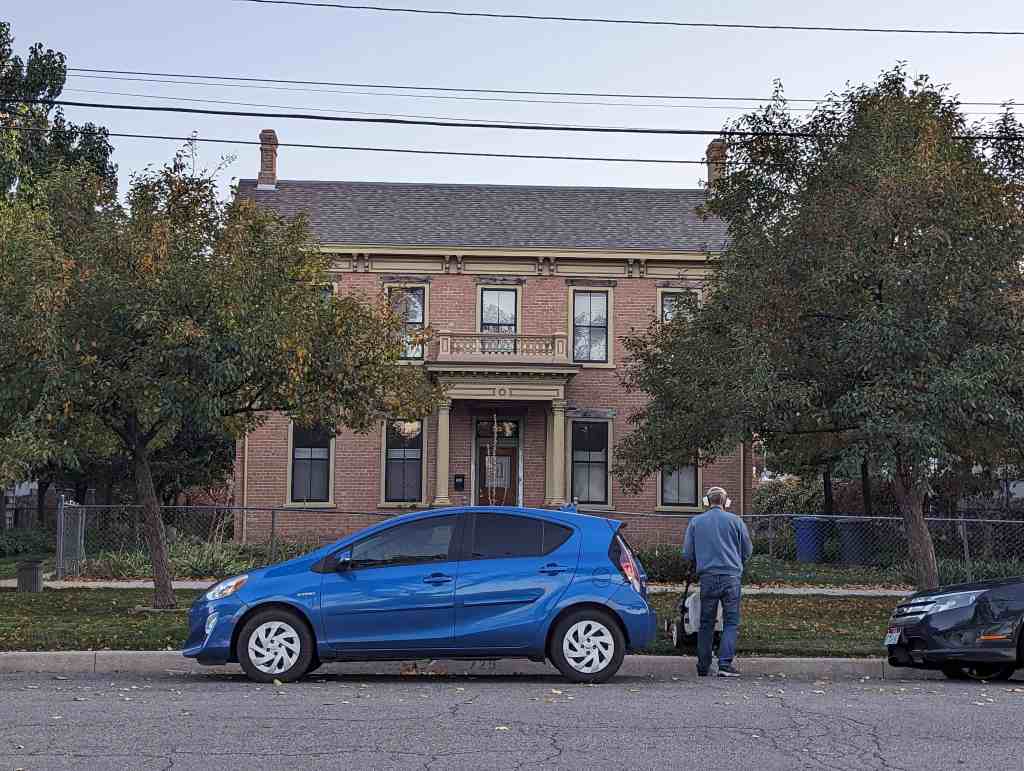
The Thomas and Mary Hepworth House, constructed in 1877, is architecturally significant under criterion C as the only known 2-story Italianate central-passage house in Salt Lake City. As such it marks a culmination of the long tradition of central-passage house designs in the United States and particularly in Utah. The house illustrates the longevity the tradition enjoyed in Utah before giving way to the popularity of the Victorian Picturesque styles of the 1880s. In some ways the house design was a bridge from the old to the new, with its traditional central-passage plan, updated with more vertical Victorian proportions and with stylish Italianate detailing.
The Thomas and Mary Hepworth House is located at 725 West 200 North in Salt Lake City, Utah and was added to the National Historic Register (#00000404) April 21, 2000.
Related:
The Thomas and Mary Hepworth House, constructed in 1877, stands facing north on 200 North in the Northwest residential section of Salt Lake City. The House originally stood on 5/8 of an acre, which likely included a number of outbuildings. The west section of the property was eventually sold off, so that the house now sits on just under 1/3 of an acre. This smaller lot at one time included a barn, a garage, and a shed, none of which survived beyond the 1960s. While homes were built in the neighborhood soon after the area was platted in 1849, only a few of the early houses remain. Most of the houses in the area date from the 1880s to the 1910s, a period when the larger lots were sub-divided into numerous small parcels. This period of smaller homes built on smaller lots corresponds with the transformation of the neighborhood from a somewhat rural area to a more working-class urban neighborhood. As one of the oldest homes in the neighborhood, the Hepworth House stands out as one of the larger homes on one of the larger lots in the area.
The Thomas and Mary Hepworth House is a two-story central passage “l-house” with a single-story ell attached to the rear of the house. The foundation is constructed of local pink sandstone, laid in a random ashlar pattern in the front of the house and a random rubble pattern in the rear. The main two-story body of the structure is built of a soft-fired orange-colored brick laid in common bond pattern, while the single-story rear ell is frame covered with drop/novelty siding. The main elevation consists of five bays and a square porch protecting the central entry door. An Italianate cornice with panel moldings and paired sandwich brackets trims the roof and punctuates the gabled ends of the house with returns. The eaves conceal functioning box gutters and a corbelled chimney stands at each gabled end.
The form and massing of the Hepworth House have undergone relatively little change since its construction in 1877. The footprint of the house originally formed a simple T. The only change in the basic footprint came with the early addition of a single-room in the southwest corner of the T. This addition was in place at least by 18981 , and had likely been there for quite some time before that year. Long porches originally flanked both sides of the rear ell, but they were altered over time and eventually removed. Otherwise, the body of the structure remains primarily as it was built. The greatest changes to the house came through the deterioration and removal of original detailing. The original front porch, while essentially the same size as the current one, was far more elaborate. It had wooden balustrades, fluted Corinthian columns, and a balustrade on the roof above, creating a second-story balcony. This balustrade had disappeared by the 1920s and by the late 1930s the columns and railings had been removed3 . The rest of the porch was replaced in the 1980s, due to structural problems. Likewise, the chimneys deteriorated over a long period of time and were eventually knocked off at the roofline and covered over in the 1980s4 . The chimneys were re-built in 1996 based on photographs and the remaining physical evidence. Decorative Italianate pediments originally hung over each window and the main entrance on the front of the house. These details were likely removed in the 1950s when the house was modernized with asbestos siding. The siding on the front and side elevations was removed in 1999 to reveal the original brickwork. The cornice detailing on the front and back of the house also suffered from neglect and most of it was removed. These sections of the cornice were re-constructed in 1997, based on photographs and the surviving cornice sections. Originally, the front part of the house had double-hung sash windows with two-over-two divided lights. The sashes were replaced with aluminum framed windows, probably in the 1960s or 70s, but the window casings were left intact.
The interior of the house is laid out in a typical central passage “l-house” plan. The entry hall contains a staircase to the second floor. A paneled octagonal newel post stands at the base of the staircase. The post as well as the surviving octagonal balusters and handrail are of walnut. The rest of the woodwork in the house, which is of pine or fir, was originally painted to imitate oak and maple. Eventually all the woodwork in the house was painted over with solid paint colors. On the main floor there is a single large parlor on each side of the entry hall. The parlor on the east was the formal parlor and included a fireplace with a cast-iron mantel, a plaster medallion on the ceiling, and a coved plaster cornice around the room. Unfortunately, the original mantel and the ceiling medallion disappeared from the house. Only portions of the cornice remain. On the second floor, there were originally two bedrooms off each side of the central hallway. In 1943, when the house first became a multi-family dwelling, the southeast bedroom was divided into a bathroom and a kitchen. At some point partition walls were also constructed underneath the stairway and at the top of the stairs to divide the house into apartments. The frame ell at the rear of the house originally included a dining room, a pantry, and a kitchen, as well as a small room that at some point became the first bathroom in the house. A single room addition (mentioned above) was constructed (or perhaps created from an existing porch) in the corner formed by the ell and the brick portion of the house on the west side.
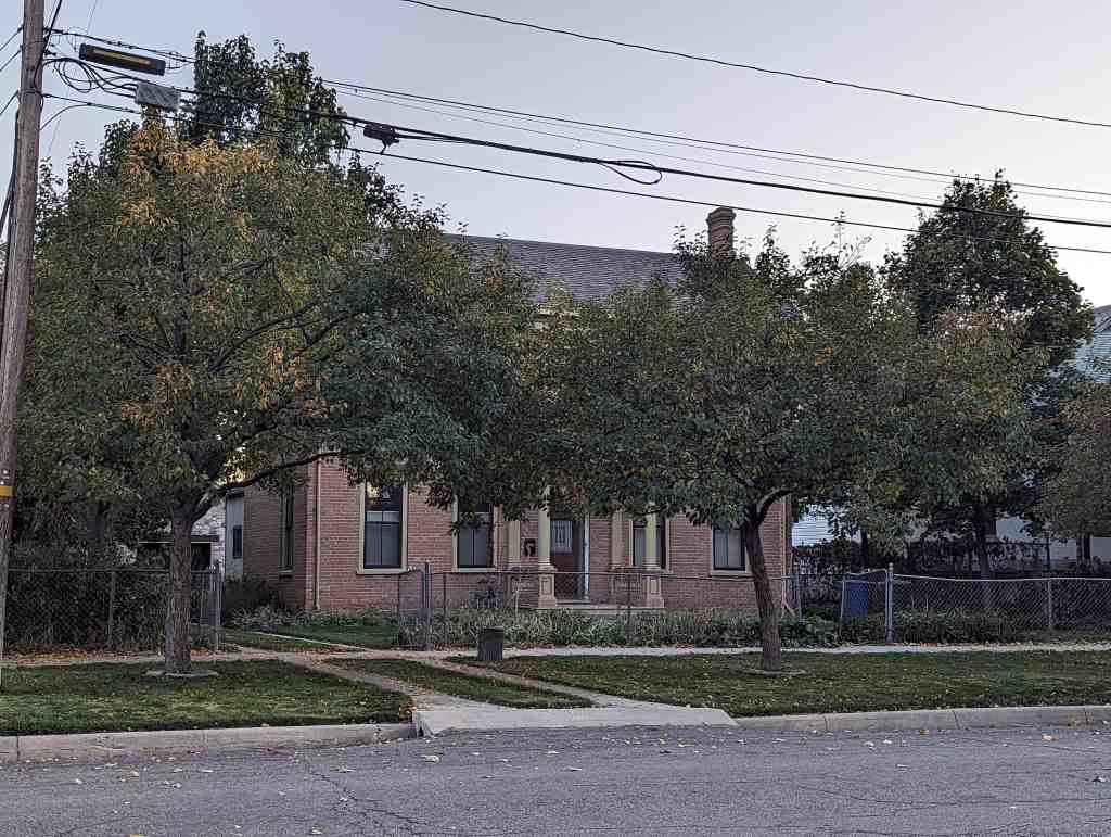
The Hepworth House was constructed in 1877 for Thomas and Mary Hepworth. Thomas and Mary were natives of England, born in 1826 and 1832 respectively. Not long after their marriage they converted to Mormonism in Liverpool and in 1852 they set out for America, making the long sea voyage and then the wagon trip across the plains to Utah. While they apparently lived in a number of communities in Utah, they eventually settled in Salt Lake City, where Thomas worked as a butcher in the City Market and in time set up his own meat market, T. Hepworth and Sons. In 1872, Mr. Hepworth purchased a piece of property on the west side of town5 . It is likely that at the time the property already included some kind of residence, because the Hepworths were listed in city directories as living on the property for several years following the purchase, but before the current house was built.
By 1877, the Hepworths had accumulated enough wealth to build a new home and construction apparently began late in the summer of that year. Physical evidence of this date of construction is found in the house itself. The roof of the house is made of planks apparently taken from some kind of billboard or fence. On the planks there are still fragments of posters advertising the coming of “Montgomery Queen’s California Menagerie, Caravan and Great Double Circus.” This circus performed in Salt Lake City on July 2 and 3, 18776 . By late August the planks had apparently been salvaged for use in the Hepworths’ new house, for a cryptic note in the attic states, “7 days, masons started Thursday August 23,1877.” This is likely a reference to the commencement of the stone foundation for the house. The brick portion of the house and the frame ell were constructed together. The only addition to the house over the years came fairly soon in its history, as evidenced by the square nails and the same circus-billboard planks used in its construction. Sanborn Maps show the one-room addition in place by 1898, but it had likely been there for quite some time before that. The Hepworths, who would have had 8 children living at home when the house was built, continued to occupy the house as their children married and left home. Thomas died in 1895, following an accidental fall in an elevator shaft. After his death, Mary continued to live in the house until 1904. Failing health prompted her to go live with a daughter in Los Angeles, where she died in 1905. The family sold the house to Samuel and Emma Bjorklund in 1906. They also sold off the western part of the original property separately and a new house was soon constructed there.
Samuel and Emma Bjorklund were both natives of Sweden. While there is no evidence that either of them were ever members of the Mormon church, it is likely that they came to Utah with family members who had converted to Mormonism. In Sweden, Samuel had been trained in “dental surgery, tonsillectomy, and barbering,” but was apparently not allowed to practice the first two professions after arriving in Utah in the early 1880s7 . He did, however, work as a barber for many years in a succession of barbershops in Salt Lake City. Samuel and Emma were married in Salt Lake City in 1886 and eventually had four children. They occupied a number of residences in the city and even had one built, but they didn’t settle down permanently until they purchased the house from the Hepworth family. During the time the Bjorklund family owned the house the only significant changes they made to it were the removal of the rear porches and the pillars and balustrades on the front porch. After their children were grown, one un-married daughter, Inga, and one widowed daughter, Frances, continued to live in the house. Following Emma’s death in 1932 and Samuel’s in 1939, the two daughters continued to occupy the home for a couple of years.
In about 1941 the Bjorklund family sold the house to a third immigrant couple, John and Marie Roothoff. The Roothoffs were natives of Holland and had come to Utah as Mormon immigrants. The Roothoffs lived in the house for only a few years, but their impact on the history of the building was great. After living in the house for a time, they began in 1943 to divide the house into apartments9 and then moved out, continuing to rent out the apartments for a number of years. In 1953, Irven and Mary Light purchased the house as their own residence, but continued renting out part of the house as well. During the time they owned the property, the Lights carried out the most extensive changes to the structure. This included removing some of the decorative woodwork on the exterior, covering the brick with asbestos siding, and further dividing the house to accommodate apartments10 . After the Lights sold the house in 1963, it would pass through multiple landlord owners, functioning as a rental property for more than thirty years.
The house is currently undergoing an extensive restoration. As noted earlier, the chimneys have been re-built, most of the asbestos siding has been removed from the brick section of the house, and missing cornice details have been reproduced. The restoration will eventually include replacement of aluminum-framed windows with historically accurate wooden-sash windows, reconstruction of the historic front porch, and duplication of the missing window pediments. Fortunately, there is sufficient photographic and physical evidence to accurately reproduce these lost elements.
Architectural Significance
The Hepworth House is located on the west side of Salt Lake City in one of the original city plats (Plat C) laid out in 1849 by Mormon pioneers who had first arrived in the Salt Lake Valley two years earlier. This plat, like other portions of the city, was made up of a grid of wide streets surrounding ten-acre blocks. Each block contained eight lots. In 1872, Thomas Hepworth purchased one-half of one of these lots on a block situated about 7 or 8 blocks from the central business section of the city. It is clear from the house he built that Thomas Hepworth had become quite prosperous and wanted a home that would express that status. Consequently, he chose a house form that had long been “something of a national symbol of economic achievement” – the central-passage house11 . Furthermore, he chose a two-story version with the more impressive five-bay façade. To this strong traditional symbol of success he added vertical proportioning and stylish Italianate detailing, including a bracketed cornice, pediments over the windows, and porch balustrades and Corinthian columns. It is clear even today that there was a conscious effort to make the house as impressive as possible. The brick portion at the front of the house has all the large windows and all the elaborate detailing. The rear ell was constructed of wood and lacked detailing. The bulk of the available resources went instead for the main façade.
By 1877 the central-passage house had long been a popular form in Utah. The form had its roots in the Georgian house and, in time, became the quintessential American house. The two-story, single-pile version became so common in the midwestern states of Illinois, Iowa, and Indiana, that it was dubbed the “l-House”. Early Mormon settlers brought this preference for the central-passage house to Utah and in the early 1850s most of the finest homes in the early Mormon communities were built in that form. This included the Beehive House, Brigham Young’s official residence, as well as those of other prominent LDS church leaders. Although the central-passage form was not the most common form in early Utah, it was the house plan of choice for almost anyone who could afford it, and Salt Lake City boasted scores of classically proportioned central passage homes. In Utah, as in other parts of the country, the central passage house was a recognizable symbol of social and economic success.
The elite preference for this form persisted through the 1860s, despite the introduction of new architectural styles in the Eastern United States. The coming of the Transcontinental Railroad in 1869 brought the end of Utah’s isolation and the 1870s saw new styles beginning to impact the trends in Utah Territory. While some adopted the new styles outright, many simply applied the new styles to familiar building forms. This was particularly true in the smaller towns in the territory, where classically inspired building forms with Gothic Revival or Italianate detailing became fairly common. In Salt Lake City, where the newer styles were more likely to be fully embraced, as in Brigham Young’s lavish new Second Empire “Gardo” House, the mix of the old and new still found a place. The Thomas and Mary Hepworth House is an outstanding urban example of these architectural “bridges” between the traditional and the up-to-date.
While the Hepworths occupied the home for many years, their house was never more stylish than the day it was built. By the early 1880s building in such a style was almost unheard of in Salt Lake City. Within a decade the tradition of central-passage houses had almost completely died out in rural Utah as well.
Today, the Thomas and Mary Hepworth House remains as a rare symbol of nineteenth century values and social structure. Of the numerous central-passage houses that once stood in Salt Lake City, only a handful remain. Of those that do, only the Hepworth House, with its central passage plan and its Italianate detailing, reflects the architectural transition from old to new that took place in Utah in the 1870s.


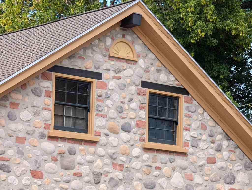
01 Friday Dec 2023
Posted in Uncategorized

McCornick Block
1891-1893, Mendelsson & Fisher
The McCornick Block represents a transition in Salt Lake City’s commercial architecture from the two to four-story buildings of the 19th century to the skyscrapers of the 20th century. When it was completed in 1893, the seven- story McCormick Building towered over its smaller neighbors. Six early model elevators enabled people to reach the dizzying heights of the seventh floor with ease. This building originally featured a four-foot copper cornice and a columned entryway on the east side. A keen observer will note that the northernmost two bays are a later addition (1908), but conform to the building’s original design.
10 West 100 South in Salt Lake City, Utah


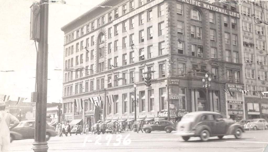
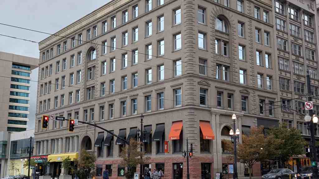
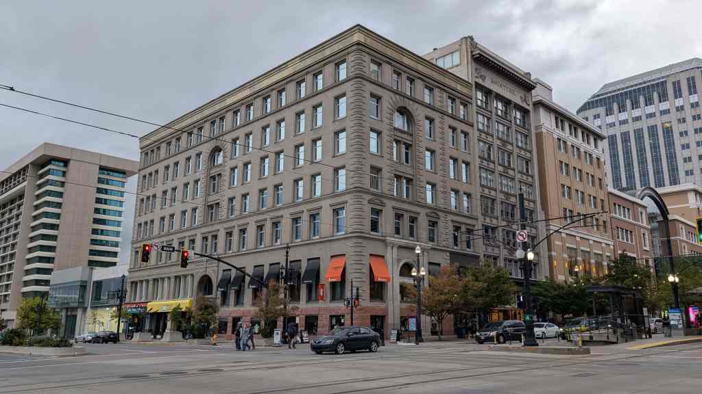
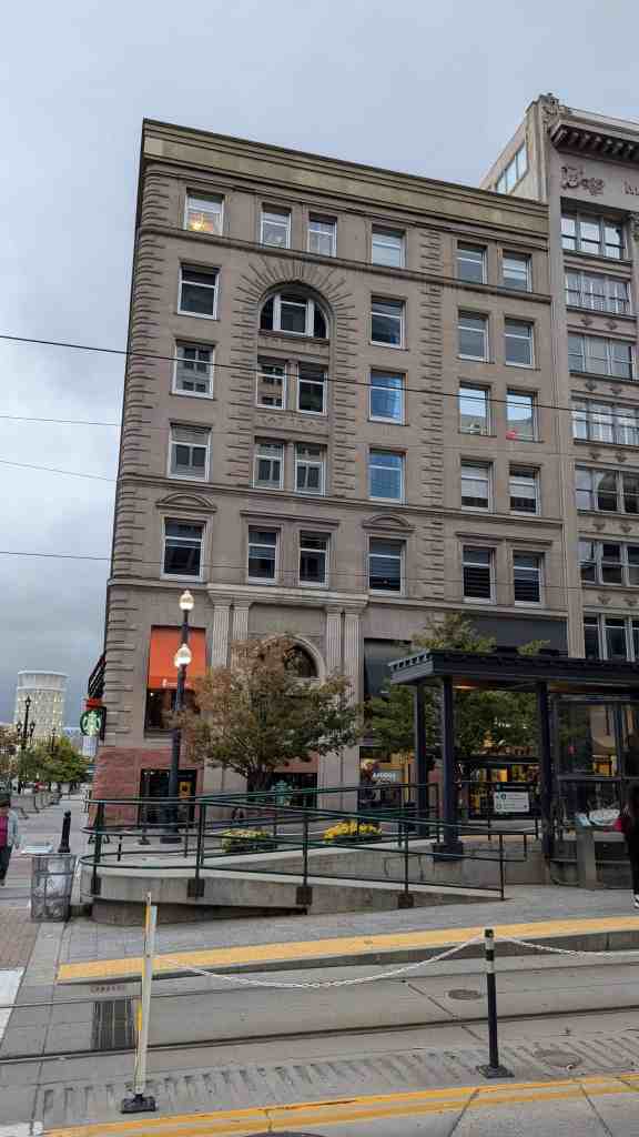
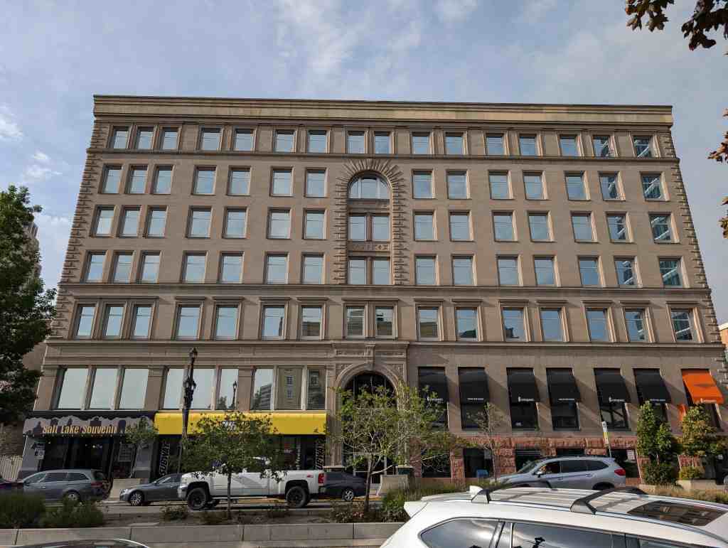
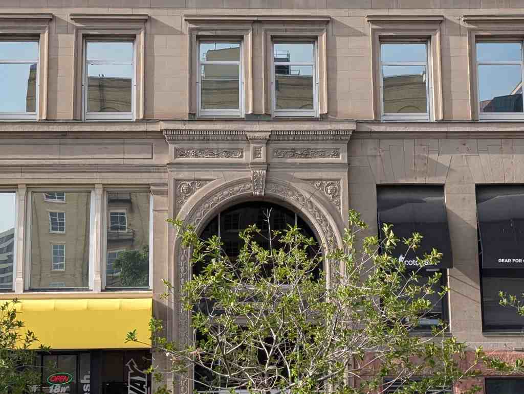
23 Saturday Sep 2023
Posted in Uncategorized
Tags
Art, Salt Lake County, Statues, UTA Stops, UTA Trax, utah, West Valley City