• About JacobBarlow.com
  • Cemeteries in Utah
  • D.U.P. Markers
  • Doors
  • Exploring Utah Email List
  • Geocaching
  • Historic Marker Map
  • Links
  • Movie/TV Show Filming Locations
  • Oldest in Utah
  • Other Travels
  • Photos Then and Now
  • S.U.P. Markers
  • U.P.T.L.A. Markers
  • Utah Cities and Places.
  • Utah Homes for Sale
  • Utah Treasure Hunt

JacobBarlow.com

~ Exploring with Jacob Barlow

JacobBarlow.com

Tag Archives: San Juan County

Church Rock

25 Sunday Sep 2016

Posted by Jacob Barlow in Uncategorized

≈ 2 Comments

Tags

Blanding, Geologic, historic, Moab, San Juan County, utah

2016-07-31-15-49-08

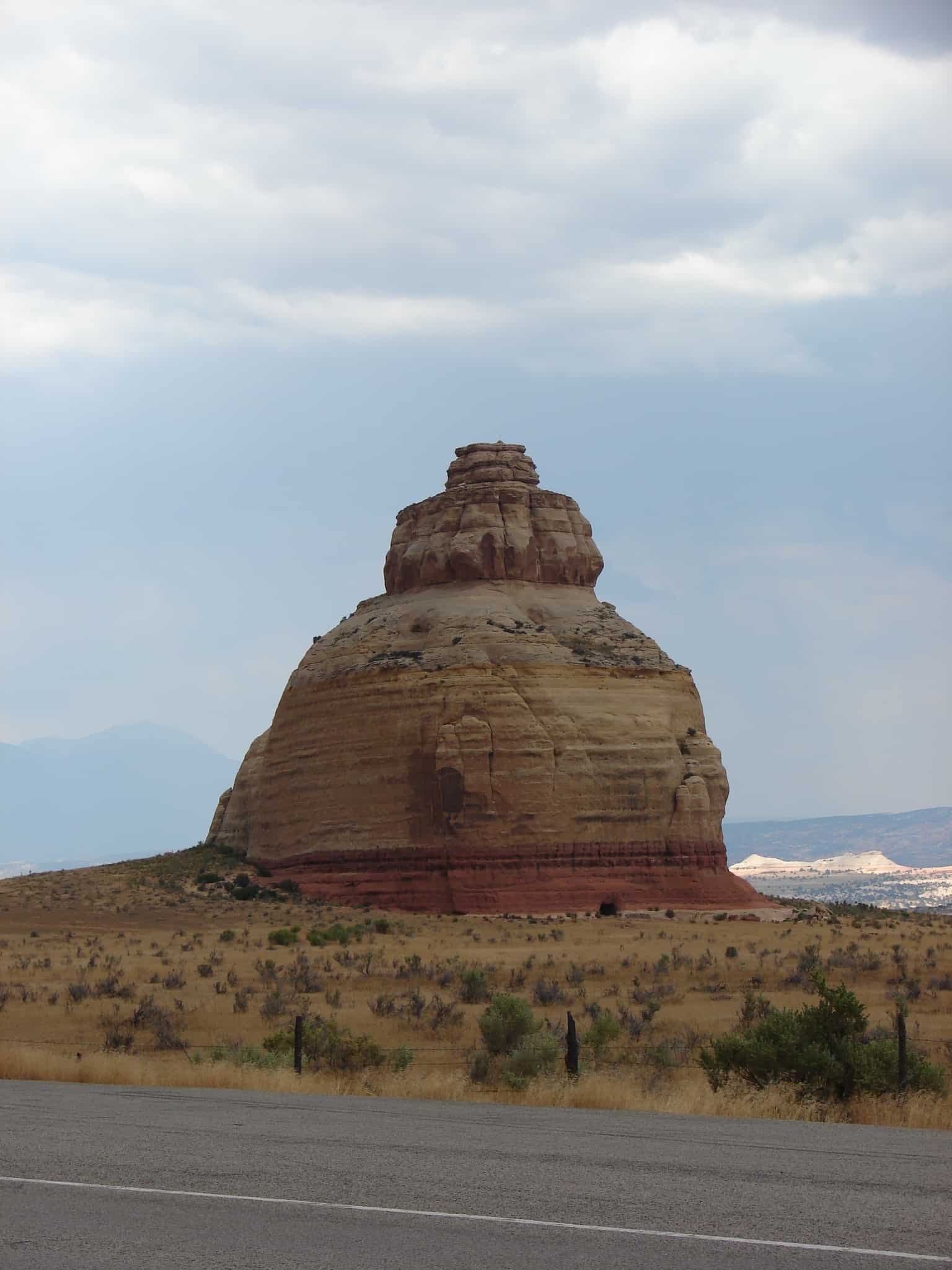
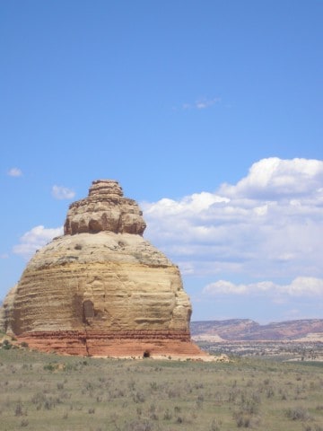
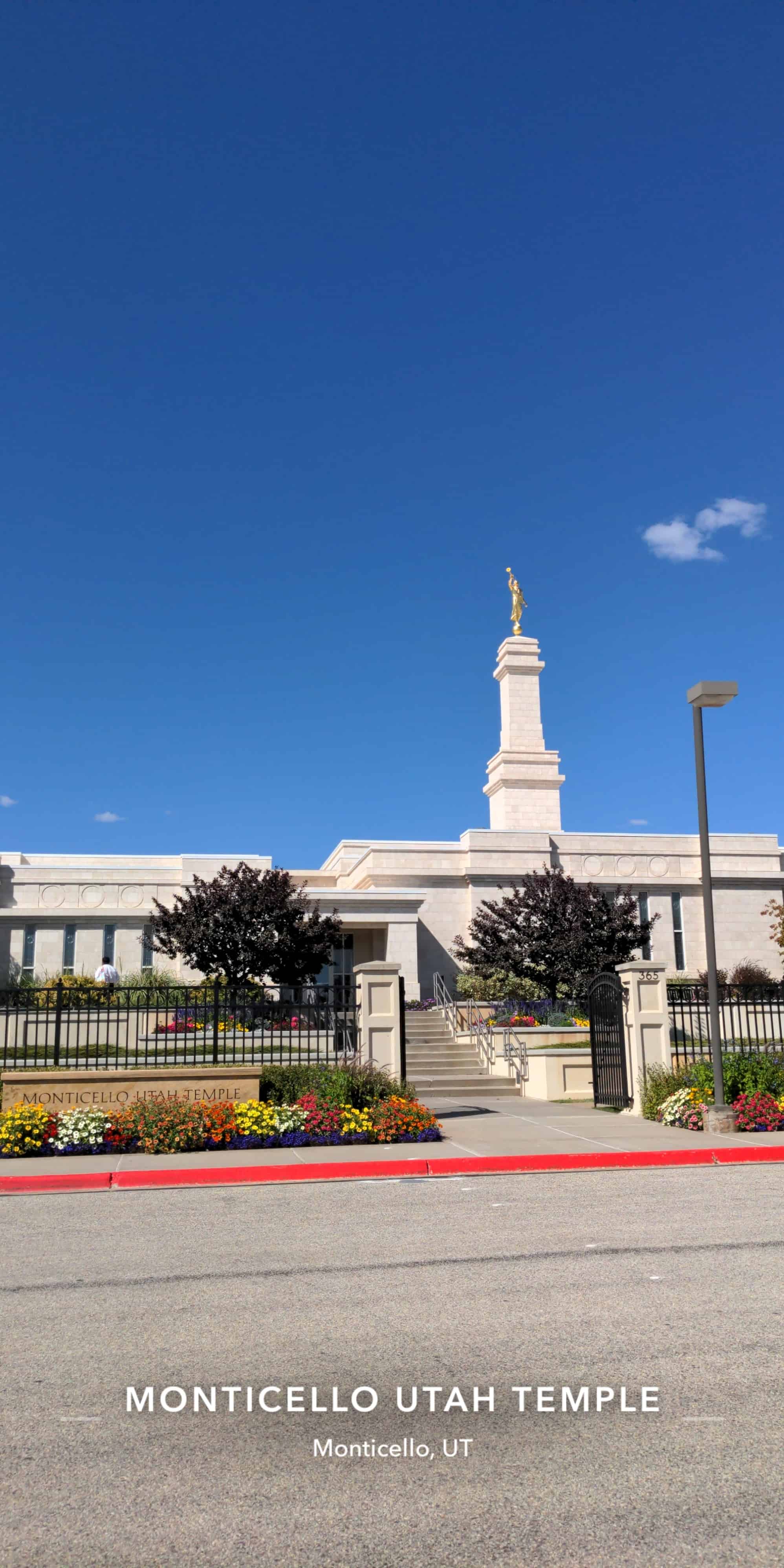
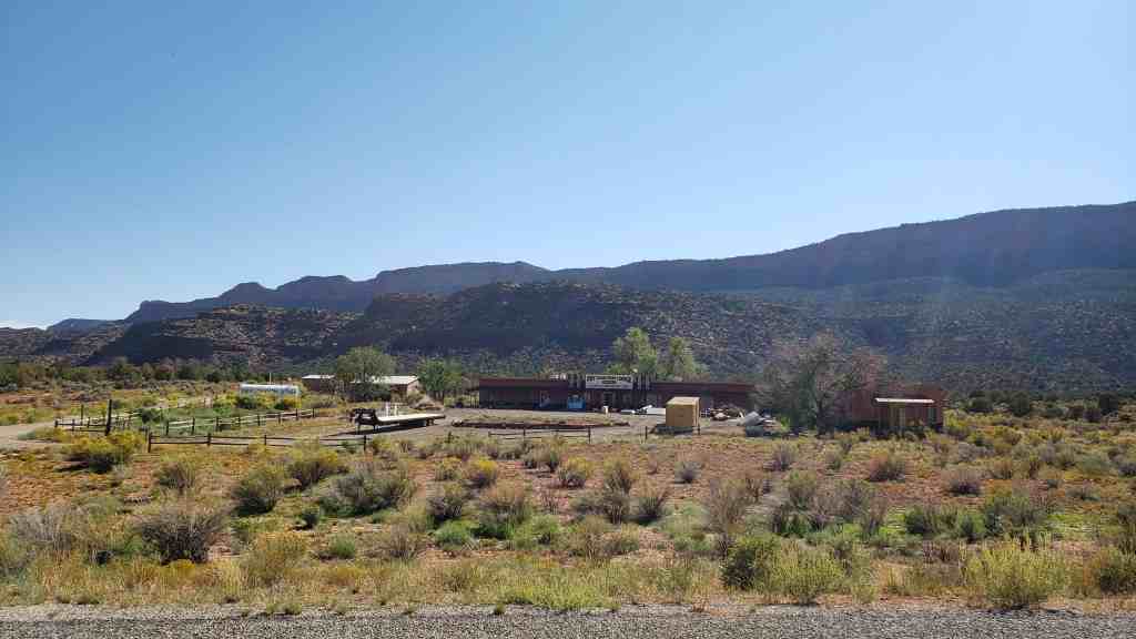
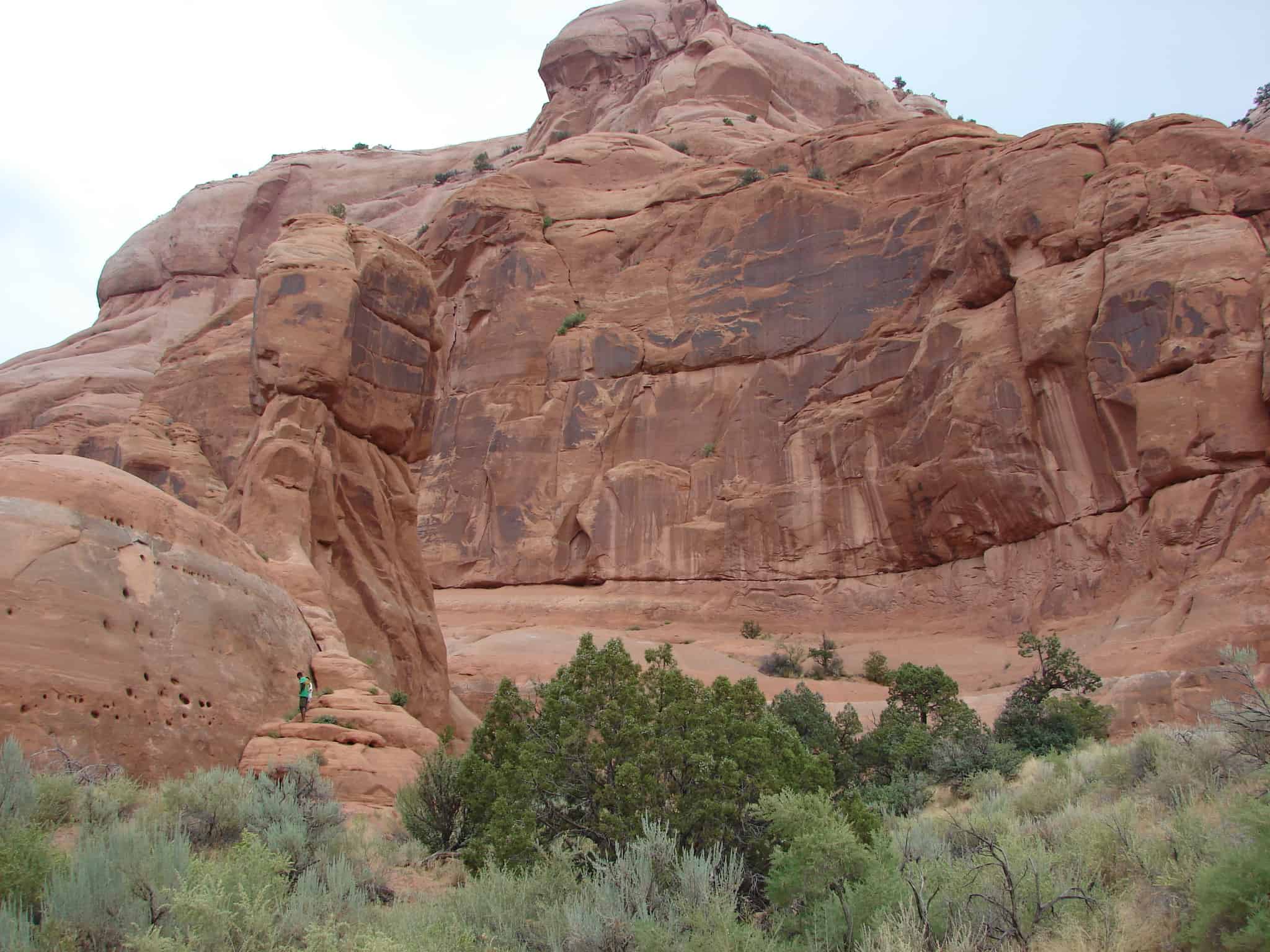
Church Rock is a solitary column of sandstone in southern Utah along the eastern side of U.S. Route 191, near the entrance to the Needles District of Canyonlands National Park.

With majestic Colorado and Green River canyons, Canyonlands, this 200 foot roadside oddity near Monticello is called Church Rock. It seldom attracts more than a casual glance as visitors head toward Newspaper Rock State Historic Monument and the Needles district or drive between Moab and Monticello.

One of the interesting pages of 1930’s myths tells about Church Rock, and how the gumdrop shaped rock earned its name. The story is that Marie Ogden’s Home of the Truth, an Utopian community, was erroneously responsible. Ogden was a spiritualist during the 20’s, giving lectures across the U.S. on spiritualism, until she came to San Juan County, Utah. She allegedly called San Juan County and Church Rock “the spiritual center of the universe.” With a small band of followers, Ogden’s group moved onto a tract of barren land along Utah’s Route 211 in 1933, calling it the “Home of Truth.” Members turned all their worldly goods to Ogden to join her Home of Truth, abiding by a strict code of conduct, were expected to work for the common goals of the settlement. Women tended to the domestic chores and men worked the arid farm acreage. Not far from Church Rock are the remains of Ogden’s ghost town. A few buildings and a small cemetery are all that remain of the Home of the Truth community, found on a ridge called Photograph Gap. After the community broke up, Ogden stayed in Monticello and became the owner and publisher of the community newspaper, The San Juan Record, in the 1940s. She died in the 1975 and is buried in Blanding.

The three-tiered sandstone rock is located not far from the Home of Truth, but is only one of several in the area (Sugarloaf and Turtle Rock among others). Part of the myth is that the group set upon a grand plan to hollow out the entire center of the sandstone monument, by hand, to build a church. In fact, the sandstone formation was owned by a local rancher, Claud Young of Monticello. Young owned about 2000 acres of land, for cattle range, before the highway came through the area known as Dry Valley.

The only evidence of the myth, and the apparent basis for the assumption of turning the rock into a ‘church,’ is the 16 by 24 foot opening chiseled into the rock. In fact, that ‘opening’ was contracted out by the owner, Claud Young. The opening was dynamited and cut out of the stone during the late 1940s to store salt licks and feed for the cattle. The rock is still owned by the Young family, in equal shares by the two daughters and two sons of Claud and Inez Young, their surviving spouses, and/or surviving grandchildren owning their percentage of ‘the rock.'(*)

picture24jul07-067
2016-07-31-15-49-38
OLYMPUS DIGITAL CAMERA

Clay Hills Pass

25 Sunday Sep 2016

Posted by Jacob Barlow in Uncategorized

≈ Leave a comment

Tags

Blanding, DUP, historic, Lake Powell, San Juan County, utah

2016-07-31-12-38-46

Clay Hills Pass – D.U.P. # 305

In 1879 the L.D.S. Church sent missionary families to San Juan Country to make settlement and better relations with the Indians. These pioneers led by Silas S. Smith and Platte D. Lyman came through the Hole-in-the-Rock. The company consisted of 83 wagons, men, women and children. Passage was often cut through solid rock or sandstone. On March 5, 1880 they reached the top of this hill, camped, and worked eight days building a road three miles long to bring the wagons safely to the bottom, a drop of 1,000 feet.

2016-07-31-12-35-08
2016-07-31-12-35-20
2016-07-31-12-35-22
2016-07-31-12-35-30
2016-07-31-12-35-47

Monticello Utah Temple

23 Friday Sep 2016

Posted by Jacob Barlow in Uncategorized

≈ 3 Comments

Tags

LDS, Monticello, San Juan County, Temples, utah

  • 13912575_10153977975629234_8464549311372050967_n

Once the smallest temple of the Church, the temple was expanded an additional 4,000 square feet.

The Monticello Utah Temple is the 53rd operating temple of The Church of Jesus Christ of Latter-day Saints (LDS Church). In October 1997, LDS Church president Gordon B. Hinckley announced the building of smaller Latter-day Saint temples throughout the world. The first of these smaller temples was to be built in Monticello, Utah. Less than one year after the announcement, the Monticello Utah Temple was dedicated on July 26, 1998.

The Monticello Utah Temple serves nearly 13,000 church members in Blanding, Moab, and Monticello, Utah areas and members from Durango, Colorado and Grand Junction, Colorado.  Located at the base of the Abajo Mountains, the temple’s exterior is finished in a marble called Noah’s Crème. Thirteen thousand tiles used on the temple were evaluated carefully to make sure they blended with each other for a uniform effect. The Monticello Utah Temple has a total floor area of 11,225 square feet, two ordinance rooms, and two sealing rooms.

Blanding, Utah

23 Monday Feb 2015

Posted by Jacob Barlow in Uncategorized

≈ 3 Comments

Tags

Blanding, San Juan County, utah

picture24jul07-079
Four distinct cultures, Ute, Navajo, European pioneer, and Spanish have left their history in Blanding, which sits on White Mesa near Blue Mountain. Anasazi occupation occurred here as early as 600 AD. Utes and an occasional Navajo camped in this area because of the water from local springs and seeps. Navajos called the location “Sagebrush,” because of the plant’s prolific growth amidst the pinyon and junipers forest at the base of the mountain.
 
In 1897, Mormon Walter C. Lyman and his brother Joseph loaded a buckboard with supplies and left Bluff to investigate White Mesa’s potential for a community. Lyman supposedly had a vision that one day this isolated area full of sagebrush would have an LDS temple. Soon, digging began on a canal from Johnson Creek, which was completed in 1905 and still waters abundant crops of hay and grain.
 
First known as Grayson (after Nellie Grayson Lyman, wife of Joseph), the town changed its name in 1914 when a wealthy easterner, Thomas F. Bicknell, offered a thousand-volume library to any Utah town that would adopt his name. Grayson competed with Thurber (renamed Bicknell) for the prize; the two towns split the books and Grayson was renamed for Bicknell’s wife’s maiden name, Blanding.
 
Blanding received notoriety for its involvement in the 1923 Posey War, called by some the last Indian uprising in the US. But the “war” was really a final bid for freedom by desperate Utes living on the edge of Blanding.*

Blanding Posts:

  • Alkali Ridge
  • Blanding Ward Chapel
  • Defiance House
  • Edge of Cedars Indian Ruin
  • Patio Diner
  • Recapture Reservoir
  • Rock Arches
  • San Juan Theater
  • Settlement of Blanding
  • The Old Settler’s “Swallow’s Nest”
2016-07-31-14-50-47

Fry Canyon, Utah

16 Monday Feb 2015

Posted by Jacob Barlow in Uncategorized

≈ Leave a comment

Tags

Fry Canyon, San Juan County, utah

Fry Canyon, Utah

Related:

  • Jacob’s Chair
  • Battle of Paiute Pass and the Wormington Grave
picture24jul07-086

picture24jul07-087

Verdure, Utah

13 Friday Jun 2014

Posted by Jacob Barlow in Uncategorized

≈ 2 Comments

Tags

Monticello, San Juan County, utah, Verdure

picture24jul07-078

The historic marker alongside the highway reads:

The oldest Mormon settlement in the Blue Mountain Region was first known as South Montezuma. Later the name was changed to Verdure after the lush green growth along the stream bed. Verdure was settled by men of the Blue Mountain Mission March 11, 1887, under the direction of Pres. Francis A. Hammond of the San Juan Stake. He called George A. Adams, Frederick I. Jones, Parley R. Butt and Charles E. Walton to establish a new settlement at North Montezuma, later named Monticello. They first set up camp at Verdure to prepare for a permanent settlement at Monticello, six miles to the north.

When company members moved on to Monticello in 1888 the Adams and Butt families remained at Verdure. By 1894 they were joined by the Alvin Decker, Willard Butt, Lingo Christensen, R.P. Hott and Francis Nielson families. Nielson operated a store and a school out of his log home, the first church met in the Decker home, and in 1893 a post office was installed in the Adams home.

Verdure was a peaceful frontier village where cattle, farming and cheese-making were the main occupations. Gradually the settlers moved to Monticello.

2017-03-12 16.46.24-1

2017-03-12 16.47.25

The Spanish Trail

10 Tuesday Jun 2014

Posted by Jacob Barlow in Uncategorized

≈ 3 Comments

Tags

DUP, historic, Moab, San Juan County, utah

picture24jul07-046

The Spanish Trail

Kane Springs, San Juan County, was a major water stop along the historic Spanish Trail, in use from 1829 to 1848. Large trade caravans halted here and drank from the abundant spring waters. In autumn months, pack trains carried woolen textiles and raw wool over the trail from the settlements on the upper Rio Grande to the coastal towns of California. On reaching California, wool merchants exchanged their goods for horses and mules, which were driven back to New Mexico the following spring. It took trail riders over two months to complete the journey.

The 1,120-mile route, from Santa Fe, New Mexico, to Los Angeles, California, followed a northward looping course that passed through the rugged southern and central landscapes of Utah. This trail avoided the deep canyons of the Colorado River and the hostile Indians of Arizona.

In 1848, at the end of the Mexican war, the territory encompassing the Spanish Trail became part of the United States. Thereafter, caravan traffic followed direct east-west lines. In the post-trail period, the waters of Kane Springs refreshed weary travelers, cattle drovers, pioneer settlers, and outlaws.

Daughters of Utah Pioneers historic marker #487, located at the Kane Springs Rest Area on Highway 191 in Grand County, Utah.

  • D.U.P. Historic Markers

Verdure

10 Tuesday Jun 2014

Posted by Jacob Barlow in Uncategorized

≈ 1 Comment

Tags

DUP, historic, San Juan County, utah, Verdure

picture24jul07-077

The oldest Mormon settlement in the Blue Mountain Region was first known as South Montezuma. Later the name was changed to Verdure after the lush green growth along the stream bed. Verdure was settled by men of the Blue Mountain Mission March 11, 1887, under the direction of Pres. Francis A. Hammond of the San Juan Stake. He called George A. Adams, Frederick I. Jones, Parley R. Butt and Charles E. Walton to establish a new settlement at North Montezuma, later named Monticello. They first set up camp at Verdure to prepare for a permanent settlement at Monticello, six miles to the north.

When company members moved on to Monticello in 1888 the Adams and Butt families remained at Verdure. By 1894 they were joined by the Alvin Decker, Willard Butt, Lingo Christensen, R.P. Hott and Francis Nielson families. Nielson operated a store and a school out of his log home, the first church met in the Decker home, and in 1893 a post office was installed in the Adams home.

Verdure was a peaceful frontier village where cattle, farming and cheese-making were the main occupations. Gradually the settlers moved to Monticello.

2017-03-12 16.46.24
2017-03-12 16.46.24-1

Check out all of the historic markers placed by the Daughters of Utah Pioneers at JacobBarlow.com/dup

Settlement of Blanding

03 Tuesday Jun 2014

Posted by Jacob Barlow in Uncategorized

≈ 1 Comment

Tags

Blanding, DUP, historic, Historic Markers, San Juan County, utah

  • picture20sep08-116

A canal was surveyed from Johnson Creek on Blue Mountain to White Mesa; in 1902-3 lots were staked for homes. Two years later Albert R. Lyman and family pitched first tent and settled one block west of this site. In 1907 a tent school was established. Population increased by families from Bluff and refugees from Mexico. Called “Grayson” Postal Service changed the name to “Blanding” in 1915. Last Indian uprising of frontier west occurred here in 1923. Death of Ute Chief “Old Posey” ended the trouble. This bell rang for church, school, fires, and other occasions.

  • picture20sep08-115

This is located at the Blanding Ward Chapel at 260 South Main Street in Blanding, Utah

Monticello

30 Friday May 2014

Posted by Jacob Barlow in Uncategorized

≈ 1 Comment

Tags

DUP, historic, Monticello, San Juan County, utah

picture24jul07-073

March 12, 1887 Frederick I. Jones, Farley R. Butt, Charles E. Walton and George A. Adams came here to start the L.D.S. Blue Mountain Mission. After their families arrived they camped at Verdure the first summer. In 1866 the families of M. Peterson, W.E. Hyde, Wm. Adams, and J.E. Rogerson came. This square was the activity center with a sports area, bowery, log relief society room and a co-op store. A log house built in 1888 stood 125 ft. west and was used for church, school and recreation.

picture24jul07-072

This is Daughters of Utah Pioneers historic marker #212 located at 165 South Main Street in Monticello, Utah

  • D.U.P. Historic Markers
← Older posts
Newer posts →

Follow Jacob

Follow Jacob

Come wander with me on Youtube.

Blog Stats

  • 2,097,637 hits

Social and Other Links

BarlowLinks.com

Recent Posts

  • Scout Monument
  • Provo High School Seminary Building
  • 821 E 100 S
  • 820 E 100 S
  • 817-819 E 100 S

Archives

Loading Comments...