Steeply dipping strata define the western edge of the San Juan basin. To the west older geologic formations are exposed toward the Defiance uplift whereas basinward they are they are downwarped thousands of feet beneath younger rock units. Vast coal, uranium, oil and gas resources occur in the strata buried within the basin.
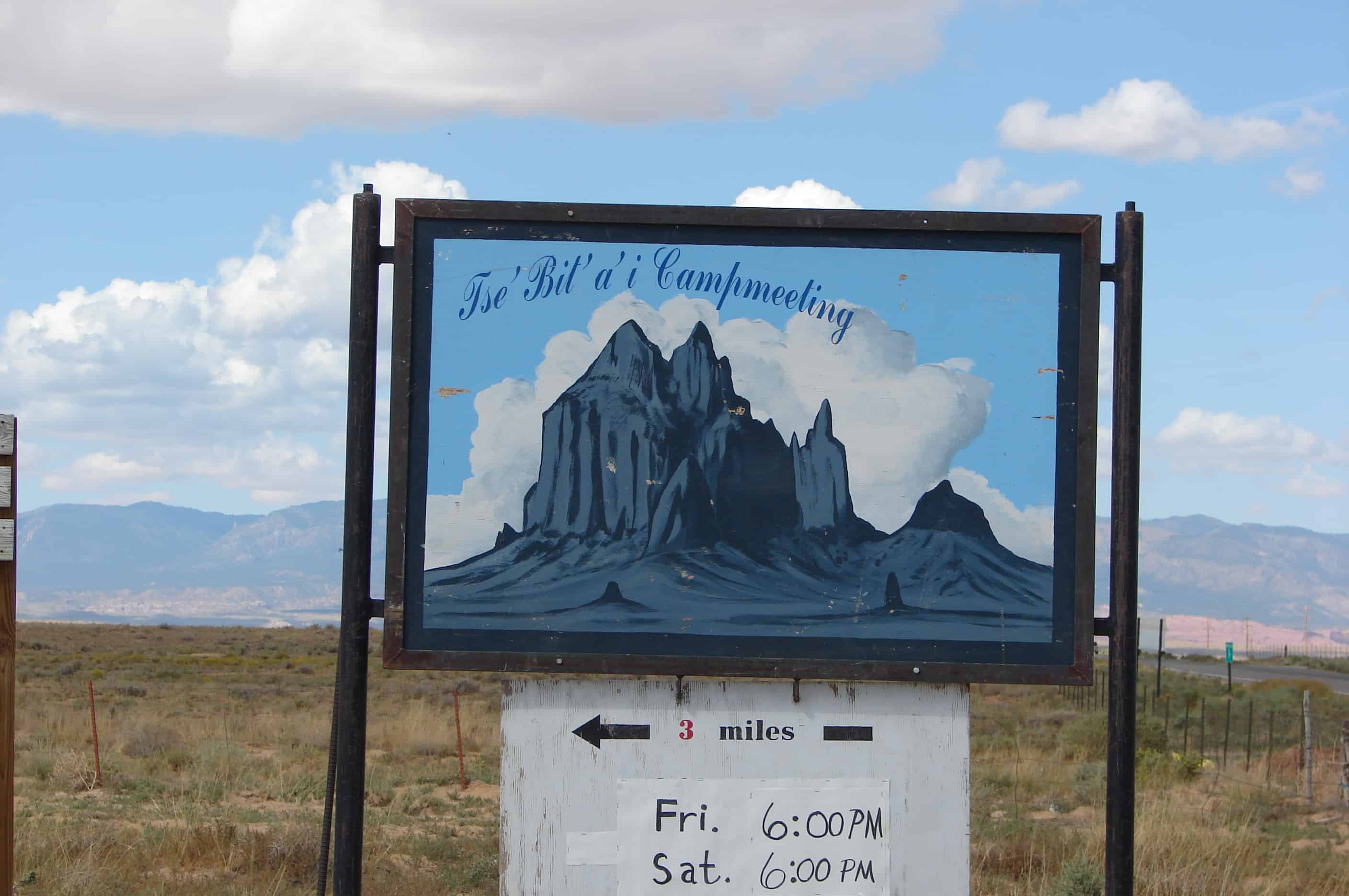
Tsé Bit’ A’í (Shiprock) is a rock formation rising nearly 1,800 feet above the high-desert plain on the Navajo reservation, about 12 miles southwest of the northern New Mexico town of Shiprock. Shiprock is composed of fractured volcanic breccia and black dikes of igneous rock called “minette.” It is the erosional remnant of the throat of a volcano, and the volcanic breccia formed in a diatreme. The exposed rock probably was originally formed 2,500-3000 feet below the earth’s surface, but it was exposed after millions of years of erosion. Wall-like sheets of minette, known as dikes, radiate away from the central formation. Radiometric age determinations of the minette establish that these volcanic rocks solidified about 27 million years ago. Ship Rock is in the northeastern part of the Navajo Volcanic Field; the field includes intrusions and flows of minette and other unusual igneous rocks that formed about 25 million years ago. Shiprock’s sheer walls make it tempting for serious mountain climbers. After years of standing as one of the continent’s great unsolved climbing problems, it was first scaled in 1939, by a Sierra Club party including David Brower. Since then at least seven routes have been climbed on the peak, all of them of great technical difficulty. However, questions of legality, ownership, and religious significance have always made access to Shiprock dubious. In particular, the Navajo have a number of legends associated with Shiprock, and consider it sacred, so climbing it is currently illegal.
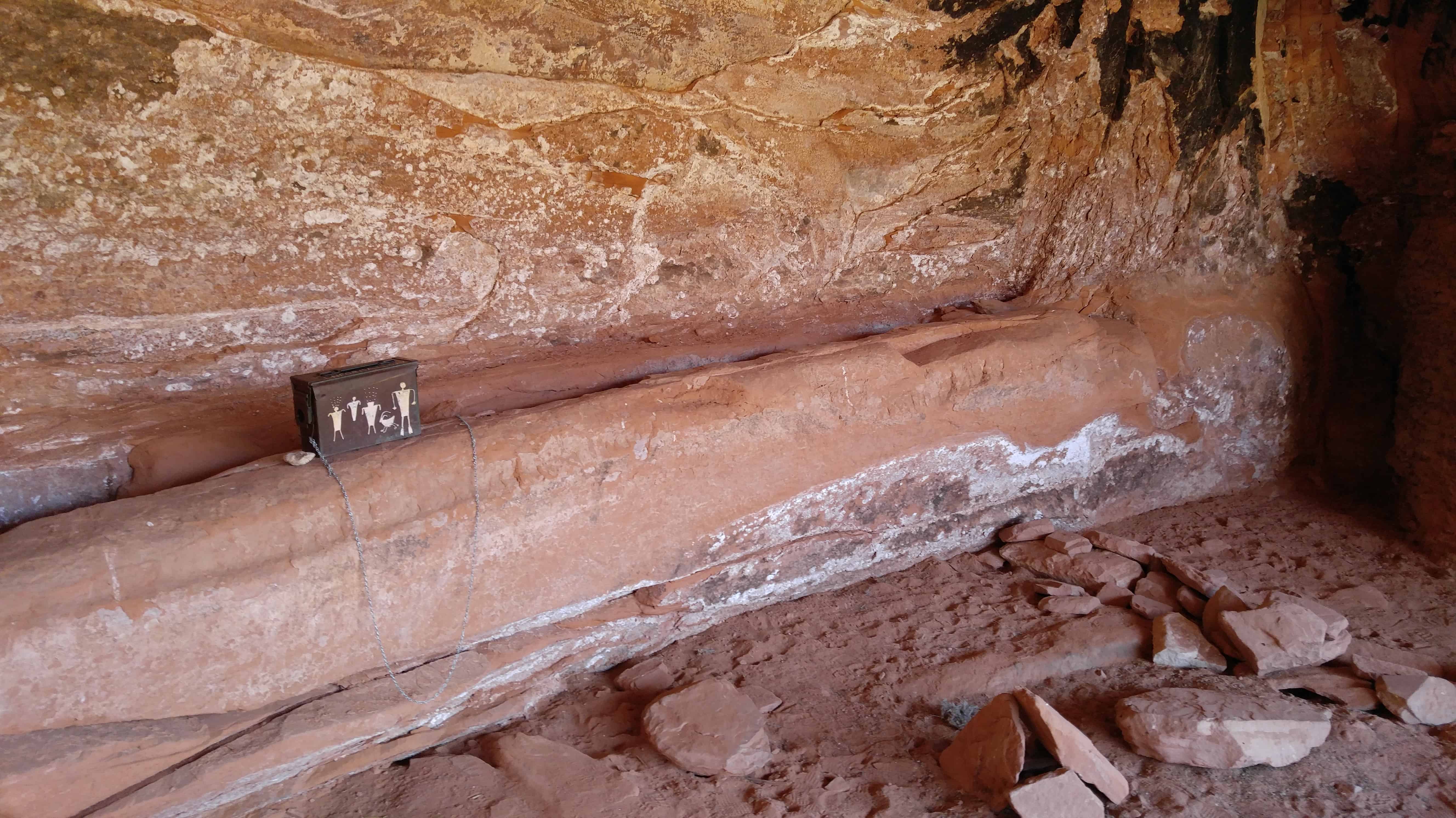
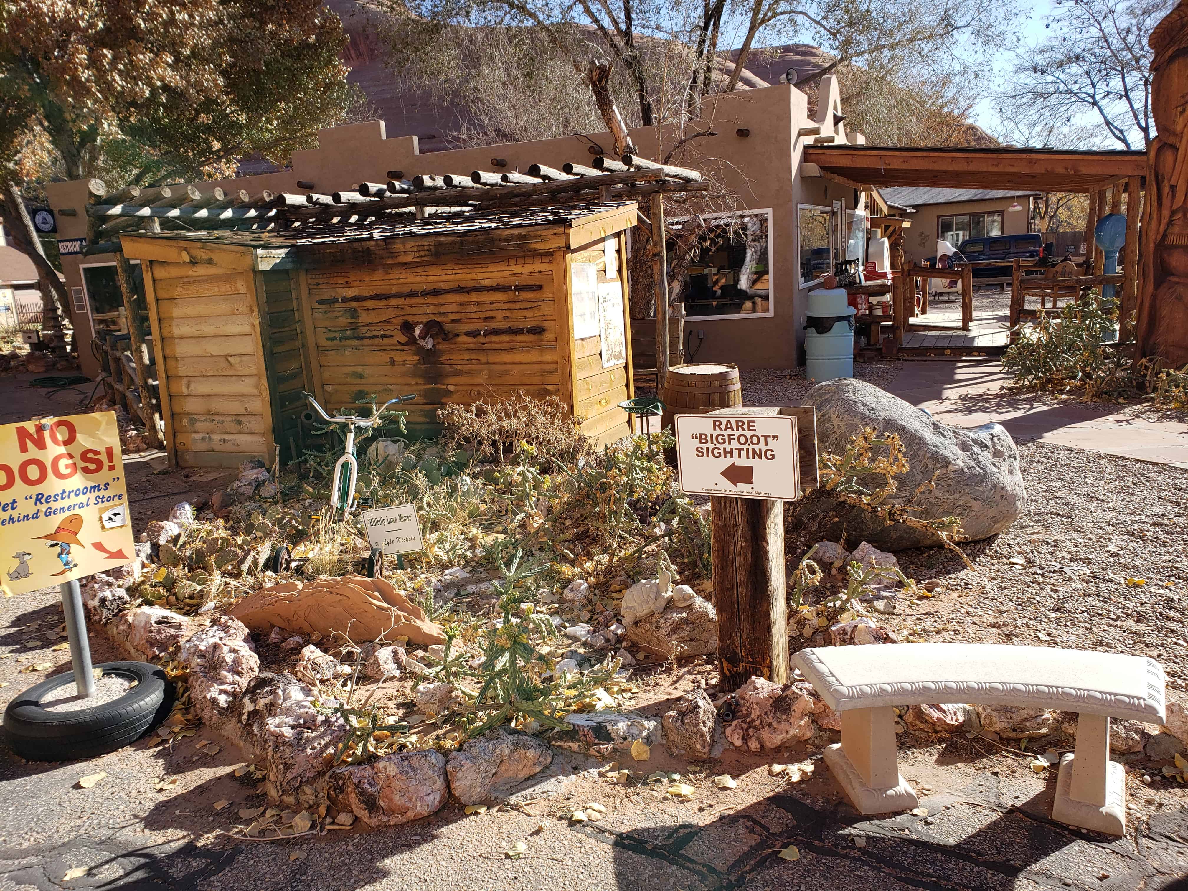
A geocache in San Juan County that I really liked, there’s an old rusty pipe coming up out of the ground and inside it is a cable to pull up the bucket that is the cache.
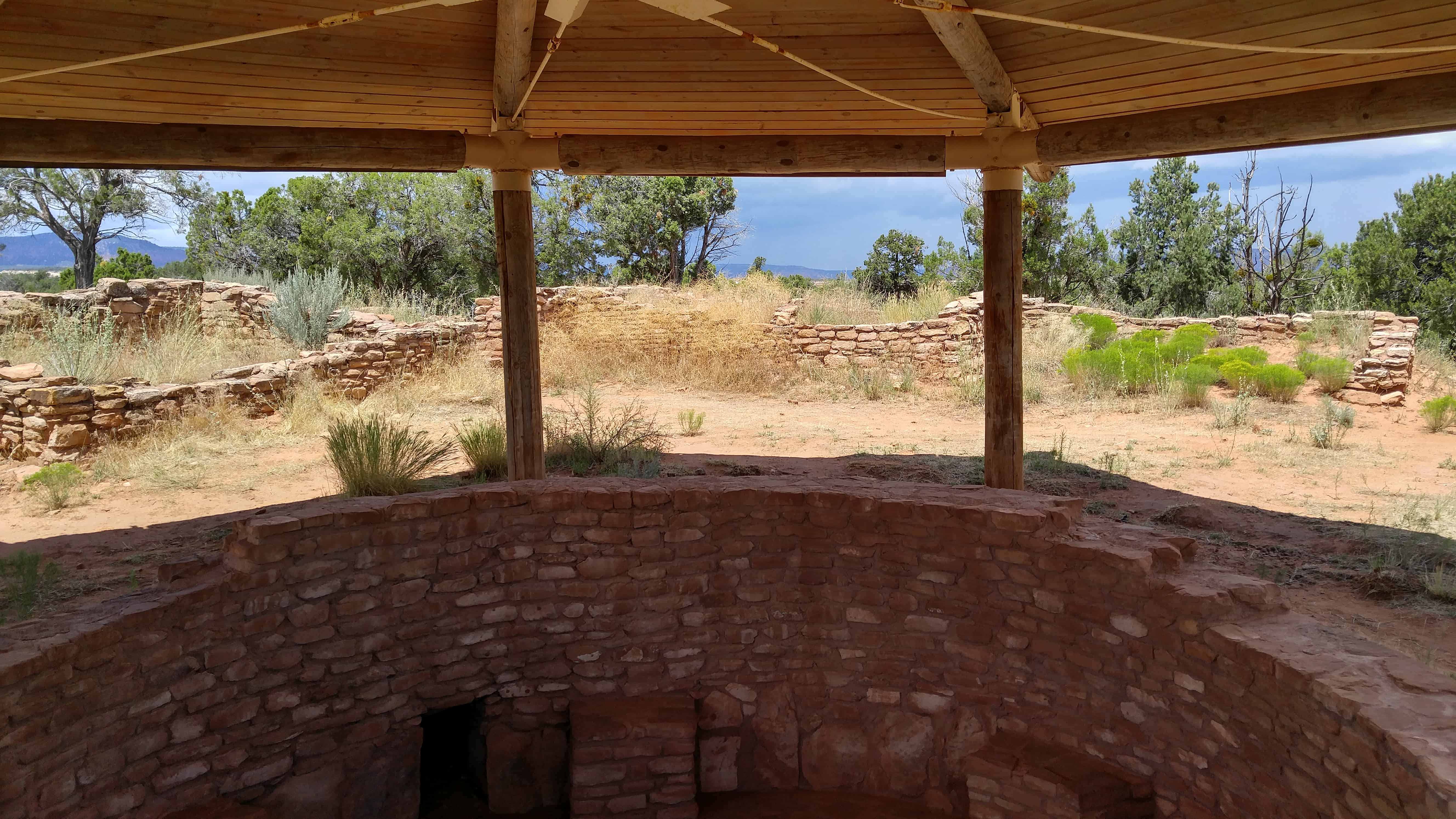
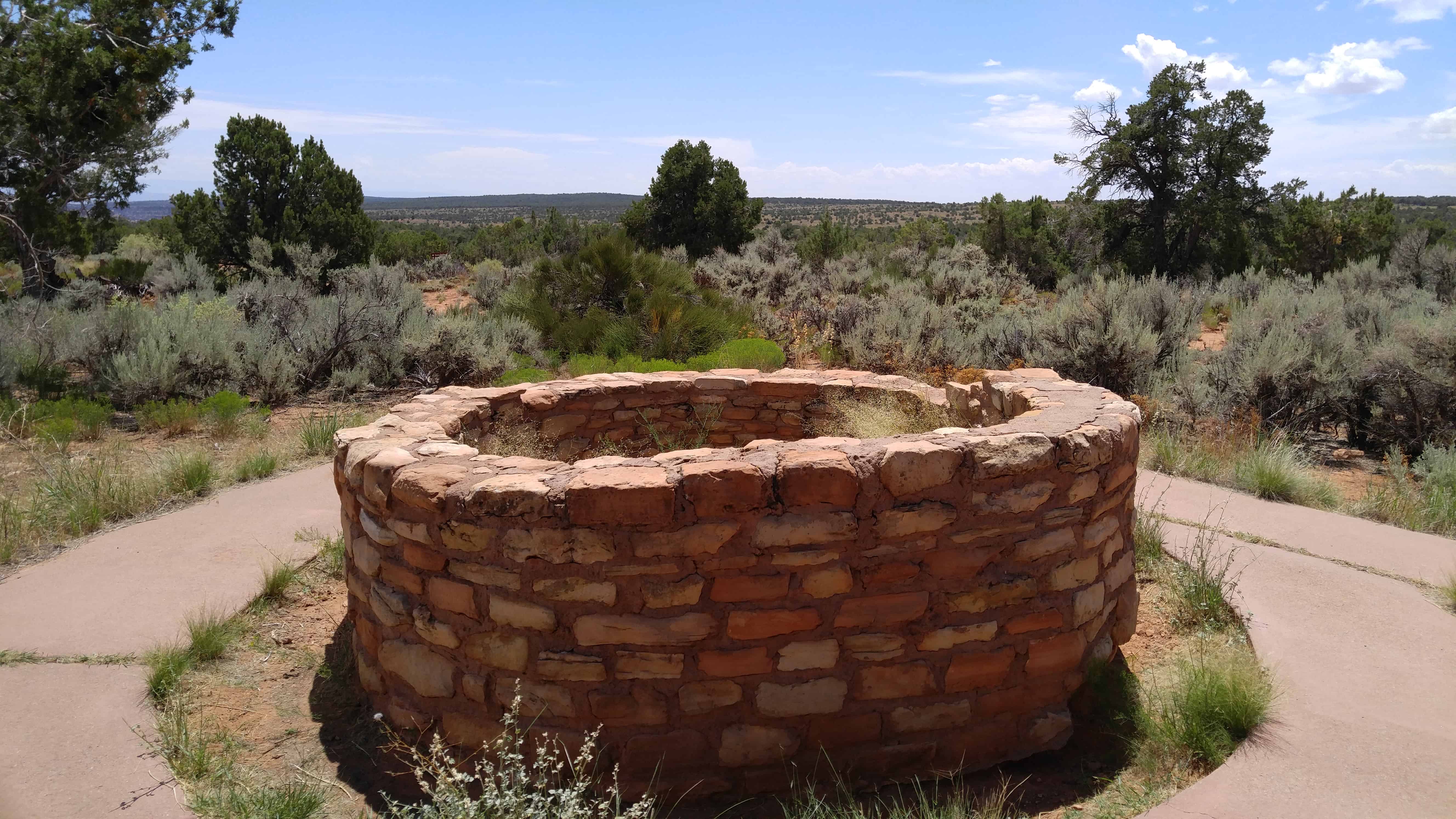
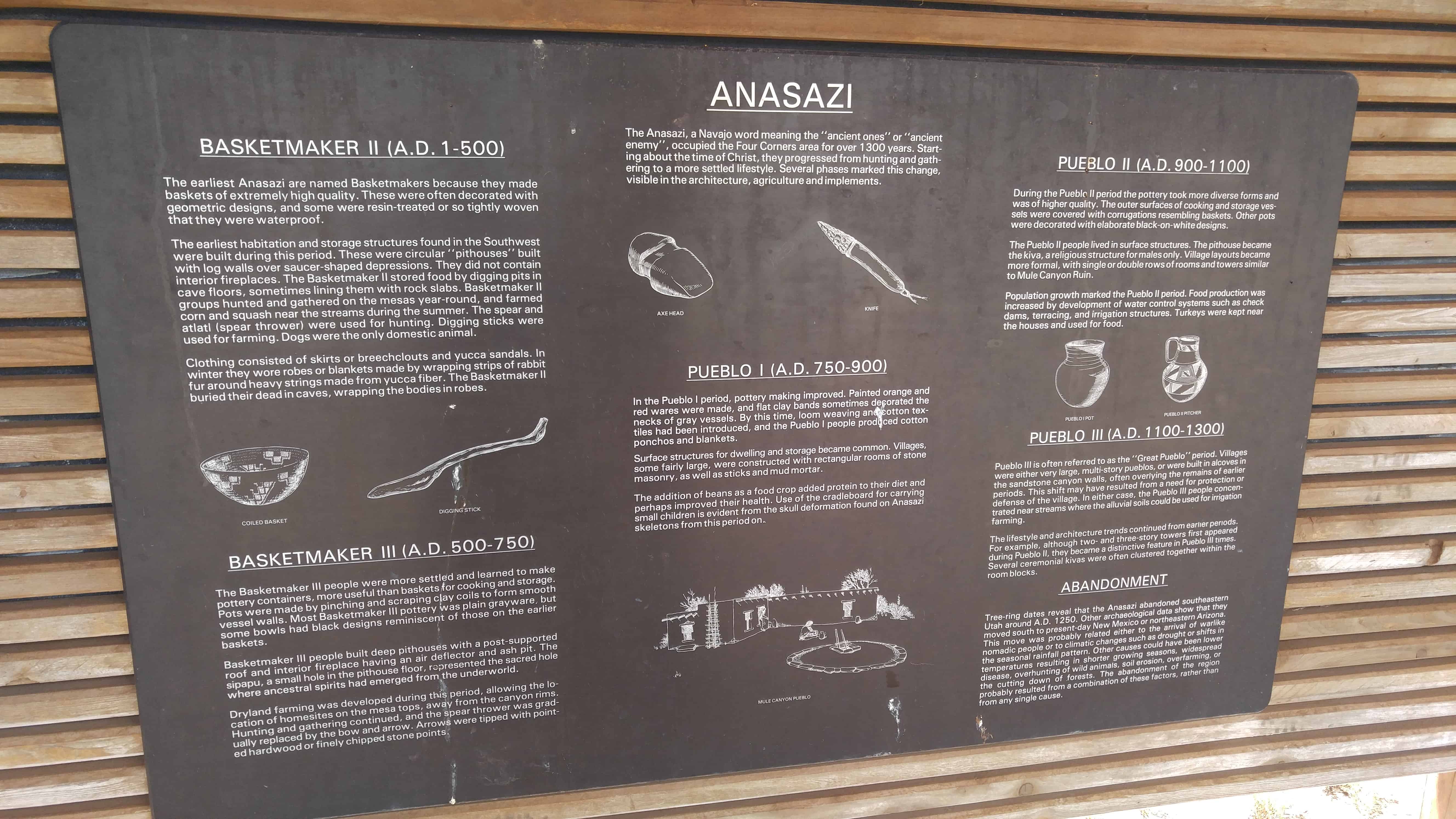
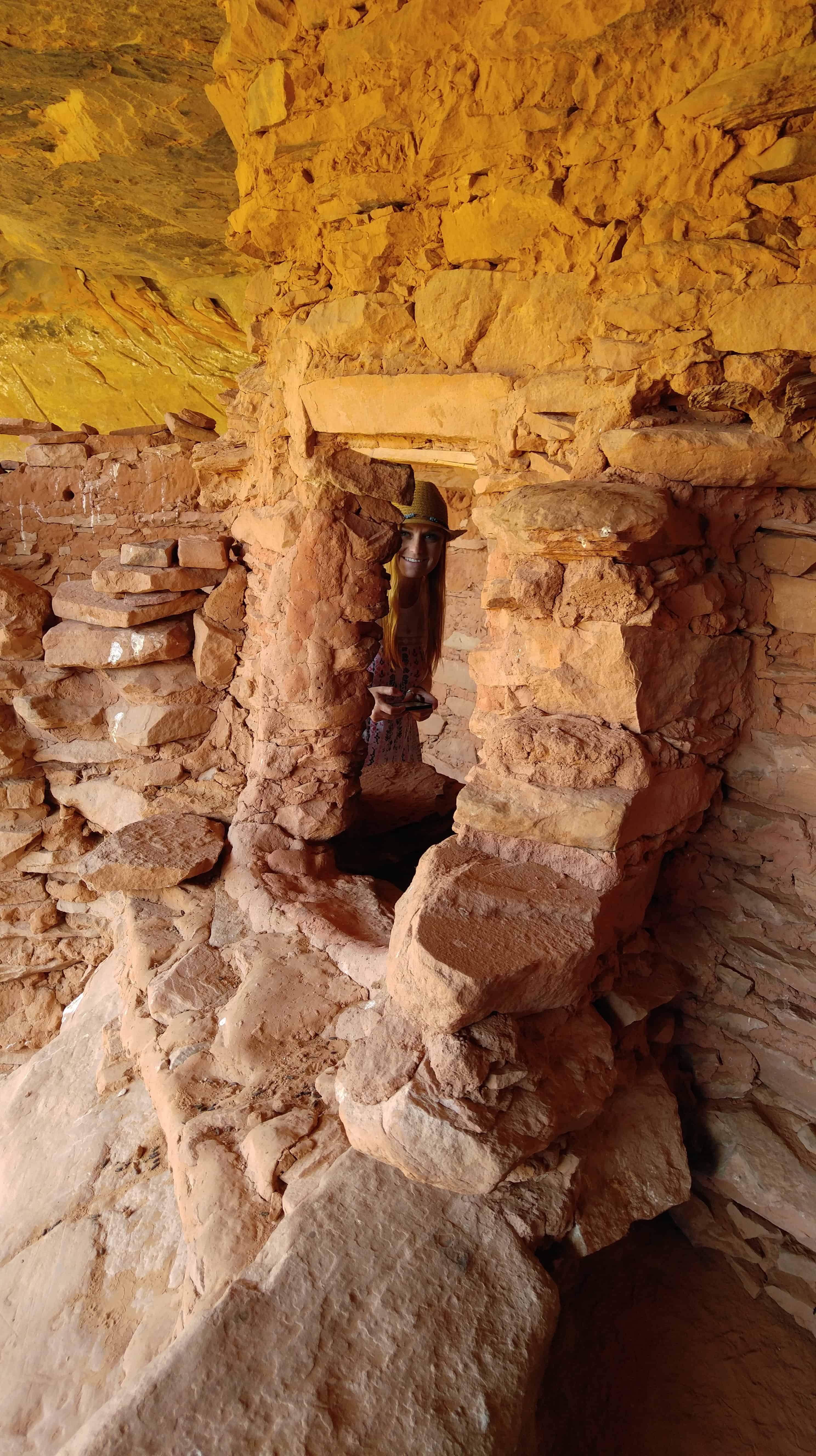
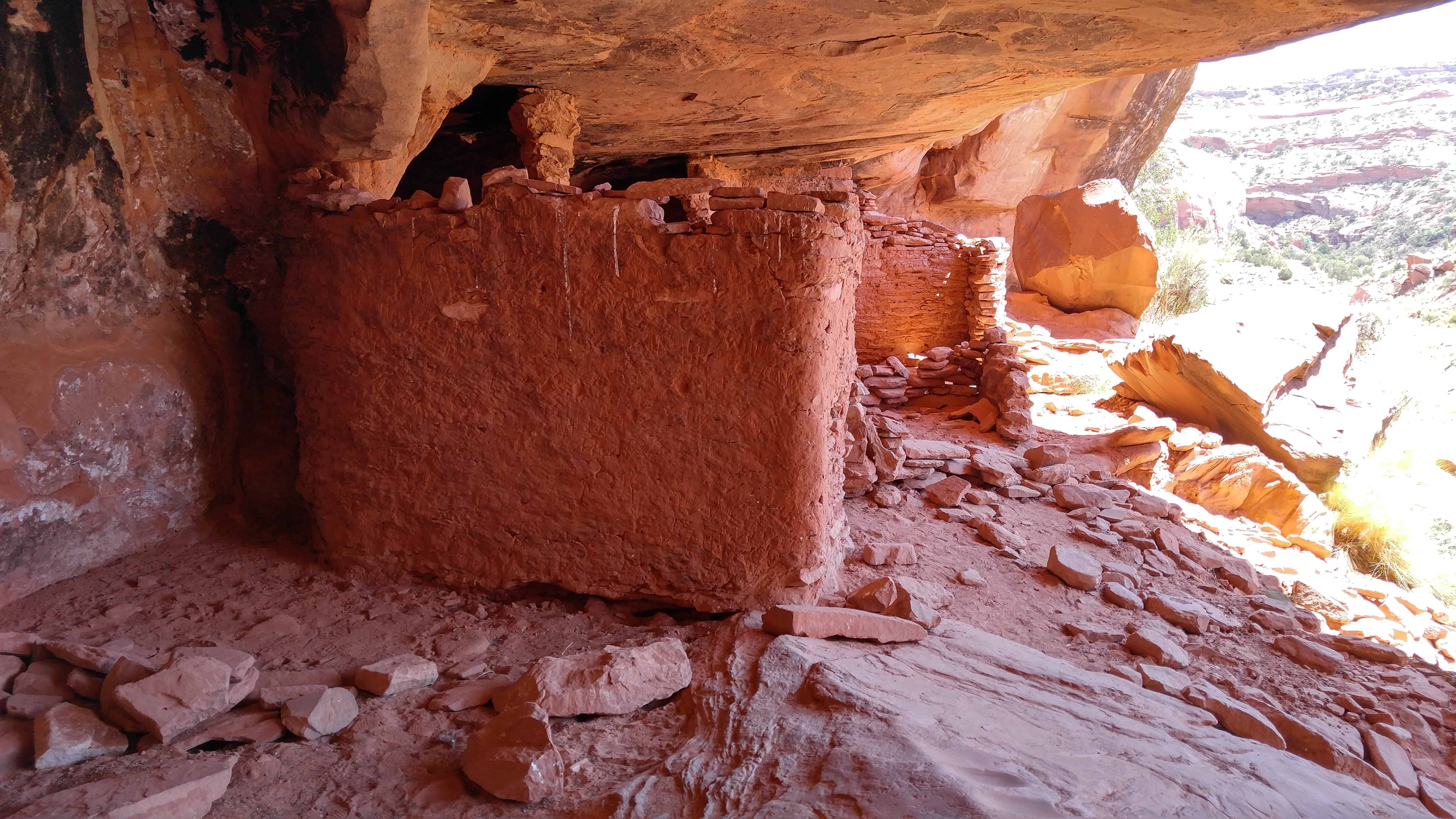
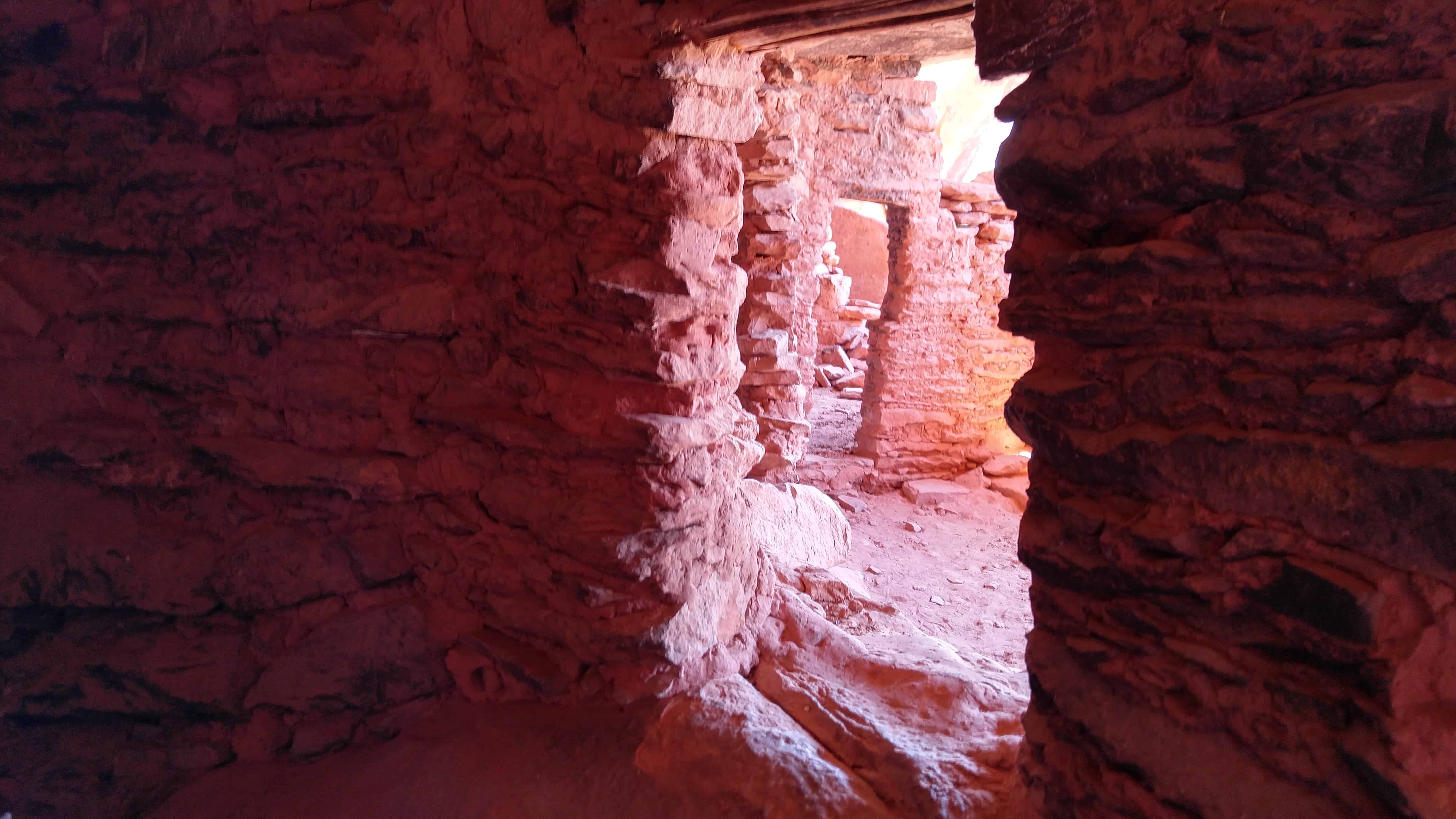
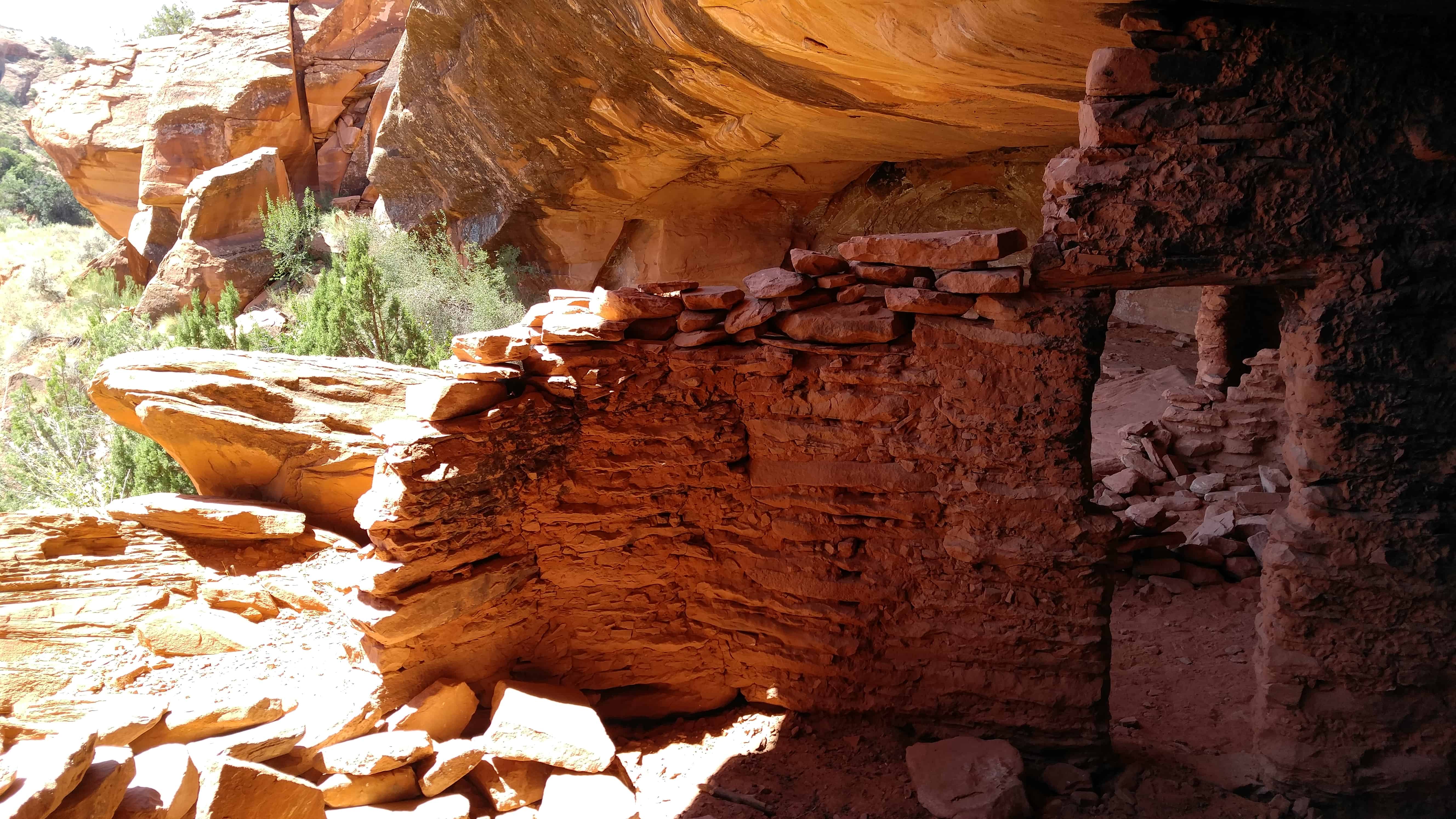
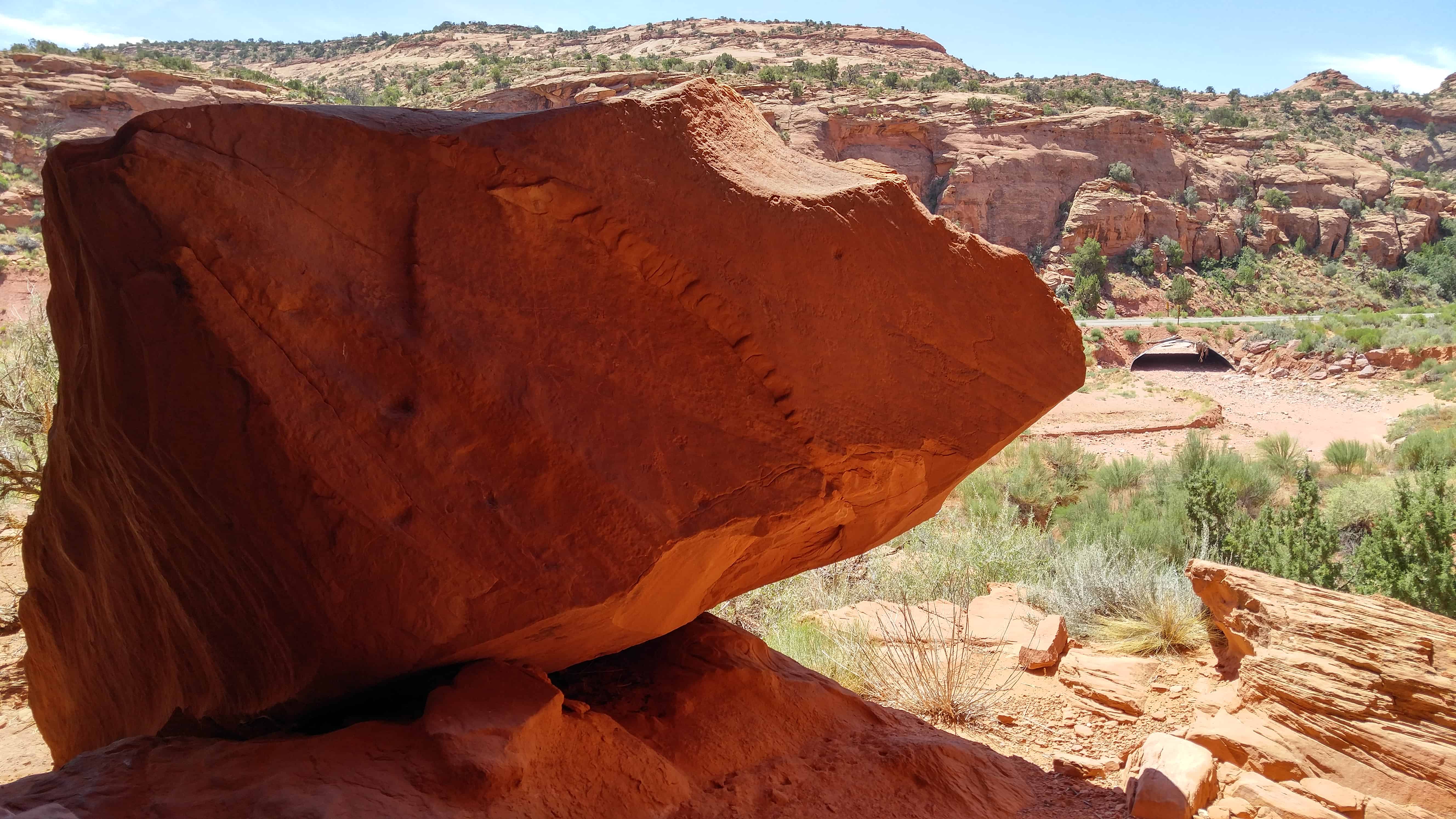
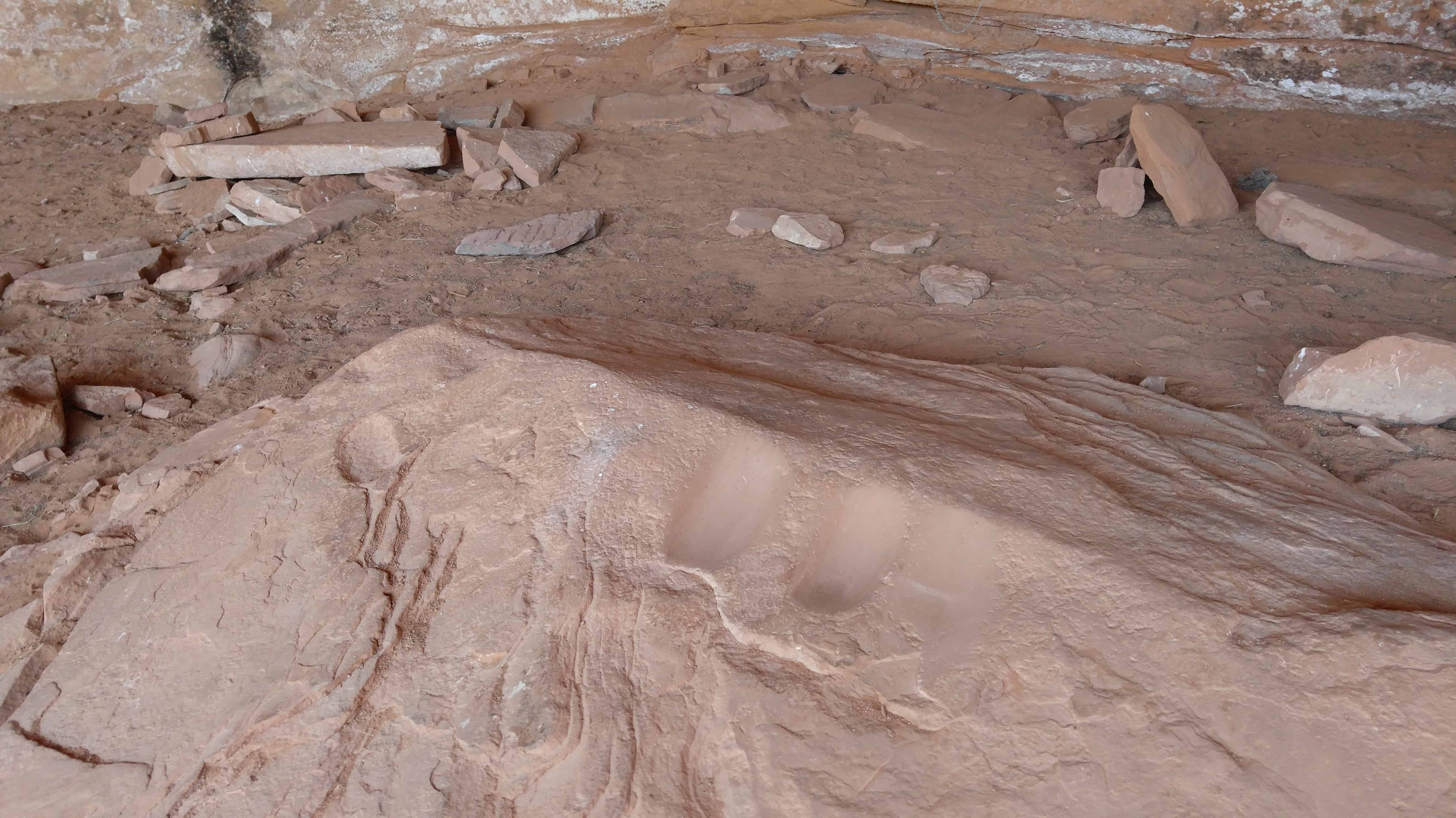
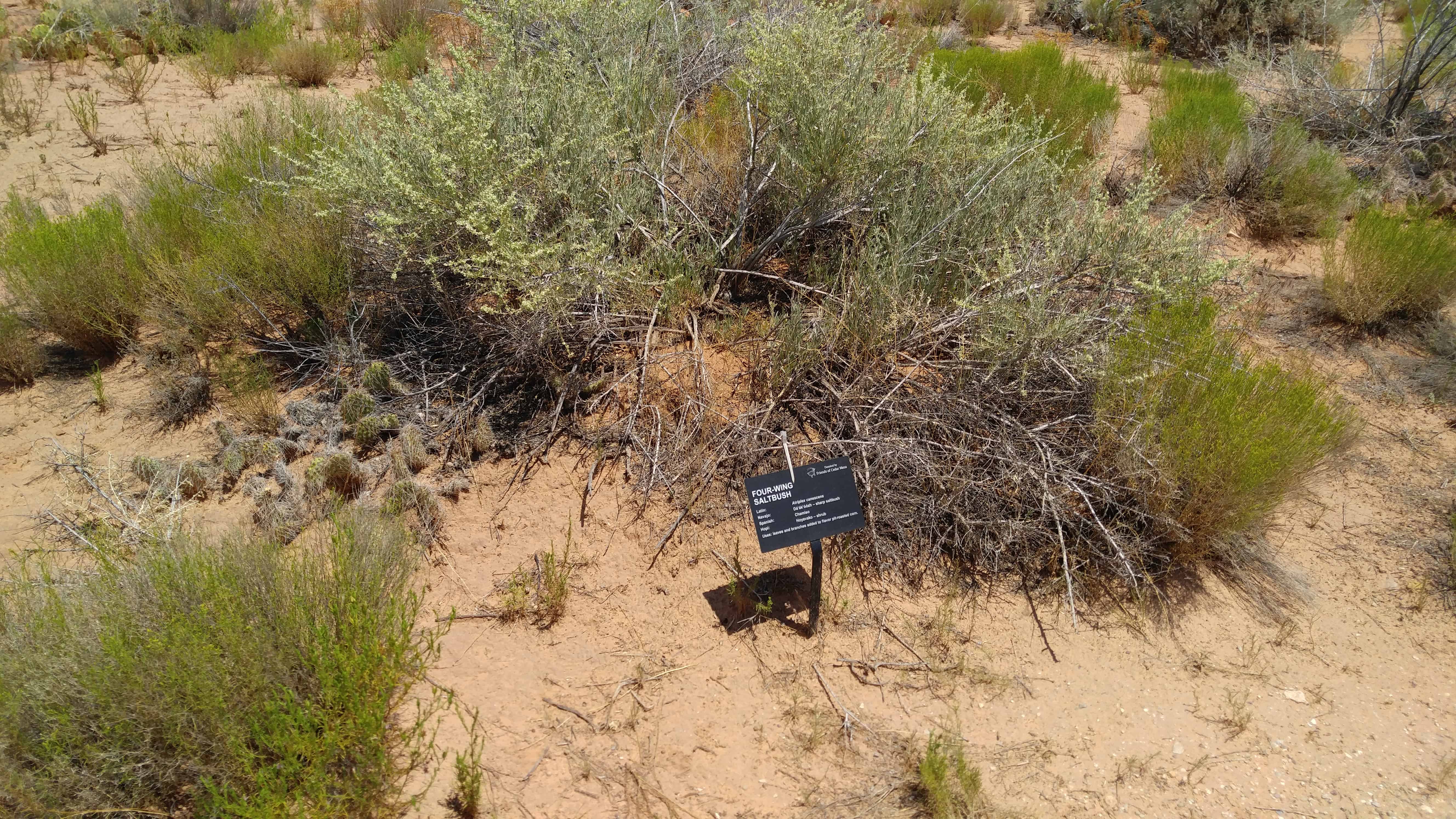
Mule Canyon Ruin is an ancestral Puebloan ruin located on Cedar Mesa in Southeastern Utah. Well preserved Pueblo surface ruins found at this site are over 700 years old. The ruin complex includes above-ground and underground dwellings: a kiva and tower which have been excavated and stabilized as well as a block of twelve rooms. The BLM has constructed a canopy to protect the kiva. Interpretive signing and vault toilets are provided. The site is handicapped accessible and well signed on the highway. The site is open year round and there is no admission fee.
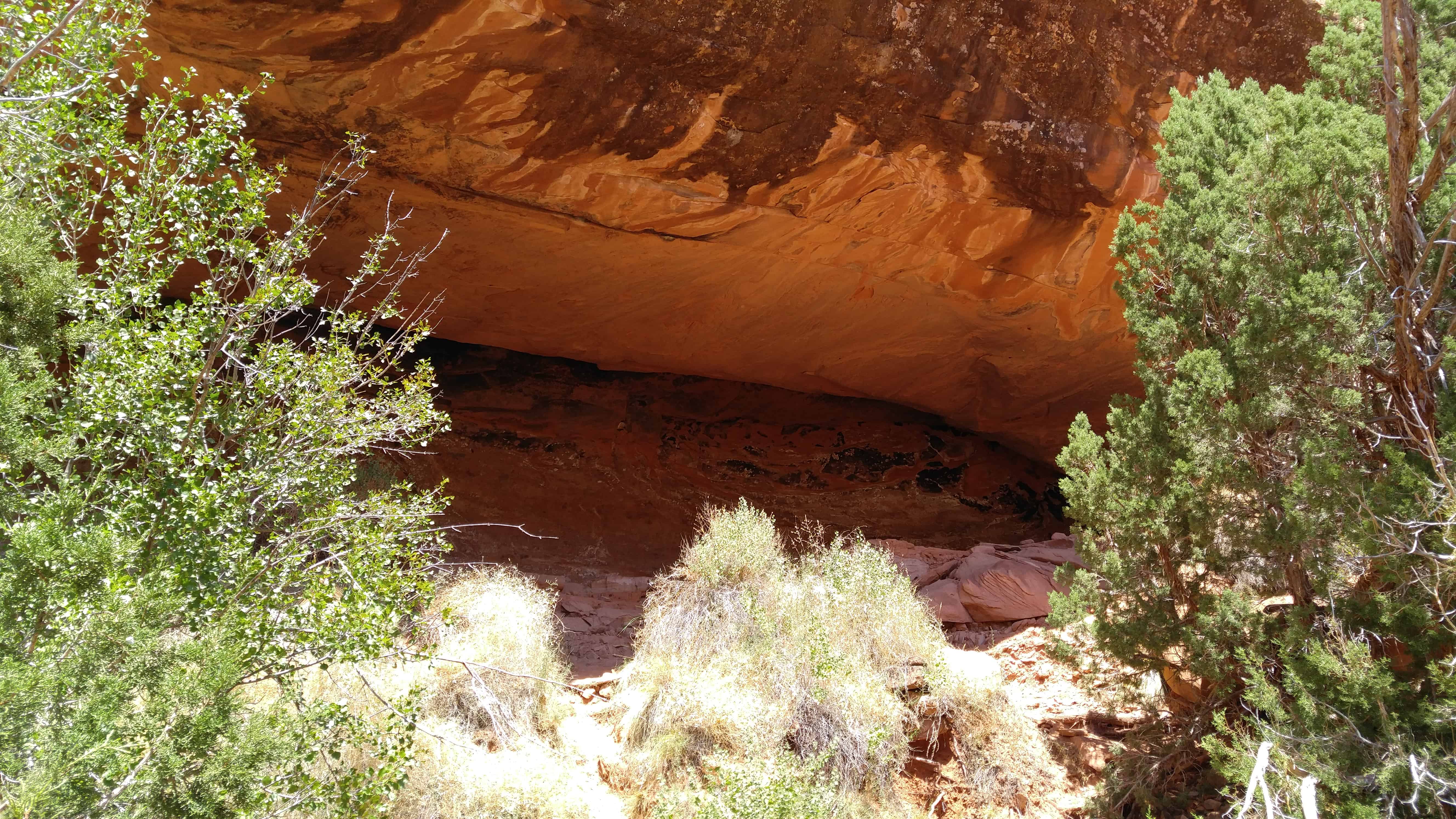
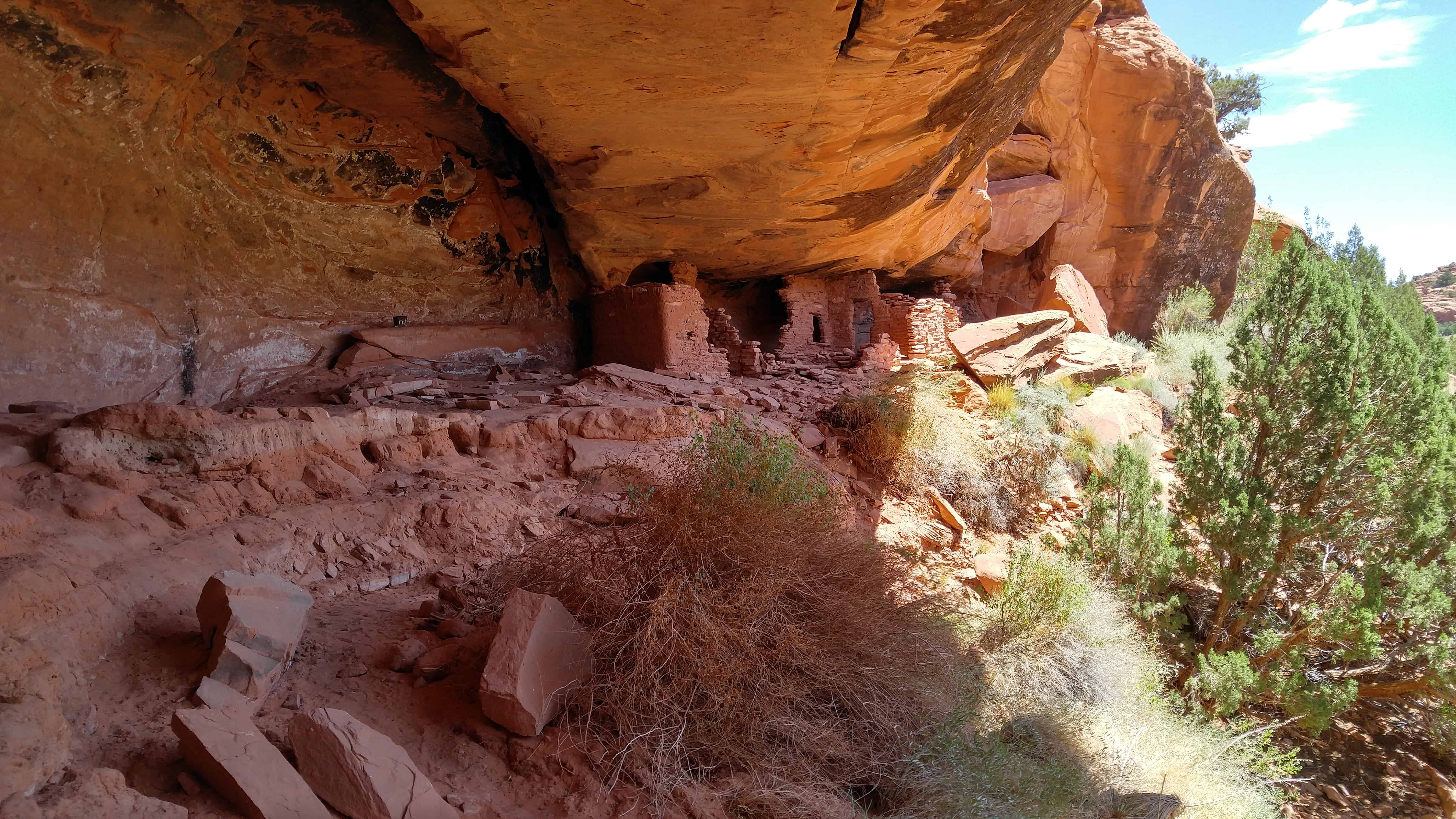
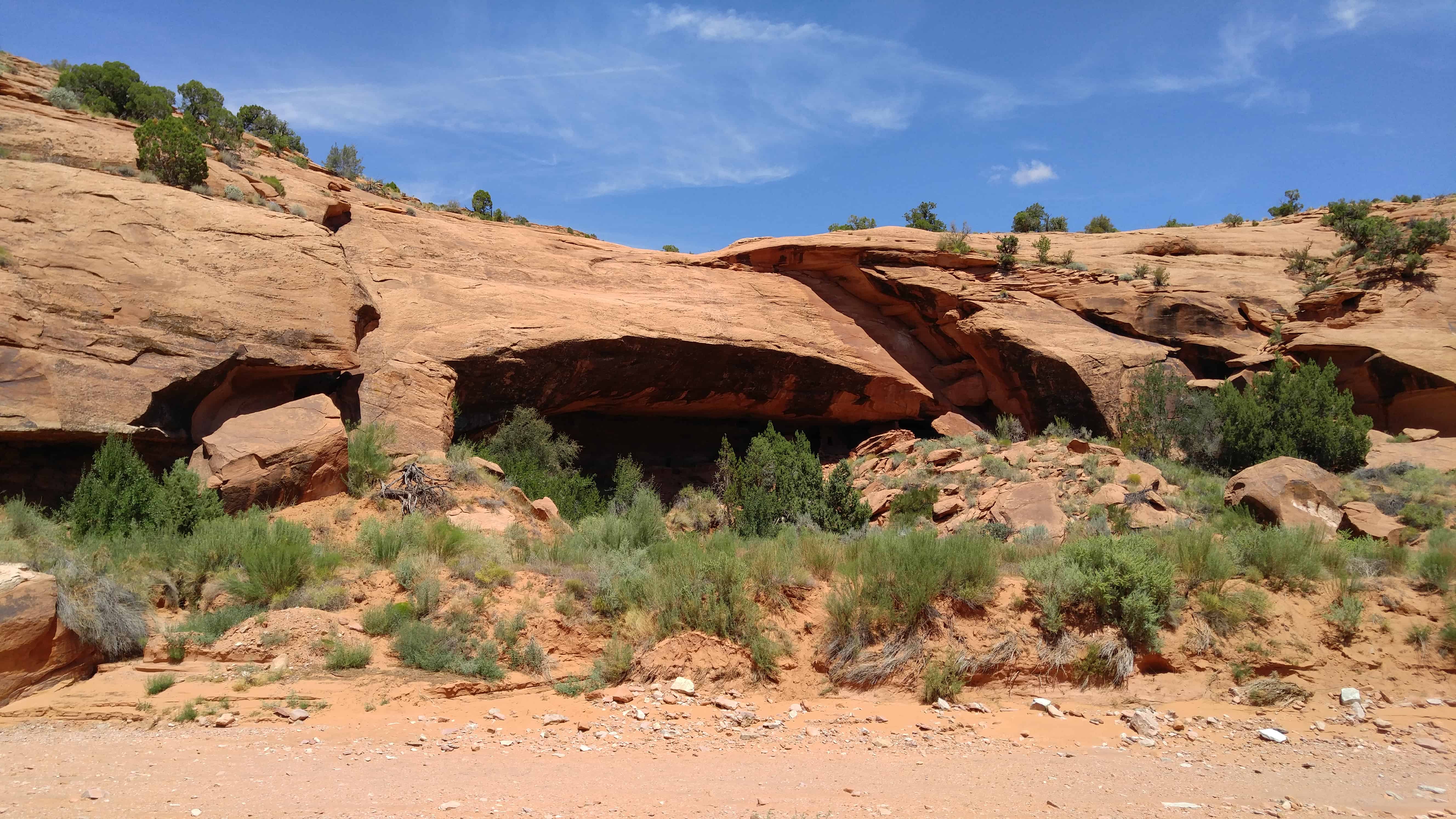
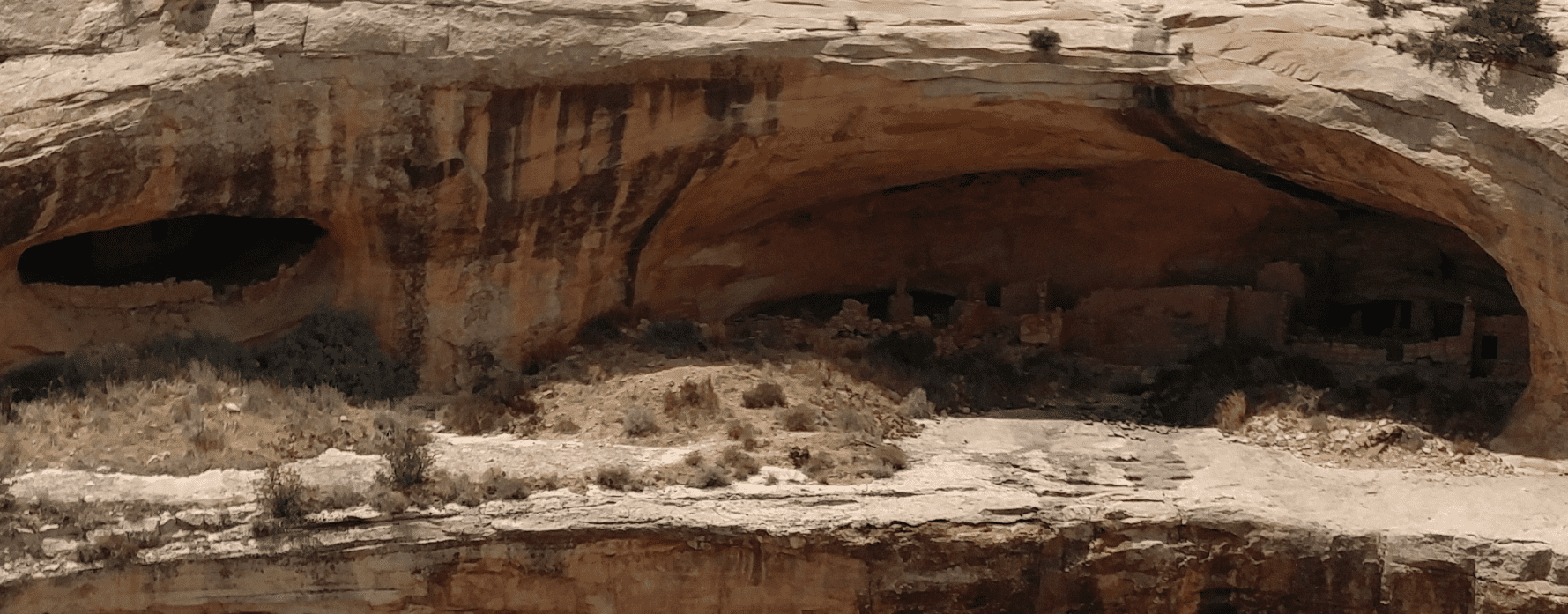
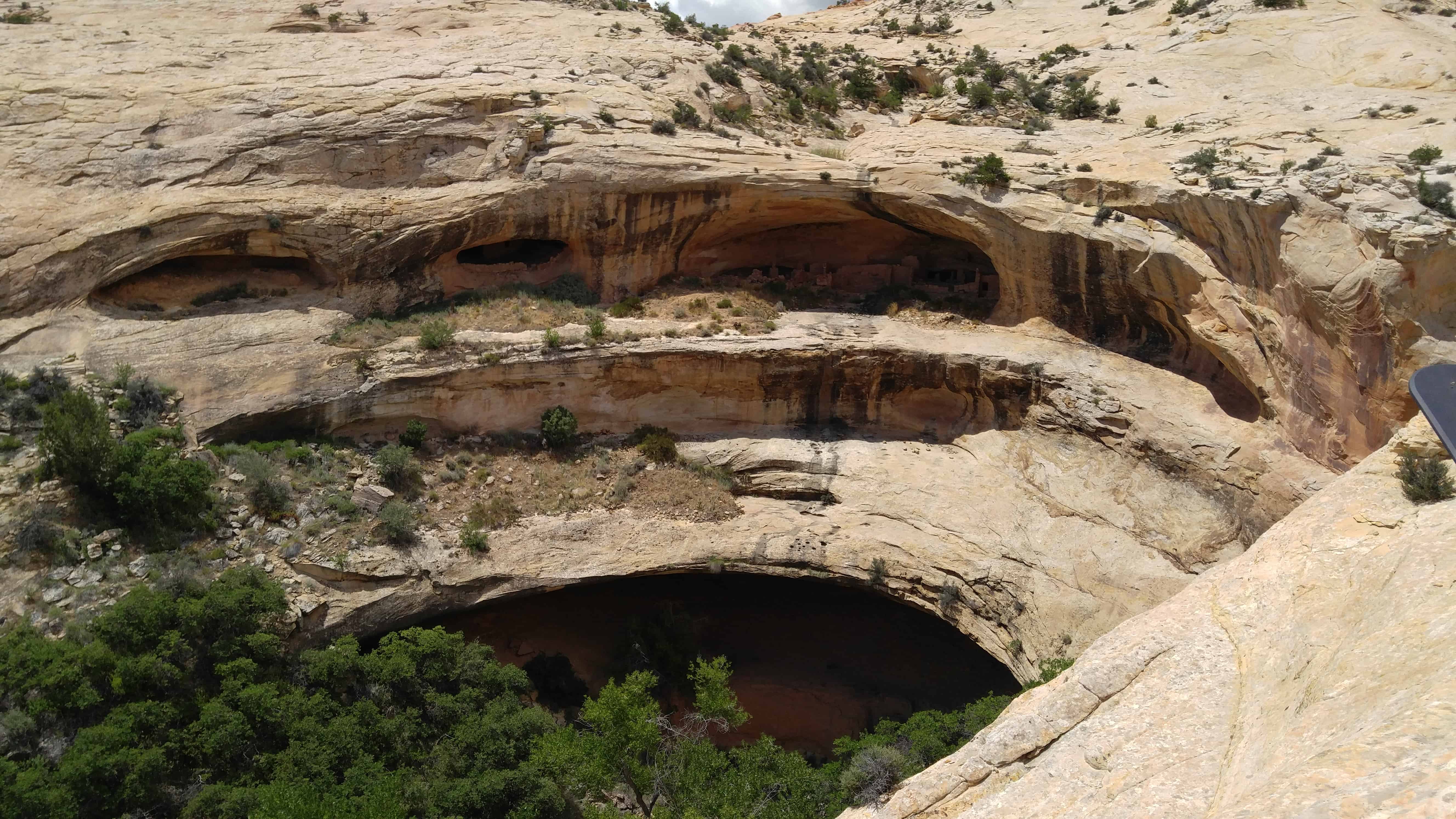
Butler Wash Ruin is a cliff dwelling that was built and occupied by the Ancestral Puebloans, sometimes known as Anasazi, in about 1200 AD. Parts of the site has been stabilized and reconstructed, but most of it remains as it was found in the 1800s. There are habitation, storage and ceremonial structures, including four kivas. This ruin is located in a side canyon of Butler Wash, on the east side of Comb Ridge.
A BLM trail to the site winds its way across slickrock and washes to reach an overlook of the cliff dwelling. Round trip hiking distance is 1 mile and takes approximately a half hour. The difficulty is moderate. An interpretive sign is located at the overlook. Ample parking and a restroom is provided. There is no water at this site, and desert temperatures can be extremely hot and dry. Plan ahead and be prepared. Bring appropriate clothing and lots of water when visiting this site.
The hike from the parking lot to the overlook is an easy one, maybe half a mile to three-quarters of a mile. It was hot and I was out of shape so I whined a bit more than needed. Actually going to the ruins took a bit more effort, working the way south from the overlook down into the canyon and then a little rock climbing and scrambling to get up on the cliff over to the side of the ruins, then straight over.
The Butler Wash Archeological District was added to the National Register of Historic Places (#81000584) on July 11, 1981.
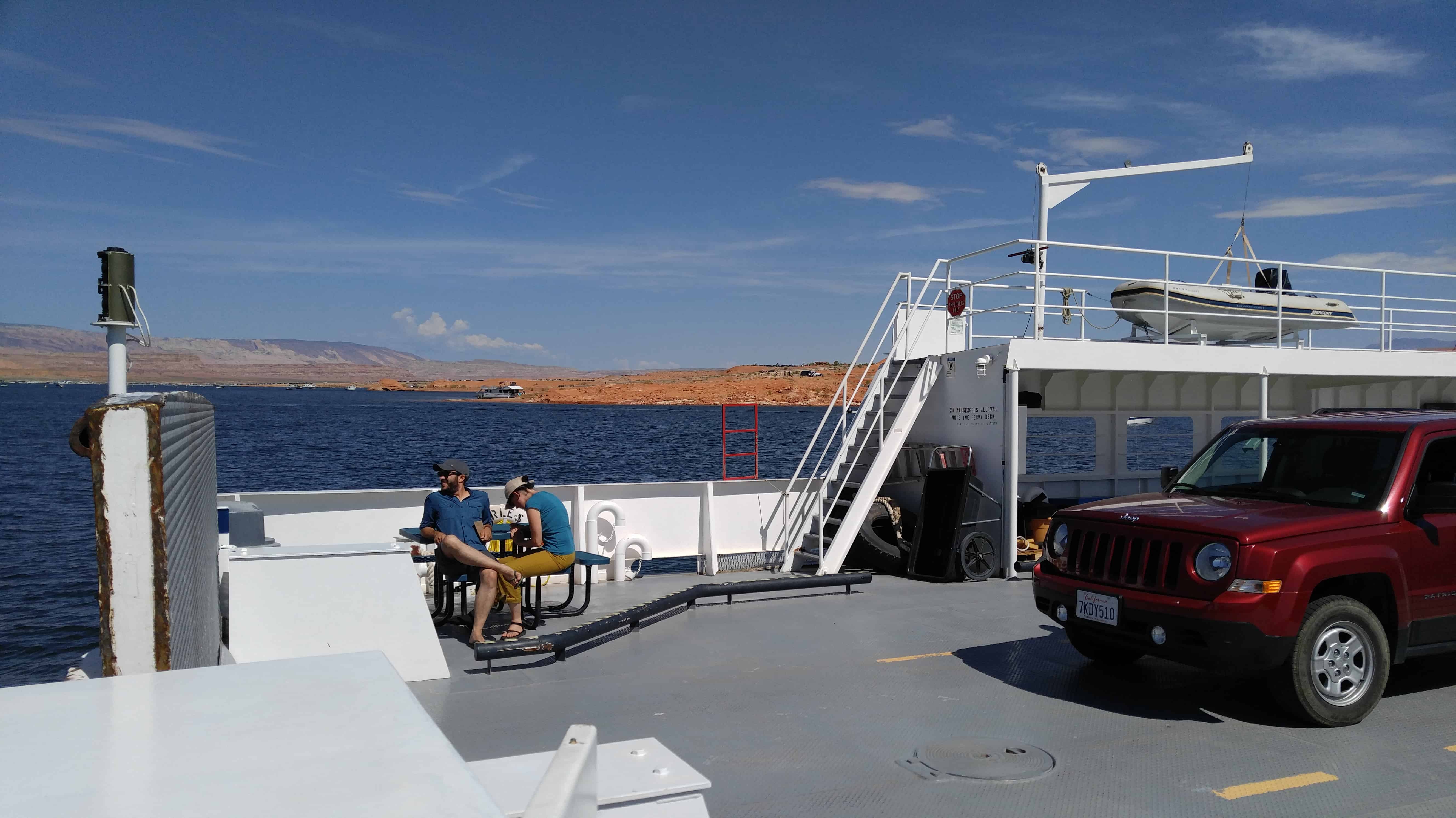
In late 1879 the Mormon Hole-in-the-Rock expedition camped near the Dance Hall Rock waiting for the development of a safe crossing for the nearby Colorado river. Hall was an important part of this expedition. He stayed on at the Hole-in-the-Rock crossing hoping to make it an important one for emigrants and freighters traveling both ways across the river. The Hole-in-the-Rock crossing was used for more than a year until the travel began to decline. Hall then developed a better crossing some thirty miles upriver at what is today known as Halls Crossing. He settled at the mouth of Halls Creek in 1882 and ran a ferry crossing the Colorado River. Hall was well known for his projects and for pioneering (he helped pioneer Parowan and Escalante). He also developed the boats used in ferrying across the Colorado River. After the dam was built and Lake Powell filled in the river and side crossing, Bull Frog Marina was developed on the west side of the lake and Halls Crossing on the east side of the Lake at the end of U-263. Today a ferry makes regular crossings at this point. From 1881 to 1883 a small settlement was established at Halls Crossing, but it quickly faded into oblivion.(*)
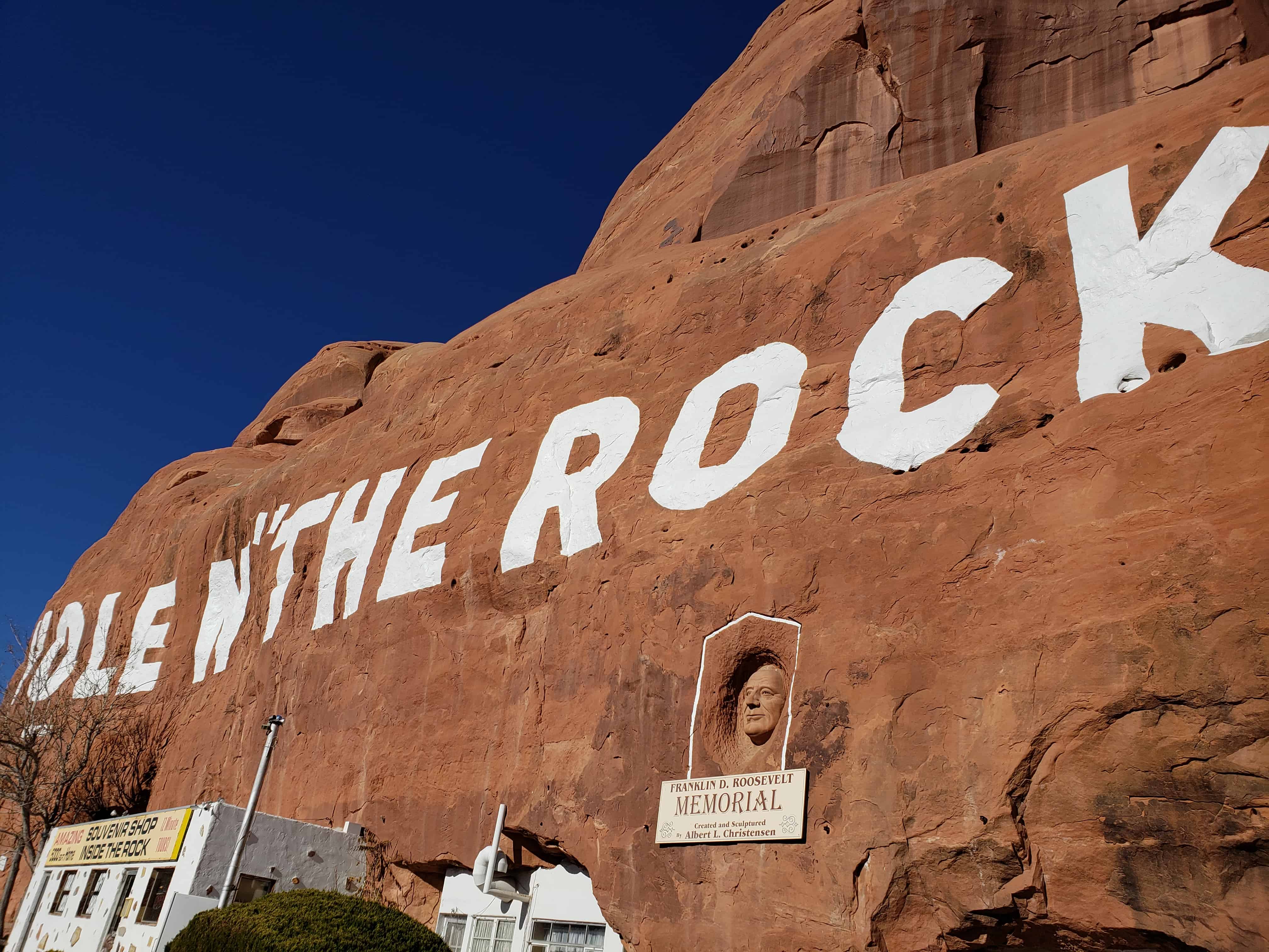
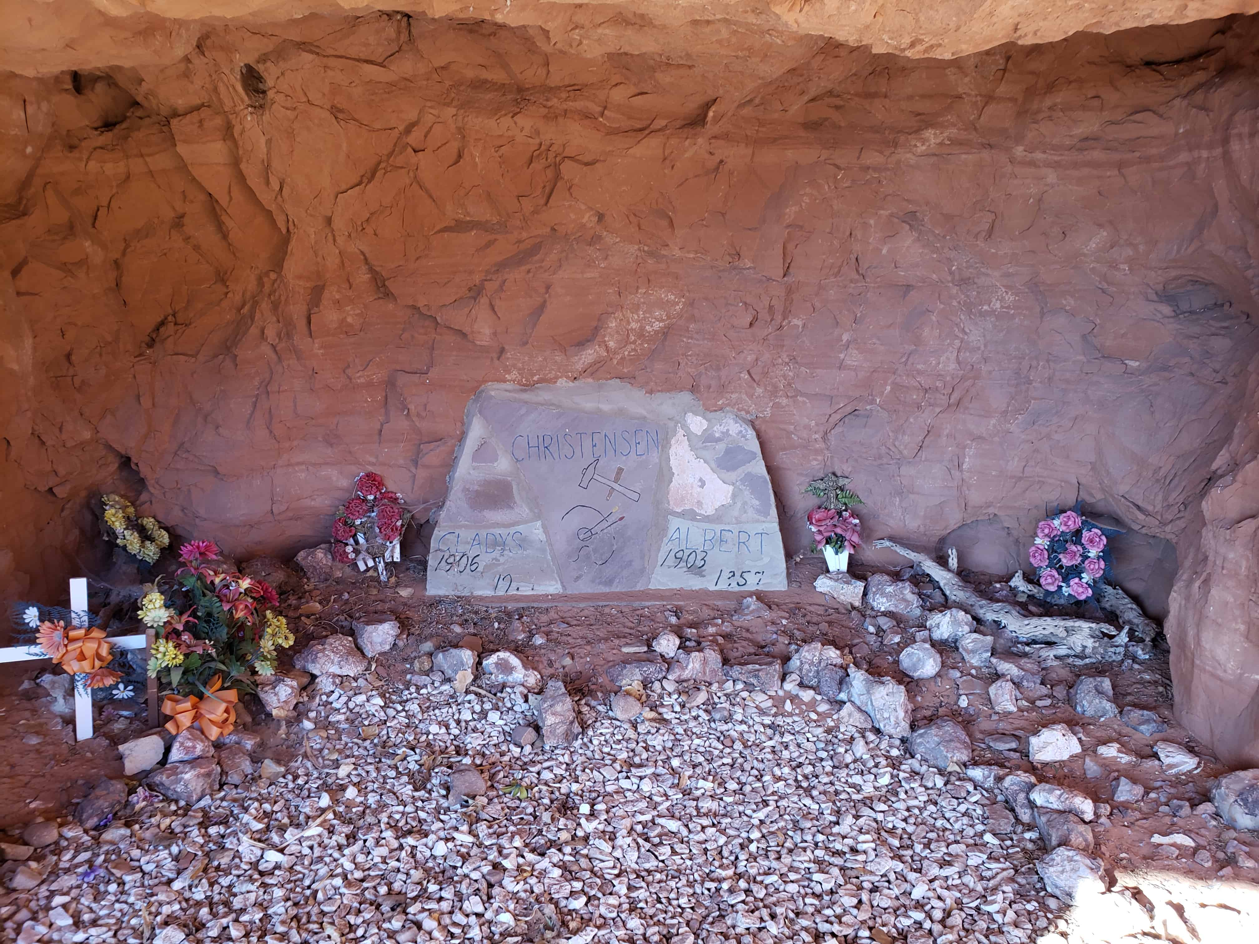
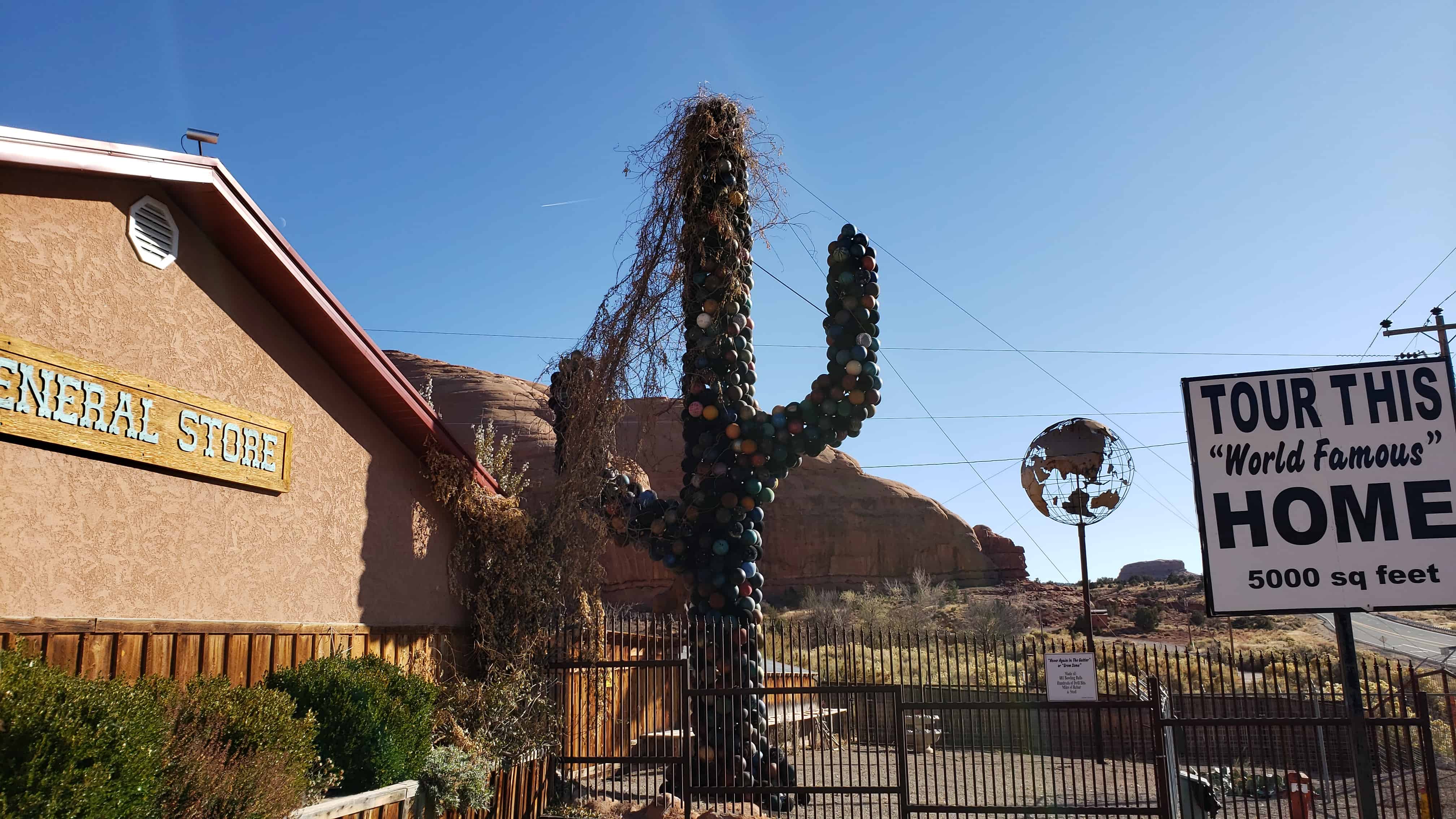
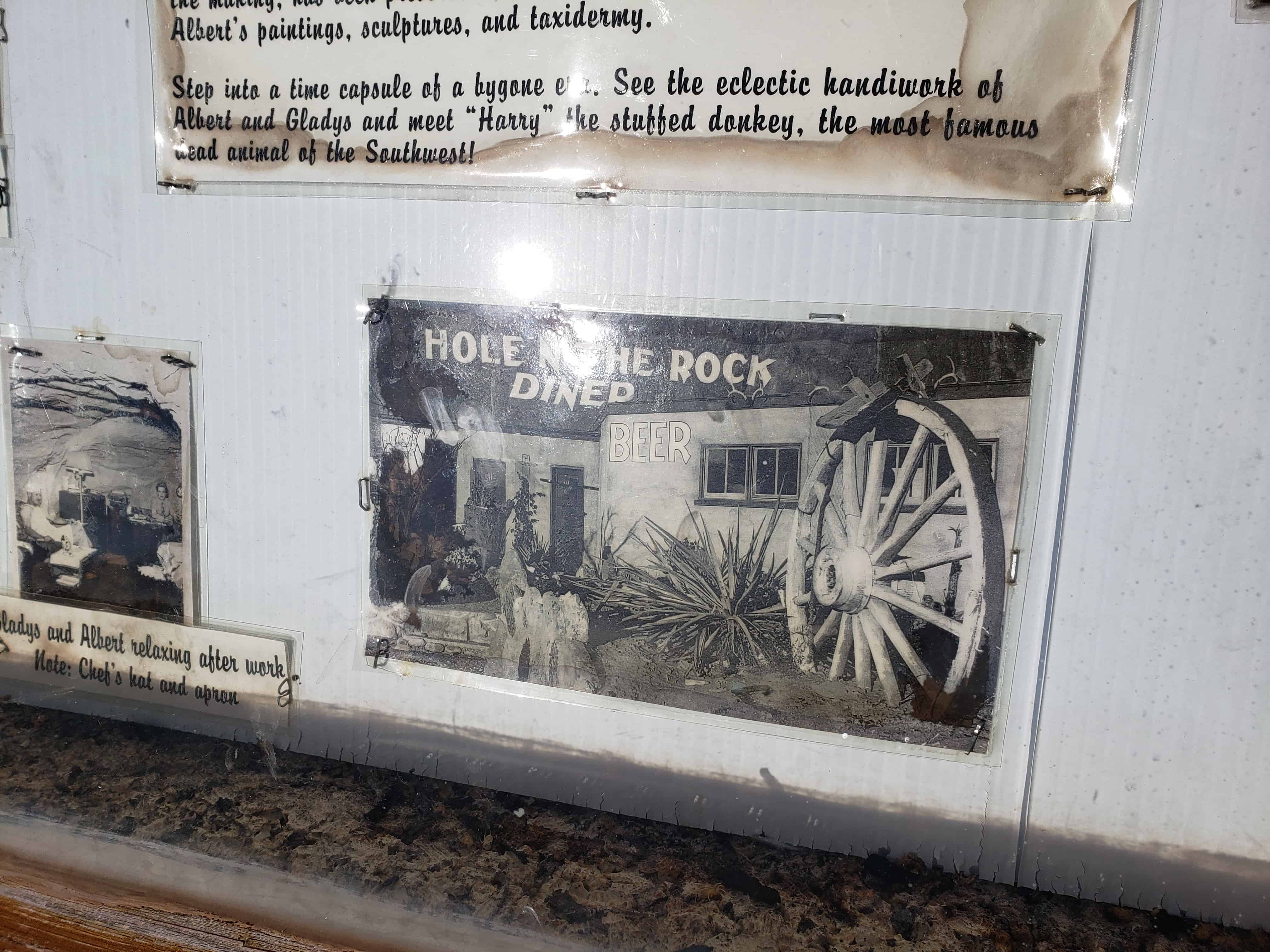
Travelers along U.S. Highway 191 in Southwestern Utah are amazed to discover this historic 5,000 square foot home which began taking shape almost a century ago by the Christensen family. What began as a small alcove for the young Christensen boys to sleep in at night grew into a man-made engineering marvel 20 years in the making. A fireplace with a 65′ chimney,14 rooms arranged around huge pillars and a deep bathtub built into the rock delight visitors who visit this most unusual home in the dessert. Original furnishings, Alberta’s paintings, Gladys’s doll collection and many of the tools used to create this home remind you of the past.
In a 12 year period Albert excavated 50,000 cubic feet of sandstone from the rock. During this time he completed his famous painting Sermon on the Mount and his sculpture of Franklin D. Roosevelt on the face of the rock above his home.
When Albert died in 1957, the home was not complete. Gladys’s in keeping with his wishes & lifelong dreams continued to develop the property, opening a gift shop and giving tours of her home until she passed away in 1974. Gladys is laid to rest next to Albert in a small cove within the rock near the home.(*)
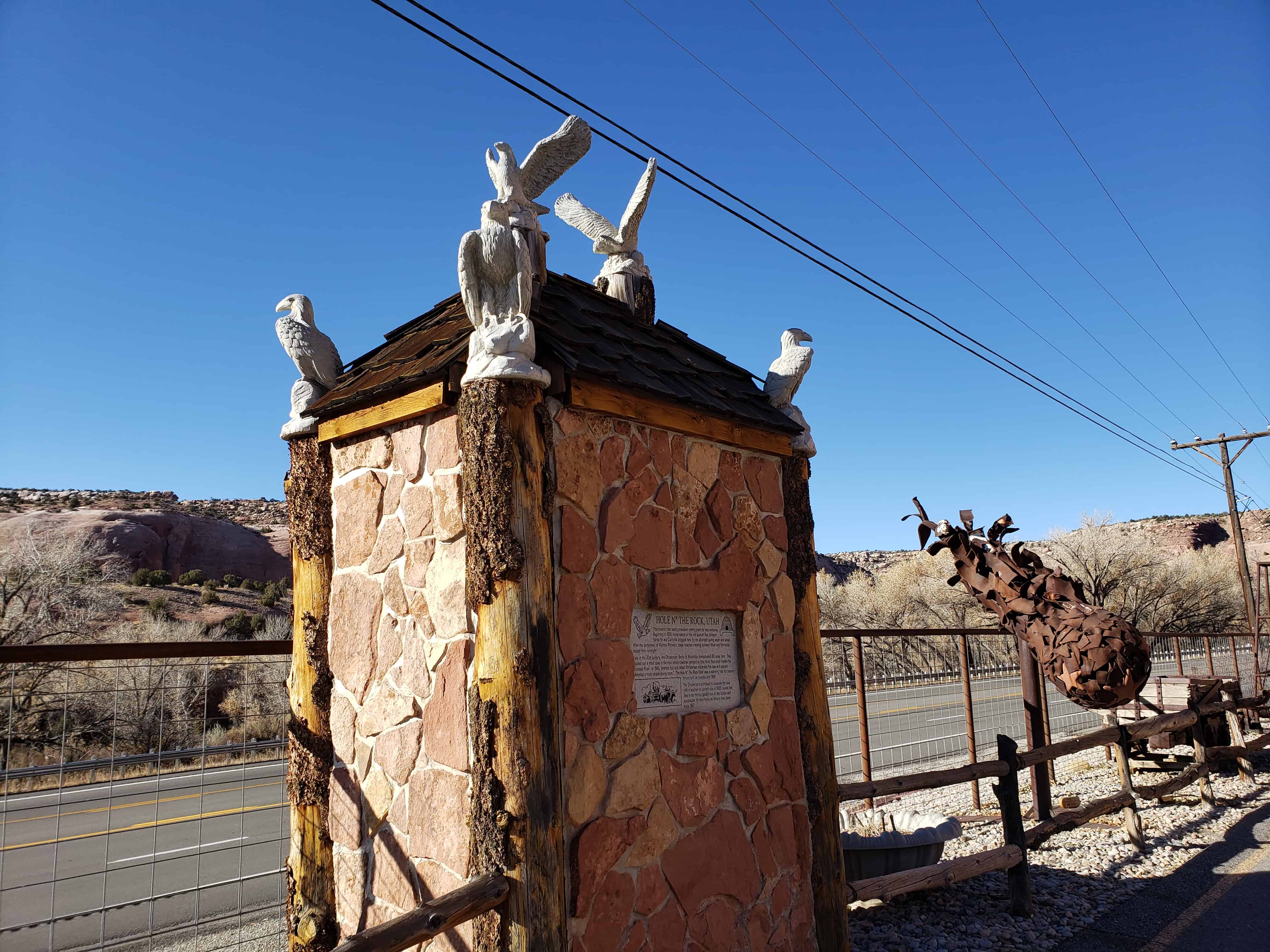
This location has been a travelers’ resting place for two centuries. Beginning in 1829, horse teams on the Old Spanish Trail between Santa Fe and California stopped here for the abundant spring water and shade. After the settlement of Mormon Pioneers, stage coaches traveling between Moab and Monticello stayed here overnight.
Early in the 20th century, the Christensen family of Monticello homesteaded 80 acres here. They blasted out a small cave in the rock where cowboys camped as they drove their stock toward the Colorado River. In 1945, brothers Leo and Albert Christensen expanded the cave and opened “American’s most unique dining room.” The Hole N” The Rock Diner was a watering hole for uranium miners and car tourists until 1955.
The Christensens continued to excavate the cave until it reached its current size of 5000 square feet. Take a ten-minute guided tour of this unique and spectacular 14-room home as millions have done since 1957.