This mill was established on this site in 1878, by Rasmus Christian Knudsen, a millwright and master joiner from Arlborg, Denmark. In 1864, he immigrated to Utah with his wife and two small children, walking across the plains, so that his family could ride. Immediately following his arrival in Utah, Brigham Young engaged him in building mills. First he built the Mork Jeff Flour Mill in Heber City, then sawmills in Big Cottonwood Canyon, and other mills in Utah, including windmills.
This stone is believed to be the largest mill stone and first pearling stone west of the Mississippi River. Rasmus cut it from a piece of hard quartzite, hauled from Farmington Canyon by six yoke of oxen. The curved furrowing around the edges is known as “sickle dressing” which, when revolving against its counterpart on the stone above, caused a scissoring action that removed the husks from the grains of barley.
The Knudsen Mill operated for nearly 30 years and was awarded prize winning medallions for its high quality products. These included white and graham flour, cornmeal, pearled barley, cracked wheat, hominy, and steel-cut oatmeal, milled in a machine invented by Rasmus Knudsen.
Both Knudsen’s Grove, founded in 1912, and Knudsen’s Corner, in 1919, owe their origins to the Knudsen Flour Mill.
Draper is in the south-east corner of Salt Lake Valley, near Bluffdale, Sandy, South Jordan and others. Draper is located just north of “Point of the Mountain,” officially “Traverse Mountain,” a popular hang-gliding spot.
Draper was originally called Sivogah, meaning Willows. The town was then known as Willow Creek for the creek the settlers used. They also used the region as a grazing area for their cattle. The town name was then changed to Brownsville for Ebenezer Brown and family who arrived in 1849. Later, the name was again changed to honor William Draper, the town’s first Mormon bishop. The Draper family settled in the area in 1850.
In the 1860′s, a town named Granite was located at the mouth of Little Cottonwood Canyon by ore miners of Alta, Silverton and Tannersville. Its desertion began as the mines closed about 1882. The surrounding country had been settled by Latter-day Saints. Granite Ward organized July 1877, chose Solomon J. Despain, bishop. A rock ward house was used for worship and school until the completion in 1890 of the one-room building on this block.
Four miles east of Sandy City and south of Butler. In 1870 it was a good campsite for teamsters, quarrymen, and miners who were working in the Mormon church granite quarries and the mines in the vicinity. When transportation became more efficient during a time of reduced operations in this area, the camp was abandoned, only to be subsequently rejuvenated with modern, permanent residences. The town was named Granite because of its proximity to the granite quarries that provided the blocks for the Salt Lake Temple.
The first half of the twentieth century was a period of transition for the city of Sandy. The mining, smelting and small farm era was being replaced by a more diversified economy. In some ways the town still resembled the earlier predominantly agricultural community founded by Mormon settlers in the 1860s, especially as the “boom town” economy created around the mining industry waned. The population of Sandy remained around 1,500 for the four decades between 1900 and 1940. However, the city was defining itself as the political, economic, civic and social center for a major portion of the southeast Salt Lake Valley. This period of Sandy’s history laid the groundwork for city’s eventual transformation from small town to suburb.
The transition began with the failure of several canyon mines which fed Sandy’s economy. As sampling and smelting plants shifted to other locations, Sandy’s impact as a mining town diminished.
While the dominant force in the economy of Sandy during the 1870s, 1880s and 1890s was undoubtedly that of mining, the local agricultural community had not ceased to develop. The local agricultural economy saw Sandy through the mining boom and subsequent depression.
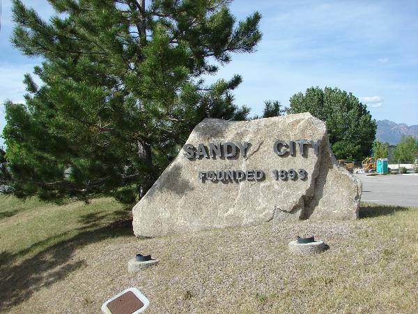
The community was also seeing a great deal of civic development. The city of Sandy was incorporated on September 26, 1893. By 1911 the city was managing its own water resources and had a volunteer fire brigade of twenty-five, complete with two fire trucks. Utah Power and Light began servicing Sandy in 1913, and by 1914 the city was managing a park and a cemetery.
Economically, the city was changing dramatically. The depletion of the mineral resources in the Alta area and the loss of the smelting and sampling industries had changed the economic structure of Sandy City significantly. Moreover, a series of national and local depressions beginning in 1893 and continuing to the onset of World War II had made small-scale single-crop agricultural enterprises nearly impossible. Sandy farmers had an especially difficult time, needing to overcome the additional challenges of water scarcity and the arid, sandy soil.
Fortunately irrigation methods improved steadily through these years, and several Sandy farmers were able to successfully continue to raise hay and grain. Despite the success of these specialized agricultural industries, most farming in Sandy during the first half of the twentieth century was purely subsistence level. Between 1900-1920, the number of farms doubled, but nearly all were very small scale. Eighty-five percent of the farms were smaller than forty-nine acres. Six farms were between two hundred and one-thousand acres, and one farm was 1,217 acres.
During the first half of the twentieth century, the majority of Sandy residents continued to live on their farms. Most managed to survive economically by combining subsistence farming with other occupations, primarily cottage industries and mercantilism. The majority of occupations were highly diversified. Sandy appeared to have at least one resident involved in occupations associated with early urbanization: a physician, a dentist, a barber, a plumber etc. The most common business listed was dry goods. The Sandy City Bank founded in 1907, employed four, and had the largest deposits of any bank in the southern portion of the Salt Lake valley. Several residents listed their civic responsibilities: city treasurer, postmaster, marshal, justice of the peace.
As the non-Mormon or “Gentile” population moved out of Sandy with the decline of the mining industry, Mormonism continued to be the dominant religion. By the 1920s, the LDS population had grown large enough to require the construction of two new ward buildings. The Sandy Second Ward meetinghouse was completed in 1921 and the Third Ward in 1926. In addition to the three LDS wards, the 1927-28 gazetteer lists two other congregations: the Sandy Congregational Church and the Inter-Mission (Swedish/Lutheran) Church.
Before the 1900s, transportation between Sandy and other towns in Salt Lake County had been limited to pedestrian or horse traffic on rutted, dirt roads. Several railroad lines and mining related spurs had converged at Sandy by the 1880s, but the service they performed was primarily freight. The extension of the State Street streetcar line from Murray to Sandy on July 4, 1907 gave Sandy residents easier access to the shops and recreations of Salt Lake City.
A few residents may have commuted to work in Salt Lake, but the city generally remained self-contained. Buses began to replaced streetcars in the 1920s, at about the same time State Street’s south end was paved for automobile traffic. The last streetcar to operated in the Salt Lake Valley was discontinued in the 1946. By that time, automobiles were becoming increasingly more common, even in Sandy.
The original township of Sandy had expanded to the west of the railroad tracks with the boom of the mining industry. After the turn of the century growth was slower. At the west boundary of the city, commercial buildings as well as bungalows and period cottages appeared along State Street, the main artery to Salt Lake City. The institutional buildings, both civic and religious, were also made of brick and exhibited a variety of popular styles and decorative elements. Of the remaining large commercial and institutional buildings, examples ranged from the Renaissance Revival to PWA Moderne.
The Specialized Agriculture, Small Business, and Community Development Period in Sandy was a time of transition from farmlands and mining industries to quiet neighborhoods and small town civic pride. The architecture of the historic square mile of Sandy, as it is called, illustrates this transition, and stands in marked contrast to later development. In the years since World War II, Sandy has plated nearly 300 subdivisions and annexed over 10,000 acres, making it one of Salt Lake’s largest “bedroom” communities. Though Sandy’s city center has been moved adjacent to the mall, the city’s historic downtown is a distinctive reminder of Sandy’s small town past.