• About JacobBarlow.com
  • Cemeteries in Utah
  • D.U.P. Markers
  • Doors
  • Exploring Utah Email List
  • Geocaching
  • Historic Marker Map
  • Links
  • Movie/TV Show Filming Locations
  • Oldest in Utah
  • Other Travels
  • Photos Then and Now
  • S.U.P. Markers
  • U.P.T.L.A. Markers
  • Utah Cities and Places.
  • Utah Homes for Sale
  • Utah Treasure Hunt

JacobBarlow.com

~ Exploring with Jacob Barlow

JacobBarlow.com

Tag Archives: Spring City

Peter Hansen House

16 Saturday Dec 2023

Posted by Jacob Barlow in Uncategorized

≈ 1 Comment

Tags

Historic Homes, NRHP, Sanpete County, Spring City, Spring City Historic District, utah

Peter Hansen House

This house was constructed c. 1898 by Peter Hansen on land that he had purchased from Peter M. Olsen. In 1901 the property was sold to Isaac P. Allred. Reid H. Allred, a well-known citizen in Central Utah, raised his family and died in this home. In addition to the wood-frame vernacular dwelling, the property also features a historic barn. The property retains its historic integrity and is a contributing resource within the Spring City Historic District.

Located at 94 West 100 North in Spring City, Utah.

Rasmus Jensen House

26 Sunday Nov 2023

Posted by Jacob Barlow in Uncategorized

≈ 1 Comment

Tags

Historic Homes, NRHP, Sanpete County, Spring City, utah

Rasmus Jensen House

This one-story stuccoed Classical-style brick hall-parlor house was built in 1905 by Rasmus Jensen. The rear kitchen wing is part of the original building, but the central pedimented portico over the front door was added at a later date.

116 South 100 West inĀ Spring City, Utah

Redick Allred House

17 Friday Nov 2023

Posted by Jacob Barlow in Uncategorized

≈ 1 Comment

Tags

Historic Homes, NRHP, Sanpete County, Spring City, utah

Redick Allred House

Redick Allred hired Jens “Rock” Sorensen in the mid-1870s to build this one-and-one-half story, hall- parlor type house. Sorensen reportedly used no scaffolding; instead, he carried the cut limestone block on his shoulder while climbing a ladder to the top of the wall. The house is an outstanding example of early Spring City vernacular architecture. The original front entrance was on the broad, west-facing side of the house, Isaac Allred, drugstore owner and self-taught dentist, bought the house in 1880 for $450.

115 South 100 East inĀ Spring City, Utah.

Charles Crawforth Farmstead

04 Monday Sep 2023

Posted by Jacob Barlow in Uncategorized

≈ Leave a comment

Tags

Farms, NRHP, Sanpete County, Spring City, utah

Charles Crawforth Farmstead

The Charles Crawforth farmstead is significant as an isolated farmstead in the midst of a farm village settlement region. Deviating from the predominate pattern, the Crawforth farmstead historically demonstrates that Mormon culture in the nineteenth century was not as homogeneous as has often been thought. The opening of a U.S. Land Office in Salt Lake City in 1869 signaled the beginning of a great change in the Mormon Church’s influence on settlement. In the areas already settled, like the Sanpete Valley, little agricultural land remained available. Farmsteads outside the established villages in Sanpete were very rare, and help document the shift there from subsistence agriculture to cash farming–cattle, sheep and cash crops including fruit and sorghum. The outstanding vernacular architecture of the farmstead is an important element of its significance. The large stone I house is a sign of agricultural prosperity and attests to Crawforth’s prominence in the local community.

The text on this page is from the nomination form (#80003956) for the National Register of Historic Places (the farm was added to the register February 19, 1980 and is located at approximately 6700 Crawford Road inĀ Spring City, Utah.

The Sanpete Valley was settled after 1849 by members of the Church of Jesus Christ of Latter-day Saints (Mormons) and land occupance here followed a farm village plan advocated by the church leadership. Mormon town planning in the West was based loosely on the “Plat for the City of Zion” developed in 1833 by the Mormon prophet, Joseph Smith. Smith’s plan was built around a nucleated agricultural community where all dwellings and farm buildings would be contained on town lots. Farm acreage would then be located outside the town limits. This town unit, when it reached sufficient size could then be repeated over and over again in other locations. The village settlement pattern was particularly strong in the Sanpete Valley where the persistent threat of Indian attack through the 1870’s made group living attractive. The Crawforth farmstead is located about two miles south of Spring City, a town which has been nominated to the National Register as an excellent and typical example of the Mormon village.

Charles Crawforth was born in Sutton-on-Hall, Yorkshire, England, on May 24, 1824. Following his conversion to the IDS Church in 1854, Crawforth emigrated to Utah and the Mormon Zion. The William Glover Company carried young Crawforth to Utah where he arrived in Provo in 1855. During the next seventeen years he engaged in farming in the Provo area and participated actively in church and civic affairs. In 1873, at the age of 48, Crawforth moved his large family (10 children) to Spring City in Sanpete County. In this new location, farming continued to be his main occupation. The Crawforth family lived within the town limits of Spring City until the big rock house was completed on the outskirts of town in 1884.

Crawforth’s decision to locate outside of town is a departure from the norm. The record shows that he remained active in the LDS Church; religious disaffection seems not to have been an issue in his choice of a building site. The spot where the house stands is extremely attractive and the view northward toward Mt. Nebo particularly inspiring. A sense of individualism and an eye for beauty could well lie beneath Crawforth’s behavior.

Two other changes in the region likely were factors in his move outside the village of Spring City. The opening of a U.S. Land Office in Salt Lake City in 1869 marked the end of a land settlement pattern controlled by the Mormons. Church leaders emphasized throughout the nineteenth century the importance of living together in towns, and the village still dominated the Utah landscape. With the establishment of federal land surveys after 1869, a homesteading pattern of isolated farmsteads filled in the open spaces between established Mormon villages in those counties were land was still available. In the Sanpete Valley, because of its early date of settlement, scarcity of agricultural land had become an issue by the 1870 f s. Two consequences of this scarcity were outmigration (to Emery and Sevier counties) and the attempts to develop cash agriculture cattle, sheep and crops like sorghum and fruit. Crawforth’s development of orchards may have been one reason for his move, which showed that Church control over settlement was declining. The Crawforth farmstead is a reminder that the Mormon landscape was not a strictly uniform landscape.

Charles Crawforth lived in the house from 1884 until his death in 1910. The farmstead was locally a showcase for Crawforth’s talents in landscaping as one observer noted, “he took pride in beautifying his home surroundings and had one of the best kept gardens and orchards in that part of the state.” Later generations of Spring City residents recall stories of peacocks which used to strut proudly around the old house. The cut-stone walk which rings the house seems consistent with this portrait of Crawforth as horticulturalist and landscape architect. Crawforth continued to be a successful farmer and his prestige in the community is evident in the large turnout at his funeral. Bishop Lauritz O. Larsen and Patriarch Rasmus Justesen delivered eulogies at the ceremony.

Following Crawforth’s death the house was passed on to his son, Charles L. Crawforth. The boy’s untimely death in 1918 brought the property into the hands of several family members who sold sections of land to Jacob Johnson, Simon Beck, and Moroni Brough. The house was sold in the 1950’s to James and Dolores Blain and in the 1960’s to Charles Beck. The present owners bought the property several years ago and though the house has been vacant since 1928 they have plans for its restoration.

The Charles Crawforth Farmstead

The Charles Crawforth farmstead is located about two miles south of Spring City, Sanpete County, Utah. The farmstead is composed of a large stone house, a granary/root cellar, a stone carriage house, and a log barn. Found on a small lane which runs off the Pigeon Hollow road, the Crawforth Farm is oriented northward with the view from the farmhouse sweeping up the valley to the snow covered peaks of Mt. Nebo. The farmstead is architecturally important because of its outstanding vernacular buildings and historically intriguing due to its location outside the town limits of Spring City. The area was settled in the 1850’s and 1860’s by member of the Church of Jesus Christ of Latter-day Saints (Mormons) and land occupation here during the 19th century normally followed an agriculture village pattern which found dwellings and agricultural structures combined within the village boundaries. As an isolated farmstead, the Crawforth farm deviates from the established village pattern and suggests that the Mormon landscape was not as strictly homogeneous as has often been thought.

The Charles Crawforth House

The crawforth house was built in 1884 of locally quarried oolite limestone. The house is gabled and generally conforms to a “two stories high, two rooms wide, one room deep” I house vernacular type. The most prominent stylistic features of the house features which attest to the lingering appeal of the Greek Revival in the area are the front door transom and the pedimented window heads. The brick gable end chimneys are small and appropriate to their function as stove flues father than fireplaces. The stone is evenly coursed ashlar with pronounced raised jointing.

The house has a basic “hall and parlor” floorplan j with an unusual faƧade fenestration. Normally folk symmetrical design dictates that upstairs openings be located directly over lower openings. The Crawforth house breaks rules with an unusual “four over three” piecing arrangement. The resultant faƧade, while slightly off balance, becomes an intriguingly complex rendering of the bilaterally symmetrical principle.

The house has a rear “T” wing, also of stone. This section was either original to the house or built shortly thereafter. The stone on this wing is limestone but of a different sort than that found on the two story front section. The stone on the “T” is a softer variety and because it breaks into square blocks quite easily it can be laid up in even courses without the heavy application of mortar. Though worked easily, this stone has the disadvantage of discoloration and the back has yellowed considerably while the front stone remains a rich cream color.

The house is surrounded by a stone path, about six feet wide of cut blocks. This border is a unique landscaping feature and not encountered on other buildings in the Sanpete valley.

Outbuildings

A log granary stands just south of the rear of the house. The granary was essential to the Utah farmer and such buildings are found on all farms. The Crawforth granary is a typical example with a gabled roof covering a one story rectangular plan. Grain bins are reached through a side door. The logs here are left round, chinked, and joined at the corners with a variant (due to the round logs) of the half-dovetail notch. The granary shows some deterioration and one side has been damaged. A stone cellar is found beneath the granary and is reached by stairs running from the outside on the north gable.

South and east of the granary is a stone carriage house. This building is large enough to accommodate both a wagon and stable area. There is a large door in the side and the stone here is the same yellowish soft stone that is found on the rear of the house. The roof of this building is now missing.

Directly east of the house and across the yard is the barn. The barn is log and of the “double-crib” type. The logs are left round and joined with a “V” corner notch. The roof is missing from the structure.

Allred – Johnson House

13 Thursday Oct 2022

Posted by Jacob Barlow in Uncategorized

≈ 1 Comment

Tags

1890s, Spring City, Spring City Historic District, utah

The Allred – Johnson House, built in 1890 and located in the Spring City Historic District in Spring City, Utah

This one and half story house is a three opening faƧade “hall, and parlor” house type. The flue is on the internal partition. The rear “L” is also stone and was part of the original structure. The stone is cut blocks with some discoloration and does not extend up the gable to the ridge. The gable has been. filled in with aluminum siding.

This house is important as a late 19th Century, extension of an earlier vernacular house plan, indicating that folk house traditions persisted quite late in the Spring City area. The construction details and fine workmanship make this small house quite exceptional in Sanpete County.

The first declaratory statement and mayors deed are to Nicolai Lund, in -1869-1870. Lund sells to James Blaine in 1878 ($100), then to John W. Allred in 1881 (also for $100). The constant and quite low price seems to indicate that no house stood on the lot in 1881. Allred kept the lot through 1899, at which time he transferred it to Mary Nielsen for $1. In 1901, John H. “Miller” Johnson bought the lot for $450 – undoubtedly the house was completed by this date. Local tradition says that the house was built in the 1885-1890 period by Allred – Ida Billington, now 96 (in 1979), went and played her guitar for the house warming when she was young.

Johnson was the miller at the Spring City Roller Mill which opened in 1900. Later Niels Adler (1906) and Margaret Griffiths (1908) owned the property. Herman Hermansen was also, an owner with the Larsens, the present (1979) owners, buying the place in 1936.

This square log granary is typical Spring City outbuilding. The corner notching is a very rough “v” notch type. The logs are hewn and flush at the ends with the interstices chinked.

This granary constructed c. 1875 is important as an example of a typical outbuilding within the Mormon village context.

Spring City Historic District

16 Tuesday Nov 2021

Posted by Jacob Barlow in Uncategorized

≈ Leave a comment

Tags

Historic Districts, Sanpete County, Spring City, Spring City Historic District, utah

Description of Spring City

Spring City is one of eleven still existing settlements located in the upper Sanpete Valley of central Utah. Each of these settlements figured in the overall colonization of the area by members of the Church of Jesus Christ of Latter-day Saints in the years after 1849. Mormon town planning in the Sanpete Valley closely followed an agricultural village system advocated by the L.D.S. church leadership. By this design, dwellings were clustered together in towns which in turn were surrounded by individual farm holdings. Such a village living arrangement strengthened church authority, fostered communitarian activity, and facilitated the defense of the population against Indian attack. Villages were platted into 5-8 acre blocks with each family generally receiving a quarter-block allotment. On this townsite, the Sanpete farm family erected a dwelling house, a barn, granary, and other necessary outbuildings. While all eleven communities in the upper Sanpete Valle y are the products of this system of farm planning, Spring City best represents the original nineteenth century character of the settlements.

Spring City lies in the northern half of the Sanpete Valley about seventeen miles north of Manti, the Sanpete County seat. U.S. 89, the principal route through the valley^ bypasses the town one mile to the west. The town is tucked up beneath the Wasatch Plateau which rises dramatically on the eastern perimeter of the town. A line of low lying limestone hills to the south and west effectively cut the town off from the larger valley. The current (1979) population is 450.

In keeping with the religious nature of the town, Spring City is dominated by a large L.D.S. Meetinghouse. This elegant stone structure was built in 1900-1914 and replaced an earlier building. In 1973 a stone wing was added on the north of the structure. This addition was designed to match the character of the original building and does not detract from the historical integrity of the Church. Other buildings in the district which display the prominent role the L.D.S. Church played in the town are the Bishop’s Tithing Office, the Endowment House-School House, and the Relief Society Granary. Orson Hyde, one of the twelve Apostles of the L.D.S. Church, resided in Spring City. Other homes of local church leaders are the Jacob Johnson house and the James A. Allred House.

Related:

  • National Register of Historic Places Nomination Form (the text of this page comes from that form)

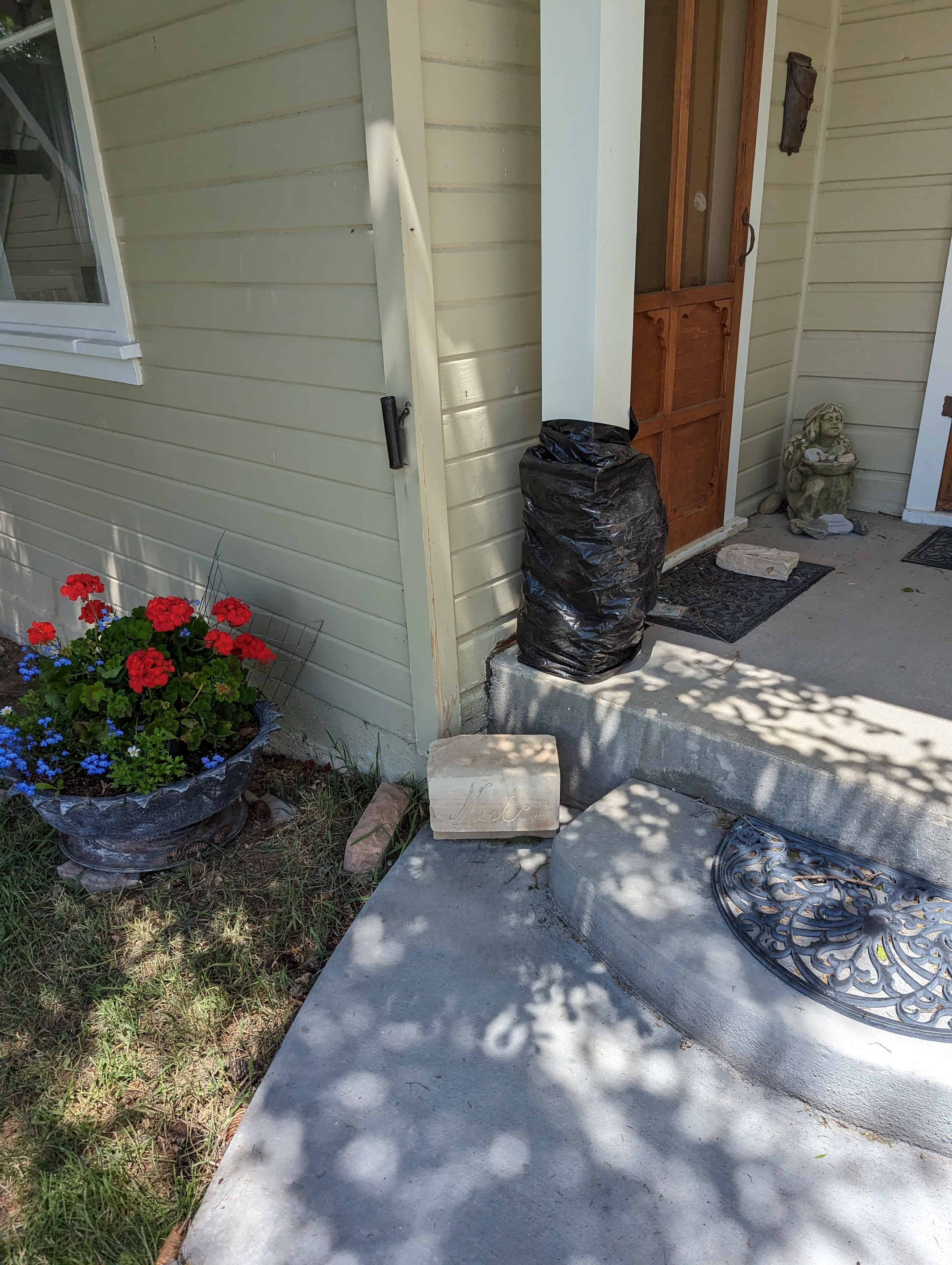
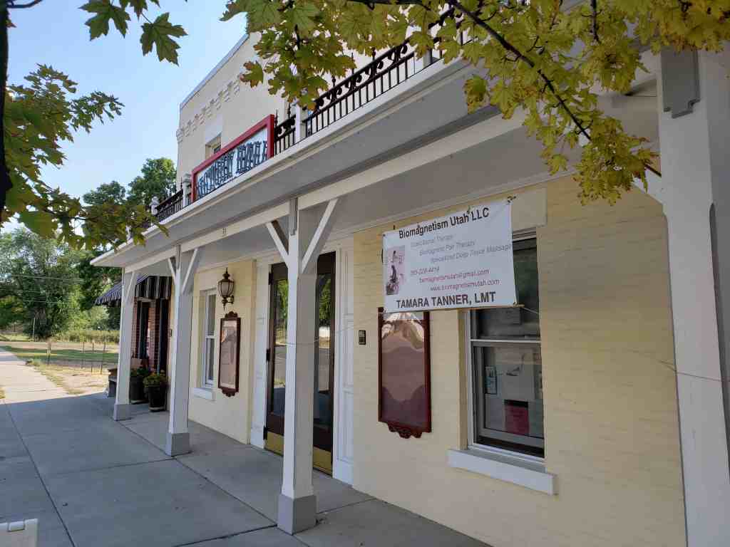
Outside of these few buildings with strong religious links and a small commercial area on Main Street, Spring City is predominantly residential. While modern intrusions do occur (and are occurring with more frequency), the ambience of the town remains strongly that of the rural farm village. Most of the streets are unpaved, town lots retain a high percentage of the original outbuildings, picket fences continue to grace many lots, and it is not uncommon in the spring and fall to witness large flocks of sheep being driven through the main streets.

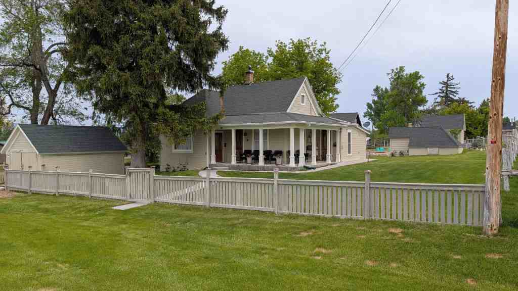
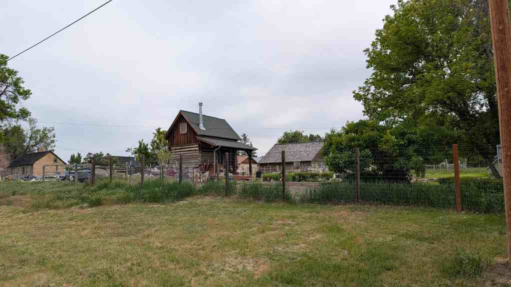
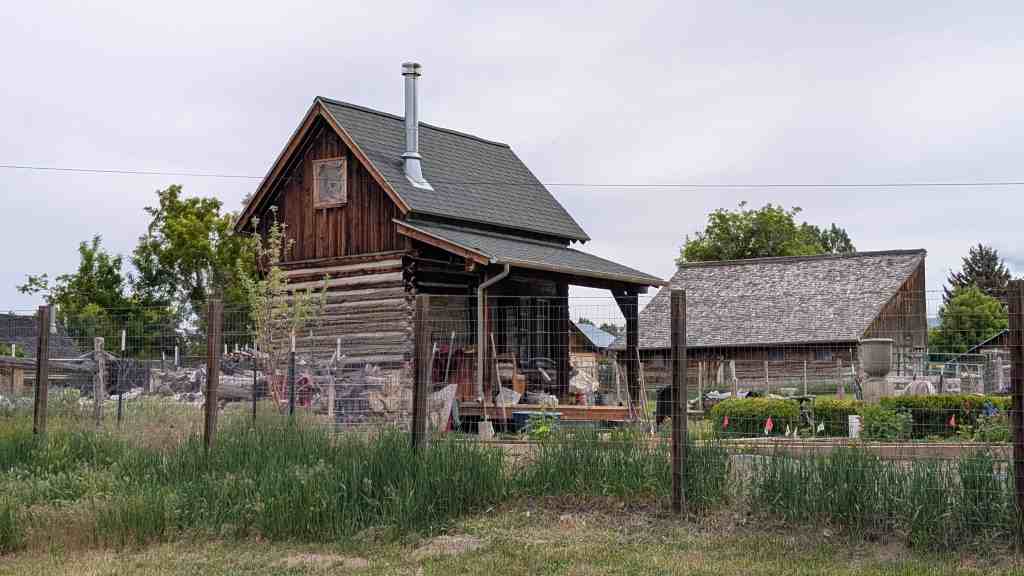
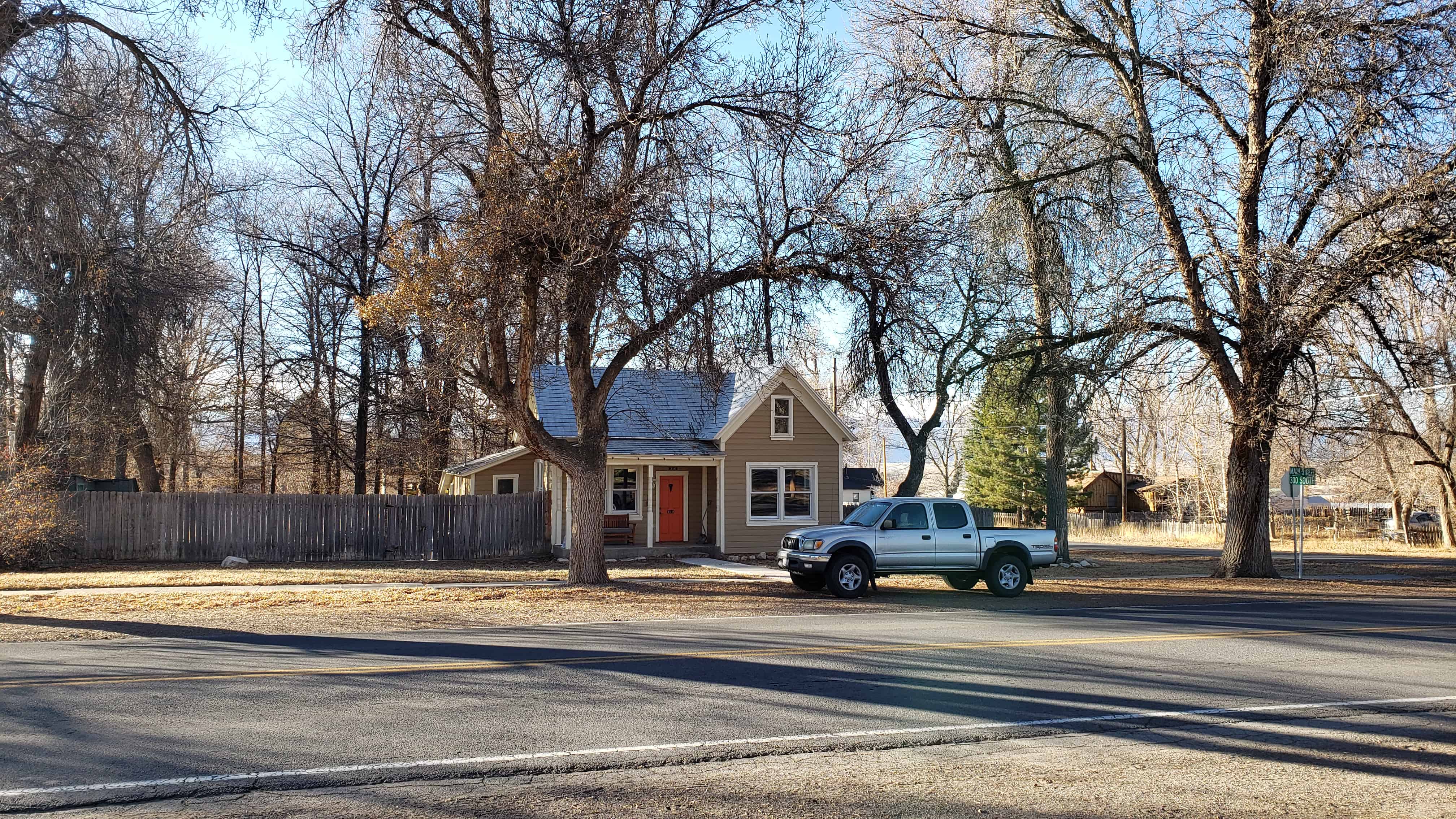
Architecturally, the town is overwhelmingly vernacular in character. Folk house types from the 1865-1890 period comprise over one-third of the extant total, and range from one room cabins to two-story hall and parlor houses. Adobe and stone are the most common building materials; though log, frame, and brick are also in evidence. Nearly all of the barns and granaries found in town follow traditional patterns. The origins of the folk designs reflect the overall diversity of the settlement population. Yankees and Southerners brought along familiar house plans from their eastern homes, and Danes (a sizeable percentage of the population) brought along Old World houses such as the “parstugen.” In general, folk styles predominate and generate much of the nineteenth century quality of the town.

Pattern book styles of the 1880-1910 period make up about another one-third of the town’s architecture. Economic prosperity during the later nineteenth century enabled Spring City residents to emulate architectural fashions found in population centers like Salt Lake City and Provo. Carpenter-builder designs were made available in Sanpete Valley through architectural pattern books. As a result, hip roofs gradually replaced the simple gable, pyramid cottages with projecting gables became extremely popular, and several successful entrepreneurs created elegant monuments to their own prosperity the John Baxter Sr. House, the Brail Ericksen House, the William Osborne House, and the Jacob Johnson House are rather large and picturesque renderings of the pattern book style. Builder’s manuals also introduced the bungalow to Spring City. While several good bungalows can be found within the town limits, these buildings make up only about one-tenth of the housing stock.

Intrusions into the historic district occur in the form of mobile and prefabricated homes and variations of the ranch styles of post World War II years. In 1973 there were thirteen trailers in town; today (1979) there are about twenty-two. About thirty ranch-style houses are found in Spring City, mostly built in the 1970s. Alterations of older houses occasionally detract from the visual nature of the district, but severe modification is minimal.

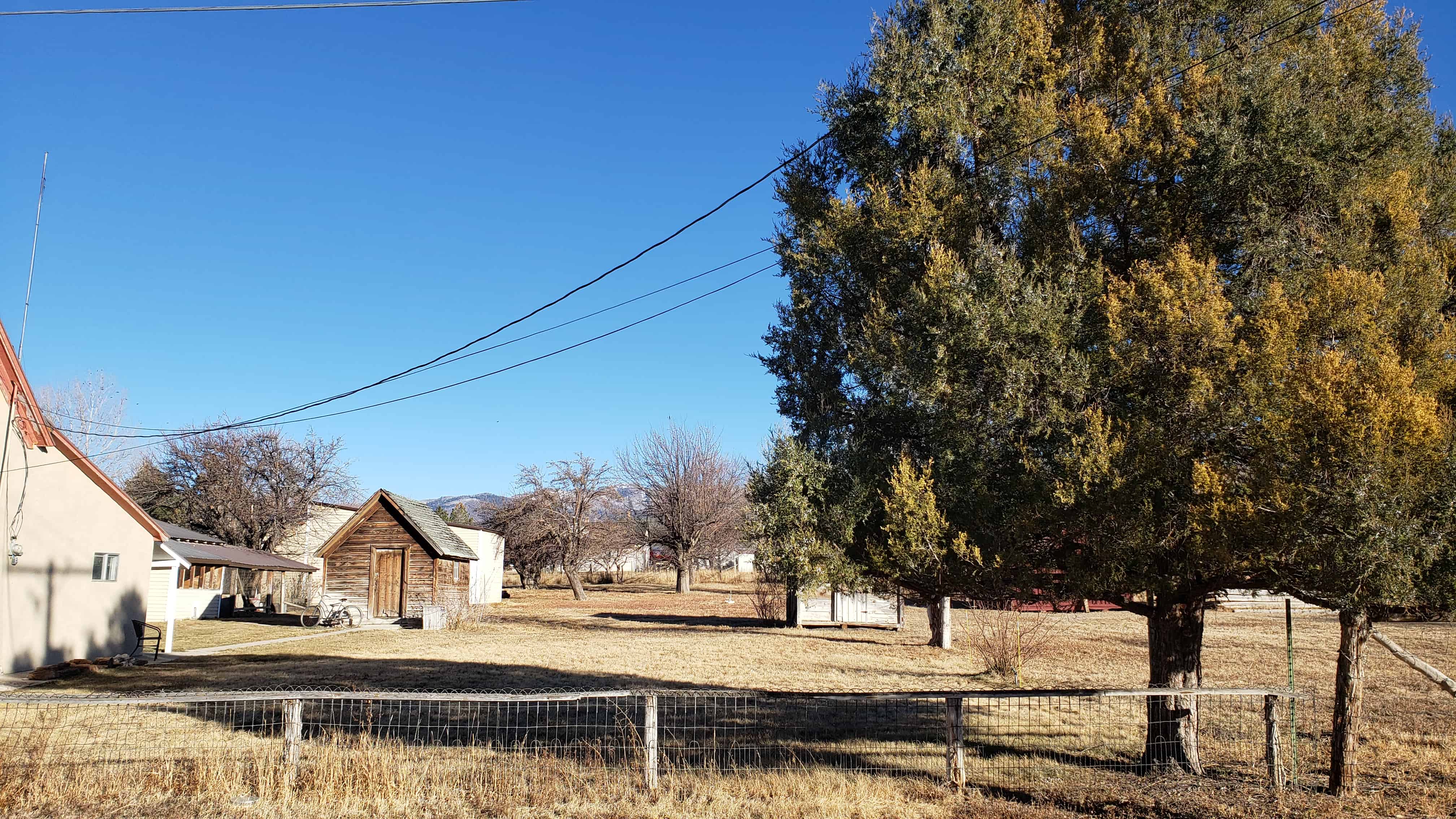
Landscape features also enhance the historic village feeling of the town. The town is isolated from the main valley by two low lying bands of hills (the “Stone Quarry Hills”) on the west and south. Streets are generally tree lined and yards are maintained. Town lots contain orchards and vegetable gardens. Irrigation ditches still carry water to each water share holder in town. The rich cream-colored limestone used in the town’s stone buildings blend in particularly well with the cultivated landscape. The adobe, brick, and frame buildings also harmonize well with the general setting. Natural features of importance are the two creeks which run through town. Canal Creek cuts through the extreme southwest corner of the town and Oak Creek runs in a northeasterly course bisecting the city. The plentiful spring which gave the town its name is displayed prominently on block 32.

The quality which serves to distinguish Spring City from other towns in the valley is the large number of buildings which appear much as they did in the years before the First World War. The pace of life and character of the people also enhance the historic atmosphere. The lack of large commercial establishments, the large number of vernacular style homes, the landscape setting, and the spectacular view of the Wasatch Plateau all contribute to the singularity of the Spring City experience.

The historic and architectural significance of Spring City lies in two areas:

  1. the town graphically documents the techniques of Mormon town planning in Utah;
  2. architecture in Spring City is remarkably well preserved with an: abundance of religious buildings, homes, and small commercial establishments which predate World War I.

This Sanpete valley town effectively documents the pattern of Mormon exploration and settlement in the West and the particular agricultural practices which accompanied village living. Spring City is one of the best remaining examples of the Mormon “village” in Utah.

History of Spring City

Spring City was settled as a part of the colonization of the Great Basin planned and directed by members of the Church of Jesus Christ of Latter-day Saints (Mormons). In 1850, the Fourth General Epistle of the Church reported that Brigham Young, the Church President/ and his counselor, Heber C. Kimball had just returned from a tour of the Sanpete Valley:

On the last of July, Brothers Young and Kimball . . . returned . . . having found a place for a good settlement located a city at Sanpete (Manti) and noticed several immediate sites worthy of the attention of smaller colonies which we anticipate will be settled this fall making a pleasant and safe communication from this our most southern habitation.

Church leaders envisioned, a line of settlements stretching the length of the valley to ensure the effective control of the area. Defensive measures, gratuitous in some parts of Utah Territory, were necessary in the Sanpete Valley due to the presence of an Indian population capable of resisting the intrusion of the Mormon colonizers. Though part of the larger plan for the settlement of the Valley, the selection of the site for Spring City was largely the decision of one man, James Allred.

James Allred, born in 1784 in Randolph County, North Carolina, was an early convert to Mormonism and followed the Saints through the persecutions in Missouri and Illinois. Arriving in Utah in the fall of 1851, Allred was advised by Brigham Young to move to the Sanpete Valley and “select a place for a settlement where he could locate with his numerous posterity and kindred and preside over them.” On March 22, 1852, James Allred examined the country lying along what is today Canal Creek (located in the southwest part of town). Four days later he returned with several of his sons and, together with a number of men from Fort Ephraim, began settling the town of Spring City. The first house, a log home, was situated on Block 4 of the present town. During the summer of 1852, two adobe houses were constructed one located on Block 4 near the original log house and the other near the spring on Block 20. Also that summer, one of James Allred’s sons, James T. S. Allred, completed the first survey of the area. A tract of about one hundred acres was divided into five acre blocks. Some crops were planted and about twelve families spent the winter of 1852 in what was then called the “Allred Settlement.”

In July of 1853 open warfare broke out between the Mormon settlers and the native population. Pleasant Creek (now Mt. Pleasant) was raided in mid-July and residents fled to the Allred settlement for safety. People from both towns fashioned a fort-like structure by dragging their log cabins together and filling in the gaps between houses with rock walls. This first “fort” was completed on July 28 and stood on Block 20. Indian attacks, resulting in considerable loss of livestock and horses, drove the defenders from the Allred settlement back to Manti on July 31. An attempt at resettlement was made during the fall of 1853, but again, threat of Indian attack caused a second abandonment of the community. Many of these settlers who vacated Spring City and went to Manti were among the founders of Ephraim in 1854.

At the request of President Brigham Young, William Black, J. T. Ellis, and the Allred family reestablished the settlement in the summer of 1859. Albert Petty, the county surveyor, accompanied this group and laid off a townsite and 640 acres of farmland surrounding it. Farm land was surveyed into five and ten acre lots and distributed among the settlers. A log meetinghouse was erected on the southwest corner of Block 29, This structure housed a variety of activities until an adobe meetinghouse was built in 1863-1864. The community also attracted a large number of Danish immigrant converts. The number of Danes in the town was large enough to warrant the naming of the community “Little Denmark.” These Scandinavian converts transplanted many architectural forms and techniques into the area, and tradesmen blacksmiths, bakers, wheelrights, shoemakers, carpenters, and masons made valuable contributions to the life of the community. By 1860, the population of Spring City (then called Spring Town) was 243 people. Indian trouble continued through 1869, when treaties were signed ending hostilities. The towns people, with life more secure, turned full attention to agriculture, stock raising, wool growing, lumbering, and other rural pursuits, In 1870, the town was incorporated as Spring City.

Significance of Spring City

In town plan and in the distribution of farm land, Spring City (like other communities in the valley) adheres to a “farm village” system advocated by L.D.S. Church leaders. According to the village scheme, houses, barns, vegetable gardens and orchards would be contained within the boundaries of the village. The large town lots, approximately an acre each, easily accommodated this large number of buildings arid domestic activity. Farm land lay outside the village,, with farmers commuting daily to their outlying fields. The farm village settlement pattern is commonly found throughout the world and is particularly linked to early English agricultural practices. Village living, however, proved unpopular in the United States where the “isolated farmstead” individualized pattern of land tenure predominated. Communitarian thinking, inspired by the Utopian ferment of the early 19th Century, brought the village idea back into currency among groups advocating social reform. As part of this larger religious Utopia movement, the early Mormons were likely influenced in their town planning activity by the resurgence of the farm village pattern.

The Mormon prophet, Joseph Smith, outlined through his teaching a plan for the salvation of mankind. The Second Coming would not occur until the kingdom of God had been built on earth. The Saints were to “gather” together and build the City of Zion, a new Jerusalem, to await the millennium. The city of Zion would have a plan, and on June 25, 1833, the prophet delivered to his followers the “Plat for the City of Zion.” Smith’s “plat” basically called for a gridiron block arrangement, blocks divided into lots, center blocks reserved for Church buildings, wide streets, houses of brick or stone construction, and the town surrounded by fields. While some scholars have disputed the claim that Smith’s “Plat” influenced town planning in Utah, it appears that L.D.S. planners in Utah realized the “general principles” of the “Plat of the City of Zion” even if their interpretations were never literal.8 The perpetuation of the “Mormon Village” in the Great Basin has produced a distinctively religious landscape in the West.9 While non-Mormon western ranchers chose the isolated farmstead, the Saints opted for the controlled atmosphere of the nucleated village. If mining boom towns grew in a haphazard organic fashion, the Mormon village was nurtured to maturity by the application of specific planning rules. Spring City is historically significant as an outstanding example of this “village” settlement type.

Spring City continues to communicate visually the structure of the nineteenth century Mormon village. The guiding principles of Joseph Smith’s “Plat of Zion” are openly in evidence. The geometry of the gridion provides the overriding blueprint for the plan. The five acre town blocks are subdivided into lots of roughly an acre and a quarter. Town lots contain dwelling house, barns, granaries, orchards, and vegetable gardens. Wide streets are the rule, with the older houses following a uniform “set back” of fifteen to twenty feet. Architecturally, the town is dominated by the L.D.S. meetinghouse, centrally located on Block 20. Vernacular domestic architecture predominates with a large number of the homes of native limestone. Non-contributory buildings do exist, but development of the town has been slow during the twentieth century and the post-1950 intrusions do not detract from the historical nature of the town. Many outstanding architectural examples continue to be inhabited and maintained by town residents.

Scandinavian Folk Building in Spring City

The Scandinavian house type found in Spring City is a variant of the northern European “pair house,” a three-bay plan arrangement with a centrally placed hall flanked by a pair of living rooms on each side. In Sweden, the house enjoyed widespread popularity in the 18th and 19th centuries and is called the “parstuga” type. Danish examples are not as clearly defined, but the “tvillinghus” or twin house is closely related to this basic three-room floorplan. The pairhouse in Utah is not an exact copy of Scandinavian originals, but rather, has been modified to its new Utah circumstances. The entrance-hall, corner bake oven, and attached animal shelter of the European house failed to survive the Atlantic crossing and do not surface on Utah examples. The pair house in Spring City has a straight forward three-room floorplan, a symmetrical faƧade, and chimneys placed on the ridge. A similar process of component adaptation occurred on pair houses built by Finns in northern Minnesota. There are three pair houses in Spring City, the Peter Monson house), the Hans Morgan Hansen house, and the Jens Jensen house.

Structures in the Historic District

  • Allred – Johnson House
  • James T. S. Allred House

310 South Main Street

31 Thursday Dec 2020

Posted by Jacob Barlow in Uncategorized

≈ Leave a comment

Tags

Historic Homes, NRHP, Sanpete County, Spring City, utah

310 South Main Street

Constructed in 1904, this ship-lap sided frame cross-wing house contributes to the historical nature of Spring City and retains excellent historical architectural integrity. Marsden Allred was a long-time occupant of the home.


Located at 310 South Main Street inĀ Spring City, Utah

Lyceum Theater

27 Sunday Dec 2020

Posted by Jacob Barlow in Uncategorized

≈ 1 Comment

Tags

Historic Buildings, NRHP, Sanpete County, Spring City, Theaters, utah

The Lyceum Theater, later known as Victory Hall, was constructed in 1915 by John Baxter. The theater was used for school productions, plays, and convocations through the 1940s. Later the theater served as an LDS cultural and recreation center.

Located at 35 North Main Street in Spring City, Utah

Victory Hall in Spring City

The Lyceum Theater, later known as The Victory, was constructed about 1915 by John R. Baxter, Jr. (1888-1978).
It featured silent films and later “talkies.” The “hall” was sold to the LDS Church and served as a recreational center until 1976 when the cultural hall addition to the LDS chapel was completed.*

Sandstrom’s Pool and Dance Hall

26 Saturday Dec 2020

Posted by Jacob Barlow in Uncategorized

≈ 2 Comments

Tags

Dance Halls, Historic Buildings, Libraries, NRHP, Pool Halls, Post Offices, Sanpete County, Spring City, utah, WPA

Sandstrom’s Pool and Dance Hall

William Sandstrom built this two-story frame and adobe commercial building in 1911. The first floor operated as a pool hall with a dance hall above. Later in the century, it was operated as a grocery store. It also served as the post office and, during the 1930s, had a WPA library on the upper floor. At one time it was occupied by the Dahl family.

Located at 37 N Main St in Spring City, Utah

William Sandstrom (1877-1911) built this two-story adobe-lined, wood frame commercial building about 1911. The first floor operated as a pool hall with a dance hall above. After Sandstrom’s death, James W. Blain ran a grocery store here and in the teens it was the post office. It also served as a bicycle shop, WPA library, and Dahl’s Grocery.*

Reuben W. Allred, Sr., House

11 Friday Dec 2020

Posted by Jacob Barlow in Uncategorized

≈ 1 Comment

Tags

Historic Homes, NRHP, Sanpete County, Spring City, utah

Reuben W. Allred, Sr., House

The original stone house (northern section) was built for Ruben Warren Allred c 1864, making it one of the oldest in town. It was expanded by a 1909 brick addition on the south and further altered in the 1970s by the stuccoing of the exterior walls. Rueben Allred, a native of Tennessee, came to Utah in 1849 then moved to Manti in 1853. From 1855 to 1860 he served as bishop of Fort Ephraim. He settled permanently in Spring City in 1861 and lived in this house until his death in 1884.

415 South Main Street inĀ Spring City, Utah

← Older posts
Newer posts →

Follow Jacob

Follow Jacob

Blog Stats

  • 2,029,058 hits

Social and Other Links

BarlowLinks.com

Recent Posts

  • Angels Are Near Us
  • Hiram Clawson Silver
  • Bingham Fort
  • Goulding’s Trading Post
  • Kyle’s Apartment – American Murderer Filming Location

Archives


Loading Comments...