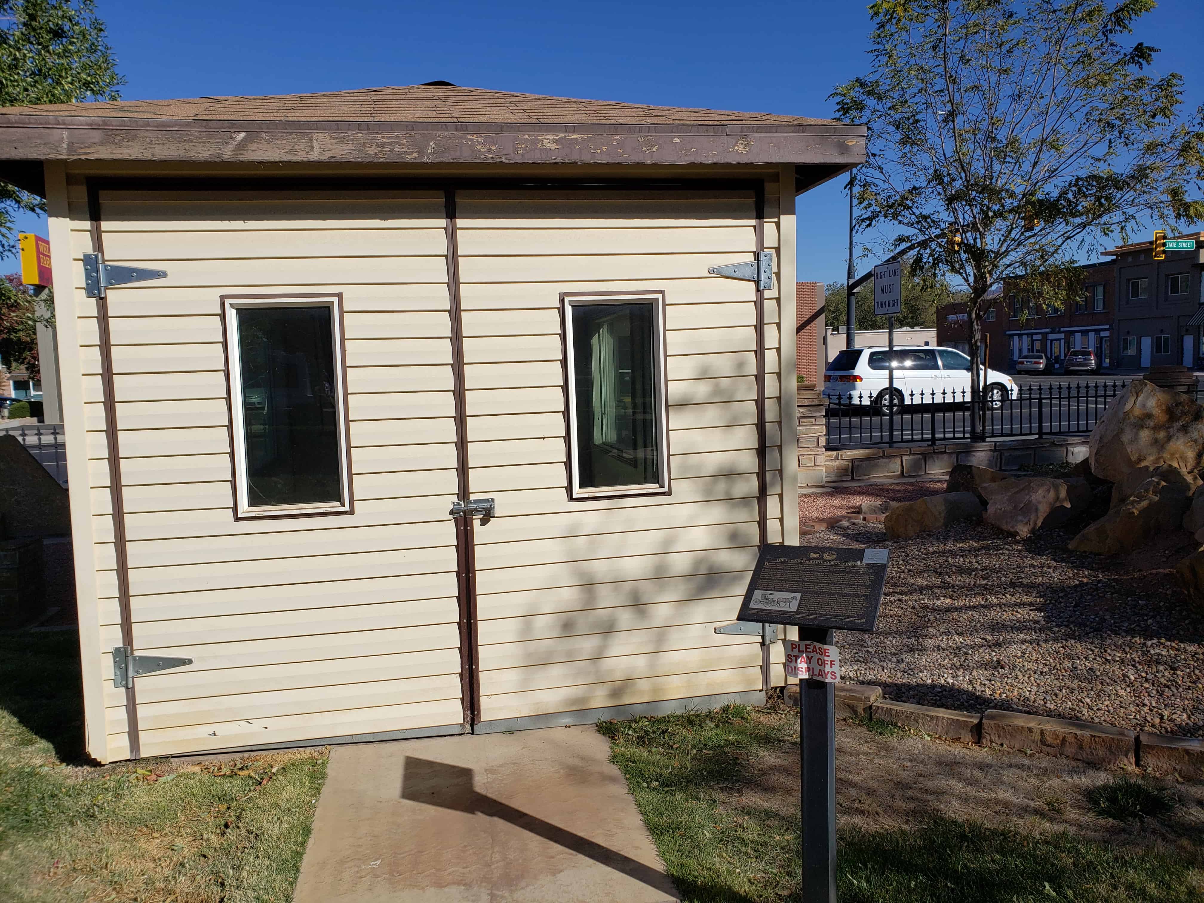
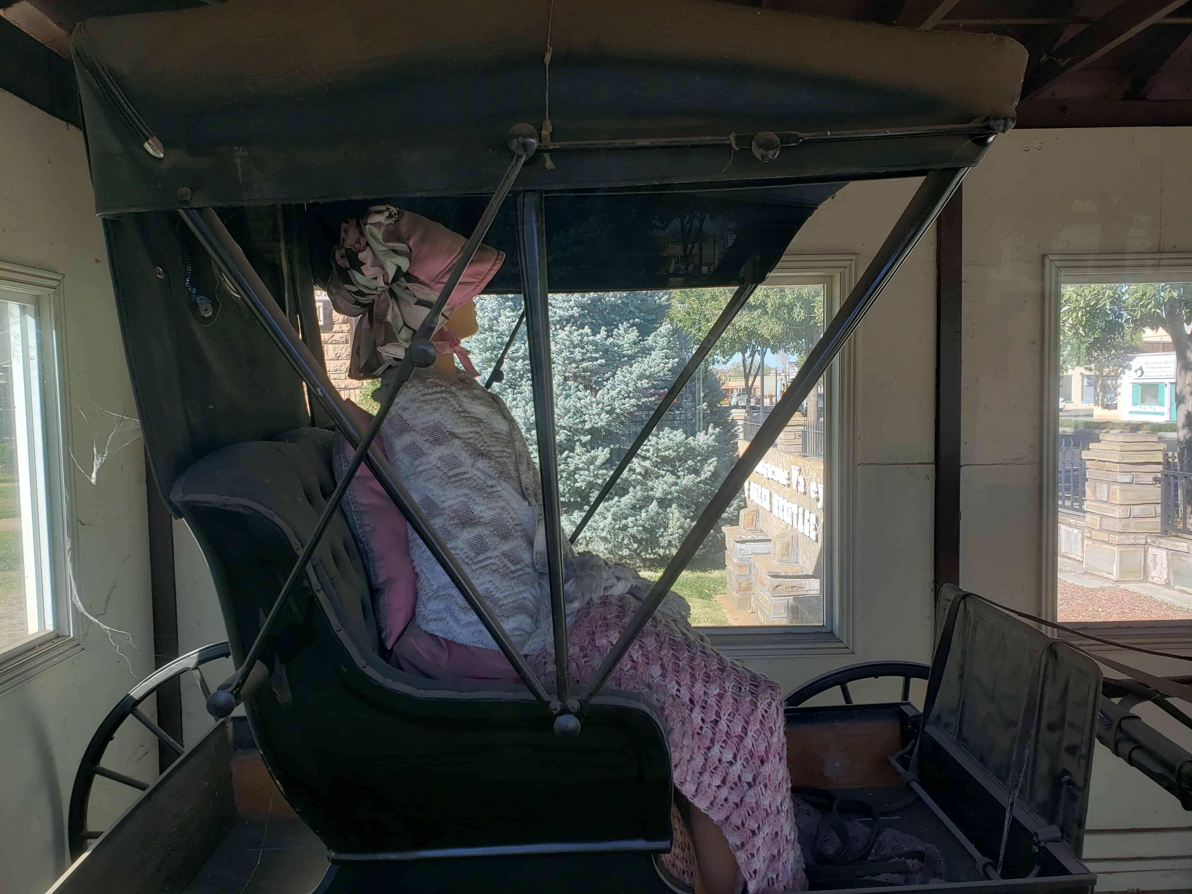
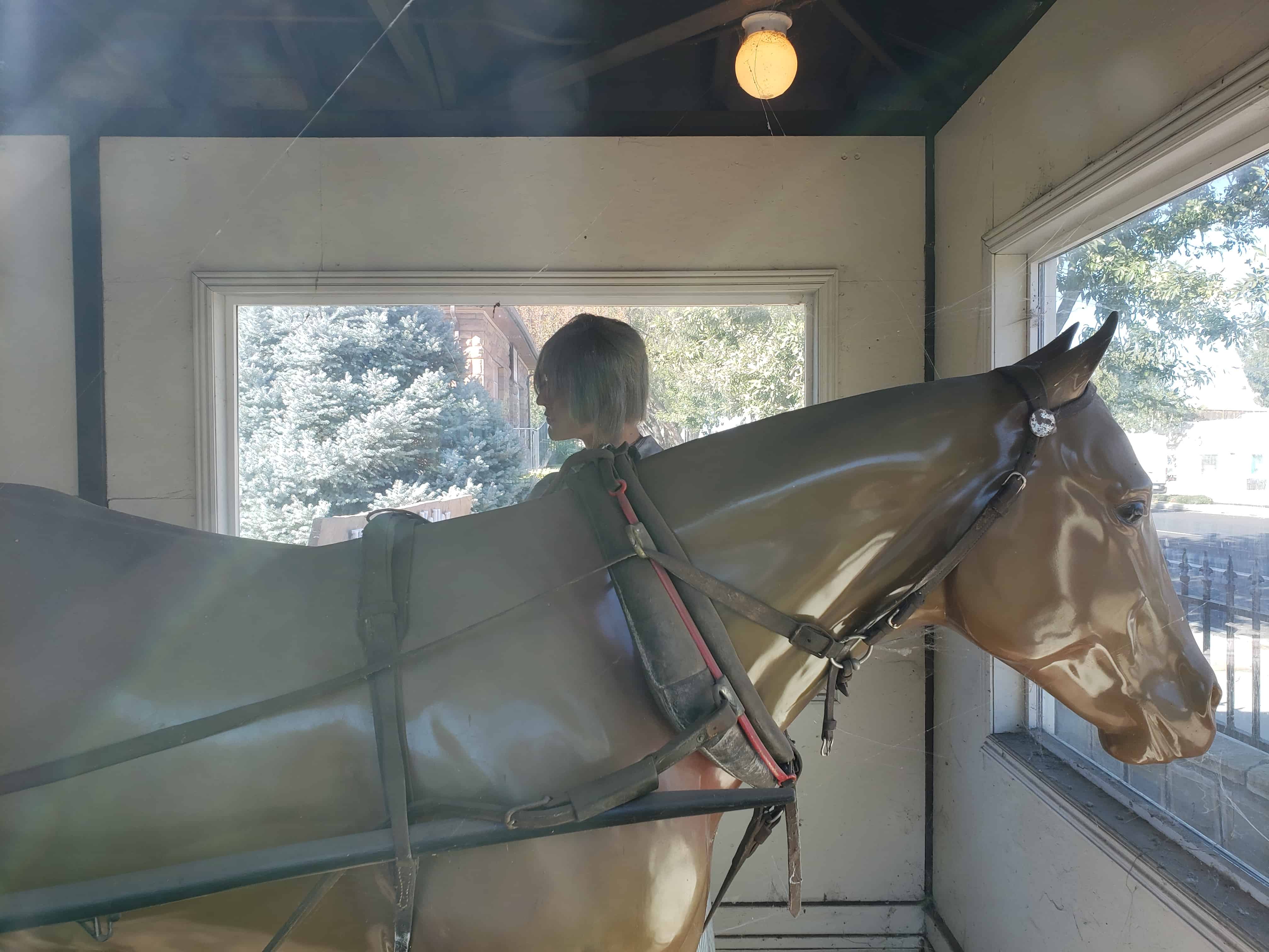
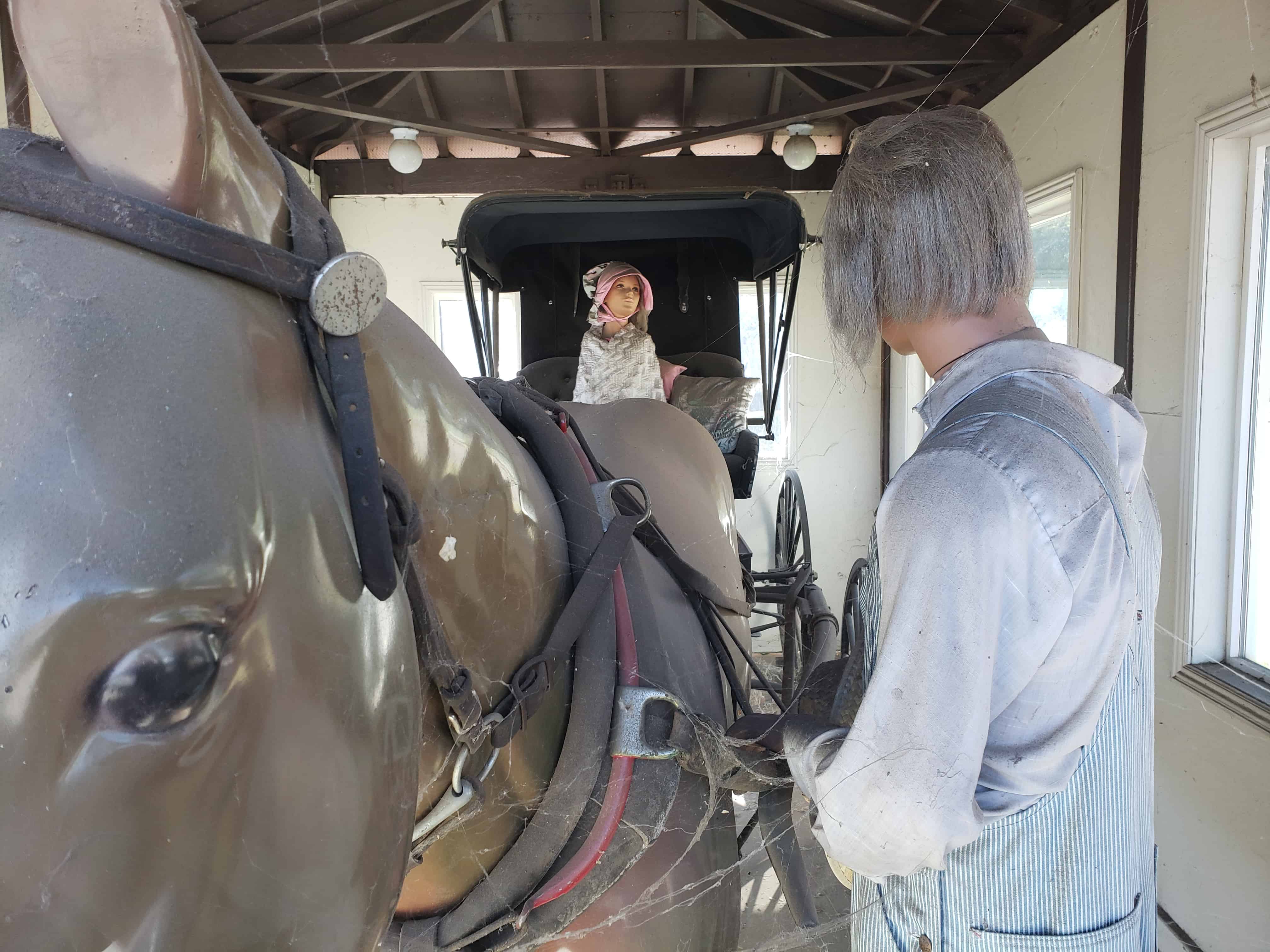
Buggies, such as the one before you, were an important part of early America. As the name implies, Doctors’ Buggies were used by physicians but they were also a popular choice for many others as well. Buggies were dearly prized and generally kept in a carriage house.
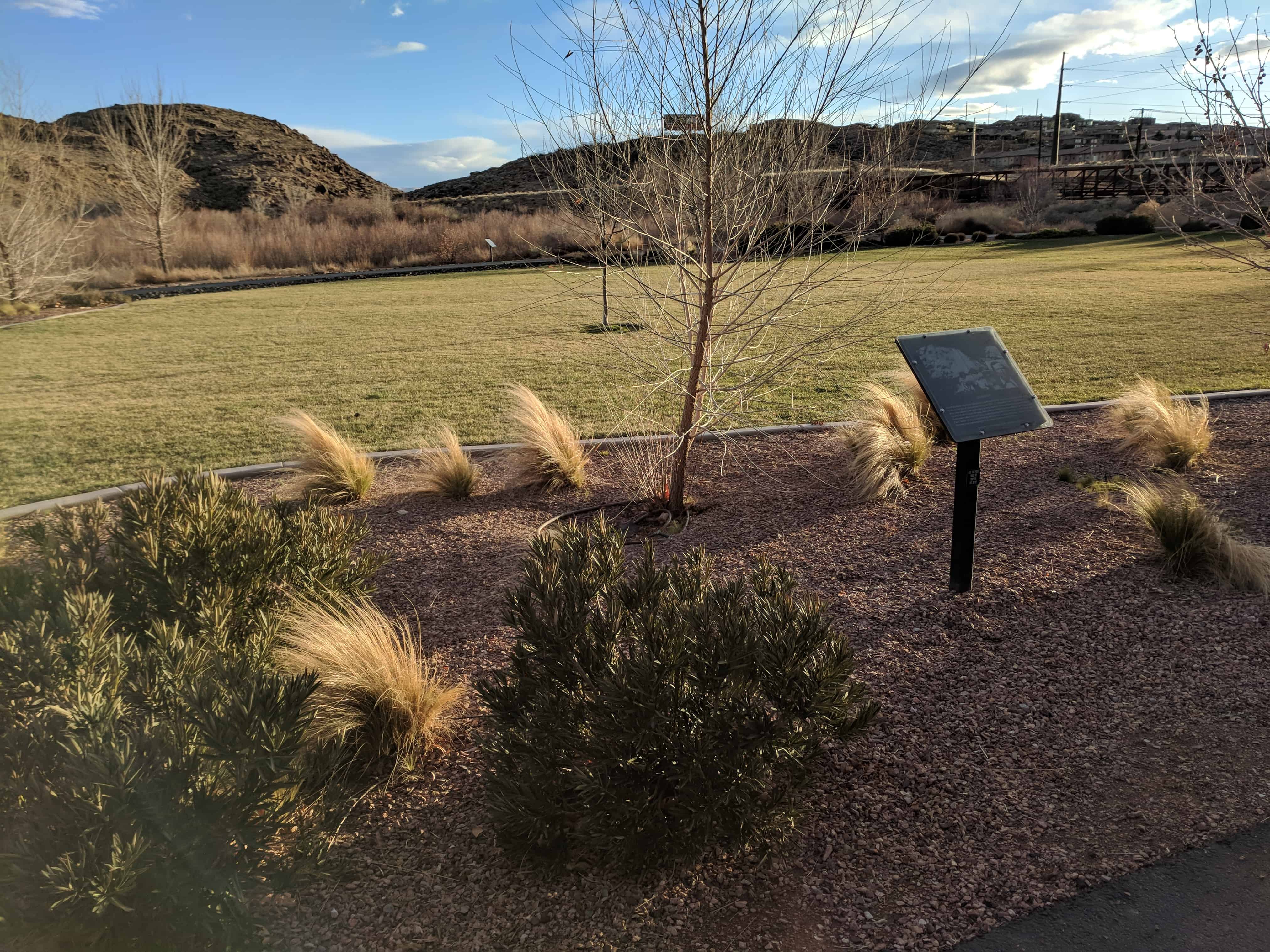
In 1863, LDS Church Apostle Erastus Snow was traveling in a similar buggy from Kanab to St. George, Utah. Accompanying him were horsemen (Nephi Johnson and David H. Cannon) who told him of an old Indian trail leading over the hill. Choosing to follow the trail, they successfully descended the other side of the hill by having the horsemen restrain the buggy with their lariats. However, a strong wind came up and blew off the top of the buggy. Erastus Snow exclaimed, “That was quite a hurricane! We will name this Hurricane Hill.”
On September 1, 1893, the Hurricane Canal Company was organized and work began on a canal around Hurricane Hill, ending at Hurricane Flat. Two thousand acres of fertile land could be irrigated by building the new canal. On August 6, 1904, a celebration was held in Hurricane, near the canal at 200 North and 300 East. About 100 people attended and watched with great excitement as water began flowing through the Hurricane Canal and onto the fertile flat.
Later that day, where you now stand, people gather in a bowery on the new town square to choose a name for the town. Names suggested were Pearl City, as the town was to be a “pearl in the desert”, Lake City, because at the time, there was a lake south of town; Chaparral, due to the bush that grew so abundantly throughout the valley; or Hurricane, after the canal company, the hill, and the flat that had used that name since the buggy incident many years before.
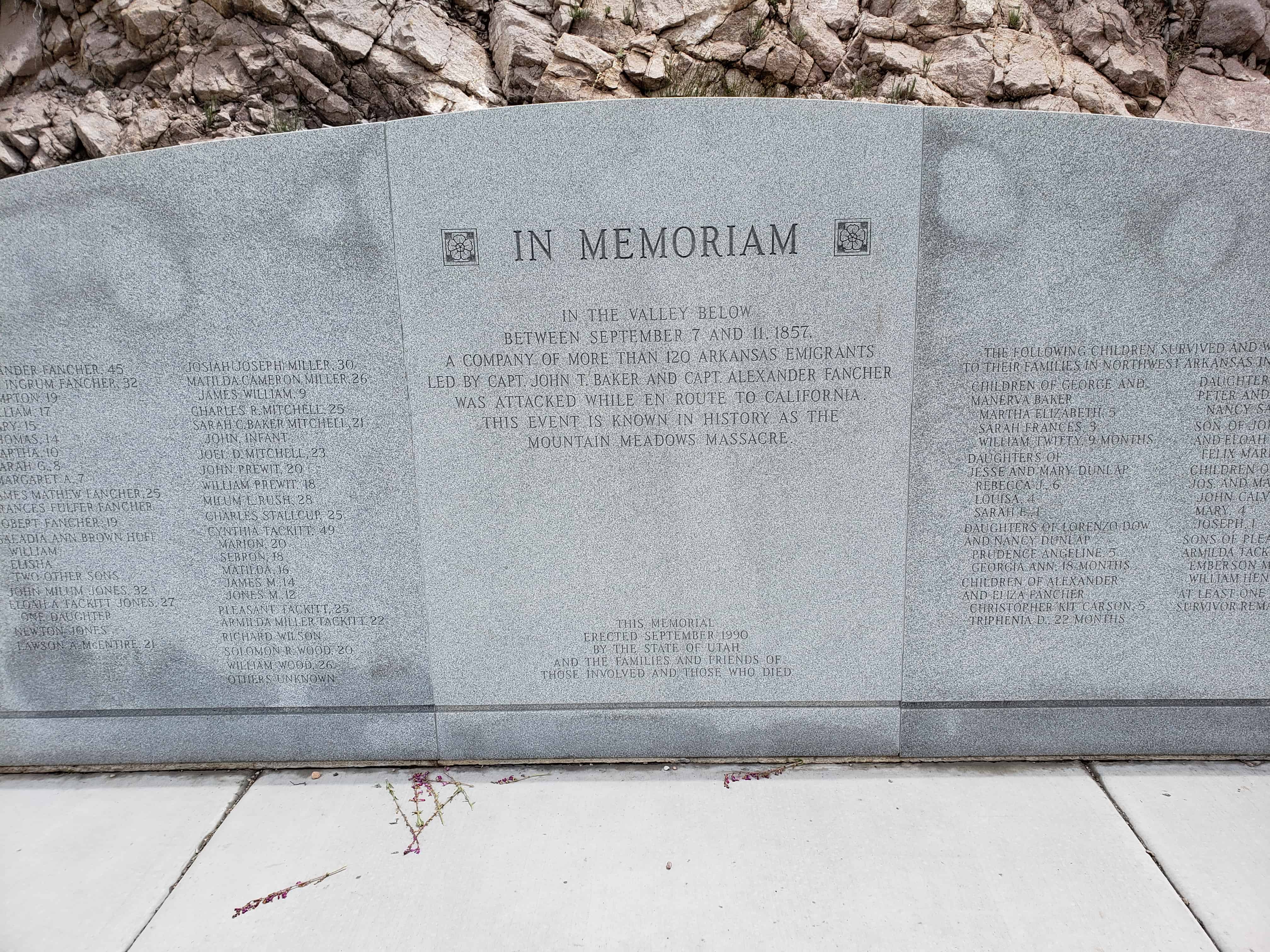
In early September 1857, about 140 people camped in this valley. Most of them were families from northwest Arkansas. Led by Captains John T. Baker and Alexander Fancher, they were headed to new opportunities in California. Their worldly possessions included about 35 wagons, several hundred cattle, and many mules, horses and oxen.
Beginning on September 7, the camp was attacked by a group of Mormon militiamen and the Paiute Indians they had recruited. In a five-day siege fueled by complex hostilities, the attackers killed at leave 10 men who fought valiantly to defend family and friends.
The emigrants fought off their attackers until September 11, when Mormon militiamen entered the encampment under a white flag of truce. The militiamen deceived their victims into surrendering weapons and property in exchange for protection and safety.
The militiamen separated the emigrants into three groups and marched them from the camp. The wounded and some small children rode in wagons, followed by women and older girls on foot with other children. Men and older boys walked some distance behind, each escorted by a Mormon militiaman.
At a prearranged signal, militiamen shot the men, older boys, and some of the wounded. Mormons and Paiutes surged from their hiding places and, in a matter of minutes, massacred most of the remaining emigrants, including the courageous women who were attempting to protect the children and flee. The victims’ voices fell silent, except for the sobbing of 17 small surviving children. The dead were stripped of their clothing and left without decent burial. Their wagons, livestock, and other property were plundered.
In 1859, soldiers in the United States Army buried the victims’ scattered, scavenged remains.
Seventeen years after the massacre, a federal grand jury indicted nine Mormon militiamen for crimes related to the siege and massacre. About 50 other militiamen were involved, along with an unknown number of Paiutes. Only one, John D. Lee, was brought to trail and convicted. He was executed near the massacre site on March 23, 1877.
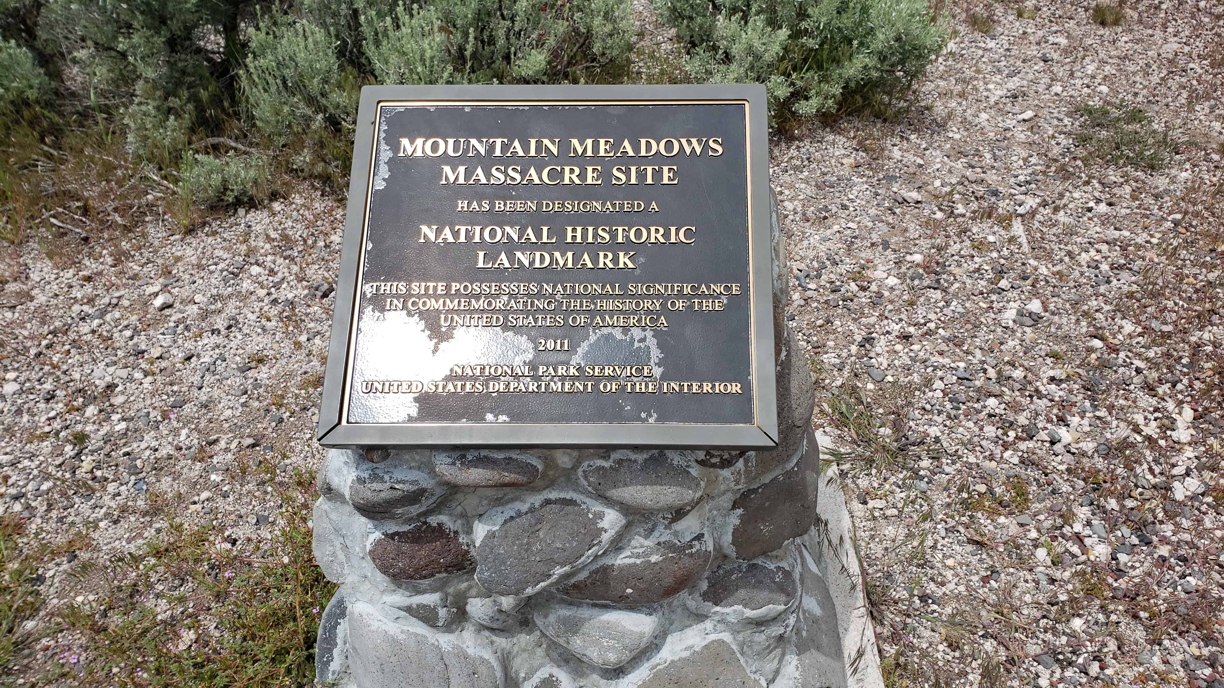
The Mountain Meadows Historic Site was added to the National Register of Historic Places (#75001833) on August 28, 1975.
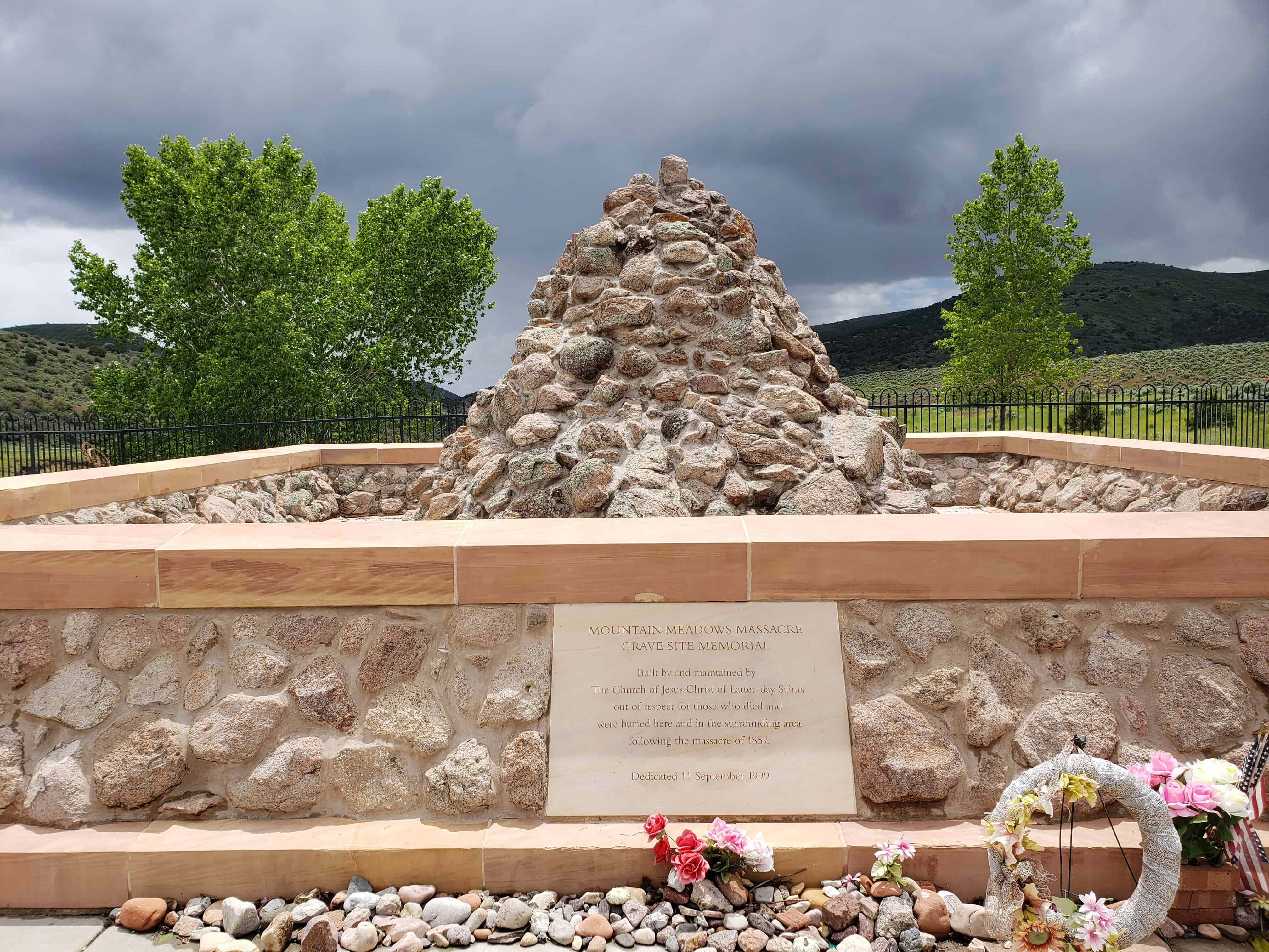
The Mountain Meadows Massacre Site has 4 memorials:
The Overlook Memorial where a trail leads to a memorial wall at the top of a small hill. Etched in the granite wall are names of victims in the Mountain Meadows Massacre.
The Gravesite Memorial, where a rock cairn marks the resting place of at least 30 victims in the massacre. Another monument nearby honors some of the emigrants who were killed in the initial siege.
On September 16, 1859, 17-year-old James H. Berry witnessed an event that he would never forget. He saw 15 children return to relatives and friends in Carrollton, Arkansas. Those children were survivors of the Mountain Meadows Massacre. They were escorted by a group of their relatives, led by Arkansas Senator William C. Mitchell. Two other children would return in January 1860.
On February 11, 1907, James H. Berry stood before the United States Senate in Washington, D.C. By that time, he was a senator himself, and he had also served as governor of Arkansas. He was a veteran of military battles, including one in which he had lost his leg. His fellow senators listened as he shared his personal connection to the victims of the Mountain Meadows Massacre:
“In 1857 I lived in the county of Carroll, in the State of Arkansas. In the spring of that year there left that county and two adjoining counties between a hundred and forty and a hundred and fifty, including men, women, and children, emigrants for California. They consisted of the best citizens in that country. It was a large train. It excited large interest throughout the section of the country from which they went. They had about 600 head of cattle, several mule teams, a number of wagons, and each head of a family had more or less money…. Late in the fall or the early winter the news came back that the train had been assaulted… far out West, and every soul had perished.
“Later on there came news that some of the children, how many we did not know at the time, were saved, and that they were in the hands of the Mormons in Utah. Our Senators and Representatives here called upon the Interior Department. An agent… was sent there by the Commissioner of Indian Affairs. He gathered those children together… who had been preserved from the massacre….
“I was a boy 17 years old on that day when they were brought to the village court-house. I saw them as they were lined up on the benches, and [Senator] Mitchell told the people whose children they were, at least whose he thought they were…. One little girl, I distinctly remember, had had an arm broken by a gunshot wound. It had not united and the arm hung dangling by her side. I have seen much of life since that day; I have seen war along the lines of the border States in all its horrors; but no scene in my life was ever so impressed upon my mind as that which I saw there that day presented by those little children, their fathers, mothers, brothers and sisters dead on the far-off plains of Utah and they, absolutely without means.”
The Surviving Children
In 1859, Major James H. Carleton interviewed Mrs. Rachel Hamblin, who lived a few miles north of the massacre field. Major Carleton carefully recorded her account of the surviving children, who were brought to her home on September 11, 1857, after witnessing the murder of their parents:
“At length between sundown and dark of the last day, I heard a firing greater than before, and more distinct. This is the time when the last of them were killed…. In about an hour, a wagon drove up to our house containing seventeen children in it, the most of them crying; one, a girl about a year old [Sarah E. Dunlap], had been shot through the arm; and another girl, about four years old [Sarah Frances Baker], had been wounded in the ear; their clothes were bloody…. The little girl who was shot through the arm could not well be moved. She had two sisters, Rebecca and Louisa, one seven and the other five [records show they were ages six and four], who seemed to be greatly attached to her. I persuaded [John D.] Lee not to separate them, but to let me have all three of them. This he finally agreed to, and the children stayed with me, and I nursed the wounded child…, though [she] has lost forever the use of [her] arm. The next day…, Lee and the rest started up the road with all the rest of the children in a wagon; and the Indians scattered off.”
Leaders of the Arkansas Wagon Train
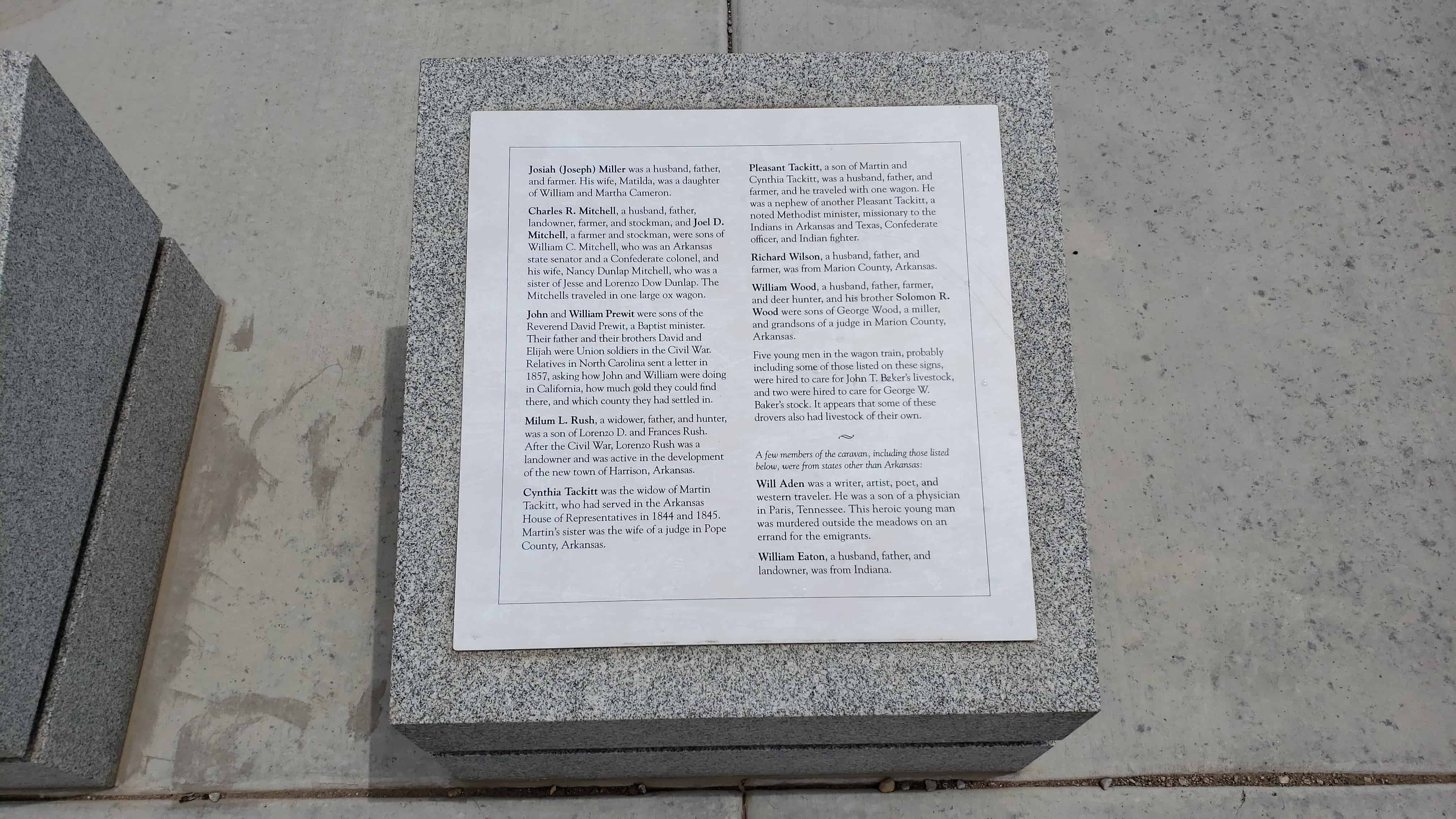
Accounts of the Arkansas wagon train list two leaders: John T. Baker (1805-1857) and Alexander Fancher (1812-1857).
John T. Baker was a farmer and cattleman, described as a shrewd trader, a warm friend, and a bitter enemy. He and his family lived along Crooked Creek, near the southern border of present-day Harrison, Arkansas.
In 1857, Baker led a group of relatives, acquaintances, and others in a wagon caravan headed to California, where he and his son John H. Baker had previously spent some time. He took 138 head of “fine stock cattle,” nine yoke of oxen, two mules, one mare, one large ox wagon, guns, saddles, bridles, camp equipment, and provisions for himself and five workhands. Three of his adult children went with him. His wife, Mary, and the other children remained in Arkansas, planning to go west later.
Before Baker left Arkansas, he wrote his will. He acknowledged that he knew “the uncertainty of life and the certainty of death” but not the time of his “dissolution.” He said, “First, I will at my death my body a decent burial in the bosom of its mother Earth and my spirit to the God who gave it.”
Alexander Fancher was a farmer and cattleman and a veteran of the Black Hawk War in Illinois. In the 1840s he and his wife, Eliza, moved with their children to Carroll County, Arkansas, and so did his brother John and his family. In 1850 the two brothers and their families moved to southern California. Soon after that, Alexander and his family returned to Arkansas. He obtained a land patent on Piney Creek in Carroll County in 1854 and settled in southern Benton County, where he acquired more land and became a justice of the peace.
Tradition suggests that Alexander, like John T. Baker, recruited family members, neighbors, and perhaps others to go to California in 1857. He and Eliza and their nine children set out on the adventure together. They took six toke of oxen, eight mules, three horses, four wagons, and as many as 200 head of cattle.
All these emigrants crossed the plains and went through the Rocky Mountains. They journeyed together from the Salt Lake City area, southward through Utah Territory.
In September 1857, the massacre at Mountain Meadow cur their journey tragically short and denied John T. Baker’s request for a decent burial. Baker was brutally murdered, along with his three children who were with him, one grandchild, a son-in-law, and a daughter-in-law. Alexander and Eliza Fancher were also murdered, as were seven of their children. Three Baker grandchildren and two Fancher children survived. Two years later, they and twelve other surviving children were returned to the care of relatives in Arkansas.
Mountain Meadows Massacre Site has been designated a National Historic Landmark. This site possesses National significance in commemorating the history of the United States of America.
Execution at the Scene of the Crimes
In September 1874, a federal grand jury indicted nine Mormon militiamen for crimes related to the siege and massacre. Some of those men immediately went into hiding as fugitives from justice. About 50 other militiamen were involved in the massacre, along with an unknown number of Paiute Indians. Only one, John D. Lee, was brought to trail and convicted.
On March 23, 1877, almost 20 years after the massacre, federal officials took Lee to the scene of the crimes. Not far from this very spot, he was executed by firing squad. He was buried about 120 miles from here.
In 1855 this valley was discovered by Isaac Riddle an Indian Missionary, while searching for a lost cow. The first sawmill south of the rim of the Great Basin was built on this site in 1855-1856 by Robert Richey, Jehu Blackburn and Isaac Riddle.
The first homes in the valley were erected around the mill. Pine Valley became the source of much of the lumber used in early towns of southern Utah and Nevada.
Dammeron Valley is in Washington County with a population of about 800, it was founded in 1859 and later abandoned and then more recently built up again.
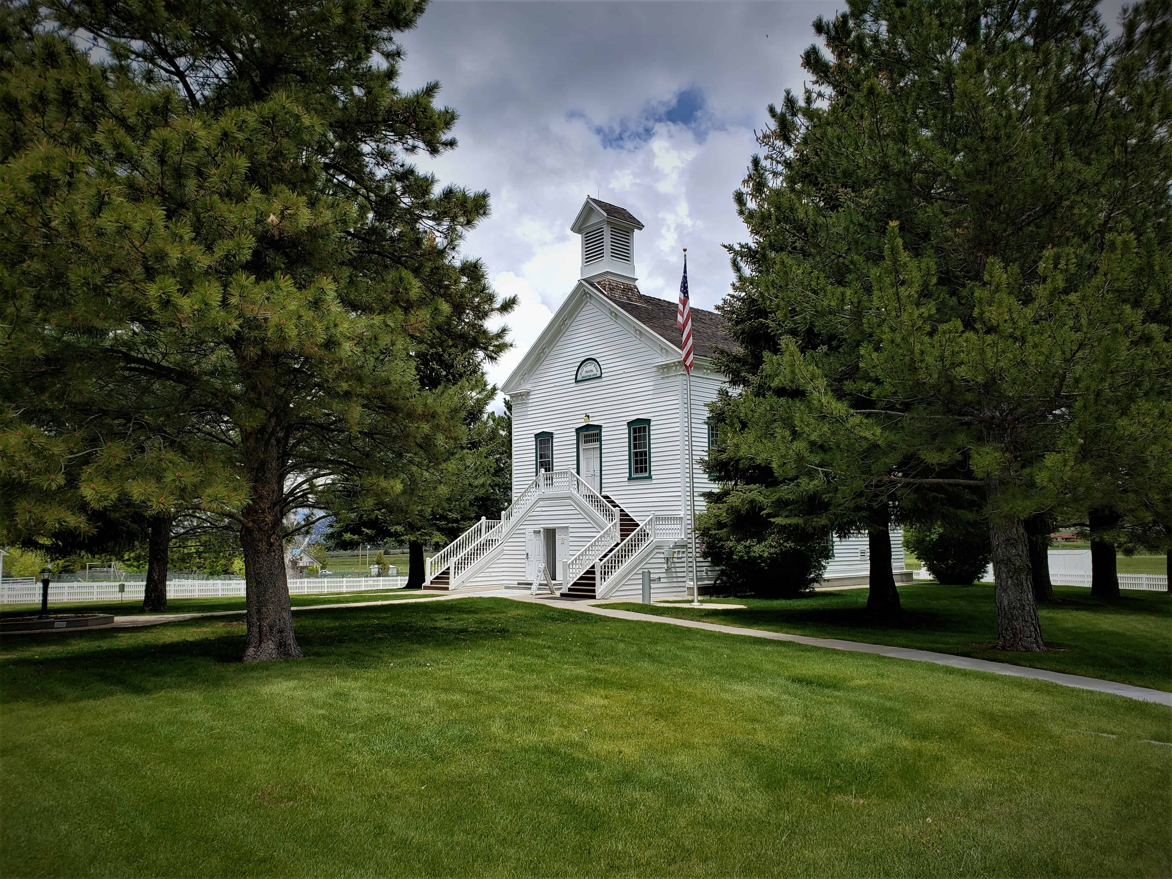
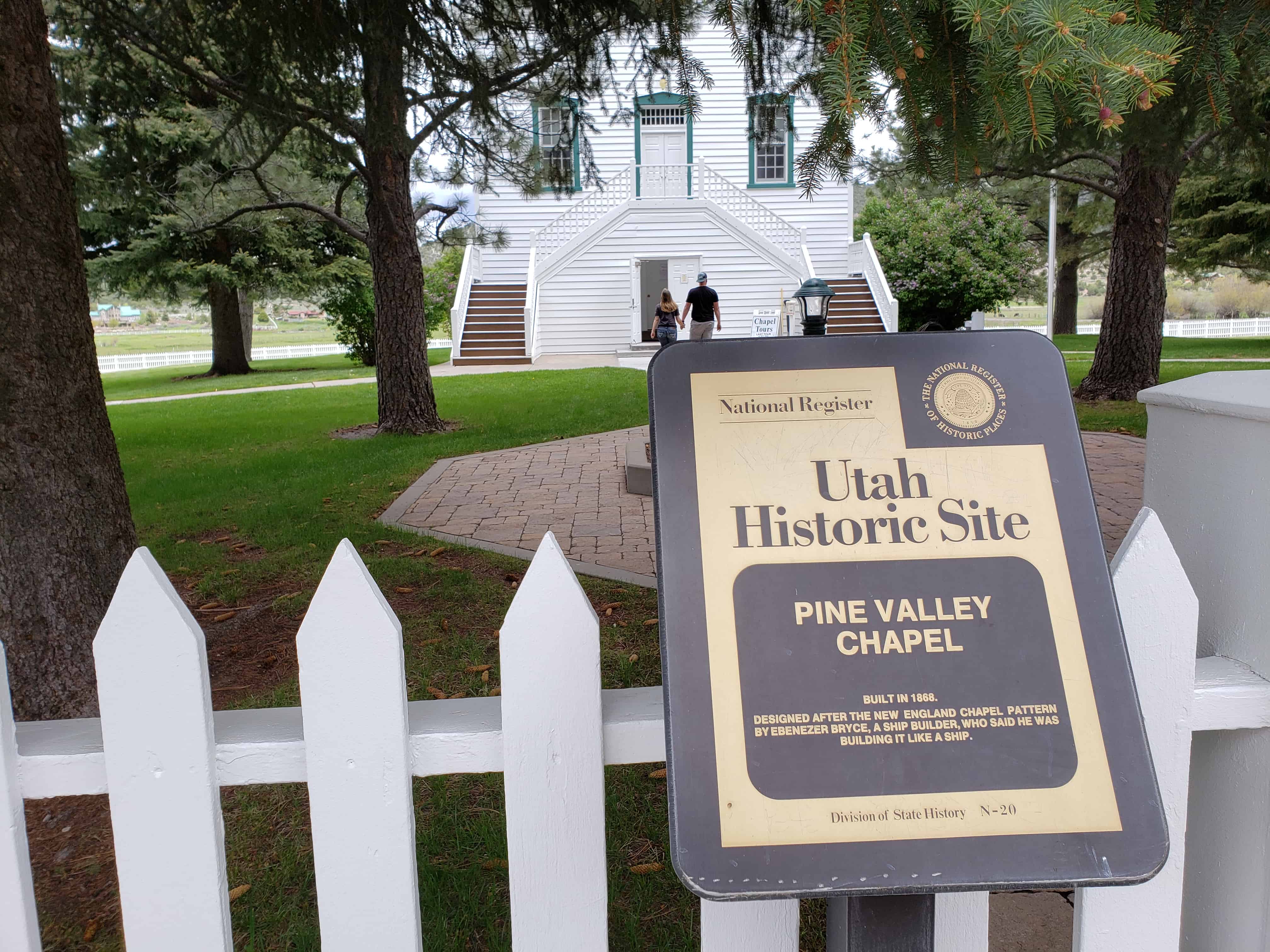
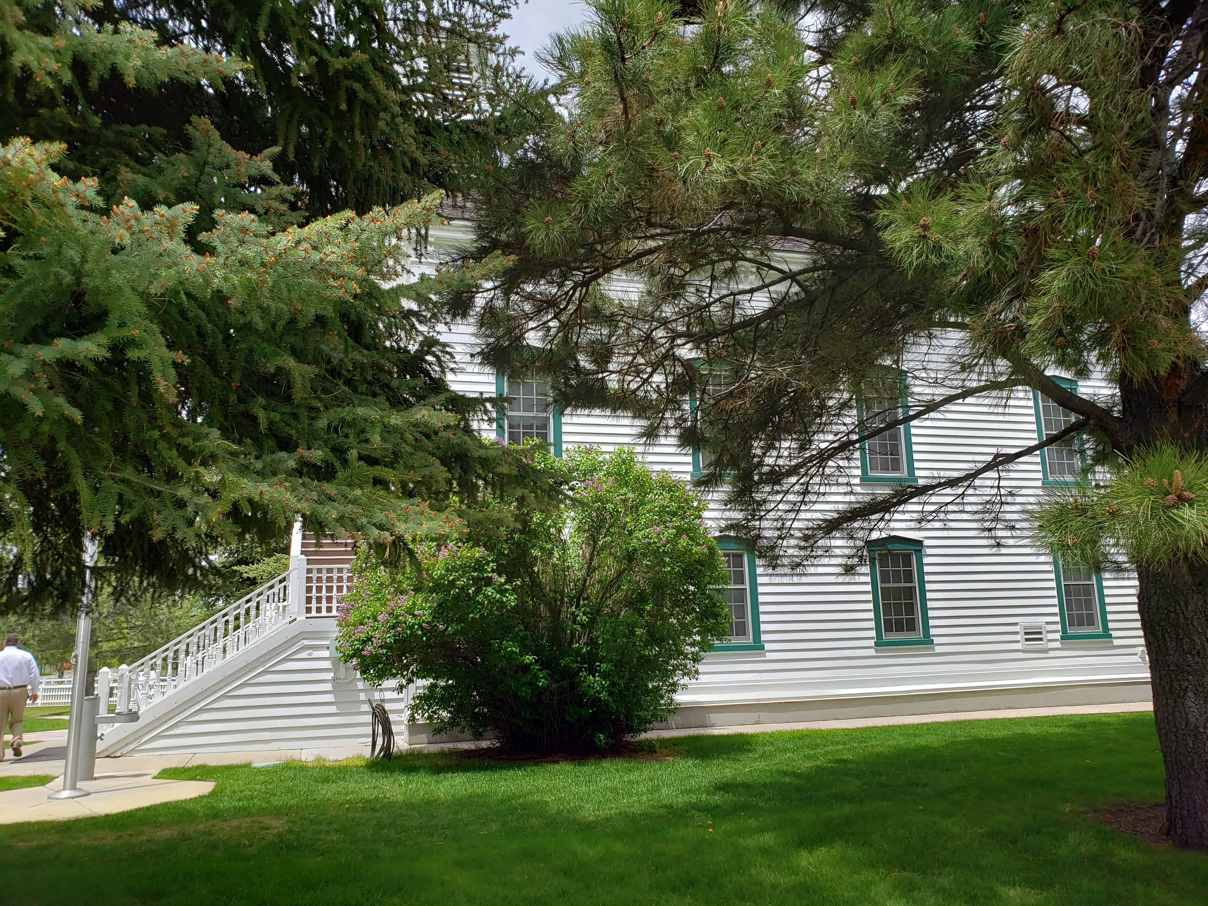
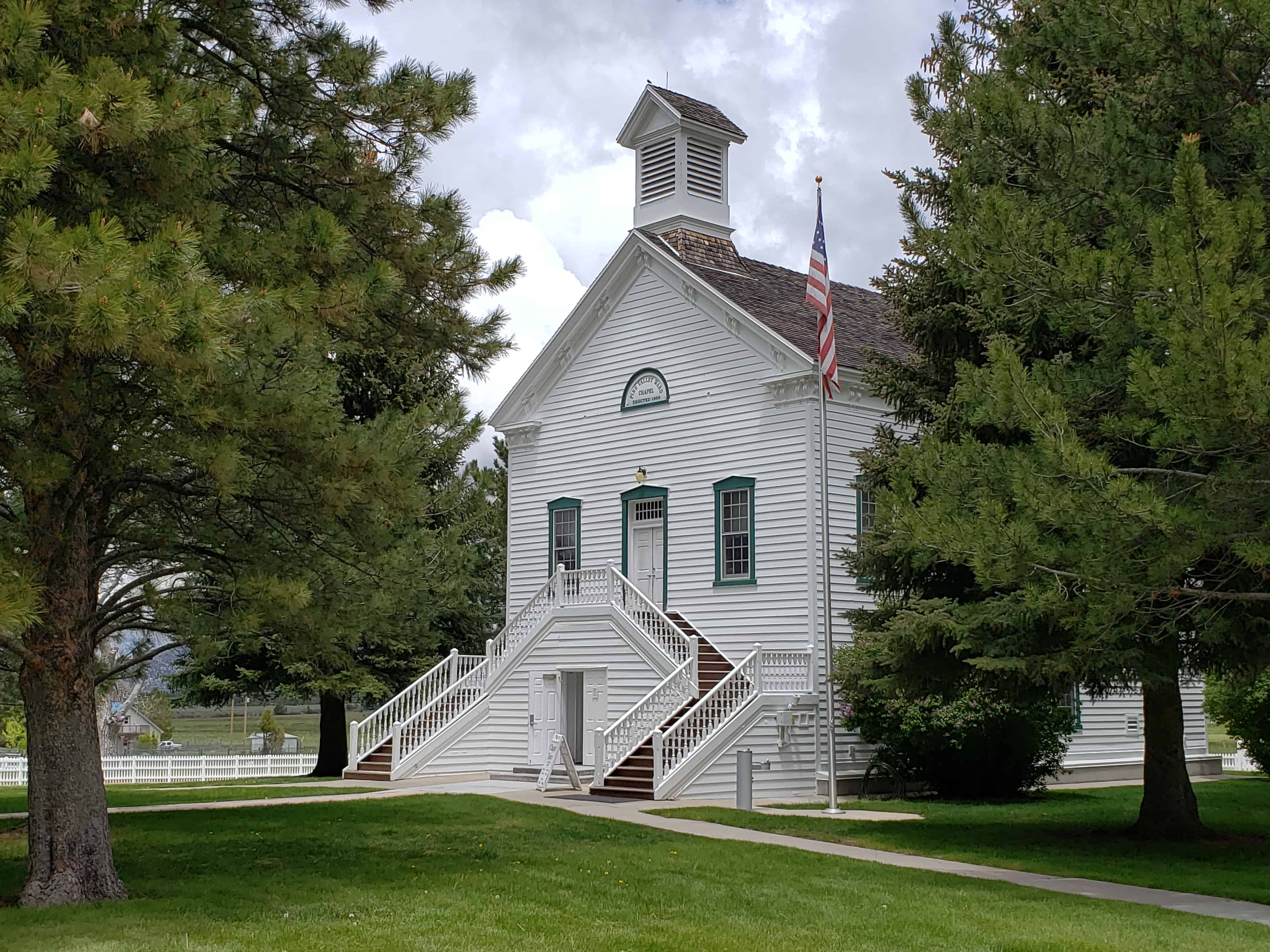
The historic Pine Valley Chapel in Pine Valley, Utah is the oldest continuously used chapel in The Church of Jesus Christ of Latter-day Saints and is a gorgeous building. Ebenezer Bryce had the job of building it and is said to have said that he didn’t know how to build a church, but he knew how to build a ship so he build it as an upside-down ship.
They have about 125 members in the branch with about 60 visitors every week who come to experience church in such a classic old building and 400-600 visitors on Memorial Day weekend’s Sunday so they hold services outside on the lawn. Tours are free and open.
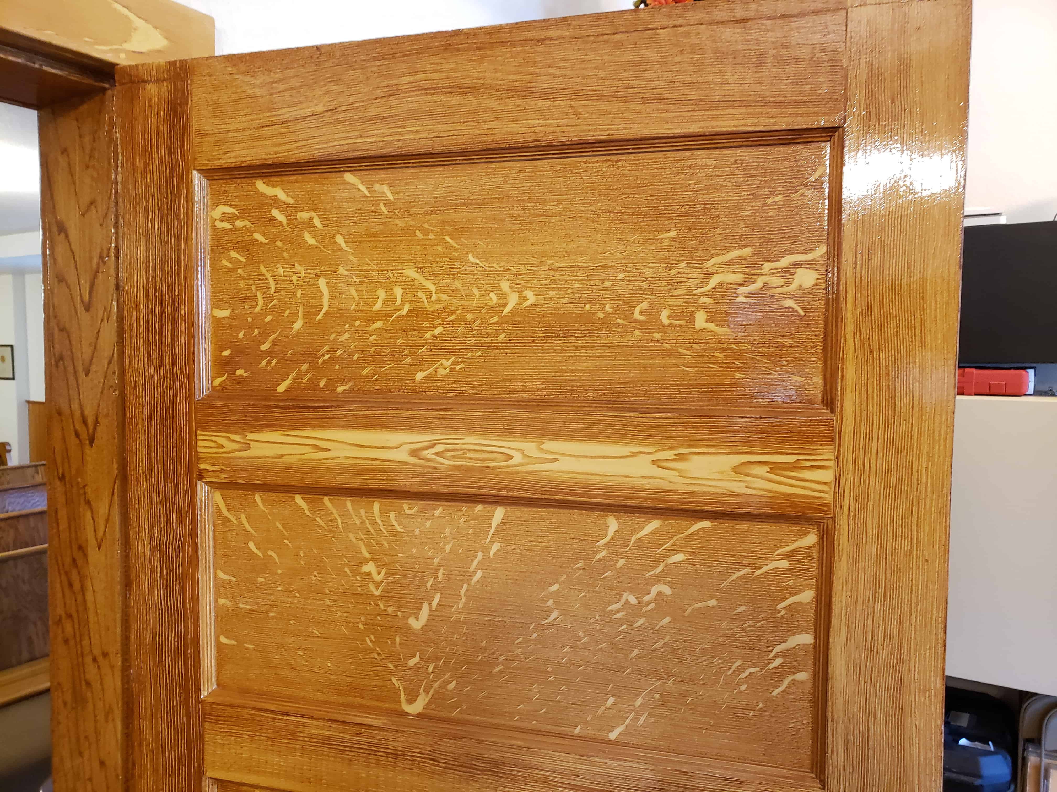
The pews and other woodwork and some cement work was painted to look like oak wood, the painter even hid his name is the grain in some of the pews.
The text below is from the nomination form (#71000859) from when the Pine Valley Chapel and Tithing Office were added to the National Historic Register on April 16, 1971:
Pine Valley was first allotted to John D. Lee a range land on which to run his livestock. However, the valley itself was discovered by Isaac Riddle who followed the trail of a straying cow from the Mormon Indian Mission at Fort Harmony, west over the mountain. He located both good range land, but even more significantly for the southern Utah settlement, excellent timber, both pine and aspen. Riddle and two partners, John Blackham and Robert Richey, purchased machinery for a saw mill and began operation in Pine Valley that fall. With expansion of the southern settlements, Washington, St. George and Santa Clara, especially, the demand for lumber increased. More families moved into Pine Valley. Some limited farming was done before 1864; however, this economic feature was secondary to livestock. Pine Valley also furnished lumber for the mines in both Pioche, Nevada and Silver Reef, Utah. Robert Gardner, one of the early expert lumber men, was asked by Joseph Ridges, organ builder, to select choice pine logs to be sent north to Salt Lake City for the Tabernacle organ’s “pipes.”
By 1868 the people of Pine Valley needed and decided to build their chapel. Ebenezer Bryce designed and supervised the construction.
Later a steam engine was brought in to supply power for the saw mills Today there is some lumbering, but the ruggedness of the lava terrain and the indiscriminate cutting of timber earlier have reduced this economic aspect of the area. It now serves as a summer home area and for recreational activities.
The general setting for the chapel has been landscaped to compliment the overall picture. Visitors are welcome at the site. The chapel is still used by the Pine Valley summer branch of the L.D.S. Church.
The tithing office also is in good repair, and sits nearby as a reminder of the close alliance between religion and the Mormon barter economy. The “Lord’s share” was given in kind and kept therein, to be meted out to the needy and for worthy projects as the Bishop so directed.
The lovely Pine Valley Chapel was designed and built in 1868 by Ebenezer Bryce, for whom the now famous Bryce’s Canyon was named. Being a ship builder from Australia, Bryce employed his earlier skills in building the church. The wood frame walls were assembled on the ground and raised into position, then joined with wooden pegs and rawhide. The frame stands independently, with the walls and petitions “hung” on the basic structure. Since Bryce built the chapel like a ship, he is reported to have claimed: “If the floods come, it will float. And if the winds blow, it may roll over but it will never crash.” The chapel was modeled after churches in New England in honor of Erastus Snow, the Apostle leading the southern colonies, and Brigham Young, church president.
Special timbers were cut from the ponderosa pine in nearby canyons to make the church. The same quality timbers had been hauled all the way to Salt Lake City to be hollowed out for pipes in the famous Mormon Tabernacle.
The church is two stories, with a gabled attic which contains a small “prayer room” over the stage or stand area. Below the main chapel is a basement, which originally consisted of only 2 large rooms, but has since been petitioned into smaller classrooms. The main chapel is a large room with a small stage and speaker’s area.
The structure’s over-all dimensions are 32′ 3″ by 52′ 4″, excluding the steps, which have a pair of double stair landings half way up. The original wooden stairs have been replaced with cement.
Fortunately, however, most of the structure remains as it was originally The restoration in progress at present is careful and minimal. This architectural jewel sits in a lovely mountain valley in Utah, now in continuous use for more than 100 years.
Sitting to the east of the chapel is a small tithing office, built of soft red brick in the 1880’s. The structure is only one story, 16′ by 27′. A “warehouse” door opens on the side. It has a gabled roof and unornamented cornices and eves. The flooring is 5″ pine board. Some refinishing has occurred, but the structure is original and its exterior modified very little. With the chapel, it represents very well the early Mormon Church situation.
Originally (1830) the economic order of the Mormon Church was the “law of Tithing” or ten percent of a person’s income, for the Lord, The administrator of these funds was the Presiding Bishop of the Church. Next a “Law of Consecration” was initiated in Missouri during the mid and late 1830’s, wherein everyone was asked to consecrate all his goods to the Lord. The Bishop in the area was responsible for the property and in turn returned a stewardship of property to each man and family. To this stewardship he received a permanent title, the surplus was retained by the Church to be given as needed to the worthy poor and to young adults whose family could not provide them an inheritance. Its success was limited.
Later the law of tithing was reinstituted. Such was the practice in Nauvoo and in early Utah. However, another kind of communal economic program was inaugurated, called the United Order. Its practices included a kind of cooperative stock holding in various kinds of production. Some “Orders” even had communal kitchens, etc.
However, the law of Tithing has persisted, a lesser law to devout Mormons, but a necessary “schoolmaster” to train the Saints for the higher law. Thus throughout Mormondom and especially in Utah, the tithing office was built, usually near the church, to which tithing in kind — hay, grain, potatoes, vegetables, etc. was brought and receipts issued.
Yet, further functions were served by these “storehouses.” The poor and needy were supplied from them, credit could be obtained by putting tithing in one place (Salt Lake City), and with a scrip issued, reclaim one’s needs in St. George or Pine Valley or where one happened to be going. This system had active use well into the twentieth century. Now only a few buildings remain to remind us of this barter economy which has given way to checking accounts and welfare squares.
This is S.U.P. Marker # 173, see the others in the series on this page.
Jacob Hamblin, pioneer, missionary and friend to the Indians, planted cottonseed in the fertile river bottoms near here in 1855. A settlement was established the next year called Tonaquint, after a local band of Indians that were located there. As part of the Cotton Mission, four families built a few log cabins and willow huts. Sometimes called Lower Clara, with nicknames of Seldom Sap, Never Sweat and Lick Skillet, it was abandoned in 1862 due to a series of floods. However, some farming was continued and it was later known as Seep Ditch.
This is S.U.P. Marker # 174, see the others in the series on this page.
Near this spot, in the fall of 1859, Brigham Young, statesman and leader of the Mormon people, silently gazed at Pine Valley Mountain, and then the valley and hills of black lava and vermillion rock before him. He saw in vision a thriving community. With a sweep of his arm he spoke: “There will yet be built between those volcanic ridges, a city of spires, towers and steeples, with homes containing many inhabitants.”
This is S.U.P. Marker # 176, see the others in the series on this page.
In 1826, Jedediah Smith, searching for a route to California, entered what is now Washington County by crossing the black ridge north of here then following Ash Creek to the Virgin River. He followed the Virgin River through the Virgin River Narrows (present route of I-15) overcoming many dangers associated with the steep, narrow, winding, rugged canyon. In 1827, he returned to California following the same route to the confluence of Santa Clara Creek and the Virgin River. Anxious to avoid a repetition of his experience in the Virgin River Narrows, he proceeded up Santa Clara Creek and turned southwest over the low mountain (present day Old Highway US 91) to a ravine which led him to the Beaver Dam Wash and its confluence with the Virgin River.
This is S.U.P. Marker # 175, see the others in the series on this page.
In the fall of 1849, Brigham Young formed the Southern Exploring Company led by Parley P. Pratt. Through that winter this company of 50 men explored potential town sites and resources from Nephi to present day St. George as part of Young’s plan for a corridor to the sea, also called the Mormon Corridor. Twenty of the company under Pratt reached their further point south at the confluence of the Santa Clara and Virgin Rivers on January 1, 1850, near this monument. Their reports resulted in the settlement of all the towns between Nephi and St. George.