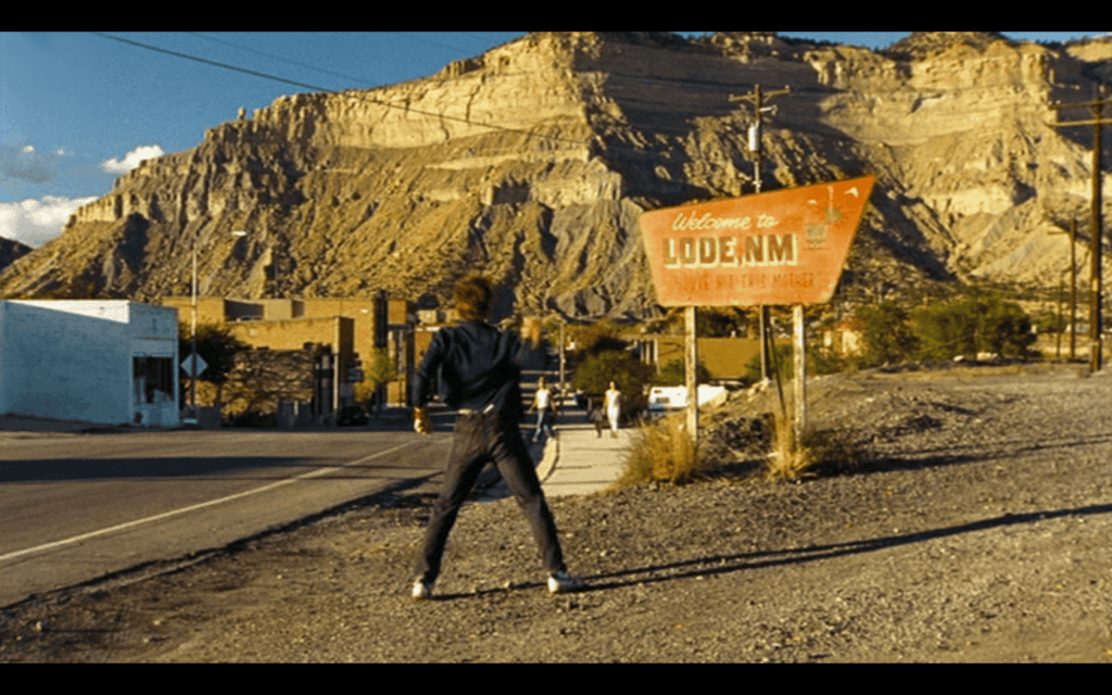
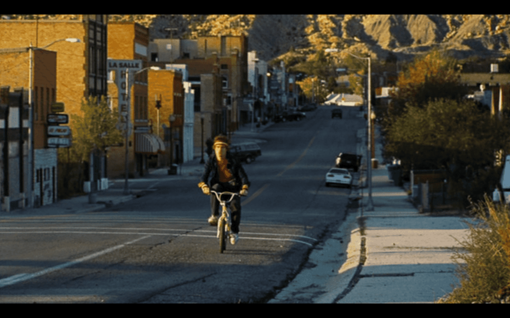
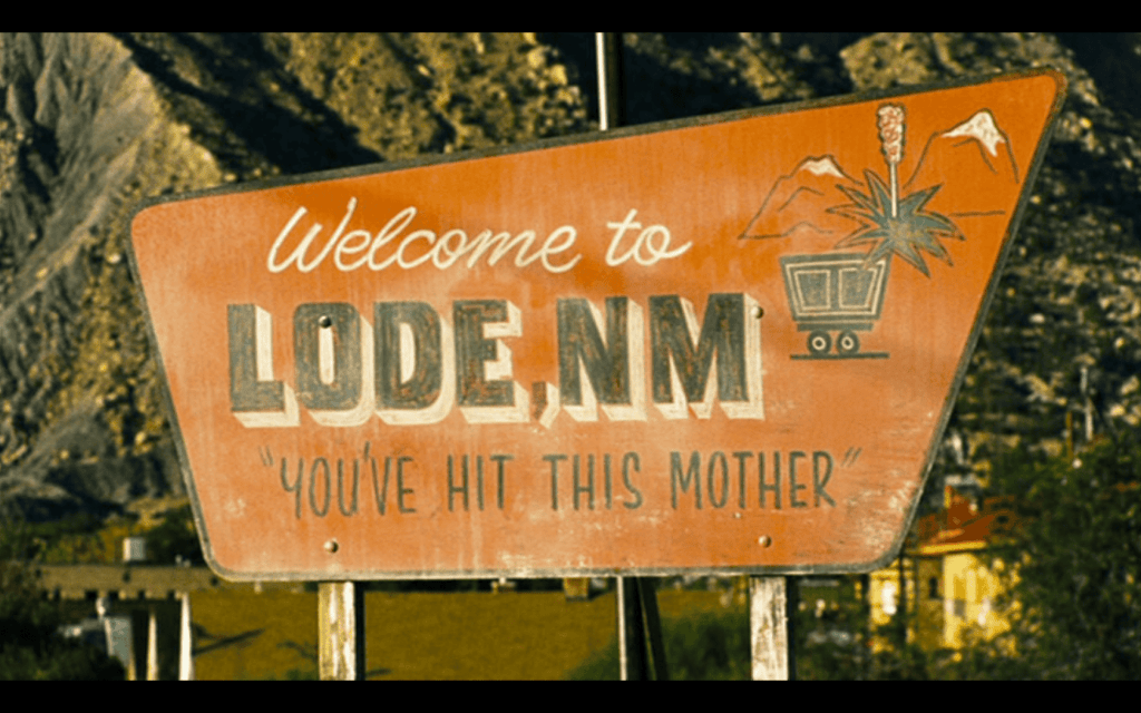
Welcome to Lode – Adventures of Power Filming Location
This is the location for multiple scenes on the movie showing the entrance to the fictional town of Lode, New Mexico from the movie Adventures of Power (2008).
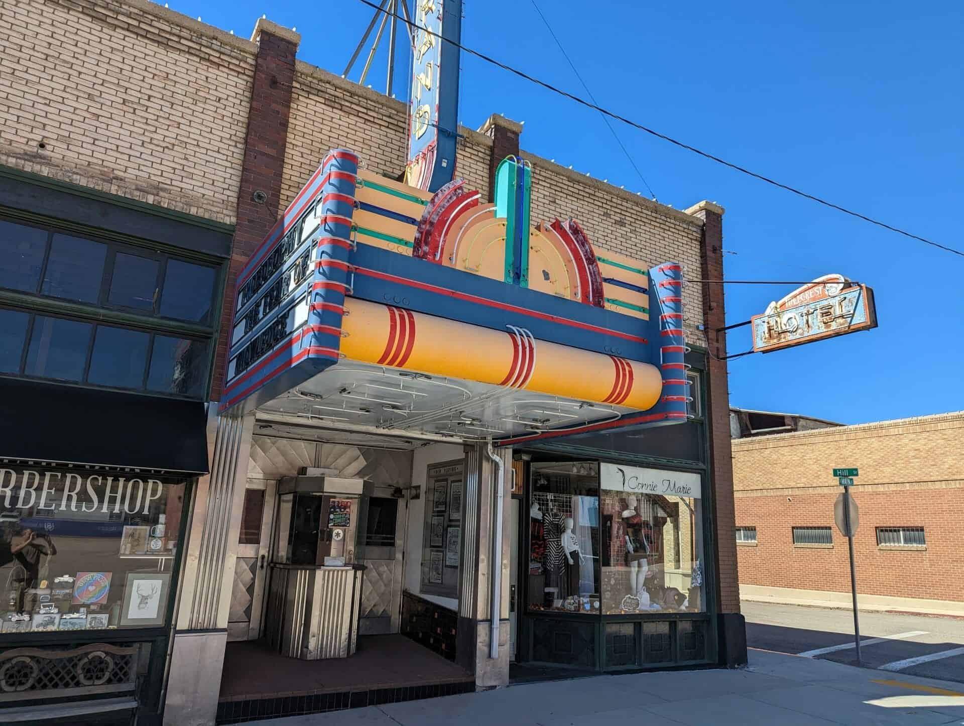
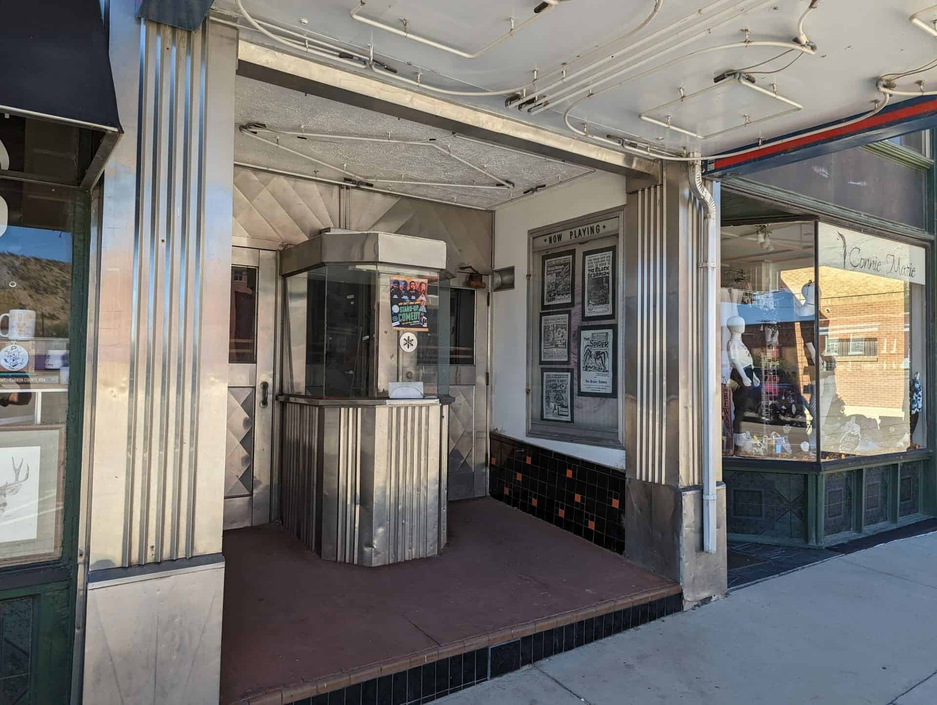
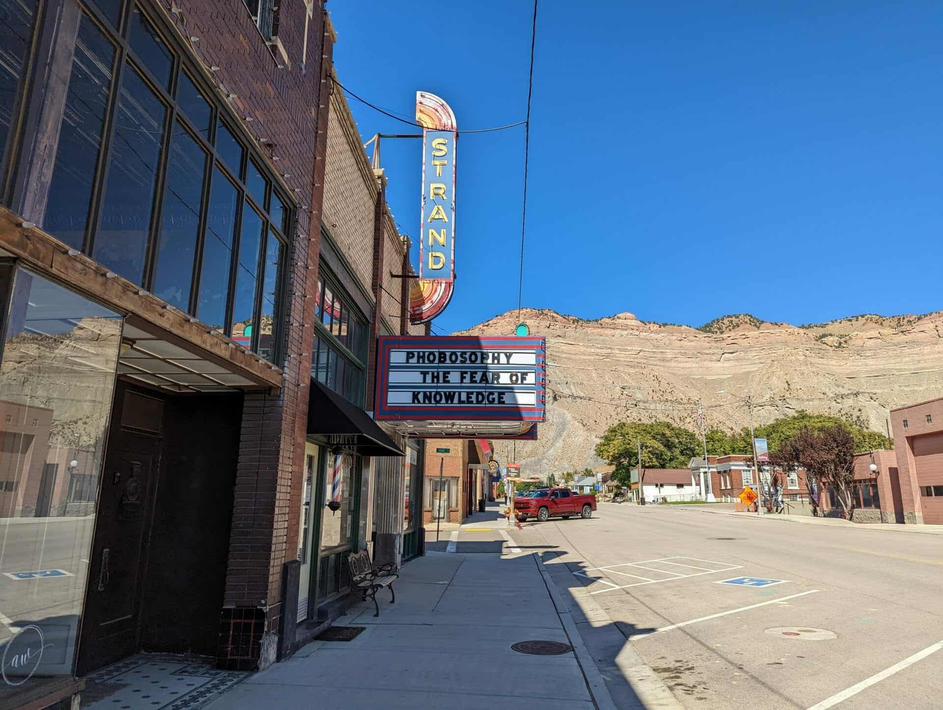
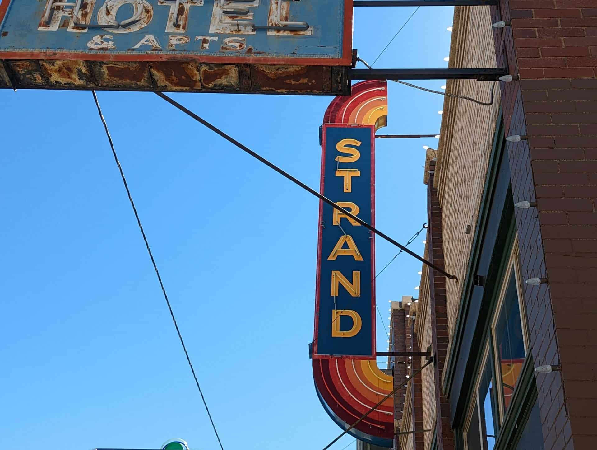
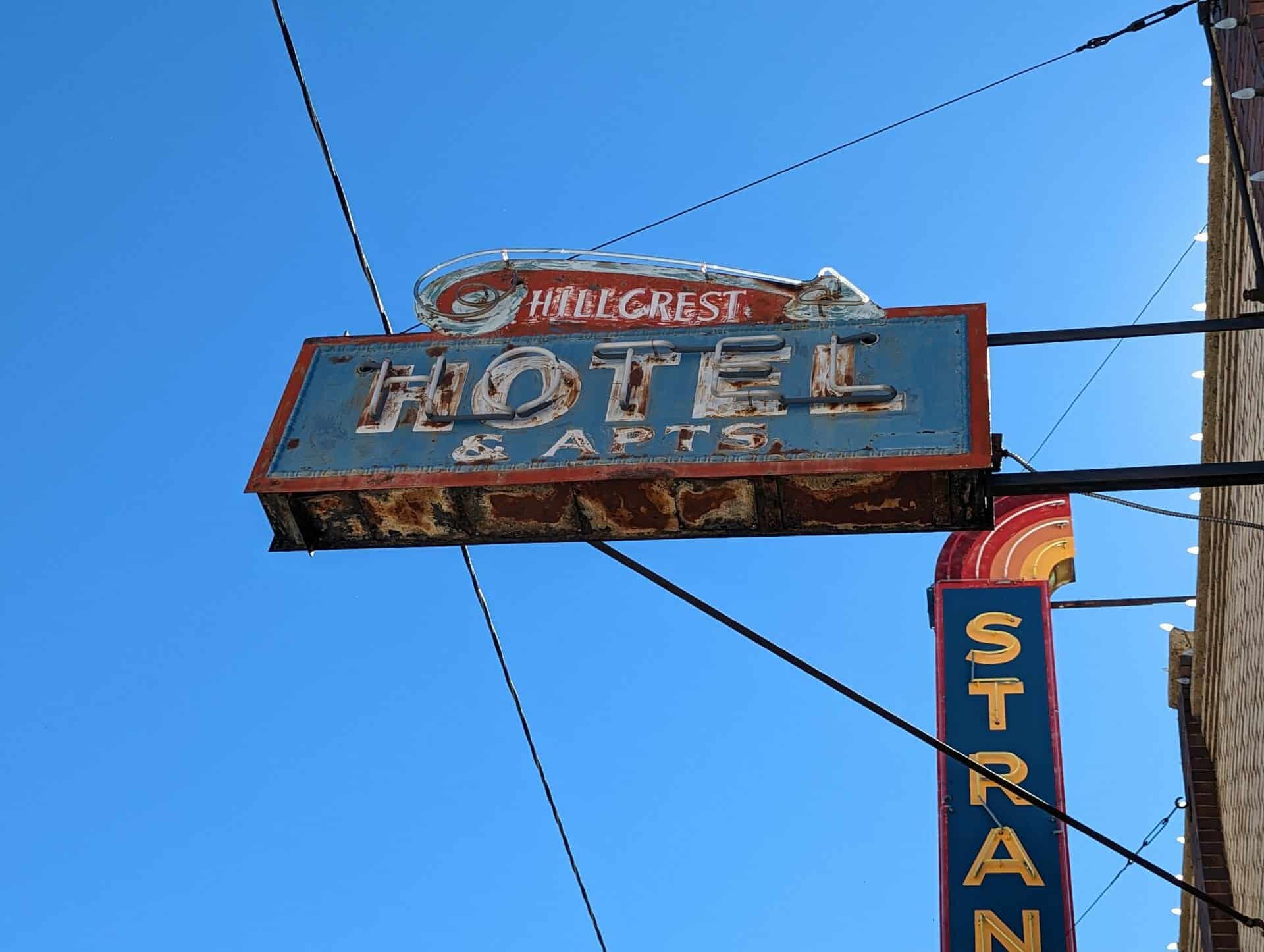
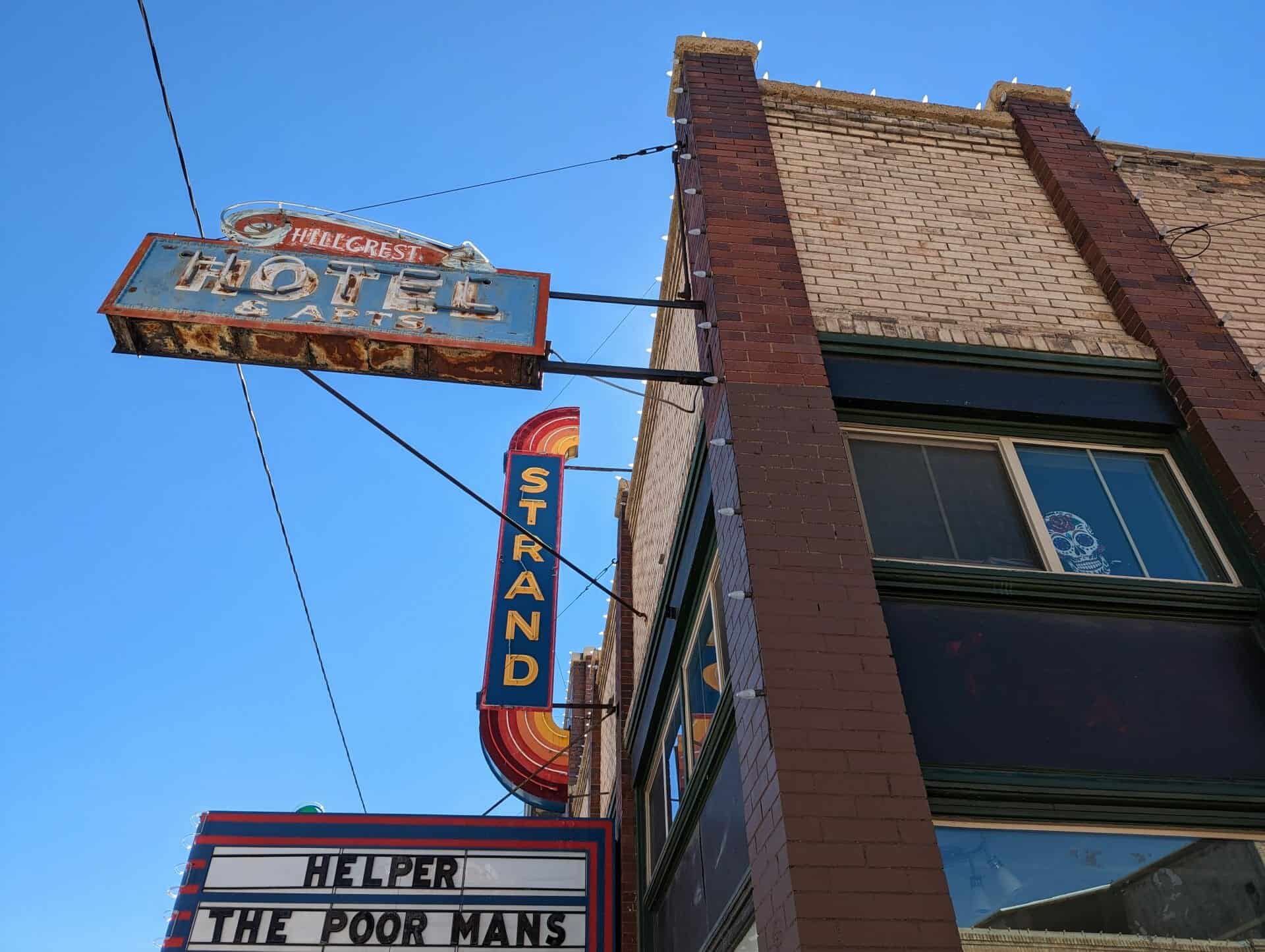
One story brick theater, originally owned by J.C. and Helen Ossana. The theater was initially called the Paramount, and was later changed to the Strand in 1929. William Littlejohn managed the theater from 1929 until 1935, when C.E. Huish of Eureka took it over. The basement used to house a Japanese “pool hall” operated by Harry Eda prior to the opening of the variety store. In addition to gambling and pool, the establishment also used to have silent Japanese movies and hosted traveling Kabuki theater groups. By 1934 the basement had been converted into the Strand Sweet Shop, operated by A.J. Ossano. The business on the LHS was Robert A. Nielson’s gift shop and jewelry until 1927 when he moved across Main Street. The RHS business was at one time a confectionary and later (in 1936) was a fashion shop operated by (Bessie) DeViettie and Dusserre. Except for the RHS portion, the building is presently unoccupied and, except for a more recent theater sign, is essentially unaltered.
The River Parkway Trail in Helper, going from the Mining Equipment Display at Poplar Street along the river up to near where North Main Street / Martin Road meet Highway 191 just north of the labyrinth has plaques/markers spaced proportionally to match the ratio of the planet’s distance from the sun.
Experience the breath-taking scale of our Solar System on this 1 mi trail representing the 3.7 billion miles from the Sun to the orbit of Pluto. On this 1:3.7 billion scale a step on the trail is equivalent to 1.4 million miles in space. Get to know the planets, each a unique outpost on their epic orbit of the Sun. See the Earth from a new perspective, as a precious blue dot in the dark. This solar trail has been sponsored by Helper City, the Utah Division of Outdoor Recreation, AARP and numerous citizens who treasure our dark skies and the opportunity to marvel at the stars and planets.
The Sun marker is located at Poplar Street.
The Mercury marker is only a few feet farther north.
The Venus marker is only a few feet farther north.
The Earth / Moon marker is only a few feet farther north.
The Mars marker is a little farther north, just beyond the park.
The Jupiter marker is located just north of Ivy Street.
The Saturn marker is located on the trail behind about 80 S 100 W.
The Uranus marker is…
The Neptune marker is located just north of where Main Street crosses under Highway 191.
The Pluto marker is located at the Carbon Fuel Company #2 Mine historic marker.
The mural “Western Town” by Jenne Magafan was painted in 1941 under the Treasury Section of Fine Arts and was a winner of the Treasury Section’s 48-State Post Office mural competition. The mural is 25.5 x 43.5 feet and painted with oil-on-fiberboard. It sits at the south end of the post office lobby and remains in pristine condition.
Utah Railway was created in 1912 to provide improved service to the coal mines of western Carbon and Emery counties. Tracks from Hiawatha to the Utah Railway junction near Martin were completed in Oct. 1914. A steel girder bridge 135 ft. high, 634 ft. long and on a 60 percent curve was constructed in order to span Gordon Creek. This remains the longest steel girder bridge of its height in the state of Utah. Original trains were 50 ton capacity cars pulled by steam locomotives. But this same bridge supports todays 100 ton capacity steel cars and 105 ton capacity aluminum cars pulled by modern diesel locomotives. Utah Railway began as a single commodity railroad and remains so today.
This caboose was built in 1918 by the Mt. Vernon Car Company for the Utah Railway Company. It was refurbished in 1958 at which time the steel siding was added. Caboose No. 55 traveled the route from Provo to Mohrland from 1918 to 1975. That’s 57 years!
This is located at the Helper Museum at 294 South Main Street in Helper, Utah
Matt Warner was born Willard E. Christiansen in Ephraim, Utah. He left home at the age of 14 after a fight in which he thought he killed the town bully. He took the name Matt Warner, became a cattle rustler, bank robber and rode with Butch Cassidy until going to prison on trumped up charges in 1897. He was released in 1900, with a full pardon from Governor Wells. In the following years, he became one of the best deputy sheriffs, city police officers, and justices of the peace Carbon County has ever known. As a man of the law, Warner won the love of all Carbon County, except the lawyers, and stuffed shirts. He was strictly a man of the people.
This historic marker is located on the Carbon Hotel at 262 South Main Street in Helper, Utah and was dedicated by the Utah Outpost Mountain Charlie Chapter 1850 of E Clampus Vitus on July 25, 1981.
This one-story red brick commercial building was built in 1927 by Helper Securities. Five business storefronts completed the whole of this larger building. The northernmost portion at 167 South Main Street was occupied by the Success Meat and Grocery Company during the early 1930s. The building is in excellent condition and is a contributing property within the Helper Historic District.