This hotel was built in 1913-14 for the Helper Real Estate and Investment Co. Formed by people of many different ethnic groups, including Assyrian, Italian, and Jewish, this company reflected the diverse nature of Helper’s population. A favorite of traveling salesmen, or “drummers,” who came by train to display their wares to the local merchants, the Helper Hotel also housed the U.S. Post Office and was the location for the printing of one of Helper’s early newspapers.
This building was known as the Helper Hotel until 1942 when it was purchased by the Denver and Rio Grande Railroad. Train crews lived here until c.1980. Vacant for several years, it became the site of the Western Mining and Railroad Museum in 1985. This three-story commercial block structure contributes to the qualities of the Helper National Register Historic District.
The Helper Hotel is part of the The Helper Museum at 294 South Main Street in Helper, Utah
The Carbon Hotel was built in the early 1900’s. It was first owned by C. A. Bartolino. The building was used as a hotel, bar, café and sporting house throughout the years. Due to the large number of single male immigrants into the local mines, the bordello on the upper floor was very popular, though somewhat illegal, during Helper’s heydays. Due to increasing pressure from the authorities during the 1970’s the doors were closed. Matt Warner Chapter purchased the building in 1987 with the help of Helper City. The building was restored and is presantly used as a meeting hall for the organization.
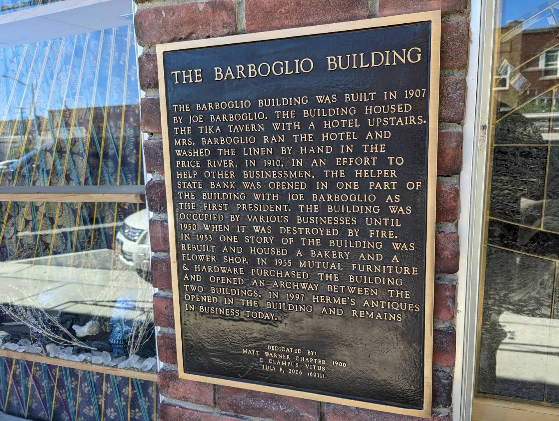
The Barboglio Building was built in 1907 by Joe Barboglio. The building housed the Tika Tavern with a hotel upstairs. Mrs. Barboglio ran the hotel and washed the linen by hand in the Price River. In 1910, in an effort to help other businessmen, the Helper State Bank was opened in one part of the building with Joe Barboglio as the first president. The building was occupied by various businesses until 1950 when it was destroyed by fire. In 1953 one story of the building was rebuilt and housed a bakery and a flower shop. In 1955 Mutual Furniture & Hardware purchased the building and opened an archway between the two buildings. In 1997 Herme’s Antiques opened in the building and remains in business today.
One story commercial building located on the site of the original Barboglio building known as the Tika Tavern. Present building houses an annex of the Mutual Furniture Company and bakery.
This two-story brick commercial building was constructed in 1929. The varied shades of tan bricks are unusual in the historic district. In the early 1930s, the right side of the building was occupied by the “Smart Shop” owned by N. A. Neilson, and the second story housed professional offices. Thorit and Janet Hatch operated the Helper Insurance and Loan Company here for many years.
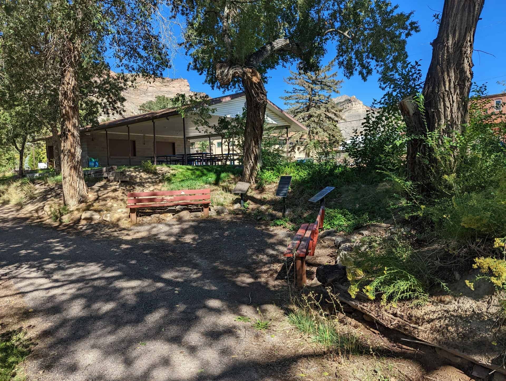
This valley was originally settled in 1881 by Teancum Pratt. The original Pratt Survey still predominates on maps of this area. He sold land to the Rio Grande Western Railroad for a right of way. By the fall of 1887 the railroad had built 27 frame residences and from this start the town continued to grow. With the completion of the standard gauging of track in 1891, a terminal was established in this area.
It took extra engines to push trains over Soldier Summit, these extra locomotives were called “Helpers” and it was from this source that Helper was named.
With a mixed population of practically every nationality, Helper grew into a booming town. In 1907 Helper Township was incorporated.
This historic marker is located at the old Helper City Hall Building at 73 South Main Street in Helper, Utah and was dedicated by the Matt Warner Chapter 1900 of E Clampus Vitus on July 11, 1987 and remounted and rededicated July 8, 1995.
This one-story red brick flat roof building was built as the Helper City Hall in 1927. This building has classical “tin” cornices, columns and pediment. The project architect was Walter E. Ware of Salt Lake City.
The City Hall has been a center of community events since it was built. The building has always served as Helper’s City Hall, maintains its original appearence and contributes to the historic qualities of the Helper Historic District.
Marker Placed in 1997 by Division of State History. ( CR-07-735.)
Star Dancing Erected June 1, 2010 The Star of Helper represents the sky like the town and has no bounds. The Star also represents Helper as Utah’s Christmas Town. Donated by: Marie Camille Truscott Lentsch (a former Helper resident) Kirt E. Mascaro Helper City Councilman, 2010
Presented to Helper City We pledge allegiange to the flag of the United States of America and to the Republic for which it stands one Nation, Indivisible, with Liberty and Justice for all.
Presented and dedicated by Price Lodge No. 1550, B. P. O. Elks June 14 – 1952
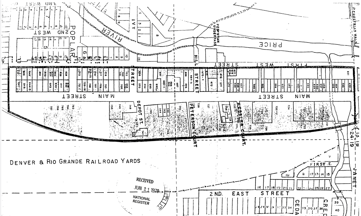
The Helper commercial district is located within the present city limits of Helper, Utah. The District is entirely within the E 1/2 of the NE 1/4 of Section 24, Township 13 South, Range 9E Salt Lake City Standard Meridian. The District is bounded on the north by Janet Street, on the west by First West Street, on the South by Locust Street and on the east by the Denver and Rio Grande Western (D&RGW) railyards. The size of the district is somewhat less than 40 acres and includes, but is not limited to, the entire extent of Pratt’s and Mead’s Survey Platts.
The existing boundaries were selected because of their tight nature, delineating the main Helper commercial district, as well as access points to that area. The inclusion of residences was determined by both their presence on Main Street or their adjacent location to the street and within business district, other residences were excluded and may be part of a future multiple resource nomination.
Janet Street is the northern boundary, and with its underpass (to the east) represents the effective beginning of Helper’s Main Street. On the west is First West Street which contains some residences, but included major rear access ways to the commercial buildings on Main Street. Locust Street boarders the district on the south, representing the end of the main commercial area. The eastern boundary follows the Rio Grande Western railway yards, which formed a vital part of Helper’s commercial life.
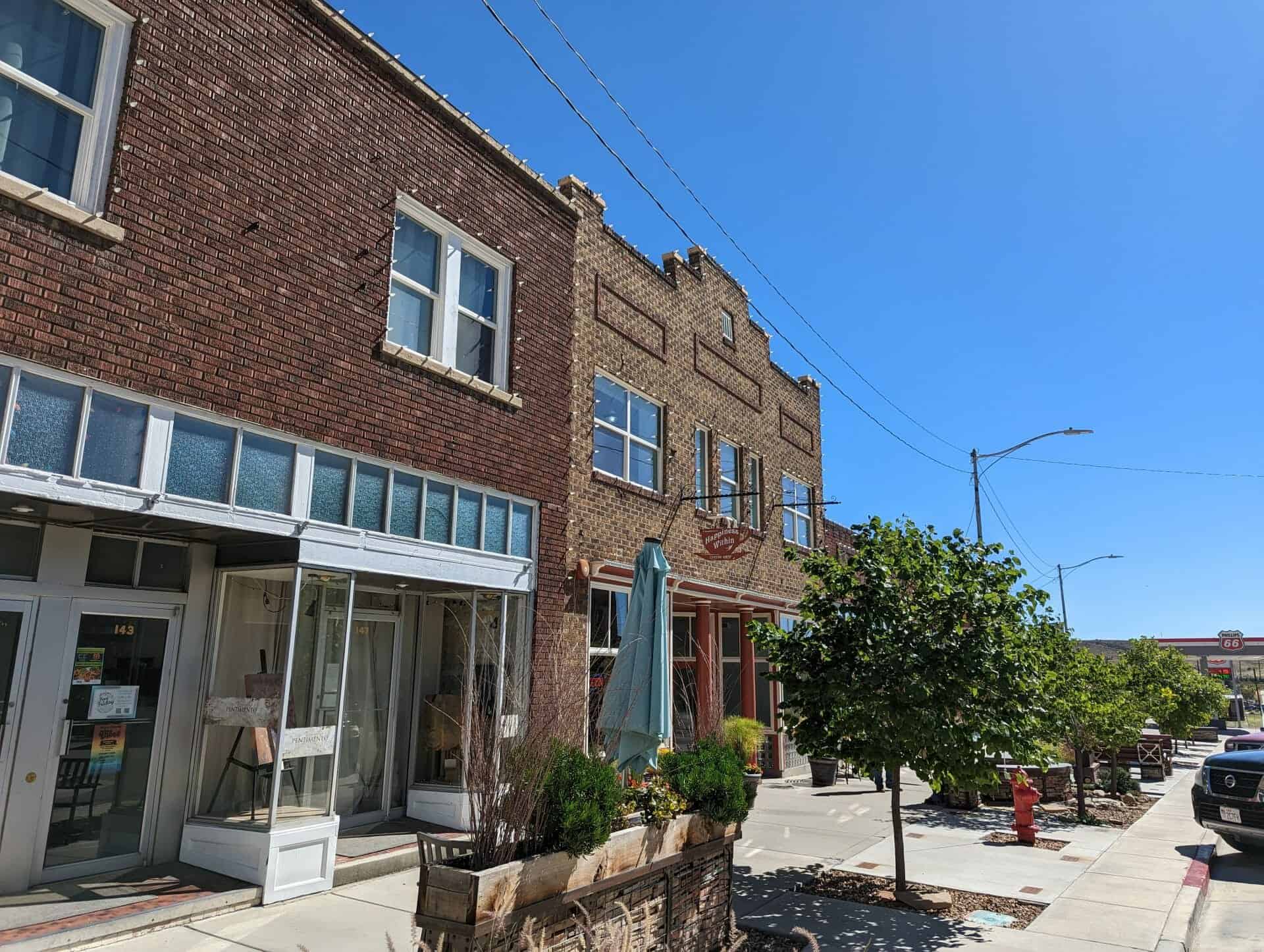
The Helper commercial district consists of a total of 110 of which 98 sites have been judged to be potentially contributory to the historic character of the area. A wide variety of both residential and commercial structures, arrayed along both sides of Main street in a north-south manner, comprise the district.
The Helper Commercial District was listed on the National Register of Historic Places (#79002491) on July 24, 1979.
The residential buildings are generally one story and are fairly modest in appearance. Several styles and building materials were utilized, including; hand hewn stone, wood frame, stucco, and several types of brick. The commercial buildings also exhibit a wide degree of variability, although they are generally consistent in scale, with almost all buildings being one to two stories in height. The predominate building material was red brick, although hand hewn stone stucco, wood frame, and other types of brick were also utilized.
Comparison of the present appearance of the district with early Sanborn maps and historic photos indicates that the area still retains much of its historic character. Prior to 1927 the area east of Main Street was dominated by Denver and Rio Grande Western (D&RGW) railroad company houses, but after that time, the area began to acquire the predominately commercial appearance it retains today. The modifications of the residential buildings have been fairly minor and have generally consisted of “modern” siding materials and additions, and modification of the porches. The commercial seen facade modifications, many of which are the installation of the enclosure or buildings have often minor and reversable.
A description of each contributory building along with its capsule history is given below. The buildings are listed by their Utah Historical Society site inventory number.
This one-story vernacular (the common building style of a period or place) house was built in 1903 of hand-hewn stone laid in a random ashlar pattern. The original part of the building is a late example of a hall-parlor house type, which was common in Utah during the second half of the nineteenth century. The house was built by John Bottino and used as a rental property until 1944 when his son, Jim, acquired the property and lived here with his wife, Ida.
The Rainbow Inn is located at 305 N Mains St, Helper, Utah and was built in 1922. Originally owned by Lena Fodero, the building was used as a hotel, bar, and sporting house. It was known for the bordello on the upper floor. The railroad which serviced the Spring Canyon coal mining towns went directly past the Rainbow Inn. It’s location drew many single male immigrants who were working on the railroad, at the power plants and in the coal mines.
It was purchased by Stephen M. Johnson on May 1, 1980 and used as a bar. On July 23, 1983, The Rainbow Inn became the first official watering hole of the Utah out post, known as Matt Warner, of the Mountain Charlie Chapter of E Clampus Vitus. The Rainbow Inn closed its doors in 1987.
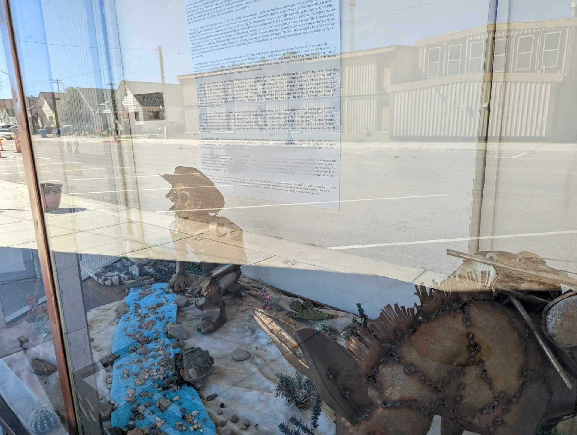
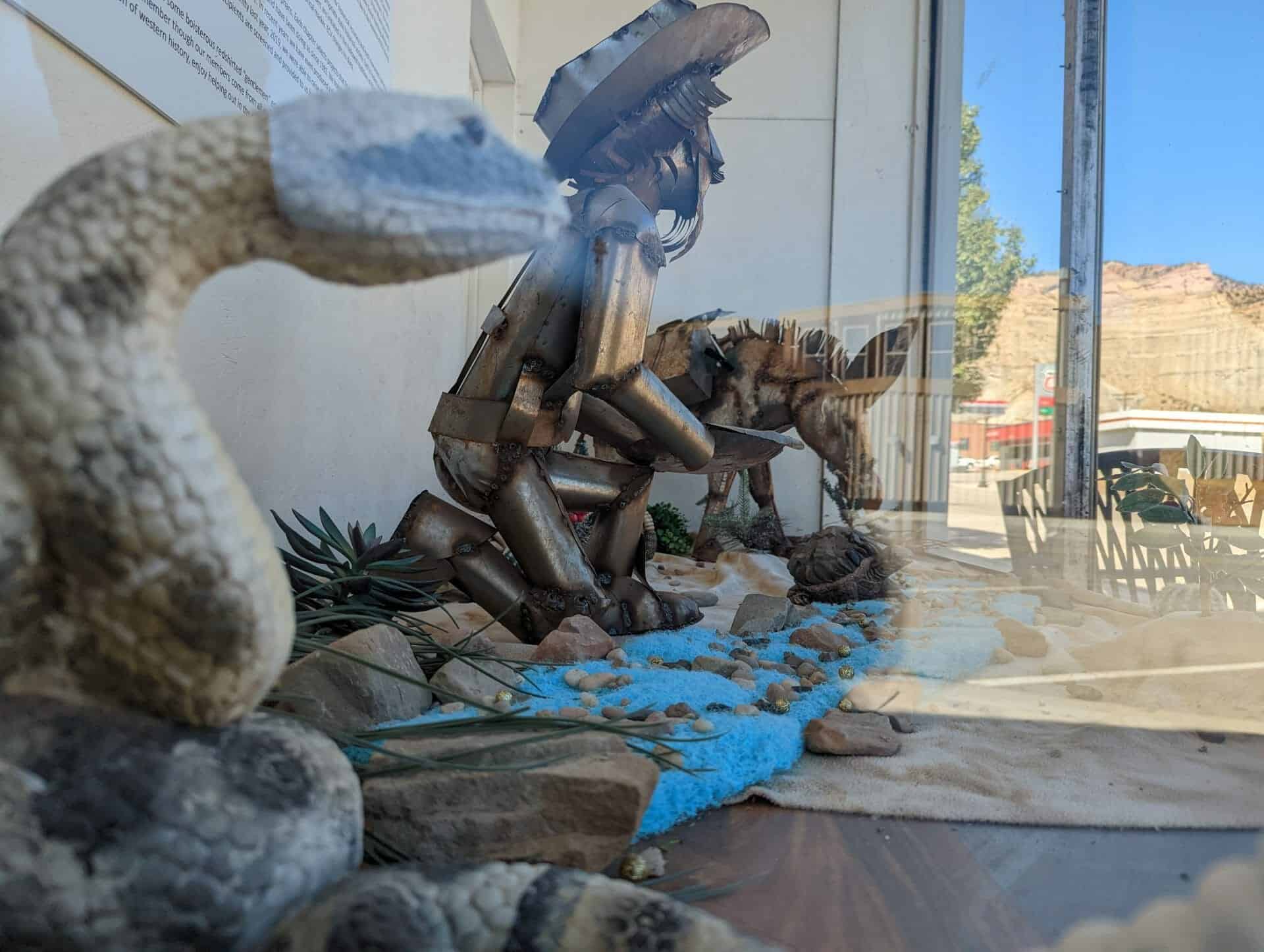
This marker was erected in 2017 by Matt Warner Chapter 1900 E Clampus Vitus.