• About JacobBarlow.com
  • Cemeteries in Utah
  • D.U.P. Markers
  • Doors
  • Exploring Utah Email List
  • Geocaching
  • Historic Marker Map
  • Links
  • Movie/TV Show Filming Locations
  • Oldest in Utah
  • Other Travels
  • Photos Then and Now
  • S.U.P. Markers
  • U.P.T.L.A. Markers
  • Utah Cities and Places.
  • Utah Homes for Sale
  • Utah Treasure Hunt

JacobBarlow.com

~ Exploring with Jacob Barlow

JacobBarlow.com

Tag Archives: Iron County

Old Irontown, Utah

08 Thursday Aug 2019

Posted by Jacob Barlow in Uncategorized

≈ Leave a comment

Tags

Iron County, NRHP, utah

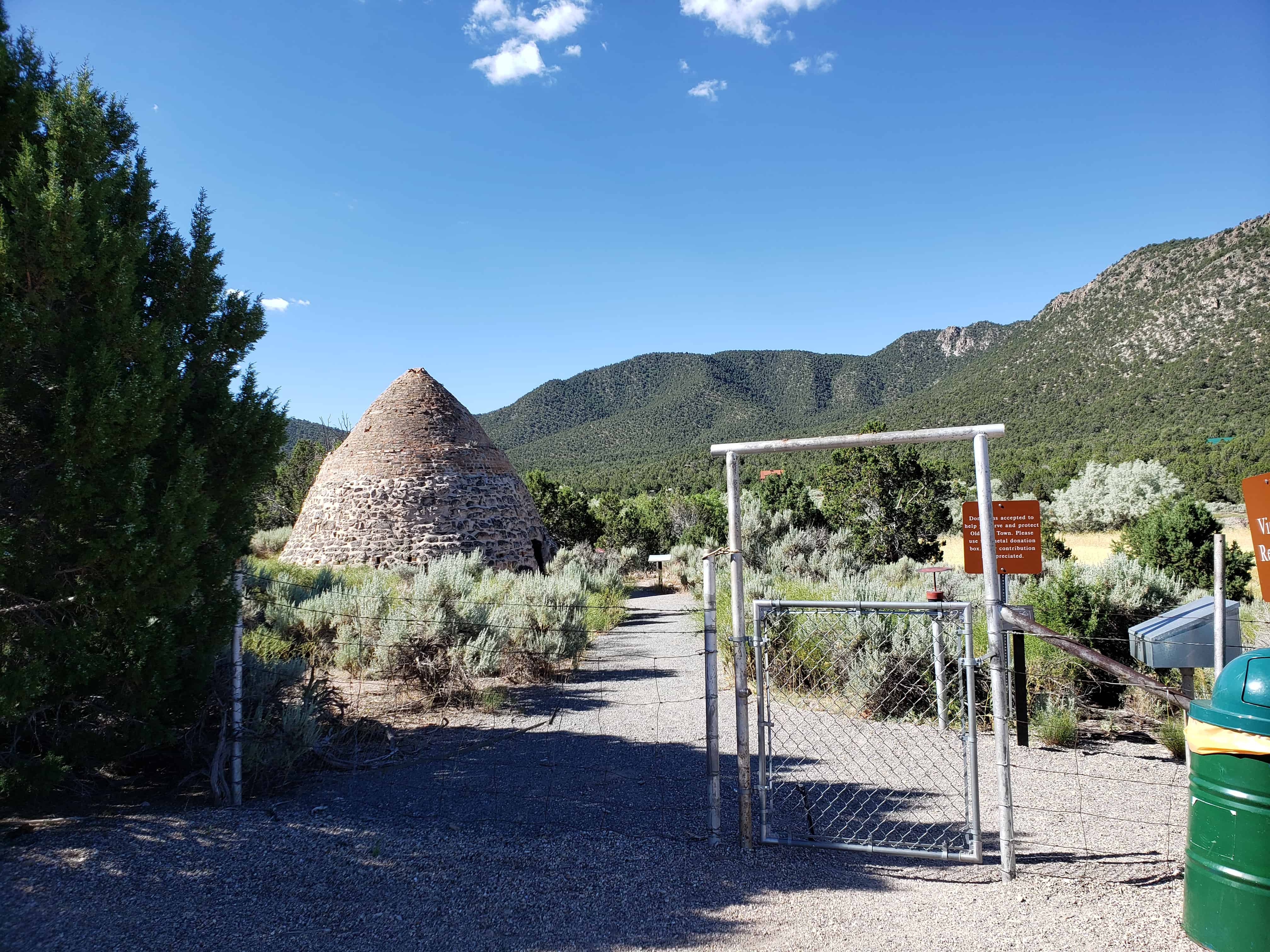
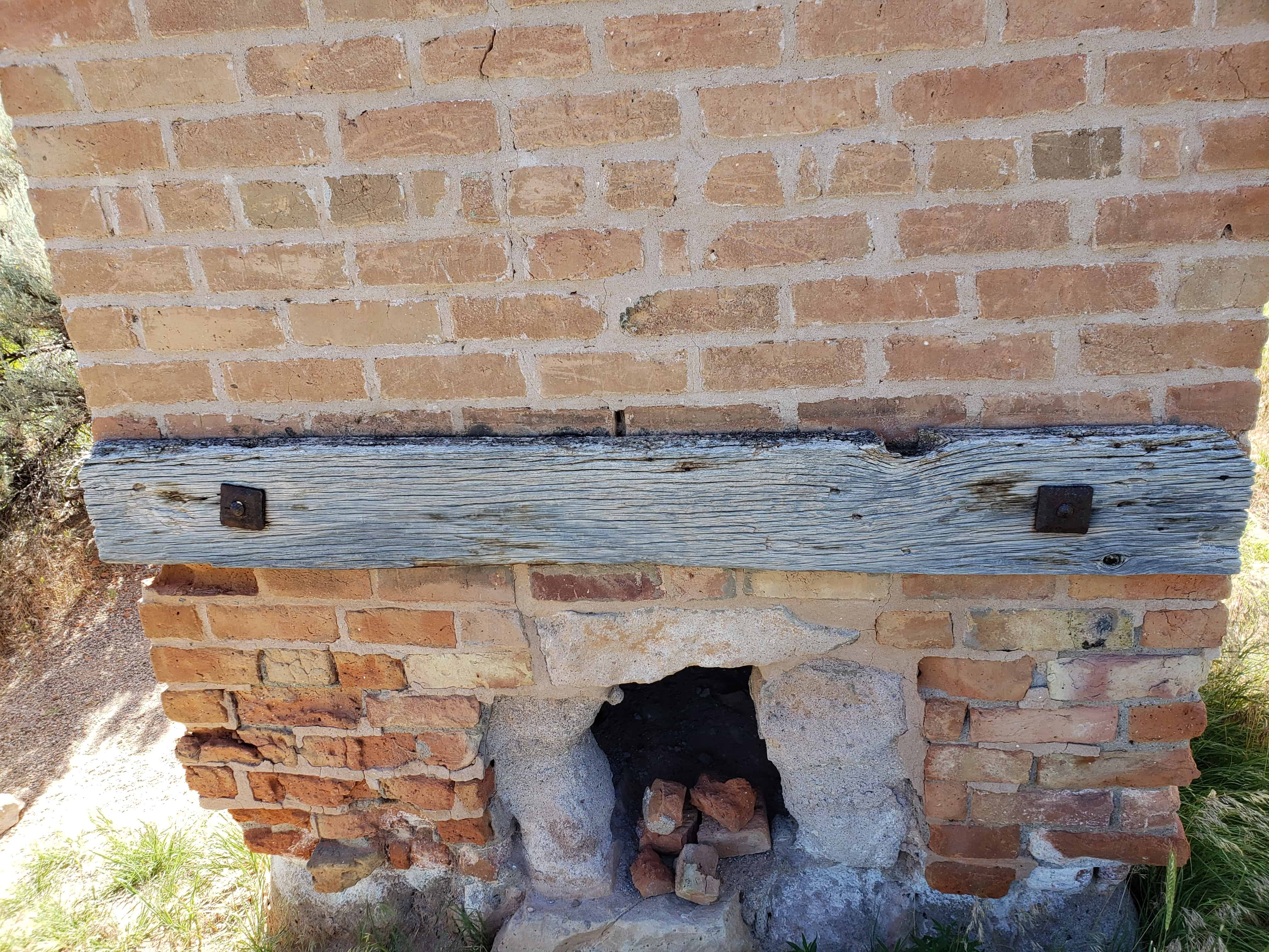
Formerly known as Little Pinto, Old Irontown is a ghost town with ruins of buildings and charcoal kilns in Iron County, Utah.

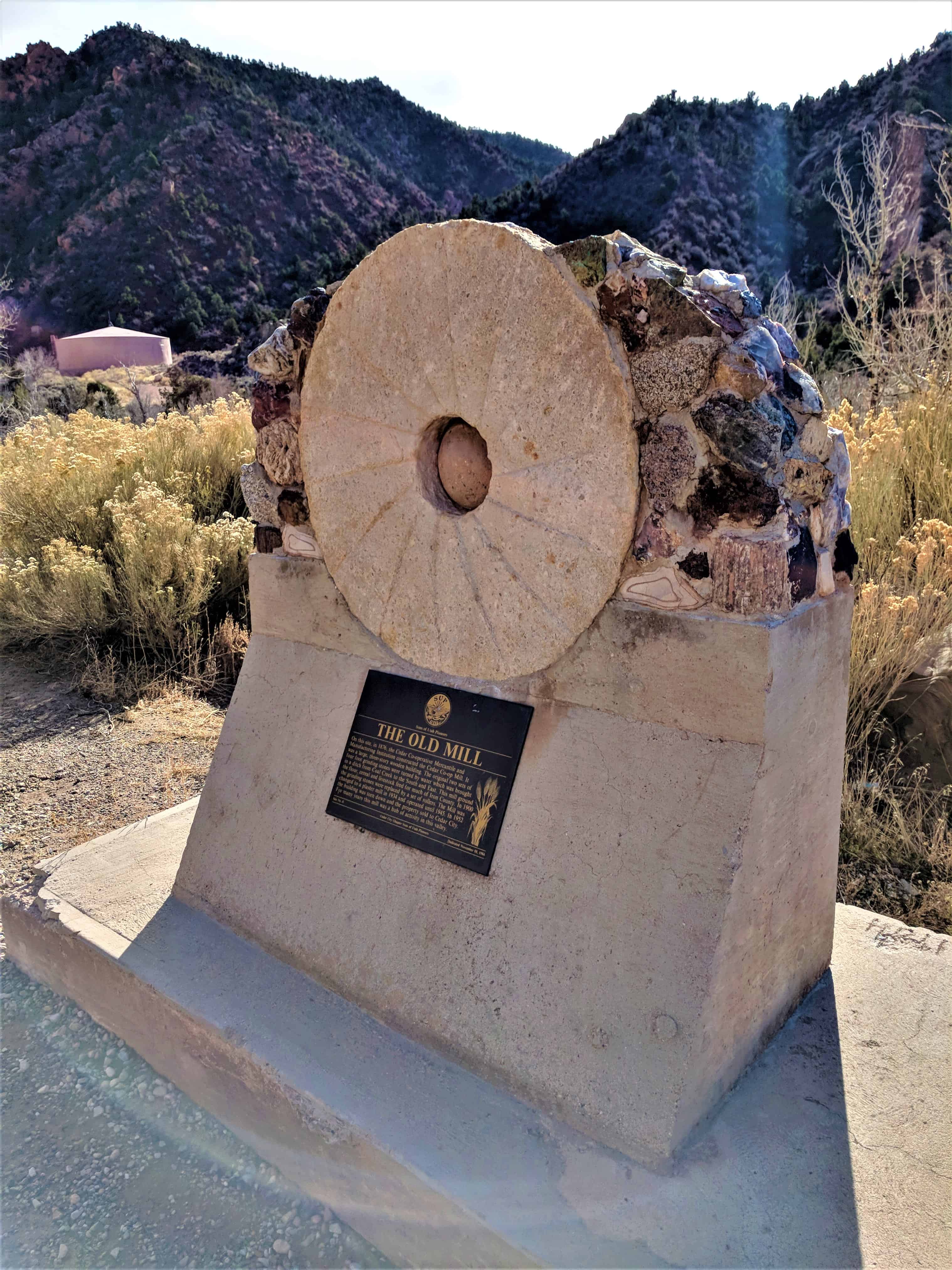
This historic marker reads:
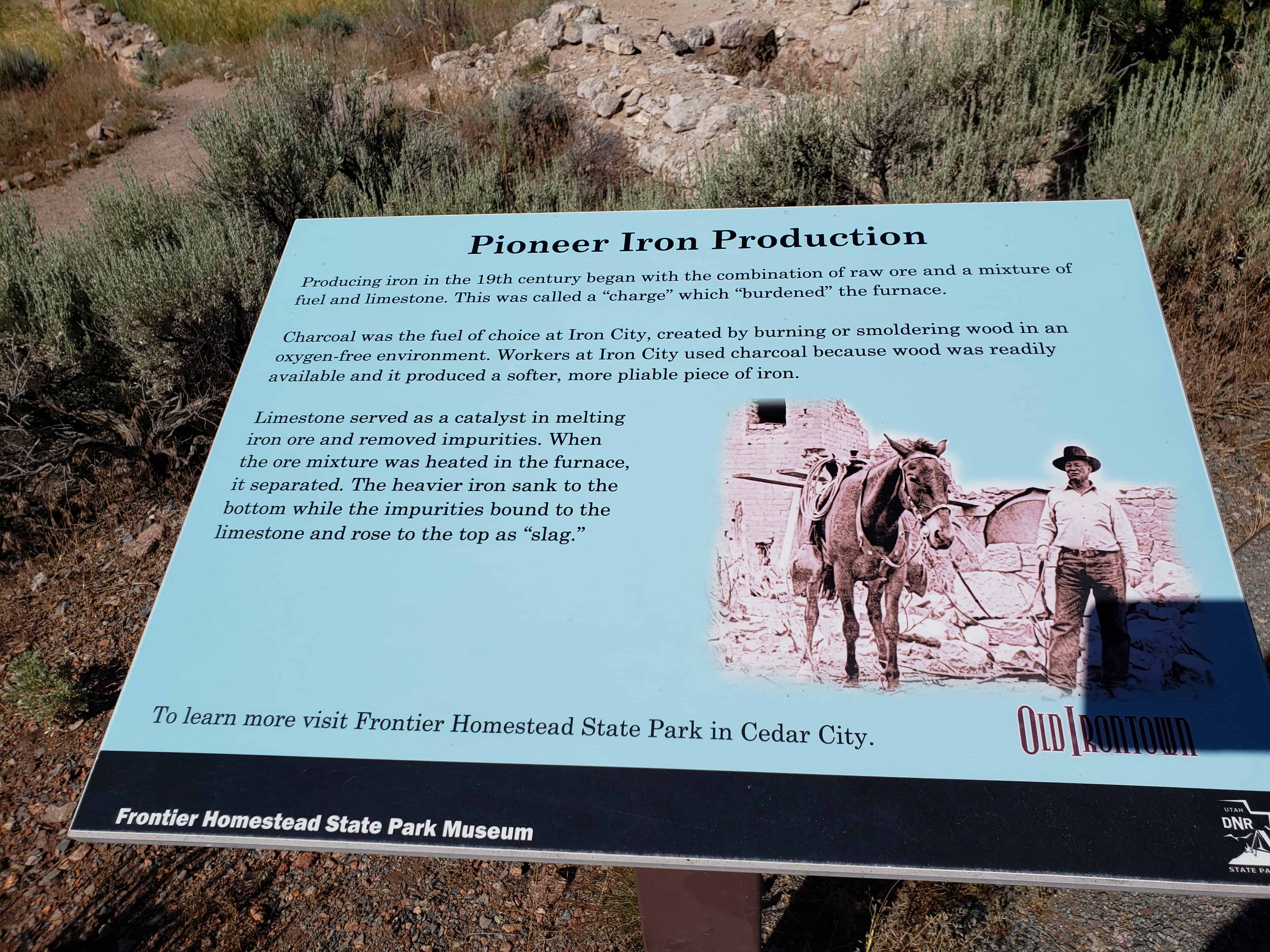
Established 1868 by Ebenezer Hanks and others who organized the Great Western Iron Manufacturing Co., a cooperative enterprise. Officers were E. Hanks, President, Homer Duncan, Vice President, Seth M. Blair, Secretary. 800 pounds of iron of good quality produced each eight hours, the plant running day and night.

The story of Utah’s iron and steel industry begins soon after the arrival of the Mormon pioneers in Salt Lake Valley in 1847.

First of all, because of geographic isolation and because of their desire for ideological insolation, Mormon pioneer leaders early adopted a policy of economic independence and self-sufficiency. Coupled to this policy was a belief in their earthly stewardship; namely, “the earth is the Lord’s . . .” to be subdued by his chosen people. The Saints could make Zion flourish by applying themselves. The resources were there to be exploited.

As early as the fall of 1849 an exploring party, led by Apostle Parley P. Pratt, discovered Iron Mountain in Southern Utah and the coal beds nearby at Cedar City.  Within two years settlements had been established at Parowan and Cedar City in Iron County.  Those settlers called to Cedar City were designated “Iron Missionaries.”  They formed the Pioneer Iron Company in 1851-1852.  It was suceeded by the ill-dated and costly Deseret Iron Company, both located near Cedar City, which operated between 1852 and 1858 This latter company was an attempt by the L.D.S. Church to raise British capital to finance the development of the industry and to employ skilled English workmen to operate the furnaces and plants. However, although nearly $150,000 were expended over a ten-year period, only about 400 tons of iron were produced. Several factors, including cold weather and floods, destroyed the project.

Yet the resource remained as did the need for iron. A renewal of interest began in 1868. Seth M. Blair, Chapman Duncan and Ebenezer Hanks, Directors and President, respectively, of the new Union Iron Works, organized the new company and employed David B. Adams of Beaver to run the furnaces. They reported in August of 1871 that they could now produce up to 2,500 pounds of iron per day. Both church and government monies subsidized this operation.

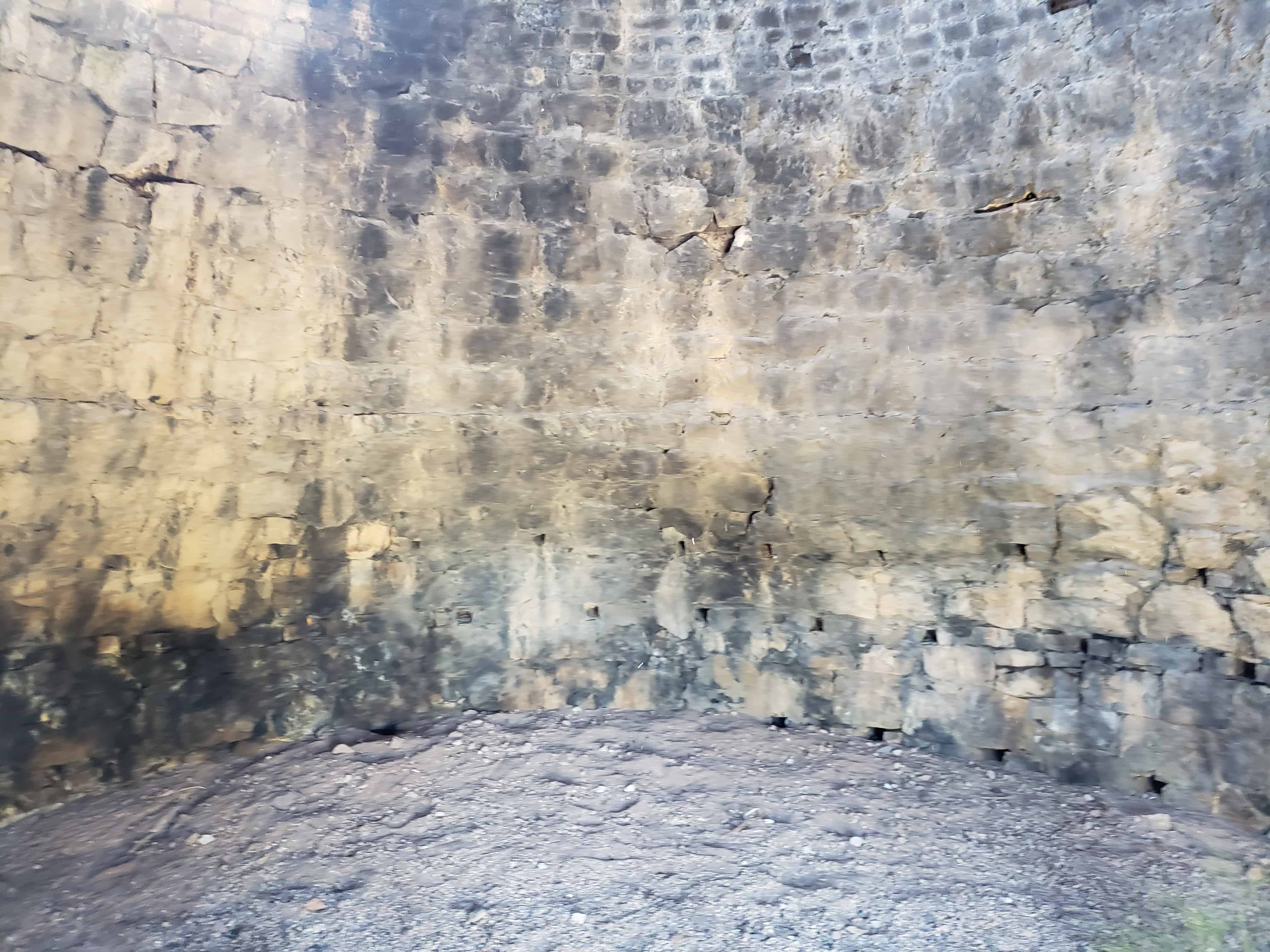
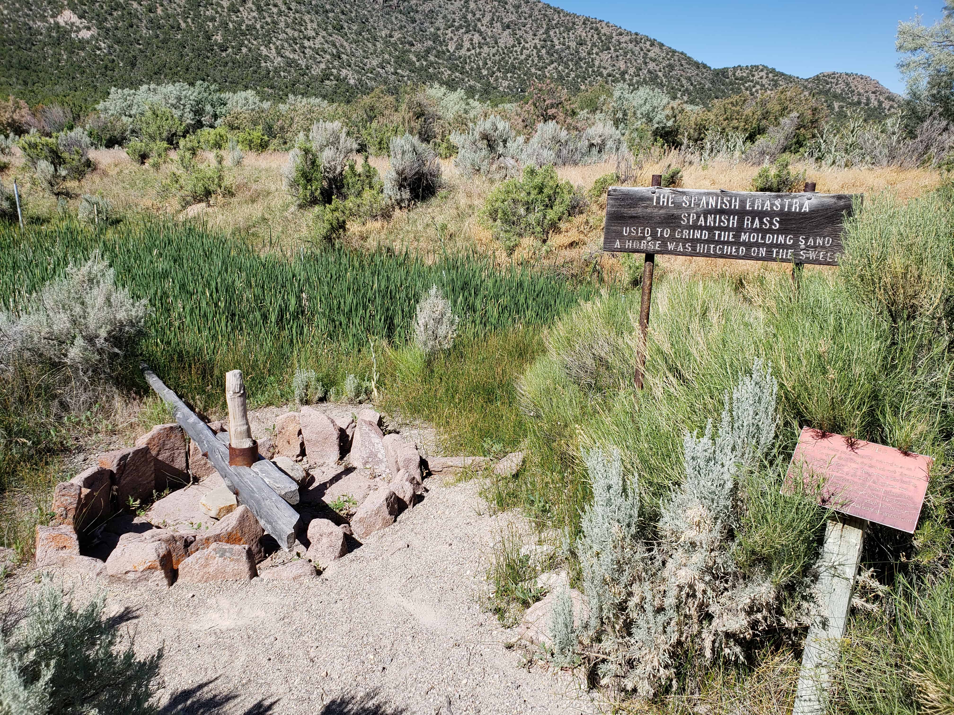
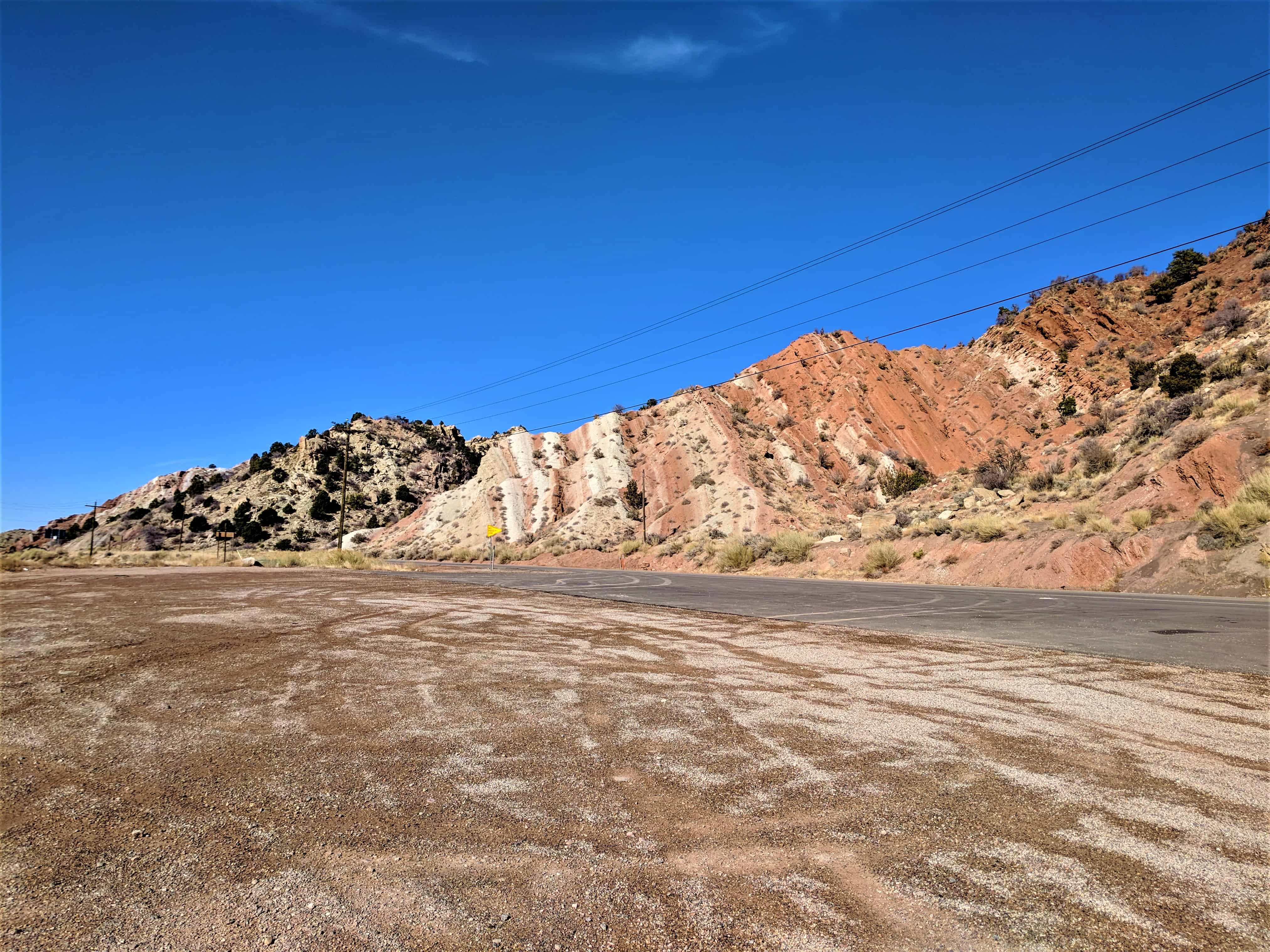
Their plant was located on Pinto Creek about 22 miles southwest of Cedar City, near the southern tip of Iron Mountain. They built several charcoal furnaces, one of which remains. (The coal near Cedar City contained so much sulfur that it was difficult to make a good coke; consideration was even given to moving the operation to Wales in Sanpete County.) They also constructed an “Arastra” for preparing fine sand for molds, a foundry and furnaces. Stoves, irons and milling equipment made at the site were sold to the miners in Nevada and elsewhere.

In 1873 the company was reorganized as the Great Western Iron and Manufacturing Company, which expanded the plant to include an engine house, two furnaces, a foundry, a pattern shop, and a business office. It remained active for three years, but could not compete on such a limited basis, and became inactive. This site preserves remnants of this 1868-1876 period of production.

In 1881 the Board of Trade and the leaders of the Mormon Church again sought the development of this major resource. The Utah Iron Manufacturing Company was organized but, as their mineral claims were “jumped,” litigation was required to clear title to them. By 1884, the properties were cleared and production was planned by the new Iron Manufacturing Company of Utah, consisting of the same interests basically as the 1881 company. However, by 1884 the United States Supreme Court had upheld the constitutionality of the 1882 Edmunds-Tucker Act prohibiting polygamous cohabitation in the case of Rudger Clawson. Consequently “Feds” descended on Mormon leaders, driving them “underground” and, in this particular instance, putting an end to the cooperative, church-supported development of Utah’s iron industry.

Later, of course, these resources were developed and became a part of the national iron and steel complexes.

Coal Creek Gold Medal Mile

13 Thursday Sep 2018

Posted by Jacob Barlow in Uncategorized

≈ Leave a comment

Tags

Cedar City, Gold Medal Miles, Iron County, utah

2017-11-29 12.51.36

Coal Creek Gold Medal Mile

One of the Gold Medal Miles is located here in Veterans Park in Cedar City.   For others on the list visit this page.

2017-11-29 12.51.59

2017-11-29 12.51.51

2017-11-29 12.51.44

Main Street Park

13 Thursday Sep 2018

Posted by Jacob Barlow in Uncategorized

≈ Leave a comment

Tags

Cedar City, Iron County, Parks, utah

2017-11-29 13.03.50

Main Street Park in Cedar City.

Related Posts:

  • Parks in Cedar City
  • Helen Foster Snow Monument 

2017-11-29 13.04.58

2017-11-29 13.04.38

2017-11-29 13.04.36

2017-11-29 13.05.06

2017-11-29 13.03.59

Veterans Park

13 Thursday Sep 2018

Posted by Jacob Barlow in Uncategorized

≈ 1 Comment

Tags

Cedar City, Iron County, Memorials, Parks, utah, War, War Memorials

2017-11-29 12.44.17

Cedar City‘s Veterans Park and War Memorial.

Related posts:

  • Parks in Cedar City
  • Coal Creek Gold Medal Mile

2017-11-29 12.38.34

2017-11-29 12.38.38
2017-11-29 12.38.42
2017-11-29 12.38.50

2017-11-29 12.38.45

2017-11-29 12.38.55
2017-11-29 12.39.01
2017-11-29 12.41.56

2017-11-29 12.39.06

2017-11-29 12.39.11

2017-11-29 12.41.27

2017-11-29 12.41.39

2017-11-29 12.41.49

2017-11-29 12.42.48

2017-11-29 12.42.51

2017-11-29 12.43.04

2017-11-29 12.43.06
2017-11-29 12.43.10
2017-11-29 12.43.24

2017-11-29 12.43.17

2017-11-29 12.43.24
2017-11-29 12.43.34
2017-11-29 12.43.39

2017-11-29 12.43.18

2017-11-29 12.44.06
2017-11-29 12.44.32
2017-11-29 12.44.38

2017-11-29 12.44.46

2017-11-29 12.44.54
2017-11-29 12.45.00
2017-11-29 12.45.04
2017-11-29 12.45.08
2017-11-29 12.45.39

2017-11-29 12.45.45

2017-11-29 12.45.57
2017-11-29 12.45.58
2017-11-29 12.46.03
2017-11-29 12.46.07

2017-11-29 12.49.12

2017-11-29 12.51.36

Parks in Cedar City

13 Thursday Sep 2018

Posted by Jacob Barlow in Uncategorized

≈ Leave a comment

Tags

Cedar City, Iron County, Parks, utah

2017-11-29 12.44.17

A list of the Parks in Cedar City.

  • Bicentennial Park
  • East Canyon Park
  • Exit 59 Skateboard Park
  • Field at the Hills
  • Hillcrest Park
  • Horseshoe Park
  • Main Street Park
  • Mayor Square
  • Park Discovery
  • Ridge Park
  • Sunbow Park
  • Trailhead Park
  • Veterans Park
  • West Canyon Park

The Old Mill

12 Sunday Aug 2018

Posted by Jacob Barlow in Uncategorized

≈ 2 Comments

Tags

Cedar City, Historic Markers, Iron County, Mills, NRHP, SUP, utah

2017-11-29 12.32.36

The Old Mill

On this site, in 1876, the Cedar Co-operative Mercantile and Manufacturing Institution constructed the Cedar Co-op Mill. It was a large, three-story wooden building. The original two sets of four foot grinding stones were turned by water which was brought in a ditch from Coal Creek to the South and East. This mill ground the flour, cereal and livestock food for much of Iron County. In 1900 the grinding stones were replaced by a set of rollers. The Mill was changed to a plaster mill in 1914 and operated until 1945. In 1952 the building was torn down and the property sold to Cedar City. For many years this mill was a hub of activity in this valley.

This is Sons of Utah Pioneers historic marker #8 located at the mouth of Cedar Canyon in Cedar City, Utah.

  • S.U.P. Historic Markers
2017-11-29 12.32.44
2017-11-29 12.33.25
2017-11-29 12.33.15
2017-11-29 12.33.07
2017-11-29 12.32.58
2017-11-29 12.32.49

Old Brickyards

10 Friday Aug 2018

Posted by Jacob Barlow in Uncategorized

≈ 1 Comment

Tags

Brickyards, Cedar City, Historic Markers, Iron County, Kilns, utah

2017-11-29 10.36.07

Old Brickyards

This historic marker, located in Cedar City reads:

It is believed that the first fired bricks in Utah were made in Cedar City in connection with the attempt of the Deseret Iron Company to manufacture iron in 1852. The blast furnace was located in the vicinity of 400 North 100 East. Fired brick was made near there for use in the lining of the blast furnace and construction of some brick homes and some public buildings.

By the turn of the century, most of the brickmaking operations had moved to the southern outskirts of the city. These were located here, immediately north, northeast, east and southeast of this monument. They supplied the brick for homes, commercial and public buildings for Cedar City and some surrounding areas until well into the 1930s. The Old Administration Building and the Old Main Building of the Southern Utah University campus, several blocks from here, were constructed from brick made in this immediate area. This monument stands on part of one of these brickyards, and includes some of the original brick made here. It is a memorial to the various brick makers including Bryant, Fretwell, Dutton, Rollo, Jackman, Palmer and others unrecorded and those who worked for them.

2017-11-29 10.37.05

2017-11-29 10.37.01

2017-11-29 10.36.53

2017-11-29 10.36.38

2017-11-29 10.36.34

2017-11-29 10.36.32

2017-11-29 10.36.26

2017-11-29 10.35.53

Paragonah Fort

05 Thursday Apr 2018

Posted by Jacob Barlow in Uncategorized

≈ Leave a comment

Tags

Historic Markers, Iron County, Paragonah, SUP, UPTLA, utah

2018-02-18 18.11.15

Paragonah Fort

Paragonah was founded in 1852. Indian troubles caused its abandonment a year later until 1855 when the Pioneer Fort was built. The site was selected and dedicated by President Brigham Young. The Fort was 105 feet square with walls 3 feet thick at the base. A second story was added in 1857. A large room served as Church, School and Amusement Hall. Homes were built around the inside of the wall. The public square includes the site of the Fort, which was torn down in 1879.

2018-02-18 18.11.21

2018-02-18 18.11.37

2018-02-18 18.11.26

Paragonah Town Square

05 Thursday Apr 2018

Posted by Jacob Barlow in Uncategorized

≈ Leave a comment

Tags

Historic Markers, Iron County, Paragonah, utah

2018-02-18 18.12.16

Paragonah Town Square

This area, a part of the Great Basin, has evolved from the time of Lake Bonneville. It has known Anasazi Indian civilizations as evidenced by nearby ruins. It has seen the Dominguez-Escalante expedition of 1776 which passed west of this valley. It has hosted explorers and traders on the Old Spanish Trail which came through Bear Valley and entered the Parowan Valley at Little Creek. It knew the Jedediah S. Smith expedition in 1826. Even Parley P. Pratt and his company explored here in 1849 to search for sites for Mormon colonization.

Apostle George A. Smith led an expedition and colonized what is now Parowan in the year 1851. That spring, 40 acres were cultivated near Black Rock, south of town. In 1852 others joined the farming venture, building rude huts for shelter at “Red Creek,” as it was originally named. In 1853 the settlement was abandoned due to Indian skirmishes, and was not resettled until 1855 when a fort was erected.

The town’s name was originally spelled “Paragoonah,” an Indian word meaning “many watering holes.” Artesian wells dotted the landscape, which today have been replaced by gravity-flow sprinkling systems that provide water to the abundant stands of alfalfa.

This Centennial year of 1996 finds a peaceful community with a spirit of unity, freedom from density of population, clear spring water, and clean air. Nearby canyons provide ample opportunities for fishing, hunting, and other recreation. Old homes and barns, the Black Rock Cave, and Anasazi remnants make it historically unique. Today, the proud community honors its past and future in the Town/Church square at this spot.

2018-02-18 18.12.20

2018-02-18 18.12.25

John Christopher Armstrong

02 Tuesday May 2017

Posted by Jacob Barlow in Uncategorized

≈ 3 Comments

Tags

Historic Markers, Iron County, Spanish Trail, utah

2017-03-20 18.14.05

Three historic markers located off exit 100 of I-15 in Southern Utah:

  • John Christopher Armstrong
  • The Old Spanish Trail
  • Southern Utah Expedition of 1849 – Winter Trail in Fremont Canyon

2017-03-20 18.14.20

2017-03-20 18.14.38

2017-03-20 18.15.04
2017-03-20 18.16.00
2017-03-20 18.16.04
2017-03-20 18.16.10
2017-03-20 18.16.19
2017-03-20 18.16.25

John Christopher Armstrong

1813 –

This monument is a memorial to the dedication and perseverance of John C. Armstrong and to all the brave men, see reverse side, who explored this area under the direction of Parley P. Pratt since a burial spot is not known this will serve as a burial monument for him.  He arrived in the Salt Lake Valley Sept. 1847 and settled his family in a mud dugout.  As a skilled tailor he applied his trade for many including Brigham Young.  He played in Captain Ballou’s Brass Band and accepted the call to join Pratt’s exploration party as bugler and explorer.  Later he was called to defend Fort Bridger against Indians on the war path.  He carved his name on a sandstone cliff east from this marker up Fremont Canyon on December 21, 1849.  The carving, as depicted on this monument is still plainly visible on the rock in the canyon.  His journal tells of the sacrifice, hardships and near tragedy endured by these explorers.

“Sunday, 9th, This night one of the coldest… both feet froze.”

“Thursday 13th, I walked as well as I could blew the trumpet for prayers… rubbed my limbs all the time trembling with cold my teeth chattering in my head.  Truly I thought about home and a good bed.”

 “Friday 21st… We have fought with the storm and the tempest and it must have been through the divine interposition of God, who led Nephi of old that we were brouhgt over these mountains.  To look at them it would be said that no white man could do it or be rash enough to undertake it…  The Mormons are the boys for such expeditions they fear neither kanyon, mountain, snow storm, gully or river because they know that they are led by The Mighty God of Jacob.”

– Reverse side of marker –

Parley P. Pratt received a commission from Brigham Young the governor of the State of Deseret to raise fifty men with the necessary teams and outfit on an exploring tour to the southward.

First Ten

Isaac C. Haight, Captain.  Parley P. Pratt, President. William Wadsworth, Hial K. Gay, Rufus Allen, Chauncey West, Dan Jones, George B. Mabson, Samuel Gould, Wm. P. Vance.

Second Ten

Joseph Matthews, Captain.   John Brown, Nathan Tanner, Sterling G. Driggs, Homer Duncan, Wm. Matthews, Schuyler Jennings, John H. Bankhead, John D. Holiday, Robert M. Smith.

Third Ten

Joseph Horn, Captain.  David Fulmer, Counselor.  Wm. Brown, George Nebiker, Benjamin F. Stewart, Alexander Wright, Alexander Lemon, Seth B. Tanner, Henry Heath, James Farrer.

Fourth Ten

Ephraim Green, Captain. Wm. W. Phelps, Counselor.   Robert Campbell, Clerk. Charles Hopkins, Sidney Willis, Andrew Blodgett, Wm. Henry, Peter Dustin, Thomas Ricks, Isaac H. Brown.

Fifth Ten

Josiah Arnold, Captain.  Jonathan Packer, Christopher Williams, Stephen Taylor, Isaac B. Hatch, John C. Armstrong, Dimick B. Huntington.

Manti Group

Madison Hambleton, Gardner G. Potter, John Lowry, Jr., Edward Everett, Sylvester Hewlitt.

← Older posts
Newer posts →

Follow Jacob

Follow Jacob

Blog Stats

  • 2,050,534 hits

Social and Other Links

BarlowLinks.com

Recent Posts

  • Moses Thatcher, Jr. Home
  • C. Gregory Crampton
  • Las Vegas High School Historic District
  • Martin Harris Gravesite
  • 585 S Riverside Ln

Archives


Loading Comments...