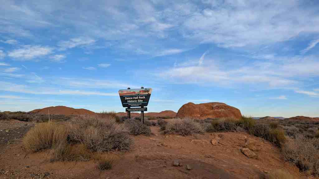
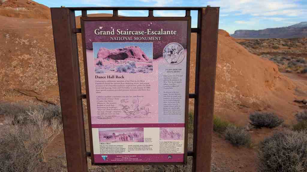
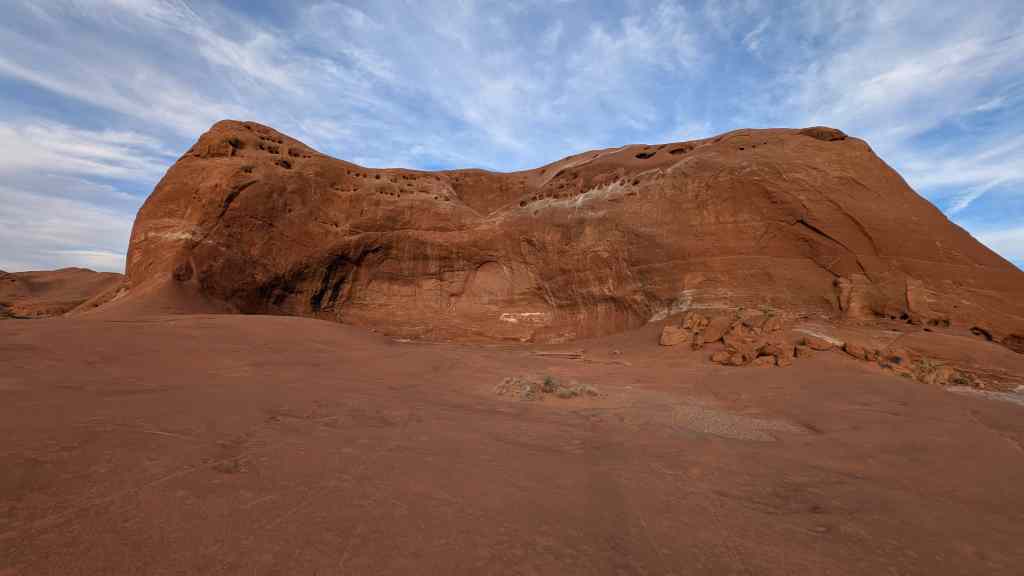
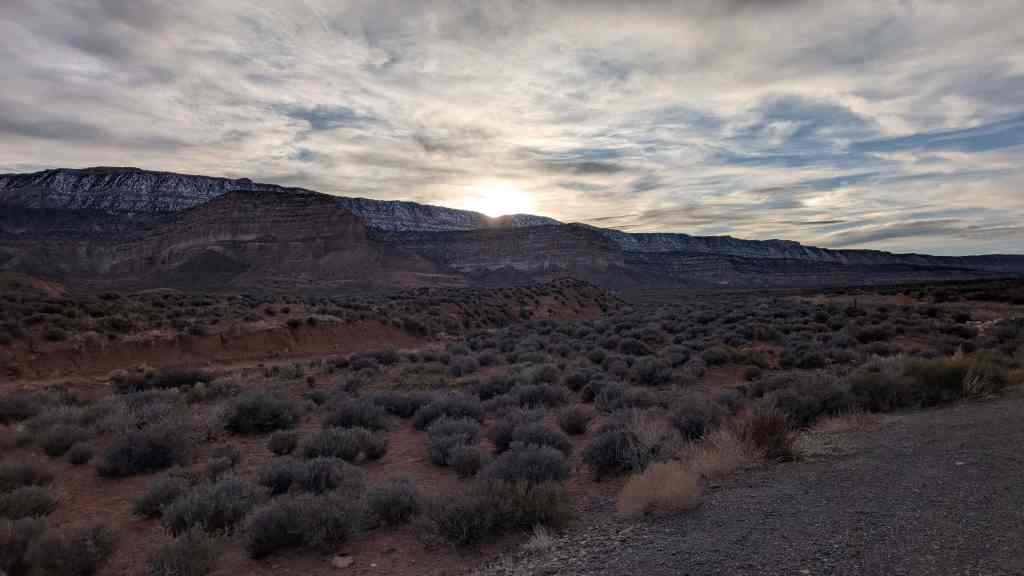
• About JacobBarlow.com
  • Cemeteries in Utah
  • D.U.P. Markers
  • Doors
  • Exploring Utah Email List
  • Geocaching
  • Historic Marker Map
  • Links
  • Movie/TV Show Filming Locations
  • Oldest in Utah
  • Other Travels
  • Photos Then and Now
  • S.U.P. Markers
  • U.P.T.L.A. Markers
  • Utah Cities and Places.
  • Utah Homes for Sale
  • Utah Treasure Hunt

JacobBarlow.com

~ Exploring with Jacob Barlow

JacobBarlow.com

Tag Archives: SUP

Dance Hall Rock

31 Tuesday Mar 2026

Posted by Jacob Barlow in Uncategorized

≈ 3 Comments

Tags

SUP

Dance Hall Rock

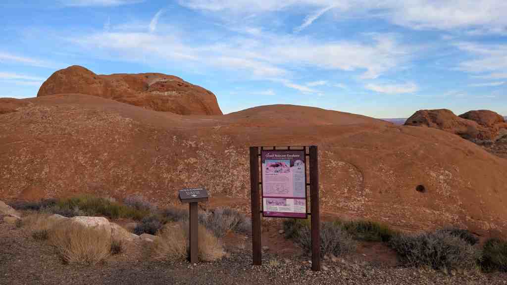
Gathering in celebration, members of the Hole-in-the-Rock Expedition found the smooth floor, sheltering alcove, and natural acoustics of this beautiful sandstone amphitheater perfect for fiddle music and dancing. From mid-November to early January of 1880, these special occasions provided pioneers welcome relief from their labors.

Called to establish a settlement near the San Juan River by The Church of Jesus Christ
of Latter Day Saints. (Mormon), the pioneers decided to reach their destination by building a “short-cut” from Escalante to San Juan. Though completed, this difficult route was only used for one year before being abandoned.

DO YOU HEAR THE FIDDLE MUSIC?
Dancing was one of the most: important recreational activities for pioneers in the West. They danced squares, waltzes, mazurkas, schottishes, polkas, and Virginia Reels.

An observer at the time stated, “In every Mormon train there are usually some musicians, for they seem to be very fond of song and dance, and as soon as the camp work is done the younger element gather in groups and ‘trip the light fantastic toe’ with as much vim as if they had not had a twenty mile march that day.”

A Matter of Music
Unlike many of their nineteenth century contemporaries, early Mormons embraced music as a means not only to express their religious devotion, but to cement congregational ties. With uncommon zeal, Mormons dedicated valuable time and resources to musical pursuits, encouraging members to participate in choirs, choral groups, bands, orchestras, musical style. For these people, music was more than just an amusement; it was spiritually integral to their everyday lives.

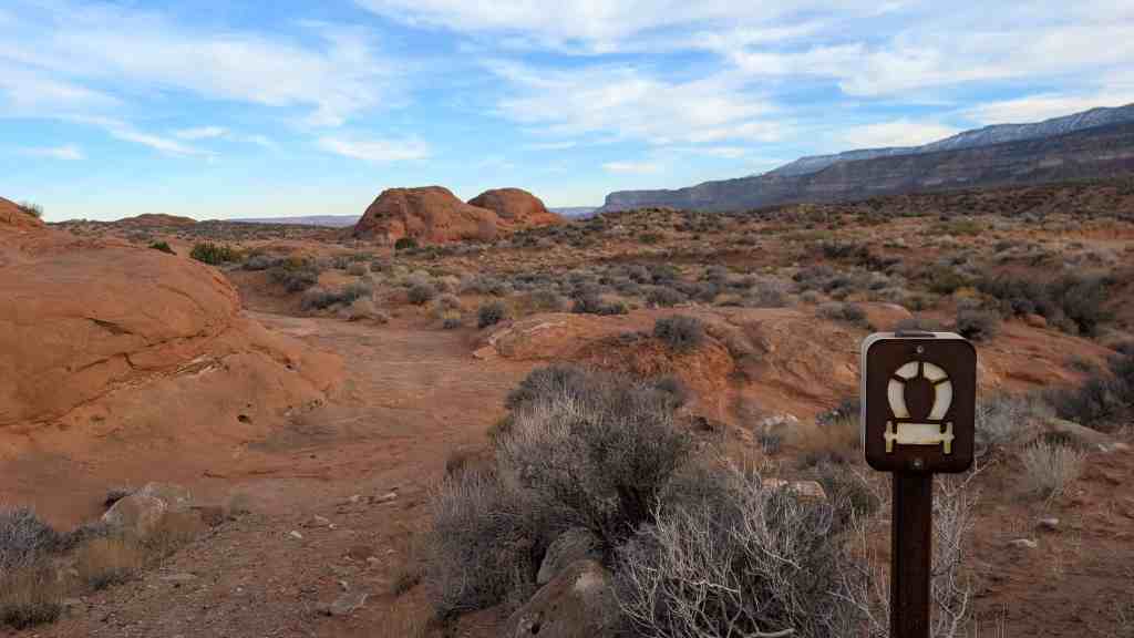
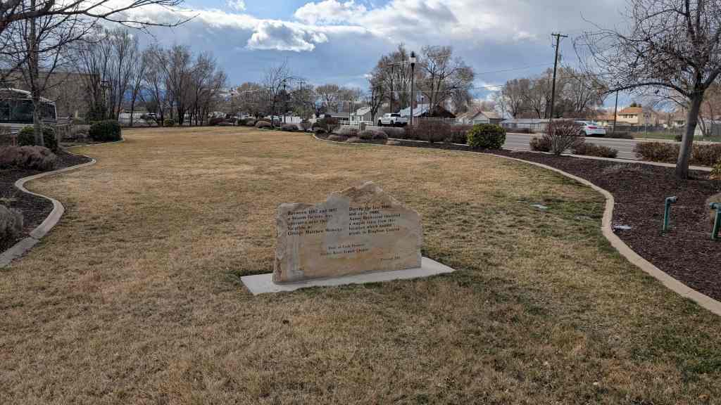
This is Sons of Utah Pioneers Historic Marker #O, located off the Hole-in-the-Rock Trail in Kane County, Utah.

  • Sons of Utah Pioneers Historic Markers

Broom Factory and Wagon Train Terminal

31 Tuesday Mar 2026

Posted by Jacob Barlow in Uncategorized

≈ Leave a comment

Tags

SUP

Broom Factory and Wagon Train Terminal

Between 1887 and 1897 a broom factory was operated near this location by George Matthew Webster.

During the late 1800s and early 1900s Aaron Beckstead operated a wagon train from this location which hauled goods to Bingham Canyon.

This is Sons of Utah Pioneers historic marker #163 (see other SUP Markers here.), located at 2205 West 7800 South in West Jordan, Utah

aa

 Blackfoot Land Office

04 Thursday Apr 2024

Posted by Jacob Barlow in Uncategorized

≈ Leave a comment

Tags

Bingham County, Blackfoot, Historic Markers, Idaho, SUP

Blackfoot Land Office

The Blackfoot US. Land Office was located here during the land rush of 1902. All staked claims for land in the Upper Snake River Valley were filed in this office.

20 East Pacific Street in Blackfoot, Idaho.

The photos below were submitted by Marshall Hurst:

Palatkwapi Trail

13 Wednesday Mar 2024

Posted by Jacob Barlow in Uncategorized

≈ Leave a comment

Tags

Apache County, Arizona, SUP

For many centuries Native Americans used this trail as a trade route to traverse the high country from the Hopi Mesas to the Verde Valley. During the mid-1800s, the United States Army, commercial companies, mail routes used portions of this trail, along with early Mormons migrating from Utah and Idaho.

Note: Due to the deteriorated condition, the Forest Service removed this marker and the monument is retired.

Sons of Utah Pioneers historic marker #40

  • S.U.P. Historic Markers

Soft-Rock

06 Saturday Jan 2024

Posted by Jacob Barlow in Uncategorized

≈ 4 Comments

Tags

Historic Markers, Soft-rock constructed, SUP

The pioneers who settled Pleasant Grove found a unique type of building rock northeast of the town. The rock was a soft, porous limestone formed when minerals in water accumulate around vegetation. The pioneers called it “Soft-Rock” because when in the ground, they could easily cut it into blocks with a saw or axe. Soft-Rock had excellent insulating qualities to keep structures warm in the winter and cool in the summer. Geologists call the rock “Tufa”. Between 1865 and 1900 over 100 buildings were erected using Soft-Rock including the first Town Hall, next to the monument and the Ashton/Driggs house south of this site. In 2021, only 19 Soft-Rock buildings remain with the original rock walls visible. Many other Soft-Rock buildings are hidden under stucco or siding. The Soft-Rock on top of this monument is a remnant of the K.V. and Gwen Adams House pictured (built in 1880 and demolished in 2012). The visible notch was cut with an axe to support a window. Historical information about the Pleasant Grove Soft-Rock Buildings is available from the Pleasant Grove Historic Preservation Commission.

This historic marker is Sons of Utah Pioneers historic marker #276, located in Rose Garden Park/Pioneer Park at 107 South 100 East in Pleasant Grove, Utah

Related:

  • Posts tagged with Soft-rock construction
  • S.U.P. Historic Markers

James Lynn Bevan

26 Tuesday Dec 2023

Posted by Jacob Barlow in Uncategorized

≈ Leave a comment

Tags

Historic Markers, SUP, Tooele, Tooele County, utah

James Lynn Bevan
March 10, 1931 – June 14, 2016
Blessed, Honored Pioneer!

“It is good to look to the past to gain appreciation for the present and perspective for the future. It is good to look upon the virtues of those who have gone before, to gain strength for whatever lies ahead. It is good to reflect upon the work of those who labored so hard and gained so little in this world, but out of whose dreams and early plans, so well nurtured, has come a great harvest of which we are the beneficiaries. Their tremendous example can become a compelling motivation for us all, for each of us is a pioneer in his own life…”
-Gordon B. Hinckley, 1984

These words are now found on a plaque at the entrance of the Pioneer Museum, the place that Jim Bevan loved so much. Jim loved these words because they epitomized his own thoughts and feelings. He had a drive and desire to help everyone visualize and understand the struggles and sacrifices that were made by those men and women that lived in the very early days of Tooele.

Jim was a descendent of the faithful pioneers that established the city of Tooele. He was the 10th of eleven children born to Eli Edson Bevan and Sarah Shields Bevan. He was named after his relative James Bevan who was born in 1821 in Herefordshire, England and came to Utah in 1847 after coming from California, as a member of the Mormon Battalion. Jim’s father, they called him Kelly, was an engineer of the train that used to travel Vine Street every day giving the men a ride to and from the Tooele Smelter. Jim’s mother died when he was only twelve years old. Jim worked at the lumber company in Tooele, at the Tooele Ordinance Depot and finally at Utah Power and Light Company. He served the LDS church as a bishop, a high counselor and stake president.

Over the years Jim spent thousands of hours with his friends Russ Hammond and John Bryan and gave much in the way of personal resources in an effort to establish a place where people could visit to catch a glimpse of the past. His desire to share his love of those early pioneers and their struggles resulted in many of the displays at the Pioneer Museum. The museum now stands as a monument to his life.

The text on this page is from Sons of Utah Pioneers historic marker #249, located at the James L. Bevan Tooele Pioneer Museum at 39 East Vine Street in Tooele, Utah.

  • S.U.P. Historic Markers

Taylorsville–Bennion Cemetery & Cemetery Flagpole

16 Saturday Dec 2023

Posted by Jacob Barlow in Uncategorized

≈ Leave a comment

Tags

SUP

Taylorsville–Bennion Cemetery & Cemetery Flagpole

Erected in memory of the early area settlers

Taylorsville-Bennion Chapter Sons of Utah Pioneers
Dedicated May 31, 1993

This flagpole is listed as being #61 & #62 of the historic markers by the Sons of Utah Pioneers.

  • S.U.P. Historic Markers

Located in the Taylorsville Cemetery at 4567 South Redwood Road in Taylorsville, Utah

Rush Valley Station

30 Thursday Nov 2023

Posted by Jacob Barlow in Uncategorized

≈ Leave a comment

Tags

Central Overland Stage, historic, Historic Markers, Overland Trail, Pony Express, SUP, UPTLA, utah

Rush Valley Station

Pony Express – 1860-61
St. Joseph, Missouri – Sacramento, California
Also Overland Stage & Freight Route 1858-1868

Note: The above is a replica of the marker placed c. 1947. However, no records prior to 1862 show a station here. This includes the 1861 Pony Express schedule. In 1862, this new station was built by the Central Overland Stage & Freight and used by others.

This monument was constructed by enrollees, U. S. Grazing Division, C. C. C. Camp G-154, Company 2517 in 1941 and sponsored by the Utah Pioneer Trails and Landmarks Association (#98 of their monuments) it was later adopted by the Sons of Utah Pioneers (#240 of their monuments) and rededicated in 2017.

Related:

  • Central Overland Trail
  • Other UPTLA Historic Markers and Sons of Utah Pioneer Markers
  • Pony Express

Tooele County Airmail Arrows and Beacons

18 Saturday Nov 2023

Posted by Jacob Barlow in Uncategorized

≈ Leave a comment

Tags

Historic Markers, Navigation Arrows, Navigation Beacons, Stockton, SUP, Tooele County, utah

Tooele County Airmail Arrows and Beacons

Western Air Express (which later became Western Airlines) delivered the first airmail on CAM #4 from LA to SLC on April 17, 1926. WAE carried its first passengers five weeks after, but priority was given to mail
cargo. The average mail load was 400 pounds and was carried in Douglas M-2 biplanes. The M-2 could carry 1,000 pounds of mail and two passengers.

Between 1926 to 1931 Boeing Air Transport had the contract for the SF-SL route, part of CAM #18. After 1931 Boeing Air Transport was renamed United Air Lines. CAM #18 used Boeing Model 40A biplanes. The Model 40A could carry two passengers and 1,200 pounds of mail.

The route was not lighted and mail could only be delivered by daylight until July 1, 1924 when the first nighttime airmail flights started. The lighted airway was completed in 1927. The airway contained lighted Airway Beacons. These beacons were spaced approximately 10 miles apart (closer in the mountains and farther away in the plains) and had 24 inch, million candle-power lights mounted on 51 foot towers. These towers were centered on an airmail arrow with a 10 x 14 ft engine generator shed oriented to the western/ southern beacon and an arrowhead oriented to the next eastern/northern beacon. The concrete arrow and shed were painted chrome-yellow (the shade of school buses).


EXISTING AIRMAIL ARROWS IN TOOELE COUNTY:

  • 59 LA-SL STOCKTON
  • 57 SF-SL LOW
  • 59 SF-SL POVERTY POINT (TIMPIE)
  • 61A SF-SL LAKE POINT

The airmail initially went through Tooele County in September 1920 when the first transcontinental route went through Salt Lake and through to Reno. This was run by the Post Office Department in cooperation with the US Army. The first eight years of airmail delivery was operated by the US Government, probably using Curtiss “JN-4 “Jenny” biplanes and De Havill and DH-4s.”

The Kelly Act of 1925 “encouraged commercial aviation and authorized the Postmaster General to contract for Air Mail Service”. This resulted in Commercial Air Mail (CAM) service. These CAMS ran from 1925. While most of these beacons were discontinued during the Depression and the program defunded, various beacons operated in limited capabilities into the 1940s. At that time the Department of Commerce decommissioned and disassembled the towers for their steel. The last airway beacon was officially shut down in 1973, although there still are beacons operating in Western Montana.

The text above is from Sons of Utah Pioneers historic marker #243, see other markers in the series here:

  • S.U.P. Markers

This is located in a little roadside park at the corner of Connor Avenue and Silver Avenue in Stockton, Utah along with other historic markers. Those located here are:

  • Central Overland Trail – Rush Valley
  • First Electric Light
  • Stockton Historic Marker
  • Tooele County Airmail Arrows and Beacons

Eagle Rock Crossing

21 Thursday Sep 2023

Posted by Jacob Barlow in Uncategorized

≈ Leave a comment

Tags

Historic Markers, Idaho, Idaho Falls, SUP, UPTLA

Eagle Rock Crossing

Honoring builders of bridges and trails and pioneers who passed this way in the development of the West.

The first wagon bridge over Snake River was erected here by James M. Taylor in 1865 replacing the ferry established on the Utah-Idaho-Montana trail for miners and freighters to Virginia City, Lander, Salmon River and other points. Robert Anderson became part owner of the toll bridge in 1866, establishing here a way station named Eagle Rock from a nesting place up the river. The Utah & Northern Railroad Co. erected here in 1879 the first railroad bridge over Snake River. The town Eagle Rock was renamed Idaho Falls in 1890.

This granite boulder from Grand Teton mountain was set by Teton Peaks Council, Boy Scouts of America and the tablet provided by Utah Pioneer Trails and Landmarks Association

The above text is from Utah Pioneer Trails and Landmarks Association marker #15 erected August 26, 1932 in Idaho Falls, Idaho.

  • U.P.T.L.A. Markers (these markers were later adopted by the SUP, S.U.P. Markers )

These photos were submitted by Marshall Hurst:

← Older posts
Newer posts →

Follow Jacob

Follow Jacob

Come wander with me on Youtube.

Blog Stats

  • 2,114,693 hits

Social and Other Links

BarlowLinks.com

Recent Posts

  • John Ford Point
  • William Capener House
  • Justus Wellington Seeley II House
  • Huntington Roller Mill and Miller’s House
  • Johnson Ranch House

Archives

Loading Comments...