The old Broadway Hotel (built in 1911) at Broadway and Date in Tooele, Utah (145 N Broadway Ave) stands majestic and abandoned for now, there has been talk over the years of restoring it but nothing happening yet. I love the big cool looking building.
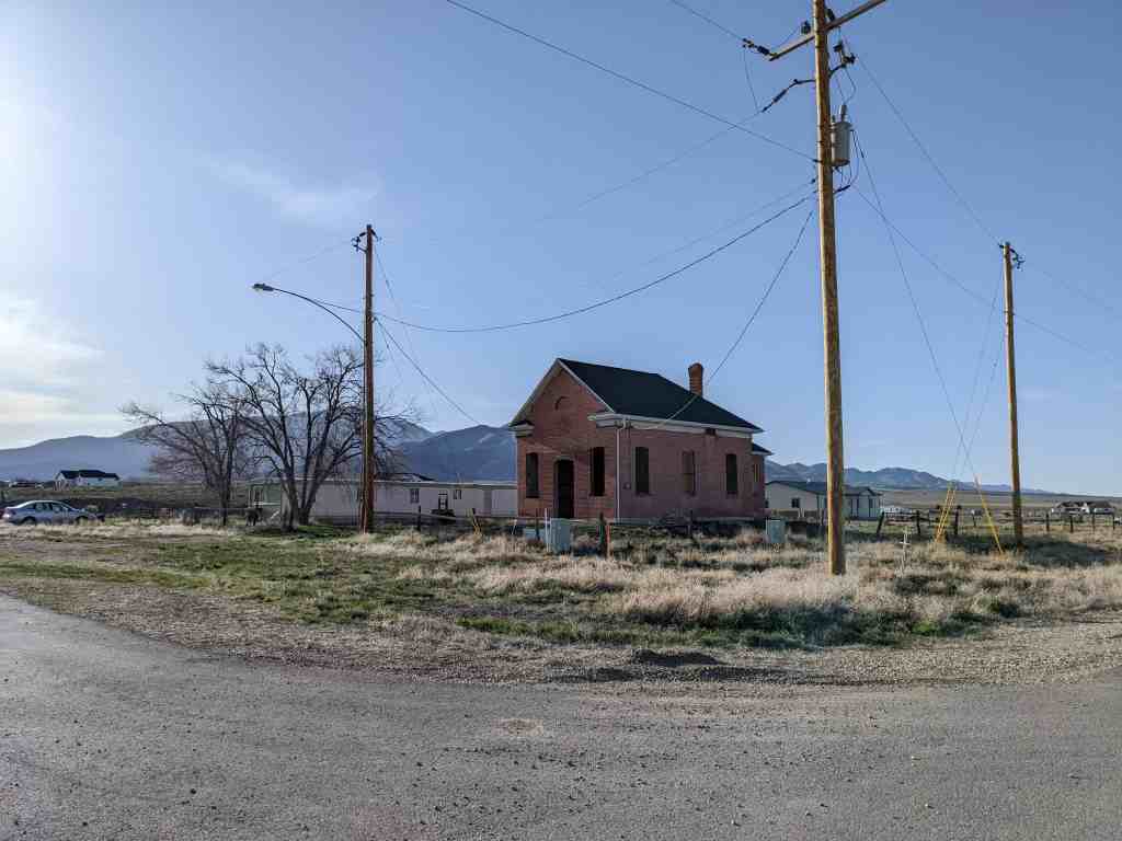
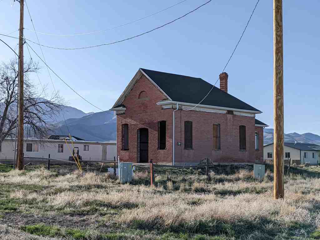
The text on this page is from the nomination form (#85000965) for the National Historic Register, the school was added to the register on May 9, 1985 and is located at 38 West Clark Street in Stockton, Utah.
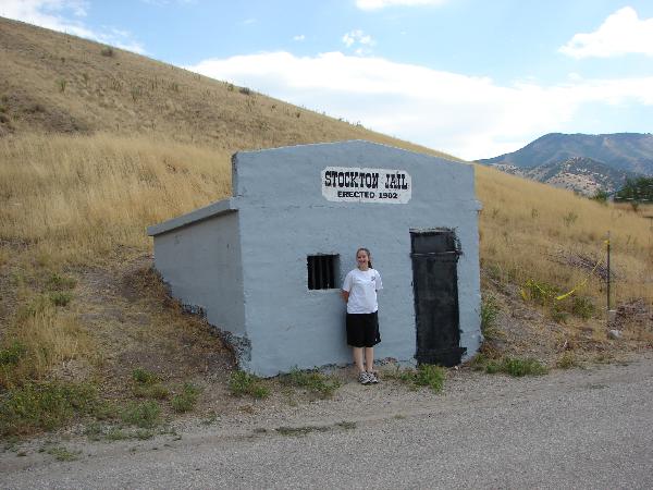
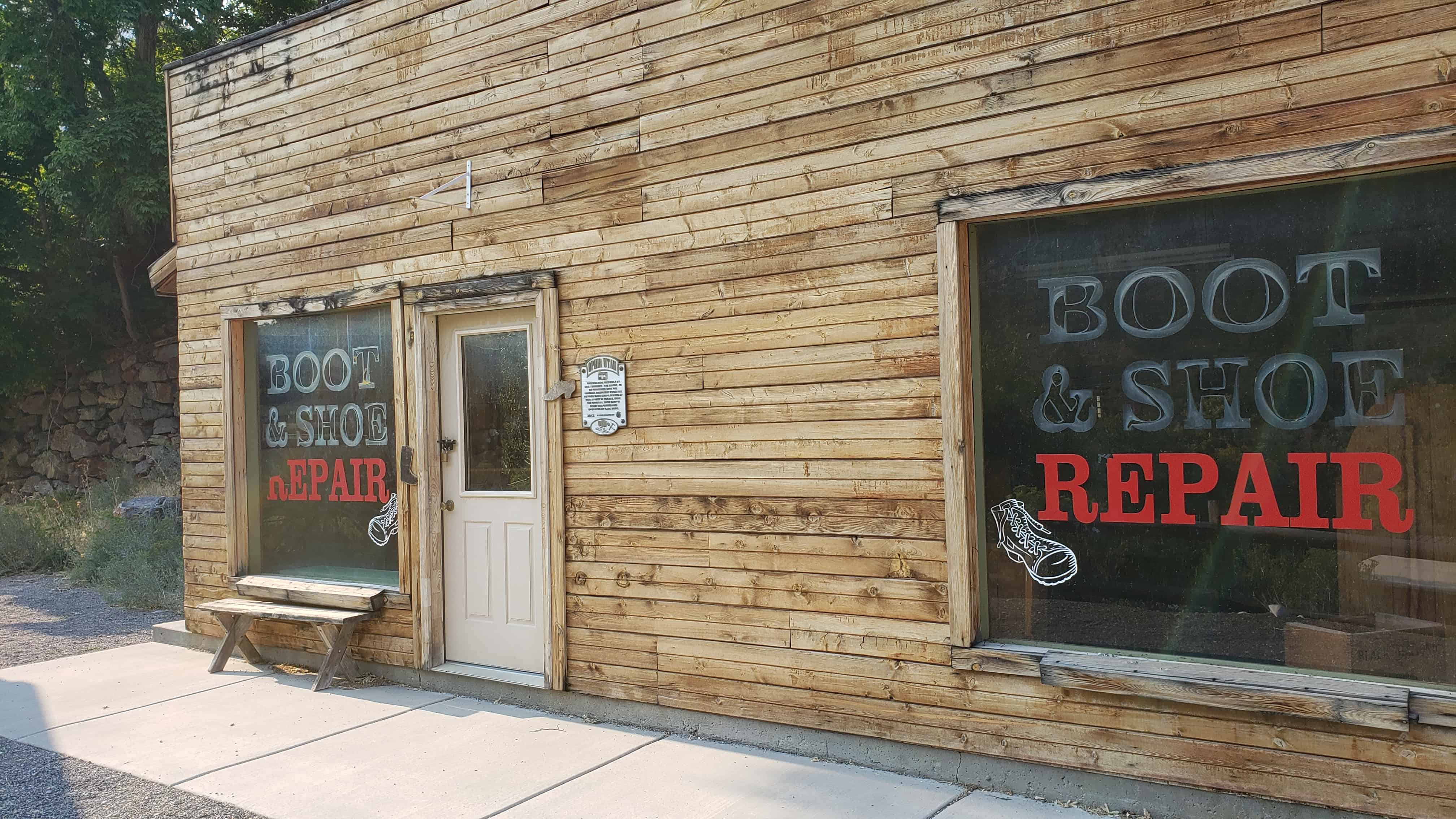
Built in 1902, the Stockton Jail is historically significant as the only building associated with early law enforcement activities in Stockton and as the best preserved public building dating from the early years of the community. The jail was constructed just one year after the town was incorporated, which was a time of considerable community development that saw a number of civic improvements, including the extension of the railroad lines into the town, construction of a railroad depot, the installation of electricity, surveying of the city cemetery, and dedication of a public square.
The decision to erect a jail in Stockton was made at the town meeting held on September 3, 1902. At that same time Town President E.J. Raddatz appointed James H. Spaulding to serve as Marshall and Street Supervisor, with a salary of fifteen dollars per month. The site selected for the jail is located in the northwest part of town at the base of Tabernacle Hill. The property was purchased in November of 1902 and construction began soon after.
Specifications for the building called for a concrete structure measuring 12 x 14 x 8, with three interior compartments, a metal door, and one small window with iron bars. A stove was installed in the outer or south compartment of the building open its completion. Through the years the building has been used primarily either for detoxification or as temporary shelter for hobos passing through on freight trains.
The Stockton Jail was one of a number of civic improvements that were undertaken in the years immediately following the incorporation of the town in 1901. The Oregon Short Line Railroad extended its tracks into the town in 1902. and in 1904-05 a large depot was built. In 1902 the town Board of Trustees set aside a plot of land as a public square and that same year paid five dollars to A.F. Stookey for surveying the cemetery plot. Electricity was brought to Stockton in 1903 by the Clark Electric Power Company and several street lights were installed at that time. The large, brick and adobe IOOF Hall was erected in 1902, and for many years its upper story was used by the town for recreational purposes, including dances, Christmas parties, and even some school functions. The Stockton Jail is the only building to have survived to the present from that era of intensive community development.
Although Stockton was not incorporated until 1901, it was first established as a community in 1864 when precious ores were discovered in the adjacent mountains by U.S. Army soldiers. The Army had established a camp, Camp Relief, at this site in 1862, and under the direction of Col. Patrick E. Connor the soldiers stationed there began prospecting in the surrounding mountains. Their discovery was probably the first significant mineral discovery in Utah and launched the important mining industry in the state. The town of Stockton, though never the nucleus of mining activity in the area, was one of several important mining towns on the west slope of the Oquirrh Mountains. The town was named after Stockton, California, the one-time home of Col. Patrick Connor.
Because only a few older jails have been identified in Utah, little is known about them – their prevalence, range of sizes and architectural styles, or whether they were generally detached buildings or part of a city hall or county courthouse. Jails that have been identified include the Juab County Jail, a separate building located behind the old courthouse, the Park City Jail, located in the basement of the old city hall, and the Garfield County Jail, adjacent to the county courthouse. The Stockton Jail, unlike those, is in an isolated location at the edge of town and is constructed of concrete.
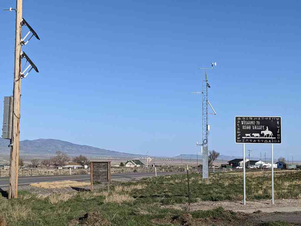
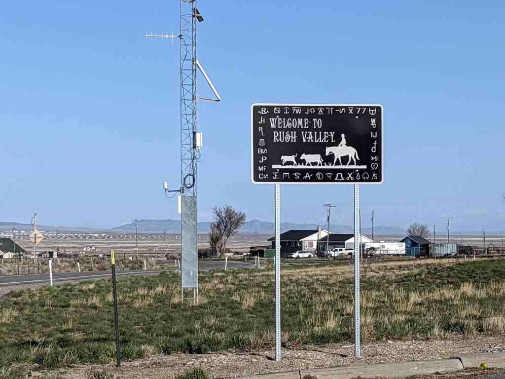
This area was first settled beginning in 1856. In 1934, a large area of some 33 square miles, comprising the settlements of Clover, St. John, and Vernon, was incorporated into a town called Onaqui. The incorporation was essentially a bureaucratic tactic to secure federal aid for development of municipal infrastructure, including from the Rural Electrification Administration. When the people of Vernon were granted a petition to incorporate separately on 22 February 1972, the remaining town was renamed Rush Valley.
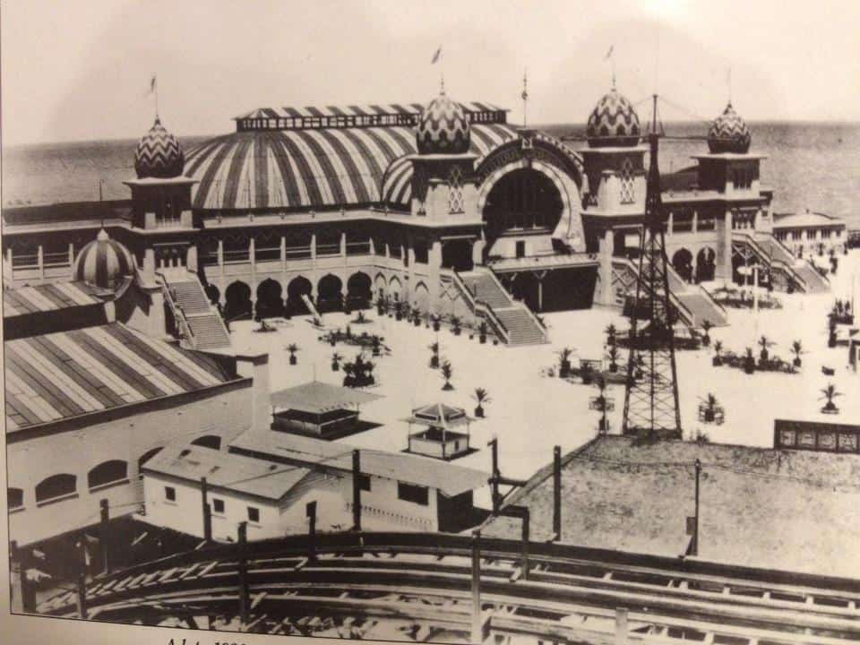
Saltair has been several resorts on the shore of the Great Salt Lake. The first was built in 1893 and designed by Richard K.A. Kletting, resting on over 2,000 posts holding it above the water. It burned down in 1925.
The replacement, Saltair II lasted until it shut down in 1958 and the remains burned by arson in 1970.
William and Emma J. Hughes Ajax The unique two-story underground building was established in 1870. Shortly thereafter a post office called “Centre” was added. The building was 80 x 100 feet, in some places the lower floor was 20 feet below ground. The excavation was done by William Ajax using a shovel and wheelbarrow. The building’s support timbers were cut from juniper and pine trees. These trees were located in the mountains west of here where he walked to and from each day to cut the timbers. The roof was constructed of poles covered with juniper boughs, sod and clay. The store was illuminated by sunlight coming through south-facing windows in the roof. Shoppers were offered a wide variety of merchandise, food, clothing, housewares, hardware, tools and medicine. Goods were arranged in department store style. It was estimated the value of the merchandise was in excess of $70,000.
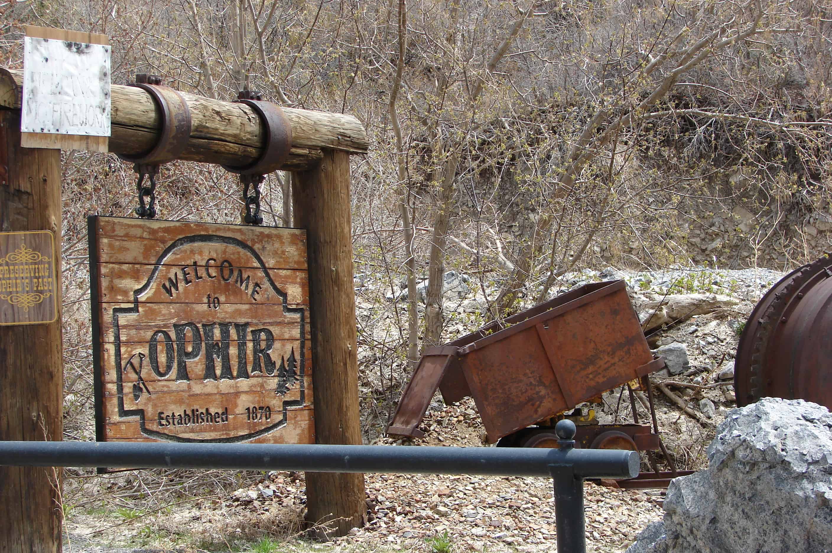
Patrons came from the mining camps, sheep and cattle ranches and the communities of Rush and Vernon Valley. Meals and lodging for travelers were provided. Their livestock was also cared for in sheds and corrals located west of the present highway. Wild grass-hay was cut in nearby meadows. It was sold to miners in Stockton, Ophir and Mercur. The coming of the railroad through Rush Valley made supplies and travel more accessible, thus ending much of the need for a store in the area. William Ajax died in 1899, his family operated the store until 1914 when they liquidated the merchandise.
The building was abandoned, and later it was burned, (perhaps railroad transients camping at the building). All that remains are the mounds of dirt just east of the monument.
This illustration depicts the living quarters where meals and lodging were provided. A portion of the underground store was under this building.
See other historic markers in the series on this page for SUP Markers.
Richville was located between Lake Point and Tooele near the former site of E. T. City. Saw, woolen, and flour mills were built nearby and subsequently names were developed: Mills, Milton, Millvale, and Milltown. For a short period of time Richville was the county seat. After the county seat was moved to Tooele and the mills shut down, the community was abandoned. Today it is Mills Junction.
The U-138 exit from I-80 leads into a brief corridor of gas stations and convenience stores and continues through present-day Lake Point and Mills Junctions, two adjacent communities whose borders essentially overlap. This corridor was an important meeting place in pioneer times.
Near here, Adobe Rock, a large outcrop at the northwest point of the Oquirrh Mountains, was a favorite pioneer rendezvous spot. Its name came from a small adobe house Captain Howard Stansbury (a U.S. surveyer of the area) had built nearby to house his herders. It was the site of many travelers’ camps and a familiar point of reference. The Donner party camped near Adobe Rock in 1846. On July 27, 1847, apostle Orson Pratt and two other men climbed to the top of the rock to get a view of the Tooele Valley. Later, when Brigham Young came to visit the settlements, this was where he was greeted.
Mormon Pioneers quickly took advantage of mountain streams in the area to power their gristmills. The mills were eventually closed, and by 1889 the town of Mills Junction was abandoned. The Benson mill, constructed in 1854 by the grandfather of Ezra Taft Benson, and LDS apostle and two-term secretary of agriculture under President Eisenhower who later became LDS Church president, has been restored and operates as a museum. The mill is open from April through October.(*)
LOOKOUT POINT Look north, see trees that mark site of TOD PARK, which was home for civilian employees of Army Depot (1943-1960). Look northwest, see the 10,000 acres of Tooele Army Depot ammunition storage, warehouses, mainenance shops and administration buildings. Look west, see the water mark on South Mountain made by Old Lake Bonneville at the 5200 foot level. Look south, see the geologic wonder of Stockton Bar which was created by wave action of Old Lake Bonneville. Look down west, see the trees that mark the site of the Ghost Town of Bauer (private property), the Honerine Tunnel adit, and the terminix of the old Utah Nevada Western Railroad (1885-1905). Look east in gully, see Soldier Bridge on old road built by Steptoe’s Army in 1854. Look northeast, see bench across Silcox Canyon which was created by an earthquake that happened before the last Ice Age. Glaciers cut through the bench and created a wide flat bottom canyon.
See other historic markers in the series on this page for SUP Markers.