• About JacobBarlow.com
  • Cemeteries in Utah
  • D.U.P. Markers
  • Doors
  • Exploring Utah Email List
  • Geocaching
  • Historic Marker Map
  • Links
  • Movie/TV Show Filming Locations
  • Oldest in Utah
  • Other Travels
  • Photos Then and Now
  • S.U.P. Markers
  • U.P.T.L.A. Markers
  • Utah Cities and Places.
  • Utah Homes for Sale
  • Utah Treasure Hunt

JacobBarlow.com

~ Exploring with Jacob Barlow

JacobBarlow.com

Tag Archives: Weber County

North Ogden, Utah

01 Monday Dec 2014

Posted by Jacob Barlow in Uncategorized

≈ 4 Comments

Tags

North Ogden, Ogden, Pleasant View, utah, Weber County

ingress_20140721_142210_55

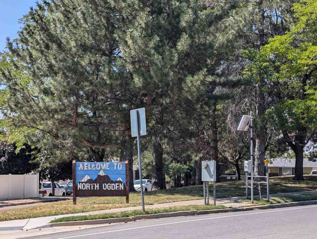
North Ogden located 3 miles north of Ogden is an outgrowth of of that city. It is on U-235, south of Brigham City. The Campbells and Riddles, Cattle ranching families from Ogden, attempted to settle the area in 1850. However, after wintering their cattle only a few months, problems with the Shoshone Indians forced them to return to Ogden. After the problem with the Indians had been partially resolved the following year, John Campbell and several other families returned to permanently settle there.

The Paramount Pictures logo, known as Majestic Mountain, was modeled after North Ogden’s own Mount Ben Lomond. William W. Hodkinson (known as the man to have invented Hollywood), a native of the Ogden area, initially drew the image on a napkin during a meeting in 1914.

Related posts:

  • Kirt’s Drive-In and the Drive Me Crazy Filming Location
  • North Ogden Public Spring
  • Parks in North Ogden
  • North Ogden by Address
2018-10-06 17.49.22

57389fd8-eca8-419f-aeb0-67f03820dfc5

Farr West, Utah

15 Saturday Nov 2014

Posted by Jacob Barlow in Uncategorized

≈ Leave a comment

Tags

Farr West, Ogden, utah, Weber County

Farr West is a city in Weber County, Utah. The population was 3,094 at the 2000 census.

Farr West City is located on the north end of Weber County. It is bordered on the east by Pleasant View and by Harrisville, on the south by Slaterville, and on the west by Plain City, and was first settled by Mormon pioneers. In 1858 Joseph Taylor settled in the area that later became Farr West. In 1868 the area was included as a part of Harrisville when a precinct was organized. On 30 November 1890 western Harrisville was organized into a separate LDS ward and given the name Farr West in honor of Lorin Farr, former president of the Weber LDS stake, and Chauncey W. West, who had served as presiding bishop of Weber County, and who was the son-in-law of Abraham Hoagland. The name echoes “Far West”, an important early Mormon settlement in frontier Missouri.

The earliest settlers engaged in agriculture for their livelihood, and it received a great boost when the sugar beet industry was introduced in 1898. In 1923 further benefits were available to farmers when the Utah Packing Corporation installed a pea viner to help process field-grown peas.

  • Farr West Posts sorted by Address
L2FkLzE5ODY3ZTliLWVlZWEtNGFlMC05OTk5LTAxZjA5MzMwNmQ4My5qcGc=

West Haven, Utah

05 Wednesday Nov 2014

Posted by Jacob Barlow in Uncategorized

≈ 3 Comments

Tags

Hooper, Ogden, utah, Weber County, West Haven

picture31march08-029

West Haven City (Weber) is located approximately thirty-five miles north of Salt Lake City, west of the Wasatch Mountains in Northern Utah. The confluence of the Weber and Ogden rivers is located inside the north-eastern corner of the city. The city is bordered on the east by Ogden, on the south by Roy and on the west by Hooper and on the north by Marriot – Slaterville.

On July 4th, 2003 the city marked the 10th annual West Haven Days celebration. The yearly event, held in the West Haven City Park and hosted by the mayor, city council and members of the city parks committee, begins at 7:00AM with a flag ceremony followed by a breakfast and an auction. Other activities throughout the day include: a variety of booths, food vendors, games, entertainment, a car show, a rodeo and fireworks.

West Haven boasts a City Park which includes an Historical Monument. Future plans provide for a River Parkway Trail that would include a fishing bridge, a pedestrian tunnel under 21st Street, picnic tables, places to rest and points of historical interest. Plans have this trail connect with the Weber County Centennial Trail.

Related Posts:

  • Green Brothers
  • Dallas Green Farm and Home
  • Kanesville School
  • Wallace and Eva Peterson Home
  • Secrist Acres
  • West Haven by address

Ogden Canyon Toll Gate

09 Saturday Aug 2014

Posted by Jacob Barlow in Uncategorized

≈ 1 Comment

Tags

historic, Ogden, SUP, utah, Weber County

picture16aug07-069

ODGEN CANYON TOLL GATE

805 feet north of this site was located the toll gate, established November 15, 1860, by Lorin Farr and Isaac Goodale, builders of the first road through Ogden Canyon. From 1865 to 1882 it was operated by the Ogden Canyon Road Company, with the original builders and John Taylor as principle stockholders. James Dinsdale was gate keeper for 14 years. It became a public road February 10, 1882.

See other historic markers in the series on this page for UPTLA/SUP Markers.

picture16aug07-068
picture16aug07-070

Blossom, Utah

20 Friday Jun 2014

Posted by Jacob Barlow in Uncategorized

≈ Leave a comment

Tags

Blossom, utah, Weber County

Image

Out exploring the fields west of the Ogden area I saw a “Welcome to Blossom” sign, I didn’t even know there was one I’ll study up and write what I learn here.

Miles Goodyear Cabin

10 Tuesday Jun 2014

Posted by Jacob Barlow in Uncategorized

≈ Leave a comment

Tags

DUP, historic, Ogden, utah, Weber County

Image

Miles Goodyear Cabin

Miles Morris Goodyear built this cabin on the lower Weber River as a way station and trading post. The cabin, along with other buildings became Fort Buenaventura meaning good venture. It was the first permanent settlement in the Utah Territory. Miles Goodyear (1817-1849) had traveled as far as Fort Hall in 1836 with Dr. Marcus Whitman’s party of Methodist Missionaries. Goodyear was a trapper, prospector and trader. His Indian wife Pomona was the daughter of Ute chief Peet-teet-neet. The couple had two children, William Miles and Mary Eliza.

Mormon Battalion Captain James Brown and Mary Black Brown bought Fort Buenaventura and all of Weber County for $1,950 in gold. Mary Brown made the cabin home for her family and made 1,000 pounds of cheese during the first year.

The Browns sold the cabin to Amos P. and Minerva Leontine Jones Stone. The Stone family lived in the cabin for a time, eventually using it as a blacksmith shop. A daughter, Minerva Pease Stone Shaw, in 1926 presented the cabin to Weber County Daughters of Utah Pioneers for preservation. It has been moved seven times, ultimately being placed at this site. In 1994 it was disassembled for preservation of the logs and reassembled in 1995 at this location to benefit posterity.

Image

The photos above were taken when the historic marker was located near the Ogden Temple, at N 41.22785 W 111.97261.

It was since moved to the new location of the D.U.P. Museum at 2148 Grant Avenue in Ogden, Utah.

The cabin and museum were later moved to 2104 Lincoln Avenue in Ogden, Utah

Malan Heights

06 Friday Jun 2014

Posted by Jacob Barlow in Uncategorized

≈ Leave a comment

Tags

DUP, historic, Ogden, utah, Weber County

In 1860’s “Tim” B. Malan found a mountain basin containing a spring and timber. By 1868, he was selling logs, using his roller invention to get them safely down the cliff. July 1892, Tim and sons finished making a road with pick and shovel; later hewed a switch-back road, built a home and hotel. Guests came in spring wagons to enjoy Aunt Loui’s cooking, play various games or watch activities in town through a powerful telescope. Malan Heights is seen southeast of this marker.

ImageImage

Check out all of the historic markers placed by the Daughters of Utah Pioneers at JacobBarlow.com/dup

Ogden City Wall

06 Friday Jun 2014

Posted by Jacob Barlow in Uncategorized

≈ 1 Comment

Tags

DUP, historic, Ogden, utah, Weber County

picture07sep08-005

In 1854 Ogden pioneers built a rock and mud wall a mile square along 28th Street, Wall Avenue and 21st Street. Madison Avenue was not completed because the Indians became peaceful. The eight-foot wall had a six-foot base, a 31 inch top and four gates. The cost of $40,000 was raised by $40.00 tax on each city lot, also a $10.00 tax on every able-bodied man over 18 years. The project was erected by 500 working men. Wall Avenue was named after this wall.

This is Daughters of Utah Pioneers historic marker #416 located at Union Station at 2501 Wall Avenue in Ogden, Utah on a monument with U.P.T.L.A. historic marker #120.

Site of Mound Fort

05 Thursday Jun 2014

Posted by Jacob Barlow in Uncategorized

≈ 3 Comments

Tags

DUP, historic, Ogden, utah, Weber County

  • picture19oct08-015

Mound Fort as a settlement began in 1848 when the first pioneers arrived in this locality. Others followed and erected a fort on an Indian burial mound. Its steep west slope, cut to a perpendicular face 10 feet high topped with a 3-foot breastwork, served as a lookout. Mud walls were begun on the other side. Cabins were built. A spring furnished water. Meetings and school were held in private homes. As more settlers came, Indian threats subsided and the fort fell into disuse.

This historic marker is located at the Mound Fort Ward Chapel in Ogden, Utah.

Related Posts:

  • Mound Fort
  • Ogden, Utah
  • Other DUP Markers
  • picture19oct08-013

Fort Buena Ventura

05 Thursday Jun 2014

Posted by Jacob Barlow in Uncategorized

≈ 2 Comments

Tags

DUP, Forts, historic, Ogden, utah, Weber County

picture13nov07-044

Soon after arrival of the ’47 Pioneers, Capt. James Brown, who was on his way to California, visited Fort Buena Ventura, located 1290 feet S.E. of this site belonging to Miles Goodyear, whom the original pioneers had met near Bear Lake. The area consisted of a stockade enclosing a few log houses and sheds, a herd of cattle, horses, goats and a garden. Upon his return Capt. Brown purchased Goodyear’s holdings with money received as wages for the Mormon Battalion. The name was changed to Brown’s Fort, Brownville, and later “Ogden“.

picture13nov07-043

Check out all of the historic markers placed by the Daughters of Utah Pioneers at JacobBarlow. com/dup

← Older posts
Newer posts →

Follow Jacob

Follow Jacob

Come wander with me on Youtube.

Blog Stats

  • 2,104,187 hits

Social and Other Links

BarlowLinks.com

Recent Posts

  • Scout Monument
  • Provo High School Seminary Building
  • 821 E 100 S
  • 820 E 100 S
  • 817-819 E 100 S

Archives

Loading Comments...