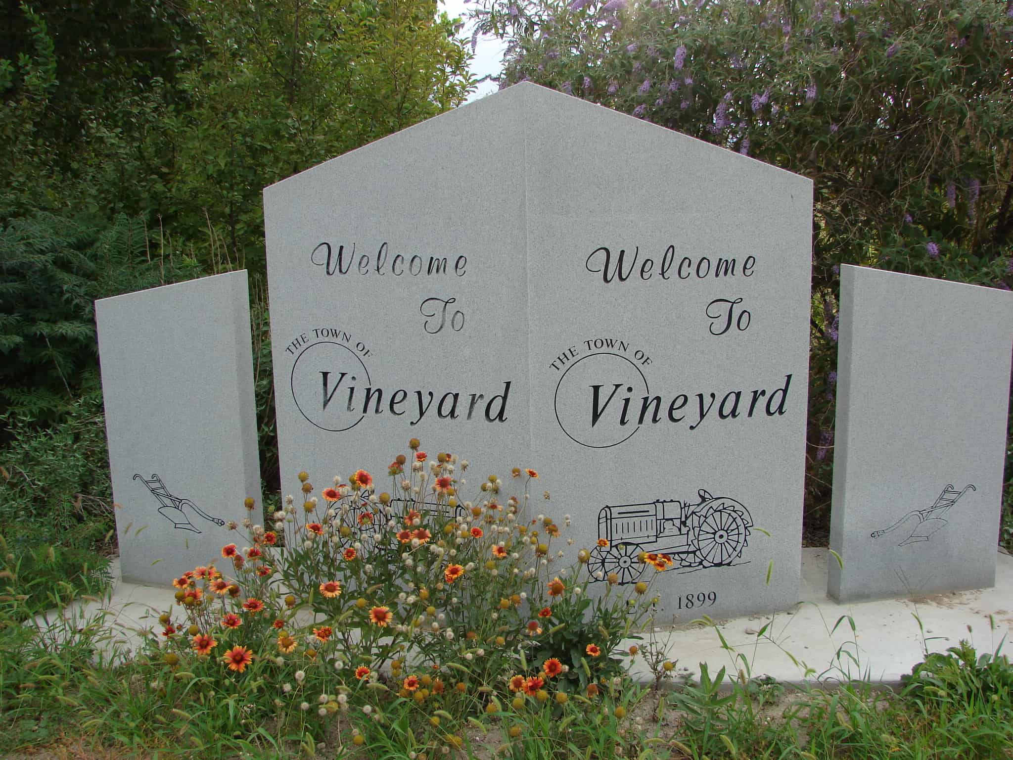
Vineyard is a town in Utah County often thought to be part of western Orem. Vineyard first became a distinct place in 1899.
Vineyard is an outgrowth of Lakeview and Provo on the east shore of Utah Lake. John Gillies planted the first grapevines in the area and is credited with naming the community. – John W. Van Cott
Built in 1897, at a cost of $1,000, by Peter Christensen who fired the brick in a kiln between Lyman and Horse Valley Ranch. Benjamin F. Brown carved the wood decorations. Used only for tithing office as long as offerings were paid in produce. It then became the Wayne Stake presidential office. Now owned by Daughters of Utah Pioneers, where pioneer relics are displayed and meetings held.
This is Daughters of Utah Pioneers historic marker #396 located at 19 South 100 West in Loa, Utah.
In 1855-56 people of Ogden area started construction of this tabernacle, under direction of Stake President Lorin Farr. About fifty families donated labor, materials, etc. Wm. Nicol Fife, architect and builder and Walter Thompson were sent from Salt Lake City by Brigham Young to take charge of the erection. Foundation was rock, walls adobe, two feet thick, and interior finished with red pine from Strong’s Canyon, floated down Ogden River and sawed at Farr’s Mill. Roof arches were fastened with wooden pegs. Dedicated October 10, 1869 and remodeled in 1896 at a cost of $15,000. It was used until 1956 for Stake Conferences.
This is Daughters of Utah Pioneers historic marker #265, erected in 1961 and located at the Ogden LDS Temple until it was remodeled, it was then moved to the Weber County Daughters of Utah Pioneers Museum at 2104 Lincoln Avenue in Ogden, Utah.
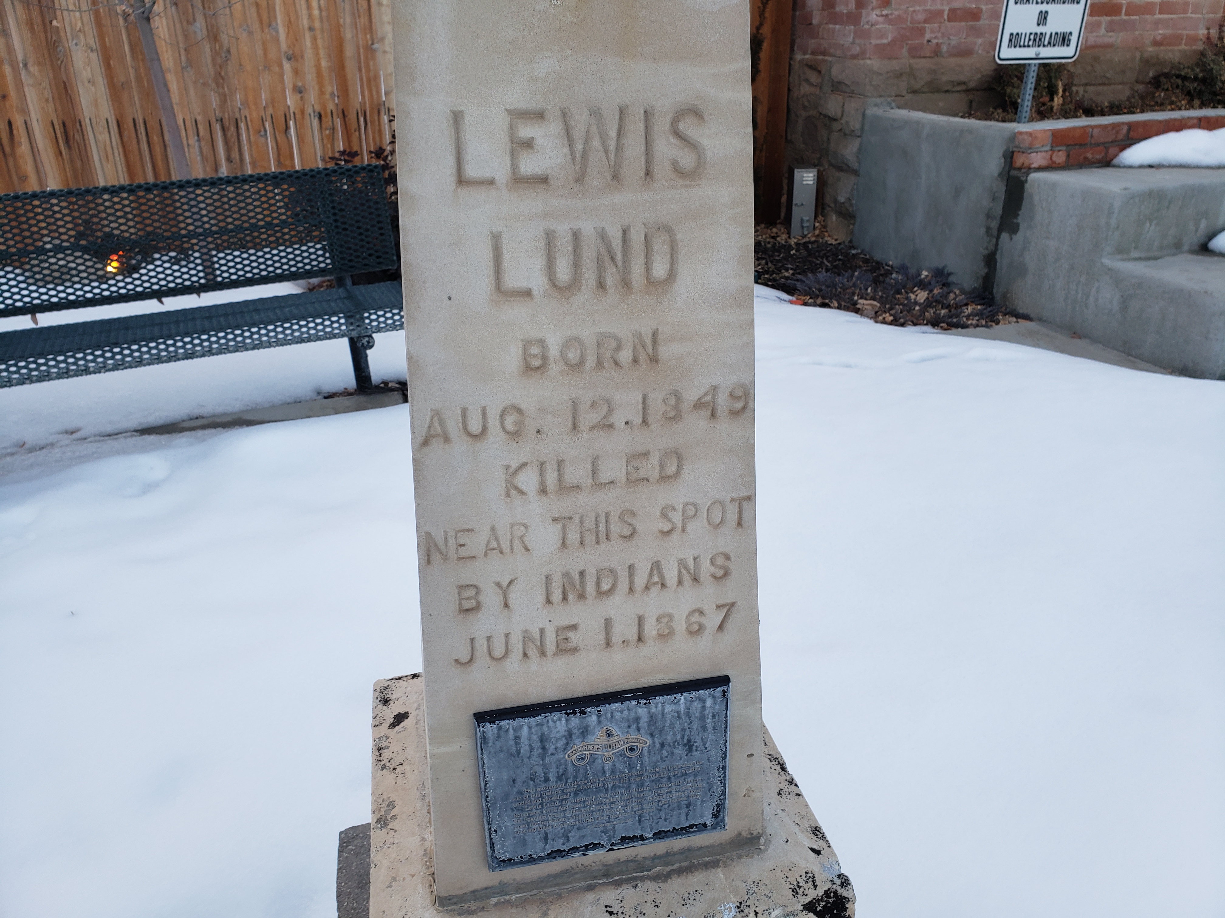
Lewis Lund
Born Aug. 12, 1849
Killed Near This Spot By Indians June 1, 1867
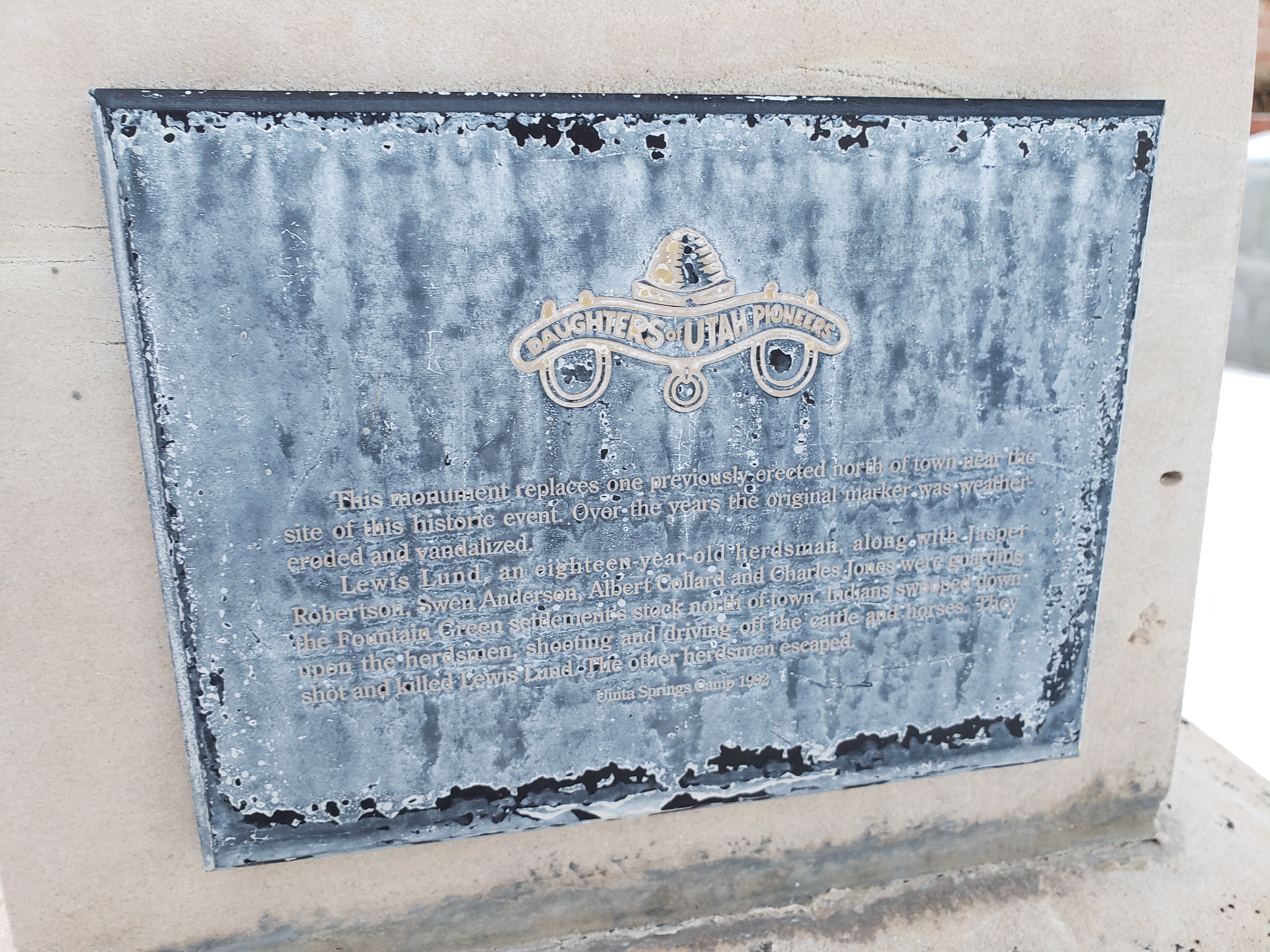
This monument replaces one previously erected north of town near the site of this historic event. Over the years the original marker was weather-eroded and vandalized.
Lewis Lund, an eighteen-year-old herdsman, along with Jasper Robertson, Swen Anderson, Albert Collard and Charles Jones were guarding the Fountain Green settlement’s stock north of town. Indians swooped down upon the herdsmen, shooting and driving off the cattle and horses. They shot and killed Lewis Lund. The other herdsmen escaped.
After Albert Petty surveyed this site in 1859, pioneers came, built homes, erected a meetinghouse of logs cut by William Gibson and Asbury Parks. In 1861, Bishop Robert L. Johnson opened first store and hotel. Polly Johnson was first Relief Society President; Catherine Oldroyd served as midwife. Bernard Snow supplied flour from his burr mill in 1867. John Green operated adobe and brickyard. Black Hawk War forced settlers to move for safety. They returned and built fort in fall of 1866. Plaque below: The bell atop this monument rang its message from the tower of the first schoolhouse, 1880. As each new schoolhouse was built, the bell was transferred; tolling time, fire and curfew for 88 years.
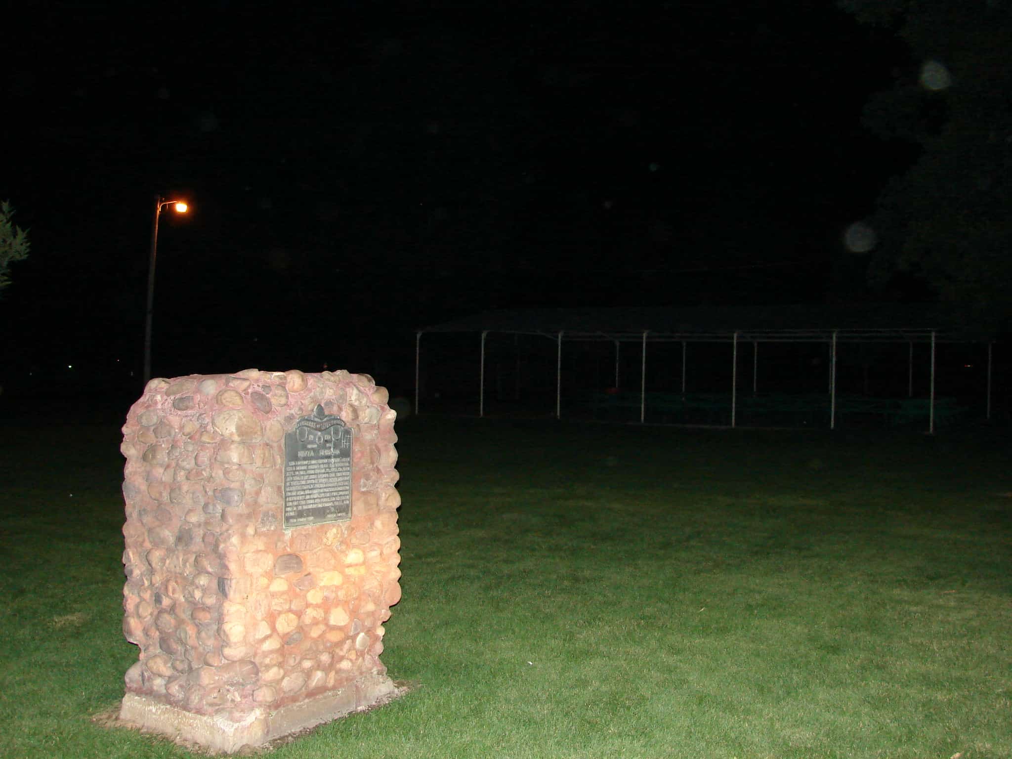
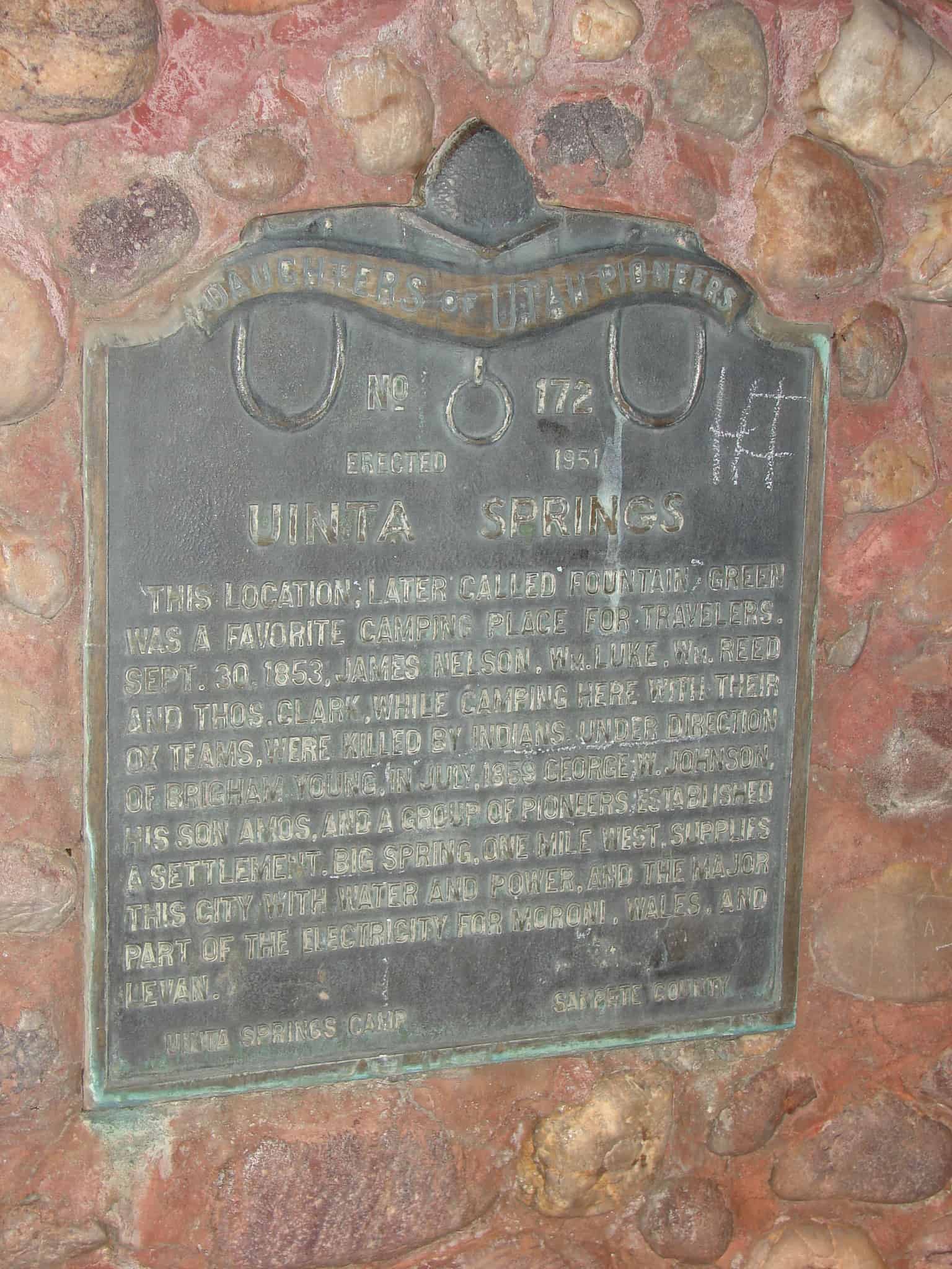
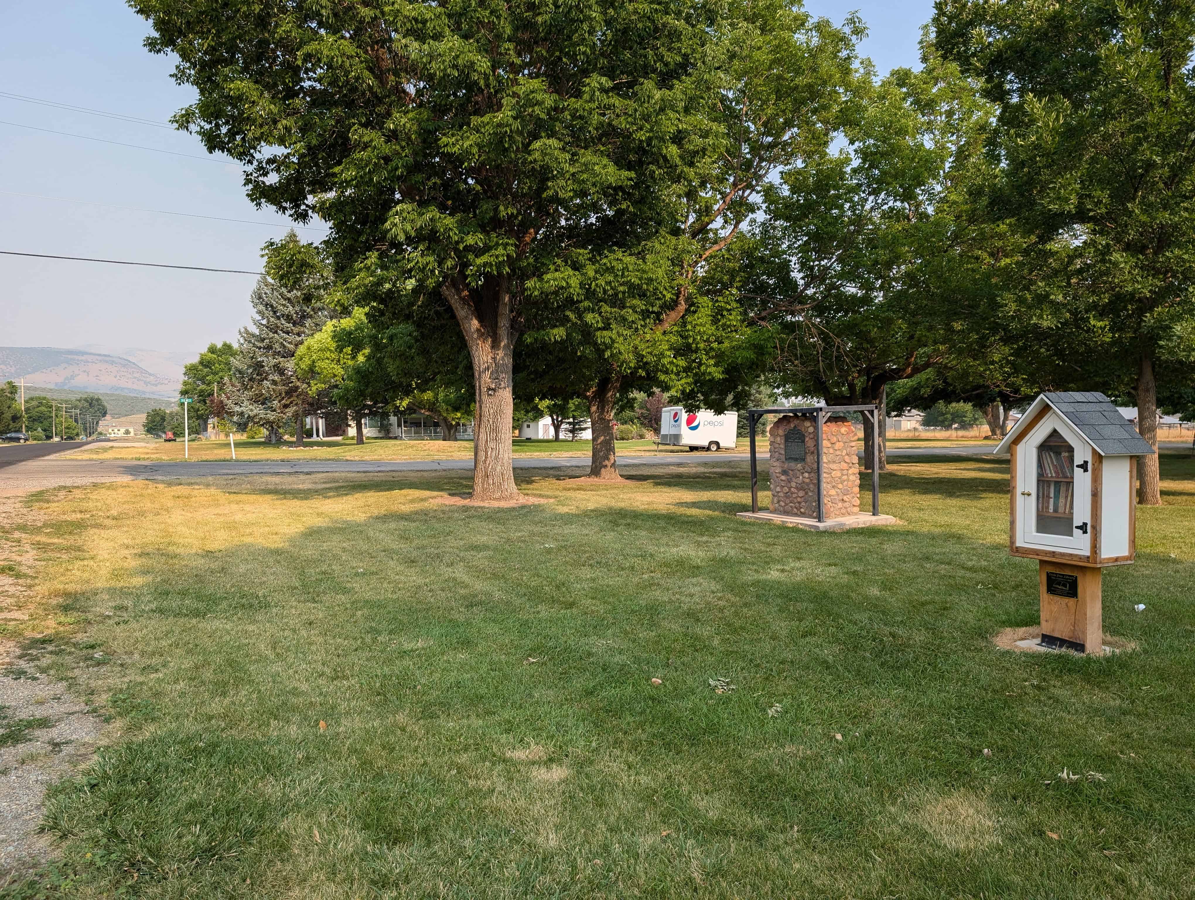
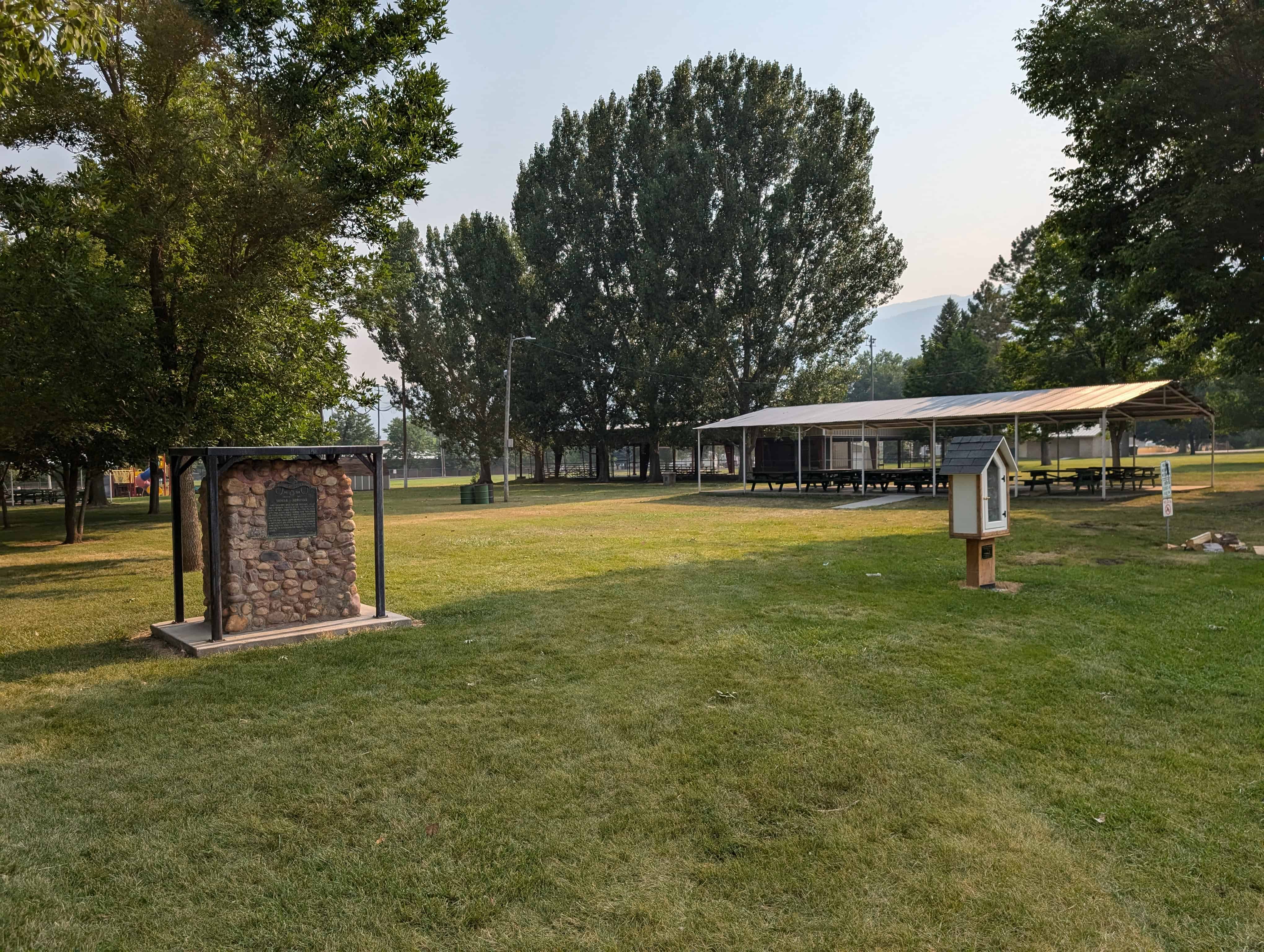
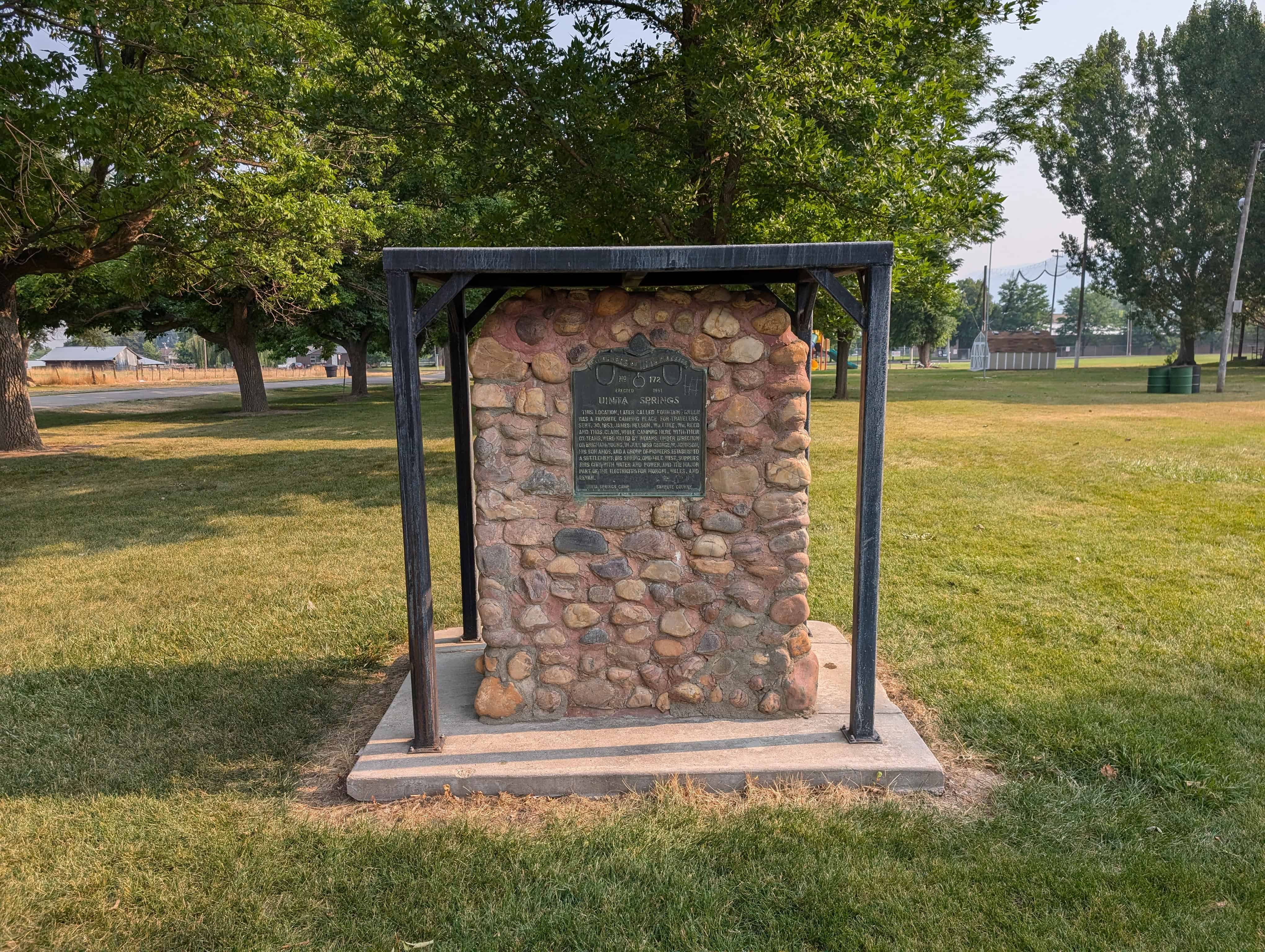
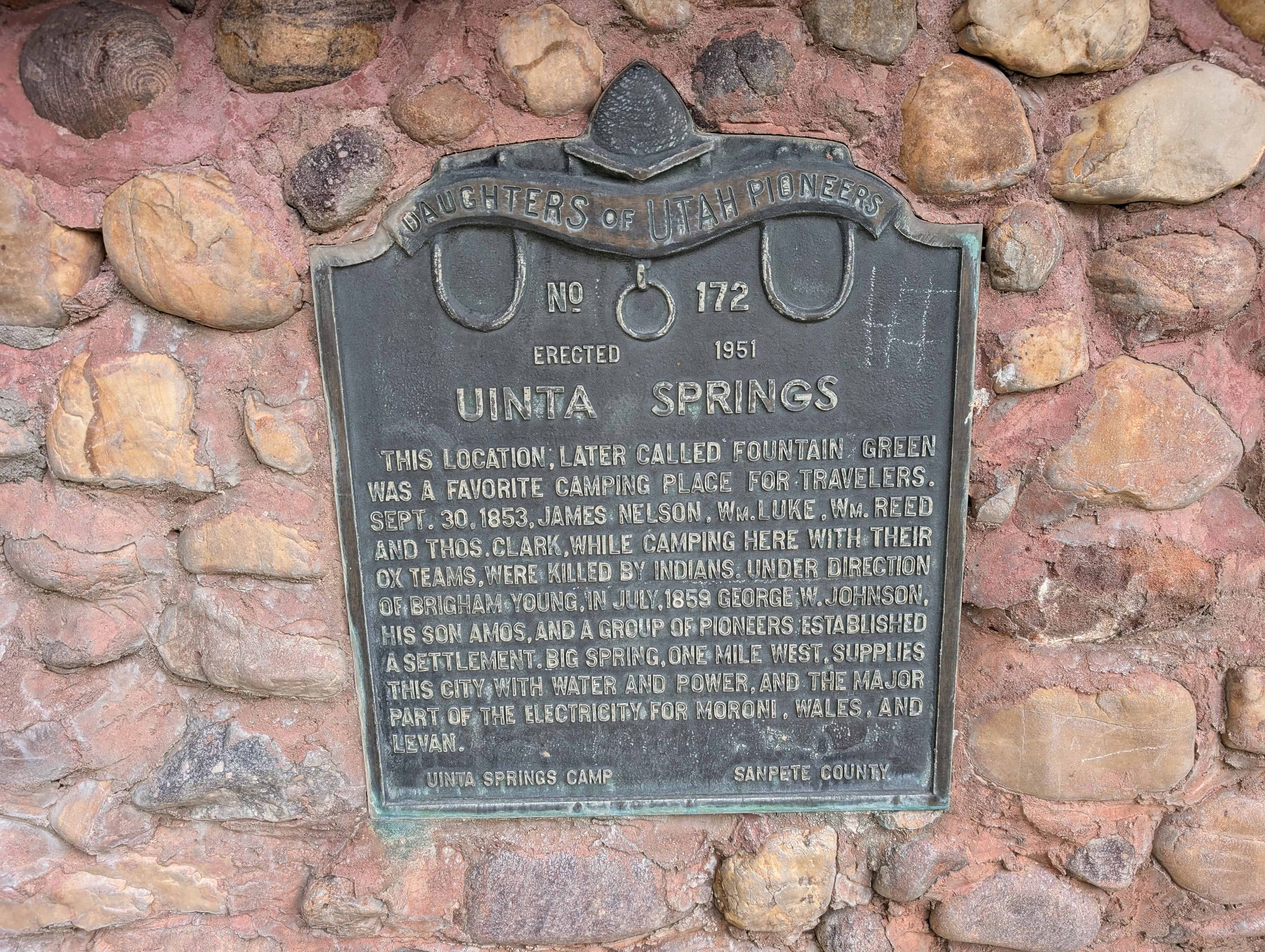
This location, later called Fountain Green, was a favorite camping place for travelers. Sept. 30, 1853, James Nielson, William Luke, William Reed and Thomas Clark, while camping here with their ox teams, were killed by Indians. Under direction of Brigham Young in July, 1859, George W. Johnson, his son, Amos, and a group of pioneers established a settlement. Big Spring, one mile west, supplies this city with water and power and the major part of the electricity for Moroni, Wales and Levan.
This is Daughters of Utah Pioneers historic marker #172 located at 305 West Center Street in Fountain Green Park.
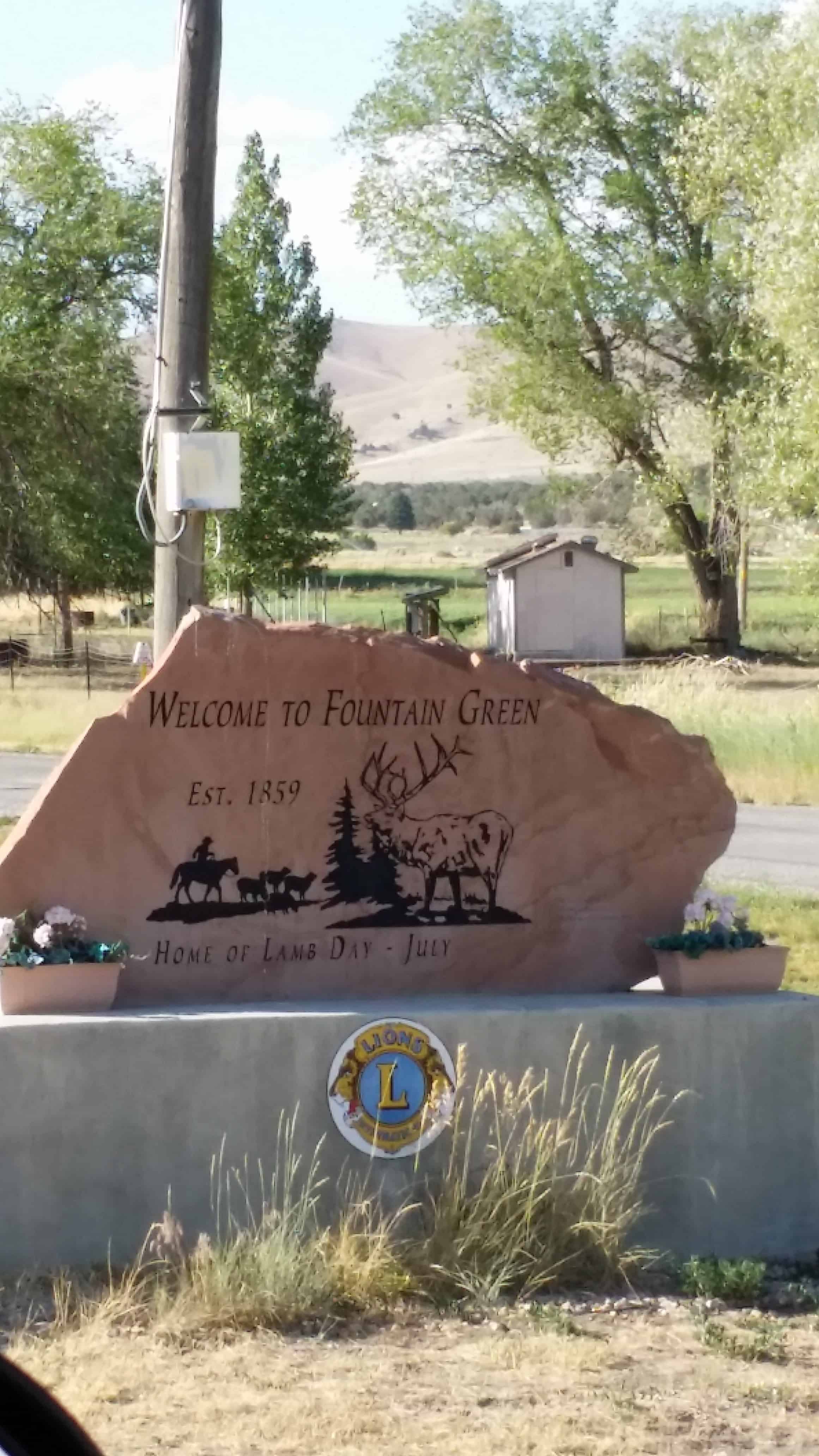
Fountain Green is a small town (about a thousand people) in Sanpete County. It is in the far North-West of Sanpete Valley and was originally called Uintah Springs.
Uintah Springs was a favorite camping place for travelers.
On Sept. 30, 1853, James Nielson, William Lake, William Reed and Thomas Clark, while camping here with their ox teams, were killed by Indians.
Under direction of Brigham Young in July, 1859, George W. Johnson, his son, Amos, and a group of pioneers established a settlement.
Big Spring (the “green fountain”), one mile west, supplies this city with water and power and the major part of the electricity for Moroni, Wales and Levan.
After Albert Petty surveyed this site in 1859 (laying out twenty blocks of about 4.5 acres each), pioneers came, built homes, erected a meetinghouse of logs cut by William Gibson and Asbury Parks. In 1861, Bishop Robert L. Johnson opened first store and hotel. Polly Johnson was first Relief Society President; Catherine Oldroyd served as midwife. Bernard Snow supplied flour from his burr mill in 1867. John Green operated adobe and brickyard. The Black Hawk War forced settlers to move for safety. They returned and built the fort in fall of 1866.
There are several historic markers around town telling of the history, including:
– and the bell atop this monument (pictured below) rang its message from the tower of the first schoolhouse, 1880. As each new schoolhouse was built, the bell was transferred; tolling time, fire and curfew for 88 years.
Fountain Green
Another historic marker tells of Lewis Lund, and eighteen-year-old herdsman, along with Jasper Robertson, Swen Anderson, Albert Collard and Charles Jones were guarding the Fountain Green settlement’s stock north of town. Indians swooped down upon the herdsmen, shooting and driving off the cattle and horses. They shot and killed Lewis Lund. The other herdsmen escaped.
In 1849, as groups of Mormon colonists began to immigrate to the fertile Sanpete Valley, many of them camped at a verdant location in the northwestern end of the valley known as Uintah Springs. A decade later, George W. Johnson of Santaquin was granted permission to establish a permanent settlement on the popular campgrounds. In July 1859 Albert Petty surveyed a townsite,. Other pioneers soon joined the Johnson family, building log homes and, in 1860, a multipurpose log meetinghouse. In the same year, an irrigation channel was plowed to a canyon in the San Pitch Mountains just west of town, and the growth of Fountain Green was well under way.
Fountain Green’s name is still a fitting description of the lush, green hillside village abundantly watered by what is now called Big Springs and Silver Creek which it forms. Artesian wells and later pumped water provided an ample water supply, allowing the development of agriculture and stock raising, the staple industries of the town from 1860 to the present. In 1865 a sawmill was constructed, followed in 1866 by an adobe meetinghouse and in 1867 by a flour mill. Due to hostilities and one death during the Black Hawk War of 1865-67, a rock fort was erected in 1866. After peace was made with the San Pitch Indians, growth and progress continued unhindered and major crops of wheat, oats, and potatoes were harvested.
Although Fountain Green was the first Sanpete community to receive the railroad in the 1880s, it did not take full advantage of this opportunity, being the only major town in the region to drop in population between 1880 and 1890. Experiencing less fluctuation in size than most other Sanpete villages, Fountain Green reached its zenith of about 1,150 people in 1920, about twice its size of 578 in 1980. It had a population of 602 according to the 1990 census.
Fountain Green’s flourishing in the early twentieth century, during which time it was considered the “richest town” in the county, was due mostly to its successful wool growing industry. Expanding from a cooperatively owned herd of Spanish Merino sheep in the 1880s, sheep growers greatly enhanced their profits after upgrading their herds with high wool producing Rambouillet stock.
In 1902, 40,850 sheep were owned by twenty-six growers, for an average of 1,571 head of sheep each, although some owned far more than others. The Fountain Green Woolgrowers Association was founded in 1908 and became the dominant group in town, with the possible exception of the LDS Church, whose members they shared in common. The association created the nationally famous Jericho Pool of 100,000 sheep, giving Fountain Green its nickname, “Wool City.” A celebration known as the “City of Lambs Days,” is still held annually, although the sheep industry has diminished in importance over the years. In 1987, 47 percent of the farms in northwest Sanpete County raised turkeys, while only 26 percent produced sheep, revealing the economic shift from Fountain Green to Moroni, the center of the county’s turkey industry.
From 1869 when a Zion’s Cooperative Mercantile Institution store was established along the main highway, a small string of general stores, shops, and public and religious buildings has gradually filled in the modest business district. The ZCMI was initially a profitable venture, delivering a 68 percent dividend in 1870, its first full year of operation. In time, other private co-ops and general mercantiles were founded to offer ZCMI some competition. A general store built of rock in 1880 with an 1884 dance hall and theater addition was the most imposing of the private commercial structures in the early days. By 1885, Fountain Green formally organized its city government, electing Reese R. Llewellyn as the first town president.
A substantial Mormon meetinghouse, built over a thirty-year period beginning in 1880, was the most prominent religious structure in nineteenth-century Fountain Green. A tithing office built in 1906 and a church-built theater and dance hall erected in 1917 allowed for expanded economic and social activity. The influence of the Mormon Church was pervasive, as it remains today, with its Sunday School, Relief Society, choir, children’s organizations, and overall concern for the community’s welfare and progress. Members of other religious faiths have lived in Fountain Green during much of its history, although no group has managed to establish a permanent foothold. A varied ethnic makeup also helped to shape the town’s early nature, with 65.3 percent of its adult married population being foreign-born in 1880.
The twentieth century brought incorporation as a city in 1910, plus several new improvements for Fountain Green, including a large elementary school in 1907, an improved water system in 1913 (updated in 1935), a high school in 1920, a city park in 1935, and a state fish hatchery in 1939-40. In recent decades, new religious, educational, and business facilities, together with the restoration and new construction of residences, mark Fountain Green’s continued vitality.
A drive down Fountain Green’s Main Street and up the hilly lanes of the square blocks to the west helps one understand the community’s story. An outstanding collection of red brick homes stands witness to the town’s once-thriving brick industry. The two-story elementary school and the fine brick tithing office on Main Street also remain along with impressive residences such as the Hans Peter Olsen home (on the National Register). Many of the log, adobe, and brick houses are vacant now, but their varied architecture testifies to the ingenuity and talent of their builders. Although there may be more buildings than people in Fountain Green–evidence of years of gradual out-migration, a trend that seems to have stabilized in the last decade–the town remains a vital part of Sanpete County.
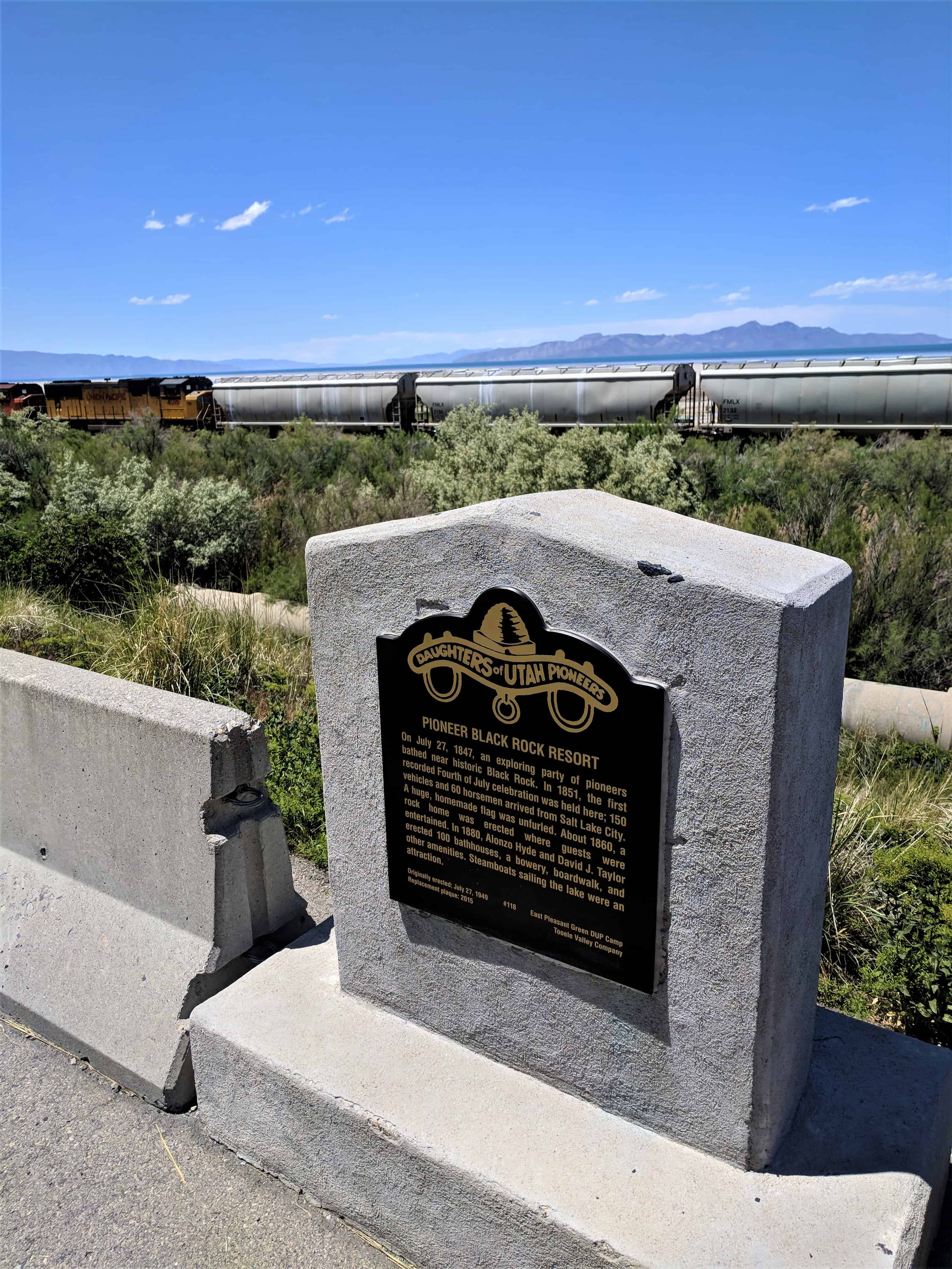
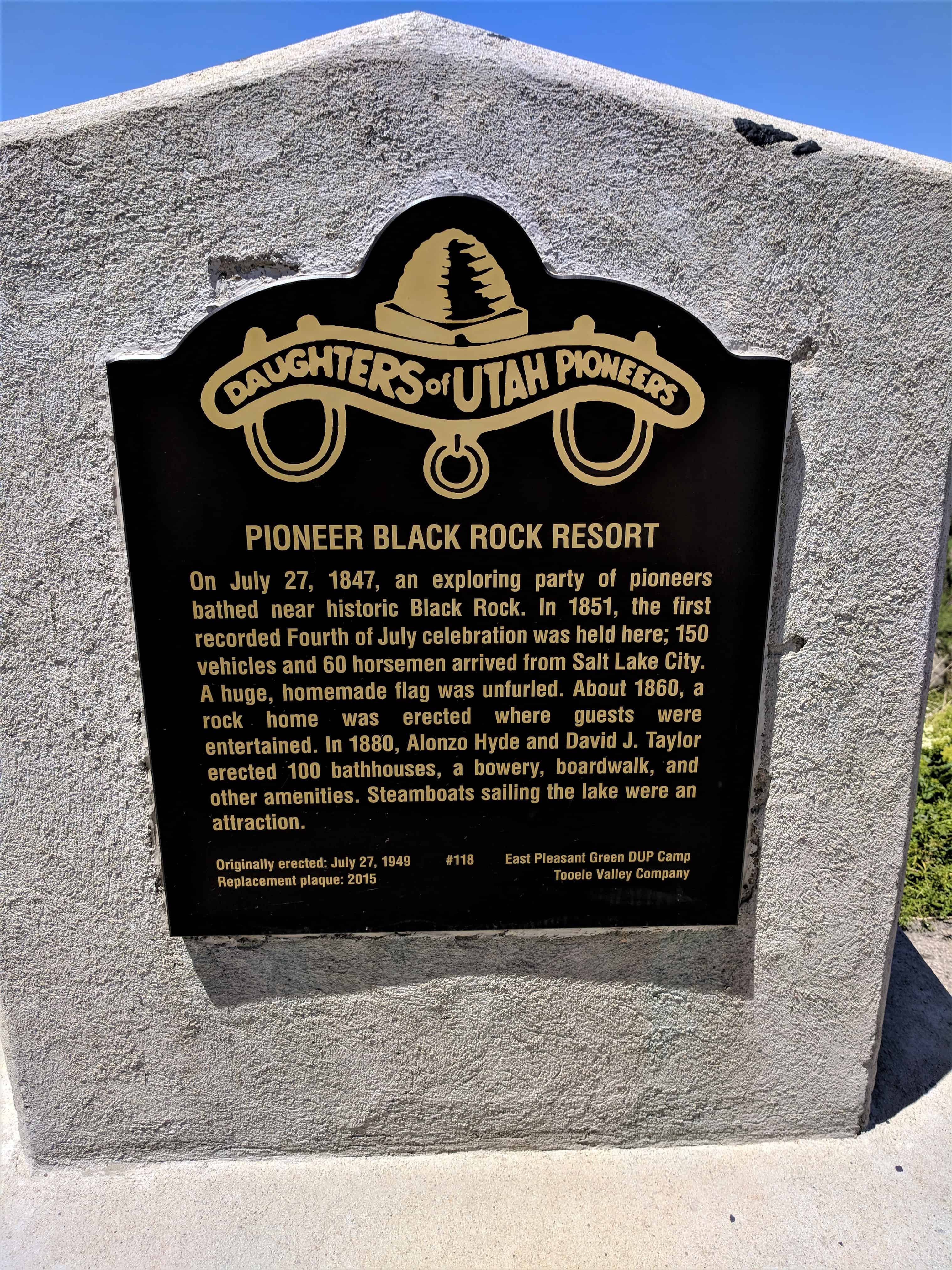
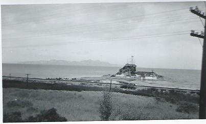
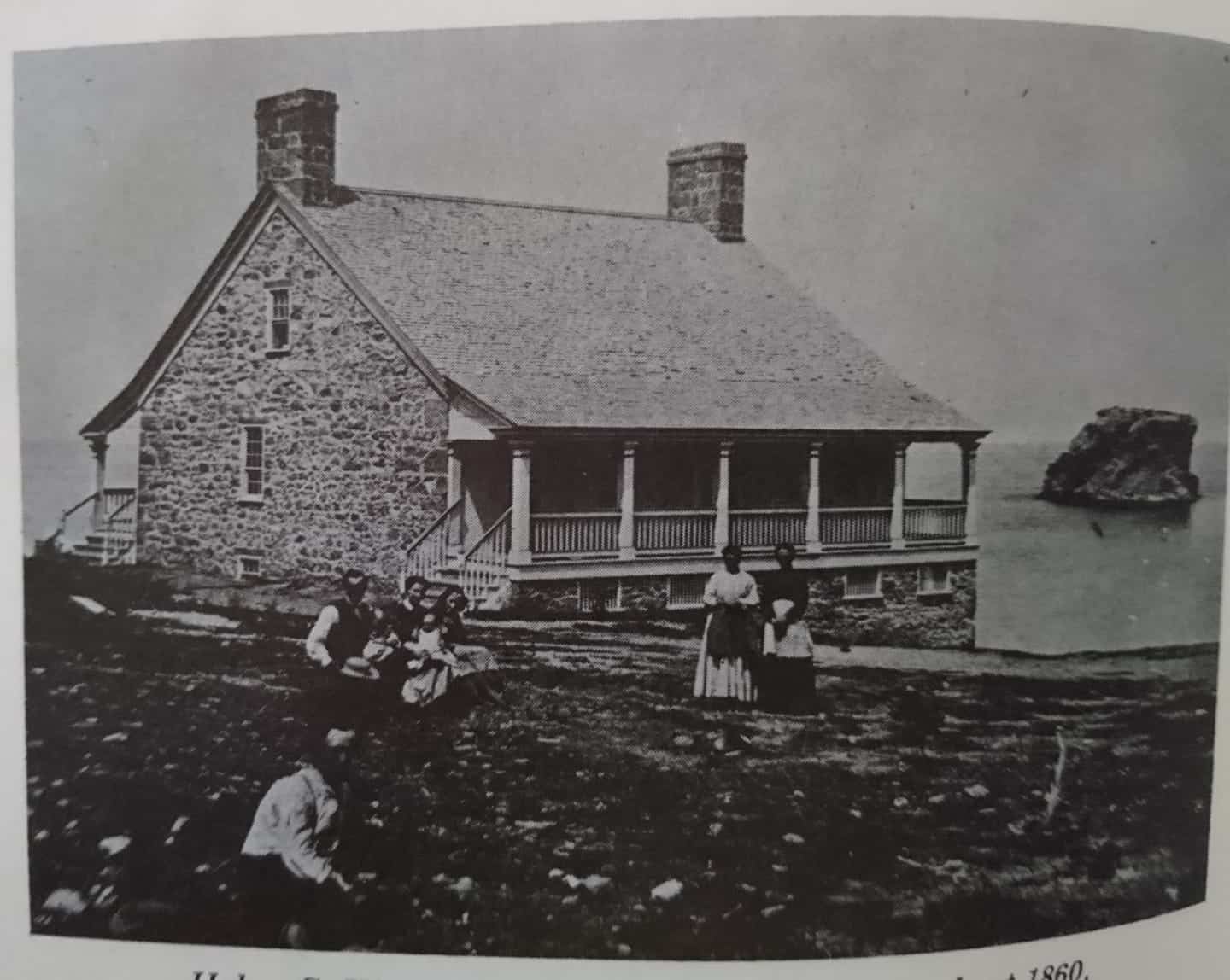
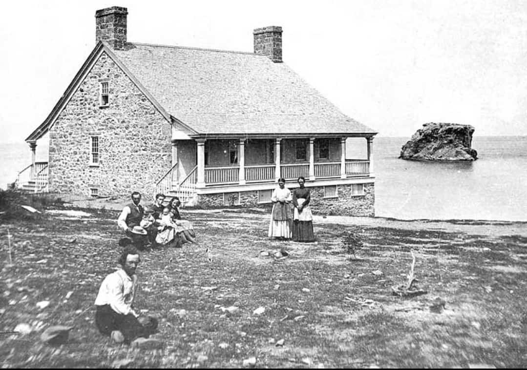
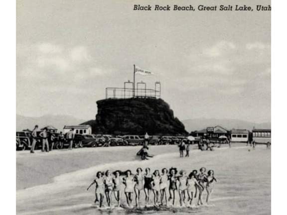
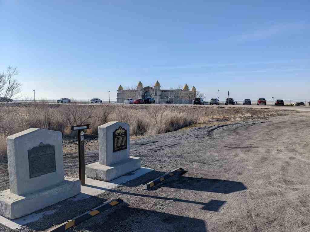
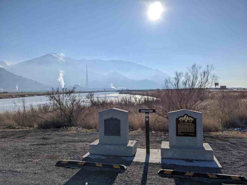
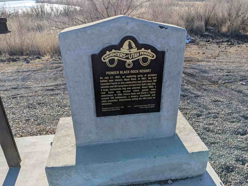
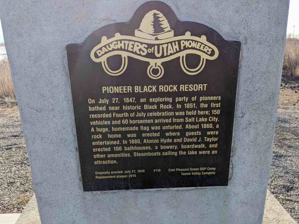
On July 27, 1847 an exploring party of pioneers bathed near historic Black Rock. In 1851, the first recorded fourth of July celebration was held here when about 150 vehicles and sixty horsemen arrived from Salt Lake City. A huge homemade flag was unfurled. About 1860, a rock house was erected where guests were entertained. In 1880, Alonzo Hyde and David J. Taylor erected one hundred bath houses, bowery, boardwalk and other equipment. Steamboats sailing the Lake were an attraction.
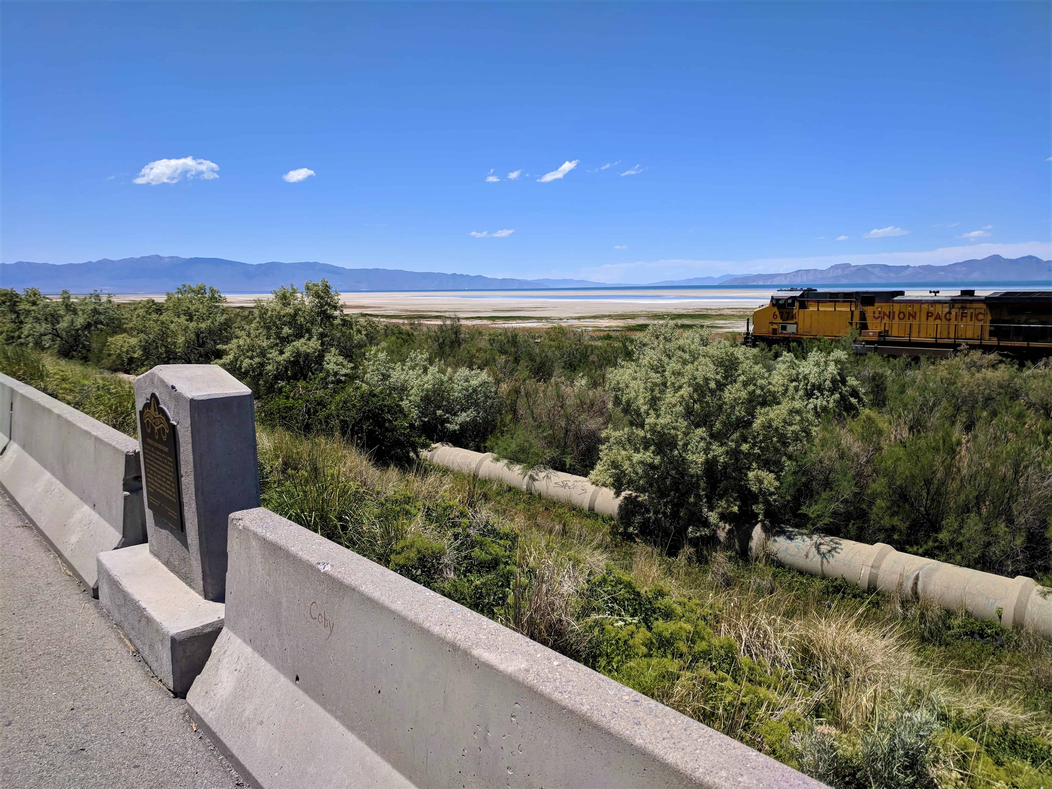
The freeway pullout this was located at (N 40.71546 W 112.24008) was closed and this historic marker along with the other two also located there were moved to a new located just outside the Saltair, (N 40.74664 W 112.18543).