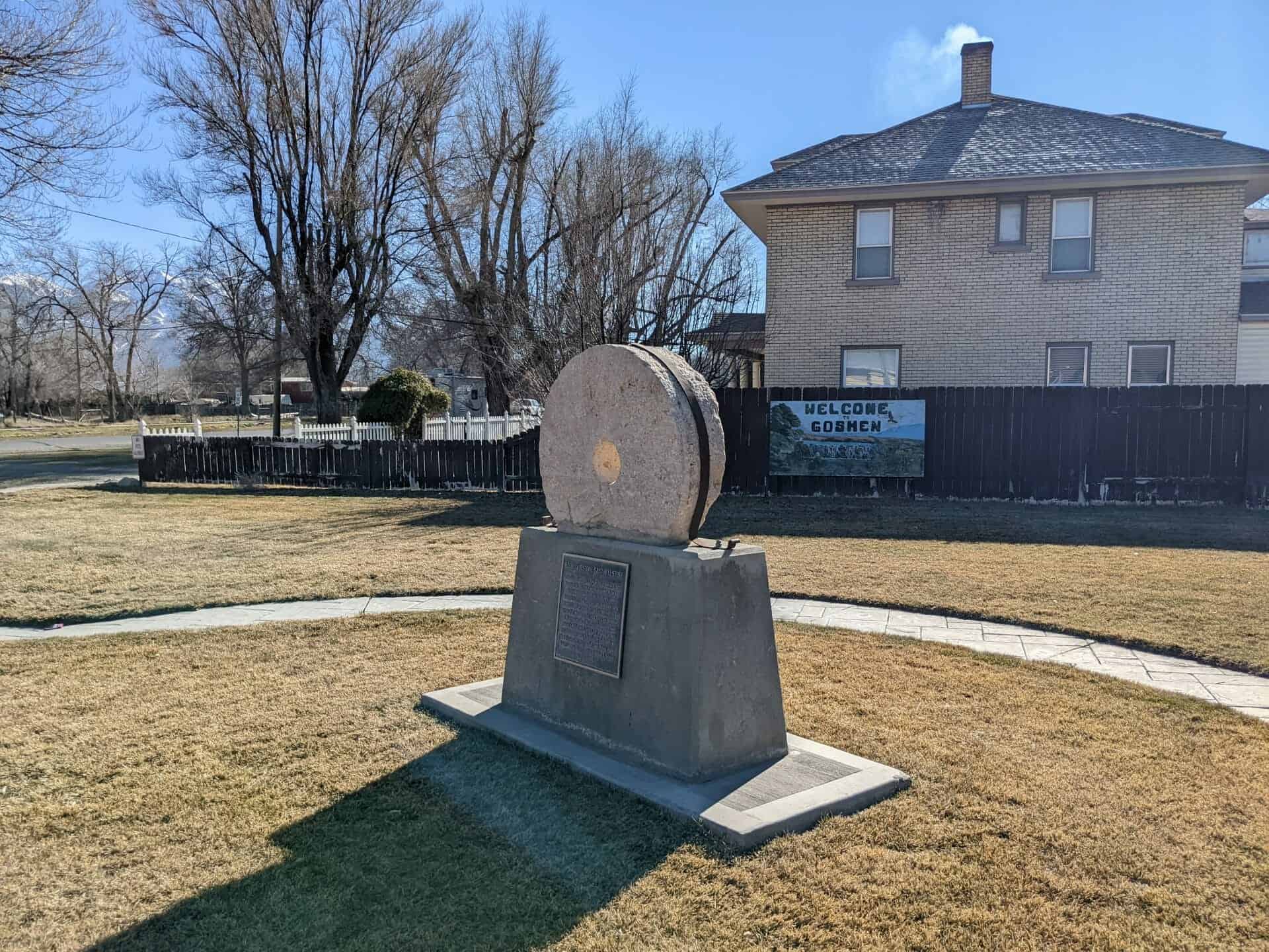
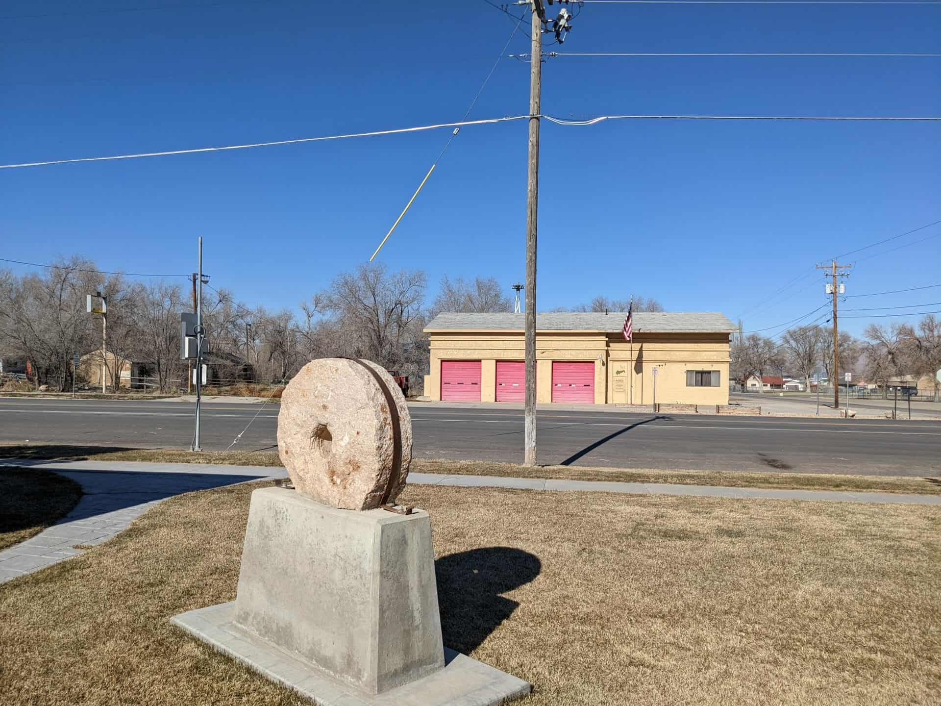
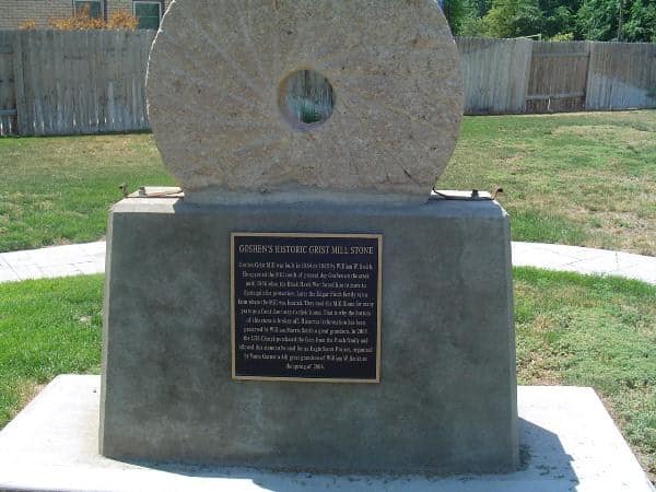
Goshen Grist Mill was built in 1864 or 1865 by William W. Smith. He operated the Mill south of present day Goshen on the creek until 1866 when the Black Hawk War forced him to move to Santaquin for protection. Later the Edgar Finch family ran a farm where the mill was located. They used the Mill Stone for many years as a front door step to their house. That is why the bottom of the stone is broken off. Historical information has been preserved by William Morris Smith a great grandson. In 2003 the LDS Church purchased the farm from the Finch family and allowed this stone to be used for an Eagle Scout Project, organized by Vance Garner a 4th great grandson of William W. Smith in the spring of 2004.
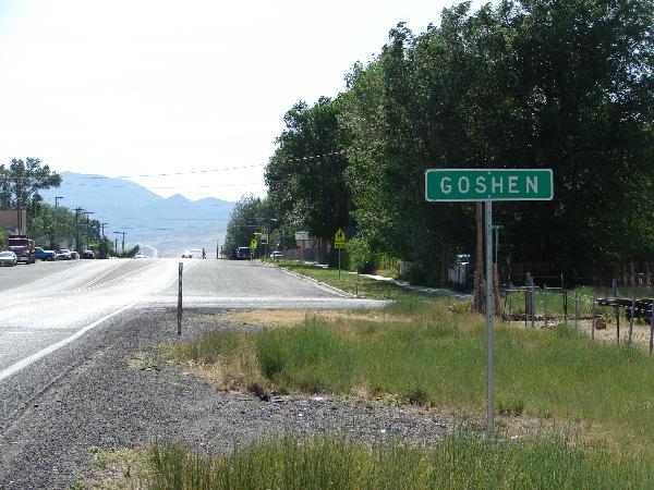
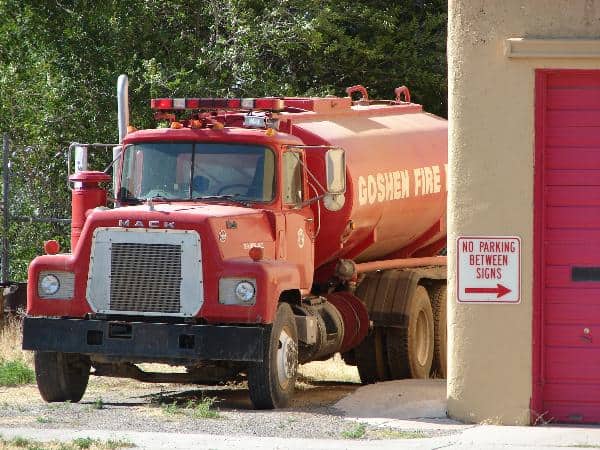
Goshen is the slowest growing city or town in Utah County and is the smallest city or town in the County by land size and has 952 residents. It was incorporated in 1910. It was previously known as Sodom, Mechanicsville, Lower Goshen and also Sandtown before being named after Goshen, Connecticut by Phineas Cook.
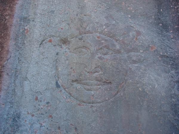
Up Diamond Fork Canyon there is a place to stop called Red Ledges, there are picnic tables, a restroom, an arch, a cool sun and moon carving in the cliff and a lot of fun hiking on red rock.
It’s fun to have a red rock playground like St George or Moab but so close to Utah Valley, we take the kids there and play.
There are often people rappelling down the cliffs too.
Up Diamond Fork Canyon (Off of Spanish Fork Canyon) you can go to Red Ledges and hike up into the red rock and see a sun and moon carved in the cliff. I’ve read books that claim the sun carving is a clue from the Spaniards to their old gold mines, I have heard that the moon appears to be more recent and not authentic.
My friend Russ Eager told me that he’s seen a sun carving across the canyon from this one, I’d love to go see it.
Either way it’s a pretty cool thing to see and red ledges is a fun place to play.
I spent a lot of my childhood hiking to Rattlesnake Point above Mapleton, it’s private property but I knew the owner and would spend a lot of time up there. I camped and explored more times than I could could up there and on the very flat bench just below it.
Rattlesnake from the West.Looking west from up top.DeerOn top.The ridge, Rattlesnake on the right, from Hobble Creek reservoir.Looking down at the flat.Looking down at Quiet Meadow Lane.Looking down at the Reservoir.
In the mid-1970s Centerville adopted the slogan “Friendly City Beside the Great Salt Lake.” Situated some twelve miles north of Salt Lake City, Centerville encompasses the area from Lund Lane on the north to Pages Lane on the south, a distance of 3.3 miles, and extends, with some minor deviations, from the mountains on the east to the shores of the lake. Population as of the 1990 census was 11,500.
Thomas Grover, and the Deuel brothers, Osmyn and William, were the first settlers, arriving in early 1848. They were soon followed by other families, and a little settlement was born. They dragged logs to build homes down the steep mountains. They lacked nails, so many of the homes were held together by wooden pegs or rawhide thongs. Later, some built their houses of adobe, made of clay and straw dried in the sun. More substantial homes were constructed from rocks washed down from the hills or found in the beds of streams.
A fort wall was commenced in 1853 to protect against Indian attack, but the project was soon abandoned. A new wall was started in 1854, made of rocks and dirt. It was six feet wide at the base, and about eight feet high. As the expected Indian attacks never materialized, this second wall also never was completed. Centerville was variously known in the early days as Deuel Creek Settlement, then as Cherry Settlement, and finally as Centerville.
The early small settlements of Utah were characterized by the unplanned mix of men and women from widely scattered places and vastly different cultures who came together for a common cause, and who generally discovered that the talents, skills, and determination that a struggling group of people needed for their survival were to be found among them.
Some had proficiency as carpenters and builders. Some were competent farmers or livestock raisers. Others were or learned to become weavers, blacksmiths, coopers, shoemakers, millers, wheelwrights, seamstresses, teachers, midwives, dentists, merchants, masons, musicians. Many were self-trained and self-taught. Others had served apprenticeships in their homeland. Some of their skills were vital to the actual physical survival of the communities. Others were valuable as respite from their difficult yet often humdrum existence.
Many housewives carded wool and spun the yarn on spinning wheels; others had looms for weaving cloth from which they fashioned clothing, bedding, tablecloths, and rag carpets. They made dyes of different colors from various plants in their yards and gardens; they made soap, using their own homemade lye; they made candles. Starch was made from potatoes. They knitted socks, stockings, mittens, gloves, and shawls.
While the women were thus busily engaged, the men made furniture and wooden cooking utensils such as butter bowls, trays, chopping bowls, ladles and spoons, potato mashers, and rolling pins. These items supplemented the few items of china, crockery, iron kettles, skillets, and dutch ovens that some had brought across the plains with them. Families lived mainly by their own production, and exchanged products with their neighbors. Every home and farm was a little kingdom to itself.
Numerous small enterprises sprang up in Centerville, such as grocery stores, a molasses mill, flour mill, sawmill, blacksmith shops, and a cooperage. There were also shoemakers, tailors, carpenters and cabinetmakers, wheelwright, rock masons, nurseries, a meat market, and even a small silkworm operation. Probably the most important business was the old Centerville Co-op, built at Main and Center in 1869. When money was scarce, housewives traded eggs, butter, and other items for store merchandise. In business for many years, the Co-op finally closed in 1940, and the building has since been used as a lumberyard, restaurant, and law offices.
The first schoolhouse was built of logs in 1851. As the community grew, more and finer schools were built, the older buildings being abandoned, torn down, or converted to different uses. Today Centerville boasts a large junior high school and four modern elementary schools.
Still standing and in use as a residence today is one of Centerville’s oldest and most historic buildings, originally a stage coach station built in 1866 by William Reeves for the Wells Fargo Company. After the Utah Central Rail Road was completed in 1870, Mr. Reeves converted the building into an amusement hall where dances and local dramatic performances were given. It was known as Elkhorn Hall. Religious meetings also were held there during construction of the Centerville Ward chapel in 1879-80.
In 1894 the Bamberger Rail Road line reached Centerville on its way from Salt Lake City to Ogden. This line served Davis County with passenger and freight transportation, first by steam power, then by electric power, and finally by diesel. It discontinued operation in 1952. The Utah Light and Traction Company extended its trolley line to Centerville in 1913, with its terminus at Chase Lane. The line was abandoned the line in 1926. Centerville is now served by buses of the Utah Transit Authority.
Centerville became active in scouting in 1912, two years after the Boy Scouts of America (BSA) was founded. In the 1930s a sea scout troop was organized, and two boats were obtained from the U.S. Navy. Now, each of the local LDS wards has a Boy Scout troop, and many boys have achieved the rank of Eagle, while other local citizens have been honored with the Silver Beaver award.
In 1915 a few local men petitioned the county to incorporate the settlement into a town in order that a culinary water system could be developed. This first system was constructed of wire-wrapped, wood-stave pipes. It was replaced by one of metal pipes in 1936.
The streets of Centerville were dark at night until the very early 1920s when a few enterprising citizens took matters into their own hands and installed lights at two street corners. These were crude contraptions consisting of a time-clock in a wooden box mounted on a pole, with a long string attached to the alarm, and then running up the pole to a light switch. The nearest homeowner had the assignment of winding the alarm clock in order that the streetlight would be turned on at dusk each evening and off again in the morning. From this first effort a modern street lighting system has evolved.
Centerville is part of the South Davis Fire District, and has a modern fire station, which stands on the same spot but is a far cry from the old hand-pulled, two-wheel hose cart housed at the old Art Pettit garage with a fire bell mounted on the roof. The new station was built in 1988.
Centerville became a third-class city in 1956. A great boon to Centerville was the coming of the Weber Basin water in 1957, and installation of the sewer system in 1959. Centerville survived two devastating floods–in 1923 and in 1930–which brought mud, rocks, and debris down the steep canyons, washing away homes and roads, and inundating much valuable farmland.
Two shopping centers currently provide local residents with a variety of stores and shops, and there are numerous fast-food outlets, as well as four service stations with convenience stores. Two steel fabricators are located in Centerville. There are a few other businesses, but Centerville is still largely a “bedroom community,” with most residents commuting to work places elsewhere. Two of Centerville’s largest businesses of the past, Porter-Walton Company and Smoot Dairy, are no longer in existence.
For twenty-nine months during World War II, some 110 Centerville men and women serving in the armed forces received news of the city, activities of fellow townsfolk in the military, pictures of their young children, and cartoons, thanks to the “Centerville Newsette,” a free newspaper produced by a volunteer staff, and financed by contributions from the people of the city.
The religious makeup of Centerville is predominantly LDS. In the spring of 1852 a ward was organized with Sanford Porter as Bishop. The town was divided into two wards in 1917. This arrangement continued until 1953, when a third ward was created. Since that time there has been rapid growth; at the present time there are four LDS stakes and twenty-six wards in Centerville.
There is also Grace Lutheran congregation in Centerville, led by the Reverend Peter C. Hovland. Centerville citizens of other faiths affiliate with congregations in Bountiful or Salt Lake City.
Many Centerville citizens have distinguished themselves and brought honor to their hometown. William H. Streeper was one of the last of the Pony Express riders. Brigham H. Roberts became a general authority of the LDS Church and was a noted writer and speaker. Arthur V. Watkins was a United States Senator. Hugh Cannon set a world’s record in the discus throw. Cecelia Harrison won the title of “1962 National College Queen.” She is now Commissioner of Higher Education for Utah. David F. Smith served as Commissioner of Agriculture for Utah. Not a native, but now residing in Centerville, is Kelly Downs, who is an outstanding major league baseball pitcher. Robert Arbuckle served in the Utah State Legislature. Golden L. Allen was state treasurer. Many of Centerville’s early residents held important offices in the county and state, and a number of local citizens were called to establish settlements in other states, including Idaho, Arizona, and California.
In January 1849, Oliver B. Huntington, Barney Ward and Joseph Matthews entered Utah Valley on an Indian trading expedition. They camped on the banks of a stream near the present site of Springville. That night, the bell-horse slipped her hobbles and led the traders horse band to the mouth of Maple Canyon where Huntington tracked them down, recovered them, and took the horses back to their campsite. The traders named the stream Hobble Creek.
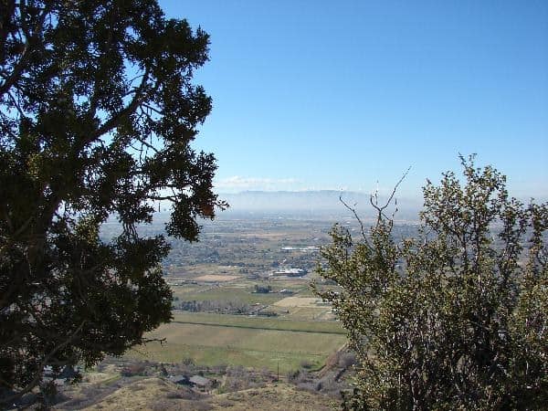
Hobble Creek Canyon is a place I spent a lot of my time growing up, the mouth of the canyon is in Springville/Mapleton and it goes up past the Reservoir, Golf Course and parks. The canyon splits and right fork goes up and over the mountain down into Diamond Fork Canyon, it’s a nice road Left fork goes to many cabins and eventually to Wallsburg but it’s a really rough road.
In February 1997, the Hobble Creek Parkway Committee submitted the trail proposal. In January of 1998 they received the grant confirmation for $55,000. With help from the Forest Service, Utah Division of Wildlife Resources, Utah County, and Springville City, construction began in August 2001, and was completed in November of the same year. Asphalt was laid in the Spring of 2002.
Fish in Hobble Creek
Fish that can be found in Hobble Creek are cutthroat trout, brown trout, and a few rainbow trout. Cutthroats are the only native species. Stocking of rainbows, and all other fish in Hobble Creek has been discontinued because they are now self-sustaining and are reproducing naturally.
Wildlife in Hobble Creek Canyon
As you stand here and take in the beauty of this place, the first thing you might notice is the sound of water running over the rocks in Hobble Creek, or maybe a breeze or wind in the trees. If you look and listen, depending on the time of year, you could hear the song of a robin, junco, meadowlark, or gold finch. The calls of kingfishers and chuckers are heard high on the mountainsides. The sharp bark of a squirrel echoes down the canyon. Although you might not see these animals, they are here along with a host of others, including: humming birds, magpies, quail, mule deer, elk, coyotes, black bears, red fox, beavers, flying squirrels, cougars, lizards, water snakes, rattlesnakes, garter snakes, deer mice, voles, skunks, raccoons, muskrats, and weasels.
St. George is the seventh-largest city in Utah, and the most populous city in the state outside of the Wasatch Front. St. George is the commercial hub of southern Utah and Utah’s Dixie, a nickname given to the area when Mormon pioneers grew cotton in the warm climate.(*)
St. George was founded as a cotton mission in 1861 under the direction of Brigham Young, there is a lot of Pioneer history in the area and also a lot of pre-historic/dinosaur diggings and findings.