When I moved to Genola back in 2006 I started exploring a little and came across this really cool mine/cave. I learned that it was called “Grandpa’s Cave.” I just love finding stuff like this. It has a hole in the top like a small “skylight” and a huge entrance I could have driven into. One big room and it looked like people enjoyed having campfires in there.
One day in church back in 2006 when I lived in Genola it was announced that the mountain was on fire, we all went out and fought it, I got some cool pictures and I went up and explored a little when it was done. Here’s the photos.
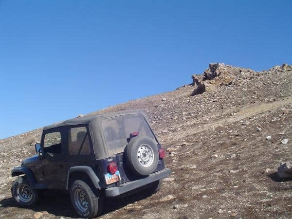
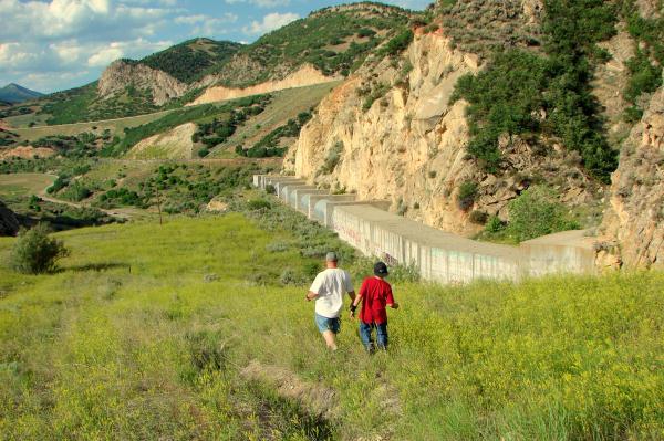
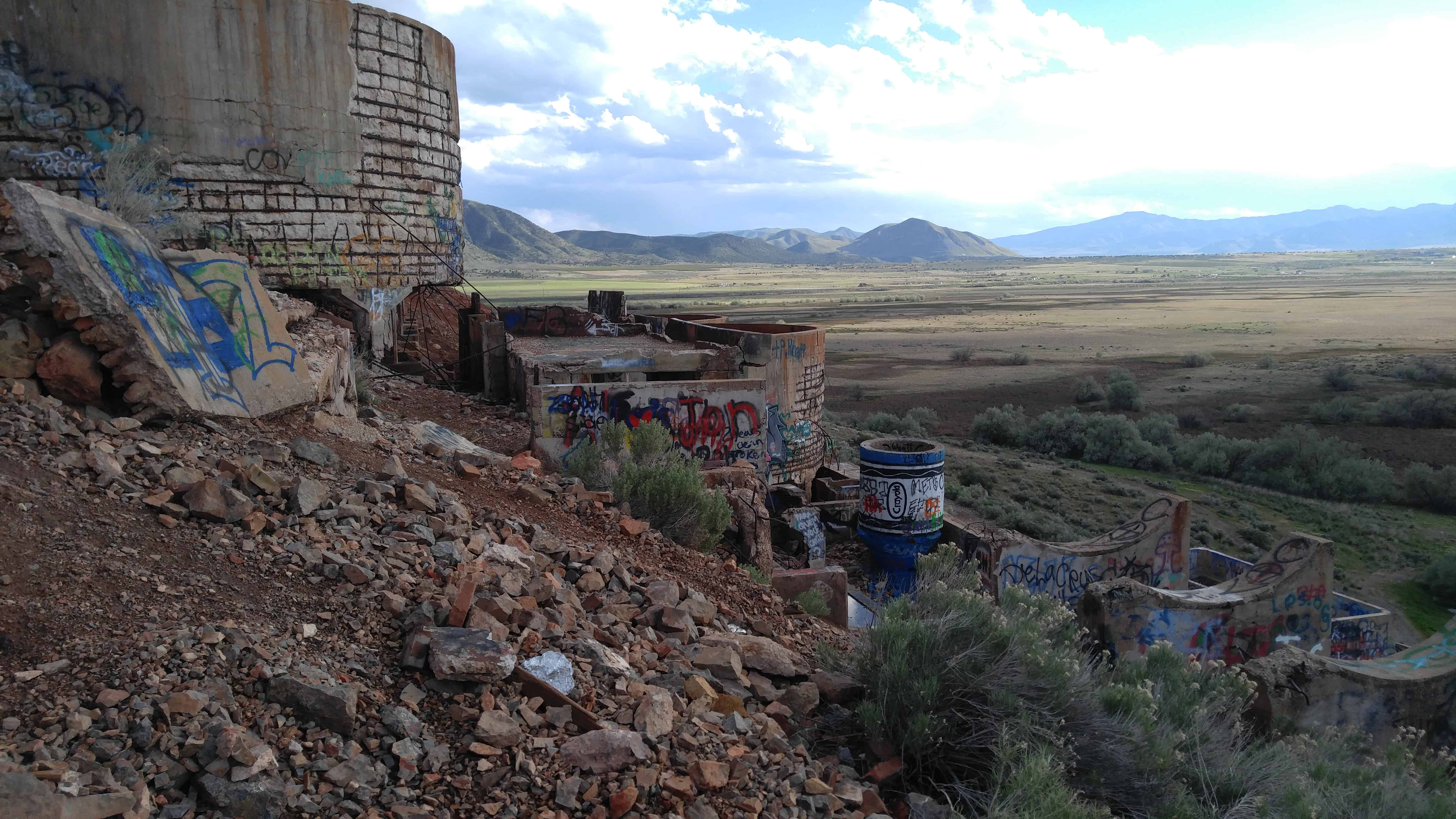
Up above Thistle there’s a cool spot where I hiked up years ago and climbed over a huge drain pipe and down the other side and hid a cache there.
The drain tunnel was created to drain the lake that was created in 1983 by the landslide, the lake that quickly rose and flooded out the town of Thistle.
Later on I took friends back to help them find the way to finding my geocache.
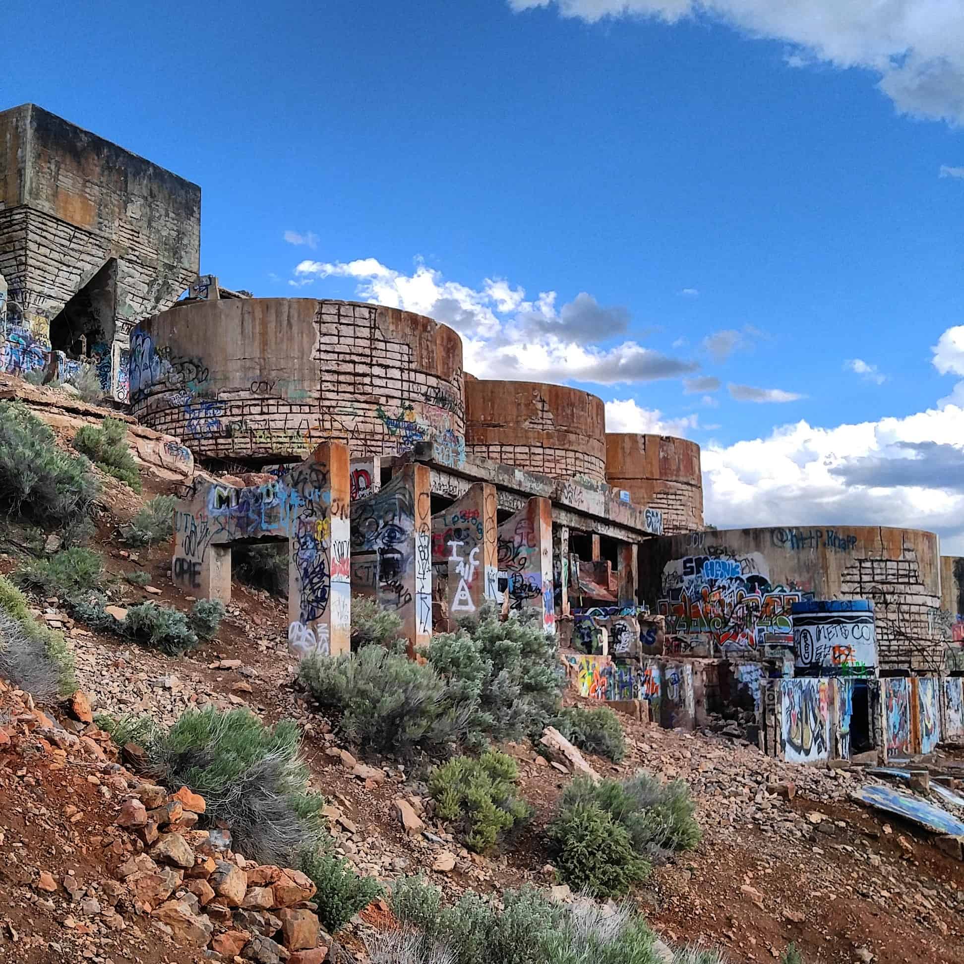
There was some pretty cool graffiti up there and a huge rattlesnake, see the pictures below.
In 1849, John S. Higbee was sent to Provo by Brigham Young to find a suitable place to settle a colony on the Provo River. Two weeks after his report, thirty-one families consisting of about fifty people made the three day trip to the south side of the Provo River. On April 3rd of the same year, these settlers began a stockade known as Fort Utah, but the name was soon changed to Fort Field. Eight people died that first year. Cemetery records disclose that George and Matilda Haws, Harriet Turner, and William Dayton were four of the eight. They were buried in the FIRST Fort Field graveyard which was located on the Williams farm located just across the highway at Lake View (now known as Geneva Road). There is a Daughters of Utah Pioneers Marker near these burial grounds.
Pioneer life resulted in several fatal accidents. For instance, William Dayton was killed as he and George W. Bean were giving a demonstration of the cannon. One shot had been fired, and a spark ignited the powder during reloading. Dayton was killed and Mr. Bean lost his left arm. “Hout” Conover rode 120 miles in twenty hours to Centerville for Dr. Blake. This was a feat of riding history.
Also recorded is the death of Joseph Higbee on February 9, 1850. He was “behind a log with his companion, it being so very quiet he raised his head to look about and was shot through the neck” (from Diary of Epsy Jane Williams Pace). He was the only living son of Isaac Higbee, a Bishop in Nauvoo and Salt Lake. This occurred during a battle with Indians where several people were wounded.
Temple Hill Cemetery
In 1850, a better location was found and a second fort was built. The houses and stockade were moved and replaced on the second spot. Later that year, it was extended by another addition or fort. A SECOND Fort Field Cemetery was begun. In The History of Provo 4th Ward, John E. Booth states, “Fort Field Cemetery name is changed to Temple Hill.” By 1880, this site was discarded as a burial ground as the soil was too sandy, causing graves to cave in before burials could take place. This site is where the Maeser Building now stands on the Brigham Young University campus.
Grandview Hill Cemetery
A THIRD cemetery was located on Grandview Hill. In about 1860, the corner of three land grants belonging to James Smith, Joseph Thompson, and a man named Rasmussen, became the burial ground for a child of Thompson. As time went on, other burials were added and eventually not only were there graves on the Thompson land, but on the land belonging to the other two landowners. By 1879, this location had become a fair-sized cemetery (around sixty burials). The landowners objected and refused to allow other burials to take place. They also requested that the bodies of those buried there be removed at the expense of their families. Most of the bodies were removed to Temple Hill Cemetery. However, some next of kin had moved from the community, others could not afford the expense involved, while still others preferred to leave their loved ones unmolested, even though it meant they would rest in an unmarked grave. Two Rasmussen children are still buried there and their graves are marked by two lilac bushes north and west of the Baptist Church on Columbia Lane.
Provo City Cemetery
The first Fort Field Cemetery was too wet, the Temple Hill Cemetery (second Fort Field) was too sandy, and the Grandview Hill Cemetery, where three farms converged had been closed at the request of the landowners. A new burial location was needed, so on June 11, 1853, a special meeting was called at the Public Square (Pioneer Park). A committee was appointed to find a better place for a cemetery. On June 25, 1853, their report was presented and the current site of the Provo City Cemetery on Springville Road (State Street) was chosen.
The Provo City Cemetery was dedicated in 1853. The process of moving the remains from surrounding burial grounds to the Provo City Cemetery took many years to complete. The records show that George Haws, Matilda Haws, Harriette Turner, and Wm. Dayton were moved from Fort Field to the Provo City Cemetery. Mary Blake Peay, Abisha Ware, and others were moved to the Provo City Cemetery from Temple Hill Cemetery. The Daughters of Utah Pioneers memorial drinking fountain lists the names of the known pioneers who were moved here from other burial sites. The first burial listed in the Provo City Cemetery records, not moved from a previous site is Joseph Whipple in December 1856.
Inside the cemetery, a large area was designated for the remains of those people who were relocated from the Temple Hill Cemetery. It is in Block 5, Lot 62, which is located at 5th West and 1st South. Some headstones are present, but most are unmarked graves.
Pioneer Memorial Drinking Fountain
In 1964, a drinking fountain was erected by the Daughters of Utah Pioneers which lists some of the known pioneers that were moved from other cemeteries. Their names and known locations are listed as follows:
Matilda & George Haws (Block 4, Lot 18, 17) Harriet M. Turner (Block 4, Lot 4) William Dayton Joseph Higbee Katherine Radford Jesse McCarred Jacob Cloward (Block 3, Lot 4) Martha Wheeler Jacob H. Barney Matilda Park Sarah & William McLane Sally Norton Joseph Ivy Margarett Fausett Emily Roberts Louisa Follett Abisha Ware (Block 4, Lot 80) Joseph McEwan Mary B. Peay (Marker in Block 5, Lot 62) Elizabeth Baum (Block 1, Lot 53) Mrs. Jerome Benson Heber C. Davis William Davis William K. Follett Elizabeth Sarah Goodman John Moroni Goodman John Haws, Sr. (Block 1, Lot 40) Willis Moss O. Foster McCarroll Ann S. B. Robbins John Rogers Tobbins Daniel Stowell Emma B. Thatcher Edward Vincent
Burial Plots
Cemetery records show burial property purchased in 1878 by: W. D. Startup, George Baum, and James J. Talmage. Other owners are listed, but no deeds were recorded so the dates are unknown. At that time a lot capable of 32 adult burials was selling for $5.00, which did NOT include perpetual maintenance. With inflation, that is the equivalent of $20,000 in 1997. In 1997 those same 32 burial rights, including perpetual maintenance, would cost $19,200.
Other Early Cemeteries Near Provo
On the old township maps, a Christmas City graveyard is located on the south side of the entrance to Provo Canyon. It was an old mining area and is now a gravel pit.
American Fork Canyon had extensive mining at one time. In the area of Mary Ellen Flat there is a cemetery where many miners are buried.
“Undocumented” Burial Sites
On the east side of State Street, three-fourths of the way up Orem Hill, there were several burials.
The mouth of Slate Canyon was said to have several burials.
A place below the “Y” on the mountain and an area up Springdell in the canyon had burials.
There were burials sites just about everywhere, as many people desired to be laid to rest by favorite trees, hills, mountains, etc. A particularly beautiful site might have several burials.
The Goshen Valley is a 17-milelong valley located in southern Utah County.
A southern arm (Goshen Bay), of Utah Lake bisects the valley, with western shore valley areas extending north to Mosida, at the south end of Lake Mountain.
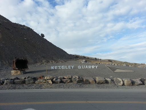
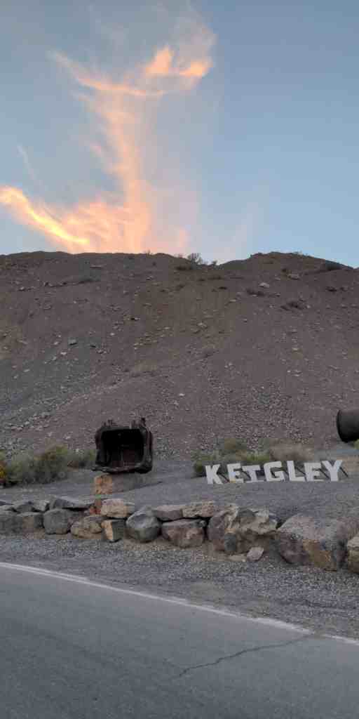
Adjacent just south of West Mountain is another mountain, Warm Springs Mountain, its western flank is the site of the abandoned mining operation, the Tintic Standard Reduction Mill, (Known as Harold, Utah) and adjacent west is Warm Springs.
The Tintic Standard Reduction Mill presently stands in partial ruin. Drawings prepared by the HAER survey show front and side elevations, as well as a general plan of the mill’s remains. Enough exists to identify the structure as a mill, and to visualize the procedures involved in the milling process. It remains at the original location, Warm Springs, Utah, some two miles east of the town of Goshen in Utah County. The mill was erected on a hillside for gravity purposes.
Originally the mill contained water tanks, ore bins, crushing rolls, Holt-Dern roasters, iron boxes, leaching tanks, and to the side, drain boxes for lead precipitate. While the actual machinery is gone, the shell of the structure remains.
The Tintic Standard Reduction Mill (Harold Mill) was constructed during the 1919-1921 period by the Tintic Standard Mining Company, under Emil John Raddatz, prominent Utah mining entrepreneur. It served as the mill for the Tintic Standard, which became one of the nation’s leading silver producers, operating from 1916 to approximately 1945.
The significance of the mill, in addition to its place as a part of Tintic Standard’s operation, is attributable to its importance in the themes of engineering and industry. W. C. Madge designed and constructed the mill after having consulted with Theodore P. Holt and George H. Bern, Utah developers of the Holt-Dern Roaster. It was built at a cost of $580,000. The Tintic Standard Reduction Mill was the only use of the “antiquated” Augustin process in the United States during the early years of the 1920s. The plant was an acid brine chloritizing and leaching mill. Ore was first roasted with salt, then leached in a strong brine solution and finally precipitated with copper. Recovery rates were fairly high, as in 1924, when the mill recovered 88% of the silver, 60% copper. 32% lead and 7% of the gold held in the ore.
As related to industry, the mill was an important part of Tintic Standard’s operation. In addition, the construction of the plant also reflected the battle, then waging, over railroad transportation rates, which mine owners believed were too high. By milling the ore themselves, owners could save the shipping costs. By 1925, the mine could no longer supply ore of the grade for which the mill was designed. Also, by then, shipping rates declined, therefore, in the fall of that year, the plant shut down.
A town grew up near the mill, named “Harold” after Raddatz’s son. Only the site remains, nevertheless, the town site and especially the mill, aids both in the documentation of mining history and also in the affect this operation had upon nearby small fanning communities such as Goshen, causing them to experience “Boom periods” in their development,
Many people driving from Goshen towards Genola and Santaquin see the Mill up on the mountain and wonder what it is, it is quite curious looking.
The Tintic Standard Reduction Mill is located on the hillside above Genola, Utah and was added to the National Register of Historic Places (#78002700) on September 13, 1978.
Here are my photos from a trip on 09 May 2016:
The Tintic Standard Reduction Mill (Harold Mill) was constructed during the 1919-1921 period by the Tintic Standard Mining Company, under Ernie J. Raddatz, prominent Utah mining entrepreneur. It served as the mill for the Tintic Standard, which became one of the nation’s leading silver producers, operating from 1916 to approximately 1945.
The significance of the mill, in addition to its place as a part of Tintic Standard’s operation, is attributable to its dunportance in the themes of engineering and industry. W. C. Madge designed and constructed the mill after having consulted with Theodore P. Holt and George H. Bern, Utah developers of the Holt-Dern Roaster. It was built at a cost of $580,000. The Tintic Standard Reduction Mill was the only use of the “antiquated” Augustin process in the United States during the early years of the 1920s. The plant was an acid brine chloridizing and leaching mill. Ore was first roasted with salt, then leached in a strong brine solution and finally precipated with copper. Recovery rates were fairly high, as in 1924, when the mill recovered 88% of the silver, 60% copper. 32% lead and 7% of the gold held in the ore.
As related to industry, the mill was an important part of Tintic Standard’s operation. In addition, the construction of the plant also reflected the battle, then waging, over railroad transportation rates, which mine owners believed were too high. By milling the ore themselves, owners could save the shipping costs. By 1925, the mine could no longer supply ore of the grade for which the mill was designed. Also, by then, shipping rates declined, therefore, in the fall of that year, the plant shut down.
A town grew up near the mill, named “Harold” after Raddatz’s son. Only the site remains, nevertheless, the town site and especially the mill, aids both in the documentation of mining _ history and also in the affect this operation had upon nearby small fanning communities such as Goshen, causing them to experience “Boom periods” in their development,
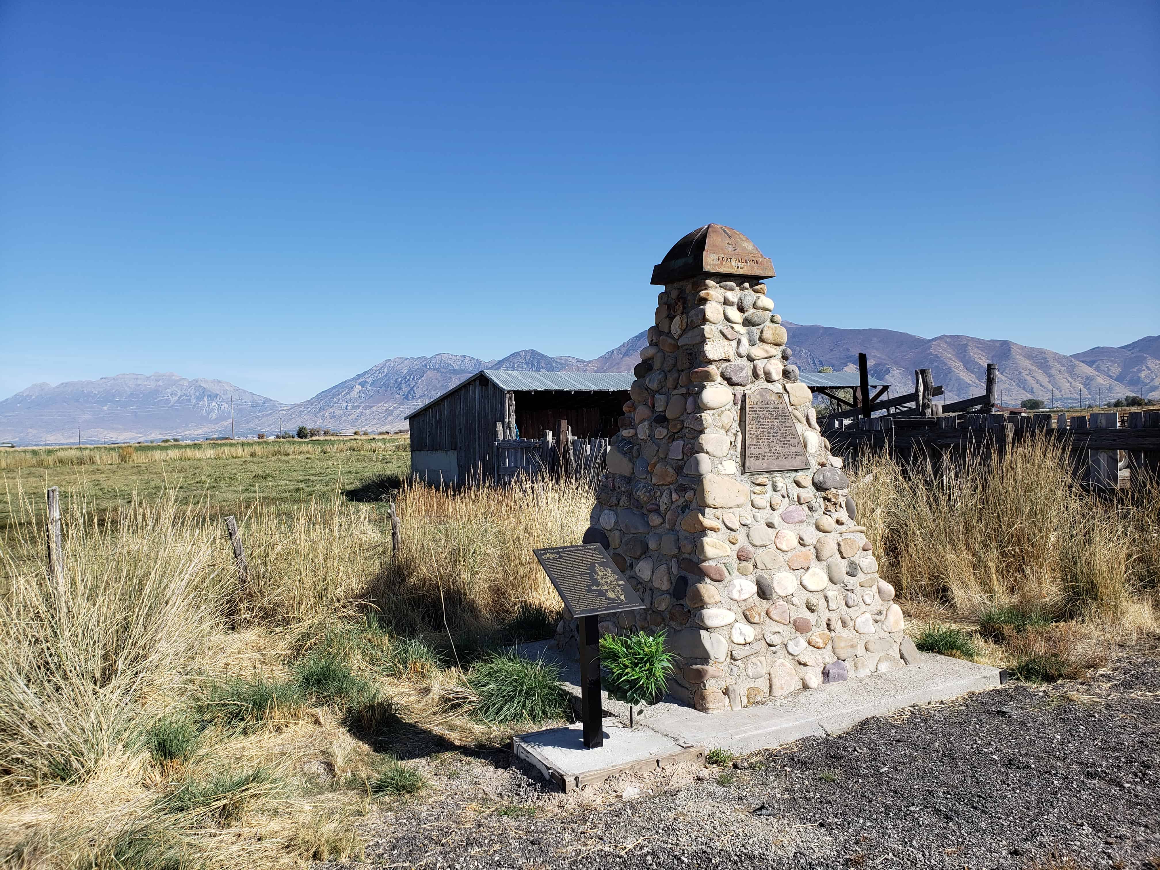
Palmyra was founded in 1852 on the banks of the Spanish Fork River. The town soon became absorbed into the city of Spanish Fork. Present-day Palmyra is a later out-growth of Spanish Fork. Both Palmyra’s were named for Palmyra, New York, a town prominent in early Mormon history.
Check out the old historic marker at the site of the old fort here.
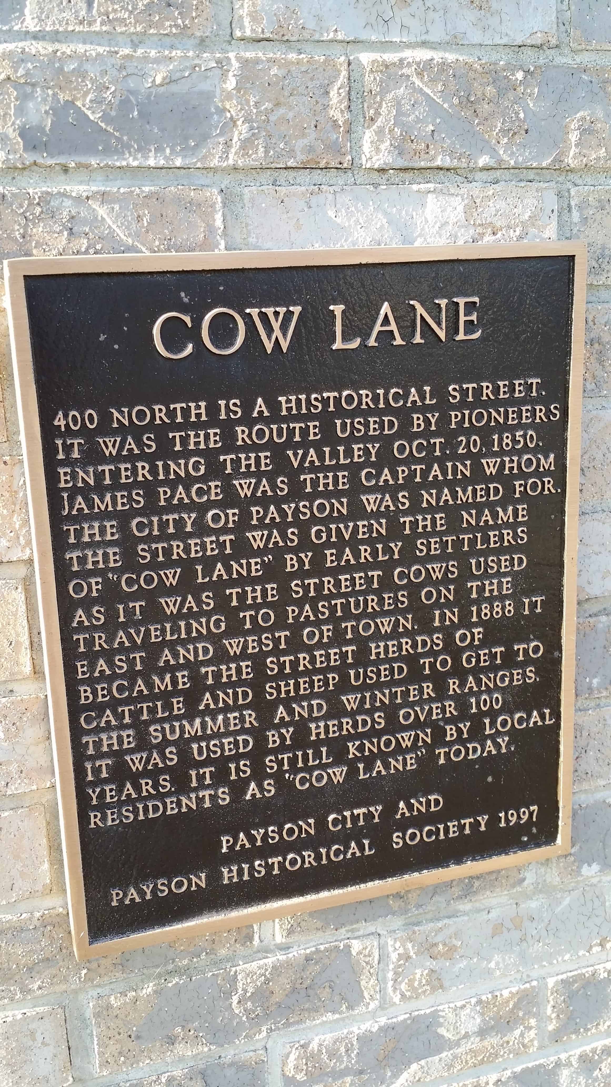
On October 20, 1850, sixteen members of the Church of Jesus Christ of Latter-day Saints (LDS or Mormon Church) arrived at the banks of the Peteetneet Creek with a mandate td establish a new settlement. They had been chosen by Brigham Young and had journeyed from Salt Lake City, sixty miles to the north. The settlers built a small fort at approximately 300 North between Main Street and 100 West. In 1851 more families arrived and the settlement was named Payson, after one of the first settlers, James Pace. The Payson Post Office was established in 1852 and the town incorporated in 1853. The Walker Indian War of 1853 disrupted the settlement for a time, but relations between the settlers and the Utes were fairly peaceful. The only other conflict was during the Black Hawk War of 1865. The fort was enlarged during the 1850s. An adobe wall (partially completed) became the back wall of the cabins, which faced the interior. A tithing office, bowery, well and visitor campground were located in the central square of the fort. Though the fort was demolished, markers were placed by the Daughters of Utah Pioneers (DUP) to mark the four corners in 1931. The cautious settlers were slow to build permanent homes outside of the fort.
Early names were Peteetneet, Fort Peteetneet, Pacen for James Pace, and then Pacen was changed to Payson when the town was incorporated.
As early Latter-day Saint pioneers came to the Goshen Valley, they settled in areas then known as Sandtown, The Bend, and The Fort. Later, President Brigham Young urged the settlers to form the township of Goshen and predicted that a new highway would be built near the existing cemetery. He instructed the pioneers to relocate farms, homes, and their cemetery to higher solid ground believed to be more fertile. Many moved their cabins, and several of those buried in the original cemetery were interred in the new Goshen Cemetery, located south of the newly established town. No record exists of those whose remains were moved. After 1880, no new burials were made in this cemetery.
The original Goshen Pioneer Cemetery is located 300 yards north of this monument made sacred by the sacrifice of original and native pioneers who gave their all for their faith. The following eighteen men, women, and infants are buried herein: Louisa Jane Bigelow, 1858; Diana Dall, 1859; John Shields Gardner, 1862; William Edward Martin 1865; Julia Ann Gardner, 1865; Riley Stewart, 1866; Gertrude Sorensen, 1868; Henry Lyman Cook, 1869; Hyrum Cook, 1869; Mary Ann Weech, 1873; Mary Ellen Finch, 1876; Soren Christensen Sorenson, 1876; Henry David Dall, 1876; Samuel Weech, 1877; Hyrum Finch, 1879; Annie Marie Sorensen, 1880; Nelce Sorensen, 1880; Soren Sorensen, Jr., 1880. We have not forgotten their lives and determined spirits; they play an important part of a vibrant heritage.