• About JacobBarlow.com
  • Cemeteries in Utah
  • D.U.P. Markers
  • Doors
  • Exploring Utah Email List
  • Geocaching
  • Historic Marker Map
  • Links
  • Movie/TV Show Filming Locations
  • Oldest in Utah
  • Other Travels
  • Photos Then and Now
  • S.U.P. Markers
  • U.P.T.L.A. Markers
  • Utah Cities and Places.
  • Utah Homes for Sale
  • Utah Treasure Hunt

JacobBarlow.com

~ Exploring with Jacob Barlow

JacobBarlow.com

Tag Archives: Arizona

Arizona State Capitol

03 Thursday Nov 2016

Posted by Jacob Barlow in Uncategorized

≈ 2 Comments

Tags

Arizona, Maricopa County, Phoenix, State Capitol Buildings

2016-09-05-16-23-39

The Arizona State Capitol in Phoenix, Arizona, United States, was the last home for Arizona’s Territorial government, until Arizona became a state in 1912. Initially all three branches of the new state government occupied the four floors of the statehouse. As the state expanded the branches relocated to adjacent buildings and additions. The 1901 portion of the Capitol is now maintained as the Arizona Capitol Museum with the mission to Connect People to Arizona Government – Past and Present.

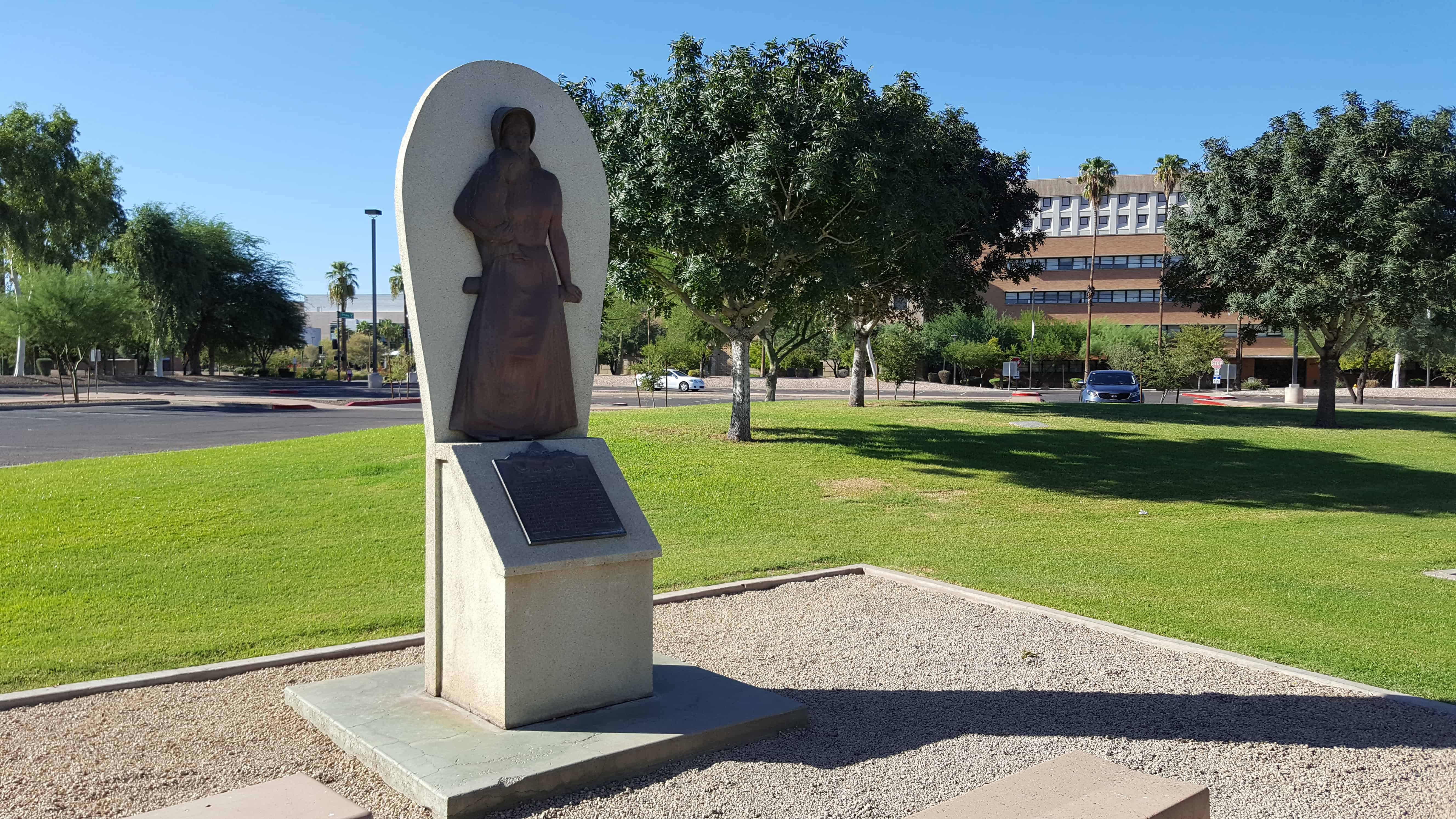
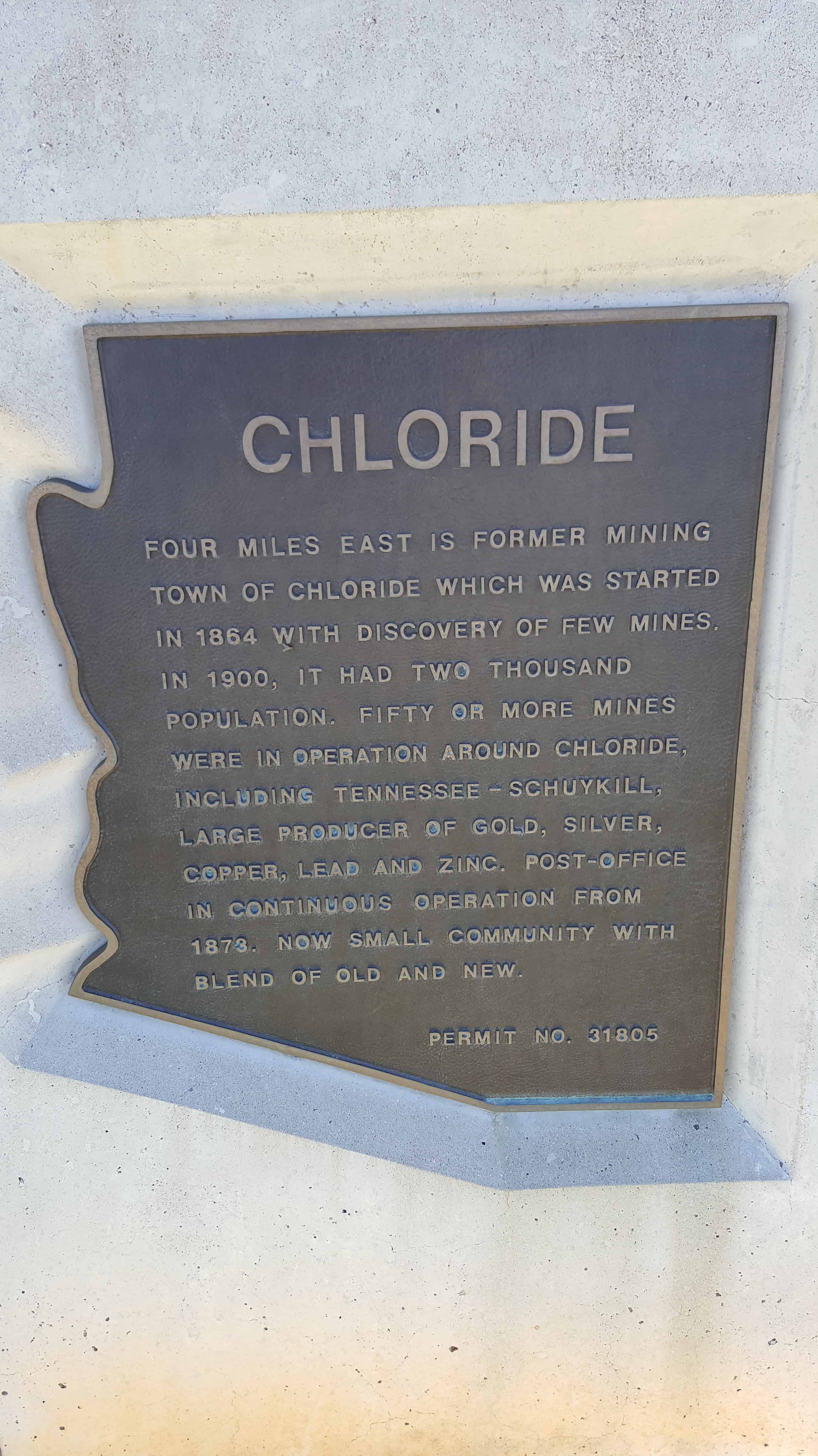
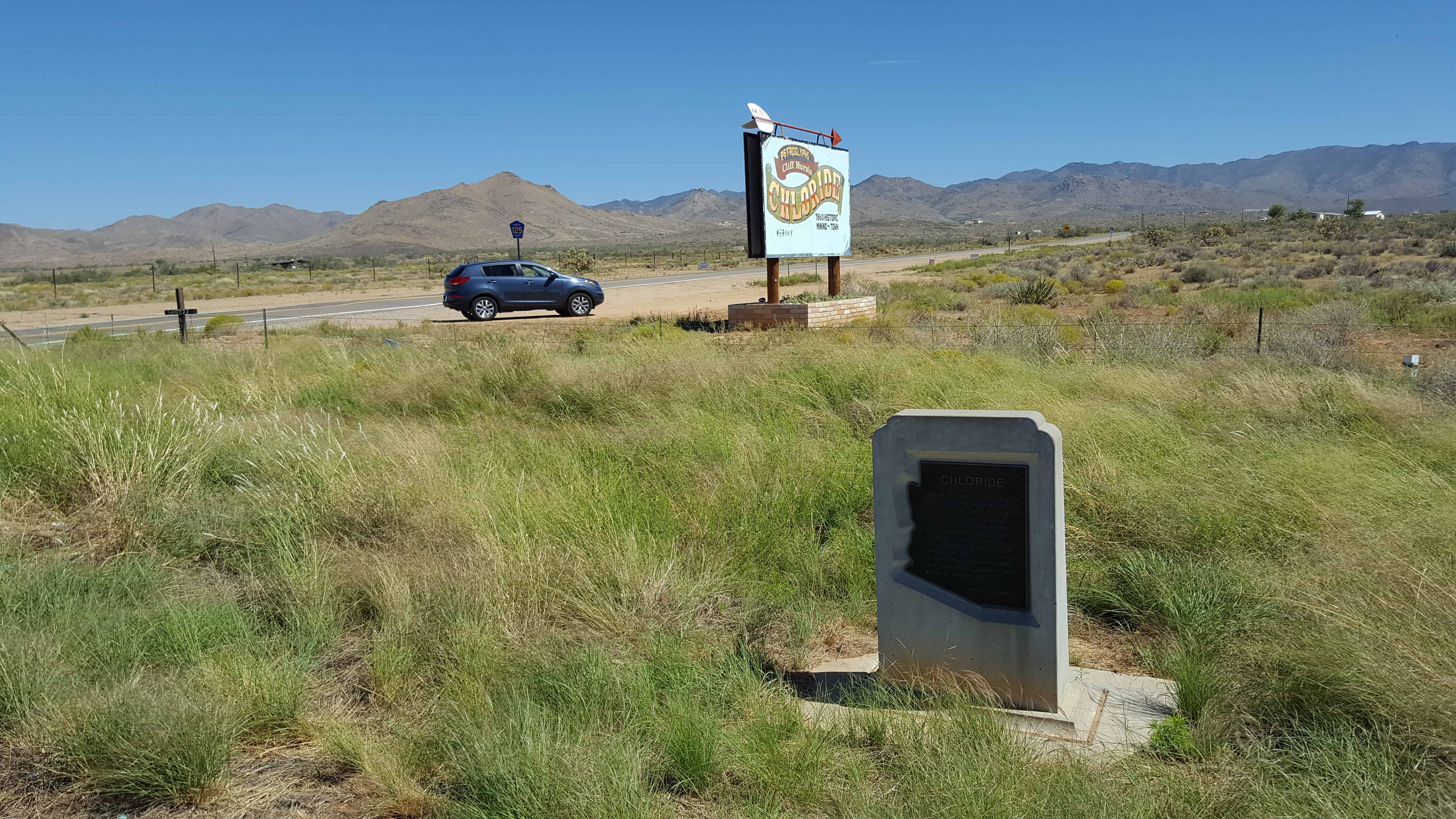
See also the Wesley Bolin Memorial Plaza.

2016-09-05-16-24-50
2016-09-05-16-25-18

Arizona’s Pioneer Women

02 Wednesday Nov 2016

Posted by Jacob Barlow in Uncategorized

≈ 1 Comment

Tags

Arizona, DUP, historic, Maricopa County, Phoenix

2016-09-05-16-17-12

D.U.P. Marker #344 (See other D.U.P. Historic Markers here.) near the State Capitol building in Phoenix, Arizona. 

Before 1875 hundreds of heroic women came to Arizona from the East and South. From this group came Arizona’s first schoolteachers and the publisher of the first newspaper.

In 1876 a group of pioneer and their families came from the North, ferried their covered wagons across the Colorado River. With indomitable bravery and strength they helped make the desert blossom into a green oasis. Their descendants pioneered in many settlements throughout Arizona. They displayed great courage and self-denial which is the rich heritage of their posterity.

2016-09-05-16-17-52

2016-09-05-16-17-58
2016-09-05-16-18-04
2016-09-05-16-18-17
2016-09-05-16-18-19

Chloride, Arizona

23 Sunday Oct 2016

Posted by Jacob Barlow in Uncategorized

≈ 1 Comment

Tags

Arizona, Chloride, historic, Mining, Mohave County

2016-09-05-11-31-39

The former mining town of Chloride was started in 1864 with the discovery of few mines.  In 1900, it had two thousand population.  Fifty or more mines were in operation around Chloride, including Tennessee – Schuykill, large producer of gold, silver, copper, lead and zinc.  Post Office in continuous operation from 1873.  Now small community with blend of old and new.

Related:

  • Arizona Historic Markers
  • The Arizona and Utah/Western Arizona Railway

Ocean-to-Ocean Highway Bridge

19 Wednesday Oct 2016

Posted by Jacob Barlow in Uncategorized

≈ 1 Comment

Tags

Arizona, Bridges, historic, Yuma, Yuma County

picture27nov08-104

Ocean-to-Ocean Highway Bridge

Constructed – 1915 & Rededicated – 2002

The bridge was constructed in 1915 through a joint effort between the Office of Indian Affairs and the states of California, Arizona and New Mexico to promote traffic along the Ocean-to-Ocean Highway. The bridge was the only one over the Colorado for 1,200 miles. The bridge has no center pillar because of the Colorado River potential roughness.

During the 1930s, California California erected a checkpoint on their side to prevent jobless Oakies and Arkies from entering.

The bridge stopped operations in 1988. In 2002 it reopened to one way traffic only. The Ocean-to-Ocean Highway Yuma” sign was restored and is illuminated at night.

picture27nov08-103

Lake Mead and Taming the Colorado

19 Wednesday Oct 2016

Posted by Jacob Barlow in Uncategorized

≈ Leave a comment

Tags

Arizona, Hoover Dam, Lake Mead

2016-09-05-10-34-33

Lake Mead and Taming the Colorado

With its rugged mountains, deep canyons, stark deserts, and two large blue lakes, America’s first national recreation area is a place of great contrasts.

Looking into Black Canyon and a narrow, river-like portion of Lake Mohave.  To the left is Davis Dam and to the right, Hoover Dam.

Hi Jolly

16 Sunday Oct 2016

Posted by Jacob Barlow in Uncategorized

≈ 1 Comment

Tags

Arizona, historic, La Paz County, Quartzite

picture27nov08-107

The famous camel herd with which the name of Hi Jolly is linked constitutes an interesting sidelight of Arizona history….
Jefferson Davis (afterward President of the Southern Confederacy). As Secretary of War. Approved a plan to experiment with camels for freighting and communication in the arid Southwest….Major Henry C. Wayne of the U.S. Army and Lt. D.D. Porter (later a distinguished admiral in the Civil War) visited the Levant with the storeship “Supply” and procurred 33 camels which were landed at Indianola, Texas. February 10, 1856. 41 were added on a second voyage….
With the first camels came. As caretaker, Haiji Ali whose Arabic name was promptly changed to “Hi Jolly” by the soldiers. And by this name he became universally known. His Greek (?) name was Philip Tedro….On the Beale Expedition in 1857 to open a wagon road across Arizona from Fort Defiance to California. The camels under Hi Jolly’s charge. Proved their worth. Nevertheless, the War Department abandoned the experiment and the camels were left on the Arizona desert to shift for themselves. Chiefly roaming this particular section. They survived for many years creating interest and excitement …. Officially the camel experiment was a failure. But both Lt. Beale and Major Wayne were enthusiastic in praise of the animals. A fair trail might have resulted in a complete success.

picture27nov08-110
picture27nov08-108

Last Camp of Hi Jolly
Born somewhere in Syria
about 1828
Died at Quartzsite
December 16, 1902
Came to this country
February 10, 1856
Camel Driver – Packer
Scout – Over Thirty
Years a faithful aid
to the US Government

Fredonia, Arizona

04 Tuesday Oct 2016

Posted by Jacob Barlow in Uncategorized

≈ 3 Comments

Tags

Arizona, Coconino County, Fredonia, Kanab

4f9e4bce-b8ee-4745-a1db-5dc93140930b

Fredonia is Arizona’s northernmost town and the gateway to the North Rim of the Grand Canyon.

The Anasazi or Basket Makers were the first inhabitants in the area. Their presence is marked by ancient ruins in the cliffs throughout Arizona.

Fredonia was originally started in 1885 as a business venture by five men who invested time, money, and energy to build a dam so they could create farmland under irrigation.

Related:

  • Buckskin Tavern
  • Fredonia Roadside Park
  • Pipe Springs National Monument (historic marker)
  • Prickly Pears and Pinon Nuts (historic marker)

Arizona

27 Saturday Aug 2016

Posted by Jacob Barlow in Uncategorized

≈ 3 Comments

Tags

Arizona

img_20160905_133853
ingress_20131213_214848_10

Some Arizona posts:

  • Arizona Historic Markers
  • Apache County
  • Cochise County
  • Coconino County
  • Gila County
  • Graham County
  • Greenlee County
  • La Paz County
  • Maricopa County
  • Mohave County
  • Navajo County
  • Pima County
  • Pinal County
  • Santa Cruz County
  • Yavapai County
  • Yuma County
  • Arizona State Capitol
  • Ash Fork
  • Bearizona Wildlife Park
  • Beaver Dam
  • Big Sandy Valley
  • Binghampton Settlers
  • Brigham City
  • Burro Creek
  • Cameron
  • Cerbat
  • Chloride
  • Circle City
  • Cliff Dwellers Stone House
  • Colorado City
  • Desert View Watchtower (at the Grand Canyon)
  • First LDS Chapel in Phoenix
  • Flagstaff
  • Four Corners
  • Fredonia
  • Gadsden Purchase
  • Gila River Indian Reservation
  • Glen Canyon Dam
  • Hassayampa River Preserve
  • Heritage Square in Phoenix
  • Hi Jolly
  • Holbrook
  • Jacob Lake
  • Joseph City
  • Lake Powell
  • LeFevre Overlook
  • Mesa
  • Mesa Temple
  • Meteor City Trading Post
  • Mineral Park
  • Monument Valley
  • Nothing
  • Ocean-to-Ocean Bridge
  • Page
  • Peach Springs
  • Pioneer Park
  • Pioneering the Strip
  • Pipe Spring National Monument
  • Rosson House
  • Route 66
  • Sacaton Rest Area
  • Seligman
  • State Corners
  • Sunset Point Rest Area
  • Tuba City
  • Two Guns, Arizona
  • Valentine, Arizona
  • Vermillion Cliffs
  • Wesley Bolin Memorial Plaza
  • White Hills
  • Wickenburg
  • Wikieup
  • Williams
  • Winslow
1929057_56037684233_1691052_n

State Corners

03 Wednesday Dec 2014

Posted by Jacob Barlow in Uncategorized

≈ 2 Comments

Tags

Arizona, Benchmarks, Colorado, Corners, New Mexico, utah

I have always enjoyed going to the corner of states. I will get some photos added on this page.

  • Utah Idaho Wyoming Corner
  • Southwest Corner of Wyoming
  • Colorado, Utah, Wyoming Corner
  • South-east corner of Utah (Four Corners)
  • Southwest corner of Utah

  • 10400911_27967839233_3998_n
    Utah, Arizona, Colorado, New Mexico
Newer posts →

Follow Jacob

Follow Jacob

Come wander with me on Youtube.

Blog Stats

  • 2,100,682 hits

Social and Other Links

BarlowLinks.com

Recent Posts

  • Scout Monument
  • Provo High School Seminary Building
  • 821 E 100 S
  • 820 E 100 S
  • 817-819 E 100 S

Archives

Loading Comments...