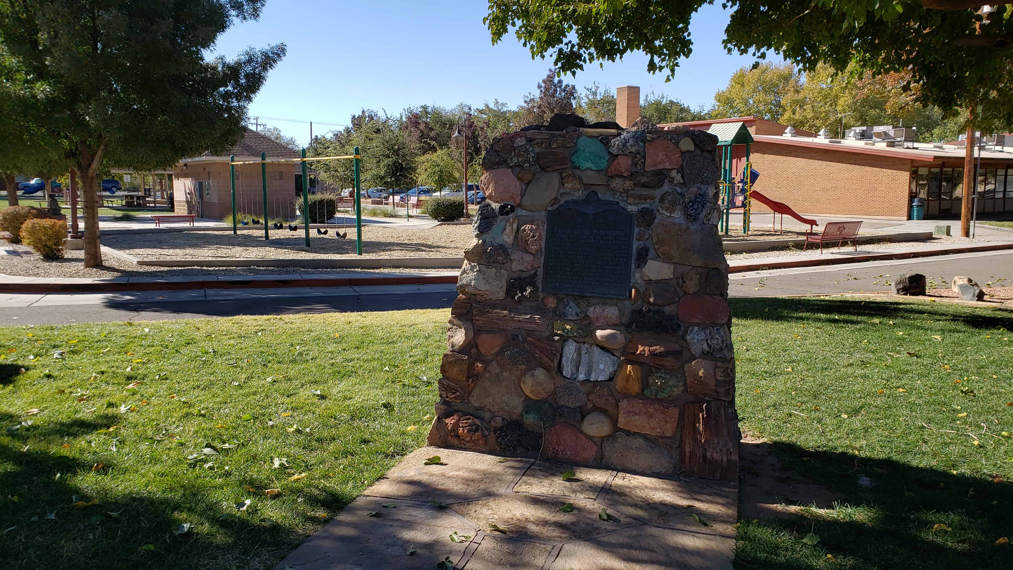
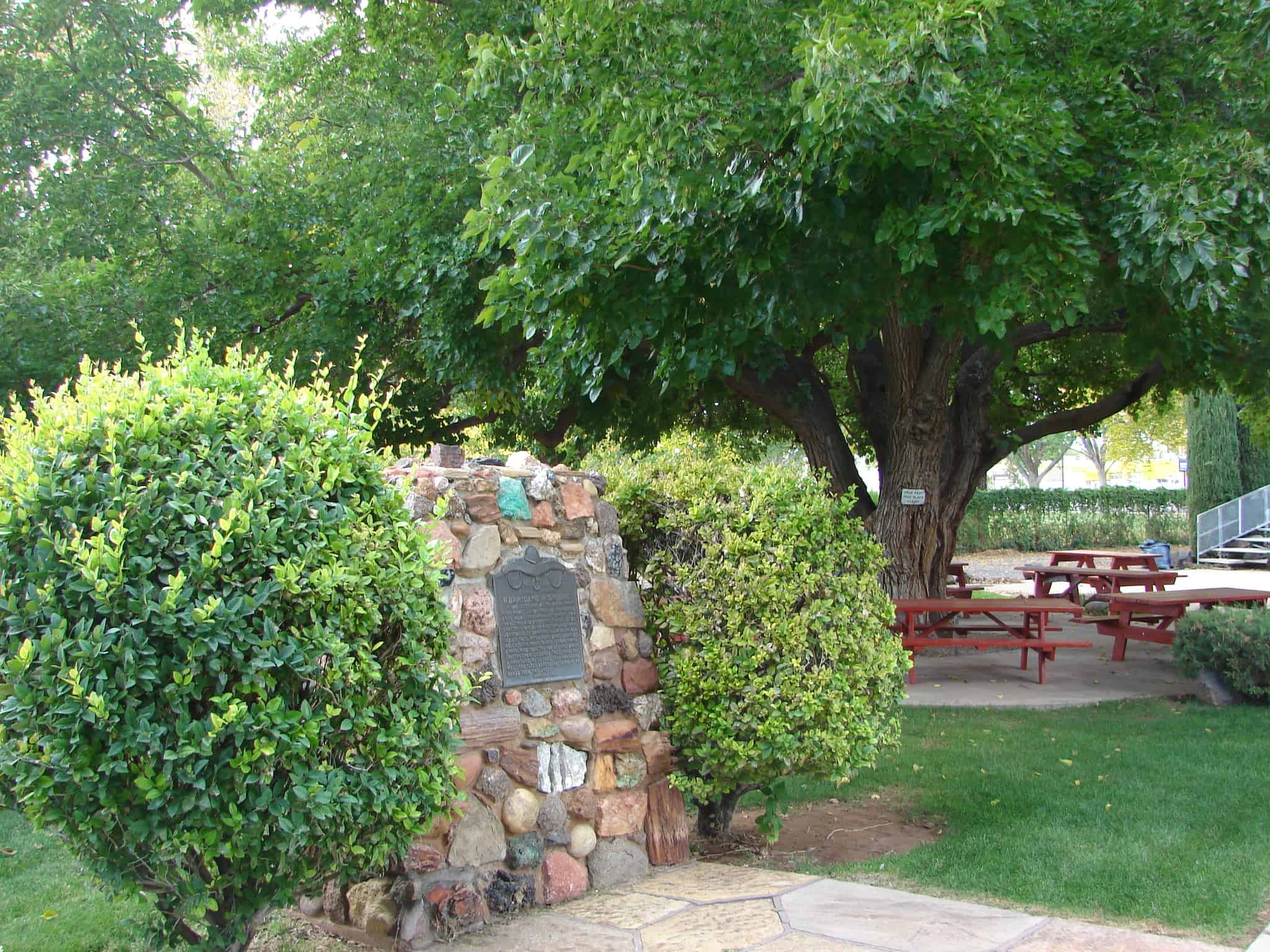
Noble Pioneers of Hurricane
S.U.P. Historic Marker #23-A, a list of 299 of the pioneers of Hurricane, Utah
Related Posts:

07 Friday Feb 2020
Posted in Uncategorized

Noble Pioneers of Hurricane
S.U.P. Historic Marker #23-A, a list of 299 of the pioneers of Hurricane, Utah
Related Posts:


06 Thursday Feb 2020
Posted in Uncategorized
The Hurricane Canal
On August 6, 1904, pioneer families from Virgin City, Grafton, Toquerville, La Verkin, Rockville and Springdale, met in the shade of a bowery and watched the Virgin River water gurgle out of the Hurricane Canal on the fertile, parched soil of this valley. Finally, the Rio Virgin was conquered! At that joyful celebration the city they had dreamed about for many heartbreaking years, was named Hurricane from the historic Hurricane Cliffs. In 1906, the first homes were built here.
This is S.U.P. Marker #23-D, see other S.U.P. Markers here.
This historic marker is located in Hurricane Valley Pioneer Heritage Park in Hurricane, Utah.
The Pattern (by Owen Sanders)
My father dug the ditches
And tilled the stubborn soil;
What have I, his son, to show
For all his years of toil?
My Mother gnarled her tender hands
And suffered for my weal;
What have I, her son, to show
For all her faith and zeal?
Their faith and love of God was strong
Their zest for life sincere;
What have I, their son, to show
For what they held so dear?
My folks have sketched a pattern
And blazed a vivid trail;
They have earned their Golden Goal
Only, I, can fail!

03 Monday Feb 2020
Posted in Uncategorized

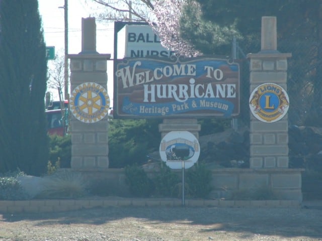
In Hurricane, Utah – next to the old library/city hall is the Hurricane Valley Pioneer Heritage Park. It has many displays and historic plaques and markers describing a lot of the local history.
Markers in the park:


27 Monday Jan 2020
Posted in Uncategorized
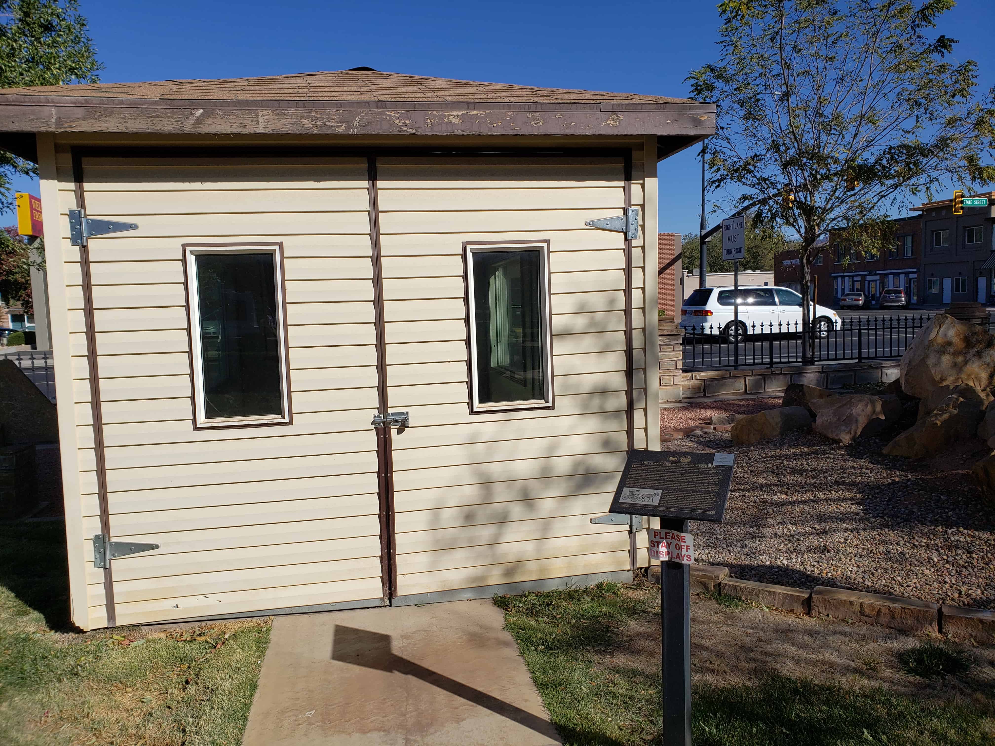
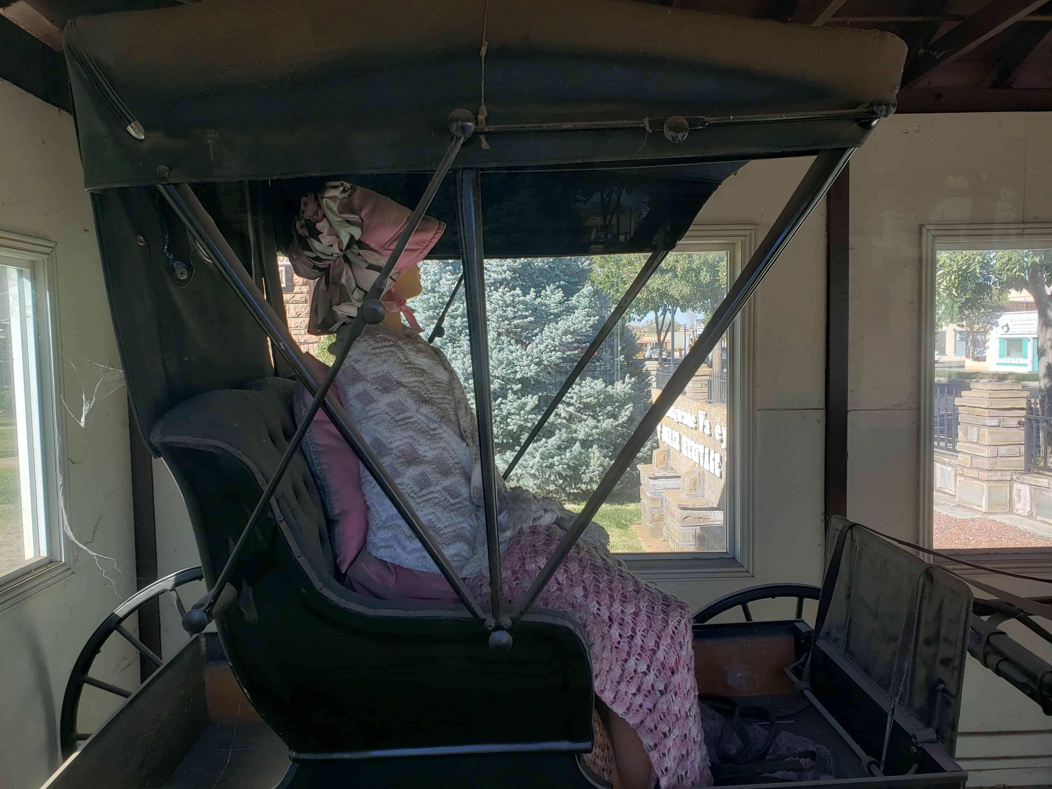
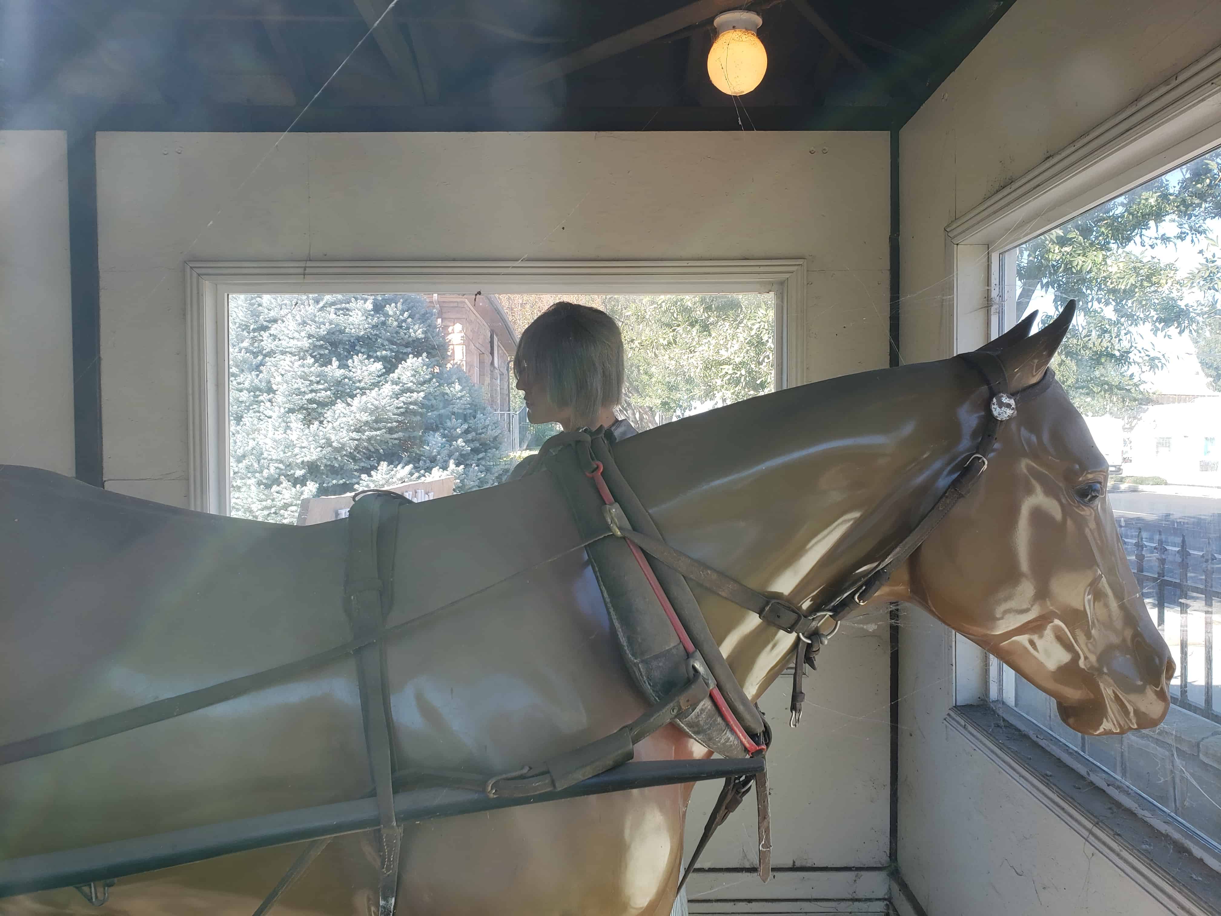
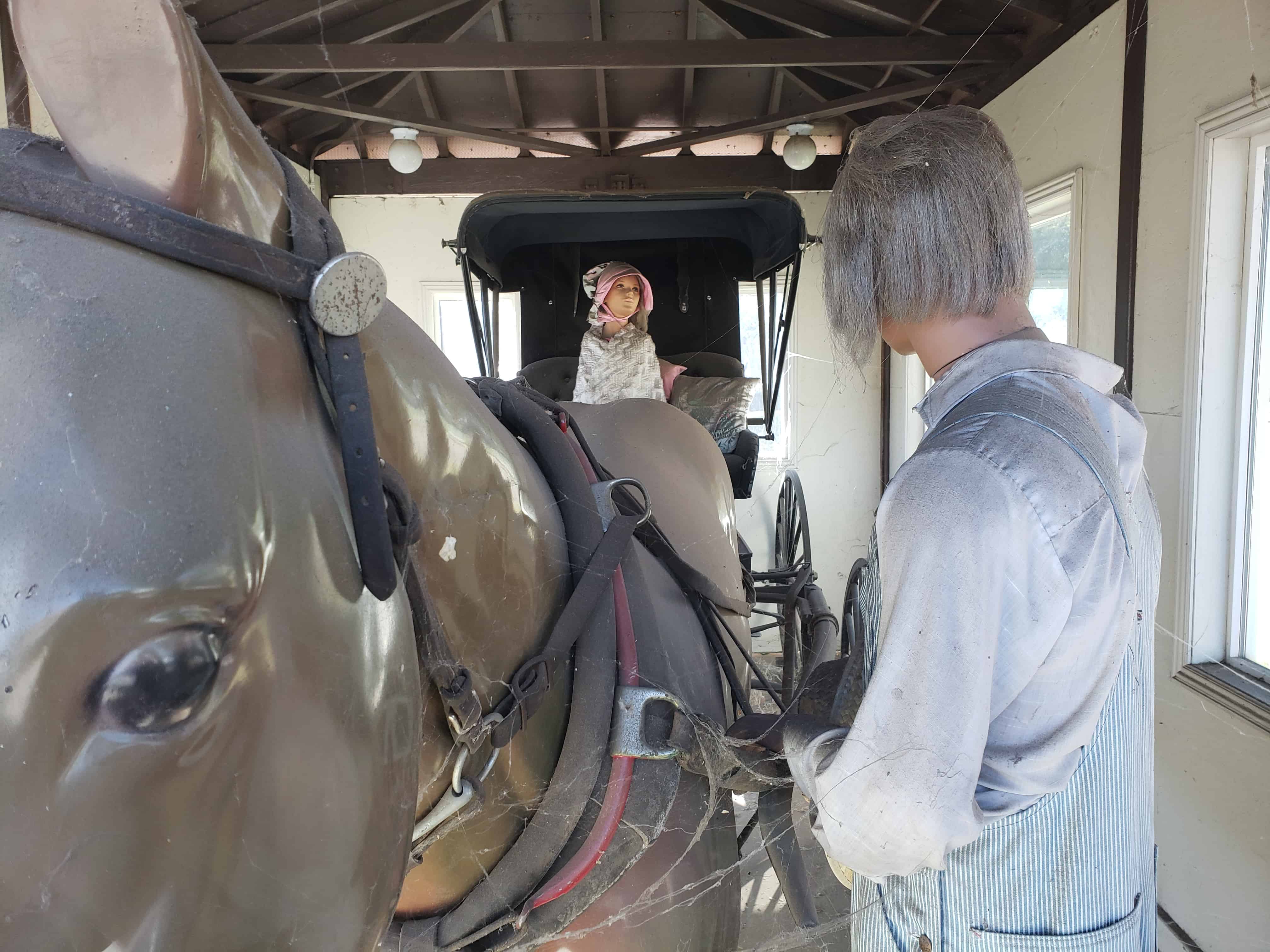
Located in Hurricane, Utah at the Hurricane Valley Pioneer Heritage Park next to a Carriage House display shelter built by Jaden Ruesch is S.U.P. (Sons of Utah Pioneers) historic marker # 166.
The Town Named After A Buggy Incident
Buggies, such as the one before you, were an important part of early America. As the name implies, Doctors’ Buggies were used by physicians but they were also a popular choice for many others as well. Buggies were dearly prized and generally kept in a carriage house.
In 1863, LDS Church Apostle Erastus Snow was traveling in a similar buggy from Kanab to St. George, Utah. Accompanying him were horsemen (Nephi Johnson and David H. Cannon) who told him of an old Indian trail leading over the hill. Choosing to follow the trail, they successfully descended the other side of the hill by having the horsemen restrain the buggy with their lariats. However, a strong wind came up and blew off the top of the buggy. Erastus Snow exclaimed, “That was quite a hurricane! We will name this Hurricane Hill.”
On September 1, 1893, the Hurricane Canal Company was organized and work began on a canal around Hurricane Hill, ending at Hurricane Flat. Two thousand acres of fertile land could be irrigated by building the new canal. On August 6, 1904, a celebration was held in Hurricane, near the canal at 200 North and 300 East. About 100 people attended and watched with great excitement as water began flowing through the Hurricane Canal and onto the fertile flat.
Later that day, where you now stand, people gather in a bowery on the new town square to choose a name for the town. Names suggested were Pearl City, as the town was to be a “pearl in the desert”, Lake City, because at the time, there was a lake south of town; Chaparral, due to the bush that grew so abundantly throughout the valley; or Hurricane, after the canal company, the hill, and the flat that had used that name since the buggy incident many years before.

18 Saturday Mar 2017
Posted in Uncategorized

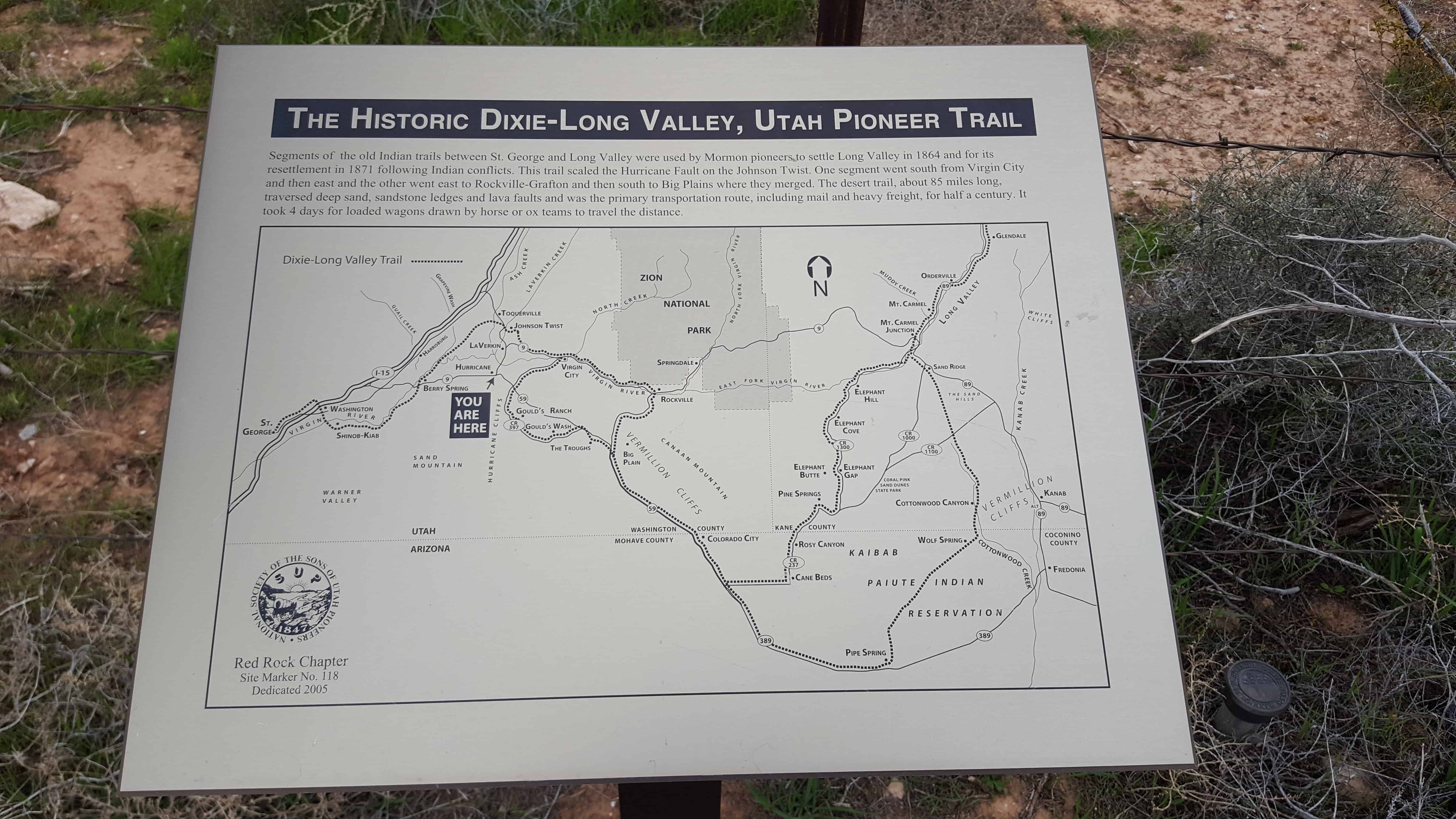
SUP Marker #118 in Hurricane. (Also located here is #101B)
Segments of the old Indian trails between St. George and Long Valley were used by Mormon pioneers to settle Long Valley in 1864 and for its resettlement in 1871 following Indian conflicts. This trail scaled the Hurricane Fault on the Johnson Twist. One segment went south from Virgin City and then east and the other went east to Rockville-Crafton and then south to Big Plains where they merged. The desert trail, about 85 miles long, traversed deep sand, sandstone ledges and lava faults and was the primary transportation route, including mail and heavy freight, for half a century. It took four days for loaded wagons drawn by horse or ox teams to travel the distance.
See other historic markers in the series on this page for SUP Markers.


18 Saturday Mar 2017
Posted in Uncategorized
Tags
Canals, historic, Historic Markers, Hurricane, La Verkin, SUP, utah, Washington County
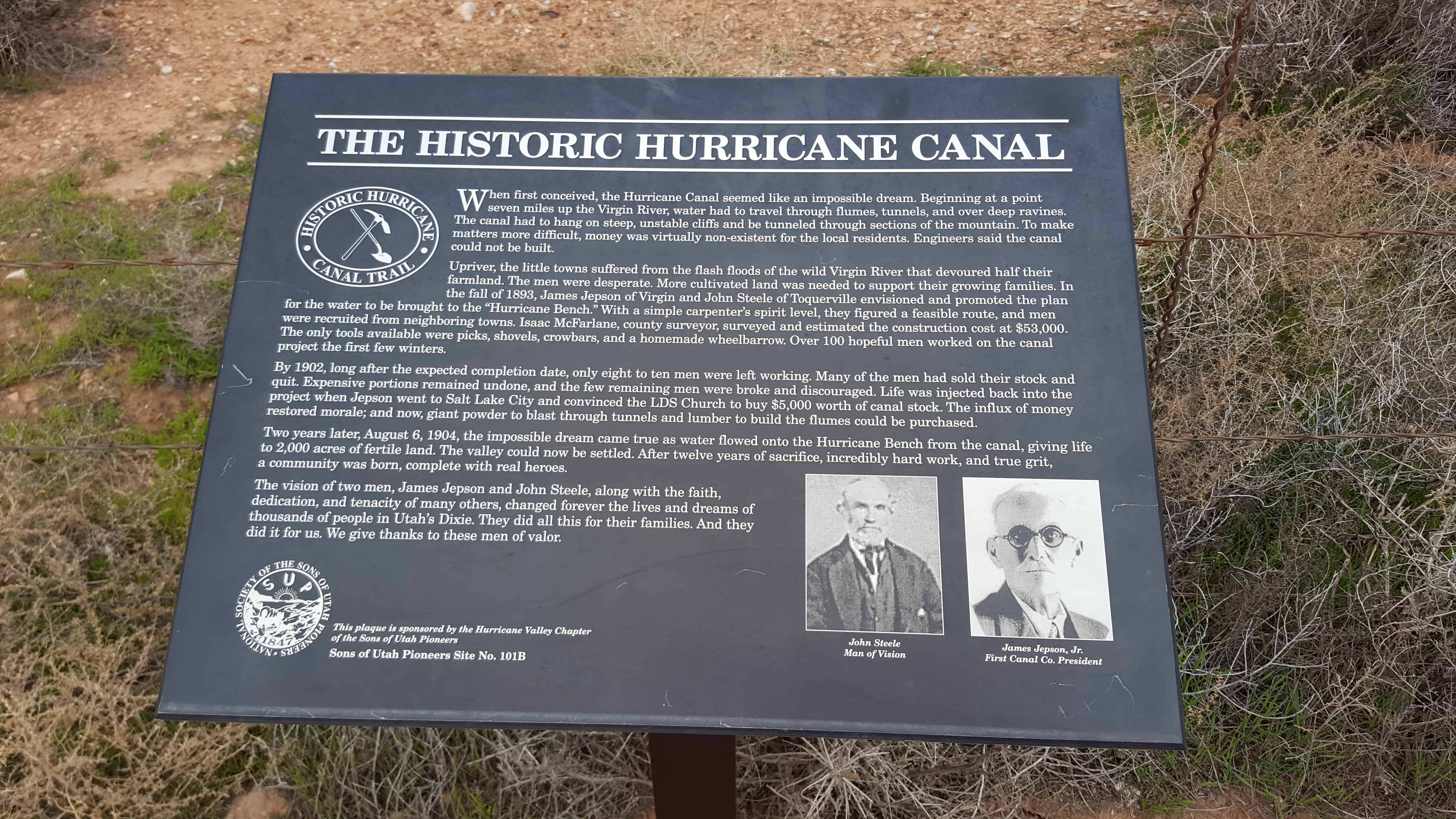
SUP Marker # 101B in Hurricane. (Also located here is #118)
When first conceived, the Hurricane Canal seemed like an impossible dream. Beginning at a point seven miles up the Virgin River, water had to travel through flumes, tunnels, and over deep ravines. The canal had to hang on steep, unstable cliffs and be tunneled through sections of mountain. To make matters more difficult, money was virtually non-existent for the local residents. Engineers said the canal could not be built.
Upriver, the little towns suffered from the flash floods of the wild Virgin River that devoured half their farmland. The men were desperate. More cultivated land was needed to support their growing families. In the fall of 1893, James Jepson of Virgin and John Steele of Toquierville envisioned and promoted the plan for the water to be brought to the “Hurricane Bench.” With a simple carpenter’s spirit level, they figured a feasible route, and men were recruited from neighboring towns. Isaac McFarlane, county surveyor, surveyed and estimated the construction cost at $53,000. The only tools available were picks, shovels, crowbars, and a homemade wheelbarrow. Over 100 hopeful me worked on the canal project the first few winters.
By 1902, long after the expected completion date, only eight to ten men were left working. Many of the men had sold their stock and quit. Expensive portions remained undone, and the few remaining men were broke and discouraged. Life was injected back into the project when Jepson went to Salt Lake City and convinced the LDS Church to buy $5,000 worth of canal stock. The influx of money restored morale; and now, giant powder to blast through tunnels and lumber to build the flumes could be purchased.
Two years later, August 6, 1904, the impossible dream came true as water flowed onto the Hurricane Bench from the canal, giving life to 2,000 acres of fertile land. The valley could now be settled. After twelve years of sacrifice, incredibly hard work, and true grit, a community was born, complete with real heroes.
The vision of two men, James Jepson and John Steele, along with the faith, dedication, and tenacity of many others, changed forever the lives and dreams of thousands of people in Utah’s Dixie. They did all this for their families. And they did it for us. We give thanks to these men of valor.
See other historic markers in the series on this page for SUP Markers.


02 Saturday Apr 2016
Posted in Uncategorized

Washington Posts:

23 Monday Feb 2015
Posted in Uncategorized
Tags
historic, Hurricane, St. George, SUP, utah, Washington County

Birth of Hurricane 1893-1904
This monument is near the spot where a celebration took place on Aug. 06, 1904. After nearly eleven years of arduous work on the canal, water was ready for diversion onto the land.
“Five or six wagon loads of people came from the little towns nearby. The crowd was solemn but happy.”
They let out a big shout as the water gushed down the hill. Names for the new city to be were discussed and voted upon.
We thank God for these pioneers of our valley.
For the complete story visit Pioneer Park.
See other historic markers in the series on this page for SUP Markers.

22 Sunday Feb 2015
Posted in Uncategorized
The Paiute Indians called the area Timpoweap, “Rock Canyon”. It is a deep gorge where the Virgin River emerges from the Hurricane Fault. The town of Hurricane lies below the fault to the south of the river and the community of La Verkin. Hot sulphur springs boil up from the bottom and sides of the river on the fault line. About one mile below the hot springs the conjoined streams of Ash Creek and La Verkin Creek make a common confluence with the Virgin River. It is a site of great historical significance.
Dominguez and Escalante in 1776 made the first historical reference to American irrigation as they observed it at this watercourse confluence: it was a Paiute Indian farm and remains a farm to this day. There are those who say that mountain men Jedediah Smith, George C. Yount, and William Wolfskill passed this way. For certain, the Parley P. Pratt southern expedition of 1849-50 and the John Steele–J.C.L. Smith exploration of 1852 along the Markagunt Plateau and Upper Virgin River used this river junction as a landmark. It was a place that could be forded.
The river has cut deep into the volcanic walls of Timpoweap Canyon, thus making it impossible to take water directly to the table-lands above. However, the soil was fertile and there was good forage, so the pioneer residents of Toquerville and Virgin town were able to use the benchland as range for their herds. These users always dreamed that some day they could get irrigation water onto the flat surface.
Hurricane Posts:


21 Wednesday May 2014
Posted in Uncategorized
Hurricane Pioneers
In 1863 settlers on the upper Virgin River whose lands were being washed away, made preliminary surveys for irrigating and occupying these lands. Erastus Snow, David H. Cannon and Nephi Johnson came down the hill over an old Indian trail, with a heavy buggy drawn by mules, using ropes to keep it from tipping. A whirlwind took the top off the buggy. Erastus Snow exclaimed, “Well, that was a hurricane. We’ll name this Hurricane Hill.” The fault, bench and town were named from this event.
This historic marker is located in Hurricane Valley Pioneer Heritage Park in Hurricane, Utah.
See other D.U.P. Markers here.