Tags
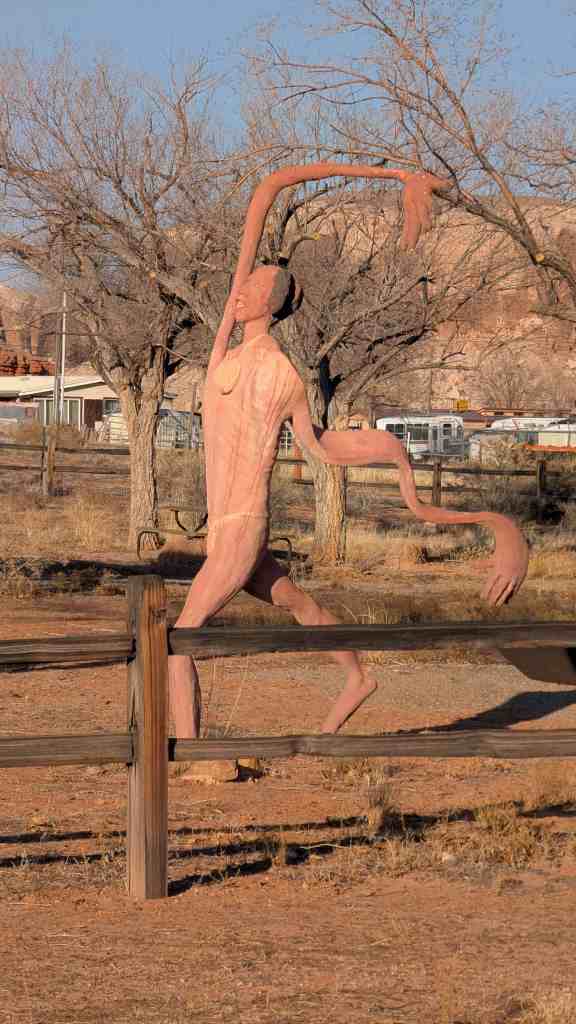
Jacobs Chair in San Juan County, Utah

08 Wednesday Dec 2021
Posted in Uncategorized
Tags

Jacobs Chair in San Juan County, Utah


30 Sunday Dec 2018
Posted in Uncategorized

Benchmark: JM0222 X 19
Location:San Juan County, UT
Designation:X 19
Marker Type:bench mark disk


23 Sunday Apr 2017
Posted in Uncategorized
Tags
Bluff, Forts, historic, Historic Buildings, Historic Markers, Hole-in-the-Rock, San Juan County, utah

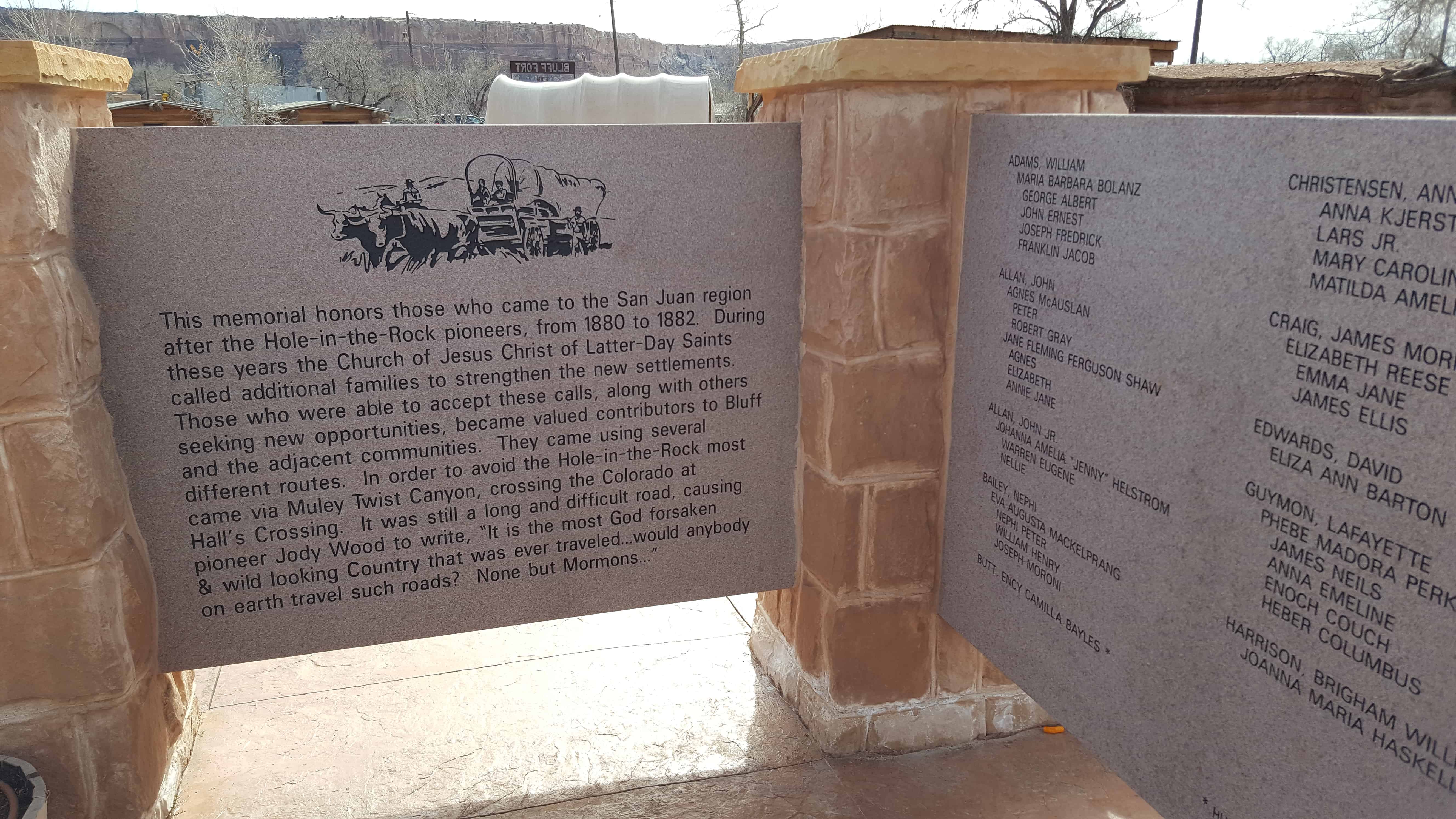
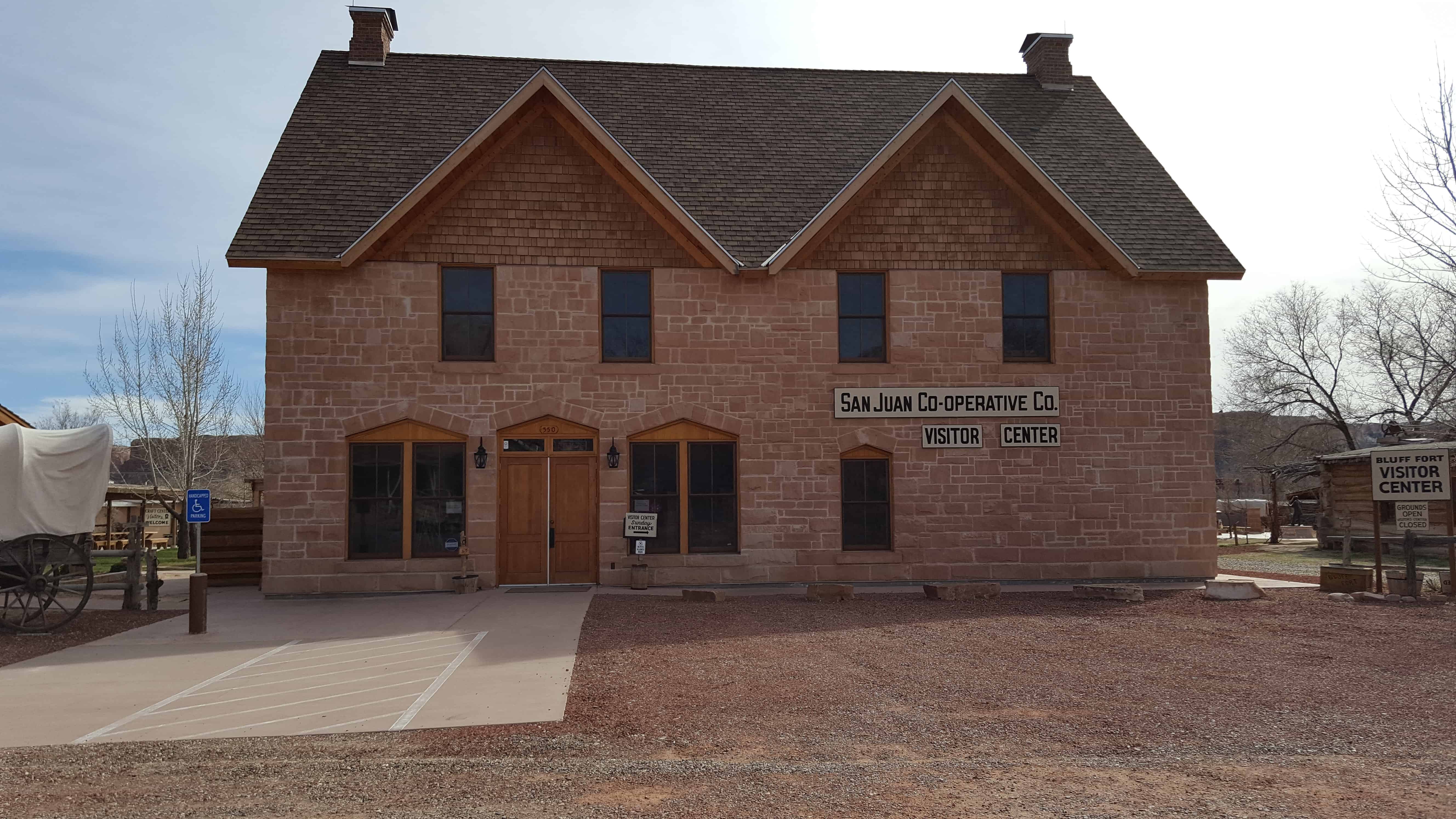
The site of Bluff Fort in Bluff is full of historic buildings, plaques and plenty to learn about for hours.
Click this map from their page to go see what they have put together there:

Some of the things to see include:
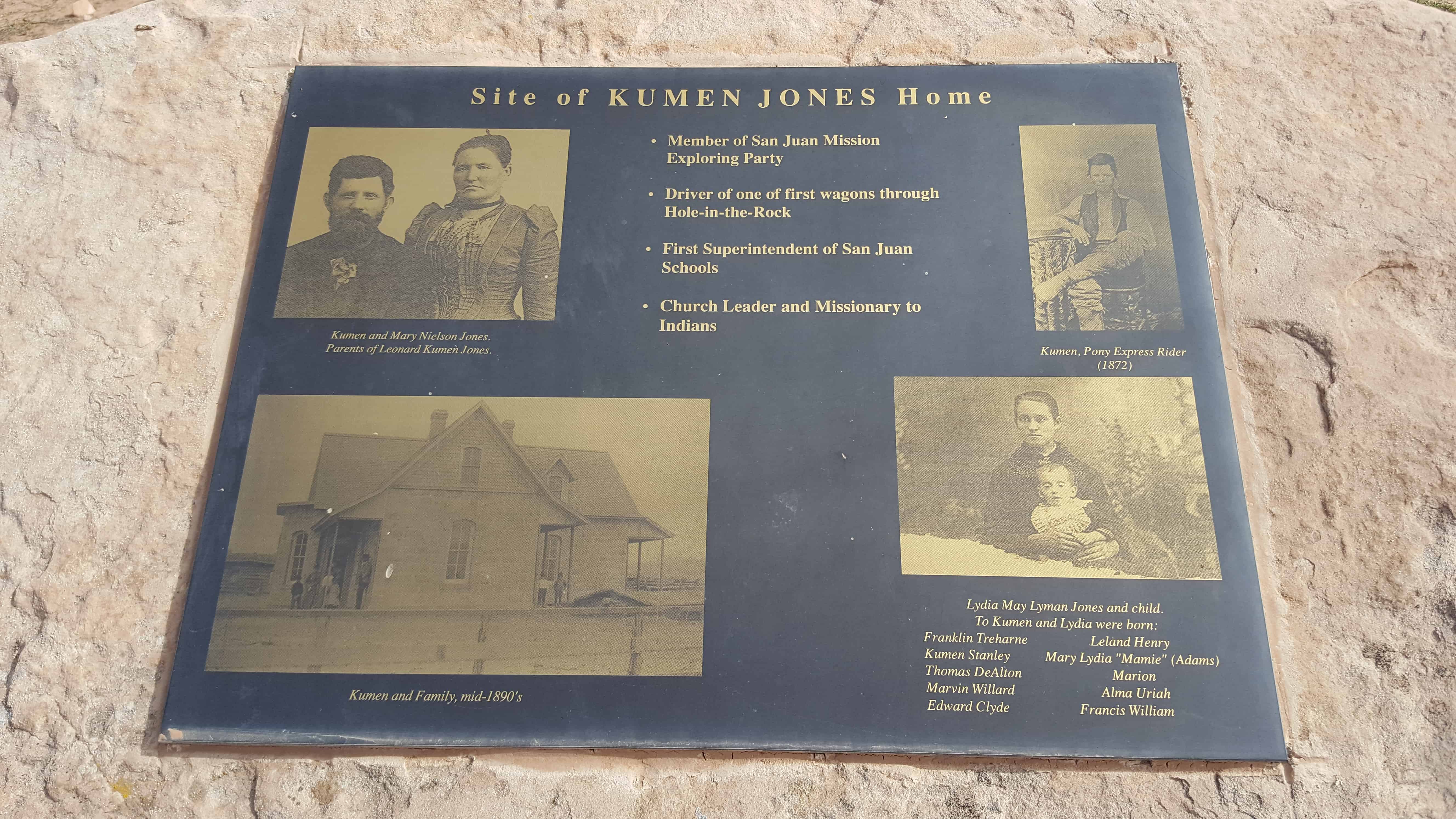
Site of Kumen Jones Home – First Stone Home in Bluff


Perkins Cabin


Lyman Cabin


Cabin Replicas


John Taylor Monument


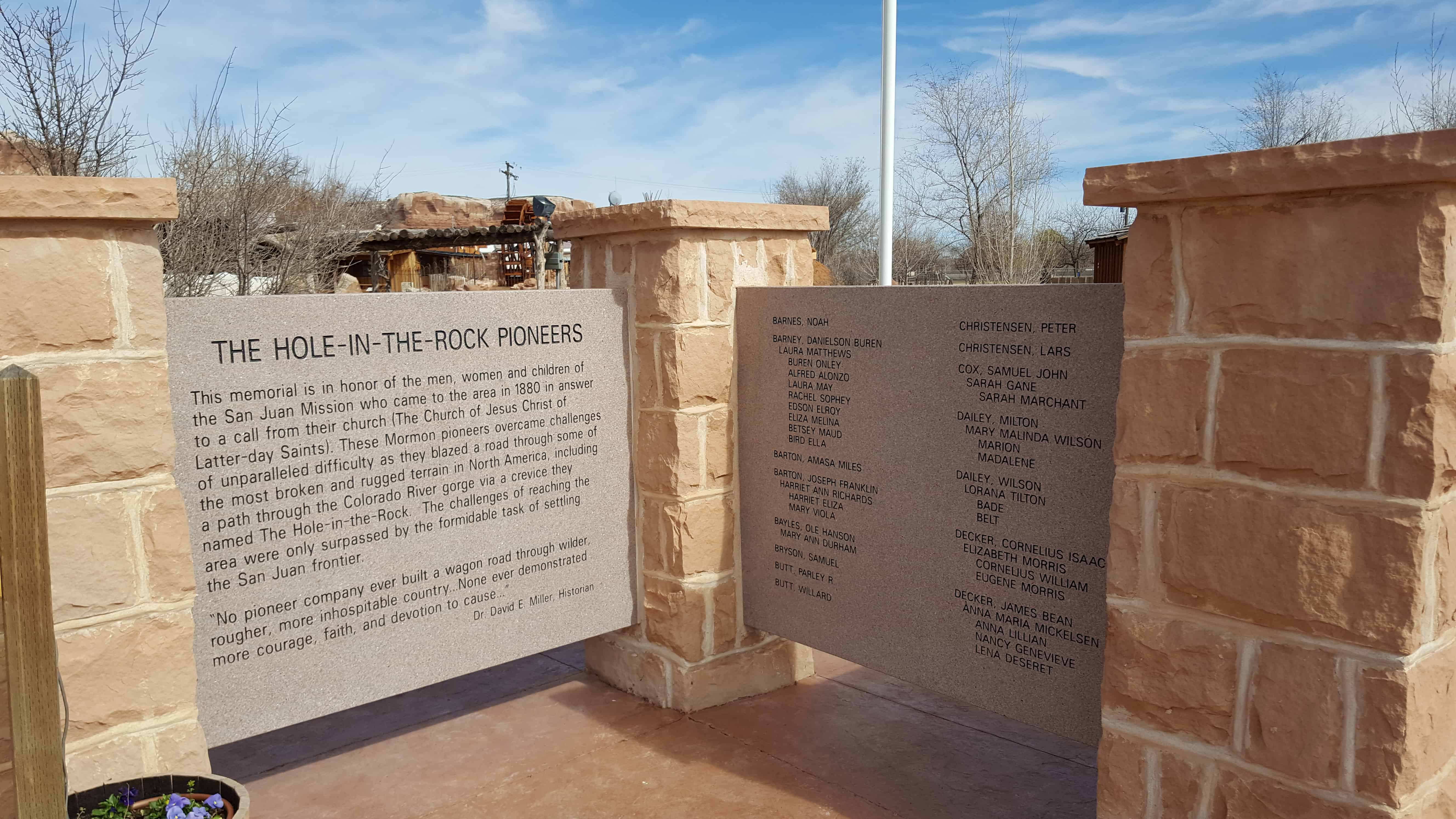
Hole-in-the-Rock Pioneers Memorial
Fort Montezuma


San Juan Co-Op
23 Sunday Apr 2017
Posted in Uncategorized
Tags

Bluff Posts:
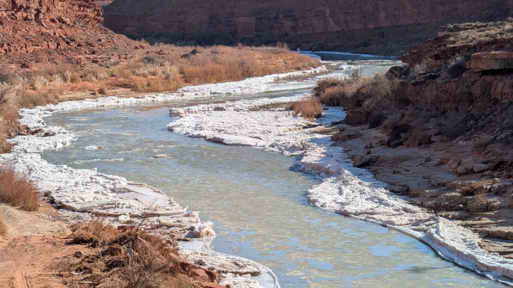
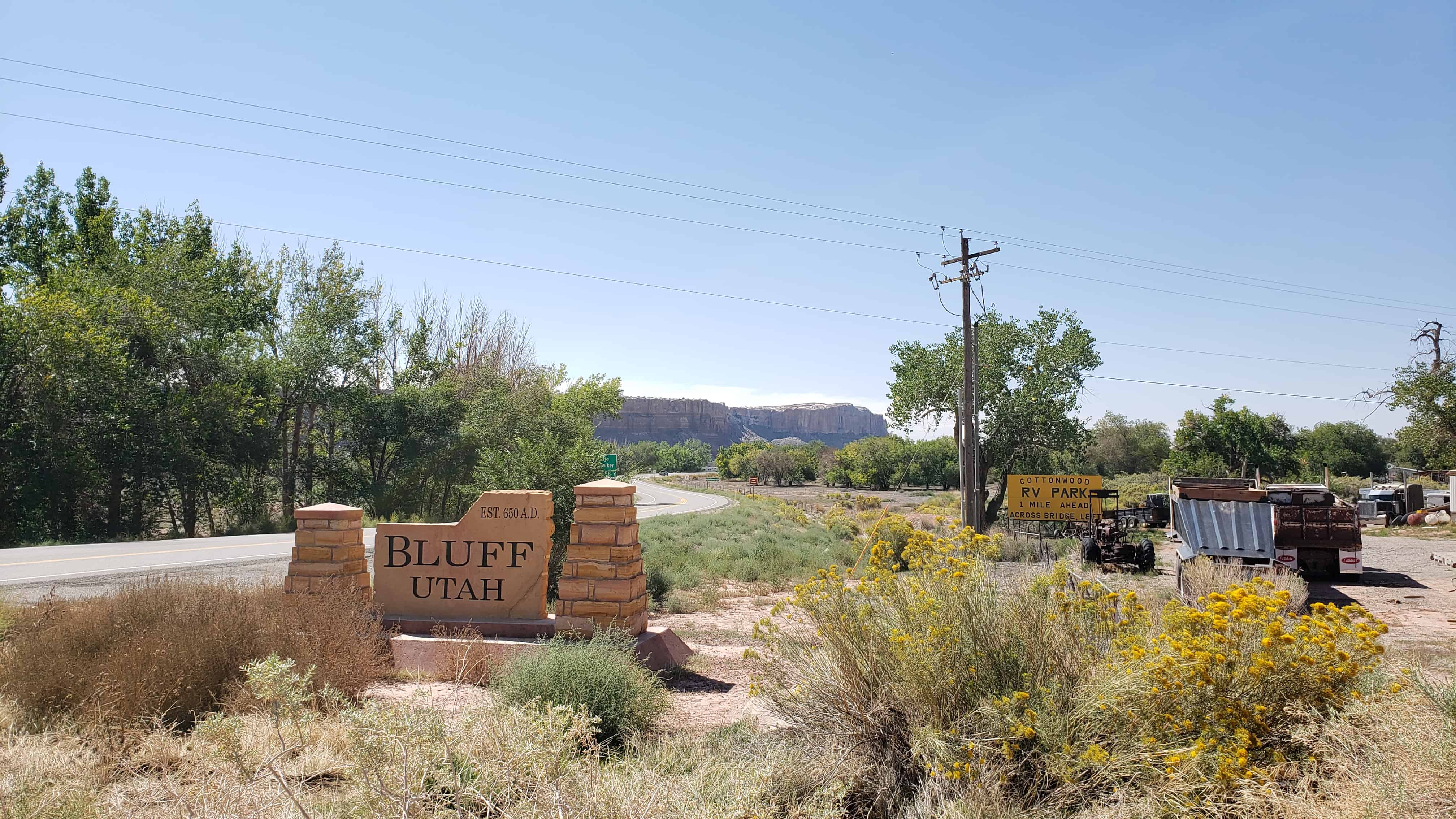
Under the direction of John Taylor, Silas S. Smith and Danish settler Jens Nielson led about 230 Mormons on expedition to start a farming community in southeastern Utah. After forging about 200 miles of their own trail over difficult terrain, the settlers arrived on the site of Bluff in April 1880. (The trail followed went over and down the “Hole In the Rock”, which now opens into one of the tributaries of Lake Powell.) The town was named for the bluffs near the town site. The town’s population had declined to seventy by 1930 but rebounded during a uranium prospecting boom in the 1950s. With the uranium decline in the 1970s Bluff again declined and now remains a small town with about 300 residents.


23 Sunday Apr 2017
Posted in Uncategorized
Tags
Bluff, historic, Historic Buildings, Historic Markers, Hole-in-the-Rock, San Juan County, SUP, utah

Bluff was the first settlement of the white man in San Juan County and its first county seat. It was founded April 6, 1880, by the San Juan Mission “called” by the L.D.S Church to establish friendly relations with the Indians. A small band of mission scouts found good farm land at this location in 1879 and it was resolved to settle here. Late in October 250 colonists from several southwestern Utah communities began the migration via the Hole-in-the-Rock shortcut across the Colorado River. Contrary to expectations this route proved almost impassable and after nearly six months of the most strenuous effort the exhausted company reached this site. No pioneering band ever overcame greater difficulties in establishing and maintaining a home. The turbulent river proved uncontrollable and for 40 years hostile Indians and various types of white renegades threatened both life and property. In spite of hardships and personal sacrifice the missionaries remained steadfast to their calling until released by the Church. The San Juan Mission is an unexcelled example of the highest type of Pioneer endeavor.
Erected by the National Society, Sons of Utah Pioneers – May 31, 1958
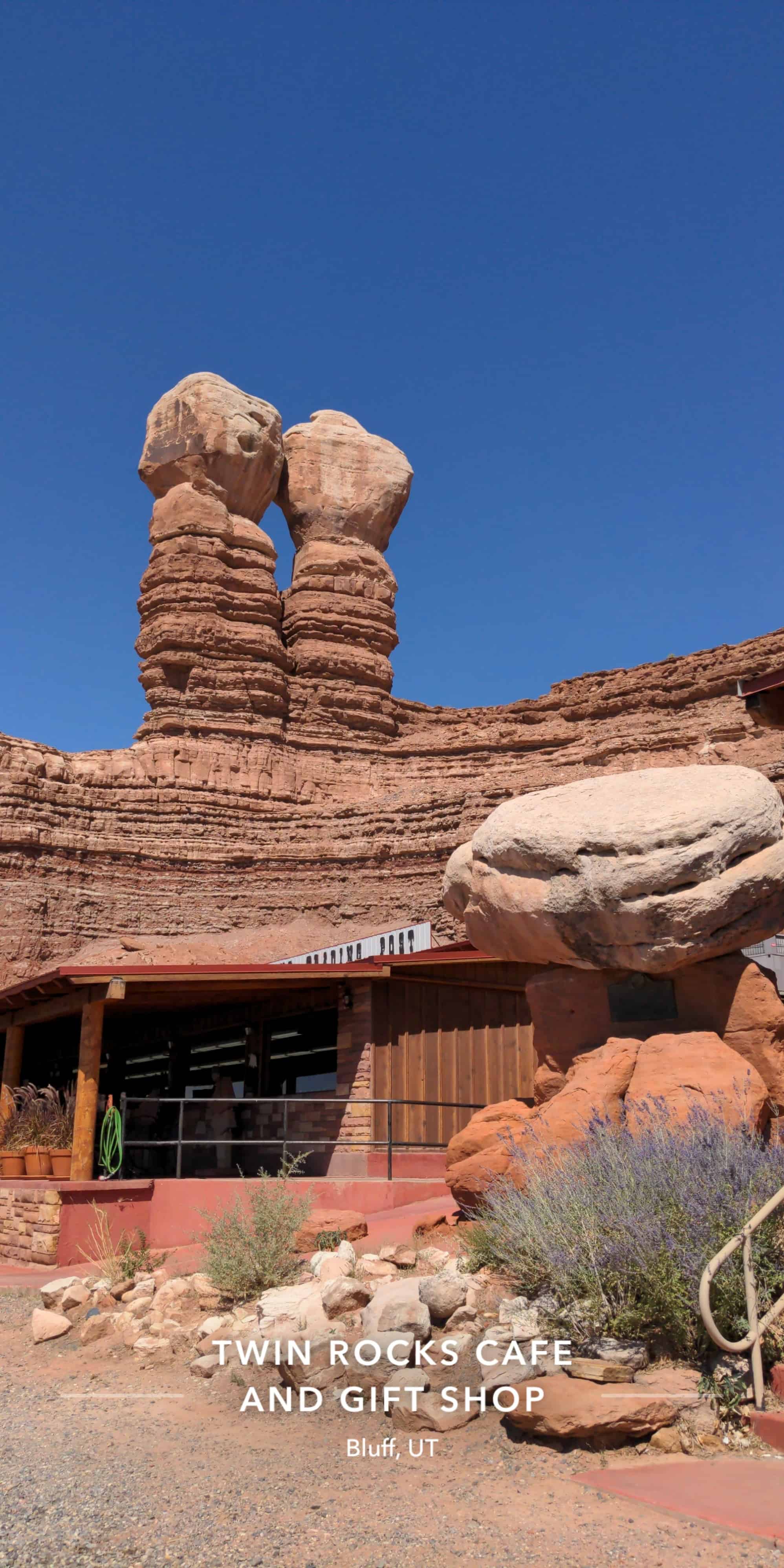
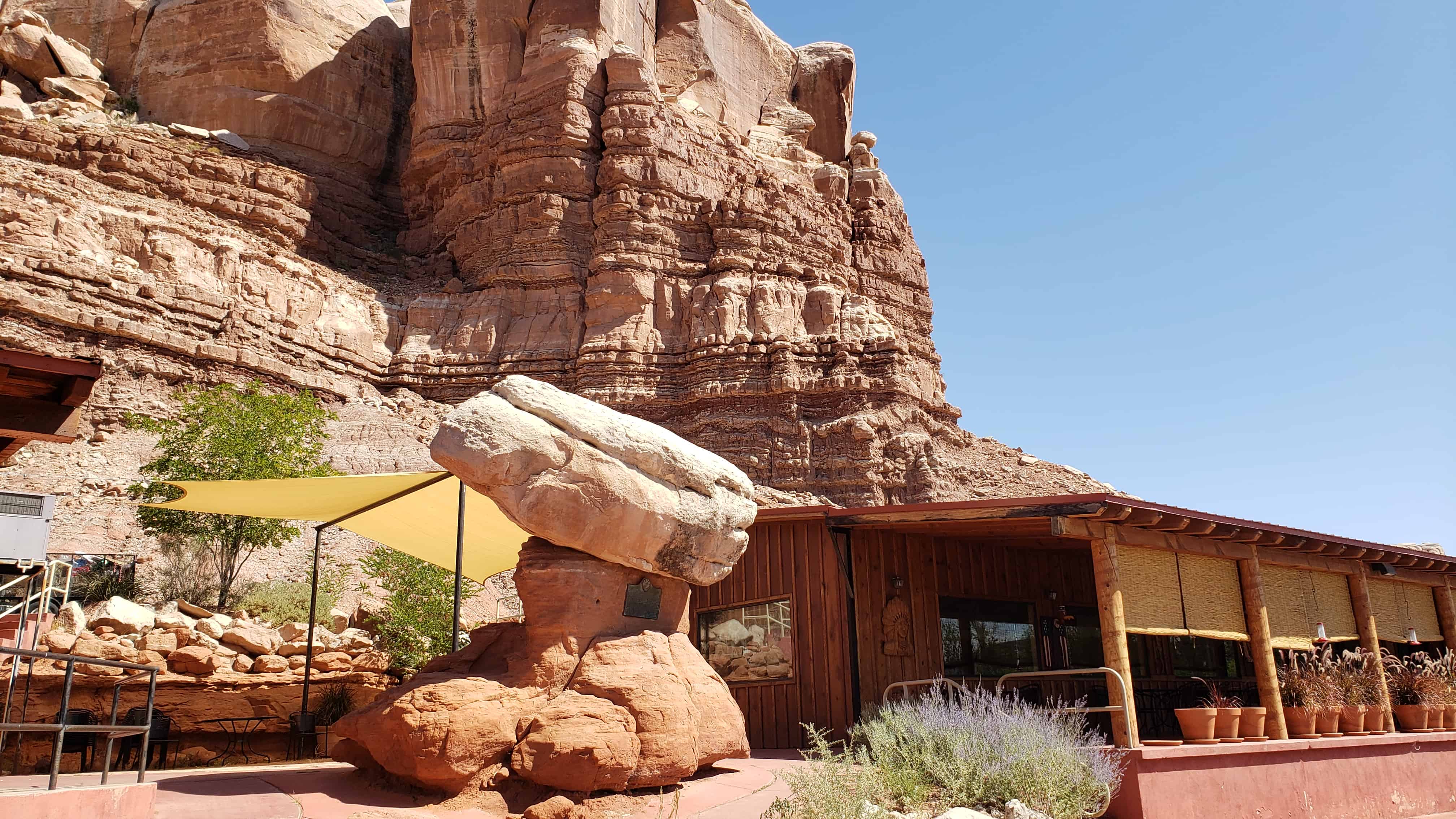
Note: This plaque is attached to a rock formation called “Sunbonnet Rock” due to its shape suggestive of a sunbonnet, and is often referred to by this name. It is located outside the Twin Rocks Café in Bluff, Utah.
This plaque is #L in the series of historic markers by the S.U.P. – See others on this page.


23 Sunday Apr 2017
Posted in Uncategorized
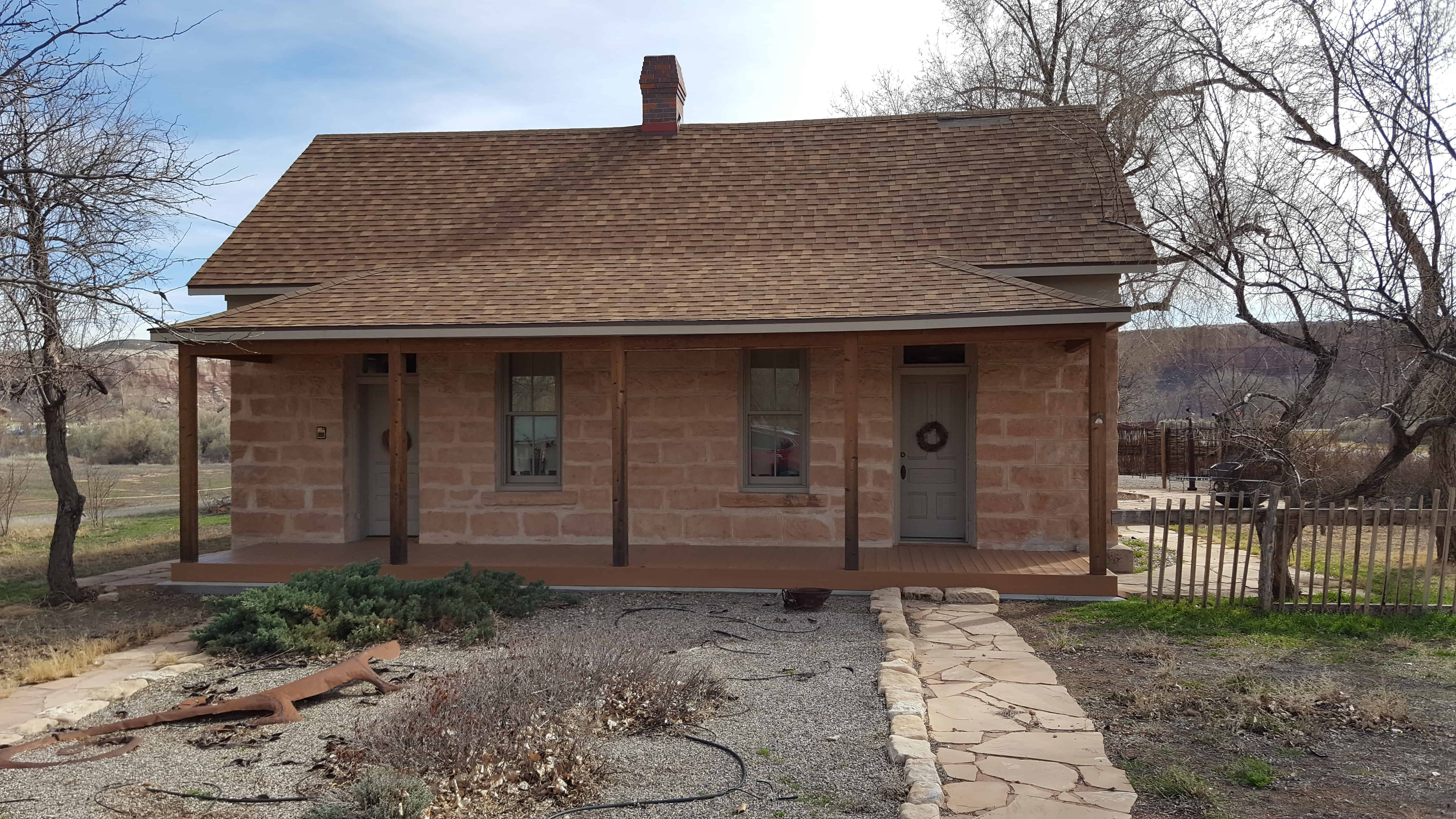
Hyrum Corey Perkins House
This small, one-story, gable-roofed, vernacular, double-cell type house was originally constructed in the 1890s, by Hyrum Corey Perkins. H.C. Perkins was the son of Hyrum and Rachel Marie Perkins, who were original members of the pioneering Hole-in-the-Rock colonizing expeditions in southeastern Utah. A log cabin was originally located on the lot, which was taken down when this double-cell house was built. Retaining its integrity, the house contributes to the architecture and community of historic Bluff.


21 Friday Apr 2017
Posted in Uncategorized

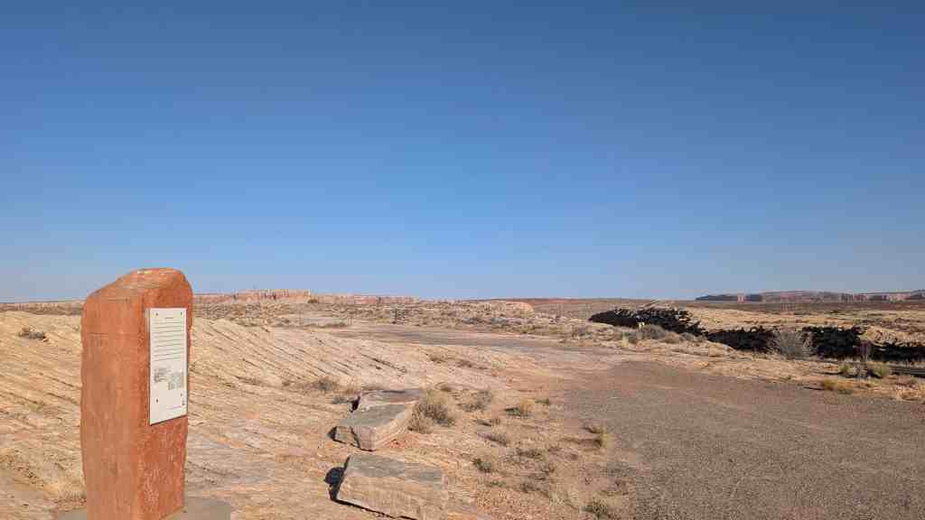
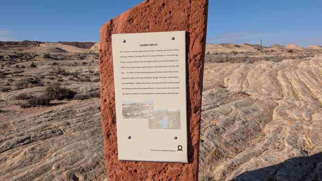
As a winter storm approached, four nearly starved scouts, George Hobbs, George Morrill, Lemuel Redd, Sr., and George Sevey, sought shelter for the night in this area on December 27, 1879. The scouts were exploring for a feasible route for the 250 Mormon (Hole-in-the-Rock) pioneers to follow from their encampments above the Colorado River gorge 100 miles west of here. George Hobbs: Night overtook us, we camped in this small canyon, this being our third day without food. I cut my name in the rock with the date I was there, not knowing that I would survive the journey.
(Near Comb Ridge and Bluff.)


20 Thursday Apr 2017
Posted in Uncategorized
Tags
Bluff, Comb Ridge, Comb Wash, Escalante, Mexican Hat, San Juan County, utah

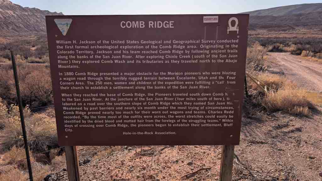
Comb Ridge
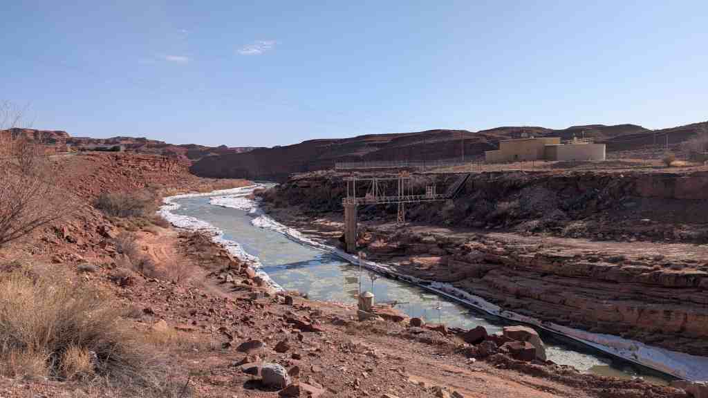
William H. Jackson of the United States Geological and Geographical Survey conducted the first formal archaeological exploration of the Comb Ridge area. Originating in the Colorado Territory, Jackson and his team reached Comb Ridge by following ancient trails along the banks of the San Juan River. After exploring Chinle Creek (south of the San Juan River) they explored Comb Wash and its tributaries as they traveled north to the Abajo Mountains.
In 1880 Comb Ridge presented a major obstacle for the Mormon pioneers who were blazing a wagon road through the terribly rugged terrain between Escalante, Utah and the Four Corners Area. The 250 men, women and children of the expedition were fulfilling a “call” from their church to establish a settlement along the banks of the San Juan River.
When they reached the base of Comb Ridge, the Pioneers traveled south down Comb Wash to the San Juan River. At the juncture of the San Juan River (four miles south of here), they labored on a road over the southern slope of Comb Ridge which they named San Juan Hill. Weakened by past barriers and nearly six months under the most trying of circumstances, Comb Ridge proved nearly too much for their worn out wagons and teams. Charles Redd recorded, “By the time most of the outfits were across, the worst stretches could easily be identified by the dried blood and matted hair from the forelegs of the struggling teams.” Within days of crossing over Comb Ridge, the pioneers began to establish their settlement, Bluff City.


19 Wednesday Apr 2017
Posted in Uncategorized
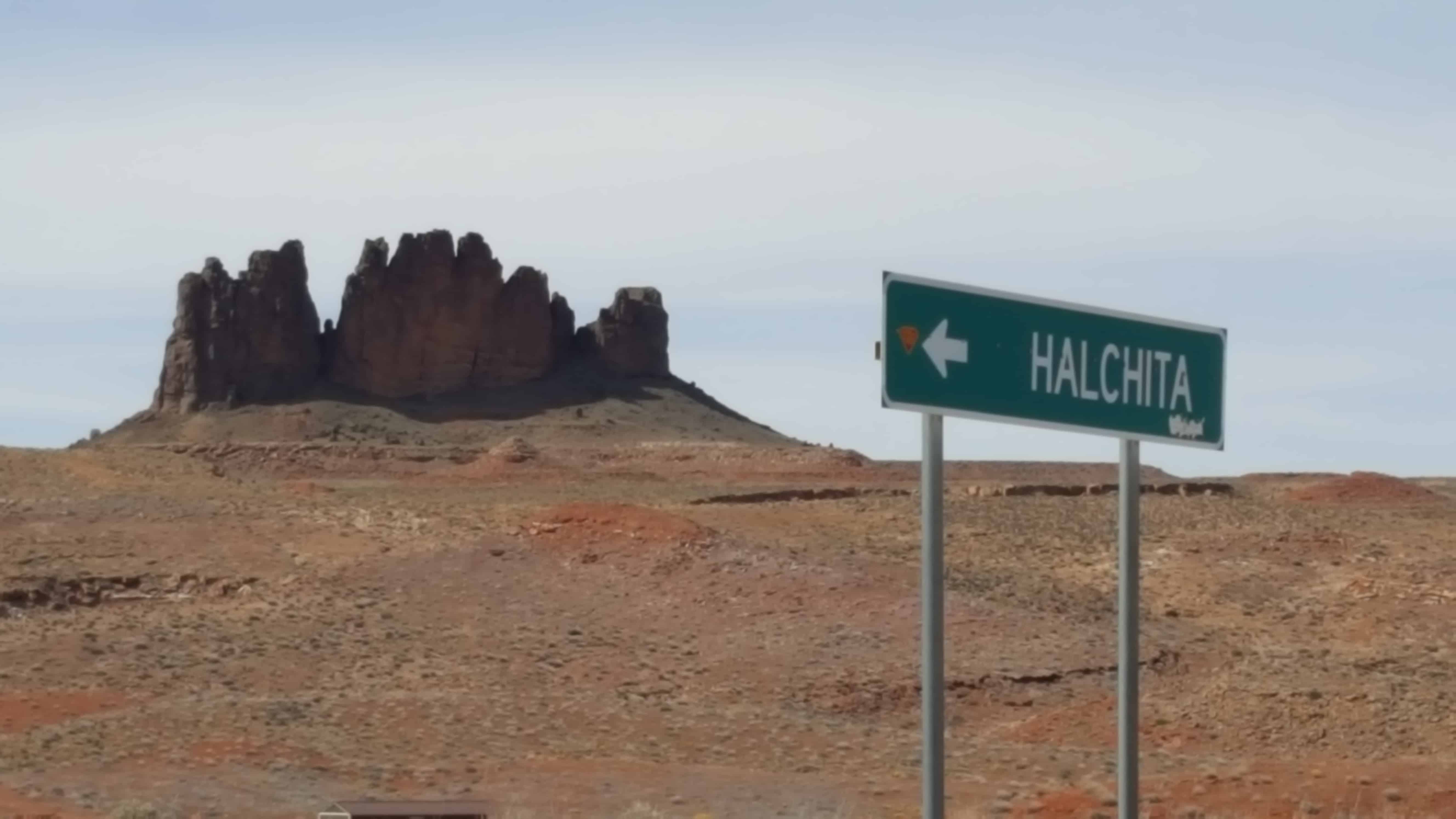
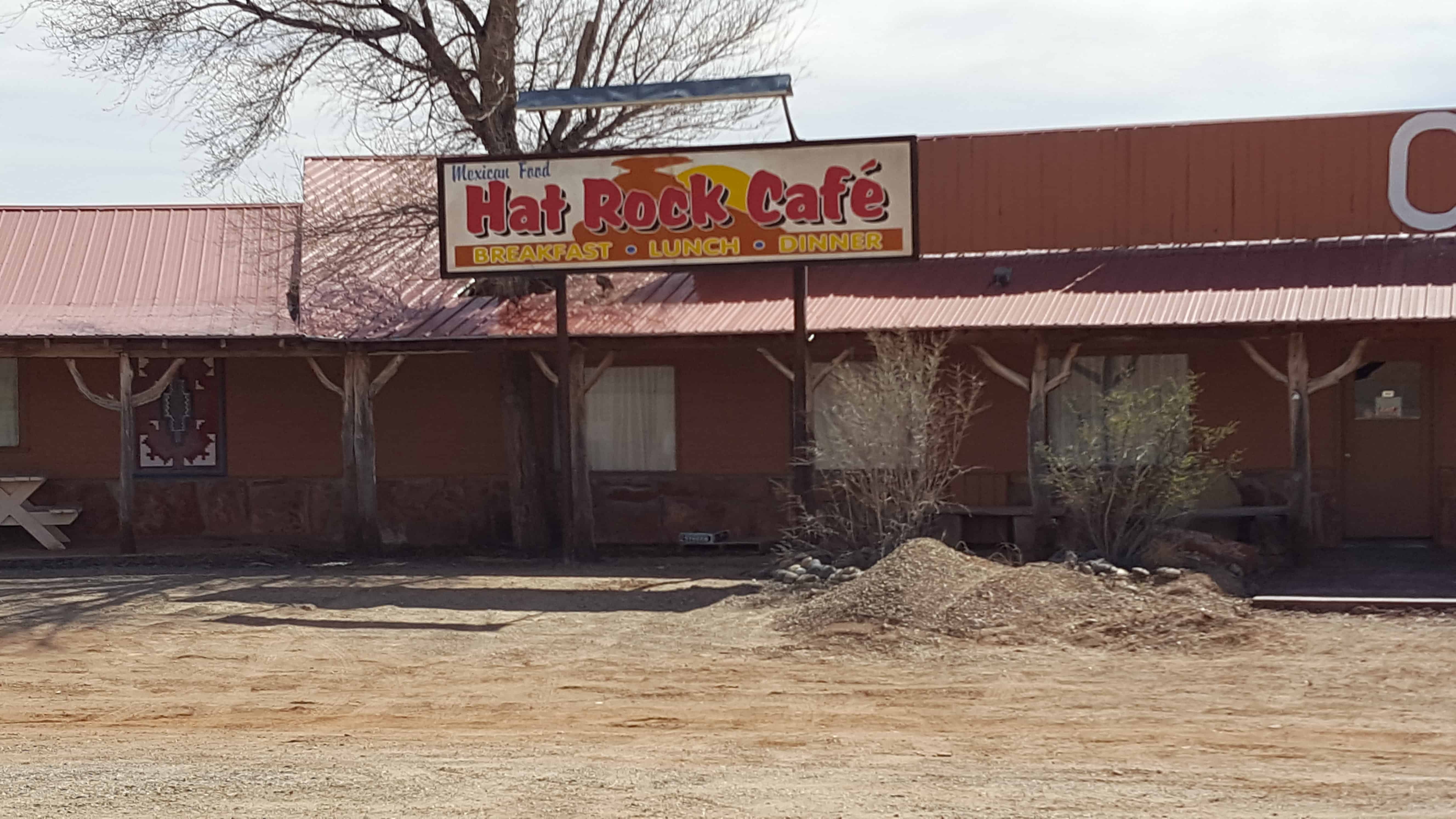
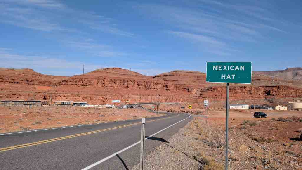
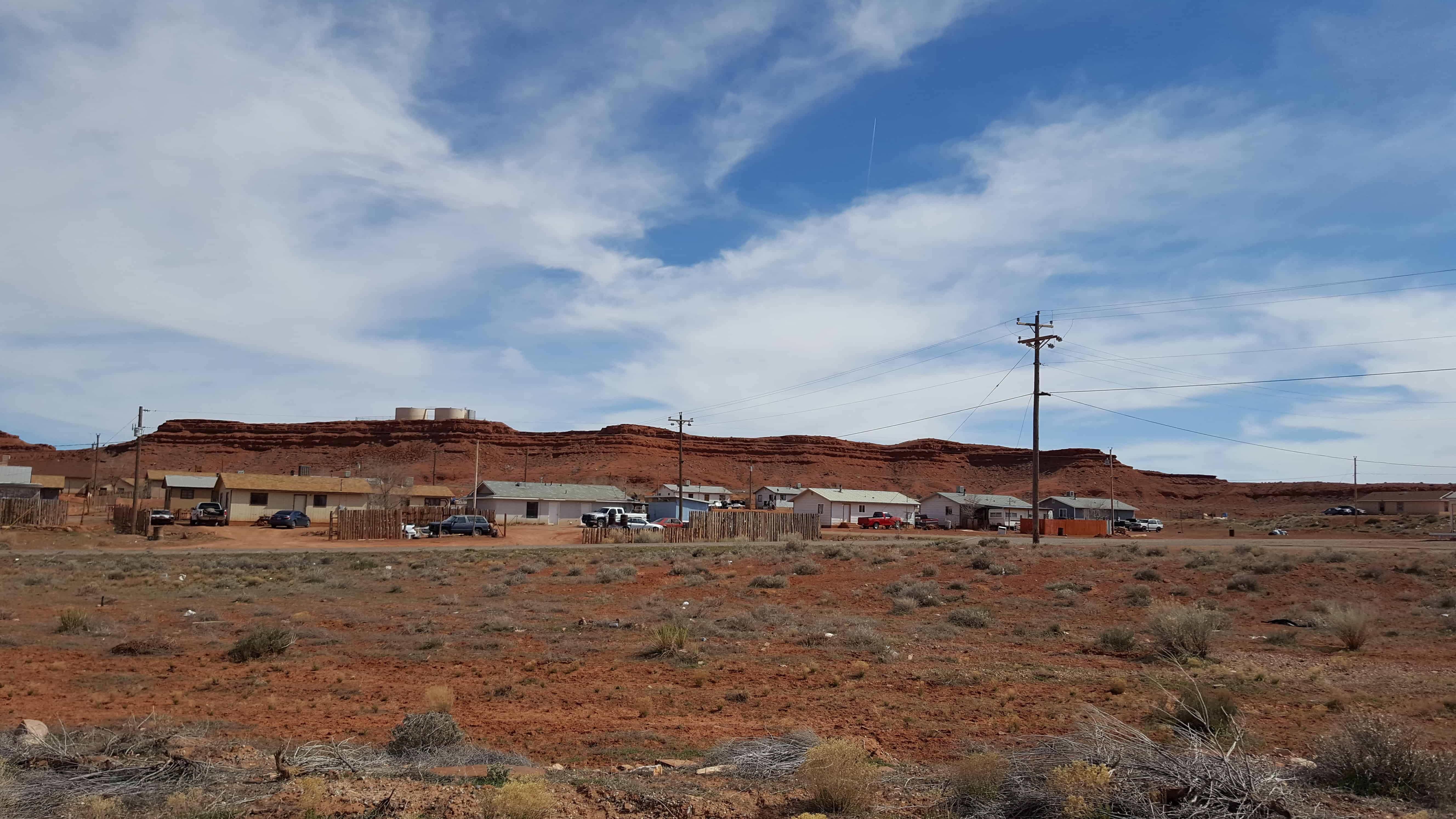
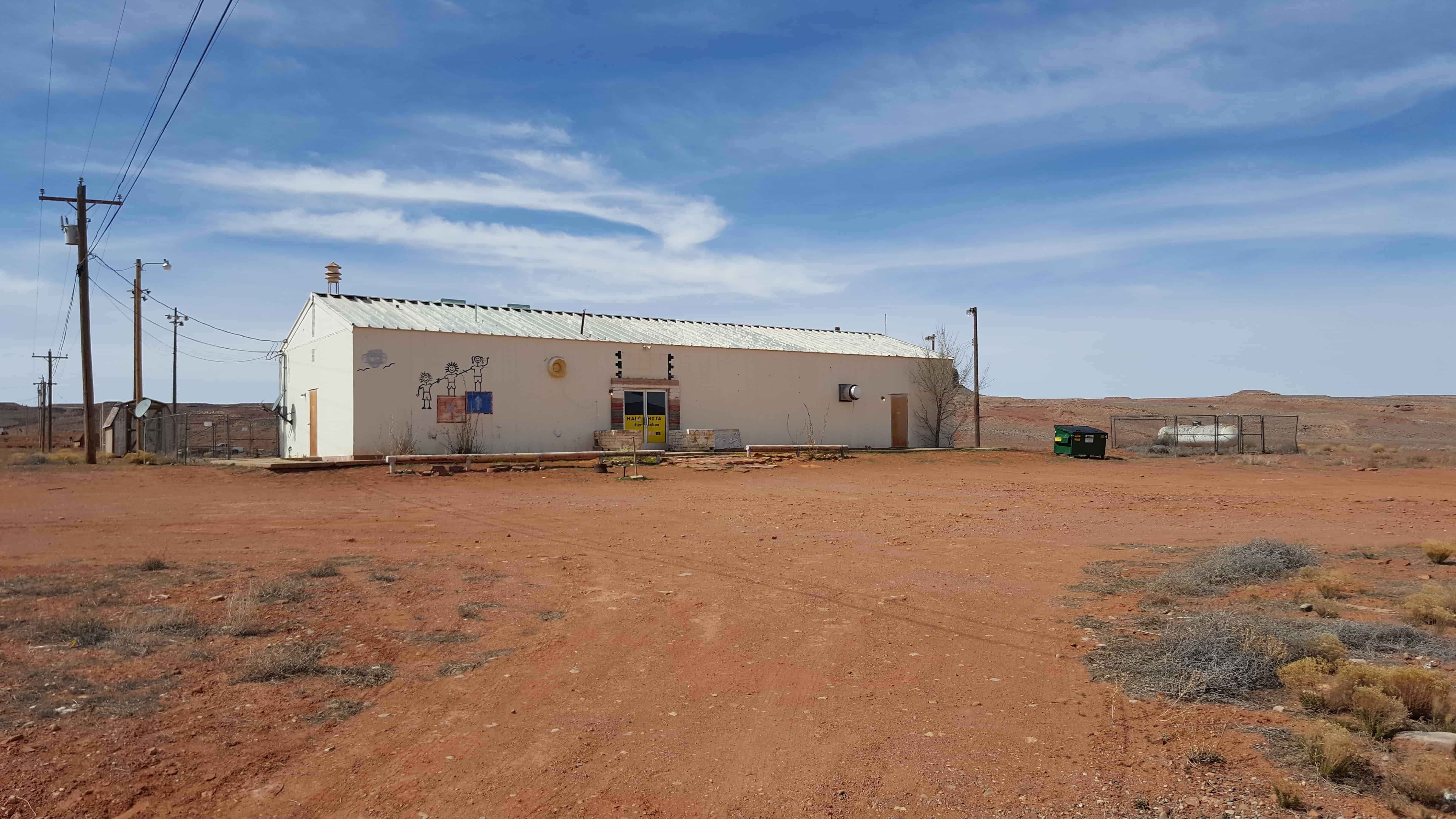
Halchita is a small CDP near Mexican Hat.
Halchita is a small community situated near the San Juan River at 4350 feet along US 163. Mexican Hat is located on the north bank of the San Juan River. Halchita, a Navajo word meaning ‘the red lands,’ is located on the south bank. These communities are approximately twenty miles south of Bluff on US 163. Halchita is the first community encountered on the Reservation when traveling southbound on US 163. It is the location of a government remediated uranium millsite. Combined estimated population of Halchita and Mexican Hat in 2000 was 110.(*)

19 Wednesday Apr 2017
Posted in Uncategorized
Tags
See also:
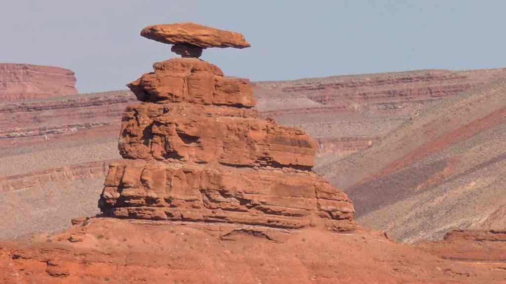
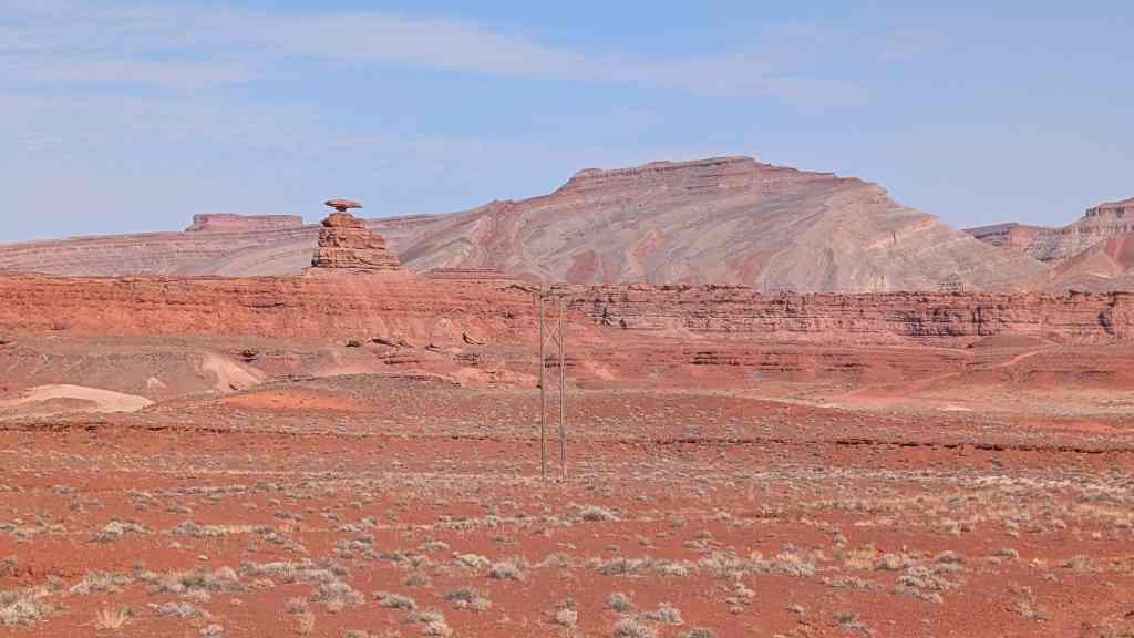
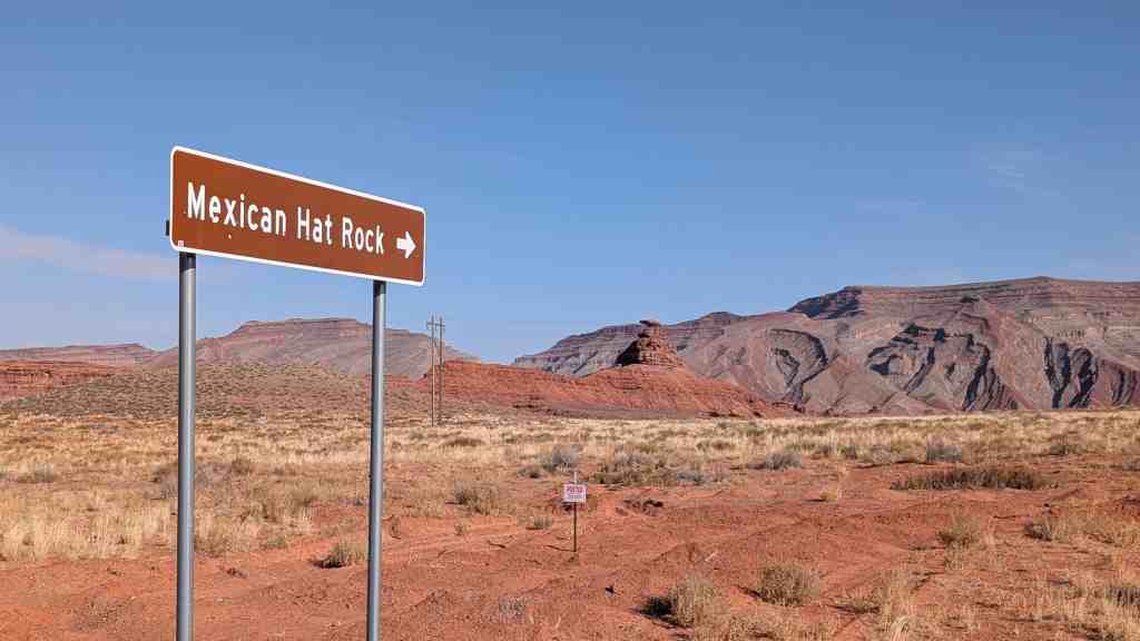
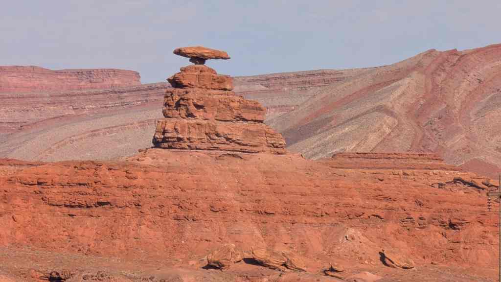
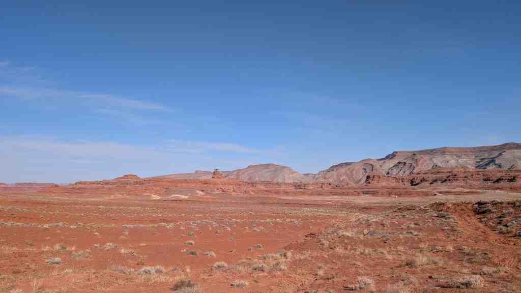
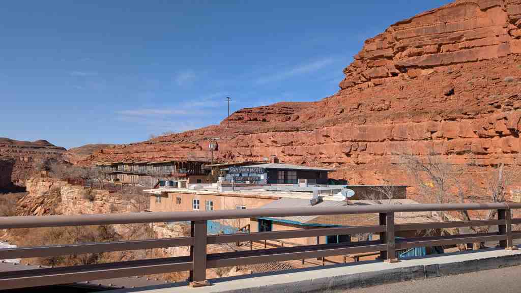
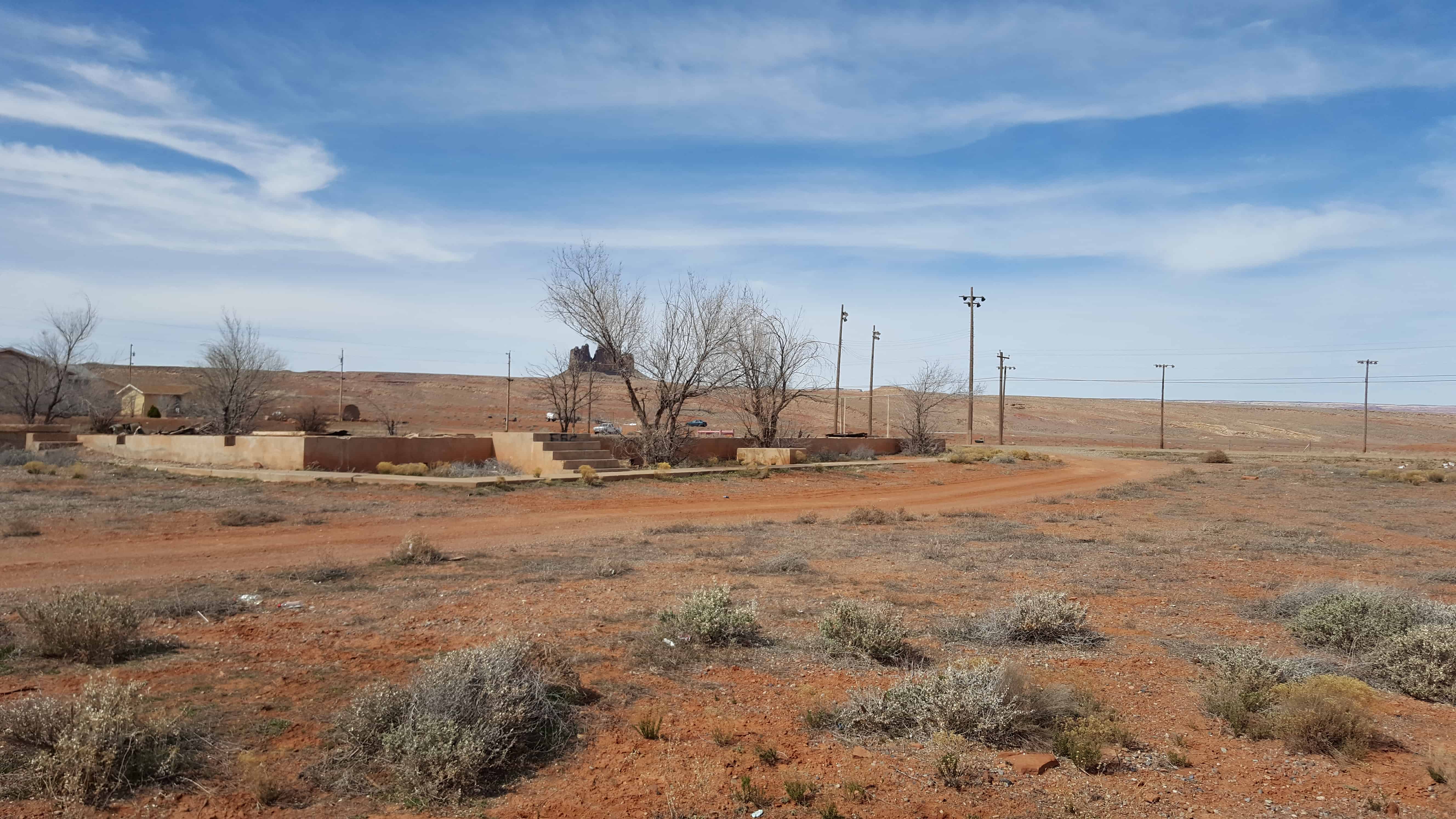
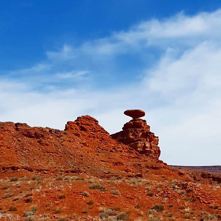
Named for the inverted stone sombrero near the town, Mexican Hat boasts a colorful history. Early in the last century over one thousand people at a time descended on this curve of the San Juan River looking for gold, oil, or uranium.
Today, the town is a popular starting point for adventures on the San Juan River. The Navajo Tapestry–wavy geometric colors in the rock strata–makes a colorful backdrop to the desert landscape. Halchita, a Navajo word meaning ‘the red lands’ is across the river.
Popular day tours include Grand Gulch Primitive Area, John’s and Slickhorn Canyons, Goosenecks State Park, Valley of the Gods, Natural Bridges, Hovenweep, Navajo National Monuments, and Monument Valley Navajo Tribal Park. Full services available in Mexican Hat, none in Halchita.(*)