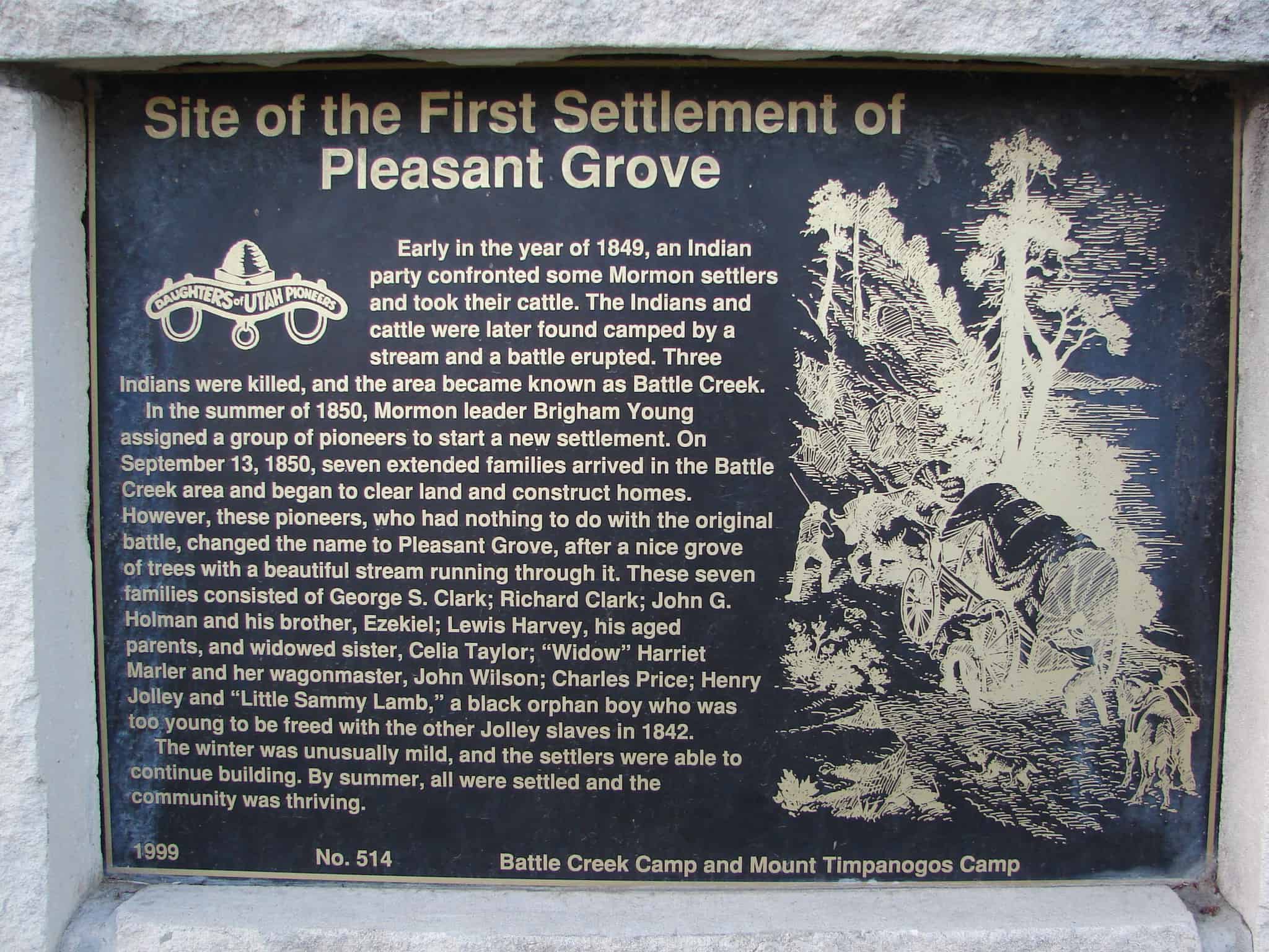
Early in the year of 1849, an Indian party confronted some Mormon settlers and took their cattle. The Indians and cattle were later found camped by a stream and a battle erupted. Three Indians were killed, and the area became known as Battle Creek.
In the summer of 1850, Mormon leader Brigham Young assigned a group of pioneers to start a new settlement. On September 13, 1850, seven extended families arrived in the Battle Creek area and began to clear land and construct homes. However, these pioneers, who had nothing to do with the original battle, changed the name to Pleasant Grove, after a nice grove of trees with a beautiful stream running through it. These seven families consisted of George S. Clark; Richard Clark; John G. Holman and his brother, Ezekiel; Lewis Harvey, his aged parents, and widowed sister, Celia Taylor; “Widow” Harriet Marler and her wagonmaster, John Wilson; Charles Price; Henry Jolley and “Little Sammy Lamb,” a black orphan boy who was too young to be freed with the other Jolley slaves in 1842.
The winter was unusually mild, and the settlers were able to continue building. By summer, all were settled and the community was thriving.
Check out all of the historic markers placed by the Daughters of Utah Pioneers at JacobBarlow.com/dup
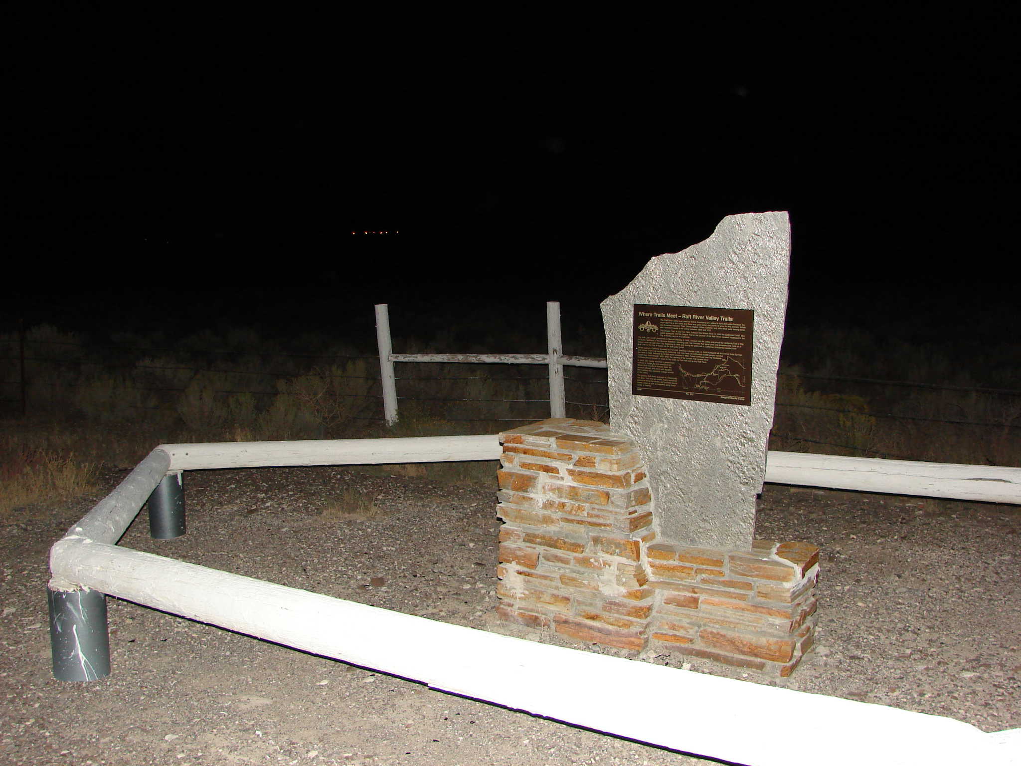
The Raft River Valley was used by Native Americans as a place to hunt and winter because the snow didn’t lie in the valley and there was good water and plenty of grass for the animals. British and American trappers, Peter Skene Ogden, Milton Sublette, and John Work were among those who recorded travels in the valley between 1825 and 1832.
The Oregon Trail, in use from 1841, followed the Snake River. In 1846 the California Cutoff, also called Applegate, left the Oregon Trail at the junction of the Raft River, traveled southwest to the City of Rocks, and on to California.
The Salt Lake Cutoff, pioneered by Samuel Hensley in 1848, crossed into the valley and joined the California Trail at City of Rocks. Members of the Mormon Battalion, traveling east, met Hensley that same year and pioneered the route as a wagon road into Salt Lake City. Beginning in 1849 and during the gold rush to California, thousands traveled from Salt Lake to the City of Rocks via the Salt Lake Cutoff.
Others going to California traveled via Fort Hall. Seeking a shorter route, in 1849 Hudspeth left the trail at Soda Springs and blazed a new trail rejoining the California Trail near here. An estimated 45,000 people traveled the route in 1850, followed by 50,000 more travelers in 1852. Travel continued over the Hudspeth Cutoff from 1849 through 1859, when the opening of the Lander Trail caused most California-bound groups to return to the route via Fort Hall and up the Raft River.
In 1869 John Hailey received a government contract to freight the rich minerals from Wood River Country to Kelton, Utah, the nearest railroad, and return with supplies. Ben Halliday also operated a stage service in this valley.
The greater Raft River drainage is a historically rich area. Trail ruts are visible, many unmarked graves lie along the routes, and journals record scenic vistas as well as tragedies along these roads in history.
Check out all of the historic markers placed by the Daughters of Utah Pioneers at JacobBarlow.com/dup
The Muddy Creek Camp, which was northwest of this marker and on the west side of the Muddy Creek was used by Brigham Young’s first group of Mormon pioneers who arrived here on July 9, 1847. Thomas Bullock reported that the brethren sang hymns for President Brigham Young, and they had a delightful evening. This camp had good water and plenty of grass, and the animals were well-fed by the tall bunch-grass growing along the creek. Erastus Snow described the campground as “very pretty.”
It was one of the most heavily used camps on the Overland-Mormon-California-Pony Express Trails. Approximately 70,000 Mormon pioneers crossed, passed through, or camped at Muddy Creek Campground. The U.S. Army camped here with 2,000 men in June of 1858. Both the Martin and the Willie handcart companies crossed here in November of 1856 while traveling with rescue wagons. The Muddy Overland Stage Stop and Pony Express Station were located at this site, and foundation stones may still be seen along the west bank of Muddy Creek. The road by this marker was the original Transcontinental Railroad bed of 1869. The Transcontinental Telegraph, automobile road, and stageline either go through the campground or are very nearby, making Muddy Creek Camp an important park of this area’s history.
Check out all of the historic markers placed by the Daughters of Utah Pioneers at JacobBarlow.com/dup
During the years of 1881-1900, many pioneers entered and settled the Surface Creek Valley. As these pioneers entered this part of western Colorado, they set the stage for the development of the communities located in present-day Delta County. Pioneer families who settled this area emigrated from Utah, other parts of the United States, and many foreign countries. These courageous men, women, and children planted crops and fruit trees, brought in livestock, discovered and mined coal, and developed the water systems from Grand Mesa. With their foresight, strength, and courage, they contributed in many ways to make this area a wonderful place to live. Many have gained from the efforts and hard work of these sturdy pioneers. Honoring the pioneers of Delta County with the erection of this monument is a privilege.
Check out all of the historic markers placed by the Daughters of Utah Pioneers at JacobBarlow.com/dup
In the spring of 1849, Samuel Comstock Snyder and Parley P. Pratt cut a road up “Big Canyon” and found what became known as “Parley’s Park.” The road became a toll road for Wells Fargo, the Overland Stage, and other travelers. In 1850 Parley P. Pratt sold his claim to the valley to Snyder for a yoke of oxen. Samuel Snyder and his family became the first of many to build homes in the basin. Millers by trade, Snyders built a gristmill, a sawmill, and a reservoir on Spring Creek. They supplied lumber for homes and for the developing mining industry. Upon a prominent knoll a cemetery was established, in which 27 Snyder Descendants have since been buried. Many markers were made of sandstone, cut and carved by a loving hand, and tell the story of a typical family who lost many children to disease and the rigors of pioneer life. The Snyderville Cemetery was dedicated in 2001.
Check out all of the historic markers placed by the Daughters of Utah Pioneers at JacobBarlow.com/dup
This is the page for the Daughters of Utah Pioneers marker in the Snyderville Pioneer Cemetery, click here for the Sons of Utah Pioneers marker at the same cemetery, or here for Snyderville in general.
The pioneers of East Millcreek built the log schoolhouse in 1854 on bench land above a creek, later named Millcreek. Drinking water was carried up the hill from the creek. Logs were brought from the nearby canyons, and members of the community furnished the labor to build the school. The children wrote on desks of wide pine slabs with charcoal gathered from a kiln in the canyon. The teacher removed the writing with a wood plane. The school was located on Millcreek Road, about one-half mile east of this site. The building was sold to Moses Wilkinson in 1878 and moved; it became his family home.
The second school was housed in the adobe chapel of the East Millcreek Ward that stood directly across this intersection, perhaps 30 yards east of the mill marker. Completed in 1878, the building housed worshipers on Sunday, young students on weekdays, and people of all ages at social gatherings. A curtain divided its single 25 by 40-foot room to give two teachers their own classrooms. As was the case with the earlier log school, parents were required to pay in cash, produce, or other goods for their children’s schooling. Serving students until 1893, the building was razed in 1974.
In 1890 the Territorial Legislature passed the Free School Law, making education available to all children. Three years later, the 33rd District School opened one-half block north of this site on the east side of 2700 East Street. This tax tax-supported school of brick, with a small bell tower, covered porch, and its date and name embossed proudly on its front, housed an increasing student enrollment until 1910 when the larger Sherman School was constructed.
Check out all of the historic markers placed by the Daughters of Utah Pioneers at JacobBarlow.com/dup
In 1859, John Hoile established a flour gristmill at First South between First and Second East. The mill consisted of a small one-story frame building. On June 20, 1870, the mill was bought by John Hague who operated it until he died in 1900. The mill sat idle until 1907 when it was purchased by the Juab Mill and Elevator Company. They immediately enlarged the mill’s manufacturing capacity by adding a three-story brick structure.
This wheel is the third and last wheel used at the millsite. A wooden flume or millrace, raised 16 feet high on stilts, carried water from Salt Creek at a place between Third and Fourth East. The force of the flow turned the wheel which powered the whole mill. During the 1920s, the Juab Mill and Elevator Company bought the Nephi Mill and Manufacturing Company located at First North and Second West. From the time on, flour was milled at the Nephi Mill and Manufacturing Company, and the Old Mill operated as a feed mill, manufacturing poultry feed and chopping and grinding grain.
Activities came to an end at the original site in 1949 when both mills were sold.
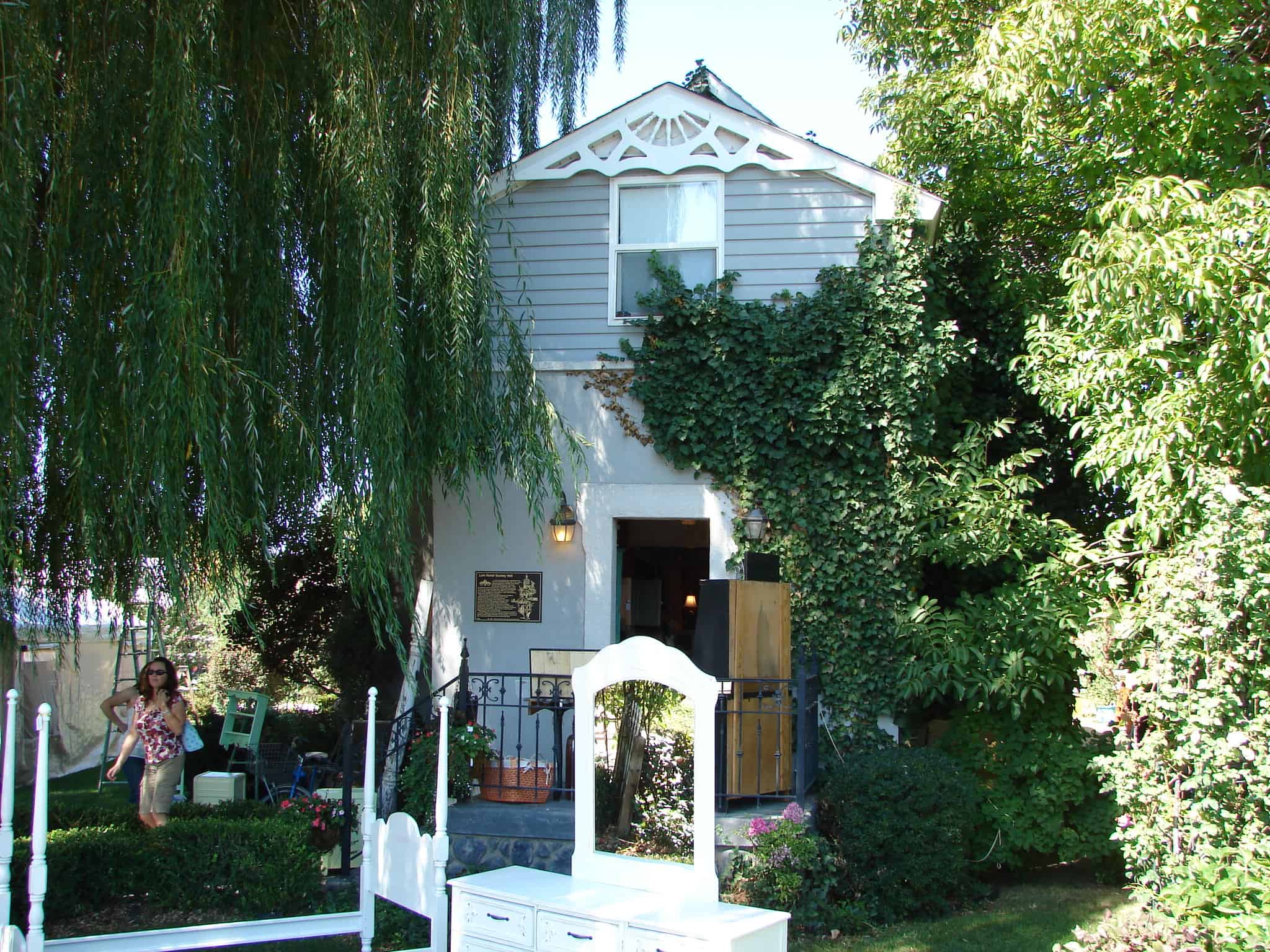
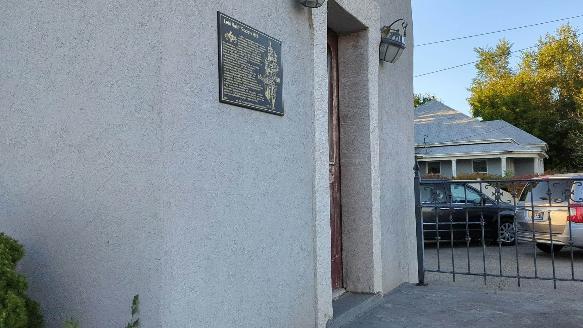
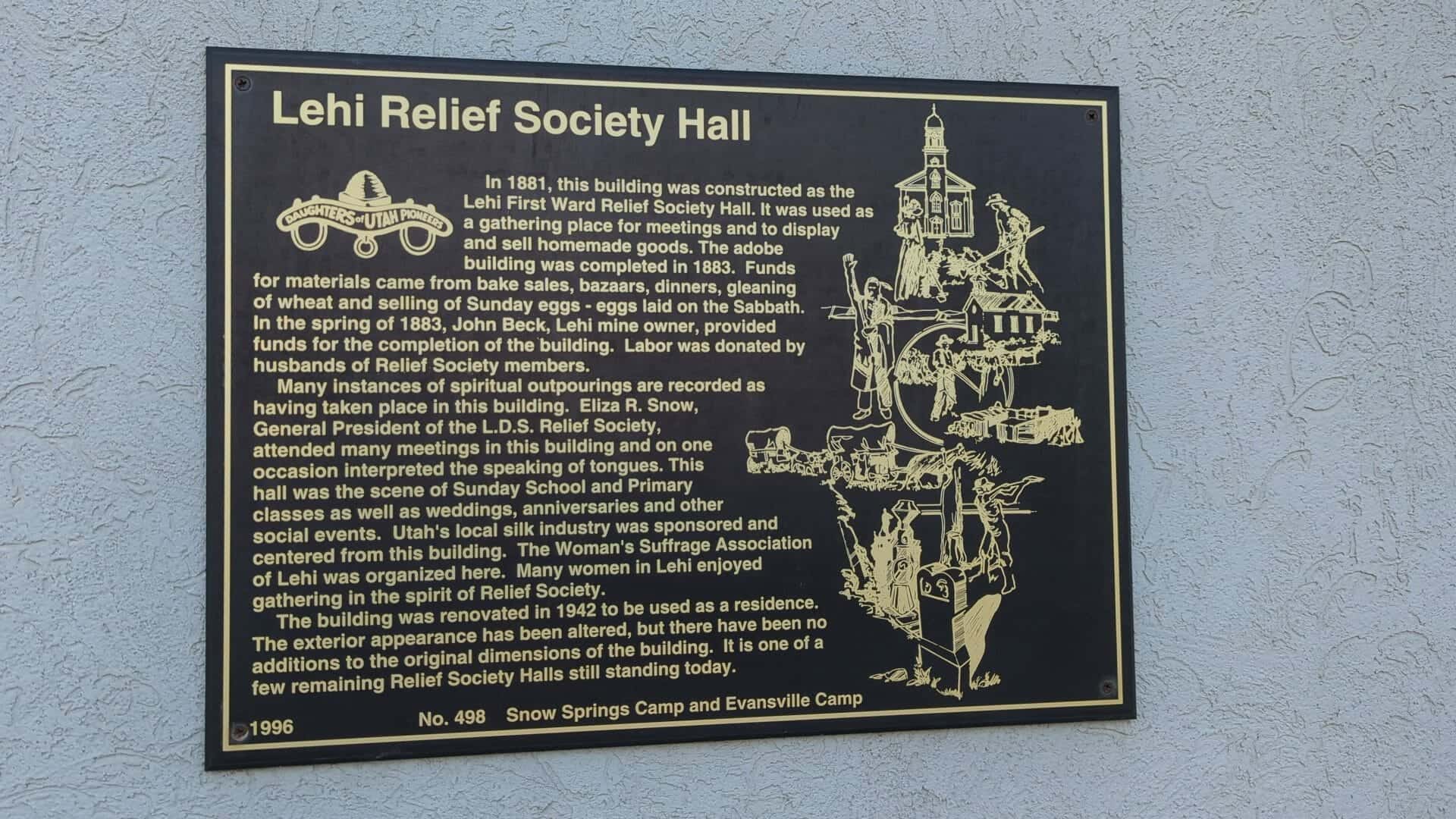
In 1881, this building was constructed as the Lehi First Ward Relief Society Hall. It was used as a gathering place for meetings and to display and sell homemade goods. The adobe building was completed in 1883. Funds for materials came from bake sales, bazaars, dinners, gleaning of wheat and selling of Sunday eggs – eggs laid on the Sabbath. In the spring of 1883, John Beck, Lehi mine owner, provided funds for the completion of the building. Labor was donated by husbands of Relief Society members.
Many instances of spiritual outpourings are recorded as having taken place in this building. Eliza R. Snow, General President of the L.D.S. Relief Society, attended many meetings in this building and on one occasion interpreted the speaking of tongues. This hall was the scene of Sunday School and Primary classes as well as weddings, anniversaries and other social events. Utah’s local silk industry was sponsored and centered from this building. The Women’s Suffrage Association of Lehi was organized here. Many women in Lehi enjoyed gathering in the spirit of Relief Society.
The building was renovated in 1942 to be used as a residence. The exterior appearance has been altered, but there have been no additions to the original dimensions of the building. It is one of a few remaining Relief Society Halls still standing today.
This is Daughters of Utah Pioneers historic marker #498 located at 212 West Main Street in Lehi, Utah
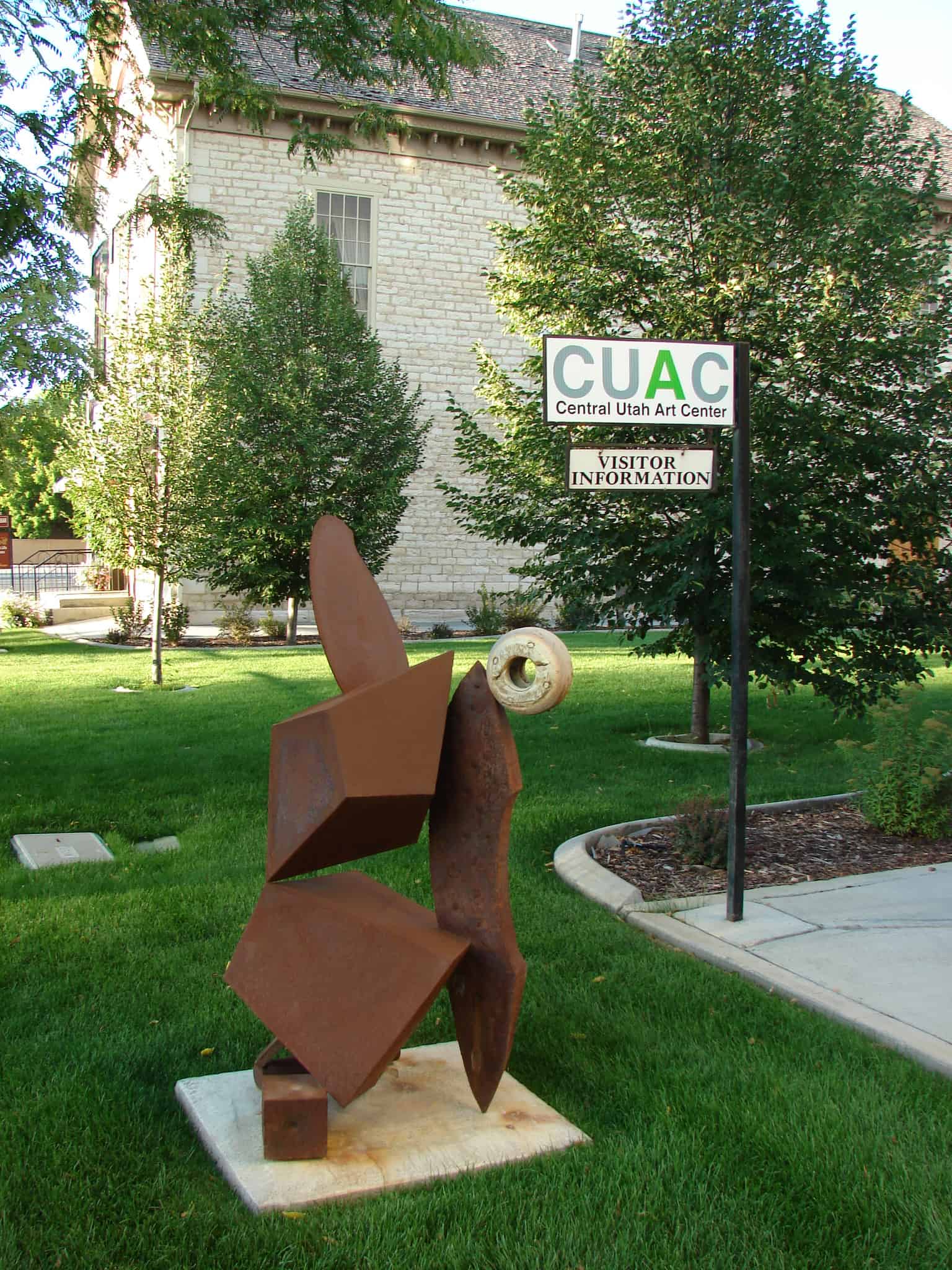
President Brigham Young, in 1876, gave the Relief Society sisters an assignment to store wheat for a time of need. This historic, oolite limestone building was constructed as a granary in response to this concept. Pioneer women and children followed the threshers to glean wheat leavings. They sold handmade items and Sunday eggs – eggs laid on Sunday – to purchase wheat to fill the bins. Wheat was given to the bishop for the needy, and grain was given to farmers for seed with a repayment of five bushels for each four bushels given.
Relief Society Wheat and flour were contributed to San Francisco after the earthquake in 1906 and to China during the famine in 1907.
In 1915, the granary was converted to a flour mill that functioned for forty years. In 1969, the granary and adjoining cooperative store were threatened with demolition but were preserved through valiant community efforts. The granary interior was completely reconstructed into The Central Utah Art Center in 1990.
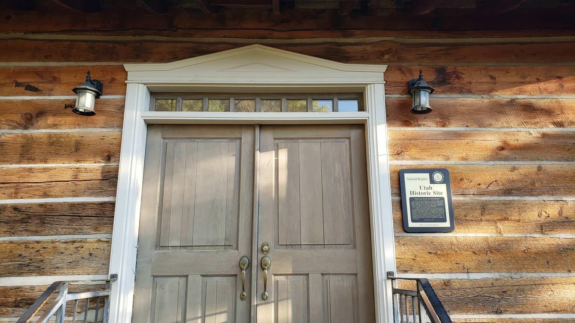
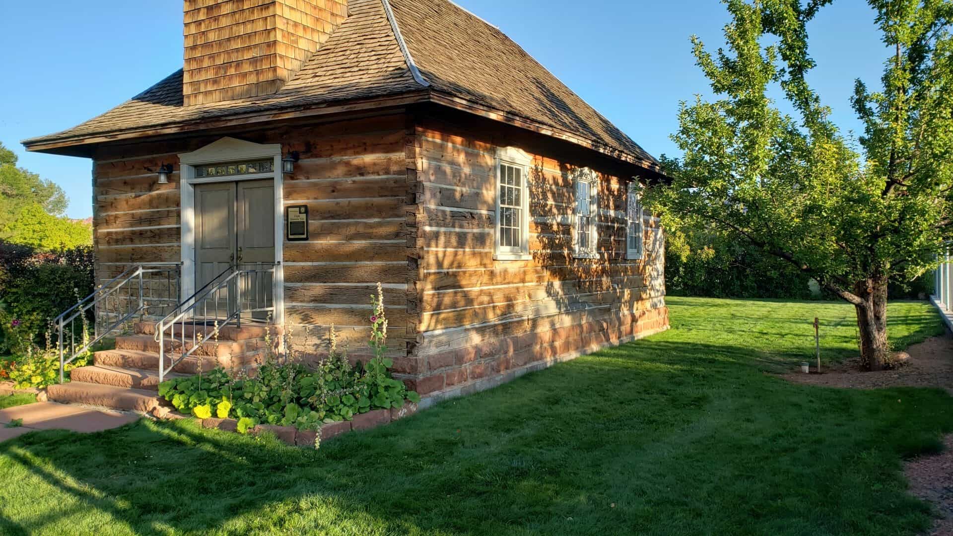
On September 18, 1898, construction began on the Torrey log church, later used also as a school. Local settlers furnished labor, cash, and materials for this unique log structure with its steep hip roof, flared eaves, square bell tower on the entry side, and a pink sandstone foundation. On December 19, 1898, school opened in this 21 X 37 foot, one-room building for students of Torrey and the surrounding ranches. This multi-purpose building was used for dances and other activities, including civic, social, and religious meetings until two, red sandstone buildings were constructed, one for a school and one for a church. However, use of this original log building continued both by the LDS Church and the community until the 1970s.
In the fall of 1990, the Church deeded the old, log building to the local Daughters of Utah Pioneers, Camp Radiare, with the provision that it was to be moved from Church property. Since that date, the building has received major restoration and renovation. This one-of-a-kind structure will continue to be used for religious, civic, and educational functions.
This is Daughters of Utah Pioneers historic marker #494, placed in 1996 and located at 59 East Main Street in Torrey, Utah.
Torrey Log Church and Schoolhouse
The Torrey Log Church/Schoolhouse, completed in 1898, is locally significant as the first church building and the first school building in the pioneer community of Torrey, settled in the 1890s. After a new multi-use building with classrooms was built in 1917 and a new meetinghouse was constructed in 1928, the Torrey Log Church/Schoolhouse continued to be used for various religious and social functions until the 1970s.
The building is architecturally significant as one of approximately one dozen remaining Church of Jesus Christ of Latter-day Saints meetinghouses built within the initial settlement phase. It is the only known example of a log meetinghouse still standing in the state. The building is made of sawn logs joined at the corners with carefully executed half-dovetailed notching. The building was relocated approximately 100 yards to the west to make room for the expansion of the neighboring 1928 sandstone meetinghouse. The Daughters of the Utah Pioneers have restored the building and are using it as a place to hold local meetings, continuing its traditional use for religious and social functions.
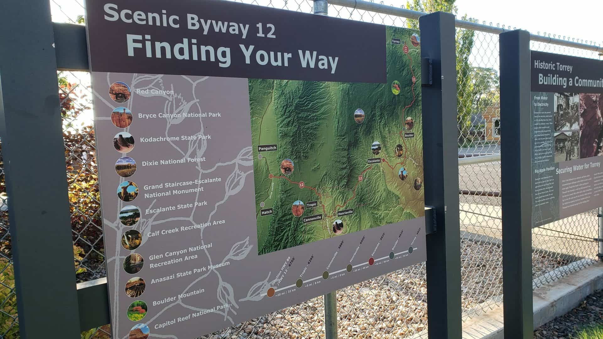
Building a Community Historic Torrey
From Water to Electricity Fremont River water also powered Torrey’s first electricity, which arrived in 1929. Recalling those days, Torrey resident Clay Robinson wrote, “When January rolled around the night temperatures often dropped below zero. Water flowing through the canal… into the power plant would turn to ice, curtailing the stream. The generating turbine would slow. The electric bulbs in our house would flicker. Light in the room would fade into a twilight, brighten momentarily, then zoom into total darkness.”
Big Apple Pavilion During the Great Depression, the Lee family built an open air dance hall in an apple orchard on Main Street. They held boxing matches there, drawing people from all over Wayne County. After each match, people danced under the stars. The restored pavilion remains a gathering place for community events.
Securing Water for Torrey Water is the lifeblood of any settlement, and Torrey settlers encountered great challenges in their efforts to secure a steady water supply. Though they found a culinary spring up on Thousand Lake Mountain, a wide lava field separated it from the town site. Around 1900, settlers built a flume of hand-hewn logs to carry the water over the lava bed into a ditch and down the 10,000-foot mountain into Torrey. Residents still rely on Thousand Lake Mountain springs for their drinking water.
Around 1900, settlers also began digging a canal to divert water from the Fremont River for irrigation. Fifteen years later, they completed the 11-mile canal. Robert Peden, a Scottish stone mason, cut a 500-foot section of the ditch through a solid rock shelf, using a pick-ax and mule, a project that took him 6 years to finish. This same canal provides Torrey’s irrigation water today.