• About JacobBarlow.com
  • Cemeteries in Utah
  • D.U.P. Markers
  • Doors
  • Exploring Utah Email List
  • Geocaching
  • Historic Marker Map
  • Links
  • Movie/TV Show Filming Locations
  • Oldest in Utah
  • Other Travels
  • Photos Then and Now
  • S.U.P. Markers
  • U.P.T.L.A. Markers
  • Utah Cities and Places.
  • Utah Homes for Sale
  • Utah Treasure Hunt

JacobBarlow.com

~ Exploring with Jacob Barlow

JacobBarlow.com

Tag Archives: DUP

Juab County Jail

07 Saturday Jun 2014

Posted by Jacob Barlow in Uncategorized

≈ 1 Comment

Tags

DUP, historic, Juab County, Nephi, utah

picture7sep07-045

Prisoners from Juab county were first held in the basement of the Social Hall that stood on the corner of Center Street and Second East in Nephi. The next jail was a sturdy frame building built of thick heavy planks painted red located directly south and west of the old courthouse.

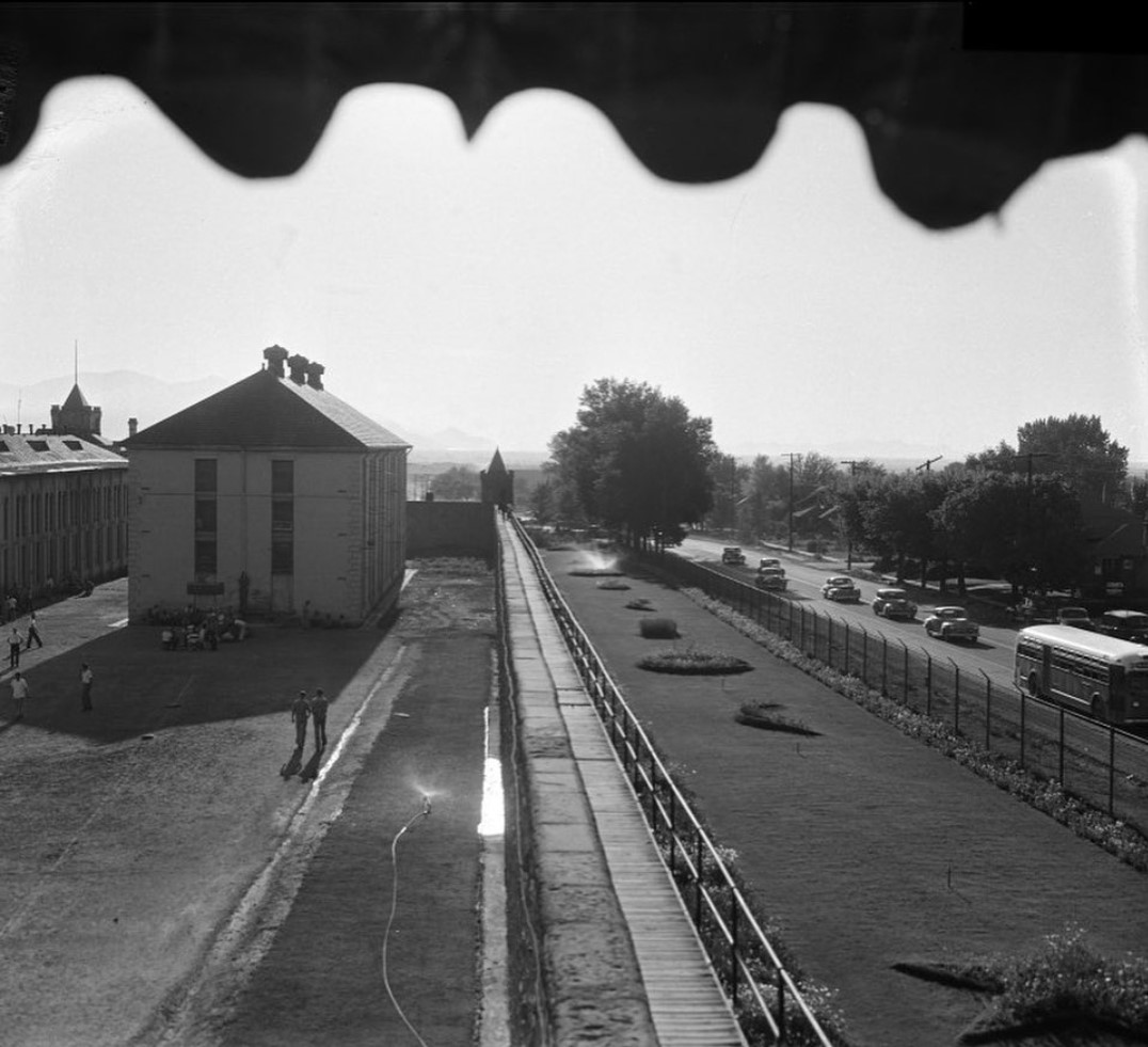
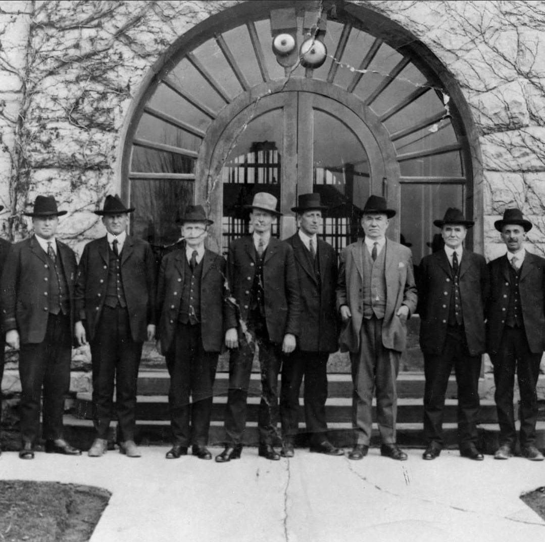
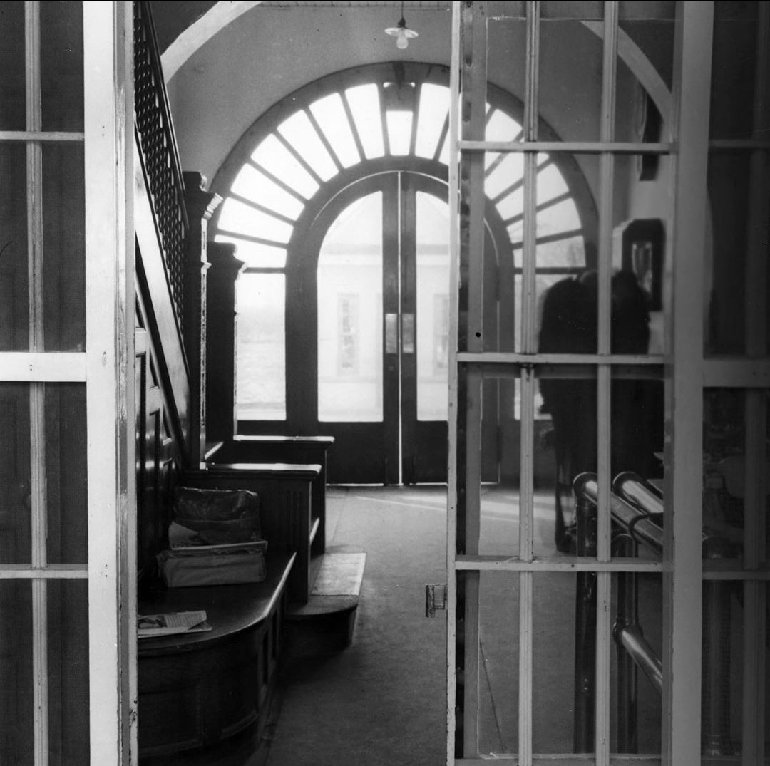
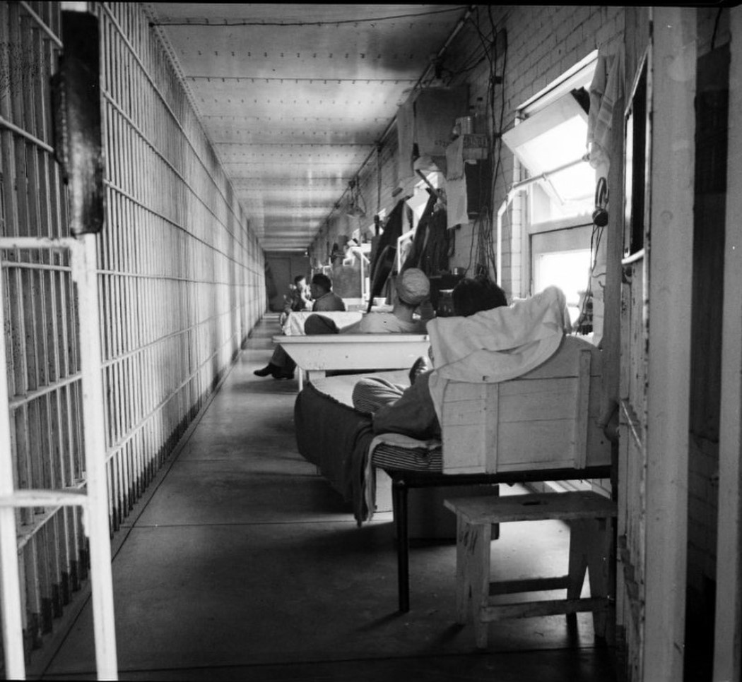
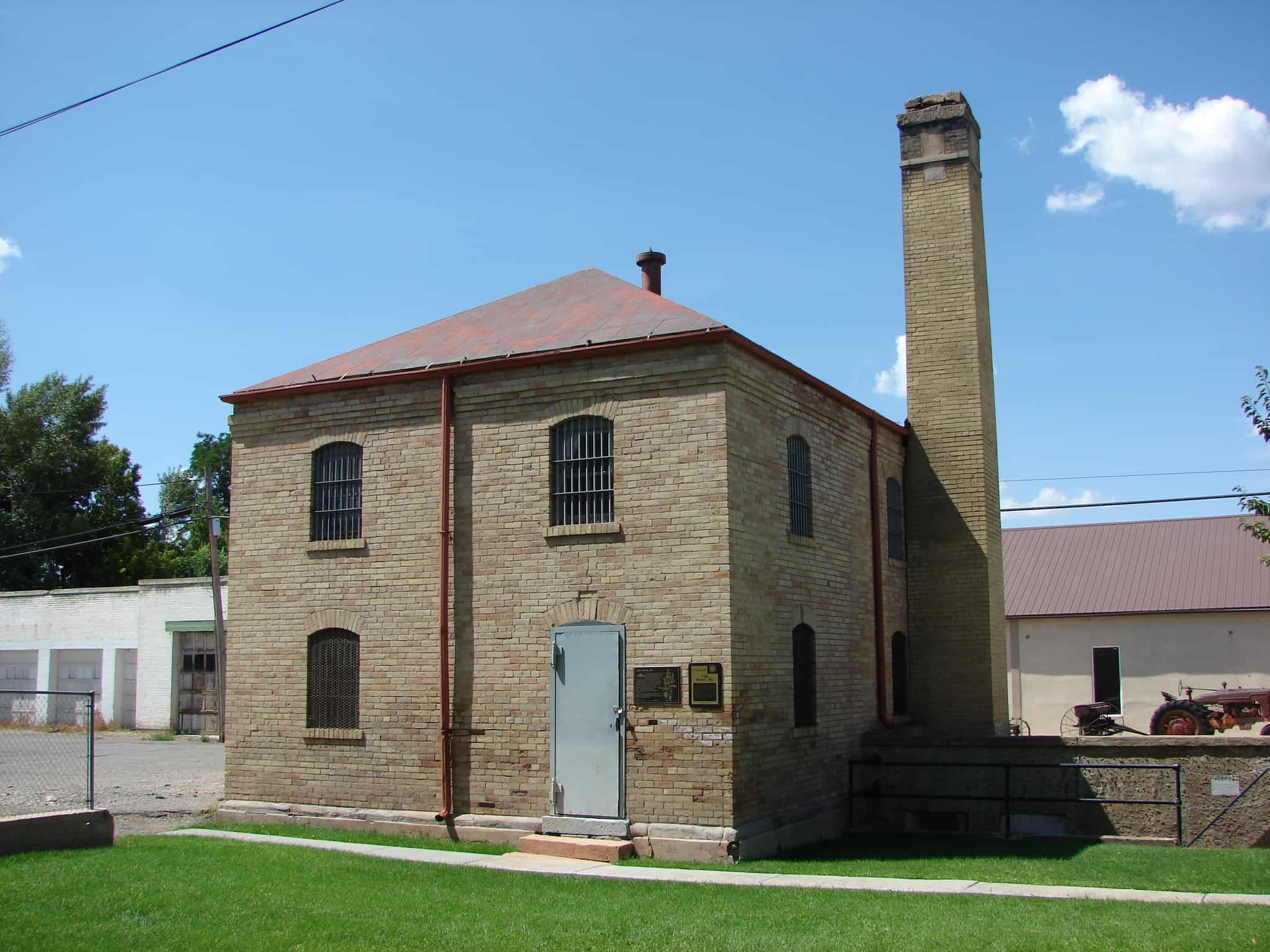
This Juab County Jail was built in the Territory of Utah four years before Utah became a state. The contract for construction of this jail was awarded July 13, 1892, to Pauley Jail Building and Manufacturing Company, St. Louis, Missouri, for $8,916. This two-story brick building is unique with iron cages and interior ceiling of heavy metal similar to a ship. Occupants through the years have known sorrow, repentance and remorse. Some were filled with bitterness and revenge. Suffice it to say that the old jail served the purpose for which it was constructed and remained in use until 1974.

This Museum and Community Center consists of part of the old Juab County Court House, the Jail and a pioneer implement building known as the Brough Building. Pioneer memorabilia are kept and displayed in this complex.

Related Posts:

  • Nephi, Utah

Check out all of the historic markers placed by the Daughters of Utah Pioneers at JacobBarlow.com/dup

Mt. Pleasant Fort

07 Saturday Jun 2014

Posted by Jacob Barlow in Uncategorized

≈ 1 Comment

Tags

DUP, Forts, historic, Historic Markers, Mt. Pleasant, Sanpete County, utah

picture24aug07-005

Mt. Pleasant, a small town nestled at the foot of the mountains in Sanpete County near the geographical center of Utah, was settled early in 1859. During June the men kept busy tending their crops and building a fort, twenty-six rods by twenty-six rods, enclosing about five and one-half acres of grounds between Main Street and First North and State Street and First East.

The wall was twelve feet high, four feet wide at the bottom tapering to two feet at the top, and constructed of native rock laid with lime mortar, according to specific instructions. Sixteen feet of the fort wall was allowed for each cabin built inside the fort; each had one porthole about seven feet from the ground. Water was obtained from Pleasant Creek, which passed almost parallel east and west through the center of the fort. Corrals for all the live-stock were built to the north, just outside the fort, leaving a roadway between. Completed on July 18, 1859, the fort had the distinction of being the finest in Sanpete County.

The first break in the fort wall was made in 1878 to make room for the new, enlarged ZCMI store to be built in the southwest corner of the fort. The town had grown from about 800 to 1,200, but only a few families still lived inside the fort, then called the Tithing Yard.

Related Posts:

  • Mt Pleasant, Utah
  • Other D.U.P. Markers

Mt. Pleasant Fort 1859 ~ Sketch by Thomas W. Woodbury and Google ~ Layout by Walter Woodbury

Cedar City Tabernacle

07 Saturday Jun 2014

Posted by Jacob Barlow in Uncategorized

≈ 2 Comments

Tags

Cedar City, DUP, historic, Iron County, utah

picture10jul07-007

A tabernacle was erected in 1885 on the adjoining corner of Main and Center Streets and was demolished in the spring of 1932. In 1872 Bishop Christopher J. Arthur suggested that this Tabernacle be built to replace the Social Hall.

Mayhew Dalley drew the plans for a building 72 x 41-1/2 feet with a tower 110 feet high. Edward J. Ashton of Salt Lake City was engaged as architect and Bengt Nelson was appointed director. The excavation was dug in 1872, but because labor was needed on the St. George Temple, the work was postponed until 1877. The Tabernacle was built of local materials except for the windows. Lumber was cut in Deep Creek, the bricks were burned south of town, shingles were made, and plastering was done. The stone tablet inscribed “Holiness to the Lord” was placed in 1885.

The town clock in the tower was a gift from the city and ward. A ball and weather indicator topped the tower. Conference was held in the unplastered building in 1887. A gallery was added later. December 20, 1931, the U.S. Government approved the purchase of the ground for a post office. The last meeting was held in the historic Tabernacle in 1932 prior to its demolition. The Tabernacle was a community project and served the people well for forty-seven years.

picture10jul07-008

Check out all of the historic markers placed by the Daughters of Utah Pioneers at JacobBarlow.com/dup

The Old Emigrant Road

06 Friday Jun 2014

Posted by Jacob Barlow in Uncategorized

≈ 1 Comment

Tags

Davis County, DUP, historic, Syracuse, utah

picture16march08-021

The Old Emigrant Road

The Old Emigrant Road started at Salt Lake City, Utah, and ended at the City of the Rocks, Idaho, where it formed a junction with the California Trail. This road was also known as Bluff Road, Old Traveled Road, and the Salt Lake Cutoff. It was established as the most practical way to reach the California Trail from Utah because it avoided hills and sand, and provided feed and water for the livestock. Hasting’s Cutoff, the alternate route, had proved impractical for wagons and livestock.

This Old Emigrant Road was used for many years by local residents as it was the easiest way to travel to the various communities in the valley. The road was first used by Captain Samuel Hensley with ten men, August 1848. Upon his advice, Mormon Battalion members returning from California also traveled this road. This contingent of forty-five men and one woman, with seventeen wagons took this trail on their way to Salt Lake City.

In 1849-1850 an estimated 22,500 gold seekers followed this northern route to the California gold fields. From 1852 to 1857 homeseeking emigrants with their families used the road on their way to Oregon and California.

picture16march08-020

Check out all of the historic markers placed by the Daughters of Utah Pioneers at JacobBarlow.com/dup

River Heights

06 Friday Jun 2014

Posted by Jacob Barlow in Uncategorized

≈ 1 Comment

Tags

Cache County, DUP, historic, River Heights, utah

Originally called “Dry Town” then later named River Heights, this town overlooks the Logan River. The first settlers, arriving here in 1883, were the families of Anders Anderson, Mathias Lundberg, Hyrum Merrill, Christian Hansen, Knut Hansen, Peter Croft, Moroni Gudmundson, Alma Cummings, and the Croftmans. In 1887, the families of Lars Larsen and Eric Lehi Olson arrived.

The first bridge across the Logan River was built in 1891. On May 4, 1908, the River Heights Ward of the Church of Jesus Christ of Latter-day Saints was organized, with Eric Lehi Olson as its first bishop. In 1910 the first chapel was built. The first school house was erected in 1912, with Loyla Raymond as the teacher. The first mayor was J. Karl Wood.

River Heights was incorporated October 31, 1934.

This monument rock was obtained from Dry Canyon, east of River Heights.

ImageImage

Check out all of the historic markers placed by the Daughters of Utah Pioneers at JacobBarlow.com/dup

The Social Hall

06 Friday Jun 2014

Posted by Jacob Barlow in Uncategorized

≈ 1 Comment

Tags

Cedar City, DUP, historic, Iron County, utah

picture01oct07-013

The Cedar City Pioneers had made their homes in the Old Fort and had built an adobe schoolhouse 28 feet by 60 feet when, in May 1855, President Brigham Young advised them to move to higher ground. By 1859, the majority of the people had moved to the new Cedar City site and had a small, adobe room available for school, church and civic affairs. As more and more people occupied the new Cedar Site, it became apparent that the small building was not adequate.

On January 6, 1861, a committee was appointed, composed of Samuel Leigh, John M. Higbee and Isaac C. Haight, who recommended building a social hall. With materials scarce and labor plentiful, the schoolhouse in the Old Fort was dismantled, brick by brick, and reassembled in the new location (Block 37 Lot 18) to become known as the “Social Hall.” This one-story building had four windows on each side, a fireplace in the west end, and a door in the east end. It was set back from the street to where the center of the State Bank of Southern Utah parking lot is located.

The Social Hall was used for church, school, dances, dramatics, funerals, civic and social needs. School functions were transferred from the Social Hall in 1881 when the new school building was finished on the southeast corner of the block.

The tabernacle was completed in 1888 for religious purposes, but the Social Hall continued to serve for recreation and other needs until the ward hall was built north of the school building in 1897. At this time the Social Hall was considered unsafe for public use and was torn down.

Related Posts:

  • Utah Social Halls, Opera Houses, and Amusement Halls
picture01oct07-012

Check out all of the historic markers placed by the Daughters of Utah Pioneers at JacobBarlow.com/dup

Layton’s Little Fort

06 Friday Jun 2014

Posted by Jacob Barlow in Uncategorized

≈ 1 Comment

Tags

Davis County, DUP, Forts, historic, Layton, utah

The pioneers who settled what is now Layton, Utah, established a fort in 1854-55 on the road then called Little Fort Lane. This road extended from Five Points, north to Little Fort and joined the Kays Creek roads from the east.

In those years the families of Billa Dickson, John Green, William Lindsey, Mark and Pratt Whitesides, and the Shipley and Croft families, lived in “The Little Fort.” It was given this name because a large fort had already been established in the center of Kaysville.

This little fort, to protect the people from the Indians, was built on the south bank of Kays Creek overlooking the sandridge road from the Morris Town Hill. The fort served mainly as a lookout point on the Indian camp area. Friendly Indians lived along the hollow.

Little Fort was built in the shape of a square with the houses forming the outside walls which were built of rock, dried mud and mortar. Vegetable gardens which provided necessary food were raised in the center court of this fort and were tended for several years after the fort was abandoned. One cabin that was moved from Little Fort can still be found at 400 North Fort Lane, near the Layton High School. This cabin had a single room and a saddle-notched construction.

Located at Layton Commons Park at 437 N Wasatch Drive in Layton, Utah

Image
(the previous location, same park, farther north)
Image

Uriah Nephi Smart Tannery

06 Friday Jun 2014

Posted by Jacob Barlow in Uncategorized

≈ Leave a comment

Tags

DUP, historic, Holladay, Salt Lake County, utah

picture20sep07-006

In a deep hollow south of 3900 South, Uriah Nephi Smart built his tannery in 1880. This two story building was thirty feet wide and one hundred feet long. It was built of adobe bricks, which were made from clay taken from a bank north of the building site. The foundation was of red sandstone from Red Butte Canyon, and the lumber in the building was red pine from Millcreek Canyon.

There were eight large redwood vats on the bottom floor which were used to soak the hides, some in lime water to loosen the hair, and others in tannic acid to soften the hides.

Uriah Smart made his own tannic acid from pine bark, ground in a mill south of the tannery. He also made his own neat’s-foot oil used to soften the leather by boiling down animal bones in large cast-iron kettles.

On the top floor of the tannery the leather was fleshed and softened, sheep and goat skins were tanned, and the hides were stored.

This property was donated by Uriah Nephi Smart’s grandson, Rowland W. Smart.

picture20sep07-005

Check out all of the historic markers placed by the Daughters of Utah Pioneers at JacobBarlow.com/dup

Spring City Pioneer Cemetery

06 Friday Jun 2014

Posted by Jacob Barlow in Uncategorized

≈ 1 Comment

Tags

DUP, historic, Sanpete County, Spring City, utah

  • picture24aug07-016

The pioneers of Spring City established a cemetery at this location in 1857. It is in the shape of the State of Utah. The earliest known burial was that of Newton Devine Allred in 1857. Three men who were casualties of the Black Hawk War, James Meek, Martin Andrew Johansen, and Lars Alexander Justesen, were buried here in 1867 and 1868. Isaac Allred, brother of James Allred founder of Spring City, was interred in 1870.

Many of the markers were of local sandstone, and the elements have washed away some of the names and dates. This cemetery was nearly covered with wooden markers, mostly children’s graves. Some graves were marked with only a square stone at the head and a smaller one at the foot, and still others with a pile of rocks. The last person buried here was Isaac Morton Behunin in 1910. This cemetery was then filled and a new location was found.

Utah Penitentiary

06 Friday Jun 2014

Posted by Jacob Barlow in Uncategorized

≈ 5 Comments

Tags

DUP, historic, Salt Lake City, Salt Lake County, utah

2016-08-05-11-24-25

DUP # 440

After World War II the growth of the city to the south and east made it imperative to construct a large prison facility in a more isolated area. In 1951 all the old penitentiary buildings were demolished and the inmates transferred to “Point of the Mountain” 30 miles away. This site then became beautiful Sugar House Park. The stones in the monument are from the old penitentiary. The name “Sugarhouse” comes from a Mormon pioneer attempt to grow beets and refine sugar in this area. The refining process was unsuccessful and the factory was torn down but the name remained to designate a suburb of Salt Lake City. After 1849 pioneers entered and left the valley from the Sugar House staging area through Parley’s Canyon to the east.

2016-08-05-11-24-21

SUP # 17

This monument marks the site of the Utah Penitentiary selected by Brigham Young in October 1853, then a safe 6 miles from the center of the city.

The first buildings of adobe brick, surrounded by a 12 foot wall, were occupied in January 1855. Early accounts indicate that escapes were frequent because of poor facilities and the lack of guards.

In 1866 the penitentiary was renovated. The three buildings, wall, and guard houses were upgraded to stone. Later a dining hall, hospital and women’s quarters were added.

By 1882 the penitentiary included 244 steel cells and a 250 capacity chapel. A new 19 foot wall enclosed 2 acres. A large area surrounding the prison was used by inmates to farm and raise livestock for inmate consumption.

Note: After World War II the growth of the city to the south and east made it imperative to construct the prison facility in a more isolated area, at the Point of the Mountain (1951).

See other historic markers in the series on this page for SUP Markers.

Check out all of the historic markers placed by the Daughters of Utah Pioneers at JacobBarlow.com/dup

← Older posts
Newer posts →

Follow Jacob

Follow Jacob

Come wander with me on Youtube.

Blog Stats

  • 2,092,964 hits

Social and Other Links

BarlowLinks.com

Recent Posts

  • Provo High School Seminary Building
  • 821 E 100 S
  • 820 E 100 S
  • 817-819 E 100 S
  • 814 E 100 S

Archives

Loading Comments...