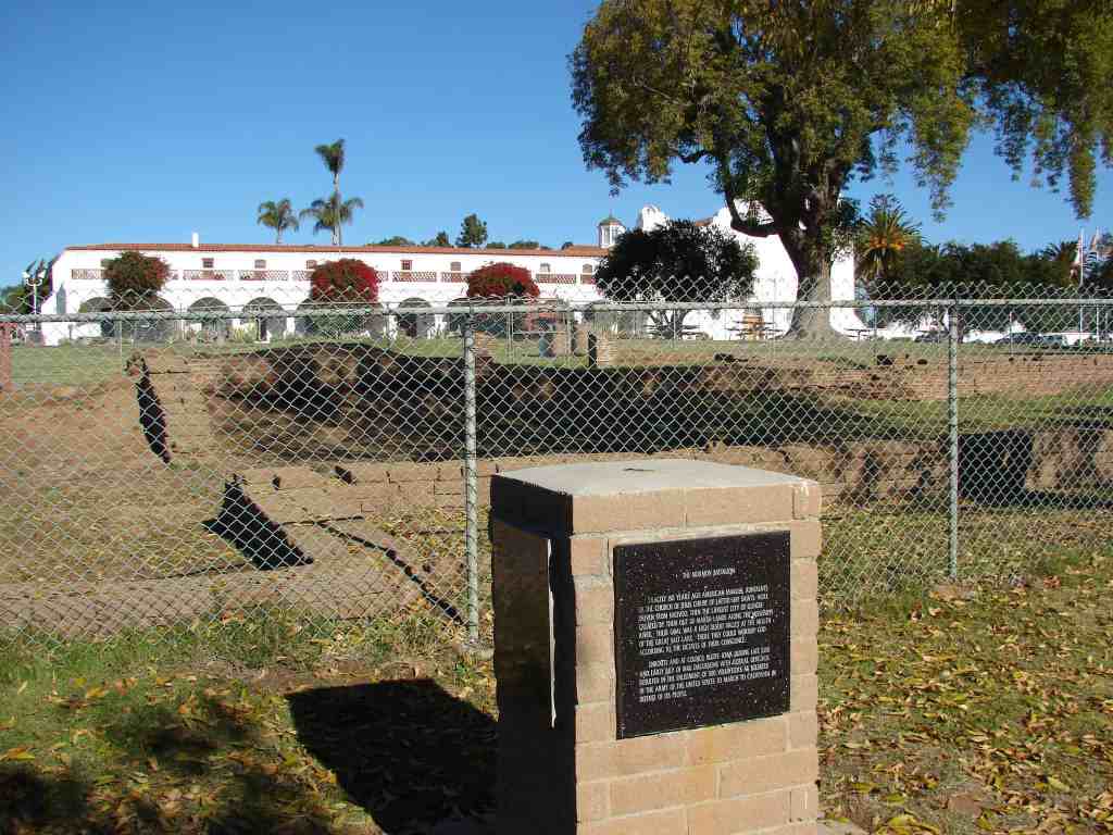
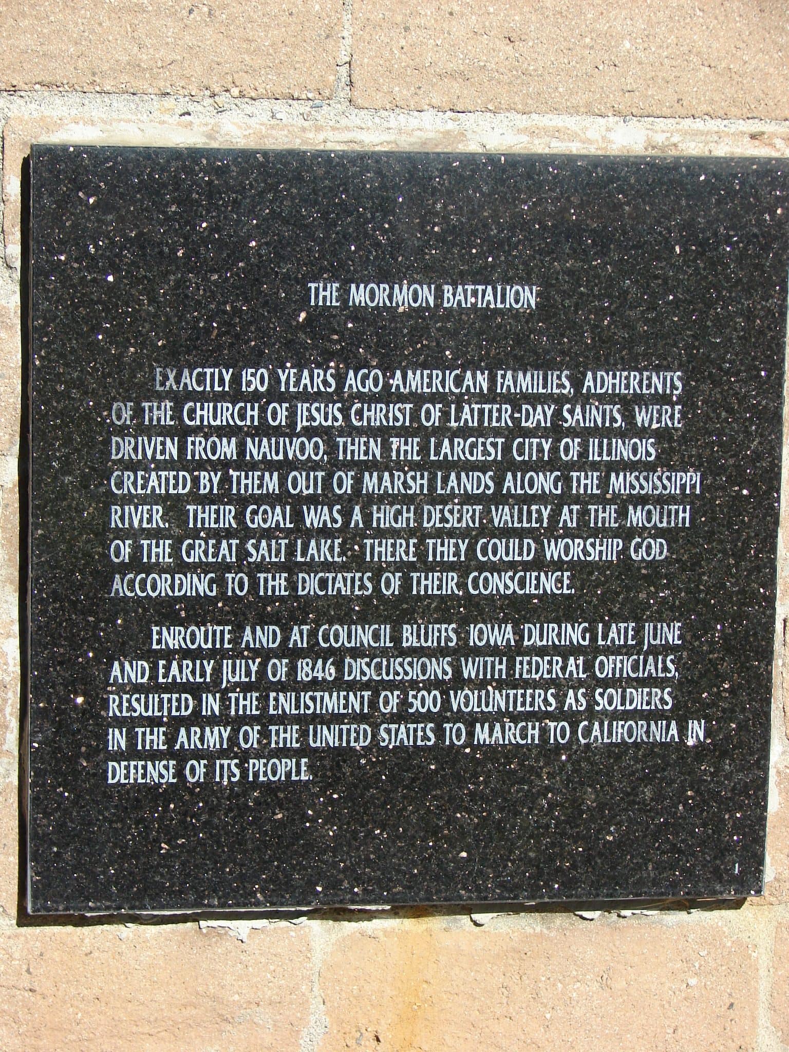
Exactly 150 years ago American families adherents Of the church of Jesus Christ of latter day saints were driven from Nauvoo, then the largest city of Illinois Created by them out of marsh lands along the Mississippi River. Their goal was a high desert valley at the mouth Of the great salt lake. There they could worship god According to the dictates of their council.
En-route and at Council Bluffs Iowa during late June And early July 1846 discussions with federal officials resulted in the enlistment of 500 volunteers as soldiers In the army of the united states to march to California in Defense of its people.”
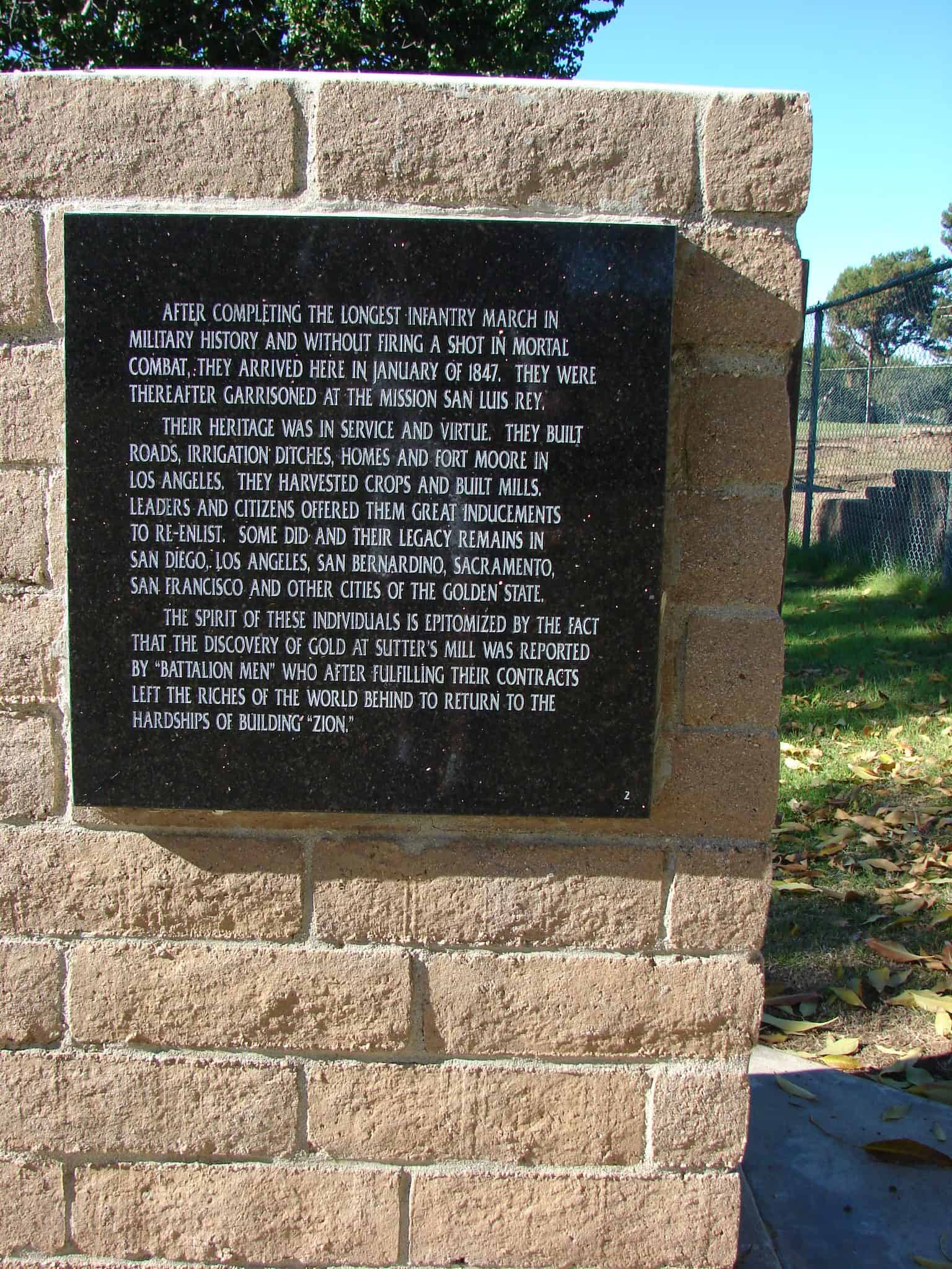
After completing the longest infantry march in military history and without firing a shot in mortal combat, they arrived here in January of 1847. They were thereafter garrisoned at the Mission San Luis Rey.
Their heritage was in service and virtue. They built roads, irrigation ditches, homes and Fort Moore in Los Angeles. They Harvested crops and built mills. Leaders and citizens offered them great inducements to re-enlist. Some did and their legacy remains in San Diego, Los Angeles, San Bernardino, Sacramento, San Francisco and other cities of the Golden State.
The Spirit of these individuals is epitomized by the fact that the discovery of gold at Sutter’s Mill was reported by “Battalion men” who after fulfilling their contracts, left the riches of the world behind to return to the hardships of building “Zion.”
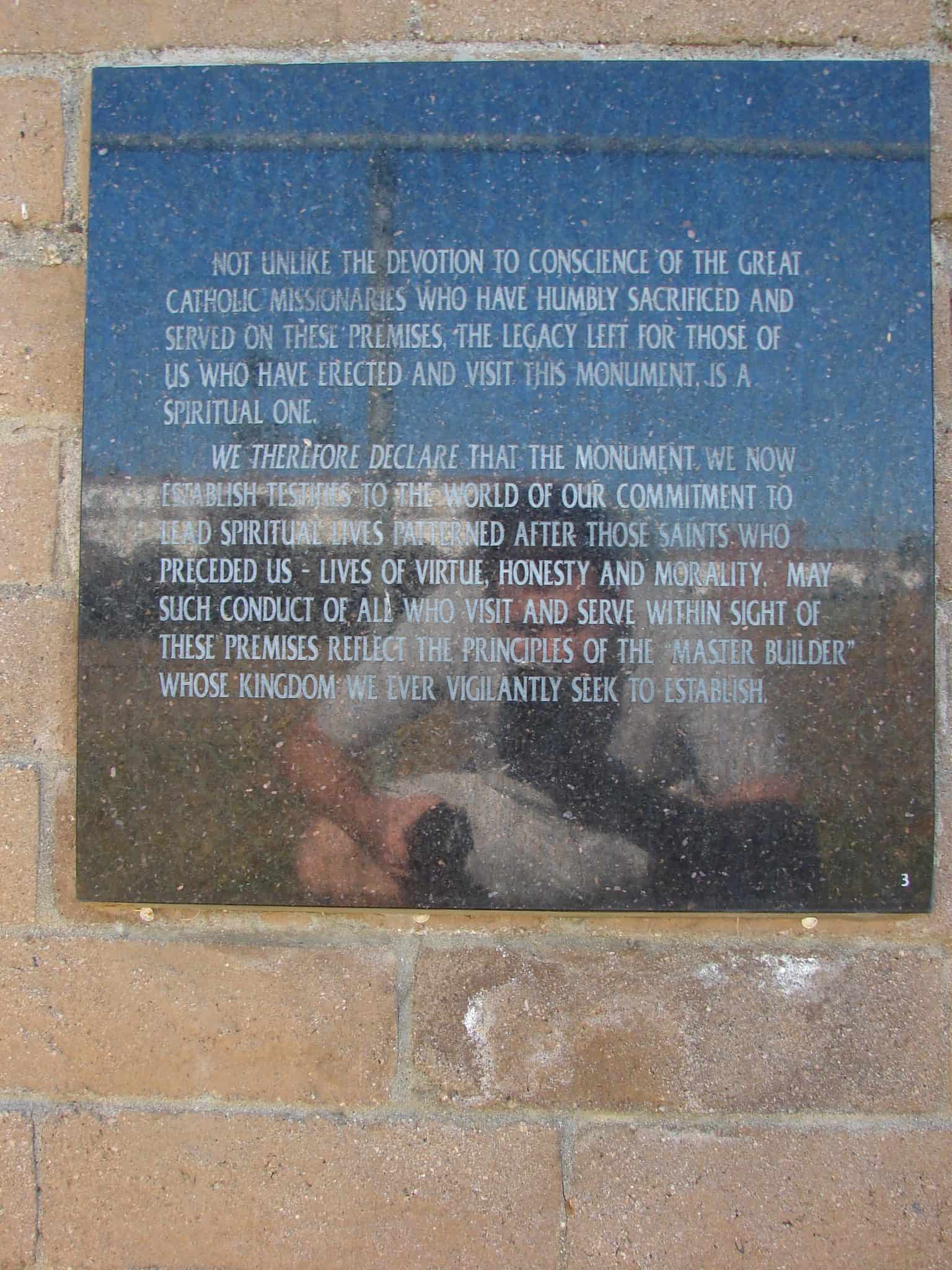
Not unlike the devotion to conscience of the great Catholic missionaries who have humbly sacrificed and served on these premises, the legacy left for those of us who have erected and visit this monument is a spiritual one.
We therefore declare that the monument we now establish testifies to the world of our commitment to lead spiritual lives patterned after those saints who preceded us – lives of virtue, honesty and morality. May such conduct of all who visit and serve within sight of these premises reflect the principals of the “Master Builder” whose Kingdom we ever vigilantly seek to establish.
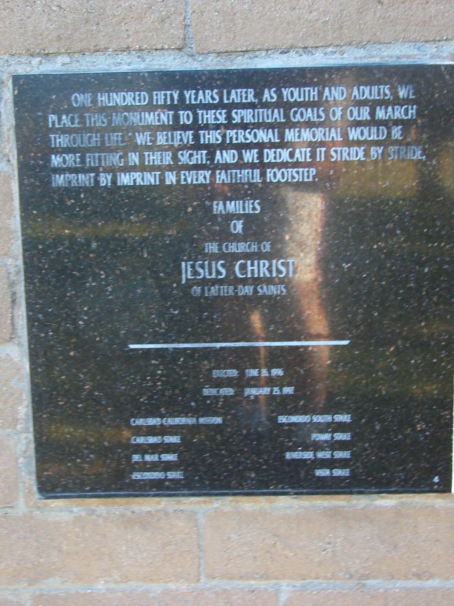
“One hundred fifty years later, as youths and adults, we Place this monument to these spiritual goals of our march Through life. We believe this personal memorial would be More fitting in their sight, and we dedicates it stride by stride, Imprint by imprint in every faithful footstep.
Families Of The Church of Jesus Christ Of Latter-Day Saints Erected: June 26, 1996 Dedicated: January 25, 1997 Carlsbad California Mission Escondido South Stake Carlsbad Stake Poway Stake Del Mar Stake Riverside West Stake Escondido Stake Vista Stake
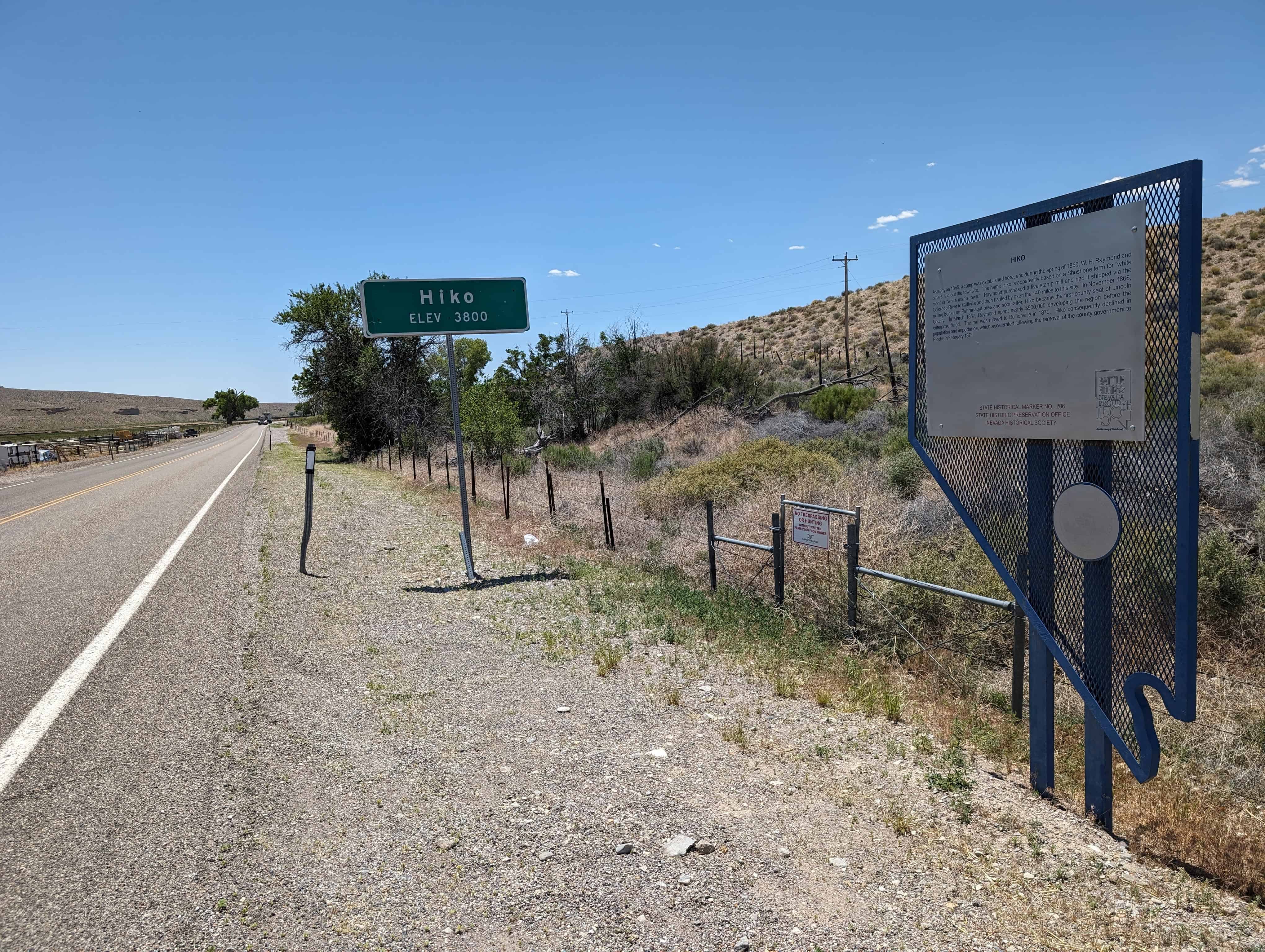
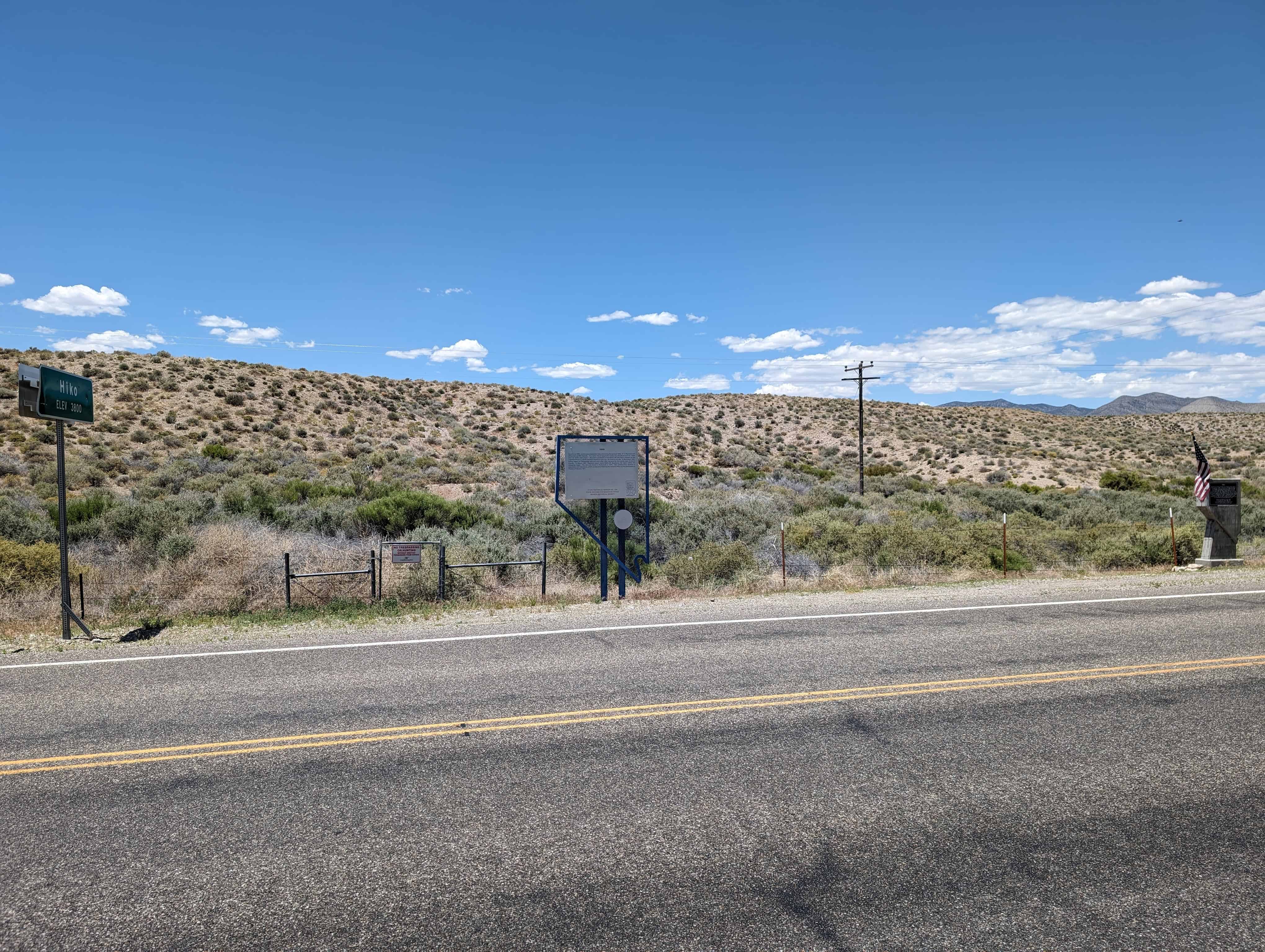
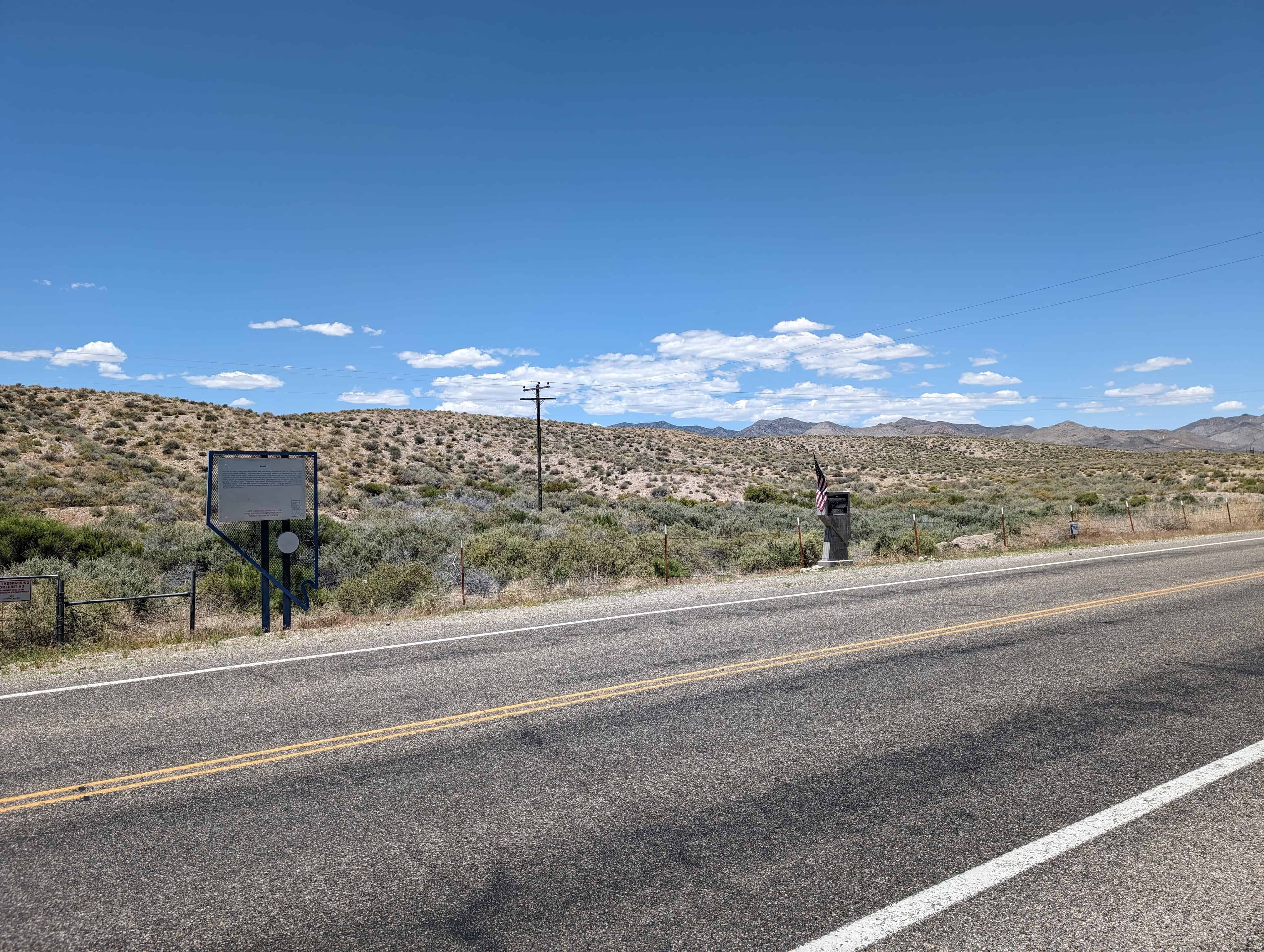
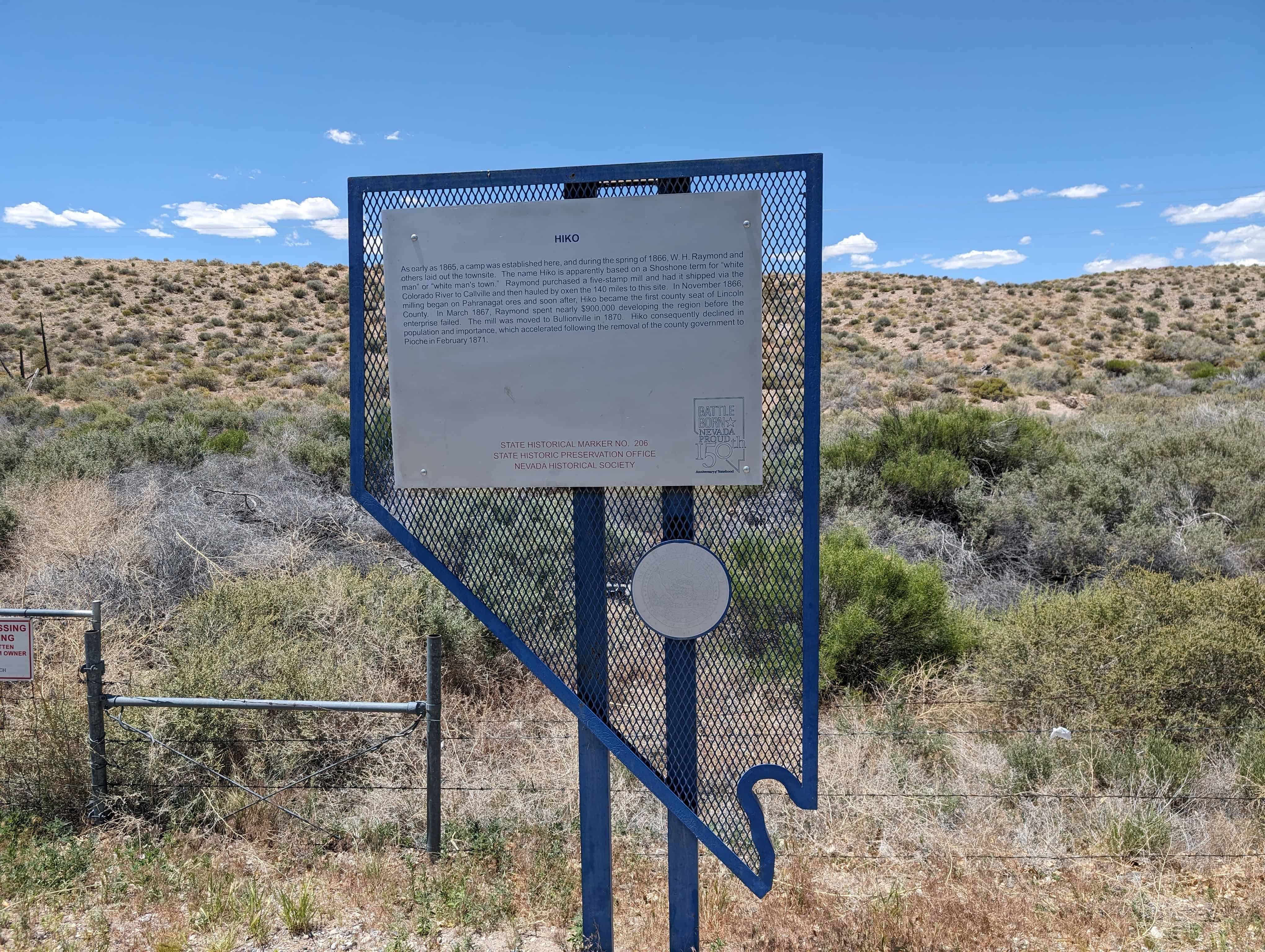
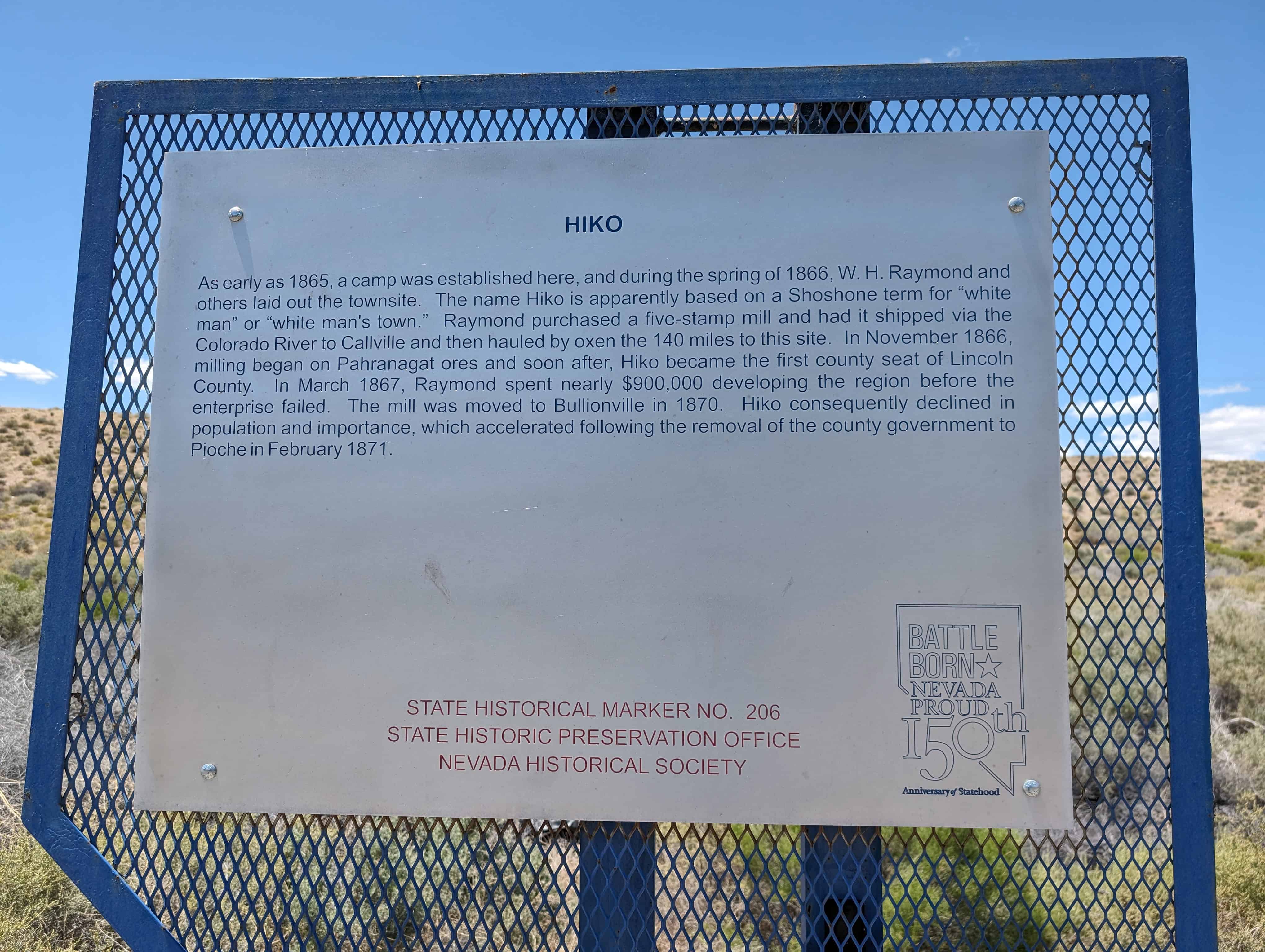
As early as 1865, a camp was established here, and during the spring of 1866, W. H. Raymond and others laid out the townsite. The name Hiko is apparently based on a Shoshone term for “white man” or ‘white man’s town. Raymond purchased a five-stamp mill and had it shipped via the Colorado River to Callville and then hauled by oxen the 140 miles to this site. In November 1866, milling began on Pahranagat ores and soon after, Hiko became the first county seat of Lincoln County. In March 1867, Raymond spent nearly $900,000 developing the region before the enterprise failed. The mill was moved to Bullionville in 1870. Hiko consequently declined in population and importance, which accelerated following the removal of the county government to Pioche in February 1871.
This is Nevada State Historical Marker #206, located on Highway 318.
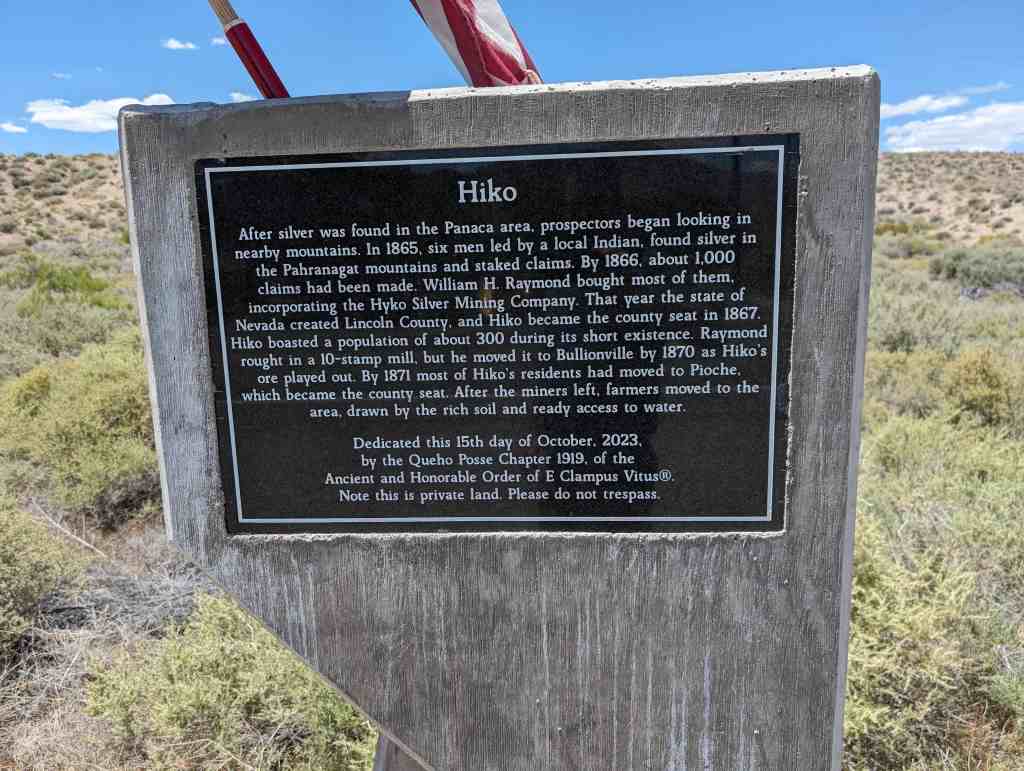
After silver was found in the Panaca area, prospectors began looking in nearby mountains. In 1865, six men led by a local Indian, found silver in the Pahranagat mountains and staked claims. By 1866, about 1,000 claims had been made. William H. Raymond bought most of them, incorporating the Hyko Silver Mining Company. That year the state of Nevada created Lincoln County, and Hiko became the county seat in 1867. Hiko boasted a population of about 300 during its short existence. Raymond rought in a 10-stamp mill, but he moved it to Bullionville by 1870 as Hiko’s ore played out. By 1871 most of Hiko’s residents had moved to Pioche, which became the county seat. After the miners left, farmers moved to the area, drawn by the rich soil and ready access to water.
Dedicated this 15th day of October, 2023, by the Queho Posse Chapter 1919, of the Ancient and Honorable Order of E Clampus Vitus®. Note this is private land. Please do not trespass.
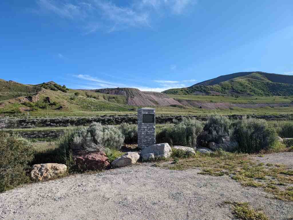
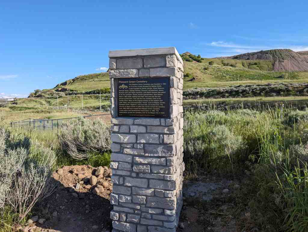
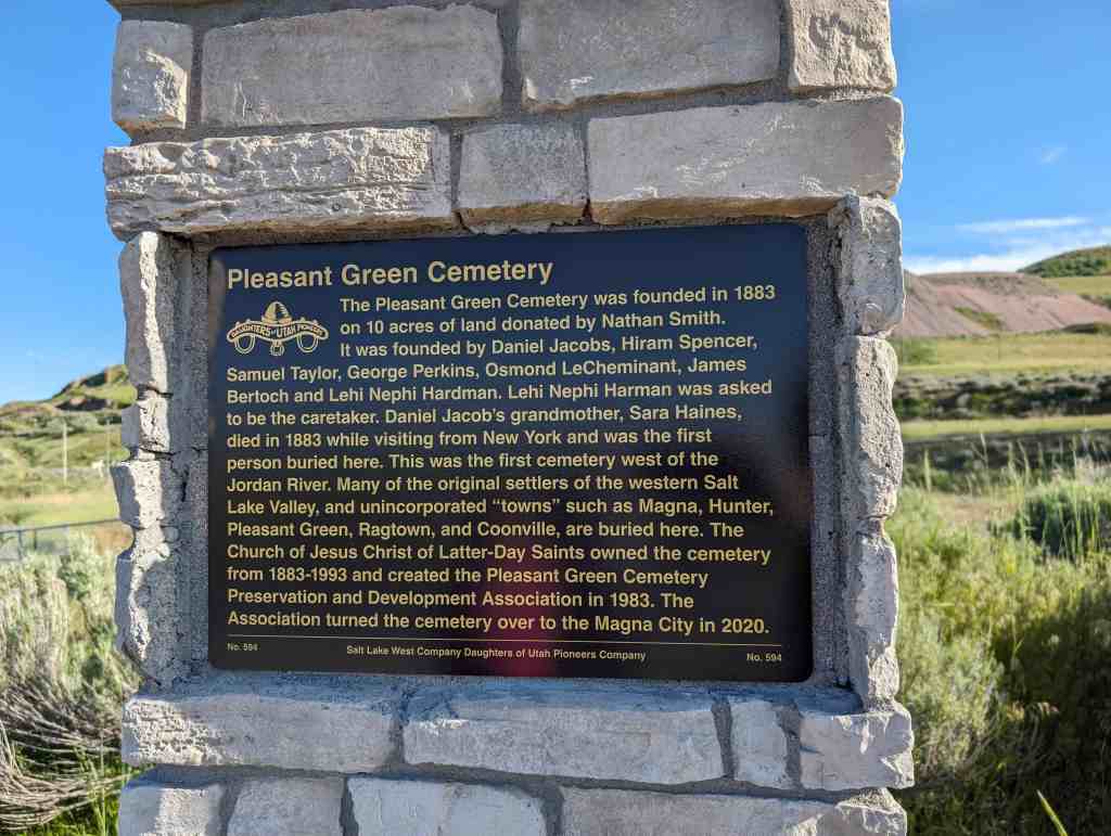
The Pleasant Green Cemetery was founded in 1883 on 10 acres of land donated by Nathan Smith. It was founded by Daniel Jacobs, Hiram Spencer, Samuel Taylor, George Perkins, Osmond LeCheminant, James Bertoch and Lehi Nephi Hardman. Lehi Nephi Harman was asked to be the caretaker. Daniel Jacob’s grandmother, Sara Haines, died in 1883 while visiting from New York and was the first person buried here. This was the first cemetery west of the Jordan River. Many of the original settlers of the western Salt Lake Valley, and unincorporated “towns” such as Magna, Hunter, Pleasant Green, Ragtown, and Coonville, are buried here. The Church of Jesus Christ of Latter-Day Saints owned the cemetery from 1883-1993 and created the Pleasant Green Cemetery Preservation and Development Association in 1983. The Association turned the cemetery over to Magna City in 2020.
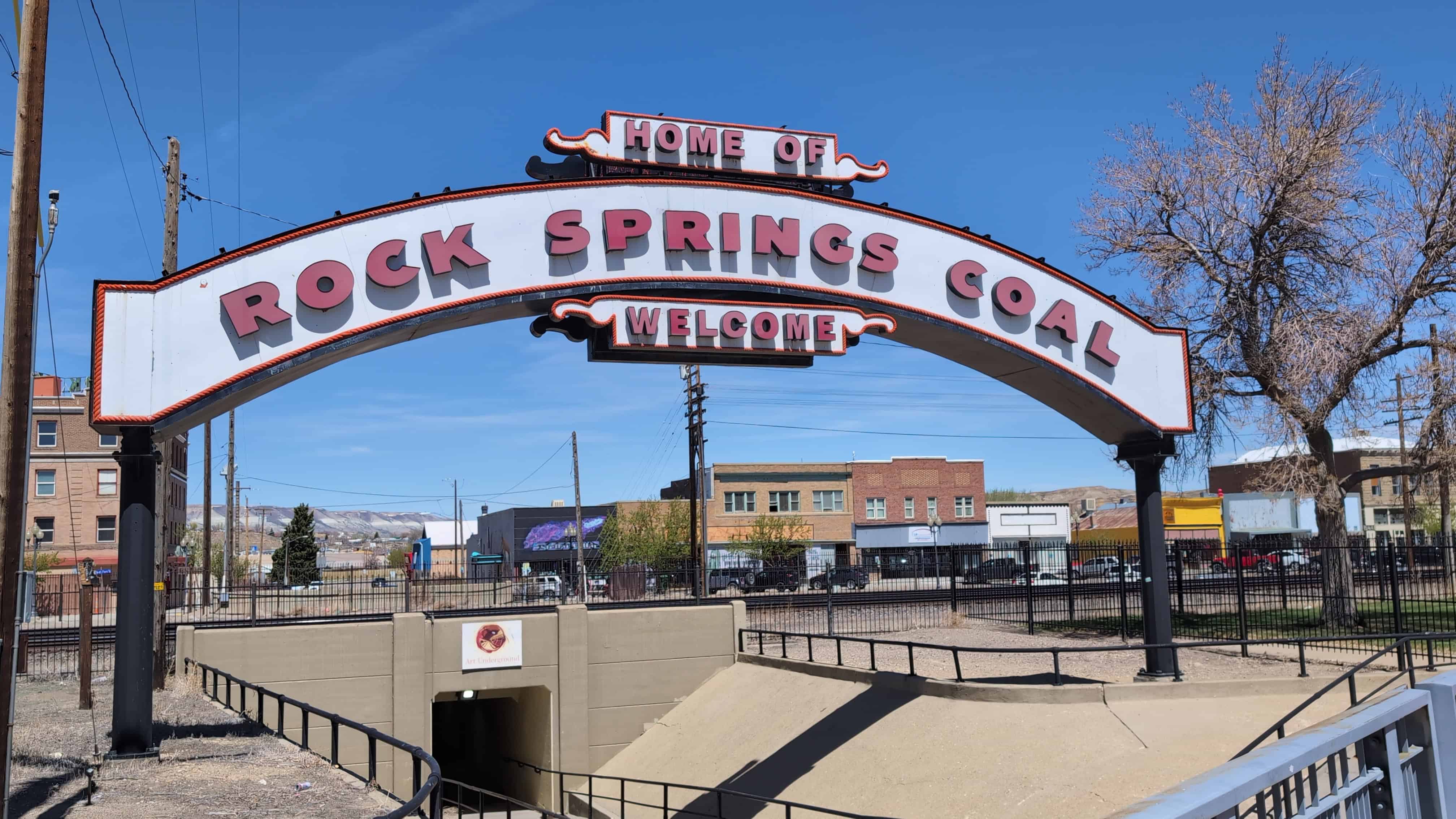
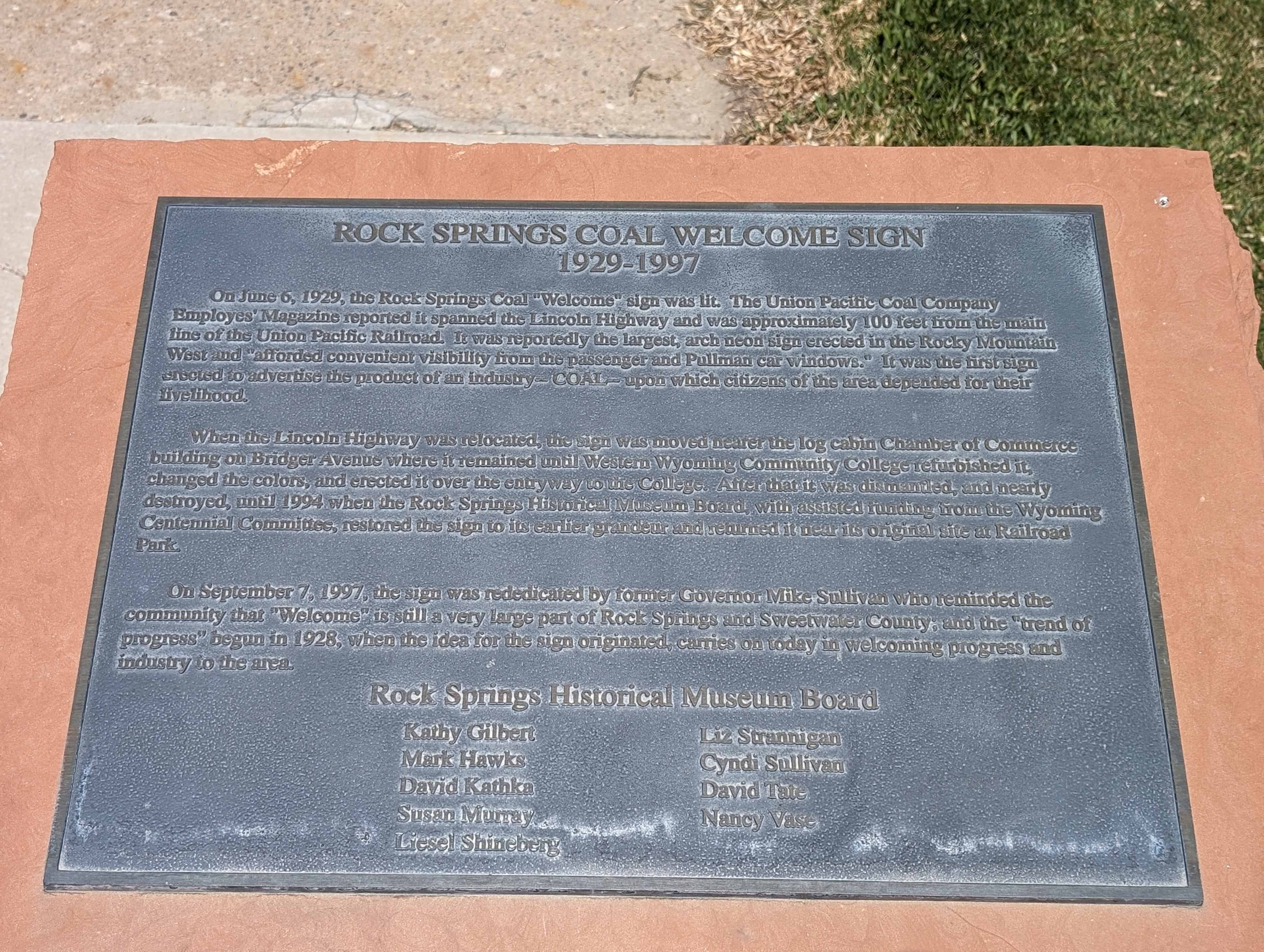
On June 6, 1929, the Rock Springs Coal “Welcome” sign was lit. The Union Pacific Coal Company Employees’ Magazine reported it spanned the Lincoln Highway and was approximately 100 feet from the main line of the Union Pacific Railroad. It was reportedly the largest, arch neon sign erected in the Rocky Mountain West and “afforded convenient visibility from the passenger and Pullman car windows.” It was the first sign erected to advertise the product of an industry – COAL – upon which citizens of the area depended for their livelihood.
When the Lincoln Highway was relocated, the sign was moved nearer the log cabin Chamber of Commerce building on Bridger Avenue where it remained until Western Wyoming Community College refurbished it, changed the colors, and erected it over the entryway to the College. After that it was dismantled, and nearly destroyed, until 1994 when the Rock Springs Historical Museum Board, with assisted funding from the Wyoming Centennial Committee, restored the sign to its earlier grandeur and returned it near its original site at Railroad Park.
On September 7, 1997, the sign was rededicated by former Governor Mike Sullivan who reminded the community that “Welcome” is still a very large part of Rock Springs and Sweetwater County; and the “trend of progress” begun in 1928, when the idea for the sign originated, carries on today in welcoming progress and industry to the area.
The sign is located at Main Street and C Street in Rock Springs, Wyoming.
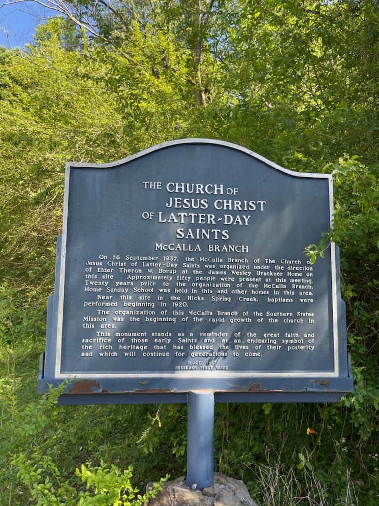
On 26 September 1937. the McCalla Branch of The Church Jesus Christ of Latter-Day Saints was organized under the direction of Elder Theron W. Borup at the James Wesley Brackner Home on this site. Approximately fifty people were present at this meeting. Twenty years prior to the organization of the McCalla Branch, Home Sunday School was held in this and other homes in this area. Near this site in the Hicks Spring Creek. baptisms were performed beginning in 1920.
The organization of this McCalla Branch of the Southern States Mission was the beginning of the rapid growth of the church In this area.
This monument stands as a reminder of the great faith and sacrifice of those early Saints and as an endearing symbol of the rich heritage that has blessed the lives of their posterity and which will continue for generations to come.
Marker placed in 1987 by the Bessemer First Ward of The Church of Jesus Christ of Latter-day Saints in McCalla, Alabama.
This historical marker commemorates the valor and service of pioneer scout Rafael Rivera, the first European American of record to view and traverse Las Vegas Valley, who scouted for Antonio Armijo’s sixty-man trading party from Abiquiu, New Mexico. In January 1830, young Rivera ascended Vegas wash twenty miles east of this marker and blazed a route to the Mojave River in California by way of the Armargosa River.
Rivera’s pioneering route became a vital link in the Old Spanish Trail, with Las Vegas Springs an essential stop on this popular route to Southern California. John C. Frémont mapped the trail in 1844. Three years later, following an extension of the course to Salt Lake Valley, the route became known in this area as the Mormon Trail. Today the Old Spanish Trail closely parallels Interstate route #15.
This is Nevada State Historical Marker #214, located on Mountain Vista Street just south of Russell Road in Las Vegas, Nevada.
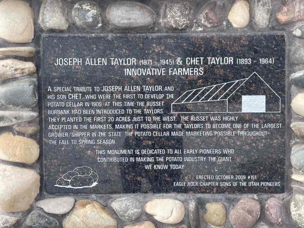
Joseph Allen Taylor (1871-1945) & Chet Taylor (1893-1964) Innovative Farmers
A special tribute to Joseph Allen Taylor and his son Chet, who were the first to develop the potato cellar in 1909. At this time the Russet Burbank had been introduced to the Taylors. They planted the first 20 acres just to the west. The Russet was highly accepted in the markets, marking it possible for the Taylors to became one of the largest grower/shipper in the state. The potato cellar made marketing possible throughout the Fall to Spring season.
This monument is dedicated to all early pioneers who contributed in making the potato industry the giant we know today.
This monument was erected by the Eagle Rock Chapter of the SUP in October, 2009 and is Sons of Utah Pioneers historic markers #151, located at 1851 East 97th South in Idaho Falls, Idaho.
The Blackfoot US. Land Office was located here during the land rush of 1902. All staked claims for land in the Upper Snake River Valley were filed in this office.