Over the years, the slide area above you has been very problematic, in 1986, a landslide moved the pipeline. The slide eventually covered and crushed the pipeline.
Because of the active nature of the slide, the pipeline was eventually moved from the hillside, and the water now flows through a tunnel undernearh the active landslide.
Wallsburg is a small agricultural community on four miles southeast of Deer Creek Reservoir. The early Indian name for the settlement was Little Warm Valley or Round Valley. It was finally named for William Madison Wall a native of North Carolina, who helped build the road through Provo Canyon. He was an explorer, colonizer, military officer, and church leader.(*)
The Heber Creeper Scenic railway is one of the last operating steam railroads in the United States.
It is the replacement of a busy freight and passenger business starting as the Utah Eastern line and evolving into the Denver and Rio Grande Western. Two trains a day ran along this line during the first part of this century. In the lower part of Provo Canyon it was located across the river from the road.
The Heber Creeper now runs two trains a day between Vivian Park (approximately four miles up the Canyon) and Heber City.
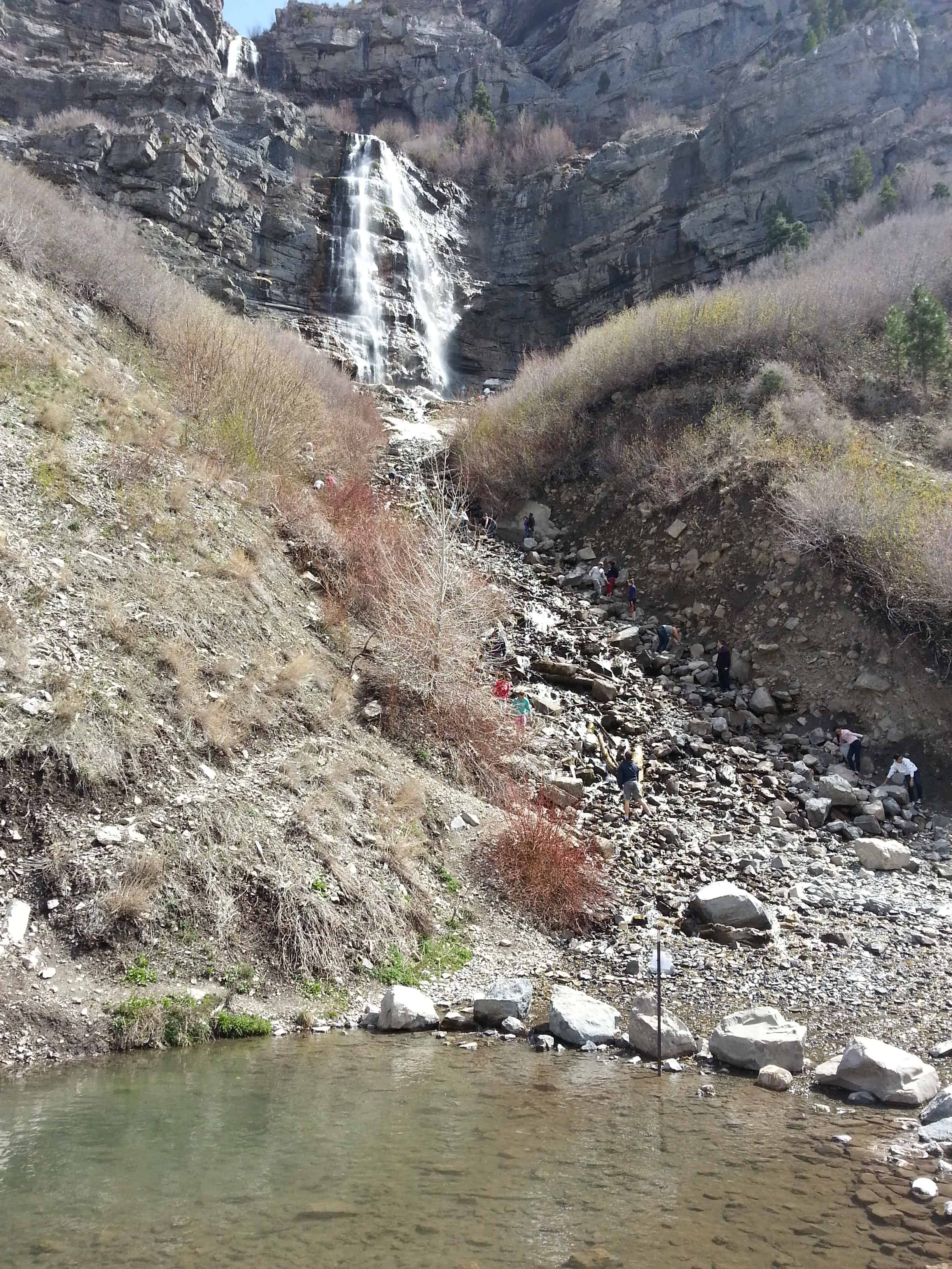
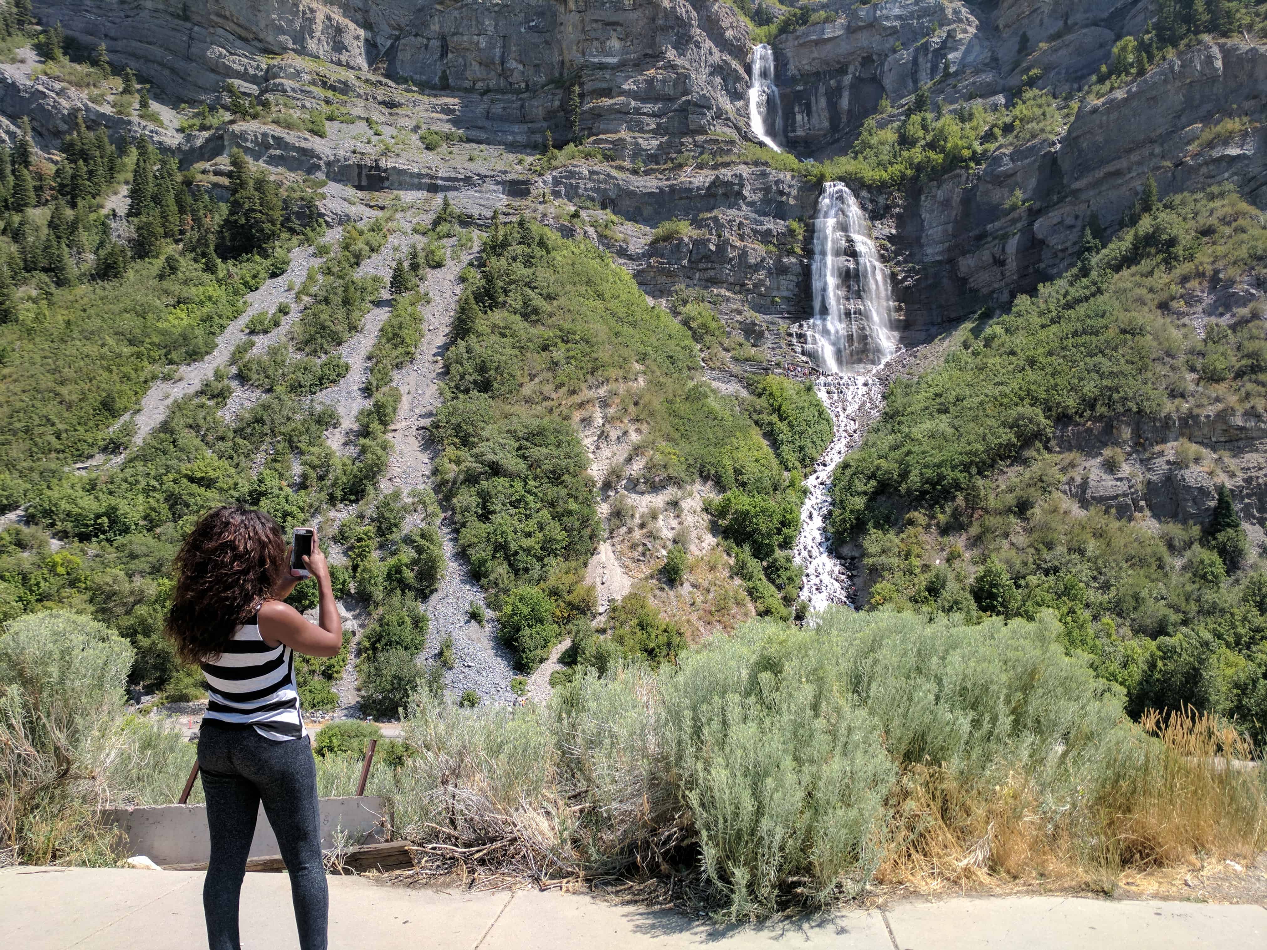
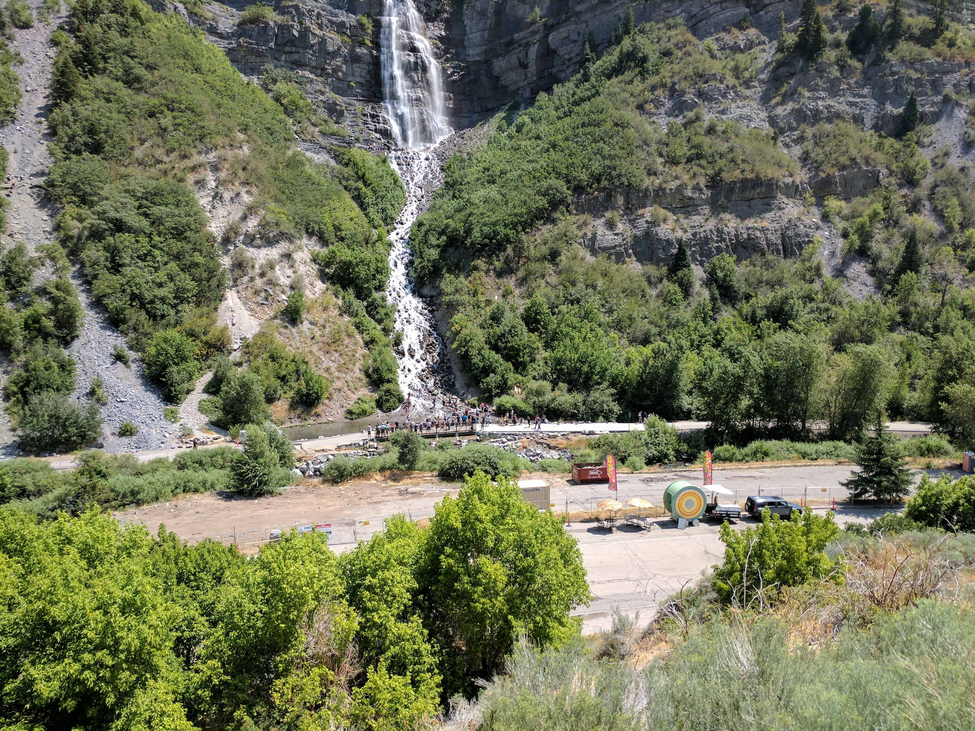
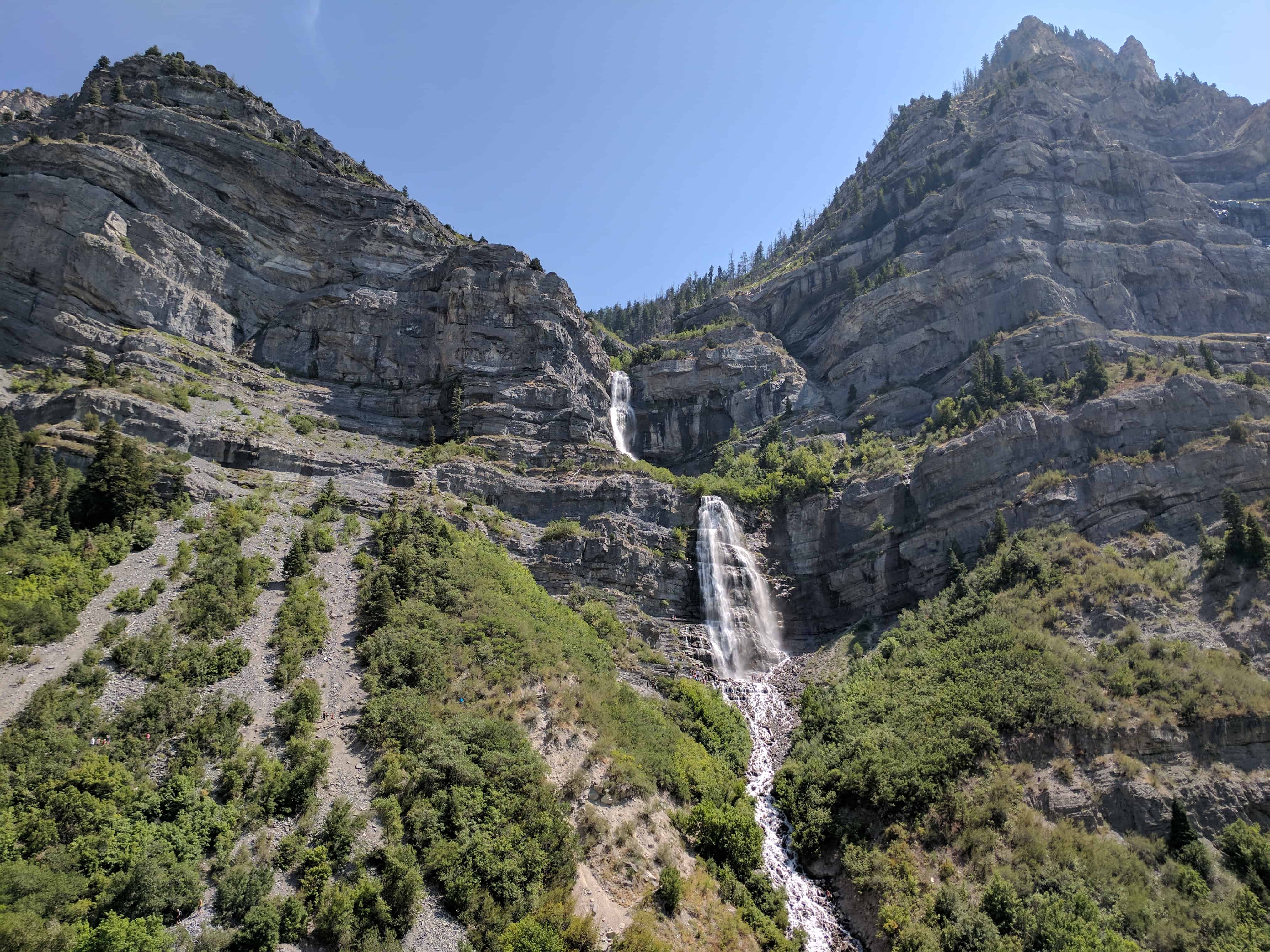
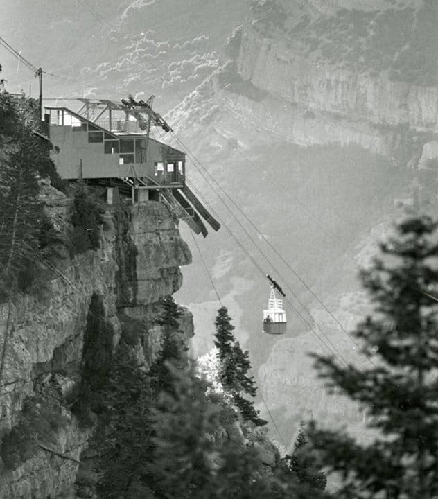
Bridal Veil Falls is a 607-foot tall waterfall in the south end of Provo Canyon, Utah. An aerial tramway service to the top of the falls was built in 1967 and the small, six-passenger tramway functioned as a recreational attraction until an avalanche destroyed the tram in early 1996. When the tramway was in operation prior to the 1996 avalanche, it was heralded as the WORLD’S STEEPEST AERIAL TRAMWAY, although that claim is difficult to ascertain. The magnificent falls are just four miles up the Provo Canyon. The falls are a favorite with visitors and locals alike. They can be seen from a scenic highway pullout or by taking an exit to where the base of the falls meets the Provo River. There is a small, cold swimming hole, and if you look carefully, you will find a dirt path that will take you up the mountain a bit for a closer view of the falls. The surrounding area is great for summer hiking and several trailheads begin at the falls. Bridal Veil falls is not only a summer attraction. In the winter, an icefall just to the right of the falls attracts experienced ice climbers. The icefall has been aptly named the Stairway to Heaven. The falls were a feature point along the route of the Heber Creeper tourist train until the train discontinued its service past the falls. The train tracks in front of the falls were removed and converted into a recreational trail. Now The falls and a small park just west of the falls (Bridal Veil Park) can also be accessed via U.S. Highway 189.(*)
Bridal Veil Falls – The Legend
Many moons ago, an Indian named Norita and a brave from a rival tribe, named Grey Eagle met and fell in love. They planned to meet near a streamlet high on the mountainside and elope to a land far away from both their tribes. On that fateful night, instead of her lover, Norita was confronted by braves from her own tribe. Fearing her lover had been destroyed she leapt from the high ledges.
Mother Nature was touched by her wild beauty, and she caught up Norita’s streaming tresses and made from them a Bridal Veil of falling water. From her flowing gown an alter was formed on the face of the mountain. Then her spirit was sent out as a mist, causing a green carpet to spread over the mountainside.
The intruders fled while her saddened lover stood and gazed down a the strange yet beautiful transformation. His grief was more than he could bear, so out of compassion for his sorrow, Mother Nature molded his massive frame into the mountain and stretched his mighty shoulders high into the heavens like silent sentinels to guard over his loved one. His cries of anguish were softened into love calls to whisper forever.
Bridal Veil Falls descends over step-like rock beds in the lower part of the Oquirrh Formation which was formed during the Pennsylvanian period. Pennsylvanian rock types, in rough order of decreasing abundance are: limestone, sandstone, shale, dolomite, halite, sylvite, conglomerate, and other minor salts.
In Utah, Pennsylvanian rocks and fossils are mostly of Marine Origin. The most commonly found are brachiopods, bryozoans, corals and crinoids.
Charleston is at the northeast section of Deer Creek Reservoir, at the junction of U-113 and US-89. The town was settled in 1852. There are two versions of the name source. The first and more accepted is that it was named for Charles Shelton who surveyed the town. The other suggests that James Herbert stopped there on his mail route and told the men at the herders’ cabin that if they would put up a mailbox, he would deliver mail to them. A Mr. Winterton, one of the herders, remembered hearing of Charleston, South Carolina, so he made a mailbox, put it in a crotch of a tree and used that name.
The Provo River Parkway weaves its way through state, city and county parks, as well as residential and commercial areas following the Provo River, then along University Avenue to the mouth of Provo Canyon. Its 15-mile length stretches from Utah Lake State Park to Vivian Park in Provo Canyon. At its northern end, the trail passes the base of Bridal Veil Falls for a spectacular view. The route is a Class 1, multi-use, gradual inclined, paved trail with a couple of short steep climbs. From Utah Lake State Park to the mouth of Provo Canyon, the path is 8-10 feet wide and nearly flat most of the way. In the canyon, the surface widens to 16 feet, and rises a little more steeply. There are some surface street crossings and some narrow underpasses. Water, restrooms, parking and picnic areas are available in the parks along the route.(*)
I have been riding the Provo River Parkway for most of my life, it is very fun and easy so even little kids can do it.
The trail is usually covered with joggers, walkers, bikers and longboarders.
Posts related to and sites found along the Provo River Parkway Trail:
Olmsted Power Plant (one of the first power plants in America)
(Near the mouth of Provo Canyon, 1018 North 1630 East in Orem, Utah)
In 1830 Michael Faraday of England discovered that when a coil of wire was moved near a magnet, the magnet induced a current of electricity in the wire. Faraday’s experiments resulted in the dynamo which generates electricity.
Anxious to capitalize on this exciting new power source, investors throughout the world began to develop and build these dynamo machines.
Installation of the electric lines began which would transform the world from a labor-intensive planet to one in which electrical energy could multiply the efforts of people by thousands of times.
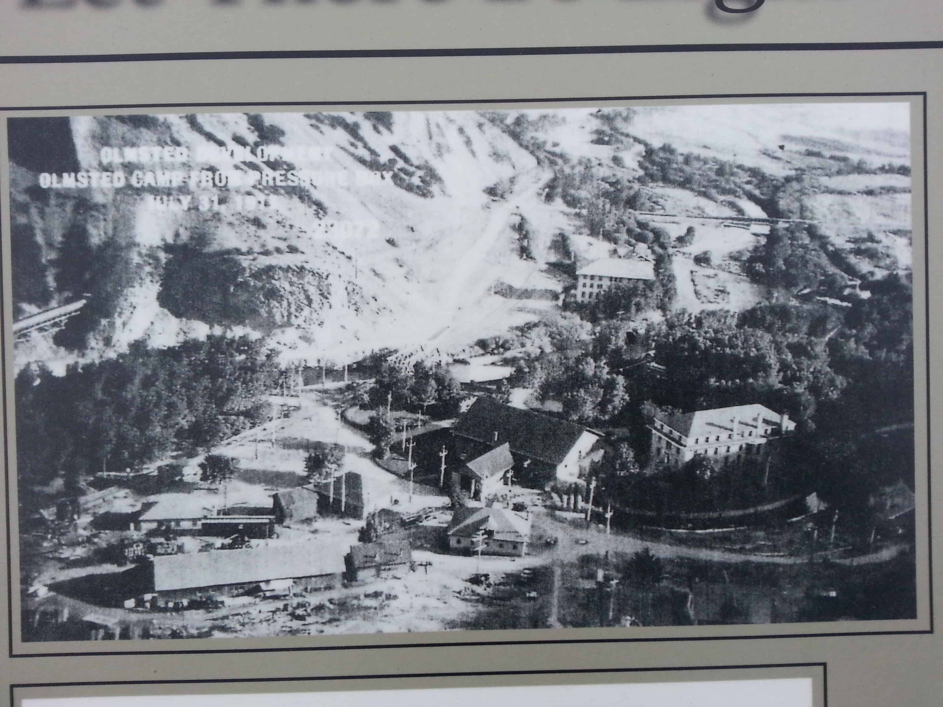
One of the early leaders in that effort in the United States was the Telluride Power Company. They selected a site at 1600 East 800 North, alongside the Provo River, to build one of the first power plants in America. Their Olmsted Power Plant became operational in 1904, supplying surrounding areas up to fifty miles away with electric power.
One of the unique features of the Olmsted Power Plant was that it used some of the most knowledgeable engineers in the country to establish on-the-job training programs for its employees. At the time, Olmsted offered one of only two competent training programs in electrical engineering in the entire United States, with the other one offered at Ohio State University.
In 1912, with less than 1,000 residents living on the Orem Bench, poles were erected to carry electric wires which were supplied with power generated at the Olmsted Power Plant.
Also in 1912, Utah Power and Light Company purchased the Telluride Power Company, which included the Olmsted Power Plant. This plant is still a fully-operational power plant. Also on the property are a few Craftsman-style residences, the 1937 “Home of Ideas” (a model home built to showcase the future of electricity use), and a large building constructed for educational use.
Olmstead Power Plant The Olmstead Power Plant, constructed by the Telluride Power Company, began operations in It supplied electricity to areas up to miles away. The plant also provided employees on the job electrical engineering training. This was one of two such training programs in the United States at the time. When the Utah Power and Light Company was formed in , it purchased the Telluride Power Company and its Olmstead Plant. The plant is currently operating under the direction of Pacificorp, doing business as Utah Power.
Let there be Light Olmsted Power Plant
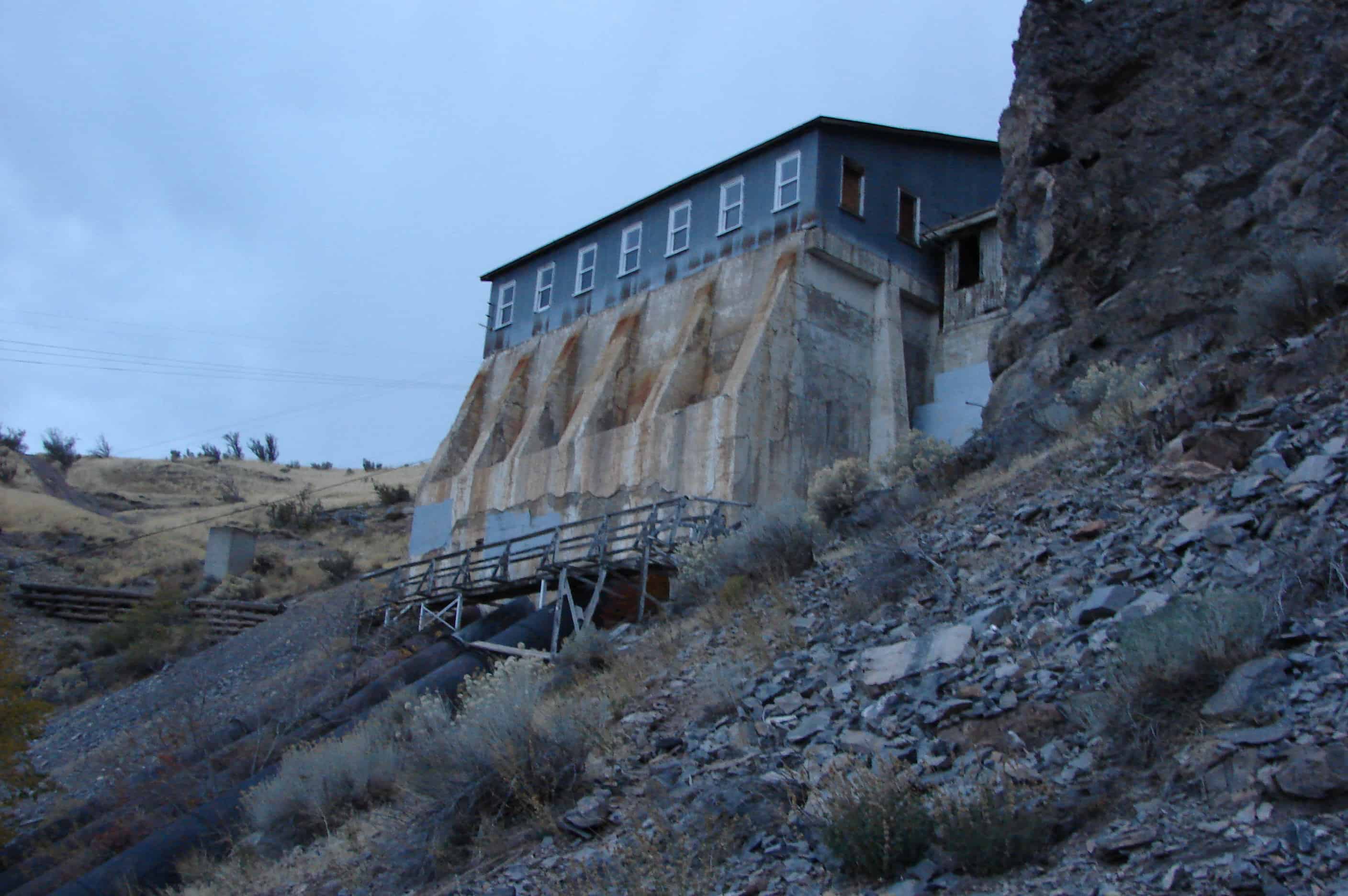
The Olmsted Power Plant, a historic structure, was constructed in by a predecessor to Rocky Mountain Power and is still in use today. The plant generates power from water diverted from the Provo River. During the last 100 years, water has reached the plant by both wooden flume and steel pipeline.
The Olmsted Station Powerhouse is located at 1018 North 1630 East in Orem, Utah and was added to the National Historic Register (#72001262) on June 26, 1972.
In 1903, L. L. Nunn, a pioneer in the development of alternating current high voltage transmission, with his brother and chief engineer, P. H, Nunn, supervised construction of the Telluride Power Company’s Olmsted Station Power House and the establishment of the Telluride Institute. The Institute, which accommodated up to 40 students, was the first corporation sponsored electrical school in the United States. The school closed in 1912 when Utah Power and Light Company acquired Olmsted Station.
The building was completed April 12, 1904.
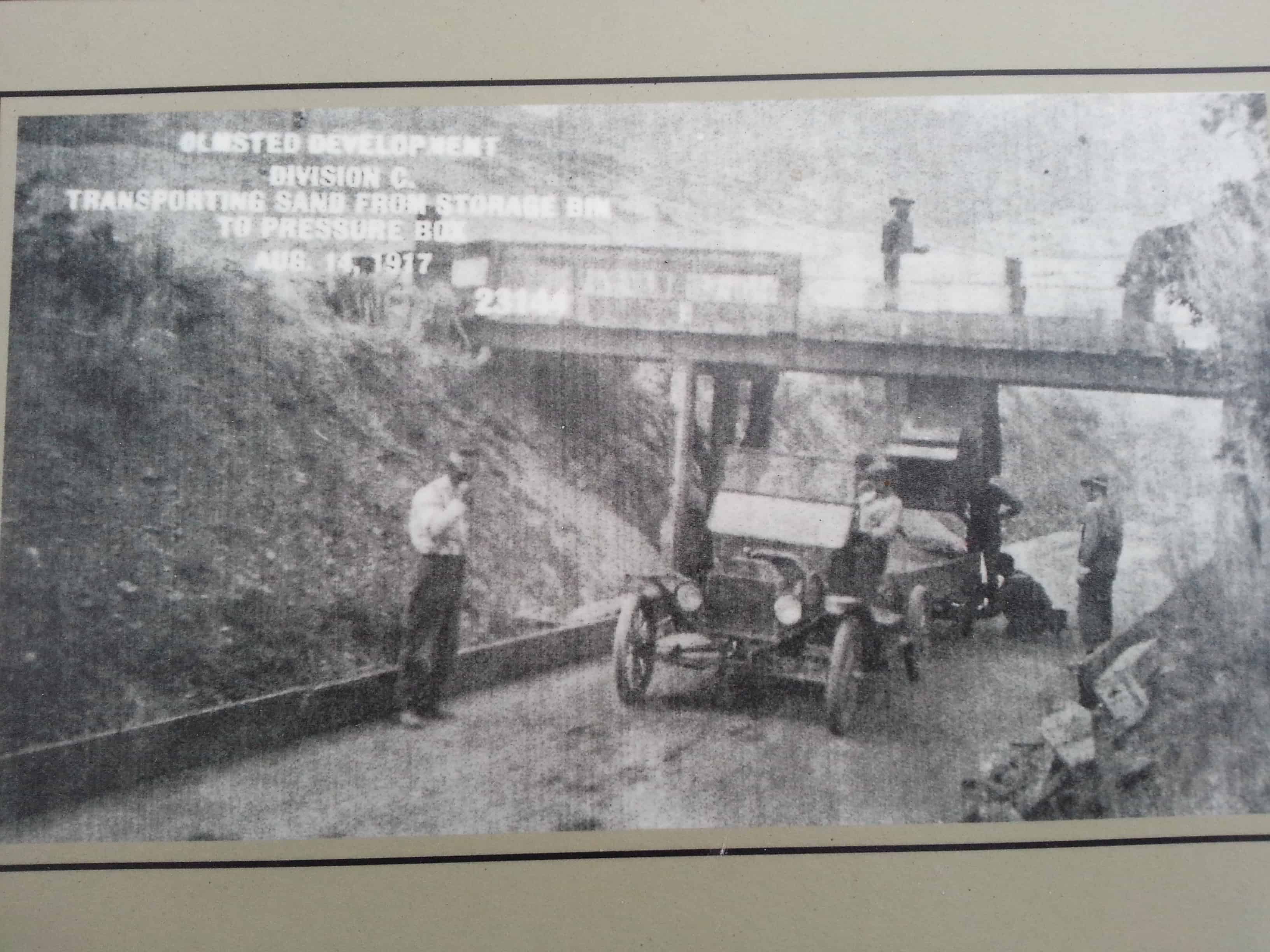
The 1917 extension (1917-1922), which called for a fourth turbine and generator, involved much additional construction. The original wood flume was replaced by a larger capacity wood flume; the pressure box was reconstructed to accommodate a fourth penstock; an I.P. Morris, 514 RPM, and a general electric generator, 2400 volt, 1895 Amp, were installed; one of two original water driven exciters was replaced by a motor driven type; extensive concrete work was done in the power house and an adjacent substation was constructed. In 1948-1951 a steel flume replaced the frequently damaged wood flume.
There are several nice parks in Provo Canyon, above is Canyon Glen Park.
Provo Canyon takes you from Provo, North-East up to the Heber City area, there are many gorgeous views, waterfalls, cliffs and colors. The Provo river winds through and is often filled with fly-fisherman and rafters. I have seen many deer, bald eagles and a moose among other more common wildlife.
There is a lot of history in Provo Canyon, most based around the river and water usage.
A list if the historic markers in the canyon (not complete yet, still adding them):
The Canyon was an alternate route into Utah Valley and plans were made to fortify the road against the U.S. Army. The Provo Canyon Guard Station was constructed in 1857 as a possible defense against the advancing U.S. Army during the Utah War.
The new road through Provo Canyon was completed in 1858, after the Utah War began. Because the road was not federally owned, but was operated by the territorial government, tolls were charged for maintenance.
In 1899, the Rio Grande Western Railroad came to Heber and started grading for the Provo Canyon line. The railroad continued to operate for over seventy years. It was very active in transporting large numbers of sheep to distant markets as Heber Valley became known as the sheep shipping center of Western America. The line was abandoned in 1969 by the Denver and Rio Grande railroad. Tracks were mostly removed and only those between Bridal Veil Falls and Heber were kept in place. The Wasatch Mountain Railway Company took over these tracks in 1969 and began “Heber Creeper” excursions in 1971. The “Heber Creeper” currently runs from Heber City to Vivian Park.
The Olmstead Spillway is seen up to the west as you’re entering the canyon, if you looked at the cliffs in 1904 this is the spillway for the Olmstead Flume you would have seen. Notice the size of the timbers used for construction and the water spilling from the overflow.
1904 Spillway
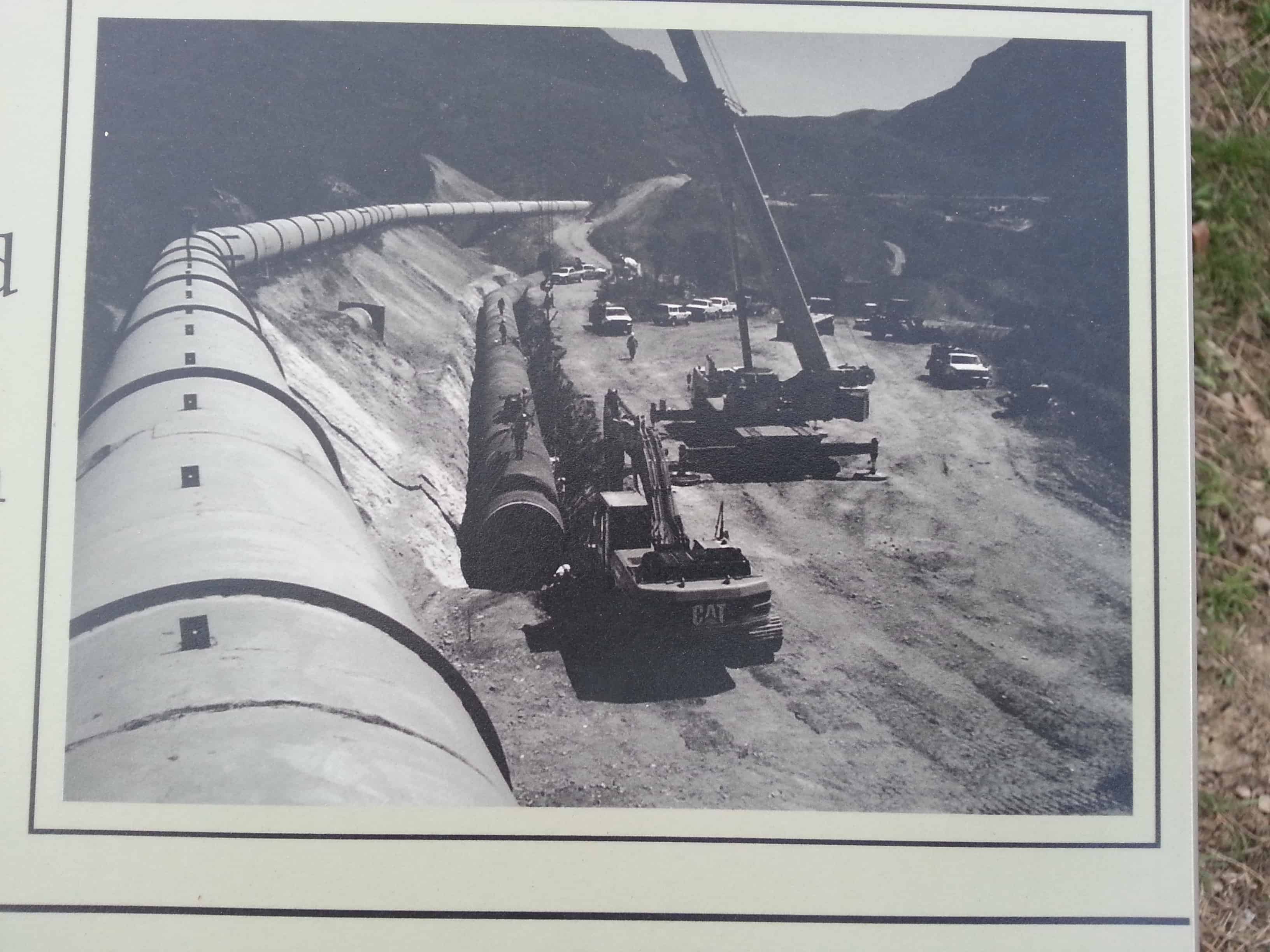
In 1949, the wooden flume was replaced with a steel pipeline and a siphon spillway instead of an overflow spillway. The pipeline shown in this photo is encased in concrete in the next photo.
1949 Spillway
2013 Spillway
Gravel Processing Plant On a hill a little past the spillway, a large gravel screening operation was set up to provide sand and gravel for the construction of new footings and the pressure box for the wooden flume. A reservoir was later constructed here.
***
Provo Canyon Gravel Processing Plant –
Flume Break In 1915, just north in the Canyon, the wooden flume broke and flooded a farm.
Provo Canyon Flume Break
The flume was repaired and eventually replaced in 1949 with a pipeline and an inverted siphon. In 2005, it was replaced again with a buried steel pipe. The Timpanogos Park is now where the farm once stood.