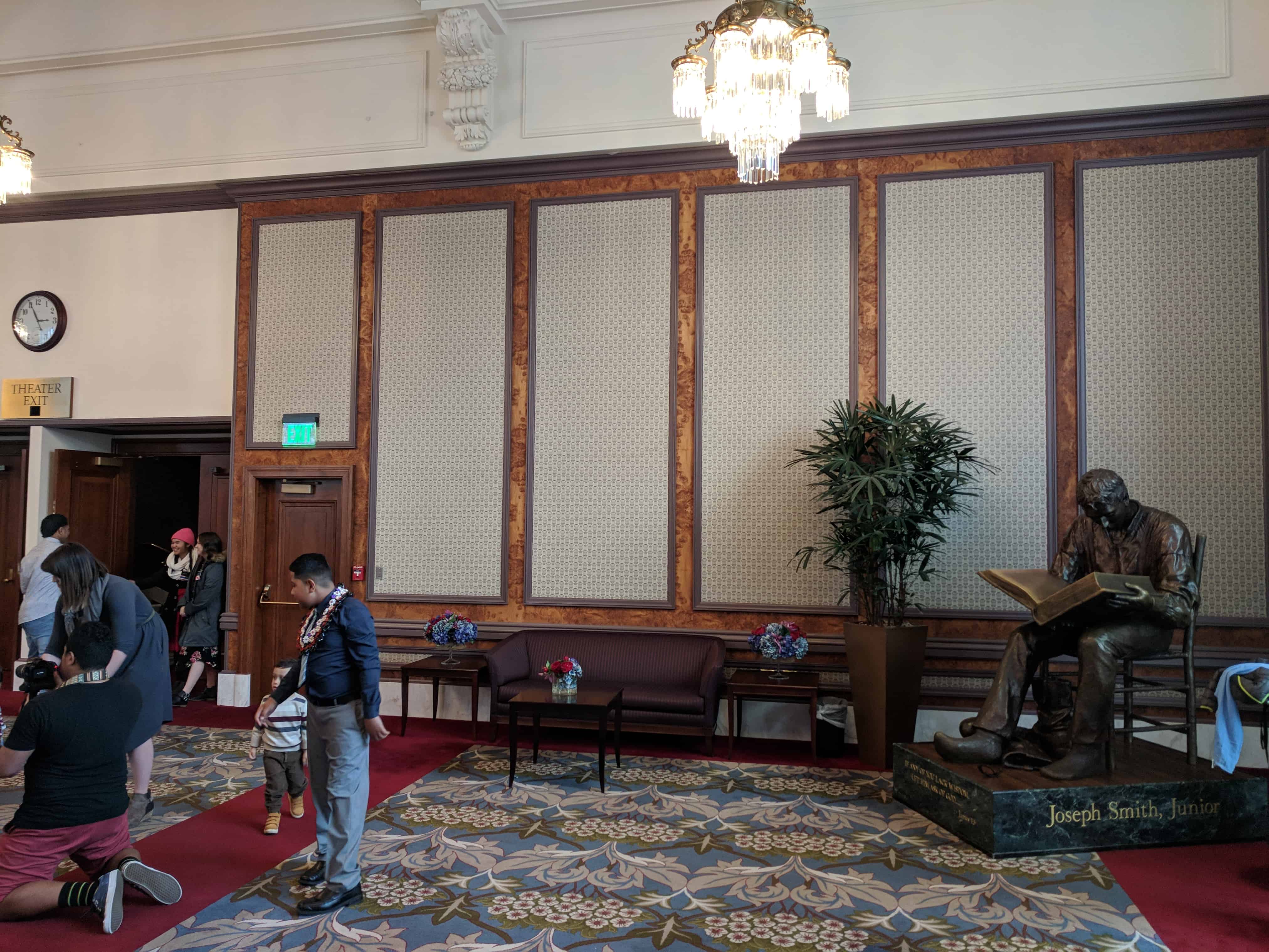
Location: Joseph Smith Memorial Building, Main St. and South Temple Street, Theater exit area
The National Society of the Sons of Utah Pioneers
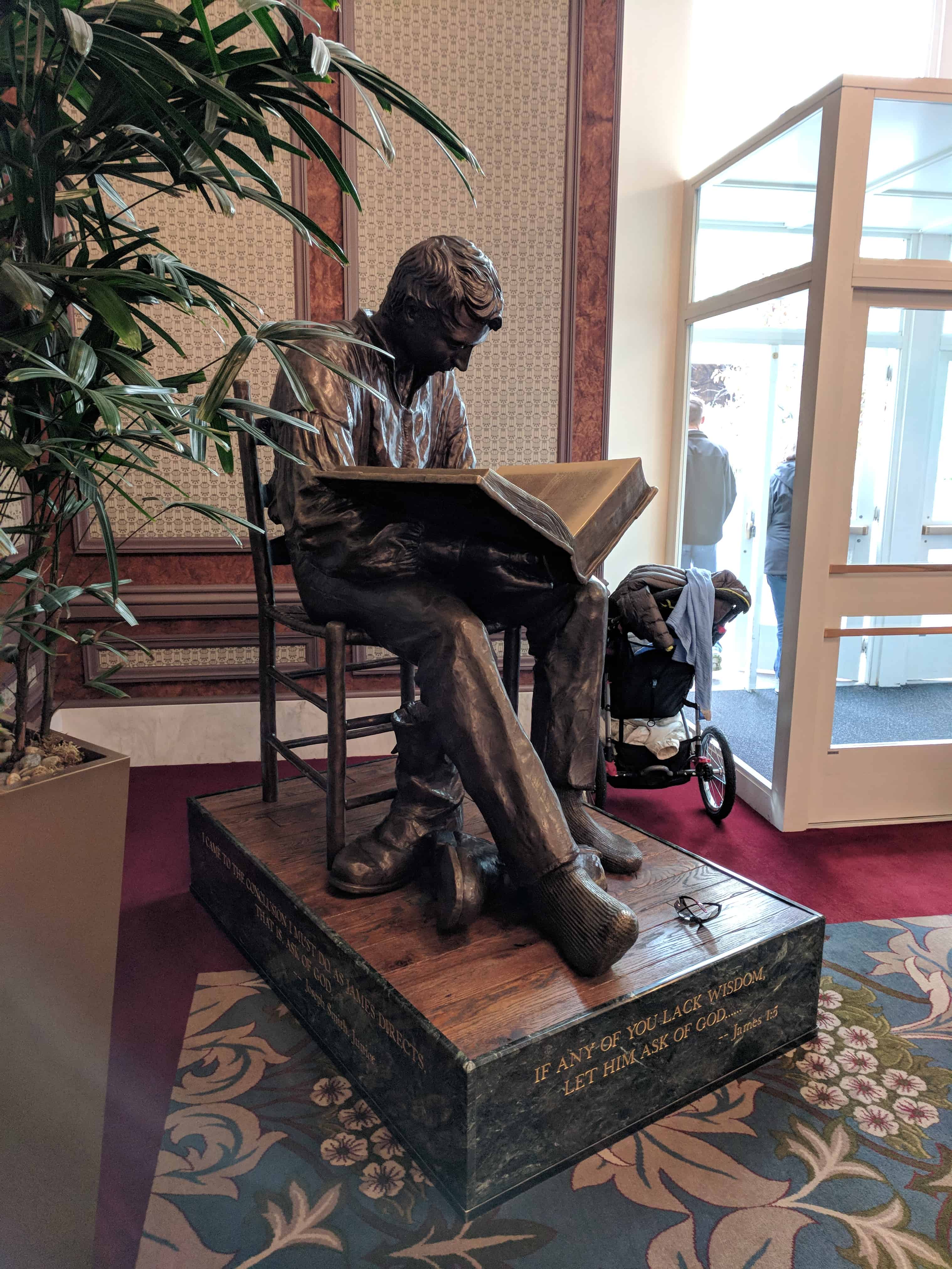
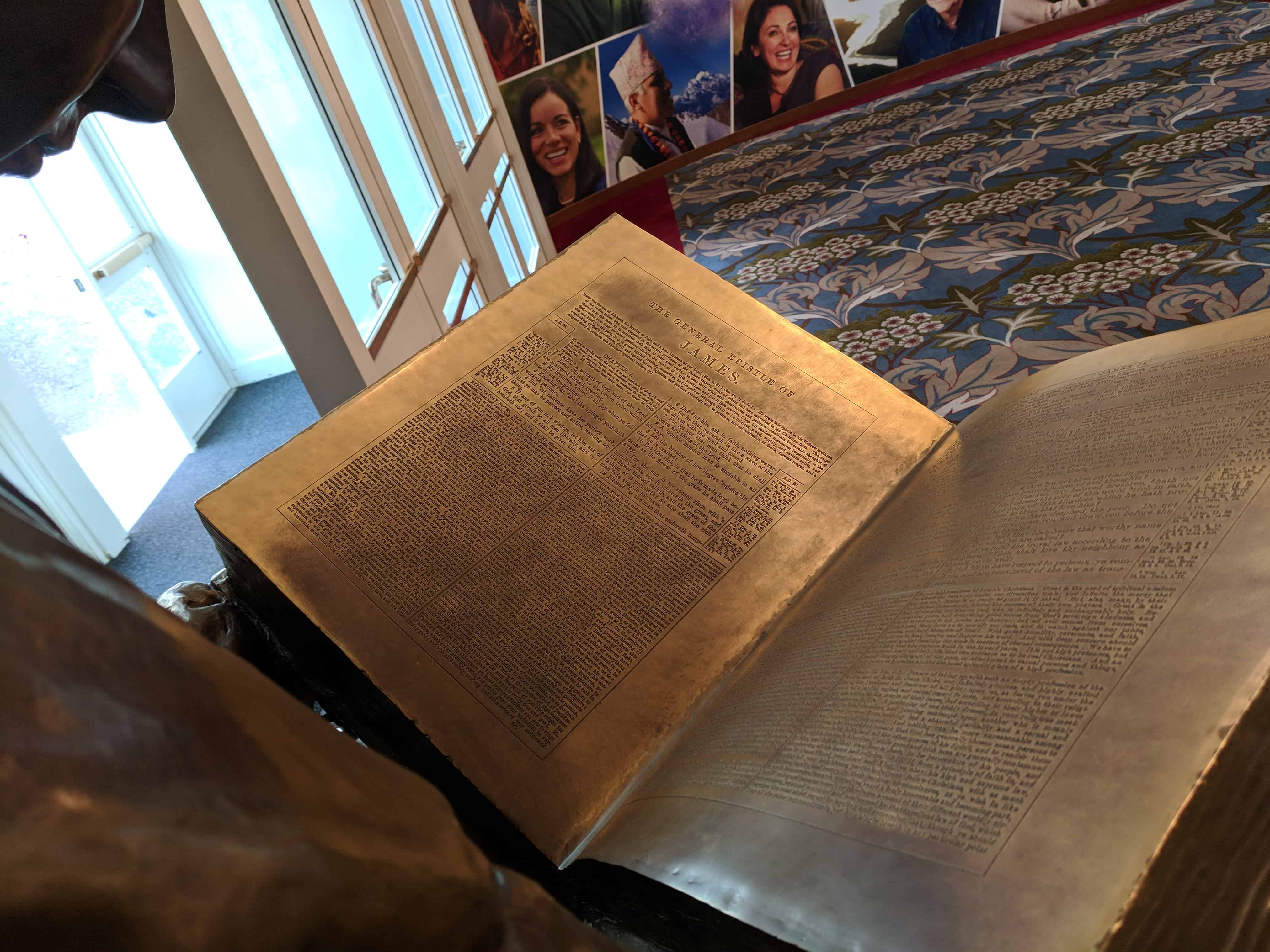
If any of you lack wisdom, let him ask of God… James 1:5
Joseph Smith, Junior
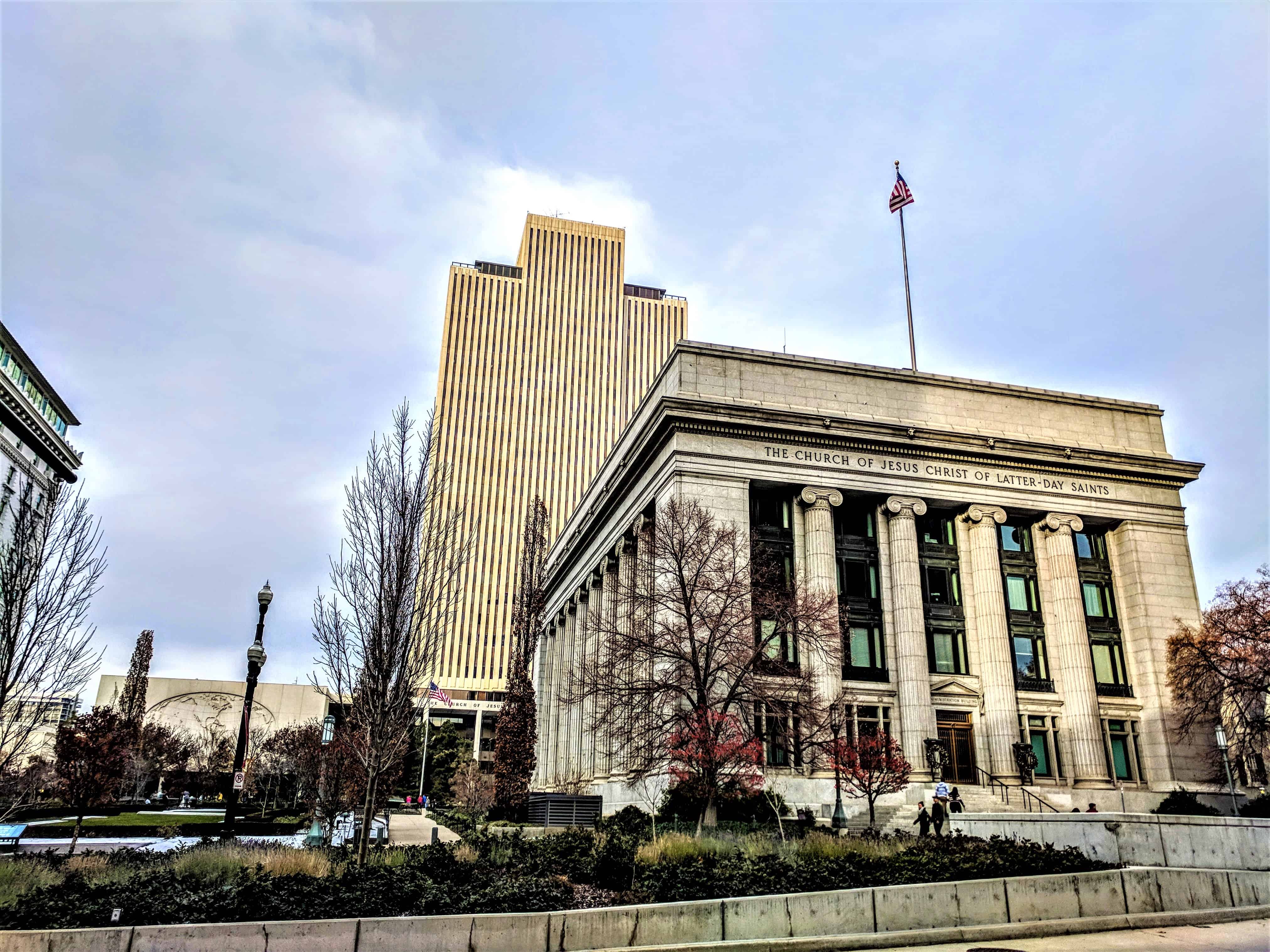
The Church of Jesus Christ of Latter-day Saints constructed this building between 1914 and 1917 to serve as its headquarters. Prior to its completion, the office of the Church President was located just to the east between Brigham Young’s Lion House and Beehive House. Today the Administration Building houses the offices of the Church’s First Presidency and other church leaders. This building is an excellent example of Neoclassical Style architecture. The 24 iconic pilasters which surround the exterior are made of solid granite. This granite, as well as that which covers the rest of the steel and concrete structure, was taken from the same quarry as the stone used to build the Salt Lake Temple.
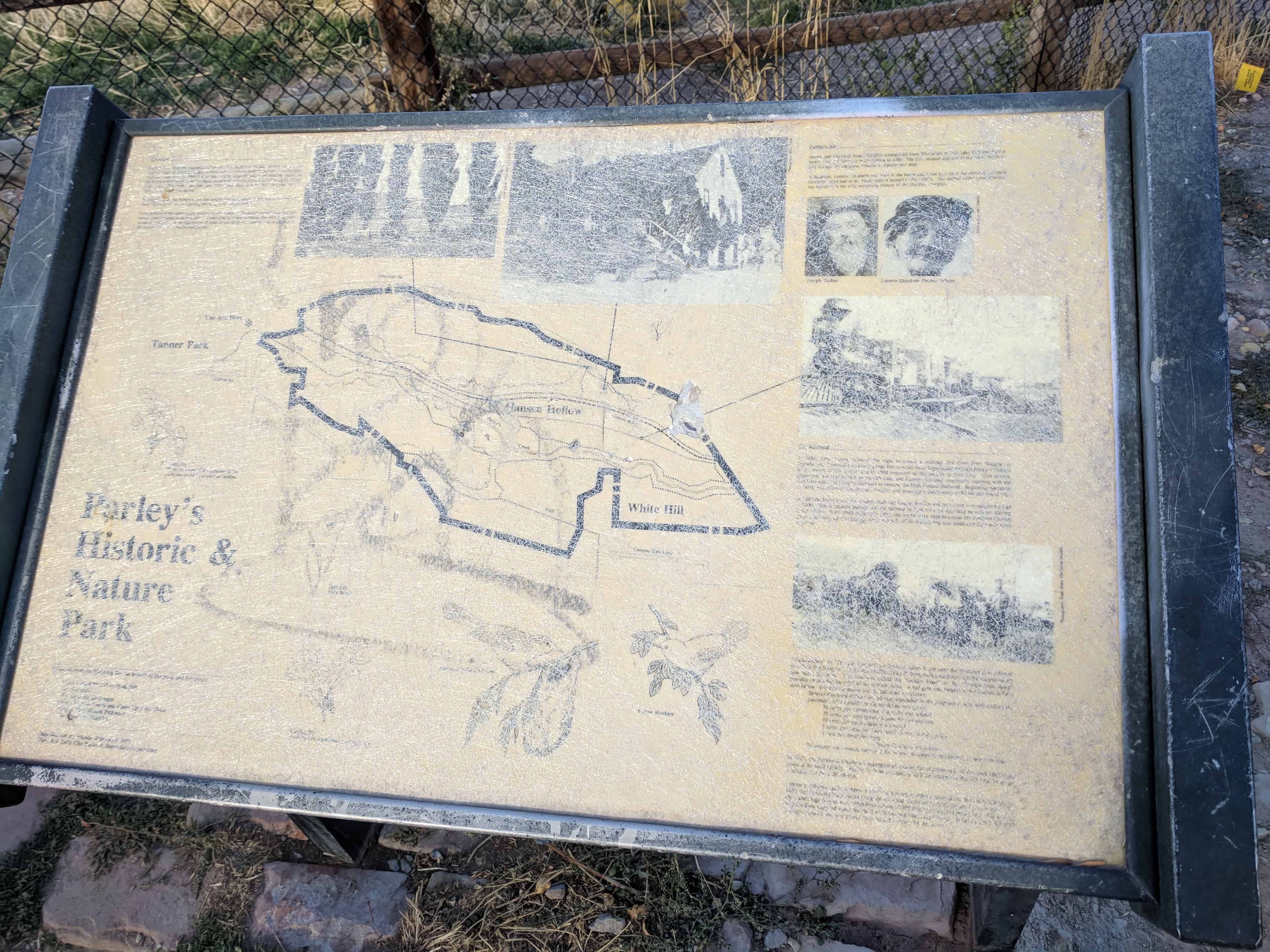
Perhaps one of the longest living and prominent residents of the area known as Parley’s Hallow, now officially Parley’s Historic Nature Preserve, was Joseph Dudler. About 1864, he settled in this location. Here he built his home. It was two stories, thirty-six by fifty-six feet in size, with rock foundation walls, the narrow front facing south, and the rest of the first floor dug into the side of the valley. The remains of the rock wall, east of the still existing foundation stones of the original building, is a continuation of the front wall of the lower floor of his Inn. The story above was frame with vertical siding, and it was here that the “Rooms To Let,” dining, and kitchen spaces were provided.
As business improved, in 1870, he built a brewery to the rear and west of the Inn. To provide further for this, he built an addition to the Inn itself, continuing the rock foundations further north sixteen feet with an adobe instead of frame upper story. In addition, he continued the lower floor north, only four feet further in the ground, with what has been called the “Wine Cellar.” Still there, it was a rock-walled room, underground, about fifteen-and-a-half feet wide and twenty feet long with ten-foot high, domed, rock ceiling. It is an ideal place for keeping things cool.
His irrigation water supply was brought to the site in a ditch from Parley’s Canyon Creek, but for drinking water he used a spring on the property northeast of the Inn location which is still flowing.
Dudler operated a saloon or two in town as well as the Inn, and in 1892, added a similar business in Park City where he also continued in the brewing and saloon business. He kept the farm and brewery area going in Parley’s Hallow until his death in October of 1897. His descendants continued using the Inn as a residence, referring to it as the “homestead” until it was destroyed by fire, the work of vandals, the night of the 17th of October, 1952.
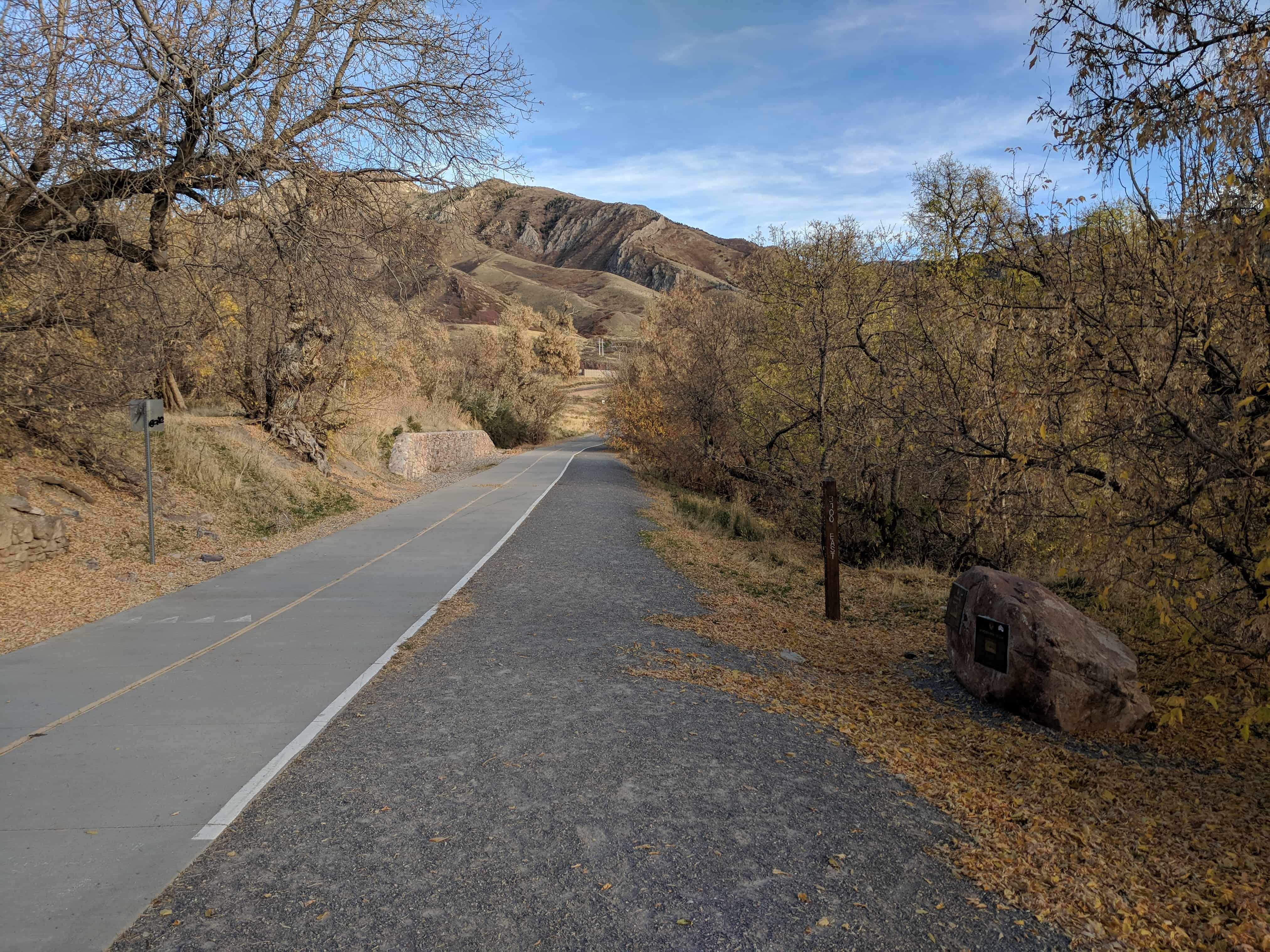
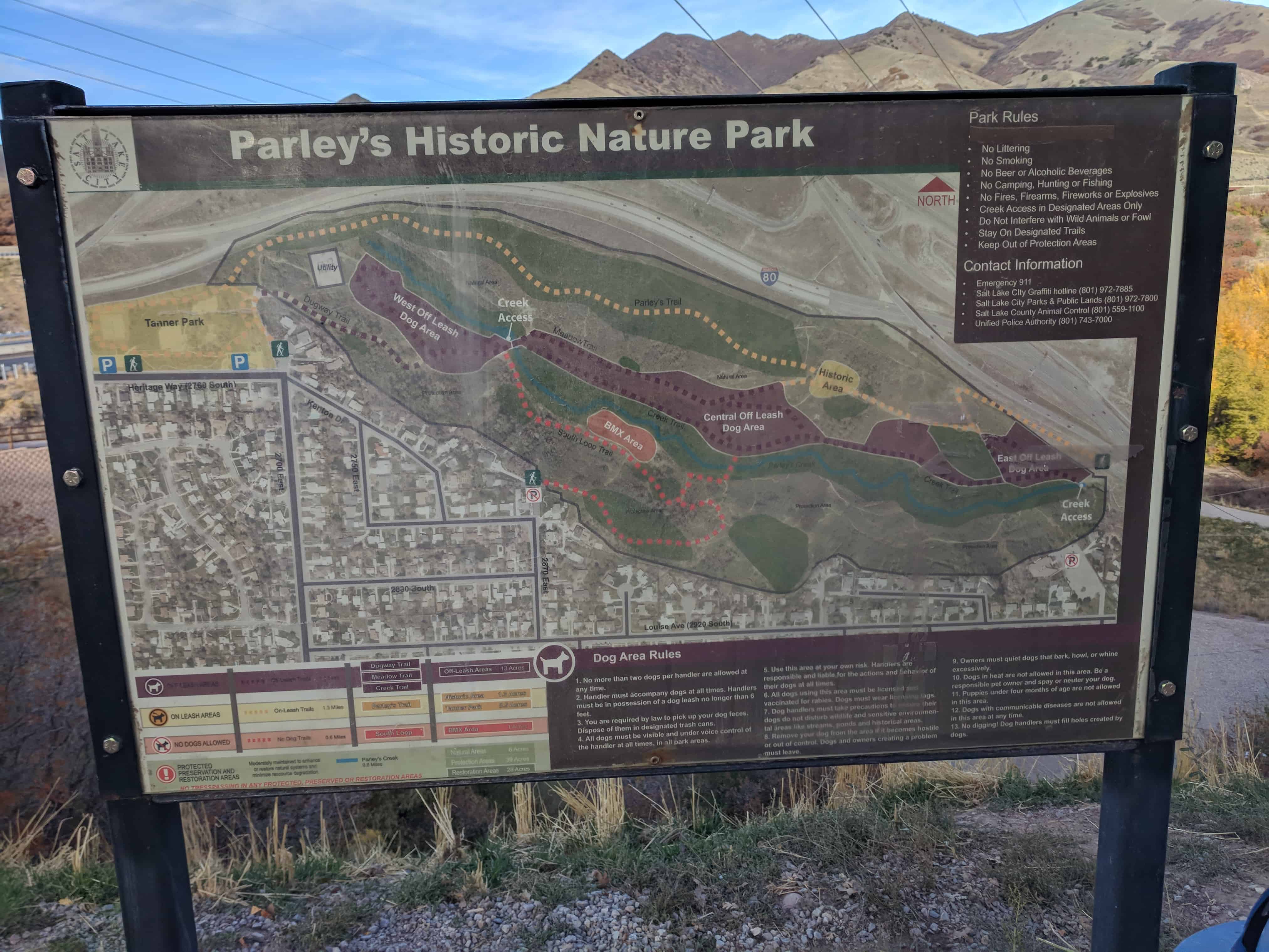
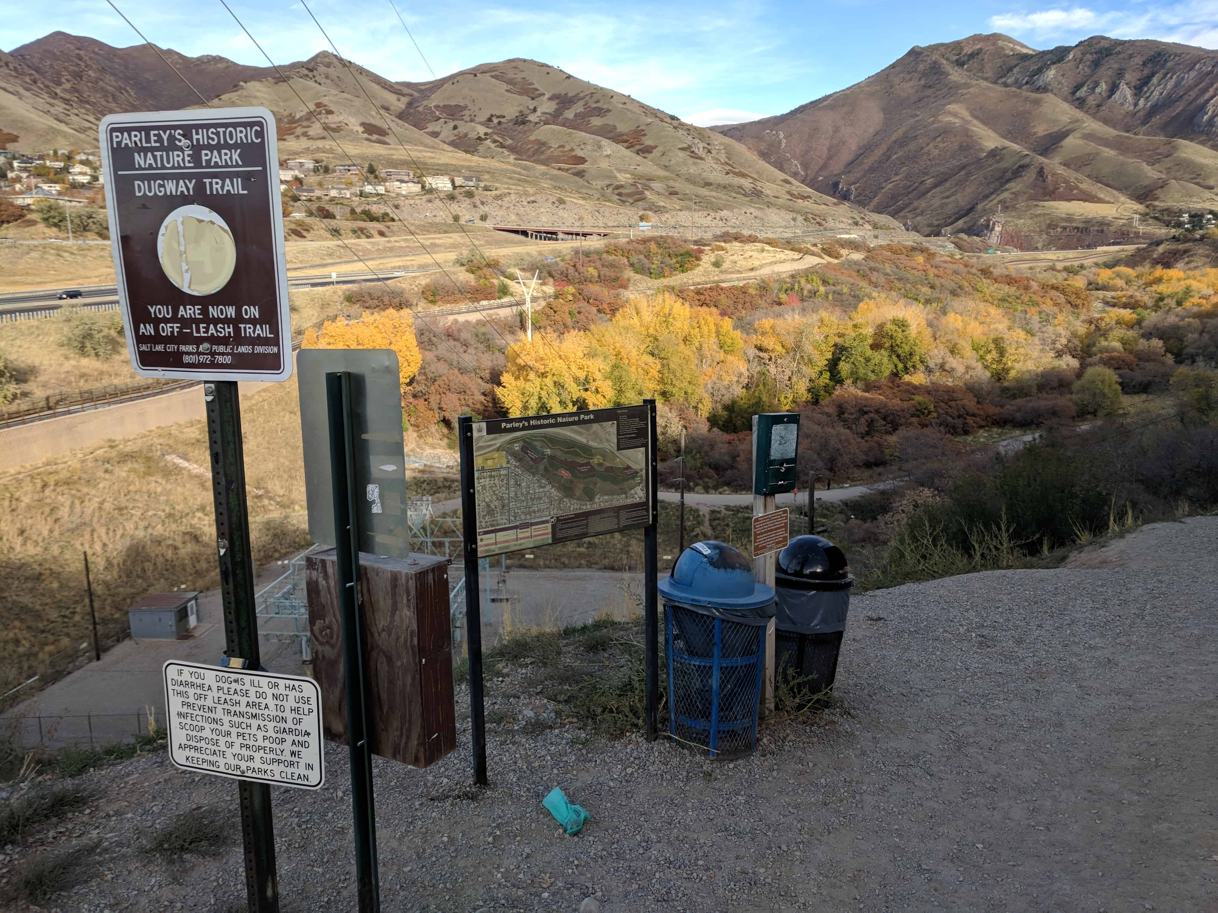
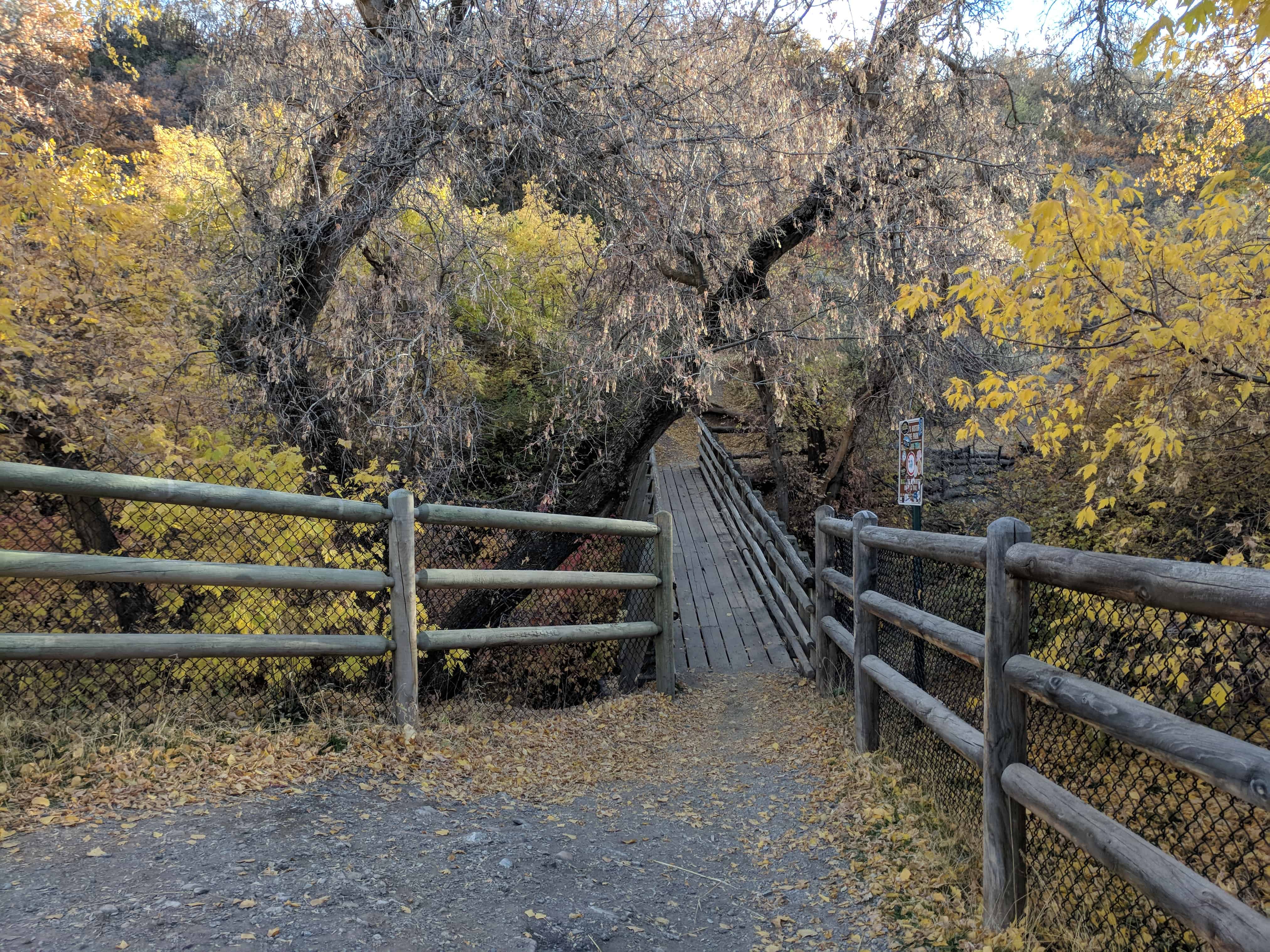
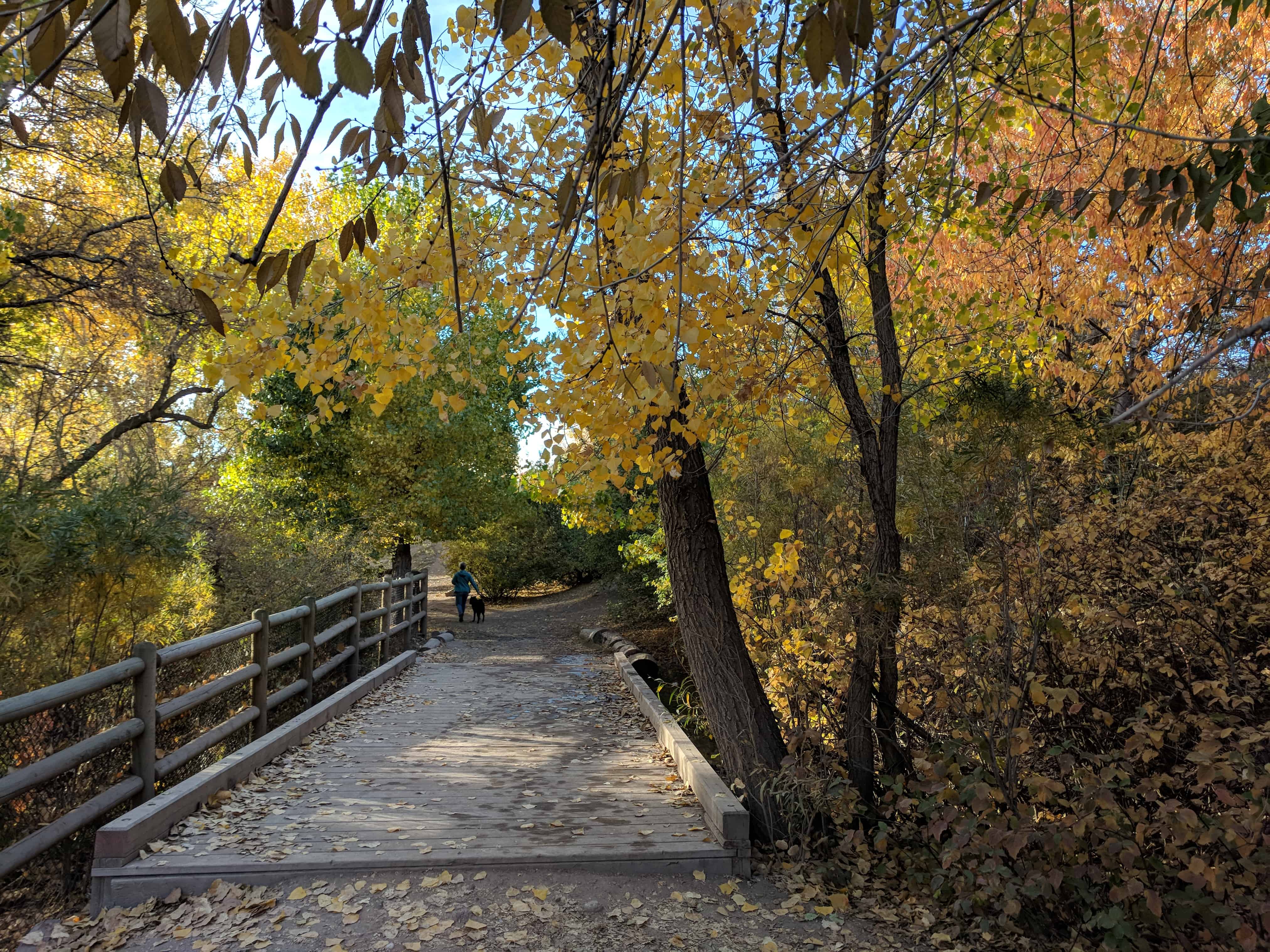
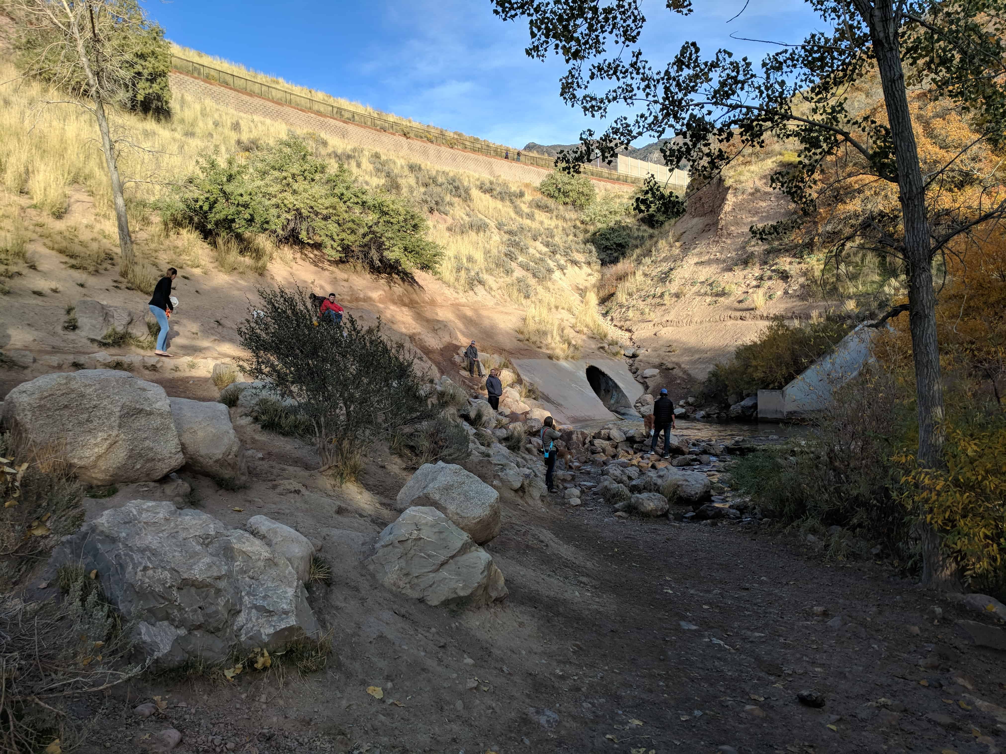
This is SUP Marker #75, to see the other SUP Markers visit this page. This marker is located in Parley’s Historic Nature Park along with 4 others (listed on the park’s page).
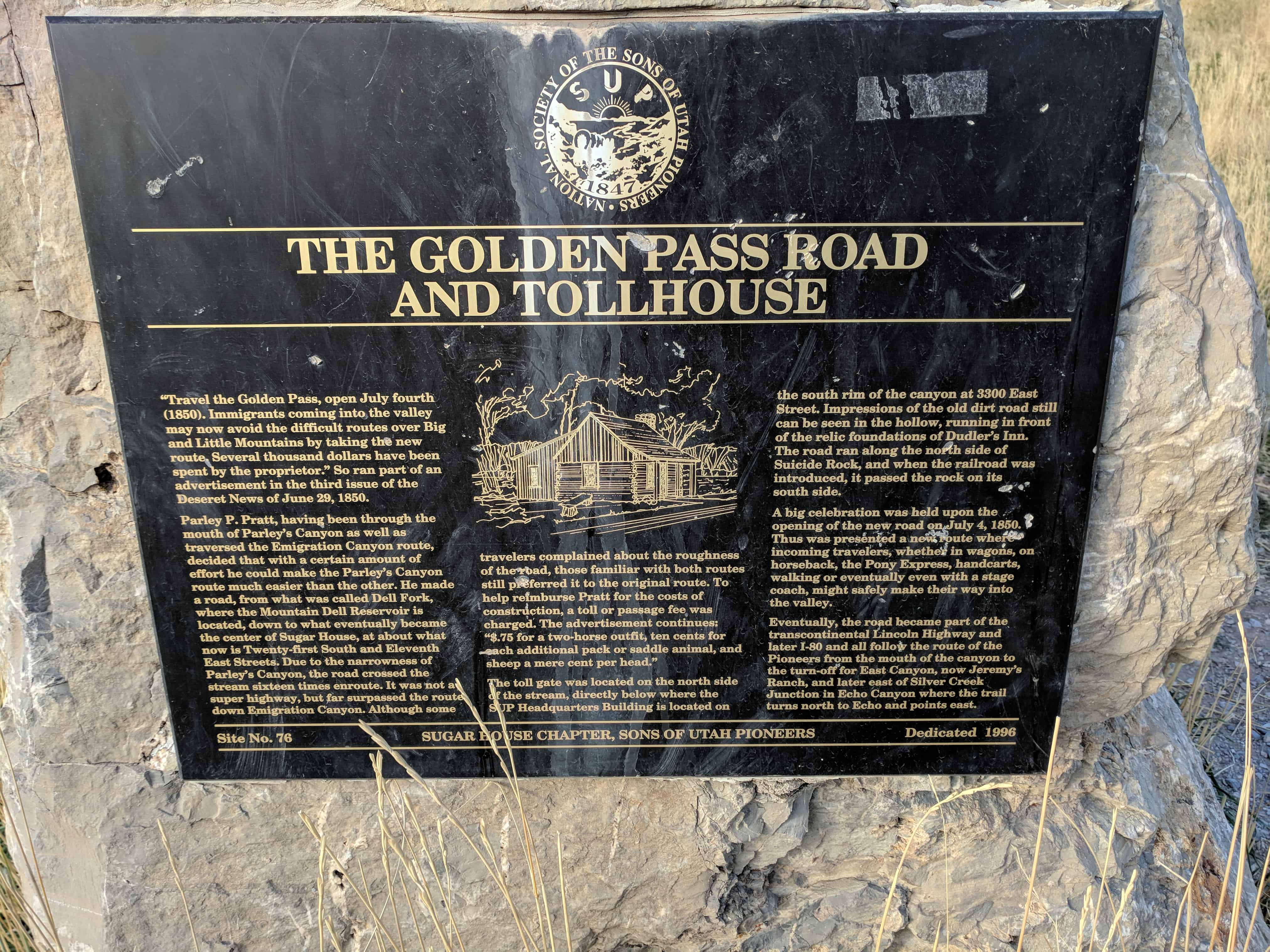
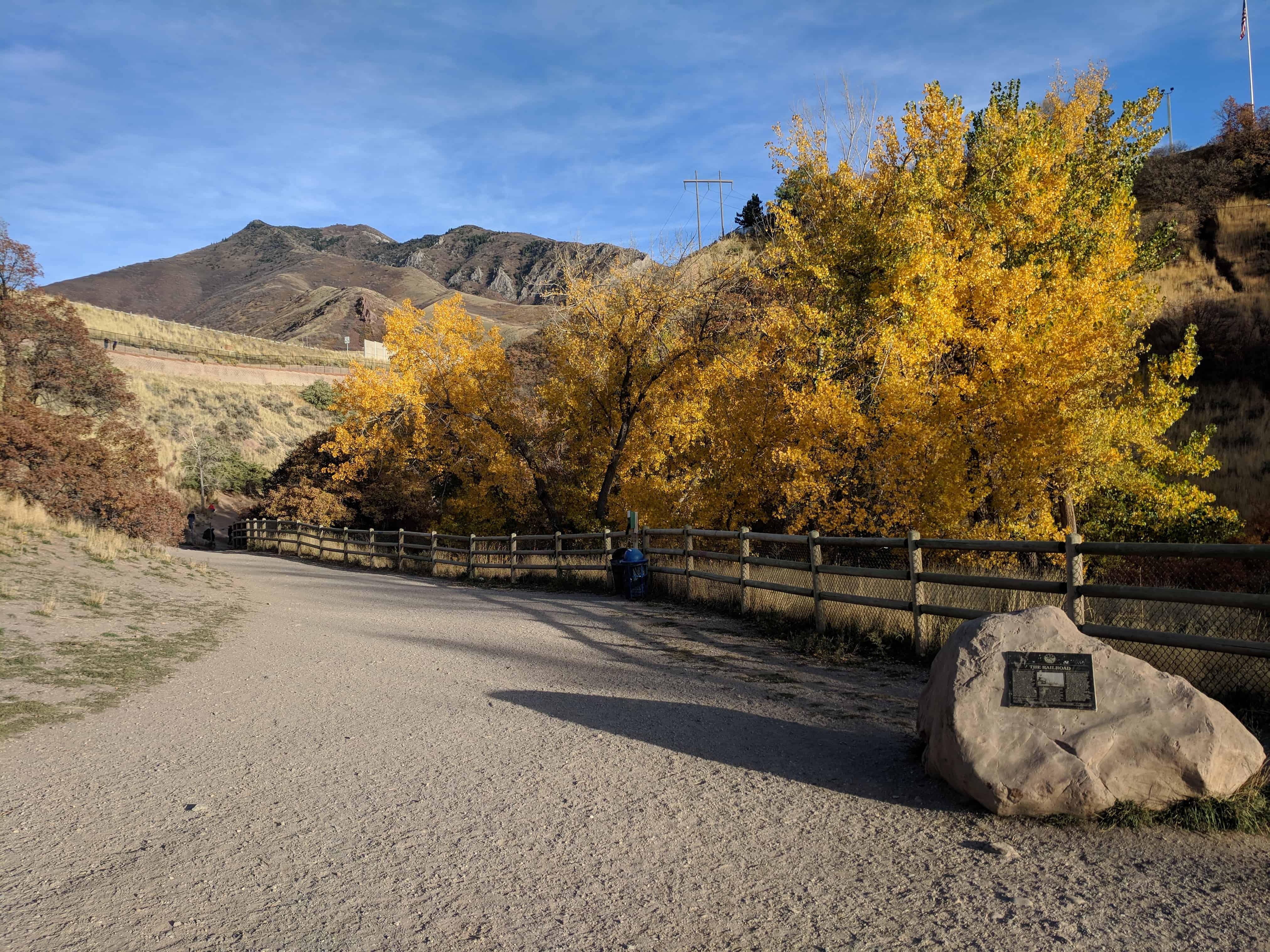
“Travel the Golden Pass, open July fourth (1849). Immigrants coming into the valley may now avoid the difficult routes over Big and Little Mountains by taking the new route. Several thousand dollars have been spent by the proprietor.” So ran part of an advertisement in the third issue of the Deseret News of June 29, 1850.
Parley P. Pratt, having been through the mouth of Parley’s Canyon as well as traversed the Emigration Canyon route, decided that with a certain amount of effort he could make the Parley’s Canyon route much easier than the other. He made a road from what was called Dell Fork, where the Mountain Dell Reservoir is located, down to what eventually became the center of Sugar House, at about what now is Twenty-first South and Eleventh East Streets. Due to the narrowness of Parley’s Canyon, the road crossed the stream sixteen times en-route. It was not a super highway but far surpassed the route down Emigration Canyon. Although some travelers complained about the roughness of the road, those familiar with both routes still preferred it to the original route. To help reimburse Pratt for the costs of construction, a toll or passage fee was charged. The advertisement continues: $.75 for a two-horse outfit, ten cents for each additional pack or saddle animal, and sheep a mere cent per head.”
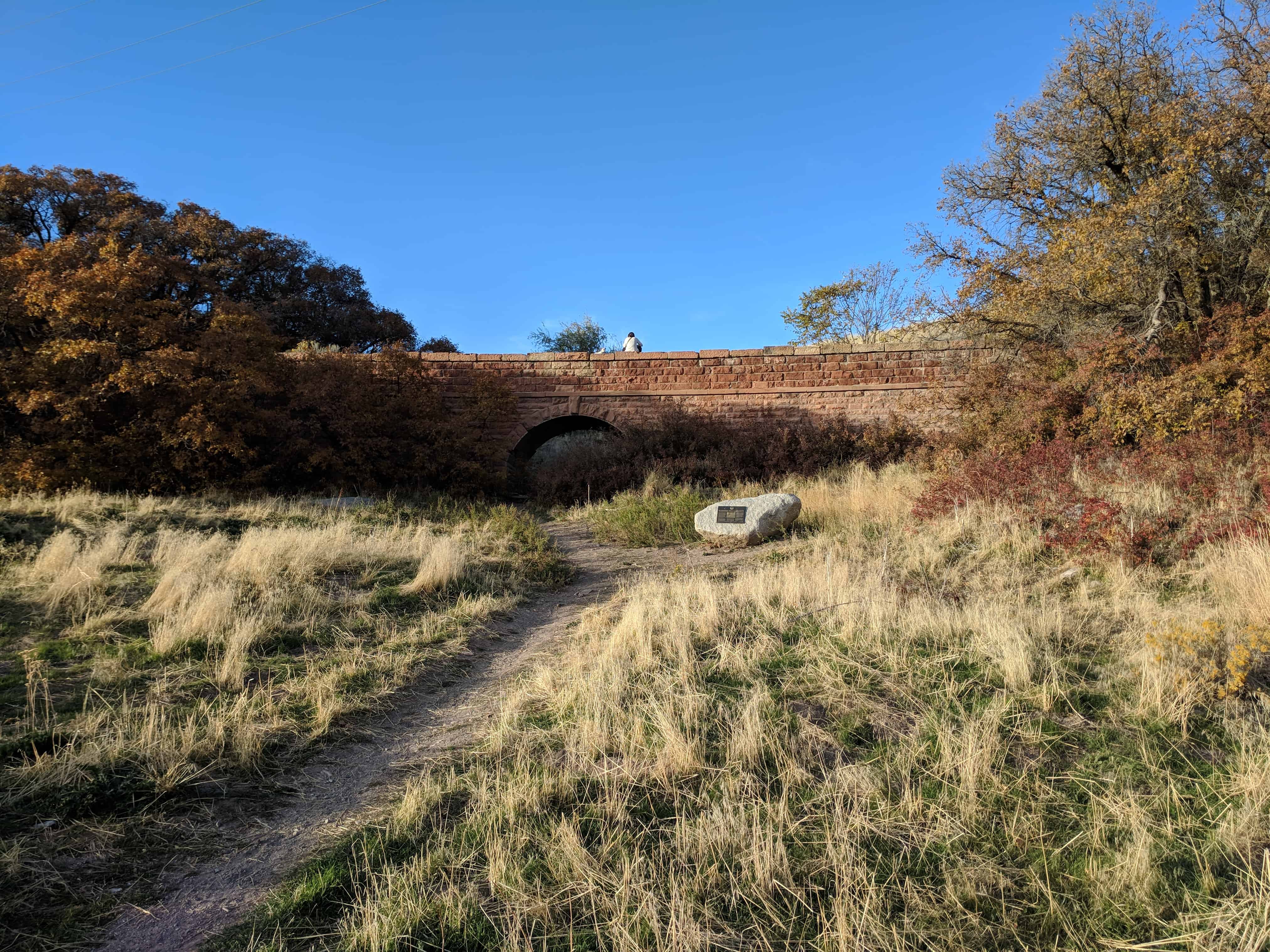
The toll gate was located on the north side of the stream directly below where the SUP Headquarters is located on the south rim of the canyon at 3300 East Street. Impressions of the old dirt road still can be seen in the hollow, running in front of the relic foundations of Dudler’s Inn. The road ran along the north side of Suicide rock, and when the railroad was introduced it passed the rock on its south side.
A big celebration was held upon the opening of the new road on July 4, 1850. Thus was presented a new route where incoming travelers, whether in wagons, on horseback, the Pony Express, handcarts, walking or eventually even with a stage coach, might safely make their way into the valley.
Eventually the road became part of the transcontinental Lincoln Highway and later I-80 and all follow the mouth of the canyon to the turn-off for East Canyon, now at Jeremy’s Ranch, and later east of Silver Creek Junction in Echo Canyon where the trail turns north to Echo and points east.
This is SUP Marker #76, to see the other SUP Markers visit this page. This marker is located in Parley’s Historic Nature Park along with 4 others (listed on the park’s page).
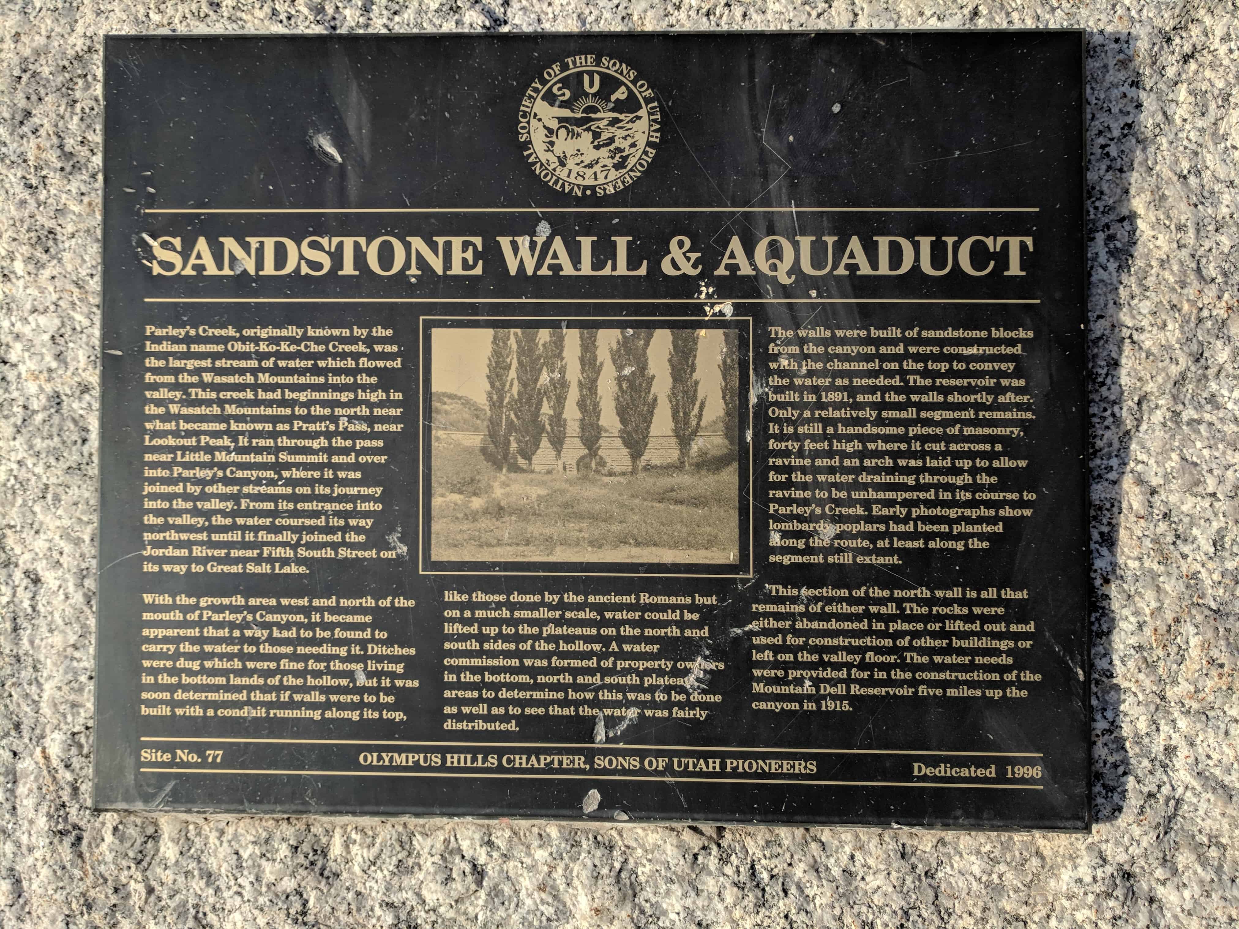
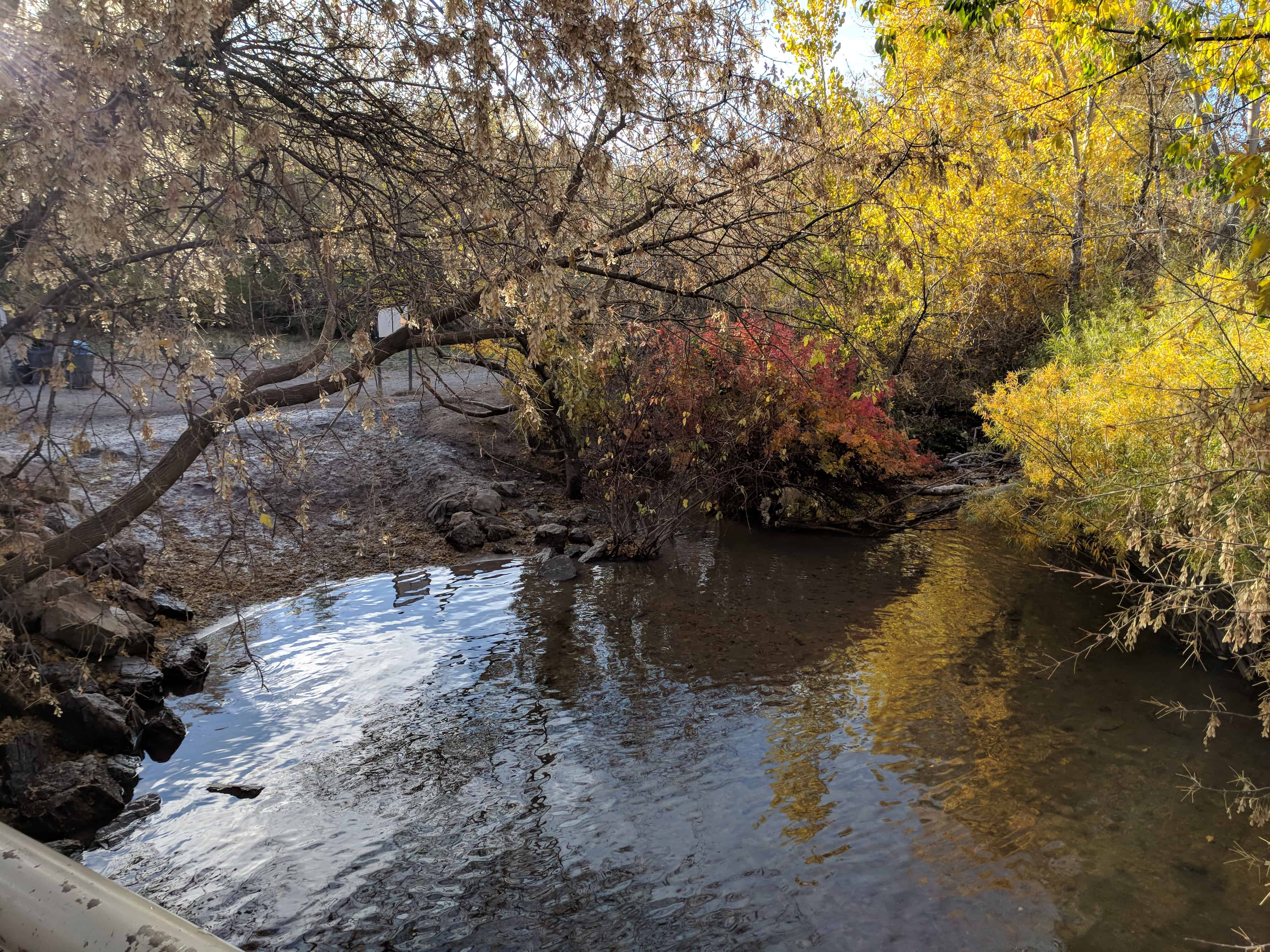
Parley’s Creek, originally known by the Indian name Obit-Ki-Ke-Che Creek, was the largest stream of water which flowed from the Wasatch Mountains into the valley. This creek had beginning high in the Wasatch Mountains to the north near what became known as Pratt’s Pass, near Lookout Peak. It ran through the pass near Little Mountain Summit and over into Parley’s Canyon where it was joined by other streams on its journey into the valley. From its entrance into the valley the water coursed its way northwest until it finally joined the Jordan River near Fifth South Street on its way to Great Salt Lake.
With the growth area west and north of the mouth of Parley’s Canyon, it became apparent that a way had to be found to carry the water to those needing it. Ditches were dug which were fine for those living in the bottom lands of the hollow, but it was soon determined that its walls were to be built with a conduit running along its top, like those done by the ancient Romas but on a much smaller scale, water could be lifted up to the plateaus on the north and south sides of the hollow. A water commission was formed of property owners in the bottoms as well as on the north and south plateau areas to determine how this was to be done as well as to see that the water was fairly distributed.
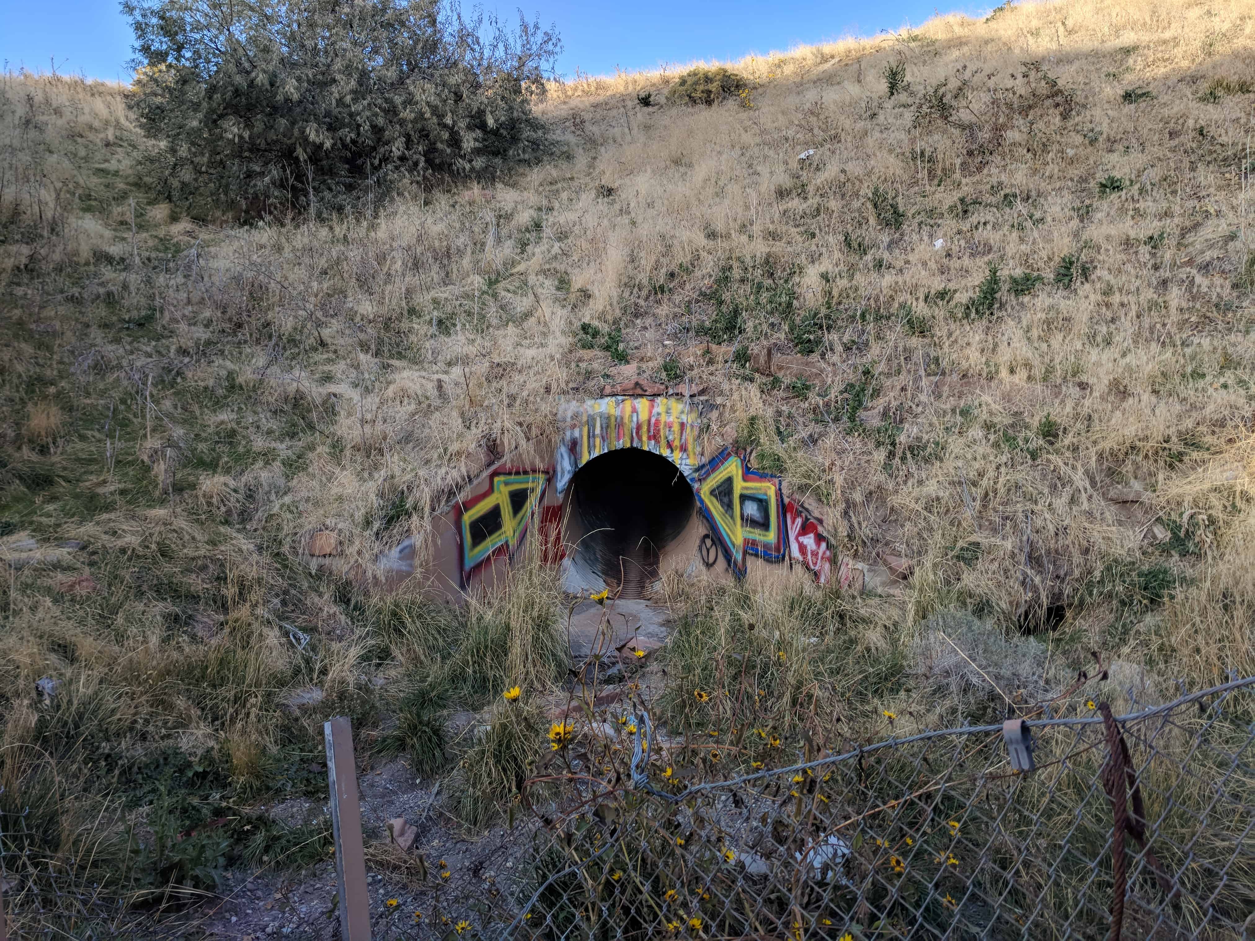
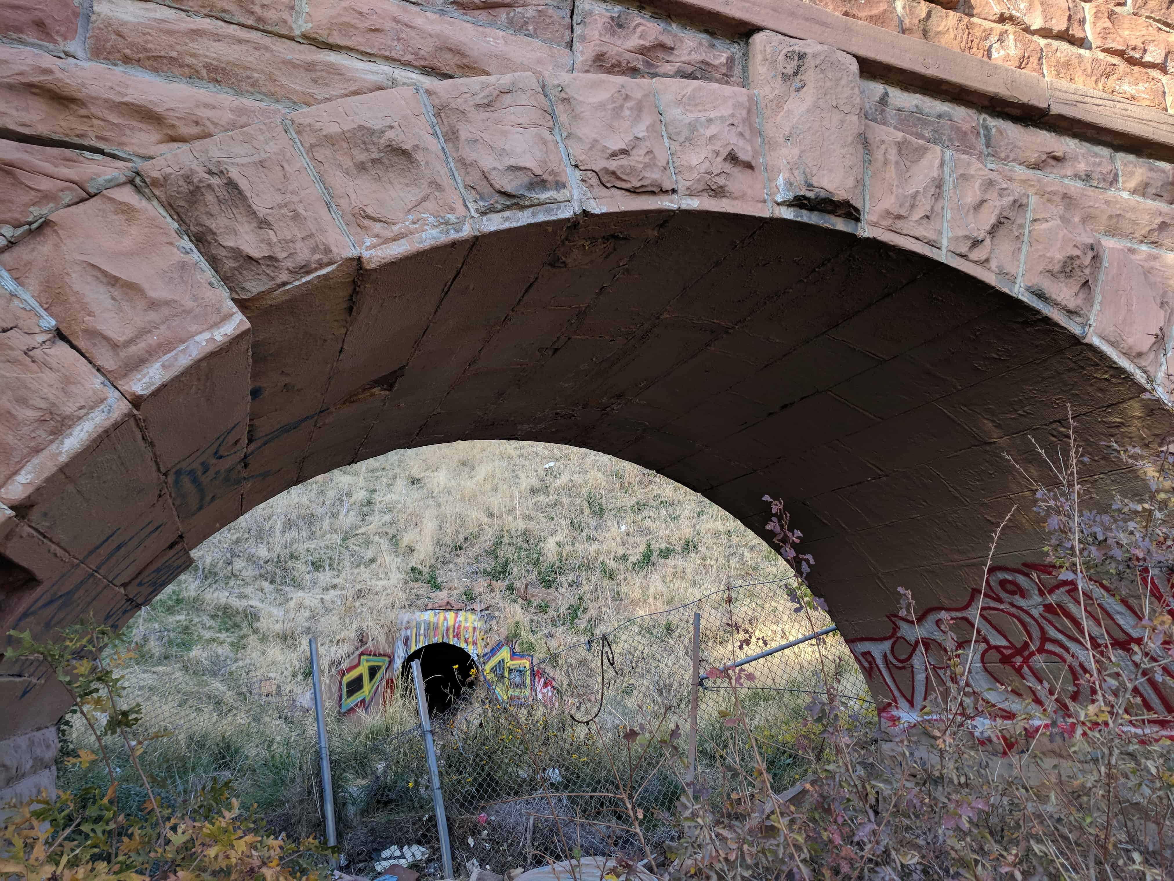
The walls were built of sandstone blocks from the canyon and were constructed with the channel on the top to convey the water as needed. The reservoir was built in 1891 and the walls shortly after. Only a relatively small segment remains. It is still a handsome piece of masonry, forty feet high where it cut across a ravine and an arch was laid up to allow for the water draining through the ravine to be unhampered in its course to Parley’s Creek. Early photographs show lombardy poplars had been planted along the route, at least along the segment still extant.
This section of the north wall is all that remains of either wall. The rocks were either abandoned in place or lifted out and used for construction of other buildings or left on the valley floor. The water needs were provided for in the construction of the Mountain Dell Reservoir five miles up the canyon in 1915.
This is SUP Marker #77, to see the other SUP Markers visit this page. This marker is located in Parley’s Historic Nature Park along with 4 others (listed on the park’s page).
After the opening of the Golden Pass Road through Parley’s Canyon, the canyon became more accessible for the cutting and hauling of wood to be used in construction of homes and industrial ventures. Lamb’s Canyon, near the top of the canon was a prime source for these materials. However, it was soon discovered that the developing industries needed more than wood fuel and water power. Pioneers were sent in various directions to attempt to locate coal deposits. Those sent to the area of the present location of Coalville, Utah, found a brown coal called lignite, east of the townsite up Chalk Creek. Brigham Young immediately formed a coal operation at the site. The coal was dug and hauled by wagon over Silver Creek and Kimball’s Junction, over Parley’s Summit and down the canyon into the valley. A ton of coal then cost $8.00 and the hauling charge was $1.50.
Shortly after the coming of the railroad to the west in 1869, a railroad line connecting Salt Lake and points south was installed from Corinne, in 1869. In 1871, a branch railroad line going north connecting Coalville to the main line at Echo was begun by Summit County Railroad. It was a narrow gage line which served, starting in 1873. The coal was there transferred into the standard gage cars of the UP Railroad which continued thence through Corinne and Ogden, into Salt Lake.
On June 11, 1874, the Eastern Utah Railroad was incorporated to build a narrow gage rail line from Coalville south to the Park City mines. In 1880, the Union Pacific Railroad Co. obtained the lines from Park City north to Echo and replaced them with a standard gage line, which was finally completed in 1888. About this same time, the Salt Lake & Eastern Railroad Co. completed the narrow gage line from Salt Lake City to Park City Mines in 1890. In 1900, the Rio Grande Railroad Co. took over the lines through Parley’s Canyon to Park City and changed them to standard gage. They also acquired the lines from Park City north to Echo. The line through Parley’s Canyon continued not only as a freight train, but carried passengers as well until the service was discontinued from Sugar House through the canyon in the 1940s. Freight service to Sugar House continued for some years after this date.
This is SUP Marker #78, to see the other SUP Markers visit this page. This marker is located in Parley’s Historic Nature Park along with 4 others (listed on the park’s page).
Early in 1870, Joseph Dudler, owner and operator of the Inn which was on the ground level of his house, built a brewery in back of his house here in Parley’s Hallow. To Provide for this, in addition to the brewery proper, located on adjacent property west and north of the Inn, he extended his entire earlier building sixteen feet further into the north side of the valley. To this extension he added what came to be known as the wine cellar. He built this rock-walled, underground cellar for a store room as well as storage for the products of his brewery. The walls and roof of the cellar, which still retain their structural integrity, average two-and-one-half feet thick and the walls were ten-feet high. The labor expended to excavate the basement, the cellar, and to erect the two-and-one-half story building of the house and inn, would have been a tremendous task. There were no backhoes, front-end loaders, no dump trucks or cranes in those days to help in the construction; just back-breaking, muscle-straining, hard work. The structure of the cellar was so well designed that over a half-century later, when crews came to clean up what was left of the burned-out building, this stone work that comprises the cellar, supported the weight of the “Cat” when the ground was leveled.
Just to the west and a little bit north of the cellar was a tall brick chimney on the north end of a small frame building which was the brewery proper. This chimney remained for many years having outlasted the frame brewery building, but it too has long since fallen to the ravages of time as did the brewery building itself much earlier. Joe Dudler was a carpenter by trade and a brewer by profession and the following years would prove his proficiency at both.
When Joe first set up his first brewery at this location, he called it the Philadelphia Brewery. He sold his products not only at the inn, but also a little later at his Philadelphia Brewery Saloon in downtown Salt Lake City. His inn was also known for a time as Dudler’s Summer Resort and simply as Dudler’s Saloon.
In the early 1900’s his son Frank and daughter Retta ran the saloon at Parley’s Hollow while their father set up a saloon and ran his famous business in Park City. Joseph Dudler died in 1897.
This is SUP Marker #80, to see the other SUP Markers visit this page. This marker is located in Parley’s Historic Nature Park along with 4 others (listed on the park’s page).
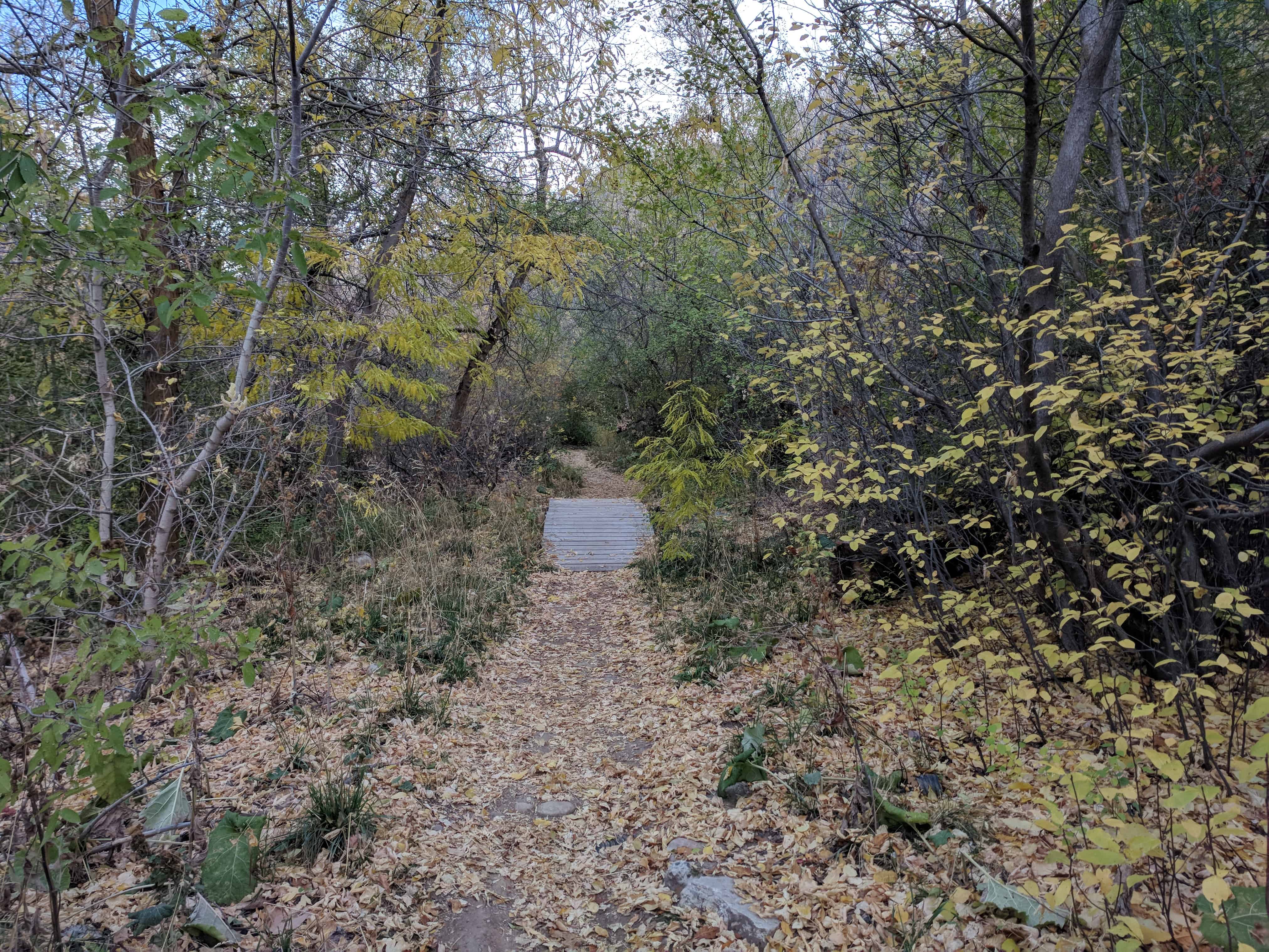
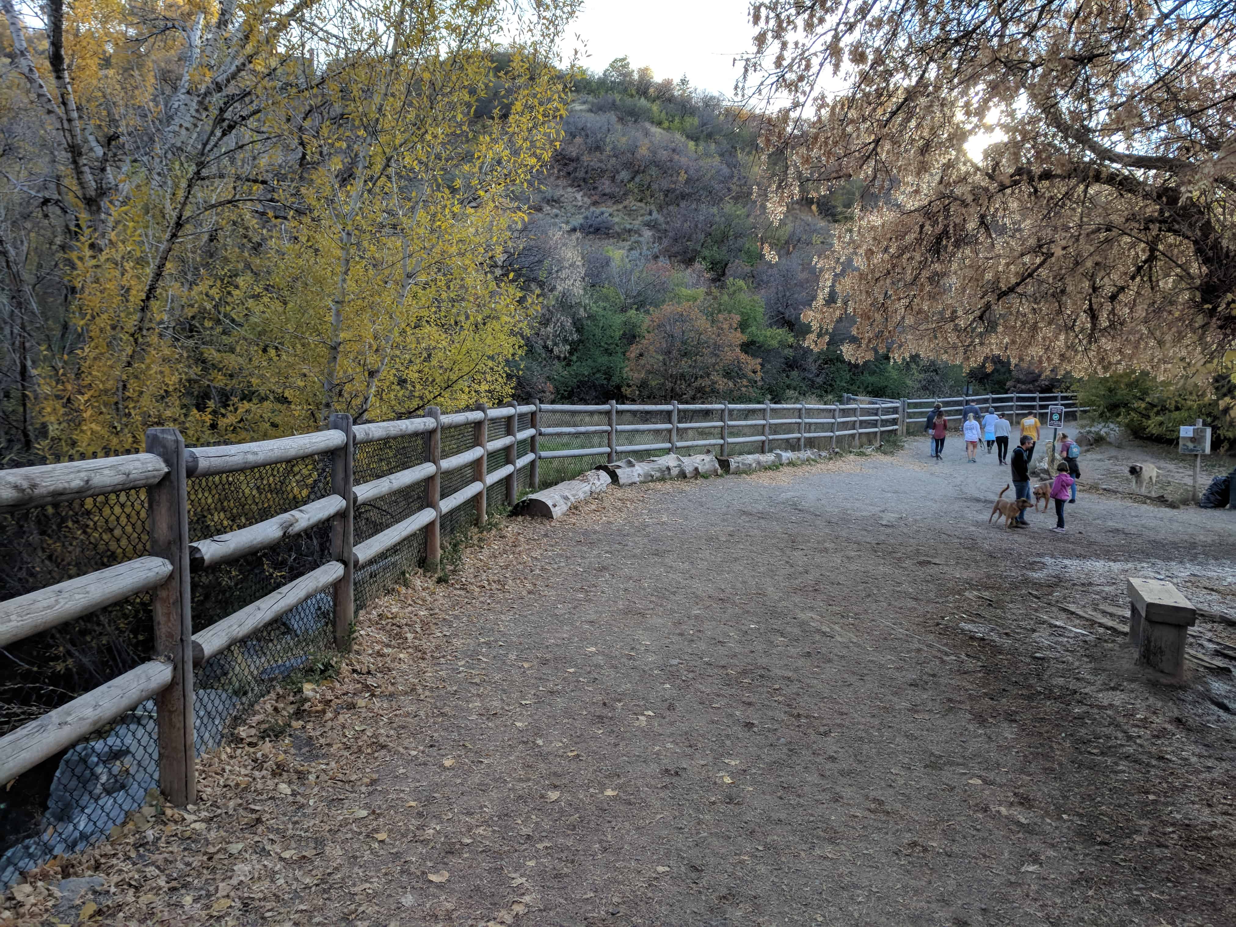
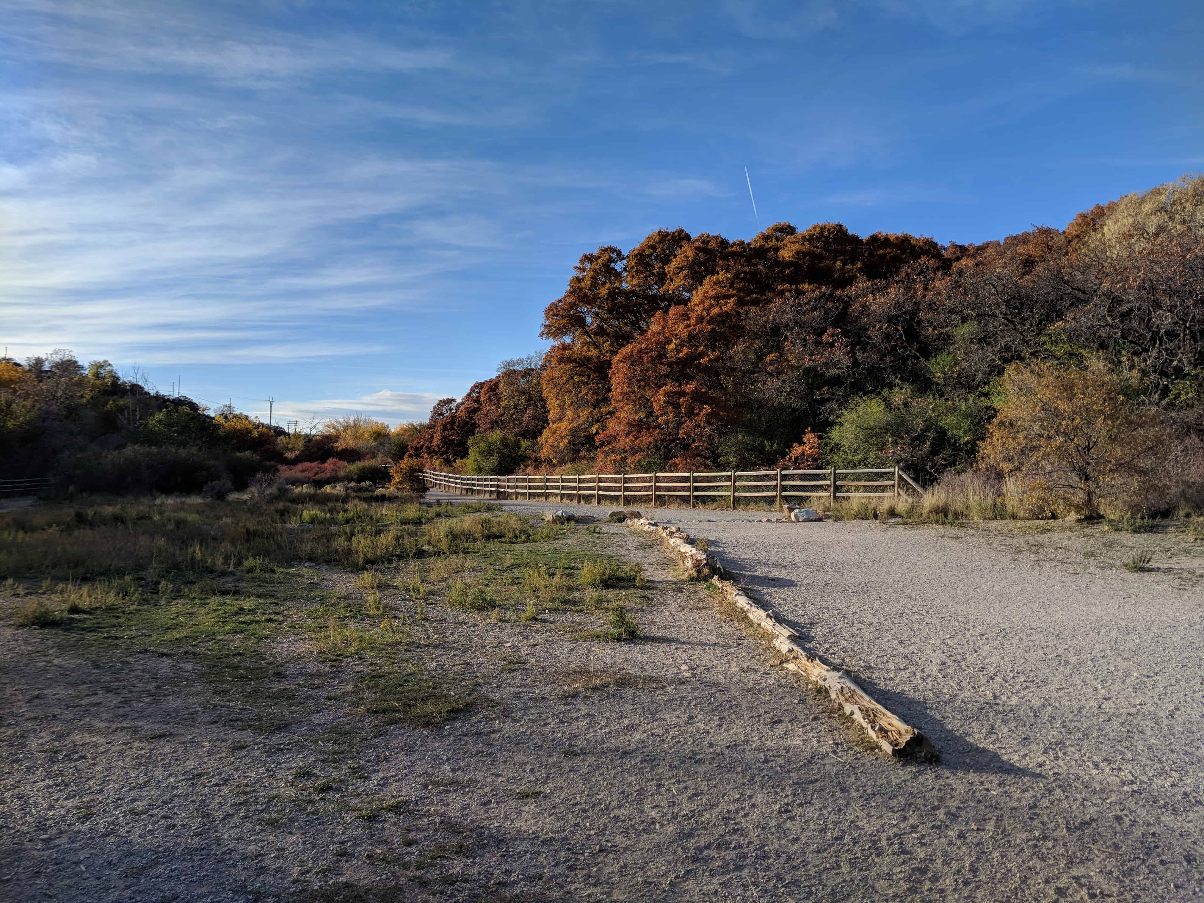
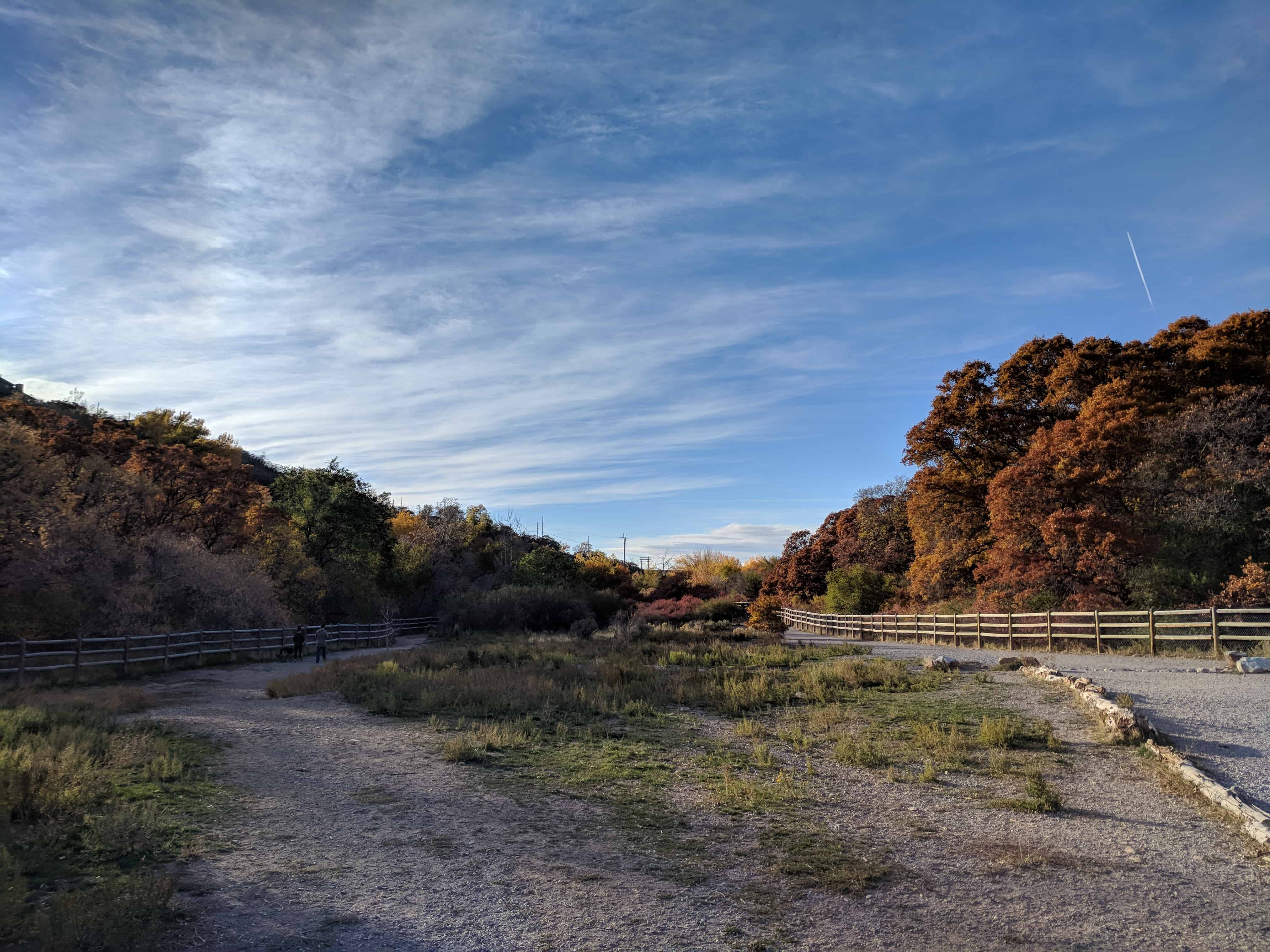
Located at 2740 S 2700 E in Salt Lake, Parley’s Historic Nature Park is a large area with trails for hiking, biking, running, dog walking. There is a creek and several historic markers and a lot to see.
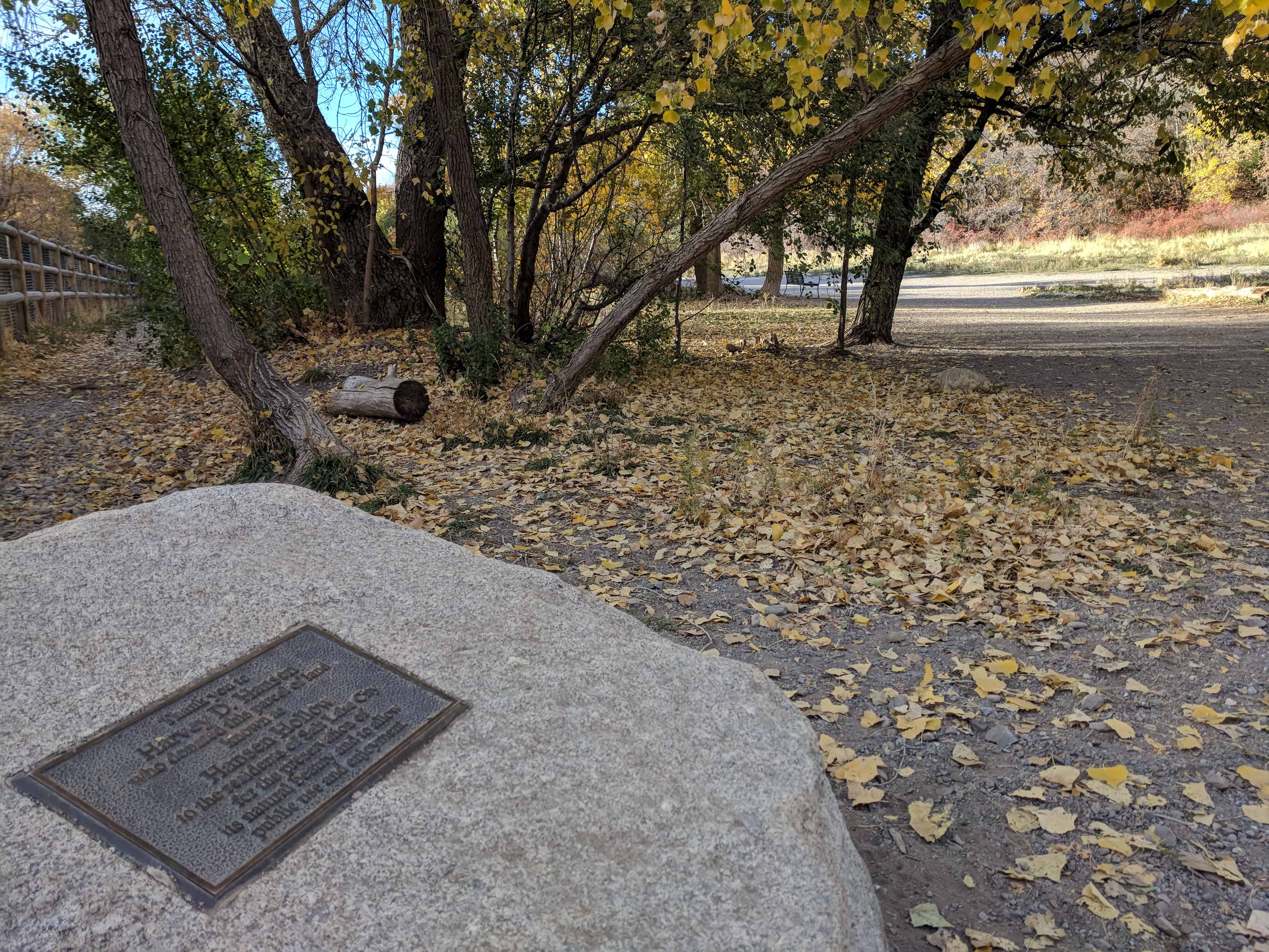
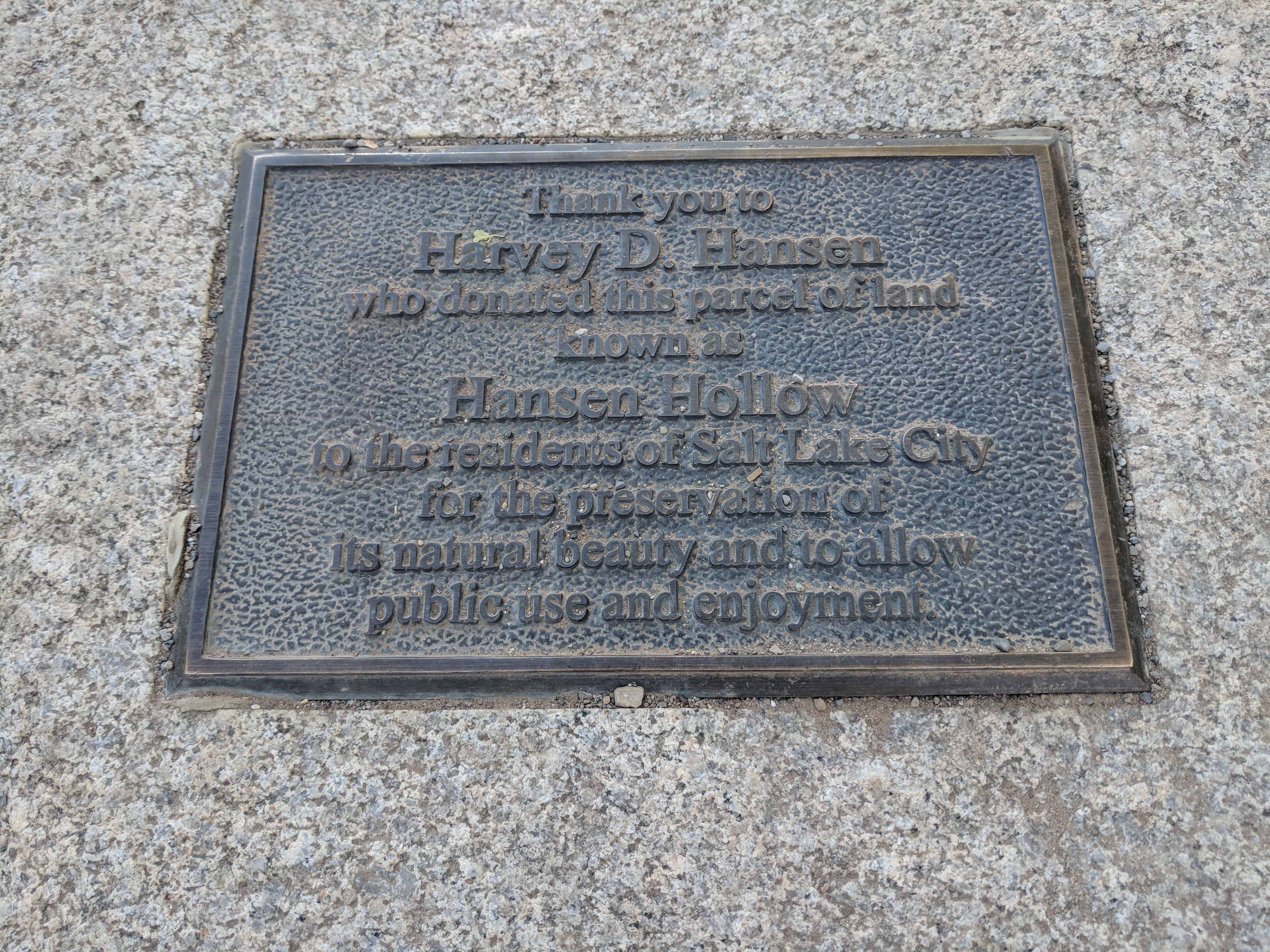
The land was called Hansen Hollow before Harvey D. Hansen donated it to be used by the public.
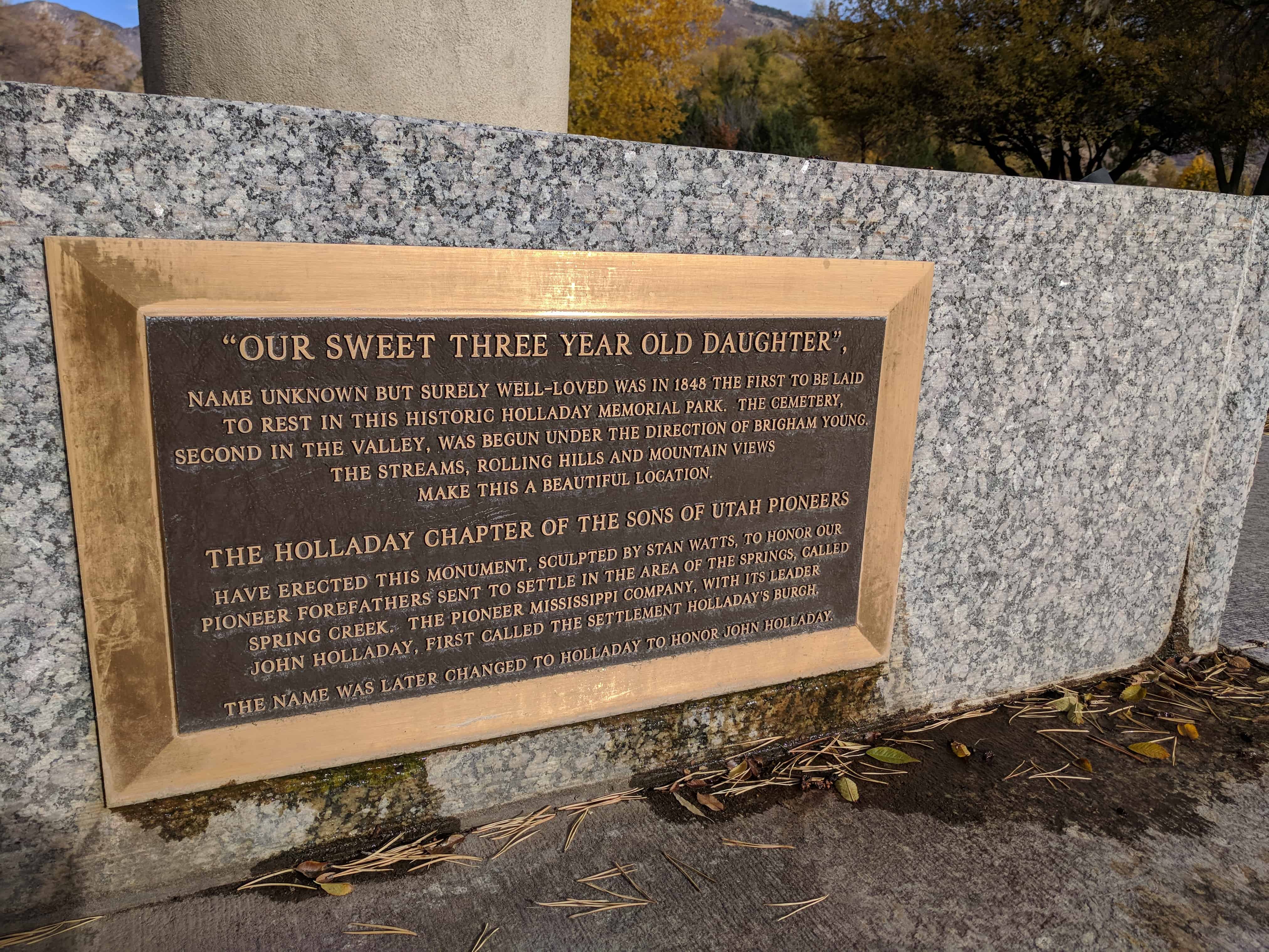
Name unknown but surely well-loved was in 1848 the first to be laid to rest in this historic Holladay Memorial Park. The cemetery, second in the valley, was begun under the direction of Brigham Young. The streams, rolling hills and mountain views make this a beautiful location.
The Holladay Chapter of the Sons of Utah Pioneers have erected this monument, sculpted by Stan Watts, to honor our pioneer forefathers sent to settle in the area of the Springs, called Spring Creek. The Pioneer Mississippi Company, with its leader John Holladay, first called the settlement Holladay’s Burgh.