• About JacobBarlow.com
  • Cemeteries in Utah
  • D.U.P. Markers
  • Doors
  • Exploring Utah Email List
  • Geocaching
  • Historic Marker Map
  • Links
  • Movie/TV Show Filming Locations
  • Oldest in Utah
  • Other Travels
  • Photos Then and Now
  • S.U.P. Markers
  • U.P.T.L.A. Markers
  • Utah Cities and Places.
  • Utah Homes for Sale
  • Utah Treasure Hunt

JacobBarlow.com

~ Exploring with Jacob Barlow

JacobBarlow.com

Tag Archives: Santaquin

First Relief Society Hall

04 Wednesday Jun 2014

Posted by Jacob Barlow in Uncategorized

≈ Leave a comment

Tags

Bells, DUP, historic, Historic Markers, Santaquin, utah, utah county

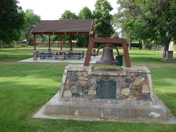
In 1882, on this site, a Relief Society building was erected under the leadership of Elizabeth J. Stickney, President. It was a one room structure, 20 x 30 feet in size, built of red clay brick made by Joseph Chatwin. The interior was furnished with homemade carpet, a pot belly stove, chairs and benches made of native lumber, an organ and a small table. At one end was a stage with curtains. July 10, 1942, the building was sold to the city for a public library and was later known as the civic center. It toppled to the ground in May, 1963. This old fort and school bell served the community until 1917. It rang for school, alarms, and special events.


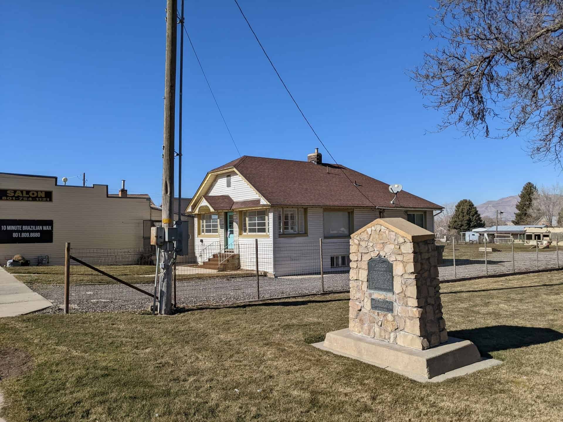
This is D.U.P. historic marker #293, located in Squash Head Memorial Park at about 45 East Main Street in Santaquin, Utah.

Related: 

  • DUP Markers
Image
Image

Santaquin

23 Friday May 2014

Posted by Jacob Barlow in Uncategorized

≈ 1 Comment

Tags

DUP, historic, Historic Markers, Santaquin, utah, utah county

The town of Santaquin was settled in the spring of 1851. At that time it was called Summit Creek, as it was located on a ridge between Utah and Juab counties. Due to Indian hostilities in 1853, the settlers were forced to leave their homes and move to Payson. In 1856, Summit Creek was permanently settled. The name was changed to Santaquin in 1875, after an Indian chief who befriended the settlers.

This is D.U.P. historic marker #109, located in Squash Head Memorial Park at about 45 East Main Street in Santaquin, Utah.

Related: 

  • DUP Markers
Image
Image

Southern Utah Valley

27 Monday Jan 2014

Posted by Jacob Barlow in Uncategorized

≈ 1 Comment

Tags

historic, Santaquin, utah, utah county

  • Image

The Dominguez-Escalante expedition looking for a route between Sante Fe, New Mexico and Monterery, California were the first white men to enter Utah Valley. They camped a few miles north of this site 23 September 1776 and spent several days exploring and teaching the Indians. In 1844 Lt. John C. Fremont whose careful scientific observations led to the definition of the Great Basin, also visited this area. His reports were studied by Mormons prior to their departure from Illinois in 1846. He noted that “there is good soil and good grass adopted to civilized settlements.” A fact which undoubtedly contributed to the choice of the Great Basin as the destination of the Mormon Pioneers. Despite the general Mormon policy of feeding rather fighting the Indians, a corollary of their settlement on Indians lands in Utah Basin was the frequent loss of life and property among the Indians as well as the white man. Before Congress extinguished the Indian land title and removed local tribes to the Uintah Basin, a 640 acre Indian Farm was established in 1855 near the mouth of the Spanish Fork River, in an effort to educate the Indians to sustain themselves through agricultural pursuits.

Located at 95 West 100 South in Santaquin, Utah in front of the Central School.

  • Image

Goshen Valley

19 Tuesday Nov 2013

Posted by Jacob Barlow in Uncategorized

≈ 1 Comment

Tags

Elberta, Genola, Goshen, Goshen Valley, Mosida, Santaquin

The Goshen Valley is a 17-milelong valley located in southern Utah County.

A southern arm (Goshen Bay), of Utah Lake bisects the valley, with western shore valley areas extending north to Mosida, at the south end of Lake Mountain.

Adjacent just south of West Mountain is another mountain, Warm Springs Mountain, its western flank is the site of the abandoned mining operation, the Tintic Standard Reduction Mill, (Known as Harold, Utah) and adjacent west is Warm Springs.

Keigley, Utah

19 Tuesday Nov 2013

Posted by Jacob Barlow in Uncategorized

≈ Leave a comment

Tags

Genola, Keigley, Payson, Santaquin, utah, utah county, West Mountain

  • 2013-07-06 17.22.59
  • unnamed
  • keigley
  • Image
  • Image

Keigley is a quarry and gravel pit between Payson and Genola.

Genola, Utah

11 Monday Nov 2013

Posted by Jacob Barlow in Uncategorized

≈ 4 Comments

Tags

Genola, Goshen, Goshen Valley, Santaquin, Townsend, utah, utah county

Genola

Previously known as Warm Creek and then Townsend, it was renamed to Genola in 1916 and was incorporated in 1935. There was a Townsend Hotel, a Townsend rock quarry and more named after Byron Townsend but now it is almost all farming and residential.

Lake Road takes you around to Lincoln Beach.

Related:

  • Ekins Quarry
  • Genola Utah Fire
  • Goshen Valley
  • Grandpa’s Cave
  • Tintic Standard Reduction Mill
  • Genola posts sorted by address
Townsend
Townsend, Utah

Image
When I lived there (2006) there was a cool old “Merc” located at N 39° 59.355 W 111° 50.040, it’s gone now.

ingress_20140317_221603_26
I have several pictures of the town from back then, it’s slowly changing so I’m glad I have them.
Image
Image
Image
Image

West Mountain

31 Thursday Oct 2013

Posted by Jacob Barlow in Uncategorized

≈ 4 Comments

Tags

Benjamin, Genola, Palmyra, Payson, Santaquin, spanish fork, utah, utah county, West Mountain

West Mountain Observatory

West Mountain is a mountain west of Spanish Fork, Palmyra, Benjamin, West Mountain and Salem, it is North of Genola and it is bordered on the west and north by Utah Lake.

Image

There are plenty of geocaches up there to keep you entertained, but be careful what time of year you go if you’re going to hike around at all because we call it spider mountain for a good reason, every bush, tree or rock has a spider on it, some bushes have hundreds. That was in July.

There’s a fun road that takes you up to the top, it’s a dirt road but it’s graded and you can take pretty much anything up there.

5968880557_abc7b2eb71_z
5969442752_30d4c7c179_z
SAMSUNG
SAMSUNG
SAMSUNG
SAMSUNG
SAMSUNG
SAMSUNG
Newer posts →

Follow Jacob

Follow Jacob

Blog Stats

  • 2,061,405 hits

Social and Other Links

BarlowLinks.com

Recent Posts

  • Arthur Miles Home
  • Navajo Shadehouse Museum
  • Impossible Canyons
  • The Old Hurricane Bell
  • Goulds Shearing Corral

Archives

Loading Comments...