Lawrence Brothers and Company Store
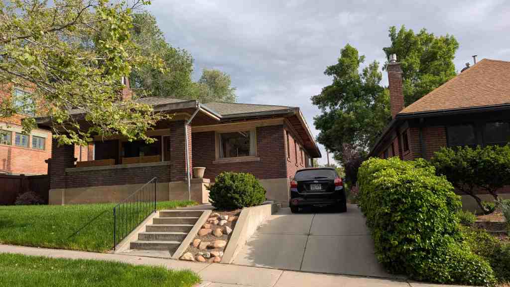
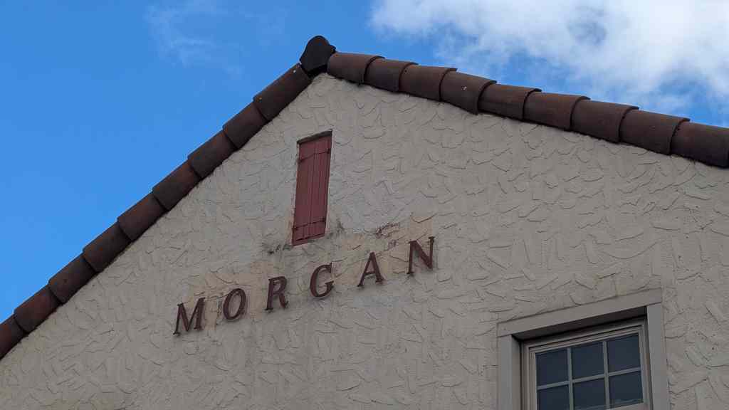
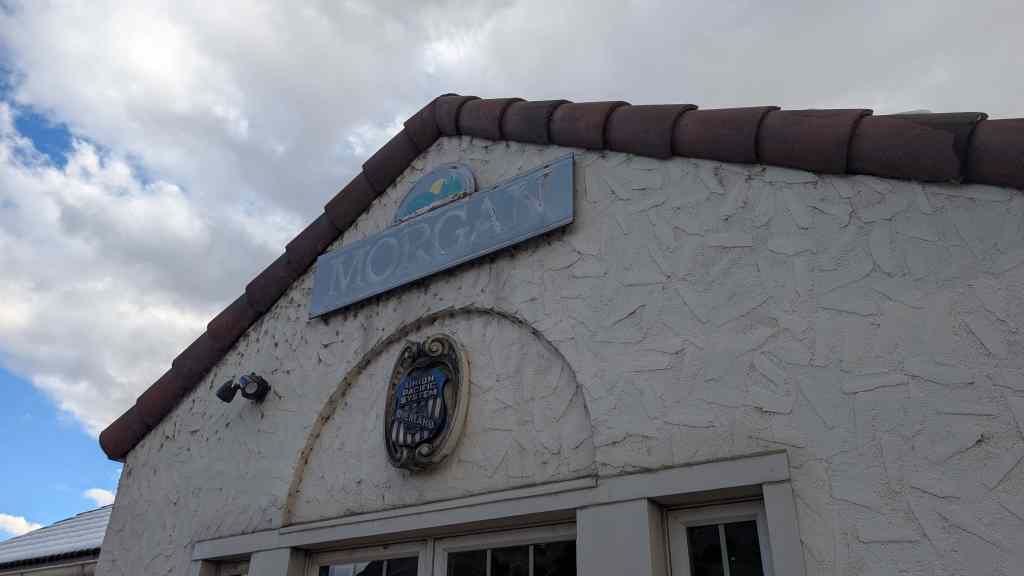
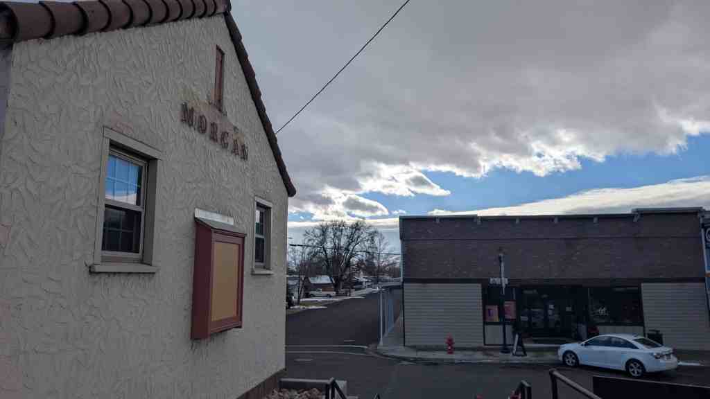
The Lawrence Brothers & Co. Store is a 1½-story rectangular stone commercial building constructed in 1874. It is located at 31 West Main Street in the town of Ophir, Tooele County, Utah. The building footprint measures 26 feet by 60 feet with the narrow end facing Main Street. Due to the steep grade through Ophir Canyon, the façade appears as a one-story building while both the main floor and basement levels are visible at the rear elevation. The foundation is granite as are the walls. The building operated primarily as a general store between 1874 and 1956, the period of significance. The original iron shutters are still intact on the façade and rear elevation. After a period of vacancy, the simple gable roof was replaced in 1987. Since 2005, two separate rehabilitation phases have focused on stabilizing the structural walls, cleaning and re-pointing the original masonry, and replacing the electrical and plumbing systems. The current owners hope to complete the interior rehabilitation in the near future.
The Lawrence Brothers and Company Store is located at 31 East Main Street in Ophir, Utah and was added to the National Register of Historic Places (#13000842) on October 16, 2013.
The Lawrence Brothers & Co. Store, built in 1874, is locally significant under Criteria A and C for its association with the development of Ophir, Utah. Under Criterion A in the area of Commerce, the building is particularly notable as one of the few extant commercial buildings that represent the town’s efforts to transform from a boom-and-bust mining camp to a more stable community. Unlike many of Utah’s mining towns of the early 1870s, particularly those in narrow canyons, Ophir was never completely abandoned. The building was originally built to house a general mercantile and a Wells Fargo office at the peak of mining activity in the canyon. Though the management of the store changed several times, the Lawrence brothers and their successors kept the building commercially viable, contributing to the stability of the town for over eight decades. The period of significance spans the initial construction in 1874 to the store’s closure in 1956. The building is also significant under Criterion C in the area of Architecture as the only substantial stone building constructed in Ophir and a rare surviving stone structure built in a Utah mining camp. The building has undergone minor modifications over the years, but retains the majority of elements from the original construction such as the granite stone masonry and operable iron door-window shutters. The building was constructed by Shelby Alfred Lineback, a former soldier and stone mason turned farmer. The Lawrence Brothers & Co. Store is currently undergoing a multi-phase rehabilitation and is a contributing historic resource in the community of Ophir, Utah.
Mining for precious metals in Utah began in 1862 when soldiers from Fort Douglas under the command of Colonel Patrick E. Connor staked claims in the canyons southeast and southwest of Salt Lake City. Many of the men were experienced prospectors from the California gold rush, and by the late 1860s numerous mining districts had been established in the Utah Territory, although mining did not become commercially successful in Utah until after the completion of the transcontinental railroad in 1869. In 1865, the soldiers began exploring East Canyon (later Ophir Canyon) after reports that Native Americans had previously worked the area to make gold and silver trinkets, as well as silver and lead bullets.2 A mining camp of canvas tents, log cabins, and whipsaw lumber shacks quickly grew parallel to Bates Creek (later Ophir Creek) as prospectors rushed to the canyon to stake claims. The Ophir Mining District was organized in 1870 with the name taken from the geographical location of King Solomon’s mines.
More than 2,500 mining claims had been staked at Ophir by 1871. That year Ophir’s population reached 1,200. By the time a townsite plat was filed with Tooele County in April 1873, the town had a thriving commercial district along Main Street with stores, saloons, brothels, restaurants, a hotel, a post office, and a Methodist church. Most of the commercial buildings featured false fronts facing Main Street, the only road through the canyon. Residences were built on the two short streets that paralleled Main Street, east and west of the business district, and up and down both sides of the canyon. A Salt Lake City newspaper article published in April 1871 referred to the town as “Ophir City” and described it as “flourishing and rapidly increasing.” A town hall/firehouse was built around 1870. The false front wood building with a belfry is one of only three surviving nineteenth-century mining camp town halls in Utah. The Ophir Town Hall was listed on the National Register of Historic Places in 1983 (NRIS #83003193).
The Lawrence Brothers & Co. General Merchandise was one of the first businesses in Ophir. Nelson Lawrence (1830-1877), the middle brother, was born in Pickering, Ontario, Canada, and immigrated to Utah in 1849. His older and younger brothers, James Lawrence (1828-1891) and Henry William Lawrence (1835-1924), and the remaining siblings came to Utah in 1850. The brothers were living in northern California at the time of the 1860 census and later returned to Utah with prospecting experience. All three worked in mercantile establishments in Salt Lake City. The brothers’ first store in Ophir operated out of a tent until March 1871 when the brothers constructed a wood building. The rectangular building was sheathed vertical planks, a false front, and had a log lean-to at the rear. In October 1871, the Salt Lake Tribune described the state of commerce in Ophir: “Legitimate business is good, Lawrence Bros. [et al] have each a large stock of goods and are doing a good and safe business.” A year later, the newspaper noted: “The firm of Lawrence and Bros. is engaged in the grocery and miners outfitting trade.” Around the same time, the Wells Fargo Company had opened an office in Ophir and by March 1872, newspapers reported that “Packages are sent through daily from Corinne to Ophir.” It is uncertain when the partnership between the Lawrence brothers and the Wells Fargo Company was created, but the Utah Gazetteer of 1874 lists the two entities at the same location “on Main Street, below Cliff Street.”
On December 17, 1873, James, Nelson, and Henry Lawrence were granted the deed to Lot 3, Block A of the Ophir City plat. In a letter to the Salt Lake Herald, an observer noted the stability and success of the business in 1873: “In the prosperity of my friend Lawrence Bros the merchant princes who have stayed by the camp and got well heeled by it.” In July 1874, Lawrence Bros. & Co. engaged a former soldier and stone mason, Alfred “Fred” Shelby Lineback, to construct a new building of native granite. In September 1874, the Salt Lake Tribune provided a description of the almost finished building:
The new building of Lawrence Bro.’s [sic] is fast nearing completion and will be quite an addition to Ophir. The building is sixty feet in depth and twenty-six feet in width, with a cellar eight feet from floor to ceiling, and store room twelve feet in height, built of rock, and is perfectly fireproof. It will be occupied as a general merchandising establishment by this enterprising firm when completed.
At its completion, the signboard on the stone building’s false front advertised the following items available: dry goods, clothing, shoes, groceries, hardware, liquors, tobacco, and miner’s tools. The stone building was a contrast to the wooden structures in town and boasted numerous security features in addition to the iron shutters on the doors and windows. The Wells Fargo Company express office was housed in the basement. The dividing rock wall in the basement may have been designed as space for a vault, but the purpose of the trapdoor directly south of the wall remains a mystery. The splayed window with bars was located near the basement entrance, possibly for a lookout guard. When the roof was replaced in 1987, it was discovered that the main-floor ceiling had a foot of sand on top of it. This may have been a security barrier, but could also have been used to keep a fire from moving from the roof to the interior of the building. The stone building was also reportedly used to secure post office deliveries.
The city directories show that all three Lawrence brothers maintained residences in Salt Lake City. Henry W. Lawrence ran his own grocery and provisions company in Salt Lake City. He was married to Jeanette Sophia Kimball (1842-1911), had a large family, and stayed in Salt Lake City until his death in 1924. James Lawrence never married. He moved to Park City where he managed a grocery business until his death in 1891. Nelson Lawrence, the middle brother, was responsible for the day-to-day operations of the Ophir store until his death in 1877. His widow, Julia Delecta Young Lawrence (1848-1938), appears to have kept the business going for a few years. The 1879 Utah Gazetteer lists the Lawrence Bros. & Co. general merchandise still in business with J. D. Lawrence as the purveyor of liquors. Julia D. Lawrence continued to live in Salt Lake City with her two sons, Nelson and William. The deed to the property was transferred to Julia and her sons in 1892. The family moved to California in the late 1890s, but held the title to the property until 1927.
In 1874, the Utah Gazetteer had 119 business listings for the town, which it described as the “business centre” of the Ophir Mining District. The Lawrence Bros. & Co. Store was one out of ten listings under the heading for general merchandise. It is estimated that during its peak in the early 1870s, the Ophir mines produced $13 million in silver, lead, and zinc, and over $300,000 in gold.12 There are reports that suggest the population of the town may have swelled to between 5,000 and 6,000 people at one point during the early 1870s, but the output of the mines decreased dramatically soon after the Lawrence brothers completed their stone building. Only five years later, the 1879 Utah Gazetteer provides only seven business listings, while stating “Ophir was once a busy mining camp but is now almost deserted.”13 In 1879, the Lawrence Bros. & Co. store was the only general merchandise establishment still in operation. The office of the Wells Fargo Company is not among the remaining Ophir businesses. Despite the downturn, there were signs the town was not completely abandoned. For example, Catholic mass was held monthly between 1874 and 1878.
A number of renters kept a mercantile business in the stone building after the death of Nelson Lawrence. Joseph Green (1820-?) held an interest in the property between 1878 and 1881 and is listed as a grocer on the 1880 census. He does not appear to have operated the business under his own name. Around 1881, John Faunce (1832-1907) began operating a general store in the stone building. George E. Edwards (1870-1948) took over the lease on the building probably around the time he moved to Ophir in 1898. He eventually constructed a new frame building for his own mercantile business across the street sometime before 1907 (now demolished). The Ophir Mercantile Company began operating out of the stone building when Edwards left. In September 1907, the Salt Lake Mining Review described the two rival companies:
The camp (of Ophir) boasts the usual number of saloons, two hotels and two general stores. The leading business house is the Ophir Mercantile Company, which carries a most complete line of general utilities. At the head of this institution are E.W. Clark, H. A. Wagner, H. J. Green and C.E. Green, who are among the leading and most progressive citizens. Mr. Edwards conducts the other mercantile establishment and also has charge of the leading hotel in the camp.
From the 1920s to his death in 1948, George E. Edwards operated the only general store in Ophir. The 1917 Sanborn fire insurance map of the town indicates the former Lawrence Brothers building was a drugstore, confectionary, and billiards hall. On September 12, 1927, Julia D. Lawrence and Nelson W. Lawrence sold the store and property to Peter Morzenti. Peter Morzenti (1882-1943) emigrated from Italy to Utah in 1910. He is listed as a grocer in Ophir on the 1930 census, a carpenter on the 1940 census, and the proprietor of a “beer parlor” on his 1943 death certificate. The property was later sold to Truman W. Wheeler and Richard R. Wray, who held the deed only two years before selling to John S. and Concetta Morrell in 1948. John S. Morrell (1885-1975) operated a “soft drink lounge” in the old stone building; however, it was known to local residents as the “beer hall.” The Morrells deeded the property to their children on April 18, 1956, after which time the building remained vacant.
By the time Steven S. Hall purchased the property in 1982, most of the surrounding buildings had been demolished. After completing some work on the interior, Steven S. Hall sold the building to Hal D. Hawkins and Connie H. LeFevre in 1986. They replaced the roof, began work to stabilize the basement, installed a septic tank, and completed plumbing and electrical work. On October 15, 2001, Hal D. Hawkins and Connie H. LeFevre sold the partially renovated building to the current owners, James T. O’Rourke and Lora Hawkins O’Rourke, Hal’s sister and brother-in-law. The O’Rourke family has continued the work of rehabilitating the building.
The historical significance of the Lawrence Brothers & Co. Store is in the area of Commerce, representing a source of economic stability to the community of Ophir. Historians have pointed to three distinct phases of development in most mining communities: settlement, camp, and town. By the year 1870, Ophir had already moved from the settlement phase to the camp phase. The construction of the town hall marked the beginning of the town phase. The substantial stone building of the Lawrence Brothers & Co. Store also represents the initial efforts to create a more permanent and stable town. Though the town phase was interrupted by a dramatic fall in silver prices in the late 1870s, the stone building outlasted most of its more ephemeral counterparts as Ophir entered the twentieth century. In 1907, the Salt Lake City Mining Review described the survival and subsequent revival of Ophir with the advent of more modern mining equipment and a large influx of capitol in the early 1900s:
A noticeable feature in the town is the absence of the down-and-out spirit that is so prevalent among camps of the “has-been” type. It is encouraging to get in a mining town like Ophir, where every citizen has the progressive habit of boosting. One is infected with this enthusiasm upon first entering the camp, and begins to feel that Ophir is the only town in Utah.
The town of Ophir has never been completely deserted and the spirit of “boosting” remains. Many current residents refuse to accept the label of “ghost town” used by outsiders. The significance of the Lawrence Brothers & Co. Store is in its contribution to the commercial and economic viability of the town through the entire historic period.
Architecture Significance
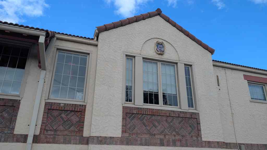
The Lawrence Brothers & Co. Store in Ophir, built in 1874, is architecturally significant as a rare example of substantial stone architecture in a Utah mining camp. Although the Lawrence Brothers & Co. Store has been modified over time, the modifications do not greatly impact its historic character as a mining camp-era stone structure. They also follow the pattern typical of many commercial buildings in the alteration of the structure to meet the needs of the current tenant. The surviving physical characteristics of the building meet six of out seven of the National Register of Historic Places qualities of historic integrity: location, setting, materials, workmanship, feeling, and association. The integrity of the original design (seventh quality) of the building has been compromised by the removal of the false front signboard, an important element of mining camp architecture. However, the false front was removed within the historic period and therefore part of the architectural evolution of the building as it is associated with the historical development of Ophir. The extended replacement roof line is a minor modification to the original design and will likely protect the integrity of the stone masonry (workmanship and materials) in the future.
The vast majority of buildings erected in Utah’s nineteenth century mining camps were made of wood. The residences were mostly log cabins or plank shacks, while the commercial buildings were usually frame with a simple gable roof and a false front. False front architecture, where the façade was extended above the apex of the roof or beyond the side walls, was used in Utah mining camps to give the impression of a much larger, more substantial structure and increase signage. Only a few mining camps lasted long enough to see dramatic changes in the physical environment during the transformation from camp to town. In contrast to the small towns of the Mormon pioneer settlements, there were no incentives to build permanent structures and to invest in adobe and brick yards. The stone quarries needed to support stone architecture were even rarer. The only comparable stone building is located in the southern Utah mining camp of Silver Reef, where in 1877 the Wells Fargo and Company built an express office of red sandstone with metal shutters similar to the Ophir building.
The Lawrence Brothers & Co. Store was constructed in the isolated canyon mining camp of Ophir by a local builder, Fred Lineback. Alfred “Fred” Shelby Lineback (1830-1914), a soldier discharged from the army at Camp Floyd in Cedar Valley in 1861, is believed to have been the first man of European descent to settle in Ophir. A deep basin boxed in by steep walls, once a natural grazing area for horses, Lineback Hollow, bears his name today.23 Fred Lineback was born in Kentucky and was a stone and brick mason before moving to Utah as a soldier. He returned to Iowa for his family and later established a farm in Ophir Canyon where he remained the rest of his life. He is listed in the 1874 gazetteer as a lime burner and on the 1880 census as brick mason. In later years, he gave his occupation as farmer. The Lawrence building may have been one of the few chances Lineback had to use his skill as a stone mason in Utah. The granite from a local canyon would have been difficult to quarry and tool into smooth blocks. The 1917 Sanborn map show only three stone buildings in Ophir, two dwellings and the store. One of the dwellings has survived, but the other was demolished after 1940. It is not known whether Fred Lineback was involved with the construction of the other buildings. In spite of some alteration the building retains enough historical integrity in concert with its historical and architectural significance to be considered a contributing historic building in the mining community of Ophir.