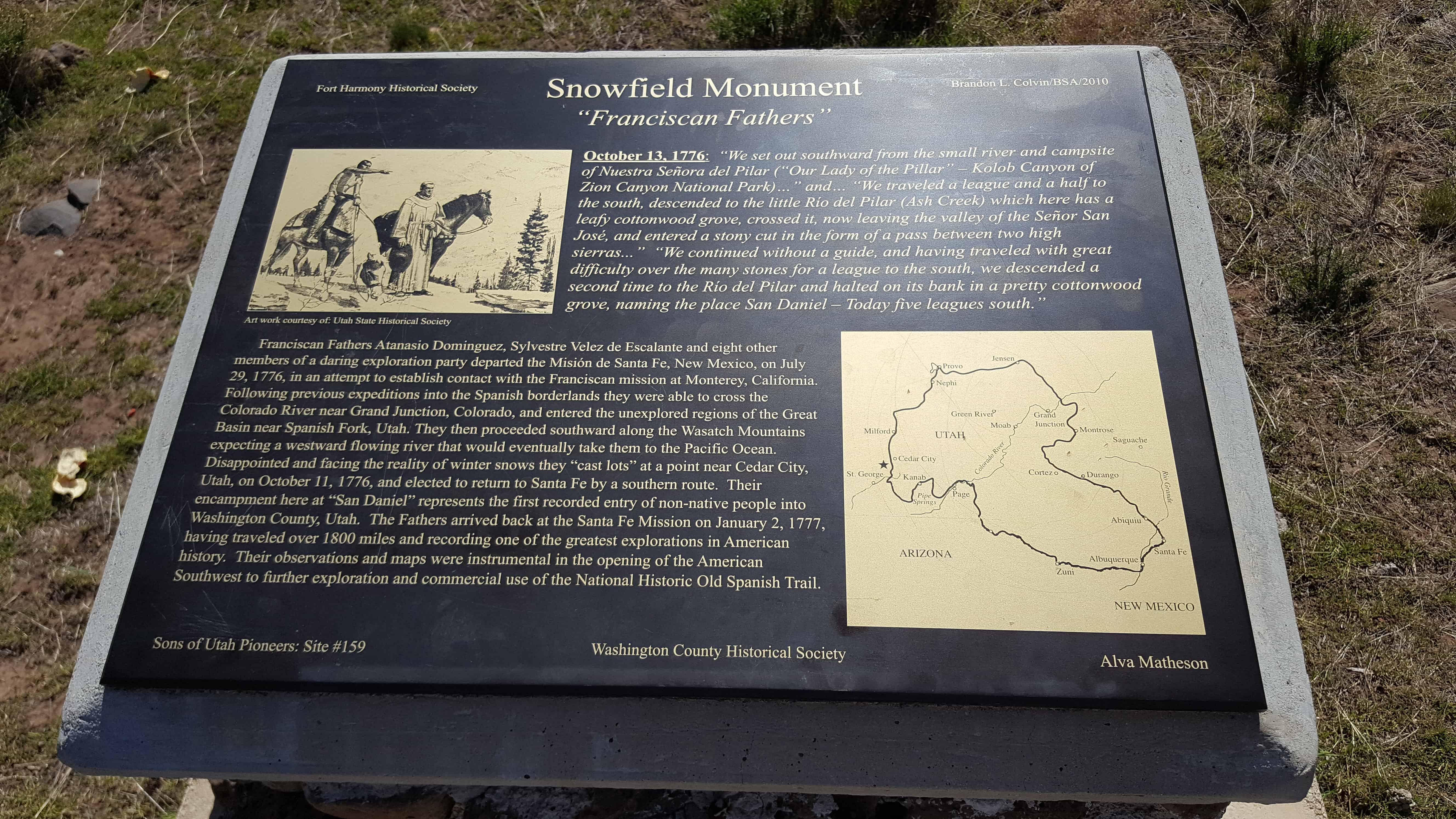
• About JacobBarlow.com
  • Cemeteries in Utah
  • D.U.P. Markers
  • Doors
  • Exploring Utah Email List
  • Geocaching
  • Historic Marker Map
  • Links
  • Movie/TV Show Filming Locations
  • Oldest in Utah
  • Other Travels
  • Photos Then and Now
  • S.U.P. Markers
  • U.P.T.L.A. Markers
  • Utah Cities and Places.
  • Utah Homes for Sale
  • Utah Treasure Hunt

JacobBarlow.com

~ Exploring with Jacob Barlow

JacobBarlow.com

Tag Archives: historic

Sawmill Road

10 Wednesday May 2017

Posted by Jacob Barlow in Uncategorized

≈ 2 Comments

Tags

historic, Historic Markers, Monroe, Sawmills, Sevier County, SUP, utah

2017-03-26 18.05.41

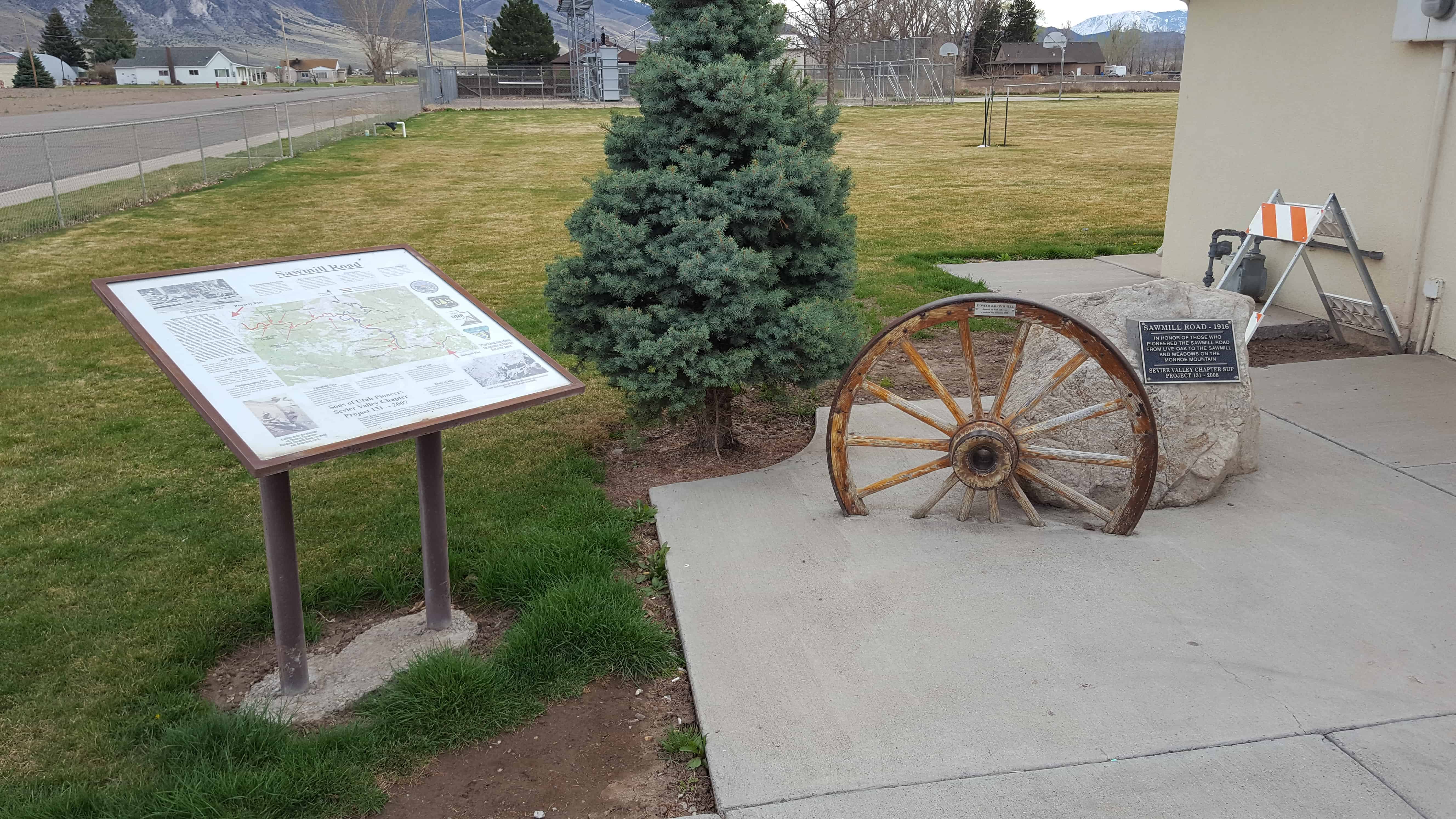
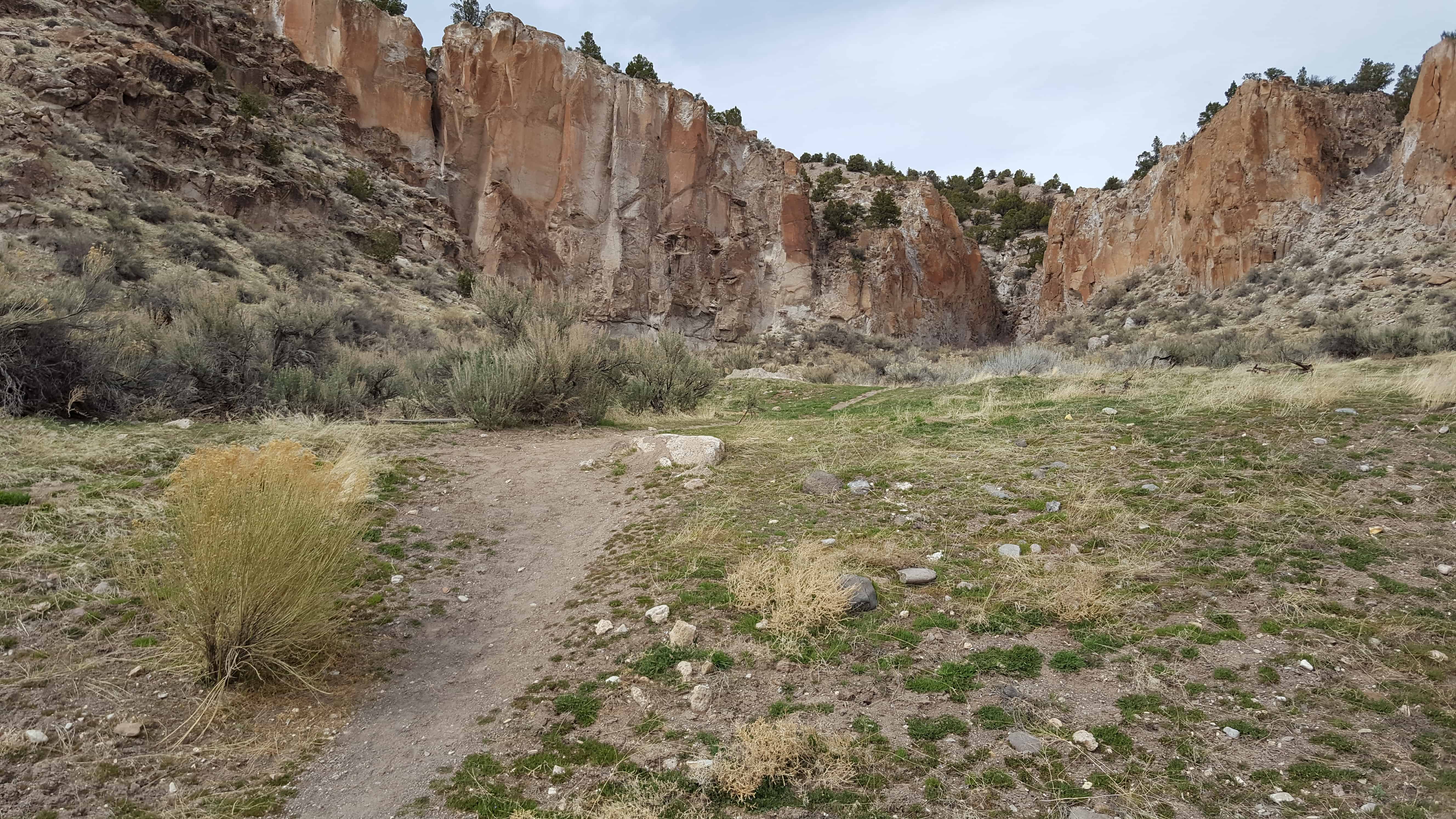
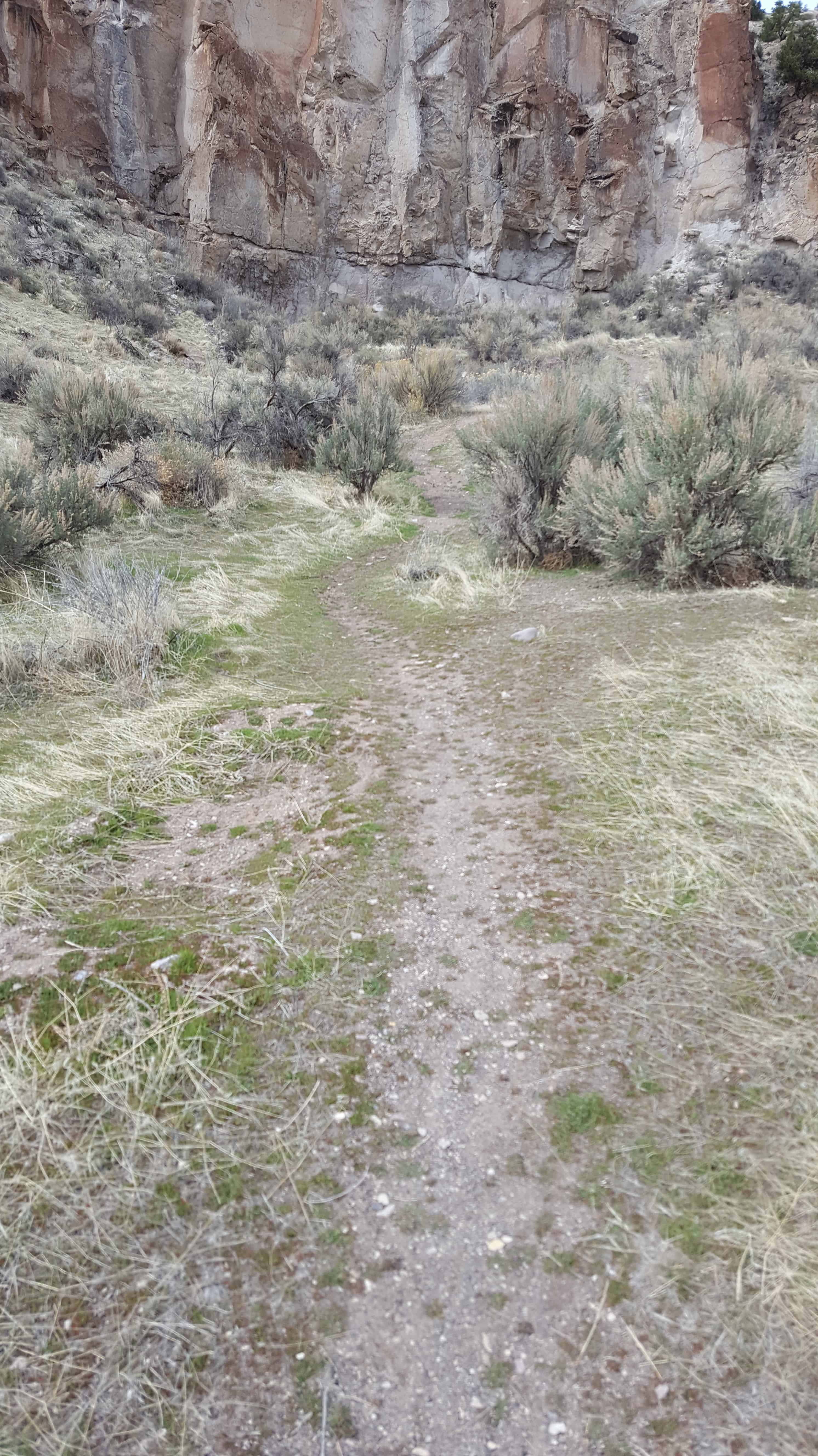
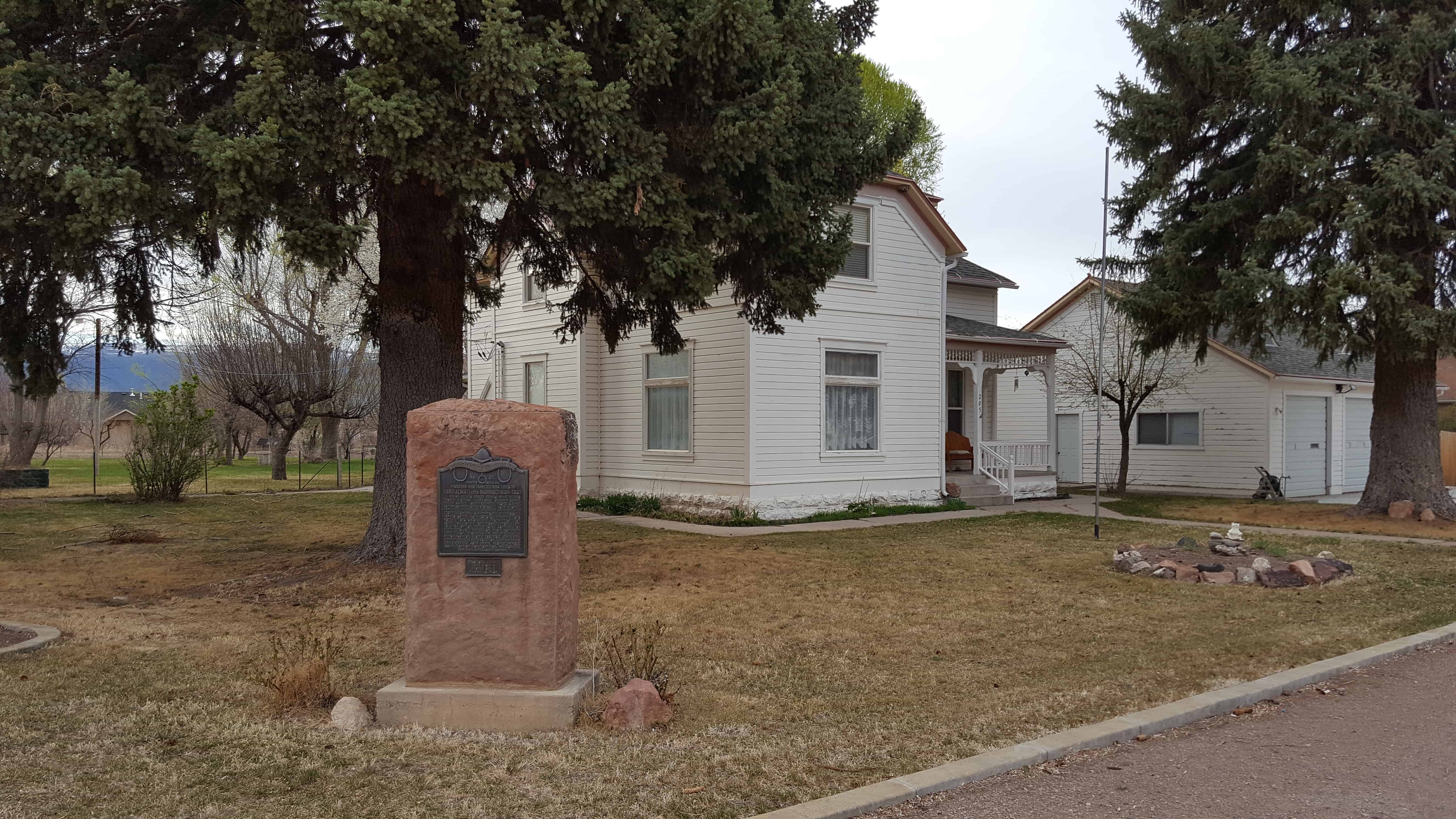
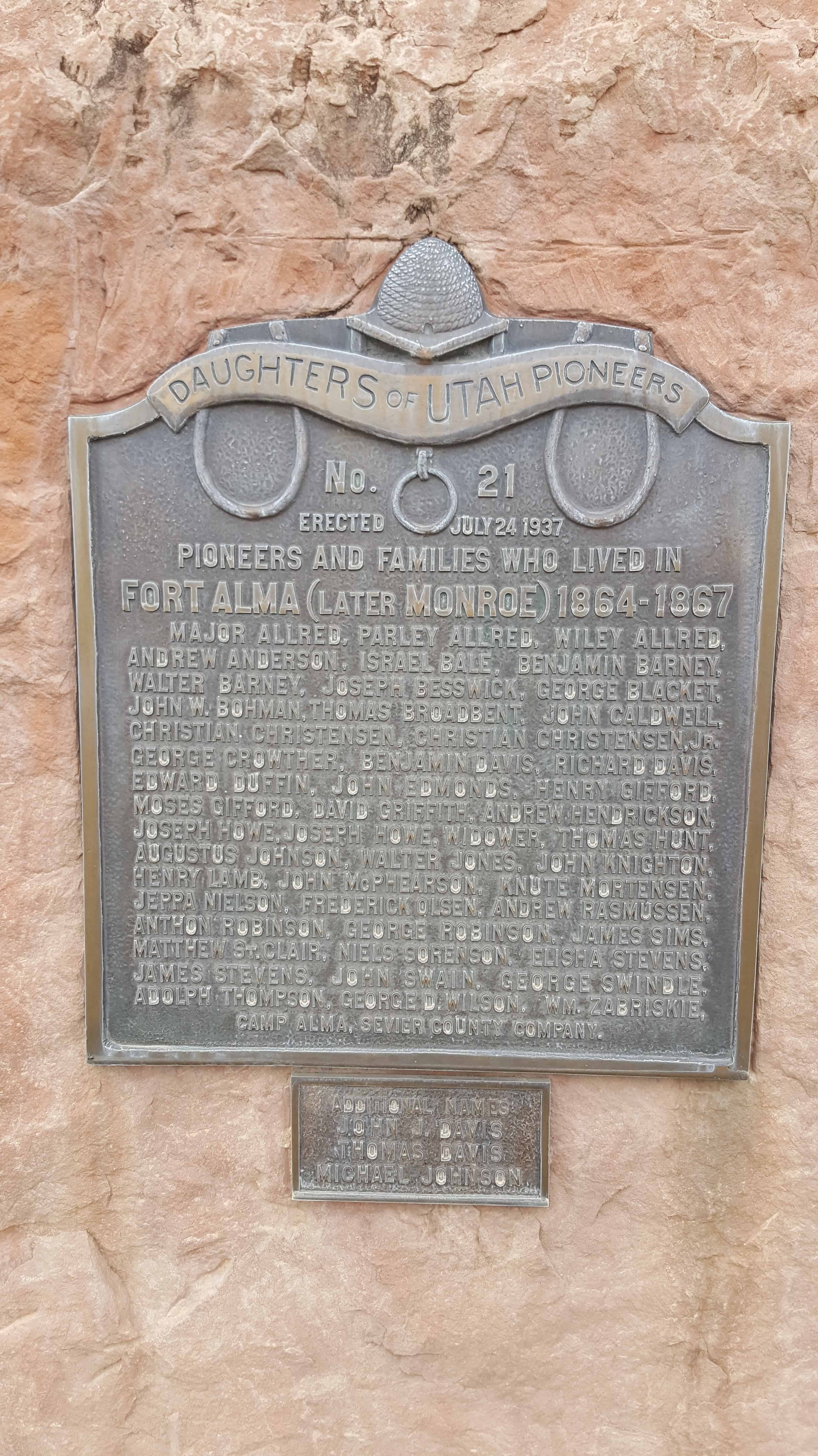
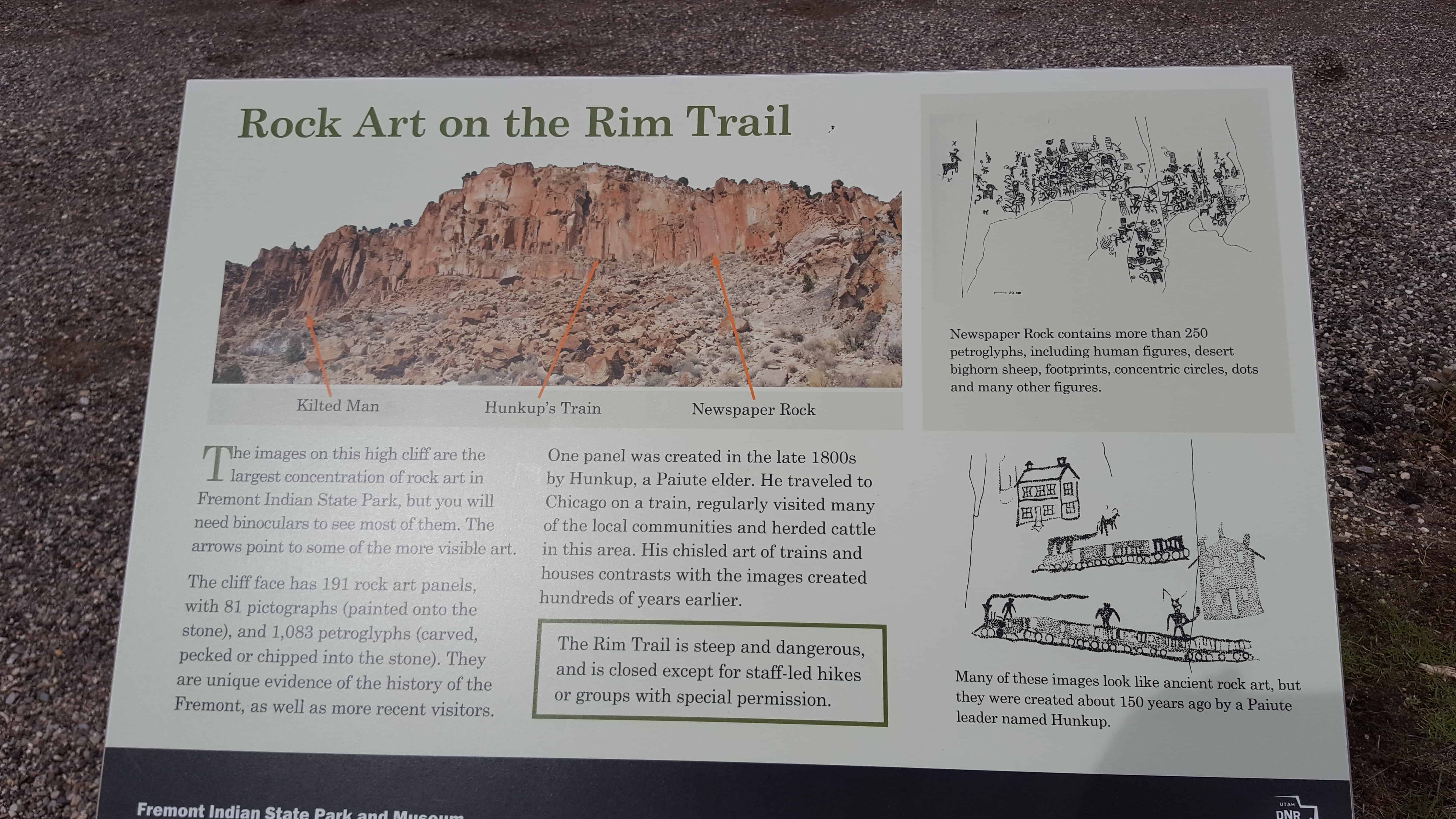
Located in Monroe in Mountain View Park and erected in honor of those who pioneered the sawmill road from live oak to the sawmill and meadows on the Monroe Mountain.

Note: Lumber was a critical element in early development of this area. The round trip required either one or two days depending on the number of horses used. Each load contained about 2,000 board feet of green lumber and weighed about the same as a modern car.

See other historic markers in the series on this page for SUP Markers.

2017-03-26 18.05.46

2017-03-26 18.05.51
2017-03-26 18.05.56
2017-03-26 18.05.59

2017-03-26 18.06.04

Canyon of Life

10 Wednesday May 2017

Posted by Jacob Barlow in Uncategorized

≈ 1 Comment

Tags

Fremont, Fremont Indian State Park, Fremont Indians, historic, Prehistoric, Sevier, Sevier County, utah

2017-03-26 15.33.28

See this page for information from Fremont Indian State Park about this location.

2017-03-26 15.34.02

2017-03-26 15.33.54
2017-03-26 15.35.51
2017-03-26 15.35.55
2017-03-26 15.32.51
2017-03-26 15.38.02
2017-03-26 15.37.59

Fort Alma (later Monroe) 1864-1867

08 Monday May 2017

Posted by Jacob Barlow in Uncategorized

≈ 1 Comment

Tags

DUP, Forts, historic, Historic Markers, Monroe, Sevier County

2017-03-26 17.47.15

Pioneers and Families who lived in Fort Alma (later Monroe) 1864-1867

Major Allred, Parley Allred, Wiley Allred, Andrew Anderson, Israel Bale, Benjamin Barney, Walter Barney, Joseph Besswick, George Blacket, John W. Bohman, Thomas Broadbent, John Caldwell, Christian Christensen, Christian Christensen Jr., George Crowther, Benjamin Davis, Richard Davis, Edward Duffin, John Edmonds, Henry Gifford, Moses Gifford, David Gifford, Andrew Hendrickson, Joseph Howe, Joseph Howe, widower, Thomas Hunt, Augustus Johnson, Walter Jones, John Knighton, Henry Lamb, John McPhearson, Knute Mortensen, Jeppa Nielson, Frederick Olsen, Andrew Rasmussen, Anthon Robinson, George Robinson, James Sims, Matthew St. Clair, Niels Sorenson, Elisha Stevens, James Stevens, John Swain, George Swindle, Adolph Thompson, George D. Wilson, Wm. Zabriskie.

2017-03-26 17.47.28

2017-03-26 17.47.20
2017-03-26 17.47.45
2017-03-26 17.47.48

2017-03-26 17.47.55

Fremont Indian State Park

04 Thursday May 2017

Posted by Jacob Barlow in Uncategorized

≈ 9 Comments

Tags

Fremont, Fremont Indian State Park, Fremont Indians, historic, Prehistoric, Sevier, Sevier County, State Parks, utah

2017-03-26 15.32.27

During construction of Interstate 70, ruins from a large ancient Fremont Indian village were uncovered. This museum was built to preserve treasures from the site, including pottery, baskets and arrowheads. The ancient people decorated many nearby cliff walls with unique rock art. Spend a few hours at the museum, tour the rock art sites and then camp at nearby Castle Rock Campground.(*)

Discover artifacts, petroglyphs, and pictographs left behind by the Fremont Indians. During construction of Interstate 70, the largest known Fremont Indian village was uncovered. This museum preserves treasures from the site, including pottery, baskets, and arrowheads. Spend a day at the museum, take a hike on the trails, and then camp at nearby Castle Rock Campground or Sam Stowe Campground.(*)

The park has an a cool list of points of interest to see and learn about, I’ll gather pictures of them all here.

  • Point Of Interest #1 Rim Trail
  • Point Of Interest #2 Canyon of Life trail
  • Point Of Interest #3 Alma Christensen trail
  • Point Of Interest #4 Five Finger Ridge
  • Point Of Interest #5 Parade Of Rock Art Trail
  • Point Of Interest #6 Court Of Ceremonies Trail
  • Point Of Interest #7 Canyon Overlook
  • Point Of Interest #8 Hidden Secrets Trail
  • Point Of Interest #9 Cave Of A Hundred Hands Trail
  • Point Of Interest #10 Arch Of Art Trail
  • Point Of Interest #11 Centennial Cabin Trail
  • Point Of Interest #12 Sheep Shelter Trail
  • Point Of Interest #13 Spider Woman Rock Trail
  • Point Of Interest #14 Geology Trail
  • Jedediah Strong Smith
  • Pioneering Utah
  • Sam Stowe Canyon

For other State Parks in Utah visit this page.

2017-03-26 15.32.31

2017-03-26 15.47.00

2017-03-26 15.47.07

2017-03-26 15.50.42

2017-03-26 15.50.51

2017-03-26 15.51.04

2017-03-26 15.52.14
2017-03-26 15.52.26
2017-03-26 15.52.37
2017-03-26 15.52.59
2017-03-26 15.53.12
2017-03-26 15.53.20

Rock Art on the Rim Trail

04 Thursday May 2017

Posted by Jacob Barlow in Uncategorized

≈ 1 Comment

Tags

Fremont Indian State Park, historic, Petroglyphs, Pictoglyphs, Prehistoric, Sevier, Sevier County

2017-03-26 15.29.56

Point of Interest #1 in Fremont Indian State Park.

2017-03-26 15.30.03

2017-03-26 15.30.56

2017-03-26 15.30.52

2017-03-26 15.30.44

2017-03-26 15.31.14

Harrisburg Historic Pioneer Cemetery

26 Wednesday Apr 2017

Posted by Jacob Barlow in Uncategorized

≈ 1 Comment

Tags

Cemeteries, Harrisburg, historic, Leeds, Silver Reef, SUP, utah, Washington County

2017-03-19 16.12.14

Honoring early Harrisburg Pioneers and their infants and children

Surname Given Name Middle/Maiden Birth Death
Cox Willard Glover 13 Feb 1887 7 Aug 1887
Daily Sarah Jane Wilson 21 Dec 1830 22 Oct 1873
Earl Eliza 1 May 1864 (Died as Child)
Earl Wilbur Joseph 29 Mar 1817 6 Aug 1874
Fuller Anne Belle Campkin 12 Aug 1841 11 Sep 1878
Fuller Elizabeth Vaughn 3 Oct 1845 7 Jan 1865
Fuller Elizabeth Vaughn 4 Jan 1865 4 Jan 1865
Fuller Orrin Eugene 8 May 1872 8 May 1872
Goddard Mary Ann Pace 20 Oct 1835 1915
Goddard William Pettibone 10 Jan 1827 1903
Hamilton Abel 28 Jan 1974 11 Oct 1874
Harris Bernice 4 Aug 1897 11 Feb 1898
Jolley John Bryant 1 Feb 1868 8 Feb 1868
Jolley Mary Ann Harris 25 Feb 1851 10 Feb 1868
Leany David 29 Dec 1877 10 Jun 1879
Leany Edwin 22 Apr 1876 28 Apr 1876
Leany Elizabeth Scearce 4 Jan 1822 9 Jun 1908
Leany Ellen 19 Dec 1878 21 Aug 1879
Leany Elmer 9 Dec 1906 14 Dec 1906
Leany Mary 19 Dec 1859 22 Jan 1915
Leany Mary Elizabeth 3 Nov 1869 3 Nov 1869

Leany Thomas Jefferson 4 Jul 1865 11 Dec 1896
Leany William Condie 19 Dec 1876 22 Mar 1877
Leany William 19 Dec 1815 29 Dec 1891
McCleve John Taylor 27 Mar 1845 5 Jun 1867
McMullin Martha Richards 2 Oct 1814 11 Jun 1867
McMullin Mary Ann Holmes 2 Jul 1836 12 Dec 1895
McMullin Willard Glover 21 Feb 1823 17 Oct 1884
Meeks Charles Mason 31 Mar 1872 25 Oct 1873
Meeks John Priddy 29 Sep 1863 11 Oct 1863
Mulford Furman 27 Jul 1812 23 Jan 1865
Newton Ann Jacques 16 Nov 1813 1 Nov 1892
Newton Elizabeth Ann 12 May 1860 30 Mar 1866
Newton John 1 May 1815 16 Jun 1864
Robb (Baby Boy) 26 Apr 1873 26 Apr 1873
Robb Albert 18 Sep 1866 21 Apr 1868
Robb Susannah Drummond 13 Nov 1837 26 Apr 1873
Robb Susannah 4 Jan 1864 Oct 1864

Note: After more than two year’s research in co-ordination with the Harrisburg Estates Homeowners Association (owners of this cemetery), this plaque was erected honoring early Harrisburg Pioneers and their infants and children.

See other historic markers in the series on this page for SUP Markers.

2017-03-19 16.13.23

2017-03-19 16.13.08

2017-03-19 16.11.59

2017-03-19 16.12.45

2017-03-19 16.12.19
2017-03-19 16.12.23
2017-03-19 16.12.32
2017-03-19 16.12.55
2017-03-19 16.13.15
2017-03-19 16.13.29
2017-03-19 16.13.38
2017-03-19 16.13.52

Harrisburg Residents

26 Wednesday Apr 2017

Posted by Jacob Barlow in Uncategorized

≈ 1 Comment

Tags

Harrisburg, historic, Historic Buildings, Historic Homes, Historic Markers, Leeds, Silver Reef, SUP, utah, Washington, Washington County

2017-03-19 16.02.02

HARRISBURG RESIDENTS
Named here are the Heads of the Families who settled in Harrisburg between 1859 and 1928:
1859
Moses Harris
1860
James Lewis Hosea Stout
1862
William Leany Dr. Priddy Meeks John Brimhall
Orson Adams Elijah K. Fuller Samuel Hamilton
William Robb Rufus Allen Allen J. Stout
Mosiah L. Hancock Alfred J. Randall
1863
Willard G. McMullen Samuel Gould John Newton
David Ellsworth John McCleve Allen Taylor
William Taylor

1865
Henry E. Harrington Milton Daily Wilson Daily
Thomas Adair Willbur Earl William Stirling
AL Carpenter Jerome Asa
Robert Richardson Frank Owens

See other historic markers in the series on this page for SUP Markers.

Harrisburg, Utah

26 Wednesday Apr 2017

Posted by Jacob Barlow in Uncategorized

≈ 5 Comments

Tags

Ghost Towns, Harrisburg, historic, Leeds, Silver Reef, utah, Washington County

2017-03-19 15.58.19

Harrisburg posts:

  • Harrisburg (DUP Marker)
  • Harrisburg (E Clampus Vitus Marker)
  • Harrisburg  Historic Pioneer Cemetery (SUP Marker)
  • Harrisburg Residents (SUP Marker)
  • Tale of Three Towns

IMG_20170319_160726_981

IMG_20170319_160109_857

2017-03-19 15.58.58
2017-03-19 15.59.03
2017-03-19 15.59.07
2017-03-19 15.59.20
2017-03-19 15.59.47
2017-03-19 15.59.48
2017-03-19 16.00.27
2017-03-19 16.02.02
2017-03-19 16.02.31
2017-03-19 16.06.07

Schoolhouse to Town Hall: A Building on the Move

26 Wednesday Apr 2017

Posted by Jacob Barlow in Uncategorized

≈ 1 Comment

Tags

historic, Historic Buildings, Historic Markers, Leeds, utah, Washington County

2017-03-19 15.47.44

FROM SCHOOLHOUSE TO TOWN HALL: A BUILDING ON THE MOVE

The building to your left was originally built as a schoolhouse in 1880 in nearby Silver Reef. It also served in the mining boomtown as a place for community dances and other gatherings.

Soon after the schoolhouse was built, Silver Reef began to decline in population, and by the early 1900s the building was no longer in use. At that time, the building was divided into two parts and moved on logs pulled by horses along the road, 2 miles from Silver Reef to its present site in Leeds. For more than five decades, until 1956, it served as the Leeds Schoolhouse. During most of that time, its two classrooms housed students in eight different grades.

After the school closed, the building was leased to and used by The Church of Jesus Christ of Latter-day Saints as a recreation center. Eventually it was remodeled and turned into a town hall and community gathering place for Leeds. The old school was reroofed and the small porch on the original building was expanded across the full length of the new town hall’s front.

LEEDS PEACHES: DID YOU KNOW? In the 30s, 40s, and 50s when the peach farming was booming in Leeds, peaches from the community were shipped throughout the West via rail from Cedar City. The local people working in the orchards and packing the bushel baskets with ripening peaches became curious about the cost consumer’s were paying for their peaches. So they began writing notes in the bottom of the baskets asking for people to write them back and let them know what they were paying. It was common to receive replies from as far away as Texas and Michigan. Compliments about how good the peaches tasted were often included with the replies.

2017-03-19 15.47.55
2017-03-19 15.49.15
2017-03-19 15.49.20

Snowfield Monument “Franciscan Fathers”

25 Tuesday Apr 2017

Posted by Jacob Barlow in Uncategorized

≈ 1 Comment

Tags

historic, Historic Markers, Snowfield, Spanish Explorers, Spanish Trail, SUP, utah, Washington County

2017-03-19 15.34.56

October 13, 1776: “we set out southward from the small river and campsite of Nuestra Señora del Pilar (“Our Lady of the Pillar” – Kolob Canyon of Zion Canyon National Park)…” and “We traveled a league and a half to the south, descended to the little Río del Pilar (Ash Creek) which here has a leafy cottonwood grove, crossed it, now leaving the valley of the Señor San José and entered a stony cut in form of a pass between two high sierra…” “We continued without a guide, and having traveled with great difficulty over the many stones for a league to the south, we descended a second time to the Río del Pilar and halted on its bank in a pretty cottonwood grove, naming the place San Daniel – Today five leagues south.”
Franciscan Fathers Atanasio Dominguez, Sylvestre Velez de Escalante and eight other members of a daring exploration party departed the Misión de Santa Fe, New Mexico on July 29, 1776, in an attempt to establish contact with the Franciscan mission at Monterey, California. Following previous expeditions into the Spanish borderlands they were able to cross the Colorado River near Grand Junction, Colorado, and entered the unexplored regions of the Great Basin near Spanish Fork, Utah. They then proceeded southward along the Wasatch Mountains expecting a westward flowing river that would eventually take them to the Pacific Ocean. Disappointed and facing the reality of winter snows they “cast lots” at a point near Cedar City, Utah, on October 11, 1776, and elected to return to Santa Fe by a southern route. Their encampment here at “San Daniel” represents the first recorded entry of non-native people into Washington County, Utah. The Fathers arrived back at the Santa Fe Mission on January 2, 1777, having traveled over 1800 miles and recording one of the greatest explorations in American history. Their observations and maps were instrumental in the opening of the American Southwest to further exploration and commercial use of the National Historic Old Spanish Trail.

See other historic markers in the series on this page for SUP Markers.

2017-03-19 15.35.04

2017-03-19 15.35.10


2017-03-19 15.35.20
2017-03-19 15.35.25
2017-03-19 15.35.53

2017-03-19 15.35.44

2017-03-19 15.36.07

← Older posts
Newer posts →

Follow Jacob

Follow Jacob

Blog Stats

  • 2,022,691 hits

Social and Other Links

BarlowLinks.com

Recent Posts

  • Our Lady of Lourdes Catholic Church
  • Dale’s Sinclair Service Station
  • 83 N Street
  • First Company of Pioneers into the Valley
  • Blue Base – The Stand Filming Location

Archives


Loading Comments...