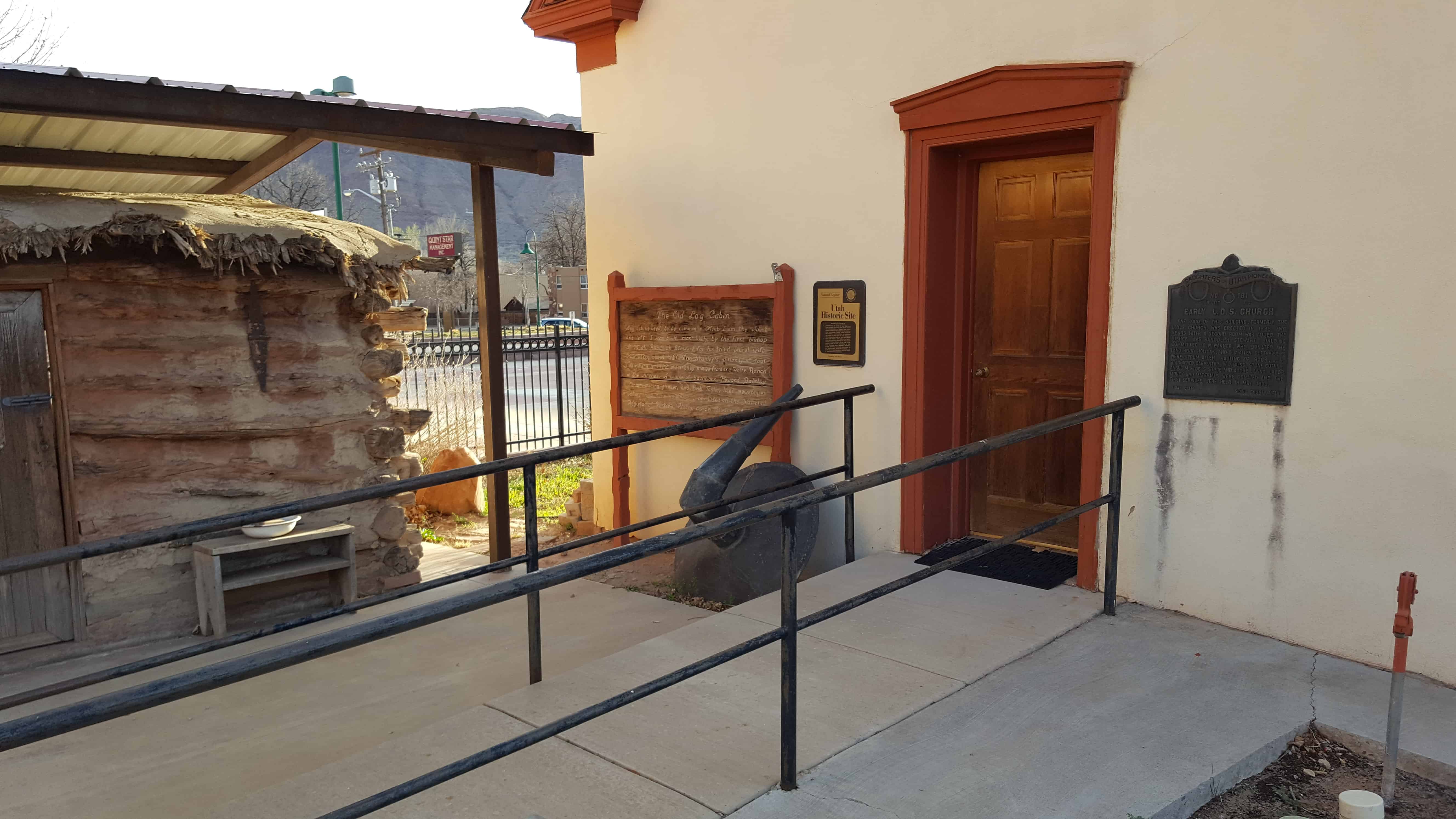
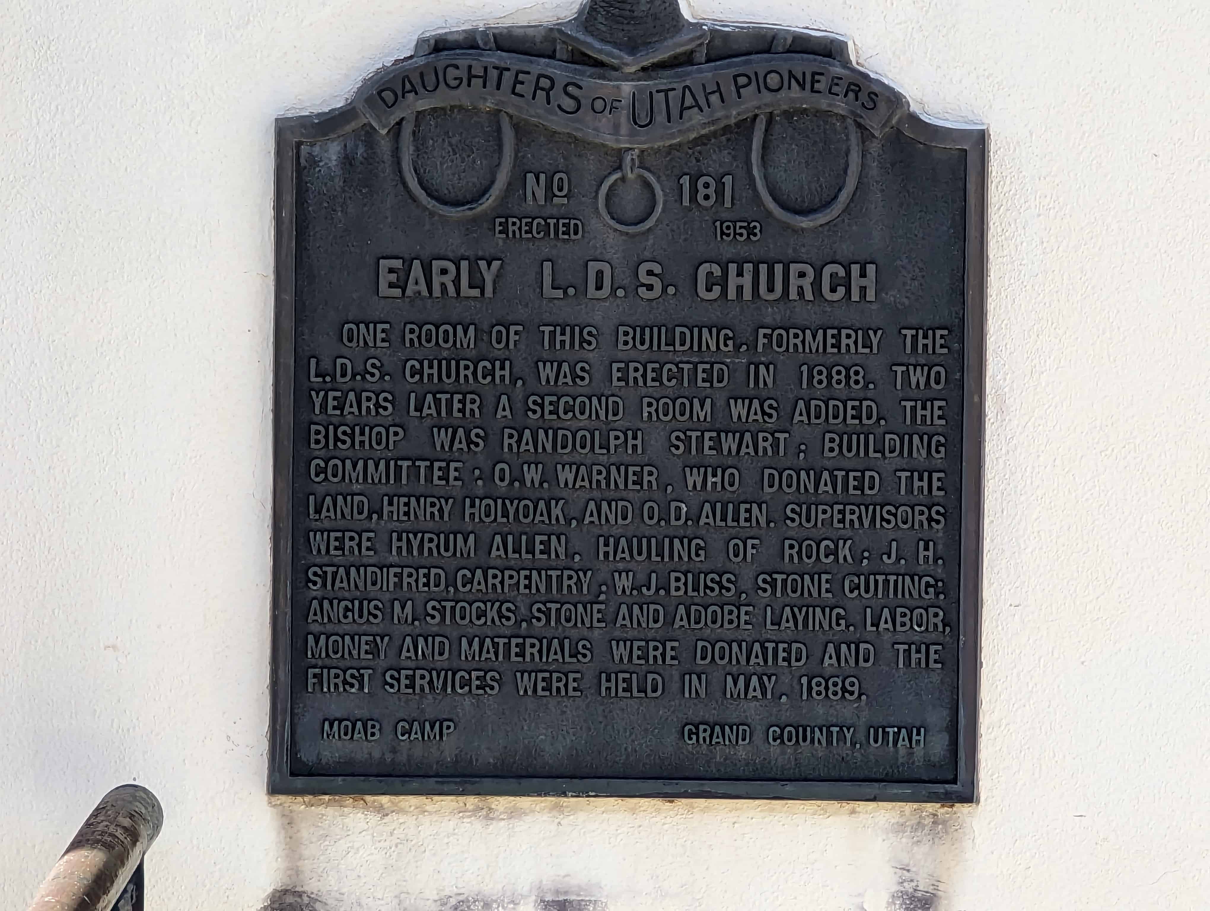
One room of this building, formerly the L.D.S. church, was erected in 1888. Two years later a second room was added. The Bishop was Randolph Stewart; Building Committee: O.W. Warner, who donated the land, Henry Holyoak, and O.D. Allen. Supervisors were Hyrum Allen, hauling of rock; J.H. Standifred, carpentry; W.J. Bliss, stone cutting; Angus M. Stocks, stone and adobe laying. Labor, money and materials were donated and the first services were held in May, 1889.
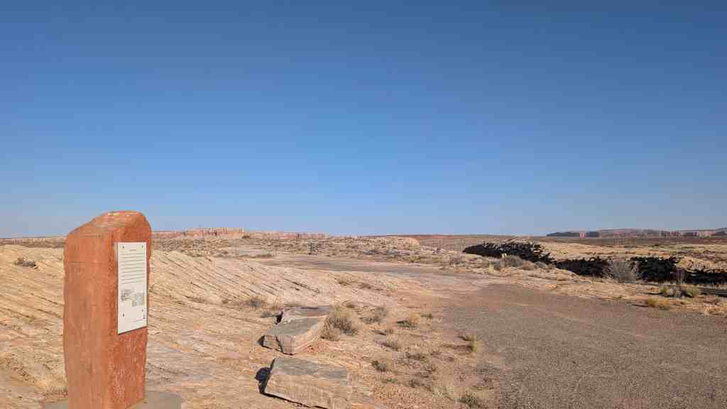
In April 1855, forty-one men under the leadership of Alfred N. Billings were called to establish a mission in the Elk Mountains. They left Salt Lake City May 7, 1855, arriving at Grand River June 11, and selected the site for a fort. By July 15, they had built a fort 64 feet square, with stone walls, 12 feet high, 4 feet at the base and 1 & 1/2 feet at the top. Three of the pioneers, James. W. Hunt, Edward Edwards and William Behunin were buried within the fort which was located about 800 feet from this monument.
This monument was relocated in April 2006. The monument was formerly located at 995 North Highway 191 (Main Street), which is 1.5 miles northwest of where the monument now stands. The location of the Old Fort was 3000 feet west, 1320 feet from the Northwest corner of Section 35 Township 25 South, Range 21 East, Salt Lake Base Meridian.
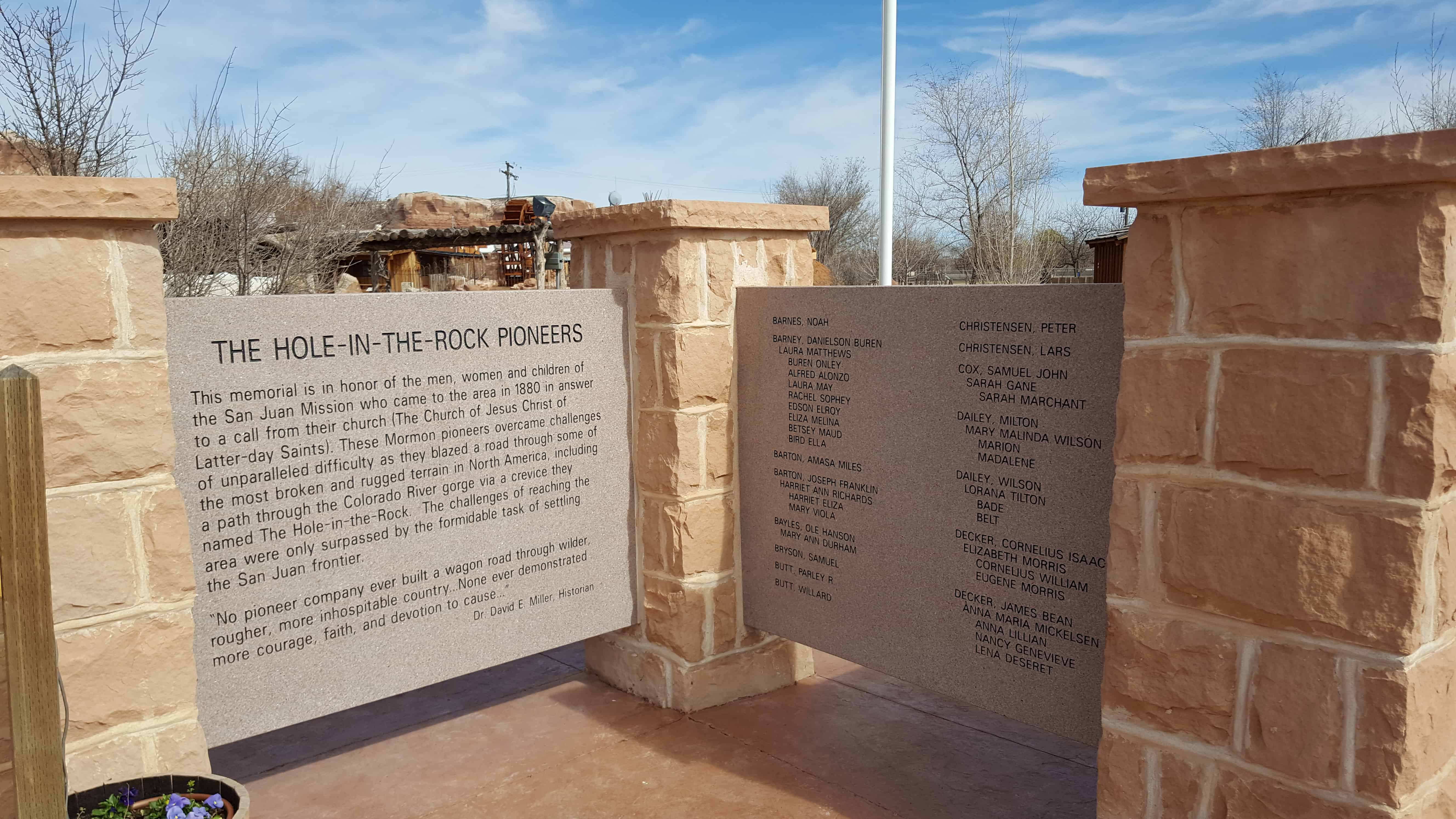
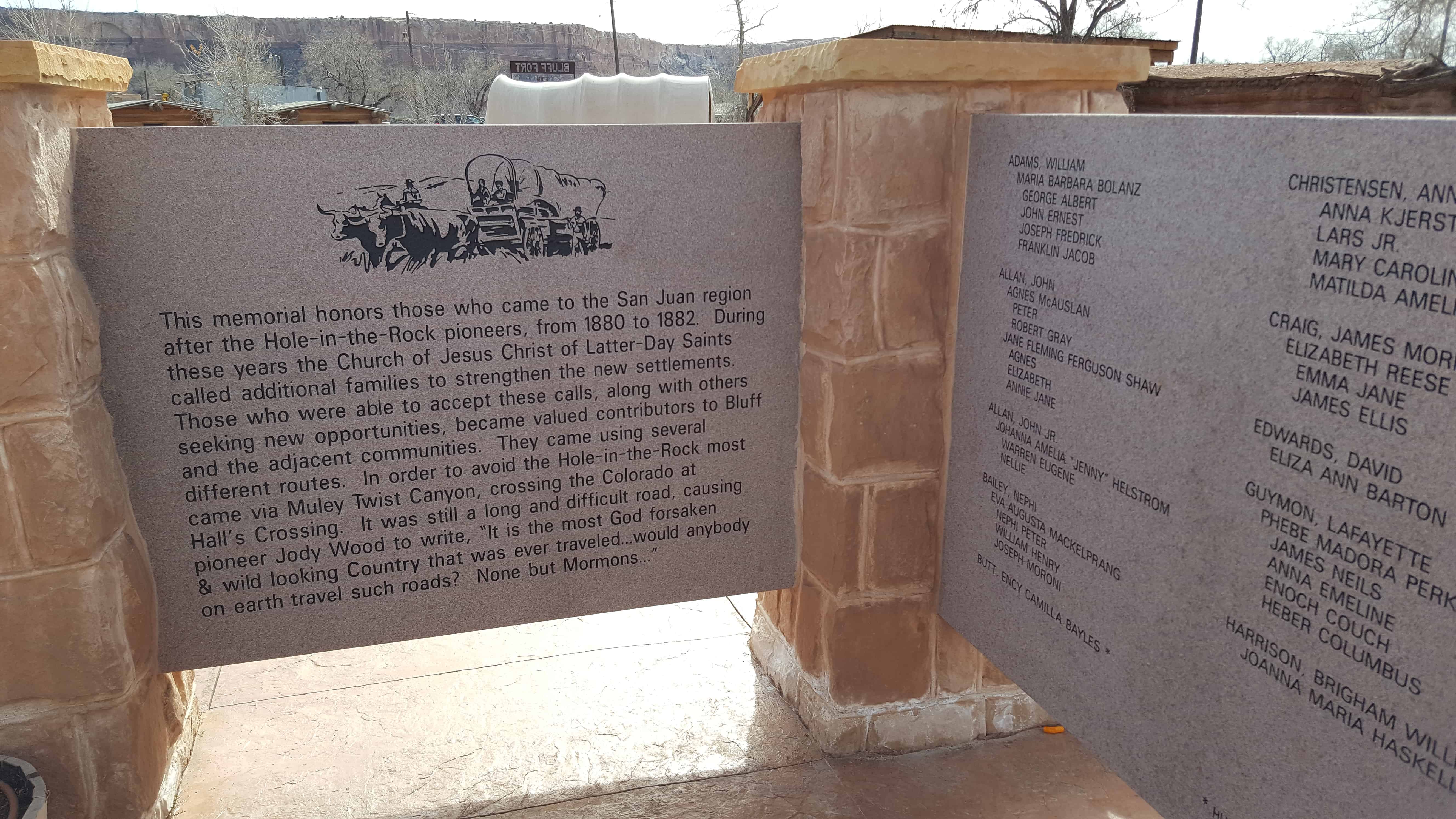
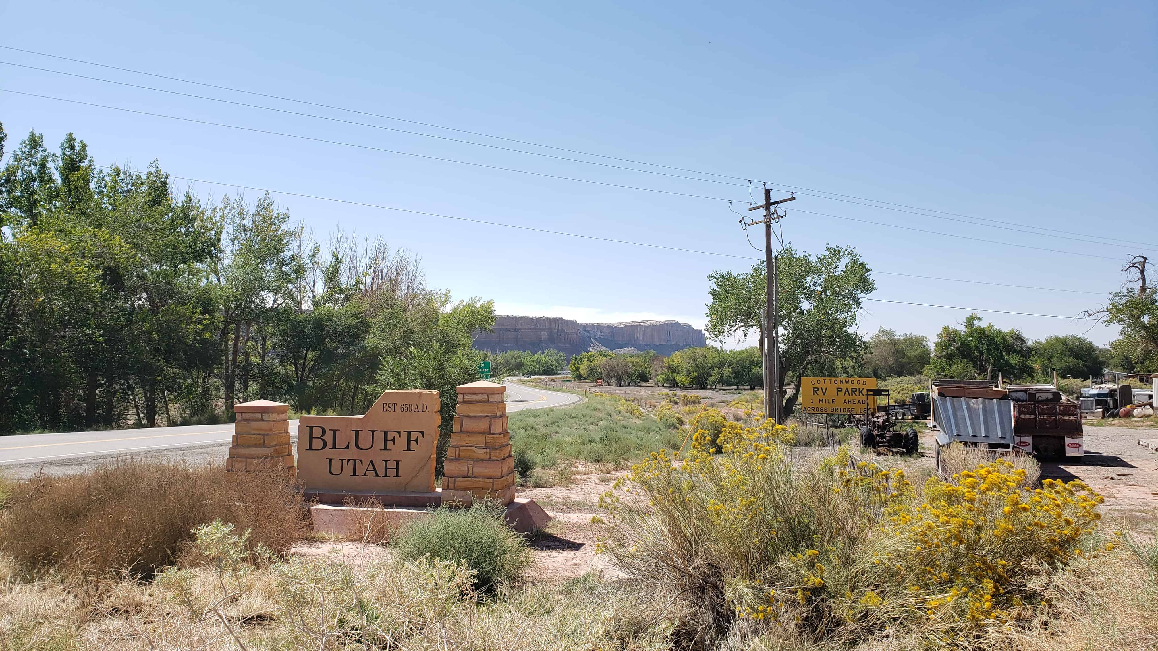
Bluff was the first settlement of the white man in San Juan County and its first county seat. It was founded April 6, 1880, by the San Juan Mission “called” by the L.D.S Church to establish friendly relations with the Indians. A small band of mission scouts found good farm land at this location in 1879 and it was resolved to settle here. Late in October 250 colonists from several southwestern Utah communities began the migration via the Hole-in-the-Rock shortcut across the Colorado River. Contrary to expectations this route proved almost impassable and after nearly six months of the most strenuous effort the exhausted company reached this site. No pioneering band ever overcame greater difficulties in establishing and maintaining a home. The turbulent river proved uncontrollable and for 40 years hostile Indians and various types of white renegades threatened both life and property. In spite of hardships and personal sacrifice the missionaries remained steadfast to their calling until released by the Church. The San Juan Mission is an unexcelled example of the highest type of Pioneer endeavor.
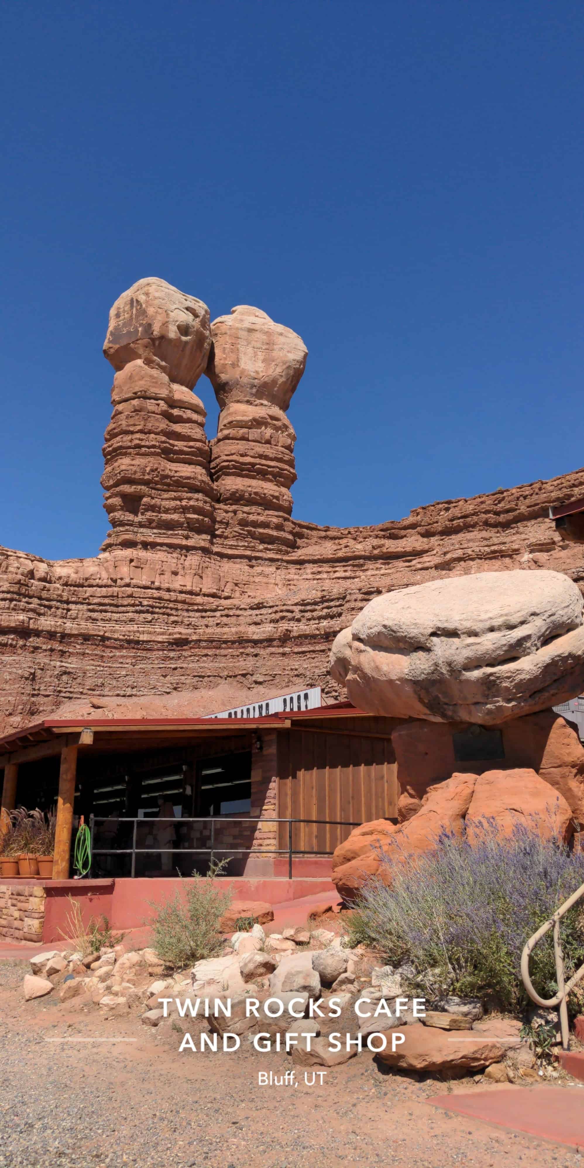
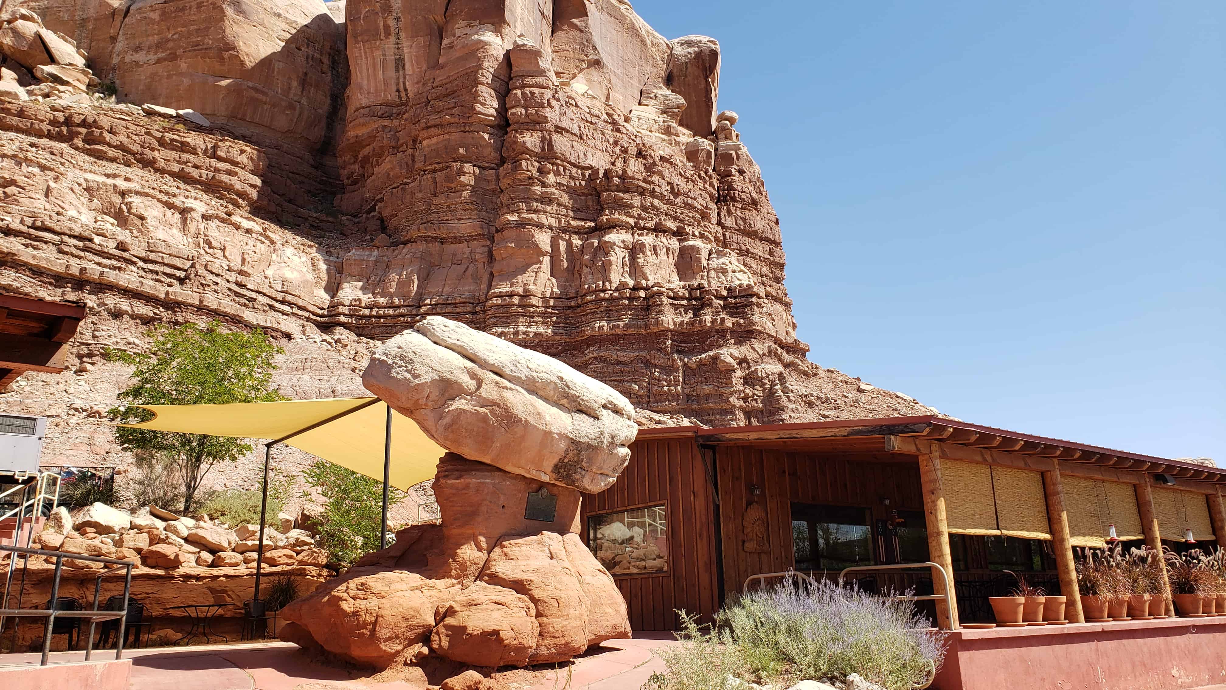
Erected by the National Society, Sons of Utah Pioneers – May 31, 1958 Note: This plaque is attached to a rock formation called “Sunbonnet Rock” due to its shape suggestive of a sunbonnet, and is often referred to by this name. It is located outside the Twin Rocks Café in Bluff, Utah.
This plaque is #L in the series of historic markers by the S.U.P. – See others on this page.
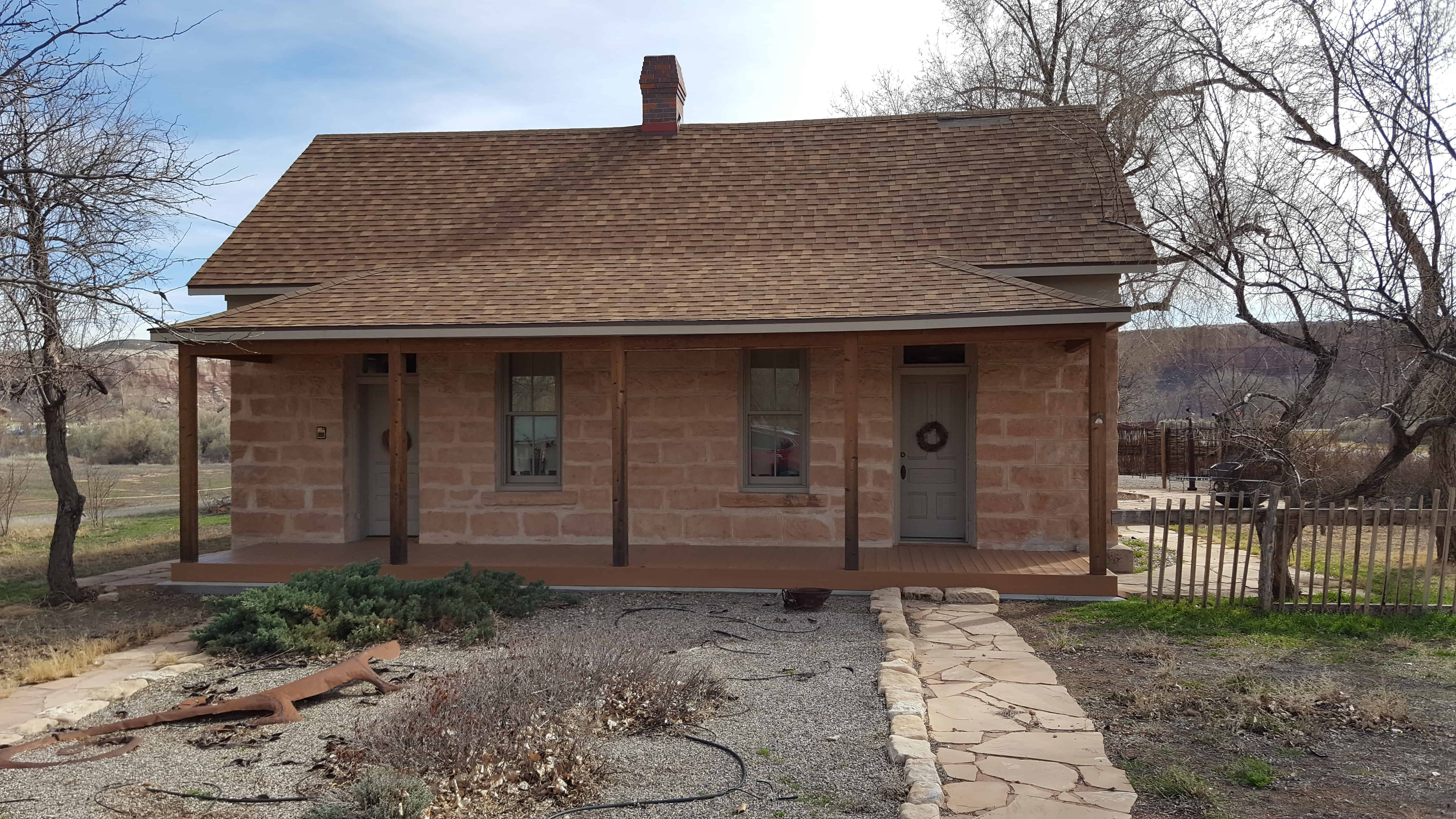
This small, one-story, gable-roofed, vernacular, double-cell type house was originally constructed in the 1890s, by Hyrum Corey Perkins. H.C. Perkins was the son of Hyrum and Rachel Marie Perkins, who were original members of the pioneering Hole-in-the-Rock colonizing expeditions in southeastern Utah. A log cabin was originally located on the lot, which was taken down when this double-cell house was built. Retaining its integrity, the house contributes to the architecture and community of historic Bluff.
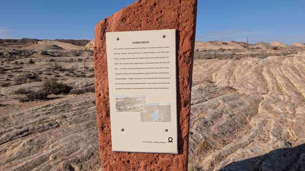
As a winter storm approached, four nearly starved scouts, George Hobbs, George Morrill, Lemuel Redd, Sr., and George Sevey, sought shelter for the night in this area on December 27, 1879. The scouts were exploring for a feasible route for the 250 Mormon (Hole-in-the-Rock) pioneers to follow from their encampments above the Colorado River gorge 100 miles west of here. George Hobbs: Night overtook us, we camped in this small canyon, this being our third day without food. I cut my name in the rock with the date I was there, not knowing that I would survive the journey.
The first meetinghouse in Phoenix for The Church of Jesus Christ of Latter-day Saints (Mormons) was built on this site by the three-hundred-member congregation of the Phoenix Ward. At the time, J. Robert Price was bishop.
Since their beginning in 1912 with nine members, the Latter-day Saints in Phoenix had met in four different locations – – the Knights of Pythias Hall at 23 East Washington Street, a laundry at 534 West Washington Street, an old Spanish-style building at 121 South First Avenue, and a room over a bicycle shop at 237 North Fifth Street. They purchased this area on the eastern edge of Phoenix’s original city plat and built their first chapel 1918-1919.
The handsome meetinghouse – – designed by Pop and Burton, Architects, of Salt Lake City – – was an early example of the influence Frank Lloyd Wright’s architecture had in the Southwest. The Latter-day Saints worshipped here for nearly thirty years. Phoenix used it as a community center, and weekly businessmen’s luncheons and youth dances were held in the building.
By 1923, a thriving congregation (ward) of 730 made it necessary to expand the building; after further expansion in 1926, the meetinghouse filled this plaza area. Other wards were organized and more chapels were built, but the Phoenix First Ward continued to meet here until 1948, and Brill was completed. The building on this site was sold to another church and eventually demolished in 1969.
Bishop J. Robert Price, 1918-1926 Bishop George F. Price, 1926-1928 Bishop John H Udall, 1928-1938 Bishop Arch B. Campbell, 1938-1950
Placed 1981 Sons of Utah Pioneers, Salt River Chapter and Historic Arts and Sites Committee of The Church of Jesus Christ of Latter-day Saints
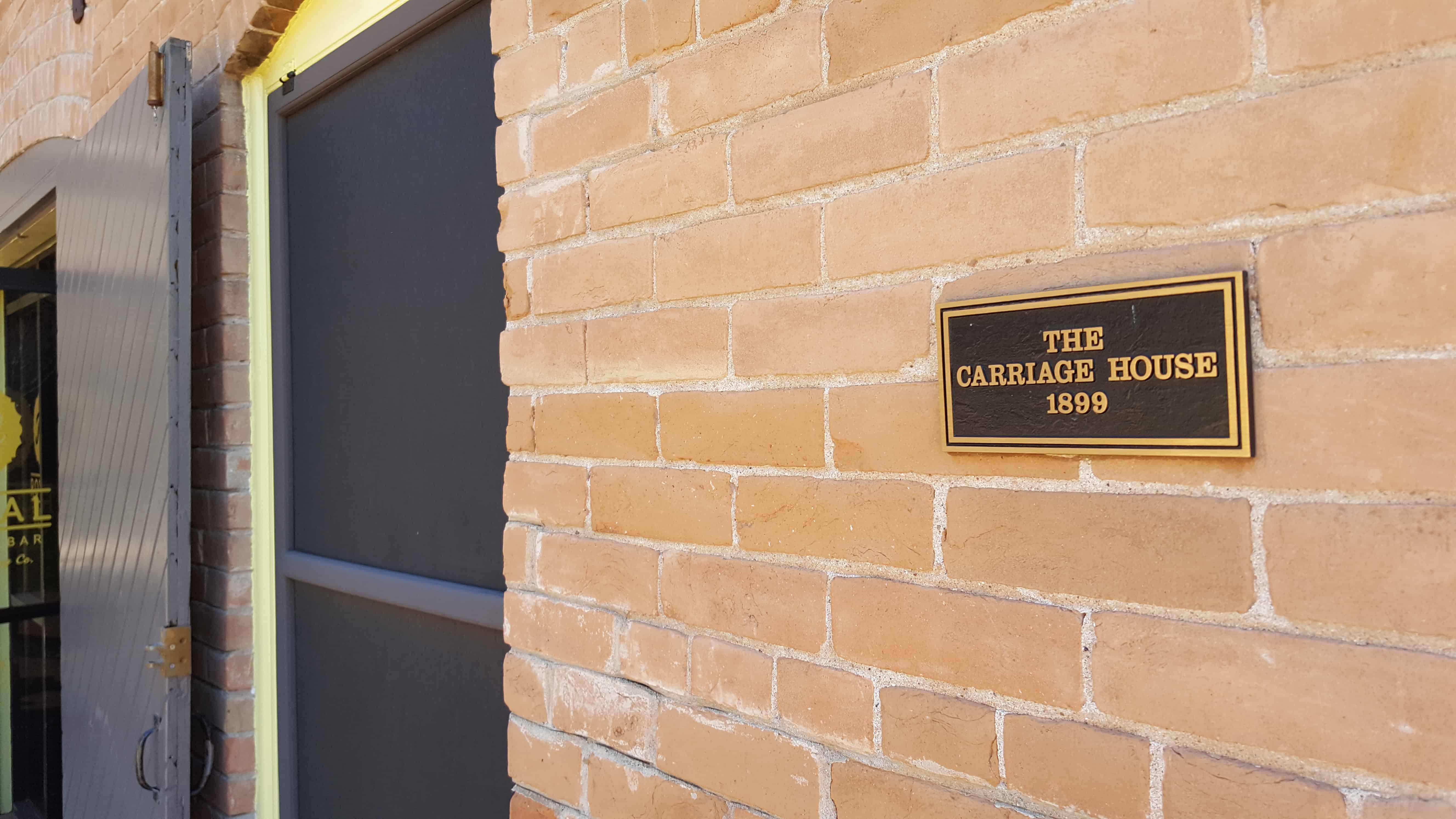
The Teeter Carriage House …was built in 1899 as the mule barn for the Bouvier-Teeter House. It is typical of the traditional carriage house structure, with vehicle, animal and tack storage below, and a loft for feed above. Detached carriage houses were common before garages and carports became popular. Today the Carriage House is home to Royal Coffee Bar.