• About JacobBarlow.com
  • Cemeteries in Utah
  • D.U.P. Markers
  • Doors
  • Exploring Utah Email List
  • Geocaching
  • Historic Marker Map
  • Links
  • Movie/TV Show Filming Locations
  • Oldest in Utah
  • Other Travels
  • Photos Then and Now
  • S.U.P. Markers
  • U.P.T.L.A. Markers
  • Utah Cities and Places.
  • Utah Homes for Sale
  • Utah Treasure Hunt

JacobBarlow.com

~ Exploring with Jacob Barlow

JacobBarlow.com

Tag Archives: historic

Lee’s Ranch Indian Raid

23 Friday Jun 2017

Posted by Jacob Barlow in Uncategorized

≈ 1 Comment

Tags

Beaver, Beaver County, historic, Historic Markers, SUP, UPTLA, utah

  • 2017-05-13 19.28.16

Hostile Indians raided a small settlement in this vicinity October 27, 1866, centering their attack on the house where Mr. and Mrs. J. P. Lee, their two daughters, and 8 year old son, a young Miss Hall and Joseph Lillywhite were barricaded, fighting desperately. During the daylong battle, Lillywhite was seriously wounded. Lee killed three Indians, and the house was badly damaged, partly by firebrands. Miss Hall and the 8-year-old son escaped and secretly journeyed by separate trails to Beaver to give the alarm. Posses of Militiamen were organized and sent to the rescue. When they arrived the Indians had departed.

See other historic markers in the series on this page for UPTLA/SUP Markers.

  • 2017-05-13 19.28.29

From Native American Trail to Interstate Exit

22 Thursday Jun 2017

Posted by Jacob Barlow in Uncategorized

≈ 1 Comment

Tags

historic, Historic Markers, Leeds, utah, Washington County

2017-05-13 17.48.38

From Native American Trail to Interstate Exit

A local history of passage

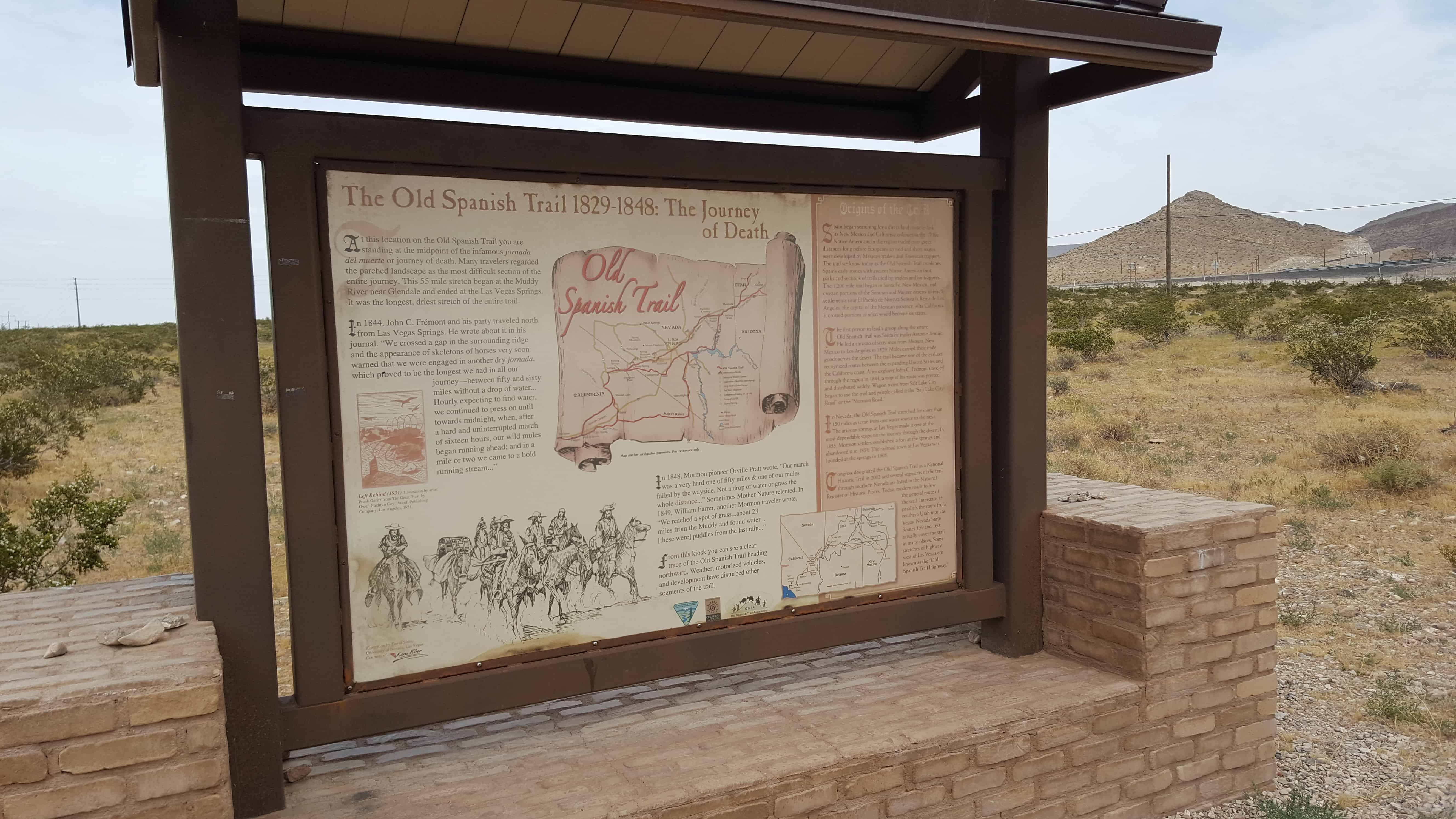
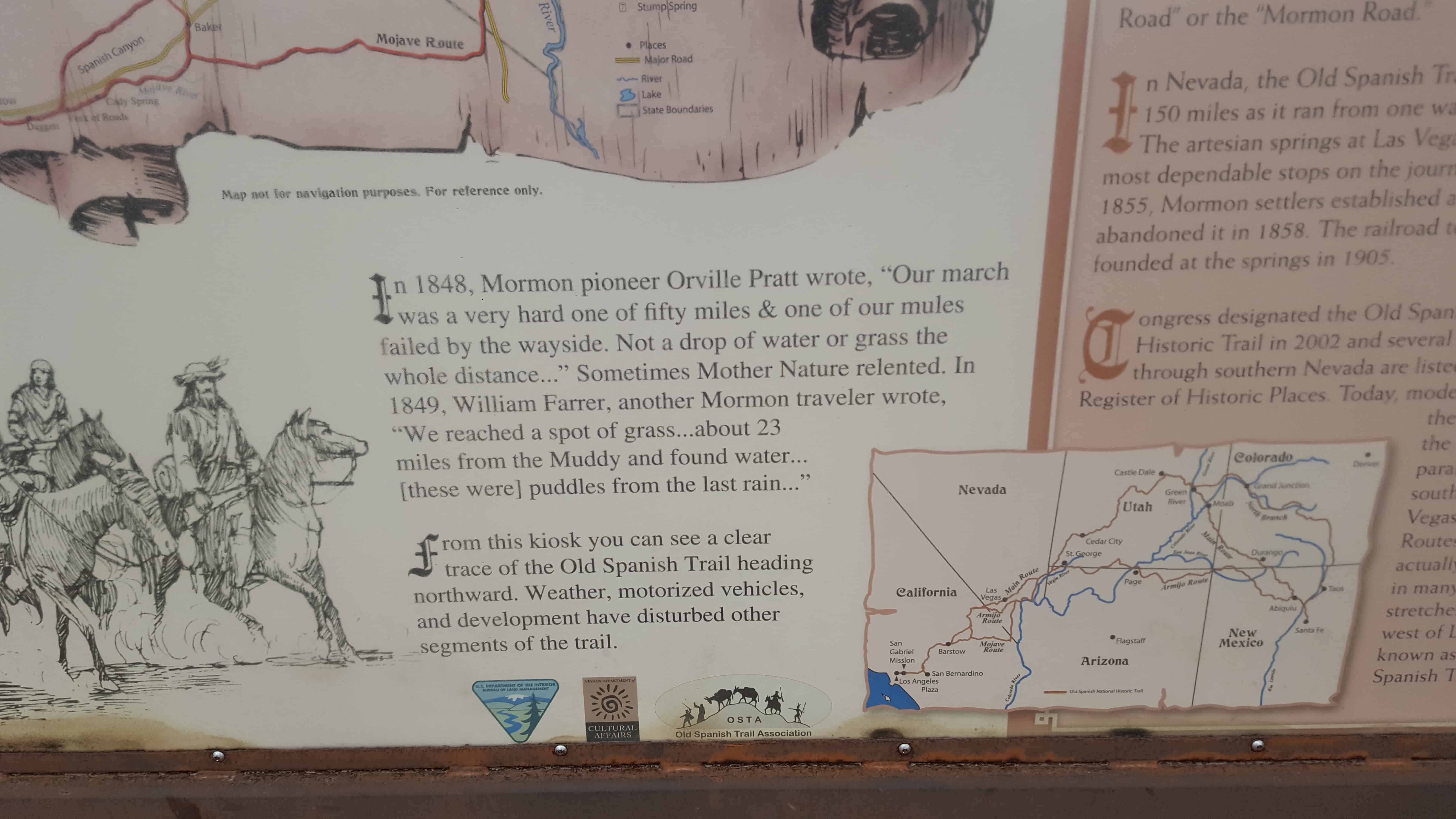
The earliest desert routes in the West followed water. Having drinking water for person or pack animal was critical in negotiating the extreme heat and rugged terrain. Springs of water are located near where you stand and elsewhere in the vicinity of Leeds. Until the 1900s, these springs were significant features in defining early travel routes for travelers in this part of the West.

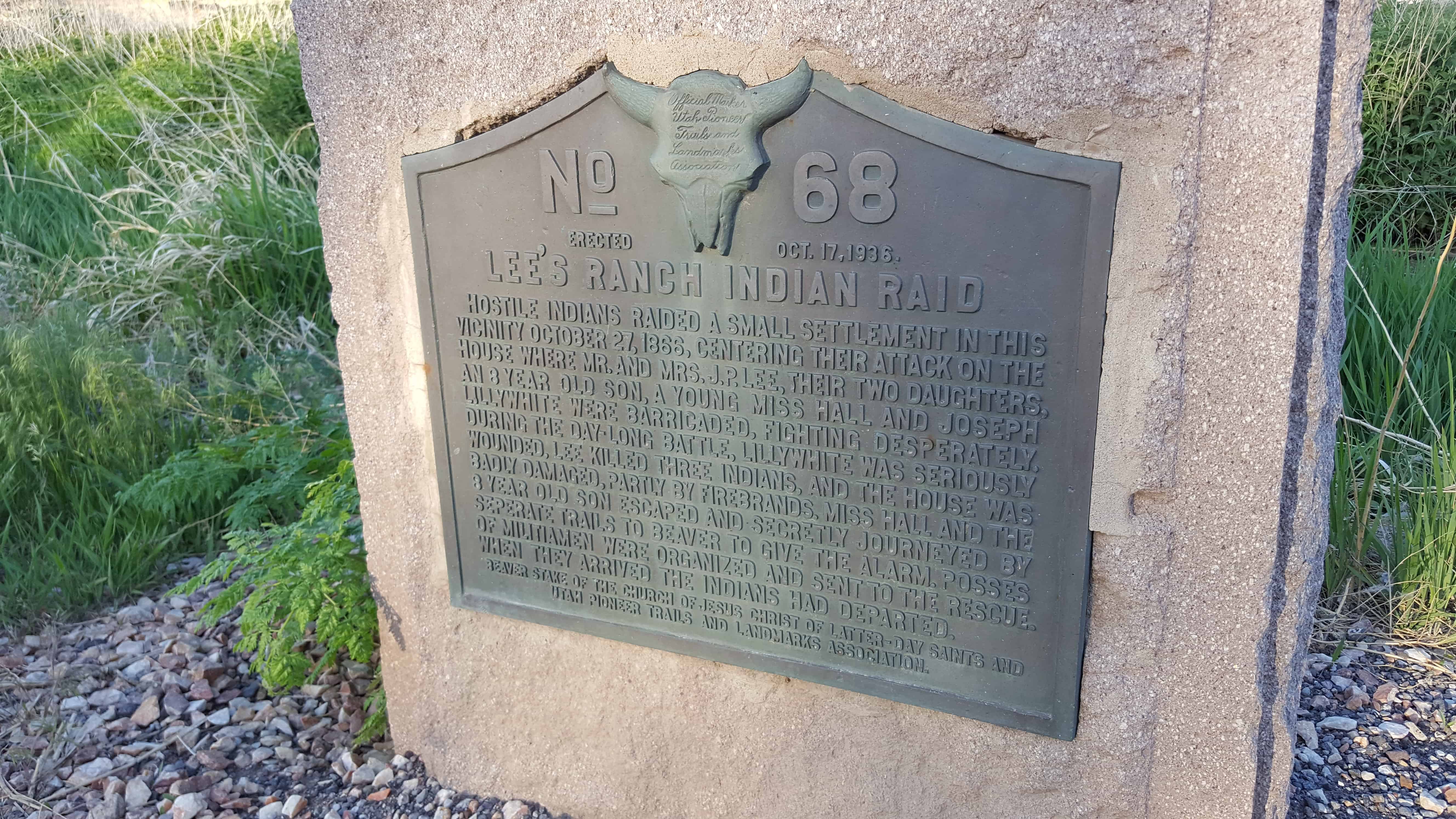
Native Americans, the Paiutes or Pah-utes, lived in the Leeds area along Leeds Creek. Pah is the native word for water. The Paiutes were somewhat nomadic, traveling along routes where life-giving water was available. The earliest pathways in the Leeds area were those of the Paiutes and their ancestors.

Fur traders, trappers, and explorers used the trails as well. In the 1860s, as the Mormons began settling southern Utah, the area that would eventually become Leeds was known as Road Valley. The springs were the site of a wagon rest stop. After Leeds was settled in
the 1860s, its main street became part of the route connecting Salt Lake to St. George and other Mormon settlements in southern Utah.

When silver was discovered in the early 1870s at nearby Silver Reef, a symbiotic  relationship between the new little farming community and the mining town was born.
Farmers sold their produce to the residents of Silver Reef. Residences, a church, dance
hall, mercantile, boarding house, and other businesses sprang up along the main road in Leeds. For several decades, the economy of southwestern Utah thrived as a result of this
interdependence of farming and mining.

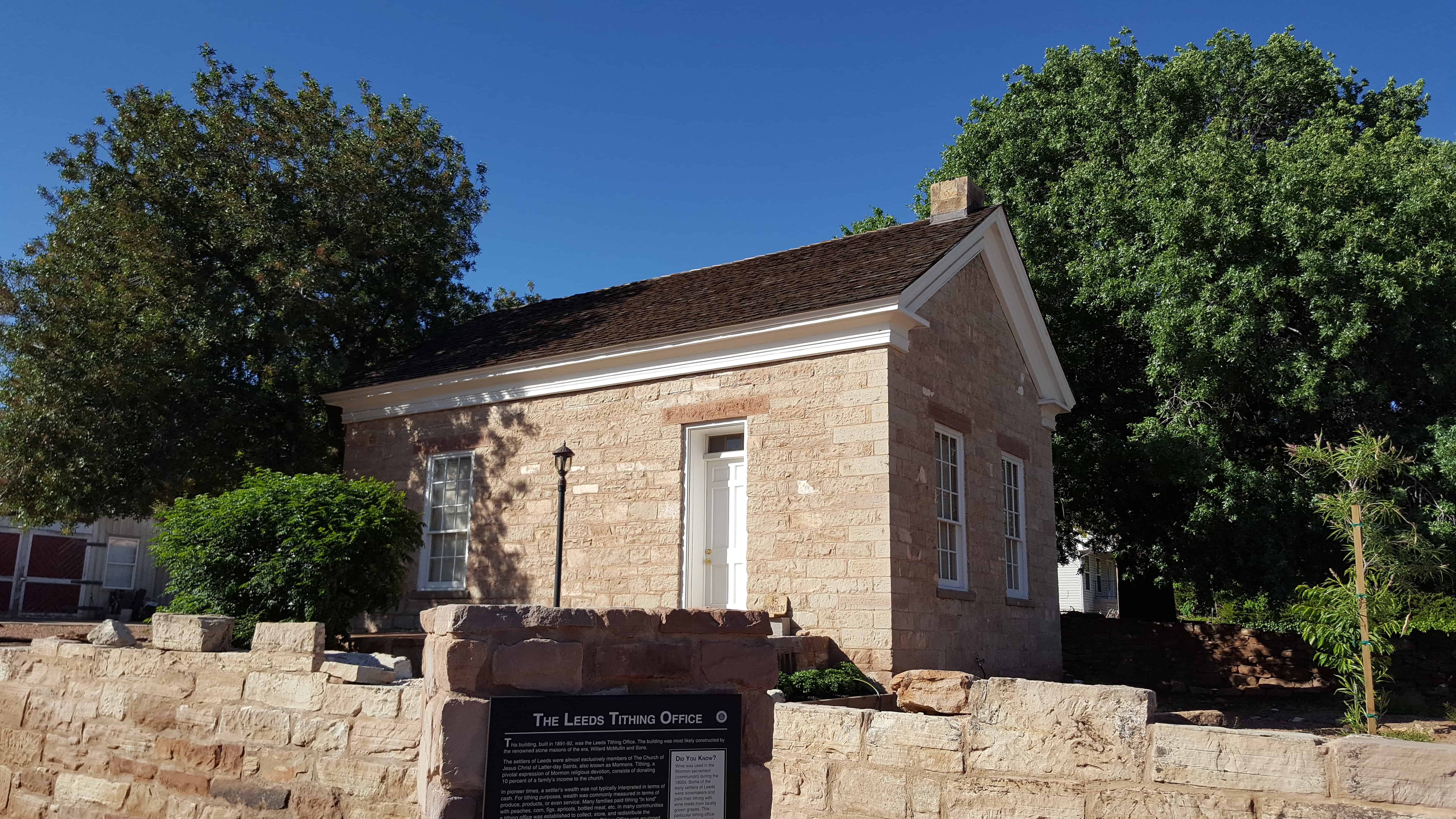
With the advent of the automobile in the early 1900s, long-distance travel became more common. In the early days of the automobile, the road through Leeds became part of a route known as the Arrowhead Trail. In 1926 the federal system of numbered highways was initiated, and the Arrowhead Trail became known as U.S. Highway 91. In 1931 the final stretch of Highway 91 from Harrisburg through Leeds to Toquerville Junction was paved. The highway became the major route between Los Angeles and Salt Lake City. Well into the 1950s, travelers continued to pass through Leeds. The small Main Street businesses were utilized by residents and travelers alike.

In 1956, with a good paved highway and faster automobile travel, the residents of Leeds started sending their children to St. George to school. Many Leeds residents worked and shopped in St. George as well. In 1964 the section of Interstate Highway 15 was completed parallel to Leeds, officially retiring Highway 91 as the major route. Leeds was reduced to just another interstate exit. The change brought more residential tranquility to the center of town but produced an economic coma for the local businesses. Over the
next several years, Main Street became almost exclusively a residential street with only a few businesses.
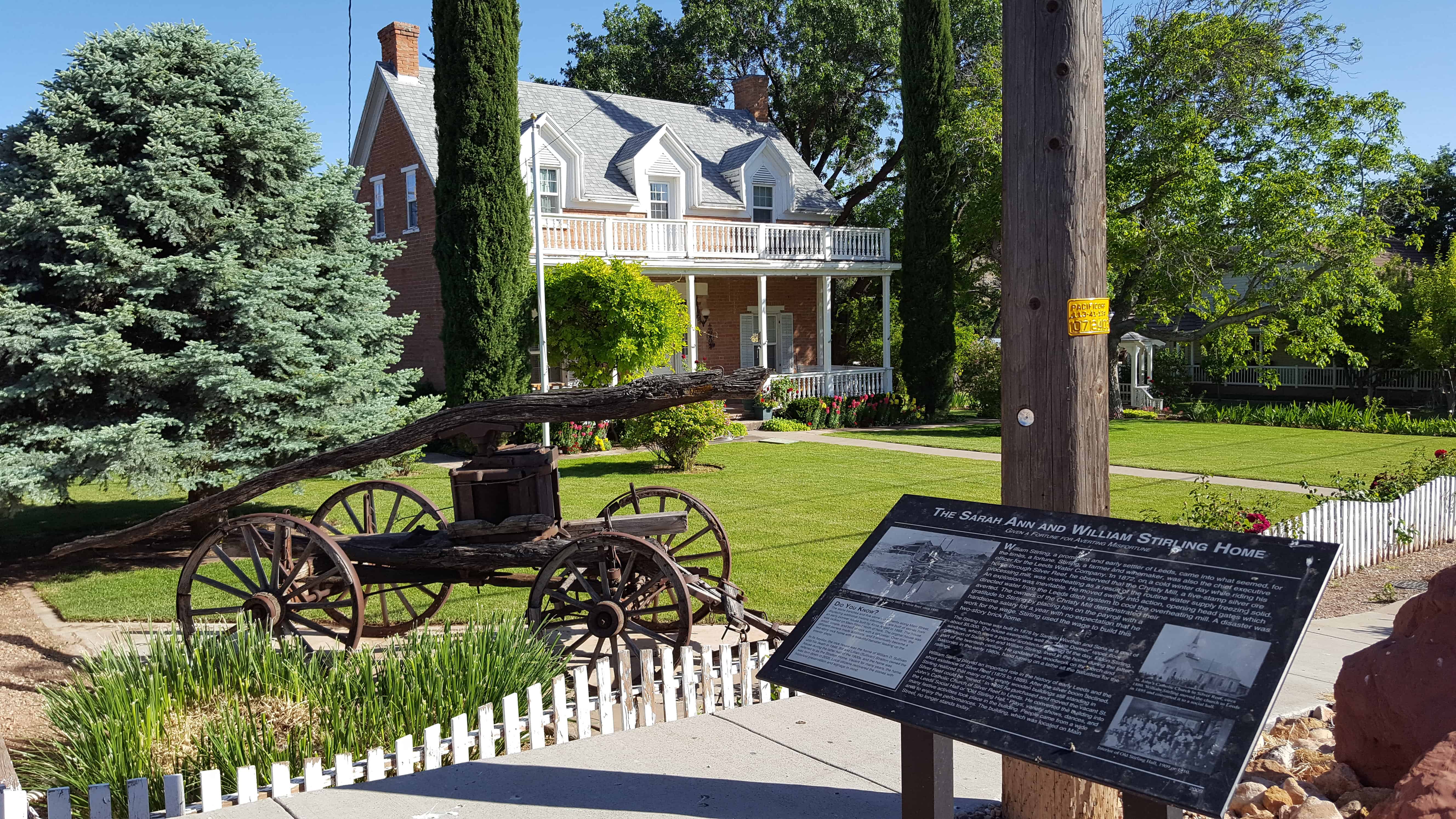
2017-05-13 17.49.15

2017-05-13 17.48.48

The Leeds Tithing Office

22 Thursday Jun 2017

Posted by Jacob Barlow in Uncategorized

≈ 1 Comment

Tags

historic, Historic Buildings, Historic Markers, LDS Church, Leeds, utah, Washington County

2017-05-13 17.47.35

This building, built in 1891-92, was the Leeds Tithing Office. The building was most likely constructed by the renowned stone masons of the era, Willard McMullin and Sons.

The settlers of Leeds were almost exclusively members of The Church of Jesus Christ of Latter-day Saints, also known as Mormons. Tithing, a pivotal expression of Mormon religious devotion, consists of donating 10 percent of a family’s income to the church.

In pioneer times, a settler’s wealth was not typically interpreted in terms of cash. For tithing purposes, wealth was commonly measured in terms of produce, products, or even service. Many families paid tithing “in kind” with peaches, corn, figs, apricots, bottled meat, etc. In many communities a tithing office was established to collect, store, and redistribute the donated goods to those in need. The Leeds Tithing Office was equipped
with bins and barrels for storage and a set of scales for weighing produce.

Of the several early tithing offices built in the region, the Leeds building is the only remaining example of a stone tithing office that still stands with its original stone walls.

The in-kind tithing system was retired in the early 1900s.

2017-05-13 17.47.46

2017-05-13 17.47.43

2017-05-13 17.48.13

2017-05-13 17.47.51

From Ditches to Pipes

22 Thursday Jun 2017

Posted by Jacob Barlow in Uncategorized

≈ 1 Comment

Tags

historic, Historic Markers, Leeds, utah, Washington County

2017-05-13 17.46.58

Water is life… The shovel is divine

From Ditches to Pipes

The use and control of water controls the future

The earliest settlers in Leeds used innovation and hard work to divert water from Leeds Creek to their homes, fields, and industry. The town pioneers carefully studied the lay of the land between the creek and the settlement and selected a route that would transport the water to Leeds. The lowly hand shovel was their “divine tool.” Digging ditches with pick and shovel and teams of work horses across the rocky terrain was hard and seemingly endless work. Ingenuity was required in keeping the path of the ditch in a
downhill direction to maintain water flow. Building a good ditch system took clever minds, strong backs, and great determination.

The Leeds Water Company was established in the late 1800s to legally secure and organize rights to use local water, a historically controversial and difficult task in the arid West.

The main ditch carried Leeds Creek water to the northeastern edge of the town. From that point, ditches conveyed the water to town lots and beyond to the nearby agricultural fields. Prized lots in Leeds were those that fronted the ditch, especially lots that were closest to the beginning of the ditch, where pollutants from upstream use of the water were fewer.

2017-05-13 17.47.02

Stirling Home

22 Thursday Jun 2017

Posted by Jacob Barlow in Uncategorized

≈ 1 Comment

Tags

historic, Historic Homes, Historic Markers, Leeds, NRHP, utah, Washington County

2017-05-13 17.44.56Stiring Home

Built c. 1876 of red brick by Samuel Worthen and sons for William Stirling, one of the first settlers of Leeds.  Fine example of “Dixie Dormers” unique to Southern Utah.  Marker placed 1973 by Mrs. David Stirling and Family.

2017-05-13 17.45.19

William Stirling, a prominent and early settler of Leeds, came into what seemed, for the times, a fortune. Stirling, a farmer and winemaker, was also the chief executive officer for the Leeds Water Company. In 1872, on a cold winter day while riding his horse through Silver Reef, he observed that the Christy Mill, a five-stamp silver ore processing mill, was overheating as a result of the routine water supply freezing solid. An explosion was inevitable. He moved swiftly into action, opening head gates which directed water from the Leeds ditch system to cool the overheating mill. A disaster was averted. The owners of the Christy Mill demonstrated their gratitude to Stirling by placing him on the payroll with a handsome salary for a year with no expectation that he work for the wage. Stirling used the wage to build this two-story brick home.

The Stirling home was built in 1876 by Samuel Worthen and Sons at a cost of about $5,000. The house exemplifies well the “Dixie Dormer” upper floor windows, which were a popular architectural design of the day. Eldon Stirling, grandson of Sarah Ann and William Stirling, lived in the home during the latter part of the twentieth century. He updated the woodwork on the porch and balconies in the early 1980s, hand turning on a lathe all the balusters for the railings

William Stirling played an important role in the history of early Leeds and the short existence of Silver Reef (1875 to 1889). After the silver boom declined, Stirling realized that many of the empty wooden buildings still standing in Silver Reef could be “mined.” In 1895 he purchased and moved the vacant St.
John’s Catholic Church of Silver Reef to Leeds. He converted the building into the Leeds Social Hall or “Old Stirling Hall.” Plays, variety shows, dances, and many festive activities took place in the building. People came from a wide area to enjoy the performances. The building, which was located on Main Street, no longer stands today.(*)

2017-05-13 17.45.51

2017-05-13 17.45.56

The Old Spanish Trail 1829-1848: The Journey of Death

21 Wednesday Jun 2017

Posted by Jacob Barlow in Uncategorized

≈ 2 Comments

Tags

Clark County, historic, Nevada, Old Spanish Trail

2017-05-07 13.25.02

At this location on the Old Spanish Trail you are standing at the midpoint of the infamous jornada el muerte or journey of death.  Many travelers regarded the parched landscape as the most difficult stretch of the entire journey.  This 55 mile stretch began at Muddy River near Glendale and ended at Las Vegas Springs.  It was the longest, driest stretch of the entire trail.

In 1844, John C. Fremont and his party traveled north from Las Vegas Springs.  He wrote about it in his journal.  “We crossed a gap in the surrounding ridge and the appearance of skeletons of horses very soon warned that we were engaged in another dry jornada, which proved to be the longest we had in all our jounrey — between fifty and sixty miles without a drop of water…  Hourly expecting to find water, we continued to press on until towards midnight, when, after a hard and uninterrupted march of sixteen hours, our wild mules began running ahead; and in a mile or two we came to a bold running stream…”

2017-05-07 13.24.53

2017-05-07 13.24.18

2017-05-07 13.23.45

Springville Fort

01 Thursday Jun 2017

Posted by Jacob Barlow in Uncategorized

≈ 6 Comments

Tags

Forts, historic, Springville, utah, utah county

18671474_985950221508561_683366220095604508_o

I’m still looking for information on the Springville Fort / Hobble Creek Fort but I found a couple old renditions of it.  It was apparently near 200 N 200 W.

18671534_985967828173467_2790418687512619006_o

18699609_985361341567449_4928998617515984496_o

Pioneering Utah

11 Thursday May 2017

Posted by Jacob Barlow in Uncategorized

≈ 1 Comment

Tags

Clear Creek Canyon, Fremont Indian State Park, historic, Historic Buildings, Historic Homes, Historic Markers, Sevier, Sevier County

2017-03-26 15.58.39

Joseph Lott and his family built a cabin on this site in the 1880s and were among the first pioneers to settle in Clear Creek Canyon.

Their 160 acre homestead extended through the canyon bottom and included orchards and pastures.

Joe, his wife Merua, and their six children loved here for nearly thirty hears.  The Lott cabin stood until the 1970s.

This pioneer cabin is typical of those built by Utah settlers in the mid-nineteenth century.  It is not known who originally built this cabin, but Bernard Barnson, his wife Hannah, and several of their children lived in the two-room structure from 1903 to 195 in Junction, Utah.   In 1996, the descendants of Bernard and Hannah Barnson donated this cabin to Fremont Indian State Park.

2017-03-26 16.00.22

2017-03-26 16.00.18
2017-03-26 15.58.59

Camp Alma Relic Hall

10 Wednesday May 2017

Posted by Jacob Barlow in Uncategorized

≈ 1 Comment

Tags

DUP, historic, Historic Markers, Monroe, Sevier County, utah

2017-03-26 17.49.47

During the winter of 1866-1867, William Cordingly built a small log cabin in the settlement of Alma, and by early spring the house was ready for his family. Indian troubles forced some of the original settlers to abandon their homes and leave this community. In 1871, when they returned, the name of the town was changed to Monroe.

One of the first families to occupy the cabin was that of Neila Mickelson. The Soren and Kristine Madsen family soon followed. Sunday School and choir practice were held here as well as many public functions.

In 1931, Camp Alma, Daughters of Utah Pioneers, decided to procure the Cordingly cabin for a relic hall. Dwight Swindle, on whose lot the cabin stood, gave the cabin to Camp Alma. In 1937, the husbands of the members along with other townspeople helped jack up the cabin and move it to the northeast corner of the Monroe North Ward property.

The cabin had no roof, floor, windows or foundation. Renovation began. Industrious members sewed and wove twelve large balls of rags together for the rag carpet. They lined the walls, covered the ceiling with White Factory and painted the interior. Many relics were given to furnish the cabin, and on May 27, 1938, Camp Alma held its first meeting in the new Relic Hall. On July 23, 1950, the cabin was moved to its present site on Main Street.

DUP Marker #468 in Monroe, see other DUP Markers here.

2017-03-26 17.50.01

2017-03-26 17.50.12

Settlement of Annabella

10 Wednesday May 2017

Posted by Jacob Barlow in Uncategorized

≈ 1 Comment

Tags

Annabella, DUP, historic, Historic Markers, Sevier County, utah

2017-03-26 19.02.27

In the spring of 1871, Harry Dalton, James Powell, and their families traveled across Sevier Valley to Omni Point at the base of Cove Mountain.  In early fall that same year, the Edward Killick Roberts and John Gleave families moved from Glenwood to Omni Point.  These four families became the first settlers of the town that was to become known as “Annabella.”  The town was named after two of the first woman settlers: Anna Roberts and Isabella Dalton.  Through hard work and diligence, the settlers built homes, cleared the ground, planted crops, and established a town.

Small springs at Omni Point supplied water for the first few families; but, as more families arrived and settled down in the valley, water from a spring in Red Butte Canyon was drawn for culinary use.  Irrigation water was diverted from lakes on the mountain, through Cottonwood Canyon.  Settlers commenced building the Annabella Canal in 1871, and they began watering crops in 1872.

The first homes were dugouts but were soon replaced with log and adobe cabins with dirt floors.  Sawmills were established in the 1800s on Cove Mountain.   Logs were cut and trimmed, hauled to the saw mills, and then cut into lumber.  Better homes were later built of brick.  The first schools were held in log cabins.  A two-story hall was constructed with classrooms on the first floor.  The social hall, located on the second floor, was used for dances, plays, and social gatherings.  A new brick school house was built in 1920.

In February of 1911, Annabella was established with a town government.  On July 3, 2011, Annabella celebrated its 100 Year Anniversary, honoring its pioneer heritage.

DUP Marker #569 in Annabella, see other DUP Markers here.

2017-03-26 19.02.36

2017-03-26 19.02.31
2017-03-26 19.02.52
2017-03-26 19.03.32

← Older posts
Newer posts →

Follow Jacob

Follow Jacob

Blog Stats

  • 2,025,736 hits

Social and Other Links

BarlowLinks.com

Recent Posts

  • Goulding’s Trading Post
  • Kyle’s Apartment – American Murderer Filming Location
  • Oljato Trading Post
  • Our Lady of Lourdes Catholic Church
  • Dale’s Sinclair Service Station

Archives


Loading Comments...