• About JacobBarlow.com
  • Cemeteries in Utah
  • D.U.P. Markers
  • Doors
  • Exploring Utah Email List
  • Geocaching
  • Historic Marker Map
  • Links
  • Movie/TV Show Filming Locations
  • Oldest in Utah
  • Other Travels
  • Photos Then and Now
  • S.U.P. Markers
  • U.P.T.L.A. Markers
  • Utah Cities and Places.
  • Utah Homes for Sale
  • Utah Treasure Hunt

JacobBarlow.com

~ Exploring with Jacob Barlow

JacobBarlow.com

Tag Archives: utah

Thompson Wash Rock Art District

27 Thursday Feb 2025

Posted by Jacob Barlow in Uncategorized

≈ Leave a comment

Tags

Barrier Style, Grand County, NRHP, Petroglyphs, Rock Art, Sego, Thompson, Thompson Springs, utah

Thompson Wash Rock Art District / Sego Canyon Rock Art Interpretive Site

Sego Canyon contains three culturally distinct styles of rock art: Fremont, Ute and Barrier-style. A well preserved ghost town and ruins of a coal mine are located nearby. Visitors are advised to plan for at least a half day to explore this exciting area.*

Located in Sego Canyon near Thompson Springs, Utah. This site was added to the National Register of Historic Places (#80003909) on August 1, 1980.

Sand Caves

03 Monday Feb 2025

Posted by Jacob Barlow in Uncategorized

≈ Leave a comment

Tags

Caves, Kane County, utah

The Sand Caves, also often called the Kanab Sand Caves or the Moqui Sand Caves are located just off Highway 89 North of Kanab, Utah.

Related:

  • Sand Caves Rock Art


Parking:

Sand Caves Rock Art

03 Monday Feb 2025

Posted by Jacob Barlow in Uncategorized

≈ Leave a comment

Tags

Kane County, Rock Art, utah

Some rock art near the Sand Caves off Highway 89.

Pharo Village

28 Saturday Dec 2024

Posted by Jacob Barlow in Uncategorized

≈ Leave a comment

Tags

Millard County, NRHP, utah

Pharo Village is located in Millard County, Utah and was added to the National Historic Register (#75001813) on October 10, 1975. The text on this page is from the national register’s nomination form.

Pharo Village is recognized as one of the type sites of the Sevier-Fremont, one of the five variants of the agricultural Fremont culture, The Fremont culture area includes all of Utah except for the southernmost portion of the state, and extends into eastern Nevada, western Colorado and southern Wyoming. The Sevier-Fremont variant, dated between A.D. 780-1260 is geographically situated in the region between Utah and Sevier Lakes (north-south), the Wasatch Plateau to the east and extends west into Nevada. Radiocarbon dates from Pharo Village of A, D, 1190+80 and A. D. 1260+90 indicate that the site was occupied in the later part of the period, probably some 200 years after the occupation of the other important Sevier-Fremont type site, Nephi. Design elements on the pottery recovered at Pharo Village indicate that occupation may have continued past A. D. 1260.

Although distinctly Sevier-Fremont in affiliation, Pharo Village illustrates the internal diversity of the Fremont culture as a whole, in its various architectural features as well as in the several types of pottery which were found at the site. The ten structures excavated at Pharo Village represent three different architectural types, and include three pit structures which are interpreted as dwellings and coiled adobe surface structures of various forms which probably functioned as granaries or storage rooms. A rectangular arrangement of stones was also uncovered probably the remains of a masonry and adobe granary, A total of 12,273 sherds and 24 partially restorable pottery vessels was recovered, This is one of the largest ceramic samples from any Sevier-Fremont site; excavated to this date and is unusual in that it was concentrated in such a small area. ‘With minor exceptions, all pottery from Pharo Village belongs to established Fremont or Sevier-Fremont types and includes Snake Valley Gray, Sevier Gray, Snake Valley Black on White, Ivie Creek Black on White.

In addition to pottery, a large quantity of other artefactual material was recovered whose analysis yielded important data on various aspects of the Fremont culture. Food remains from the site included charred corncobs and cornstalks, as well as relatively. large quantities of boney Analysis of this bone indicated that ungulates ware probably the major food animals, with bighorn sheep and mule deer predominating, Evidence for the importance of horticulture in the subsistence regime (in addition to the food remains) included a large number of grinding stones, and a high proportion of storage structures over dwellings. In addition, the location of the village on an alluvial fan, where crops could take advantage of ground iroisture, probably insured a relatively stable crop yield.

Thus, Pharo Village is an important site in many respects/ not only has it been significant for the interpretation of the nature of the Fremont culture and its internal diversity, but it has produced significant information regarding those cultures in the Great Basin which practiced agriculture.

Pharo Village,, at an elevation of 6240 feet, is located near the south end of the Upper Round Valley near the boundary between the Basin-Range and Colorado Plateau provinces. The valley is an area of interior drainage with several perennial streams rising in the Pavant Range which borders the valley on the west.

“Pharo Villacre is located on an alluvial fan. The area of occupation extends irregularly for ca. 700 feet parallel to the creek with two major concentrations of cultural materials. (Marwitt 1968:3) The smaller concentration is located on top of a 15 foot high fault scarplet.

At present, most of the site area is dissected by small dry washes extending east from Pharo Creek. Numerous surface rocks and a thin coating of alluvium were deposited on the site during the first decade of this century when over grazing in the Pavants resulted in extensive canyon erosion.

Pharo Village is located in the western half of the valley. which is relatively well-watered, in a zone of sagebrush and rabbitbrush vegetation, Numerous other low mounds and surface concentrations of cultural material which represent living sites are scattered along the western half of the valley and attest to the aboriginal occupation of Upper Round Valley, Like Pharo Village, which appears to be the most extensive of these sites, they are concentrated on the alluvial fans near perennial streams. Today animal resources of the valley are limited, but game is plentiful in the Pavants and deer commonly descend to the valley floor in winter, Conditions were probably much more favorable in aboriginal tines. Soils are extensive and rich in the valley, and other natural resources, including clay for construction purposes are readily available.

In 1967 the Department of Anthropology, University of Utah, partially excavated the larger cultural concentration on tire site which comprised approximately 10,000 square feet of low mounds covered by cultural deposits averaging two feet in thickness. The smaller concentration was not excavated, except for a test trench which uncovered one structure.

Ten structures representing three different architectural types were uncovered:

1) 3 pot structures (14 to 23 feet in diameter) interacted as dwellings, which contained fire pits and subfloor trash and storage pits.
2) a rock “alignment” which probably represents the remains of a granary.
3) 6 single- and multi-bin coiled adobe surface structures exhibiting great variation in size and detail which were probably utilized as both granaries and domestic dwellings.

James and Mary Forbes House

28 Saturday Dec 2024

Posted by Jacob Barlow in Uncategorized

≈ Leave a comment

Tags

Davis County, Historic Homes, Layton, utah

James and Mary Forbes House

Built in 1863 of fieldstone in the hall-parlor style with a crosswing addition added by son, Will Forbes in 1913.

2776 North Valley View Drive in Layton, Utah

Logan Center Street Historic District

28 Saturday Dec 2024

Posted by Jacob Barlow in Uncategorized

≈ 18 Comments

Tags

Cache County, Historic Districts, Logan, utah

Logan Center Street Historic District

The Historical significance of Logan and its historic district can best be described by historian Leonard J. Arrington who in an article on Cache Valley (wherein Logan is the commercial, educational, political and religious center) wrote the following:

The economic development of Cache Valley is unique in American history. Virtually all of the United States was settled and developed with “outside” capital. The Atlantic Coast states had extensive commercial connections with England, Northern Europe, and the West Indies, The Southeast, likewise, built its capital fund by exporting to England. The Midwest was developed primarily by eastern capital, while West Coast development was stimulated and financed by exports of gold, lumber, and wheat. Even most of the valleys in the Mountain states were developed by eastern and midwestern capital. Wyoming’s important range cattle business was largely financed by easterners and English-men; and the growth of Montana, Colorado, Nevada, and the Salt Lake Valley was largely induced by the immigration of mining capital from east of the Mississippi. Cache Valley, on the other hand, was settled by people who did not have capital when they came. This is one valley whose development was accomplished without the attraction of significant amounts of outside capital. Its people raised themselves, as it were, by their own bootstraps or rather, by their own bone and sinew. This is perhaps one reason why economic development was so slow. It also explains why the development was so solid and lasting.

The history of Cache Valley is also significant because it was one of the few economies founded for a religious purpose, dominated by religious sentiments, and managed by religious leaders. Some American states were founded for benevolent and religious purposes, and some were influenced for many years by religious attitudes and leaders, but there are few cases in which a church undertook such whole-hearted planning and organization for economic progress as in the case of the Mormon community in the Mountain West. Cache Valley’s settlers believed that God was with them. They regarded themselves as partners with God in subduing the earth and making it fruitful. They believed it was their solemn obligation and privilege to unite in building a Kingdom of God a Kingdom at once comfortable to live in and beautiful to behold. This unity in building a Godly Commonwealth gave flavor and distinction to the economic growth and development of Cache Valley.

The Logan Center Street Historic District is one of Utah’s Historic Districts and is bounded by ……. in Logan, Utah. It was added to the National Historic Register (#74001933) on April 26, 1979. The text on this page is from the national register’s nomination form.

Cache Valley’s history is significant, in the third place, because it illustrates the problems connected with the settlement of a semi-arid region. It is doubtful that any semi-arid region has faced up the particular problems involved in irrigation agriculture more resolutely, and documented the story more completely, than has Cache Valley. As the result, the valley is today one of the best watered in the West; its history and development are objects of study by scientists and technicians from as far away as Africa, Iran, and Australia.

Finally, Cache Valley history is significant because it represents in so many ways the pioneering experience which was typical of America. Dr. Ralph Barton Perry, in his justly famous book, Characteristically American, wrote:

Mormonism was a sort of Americanism in miniature; in its republicanism, its emphasis on compact in both church and polity, its association of piety with conquest and adventure, its sense of destiny, its resourcefulness and capacity for organization.

It was not only a Mormon dream, but the dream of all Americans to build on this continent a Kingdom of God. It was the dream of all Americans to escape, as Goethe said, from the past of European man, and to build a new society a good society. The history of Cache Valley is a kind of summation of American history, a heightening, a more explicit formulation of that history. Cache Valley history is thus a study of American problems, of human problems, of the problems of all individuals making a living on the frontier of civilization, .whether in Siberia, Argentina, or New South Wales.

Logan is the biggest city of the several small communities nestled in a beautiful northern Utah basin called Cache Valley. This “structural valley,” the largest of its kind in the Wasatch Range, resulted from a long period of faulting and breaking of the once level floor. The fault lines can still be seen in the foothills, and though millions of years old, they still have the ability to give the contemporary resident a scare when it decides to find a more comfortable place to rest for another generation or so. This faulting not only created the steep mountains which rise to levels of 9,000 feet and are 5,000 feet above the valley floor, but millions of years ago they became the rim of Lake Bonneville which left its own legacy. This great and ancient lake at one time covered 19,750 square miles and inundated most of Utah, Idaho and Nevada. As the lake began to leave the valley, its gradual decline brought down large amounts of gravel, silt, sand and clay from the mountains and deposited these unknowing passengers on the floor of the valley, thus making it unusually level. As the winds blew and the rains came and time passed, a fertile brown soil of about eight inches was placed on top of this high, but level floor of Mother Earth, and the result was a valley that was most suitable for agriculture if the suitor could only overcome the thorns of a rather stoic sky (when it came to tears) and a few million grasshoppers and crickets.

These two problems, though severe to any man seeking a quick profit, proved not to be so overwhelming to a group of settlers willing to work together closely and to patiently survive the first few desperate years until the groundwork for a successful economy could be laid.

The Settlement of Cache Valley

The Mormons, or members of the Church of Jesus Christ of Latter-day Saints, came to the territory, which is now Utah, in 1847 and first settled in the valley of the Great Salt Lake. They came to find a place in the West that nobody wanted where they could live and worship God as they pleased without conflict with non-Mormons.

Cache Valley is almost unique among Mormon settlements in that the settlers who came to build the cities in this valley were not “called” or assigned to go to Cache Valley by the great Mormon leader, Brigham Young. In the settling of Cache Valley, the pioneers came out of desire and love of the land, although they did get Brother Brigham’s blessing in the venture.

Cache Valley had been visited by mountainmen and trappers for years .before the Mormons came. In fact, Jim Bridger had told Brigham Young that this valley was probably as fertile as any around and certainly better than that of the valley of Salt Lake. But the nineteenth century Moses had already made up his mind on the valley to the south, and that is where the Saints first settled. But Young’s plans were for an empire expanding over the entire mountain west, and as soon as they had arrived, he began sending out explorers to evaluate other possible sights for his communities. Jessie C. Little headed for Cache Valley in August 1847 and reported that the valley was, “beautiful and had more timber than any place… explored. From an area of nine miles to nineteen and one-half miles, there were twelve streams flowing through a good country into the Great Salt Lake.” Fears of the valley’s killing frosts and harsh winters related to them by the trappers and the strength of the Shoshoni Indians, who considered the valley their hunting grounds, left the area free of Mormon settlers for a decade. However, the need for further expansion became more intense and in 1859 Peter Maughan received permission from Brigham Young to settle Cache Valley. Maughan and the several families that came with this seasoned pioneer founded a small community at the southwest end of the valley not far from the mountains through which they entered the valley. The community called Maughan’s Fort (later named Wellsville) immediately became the rendezvous spot for the flood of new settlers that surged into the valley in the late spring and early summer. Maughan encouraged the new settlers to find new sites and start new communities. He also advised them to follow his pattern of settlement– the fort style. This method of settlement was used extensively in the early days of Utah. The log houses and dugouts were very close together, but they were separated by a fence that encompassed a back yard of substantial size for the stock. All the houses were arranged inside a perimeter fence or stockade. One long street divided j the two rows of houses with a gate at each end. The fort style had several advantages. Most important, it aided in protection against Indian raids. The Shoshonis, though basically nomadic, considered Cache Valley their hunting grounds, and they were naturally disturbed to see the settlers come and compete with them for the wildlife and to turn their pristine valley into a civilization they could not comprehend. On numerous occasions, there were confrontations and killings. One Wellsville citizen explained the Indian experience this way:

We had a pretty hard time for three or four years to make a living. We had many times to guard the fort at nights and herd our stock in the day so the Indians could not steal them. In the summer of 1859, the Indians stole every horse that was out on the range.

The fort style protected the settlers from possible intrusions, but it also gavel unity to the town and provided a sense of belonging which most emigrants needed as much as any physical object. One settler explained other advantages of the fort style:

… a splendid lesson had been taught and learned, it being really necessary to love the neighbors, their doors being only half speaking distance apart, which however was quite convenient in one respect, as people had to 5 borrow to quite an extent, it was not a great task to borrow and return.

The influx of new settlers brought on a settlement bonanza in 1859. In just a few months, Providence, Logan, Hyde Park, Smithfield, Richmond, and Mendon were established, creating a chain of closely linked villages instead of one overgrown town. The next year brought three more communities into existence in the valley of the north, making a total of ten village settlements in just two years. All of these communities used the fort style settlement thus rejecting the homestead method of western pioneering so common in all other western territories. This unique form of western settlement also helped the town life so deeply ingrained in the Utah way of life.

Logan’s Rise to Prominence

Logan’s birth came in June when two groups of settlers built their homes in the fort style along present day Center Street for about two blocks. The next year another block was added to the nascent, but burgeoning community. Most of the houses in this vernal village were built of logs with dirt floors and dirt roofs. Despite this terrestrial beginning, Logan became the most prominent town in the valley because oftwo reasons. First, it was about equal distance from the outlying communities which automatically gave it the cardinal position in the valley. Second, because it was settled on the banks of the Logan River, it gave the community the greatest source of water supply of any place in the valley. The chart below shows Logan’s tremendous growth compared to the other communities of the valley.

Population of Cache Valley Communities in Various Years:

1870188018901900
Wellsville8851,1931,045908
Logan1,7573,3964,6205,451
Smithfield7741,1771,3861,494
Hyrum7081,2341,4231,652

Though settled in 1859, Logan and all other communities in Cache Valley were not incorporated for several years after settlement so the Mormon Church’s ecclesiastical leaders fulfilled this political void while maintaining the religious leadership of the communities at the same time. William B. Preston was chosen to be the Bishop of Logan in 1859 by Mormon Church Apostles Orson Hyde and Ezra T. Benson.

By 1864 the threat of the Indians had been minimized by the United States Army which had defeated the Shoshoni Indians in a battle the year before. So that year the county surveyor, James H. Martineau, and the territorial surveyor, Jessie W. Fox, surveyed and platted the town, making it ready for the establishment of city lots. Also that summer, Brigham Young visited Cache Valley and advised the settlers accordingly:

There are a few trees here. Raise orchards, if only for the welfare of your children…. Why not quarry rock and build stone houses and make stone fences? Stone makes a good fence and it will not winterkill. Build good fences, have good gardens and make yourselves happy, serving God…. Build meeting houses, put up the lumber and make bins in which to put up your wheat so that it can be safe for fifty years if needed.

As soon as these faithful followers of the “modern-day Moses” received their city lot (given to them by Bishop Maughan), they did just what President Young had advised. For the Mormons came to Utah and Cache Valley because they wanted a place where they could reside and worship as they pleased and build a kingdom for their God. There was no desire to exploit the natural resources of the area and then take the wealth from that exploitation back east for a prosperous life among the affluent. ( Such ethereal goals, however, would take time and determination. So the Mormons built sturdy rock homes because they were here to stay. Four of these rock homes (#100, 602, 600, 348) are still standing and are important elements of the district because they not only represent the first stage of the city’s developmental process, but they also signify the pioneer’s intentions of permanency. Since the wood and stone used to build the homes was all garnered locally, they are-excellent examples of vernacular architecture.

There is one other aspect of early Mormon culture represented in one of the rock homes in the district, and that is polygamy. Polygamy or plural marriage was a tenant of the Mormon religion until the federal government forced the church to stop the ; practice in 1890. The George L. Farrell home (#100) in the district was a polygamy home, and its survival explains much about that controversial Mormon Doctrine.

Logan and the City of Zion Plan

By 1864 the city had now been surveyed and laid out and the properties deeded, ! though in fact, they were just squatters on public domain since the land still remained officially in the hands of the federal government. But what was the plan of the city? The settlement of the city and its plans for future growth had been worked out long before the pioneers had ever come to Cache Valley. The founder of the Mormon Church, Joseph Smith, had determined the city plans for the “ideal” Mormon community in 1833.

“This ideal city was to be one mile square, with ten-acre blocks, divided .into one-half-acre lots, one house to the lot; a complex of temples was located on two city blocks. The ideal, according to Joseph Smith, was to fill this city then another one next to it, and so on as needed to fill up the world in these last days.”

The plan was modified a little in regards to the number of temples in the area, but the rest of Joseph Smith’s ideal was applied to Logan with great care, thus formalizing the village concept. Each family received a town lot of about an acre and a quarter upon which they were to plant their vegetables and small orchard as I well as their home. In addition to the city lot, each family was given approximately two farm tracts to plant their crops. The tracts were situated on the perimeter of l the city lots just a short distance from their homes. This required a daily ride to their farms, but it also continued the close” relationship of the fort style life that, the settlers had previously known. This village lifestyle allowed for the close contact of the individuals with one another, thus allowing the development of culture through schools, neighborhoods, entertainment, commerce, and, of course, churches. Out of this lifestyle, unique forms emerged which contradicted some of the traditional frontier methods. For example, no one could own the water, though anyone could receive a share providing he did his part in the construction or maintenance of the canals. A similar condition existed with timber and to some extent land. New arrivals to these early communities received land allocations without charge.

The plan of Zion, as mentioned, set aside ground for particular buildings, namely a meeting place and a temple, and in 1865, excavation for the construction of a tabernacle began. However, for several reasons, the construction of the religious and public ediface was delayed and the tabernacle was not finished until 1891. This impressive structure has been used for all the conferences of the Mormon Church as well as many public meetings and performances. The structure is still standing and is an integral part of the district. Once again, most of the material for the impressive building is local, including the rock of which it is built.

The crowning stage of the implementation of the City of Zion Plan was the construction of a temple. Logan began the construction of this magnificent stone structure in 1877. The raw materials for the construction of the temple again came from the local canyons, and the work and the demand for the project created a virtual boom town atmosphere in the valley. The project took seven years of intensive labor and sacrifice from the valley citizens. Today, this beautiful edifice is still the symbolic structure of the valley.

Logan’s central location and its excellent water supply soon made it not only the religious center of the valley, but the economic and financial center as well. By the mid-eighties, the two major streets of the town, Center and Main, became the commercial center of the entire valley. These streets are still the center of the valley’s commercial district with some of the buildings dating back to the 1860’s. Most, however, are late nineteenth and early twentieth century. By the eighteen- nineties, Logan had progressed beyond the pioneer stage and was now entering into the! mainstream of American life. The town began to show the physical effects of the desire to be accepted by the rest of the American society.

Cooperative Economic Activities

It is interesting and significant to see how the basic needs of these pioneer settlers were met. The first problem of the pioneer settlers were those of survival – a thing which proved to be more difficult than most had anticipated. Fortunately, in the compact, well-organized villages, and in the habit of working together cooperatively, the early settlers possessed institutions aptly suited for meeting the enormous difficulties which were to arise. One of the most serious problems was the need to get the water from the many rivers to the land on which the pioneers used as farmland. Since the land immediately adjacent to the Logan River was designated as the townsite, the settlers had to somehow divert the water from the river to their farms some distance away. Irrigation canals were the natural answer, but this large task could not be done by the individual. Therefore, cooperation was used in the solving of the irrigation problems. As early as 1860, canals were in the process of being constructed. It was an immense project, one that took backbreaking efforts and a great deal of time despite the use of cooperation. One pioneer remembers that, “The man who could shovel the most dirt or cut the most hay or grain, or bring the largest load of logs or wood from the canyon was the hero of the community in those times.” Even today the very canals which were built over a hundred years ago are still in use and are a significant part of the district.

Another need of the Logan founders was lumber with which to build their homes, fences, and barns. The valley floor was virtually absent of trees and so were the adjacent mountain sides. The kind of lumber needed for building was far back in the canyons and quite inaccessible, especially for the individual. So once again, the Mormon pioneers relied on cooperation to solve the problem. Together, the settlers first built roads to the canyons and then cooperatively cut down the necessary timber and hauled it to the sawmills that were being established to cut the timber into usable lumber for construction.

The difficulty of this task delayed the use of wood frame houses for some time, do the first homes were either adobe homes or dugouts. Even with this cooperative method,

Homes and building development evolved slowly from the early dugout to the dirt-roofed log cabin, to the shingle-roofed log cabin, to the adobe and rock structures so popular in the 1870’s and 1380’s, to the “gingerbread” frame houses of this century dependent almost entirely on material imported into the valley from the outside.

The Coming of the Railroad

The material from the “outside” had to await the coming of the “iron horse” , which is another example of the cooperation in this Mormon community. Since the coming of the railroad to Utah, Mormon Church leaders immediately began sponsoring construction of interior branch lines to facilitate and expedite transportation through the principle settlements of the territory. The fourth of such projects was the construction of the Utah Northern which ran from Ogden, Utah to Logan. The Utah Northern was organized on August 23, 1871 with Logan Bishop William B. Preston vice-president and assistant superintendent. The directors of the company consisted almost entirely of Mormon bishops along the route the train was to go. The method of construction was as follows:

The plan of construction called for the appointment of superintendents in each of the major areas of construction. Labor was to be recruited directly by these men or through local bishops. Each priesthood-bearer was expected to do his share of the work. The men were to be paid principally in stock in the railroad, but in cases of necessity a certain amount would be given workers in “ready pay.”

The company broke ground at a religiously directed dedication ceremony on August 1871 and by January 1873, the track had been completed to Logan. Virtually all the wards in Logan participated in the construction work receiving only railroad stock for pay.

The citizens of Logan were so excited with the completion of their railroad that when a severe snowstorm stopped the train that winter, several hundred people turned out to break the blockade.

The railroad had a tremendous impact on Logan as it did when it came to other isolated communities, bringing it more into the national picture economically and culturally. But like many early railroads, the Utah Northern soon went bankrupt and its property was sold to the Oregon Short Line in 1877 which in 1899 sold out to the king of railroads the Union Pacific. Five years prior to this last sale, the Oregon Short Line constructed the present beautiful rock depot. This sturdy rock station is still standing and is the western boundary of the district.

United Order Manufacturing and Building Co.

Another good example of the cooperative efforts of Logan’s citizens was their practice of economic cooperation in the business sector also. In 1875, the Logan LDS Second Ward combined two private mills owned by members of the ward into the United Order Manufacturing and Building Company. This cooperative was designed to give employment to the members of the ward and all “good Mormons” were expected to patronize it rather than the gentile store. The store was a huge success and became the biggest lumber mill and building company in the valley. The most prominent structure that it built and which is still standing is the Cache County Courthouse constructed in 1881-82. The building is a beautiful, white brick, Neo-classic structure that today is the oldest functioning courthouse in the state of Utah and is one of the landmarks of the district.

Summary

Logan’s historic district contains most of the elements of the various stages of growth in the town’s past and is, therefore, an excellent microcosm of the colorful past of this northern Utah community.

The first stage of development in the community was the establishment of the fort style mode of village life. The heart of the district is on the very street that came into existence as a result of the fort style pattern and after which the district is named. There are even a few log cabins and adobe structures left depicting the j very earliest elements of beginnings in the town. The next stage of growth and progress is exemplified by the rock homes which are present. These stone structures represent the sense of permanency that was instilled in the minds of the early pioneers despite the serious challenges of Indians, grasshoppers, crickets, and drought. One of the rock homes also symbolizes another aspect of the early Mormon pioneers lifestyle; for it was a polygamy home. These adobe and rock homes represent the ability of the pioneers in the early stages, for they were well built and their use of totally local materials makes them excellent examples of vernacular architecture.

The district is also a superb example of the “City of Zion” plan of town life. The blocks inside the district are ten acres each, and the original plats show that the blocks were divided into eight equal lots which were big enough for a home, barn, vegetable garden, and stock corral. These large lots have since been sub-divided with the growth of the town, but the style of early development is very much present. Further, the central elements of the “City of Zion” plan are still the central elements of not only the district, but the town as well. The temple, sitting high on the east bench still is the structural symbol of the valley. The tabernacle is very prominent as well for it continues to watch over downtown Logan as the early pioneers believed God watched over them.

The canals of the early pioneers that carried the valley’s life blood to the outlying farm lots are still in use and in the district. The canals graphically express the determination, vision and skills of the fathers of Logan City.

Finally, the styles of the later period (1890-1915) which were the styles that were popular in other parts of America and are the ones that now dominate the Center Street are there as if to say, “Accept us America.” We are part of the whole and are here to stay.

Verbal Boundary Description

The northwest corner of the district begins approximately 100 yards northwest of the Union Pacific Depot and runs east to Forth west along backyard properties lines off Center street. At Fourth west it runs north to First North and then east to Third west and then north again to Second north. The boundary then runs basically east to the north east corner of Third East and Second North with some intrusions left out of the district. From the northeast corner of Third East and Second North the boundary runs south to First North and then west to Second East. The boundary then follows the canal to Center Street and then west to first East, then south to First South. The boundary then runs west to a point approximately 100 yards south of the corner of Fourth West and First South. From here it goes north to the back property lines off Center Street and then west to approximately 100 yards southwest of the Union Pacific Depot then runs due north to the point of the beginning.

Logan Center Street Historic District, Cache County, Utah. The northwest corner of the district begins approximately 100 yards northwest of the Union Pacific Depot, and runs east to 400 West along the backyard property lines of the buildings facing south on to Center Street. At 400 West the boundary turns north running to 100 North where it turns east down the center of 100 North to 300 West where it turns north again running approximately three quarters of the length of the block to a point just north of 154 North 300 West where it turns and runs east through the block to the north of 165 North 200 West facing east on 200 West. Continuing across 200 West it makes a quick or short jag back to the south before continuing east again just north of 162 North 200 West where it turns south running along the back property lines of the buildings facing west on 200 South. At the point where it reaches 100 North the boundary turns from the south continuing east to 100 West where it turns north running up 100 West to 200 North. At the corner of 100 West and 200 North the boundary turns east again running along the southern side of the street to the center of the block between Main Street and 100 East. At this point just to the west of a non-contributory building the boundary line turns south running to the middle of the block where it turns east again running through the middle of the block to 100 East Street. At this point it turns up 100 East Street north to the northside of 168 North 100 East where it turns east again running east through the middle of the block to the back property lines of 183, 181, and 165 North 200 East where it turns north again passing on the north side of 183 North 200 East to 200 East. The district boundaries then continue east, then south, then west again around the Logan Temple Block to a point at the intersection of 100 North and 200 East where it turns south to the southern boundary property line of 192 East 100 North, then west to the back (west) property line of 192 East 100 North. It then turns south running along the back property line of the buildings which are all non-contributory facing east on 200 East. The boundary continues south to Center Street where it then turns north again running up Center Street to 100 East, then south down 100 East to 100 South where it turns west up 100 South, then south again and west again around 1420 North 400 West, then north again back to 100 South where it continues along 100 South. Then it runs around 1301 North 600 West on the south side of 100 South and along 100 South to 200 West where it turns south, then west again around the back property lines of 154, 136, 132, and 120 South 300 West and 294, 288, 272, 256, 246, 244, 236, and 226 West 100 South which face north on 100 South. It then turns south along the back property lines of 202, 198, 192, 184, 164, 154, 136, 132, and 120 South 300 West running south along the back property lines of those buildings to 200 South where it turns west along 200 South, then north again along the back property lines of 125, 131, 145, 155, 163, I’ll, 179, and 191 South 300 West which face east along 300 West. The district then turns west again along the back property lines of 394, 386, 368, 374, 362, 350, 338, 326, and 320 West 100 South running west along the back property lines of these buildings facing north on 100 South. The line continues west to 400 West where it turns north up 400 West to a point just south of Center Street where it turns west running along the back property lines of 570, 562, 554, 530, 528, 520, 510, 502, 494, 478, 470, 454, 444, and 432 West Center which face north on Center Street. Running along the back property lines of these buildings, the boundary line goes west to a point approximately 100 yards from the southwest corner of the property lines of the Union Pacific Depot where it turns north back to the point of beginning.

Structures / Sites

  • 120 N 300 W
  • 130 N 300 W – Robert Kewley Home
  • 142 N 300 W
  • 154 N 300 W – Leonard Kearl Home
  • 165 N 300 W – Charles Goodwin Home
  • 155 N 200 W – Joseph Squires Home
  • 123 N 200 W – James W. Quayle House
  • 115 N 200 W
  • 111 N 200 W – George L. Farrell Home
  • 205 W 100 N – Sarah J. Tarbet Home

Willard Historic District

28 Saturday Dec 2024

Posted by Jacob Barlow in Uncategorized

≈ Leave a comment

Tags

box elder, Box Elder County, Historic Districts, utah

Willard Historic District

Willard, located forty-five miles north of Salt Lake City, was settled in 1851. Of these original settlers one home, the Lyman Wells Home, was constructed in the early 1850’s, The original settlement was called Willow Creek because of the numerous willows along the stream which flowed from the steep mountain canyon just east of the settlement westward into the Great Salt Lake. Later, the town was renamed Willard in honor of Willard Richards an apostle of the Mormon Church.

Willard reflected Brigham Young’s concern about Indian attack and on his advice s constructed one of the largest forts in any Utah village. It measured half a mile in length and a quarter mile in width and had walls twelve feet high and two feet thick at the top. The fort proved unnecessary and as the settlers grew more convinced they were at last at their permanent homesite, they disassembled the fort and used many of its rocks in homes nearby and in the foundation for the L.D.S. Meeting House beginning in the 1880’s.

The Willard Historic District is one of Utah’s Historic Districts and is bounded by 200 W, 200 N, 100 E and 200 S in Willard, Utah. It was added to the National Historic Register (#74001933) on June 25, 1974. The text on this page is from the national register’s nomination form.

As the pioneers expanded beyond the confines of the fort, Willard began ;o take on the form of a typical Mormon agricultural village. In many other frontier communities, the move from the fort was to dispersed farmsteads (a pattern encouraged by the Federal Land Acts such as the Homestead Act of 1862) but the Mormons maintained a closely-knit farm-village pattern, Willard’s plan resembled that of the Plan for the City of Zion drawn by the Prophet Joseph Smith in the following respects:

  • All of the people lived in the town, an area approximately one mile square.
  • The grid pattern was strictly north-south, east-west.
  • Blocks were large and those in the center of town were larger than others and set aside for church, school and public use.
  • Houses were set back from the streets at least twenty-five feet and the streets were wide, intersecting each other at right angles.

Other important distinguishing characteristics of a Mormon village manifested in Willard are the presence of barns, granaries, sheds, corrals, and fences in the village proper and the predominance of earth tones in the color of building materials. The abundance of pioneer stone architecture in Willard sets it apart from most other villages not only in terms of sheer numbers but in styles ranging from Gothic to Greek. The ingenuity of the settlers in making such harmonious use of natural stone is uniquely demonstrated in the craftsmanship of the towns’ master-builder, Shadrach Jones, A native of Wales, Shadrach was converted to Mormonism in 1850. After emigrating to Utah, he made his home in Willard. As a stone mason, his work reflects the style of the houses in his native Wales. In 1083, Shadrach was called by L.D.S. Church authorities to return to his homeland as a missionary. He died June 24, 1883 at Swansea, Wales after a three week bout with pneumonia.

The Willard Historic District illustrates several significant facts relating to America’s and Utah’s history and heritage, as follows:

  • The concentration of rock homes reflecting the influence and use of European house styles on the Mormon frontier.
  • The craftsmanship of Shadrach Jones and his helpers who used their tremendous skills with a minimum of hand tools to create some of the most beautiful structures still standing.
  • The Mormon philosophy of building as permanently and beautifully as their resources would allow.
  • The adaptability of these settlers to their environment. Rocks were used in the homes because of their abundance and the ability of the settlers to work with them. In other parts of the Mormon territory adobe and bricks were used in constructing much the same styles of homes.
  • Willard still reflects, in large measure, the design and composition of the typical Mormon agricultural village.

It is believed that Willard’s rock buildings were designed from memories of Wales, since the master stonemason credited with their construction came directly to Willard from Wales. Although northern Utah is endowed with many pioneer rock structures, the greatest concentration existed in Willard. Also, certain features of Willard’s homes differ from those found elsewhere. For example, the rock homes built in Willard between 1861-1881 did not have fireplaces. Although many communities along the Wasatch front had ready access to rocks, the extent and success of this material’s use is especially pronounced in Willard.

The settlers and early residents of Willard were as substantial as their architecture. One of Shadrach Jones apprentices, Evan Stephens, nurtured his musical talents in Willard then went on to direct the famous Mormon Tabernacle Choir. Robert Bell Baird, another accomplished musician, composed many hymns still used in L.D.S. Churches today. John L. Edwards was one of northern Utah’s most prominent cattlemen and entertained Lei and Stanford and Brigham Young in his home. George Mason was a well-todo dairyman and George and Charles Harding were prominent ranchers. Matthew Dalton had the first sailboat on Great Salt Lake and set out the first orchard in northern Utah. It is believed that more residents of Willard per capita achieved college educations than from any other town in Utah. Willard was (and still is) a hub of fruit-growing activity. Some associate Willard most clearly with the devastating floods of 1923 and 1936.

Several Willard residents interested in the protection and enhancement of their heritage have formed a non-profit, educational organization called Historic Willard. They are participating in workshops directed by outstanding restoration architects, landscape architects and planners and legal consultant Their goal is to learn how to preserve and restore their individually-owned buildings at the same time they become advocates for compatible community development. These citizens were instrumental in securing zoning for Willard last year. They are sponsoring educational activities, e.g. the collection of photographs to document Willard’s early history. They are also studying the long range effects of major planning considerations, e.g. curb and gutter, sewer, etc. They hope to influence public opinion on the latter to provide what is considered appropriate for Willard.

Price Main Street Historic District

08 Sunday Dec 2024

Posted by Jacob Barlow in Uncategorized

≈ Leave a comment

Tags

Carbon County, Historic Districts, NRHP, Price, utah

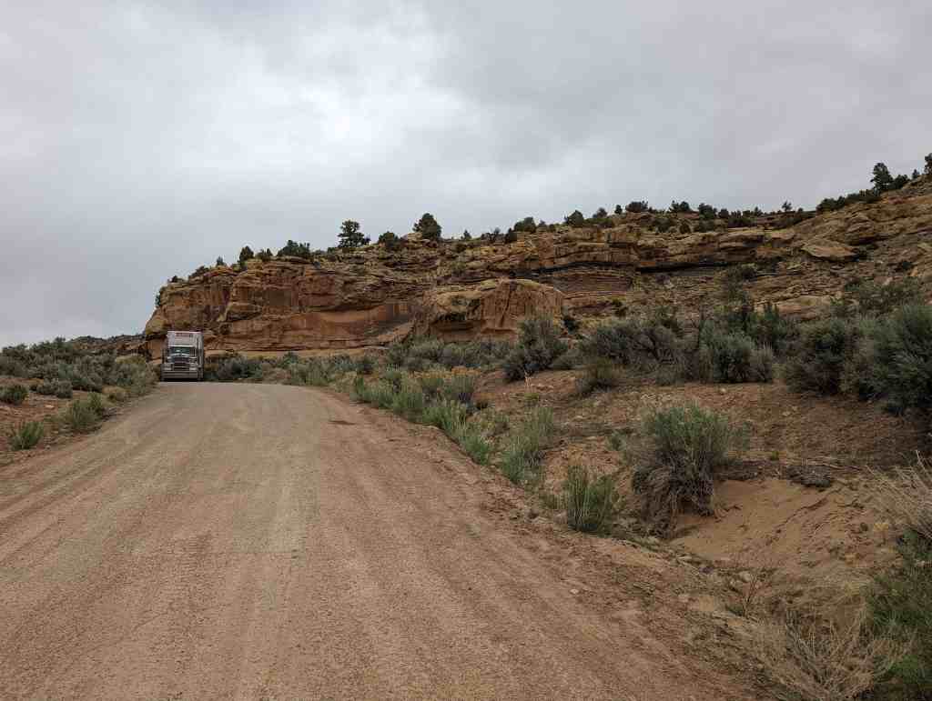
Price Main Street Historic District is a historic district covering Main Street from 100 West to approximately 215 East.

Related:

  • Price Main Street Historic District
  • Price, Utah

The text below is from the nomination form (#08000383) to the National Historic Register.

The City of Price is the county seat of Carbon County in east-central Utah, and is approximately 120 miles southeast of Salt Lake City. The Price Main Street Historic District, with a period of significance dating from 1910 to 1960, contains the greatest concentration of commercial buildings in the city and is the de facto commercial center for both Carbon and Emery counties. In addition, the City of Price is a key regional transportation hub, with the Denver & Rio Grande Western (now merged with the Union Pacific Railroad), US Highway 6 and State Highway 10 all converging in town. Due to its geographic location and influx of immigrants, early development in Price did not follow the pattern established by the early LDS (Mormon) colonies, principally along the Wasatch Front. Consequently, Price is unique in Utah for its early association with the railroad and coal industries and for its sectarian history.

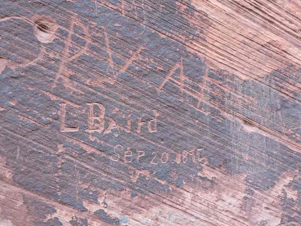
The town of Price did not develop as most early Utah communities had; its growth was not due to an influx of Mormon settlers but was largely the result of industrial development in the region, specifically from the coal and railroad industries. The arrival of European immigrants, especially from Greece and Italy, accounted for much of the community’s early population growth. The earliest commercial district in Price, representing the early period of settlement and growth, from 1877 to 1910, was centered on the railroad yards at the west end of town. The Main Street Historic District began to develop as businesses moved away from the railroad district and concentrated to the east along Main Street, from 200 West to 100 East. These later businesses were often owned or managed by immigrant settlers, and to the present day many of the Main Street buildings and businesses bear the names of their immigrant founders, such as Silvagni, Oliveto, and Georgides.

The Price Main Street Historic District is a concentration of historic buildings on Main Street that are representative of the commercial prosperity and growth that characterized the town of Price through the first half of the 20th century. The district is bounded by 100 West and 200 East, and also includes the United Methodist Church at the northeast corner of Main Street and 200 East. The Price Municipal Building and the Carbon County Courthouse, together with the United Methodist Church , define the eastern end of an otherwise largely commercial district. West of 100 West the early commercial buildings have either been demolished or no longer retain their integrity; East of 200 East the concentration of commercial buildings is far less than the concentration within the district boundaries and includes few buildings from the historic period. The streets immediately north and south of Main Street never experienced the kind of commercial growth that sets apart Main Street. The district boundaries, therefore, include the two blocks with the largest concentration of extant historic commercial buildings in Price, together with the two most substantial public buildings, and an historic church.

Period of Significance 1910-1960

No buildings from the earliest period of development remain on Main Street (1877-1909). Some of these early buildings were destroyed by fire; others were demolished to make way for the structures that we see today. The Period of Significance ( 1910-1960) began with rapid growth and development on Main Street. Although it was destroyed by fire in 1965, the Savoy Hotel, constructed in 1910 at the southwest corner of 100 West and Main Street was representative of this rapid growth. The years from 1910 to about 1915 also saw the construction of many other extant buildings within the district (historic names are given if known):

  • Paternoster Building, 5 East Main (c. 1910),
  • 5 West Main (1912),
  • Eko Theater. 34 West Main (1912),
  • Parker & Weeter Block, 85 West Main (1913),
  • Franks Building (Oliveto’s Furniture), 48 East Main (c. 1913),
  • 63 East Main (c. 1915),
  • 9-17 East Main ( c. 1915),
  • 36 West Main ( c. 1915),
  • 40 West Main (c. 1915),
  • 44 West Main ( c. 1910),
  • 60 West Main (c. 1915),
  • 70 West Main ( c. 1915),
  • 75 West Main (c. 1915),
  • 69 West Main (c. 1915),
  • 67 West Main (c. 1915),
  • 63 West Main (c. 1915),
  • 41-47 West Main (c. 1915),
  • 39 West Main (c. 1915),
  • Boecker Electric Store (Eastern Utah Electric Company), 11 West Main (c. 1915),
  • Silvagni Building, 4-14 East Main (c. 1915).

These 20 buildings account for nearly one-half of the buildings within the district that date from the period of significance.

Based on the Utah SHPO criteria, of the 46 buildings within the district ~ the Price Main Street Historic District contains 28 contributing resources ( 60 percent) and 18 noncontributing resources ( 40 percent). Of the contributing resources, three are individually listed in the National Register. These are:

  • Price Municipal Building (Price City Hall), listing number 78002652 (2/17/1978);
  • Star Theatre, listing number 82004116 (8/9/1982);
  • Parker & Weeter Block/Mahleres-Siampenos Building, listing number 82004115 (3/9/1982).

individual building s within the district consist mainly of a variety of commercial structures, from boarding houses and hotels with ground-floor business or retail space to single-story commercial blocks. The district includes three non-commercial buildings: the United Methodist Church , Carbon County Courthouse , and Price Municipal Building (City Hall), all three of which are significant, contributing resources within the district.

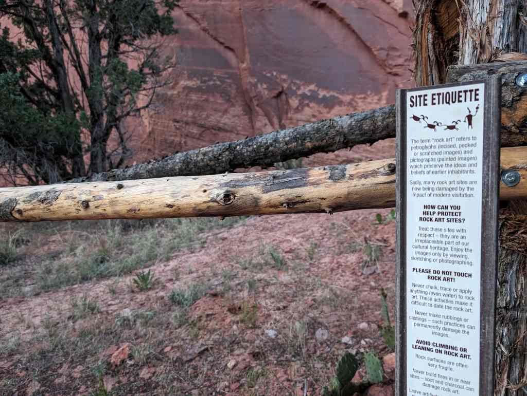
As exterior “windshield” visual survey results only, RLS criteria address the age and historic integrity of the Main Street façade, and do not address other criteria such as structural condition or integrity of historic interiors. A number of resources that date from the period of significance have been remodeled, such as the Silvagni Building , con structed about 1915. The existing aluminum “skin” was applied c. 1960 and has gained significance in its own right. Similarly, exterior alterations such as those on the Elk Theater (Crown Theater) date from the period of significance such that these buildings represent very different styles and dates of construction, yet still retain integrity as examples of the perpetual adaptation of commercial buildings with regard to use and style. The district includes only one out-of-period intrusions, the building at 6 W. Main.

Survey results indicate a variety of styles and periods of construction, from late 19th century varieties to mid- 20th century styles. A handful of earlier buildings show elements of late Victorian eclectic styles, with decorative brickwork , decorative trim and deep, classically adorned cornices. The most common style in the district is also eclectic: early 20th century commercial style with varying degrees of decorative elements and vernacular interpretations of popular styles of the day. These buildings may include Prairie Style influences, Arts and Crafts and/or Art Nouveau influences, or other fanciful or eclectic details However, only where a given style is dominant has the building been indicated as having a given style. The relevant periods , approximate dates of construction and architectural styles include those shown below, have the number of contributing resource s within the district representative of each period /date/style (approximate dates are indicative of the buildings within the district and not necessarily representative of the style itself). A few representative buildings of each style are shown below. Those that are both stylistically significant and retain their historic character are indicated with an asterisk(*):

Victorian Period, Beaux Arts Style:

  • *40 West Main

Victorian Period, Eclectic/Commercial Style:

  • *70 West Main

Revival Period, English Tudor Style:

  • *United Methodist Church, 10 North 200 East

Revival Period, Italian Renaissance Style:

  • *Star Theatre, 20 East Main
  • *Boecker Electric Store (Eastern Utah Electric Company), 11 West Main

Revival Period, Spanish Colonial Revival Style:

  • *Eko Theater, 34 West Main

20th Century Period, Commercial/Eclectic Style:

  • 63 East Main
  • 29-43 East Main
  • 82 West Main
  • *Parker & Weeter Block, 87 West Main
  • 41-47 West Main
  • Redd Building, 21 West Main
  • *Paternoster Building, 5 West Main
  • Franks Building (Oliveto’s Furniture), 48 East Main

Modern Period, Art Deco Style:

  • Price Theater, 30 East Main
  • Lewis Jewelry, 46 East Main

Modern Period, WPA Moderne Style:

  • *Price Municipal Building, 185 East Main

Post WWII Period, Other/undifined Style:

  • *82 West Main
  • *J.C. Penney Company, 78 East Main

Late 20th Century Period, Other/undifined Style:

  • *Carbon County Courthouse, 120 East Main

As indicated above, the Price Main Street Historic District also includes a number of altered, non-contributing resources (17) and one out-of-period building (1).

The estimated date of construction of the earliest building from the period of significance, at 5 East Main Street, is 1910. The earliest buildings with actual documented dates of construction include the Paternoster Building, 5 West Main (1912), Eko Theater, 34 West Main (1912), and the Parker & Weeter Block, 85 West Main (1913).

While 1910 is an estimate for the building at 5 East Main, this year is nonetheless chosen as the beginning date for the period of significance. Additionally, in December, 1910, a successful election was held to upgrade Price’s standing to a third class city. Thus, 1910 was a symbolic end to the period of early settlement and growth that began in 1877 and also heralded the establishment of Price as the comn1ercial center of a larger region.

Narrative Statement of Significance

The Price Main Street Historic District is locally significant under criterion A, and ”is associated with events that have made a significant contribution to broad patterns of our history.” The historic resources within the Price Main Street Historic District represent a period of local economic growth and prosperity that paralleled the expansion of the region’s coal and railroad industries. As described below, under criterion A, the development of Utah’s coal and railroad industries and their relationship to the growth of the city of Price are a significant regional and national historical development of which Price’s Main Street commercial district is an integral part.

The District is also architecturally significant under criterion C. Of the forty six (46) buildings within the district boundaries, twenty eighty (28), or 60 percent, are contributing. At least a dozen of the extant buildings are important examples of distinct architectural periods and styles, including the three that are already listed in the National Register: Price Municipal Building/Price City Hall, listing number 78002652 (2/17/1978); Star Theatre, listing number 82004]] 6 (8/9/1982); Parker & Weeter Block/Mahleres-Siampenos Building, listing number 82004115 (3/9/1982). In addition, under criterion C, the physical development of Price’s Main Street and the types and styles of individual buildings within the district embody the spirit of growth and prosperity that were largely a consequence of the region’s growth and industrial development.

The period from 1910 to 1960 is chosen as the period of significance. Not only is 1910 the estimated date of the earliest building in the district, it was also the date of the establishment of Price as a third class city that commenced a couple of decades of rapid growth, as represented by the commercial buildings on Main Street. This period also saw relatively consistent prosperity for Price, even as other communities in the region suffered through economic downturns such as the Great Depression. Not until the decline of the coal mining industry and railroad traffic in the early 1960s did Price experience any significant corresponding economic decline. This period ended with the construction of the most significant “modern” building within the district, the Carbon County Courthouse, constructed 1958-60.

The commercial sector of Main Street included within the historic district boundaries is the best representation of the growth, both commercially and architecturally, of Price during the early to mid twentieth century. The character and setting of the district retain a high degree of integrity and contribute to the history of Price.

Price Early Settlement and Growth: 1877-1910

The first permanent Anglo settlers in the Great Basin region of the Intermountain West were members of the Church of Jesus Christ of Latter-day Saints (LDS, or Mormons), who first arrived in the valley of the Great Salt Lake in July of 1847. The early leaders and members of the church considered this region their “Zion” and began organized colonization efforts immediately after their arrival. The first settlements were founded along the north-south corridor of the Wasatch Front, but soon communities were established in regions in the central and southern areas of the territory, as well.

As a largely agrarian culture, the LDS settlers preferred areas that were well-watered and advantageous for raising food crops and livestock. The Wasatch Front and central valleys of the territory, such as the Sanpete and Sevier valleys, met these criteria, and early settlements were established in these fertile areas. “Missions” or settlements were also established in less favorable environments, such as the desert southwest comer of the territory and the Uinta Basin to the east, but not until the 1870’s did Mormon pioneers begin settling eastern Utah in relatively large numbers. By the time of the death of the LDS prophet and colonizer Brigham Young, in 1877, the more fertile parts of the territory had been colonized, and the systematic pattern of settlement established by Brigham Young had largely run its course.

For territory residents or later immigrants seeking land or less-crowded conditions than the earlier settlements afforded, opportunities existed mainly in the less-favored regions, and thus it was that some of these adventurous individuals settled in the Price River Valley, beginning in 1877. In contrast to the well-planned grid-like town planning of the earlier Mormon communities, early Price-area residents settled along the Price River, where water could be readily obtained for crops. Within only two years, however, the completion of the first railroad in Carbon County altered the character of the region, and instead of an isolated farming community, Price quickly became a planned community with regular streets, and rapidly rose to also become the dominant commercial center in the area.

The discovery of coal in the mountains north, east and west of Price prompted the construction of the first railroads in the region. The Utah and Pleasant Valley Railroad, organized in 1875 and completed in 1879, connected Utah Valley with Pleasant Valley, northwest of Price. In 1881, the Denver & Rio Grande Western Railroad proposed to construct a line through the area to connect Denver with Salt Lake and Ogden. Consequently, the D&RGW purchased the Utah and Pleasant Valley Railroad, and in May, 1883 arrived in Price with much fanfare. The railroad made the extraction and transportation of coal from the region commercially viable, and Castle Valley Junction, as Price was then known, experienced its first economic boom as an important regional transportation hub. The railroad and coal-mining industries significantly shaped the development of Price as a community, from the early settlement years into the latter half of the 20th century.

With the coal mines and railroad came immigrants from many countries, particularly Italy and Greece. While most lived and worked in the mining towns, or “coal camps,” some became merchants and businessmen and established themselves in Price. Early immigrants also included a number of French, who were mainly sheepherders and wool growers. The business district was the center of activity for railroad workers, coal miners, and other transient inhabitants, most of whom were not Mormons, while the more permanent residents tended to be Morn1on fanners and ranchers. However, the two groups learned very early to tolerate one another, and cooperation became a hallmark of Mormon and non-Mormon relations in Price.

Another early influence in the commercial development of Price was the freighting, or “forwarding” business, as Price residents called it. In 1886 a road through Nine Mile Canyon east of Price was completed, connecting the town to Fort Duchesne, about 60 miles to the northeast, and the lucrative hauling of freight between Price and the Fort began. Prior to 1886 only four general merchandising businesses were known in Price, while by 1888 town businesses included two contractors, four mercantile or general merchandising establishments, a blacksmith, a hotel, two saloons, a butcher, a baker and a restaurant.

Early commercial activities in Price in essence created two distinct communities. The industrial and business district was centered on the railroad yards and depot at the west end of town and also included hotels and saloons, while four blocks to the east were the church, school and town government buildings. As commercial and business activity increased, business interests began to expand west from the railroad district to the east along Main Street, toward the civic and religious center near 200 East. Sanborn insurance maps clearly show this pattern of growth. In 1908 commercial interests were clustered on either side of the railroad tracks and the densest grouping of buildings occurred on Main Street between 100 and 200 West. By 1924 wall-to-wall commercial buildings had been extended along Main Street almost as far as 100 East.

Price residents organized in 1892 to create a town government. By then, the population of Price had grown to 245, with businesses that included an attorney, a bank, two blacksmiths, a butcher, three hotels, two saloons, a livery and stable, four mercantile businesses, and a publisher.

Price was clearly becoming the dominant commercial center in the region, and shortly after the organization of the town, residents tried to have the Emery County seat moved from Castle Dale to Price. Although this attempt failed, the effort helped persuade residents that they should separate themselves from Emery County. With a more diverse population and a very different economy in the northern po11ion of the county, the proposal seemed to make sense, although residents in some communities, sucl1 as Huntington, opposed the plan. Subsequently, petitions were circulated among the communities in the northern part of Emery County to convince the territorial legislature to create a new county. In spite of some opposition, the petition was finally delivered to the legislature, which enacted a bill on February 17, 1894 to create the new county. Territorial Governor Caleb B. West signed the bill into law on March 8, and Carbon County officially came into being, with Price as the new county seat.

As noted above, early business establishments were largely clustered around the railroad depot and yards. In 1892 these included the Mathis Hotel, the Oasis Saloon, the Emery County Mercantile Institution, Price Trading Company and tl1e D.J. Williams General Merchandise. Early Main Street businesses were also located near the railroad, mostly between 100 West and 200 West. By 1908 these included a saloon, office, grocer, printer, cobbler, barber, and the Price Cooperative Mercantile Institution on the north side of the street, and a saloon, general store, drugstore, restaurant. barber and billiards on the south side. The Price Cooperative Mercantile Institution had relocated to Main Street, in 1906, from a building nearer to the railroad. Its relocation was indicative of the growing tendency for businesses during this period to locate on Main Street rather than in the railroad district. The J C. Weeter Lumber Company, located on the opposite corner of 100 West and Main Street, a bank across the street from it to the north and the Price Cooperative Mercantile Institution anchored what was then the east end of the Main Street business district. Three blocks away, at the northwest corner of 200 East and Main Street was the City Hall.

The growing importance of the community and the substantial business and retail activity “downtown” led to improvements in the construction and maintenance of streets, sidewalks, utilities and other community services. Street were at first graded, and then graveled to accommodate horses, wagons, and a gr wing number of automobiles. The 1912-1913 Polk Business Directory predicted that Price would soon have paved streets. By October, 1910, the town had even constructed its own electric power plant, and had extended electric service to both businesses and residences, a major undertaking for a town of only 1,000 residents.

The progressive spirit demonstrated by the settlers and early residents of Price was firmly established in the developing community, and its residents determined to become a third class city. (Third class cities could assess more taxes and could also provide more services.) An election was held in December, 1910, and the measure to change Price’s status easily passed. Price’s residents celebrated its new standing on March 24, 1911.

Main Street Period of Significance: 1910-1960

ln the early years of the period of significance, building construction, especially along Main Street, continued to increase. Although no longer existing, 1910 saw the construction of the Price Commercial and Savings Bank and the First National Bank, both on the north side of Main Street near 100 West. The following year, the Miles Building was completed, and one of the early merchants near the railroad, Louis Lowenstein, relocated to a new business building and hotel, the Savoy, at the southwest comer of 100 West and Main Street. These, too, have since been demolished. Other important Main Street businesses established during this period of growth included the Eastern Utah Telephone Company. Established in 1905, the telephone company constructed its new building in about 1912. On the southeast comer of Carbon Avenue and Main Street, Pietro Silvagni constructed a substantial office building, in 1913. Across the street to the west, the Paternoster Building, consisting of a drugstore and hotel, was constructed, about 1916. All three of these early buildings still exist as contributing resources within the district. Besides the new banks, stores, hotels and office buildings, new businesses also included amusement and entertainment establishments. such as the Eko Theater, at 32 West Main Street, built in 1912 and still standing.

Main Street expansion was not limited to business growth, alone. At the east end of Main Street, near the city hall, the LDS Church built a new tabernacle at 100 East and Main Street; the Methodist Church constructed a new church building across the street east of City Hall; and, a new County Courthouse was built, across the street to the south of the tabernacle. All of this construction had been completed by 1914. 1914 also saw the establishment of a chamber of commerce, organized by about 40 businessmen. Membership applications soon reached nearly one hundred.

The first automobile took to the highway in the United States in 1893. Within just twenty years, even in remote Utah there was a growing need for improved roads to handle automobile traffic. In 1913 the Utah legislature authorized the construction of the Midland Trail, a new highway intended to extend west from the Colorado state line through Cisco and Green River, thence north through Price, Colton, Spanish Fork and Salt Lake City, and finally extend to Brigham City and around the north end of the Great Salt Lake to Nevada. This road was completed through Price the following year. As the railroad had a generation earlier, this automobile link to the north and other regional communities to the south and west enhanced Price’s significance and economic control in the area.

The First World War seems to have barely slowed the consistent and continued growth of Price and its Main Street business district . The 1918-1919 Polk Directory reported a population of 2,000, and noted Price’s importance as “the center of a large livestock, coal mining, agricultural and fruit raising section.” The Directory also provides a glimpse at the cultural diversity for which Price had become known. Surnames in the directory include “foreign-sounding” names (at least to the more established Mormon and Protestant settlers with northeastern U.S., British, and Scandinavian ancestry) such as Bonacci, Broeker, Dragates, Grosso, Klapaki, Kopf, Nakagawa, Pappas, Viglia, Yukawa, and numerous others. Many of these immigrants bad become managers of local businesses or business owners themselves.

By the mid 1920s, Price’s Main Street could boast additional banks and numerous small business buildings. 1924 Sanborn maps show that commercial buildings bad been completed along Main Street to 100 East, with few empty lots in between. The Polk Directory of the same year complemented Price’s business community: “Because Price is the commercial center for a vast territory the business section would do credit to a town of more than twice its size in population.” The Directory also noted that Price had ‘”three good banks… sixteen hotels and a number of practically all kinds of retail business firms.” Buildings of note completed during this time include the Redd Building, at 21 West Main, which John Redd completed in 1921 then leased to the J.C. Penney Company for its first location in Price, and the national-register-listed Star Theatre, built by Angelo, Peter and George Georgides in 1923, which was a popular venue for vaudeville, music, lectures and motion pictures.

The economic collapse of the late 1920s and the Great Depression both had a great impact on Carbon County and Price. As the economic center of the region, Price business, perhaps suffered less, but all were affected. Workers who did not lose their jobs often had their wages and/or hours reduced, anyway, and the effect rippled through the business community. For Price businesses, the result was often a merger of like companies. Businesses that survived this way included the Redd Motor Company, which acquired the Chevrolet Motor Agency in 1928, and the two local newspapers, the Sun and News Advocate, which together became the Sun Advocate, in 1932. In 1932 the Carbon Bank of Price and Emery Bank of Castle Dale also merged, and the bank in Price took over all business of the two for both Emery and Carbon counties. (None of these buildings still exists.)

Even through the Depression, some Price businesses prospered, largely due to its economic dominance of the region. Construction of some private and public projects also helped alleviate the effects of the Depression on the local economy. The most significant of these projects was the replacement of the aging city hall building at the northeast corner of 200 East and Main Street with a new facility, the Price Municipal Building (Price City Hall–individually listed in the National Register). The Work Projects Administration (WPA) funded about one half of the projected cost of $200,000. In November of 1938 the city’s offices moved into the new building and the mayor and city council held their first meeting there. The project also included a new auditorium attached to City Hall, which was completed in February, 1939, and a new gymnasium, finished some time later.

World War II brought new prosperity to Price. Because of the increased need for coal to help fuel the war effort, output at the region’s mines increased, and of course, so did railroad traffic. Improvements in local roads and regional highways contributed to a corresponding increase in automobile traffic, which also brought new business to Price. In 1941 the increased automobile traffic led to the installation or a new semaphore at Carbon Avenue and Main Street, with caution lights at a number of lesser intersections.

Perhaps the most significant change during the war and immediately afterward was the construction of new businesses on the blocks west of the tabernacle and county courthouse as the few remaining empty lots were filled in. The largest of these was a new J.C. Penney store, at 78 East Main Street, Opened in 1947. Some newer buildings replaced older structures, such as the new First National Bank at100 West and Main Street, also completed after the war.

The years after World War II through the end of the historic period also saw the period of greatest economic prosperity for Price. The post-war economic expansion benefited Price, and Main Street thrived. The eastward expansion of the Main Street business district that began during the community’s early years continued, with some businesses also being constructed east of the historic district. Prosperous miners in the area, among others, continued to bring their business to Price, and its importance as the dominant regional commercial/retail/business center was reinforced.

In addition to some new construction, many Main Street businesses changed hands or were otherwise remodeled during this prosperous era. As Ronald Watt recounts:

“From 1948 to 1965 the Price commercial district continued to expand eastward along Main Street. The First National Bank reconstructed its building on the corner of Main and First West. The Eastern Utah Electric Company remodeled its store, forcing Ross Boyack, who had a small shop within it, to move his men’s clothing store to another location. He purchased a lot on Main Street between Carbon Avenue and First East and built a new store that would serve Price for almost half a century. In 1950 the Mahleres and Siampenos block [national-register-listed Parker & Weeter Block] and the Larcher building (which included Houston Furniture, the Price Hotel, and the Walnut Bar) were also remodeled. The old Utah Theater building was thoroughly remodeled both inside and out with new lighting, ventilation, and heating systems. It reopened as the Crown Theater. Mode-O-Day opened a women’s apparel shop on Main Street, and in November 1954 a Brigham City man, Max A. Creer, held a grand opening for Sonoma’s, another women’s clothing store. The J.C. Penney store also remodeled, adding a basement level.” [Of the building cited, the Eastern Utah Electric Cmpany, Mahleres and Siarnpenos Block, Crown Theater and J.C. Penney’s are all extant, contributing resources in the Price Main Street Historic District.]

Besides J.C. Penney’s, other national chains found homes in Price. Both Safeway and Woolworth opened stores in Price, with Woolworth’s opening in 1958 at 100 East and Main Street, and Safeway on Carbon Avenue, one block north of the historic district.

As if to mark the end of the historic period, in 1958 the original county courthouse, completed in 1912, was demolished to make way for a new county complex. Its replacement had been contemplated since the end of the war, but not until 1958 did construction begin on a new building on the site of the original. The new building was completed in 1960, retains its character as a contributing resource, and marks the end of the period of significance for the historic district.

Economic Decline and Recovery: 1961 – Present

In the early 1960s, the fortunes of Price, its residents, and its Main Street district began to decline with the closure of many of the region’s mines. The economic engine that had largely driven Price’s prosperity for 80 years slowed and Main Street businesses suffered. At first, mine closures related more to the accessibility of the coal and/or the economic viability of the mining operations, but this was also combined with a general recession. With the loss of jobs, the population of Price declined by about 4,000 persons. The low point for the community occurred during the middle of the decade, punctuated by the unrelated destruction of the Savoy Hotel, by fire in 1965. During this time, the opening of small industries in Price took up some of the slack so that the declining prosperity was not a death-blow for Main Street.

Concerted efforts by Price’s political and business leaders during the latter half of the 1960s and later were rewarded with additional industries and businesses locating in Price. The energy crisis of the early 1970s also brought resurgence in the coal industry and an increase in mining jobs. However, a trend also began to construct new buildings away from Main Street, as it .vas considered cheaper to build new than to rehabilitate Main Street’s older structures. A mini boom during the 1970s saw the construction of shopping centers and businesses both east and west of town. By 1980 the perception was clear: Main Street was dying and “redevelopment” would be needed to save it from certain death. In the early 1980s the City of Price organized a redevelopment agency to cover an area that included the historic district. A number of Main Street businesses <wailed themselves of the incentives offered by the redevelopment agency to renovate.

Beginning in the 1980s and continuing today, another trend to affect Main Street merchants was the construction of “big box” businesses, mostly east of town. These included a K-Mart, a Smith’s grocery center, and a Wal-Mart “Super Store.” On Main Street, specialty stores and boutiques, in particular, have seemed to successfully survive this new challenge, but even J. C. Penney’s on Main Street continues to serve the community, in spite of the competition.

Today, Price continues in its place as the largest and most important community in both Carbon and Emery Counties. In the years since the period of significance it has weathered considerable economic downturns, but its significance in the region’s history, both past and future, is assured. The Main Street Historic District exemplifies the spirit of cooperation, independence and progress that have characterized the community since its founding.

Washington Cotton Factory

08 Sunday Dec 2024

Posted by Jacob Barlow in Uncategorized

≈ Leave a comment

Tags

NRHP, utah, Washington, Washington County

The Washington Cotton Factory was added to the National Historic Register (#71000864) on April 16, 1971 and was located at 385 West Telegraph Street in Washington, Utah. Daughters of Utah Pioneers historic marker #213 talks about it as well. The text below is from the national register nomination form.

(looking east)
(looking southeast)

Basic to an understanding of early Utah history is an awareness of the Mormon hope for economic independence and the “mission call.” With early explorations into Utah’s southwest, which discovered the mild climate of the valleys of the Virgin River, a major tributary to the Colorado River the agricultural implications became obvious.

By 1854 an Indian Mission had been established on the Santa Clara River. With cotton seed obtained from Nancy Anderson at Parowan, Angus Hardy, Jacob Hamblin and others planted and grew cotton successfully. Colonists moved south to grow cotton between 1856 and i860. An experimental farm was established at Tonaquint (near Bloomington) in 1858. Washington was settled by “Southerners” led by Bishop Robert D. Covington a year earlier. However, although several thousand pounds were grown during these experimental years, not until the fall of 1861 did Brigham Young call 300 families to the Cotton Mission, the Civil War opened this second phase.

With the erratic Virgin River to supply water for irrigation, the settlers suffered extremely. Floods destroyed dams, leaving no water for partially grown crops. No cotton meant no trade, even for foodstuffs. By 1864 about 74,000 pounds of lint had been sent east to markets. As Young wanted economic independence, he located a factory in “Dixie” to support and encourage the missionaries. “Joseph Birch managed this mill. Brigham sold his factory after five years (1870) to the Rio Virgin Manufacturing Company for $44,000; however, most of this debt was cancelled, since the factory was having such a difficult time.

During this second period, the “Saints” were organized into the “United Order,” a communal economic system. “Orders” from Brigham City on the north and Orderville on the east, sent people to Dixie to grow and process their cotton. Only with the boom of Silver Reef did any real economic relief come to the cotton missionaries, and then mainly to those who grew produce for market at the mines. This diversion, however, slighted the factory’s needs for raw cotton. By 1877, new farms were opened on the lower Virgin River at Bunkerville and Mesquite, Nevada. The St. Thomas area was resettled in the 1880’s and also raised cotton for the factory. Its impact was widespread. Its product and script were used extensively.

Finally, in 1890, Thomas Judd, an important southern Utah merchant, leased the factory and operated it profitably for a few years. By 1898, it was again idle, A few brief attempts at reactivation followed until 1910, when some machinery was sold. In 1914, the rest was scrapped. Since that time, the old mill has served primarily as a warehouse and a haunted house for Halloween dances.

The old cotton factory became the heart of the Cotton Mission. It remains its symbol today. In trying to meet the Saints’ needs for cotton goods under extreme conditions, the L.D.S. Church leaders employed both the “mission call” and the “United Order.” Success was limited. After the Civil War and the coming of the transcontinental rail road, competition from the American “Dixie” increased. The factory’s survival until the turn of the century owes much to the dedication of the cotton missionaries.

On a site originally selected for a mill by James Richy and Benjamin F, Pendleton, Brigham Young and the Dixie settlers constructed their cotton factory.

The large sandstone structure was .begun in1865, with Appleton Harmon assigned as superintendent of construction, Elijah and Elisha Averett, stone masons, and John P. Chidester, chief carpenter. August Mackelsprang and Hyrum Walker supplied lumber from Cedar Mountain. One story was completed and machinery in operation by January 1867. Later, because of expanded demand, including processing of woolen goods, two additional stories were added. By 1870 the enlarged factory was in use.

Located on Mill Creek, west of Washington, central to the cotton producing region, the factory used the water from springs feeding the stream, which was stored in a reservoir west of the mill. Fourteen hours of storage plus the stream flow, would operate the factory for ten hours. At peak production, the factory was capable of producing 500 yards of cloth per day and employed scores of local people. Their production included cotton batts mattresses, quilts, blankets, jeans, denims, broadcloth, flannels and gingham. Problems plagued the factory a supply of cotton and wool, a balanced operation, and lack of a market.

The factory has been empty for years. Fortunately, the roof has been in generally good repair until the last few years. The structure is sound, modified very little and in need of a new roof. It awaits preservation interest, which is now appearing. Its restoration is vitally important to telling this facet of Utah and Mormon history.

Wildhorse Canyon Obsidian Quarry

07 Saturday Dec 2024

Posted by Jacob Barlow in Uncategorized

≈ Leave a comment

Tags

Beaver County, NRHP, utah

Wildhorse Canyon Obsidian Quarry / Milford Obsidian Quarry

The Wildhorse Canyon Obsidian Quarry is significant for several reasons. First, it is the only obsidian flow in Utah, presently known, which has been extensively used prehistorically as a source of raw materials. Recent studies (Condie and Blaxland 1970) of trace element distributions in obsidian artifacts from Hogup and Danger Caves and from the Wildhorse Canyon Obsidian flows do indicate that the prehistoric groups who inhabited these caves for 8000 to 10,000 years were not utilizing Wildhorse Canyon obsidian; instead, they evidently utilized two other sources. At this time, however, the location of these other quarries is completely unknown. There are also obsidian flows in western Utah that apparently were never used aboriginally as quarries, or at least there is no evidence thus far for such use. Thus, the Wildhorse Canyon. Obsidian Quarry offers the only opportunity within this region for the study of one particularly important aspect of prehistoric cultural systems: the procurement of raw materials for the manufacture of tools necessary in all aspects of daily life. The extremely large quantity of lithic material (in the form of blanks, preforms, debitage, cores, etc.) at the quarry itself, as well as at the numerous camp and manufacturing sites which surround the quarry, is still present, in situ, for such analysis.

The Wildhorse Canyon Obsidian Quarry is also the only quarry site in western Utah whose material has been definitely traced to specific archeological sites some distance away from the quarry location itself. The most important of these sites, and the ones which have been subjected to the most intensive archeological investigation, are four large agricultural Fremont villages located in the Parowan Valley, These sites (Parowan, Paragonah, Median Village, and Evans Mound) are dated A.D. 900(?) to 1300, and thus furnish evidence for the intensive use of the Wildhorse Canyon Obsidian Quarry by one particular culture for this particular time period. Analysis of the obsidian material recovered from these sites has furnished important information on the logistics and method of procurement of obsidian from the quarry.

“No large obsidian cores have been reported from excavations at Parowan or Paragonah and none were recovered from Median Village or the Evans Mound. This suggests that most of the knapping process was conducted near the obsidian source to minimize the bulk of the transported materials. The numerous chipping stations within a mile or two of Wildhorse Canyon (Rudy, 1953) lend support to this interpretation.” (Berry 1972:156-157).

As noted in the previous section, there is reason to believe that the quarry was the source of raw materials for a considerably larger area and longer time span that that represented by the agricultural Fremont groups of the Parowan Valley. The number of recent studies on source areas (e.g. Jack 1971) and on the usefulness of dating obsidian directly through hydration rates (Findlow, Bennett, Ericson and De Atley 1975) can only be an indication of the enormous quantity of information that can be extracted from the scientific study of what is apparently the major obsidian quarry in western Utah–the Wildhorse Obsidian Quarry.

The text above is from the nomination form from when this site was added to the National Historic Register (May 13, 1976). (#76001810)

← Older posts
Newer posts →

Follow Jacob

Follow Jacob

Come wander with me on Youtube.

Blog Stats

  • 2,096,557 hits

Social and Other Links

BarlowLinks.com

Recent Posts

  • Scout Monument
  • Provo High School Seminary Building
  • 821 E 100 S
  • 820 E 100 S
  • 817-819 E 100 S

Archives

Loading Comments...